THE BAHAMAS NATIONAL REPORT
INTEGRATING MANAGEMENT OF WATERSHEDS AND COASTAL AREAS
IN SMALL ISLAND DEVELOPING STATES (SIDS) OF THE CARIBBEAN
TABLE OF CONTENTS
EXECUTIVE SUMMARY....................................................................................................... 5
1.0 COUNTRY ORIENTATION ............................................................................................. 6
1.1 Landscape...................................................................................................................... 6
1.2 Demographics................................................................................................................ 6
1.3 Economy........................................................................................................................ 6
1.4 Climate .......................................................................................................................... 7
2.0 CURRENT WATERSHED/WATER RESOURCES MANAGEMENT ISSUES............. 9
2.1 Summary of Observations............................................................................................. 9
2.2 Fresh Water Resources of The Bahamas....................................................................... 9
2.3 Natural Influences on Fresh water Supply: Residence Time and Internal Flow......... 10
2.4 Impacts to Fresh water Resources............................................................................... 11
2.4.1 Role of Hurricanes and Tropical Storms in Releasing and Dispersing
Pollutants in Coastal Areas ............................................................................... 11
2.4.2 Impacts from Sea Water Intrusion on Fresh water Resources............................ 12
2.4.3 Impacts from Waste Generation.......................................................................... 13
2.4.4 Impacts from Sewage .......................................................................................... 13
2.4.5 Methods of Sewage Collection and Disposal...................................................... 14
2.5 Demands on Fresh Water Resources: Abstraction Systems........................................ 14
2.6 Tourism Sector Demands on Water Consumption and Waste Disposal..................... 15
2.7 Service Industries Demands on Water Consumption and Waste Disposal................. 16
2.8 Water and Sewerage Regulatory Authority: The Water and Sewerage Corporation.. 16
2.9 Conclusions ................................................................................................................. 16
3.0 CURRENT COASTAL ZONE MANAGEMENT ISSUES............................................. 18
3.1 Summary of Observations........................................................................................... 18
3.2 Applicable Regulations ............................................................................................... 19
3.2 Marine Parks of The Bahamas .................................................................................... 20
3.2.1 The Bahamas National Trust Act By-Laws 1987 ................................................ 20
3.2.2 Bahamas National Parks..................................................................................... 21
3.3 Coastal Habitats and Ecosystems Management Issues ............................................... 23
3.3.1 Coral Reef Management Issues........................................................................... 23
3.3.2 Mangrove and Wetland Management Issues ...................................................... 23
3.3.3 Sand Beach and Dune Systems Issues................................................................. 25
3.3.4 Iron (Rocky) Coastline Management Issues........................................................ 26
3.3.5 Seagrass Beds Management Issues ..................................................................... 26
3.3.6 Dunes and Other Natural Shorelines .................................................................. 26
3.3.7 Public Access to Coastal Areas........................................................................... 26
3.3.8 Inland Lakes ........................................................................................................ 26
3.4 Coastal Infrastructure and Management Issues........................................................... 27
3.4.1 Infrastructure and Utilities Management Issues................................................. 27
3.4.2 Marinas and Mooring Areas ............................................................................... 27
ICF Consulting
1
Integrated Coastal Management Planning
3.4.3 Dredging.............................................................................................................. 28
3.4.4 Electrical Utilities and Solid Waste Facilities .................................................... 29
3.4.5 Coastal Land Use Planning Issues ..................................................................... 30
3.5 Climate Change and Natural Disasters........................................................................ 31
3.6 Transboundry Threats ................................................................................................. 32
3.7 Information Management Issues ................................................................................. 32
3.8 Social and Cultural Issues Relating to Implementing Coastal Management .............. 32
3.9 Governmental and Non-Governmental Eco-Conscious Organizations in The
Bahamas ...................................................................................................................... 32
3.10 Institutional Issues....................................................................................................... 35
4.0 PRELIMINARY RECOMMENDATIONS FOR DEVELOPMENT IN THE
COASTAL ZONE OF THE BAHAMAS......................................................................... 38
4.1 Introduction ................................................................................................................. 38
4.2 Process to Determine Build and No Build Zones Based on Flood Hazard and
Erosion Analysis in The Bahamas .............................................................................. 39
4.3 Determine Appropriate Infrastructure Design Process for the Coastal Zones of
The Bahamas ............................................................................................................... 42
4.4 Requirements for Guidelines for Development at Each Coastal Zone ....................... 46
4.4.1 Process to Develop Database of Coastal Information........................................ 46
4.4.1.1 Select Specific Islands for Detailed Wind, Wave, and Water Level Analyses
(e.g., Grand Bahama, New Providence, Eleuthera, Cat Island)........................ 47
4.4.1.2 Collect WIND Data for `Normal,' `Storm,' and `Extreme' Events..................... 47
4.4.1.3 Generate Offshore Wave Conditions................................................................... 47
4.4.1.4 Generate Nearshore Water Levels for Entire Island Shoreline .......................... 47
4.4.1.5 Undertake Frequency Analyses for Waves and Water Levels............................. 48
4.4.1.6 Calculate Nearshore Wave Conditions and Related Exposure Zones ................ 48
4.4.1.7 Characterize Shoreline Types and Develop Related Setback
Recommendations By Shoreline Reach .............................................................. 49
4.4.2 Summary.............................................................................................................. 50
4.5 Introduction to Design and Approach to Construction in the Coastal Zone of The
Bahamas ...................................................................................................................... 51
5.0 STRATEGY FOR THE BAHAMAS NATIONAL COASTAL ZONE
MANAGEMENT PROGRAM ......................................................................................... 53
5.1 A Vision for ICM in The Bahamas ............................................................................. 53
5.2 Definition of Coastal Zone.......................................................................................... 54
5.3 Components of a National Integrated Coastal Management Program........................ 54
5.3.1 Policies and Goals .............................................................................................. 55
5.3.2 Legislation and Regulations................................................................................ 56
5.3.3 Institutional Arrangements.................................................................................. 56
5.3.4 ICM Plan Formulation........................................................................................ 57
5.3.5 ICM Plan Implementation................................................................................... 57
5.3.6 Professional Staff Training ................................................................................. 57
5.3.7 Public Education................................................................................................. 58
5.3.8 Monitoring and Enforcement .............................................................................. 58
5.4 Bahamas Integrated Coastal Planning Strategy .......................................................... 58
5.4.1 National and Regional Economic Development Strategies ................................ 59
ICF Consulting
2
Integrated Coastal Management Planning
5.4.2 The Role of Integrated Coastal Management Planning...................................... 60
5.4.3 An Integrated Coastal Management Strategy for The Bahamas......................... 60
5.4.4 Elements of an ICM Planning Framework ......................................................... 61
5.5 ICM Planning for Climate Change and Sea Level Rise.............................................. 62
5.5.1 Establishing Economic Incentives for Climate Change Initiatives..................... 62
5.5.2 Overcoming Institutional Barriers to Managing Sea Level Rise ........................ 63
5.5.3 Define Tangible ICM Climate Change and Sea Level Rise Program Goals ...... 63
5.6 Recommendations ....................................................................................................... 64
6.0 REFERENCES.................................................................................................................. 66
ICF Consulting
3
Integrated Coastal Management Planning
ACKNOWLEDGEMENTS
A Caribbean Environmental Health Institute and United Nations Environmental
Programme Caribbean Regional Coordinating Unit - funded, Integrating Management of
Watersheds and Coastal Areas in Small Island Developing States of the Caribbean ş
Integrated Watershed and Coastal Management planning team comprising the Bahamas
Environmental, Science, and Technology (BEST) Commission and the consulting firm
ICF Consulting undertook the preparation of this National Report. The purpose of the
project was to initiate the development of a Bahamas National Report to be used in part,
for the preparation of a Regional Synthesis document, which will inform the development
of a GEF Project Brief. The project was undertaken through the The BEST Commission,
in the Office of the Prime Minister, under the direction of The Bahamas Ambassador for
the Environment, The Honorable Earl Deveaux, and BEST Undersecretary and Project
Coordinator, Dr. Donald Cooper.
The overall objective of this project is to integrate fresh water resources and coastal water
management through multi-sectoral planning and management of island ecosystems.
Specifically, the project will assist participating countries in improving watershed and
coastal zone management practices in support of sustainable development.
The Bahamas Watershed and Coastal Areas planning team is composed of Dr. Donald
Cooper (BEST ş Undersecretary), Ms. Nakira Gaskin (BEST ş Supervisor of Computer
Operations), Mr. Philip Weech ş (The Water and Sewerage Corporation ş Hydrology
Specialist), Brendan Sweeney (ICF Consulting - Environmental Management Specialist).
ICF Consulting
4
Integrated Coastal Management Planning
EXECUTIVE SUMMARY
In The Bahamas, the current national policies, regulatory responses, and enforcement of
activities in the coastal areas do not adequately protect the environmental, social, and
economic significance of coastal resources to the society. Relevant legislation is lacking
or problematic, compared to the nature and significance of the environmental, social, and
economic problems in the coastal zone. Because the coastal resources are critical and
central to The Bahamas, the current legislative, regulatory, and institutional arrangements
require review and improvements.
The fresh water resources of The Bahamas are both finite and vulnerable. The current
estimate of available water per head of population will decrease with time as the
increased demands from industry, agriculture, and population growth continues. The
uncontrolled development of land is resulting in land use that will limit the abstraction of
water from beneath sites of development due to incompatible land use. The lack of
regulation and enforcement of existing regulations on land use, agriculture, pesticides,
domestic sewage, landfill sites, solid waste disposal, and the abstraction of water has
resulted in the degradation of the resource. To date, the pollution and degradation by
natural as well as anthropogenic sources and causes is yet limited to specific sites, and
limited in magnitude.
The conservation and responsible use of fresh water resources are an urgent need in some
island communities in the country. A daily availability of less than one half of a cubic
meter per head as in New Providence is a critical shortage. The result is increased cost
for supplies that are dependent on high-energy input in the form of ocean transport or
desalination. This state of scarcity and increased cost is likely to become country wide
with few exceptions. The conservation of and responsible use of the resource at the
national level, expected to delay the crisis state for many communities, will be offset if
there is no drastic change in population growth, or control on the siting of population
centers, and the shortage or alternately, incrementally higher cost for water is certain.
The Government of The Bahamas, and specifically, the Water and Sewage Corporation
recognize the shortfall of existing regulations. The development of a comprehensive and
cross-sectoral land use policy is the most effective way to control development and
indirectly control activities that affect the coastal resources of The Bahamas.
Integrated Coastal Management (ICM) planning can afford the Government of The
Bahamas (GoB) appropriate planning, management, and investment interventions
designed for implementation at the national, island (cay), and local levels. Experiences
in coastal zone management throughout the world suggest the need for an integrated,
multi- and inter-disciplinary and multi-sectoral approach in planning actions to alleviate
and preempt coastal problems and issues. This paper presents the current state of affairs
in The Bahamas regarding the condition of coastal areas and management of coastal
assets. Also, described in Sections Four and Five, are emerging integrated coastal
planning interventions and techniques designed to afford the Government of The
Bahamas the institutional capacity to manage their coastal zone in an integrated manner.
What is needed is a pilot study and demonstration project to apply the methodologies and
techniques to real Bahamian situations.
ICF Consulting
5
Integrated Coastal Management Planning
1.0
COUNTRY ORIENTATION
The Bahamas with a total surface area of 13,880 square kilometers, comprise thirteen
major islands and seven hundred smaller islands and cays. The islands are aligned in a
northwestern to southeastern direction for more than 1,400 km from the East Coast of
Florida to the southeastern coast of Cuba.
1.1
Landscape
Topographically, the islands are typically flat with elevations of less than ten meters. A
higher coastal ridge may occur, usually located along the exposed side of most islands.
Islands of the southeast and central Bahamas are generally of higher elevation than the
northern Bahamas. The highest point in the country is 206 feet at Mt. Alvernia in Cat
Island. The terrestrial vegetation may be classified into three types in three zones from
north to south. The islands of the north are covered by forests of Pinus caribea var.
bahamanensis in the interior of the islands, with a coastal strip of broad-leaf coppice of
hardwood species on the windward side of the island. The protected side of these islands
is typically covered by mangrove in tidal flats with Rhizophus manzle as the dominant
species. The islands of the Central Bahamas are covered by broad-leaved vegetation
similar to that of the exposed coastal strip of the Northern Bahamas. This vegetation type
is dominant on all islands in the central zone. Protected, leeward, coastal flats of the
Central Bahamas are similarly covered by mangrove. A mixture of broadleaf coppice
with an increasing amount drought resistant species progressively further southeastward
covers the islands of the drier southeast. Vegetation of this zone is scrub-like and as with
the previous two zones, mangroves are present on protected coastal flats.
1.2
Demographics
The population at the last census (2000) was 304,913 with most residents concentrated
into two population centers in Nassau, the capital city, on the Island of New Providence,
with 70%, and Freeport, located on the Island of Grand Bahama, with 15%. Thirteen
major islands are populated to some degree. Utilities and essential services including
roads, ports, airports, mail, telephone, electricity, secondary education, police presence,
and limited medical care are extended to most communities. All communities of the
north and central islands have access to managed water distribution schemes. Many
communities of the southeast do not have access to managed distribution systems, either
because adequate ground water is not available, or the number of residents and dispersed
nature of settlement makes such a system prohibitively expensive. The islands of the
drier southeast and central Bahamas are experiencing loss of population to the urban
centers of Freeport and Nassau as residents seek improved opportunities for employment,
education, and health care.
1.3
Economy
The economy is based principally on tourism, with lesser contributions from banking,
fishing, and agriculture. The islands are singularly lacking in mineral resources, with
aragonite mining from the sea-bed, and salt extraction by solar evaporation in the dry
southeast are the only minerals exploited commercially.
ICF Consulting
6
Integrated Coastal Management Planning
Tourism ş Tourism became a major industry for The Bahamas following the Second
World War. The number of yearly visitors has risen from 45,000 in 1950 to about 4
million in 2000, producing one of the most remarkable and resilient economies of any
small state in the word ş one that has provided sustained growth over many decades.
About 60 percent of visitors arrive by sea and the rest by air, contributing a total of $1.5
billion to the Bahamian economy, and supporting more than half of the workforce in the
country. In addition to an equable climate and a friendly culture, tourists are attracted to
The Bahamas by a clean, healthy, and beautiful environment. Marine biodiversity, in
particular, has been an important lure for high-spending visitors seeking recreational
fishing, scuba diving, other water sports, and fresh seafood.
Financial Services ş Banking and financial services account for roughly 15% of the
Gross Domestic Product (GDP) of The Bahamas and directly contribute over $300
million a year to the economy in salaries, fees, and other local overheads. More than
4,000 people are employed in the financial sector. In addition to a well-developed
commercial banking network dominated by Canadian institutions, there is a large
international offshore sector that provides asset management services.
Agriculture ş The value of agriculture production is currently $50 million per year
supported by approximately 8,000 hectares of land in production concentrated on Abaco,
Andros, Grand Bahama, and Eleuthera. Domestic crops include citrus, bell peppers,
tomatoes, potatoes, onions, avocadoes, pumpkins, corn, pigeon peas, cassava, cabbages,
and tropical fruits. Six poultry farms are located in New Providence producing 16
million broilers and 4 million eggs annually for local markets. Livestock includes pork
and mutton and total red and white meat production in 1999 was about $1.2 million.
Fisheries ş The Bahamas supports the largest area of productive shallow water in the
western Atlantic and its Economic Exclusion Zone incorporates habitats ranging from sea
grass beds and coral reefs to deep oceanic waters. The Bahamas supports one of the
world's major Spiny lobster fisheries as well as the most important fisheries for conch
and Nassau grouper in the western Atlantic and Caribbean. Commercial fisheries
generate $70 million a year, in exports, accounting for approximately 2.25 % of the GDP.
1.4
Climate
The Bahamas may be classified as a marine tropical climate dominated by Atlantic
Southeast trade winds in the summer and coot dry North American high-pressure systems
in winter. Approximately two-thirds of the country is north of the Tropic of Cancer.
Average rainfall totals range from 600 mm in the dry southeastern islands to more than
1600 mm the northwestern part of the archipelago. Most rainfall occurs during the warm
summer months from May to October. Limited rainfall is contributed in the cooler
months from November to April, due to the passage of North American winter frontal
systems. Annual rainfall totals vary significantly from the average due to the influence of
tropical storms and hurricanes, both of which exert a great deal of influence on
precipitation even when their tracts of passage is several hundred kilometers away from
The Bahamas. Maximum temperatures range from 25 to 3 degrees Celsius and a range in
minimum temperatures of 17 to 24 degrees Celsius from north to south. The Southeast
Trade Winds dominate the weather for much of the year providing a cooling effect.
ICF Consulting
7
Integrated Coastal Management Planning
This page intentionally left blank
ICF Consulting
8
Integrated Coastal Management Planning
2.0
CURRENT WATERSHED/WATER RESOURCES MANAGEMENT
ISSUES
2.1
Summary of Observations
The fresh water resources of The Bahamas are both finite and vulnerable to degradation
from both natural and anthropogenic sources of pollution. The resource occurs in
limestone aquifers as unconfined lens shaped fresh water bodies at the center of islands.
Thirteen islands contribute to a total reserve of 7. 7 x 10⁹ M3 of water that is scattered
throughout the country in localized lenses of various sizes and quality. The geology,
climate, and nature of the reserve have created a fragile resource that is highly susceptible
to damage due to excessive abstraction rates, as well as pollutants.
The major sources of pollutants are inundation by sea water due to hurricanes and other
severe weather phenomena, intrusion of sea water due to excessive abstraction, and
anthropogenic sources such as domestic sewage, landfill leachates from solid waste,
tourism, agriculture, residential, and light industries. Pollutants impacting the lens
include sea water, sewage, solid waste effluents, pesticides, fertilizers, fuels and oils, and
heavy metals.
The absence of adequate regulation of water abstraction schemes, sewage disposal
systems, solid waste handling, landfill sites, waste handling from automobile service and
repairs, fuel storage and dispensing, pesticides and their use, are continuing to degrade
the fresh water resource at an increasing rate. The scattered nature of the resource
provides some protection by limiting the effects of pollution to localized lenses. Current
estimates of daily available water per head of population ranges from less than one half to
more than 107 M3 at different locations, the national average of 7.4 M3 will decrease with
increasing demand from population increase and increasing degradation.
The conservation of fresh water resources will come as a result of increased regulation of
waste from industry, agriculture, domestic sewage; increased regulation of land use for
fuel storage and dispensing, solid waste, agriculture, tourism, residential, and recreation
sites; and finally the regulation of water abstraction methods, sites of abstraction, and
rates of abstraction. Existing legislation must be strengthened and new legislation
particularly with respect to national land use planning must be enacted. Even with
conservation measures, the shortage of water and increasing prices of water now
experienced by some island communities will become more commonplace.
2.2
Fresh Water Resources of The Bahamas
The groundwater resources of the Commonwealth comprise the fresh, brackish, saline,
and hypersaline waters found in the near and deep subsurface and in lakes and ponds that
intercept the surface. The fresh water resources occur as concave lens-shaped bodies that
overlie brackish or saline waters at depths. In excess of 90 percent of the fresh water
lenses are within five feet of the surface. All fresh water in The Bahamas comes from
rainfall that is in a dynamic transit back to the ocean from which it came. It has been
estimated that fresh water underlies only five percent of the total landmass of The
Bahamas and some one- percent of the total archipelagic extent of the Commonwealth.
ICF Consulting
9
Integrated Coastal Management Planning
The physical geology and hydrology of The Bahamas and water resources are directly
linked, as there are no true rivers in The Bahamas.
The known fresh water resources of The Bahamas are estimated at 7.7 x 10⁹ M3, stored in
the islands, all in the form of ground water within limestone aquifers (Cant et al, 1986).
Due to narrow profiles and the irregularity of breadth, many islands have several
localized reserves that are distinct from adjacent fresh water bodies within the same
island. Exploitable or available water is a mere fraction of the total reserves as the bulk
of the reserve functions as the 'container' and is essential to maintain the geometry of the
structure of the fresh water body, over exploitation will result in long term change in the
shape and dimensions of the storage structure.
The actual volume of potable water available is assumed to be less, as the total volume is
calculated for all water bearing land including residential and other sites not acceptable
for abstraction of potable water. It is worthy of further note that the total volume is a
cumulative total of many lenses on thirteen separate islands throughout The Bahamas.
Available water per head of population is not the amount available to Bahamian residents
for potable supplies as the characterization implies, other demands on available water
includes tourism, industry, and agriculture.
The fresh water resources of The Bahamas occur in unconfined lens shaped structures
described as Ghyben-Hertzberg lenses. The lens shaped reserves of fresh water are found
in the limestone matrix at the center of islands. Typically, the lenses taper towards the
edges of the islands. The existence of the fresh water bodies is described as dependent
upon the differences in density between sea water and meteoric water, and the nature and
the permeability of the confining strata. The recharge source is meteoric water directly to
the containment area, unlike other types of aquifers that are partially or entirely fed by
ground water flow, or surface flow from other catchment sites. Due to the very high
natural porosity of the limestone rock and relatively flat terrain, there are no rivers or
other forms of surface flow, except where human activity has resulted in surface sealing
due to concrete and asphalt. Therefore, the extent of the water bodies is a function of the
precipitation of the site less evapotranspirational losses and losses due to surface flow to
the ocean. The nature of the confining strata, the permeability due, to intergranular and
interfissure spaces, as well as the size and number of submerged karst structures
determines the rate of outflow, if they are present.
2.3
Natural Influences on Fresh water Supply: Residence Time and Internal
Flow
The residence times of water in these structures are dependent upon the nature of the
confining strata, the breath of the strata, amount of rainfall, and the hydraulic
conductivity. Bulk residence times have been calculated by McClain (1990) to be a
function of the total volume of the lens and the volume of the recharge. A bulk residence
time of 18 years was calculated for a lens of 20 meters maximum depth beneath a surface
area of 1.2 kilometers square, in a Holocene deposit. The length of residence time is
considered significant to the fate and persistence of certainly pollutants within the
structure. The residence time of each water body is expected to be specific
ICF Consulting
10
Integrated Coastal Management Planning
for the prevailing determinants of size of the body, conductivity of the confining strata,
location of the body, and the climatological effects of recharge and evapotranspiration on
the preceding determinants.
The direction and flow rate within the lens as described by Mclain (1990) is a function of
both vertical and horizontal velocities from the point or line of greatest hydraulic head at
the center of the water body. In real terms the flow is largely horizontal, as the vertical
velocity is much smaller than the horizontal. The actual flow will be influenced by the
many localized differences in density and permeability within the limestone and the
degree of folding, amount of fractures, and the degree of karst development present.
The combined effect of residence time and flow characteristics inside the lens will have a
significant impact on the fate of introduced substances particularly as the chemistry of the
aquifer changes from the vadose zone, to the zone of partial saturation, to the upper,
saturation, aquifer by internal flow characteristics and residence time. Pollutants of to
deeper zones within the aquifer. Pollutants of high solubility are predicted 'to be affected
most immiscible characteristics are likely to be least affected by internal flow.
2.4
Impacts to Fresh water Resources
Nine major factors are identified as sources of impact on the ground water resources of
The Bahamas. Severe weather, a non-anthropogenic impact source is a very significant
agent of pollution. Severe weather in combination with anthropogenic sources such as
solid waste, sewerage, agriculture, coastal construction, tourism, residential, and the
service and distribution industries can magnify the effects and extent of pollution from
these sources. Abstraction of water for distribution may become a significant impact
source on the resource, particularly with respect to the methods and rates of abstraction.
Brief discussions of the major factors influencing groundwater in The Bahamas are
described below.
2.4.1 Role of Hurricanes and Tropical Storms in Releasing and Dispersing
Pollutants in Coastal Areas
The significance of the predicted surges and their possible magnification is realized when
it is noted that most human activity including coastal development, agriculture, industry,
and residential sites are at elevations of one to four meters above sea level, with the
greatest concentration between one and, three meters above sea level. A direct hit of a
category five hurricane will result in significant property damage, possible loss of life,
and possible long-term damage to the aquifer. As previously stated, more than 90% of all
fresh water resources are to be found within 1.5 meters of the surface.
An event that results in significant ponding of sea water behind a coastal ridge and above
a significant aquifer will result in increased persistent salinity until dilution is achieved
by further meteoric recharge. The rate of dilution is expected to depend upon the size of
the aquifer and the amount of sea water ponded in the event. Similar behavior is
expected in the event of contamination by sewerage and highly soluble chemicals. In
addition to dilution, some degree of biodegradation is expected in the event of sewerage
or chemical contamination, the rate is expected to be controlled by hydro chemistry and
ICF Consulting
11
Integrated Coastal Management Planning
the nature of the contaminant. Pollutants of low solubility in water such as petroleum
products are not expected to be widely dispersed but to persist for very long periods
within the aquifer. Cant reports one such fuel spill on the island of New Providence that
remains a source of pollution after 12 years of efforts to clean it up (Cant, 1984).
Past events of landfall by hurricanes have shown significant effects due to coastal
inundation by sea water in the form of storm surges, localized flooding due to heavy
precipitation, and the possibility for contamination of soil and ground water due to sea
water, sewerage, petroleum products, pesticides, and any other objectionable substances
that are not adequately secured or stored. The force of hurricane winds and wind driven
surges are capable of demolishing storage facilities. The movement of localized flood
waters and storm surge waters are capable of releasing and spreading pollutants widely
over soil and into the aquifer. Contamination of the aquifer by sewerage during a
flooding event is routinely assumed to be the case until testing determines otherwise.
Seasonal coastal inundation by weather phenomenon other than hurricanes is fairly
common events to certain low lying coastal areas. These events are caused by a
combination of high winds, ocean Spring Tides of the astronomical tidal cycle, and
specific coastal formations, all occurring at the same time. Susceptible coastlines are
typically around tidal creeks and sounds that permit wave piling due to high winds, along
with the prerequisite of Spring Tides that are higher than normal tides. Spring Tides
occur when the alignment of the moon, earth, and sun are in a straight line thereby
magnifying normal tidal fluctuations by the combined effect of lunar and solar
gravitational fields on the oceans.
The effect of seasonal coastal inundation that is not related to hurricanes or tropical
storms is less dramatic and less widespread than that due to hurricane events, but these
events are more frequent and in a local setting have the same potential for both soil and
ground water contamination by salt and other pollutants.
2.4.2 Impacts from Sea Water Intrusion on Fresh water Resources
Sea water introduced into the lens by inundation is expected to persist until eventual
dilution by meteoric recharge. Events such as hurricanes and tropical storms are
normally accompanied by heavy precipitation; hence dilution begins during and
immediately after these events. The rate of dilution and time to return to former salinity
levels are dependent upon the amount of sea water introduced and subsequent rainfall.
Compromised lenses in the drier islands of the southeast Bahamas are expected to
maintain higher levels of residual salinity for longer periods than lenses of islands in the
northern Bahamas.
The intrusion of sea water into the aquifer due to excessive abstraction is different as the
amount of fresh water in the lens is reduced and replaced by sea water, loss of fresh water
is accompanied by reduction and deformity of the lens structure. Recovery of former
stored quantity and lens structure is dependent upon the accumulation of meteoric
recharge. The rate of accumulation is a function the annual rainfall less the losses due to
Evapotranspiration, outflow to the ocean, and continued abstraction, if abstraction is
continuing. The time required is expected to be largely dependent upon degree of
ICF Consulting
12
Integrated Coastal Management Planning
damage and the recharge rate. The estimation of bulk residence time is not likely to be a
realistic indicator, as it does not account for changes in lens dynamics as the size of
lenses change.
2.4.3 Impacts from Waste Generation
In The Bahamas, waste generation and disposal of wastes as sources of pollution are
proving to be difficult and expensive to manage. Waste disposal options are often
limited to confined areas with limited water resources. The problem of waste disposal
and environmental pollution becomes critical to the maintenance of the fresh water
resource. For island states such as The Bahamas that are solely dependent upon ground
water, which is directly beneath the surface on which human habitation, recreation,
industry, and agriculture are taking place, the survival of the population, is dependent
upon the maintenance of that resource. All land-based activities of construction,
industry, agriculture, and domestic activities related to occupation and residence, are
certain to have an impact on the soil and ground water quality. In The Bahamas more
than 90% of the total fresh water resources are reported to occur within one and one-half
meters of the surface (Water and Sewerage, 1994). Thin soils of coarse texture and low
sorption capacity offer little protection to the water resource.
Severe weather has the potential to exacerbate pollution of the fresh water resource on a
massive scale in a single event. Inundation of the areas containing fresh water resources
by sea water, due to severe weather may be considered as pollution from a natural source.
Such events are certain to have occurred in the past, recovery is also certain, but the time
to recovery is the unknown. With the continued expansion of populations and the
demands on the resource, the impact of such an event will increase with development.
The certainty of extreme weather phenomena all but guarantees a major pollution event
by sea water at some time in the near future. In the meantime, domestic waste, landfill
leachates, petroleum products, detergents, industrial wastes, pesticides, and fertilizers are
all certain to enter the fresh water body at specific source points as with industry and
agriculture and a more dispersed source as with human habitation. The nature of the
fresh water resource, the soil, the climate, and geology of The Bahamas collectively have
created unique circumstances that are relevant to the consideration of waste disposal and
pollution.
To appreciate the vulnerability of The Bahamas fresh water resource and the implications
of the contamination of the resource, the nature of the confining strata, the climate,
geology, and nature of the fresh water resource must be understood.
2.4.4 Impacts from Sewage
The method of individual sewage containment systems in common use has resulted in
wide spread contamination of ground water by sewage in residential areas of the capital
(Water and Sewage, 1994), the magnitude is expected to be less in other communities but
ground water contamination is certain at these locations also ground water pollution
studies by the Water and Sewage Corporation through the period 1991 to 1994 at various
locations in New Providence, confirmed elevated levels of nitrates, phosphates, fecal
coliforms, and streptocci bacteria.
ICF Consulting
13
Integrated Coastal Management Planning
The physical characteristics of high porosity, karst conduits, and caverns in the Bahamian
aquifer can permit the movement of ground water and accompanying sewage to locations
removed from the point of input without the benefit of filtration. Sewage released in to
aquifer will undergo biodegradation in a largely anaerobic environment as any oxygen
present in the vadose zone or upper lens will be rapidly consumed in the initial
degradation. There is no available information on the survival of pathogenic microbes
and the rate of decomposition under local conditions in the aquifer.
2.4.5 Methods of Sewage Collection and Disposal
Sewage collection and handling in The Bahamas is a mixture of systems from a
centralized sewer in parts of the capital to on-site treatment plants for large resorts, and
individual septic tanks for most households. Only twenty percent of residences in the
capital city are connected to the central sewer system, apart from resorts. The remaining
residences collect sewerage in individual septic units. Septic tanks or cesspits are most
commonly used, but do not always conform to the Building Code and, therefore, do not
function properly. Typically, these systems consist of an open pit in the ground where
contaminants are prone to infiltrate the groundwater. Disposal of the effluent from the
central unit is by deep well injection following primary and secondary treatment.
Injection wells are cased to depths of 200 meters; below this depth the effluent is forced
into the cavernous limestone. Large volumes of effluent are disposed of in this system,
including effluent from household septic units. Independent private contractors collect
effluent from residential tanks and deliver to the central processing facility (Report,
Groundwater Pollution, 1994).
Individual household units are usually a tank with a drainage field attached, most are
assumed to be operating below building code specifications due to faulty construction or
poor maintenance. These units long suspected of causing wide spread pollution of
ground water, were confirmed to be responsible, particularly in areas of high population
densities on the Island of New Providence (Weech 1993).
Relatively small treatment plants employed by the larger tourist resorts are limited to
treatment of in-house sewerage, the final effluent is usually disposed of on green areas
and golf courses on premises.
2.5
Demands on Fresh Water Resources: Abstraction Systems
Cant (undated) reports multiple abstraction schemes are used in The Bahamas for the
abstraction of ground water. The shallow depth of 1.5 meters, and often less, to the water
table allows easy access to ground water. Abstraction methods include hand-dug wells,
bore hole wells, trenches, pits, and direct use or water from fresh water marshes. Power
sources for abstraction include wind, diesel power, and electrically powered units.
The Water and Sewerage Corporation of The Bahamas, a government owned corporation
formed in 1976, claims 60 abstraction and distribution systems on 26 separate islands.
Daily delivery by the corporation exceeds 45,424 M3, however this represents only a part
of the consumption, as there are thousands of private abstraction schemes by individuals
and other mass distribution schemes. The Grand Bahama Utility Company, a private
ICF Consulting
14
Integrated Coastal Management Planning
company, supplies the second most populous town of Freeport. Piped water was
available to residents in the capital since 1920. Today, an estimated 88 percent of the
population has access to piped water supplies. On the island of New Providence, the
Water and Sewerage Corporation supplies only 50 percent of the water consumed by the
213,000 residents and the booming tourism industry. Additional 12,000 private
abstraction schemes are known to supply the remaining water. Of the water supplied by
the Corporation, 50 percent is barged from the neighboring island of Andros.
Cost of Water Supp1ies by Source
Source of Water
Cost Estimate Low
Cost Estimate High
$ per M3
$ per M3
Groundwater
$0.50
$1.00
Groundwater Blended with Barged Water
$2.40
$4.28
Reverse Osmosis from Brackish Water
$2.40
$4.28
Reverse Osmosis from Sea Water
$4.40
$6.60
Source: Cant, (Undated). Water Supply and Sewerage in a Small Island Environment:
The Bahamian Experience.
Barged volumes of water are recorded at 22,700 M3 per day in 1980, 29,000 M3 per day
in 1986, and 31,700 M3 per day at present. Water destined for New Providence is
pumped into temporary storage in North Andros before barging- to New Providence
where it is chlorinated and fed into the distribution system.
The cost of blended water is reported to be equal to water produced from reverse osmosis
using brackish water as a raw water source. The dispersed nature of the supplies
countrywide in relation to the population centers will probably dictate a continued rise in
water rates as population expansion continues. Some locations are already in difficulty
with respect to available supplies and amount available per head of population. The total
availability per head of population on a country wide scale is not generous, it would
appear that supplementation of ground water with water from other sources is a certainty,
particularly in view of the high usage normally attributed to tourism.
2.6
Tourism Sector Demands on Water Consumption and Waste Disposal
Total visitor arrivals to The Bahamas have exceeded three million persons annually for a
number of years. Tourism as the major industry for the country has grave implications
for the fresh water resources. Average daily consumption of water by tourists is
estimated at 400 to 1,000 liters per head per day, this is in contrast to residential
consumption of 150 to 200 liters per head. Expansion of tourism in future will demand
increasing amounts of potable water from a limited source of exploitable water.
Marine based tourism in the Bahamian context may be defined as tourist arriving by sea
and usually residing at sea either in small sailing and power boats or in large cruise ships.
Large cruise ships typically carry very large numbers of persons for relatively short
periods, usually days. The volume of solid waste and sewage generated by a cruise ship
is equal to that of a small town. The intermittent nature of the load complicates the
ICF Consulting
15
Integrated Coastal Management Planning
management of this waste. Until very recently both sewage and solid waste were
dumped at sea, international agreements have since reduced this practice, the onus is now
on the receiving port of call to provide facilities to adequately transport, treat, and dispose
of this waste. The success of this policy will result in a further increase in the waste load
on cruise ship destinations.
Small pleasure craft and sailboats though smaller in size are great in number, and the
length of stay is longer, from weeks to months usually in several locations. The operators
of these crafts have generally proven to be responsible in handling solid waste but the
concentration of untreated sewage at some popular mooring sites have resulted in
localized pollution of the environment.
2.7
Service Industries Demands on Water Consumption and Waste Disposal
Service and light industries account for a significant contribution of toxic and persistent
inputs into the aquifer. These industries account for a large portion of the non-aqueous-
phase liquids, heavy metals, and other water soluble pollutants into the water table. Fuel
bulk storage, and dispensing sites are major sources of many non-aqueous-phase liquids
(NAPL) in the form of fuels, lubricants, hydraulic fluids, and cleaning, solvents. These
sites are also sources of heavy metal contamination, including copper and lead
compounds. Other products contributed at these points include detergents and anti-freeze
liquids.
2.8
Water and Sewerage Regulatory Authority: The Water and Sewerage
Corporation
The Water and Sewerage Corporation is the only water resources authority, and
regulating agency for water and sewer in The Bahamas. The functions of the Water and
Sewerage Corporation include the following:
1. To control and ensure the optimum development and use of the water resources of the
Commonwealth of The Bahamas;
2. To ensure the co-ordination of all activities which may influence the quality, quantity,
distribution, or use of water;
3. To ensure the appropriate application of standards and techniques for the
investigation, use, control, protection, management, and administration of water;
4. To provide adequate supplies of suitable water for domestic use, for livestock, for
irrigation, and agricultural purposes, for urban and industrial use; and
5. To provide adequate facilities for drainage and safe disposal of sewerage and
industrial effluents.
2.9
Conclusions
The ground water resources of The Bahamas are both finite and the vulnerable. The
current estimate of available water per head of population will decrease with time as the
increased demands from industry, agriculture, and population growth continues. The
uncontrolled development of land is resulting in land use that will limit the abstraction of
water from beneath sites of development due to incompatible land use. The lack of
ICF Consulting
16
Integrated Coastal Management Planning
regulation and enforcement of existing regulations on land use, agriculture, pesticides,
domestic sewage, landfill sites, solid waste disposal, and the abstraction of water has
resulted in the degradation of the resource. To date the pollution and degradation by
natural as well as anthropogenic sources and causes is yet limited to specific sites, and
limited in magnitude.
The conservation and responsible use of the resource is an urgent need in some island
communities in the country. A daily availability of less than one half of a cubic meter per
head as in New Providence is a critical shortage. The result is increased cost for supplies
that are dependent on high-energy input in the form of ocean transport or desalination.
This state of scarcity and increased cost is likely to become country wide with few
exceptions. The conservation of and responsible use of the resource at the national level
is expected to delay the crisis state for many communities, if there is no drastic change in
population growth, or control on the siting of population centers, the shortage or
alternately, incrementally higher cost for water supplies is certain.
The shortfall of existing regulations is recognized by the Water and Sewage Corporation,
there is a pending draft legislation intended to cover most areas of concern by amending
existing legislation. Conservation of the resource should come from enforcement of
existing legislation and the passage of legislation on pesticide use (also pending), and
land use. The Development of a comprehensive land use policy is the most effective way
to control development in a finite indirectly control activities that affect the resource.
Legislation in one sector will not way and address the problems of all sectors, a land use
policy that is complimentary to legislation of specific sectors will cover all areas.
ICF Consulting
17
Integrated Coastal Management Planning
3.0
CURRENT COASTAL ZONE MANAGEMENT ISSUES
3.1
Summary of Observations
In The Bahamas, the current national policies, regulatory responses, and enforcement of
activities in the coastal areas do not adequately protect the environmental, social, and
economic significance of coastal resources to the society. Relevant legislation is lacking
or problematic compared to the nature and significance of the environmental, social, and
economic problems in the coastal zone. Because the coastal resources are critical and
central to The Bahamas, the current legislative, regulatory, and institutional arrangements
are undergoing review and improvements.
Integrated Coastal Management (ICM) planning can afford the Government of The
Bahamas (GoB) appropriate planning, management, and investment interventions
designed for implementation at the national, island (cay), and local levels. Experiences
in coastal zone management throughout the world suggest the need for an integrated,
multi- and inter-disciplinary and multi-sectoral approach in planning actions to alleviate
and preempt coastal problems and issues.
In The Bahamas, development and implementation of coastal policies and regulation
have been ad hoc and sectoral in nature. Specifically, no consolidated and substantive
regulation or comprehensive institutional capacity exists for planning, managing, and
enforcing coastal policies. Institutional capacities for the requisite monitoring and
enforcement practices have been inadequate. Additionally, legal difficulties arise when
public access to beaches, government control of wetlands, and other coastal assets reside
in private ownership. The resulting environmental problems and related juridical
deficiencies are significant and deep-rooted. A significant obstacle to Government
management of coastal resources concerns the pattern of land ownership. Coastal land
under ownership and control of the GoB is managed reasonably well but real challenges
are posed by land in private ownership or control.
Several plausible explanations exist for the lack of dedicated ICM regimes. The
Bahamas geography, consisting of 700-plus islands, thousands of miles of coastline, and
economic development concentrated on a few of the comparatively smaller islands (e.g.,
New Providence, Grand Bahama), means that no real distinction is possible between land
use planning problems and ICM applications that include both land and marine
environments and issues. To illustrate this point, the entire country is and should be
considered a coastal zone. The expense and difficulty of communications between the
central government and the local governments from the more geographically distinct
Family Islands, further exacerbate the ineffectual centralized regulatory control of the
coastal zone. Furthermore, the Local Government Act, 1996 appears to make provision
for local government predicated largely upon the concept of island governance. The Act
transfers some responsibility to local government agencies to make decisions regarding
upkeep and maintenance of coastal assets. The institutional capacity to efficiently
facilitate and maintain coordination between central government and local government
regarding planning and management of coastal areas does not exist with in the GoB.
ICF Consulting
18
Integrated Management of Watersheds and
Coastal Areas in SIDS of the Caribbean
Currently, the GoB mandate for ICM planning is executed through the Ministry of Works
and Transportation (MoWT) that, historically, has considered Integrated Coastal Zone
Management (ICZM) as the rebuilding of coastal infrastructure and sea defenses and not
integrated, cross-sectoral planning aimed at avoiding coastal hazard zones.
3.2
Applicable Regulations
The Bahamas does not possess policies or legislation to adequately regulate problems or
conflicting uses in the coastal zone on a comprehensive basis. Currently, relevant
regulation is found in diverse sectoral and ad hoc legislation. In some instances, the
legislation is outdated and requires review and careful consideration to ensure conformity
with constitutional protection of private property rights.
The two local government entities with regulatory functions in relation to the coastal
zone are the district councils and town councils, both erected by the Local Government
Act, 1996. The Act appears to make provision for local government predicated largely
upon the concept of island governance. The Act also transfers some responsibility to
local government agencies to make decisions regarding upkeep and maintenance of
coastal assets. The Town Planning Act, 1961 is relevant in that it empowers the
Department of Physical Planning to prescribe areas approving, restricting or forbidding
building. The legislative refusal to discriminate between coastal and terrestrial
management has recently been given virtual codification with the advent of local
government. Local governments may also join in making provisions in respect to the
upkeep and maintenance of local ports, docks, harbors, wharves, and jetties. Provision
for the protection of the coast against erosion and encroachment by the sea is made by the
Coast Protection Act, 1968. The Act enables the Minister responsible for Ports and
Harbors to carry out necessary coast protection works (including maintenance or repair).
The cost of the work may be apportioned among landowners that benefit from the
protection works and requires ministerial consent.
Additional applicable regulations mention throughout the report include Conservation
and Protection of the Physical Landscape of the Bahamas Act, Local Government Act,
RAMSAR Convention, Biodiversity Convention, Ports and Harbors Act, and Fisheries
Resources Act.
The GoB's, Enabling Expanded Private Investment Component II: Strengthening of
Environmental Management, an IDB-funded project, is intended to support the
development of the country's environmental laws and regulations and the establishment
of a national ministry for the environment to implement and enforce the regulations. The
immediate challenge will be to harmonize and integrate the existing regulations and the
associated institutional and legal issues and/or create a new coastal zone management act.
ICF Consulting
19
Integrated Management of Watersheds and
Coastal Areas in SIDS of the Caribbean
3.2
Marine Parks of The Bahamas
The Bahamas National Trust (BNT) is a unique organization that grew out of efforts to
rescue the West Indian Flamingo from extinction and create the world's first land and sea
park. The Trust was established by Act of Parliament in 1959. It is a unique
collaboration of governmental, private sector, and scientific interests dedicated to the
conservation of the natural and historic resources of the Bahamas for the enjoyment and
benefit of the Bahamian people.
3.2.1 The Bahamas National Trust Act By-Laws 1987
By-laws passed in 1986 govern all Land and Sea Parks and Reserves, and include the
following stipulations:
1. Land and Sea Parks have been designated marine replenishment areas for The
Bahamas. Hunting, trapping, netting, captures or removal of a fish, turtle, crawfish,
conch or whelk is prohibited.
2. Destruction, injury or removal of any living or dead plant life, beach sand, corals, sea
fans or gorgonians is prohibited.
3. Molestation, injury or destruction of any land animal or bird life or the eggs of any
animal or bird is prohibited. Use of nets or snares is prohibited.
4. Permission may be granted for capture or removal of a designated number of land or
sea animals or plants required for valid scientific research.
5. Dumping of any wastes, oil or rubbish on land or sea is prohibited.
6. No person shall injure, deface or remove any building, structure, sign, ruins or other
artifacts.
7. Posting of any sign, placard, advertisement or notice is prohibited.
8. No person shall display or use fire, or discharge any explosive, firearm or harpoon
gun within the parks.
9. With reference to privately owned property, these bye-laws do not affect the existing
rights of any person acting legally by virtue of any estate right or interest in, over or
affecting lands of the Parks.
10. Willful obstruction, disturbance or annoyance of anyone in the proper use of the lands
and submarine areas or any officer of The Bahamas National Trust in the exercise of
his or her duties is prohibited.
11. Any person charged with an offence against any of these by-laws shall be liable on
summary conviction to a penalty up to $500. Any boat, vessel or aircraft and all
equipment, stores, provisions or other effects used for committing an offence may be
confiscated.
One of the primary functions of The BNT is to build and manage the National
Park/Protected Area System of The Bahamas. This responsibility, mandated by act of
parliament, makes The National Trust unique for, as far as we know, no other non-
governmental organization in the world manages a country's entire national
park/protected area system.
ICF Consulting
20
Integrated Management of Watersheds and
Coastal Areas in SIDS of the Caribbean
As mandated by Government, BNT has built and manages the National Park System.
BNT has a good record of maintaining the existing National Parks and has made
proposals to Government for additional park and protected areas. Efforts to obtain
government approval for these areas must be sustained. BNT will continue efforts to
establish an integrated system of national parks that will include the most significant
natural and historic resources of The Bahamas.
Outside the National Parks the need for preservation of wildlife and marine resources is
ever more pressing in view of the expansion of population and related development in the
country. The Bahamas National Trust will work toward establishing species/habitat
priorities and work actively towards their protection. Within its scope of work, the BNT
aims to hold "in trust" the heritage of the islands of The Bahamas by managing the
National Parks, historic preservation, conservation education, policy planning, research,
protecting the indigenous species of The Bahamas, i.e. the white crowned pigeon,
flamingo, hutia and Bahama parrot.
The most celebrated BNT success story is that of the legendary Inagua National Park.
There, on 287 square miles, lives the world's largest colony of West Indian Flamingos.
Driven almost to the point of extinction, our flamingo "fine feathered friends" now
number in the thousands, more than 60,000 in fact.
3.2.2 Bahamas National Parks
The National Parks of The Bahamas are neither government funded or owned and are run
on a not-for-profit basis. However government policy and structure support them. Here is
a list of current Bahamian national parks and protected areas:
Abaco National Park - Established on May 9, 1994, this beauty comprises 20,500 acres
of Southern Abaco. It is the major habitat for the Abaco population of the Bahama parrot.
Inagua National Park - This Park on Great Inagua Island is internationally famous as
the site of the world's largest colony of wild West Indian flamingos. In Bahamian dialect
these birds are called "fillymingos" and/or "flamingas".
Union Creek Reserve - This enclosed tidal creek of seven square miles on Great Inagua
serves as a captive breeding research site for giant sea turtles, with special emphasis on
the Green Turtle. Green Turtle Cay was famous for having sea waters chockablock with
magnificent Green Turtles.
Exuma Cays Land And Sea Park - This park, inaugurated in 1958, is the first of its
kind anywhere on the planet. It comprises 176 square miles of outstanding anchorages
and a stunning marine environment. It was the Caribbean's first marine fishery reserve.
Many a worldly yachtsperson will tell you that the Exumas are the world's most
picturesque yachting grounds.
ICF Consulting
21
Integrated Management of Watersheds and
Coastal Areas in SIDS of the Caribbean
Pelican Cay National Park - For sensational undersea caves, seemingly endless coral
reefs and abundant plant and marine life - sail away to this sister of the Exuma Cays Land
and Sea Park. It is located eight miles north Cherokee Sound, Great Abaco Island.
Conception Island National Park - This is another Bahama park that is "for the birds",
so to speak. Conception is one of three Bahama islands believed to have been visited by
Columbus. The island is a major sanctuary for migratory birds, and a rookery for a
variety of sea birds as well as a known egg-laying venue for the Green Turtle.
The Retreat - Aforementioned headquarters of the BNT, The Retreat was once a private
home and is located on Village Road in residential Nassau.
Lucayan National Park - Named for the aborigines who lived here long before the
arrival of Columbus, this 40-acre park is east of the Bahamian "Second City",
Freeport/Lucaya, Grand Bahama Island. It boasts one of the longest charted underwater
cave systems in the world. More than six miles of caves and tunnels have been charted.
Some of the caves have yielded important archaeological finds relating to habitation
centuries ago by the Lucayan-Taino-Arawaks of pre-Columbian times.
Black Sound Cay - This miniature park just off Green Turtle Cay comprises a thick
stand of tropical mangrove that provides an important habitat for waterfowl and avifauna
which winter in the region.
Tilloo Cay National Protected Area - This cay, between Marsh Harbour and the Pelican
Cays Land and Sea Park, provides BNT protection for endangered species such as the
Tropic bird.
The Rand Nature Center - This center comprises 100 acres of stunning natural beauty
just two miles from downtown Freeport. There is a 2,000-ft. nature trail through native
coppice and pine barrens. The center has a library as well as a resident flock of West
Indian flamingos. Administrative offices of the BNT in Grand Bahama are located in the
center. Bird-watching and other eco-related activities are important new features of the
Rand Nature Center. (242) 352-5438.
Peterson Cay National Park - A one and a half-acre geological wonder this is the only
cay off Grand Bahama's leeward shore.
ICF Consulting
22
Integrated Management of Watersheds and
Coastal Areas in SIDS of the Caribbean
3.3
Coastal Habitats and Ecosystems Management Issues
In The Bahamas, coastal resources such as healthy coral reefs, mangroves and wetlands,
sand beach and dune systems, and seagrass beds provide the "first line of defense"
protecting coastal infrastructure, facilities, and coastal land uses. For these reasons,
coastal resources must be considered valuable, natural, and economic assets and need to
be carefully managed and protected to ensure their health and continued ability to provide
these essential and critical services for The Bahamas. The following summarizes the
issues related to these valuable natural assets that need to be addressed in a national
coastal zone management program.
3.3.1 Coral Reef Management Issues
Coral reefs receive varied levels of protection under the Fisheries Resources Act, 1977
and protected areas may also be declared under protection "for the purposes of this Act."
The Act can also be interpreted to include protection of corals and grants permission for
their exploitation only for scientific purposes.
Fisheries are conserved and protected under the Fisheries Resources Act, 1977. The
interviewees suggested that resources within the primary fishery zones are currently
being harvested within their carrying capacity, although no scientific data supports this
claim. Fishing issues include the following:
Ě Using bleach to catch fish may have the side effect of killing corals.
Ě Substantial anchor damage can be realized in popular cruising anchorages.
Ě Recreational and commercial fisheries impact coral reefs if undertaken improperly.
Ě Snorkeling and diving activities can have serious impacts on corals.
Ě Land-based and marine-based sources of pollution (e.g., cruising yachts, cruise ships,
and other ocean-going ships) can have serious impacts on corals.
Ě Coastal construction that results in sedimentation of the coastal waters can damage
coral reef ecosystems.
Ě Climate change is increasingly impacting the health of coral reefs.
3.3.2 Mangrove and Wetland Management Issues
No dedicated legislation exists for the protection of mangroves or wetlands in The
Bahamas. Provisions found in the statutes under which these assets are regulated are
widely considered to be inadequate. Protection for mangroves and wetlands is imposed
through the GoB membership to the international Ramsar Convention for the protection
of wetlands.
Ě Dredging for marinas, boat channels, and other coastal developments cause
irreparable damage to mangrove and wetland systems.
Ě Improper construction of roads that do not respect the natural water flows causes
mangroves to suffer from changing drainage conditions.
Ě Mangroves and wetlands suffer damage from changes in water salinity.
ICF Consulting
23
Integrated Management of Watersheds and
Coastal Areas in SIDS of the Caribbean
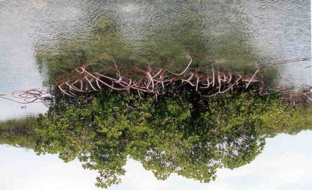
Figure 1: Mangroves provide hurricane protection, reduce coastal erosion, and habitat.
Figure 2: Pristine mangroves support habitat and nursery grounds for fish and shellfish.
ICF Consulting
24
Integrated Management of Watersheds and
Coastal Areas in SIDS of the Caribbean

Figure 3: Proposed marina and inland channeling will destroy these vital mangroves.
3.3.3 Sand Beach and Dune Systems Issues
Ě Channeling through sand beaches and dune systems to create an entrance to a marina
destabilizes the sand beach and dune coastal system and creates a serious
maintenance problem, which increases the costs to keep the channel open.
Ě Improper construction in sand dunes causes dune erosion and instability to coastline.
Ě Ad hoc private home owners construction of groynes causes erosion downshore and
forces neighboring land owners to spend money developing their own groynes until
the entire beach system is a groyne field and the property furthest downshore is
devoid of sand, e.g., Treasure Cay.
Ě Sand beaches and dune systems suffer from pressures of sand mining or dredging that
destabilizes the dunes.
Figure 4: Poor resort planning calls for dredging this pristine beach to create a harbor.
ICF Consulting
25
Integrated Management of Watersheds and
Coastal Areas in SIDS of the Caribbean
3.3.4 Iron (Rocky) Coastline Management Issues
Ě Private property owners may clear cut the vegetation above iron coasts to the
embankment edge causing soil erosion, sedimentation, and impacts on near shore
habitats such as seagrass beds and coral reef systems, e.g., Harbor Island.
3.3.5 Seagrass Beds Management Issues
Ě Dredging in the vicinity of seagrass beds causes physical damage and loss of
seagrasses and habitat.
Ě Improper fishing practices (dragging nets) damage seagrass beds.
3.3.6 Dunes and Other Natural Shorelines
The threat of significant and increasing beach erosion exacerbated by commercial sand
mining (particularly for export) played a major role in the GoB changing policies
regarding the harvesting of sand from beaches. The Conservation & Protection of the
Physical Landscape of The Bahamas Act, 1997 prohibits all significant excavation,
landfill, operation, quarrying, or mining of physical natural resources (including sand) on
the coastline. The Act applies to beaches, sand dunes, and the seashore and applies to the
Crown Lands. But its applicability to mining activity on private land remains unclear and
probably subject to challenges.
3.3.7 Public Access to Coastal Areas
All Bahamians have the common law right to use the foreshore and beach for swimming,
fishing, and navigation. However, there is no legislation guaranteeing the right to access
the foreshore.
3.3.8 Inland Lakes
Most of the Bahamian lakes are linear or crescentic in shape, and this is easily identifies
their origin in depressions between ridges. Inland lakes are shallow, usually only a few
feet deep, and rarely more than three to four meters deep. They typically have swampy
islands of mangroves within them and along the perimeters. Gradually, the swamps
expand and as a result the lakes decrease in size, so that all the lakes eventually mature
into swamps. All the major Bahamian islands have such marshy areas that were once
lakes and which usually flood when the water table rises in the rainy season. Inland lakes
are not sources of potable water in The Bahamas.
Geologically two types of lakes predominate throughout The Bahamas, ridgeland and
rockland lakes. Ridgeland lakes will form whenever the land between two ridges falls
below the level of the water table. Lakes in The Bahamas are usually small in size. A
second type of lake is a shallow, saucer-like depression in the rockland. Presumably
rockland lakes were formed while the rockland was still below sea-level, and in some
cases tidal currents may have been responsible. In general, rockland lakes are less
common throughout The Bahamas than ridgeland lakes.
ICF Consulting
26
Integrated Management of Watersheds and
Coastal Areas in SIDS of the Caribbean
3.4
Coastal Infrastructure and Management Issues
3.4.1 Infrastructure and Utilities Management Issues
The Bahamas' roads in the path of Hurricane Floyd suffered various degrees of "wash
out" damage at almost all locations where the roads were adjacent to the shoreline. The
degree of damage was, in part, dependent on the protection, or lack of protection,
provided by the associated sea defenses. In almost all cases where the sea defenses
failed, either because of sea surge or wave action, the adjacent road and/or shoulder
suffered damage. The main variables relating to the amount of damage was the elevation
Above Sea Level (ASL), distance of the road from the high water level, and, to a lesser
degree, the presence or absence of vegetation between the road and the sea.
In some cases, waves overtopping the sea defenses caused shoulder and road washouts on
the landside of the seawall. The conditions were worsened as the seawalls acted as a
barrier to the wave surges returning to the ocean. Waves and surges also caused erosion
and destruction of the natural vegetation cover. Erosion damage to roads was limited to
those near the sea defenses because no heavy rains were associated with the hurricane.
3.4.2 Marinas and Mooring Areas
Provision for the protection of the coast against erosion and encroachment by the sea is
made by the Coast Protection Act, 1968. The Act enables the Minister responsible for
Ports and Harbors to carry out necessary coast protection works (including maintenance
or repair). The cost of the work may be apportioned among landowners that benefit from
the protection works. Private coast protection work requires Ministerial consent. Local
Governments may also join in making provisions in respect to the upkeep and
maintenance of local ports, docks, harbors, wharves and jetties.
Ě New construction of commercial marinas (> 12 slips) and reconstruction of damaged
marinas should incorporate sewage pump out facilities and spill prevention plans.
Ě The design of new marinas and reconstruction of damaged marinas should
incorporate best management practices in the development of new bulkheads, e.g.,
preference to rock mounds construction and aquatic vegetation rather than walls.
Ě Marinas should incorporate the use of wetlands and mangroves to buffer wave action.
Ě Regulations and guidelines should be developed for the establishment of mooring
buoys for permanent anchoring areas near or around coral reefs and seagrass beds.
ICF Consulting
27
Integrated Management of Watersheds and
Coastal Areas in SIDS of the Caribbean
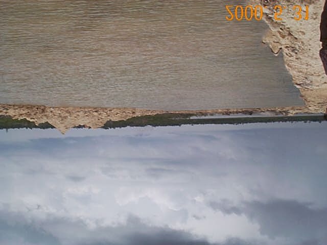
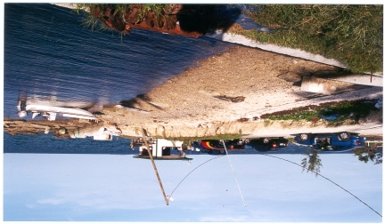
Figure 5: Remnants of small boat harbor destroyed during Hurricane Floyd because the
marina wall completely failed.
3.4.3 Dredging
Dredging for marinas and canals is a significant problem compounded by the fact that
construction work generally occurs on privately owned land. Presently, no adequate
regulation of dredging exists.
Dredging regulation is generally enforced through the Town Planning Act, 1961 since
permission for the development of land is required. Dredging harbors and ports require
permits from the Ministry of Transport.
Figure 6: Large dredging operation impacts mangroves and alters fresh water habitats.
ICF Consulting
28
Integrated Management of Watersheds and
Coastal Areas in SIDS of the Caribbean
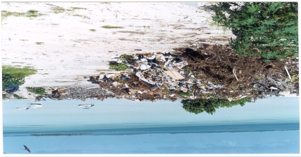
3.4.4 Electrical Utilities and Solid Waste Facilities
Ě New utility construction or reconstruction of damaged infrastructure should design
the placement of the infrastructure on the landward side of the roadways to provide
additional protection.
Ě The placement of electrical transfer stations should be on the landward side of the
roadway.
Ě Solid waste facilities are being designed and constructed to minimize land-based
sources of solid waste pollution. Solid waste facilities should be located in contained
areas away from open water.
Figure 7: Poor administration turns solid waste transfer facility into permanent dump.
ICF Consulting
29
Integrated Management of Watersheds and
Coastal Areas in SIDS of the Caribbean
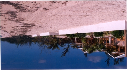
Figure 8: Poor planning places new construction on top of dune and subject to washout.
3.4.5 Coastal Land Use Planning Issues
The main coastal land use planning, permitting, and approval issues identified during the
field visit include the following.
Ě No coordination between central government and local town councils regarding land
planning and construction project approvals.
Ě No coastal plans ş mostly ad hoc development.
Ě No "Best Practices" to minimize impacts resulting from construction are in place.
Ě Criteria for Government approval of projects in the region are somewhat ambiguous,
e.g., different standards exist for international versus national investor and for the
relative size of the development.
Ě Coastal land use planning is reactive versus proactive, i.e., reacting to major
development proposals without some overall guidance for developers and
Government managers.
Ě Often people at the local level who are approving coastal land use projects are the
same ones who are building the projects or otherwise indirectly vested in the success
of the project.
Ě Coastal land ownership is sometimes a question. Clear definition of property lines
and land ownership needs to be addressed including definition of crown land,
common land, generation land, and private land.
Ě Social Impact Assessment (SIA), Environmental Impact Statement (EIS), and
Environmental Impact Assessment (EIA) processes are not well understood or
developed and have not been applied consistently throughout The Bahamas.
Ě No building codes for construction in sensitive areas, i.e., sand dunes or flood areas.
Ě New beachfront construction should require building setbacks from the landward base
of the dune.
ICF Consulting
30
Integrated Management of Watersheds and
Coastal Areas in SIDS of the Caribbean
3.5
Climate Change and Natural Disasters
The Bahamas, as many other low-lying island states are especially vulnerable to climate
change and associated sea-level rise because much of its land area rarely exceeds three to
four meters above the present mean sea level. Coastal areas with slightly higher
elevations are also susceptible to climate change effects, where the main settlements and
vital economic infrastructure invariably concentrated. The coastal region of The
Bahamas, compared to other parts of the country, is the most important and economically
most valuable both from development and environmental points of view.
Certain species of corals that inhabit The Bahamas are very sensitive to sea water
temperature changes. Elevated sea water temperatures (above seasonal maxima) can
seriously damage coral ecosystems by bleaching and also impair reproductive functions,
and lead to increased mortality. It is expected that mangroves will be more adaptive to
climate change by species, as well as local salinity regime and biological interactions.
Coastal land loss and the presence of infrastructure in coastal areas will also reduce the
natural capacity of mangroves to adapt and migrate landward.
Fresh water lens storage and capacity is a serious problem in The Bahamas because of the
dependence on rainwater replenishment. Changes in the patterns of rainfall may cause
serious problems to the islands of The Bahamas.
Higher rates of erosion and coastal land loss, and increased sea flooding, inundation and
salinization (of soils and fresh water lenses) are expected as a direct consequence of the
projected rise in sea level.
Throughout The Bahamas, tourism resorts, coastal towns and infrastructure will be at
risk, given their location at or near present sea level and their proximity to the coast.
Relocation or fortifying coastal infrastructure for coastal protection will become
financially burdensome for The GoB, particularly in the Family Islands. As discussed
later in this report, integrated coastal planning will afford the GoB the tools to help
minimize hazards of flooding and erosion and investments in coastal structures and
optimize performance.
Tourism is increasingly recognized as an important source of foreign exchange for The
Bahamas. Climate change and sea level rise will affect tourism directly and indirectly
due to: loss of beaches to erosion and inundation, salinization of fresh water aquifers,
increasing stress on coastal ecosystems, damage to coastal infrastructure from storm
events, and the overall loss of amenities would jeopardize the viability and threaten the
long-term sustainability of the tourism industry in The Bahamas.
Uncertainties in climate change projections may discourage planning and adaptation,
especially because of the lack of information and options will be costly or require
changes in societal norms and behaviors. The GoB should develop the national policies
and land use regulations aimed at minimizing the potential affects of climate change and
sea level rise.
ICF Consulting
31
Integrated Management of Watersheds and
Coastal Areas in SIDS of the Caribbean
This report recommends new standards and procedures for construction and development
in the coastal areas of The Bahamas. The GoB would benefit greatly from the practical
application of these new coastal planning and engineering principles through undertaking
an integrated coastal planning pilot project for a selected island in the Family Islands. A
pilot project would afford the GoB opportunities to develop policies, standard
construction procedures, and implement proven measures with respect to disaster
preparedness and climate change.
3.6
Transboundry Threats
Due to its isolation as an island, The Bahamas does not have any land-based
transboundry threats. Water-borne transboundry threats include impacts resulting from
migration of toxic substances (oil spill) or diseases on oceanic currents. Shipping
commerce can also act as a vector in transmitting disease or non-native species to The
Bahamas.
3.7
Information Management Issues
Below are the main information and information management issues identified during the
field visit.
Ě Central authorities do not have ready guidelines to provide local decision-makers
regarding sustainable coastal development.
Ě No clear definition of "no build zones" such as flood prone areas and
Environmentally Sensitive Areas (ESAs), e.g., sand dunes and mangroves.
Ě Lack of ready availability of national information contained in the various Ministries
that could be of immediate value for coastal zone planning and local decision-
making, e.g., flood prone areas.
Ě Relevant tools for coastal zone planning are not readily available or applied to coastal
zone management, e.g., Geographic Information Systems (GIS), remote sensing
imagery, and Digital Elevation Models (DEMs).
3.8
Social and Cultural Issues Relating to Implementing Coastal Management
Below are the typical social and cultural issues identified during the field visit.
Ě Representatives from the Local Town Councils often presented a cavalier mentality
towards development in the Family Islands.
Ě Independent spirit of people in the Family Islands makes it difficult to set and
implement standards and guidelines.
3.9
Governmental and Non-Governmental Eco-Conscious Organizations in The
Bahamas
The Adventure Learning Center
A non-profit, charitable organization aimed at nature-centered education for all children,
pre-school to grade 6. The center is based in over 100 acres of wetlands; home to nature
ICF Consulting
32
Integrated Management of Watersheds and
Coastal Areas in SIDS of the Caribbean
trails and haven to 150 species of indigenous animals. Soon to be opening to tourists
interested in the ecology of The Bahamas. Tel: (242) 324-3166
ARK
"Animals Require Kindness". A society actively is preventing the cruelty of animals. Tel:
(242) 394-3757
Bahamas Environment Science & Technology (Best) Commission
Bahamas Environmental Science and Technology Commission having an effect upon
legislation in all matters concerning the environment. BEST also ensures that The
Bahamas complies with international regulations on environmental protection. Tel: (242)
327-4691/3, e-mail: bestnbs@batelnet.bs.
Bahamas Reef Environmental Educational Foundation (Breef)
Is dedicated to encouraging Bahamian children to become well-informed and active
stewards of our environment. Sponsors of teacher training in The Bahamas and in the
USA. Holding workshops on the role of reefs in these islands' systems at the Bahamas
Field Station. Tel: (242) 326-7938, e-mail: breef@bahamas.net.bs.
Bahamas National Trust
First established in 1959, it is a collaboration of governmental, private sector, and
scientific interests dedicated to the conservation of the natural and historic resources of
The Bahamas. Holding in "trust" the heritage of the beauty of the Bahamas. Managing
the national parks, policy planning, conservation education and research. Tel: (242) 393-
1317, e-mail: bnt@bahamas.net.bs.
The Bahamas Marine Mammal Survey
A long-term research program affiliated to Earthwatch concerned with documenting the
occurrence, seasonality and abundance of dolphins and whale species in Bahamian
waters. The overall, long-term research goal is to characterize the marine mammal fauna
of The Bahama Islands for scientific understanding and conservation purposes. Since
the survey began in 1991, there have been over 200 encounters with fourteen species of
dolphins and whales and over 700 sighting reports from other boaters. To date, 17
different species of dolphins and whales have been documented and seen in Bahamian
waters, as well as the West Indian manatee. This research has been instrumental in
increasing public knowledge and affecting local management policy for the capture of
wild dolphins within The Bahamas. Tel/Fax: (242) 367-4505
"BNE Tours" on VHF Ch. 65A.
The Bimini Biological Field Station
A worldwide shark research center devoted to the conservation of shark species in the
wild. The Center, since 1990, works under a research permit from TheGoB, which
includes an annual scholarship to a Bahamian student. The Center is associated with the
University of Miami's Rosentiel School of Marine and Atmospheric Science. Tel: (305)
274-0628 or (305) 361-4146.
ICF Consulting
33
Integrated Management of Watersheds and
Coastal Areas in SIDS of the Caribbean
Cape Eleuthera Marine Conservation Project
The Cape Eleuthera Island School is a unique campus and research center serving the
needs of students, teachers, scientists, and the local community. It boasts access to one of
the most biologically diverse and pristine marine environments in the world. The mission
of The Island School is to understand and preserve the ocean through education. The
program is sponsored by The Lawrenceville School and funded by private foundations.
Tel: (609) 620-6700 or Eleuthera: (242) 334-8300, e-mail: ischool@batelnet.bs
Caribbean Marine Research Center
Founded in 1984 by the Perry Foundation and lying 110 miles southeast of Nassau on
Lee Stocking Island is the Caribbean Marine Research Center. The center is
internationally recognized for focusing on research in ecology, nature resource
management, coral reef habitats, climatic change and marine geological change
processes. Of particular concern are the over-fishing and reproductive habits of queen
conch, spiny lobster and the Nassau Grouper. The center is utilized by scientists and
students from all over the world because of its diversity in geographical environments
and variation in biological habitats. The pristine waters of Exuma make it particularly
suitable for baseline data in scientific research. Tel: (242) 345-6039, (561) 741-0192.
Internet: http://www.cmrc.org.
Ecotourism Association Of Grand Bahama
Formed to educate and promote natural, cultural and historical features of Grand Bahama
Island to visitors and residents whilst also addressing issues of protection in the use of
our natural environment. The association has a criterion for involvement including - use
of natural and cultural features of the environment; education and interpretation;
ecological and cultural sustainability; benefits to the local community. Tel: (242) 352-
5438
The Garden Clubs of Nassau
Gardening clubs aimed at beautifying the Islands of The Bahamas. They also support
gardening projects on the island, hold shows and competitions and give awards annually.
Tel: (242) 324-2211. International Garden Club Tel: (242) 324-6994
Marine Group
The marine group organizes itself to promote research and conservation of The Bahamian
marine environment. They are currently working on collating research bibliographies and
mapping the Andros reef system. Tel: (242) 393-1317.
National Pride Association
An organization concerned with the beautification of the islands of The Bahamas. Tel:
(242) 326-3330.
Oceanwatch
Oceanwatch Bahamas Ltd. is a volunteer non-profit company established for the purpose
of reef and ocean conservation in and around The Bahamas. Projects so far have
included: the installation of 40 mooring buoys around New Providence, relocating a
ICF Consulting
34
Integrated Management of Watersheds and
Coastal Areas in SIDS of the Caribbean
sand-dredging project away from famous diving sites, stopping longline fishing and an
annual Reef Sweep/clean-up. At present, Oceanwatch is aiming to establish marine
preserve at the western end of New Providence. Tel: (242) 327-8554, e-mail:
oceanwatch@batelnet.bs.
The Ornithology Group
Associated with the Society of Caribbean Ornithology and concerned with the
preservation of Bahamian birds. Tel: (242) 393-1317.
Re-Earth
To educate consumers on the selection of eco-conscious products. Action group for
environmental issues within The Bahamas. Working in schools and in the community.
Tel: (242) 322-3128/393-7604.
The Rob Palmer Blue Holes Foundation
The Blue Holes Foundation is a not-for-profit organization dedicated to the scientific and
physical exploration of Blue Holes within The Bahamas, and related Cave environments.
Blue Holes are one of the world's last unexplored frontiers, a unique environment with a
unique ecosystem that may have remained little changed for over 150,000,000 years. The
goals of the foundation are: to explore and survey speleological resources in The
Bahamas; to encourage education in and conservation of Bahamian caves, and Blue
Holes and their associated terrestrial and marine habitats; to promote the concept of
integrated ecosystems within the Bahamian environment; the development of safe and
appropriate techniques for the exploration of Bahamian caves and Blue Holes; the
documentation and publication of exploration and research in Bahamian caves, and the
creation of a database on Bahamian Caves. Tel/Fax: (242) 373-4483.
3.10
Institutional Issues
Institutional management of coastal assets is fragmentary and dispersed over a variety of
legislation. The absence of dedicated institutional management is compounded by an
inadequate or non-existence legislative basis for some of the most important management
agencies including the BEST Commission. Most critically, the administrative provisions
for consultation and coordination are weak and often by-passed in practice.
Coastal and terrestrial management in the Family Islands has recently been given
recognition with the approval of local government. The Local Government Act, 1996
appears to make provisions for local government, based largely upon the concept of
island governance.
Ě Limited collaboration and coordination between central authorities and local town
councils.
ICF Consulting
35
Integrated Management of Watersheds and
Coastal Areas in SIDS of the Caribbean

Figure 9: The Ambassador for the Environment meets with local citizens in Family
Islands to discuss current issues.
ICF Consulting
36
Integrated Management of Watersheds and
Coastal Areas in SIDS of the Caribbean
This page intentionally left blank
ICF Consulting
37
Integrated Management of Watersheds and
Coastal Areas in SIDS of the Caribbean
4.0
PRELIMINARY RECOMMENDATIONS FOR DEVELOPMENT IN THE
COASTAL ZONE OF THE BAHAMAS
4.1
Introduction
During the development of any coastal project in The Bahamas, it is extremely important
to have a clear understanding of the overall objectives for protecting human life and
enhancing natural coastal assets, including the following.
Ě Preserve and restore beaches
Ě Minimize hazards of flooding and erosion
Ě Minimize investment in coastal structures
Ě Maximize performance of coastal structures
Ě Maintain water quality standards to preserve reefs and recreational beaches
Ě Maintain existing coastal resources in general
In order to accomplish these objectives and to manage for development in the coastal
zone, it is necessary to have a detailed understanding of several coastal parameters. The
information noted below is required to maintain existing coastal resources as well as for
the development or maintenance of coastal facilities including restoration of beaches,
recreational beaches, resort developments, infrastructure (e.g., coastal roadways and
piers), and other related coastal structures.
In order for these facilities to be designed and constructed properly, it is essential that the
designers, planners, and government agencies reviewing the applications understand the
following issues.
Ě The water levels and wave heights to which the facilities will be exposed.
Ě The nearshore area (reef topography/health), beach/dune (topography, grain size), and
other shoreline characteristics, including the presence or absence of coastal
protection.
Ě How frequently structures or beaches will be exposed to extreme conditions.
Ě How the beach/coastal facilities react to these conditions.
With this knowledge base, it is possible to avoid failures, minimize impacts to the natural
environment, and minimize costs related to both the initial capital cost and future
maintenance expenditures. It is also possible to preserve and even restore beaches.
This Chapter provides an overview of the processes required to establish setback or
build/no build zones, develop cost effective, quality infrastructure design, and develop
guidelines to ensure that this process is clear, focused, and results in significant benefit to
the people and GoB. This Chapter also provides a series of recommendations to assist in
achieving the stated objectives and an introduction to construction related issues in the
coastal zone.
ICF Consulting
38
Integrated Management of Watersheds and
Coastal Areas in SIDS of the Caribbean
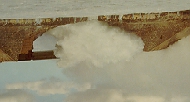
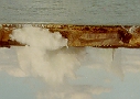

4.2
Process to Determine Build and No Build Zones Based on Flood Hazard and
Erosion Analysis in The Bahamas
In The Bahamas, flooding and erosion generally occurs during severe wave attack at
elevated sea levels (high tide combined with surge). Under these conditions, waves erode
protective beaches and dunes and cause wave and flooding damage to the adjacent lands,
buildings, and infrastructure. These hazards may be defined through the following steps:
Ě Evaluating the possible extreme wave and water level conditions
Ě Determining the local nearshore, beach, and dune characteristics
Ě Classifying the shore into like reaches; determining the flood and erosion response for
these reaches based on tested numerical models; and presenting this information on
maps and air/satellite photos
Ě Present findings in a GIS database
The challenge in determining the design values for waves and water levels relates to the
fact that The Bahamas, which consists of over 700 islands, has an extremely diverse
range in exposures to both water level variation and wave heights. These include
exposure to "normal" conditions (water level changes related to varying tidal conditions
and trade wind generated waves) and exposure to "extreme" wave and water level
conditions.
Extreme wave conditions in The Bahamas may be generated by both hurricanes and
waves generated in the Atlantic Ocean. Exposure also varies depending on the specific
features and location on the particular island under consideration. For example, some
sites (such as Glass Window, Eleuthera) are exposed to extreme wave conditions from
both hurricanes and the Atlantic. Other sites (such as Rock Sound, Eleuthera) are
relatively protected from waves, but are exposed to very large storm surges or increases
in water levels during hurricane events. This large increase in water level occurs as a
result of the shape of the island and surrounding water depths, and results in serious
flooding (although on an infrequent basis).
Photos courtesy
of the Ministry
of Works and
Transportation
Figure 11: Extreme Atlantic wave conditions at Glass Window, Eleuthera
ICF Consulting
39
Integrated Management of Watersheds and
Coastal Areas in SIDS of the Caribbean


Wind is the primary driving force behind both the water level variation and wave heights.
The effect of the wind varies dramatically depending on numerous factors (i.e., shape of
island, water depths around site, wind direction, wind speed), which in turn are affected
by whether they are driven by normal trade winds, storm conditions, or a hurricane.
Nearshore currents are also a consideration at many locations, either wind or tidal driven.
Finally, atmospheric pressure also affects water levels and must be a consideration.
The following schematic defines the required steps in the proposed design process for all
coastal structures. Additional detail relating to this process is provided in Section 3.
s
of
ce
of
e
s
i
g
n
e
s
r
e
tion
m D
n
d
r
u
c
t
ur
e
s
o
ur
va
u
ctu
a
l
va
g
n
a
a
l
st
er
l R
er
o
ast
e
si
ta
p
t
i
mu
Str
o
ast
p
t
i
mu
f
C
f
d
c
o
ns
of
C
oas
C
d O
C
s
i
on of
an
l
t
a
n
t
v
a
t
i
o
n o
ce
a
t
i
o
n
o
ce
su
ur
r
uct
su
Re
o
nser
e
so
p
timiz
Re
C
R
O
const
e
ment
s
pe
i
ze
h
c.
a
nag
lis
et
s
ter
n
e ty
s
o
r
e
l
i
n
e
i
t
y
i
ght
i
t
y
k
s
ac
c
ks
e
M
ac
e
M
eli
s
tab
b
ac
o
n
E
tba
a
ve he
o
n
h
ar
E
i
on, sh
at
a
t
e
r
qul
d set
C
s
h
or
&
Se
at
Se
w
o
ces
l Z
o
ces
r
s
gn w
s an
ta
7.
r
s
7.
cto
l
opes,
y
pe
cto
o
r
e
desi
o
as
C
Fa
c
a
l
i
n
f
o
r
m
o
r
e s
sh
i
n
e t
Fa
sh
hni
ar
r
el
,
nts
ific
ec
r
sh
ific
ec
a
t
e
r
l
e
vel
sho
re
ec
e
ot
o
r
ne
i
g
n
Pr
ec
i
g
n
Pr
g
ze
g
e f
a
ves
ur
i
o
n, nea
gn w
C
i
o
n, nea
C
Y
ude
si
c
t
e
ri
Y
Y
Y
t-Sp
ude
at
si
at
t-Sp
C
n
cl
C
e W
&
N
o
c
edur
N
N
N
j
ec
s i
h
ara
s i
o
r
i
e
nt
Pr
and de
C
Des
or
YSES
ls,
YSES
Des
UE
5
sh
5
UE
sh
Pro
I
nput
6.
7.
ed
Q
Q
ar
e
ve
ed
ar
ANAL
FRE
ANAL
FRE
Ne
r L
FRE
Ne
s
6.
a
te
v
ent
i
n
e
W
e
'
e
o
r
el
o
p
os
r
e
m
a
t
e
r
l
e
v
e
l
s
e
xt
w
Pr
r
l
s
'
and `
i
r
e
i
s
l
a
nd sh
a
te
'
and `
a
te
a
v
e
s and
v
e
s
ve
o
r
ent
W
Le
t
i
ons
o
r
w
4.
t
i
ons
4.
s
f
3
.
Wa
s
a
l
'
,
`
s
t
o
r
m
s
ondi
ysi
or
n
o
r
m
a
t
e
r
l
e
v
e
l
s
f
n
al
a
t
e
r
l
e
v
e
l
s
f
a
ct
o
r
`
a
ve c
w
y
a
o
r
`
a
f
e
w
r
e
e
w
d
F
a
f
d
F
sho
i
ne
f
s
hor
ar
r
e
quenc
i
ne
i
nd dat
w
2.
e
r
m
r
a
t
e
of
r
a
t
e
ne
t
ake f
e
r
m
r
a
t
e
ne
et
o
l
l
e
ct
e
ne
e
ne
nder
C
G
G
U
P
r
ed
2.
3.
4.
5.
Figure 12: Proposed design process for Integrated Coastal Management Planning.
ICF Consulting
40
Integrated Management of Watersheds and
Coastal Areas in SIDS of the Caribbean
The government can also minimize impacts on coastal resources (e.g., coral, mangroves,
and beaches) and optimize coastal infrastructure investment by considering all of the
applicable factors. The various factors that must be considered are summarized in Figure
13 and listed below.
Ě Assessing and selecting appropriate values for the coastal environmental conditions
(i.e., wind, waves, water levels, and currents) Presiding fiscal conditions (i.e.,
necessity of project and availability of funds)
Ě Cost benefit analyses (performance versus cost of range of solutions)
Ě Construction issues such as availability of equipment and site access
Ě Conservation of natural marine resources which in many cases provide a critical
portion of the protection for coastal sites
Ě Compare design to overall Integrated Coastal Management Plan.
All of this information can be stored in a GIS database and reviewed on a project specific
basis as each project is considered.
Proposed Design Process
CONSERVATION of
Natural Resources
Design WAVE
(reefs, mangroves )
Design WATER LEVEL
Overall COASTAL ZONE
FREQUENCY Analyses
MANAGEMENT Plan
RESULT
Define Nearshore
GIS
*Optimize Infrastructure
BEACH and DUNE
Database
Design and Construction
Characteristics
*Conservation of Coastal
Currents, Water Quality
Resources
*Economic Benefits
Financial / FISCAL $$
Information
COST BENEFIT
CONSTRUCTION
Analyses
Equipment Access/Availability
Analyses
Figure 13: Schematic Diagram of Data Required to Properly Assess
Individual Coastal Sites, Optimize Infrastructure Design and Construction,
ICF Consulting
41
Integrated Management of Watersheds and
Coastal Areas in SIDS of the Caribbean
The following sections outline the tasks required to define the wave and water level
environment for the populated areas of The Bahamas to suggest setback distances and
build/no build zones. To support the setback determinations, a discussion of how to use
this information in the future to design and construct structures which are sturdy yet
reflect the environment (waves and water levels) to which they are exposed are described.
This process will result in less environmental impact and better coastal infrastructure
benefiting all Bahamians.
4.3
Determine Appropriate Infrastructure Design Process for the Coastal Zones
of The Bahamas
As described in the previous section, the design of a coastal structure requires a clear
understanding of, and accurate values for, the design wave height, design water level, and
frequency of occurrence of these events. In addition, it is important to have an
understanding or description of the nearshore beach (cross section, sand grain size), dune
dimensions, and related adjacent shoreline (rock outcrops, wetland etc.). All of this
information affects the resulting design of coastal structures and the related capital and
maintenance costs.
Using wave height and related wave energy, it is possible to demonstrate why it is critical
to have accurate design values and information in order to design coastal structures. As
shown in the chart below, wave energy varies as a function of wave height squared. To
illustrate the concept, a three-foot wave height has nine times the energy of a one-foot
wave. Wave energy generates the damage and erosion that occurs during storm events.
It is, therefore, extremely important to develop accurate values for wave height and the
related wave energy to be used in the design of coastal infrastructure, as even small
differences will have a significant impact on the final design.
Wave Height vs. Wave Energy
Wavee Heightt (ft)
Wavee Energy
1
2
3
4
5
6
7
8
9
Figure 14: An increase in wave height results in an exponential increase in wave energy
and the related potential for damage to coastal structures.
ICF Consulting
42
Integrated Management of Watersheds and
Coastal Areas in SIDS of the Caribbean
Similar issues exist in regard to an accurate estimate of the nearshore water level.
Throughout The Bahamas, the nearshore water level typically defines the wave height
that reaches the shoreline. The schematic below indicates the effect of correctly
establishing the design water level. A low water level results in a much lower wave
height at the shoreline. If the engineer does not take into account the water level
increases which occur near the shoreline during storm conditions, they will underestimate
the design wave height and subsequently the required size and strength of the coastal
structure or the erosion potential for a particular beach. Alternatively, overestimating the
water level will result in the construction of excessively large and costly structures whose
performance is often inferior. In addition, the aesthetic and ecological impacts are
generally much greater for larger, oversized structures than for those properly designed
using accurate design wave and water level values.
Low Water Level
High Water Level
Figure 15: Accurate water level information is essential, as the water level defines the
wave height and subsequently the wave energy that reaches the shoreline as well as the
related potential for damage.
ICF Consulting
43
Integrated Management of Watersheds and
Coastal Areas in SIDS of the Caribbean


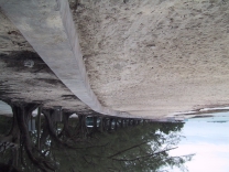
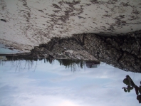
Hurricane Floyd caused extensive damage throughout The Bahamas on a variety of
coastal structures including piers, seawalls, and roadways, in addition to beach and dune
erosion and damage to shoreline vegetation. Using seawalls as an example, it is possible
to highlight some of the design flaws of existing structures and emphasize the
requirement for new planning procedures and related final construction designs.
There are many reasons for seawall failure including toe erosion, structural failure of
small sections of the wall itself, and collapse of sections of seawall toward the sea. In
many locations it has been suggested that the reconstruction of seawalls should include
increasing the height of the seawall. However, the failure of many seawalls occurred as a
result of the existing seawall being too high and unable to support the load of water
trapped on the land side of the wall during the hurricane event, thus causing the wall to
topple toward the sea. The higher seawalls also increase the amount of trapped water and
related flooding, as well as increase the duration of flooding.
Figure 16: Failure and Repair of a Seawall
New Providence Low Crested Sea Wall and Adjacent Beach New Providence Failed Sea Wall
ICF Consulting
44
Integrated Management of Watersheds and
Coastal Areas in SIDS of the Caribbean
The objectives of sea wall construction are to balance the design to accomplish the
following:
Ě Natural beach is maintained or enhanced in front of the seawall
Ě Hazards of flooding and erosion are minimized
Ě Flooding occurs for the minimum amount of time during infrequent hurricane events
Ě Hurricanes do not destroy the infrastructure
Ě Minimize investment in coastal structures and maximize performance
The schematic provided below summarizes a few of the issues related to flooding and
damage during hurricane events on improperly designed seawall structures.
Opti
p mu
m m Seawall
High
i Seawall
High Seawall - Failure
F
Figure 17: High Seawalls often trap receding floodwaters prolonging the flooding
condition and resulting in failure of the seawall in some cases, as indicated above.
ICF Consulting
45
Integrated Management of Watersheds and
Coastal Areas in SIDS of the Caribbean
It is important to note that the capital cost of infrastructure is often less when the designer
has an accurate estimate of the design water levels and wave heights, as well as an
understanding of the frequency with which they occur. As shown during actual
conditions and damage generated by Hurricane Floyd, lower, less expensive seawalls
were often adequate and provided better overall performance than high seawalls.
Although the lower seawalls would tend to overtop earlier in the hurricane (probably a
few hours or less), the flooding water is able to return to the sea quicker and the potential
for significant structural damage is generally less.
It is also important to note that failure due to the load generated by trapped water is not
the only mode of failure for coastal structures. The structures are often undermined by an
eroding shoreline and damaged by wave impacts or other coastal phenomena. All of
these possibilities must be taken into consideration during the design process.
4.4
Requirements for Guidelines for Development at Each Coastal Zone
By determining and documenting the wind, water level, and wave parameters in advance,
as well as the frequency of each event, the GoB could develop a thorough understanding
of the coastal environment. This information, in addition to the nearshore characteristics
of the shoreline, could be stored in a GIS database. This would allow the government to
accurately review submissions for new coastal projects as well as provide guidance for
the improvement or reconstruction of existing coastal infrastructure. The ultimate benefit
would be the preservation or even enhancement of existing beaches and other coastal
resources that are so important to The Bahamas.
4.4.1 Process to Develop Database of Coastal Information
This process is outlined below and described in greater detail in Sections 4.4.1.1 through
4.4.1.7.
1. Select specific islands for analyses (e.g., Grand Bahama, New Providence, Abaco,
Andros, Exuma, Eleuthera, Cat Island)
2. Collect wind data for `normal,' `storm,' and `extreme' events
3. Generate offshore wave conditions
4. Generate nearshore water levels for the entire island shoreline
5. Undertake frequency analyses for waves and water levels
6. Calculate nearshore wave conditions and related exposure zones
7. Characterize shoreline types and develop setback recommendations by shoreline
reach, consistent with the overall ICM Plan
8. Repeat the process for each island to be considered
ICF Consulting
46
Integrated Management of Watersheds and
Coastal Areas in SIDS of the Caribbean
Figure 18: Recommended areas for detailed coastal studies and development of database.
4.4.1.1 Select Specific Islands for Detailed Wind, Wave, and Water Level Analyses
(e.g., Grand Bahama, New Providence, Eleuthera, Cat Island)
Specific islands would be selected for the development of a coastal database, as
prioritized by the GoB, based on existing stress on coastal resources, requirement for
replacement of existing infrastructure or the construction of new infrastructure,
population, and other factors.
4.4.1.2 Collect WIND Data for `Normal,' `Storm,' and `Extreme' Events
Wind data for "normal," "storm," and extreme events (hurricanes and tropical
depressions) will be collected and analyzed to develop a long-term (fifty plus years) wind
database.
4.4.1.3 Generate Offshore Wave Conditions
Using the long-term wind statistics developed in Section 4.3 above, the offshore wave
conditions will be developed for each island selected for detailed design. This will
include hourly values of offshore wave height and hurricanes/storm waves covering a
period adequate to develop long term wave statistics.
4.4.1.4 Generate Nearshore Water Levels for Entire Island Shoreline
Using the long-term wind statistics developed in Section 4.3 above, the nearshore water
levels will be developed for each island selected for detailed design. This will include
hourly values covering a period adequate to develop long-term water level statistics.
ICF Consulting
47
Integrated Management of Watersheds and
Coastal Areas in SIDS of the Caribbean
4.4.1.5 Undertake Frequency Analyses for Waves and Water Levels
The statistical assessment and related selection of a design level is particularly important.
The level of protection needed for a coastal region is normally based on an assessment of
the frequency of occurrence of both wave conditions and storm surge. As such, it is
important to define the magnitude of the maximum wave heights and surge levels for
each location as a function of return period. Selecting a design level (i.e., 1 in 20 years
versus 1 in 50 years) has a significant influence on the capital cost of construction as well
as potentially on repair and maintenance costs. For example, the selection of a higher
return period will result in a more robust structure, but also the potential for significantly
higher capital cost.
It is important to consider the likelihood of occurrence of these events. For example, a 1
in 20-year event has a 5% chance of occurring in any one year. Further, a 1 in 20-year
event has a 65% probability of occurring in the next 20 years (star on Figure 19), whereas
a 50-year event has a 34% probability of occurring in the next 20 years. The net outcome
of the statistical analysis procedure is the definition of the magnitude of wave height and
water level at the site of interest, as a function of return period.
100.0%
90.0%
80.0%
70.0%
60.0%
50.0%
10 Year Event
40.0%
20 Year Event
30.0%
30 Year Event
Probability of Occurrence
20.0%
50 Year Event
10.0%
100 Year Event
0.0%
0
20
40
60
80
100
120
140
160
Time Period (years)
Figure 19: Frequency Analysis Example: Note that there is a 65% chance that
the 1 in 20-year storm will occur within 20 years
4.4.1.6 Calculate Nearshore Wave Conditions and Related Exposure Zones
A procedure is also required for developing a nearshore design wave height based on a
variety of parameters. In some cases, the procedure will be very simple and not require
any professional review. In other more exposed locations, the determination of the
nearshore design wave height and procedure required to develop the value will require
professional review. This whole process should be carefully established in advance in the
ICF Consulting
48
Integrated Management of Watersheds and
Coastal Areas in SIDS of the Caribbean


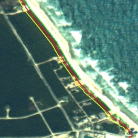
design. Calculated wave height ultimately defines the cost and longevity of the structure
in many coastal locations. The definition of the type of review required based on
exposure is summarized in the graphic below.
Recomm
Reco
end
en ed
d
Se
S tback
Low E
w xp
x os
o u
s re
High Exposure
Mo
M derate Exposure
MP
M W B
W a
B hamas Design
Pr
P ofe
f ssional Design
g
Pr
P ofe
f ssional Design
g
Recomm
Reco
end
en ed
Revi
Rev ew
Design
g Su
S r
u ge
g and
n
Wa
W ve Runu
R
p Le
L ve
v l
Norma
m l Tidal Ra
R nge
g
Figure 20: Determination of the nearshore design wave height and procedure required to
develop the value requiring professional review.
A key step in the development of conceptual designs for any coastal structure is the
definition of representative "exposure zones," considering factors such as design waves
and water levels (considering shoreline orientation relative to typical storm tracks,
sheltering effects, etc.), nearshore profile (water depth at structure and nearshore slope),
erosion potential of nearshore profile, and subsurface conditions. Assuming that the
design water level and offshore design wave heights are available, it is possible to
determine the structural design wave height through the application of standard coastal
engineering principles.
4.4.1.7 Characterize Shoreline Types and Develop Related Setback Recommendations
By Shoreline Reach
A variety of shoreline types exist throughout
The Bahamas including fine silt/sand
materials, sandy beaches, and rocky
shorelines. After you characterize the
shoreline type and exposure to waves and
water levels it is possible to establish setback
recommendations based on quantifying and
minimizing the risk of damage. The setback
allowance will also vary depending on the type
and value of the proposed development and
acceptable level of risk.
Figure 21: Risk based shoreline setback lines
ICF Consulting
49
Integrated Management of Watersheds and
Coastal Areas in SIDS of the Caribbean
The proposed steps to develop appropriate setback recommendations are below.
1. Estimate flood and erosion hazard setback recommendations for reaches of shoreline
with common characteristics related to wave and water level exposure and shoreline
conditions.
2. Address protection of existing structures/buildings that fall within the setback
recommendation requiring protection for these structures (i.e., piled foundation).
3. Incorporate setbacks in zoning policy and legislation.
4. Develop educational material describing why setbacks and building specifications are
required.
5. Promote the setback concept with local insurance and real estate agents.
The final data set (design waves and water levels, setback line locations, etc.) could be
stored in a GIS database. An example of setback lines taken from Elbow Cay and stored
in a GIS database is shown in Figure 21.
4.4.2 Summary
The proposed approach to future development along the coastlines of The Bahamas
outlined in this document will do the following:
Ě Assist in the preservation, enhancement, and restoration of beaches
Ě Minimize hazards of flooding and erosion
Ě Result in a coastal design information database, accessible to the public
Ě Minimize investment in coastal structures and optimize performance
Ě Allow the unique characteristics of each site to be taken into account
Ě Simplify the design process and allow the use of standard pre-approved MoWT
designs in many cases
Ě Make the permitting and review process consistent between projects
In order to achieve these objectives the following recommendations are suggested.
1. Develop deepwater and nearshore information on DESIGN WAVES AND WATER
LEVELS for key islands.
2. Define NEARSHORE CHARACTERISTICS including profile, beach, and dune
characteristics. Site-specific characteristics may need to be incorporated in many
cases depending on the shoreline exposure, type, sensitivity, and other factors. This
would be the project proponent's responsibility.
3. Develop a MONITORING program consisting of satellite or aerial images. nearshore
beach profiles, wave and water level gages (a portion of this exists).
4. Develop a WATER QUALITY standards and monitoring program (essential to the
long-term health of the offshore reefs).
5. Establish SETBACK recommendations and requirements including the related
legislation, policy, and educational materials.
6. Develop a comprehensive COASTAL DATA BASE for the selected islands
accessible to the public.
ICF Consulting
50
Integrated Management of Watersheds and
Coastal Areas in SIDS of the Caribbean
This entire process will result in a comprehensive GIS-based coastal database for The
Bahamas, including all of the key islands and many surrounding islands. The design
wave, design water level, frequency of each event, shoreline types, related setback
recommendations, and coastal resources would be input into a GIS database so that it
could be readily accessed. As each project is submitted for review, the GoB could either
sell this design data or simply use it to review the values used in each submission. The
information would also be extremely valuable for the design or reconstruction of public
coastal infrastructure.
4.5
Introduction to Design and Approach to Construction in the Coastal Zone of
The Bahamas
The design and construction of coastal structures in The Bahamas requires consideration
of many factors. Some of these are standard coastal design and construction issues and
others relate specifically to The Bahamas. It is important to take all into account
including the variation that occurs throughout The Bahamas. For example, the
availability and cost of materials and construction equipment varies widely throughout
the islands. The exposure and type of shorelines covers an incredibly wide range of
situations. The scale of the project (size of pier, draft of access channel, etc.) varies
widely from one situation to another. All of these factors and many more must be taken
into account when selecting a design for a specific coastal structure.
As mentioned previously, consideration of the design wave height, design water level,
and frequency of events are critical inputs to the design selection. In many cases, it is
simply unreasonable to design facilities such that they do not flood during hurricane
events. In order to avoid flooding entirely, the capital cost of the structure would be
excessive and rarely utilized. By determining the design water level and design wave
height in advance, it is possible to select a roadway elevation and slope protection that
will survive exposure to a hurricane and flood for a brief period, yet cost a fraction of the
no-flood alternative. Using a coastal roadway as an example, the challenge is to design
the roadway to be stable under all conditions (average storms and hurricanes), yet only
flood briefly during hurricane events. This approach results in a lower structure,
requiring less slope protection and a much lower overall cost. Relative performance is
almost identical, as the structures in most cases will only be exposed to hurricane wave
and flooding conditions for a matter of hours once every few years or less. Designing to
these standards can only be accomplished with an advanced detailed knowledge of the
design wave, water levels and their frequency of occurrence.
Similar approaches also apply to piers and other coastal structures. For example, it is
often more cost-effective to design piers to "tear away" during a hurricane event. In this
case the decking is designed to withstand "regular" high tides and storm conditions, but it
is also designed with decking sections that will separate from the main supporting
infrastructure (piles and pile caps) during a hurricane event. This typically represents the
most cost-effective approach by reducing the initial capital investment and minimizing
the cost of repairs following a hurricane.
ICF Consulting
51
Integrated Management of Watersheds and
Coastal Areas in SIDS of the Caribbean
It is also very important to have an appreciation of The Bahamian-specific issues relating
to each project. This may include the availability of construction equipment, access for
construction equipment (what size/type can access the site), land versus marine-based
construction and so on. The availability of materials for shore protection and
construction is also an important consideration that frequently impacts the selection of a
final design.
In summary, it is important to have an appreciation of coastal specific construction issues
(i.e., the likelihood of exposure to storms during construction, construction access--
marine or land based), as well as Bahamian-specific issues such as available equipment,
import duties, available materials, and so on.
ICF Consulting
52
Integrated Management of Watersheds and
Coastal Areas in SIDS of the Caribbean
5.0
STRATEGY FOR THE BAHAMAS NATIONAL COASTAL ZONE
MANAGEMENT PROGRAM
The Bahamas geography, with over 700 islands and thousands of miles of shoreline,
suggests the need for comprehensive coastal zone management structures. The Bahamas
occupies an area approximating the distance between Puerto Rico and Trinidad and
Tobago and provides an excellent illustration of the requirement for environmental
control that distinguishes between marine, coastal, and terrestrial management. The
Bahamas possesses the longest coastline of all Commonwealth Caribbean states. It also
boasts of at least one individual island (Andros) that is larger than some Commonwealth
Caribbean island States (e.g., Barbados, St. Kitts, and Nevis).
5.1
A Vision for ICM in The Bahamas
The Bahamas would benefit from a national program and plan that provides a "blueprint"
toward achieving national objectives for long-term sustainability of the coastal
environment. ICM planning can serve as the springboard from which appropriate
planning, management, and investment interventions could be implemented at the
national, island (cay), and local levels. Nowhere is this more warranted than in The
Bahamas coastal zone, which essentially encompasses the entire country of 5,000 square
miles of land, spread across 700 islands.
The concept of sustainable development (embraced by The Bahamas) implies
environmentally sound and economically productive planning for the long-term to ensure
benefits to future generations. Three basic principles uphold an approach to sustainable
coastal development:
1. The people whose lives are affected by development programs must be involved in
the design and implementation of coastal resource management interventions.
2. Management of the coastal zone will involve many government ministries and
agencies, requiring teamwork, consultation, cooperation, and coordination between
and among them.
3. Sustainable use of coastal resources requires combining traditional systems,
institutions, and approaches with new technologies for planning and management.
One important linking element for all activities, assessments, and products of ICM
studies is information management and communication. The use of Geographic
Information Systems (GIS), Global Positioning systems (GPS), and remote sensing,
along with the practical application of these tools and environmental and economic
analyses are key aspects of ICM planning.
Experiences in coastal zone management throughout the world suggest the need for an
integrated, multi- and inter-disciplinary and multi-sectoral approach in planning actions
to alleviate and preempt coastal problems and issues. This Inter-American Development
Bank (IDB)-funded environmental management activity is expected to contribute to this
end significantly.
ICF Consulting
53
Integrated Management of Watersheds and
Coastal Areas in SIDS of the Caribbean
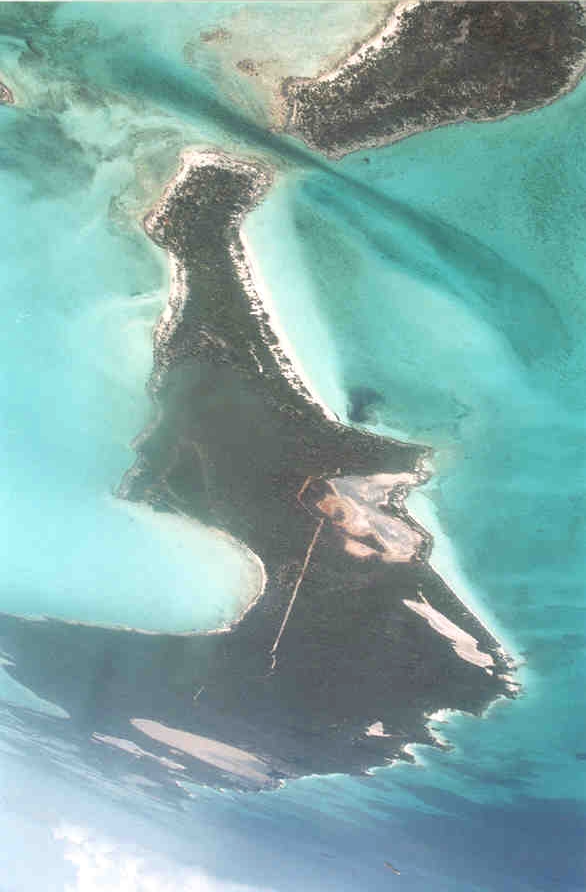
5.2
Definition of Coastal Zone
In The Bahamas, no codified regulations or definition of the coastal zone exists.
Application of coastal zone-related legislation relies upon common law understandings.
Terms such as "beaches," "coastline," "sand dunes," and "seashore" are commonplace in
Bahamian legislation. However, there has been no attempt at comprehensive definition
of the concepts of "coastal zone," "coastal areas," or "coastal resources."
Figure 22: Typical and diverse coastal areas throughout The Bahamas
5.3
Components of a National Integrated Coastal Management Program
The following description of the components of a national ICM program is based on the
varied experiences of the Team members over the last thirty years in coastal zone
management and environmental management projects. While each project is unique, the
basic principles remain the same.
The following list describes the essential components of a national ICM program. These
components also apply whether dealing with a small coastal region within a country or
planning and managing the entire coastal zone of a country. If any of these components
is missing or incomplete, the overall ICM program or plan may suffer.
ICF Consulting
54
Integrated Management of Watersheds and
Coastal Areas in SIDS of the Caribbean
A national ICM program includes the following components, which are described in
Sections 5.3.1 through 5.3.8.
Ě Policies and Goals
Ě Institutional Arrangements
Ě Legislation and Regulations
Ě ICM Plan Formulation
Ě ICM Plan Implementation
Ě Professional Staff Training
Ě Public Education
Ě Monitoring and Enforcement
5.3.1 Policies and Goals
This group of activities may include the following items.
(1) ICM Plans and Guidelines
This includes the development of a national policies and guidelines for land use planning
in the coastal zone to include satellite imagery and GIS map based inventory.
(2) Permit Review/Approval Process
This provides for national and local coordination and assessment of all major
developments in the coastal zone and assures that the permits issued are consistent with
established ICM plans and guidelines.
(3) Code of Construction in the Coastal Zone
This includes preparation of a Code of Practice for construction in the coastal zone with
respect to coastal setbacks, construction techniques, and construction in flood prone
areas.
(4) Preparation of Development Guidelines and Agreements
This includes the preparation of general policies geared towards the conservation and
management of coastal and marine resources. In addition, guidelines regarding coastal
setback limits, coastal erosion prevention, building heights, site coverage, architectural
restoration, rehabilitation and new construction, and site plan control. Agreements will
ensure that the guidelines are formally included in all development agreements with the
private sector to be executed in the country.
(5) User Charges
This activity would allow for tourist hotels to pay local institutions responsible for
environmental protection to ensure that development is sustainable and biodiversity
assets of the coastal region are protected.
ICF Consulting
55
Integrated Management of Watersheds and
Coastal Areas in SIDS of the Caribbean
5.3.2 Legislation and Regulations
This component includes the creation/completion of national laws and/or specific ICM
regulations in The Bahamas, plus specific coastal development regulations in the coastal
communities. The IDB funded project will begin to address many of the legislative and
regulatory issues through the development of the country's environmental laws and
regulations, many specifically pertaining the coastal areas, and the establishment of a
national ministry for the environment.
5.3.3 Institutional Arrangements
This group of activities could include any of the following items.
(1) Establish/Enhance the Coastal Zone Management Authority
The authority will be responsible for planning and management in the coastal zone of
each island or by each town council. It will manage and guide the preparation of plans
and channel the available resources for biodiversity conservation, sustainable coastal
development, and institutional strengthening.
(2) ICM Coordination
This provides for the national and local multi-sectoral and inter-sectoral coordination,
planning (steering committee, working groups, coordination meetings, scoping meetings,
public hearings, coordination among national and local councils), and inputs into the
review and approvals process.
(3) Management Studies
These include a series of ICM management studies to support institutional decision-
making, such as sustainable coastal tourism marketing strategy and marketing plan,
"user-pay" system for infrastructure related to new tourist facilities, "user-rights" for
fisheries, and economic incentives to phase out negative activities. Preparations of
specific Environmental Management Plans (EMPs) are examples of these types of
studies.
(4) Local Group Organization
This activity supports the local NGOs, interest groups, small-scale resource users, and
others to participate actively in the ICM planning and management process.
NGOs play an important role in regulation and management of coastal assets but (with
exception to The Bahamas National Trust) no general legislation exists to facilitate their
emergence, operation, and participation in The Bahamas.
The BNT was given statutory recognition by the Bahamas National Trust Act, 1959 and
functions to promote permanent preservation of lands and marine areas of beauty and
national historical interest. The Trust is obligated to preserve the natural aspects,
features, and animal, plant, and marine life found in these areas.
ICF Consulting
56
Integrated Management of Watersheds and
Coastal Areas in SIDS of the Caribbean
5.3.4 ICM Plan Formulation
(1) Finalize ICM Plan
Work should be undertaken on the preparation of a series of plans both at the national
level and at the island level, based on the framework jointly developed by the national
team and the local communities. The plan may include the following components: flood
prone zone mapping, coastal protected areas management plans, biodiversity
management plans, sustainable tourism development plans, emergency preparedness, sea
level rise, and response plans for hurricanes, oil spills, etc.
.
(2) Establish Coastal Development Guidelines
A set of national guidelines for coastal development or a "Code of Practice" for
construction in the coastal zone should be prepared. This common Code for coastal
development will be important for all to understand. Of course, there may be variations
based on the specific needs of each island.
(3) Maintain Information Management and GIS System
Information collection, storage, and manipulation are fundamental elements in a
successful ICM program.
5.3.5 ICM Plan Implementation
Capital investments for implementing ICM plans may include facilities that will protect
and enhance biodiversity protection and achieve sustainable tourism development,
fisheries management, etc. These investments are usually prepared as part of a
comprehensive ICM planning process.
5.3.6 Professional Staff Training
This component might involve any of the following items:
(1) Profession ICM Planning Training
This will incorporate training of national and local experts in Environmental Planning,
Environmental Impact Assessment (EIA) techniques, application of GIS technology,
remote sensing analysis, site planning and design, implementation of ICM plans and
projects, reviewing development proposals, participating in the review and approvals
process, and participation in the inspection, monitoring, and evaluation process.
(2) Sustainable Tourism and Protected Areas Training
General training in reviewing and evaluating tourism development proposals, as well as
more specific training for management of coastal and marine protected areas and training
in understanding coastal geomorphological process and how the coastal zone responds to
major storm events. This could include participation in international workshops, training
sessions, in situ, and international study tours.
ICF Consulting
57
Integrated Management of Watersheds and
Coastal Areas in SIDS of the Caribbean
(3) Water Quality Monitoring Training
Training of management and technical staff in sampling techniques for water quality
monitoring. This could include training in Quality Control/Quality Assurance (QA/QC)
methodology. Training should be offered to all agencies conducting water quality
monitoring. Standardization of monitoring techniques and QA/QC practices will allow
for the exchange of water quality data among agencies and jurisdictions.
5.3.7 Public Education
This component involves local implementation of a national program for public
awareness and education regarding sustainable use and management of coastal and
marine resources. Participation in environmental awareness programs will enable coastal
communities' full participation in the national program. This may include all kinds
public outreach programs such as training of NGOs, local communities, and school
programs carrying out demonstration projects in coastal areas.
5.3.8 Monitoring and Enforcement
This activity could include the following items:
(1) Enforcement and Monitoring
This activity covers municipal and tourist facility waste discharge; port, marina, and
anchorage discharges; and industrial discharges. This will require the necessary
equipment such as vehicles, boats, computer equipment (hardware and software), and
sampling and analysis equipment.
(2) Information Management
This includes establishment of an environmental information system for ICM planning
and other information requirements (information dissemination, reporting).
(3) Environmental Audits
Where there was some concern about data gaps or the availability of information in areas
critical to investment decisions, audits may be recommended.
5.4
Bahamas Integrated Coastal Planning Strategy
Introduction
The Bahamas is now experiencing significant private investment and has been
experiencing substantial growth led by private investment in sectors such as tourism,
construction, and banking. Dramatic improvement in public investment efficiency and
regional integration among all sectors is critical for an efficient and a coherent
development strategy, led by the private sector in The Bahamas and approved by the
public sector and the stakeholders (the public). It is difficult for local people, the GoB,
and other stakeholders to make decisions on the "best use" of their islands without the
ICF Consulting
58
Integrated Management of Watersheds and
Coastal Areas in SIDS of the Caribbean
benefit of a comprehensive, long-term, strategic plan for the management of their islands
that considers all the options in a cross-sectoral and integrated manner.
In The Bahamas, regional planning and public investment programming are currently
carried out in an ad hoc manner. An Integrated Coastal Management plan, as described
in Section 5.3, would enable the GoB and donors (Inter-American Development Bank,
Caribbean Development Bank, Overseas Development Agency) opportunities to finance
Public Investment Projects, with the ICM plan supporting and enhancing the proposed
private sector investments such as the tourism resorts.
One of the main tactical objectives of the ICM planning is to strengthen The Bahamas
public sector's ability to deliver quality products and services and create a business
environment that enables the private sector to thrive. This ICM project will begin to
contribute towards the achievement of this objective by identifying the appropriate ways
and means to account for the views of key regional and local stakeholders. In particular,
those in the private/non-governmental sectors must be involved in the decision-making
process for establishing regional and local development policies and investment
priorities.
5.4.1 National and Regional Economic Development Strategies
The concept underpinning ICM planning is that regional and local economic growth and
development led by the private sector investment is critical to long-term growth and
development in The Bahamas. In order for planned economic growth to materialize, a
coherent decision-making process for near-term public investment (energy, water supply
and treatment, sewage and solid waste, roads, bridges, airports, communications, schools,
and hospitals) must be established. The process should be based on a strategic, cross-
sectoral plan that supports and guides the future private sector efforts. Building public-
private partnerships in support of regional and local priorities derived from the ICM
planning will be instrumental in promoting more sustainable development of the country
as a whole.
In regional ICM plans with multiple stakeholders, the financing plan for core economic
infrastructure and community facilities--roads, water and sewer systems, parks, schools,
and fire stations--provides the regional economic framework that is needed to determine a
financially feasible scale and mix of core and support industries, level of community
amenities, and timing of improvements.
This ICM planning implementation process evaluates regional economic assets, and
performs a quantitative industrial cluster analysis, and evaluates market trends as a basis
for comprehensive planning and facility (infrastructure and utilities) programming
efforts. ICM planning integrates an understanding of infrastructure and market forces on
regional, national, and local levels to assure that outcomes have broad, long-term
relevance.
ICF Consulting
59
Integrated Management of Watersheds and
Coastal Areas in SIDS of the Caribbean
Creating a more conducive business environment in The Bahamas requires better quality
and more productive public investment, in particular, better public investment
coordination, better spatial planning, enhanced synergy with private sector investment,
and a decentralized and cross-sectoral decision-making process for preparing the public
investment projects within the islands.
5.4.2 The Role of Integrated Coastal Management Planning
Privatization strategies for public sector infrastructure and utilities and other innovative
means of facilitating public-private partnerships can only be achieved through a dramatic
change in The Bahamas' regional planning and local investment programming process,
which ICM planning is designed to initiate. To facilitate this evolution, it is key to
integrate information management tools--remote sensing technologies and geographic
information systems (GIS)--in to the strategic regional planning processes for the islands
or "economic region." The ability of such tools is expected to enhance the key regional
stakeholders' knowledge and understanding of major regional issues, thus leading to
sound regional planning and investment programming and reducing the risk for private
investment projects.
This ICM process will assist private investors in promoting their projects within the
regional environmental and economic frameworks and obtaining agreement prior to large
investments by assuring the project is consistent with the overall ICM strategic plan for
The Bahamas and accepted by the public sector and stakeholders.
Traditionally, the coastal resources of The Bahamas, as in most places, have been
developed in a sectoral manner with little regard to the inherently integrated nature of
coastal and marine ecosystems. Coastal zones have usually only been managed around
political/administrative/family boundaries rather than environmental units, which often
results in overlapping jurisdictions and responsibilities. Finally, sectoral approaches
often focus on short-term rewards without taking in to account the long-term costs of
resource depletion. If The Bahamas maintains a status quo of ad hoc and sectoral
environmental management and investment strategies, the result will be further decline in
environmental quality and functioning, an increase in conflicts among the users of the
coastal zone, and diminishing resources available to those users.
5.4.3 An Integrated Coastal Management Strategy for The Bahamas
While there are numerous reasons why The Bahamas needs an ICM strategy, the two
most important reasons are the following. The coastal region of The Bahamas, compared
to the other parts of the country, is the most important and economically most valuable
from both development and environmental points of view. The initiation of an ICM plan
represents powerful tools for securing the rational use of the natural resources, protection
of biodiversity, and the creation of the institutional foundation for the formulation and
implementation of an appropriate development strategy based on the concept of
sustainable development.
ICF Consulting
60
Integrated Management of Watersheds and
Coastal Areas in SIDS of the Caribbean
Basic ICM principles will facilitate the integration of sectoral interests, productive
coordination of responsible GoB institutions, resource use compatibility, and equity of
values among different users. Given the important role of The Bahamas' coastal and
marine habitats, biodiversity and environmental considerations should be considered first
and from there determine what level of development an area can sustain. It is essential
that downstream or indirect impacts, as well as the impacts of adjacent activities, be
accounted for. Criteria for the establishment of "environmentally sensitive areas" should
be conducted first and from this allocation of different ranges of protected areas.
As mentioned above, tourism is increasingly recognized as an important source of foreign
exchange for The Bahamas. Given the relatively good health of The Bahamas' natural
environments, environmentally based tourism that is sensitive to coastal and marine
habitats and enhances their quality is the most compatible development option. Linking
"high-end" tourism with nature conservation, through the establishment of protected
areas, provides an incentive for environmental standards for facilities and ensures that
large areas of nature are protected. The ICM planning and initial planning stages focus
resources into assessing which level and type of organizational responsibility,
coordination, and implementation is most suitable to the particular places and activities.
One result of the ICM planning is the development of a priority plan for Coastal
Investment Projects (CIPs). The identification and selection of CIPs, cost estimates, and
the recognition of possible benefits are the result of a process that has five steps.
5.4.4 Elements of an ICM Planning Framework
A general description of the five steps of the ICM formulation and implementation
leading to CIPs is described below.
Step one or "scoping" is the identification of priority CIPs by a Steering Committee.
Step two is the establishment of a Management Area Classification System. Its purpose
is to classify marine, terrestrial, and wetland biographic units into general management
areas to reflect short- and long-term management interventions required for investment
projects.
Step three is the preparation of the Integrated Conceptual Management Plan for Priority
Coastal Investment Projects. This step more specifically establishes the purpose,
objectives, and components for each management category. The "biogeographic
footprints" of each management area make the spatial definition of the management
category and the investment projects coincide. This process also evaluates the regional
economic assets and liabilities through a quantitative industrial cluster analysis. This
comprehensive planning effort will ensure the region can competitively supply for the
market demand of goods and services. Regional planning integrates an understanding of
market forces on regional, national, and local levels to assure that ICM findings have
broad, long-term relevance.
ICF Consulting
61
Integrated Management of Watersheds and
Coastal Areas in SIDS of the Caribbean
Step four is the preparation of a Preliminary Master Plan for Each of the Coastal
Investment Projects including sub-project components. Preliminary master plans are
based on the management plans and further detail project components for each
investment projects mentioned above. The plan establishes an organization and pattern
of land use, transportation, and core and indirect service industries.
Step five is the Identification of Potential Investment Options and Preliminary
Assessment of the CIPs Costs and Probable Benefits based on the analysis of the detailed
project components identified in the preliminary master plans. The project costs consider
those investments that could be financed from public sources but do not include the
commercial developments (e.g., tourism projects) which would be financed from private
sources.
5.5
ICM Planning for Climate Change and Sea Level Rise
ICM planning would also afford the GoB a framework to begin to consider futuristic
coastal issues that do not necessitate immediate action but need to be included in long-
term planning. One key issue of concern is climate change and the resulting impacts of
sea level rise on the coastal zone of The Bahamas. A set of national guidelines for
coastal development or a "Code of Practice" for construction in the coastal zone to
include futuristic planning for climate change and sea level rise should be included in the
ICM plan. Planning for sea level rise includes the following fundamental concepts:
Ě Protect: reduce the risk of the event by decreasing its probability of occurrence
Ě Retreat: reduce the risk of the event by limiting its potential effects
Ě Accommodate: increase society's ability to cope with the effects of the event while
considering the variations based on the specific divergence among each island.
5.5.1 Establishing Economic Incentives for Climate Change Initiatives
ICM programs typically seek to establish strong economic benefits to all stakeholders
because experience has shown that economic benefits are the strongest incentives to
motivate behavior change. However, there are few direct or immediate economic
incentives for coastal planning today for the possibility of sea level rise tomorrow. To
overcome this barrier, effective ICM planning should focus on indirect economic
benefits, such as overcoming disincentives to sea level rise that would inhibit or prevent
the use of mitigation/adaptation measures to reduce the impacts of climate change on
coastal communities (such as "investments in hazardous zones, inappropriate coastal-
defense schemes, sand or coal mining, and coastal habitat conversions). A common
cause for avoiding long-term planning issues (climate change and sea level rise) is a lack
of available information on the potential external effects of proposed coastal
developments on other economic sectors, or a lack of consideration thereof. Therefore,
more proactive and integrated planning and management for coastal zones is widely
suggested as an effective mechanism for strengthening long-term, sustainable
development that can be both environmentally sound and economically efficient.
ICF Consulting
62
Integrated Management of Watersheds and
Coastal Areas in SIDS of the Caribbean
Another benefit is that ICM planning will address more than climate issues alone and will
involve a change in adaptation strategies, i.e., nourishing beaches instead of constructing
seawalls, or introducing a building setback instead of allowing construction next to the
coast.
In the future, the GoB could more effectively utilize market drivers to their advantage by
building collaborative efforts with other public sector authorities. For example, a strong
collaborative agreement with the Water and Sewerage Corporation, BELTELCO, and
Cable Bahamas could allow for expedited permitting for geographic areas that are willing
to implement one or several climate change mitigation/adaptation measures specifically
targeted for coastal communities.
5.5.2 Overcoming Institutional Barriers to Managing Sea Level Rise
Critical to a climate change program success is that it overcomes institutional barriers
that impede the adaptation of common sense, best management practices in the coastal
zone. Having a keen understanding of what factors drive the target audience and
influence behavior will help determine the barriers that the GoB face in implementing the
desired ICM strategies. Additionally, strong background in and knowledge of the new
technologies, industry practices, and opportunities are also important to understanding
stakeholders' motivation and barriers.
5.5.3 Define Tangible ICM Climate Change and Sea Level Rise Program Goals
Climate Change planning should be undertaken during the ICM Implementation phase
focused on the preparation of a series of plans both at the national level and at the island
level based on the framework jointly developed by GoB, the national Climate Change
Steering Committee, and the local communities.
A successful ICM program will clearly define a set of program goals that offer tangible
benefits to society by planning now to avoid areas prone to future sea level rise.
Secondary benefits should also be addressed through communicating public awareness
and increase public buy-in by demonstrating the value of this long-term environmental
stewardship. Furthermore, a climate change program should be relayed in simple,
focused messages that clearly state the problem, the proposed solution, and the outcome.
The messages should consist of easy to understand language to facilitate comprehension
among both experts and lay-people.
The plan may include the following components.
Ě Increase the area where wetlands and beaches, through protection and restoration,
will survive rising sea level and decrease the future costs of sea level rise defenses by:
(a) prompting the central GoB and Local Town Councils to start to decide now which
areas will be protected from the rising sea and which areas will retain wetlands and
beaches, (b) prompting the GoB and Local Town Councils to consider how they
might increase the area of natural shores where community plans imply too-little
ICF Consulting
63
Integrated Management of Watersheds and
Coastal Areas in SIDS of the Caribbean
protection, and (c) prompting incentives for development and construction interests to
look for opportunities to gain "credit" for efforts that allow wetlands and beaches to
survive rising sea level.
Ě Decrease the cost of sea level rise in areas likely to be abandoned to a rising sea by:
(a) encouraging timely signals to the tourism market so that private investors do not
over invest, (b) encourage private and public purchase of rolling easements, and (c)
prompt development and infrastructure to take place consistent with this long-term
ICM plan.
Ě Decrease the cost of sea level rise in areas likely to be protected by: (a) prompting
communities to decide whether to replenish beaches, use dikes/seawalls and pumping
or elevate land surfaces and (b) prompting development and infrastructure
improvements to take place consistent with this long-term ICM plan.
Ě Increase environmental functioning and quality in areas likely to be protected by
promoting measures that retain natural wetlands, beaches, and public access along the
shore.
Ě Promote county/local climate outreach projects (e.g., school curricula, demonstration
awareness, and arts).
5.6
Recommendations
The following strategy is suggested to initiate the national ICM program over the short-
term.
5.6.1 Case Study for a selected Bahamian island focusing on flood prone areas and "no
development zones: integrating the coastal engineering principles and analytical
models described in Section Four and the Integrated Coastal Planning Principles
described in Section Five.
5.6.2 Apply ICM and EIA planning principles to the review of the New Providence
Road Improvement Project.
5.6.3 Establish a national coastal GIS database by engaging, collaborating, and gaining
cooperation of all relevant ministries, NGOs, and international organizations
(IMO). The database will contain critical coastal information that is readily
available and will be useful for planning and review purposes (e.g., EIA).
Examples of the data follow.
Ě Areas vulnerable to flooding (flood prone zones) based on past series of storms. This
information is essential for the national Emergency Response group, for Physical
Planning to determine "no build zones" because of potential flooding.
Ě Input national map series produced by ODA for the nation indicating land capability.
Ě Input national bathymetric maps and nautical charts as a foundation for establishing
critical marine habitats.
ICF Consulting
64
Integrated Management of Watersheds and
Coastal Areas in SIDS of the Caribbean
Ě Determine if World Conservation Monitoring Center (WCMC) in Cambridge has a
useful coral reef database of The Bahamas coral reef. If so, incorporate it.
Ě Digitize the existing and proposed terrestrial and marine protected areas available
from the BNT.
Ě Digitize the existing and proposed fishery reserves proposed by the Department of
Fisheries.
Ě Digitize and incorporate the national crown lands.
Ě Digitize and incorporate major shipping lanes for hazardous and petroleum products.
This will serve as a foundation for preparing an oil spill contingency plan for
vulnerable coastal areas.
Ě Digitize critical coastal and marine habitats such as mangroves, seagrass beds, sand
beaches and dune systems, coral reefs, and areas of high coastal biodiversity.
Ě Work with the Ministry of Tourism to digitize major priorities for coastal and marine
tourism.
Ě Digitize preferred cruising anchorages and dive sites.
5.6.4 Working with an interdisciplinary team of coastal geomorphologists, coastal
engineers, and coastal planners, establish standard methodologies to prepare
coastal hazard zones and setbacks based on the characteristics and dynamics of
different coastal types, e.g., sandy beach and dune coasts, iron coasts, and
mangrove coasts.
5.6.5 Working within a multi-agency team, prepare a handbook or a "Code of Practice"
for construction in the coastal zone for wide distribution.
5.6.6 Undertake a comprehensive coastal zone management workshop, based on the
upcoming ICM workshop and further field investigations and interviews. Based
on the above, prepare an issues paper on coastal zone management in The
Bahamas and further elaborate the strategy to achieve sustainable management of
Bahamian coastal resources. Since ICM planning is the "resolution of issues in
context," this issues paper will provide the foundation for the ICM strategy, plan,
and investment program (Coastal Investment Program ş [CIP]).
ICF Consulting
65
Integrated Management of Watersheds and
Coastal Areas in SIDS of the Caribbean
6.0
REFERENCES
Cant, R. V. and Weech, P. S., 1986;
A Review of the Factors Affecting the
Development of Ghyben-Hertzberg Lenses in The Bahamas, Journal of Hydrology, 84
(1986) 333-343.
Cant R. V., 1980; Water Resources Evaluation of The Bahamas.
Cant, R. V., Undated; Water Supply and Sewerage in a Small Island Environment: The
Bahamian Experience.
McClain E. M., 1990; A Geochemical Study of Early Meteoric Diagenesis at Ocean
Bight, Great Exuma Island, The Bahamas.
Water and Sewerage Corporation, 1994; Report on Ground Water Pollution
Assessment New Providence, The Bahamas.
Water Resources 1993; Water Resources of The Bahamas: A Proposal for Institutional
and Legal Arrangements.
ICF Consulting
66
Integrated Management of Watersheds and
Coastal Areas in SIDS of the Caribbean
Document Outline