

Technical Paper Sheet PSSA
ENVIRONMENTAL PROTECTION AND MARITIME TRANSPORT
POLLUTION CONTROL PROGRAM IN THE GULF OF HONDURAS
TECHNICAL SHEET
Gulf of Honduras, Puerto Cortes. Number 1. November 2007.
DESIGNATION OF THE GULF OF HONDURAS AS PARTICULAR
SENSITIVE SEA AREA (PSSA)
_____________________________________________
INTRODUCTION
The term "Sensitive Sea Area (SSA)" defines any marine body of water that needs
special protection due to recognized technical reasons related to oceanographic and
ecological attributes and to particular maritime traffic conditions which may endanger
these attributes. Special protection measures are developed within the area to prevent
sea contamination through hydrocarbons, hazardous liquid substances, or wastes
(according to the circumstances). A "Particularly Sensitive Sea Area (PSSA)" is an area
requiring higher standards of environmental protection.
An effective set of international regulations or conventions such as CONVEMAR
address the State parties' role regarding marine economic zones and sea areas
management and environmental protection. They define the parties' jurisdiction and
place an obligation on them to adopt necessary measures to protect and preserve the
marine environment.
The International Maritime Organization (IMO) in order to achieve its goal to protect
the marine environment has developed the following instruments:
1. The International Convention for Human Life Protection on the Sea (SOLAS)
Convention, tailored to the shipping industry safety requirements, expected to
generate a positive indirect effect upon environmental protection.
2. The International Convention for the Prevention of Pollution from Ships
(MARPOL) addresses basic environmental protection standards related to
threats posed by operational and accidental discharges.
3. Regulations aimed in particular at restructuring maritime traffic flow, which
improve and reinforce navigational safety and contribute to protect and preserve
rare or fragile ecosystems.
4. Designation of Sensitive Sea Areas (SSA) and Particularly Sensitive Sea Area
(PSSA).
Project for the Golf of Honduras
1
Technical Paper Sheet PSSA
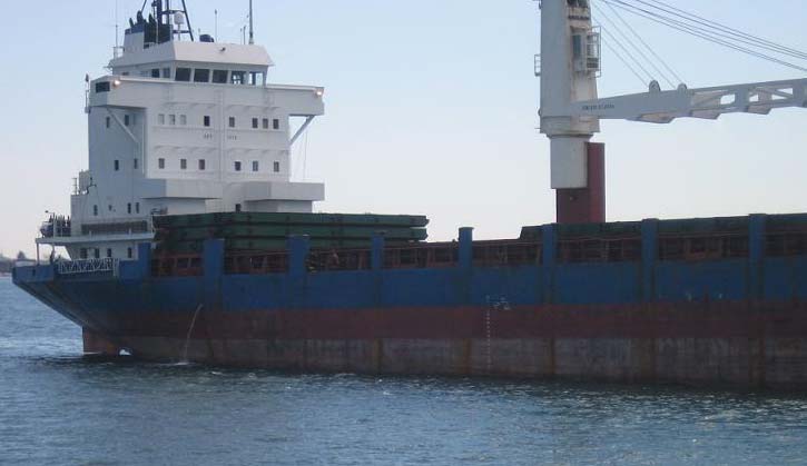
Ship on the Bay, Puerto Cortes, Honduras
GUIDELINES
According to the guidelines for the identification and designation of a Particularly
Sensitive Sea Area, a submission must meet three key elements:
1. The area must include relevant ecological, socioeconomic, and/or scientific
characteristics, such as, critical habitats, representative ecosystems, high
diversity, rare or unique ecosystems, vulnerability to degradation by natural
events or human activities, baseline or/and a monitoring system, constitute a
cultural heritage, etc.
The Gulf of Honduras environmental problems have a transboundary scope. Belizean,
Guatemalan, and Honduran waters blend within the semi-enclosed area. Tributaries
from the three countries flow into the gulf carrying increasing amounts of sediments and
pollutants. Existing oceanographic conditions, seasonality and weather; contribute to
spread environmental consequences throughout the region. Due to its susceptibility and
potential to spread consequences, the countries shall develop a strategic approach to
prevent and control contamination inside the gulf. Implementing actions designed to
counteract pollution on its source, monitoring tendencies, and building sustainable
systems to coordinate management and environmental protection within the region.
The complex dynamics among coastal and open waters processes, ocean currents and
fronts, create a highly diverse and unique ecosystem within the Gulf of Honduras. The
region encloses a wide variety of coastal marine waters. Along the Belizean coastline
estuaries, lagoons, barrier beaches, intertidal salt marsh areas, keys, mangrove forests,
seagrass beds, patches, and barrier reefs may be identified. The Guatemalan coastal
waters are also very diverse. Dense mangrove forests grow along estuaries and bayous'
mouths (Dulce River), along Amatique Bay's shallow water depths and seagrass beds
(La Graciosa Bay), along the sandy region of Manabique Peninsula, and along the
beaches leading to the mouths of the Motagua, San Francisco, and Piteros River. The
Honduran coastal zone is characterized by vast beaches, mangroves, lagoons, estuaries
and off-shore keys. The Gulf of Honduras high degree of structural complexity supports
Project for the Golf of Honduras
2
Technical Paper Sheet PSSA
a multifaceted community of species that contribute to the ecological significance of the
region.
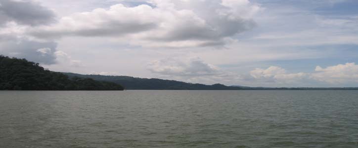
Panoramic View of Amatique Bay in Guatemala
The Gulf of Honduras constitutes a very productive aquatic habitat. Its proximity to
mangroves, marine seagrasses, and coral reefs and a distinctive combination of nutrients
Łterrigenous nutrients transported by rivers and nutrients carried by ascending currentsŁ
creates a rich environment that shelter diverse and numerous marine species. The gulf's
shallow depths support commercially important communities such as prawns, common
lobsters, seashells, and scale fish as well as the biggest West Indies manatee population
found in the Caribbean region.
The Gulf borders west to the Mesoamerican Barrier Reef System (MBRS). A highly
diverse unique ecosystem, extending through a broad territory and weaving a complex
variety of reef systems and luxuriance corals kept in a pristine condition. The Reef
System is the second largest barrier reef in the world extending through 250 Km and
covering 22.800 km2. It constitutes a rich coral environment, assembling highly diverse
reef types: lagoon reefs (atolls), fringing reefs, and barrier reefs. The Gulf extends along
the southern fraction of the system. Fresh water inflows from the Motagua, Sarstun, and
Dulce River contribute to the high degree of patchiness in the reef assemblages.
Sediments (natural sediments as well as those derived from human activities) fluxes and
characteristics play a key role in the Reef System productivity, justifying the
transboundary nature and scope of the Project.
According to estimates, 12.4 million people inhabit near the coasts of the hydrographic
watersheds that flow into the Gulf of Honduras. This amount constitutes 70% of the
population of the three countries. Of this number, approximately 2 million people live in
vast urban areas: Guatemala City, in Guatemala, and San Pedro Sula, in Honduras.
Small groups of culturally diverse populations reside along the Gulf's coasts, about half
million people of different ethnicities and races predominating the garifuna, the mestizo,
and the criole. These communities have a direct effect upon coastal and marine
ecosystems.
The gulf's coastal region economy is based on two main activities: fishery (commercial
and artisanal fishery) and agriculture. The most important exportation product of the
region Ł banana Ł derives from agricultural production. Farmers utilize intensive
cultivation methods such as fertilizers and other chemicals. Polluted surface drainage
water or hazardous materials which have trickled into the groundwater eventually reach
Project for the Golf of Honduras
3
Technical Paper Sheet PSSA
the bay accelerating algae formation and consequently the rate of oxygen depletion in
water. The region is experiencing a period of economic growth. The combination of two
events, the expansion of the road network which improved the access to previously
uncommunicated areas and escalating infrastructure investments, have caused other
activities such as, tourism, aquaculture, and industry to flourish. This in turn has
intensified workforce migration towards rural areas along the coasts of the Gulf of
Honduras.
2. The area must be at risk from international shipping activities. Supporting
documentation corroborating the damages or the threats of damage must be
provided.
Port facilities in the region possess physical Infrastructure for cargo unloading, storage,
and transportation. Ports are equipped for handling containers, bulk and liquid cargo,
hydrocarbons, and dangerous chemicals. According to annual handling statistics, 1,700
ships carrying different types of cargo such as liquids and refined petroleum products
dock at Puerto Cortes terminals. More than 1,300 ships including tank vessels
transporting petroleum disembark in Puerto Santo Tomas de Castilla. Approximately
550 ships, including containers and tank vessels transporting hydrocarbons and
chemical products arrive to Puerto Barrios. Belize City Port handles different types of
liquid and bulk cargo yet nearly all its trade is shipped by containers. Big Creek
shipping operations limit to banana exportation, although, in future plans, it might
consider the inclusion of new products. In year 2003, the Gulf of Honduras managed
nearly 28% of the maritime port traffic and 20% of merchandise flows within the
Central American region (Atlantic and Pacific coasts). Approximately 4,000 ships
docked at the gulf in one of its five major ports and their terminals handled more than
12 million metric tons of cargo.
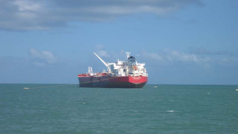
Tank Liner mooring with buoy in Belize City Port
At the present time, most of the trade and flows of merchandise in the Gulf of Honduras
are shipped by sea furthermore a favorable evolution in cargo handling rates has been
observed. Between 1990 and 1999, the volumes of merchandises handled by Puerto
Project for the Golf of Honduras
4
Technical Paper Sheet PSSA
Santo Tomas de Castilla, Puerto Barrios, and Puerto Cortes increased at an annual rate
of 11.09% (1991-1998), 16.50%, and 8.52%, respectively (SIECA, 2001). In 2001,
Puerto Cortes almost reached its handling capacity limit and according to statistical
projections Puerto Santo Tomas de Castilla and Puerto Barrios will reach their limit in
the next few years (SIECA, 2001). Maritime port traffic within the region is expected to
boost. Guatemala crude production is growing which translates in an expansion of
hydrocarbons exploration and an increase in energy demand within the region. Traffic
and handling of dangerous cargo as well as hydrocarbons is projected to increase in the
next decade. Simultaneously, during this growth, several projects regarding construction
and improvement of maritime facilities will be implemented in the five ports.
The economy of the gulf region is based on its marine resources. Activities such as
tourism, aquaculture, and fishery rely on clean water for their operation and
sustainability. Port activities such as dredging depend on the volume of sediments
discharged into the gulf by streams and rivers. Since economic activities are based on
the environment, they directly affect aquatic habitats. Port operations, maritime
transportation, and other related industries located upstream are sources of chemical
contaminants and sediments that generate negative environmental impacts within the
region and contribute to maritime lanes of sedimentation. The Regional Environmental
Programe for Central America (PROARCA) conducted two complementary studies
reaching to a conclusion that a single spill of 75,000 barrels into Amatique Bay waters
may generate long-term economic consequences in the blooming touristy industry along
the Guatemalan and Southern Belizean coasts. Additionally, spills into port areas and
open waters increase companies' insurance costs as well as port operations dredging
costs.
Regarding the gulf's hydrographic assessment, the countries do not have updated and
officially approved nautical charts for the region. The formulation of nautical charts and
the bathymetric information can contribute to the overall assessment of the condition of
the gulf and should be a priority for the ports and governments of the region.
The countries have participated in several international maritime treaties. Among them,
the United Nations Convention on the Law of the Sea (UNCLOS), the International
Convention for the Prevention of Pollution from Ships (MARPOL), and other treaties
related to maritime transport and contamination that have been promoted by the
International Maritime Organization (IMO). However, the lack of norm-
implementation, clear lines of authority, and coordination among agencies has restricted
the effectuality of the inspections and the enforcement of agreements. National
engagements contracted in these treaties have not materialized in clear objectives or
actions within the region, including the Gulf of Honduras. Conscientious fulfillment of
the obligations defined in the treaties will be reinforced by strengthening cooperation
and coordination among the involved parties.
Additionally to their condition of signatories of several international agreements
Honduras, Guatemala, and Belize have also issued several national laws and other
judicial instruments to protect the environment and prevent and control pollution.
Although these countries count on a general legal frame to support the Program's
activities Ł leading to counteract marine contamination and improve navigational safety,
they have not been consistent in its enforcement. The lack of adequate norms and
institutional support at the local and national level, have weakened its enforcement.
Project for the Golf of Honduras
5
Technical Paper Sheet PSSA
3. There must be measures that can be adopted by IMO to provide protection to
the area. This may be achieved through amendments to existing regulations
and measures improving protection against threats and the legal basis.
According to all the factors considered in this document the following associated
protective measures have been considered:
a) Traffic separation schemes. This refers to a restructuring of navigational space as a
function of traffic flow, separating opposing streams of traffic through the
establishment of new shipping lanes.
b) Areas to be avoided. This measure refers to a restructuring of navigational space.
Closing an area, where navigation is extremely dangerous and/or accidents'
prevention is very important, to all ships or to certain sizes or classes of vessels.
c) Mandatory no anchoring areas. This measure refers to a restructuring of
navigational space through the establishment of protected areas where all ships or
certain sizes or classes of vessels may not anchor because of the dangerous nature of
the area (unstable anchoring bottom) or the irreversible damages to the environment
that may be generated by anchor weight or slippage. Only in cases of imminent
danger to the vessels or their seafarers this measure may be dismissed.
d) Areas for ballast water management. This measure refers to the establishment of
areas for ballast water exchange. The purpose of this measure is to prevent invading
organisms to infest local ecosystems causing irreversible damages.
e) SOx (Sulphur oxides) emission control area. At this point, the countries must
demonstrate that MARPOL's basic measures do not meet the area requirements of
protection. The PSSA designation can only be achieved when the adopted measures
provide effective protection to the area. It is neither appropriate nor necessary to
designate all marine protected areas as PSSA.
f) Recommended routes. Previous analyses of the area's actual shipping lanes have
provided an overall assessment regarding safer navigational routes. These traffic
lanes constitute the recommended routes.
g) Two way route. This measure refers to the establishment of opposing streams of
traffic to guarantee the safety of the vessels in waters where navigating is
difficult or dangerous.
An application for a PSSA may only be submitted by an IMO Member Government or
Governments.
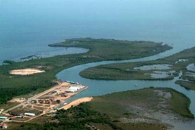
Aerial view of Big Creek Port in Belize
Project for the Golf of Honduras
6