


"Reversing Environmental Degradation Trends
in the South China Sea and Gulf of Thailand"
WETLANDS BORDERING THE SOUTH CHINA SEA
UNEP/GEF
Regional Working Group on Wetlands


First published in Bangkok, Thailand in 2004 by the United Nations Environment Programme.
Copyright � 2004, United Nations Environment Programme
This publication may be reproduced in whole or in part and in any form for educational or non-profit purposes
without special permission from the copyright holder provided acknowledgement of the source is made. UNEP
would appreciate receiving a copy of any publication that uses this publication as a source.
No use of this publication may be made for resale or for any other commercial purpose without prior permission in
writing from the United Nations Environment Programme.
UNEP/GEF Project Co-ordinating Unit, United Nations Environment Programme,
UN Building, 9th Floor Block A, Rajdamnern Avenue, Bangkok 10200, Thailand.
Tel.
+66 2 288 1886
Fax.
+66 2 288 1094
http://www.unepscs.org
DISCLAIMER:
The contents of this report do not necessarily reflect the views and policies of UNEP or the GEF. The
designations employed and the presentations do not imply the expression of any opinion whatsoever on the part
of UNEP, of the GEF, or of any cooperating organisation concerning the legal status of any country, territory, city
or area, of its authorities, or of the delineation of its territories or boundaries.
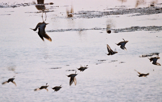
Cover Photo:
Migratory Birds in Pearl River Delta, China � Professor Guizhu Chen.
Photo credits:
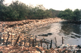
Page 3
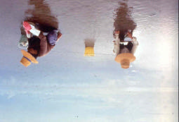
Dumping of waste in coastal wetlands, Philippines � Marlynn Mendoza
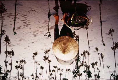
Page 3
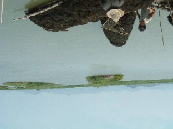
Collection of molluscs from mudflats replanted with mangrove, Vietnam � Mai Trong Nhuan
Page 4
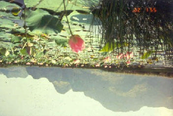
Khao Sam Roi Yot Marine National Park, Thailand � Sansanee Choowaew
Page 5
Coastal pond development in Sembilang, Indonesia � Dibyo Sartono
Page 5
Erosion Prevention Dike in Ham Tien, Vietnam � Mai Trong Nhuan
Page 7
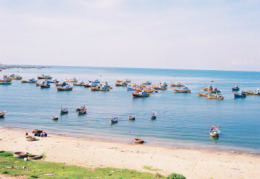
Mui Ne Fishing Port, Vietnam � Mai Trong Nhuan
Page 8
Harvesting of mollusc Solen regularis at Don Hoi Lot, Thailand � Sarakhadee Magazine
Page 8
Harvest the edible seaweed Gracilaria tenuistipitata var. liui in Shantou, China � Guizhu Chen
Authors:
Dr. Sansanee Choowaew, Dr. Liwei Chen, Mr. Sok Vong, Professor Guizhu Chen, Mr. Dibyo Sartono, Dr. Ebil Bin
Yusof, Ms. Marlynn Mendoza, Mr. Narong Veeravaitaya, Dr. Mai Trong Nhuan, and Ms. Sulan Chen.
This publication has been compiled as a collaborative document of the Regional Working Group on Wetlands of
the UNEP/GEF Project entitled "Reversing Environmental Degradation Trends in the South China Sea and Gulf of
Thailand."
For citation purposes this document may be cited as:
UNEP. 2004. Wetlands Bordering the South China Sea. UNEP/GEF/SCS Technical Publication No. 4.
W ETLANDS BORDERING THE SOUTH CHINA SE A 1
FOREWORD
The South China Sea region has experienced high rates of economic growth and rapid coastal development in
recent decades. Each country bordering the South China Sea has actively and in certain respects very
successfully engaged in its economic development. This is a region where economic development has imposed,
and will continue to place increasing stress on the ecological systems.
In 1981, under the sponsorship of UNEP, the East Asian Seas Action Plan was adopted by five Southeast Asian
countries: Indonesia, Malaysia, Philippines, Singapore, and Thailand. At that time, obstacles to engaging all the
South China Sea border countries in a single programme were seemingly insurmountable. Two decades after the
adoption of East Asian Seas Action Plan, the region has witnessed a trend of deepening interdependence,
integration, cooperation and prosperity. Despite the 1997-1998 financial crisis, the region remains the fastest
industrializing area. However, economic development was not achieved without negative impacts. Fast economic
development was accompanied by urbanization, population growth and deterioration of environment.
In 1996, realizing the urgency to collaboratively tackle regional marine environmental problems in the South China
Sea, the countries bordering the South China Sea requested assistance from UNEP and the Global Environment
Facility (GEF) in addressing the issues and problems facing them in the sustainable management of their shared
marine environment. From 1996 to 1998 initial collection of data and information was conducted by each country
to provide inputs for the development of a Transboundary Diagnostic Analysis, which identified the major water
related environmental issues and problems of the South China Sea. In 1999 the governments, through the
Coordinating Body for the Seas of East Asia endorsed a framework Strategic Action Programme that established
targets and timeframes for action.
The endorsement of the UNEP/GEF South China Sea Project by all the major countries around the South China
Sea ushered in a new era of environmental cooperation in the region. It demonstrates the determination of the
littoral countries to take an holistic approach to addressing shared environmental problems, despite the continuing
existence of certain political disputes or disagreements. Under the framework of the Project, the wetlands sub-
component focuses its activities on five types of wetlands, i.e. intertidal flats, estuaries, lagoons, peat swamps
and non-peat swamps. During the first phase of the Project, data and information have been collected and
compiled for regional use, which provides baseline information for the operational phase of the project.
We are delighted to have been asked to write the Foreword to this booklet, and we consider this booklet a valid
contribution to accumulate regional knowledge and understanding on wetlands bordering the South China Sea. It
reflects the collective effort of the Regional Working Group on Wetlands in exchanging and sharing data and
information. We hope it reaches the possible widest audience and inspires new political and financial
contributions to promote the protection and sustainable management of wetlands in the global marine biological
divers ity centre--the South China Sea.
Dr. Sansanee Choowaew & Dr. Liwei Chen
Bangkok, Thailand
January 2004
Reversing Environmental Degradation Trends in the South China Sea and Gulf of Thailand

INTRODUCTION
regions and almost 1/3 are located in Asia (Mitsch
and Gosselink, 2000).
Wetlands are defined as "areas of marsh, peatland
or water, whether natural or artificial, permanent or
Wetland ecosystems are cradles of biological
temporary, with water that is static or flowing, fresh,
diversity. Countless species of plants and animals
brackish or salt, including areas of marine water, the
depend on them for survival. Fishes in wetlands
depth of which at low tide does not exceed six
number around 20,000 species worldwide. Diversity
meters" (Ramsar Convention, 1971). This definition
amongst aquatic species groups is highest in the
encompasses reef flats and seagrass beds in
tropics: South America has the most species with
coastal areas, mudflats, mangroves, estuaries,
2,220 species, of which more than 1,000 are in the
rivers, freshwater marshes, swamp forests and
Amazon River basin; Africa has 2,000 species, with
lakes, saline marshes and lakes as well as
more than 700 occurring in the Za�re River basin;
underground water resources.
Europe has about 200 species; and, Asia has an
estimated 1,600 species but this number is
Under the UNEP/GEF South China Sea Project,
increasing as additional research is undertaken
activities in the wetland sub-component are focused
[WCMC, Global Biodiversity, 1992].
on five specific types of wetlands, namely intertidal
flats, estuaries, lagoons, peat swamps and non-peat
The Southeas t Asian Region is rich in marine
swamp, since mangroves, coral reefs and seagrass
biodiversity. Field records of hermatypic coral
beds are the subjects of separate sub-components.
genera indicate that Indonesia, Malaysia and
Activities at national level include establishment or
Philippines form the centre of coral diversity.
re-vitalisation of national committees or technical
Countries bordering the South China Sea largely
working groups; review of national data relating to
depend on wetlands for their livelihood. In
wetlands; development of national meta database;
Cambodia, Over 30% of its territory is wetlands.
development or update of national management
Following internationally accepted criteria for
plan. At the regional level, the Regional Working
wetland identification (defined by the Ramsar
Group on Wetlands develops regional criteria and
Convention), over 20 % (36,500 Km2) of the
procedures in identifying, prioritising, and ranking
Kingdom may be classified as wetlands of
the importance of sites by environmental and socio-
international impor tance (Cambodia Wetland
economic indicators.
Report, 2003).
About 6% or 5.7 million square kilometres of the
Despite the importance of wetlands of high
Earth's surface is wetlands. The greatest proportion
biodiversity in the South China Sea, loss and
is made up of bogs (30%), fens (26%), swamps
degradation of wetlands and their biodiversity have
(20%) and floodplains (15%), with lakes accounting
been continuing at a high rate due to the increasing
for just 2% of the total. Mangroves cover about
human population size, particularly in coastal areas,
240,000km2 of coastal area and an estimated
poverty, and people's dependency on wetland
600,000km2 of coral reefs remain worldwide
resources. Actions are urgently needed to halt the
(WCMC, Global Biodiversity, 1992). About 56% of
degradation of coastal wetlands around the South
wetlands are found in tropical and subtropical
China Sea.
Reversing Environmental Degradation in the South China Sea and Gulf of Thailand.
Cambodia, China, Indonesia, Malaysia, Philippines, Thailand, Viet Nam
In 1996, the countries bordering the South China Sea requested assistance from UNEP and the GEF in
addressing the issues and problems facing them in the sustainable management of their shared marine
environment. From 1996 to 1998 initial country reports were prepared that formed the basis for the development
of a Transboundary Diagnostic Analysis, which identified the major water related environmental issues and
problems of the South China Sea. Of the wide range of issues identified the loss and degradation of coastal
habitats, including mangrove, coral reefs, seagrass and coastal wetlands were seen as the most immediate
problem. Over-exploitation of fisheries resources and land-based sources of pollution were also considered
significant issues requiring action.
In 1999 the governments, through the Co-ordinating Body for the Seas of East Asia endorsed a framework
Strategic Action Programme that established targets and timeframes for action. In December 2000, the GEF
Council approved this project with UNEP as the sole Implementing Agency operating through the Environmental
Ministries in the seven participating countries and with over forty specialised Executing Agencies at national level
directly engaged in the project activities
Reversing Environmental Degradation Trends in the South China Sea and Gulf of Thailand
W ETLANDS BORDERING THE SOUTH CHINA SE A 3
Rate of Wetland Loss. It has been estimated that
being drainage for agriculture, settlement and
about 50% of wetlands have been lost worldwide
urbanization, pollution and hunting.
since 1900. This has mostly occurred in the
northern temperate zone, however, since the 1950s,
Global Importance of Wetlands in the South
tropical and subtropical wetlands especially swamp
China Sea. The South China Sea is a strategic
forests and mangroves have been rapidly
body of water, surrounded by nations that are
disappearing (Stuip, et al., 2002).
currently at the helm of industrialization and rapid
economic growth in the Asia-Pacific Region. It is
In Southern and Eastern Asia, wetland loss has
bordered by China to the north; Philippines to the
been occurring for thousands of years. Lowland rice
east; Malaysia, Singapore, Indonesia and Brunei to
cultivation began in Southeast Asia about 6,500
the south; and, Thailand, Cambodia and Vietnam to
years ago, and sophisticated drainage and irrigation
the west (Talaue-McManus, 2000).
systems had been developed in parts of the Middle
East by the 4th millennium BC (Scott, 1993). Over
The South China Sea has always been central to
the centuries, vast areas of wetland in Southern and
issues of economic and political stability in
Eastern Asia have been converted into rice fields or
Southeast Asia and adjacent regions. Its richness in
drained for agricultural use and human settlement.
flora and fauna contributes to the area's high natural
For example, no trace remains of the natural
rates of primary and secondary production. Capture
floodplain wetlands of the Red River delta in
fisheries from the South China Sea contribute 10%
Vietnam, which originally covered 1.75 million
of the world's total landed catch.
hectares.
The South China Sea is a region of important
In China, during the period of 1966-1996, the total
interaction between extensive watershed areas and
reclaimed area in the entire Pearl River delta
the marginal sea, where a large number of riverine
was344km2, which represents an average rate of
systems discharge a globally significant and high
11.47 km2 per year (China Wetland Report, 2003). It
volume of water and sediment into coastal waters.
has been estimated that approximately 69% of the
original mangrove forest area in the South China
About 40 marine protected areas have been
Sea was destroyed during the past century (Talaue-
established along the South China Sea coastline.
McManus, 2000). Logging and woodcutting affect
Twelve wetlands sites, with a total area of 364,832
about 30% of all wetlands sites in the Southeast
ha, have been designated as Ramsar sites around
Asian countries (ASEAN, 2001).
the South China Sea (Figure 1). The Ramsar sites
bordering the South China Sea are Koh Kapik
(Cambodia), Dongzhaigang (China), Huidong
Harbor Sea Turtle National Nature Reserve (China),
Mai Po Marshes and Inner Deep Bay (Hong Kong,
China), Shankou Mangrove Nature Reserve
(China), Zhanjiang Mangrove National Nature
Reserve (China), Berbak National Park (Indonesia),
Tasek Bera Peatswamp (Malaysia), Don Hoi Lot
intertidal mudflats (Thailand), Thale Noi Wildlife
Non-Hunting Area (Thailand), Phru To Daeng
Peatswamp Wildl ife Sanctuary (Thailand), and Xuan
Thuy National Park (Viet Nam).
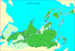
Figure 1
Distribution of Ramsar Sites in Asia.
Dumping of waste in coastal wetland, Philippines
Agriculture is consider ed the principal cause for
wetland loss worldwide. By 1985, it was estimated
that 56%-65%, 27%, 6% and 2% of available
wetlands in Europe and North America, Asia, South
America and Africa, respectively, had been drained
for agriculture (Stuip et al., 2002) . Scott (1993)
quoted an overall wetland loss of 31%, 78%, and
22% in Indonesia, Philippines and Thailand,
respectively. In their review, Immirzi et al. (1992)
quoted peatland losses of 82%, for Thailand; 71%
for West Malaysia; 18% for Indonesia; 13% for
China; and, 11% in Sarawak in East Malaysia.
The Ramsar Site Database provides insight to the
Source: www.wetlands.org
main threats to wetlands. In 1999, 84% of Ramsar-
listed wetlands had undergone or were threatened
by ecological change. The most widespread threats
Reversing Environmental Degradation Trends in the South China Sea and Gulf of Thailand
4
WETLANDS DISTRIBUTION AND DIVERSITY IN THE SOUTH CHINA SEA
WETLANDS DISTRIBUTION AND DIVERSITY IN THE SOUTH
CHINA SEA
Southeast Asian countries have at least 334
wetland sites, with a total area of 192,363,601 ha, of
which Indonesia has the greatest number, 129 sites
scattered throughout the country (ASEAN, 2001).
Along China's South China Sea coast, a total area
of 15,333.35 hectares has been identified under the
five types of wetlands with relevance to the
UNEP/GEF South China Sea Project. These
wetlands support local communities and habitats
that are home to a variety of rare, endemic,
endangered and threatened species of global
significance.
Khao Sam Roi Yot Marine National Park, Thailand
Wetlands are dynamic and complex ecosystems.
They exhibit enormous diversity in size and shape
Coastal wetlands play a critical role in protecting
according to their origins and geographical location,
coastal land from the influence of violent coastal
their physical structure, as well as their chemical
weather by providing a buffer against storm surges
composition. The characteristics of the flora and
and protecting coastlines from erosion. In Malaysia,
fauna are largely defined by the water depth, current
it has been estimated that the economic gain is
and intensity, underlying soil structure, sediment
US$300,000 per kilometre from intact mangrove
composition, and water temperature and, in coastal
swamps for storm protection and floo d control
regions, influence of the tide. Levels of diversity vary
alone, which is the cost of replacing them with rock
between different wetland types--some exhibit high
walls. This role of coastal wetlands may become
levels of diversity and endemism while others
even more important under conditions of changed
support little life.
climate over the next 50-100 years.
Ecological Functions of Wetlands in the South
The UNEP/GEF South China Sea Project focuses
China Sea. Wetlands are the ecotone and buffer
its activities on five wetland types, namely: estuaries
zone for inland and marine habitats with great
(including deltas), lagoons, intertidal mudflats, peat
importance for their "ecological functions," that
swamps, and non-peat swamps. Their functions,
support economic activities of significant value.
products and attributes are shown in Table 1.
These ecological functions include regulation of
water regimes; flood buffering and control;
Estuary. A wetland type where the river mouth
groundwater recharge and discharge; wind breaks
widens into a marine ecosystem, the salinity of
and storm protection; shoreline stabilization and
which is intermediate between salt and fresh water
erosion control; retention of nutrients, sediments
where tidal action is an important biophysical
and contaminants; nutrient processing, provision of
regulator.
nutrient-rich and sheltered habitats, spawning and
nursery areas for fish and aquatic organisms;
Lagoon. A semi-enclosed coastal basin with limited
retention of carbon dioxide and regulation of local
freshwater input, high salinity and restricted
and global climates.
circulation which of ten lies behind sand dunes,
barrier islands or other protective features like coral
reef of an atoll.
Intertidal mudflat. A wetland type that is usually an
unvegetated area, dominated by muddy substrate.
Peat swamp. Under normal oxygen-rich conditions,
dead plant matter decomposes eventually into
carbon dioxide and water. When under low
temperature, high acidity, low nutrient supply, water-
logging, and oxygen deficient conditions, the
process of decomposition is retarded and dead
plant matter accumulates as peat.
Non-peat swamp. A wetland type having still water
areas around lake margins, and in parts of
floodplains such as oxbows, where the water rests
Collection of molluscs from mudflats replanted with
for longer periods. Their precise characteristics vary
mangrove, Vietnam
according to geographical location and environme nt.
Reversing Environmental Degradation Trends in the South China Sea and Gulf of Thailand
W ETLANDS BORDERING THE SOUTH CHINA SE A
5
Table 1
Functions, Products and Attributes of Wetlands. (X = present; = common and important value)
Estuaries
Lagoons
Intertidal
Mudflats
Peatswamps
Non-
peatswamps
Functions (Services)
Groundwater recharge
X
X
Groundwater discharge
X
X
X
X
Flood control
X
X
X
Shoreline stabilization/
erosion control
X
X
X
Sediment/toxicant retention
X
X
X
Nutrient retention
X
X
X
Biomass export
X
X
X
Storm protection
X
X
Water transport
X
X
Recreation/tourism
X
X
X
X
X
Products
Forest resources
X
Wildlife resources
X
X
X
X
Fisheries
X
X
X
Agricultural resources
X
X
Water supply
X
X
X
Energy Resources
Attributes
Biological diversity
X
X
Uniqueness to culture/heritage
X
X
X
X
X
Source: Dugan, P.J. (eds) 1990
ENVIRONMENTAL IMPACTS CONSEQUENCES OF
WETLAND LOSS
Floods and storms. Loss of coastal wetlands and
their ecological functions of storm and flood
Causes of wetland loss. Wetlands have been lost
protection, and coastal erosion control leads to
or altered because of the disruption of natural
severe damage and loss of life and property among
processes by agricultural intensification,
coastal communities. For example, between May
urbanization, pollution, water transfer, dam
and September 1994 Southeast Asia was
construction, and other forms of intervention in the
devastated by 5 months of storms and floods that
ecological and hydrological systems.
destroyed 220,000 houses in the Mekong Delta of
Vietnam and caused major losses in the rice crop.
Population growth remains high in the SCS
Tropical storms battered and drenched southern
countries (e.g. 2.6% in Cambodia and 1.7% in
China, Vietnam and Thailand during the period of
Vietnam, exceeding the East Asia/Pacific regional
June-November 1995.
average of 1.6%). It is estimated that some 37% of
the population in Vietnam, 36% in Cambodia, and
In 2000, the Mekong River delta experienced the
13% in Thailand live below the poverty line. These
longest-lasting and most severe flooding to affect
people in poverty are often those depending on
the area in 40 years. Floodwaters exceeded Alarm
wetland resources for their subsistence livelihoods.
Level III (very dangerous flood conditions) and
Wetland loss and degradation has led to loss of
flooding was reported in Thailand, Cambodia and
occupation and income.
Laos (IRI Climate Digest, 2000). The floods affected
almost 9 million people and killed 800. Damage was
estimated at more than US$ 455 million. Without
wetlands preventing such losses, investment in
coastal and flood plain protection are required.
Coastal pond development in Sembilang, Indonesia
Erosion Prevention Dike in Ham Tien, Vietnam
Reversing Environmental Degradation Trends in the South China Sea and Gulf of Thailand
6
WETLAND LOSS AND DEGRADATION
WETLAND LOSS AND DEGRADATION
believed that the salt-water intrusion was
caused by decreased outflow from the lakes
Black Rivers. In 1979, 42 of the major rivers in
and rivers of the Makaham system as a
Peninsular Malaysia were declared dead as a result
result of extensive forestry clear felling in the
of pollution, primarily from oil palm and rubber
catchment.
effluents, sewage and industrial wastes. These
rivers no longer support fish, shellfish, or
�
In Malaysia and Indonesia, more than 1 and
crustaceans, and are unfit for drinking or washing
3 million hectares of peatland respectively,
(Sababat Alam Malaysia � cited in Jayal, 1984;
have been converted into agricultural land.
Dugan, 1990).
Such conversion destroys not only the
developed peatland and its associated
In the Philippines, the National Pollution Control
biodiversity but has flow-on effects on the
Commission estimated that copper mining has
remaining peatlands by enhancing drainage
severely polluted 14 rivers in Luzon, the Visayas,
and loss from fire.
Palawan, and Marinduques. Where these rivers
enter the sea, fishing yields have declined by 50%
�
An intensive eel aquaculture scheme has
(Aditjondro, 1989 � cited in Dugan, 1990).
been set up in the South East Pahang Peat
Swamp Forest on the east coast of
Wetland degradation. The following are further
Peninsular Malaysia. Huge quantities of
examples of wetland destruction or degradation and
groundwater have been extracted for the
their economic, social or ecological consequences:
ponds, resulting in the drying up of wells
used by local communities for their domestic
�
in the Philippines, some 300,000 ha of the
needs.
country's mangrove resources were lost in 60
years from 1920-1980, leading to a decline in
�
The Central plains of Thailand used to be
marine fishery production
swamp plains supporting populations of
wetland dependent wildlife such as
�
in Sumatra the average coastal fishpond
Schomburk's deer (Cervus schomburgki).
produces 287 kg/ha/year of fish but the loss
Drainage of the plains for rice cultivation
of one hectare of mangrove leads to a loss of
during the early 20th century destroyed most
approximately 480 kg/yr of offshore fish and
of the riverine wetlands and led to the
shrimp
extinction of the deer.
�
Local people of Samarinda (East Kalimantan)
�
Another consequence of wetland destruction
report that seawater formerly intruded
is the increasing number of threatened
upstream in the Makaham river as far as the
species as seen from Table 2.
town only in the very few years with a dry
season of ten or eleven months . In 1991
Within the framework of the UNEP/GEF South
saline water intruded upstream of Samarinda
China Sea Project, 102 ecologically and socially
after only six months of the dry season. This
important wetlands sites have been identified and
had significant impact on agriculture, industry
characterized (Table 3). Among these, 58 wetland
and the health of the community. It is
sites are already afforded some degree of
protection.
Table 2 Numbers of globally threatened wetland Species in countries bordering the South Chin Sea. (Numbers in parentheses
are species endemic to the country concerned)
Mammals Birds
Reptiles Amphibians Fishes
Invertebrates
Brunei
2-3
9-10
3-5
0
2 (1)
0
Cambodia
3
15-17
10-12
0
7
0
Indonesia
6 (1)
28-29 (8)
23 (3)
0
67 (54)
4 (2)
Malaysia
6-7 (2)
16-17
18-19
0
16 (10)
2 (1)
Philippines
1
16 (5)
7 (2)
26 (26)
30 (26)
4 (2)
Singapore
1-2
8
3-4
0
2
0
Thailand
5
22-29 (1)
17-20
0
19-20 (8)
1
Vietnam
4
21-26
20-24
1 (1)
6
0
Table 3 Number and areas of important wetlands bordering the South China Sea.
Cambodia
China
Indonesia
Malaysia
Philippines
Thailand
Viet Nam
No. of Wetlands Sites
3
6
40
9
16
13
15
Total Area (ha)
22,000
20,276
5,179,660
76,560
630,288
271,311
629,954
Range in Area (ha)
4500-13,000 218-12,783 7-1,000,000 348-35,750 420-193,195 140-65,000 16,000-160,000
No. of Sites with
protection measures
1
6
24
4
12
6
5
Reversing Environmental Degradation Trends in the South China Sea and Gulf of Thailand
WETLANDS BORDERING THE SOUTH CHINA SE A 7
COASTAL DEVELOPMENT AND WETLANDS LOSS IN CHINA'S PEARL RIVER DELTA
Since the late 1970s, the Pearl River Delta has been the fastest developing area in China, acting as an engine for
the country's economic development. In the period 1978 to 1990, Guangdong's real gross domestic product
(GDP) increased at an average annual rate of 12.3% while its real per capita GDP grew at 10.4%. Due to
population increase, urbanization and industrialization, many wetlands in the Pearl River Delta have been
destroyed and reclaimed for agriculture, aquaculture, and industrial or residential uses.
Large areas of wetlands have been exploited or converted for farming, or city expansion, resulting in the reduction
of wetland area and decline of wetland functions. There were about 400,000 ha of mangrove in Guangdong in the
1950's, however, only 147,000 ha was left in the 1990s. The rate of mangrove loss has been especially high since
the 1980s. A total of 7,911.2 ha of mangrove have been destroyed or occupied since 1980, most of which has
been converted to aquaculture ponds (7,767.5 ha); reclaimed for construction projects (139.4ha), or converted to
salt pans (5.3 ha). From 1966 to 1996, the total reclaimed area in the entire Pearl River delta is 344 km2, an
average annual rate of 11 km2 yr-1 of reclamation, much greater than that experienced during recent historical
times.
Wetland degradation and loss have resulted in the disappearance of coastal vegetation, reducing the
effectiveness of coastal protection from typhoon winds and flood . In September 2003, Typhoon Dujuan, the
strongest storm to hit the Pearl River delta since 1979, killed 38 people, injured more than 1,000 and up-rooted
30% of all trees in the area. The direct economic losses were estimated at US$ 242 million and the severe
impacts of this typhoon can be partly attributed to the loss of natural coastal protection: coastal wetlands.
Guizhu Chen, China Wetland Focal Point
STATE OF WETLANDS AND PRESENT THREATS
Coastal wetlands continuously receive water,
sediment, nutrient and contaminants via inflows
The view that wetlands are wastelands, results from
from the inland catchment areas. Land-based
ignorance and misunderstanding of the value of the
pollution from industries, tourism, urban areas,
goods and services provided by wetlands, and has
agriculture, and aquaculture have impacts on
resulted in their conversion to intensive agricultural,
noteworthy fauna, and reduce the value of the
industrial or residential uses. Driven by short-term
benefits and services derived from estuaries,
economic gains and encouraged by government
mudflats, and other coastal wetlands. In the context
development policies, large coastal development
of climate variability and change, the projected sea
projects, along with scattered individual excessive
level rise and increases in storm surges are likely to
or inappropriate utilization of wetlands has
affect coastal wetlands significantly. Such changes
contributed to the rapid loss and degradation of
may cause substantial ecological, and economic
wetlands bordering the South China Sea.
losses.
Population growth and increasing demand for
economic development place tremendous pressure
on wetland ecosystems. The loss and degradation
of coastal wetlands bordering the South China may
trigger serious and long-term ecological, and socio-
economic consequences. For example loss of
coastal mangrove swamps in Viet Nam has resulted
in increasingly severe coastal erosion, affecting, for
example, at least 20% of Viet Nam's coastline,
leading to the loss of agricultural land and even
entire villages.
Major threats which are common to wetlands of all
countries bordering the South China Sea include
over-exploitation through over-fishing resulting in
Mui Ne Fishing Port, Vietnam
declining fish productivity; alteration of the
hydrological regimes, through draining and wetland
Many wetlands bordering the South China Sea are
reclamation schemes; conversion to other use such
protected as, national parks, wildlife sanctuary,
as agriculture or urban expansion, aquaculture,
wildlife non-hunting areas, and nature reserves.
agriculture, construction of coastal roads, and
Many of them however, are not well manag ed and
physical barriers for coastal protection against
the lack of appropriate and efficient management
erosion.
and unsustainable use remain threats to wetlands in
all countries.
Reversing Environmental Degradation Trends in the South China Sea and Gulf of Thailand
8
USE AND VALUE OF W ETLANDS BORDERING THE SOUTH CHINA SEA
USE AND VALUE OF WETLANDS BORDERING THE SOUTH
and well-known as an attractive tourist destination.
CHINA SEA
Attractions include the natural environment,
traditional fisheries and fishing technologies,
The dependency of people on the coastal areas of
seafood and fishery products.
the South China Sea can be shown by the high
proportion of the total population living within 100
km of the coast: Cambodia, 24%; Indonesia, 96%;
Malaysia, 98%; Philippines, 100%; Thailand, 39%;
and Viet Nam, 83% (ASEAN, 2001). Whatever type
of wetland, their processes are based on the
interaction of the basic components of the natural
system, the physical and chemical components
including soil, and water, together with the biological
components, the plants and animals. It is the
wetland processes that generate the products,
services and attributes that are valued by humans.
Values are realized when people decide that
something is important to them. Human interactions
with the environment are diverse and so there are
many specific values that are applicable to
individual sites and to different stakeholder groups.
Harvesting the edible seaweed Gracilaria tenuistipitata var.
These can be categorized according to the principal
liui in Shantou, China
types of use and non-use values.
Wetlands are of significant importance to
Direct or extractive use values. The most tangible
subsistence communities in the South China Sea.
values, relating to the products and materials that
For generations, a large proportion of the population
can be derived from the wetland, such as food, and
of the South China Sea coastal area has depended
fibre.
on wetland ecosystems and their products for direct
use, and as sources of trade goods and for cash
Indirect or non-extractive use values. May be
income (see box on page 9).
seen as the value of wetlands for recreational use,
for tourism, or for research.
The countries bordering the South China Sea are
significant producers and consumers of captured
Service values. Reflect the services wetlands
and cultivated fish. In the coastal areas of the seven
provide for flood control, or as a windbreak.
participating countries, the marine capture fisheries
and culture production account for 8.2% and 54%
Existence value. The most difficult to determine,
respectively of the total world production. Globally,
such values reflect the intrinsic value of individual
two thirds of all fish consumed are dependent on
species and systems.
coastal wetlands at some stage in their life cycle.
Marine fishery aquaculture is mainly conducted in
wetlands or areas associated with wetlands.
Southeast Asia is the global centre of marine
aquaculture. In 1994, six of the seven countries
participating in this project accounted for 61% of
shrimp imports by Japan, and 6 of the ten top
shrimp producing countries border the South China
Sea. This dominant role has grown rather than
declined in recent years and the internal market
within the region has also grown significantly as
economic growth has lead to increasing levels of
disposable income.
On average, people in ASEAN countries consume
Harvesting of mollusc Solen regularis at Don Hoi Lot,
about 20 kg of fish per capita per year, which
Thailand
provides nearly half of their animal protein intake.
The figure can be much higher in some low -income
Don Hoi Lot Inter-tidal Mudflats on the Gulf of
countries. For example, in Cambodia, fish and fish
Thailand is the only major productive area of Solen
products are the single most important sources of
regularis, an economic, endemic mollusc species,
protein, for the Cambodian population, representing
which, unique to Thailand and to the region, is an
75% of the animal protein intake.
important source of fisheries production, occupation
and income. Solen regularis is harvested by 200-
300 mollusc harvesters at 1,360-3,025 kg/day and
sold at US$2.5/kg of fresh flesh. The site is famous
Reversing Environmental Degradation Trends in the South China Sea and Gulf of Thailand
WETLANDS BORDERING THE SOUTH CHINA SE A
9
COMMUNITY LIVELIHOOD IN THALE NOI WILDLIFE NON-HUNTING AREA OF THAILAND
Thale Noi Wildlife Non-Hunting area, is a very important wetland site in the south of Thailand, covering
approximately 45,700 hectares. It includes various ecosystems, a freshwater lake, swamp forests, inundated
grassland, reed swamps and paddy fields. Phru Khuan Khi Sian, a permanently inundated swamp with
Melaleuca cajeputi, and dense stands of Cyperus imbricus , Scirpus mucronatus and Eleocharis dulcis is a
designated Ramsar site. This wetland is the nesting site of waterbirds such as the little cormorant, purple heron,
cattle egret, little egret and black-crowed night-heron and provides important habitats to over 187 species of
waterfowl. The area is also used by large groups of birds, estimated at over 10,000 individuals during the
migratory season.
There are fifty villages in the wildlife non-hunting area, with 7,813 households and 37,662 individuals. Most of the
population depends on farming for a living. Benefits of Thale Noi to local populations include its role as a
transport route, for recreation and for fishing. The area also provides timber for household usage, reeds for
handicraft, feed for livestock and sources of protein, including edible birds, reptiles and amphibians. The resident
communities have depended on this wetland for resources to generate cash income. Of the households resident
in the area, 4,771 households are engaged in rice farming, 1,073 households in rubber plantation, 1,579
households in reed harvesting, 2,894 households in handicraft production, and 41 households in tourist activities.
The average annual income from reed harvesting and handicraft production is estimated at US$525.09 and
US$462.67 per household, respectively (Office of Environmental Policy and Planning, 1999).
Narong Veeravaitaya, Thailand Wetland Focal Point
PURPOSE OF THE DEMONSTRATION SITES
�
function related sites which might include
existing sites that demonstrate sustainable
As stated in previous sections, the coastal wetlands
use for specific purpose;
of the South China Sea have been suffering from
�
process related sites which might include
serious degradation and rapid rates of loss over the
existing sites that demonstrate innovative
recent past. Due to limited available financial
management interventions and/or regimes
resources, it is not possible to fund activities at all
at the site level;
wetlands sites under severe threat. Sites therefore,
�
problem related sites, which might
should be selected with care according to agreed
demonstrate new modes of managing
priorities in order to maximize the environmental
specific problems or causes of
and socio-economic benefits of the investment.
environmental degradation.
The primary goal of the demonstration sites within
Whilst all the participating countries have identified
the context of the habitat component of this Project
national priority wetlands for conservation action
is to "demonstrate" actions that, either of
and sustainable management the determination of
themselves, "reverse" environmental degradation or,
national priority has rarely included a consideration
will demons trate methods of reducing degradation
of transboundary, regional or global considerations,
trends if adopted and applied at a wider scale.
beyond the inclusion of their status or potential
Demonstration sites could be sites where actions
status under the RAMSAR Convention as one
are directed towards:
criterion amongst many. Since the present project
takes a regional approach to intervention it was
�
Maintaining existing biodiversity; or,
necessary to develop a process by which regional
as opposed to national priority could be determined
�
Restoring degraded biodiversity to former
in as objective a manner as possible.
levels; or,
PROCESS OF SELECTING DEMONSTRATION SITES
�
Attempting to remove or reduce the cause,
and hence reduce the existing rates of
The Project has undertaken a transparent, scientific
degradation; or,
and objective regional procedure to rank and select
demonstration sites based on environmental and
�
Attempting preventive actions that halt the
socio-economic criteria and indicators discussed
adoption of unsustainable patterns of use,
and agreed at the regional level. To achieve
before it commence.
maximum impact from a limited number of
interventions, the Project Steering Committee
In the context of this Project, the demonstration site
adopted a three-step regional procedure to prioritise
proposals need not only to consider the goals and
and select demonstration sites.
purposes of the sites themselves but also what is
being demonstrated, to whom is it being
Full details of this procedure are contained in the
demonstrated, and how is it being demonstrated.
reports of the Regional Working Group (RWG-W)
An initial consideration of what is to be
meetings (UNEP, 2002a; 2002b; 2003a; in press)
demonstrated leads to three types of potential
but it may be outlined as follows:
demonstration site:
Reversing Environmental Degradation Trends in the South China Sea and Gulf of Thailand
10
PRIORITISING AND SELECTING DEMONSTRATION SITES
�
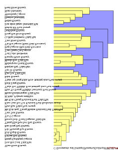
Step 1. A cluster analysis was conducted
Figure 2 Results of Cluster Analysis of Wetlands Sites.
to review the similarities and differences of
all proposed sites, using data and
information assembled at the national level
that described the physical and biological
characteristics of the systems under
consideration. This analysis was used to
group sites of high degrees of similarity
within which priority could be determined.
�
Step 2. The Regional Working Group on
Wetlands developed a set of criteria and
indicators with an associated numerical
scoring system, encompassing
environmental and socio-economic
characteristics;
�
Step 3. The proposed sites were scored
according to the agreed system and
ranked within each cluster. Rank order was
considered to represent regional priority.
Site Characterization. The collection of data and
information at the national level is critical and
formed the fundamental basis for initiating the
regional comparis on. To ensure data compatibility
and comparability, the Regional Scientific and
Technical Committee (RSTC) provided initial
It was agreed to use socio-economic indicators in
guidance to the working groups on assembling
ranking of those sites with proposals. The socio-
regional level data and information; developing site
economic indicators include threats, national
characterisations; and commencing the process of
significance, financial considerations and level of
prioritising or ranking sites. A total of forty-three
local stakeholder involvement. reversibility of
sites were fully characterised and included in the
threats, national priority, level of stakeholder direct
raw data set for cluster analysis and prioritisation.
involvement in management, potential for co-
financing The scoring system developed for the
Cluster Analysis. To maximize the range of
socio-economic characteristics indicates a stronger
biological diversity covered by a limited number of
demonstration sites, selected sites should represent
weight for a site with stronger commitment from the
government and other stakeholders, in terms of co-
the greatest range of conditions represented in the
financing and level of involvement.
region as possible. The Clustan Graphic6 software
programme was used to conduct the cluster
Final rank scores for an individual site were
analysis, the results of which are shown in Figure 2.
determined using a combination of the
The RWG-W noted that the number of sites was not
environmental and socio-economic criteria and
evenly distributed among the six clusters in the
indicators in a 7:3 ratio. The combined scores and
cluster analysis; the first cluster having many more
final ranking are presented in Table 4.
sites (17) than any other cluster. It was decided
therefore that three major groups should be
Table 4 Ranking Proposed Demonstration Sites.
considered, with the second and third clusters being
Socio-
Weighted
grouped as one, and the fourth, fifth, and sixth
Environ.
Score
econ
Total
groups being combined as a third cluster.
Score
Cluster 1
Site Prioritisation and Ranking. Two sets of
Vietnam Tra O Lagoon
46
62
51
indicators with assigned scores were developed and
Cambodia Koh Kapik
26
69
39
agreed by the RWG-W; environmental and
Cambodia Beung
biological criteria and indicators; and socio-
Kachhang
15
50
26
economic criteria and indicators. Environmental
Cluster 2
criteria included specific measures of biological
Vietnam Balat Estuary
68
90
75
diversity, transboundary significance and
Thale Noi Non-hunting
regional/global significance. Criteria and indicators
Area
56
70
60
included area, number of fish, bird, plant, and
Malampaya Sound
46
76
55
mammal species, number of wetland types, number
Pansipit River
42
66
49
of migratory species, number of endemic species
Cluster 3
and number of endangered species. Priority for
China Pearl River
94
82
90
development of demonstration site proposals was
China Shantou
80
72
78
based on the total score and assigned to sites with
China Hepu
86
48
75
higher ranking in each of the identified groups of
Vietnam Ca Mau
69
67
68
sites.
Reversing Environmental Degradation Trends in the South China Sea and Gulf of Thailand
W ETLANDS BORDERING THE SOUTH CHINA SE A
11
REFERENCES
Aditjondro, G. 1989. Irian Jaya: Copper Mining Boom Endangers River Systems. World Rivers Review 4: 8.
ASEAN. 2001. Second ASEAN State of Environment Report 2000. Jakarta: ASEAN Secretariat.
Chan, S., Benstead, P., Davies, J. and Grubh, R. 2001. The Wetland Management Handbook for South East
Asia. Ministry of the Environment, Japan.
Davies, J. and Claridge, C.F. (eds.) 1993. Wetland Benefits, The Potential for Wetlands Support and Maintain
Development. Asian Wetland Bureau Publications No. 87. IWRB Special Publication No. 27. Wetlands
for the Americas Publication No. 11.
Dugan, P.J. (ed.). 1990. Wetland Conservation: A Review of Current Issues and Required Action. IUCN, Gland,
Switzerland.
International Research Institute for Climate Change (IRI). 2000. IRI Climate Change Information Digest
September 2000 (http://iri.Columbia.edu/climate/cid/) accessed 12 January 2004.
Immirzi, C.P. et al. 1992. The Global Status of Peatlands and their Role in Carbon Cycling. Department of
Geography. University of Exeter. Friends of the Earth. London.
Jayal, N.D. 1984. Destruction of Water Resources � the Most Critical Ecological Crisis of East Asia. Paper
presented at the 16th IUCN General Assembly, 5-14 November 1984. Madrid, Spain.
Mitsch, W.J. and Gosselink, J.G. 2000. Wetlands. 3rd edition. John Wiley & Sons. http://www.ramsar.org
Moser, M., Prentice, C. and Frazier, S. 1996. A Global Overview of Wetland Loss and Degradation. 6th Meeting
of the Conference of the Contracting Parties to the Ramsar Convention in Brisbane, Australia.
Office of Environmental Policy and Pl anning. 1999. The Conservation and Protection of the Important Wetland
namely Thale Noi Non-Hunting Area, Phatthalung Province. Bangkok, Thailand.
Ramsar Convention Bureau. 1971. Convention on Wetlands of International Importance especially as Waterfowl
Habitats. Gland, Switzerland.
Ramsar Convention Bureau. 1996. Wetlands and Biodiversity. 3rd Meeting of the Conference of the Parties to
the Convention on Biological Diversity in Buenos Aires, Argentina.
Ramsar Convention Bureau. 2000. Wetlands Values and Functions. Gland, Switzerland.
Scott, D.A. (ed) 1993. Wetland inventories and assessment of wetland loss: a global overview. Proceeding of the
IWRB Symposium St. Petersburg, Florida, November 1992. IWRB Special Publication 26.
Stuip, M.A.M., Baker, C.J. and Oosterberg, W. 2002. The Socio-economics of Wetlands. Wetlands International
and RIZA, The Netherlands.
Talaue-McManus, L. 2000. Transboundary Diagnostic Analysis for the South China Sea. EAS/RCU Technical
Report Series No. 14. UNEP, Bangkok, Thailand
UNEP/GEF South China Sea Project. 2003. National Reports from Wetland Subcomponent. UNEP, Bangkok,
Thailand.
UNEP, 2002a. First Meeting of the Regional Working Group for the Wetland Sub-component of the UNEP/GEF
Project "Reversing Environmental Degradation Trends in the South China Sea and Gulf of Thailand".
UNEP/GEF/SCS/RWG-W.1/3. 44 pp In: UNEP, "Reversing Environmental Degradation Trends in the South
China Sea and Gulf of Thailand", report of the First Meetings of the Regional Working Groups on Marine
Habitats. 179 pp. UNEP, Bangkok, Thailand.
UNEP, 2002b. Second Meeting of the Regional Working Group for the Wetland Sub-component of the UNEP/GEF
Project "Reversing Environmental Degradation Trends in the South China Sea and Gulf of Thailand". Report
of the meeting, UNEP/GEF/SCS/RWG-W.2/3. 25 pp. In: UNEP, Report of the Second Meetings of the
Regional Working Groups on Mangrove & Wetlands. UNEP, Bangkok, Thailand.
UNEP, 2002b. Third Meeting of the Regional Working Group for the Wetland Sub-component of the UNEP/GEF
Project "Reversing Environmental Degradation Trends in the South China Sea and Gulf of Thailand". Report
of the meeting, UNEP/GEF/SCS/RWG-W.2/3. 38 pp. UNEP, Bangkok, Thailand.
WCMC. 1992. Global Biodiversity. in Moser, M., Prentice, C. and Frazier, S. 1996. A Global Overview of Wetland
Loss and Degradation. 6 th Meeting of the Conference of the Contracting Parties to the Ramsar Convention
in Brisbane, Australia.
Reversing Environmental Degradation Trends in the South China Sea and Gulf of Thailand
MEMBERS OF THE REGIONAL W ORKING GROUP ON WETLANDS
Dr. Ebil Bin Yusof, Department of Wildlife and National Parks, Peninsular Malaysia, KM10, Jalan Cheras, 56100
Kuala Lumpur, Malaysia, Tel: (603) 9075 2872; 016 3807344, Fax: (603) 9075 2873,
E-mail: ebil@wildlife.gov.my; ebilyusof@hotmail.com
Professor Guizhu Chen, Institute of Environmental Sciences, Zhongshan University, 135 West Xingang Road,
Guangzhou 510275, Guangdong Province, China, Tel: (86 20) 8411 2293; 8403 9737, Fax: (86 20)
8411 0692; 8403 9737, E-mail: chenguizhu@yeah.net
Dr. Liwei Chen, Program Officer, Freshwater and Marine Programme, WWF-China Program Office, Room 1609,
Wenhua Palace, Laodong, Renmin Wenhua Gong, Dongcheng District, Beijing 100006, China, Tel: (86 10)
6522 7100 ext 238, Mobile: (86) 13 6510 46407, Fax: (86 10) 6522 7300, E-mail: lwchen@wwfchina.org
Ms. Sulan Chen, Associate Expert, UNEP/GEF Project Co-ordinating Unit, United Nations Environment
Programme, United Nations Building, 9th Floor, Block A, Rajdamnern Avenue, Bangkok 10200, Thailand,
Tel: (66 2) 288 2279, Fax: (66 2) 288 1094; 281 2428, E-mail: chens @un.org
Dr. Sansanee Choowaew, Programme Director, (Natural Resource Management), Mahidol University, Faculty of
Environment and Resource Studies, Salaya, Nakhonpathom 73170, Thailand, Tel: (66 2) 441 5000
ext. 162, Mobile: (66 1) 645 1673, Fax: (66 2) 441 9509-10, E-mail: enscw@mucc.mahidol.ac.th
Ms. Marlynn M. Mendoza, Protected Areas and Wildlife Bureau, APWNC Compound, North Avenue, Diliman,
Quezon City, Philippines 1101, Tel: (632) 925 8950; 9246031; 0916 7475492, Fax: (632) 924 0109;
925 8950, E-mail: mmmendozapawb@netscape.net; mmendoza@i -manila.com.ph
Dr. Mai Trong Nhuan, Vietnam National University, Hanoi, 165 Khuong Trung Street, Thanh Xuan, Hanoi,
Vietnam, Tel: (844) 834 2015; 853 1142, Mobile: (84) 91 334 1433, Fax: (844) 834 0724,
E-mail: nhuanmt@vnu.edu.vn; mnhuan@yahoo.com
Mr. Dibyo Sartono, Wetland International Indonesia Programme, JL Jend A Yani 53 BOGOR 16161, P.O. Box
254/BOGOR 16002, Indonesia, Tel: (62 251) 312 189, Fax: (62 251) 325 755,
E-mail: dibyo@wetlands.or.i d
Mr. Narong Veeravaitaya, Department of Fisheries Biology, Faculty of Fisheries, Kasetsart University,
50 Paholyothin Road, Bangkhen, Bangkok 10900, Thailand, Tel: (66 2) 579 5575 ext. 315; 01 741 0024,
Fax: (66 2) 940 5016, E-mail: ffisnrv@ku.ac.th
Mr. Sok Vong, Department of Nature Conservation and Protection, Ministry of Environment, 48 Samdech Preah
Sihanouk, Tonle Bassac, Chamkarmon, Cambodia, Tel: (855 23) 213908; 12 852904, Fax: (855 23)
212540; 215925, E-mail: sok_vong@camintel.com; sokvong@yahoo.com


UNEP/GEF South China Sea Project Co-ordinating Unit
United Nations Building
Rajadamnoern Nok
Bangkok 10200
Thailand
Ministry of Environment,
Department of Nature Conservation and Protection
48, Samdach Preah Sihanouk
Tonle Bassac, Chamkarmon
Phnom Penh, Cambodia
Institute of Environmental Sciences
Zhongshan University
135 West Xingang Road
Guangzhou 510275
Guangdong Province, China
Wetland International Indonesia Programme
JL Jend A Yani 53 BOGOR 16161
P.O. Box 254/BOGOR 16002
Indonesia
Department of Wildlife and National Parks
Peninsular Malaysia
KM10, Jalan Cheras
56100 Kuala Lumpur, Malaysia
Protected Areas and Wildlife Bureau
NAPWNC Compound, North Avenue, Diliman
Quezon City, Philippines 1101
Department of Fisheries Biology
Faculty of Fisheries
Kasetsart University
50 Phanolyothin Road
Bangkhen, Bangkok 10900
Thailand
Vietnam National University, Hanoi
165 Khuong Trung Street
Thanh Xuan, Hanoi
Viet Nam