


United Nations
UNEP/GEF South China Sea
Global Environment
Environment Programme
Project
Facility
"Reversing Environmental Degradation Trends
in the South China Sea and Gulf of Thailand"
National Reports
on
Wetlands in South China Sea


First published in Thailand in 2008 by the United Nations Environment Programme.
Copyright © 2008, United Nations Environment Programme
This publication may be reproduced in whole or in part and in any form for educational or non-profit
purposes without special permission from the copyright holder provided acknowledgement of the
source is made. UNEP would appreciate receiving a copy of any publication that uses this
publicationas a source.
No use of this publication may be made for resale or for any other commercial purpose without prior
permission in writing from the United Nations Environment Programme.
UNEP/GEF
Project Co-ordinating Unit,
United Nations Environment Programme,
UN Building, 2nd Floor Block B, Rajdamnern Avenue,
Bangkok 10200, Thailand.
Tel.
+66 2 288 1886
Fax.
+66 2 288 1094
http://www.unepscs.org
DISCLAIMER:
The contents of this report do not necessarily reflect the views and policies of UNEP or the GEF. The
designations employed and the presentations do not imply the expression of any opinion whatsoever
on the part of UNEP, of the GEF, or of any cooperating organisation concerning the legal status of
any country, territory, city or area, of its authorities, or of the delineation of its territories or boundaries.
Cover Photo: A vast coastal estuary in Koh Kong Province of Cambodia. Photo by Mr. Koch
Savath.
For citation purposes this document may be cited as:
UNEP, 2008. National Reports on Wetlands in the South China Sea. UNEP/GEF/SCS Technical
Publication No. 13.


United Nations
UNEP/GEF South China Sea
Global Environment
Environment Programme
Project
Facility
NATIONAL REPORT
on
Wetlands in South China Sea
CAMBODIA
Mr. Koch Savath
Focal Point for Wetlands
Department of Nature Conservation and Protection, Ministry of Environment
48 Samdech Preah Sihanouk
Tonle Bassac, Chamkarmon, Cambodia
NATIONAL REPORT ON WETLANDS IN SOUTH CHINA SEA CAMBODIA
Table of Contents
1. INTRODUCTION .............................................................................................................................1
2. COASTAL WETLAND ECOSYSTEM.............................................................................................1
3. CURRENT WETLAND SYSTEMS ..................................................................................................2
3.1 WETLAND CLASSIFICATION SYSTEM.............................................................................................2
3.2 COASTAL WETLAND TYPES .........................................................................................................3
3.2.1
Marshes.............................................................................................................................3
3.2.2
Swamps.............................................................................................................................3
3.2.3
Peatlands...........................................................................................................................3
3.3 INTERNATIONALLY SIGNIFICANT WETLAND SITES ..........................................................................4
3.3.1
Brackish Water Wetland Sites...........................................................................................4
3.3.2
Marine Wetland Sites ........................................................................................................4
4. WETLAND REOURCES AND ECONOMIC VALUATION..............................................................6
4.1 COASTAL WETLAND RESOURCES.................................................................................................6
4.2 ECONOMIC VALUATION OF WETLANDS .........................................................................................7
5. CAMBODIAN DATA AND INFORMATION ON WETLANDS ........................................................9
5.1 GENERAL DATA ..........................................................................................................................9
5.2 INFORMATION RELATED TO WETLANDS ......................................................................................10
5.3 MAPPING DATA RELATED TO WETLANDS....................................................................................10
6. CONCLUSION AND RECOMMENDATIONS ...............................................................................11
REFERENCES......................................................................................................................................12
List of Tables and Figures
Table 1
Relationship between Shrimp Farm Productivity and Age
Table 2
Price of Charcoal Production from 1997-2000
Table 3
Direct Use Value per ha of the Mangrove by the Local Populations
Table 4
Indicative Economic Value of Major Coastal Ecosystems
Table 5
Total Value within the Three Wetland Sites per Year
Figure 1
System for the Classification of Wetlands
Figure 2
Description of the Classification of Wetland Systems
Reversing Environmental Degradation Trends in the South China Sea and Gulf of Thailand
NATIONAL REPORT ON WETLANDS IN SOUTH CHINA SEA CAMBODIA 1
1. INTRODUCTION
The Kingdom of Cambodia is rich in wetland environments. Over 30 percent of the country is
considered wetlands (according to the wetlands inventory and management project). Following
internationally accepted criteria for wetland identification (defined by the Ramsar Convention) over 20
percent (36,500km2) of the country may be classified as wetlands of international importance. This
represents over five percent of Asia's total area of wetlands of international importance.
Wetland areas support rice and fish production the primary sources of food for the vast majority of
the population and currently Cambodia's most economically productive sectors. Fish and fish products
are the single most important sources of protein for the Cambodian population, representing 75
percent of the animal protein intake. Wetlands provide nutrient-rich and sheltered habitats for fish
(breeding, spawning and nursery areas or habitats for adults) and therefore they play a central role in
the supply of animal protein in Cambodia. Agriculture is supported by water from wetlands. Wetland
water may be stored for use in the dry season or withdrawn for irrigation purposes. Other economic
activities utilizing wetland resources include aquaculture, tourism, inland transport, and energy (hydro-
electricity).
Wetlands serve a wide variety of ecological functions that support economic activities or are of
economic value. In addition to supporting agriculture and fisheries, they play a vital role in maintaining
the water cycle and protecting inland areas from flooding. Coastal wetlands act as barriers against
storm surges and protect the coastline from erosion. Many wetlands are important as filtering systems
- cleaning up polluted water and removing silt, encouraging plant growth, and further improving water
quality. Cambodia's wetlands are important sanctuaries for birds and other species of wildlife not
commonly found in other countries in the world. They are also important for research and educational
purposes.
2.
COASTAL WETLAND ECOSYSTEM
The Cambodian coastline extends along 435km of some of the least populated areas in all of tropical
Asia. The coastal region features a number of closely interrelated ecosystems, embracing beach
forest and strand vegetation, mangroves (including a Melaleuca dominated swamp forest referred to
as "rear mangrove," estuarine ecosystems, seagrass, coral reef and the unstudied marine
ecosystems of the gently sloping, relatively shallow seabed (only 80 meters of water depth at the
outer limit of the 200 nautical mile Executive Economical Zone), and of the water column above.
Estuaries are semi-enclosed bodies of water that are connected to the sea and in which salt water is
diluted by fresh water from land drainage. Estuaries are often highly productive areas due to the
nutrients they receive from the land and the sheltered environments that they provide.
The major estuarine areas in Cambodia occur in the region around Koh Kong province and near
Kampot province. The Stung Koh Pao and Stung Kep estuaries are recognized as wetlands of
international significance. Both rivers originate in the Cardamom range and discharge their flow into
Koh Kong Bay. The Bay is protected from southwest storms by the large island of Koh Kong. The
estuarine system is "a complex of channels and creeks, low islands, mangrove swamps, tidal
mudflats and coastal lagoons."
Mudflats occurs when sediment settles out of the water due to a decrease in current and/ or wave
action. Mudflats are often associated with estuaries, but also occur in low-energy, coastal
environments, such as in large bays or in the lees of islands. They are commonly continuous with
mangrove areas. Mudflats can be very productive system as a result of nutrients recycling through the
sediments. Typically there are high diversities of invertebrates living in and on the mud, and as a
result, the mudflats provide rich feeding grounds for vertebrates such as fish and waterbirds.
Mudflats adjacent to the mangroves and in natural mangrove streams are exploited for cockles,
although this is generally an unrewarding activity practiced only by those with no alternative form of
income.
The productivity of estuaries and mudflats is threatened by pollution from a range of sources, e.g.
construction activities outside mudflats can have adverse effects by causing the inflow of water, which
either erodes the mudflats or prevents further deposition. The location, extent, and significance of
mudflat areas in Cambodia have not been adequately studied.
Reversing Environmental Degradation Trends in the South China Sea and Gulf of Thailand
2 NATIONAL REPORT ON WETLANDS IN SOUTH CHINA SEA CAMBODIA
3. CURRENT
WETLAND
SYSTEMS
3.1
Wetland Classification System
In the Cambodian Wetlands Inventory, for a site to be classified as a wetland, it must meet one of the
following criteria:
· Plants able to tolerate inundation by water for a period of greater than six weeks
(hydrophilic plants);
· Soils are classified as hydric soils; and
· The area is inundated by water for a period on an annual and periodic basis (see below for
further explanation).
A system for the classification of wetlands has been developed for Cambodia since 2000. This system
provides for the classification of wetlands based on a number of functional characteristics. These
characteristics allow for the classification into systems, categories, sub- categories, and modifiers that
describe the wetland sites (Figure 1). This classification system proposes to describe the important
characteristics of particular wetland sites. It considers the wetlands in terms of water regime,
substrate, vegetation type, etc. In combination, these definable characteristics should be able to
provide a clear categorization of each wetland type.
This system can be called a "Hierarchical approach" to the classification of wetlands. This is a
process to evaluate a particular set of characteristics through a series of levels related to the
characteristics of each particular site. At each step of this process more detailed information is
gathered to refine the description of the area. At the end of this process, the unique characteristics to
identify the wetland habitat will have been identified.
System
Wetland
Category
Wetland
Plant
Sub-category
Dominace
THE MODIFIERS
Water
Artificial
Salinity
regime
Modifier
Figure 1
System for the Classification of Wetlands.
The first level of classification is the system. The system level allows for the classification of wetland
habitats into broad functional ecosystems. The system is classified into Saltwater Wetland Systems
and Freshwater Wetland Systems. Saltwater Wetland Systems are classified into Marine and
Estuarine. Freshwater Wetland Systems are classified into Riverine, Lacustrine and Palustrine. Figure
2 represents the classification of the wetland system of Cambodia.
Reversing Environmental Degradation Trends in the South China Sea and Gulf of Thailand
NATIONAL REPORT ON WETLANDS IN SOUTH CHINA SEA CAMBODIA 3
Wetlands
Freshwater
Saltwater
Wetlands
Wetlands
Marine
Estuarine
Riverine
Lacustrine
Palustrin
Figure 2
Description of the Classification of Wetland Systems.
3.2
Coastal Wetland Types
3.2.1 Marshes
Marshes have a number of specific characteristics: they are usually dominated by reeds, rushes,
grasses and sedges. These plants are commonly referred to as emergents since they grow with their
stems partly in and partly out of the water. Marshes are sustained by water sources other than direct
rainfall. They can vary a lot in response to often-subtle hydrological and chemical differences.
Marshes include some of the most productive ecosystems in the world.
Dominant plants in most freshwater marshes include species of reeds (Phragmites; traing), bulrush
(Typha), clib rush (Scirpus; kok), spike rushes (Eleocharis) and grasses such as paragrass
(Brachiaria mutica; smau barang). In Cambodia a good example of a marsh can be found close to
Phnom Penh in the Bassac marshes, which is an area between the Mekong and Bassac Rivers that
floods very year.
3.2.2 Swamps
Swamps are often confused with marshes. They are, however, very different. Swamps generally have
saturated soil or are flooded for most, if not all of the growing season. They are often dominated by a
single emergent herb species or are forested (e.g. the Plain of Reeds in the Mekong Delta). The
Tonle Sap lake, for example, was until recently surrounded by a belt of freshwater swamp forest (the
flooded forest).
According to a study by the Mekong Secretariat in 1991, there are 1.2 million ha of grassland and
other swampy areas associated with the flooded forests in Cambodia (MRC, 1997).
3.2.3 Peatlands
Peat is formed when decomposition fails to keep up with the production of organic matter. This is a
result of water logging, a lack of oxygen or of nutrients, high acidity or low temperatures. Peat can be
found in many types of wetland, including floodplains and coastal wetlands such as mangroves.
Where the peat deposits are deeper than 300 to 400 mm, they create a variety of distinctive wetland
ecosystem such as bogs and fens.
· Bogs from where a high water table, fed directly by rain, results in waterlogged soil with reduced
levels of oxygen. Rainfall leaches out nutrients in the soil, and the slow fermentation of organic
matter produces acids. Bogs are characterized by acid loving vegetation, including mosses.
Sphagnum bog mosses are likely sponges and can hold more than ten times their dry weight of
water. Bogs are not very common in Cambodia, but some have been reported from Bokor.
· Fens are fed by ground water rather than by rain. They produce wetlands higher in nutrient
content than bogs, but still able to accumulate peat. The combination of more nutrients and low
acidity results in very different vegetation, often a species rich cover of reeds, sedges and herbs.
Reversing Environmental Degradation Trends in the South China Sea and Gulf of Thailand
4 NATIONAL REPORT ON WETLANDS IN SOUTH CHINA SEA CAMBODIA
3.3 Internationally
Significant Wetland Sites
Totally, 29 wetland sites were identified as significant habitats, or internationally important sites for
migratory birds. These sites have been classified into freshwater, brackish or marine wetlands. The
identification of these wetlands are based on the criteria of size, habitat, biodiversity richness,
distribution of species and cultural, landscape, and recreational values.
3.3.1 Brackish Water Wetland Sites
These types of coastal wetlands are located on the coastal plain and are linked to the sea. The water
component seasonally changes into brackish during the rainy season and saline during the dry
season. The main vegetation types in these wetlands are mangroves and rear mangroves, which
support reptiles, small mammals, and aquatic species. There are two brackish wetland sites:
1) Stung Metoek Mangrove and Creek System
Coordination:
11o 32' 00" 11o 51' 00" N
102o 51' 00" 103o 06' 00" E
Location:
About 1km north of Koh Kong Provincial town
Total
Area:
22,500ha
-
Water
surface:
10,000ha
-
Marshes:
12,500ha
Altitude:
Average:
116.6m
Maximum:
153m
Wetland Types:
Mangrove, creek systems, rear mangrove and shrimp ponds
Soil Types:
Coastal
complex
2) Prek Piphot Creek System and Swamp Mangroves
Coordination:
11o 04' 30" 11o 19' 00" N
103o 18' 30" 103o 36' 30" E
Location:
10km north of Sre Ambel, Koh Kong Province
Total
Area:
21,250ha
-
Water
surface:
12,750ha
-
Marshes:
85,000ha
Altitude:
Average:
62m
Maximum:
262m
Wetland Types:
Mangrove, creek systems, mud, sand and a little rear mangrove
Soil Types:
Acid lithosol and alumisol
3.3.2 Marine Wetland Sites
Marine wetlands are located in coastal areas similar to the brackish wetlands, however the water
regime is permanent although the water table can move with the start of the rainy season.
Six sites have been identified as internationally important habitats for migratory birds or marine
aquatic species:
1) Kampong Trach Marshes and Salt Ponds
Coordination:
10o 24' 30" 10o 33' 30" N
104o 24' 00" 104o 36' 00" E
Location:
About 2 km east of Kep town
Total
Area:
7,500ha
- Water surface: 2,500ha
-
Marshes:
15,000ha
Altitude:
Average:
89.7m
Maximum:
144m
Wetland Types:
Salt ponds, marshes, mangrove swamps, sand and seagrass
Soil Types:
Coastal
complex
Reversing Environmental Degradation Trends in the South China Sea and Gulf of Thailand
NATIONAL REPORT ON WETLANDS IN SOUTH CHINA SEA CAMBODIA 5
2) Prek Kampong Bay, Creek System, Mangrove and Marshes
Coordination:
10o 30' 00" 10o 41' 00" N
104o 08' 30" 104o 18' 00" E
Location:
Kampot Provincial town
Total
Area:
16,250ha
- Water surface: 7,500ha
- Marshes:
8,800ha
Altitude:
Average:
94m
Maximum:
351m
Wetland Types:
Mangrove, swamps, sand and creek systems
Soil Types:
Coastal complex and red-yellow podzol
3) Prek Toek Sap Creek System, Mangrove and Marshes
Coordination:
10o 24' 00" 10o 37' 30" N
103o 40' 00" 103o 59' 00" E
Location:
15km east of Ream Navy Base, Sihanouk Ville
Total
Area:
21,250ha
-
Water
surface:
12,250ha
- Marshes:
8,750ha
Altitude:
Average:
328m
Maximum:
564m
Wetland Types:
Mangrove, creek systems, coral reef, seagrass and rear mangrove
Soil Types:
Acid lithosol and red-yellow podzol
4) Chhok Veal Rinh
Coordination:
11o 05' 00" 11o 15' 00" N
103o 47' 30" 103o 58' 30" E
Location:
170km southwest of Phnom Penh
Total
Area:
14,900ha
- Water surface: n/a
- Marshes:
n/a
Altitude:
Average:
3m
Maximum:
5m
Wetland Types:
Mangrove, marshes, rear mangrove and rice fields
Soil Types:
Peat, mud and sand
5) Koh Kapik Ramsar Site
Coordination:
11o 24' 00" 11o 32' 00" N
102o 59' 10" 103o 09' 45" E
Location:
Koh Kong Province
Total
Area:
12,000ha
- Water surface: n/a
- Marshes:
n/a
Altitude:
Average:
3.3m
Maximum:
5m
Wetland Types:
Estuary, mangrove, creek and tidal mudflats
Soil Types:
Mud, sand and peat
6) Prek Kampong Som Mangrove, Swamp and Marshes
Coordination:
11o 01' 30" 11o 09' 00" N
103o 37' 30" 103o 45' 15" E
Location:
About 52.5km north of Sihanouk Ville
Total
Area:
10,800ha
-
Water
surface:
3,300ha
-
Marshes:
7,500ha
Altitude: Average: 2.5m
Maximum:
10m
Wetland Types:
Mangrove, swamps, marshes and rice fields
Soil Types:
Mud, sand and brown soil
Reversing Environmental Degradation Trends in the South China Sea and Gulf of Thailand
6 NATIONAL REPORT ON WETLANDS IN SOUTH CHINA SEA CAMBODIA
4.
WETLAND REOURCES AND ECONOMIC VALUATION
4.1
Coastal Wetland Resources
There is a 435km-long strip of coastal wetlands stretching from the border with Thailand eastwards to
the border with Viet Nam. Several areas of mangrove and Melaleuca forest are of potential
international importance. In addition, there is one large estuarine system with about 16,000ha of
mangrove forest near Koh Kong in the north. Smaller areas of mangrove are found along the shores
of the Veal Renh and Kompong Som Bays. It may be assumed that over 20 percent of Cambodia is
one or another type of wetland.
Some areas, such as Prek Kaoh Pao, are formed mainly by two communities, namely: mangrove and
melaleuca. In most places, the mangrove fringe is narrow, but contains a variety of species. Many
epiphytes including orchids and Asplenium nidens are found in mangrove forest. Immediately behind
the mangrove fringe, Melaleuca occurs, either as a monoculture or in a mixed assemblage. This
assemblage has often been called the rear mangrove formation. Melaleuca occurs above tidal
influence at an elevation around two meters above sea level, where there is the possibility of seasonal
freshwater inundation. The monoculture is due to repeated burning. The mixed assemblage consists
of Melaleuca with licualaspinosa, Pandanus, Acrosthicum aureum, A. speciosum, Hibiscus tiliaceus,
Xylocarpus granatum, Heritiera littoralis, and Phoenix paludosa. However, some areas, such as Koah
Kapik, are formed by three main communities, namely: Mangrove forest, Melaleuca forest, and Beach
strand vegetation. Beach strand vegetation is dominated by Casuarina equisitifolia.
The coastal zone is composed of alluvial islands, river estuaries, creeks, sand flats, rivers with
brackish water influence, rivers with tidal influence, mixed Melaleuca woodland, freshwater-influenced
mangrove, mangrove and Melaleuca, shrimp ponds, and mud flats. The catchments are comprised
mainly of the southern slopes of the Cardamom Mountains, which are mainly forested.
Mangrove: Most of the mangrove communities are characterized by areas that are inundated only at
some high tides, and where there is a large degree of freshwater influence. The islands and creeks
are typically fronted by Rhizophora apiculata, one of the most common of the mangrove species
present, and stands of Nypa fruticans. Immediately behind this fairly narrow strip of Rhizophora there
is an interesting mixture of other mangrove species, of which the following are most common:
Brugiera gymnorrhiza, B. sexangula, Ceriops tagal, Lumnitzera littorea, Heritiera littoralis, Xylocarpus
granatum, hibiscus tiliaceus, Phoenix paludosa, Acrosthicum speciosum, Aegialitis sp., and Acanthus
sp. Avicennia and Sonneratia are relatively infrequent in Koh Kapik.
Rear mangrove community: On some of the islands and on the mainland between Prek Khlang Yai
and Prek Thngo, the mangrove community is only a narrow band and is replaced by a community
which is above the high tide mark and is probably only subject to fresh water inundation during the
wet season. This community is dominated by Melaleuca leucadendron. In many places, there is an
almost pure stand of this tree, but this may be due to repeated burning rather than it being a layer of
humus. Other plants typical of this community are: Pandanus, licuala spinosa, Acrosthicum aureum,
A. speciosum. Hibiscus tiliaceus, Xylocarpus granatum, Heritiera littoralis, Phoenix paludosa,
Melostoma sp. (in more distributed areas), and Scleria sp. This is found together with several rattans
and epiphytes such as orchids and the bird nest fern Asplenium niden.
Beach strand vegetation: At the southwest side of Koh Kapik and on sandy areas of some of the
islands, there are small areas of typical beach strand vegetation dominated by Casuarina equisitifolia,
with some Terminalia catappa.
Fisheries resources: Common fisheries include: fish (grouper and sea bass), wild shrimp, crabs
(mostly mangrove mud crabs), and squid. Some aquatic fauna migrate depend on the season. There
is no exact data about the aquatic fauna in this area yet. However, the research conducted at Peam
Krosop Wildlife Sanctuary showed that this area is rich in aquatic fauna including the Dolphin and Sea
Cow.
Wildlife: The research conducted in Peam Krasop Wildlife Sanctuary, Koh Kong Province, showed
that more than 190 species of birds have been identified. Some are present over the whole year, but
some use this area as a migration place. There are also 29 species of reptiles that are present in the
Peam Krasop Wildlife Sanctuary. Some species are rare species such as Dermochelys sp,
Eretmochelys sp, and Scaly anteater. In addition, around ten species of mammals have been found.
This number has decreased because of destruction of the mangrove habitat.
Reversing Environmental Degradation Trends in the South China Sea and Gulf of Thailand
NATIONAL REPORT ON WETLANDS IN SOUTH CHINA SEA CAMBODIA 7
Corals: Little data exists for coral within the mangrove ecosystem. Local Cambodian coral experts
have identified 56 different types of hard and soft corals within wetlands in Peam Krasop. This area is
a good habitat for Greasy grouper and Yellow grouper, and the habitats have been disturbed by
fishing.
The land and water is state owned, but some land may be privately leased. The water and mangrove
areas are under the jurisdiction of the Fishery Department, while the Melaleuca areas beyond the tidal
influence are under the jurisdiction of the Department of Forestry and Wildlife. Some areas, such as
Peam Krasop, along with much of the catchments, have recently been designated as the Wildlife
Sanctuaries.
4.2
Economic Valuation of Wetlands
Koh Kapik Ramsar Wetland Site
In 1997, a case study was conducted to find out the socioeconomics of protected areas provided a
short data of logging activities including Peam KraSop, where Koh Kapic is located. Both Khmer and
Thai logging companies are operating in the upland areas in Koh Kong. The logs are typically sold
directly to Thailand. Companies employ 200-300 workers. In addition, many workers from Peam
Krasop are involved in the collection of timber from nearby Koh Kong Island, which is under the
control of the navy. It is estimated that more than 100 electric saws are in use on the island (one
owner may have 2-3 saws). One machine can cut 1-2m3 wood per day. Soldiers are paid 10,000
Baht/month (US$400) per machine. Anyone can cut wood provided they pay the soldiers. The
workers, who carry wood from the island, can earn 400-1000 Baht per m3 depending on the distance
the wood is carried. A worker can transport on average 2-3m3 per day, thereby earning between 800-
2000 Baht per day (US$32-$80). Workers operating cutting machines are paid between 500-700 Baht
(US$20-28)/m3 (i.e., US$40-$56 per day including food). Trees are reportedly cut indiscriminately,
often on steep slopes.
Commercial Shrimp Farms
Investment at the construction stage includes the cost of a license and expenditure on farm
construction and equipment (e.g., dike construction, gates, fan for aerating water). The average
expenditure at the construction stage was estimated to be US$28,662 per hectare.
Only 25 percent of farms surveyed were operating under licenses. Licenses are valid for the lifetime of
the farm and cost between US$800-$1,200. Technically, the fisheries department needs to be
informed each year of the farm's intention to continue its operations.
Productivity per harvest ranges from 3-16 tonnes per hectare, with an average of five tonnes per
hectare. Sixteen tonnes per hectare is very high and represents the first harvest of a newly
constructed farm. Excluding this figure, productivity per harvest ranges from 3.1-4.4 tonnes per
hectare, with an average of 3.6 tonnes per hectare. Relationship between shrimp farm productivity
and shrimp age is shown in Table 1.
Table 1
Relationship between Shrimp Farm Productivity and Age.
Age of farm /
Yield/ha/Harvest Gross value US$ Gross value US$ Gross value US$
years
per hectare /
per hectare /
per hectare /
harvest
harvest @
harvest @ 185
@120Baht/kg
35Baht/kg
Baht/kg
1
16
76, 800
22, 400
118, 4000
2
3.78 18,
144 13,
230 27,
972
3
3.26 15,
648 4,564 24,
124
4
3.12 14,
976 4,368 23,
088
Reversing Environmental Degradation Trends in the South China Sea and Gulf of Thailand
8 NATIONAL REPORT ON WETLANDS IN SOUTH CHINA SEA CAMBODIA
The price of shrimp ranges from 30-185 Baht/kg depending on size and quality. The shrimp are sold
to Thailand. Prices are dependent on the international market and have fallen over recent years from
a high of 210 Baht. Using a price of 120 Baht/kg (weighted average) and using the average
productivity of 5.1 tonnes/hectare/harvest, the average gross income from shrimp production per
harvest can be estimated at US$24,480 per hectare.
Assuming a five-year productive life of a shrimp farm, and two successful harvests per year at 5.1
tonnes/hectare/harvest, net income per farm is estimated at US$4,451 per hectare. If however, one
harvest fails because of disease or technical problems (very common), the farm will lose US$20,029
per hectare. A year of loss in which both harvests fail means losses of US$44, 509. At 120 Baht/kg,
productivity has to be at least 4.7 tonnes/kg to break even. At a productivity rate of 3.6 tonnes per
harvest, a loss of US$9,949 per hectare is incurred.
Given the risks facing shrimp farming, it is becoming increasingly rare for farms to have two
successful crops a year. Half of the farms surveyed have incurred losses ranging from 1-6 million
Baht (US$40,000-$240,000).
The calculations for each of the eight farms surveyed revealed that 50 percent of farms are making
profits of between US$17,508-$100,880 (US$1,782-$100,880 per hectare), and 50 percent to be
incurring losses of between US$3,602-$162, 216 (US$1,125-$20,481 per hectare).
Excluding the farm with the unrealistically high productivity rate of 16 tonnes/harvest, profits range
from US$74,658-17,508 per farm (US$11, 109-1,782 per hectare). Overall, the farms are incurring a
loss of US$8,826, or US$1,103 per hectare.
Calculations for individual farms are based on the investment, operating and productivity figures, and
selling price of shrimp of the individual farms covered in the survey. Shrimp prices ranged from
98-158 Baht/kg and obviously affected profit margins.
Therefore the TEV of the Koh Kapic can be calculated and mentioned as important in reference to the
general studies of Peam Krasom, where Koh Kapic is located within this area. There have been no
specific research studies on the economic valuation of the site yet, due to the lack of financial and
technical support. Even though it is fair enough to show the general picture of the economic, social,
and cultural values that come purely from the wetland site.
Table 2
Price of Charcoal Production from 1997-2000.
Year
Price
Cost per kg in Thai Baht
Price per kg in $ US
1997 2.15
Baht
$0.05
1998 2.4
Baht
$0.05
1999 2.55
Baht
$0.06
2000 4
16
Baht
$0.1
Source: PMMR (2000).
Sragnam-Russey Srok Wetland Site
In the actual case of the Russey Srok-Tourl Sragnam site, not every household earns income from the
mangrove forest. The forest is not as productive as it was before it was degraded, although it is
recovering. The case of Russey Srok-Tourl Sragnam represents villages that are mangrove, salt farm
and fishing dependent. Since there is no real data on the case, the assumption was made that every
household earns the same average net annual return per household as in the case for a sustainable
basis. The local use value per ha per year has been calculated (Table 2). The local use value is per
hectare/year in the case with charcoal production has been calculated and shown in Table 3.
Table 3
Direct Use Value per ha of the Mangrove by the Local Populations.
Cases
Direct use value per ha per year (baht)
The Case of a Mangrove without Charcoal Production
1,937.98
The Case of a Mangrove with Charcoal Production
4,237.16
Total 6,175.14
Reversing Environmental Degradation Trends in the South China Sea and Gulf of Thailand
NATIONAL REPORT ON WETLANDS IN SOUTH CHINA SEA CAMBODIA 9
The total value of the economic valuation of wetlands, as well as others, is indicated below in US
dollars and illustrates in Table 4.
Table 4
Indicative Economic Value of Major Coastal Ecosystems1.
Estimated Net
Estimated Existing
Total Estimated Net Annual
Ecosystem
Annual Benefits
Area in Cambodia
Benefits
(US $/ha/yr)
(ha)
(million US $/yr)
Mangrove Forest
183
26,650
4.9
Coastal Wetlands
130
54,500
7.1
Coral Reefs
300
476
0.14
Seagrass
300
175
0.05
Total
81,801
12.2
Source: ADB (1996).
Based on the table referenced above, the direct use value of the three wetland areas per year can be
computed in
Table 5
Total Value within the Three Wetland Sites per Year.
N Site
Cost (US$)
1
Koh Kapic Wetland Site
1,755,000
2 Beung
Kachhang
585,000
3
Tourl Sragnam-Russey Srok
650,000
5.
CAMBODIAN DATA AND INFORMATION ON WETLANDS
5.1 General
Data
The general data provides a description of the existing situation that excludes the data depicted
above, and is not mappable data. This includes the biodiversity, socio-economic, and education data.
1. Biodiversity data: this database covers all the natural resources, as well biodiversity that includes
the fauna and flora explored during the past. It was set up by the Support Programme to the
Environment Sector in Cambodia, European Union in 1998, and the direct collaboration with the
Ministry of Environment, especially the department of Nature Conservation and Protection. It accounts
totally for more than 3,000 species. And it includes some site surveys at Bokor National Park, and
Tonle Sap areas.
2. Socio-economic data: this section logically came from the Cambodian National Census in 1998
that was supported by the UNFPA programme (National Institute of Statistic 1998). The database
includes four systems:
- Pop Map: this is a population map;
- Priority Data: this is a table with the priority data for Cambodia;
- Village level: this is the detail for the village level;
- WinR+: the system of database that was set up for using multi-purposes and facilitation for
the easy extraction of data with many compatible formats.
3. Education: The school census is a database system that was created by the EMIS, Ministry of
Education, Youth and Sport and supported by the UNESCO and UNICEF. It includes all the
information and data related to Cambodia's education statistics and indicators from preschool until the
university degrees. It is an annual census for Cambodian education that comprises the number of
students (enrolment, drop-out, repeater), teachers, schools, classes, and its facilities in all grades.
Overall, the quality of physical, biological, environmental, and socio-economic data and information
for the coastal and marine areas of Cambodia is inadequate for good planning and management:
ix
1 These economic valuations simply measure the annualized Net Present Value of some of goods and services provided by
these ecosystems. A comparison of different types of uses for these ecosystems (e.g., shrimp farm conversion, agriculture,
etc.) could show even higher economic values for existing ecosystems (e.g., Sathirathai 1998 estimates that the economic
value of mature mangrove ecosystems increases to about US $250/ha/yr when compared to shrimp farming).
Reversing Environmental Degradation Trends in the South China Sea and Gulf of Thailand
10 NATIONAL REPORT ON WETLANDS IN SOUTH CHINA SEA CAMBODIA
5.2
Information Related to Wetlands
The information collected relates purely to environment, natural resources and wetlands within
Cambodia. It is mainly focusing on the coastal areas in Cambodia. Furthermore, the information
includes the report formats written in different reports for each activity, research project, or
programme in the Cambodia's Coastal zone (see the meta-database for Cambodian Wetlands in
spreadsheet as attached).
Referring to this meta-database, the information can be seen as made up of different parts, where
each part represents different areas, scales, and subjects. However the information generally
represents the Nation, the entire coastal zone, each protected area (such as Bokor National Park,
Ream National Park, Peam Krasop, Dong Peng) and/or each province as indicated as the whole
image. Most information was produced by the Coastal Zone Management Project supported by
DANIDA since 1997, and the Participatory Management of Mangrove Resources Project that has
been supported by IDRC since 1997 (IRIC and IDRC, 1997). The information basically describes the
physical infrastructures in place, water quality, some sources of pollution, mangrove plantations,
tourism issues, source of mangrove destruction and fishing activities.
Despite a great deal of information, it has only been interpreted and analysed from community
approaches. This means that approaches to evaluate and assess it were through the consultations,
meetings, discussions and interviews. This is good in some ways, however it is not scientifically
based. The information is just the vision of the people involved. Moreover the information indicated
the holistic management issues for the whole nation or coastal zone.
On the other hand, the coastal wetland classification has not yet been planned or considered. In order
to maximize the use of the existing data and information, we need to adjust the information to focused
areas. This is the main challenge and sometimes is not feasible. There is not any specific research
yet on wetland areas and the issues in coastal areas.
5.3
Mapping Data Related to Wetlands
The mapping data refers to the data that can be produced in a GIS map. The mapping data is from
different sources of databases in Cambodia, such as the Department of Geography, Support Unit of
the MRC, DoF/LUMO/MAFF, JICA/MPWT, MoE/GIS/RS Unit, MoP/NIS, MoEYS/EMIS, WFP/UN and
EU projects/programmes (please see the Cambodian Wetland Meta-database that was produced in
the spreadsheet).
After reviewing all these data, there are fives mains parts including:
1. Administrative data: This includes information on national boundaries, provinces, districts,
communes' polygon as boundaries, and central points with the points of the villages. These data are
updated annually and managed by the Department of Geography, Ministry of Land Management,
Urbanization and Construction. There is collaboration between the department with the Ministry of
Public Works and Transport that is supported by JICA.
2. Infrastructure: this includes information on all roads (national roads, main roads, secondary,
paved roads), all the railways (two lines, 1st to Sihanouk ville and the 2nd to Battambang/Banteay
Meanchey), all rivers (entire the main rivers, 2nd rivers, 3rd rivers, up till to the small streams), Oceans
and lakes (Tole Sap, all other lakes). These maps were produced from the Ministry of Public Works
and Transport, in collaboration with the JICA project. There are two phases, the 1st phase was already
finished in 2000, and the 2nd phase began, and is nearly finished.
3. Physical and chemical condition of the land: this includes information on watershed classes,
contour lines, soil, climate, catchment's areas, geology, landforms, hydrogeology, and landscape
conditions. These data were produced from the MRC, FAO, JICA, and collaborations with the national
institutions such as the Ministry of Agriculture, Forestry and Fisheries, Ministry of Environment,
Ministry of Land Management and Ministry of Public Works and Transport.
4. Land Use, Land Cover and Forest Cover: these data came from different sources at various
times, including the FAO, UNEP, Department of Forestry, Land Use Management Office of the
Ministry of Agriculture and the MRC. The data was found in 1971 for vegetation, then 1992-93 and
96-97 for forest and land cover of Cambodia (MRC 1997).
Reversing Environmental Degradation Trends in the South China Sea and Gulf of Thailand
NATIONAL REPORT ON WETLANDS IN SOUTH CHINA SEA CAMBODIA 11
5. Population: there is a population density map that was produced from the National Institute of
Statistics, Ministry of Planning (National Institute of Statistic, 1998). Its source is mainly based on the
data from the National Census in 1998 and using the PopMap application that is more or less similar
to the MapInfo application. The data within the application not only produced the population density,
but also the distribution of population activities, of education, of age groups, households, gender, and
utilization of water, light and cooking. This map can be produced at the commune, district, and
provincial scales. Moreover, there was an old map of the Ethnic distribution that describes the
different ethnic groups in Cambodia.
6. CONCLUSION
AND
RECOMMENDATIONS
According to the descriptions above, the data and information is still very limited, especially for the
specific issues such as Wetlands in local areas. Most of the supports are likely to work at this stage
on the national level. In other words, nobody takes care yet for the local level, even though Cambodia
is in the process of decentralization. Regarding the local data and information, it mostly focuses on
the socio-economic and health issues, which are the immediate objectives to help people to survive,
maintain, and develop their own life. Environmental issues are the secondary or long-term objectives.
Therefore, the national self-management of the data and information is the key issue. Concerning its
management, there are a lack of knowledge and skills in information and data management and its
supporting infrastructures. People do not appropriately consider the data and information for decision
making, planning, and monitoring as well as evaluation. The principle causes are lack of mechanisms
for data and information sharing among other people, and lack of dissemination, which would allow
people to understand its importance, and to use and manage it effectively.
In order to maintain and keep records up to date, the key issue is to compile and manage the existing
data and information in a national database system that can be used by other people. As Cambodian
human resources are very limited, thus the capacity building in data and information use and
management is a prerequisite as an immediate objective.
Gathering and giving data and information are the principle issues to promote and maximize its
sharing and dissemination. There needs to be established the coordination for data and information
management with the enhancement of flow mechanisms with its free access.
Good information is crucial for sound coastal and marine environmental management and, by and
large, this good information does not yet exist in Cambodia. There has been a lack of data and
information, especially for coastal and marine resources, throughout the history of Cambodia.
Although the DANIDA coastal zone project prepared coastal resource profiles and mapping, as well
as community socio-economic survey reports, more information, and more up to date information,
especially data and information relevant to the biophysical characteristics of the natural resources, is
required for proper coastal and marine zone planning and management. Because of this, one of the
first items of work in the coastal and marine zone has to be basic gathering and assembly of data and
information.
The collection of data in and of itself should not be the goal. Resources are too scarce in Cambodia
for collecting data and information that do not meet practical needs. It is also impossible to substitute
for local knowledge of coastal conditions and resources. Sometimes dismissed with regards to
essentially anecdotal, unsystematic, or unverifiable, local knowledge may represent the distillation of
the experience of generations of those who have had 'hands-on' knowledge of a particular matter with
a particular issue.
There is an important institutional issue with respect to the sharing of information. Coastal and marine
environmental management is: (i) always multi-sectoral, meaning that many different types of
information are needed, and (ii) should be integrated, meaning that institutions often need information
collected by other institutions to provide a necessary and useful contribution. Overcoming this barrier
requires particular effort on the part of the practitioners of coastal and marine environmental
management.
Reversing Environmental Degradation Trends in the South China Sea and Gulf of Thailand
12 NATIONAL REPORT ON WETLANDS IN SOUTH CHINA SEA CAMBODIA
Finally, coastal and marine environmental management cannot wait for perfect information. In fact, not
all of the scientific and technical issues germane to many of the proposed programs have been
resolved. For example, feasible farm models may not yet be perfectly tested, or the best method of
rehabilitating abandoned shrimp ponds may not be well known. This must be balanced against the
need to take steps quickly in some cases and locations to halt or reverse natural resource
degradation. Coastal and marine environmental projects in Cambodia will have to be implemented
with incomplete knowledge. This reality demands an adaptive approach to program implementation
and delivery. This adaptive approach will require environmental monitoring so that unanticipated
effects can be detected quickly, and lessons learned can be used to quickly modify and re-design
investments and technical assistance.
REFERENCES
ADB (1996). Coastal and Marine Environment Management for Kingdom of Cambodia (Final Draft).
RETA: Coastal and Marine Environment Management in the South China Sea.
IRIC and IDRC, (1997). Project on re-monitoring of nature and fishery resources in Cambodia coastal
zone. Ministry of Environment. Phnom Penh, Cambodia.
MRC (1997). The Study of Wetlands in Cambodia. Ministry of Planning. Phnom Penh, Cambodia.
National Institute of Statistic (1998). National Population Census. Phnom Penh, Cambodia.
PMMR (2000). Mangroves Meanderings: Learning about life in Peam Krasop Wildlife Sanctuary.
IDRC/Canada and Ministry of Environment of Project: Participatory Management in the Coastal Zone
of Cambodia. Ministry of Environment, Phnom Penh, Cambodia.
Reversing Environmental Degradation Trends in the South China Sea and Gulf of Thailand


United Nations
UNEP/GEF South China Sea
Global Environment
Environment Programme
Project
Facility
NATIONAL REPORT
on
Wetlands in South China Sea
CHINA
Ms. Chen Guizhu
Focal Point for Wetlands
Institute of Environmental Sciences
Zhongshan University, 135 West Xingang Road
Guangzhou 510275
Guangdong Province, China
Reversing Environmental Degradation Trends in the South China Sea and Gulf of Thailand
NATIONAL REPORT ON WETLANDS IN SOUTH CHINA SEA CHINA
Table of Contents
1. INTRODUCTION .............................................................................................................................1
2. REVIEW OF CHINA'S WETLAND RESOURCES..........................................................................1
2.1 GENERAL STATUS OF WETLANDS IN CHINA.................................................................................1
2.1.1 China's Wetland Resources..........................................................................................1
2.1.2 Chinese Wetlands on the Ramsar Convention List of Wetlands of International
Importance ....................................................................................................................2
2.2 DISTRIBUTION OF WETLANDS IN CHINA ALONG THE SOUTH CHINA SEA.........................................2
2.3 TOTAL AREAS OF WETLANDS IN CHINA .......................................................................................4
3. UTILIZATION OF, AND THREATS TO, WETLANDS ....................................................................4
3.1 UITILISATION OF WETLANDS.......................................................................................................4
3.1.1 Land-use Resources .....................................................................................................4
3.1.2 Coastal Beach Wetland Resources ..............................................................................5
3.1.3 Mineral Resources ........................................................................................................6
3.1.4 Estuary Resources........................................................................................................6
3.1.5 Utilisation for Tourism ...................................................................................................6
3.2 CAUSAL CHAIN ANALYSIS FOR THREATS TO WETLANDS ..............................................................7
3.2.1 Global Climate Change .................................................................................................7
3.2.2 Typhoons and Storm Tides ...........................................................................................7
3.2.3 Red Tides ......................................................................................................................8
3.2.4 Enclosing Beaches for Land Reclamation ....................................................................8
3.2.5 Urbanization and Industrial Development .....................................................................8
3.2.6 Other Causes of Destruction.........................................................................................9
4. THE ASSESSMENT OF THE ENVIRONMENTAL ECONOMIC VALUE OF THE WETLANDS
ALONG THE SOUTH CHINA SEA ................................................................................................9
4.1 THE ENVIRONMENTAL ECONOMIC VALUE OF WETLANDS..............................................................9
4.2 THE ECONOMIC VALUE OF EXPLOITATION AND UTILIZATION OF THE WETLANDS ALONG THE SOUTH
CHINA SEA................................................................................................................................9
4.2.1 Total Benefit Value of the Coastal Wetland Ecosystem in the South China Sea .......10
4.2.2 Assessment and Analysis of the Value of Wetland Tourism along the South China
Sea ..............................................................................................................................10
4.2.3 Environmental Economic Analysis of the Value of Land Resources along the South
China Sea....................................................................................................................11
4.2.4 Analysis of the Transportation Value of Wetlands along the South China Sea..........11
4.2.5 Value of Ecological Services of Wetlands along the South China Sea ......................11
5. THE LEGISLATION AND MANAGEMENT SYSTEM FOR WETLANDS PRESERVATION IN
THE SOUTH CHINA SEA REGION .............................................................................................13
5.1 RELEVANT ADMINISTRATIVE BODIES AND CONSERVATION ACTION PROGRAMS ...........................13
5.1.1 Establishment of Administrative Bodies......................................................................13
5.1.2 Conservation Action Programs ...................................................................................15
5.2 INTRODUCTION TO THE CREATION OF NATURE RESERVES .........................................................15
5.2.1 Wetlands and Wetland Nature Reserves in Guangdong Province .............................15
5.2.2 Wetlands and Wetland Nature Reserves in the Guangxi Zhuangzu Autonomous
Region .........................................................................................................................16
5.2.3 Wetlands and Wetland Nature Reserves in Hainan Province ....................................17
5.3 MANAGEMENT OF WETLANDS AND WETLAND NATURE RESERVES..............................................17
5.3.1 Management of Wetlands in Guangdong Province ....................................................17
5.3.2 Management of Wetlands in the Guangxi Zhuangzu Autonomous Region................18
5.3.3 Management of Wetlands in Hainan Province............................................................20
5.3.4 The Wetland Management System and Legislation of the Hong Kong Special
Administrative Region (HKSAR) .................................................................................20
5.3.5 The Wetland Management System and Legislation of Macau ...................................21
Reversing Environmental Degradation Trends in the South China Sea and Gulf of Thailand
NATIONAL REPORT ON WETLANDS IN SOUTH CHINA SEA CHINA
5.4 WETLAND LAWS AND REGULATIONS .........................................................................................22
5.4.1 Legislation on Land and Maritime Resources.............................................................22
5.4.2 Legislation on Protection of Wetland Animal and Plant Species ................................25
5.4.3 Legislation on Wetland Nature Reserves....................................................................27
5.5 PROBLEMS AND RESOLUTIONS WITH WETLAND MANAGEMENT...................................................28
5.5.1 General Problems .......................................................................................................28
5.5.2 Resolution of Problems ...............................................................................................28
6. CONCLUSION...............................................................................................................................28
REFERENCES......................................................................................................................................29
List of Tables and Figures
Table 1
Total Area of Coastal Wetlands of the South China Sea (km2).
Table 2
Land Reclamation in the Lingdingyang Area of the Pearl River Estuary from1966 to 1996
(unit km2).
Table 3
The Gross Product of the Main Industries Associated with Coastal Wetlands along the
South China Sea from 1996 to 1999 (unit: billion YMB Yuan)
Table 4
Total Economic Income of Tourism of South China Sea Wetlands
Table 5
Analysis of Land Resource Value along the South China Sea
Table 6
Economic Income from Transportation at Wetland Seaports and Gulfs along the South
China Sea (1999-2001)
Table 7
Assessment of the Principle Ecological Services Values of the Shantou Wetland
Demonstration Area
Table 8
Assessment of the Principle Ecological Services Values of the Pearl River Estuary
Wetland Demonstration Area
Table
9
Assessment of the Principle Ecological Services Values of the Hepu Wetland
Demonstration Area
Figure 1
Map of Coastal Wetland Types along the South China Sea based on Remote Sensing
Images.
Reversing Environmental Degradation Trends in the South China Sea and Gulf of Thailand
NATIONAL REPORT ON WETLANDS IN SOUTH CHINA SEA CHINA 1
1. INTRODUCTION
China has 6,888 kilometres of coastline along the South China Sea (including 403 kilometres of
coastline in Hong Kong and Macau) from Raoping County in Guangdong Province, to the Beilun
Estuary in the Guangxi Zhuang Autonomous Region. There are five administrative regions located
along the coast of the South China Sea: 1) Guangdong Province, 2) Hong Kong Special
Administrative Region, 3) Macau, 4) the Guangxi Zhuang Autonomous Region, and 4) Hainan
Province.
The majority of relevant data was totalled from the county to the city level, from the city to the
provincial or autonomous region level and finally to the national level. Therefore, the analysis of
China's coastal area along the South China Sea is divided into five sub regions, which are: 1)
Guangdong, 2) Hong Kong, 3) Macau, 4) Guangxi, and 5) Hainan.
2.
REVIEW OF CHINA'S WETLAND RESOURCES
2.1
General Status of Wetlands in China
China is located in the southeastern part of the Eurasian mainland. Its territory spans 9,600,000km2
and extensive territorial waters. China is a large country with diverse physical characteristics,
geography, and environmental and climatic conditions that also contains large numbers of varied
wetlands.
2.1.1 China's Wetland Resources
1)
Characteristics of China's Wetlands
There are many types of wetlands in China. They span large areas, appear in large numbers, and are
widely distributed. Differences among regions are notable and biodiversity is plentiful.
(1)
Types of Wetlands: According to the Ramsar convention, there are 31 types of natural
wetlands, and nine types of artificial wetlands in China. The primary types include marsh wetlands,
lake wetlands, river wetlands, estuary wetlands, coastal wetlands, wetlands in the neritic zone,
reservoirs, garden ponds, and paddy fields.
(2)
Expansive area: The area of wetlands in China is approximately 65,940,000hm22 (not
including rivers, garden ponds etc.) This represents ten percent of the total global wetlands, the
largest amount in Asia, and the fourth largest in the world. Chinese wetlands include 25,940,000hm2
of natural wetlands and 40,000,000hm2 of artificial wetlands.
(3)
Wide distribution: In China, wetlands extend from the frigid-temperate region to the tropics,
from coastal to inland areas, from plain to altiplano. Many types of wetlands exist in the same region
and one type of wetland can exist in many regions. This high degree of variation makes for a colourful
composition of different types of wetlands.
(4)
Notable differences among regions: There are many river wetlands in eastern China, many
marsh wetlands in north-eastern China, few wetlands in the west, and abundant lake wetlands in the
middle and lower reaches of the Yangtze River and Qingzang Altiplano. Many salt lakes and saline
lakes exist in the Qingzang Altiplano and the arid area of northwest China. Special mangrove forests
and tropical and subtropical artificial wetlands spread from Hainan Island to the foreland of northern
Fukien. The Qing Zang Altiplano has the highest altitude and amplitude marshes and lakes, forming a
particular habitat.
(5)
Rich biodiversity: China has many wetland habitat types with numerous species. Not only are
the number and quantity of species large, but many of them are endemic to China. Thus, the wetlands
are important to science, research, and the economy. According to recent statistics, there are
approximately 172 families (15.5 percent), 495 genera (48.7 percent), and 1642 species (5.5 percent)
of national plants found in Chinese wetlands. More than 100 species are endangered. There are 770
species or sub-species of fresh water fish, including many migratory fish stocks whose reproduction
depends on wetland ecosystems. There are numerous waterfowl in Chinese wetlands, amounting to
i
2 1 square hectometer = 0.01 square kilometer.
Reversing Environmental Degradation Trends in the South China Sea and Gulf of Thailand
2 NATIONAL REPORT ON WETLANDS IN SOUTH CHINA SEA CHINA
280 species, including crane, umbrettes, wild geese, gulls, and storks. There are many rare or
endangered waterfowl found in Chinese wetlands, including 15 national Class-A protected rare birds,
such as the Red-crowned Crane, and 45 Class-B protected rare birds, such as swans, Black-faced
Spoonbill, and Tringa guttifer. There are 57 species of endangered birds in Asia, out of which 31
species of endangered birds are present in Chinese wetlands, accounting for 54 percent of the total.
There are 166 species of wild geese in the world, with 50 species present in Chinese wetlands,
accounting for 30 percent of the total. There are 15 species of cranes, and nine of them are found in
China. Moreover, China is home to many migratory birds. Several Chinese wetlands provide the only
wintering grounds for some species along their migratory routes.
2)
Status of Primary Types of Chinese Coastal Wetlands
Coastal wetlands and wetlands in the Neritic Zone: Coastal wetlands in China are primarily distributed
among 11 littoral provinces and districts, and the Hong Kong-Macau-Taiwan area. There are
approximately 1,500 rivers flowing into oceans in China. They form six types of coastal/marine
wetlands with more than 30 types of ecosystems.
The northern section of Hangzhou Bay consists of sandy and silty beaches, except for the rocky
beach of the Shandong Byland and sections of the Liaodong Byland. Wetlands in the Huan-bohai Sea
and Jiangsu littoral area have the same composition. The Yellow River delta and Liaohe River delta
are important littoral wetlands in the Huan-bohai Sea. The Huanbohai Sea littoral area also contains
the Laizhou Bay Wetland, Mapengkou Wetland, BeidaGang Wetland, and Beitang Wetland. The total
area is 6,000,000hm2. The Jiangsu littoral wetland is made up of sections of the Yangtze River delta
and Yellow River delta. The total beach area amounts to 550,000hm2, including the Yancheng
Wetland, Nantong Wetland, and Lianyungang Wetland.
The southern part of Hangzhou Bay primarily consists of rocky beach. The major estuaries and gulf
are located at the mouth of the Qiantangjaing Huangzhou Bay, Jinjiangkou Quanzhou Bay, Pearl
River, and North Gulf.
2.1.2 Chinese Wetlands on the Ramsar Convention List of Wetlands of International
Importance
There are 21 Chinese wetlands included on Ramsar Convention list of Wetlands of International
Importance. The Chinese wetlands of international importance are 1) Zhalong Nature Reserve; 2)
Xianghai Nature Reserve; 3) Dongzhaigang Nature Reserve; 4) Qinghai Birds Island Nature Reserve;
5) East-Dongting Lake Nature Reserve; 6) Poyang Lake Nature Reserve; 7) Mipu and Back Gulf; 8)
Dongtan Nature Reserve; 9) Dalian National Harbour Seal Nature Reserve; 10) Dafeng Elk Nature
Reserve; 11) Inner-Mongolia Dalai Lake Nature Reserve; 12) Zhanjiang Mangrove Nature Reserve;
13) Honghe Nature Reserve; 14) Chelonian Nature Reserve; 15) Larus relictus Nature Reserve; 16)
Sanjiang National Nature Reserve; 17) Sankou National Mangrove Nature Reserve; 18) Wetland and
Waterforwl Nature Reserve; 19) Westdongting Lake Nature Reserve; 20) Xingkai Lake National
Nature Reserve; and 21) Yancheng Nature Reserve.
2.2
Distribution of Wetlands in China along the South China Sea
(1)
Estuarine Waters: These wetlands include the river water areas from the non-tidal reach to
the division of saltwater and freshwater. The estuarine waters are mainly distributed in the reaches of
tidal flats, which meets the mouth of the river, such as the reaches from the Xijiang River, Dongjiang
River and Beijiang River to the Pearl River Estuary (Lingdingyang Estuary) in the Pearl River Delta in
Guangdong; the estuary reaches of the Ganjiang River and Rongjiang River in the east of
Guangdong; the estuary reaches of the Moyangjiang River, Loujiang River and Zhanjiang River in the
west of Guangdong; the estuary reaches of the Kangjiang River in Beihai in Guangxi; the estuary
reaches of the Qingjiang River in Qingzhou, Guangxi; the estuary reaches of the three river systems
of Hainan, that is the Wanquanhe River, Nanduhe River and Changhuajiang River.
(2)
Intertidal Flats: These wetlands lie from the shoreline to the lowest low water limit that is the
beach land which comes out when the seawater falls to the lowest low water limit. The intertidal flats
include sandy gravel beaches, sands beaches, mud beaches, grass beaches, and mangrove
Reversing Environmental Degradation Trends in the South China Sea and Gulf of Thailand
NATIONAL REPORT ON WETLANDS IN SOUTH CHINA SEA CHINA 3
swamps. Most of the mud beaches, mangrove swamps, and grass beaches are distributed in the
estuaries, both sides of the bays or the bay heads. The sandy gravel beaches are mostly distributed
on the rocky shores.
(3)
Coastal Lagoons: These wetlands are mostly formed in bays with a narrow mouth. When a
sand bank, sand spit, or sand bar appears in the bay mouth resulting from a washed deposit, a
lagoon will form--a salt water lake with one or more outlets, such as the Pinqing Lake in Shanwei,
Guangdong, the Dazhou Bay in Huidong, Guangdong, the Qingzhou Bay in Guangxi, the Dongzai
Port, the Gangbei Port and the Qinglan Port in Hannan.
(4)
Shallow Marine Waters: These wetlands cover the area between the depths of 0m to 6m at
low tide, which can be determined with reference to charts. Another method is to obtain the tidal
levels corresponding to the imaging time of the satellite images, and the depths of 0m to 6m can be
determined roughly through image processing.
(5)
Rocky Marine Shores: Because the shoreline of the South China Sea is meandering with a
large number of ports, rocky marine shores are distributed in each province, especially in the
Guanghai Bay in the west of Guangdong, and the Daya Bay, Dapeng Bay and the Dapeng Island in
the east of Guangdong. These wetlands also exist in the Pearl River delta, the Tieshan Port in Beihai,
Guangxi, the Qingzhou Port in Qingzhou, Guangxi, and the Yulin Port, Sanya Port and Yazhou Port in
Sanya, Hainan.
Based on the data from Remote Sensing, Geographic Information Systems, and Global Positioning
Systems, the resources of the coastal wetlands in China are shown to be plentiful (refer to Map 3-2).
The statistics show that there are: 1) estuarine waters with a total area of 4,550.12km2; 2) intertidal
flats with a total area of 2,824.71km2; 3) coastal lagoons with a total area of 365.83km2; 4) shallow
marine waters with a total area of 6,908.15km2; and 5) rocky marine shores with a total area of
666.55km2.
Figure 1 shows Map of Coastal Wetland Types along the South China Sea based on Remote Sensing
Images.
Figure 1
Map of Coastal Wetland Types along the South China Sea based on Remote Sensing
Images.
Reversing Environmental Degradation Trends in the South China Sea and Gulf of Thailand
4 NATIONAL REPORT ON WETLANDS IN SOUTH CHINA SEA CHINA
2.3
Total Areas of Wetlands in China
Based on the above map of the coastal wetland classification at a scale of 1:250,000, the area of the
map polygons of each type of wetland was measured by GIS software (Arc/info) and summarised
according to the district divisions of the UNEP/GEF project, county, city, and province respectively.
Thus, the statistics of the coastal wetlands in the South China Sea have been obtained (Table 1). In
the tables, the data are area statistics from 2002 obtained from the remotely sensed images as
described above.
Table 1
Total Area of Coastal Wetlands of the South China Sea (km2).
Guangdong Hongkong Macau Guangxi Hainan
Total
Estuary Waters
3,974.56
28.08 11.97 403.31 160.28
4,578.20
Intertidal Flats
1,582.03
11.10
0.00 853.72 392.73
2,839.57
Coastal Lagoon
119.67
20.25 0.00 0.00
245.29
385.21
Shallow marine Waters
4,502.66
295.59 61.24
1,390.87 933.13
7,183.49
Rocky marine Shores
374.63 17.37 0.00 2.30 12.98
407.29
Total 10,553.55
372.39
73.21
2,650.20 1,744.40 15,393.75
3.
UTILIZATION OF, AND THREATS TO, WETLANDS
3.1
Uitilisation of Wetlands
3.1.1 Land-use
Resources
1)
Enclosing Beaches for Fisheries and Aquaculture in Shallow Seawater
The total aquaculture products from the South China Sea over the period from 1999 to 2001 were
44,570 thousand tonnes. In Guangdong Province from 1999-2001, beach enclosure and land
reclamation created 40,683 ha for aquaculture, and the total aquaculture products was 24,110
thousand tonnes. These areas became important sites for fisheries and aquaculture production.
2)
Coastal Mangrove Swamp Wetlands
Mangrove swamp wetlands are important resources that are mainly distributed in estuaries. They
provide many important ecosystem functions, such as shielding against wind and erosion, maintaining
banks, enduring huge waves, providing reproduction sites for fish, shrimp, crabs, and shellfish, and
providing nesting grounds for water birds. The area of coastal mangrove wetlands in the South China
Sea (including Hong Kong and Macao) was 22,121hm2 during the period from 1950-1959. From
1990-1999 the area of coastal mangrove wetlands fell to 14,567hm2, and 7,554hm2 currently. Land
reclamation is the primary cause of wetland loss. Land reclamation of these mangrove swamps has
provided the land to develop the Guanghai Farm in Taishan, Niutianyang Farm in Shantou, the
Huanggang tax-free Industrial Park in Shenzhen, the Mawan Oil Dock in Shenzhen, the Huangtian
Airdrome in Shenzhen, and the Aotou Industrial Park in Dayawan.
3)
Land Resources for Coastal Salt Fields
The natural conditions in the South China Sea are very advantageous for the salt industry, especially
in western Guangdong Province and in western Hainan Province. The salinity of the South China Sea
is 33 percent. The area of salt fields in the South China Sea was 21,613hm2 in 1992, including
11,656.92hm2 in Guangdong, 4,512.64hm2 in Hainan, and 5,444.16hm2 in Guangxi; the original
output of salt was 659,100 tonnes, including 351,700 tonnes in Guangdong, 152,000 tonnes in
Hainan, and 155,200 tonnes in Guangxi. Over the period from 1996 to 1999, the economic value of
salt industry production was 0.6 billion, and the annual mean was 0.15 billion.
4)
Delta Low Plane Land Resources
The important delta wetlands in the South China Sea include the Pearl River Delta, Hanjiang Delta,
Jianjiang Delta, Nanliujiang Delta, and Nandu River Delta. These areas have mainly been used for
Reversing Environmental Degradation Trends in the South China Sea and Gulf of Thailand
NATIONAL REPORT ON WETLANDS IN SOUTH CHINA SEA CHINA 5
agriculture and aquaculture in the past. Today, these areas have become developed industrial areas.
In Wanqingsha of Panyu, a new town named Xinken was reclaimed in ten years; other areas that
have been reclaimed from deltas include the town of Maofengwei in Zhongshan, Baitenghu in Zhuhai,
the Yanan Farm in Xinhui, the Huangtian Airdrome in Shenzhen, the Zhuhai Airdrome, and the
Yantian Port in Shenzhen amation.
3.1.2 Coastal Beach Wetland Resources
The total area of coastal beach wetlands in the South China Sea is 3,535.7hm2, which is mainly used
for aquaculture, the salt industry, enclosing beaches for land reclamation, and building mangrove
wetlands. Through remote sensing and GIS techniques, it has been determined that 210.00km2 of
beaches were enclosed for land reclamation from 1978 to 1997 in the Pearl River Estuary. Of the
210.00km2, 160.00km2 occurred in the western Pearl River Estuary, and 50km2 in the eastern Pearl
River Estuary. In the eastern Pearl River Estuary, land reclamation in the south was mainly used for
urban development, industrial development, and establishment of foundations, while land reclamation
in the north was mainly used for agriculture and aquaculture. In the western Pearl River Estuary, land
reclamation was mainly used for agriculture and aquaculture. In recent years, land reclamation of
wetlands was mainly conducted to develop cities, transportation networks, airports, harbours,
industrial lands, and aquaculture.
Over the past 100 years, the siltation rate of the delta and evolution of the coastline has increased
rapidly, especially over the past 30 years. The natural rate of beach formation was approximately
1,000hm2/year, while the enclosure rate of beaches for land reclamation was approximately
1,100hm2/year.
Wetland Utilization in the South China Sea region mirrors that in the Pearl River Delta estuary as
described below:
The Pearl River Delta estuary is one of the largest estuaries in the world, which was densely covered
by networks of rivers. The beach resources were mainly distributed along the coast of the
Lingdingyang and Huangmaohai Districts, while the shallow areas were distributed in the Modaomen
and Jitimen districts. The pushing rate of Xijiang and Beijing delta was increased to 4,050m/year.
Delta pond wetlands are very famous in China. In this ecosystem, mulberry, fruit, sugar cane, and
other economic crops were planted along the banks, fish were cultivated in the ponds, and the leaves
of the mulberry gave birth to the silkworm.
In the Pearl River Delta Estuary, land reclamation is a serious problem. At the present time, the
proportion of enclosing and silting is three to five. There is a delay in construction of the protected
zone.
The Pearl River empties into the South China Sea through eight outlets in the delta. The evolution of
the outlets, the rates of delta reclamation, and the changes in the coastline from 1966 to 1996 has
been quantitatively studied through remote sensing and GIS techniques. The total reclaimed area in
the entire delta during the period has been calculated to be 344km2, at the average rate of
11.47km2/year, which is much greater than in the historical period. Of this total, 146km2 has been
reclaimed in the Lindingyang District, where four eastern outlets (Humen, Jiaomen, Hongqili and
Hengmen) are found. In the Modaomen and Jitimen Districts in the western part of the delta, 115km2
has been reclaimed, and around the Yamen and Hutiaomen in the Huangmaohai district, 73km2 has
been reclaimed.
By contrast, the eastern coast of the Lingdingyang estuary has grown much more slowly, with some
sections even experiencing a slight retreat due to erosion. In the western part of the delta during the
same period, the coastline has moved seaward by 4.7km, at the rate of 156m/year, due to rapid
reclamation, which has seriously affected the hydrological conditions and sediment dynamics in each
outlet and its adjoining channel. This has caused the channels to lengthen greatly and resulted in
channel splitting, distribution of runoff and sediment load, and frequent river flooding.
Reversing Environmental Degradation Trends in the South China Sea and Gulf of Thailand
6 NATIONAL REPORT ON WETLANDS IN SOUTH CHINA SEA CHINA
Rapid reclamation from 1966 to 1996 led the Modaomen outlet to rapidly advance seaward by 4.7km.
After the completion of a planned reclamation project, shown in the area with the dashed line, the
present Modaomen outlet will advance further seaward by more than 11km, while in the
Huangmaohai Estuary, the Yamen and Hutiaomen outlets are merging into a new outlet due to rapid
reclamation. Table 2 shows Land Reclamation in the Lingdingyang Area of the Pearl River Estuary
from1966 to 1996.
Table 2
Land Reclamation in the Lingdingyang Area of the Pearl River Estuary from1966 to 1996
(unit km2).
Jiposha and
Wanqingsha
Hengmen
Jinxingmen
Time
Shaken Area
Reclamation Area
Reclamation Area Reclamation Area
1966-1986 ignore
23.6
ignore
10
1986-1996 21.7
26.3
21 ignore
Total 21.7
49.9 21
10
Data Source: Yuefeng et al. (1998).
3.1.3 Mineral
Resources
According to statistics, there have been 662 mineral deposits discovered in the South China Sea
wetlands; of this total, there have been 21 large mineral deposits, 60 medium-sized mineral deposits,
and 123 small mineral deposits discovered. Besides these mineral deposits, 60 underground hot
mineral springs have been discovered. In Guangdong, mineral deposits include zirconium quartz,
ilmenite, tin mine, niobium and tantalum mine; while in Hainan, reserves of titanium and zirconium are
the highest in China. Groundwater springs are also abundant in the wetland. For example, in the
Zhuhai coastal hot spring, the temperature of water is approximately 80°C.
3.1.4 Estuary
Resources
There are more than 200 large harbours in the South China Sea. The Dapeng Bay, Daya Bay,
Hongkong, Hailing Bay, and Yulin are large enough to build huge deep water harbours, while the
Zhanjiang Harbor, Guangzhou Harbor, Fangcheng Harbor, Mawan Harbor, Shenzhen Harbor,
Yangpu Harbor, Sanya Harbor, Qinzhou Bay, and Tieshan Harbour are also suitable for huge deep
water harbours if dredging is conducted.
In the South China Sea, the following ports have a throughput which exceeds 10,000 thousands
tonnes: the Guangzhou Port (throughput of 84,320 thousands tonnes in 1997; throughput exceeds 0.1
billion tonnes presently); Shenzhen Port (throughput of 19,350 thousand tonnes in 1993); Zhanjiang
Port (throughput of 18,000 thousand tonnes in 1996); Shuidong Port in Maoming (throughput of
14,250 thousand tonnes in 1995); and the Hong Kong Port (throughput of 0.12 billion tonnes in 1992).
In the South China Sea, the following port has a throughput which exceeds 5,000 thousands tonnes:
the Shantou Port (throughput of 8,000 thousands tonnes in 1997, and throughput of 65,000
thousands tonnes in 1997).
3.1.5 Utilisation
for
Tourism
Wetlands provide many values essential for tourism, including their innate biodiversity, landscape
diversity, and culture diversity. From the point of view of sustainable eco-tourism, tourism within
wetlands may be developed up to the carrying capacity of the wetland; that is, of the development of
tourism should only be developed to the point where it will not have a negative effect on the wetland
ecosystem function.
There are many famous tourist spots, including the Huizhou Western Lake (which is a famous coastal
lake wetland tourist spot); Dameisha and Xiaomeisha in Shenzhen; Zhuhai Coastal Park,
Shangchuan Island and Zhapo in Yangjiang; Fangji Island in Dianbai; Jiaowei Coral Reef Wetland in
Xuwen; Wenchang Coco Forest in Hainan; Dadonghai, Yalongwan and Tianyahaijiao in Sanya in
Hainan; Silver Beach in Beihai in Guangxi; and the Hepu-Shankou Mangrove Wetland. Utilizing
wetland land resources, 33 coastal tourism areas have been created, including 11 coastal tourist
holiday areas at the provincical level, and 22 scenic tourist spots that involve coastal scenery.
Reversing Environmental Degradation Trends in the South China Sea and Gulf of Thailand
NATIONAL REPORT ON WETLANDS IN SOUTH CHINA SEA CHINA 7
In recent years, wetland tourism has sprung up in Guangdong, including the ecological Paradise in
Jun'an in Shunde; Fazenda on the Sea; Lotus Pond and Sunflower Garden in the town of
Wanqingsha in Panyu; and the Rural Holiday spot in the town of Shajing in Shenzhen.
The annual mean number of tourists in these areas totalled 30,343.5 thousand from 1999 to 2001,
and the gross economic earnings from tourism were 39.74 billion.
In recent years, officials at all levels of government have considered opening up and suspending the
development of wetland environments. Integrated investigation and research of coastal beach and
sea recourses in the SAS (which includes three Provinces in South China) was carried out throughout
the 1980's. Management and planting of mangroves were stressed during the 1990's. For example,
seven protected areas of coastal mangroves (32,585.5hm2) were established in the Guangdong
Province from 1997 to 1999. From 1985 to 1995, 1,867.4hm2 of mangrove was established in
Zhanjian, Guangdong, and the mangrove wetland eco-tourism was exploited.
3.2
Causal Chain Analysis for Threats to Wetlands
3.2.1 Global Climate Change
According to one study, the Pearl River Delta Sea-Level Rise and its Defending Measures, Huang
Zhenguo, if the sea-level rises by one meter, the low-lying plains area of the Pearl River Delta
(including the city of Guangzhou) would be submerged; if the sea-level rises by 0.6m, 74 percent of
the Pearl River Delta low-lying plains would be submerged. The rates of relative sea-level rise will
greatly influence coastal wetlands. According to research results from the Chinese Academy of
Science (1993), the rates of relative sea-level rise will reach 0.4m to 0.6m by the year 2050. The
result, according to the National Mapping Bureau and National Marine Information Centre (1996), is
that the rates of relative sea-level rise will reach 0.42m. Based on the above research results, sea-
level rise will lead to the following consequences: raising the water depth and sea-level height of the
eight River outlets, slowing the rate of delta edge sediment deposition, eroding and causing the
destruction of banks and coastlines, and submerging the low-lying, reclaimed land areas.
3.2.2 Typhoons and Storm Tides
The Pacific Ocean and South Sea are the main source of these typhoons. From 1949-1982, an
average of 12.7 typhoons per year affected Guangdong and Hainan. From 1949-1984, the number of
annual mean typhoons that affected Guangxi was 2.3. Storm gusts, rains, tides, and gigantic waves
followed typhoons and caused severe destruction. Typhoon No. 8607 landed on the Jieshi Bay in the
city of Lufeng in Guangdong, and led to the complete destruction of many costal counties and cities.
The direct loss exceeded 1,100 million; 1387 people were injured or died; more than 533,333ha of
agricultural fields were destroyed; 500 thousand tonnes of early rice paddies were lost; and crops,
dykes (embankments), fish ponds, and shrimp ponds were also damaged. In 1996, Typhoon No.15 hit
the Leizhou Peninsula, which suffered a 1.6 billion loss. However, a 30km long sea wall protected
1,400hm2 of farmland (with an economic value of approximately16,000 thousand RMB Yuan) and
10,000 people.
On July 6, 2001, the eastern coastal zones in Guangdong were devastated by a storm tide called
"Youte," the aftermath of which included a 2.45 billion economic loss, destruction of 57km of dikes, 17
bursts, 1,169 damaged dams, and aquaculture loss of 56 thousands tonnes.
In 2002, three tropical storms hit Guangdong; seven cities were affected, 220m of banks were
destroyed, 115 ships were damaged, four people died, and 23 fishermen disappeared.
In 2002, Tropical Cyclones No. 0214 and No. 0220 hit. In the station of Haikou Xiuying, the water rose
by 58cm as a result of Cyclone No.0214, and the largest tidal level was 145cm (Yulin 76 base level).
In the station of Haikou Xiuying, the water rose by 53cm as a result of Cyclone No. 0220.
Reversing Environmental Degradation Trends in the South China Sea and Gulf of Thailand
8 NATIONAL REPORT ON WETLANDS IN SOUTH CHINA SEA CHINA
3.2.3 Red Tides
The coastal areas which suffer from red tide encroachment along the Guangdong Coast includes the
Peal Estuary, Da-peng Bay, Da-ya Bay, and coast of Zhanjiang. Over the period from 1980-1990,
there were 26 red tides that occurred in Guangdong, 14 red tides in the Peal Estuary, approximately
seven in the Da-peng Bay, and five in the Da-ya Bay. Since 1983, red tides have occurred every year.
In April of 1983, red tides occurred simultaneously in the Da-peng Bay and Da-ya Bay.
In 2002, nine red tides occurred in the area of the Guangdong Sea. The affected areas covered
approximately approximately 500km2. The main species of the red tide included Thalassiosira sp.,
Skeletonema costatum, Gyrodinium instriatum, Noctiluca scintillans, Mosodinium rubrum, and
Phaeocystis sp.
On May 1, 2002, a red floater seawater strap appeared east of Weizhou Island, in Beihai, Guangxi.
Although monitoring was conducted, the algae leading to the red tide could not be identified. On June
19, 2002, a red tide occurred east of Weizhou Island, with an area of approximately 20km2. The
biomass of this red tide was 2×10⁶ entries/L. On February 19, 2002, a red tide also occurred in the
coastal area near Danzhou.
3.2.4 Enclosing Beaches for Land Reclamation
From 1978 to 1997, the area of beach enclosure in the Pearl River Estuary was 210km2. One
example can be seen with the town of Wanqngsha, in the southern part of the city of Guangzhou,
which is a new town that was created by enclosing beach land.
Guangdong Province has one of the most abundant distributions of mangrove wetlands of any coastal
city. There were 40,000ha of mangrove wetlands in the 1950s; however, there were only 147,000ha
left by the 1990s. There have been 7,911.2ha of mangrove wetlands destroyed or occupied since
1980, including 7,767.5ha which were dug as ponds to breed aquatic species; 139.4ha which were
used for construction; and 5.3ha which were turned into salt fields. From 1966 to 1996, the total
reclaimed area in the entire delta was 344km2, at an average rate of 11km2/year, which is much
greater than in the historical period. Most of these reclaimed areas are located along the western
coast of the Lingdingyang and Modaomem districts, and coast of Huangmaohai.
From 1950 to 1997, the total area of land reclamation was 44,640hm2. Of the enclosed lands, 753hm2
were used for urban development and industry, 669hm2 for ports and harbours, 2,336hm2 for
plantations, and 33,809hm2 for aquaculture. A similar situation occurred in both Guangxi and Hainan.
3.2.5 Urbanization and Industrial Development
The main causes of wetland pollution include the following:
1)
Drainage of municipal wastewater and industrial wastewater
According to the statistical yearbook of the Guangdong Province in 2003, the total wastewater
drainage of the Pearl Delta area was 3.4 billion tonnes in 2002, accounting for 69.75 percent of the
Province total. Of the total amount, industrial wastewater drainage amounted to one billion tonnes,
and household sewage amounted to 2.41 billion tonnes. The sewage is usually disposed directly into
wetlands, due to the shortage of wastewater treatment facilities. The total sewage exceeded one
billion tonnes in Guangzhou and Dongguan.
2)
Non-Point Source Pollution
Many water bodies and waterways in the delta of the South China Sea are nutrient enriched and
eutrophic. Nutrients come from point sources (e.g., inadequately treated sewage) and non-point
sources (e.g. agricultural and urban runoff).
3) Oil
Pollution
The seawater is polluted by oil from the petroleum survey, residences, and leaks or accidents.
When mangrove wetlands are heavily polluted, they are destroyed. For example, the mangrove
wetlands in the city of Zhanjing (town of Haitou in the Xiashan District) have been mostly destroyed by
pollution. From 1992 to 1993, a great deal of pollutants was discharged to the Pearl Estuary, which
caused more than 100 species of fish and 20 species of shrimp to die off.
Reversing Environmental Degradation Trends in the South China Sea and Gulf of Thailand
NATIONAL REPORT ON WETLANDS IN SOUTH CHINA SEA CHINA 9
3.2.6 Other Causes of Destruction
Other causes of wetland destruction include the illogical use of the wetland water resources, the
annual accumulation and rate of sedimentation, and the expansion of coastal erosion.
4.
THE ASSESSMENT OF THE ENVIRONMENTAL ECONOMIC VALUE OF THE WETLANDS
ALONG THE SOUTH CHINA SEA
4.1
The Environmental Economic Value of Wetlands
In order to exploit and protect the wetlands resource within reason, we should assess the wetlands
environmental economic value. In generally, wetlands can provide the following services for the
environmental economic system:
1) Wetlands are the source of some raw and processed materials of the economic system, such
as primary products, aquatic species, and mineral products;
2) Some compositions of the wetland ecosystem provide necessary services for the life system,
including nitrogen balance maintenance, moisture regulation, promotion of soil replacement,
regulation of floods and droughts, and enhancement of system stability;
3) Wetland systems can provide appealing services, especially wetland tourism; and
4) The wetland ecosystem can break down some pollutants.
In 1997, an article on wetland valuation was published in the journal Nature. In this paper, the author
estimated the total value of the world's wetlands. In this estimation, the total value of the world's
wetlands was approximately 15,000 billion US dollars. Among the above, the value of the tidal
wetlands and mangroves was approximately 1,640 billions US dollars, or 9,990 US dollars per
hectare/year.
4.2
The Economic Value of Exploitation and Utilization of the Wetlands along the South
China Sea
According to the theory of environmental economics, the wetland resource should have an economic
value. Based on fundamental economic data, the direct market value method was adopted to
estimate the direct use value of the coastal wetlands along the South China Sea (Table 3).
Table 3
The Gross Product of the Main Industries Associated with Coastal Wetlands along the
South China Sea from 1996 to 1999 (unit: billion YMB Yuan).
Area Year Total Aquatic
Oil and Costal
Salt
Coastal
Transportation International
Products
Gas
Sand
Industry Shipbuilding
Coastal
Mines
Tourism
1996 79.013 24.092
17.231
0..95
3.087
13.377
21.098
1997 84.976 23.988
19.309
0.051
3.078
16.674
21.858
Guangdong
1998 79.1 26.4
13.4
0.03
0.1
3.2
13.1
22.8
1999 89.6 31.6
16.7
0.1
0.1
3.6
12.1
25.4
1996 7.614 5.586
0.033
1.968
0.027
1997 7.765 7.324
0.024
0.36
0.03
Guangxi
1998 9.3 8.8
0.002
0.04
0.4
0.1
1999 10 9.5
0.002
0.05
0.4
0.1
1996 4.302 2.774
0.053
0.812
0.658
1997 4.72 3.105
0.025
0.012
0.723
Hainan
1998 5.3 3.8
0.02
0.1
0.8
0.6
1999 5.5 4.8
0.02
0.03
0.6
Total 387.19 152.79 66.64
0.174
0.601
12.977
59.991
94.021
Annual Mean
96.798
38.198
16.66
0.044
0.151
3.244
14.997
23.505
Reversing Environmental Degradation Trends in the South China Sea and Gulf of Thailand
10 NATIONAL REPORT ON WETLANDS IN SOUTH CHINA SEA CHINA
4.2.1 Total Benefit Value of the Coastal Wetland Ecosystem in the South China Sea
In 2000, two Chinese researchers, Zhang Zhong-xin and Zhang Xinshi, estimated the value of the
wetland ecosystem in the South China Sea. By their estimation, the benefit value of the wetland
ecosystem in China is approximately 2,676.351 billion YMB Yuan per year. In 2003, the area of
wetlands in China was estimated to be 3,848hm2. According to remote sensing estimations of the
wetlands in the South China Sea, the area of the coastal wetland in the South China Sea was
15,333.35km2. According to the above parameters, the benefit value of the coastal wetlands in the
South China Sea was calculated to be approximately 106.46 billions YMB Yuan per year.
4.2.2 Assessment and Analysis of the Value of Wetland Tourism along the South China Sea
1)
The Value of Wetlands for Tourism and Education and Scientific Research
1.
The Tourist Value of Wetlands
Wetlands are often areas for tourism because of their high biodiversity. Wetland biodiversity is
attractive due to the high number of species found there, their unique habitats, communities,
ecosystems, landscape, natural processes, and special wetland types. For example, the Futian
mangrove wetland protected area in Shenzhen occupies 367.5ha, and provides the habitat for many
winter migratory birds. Every year, many people come here to visit the reserve, for both study and
tourism, which brings many economic benefits to the surrounding region. In the area of the South
China Sea, there are many such areas like Futian, and many famous wetlands are already famous
tourist destinations now.
2.
Value for Education and Scientific Research
Wetlands provide a good laboratory for many scientific activities (for example monitoring,
experiments, and comparison). Wetlands are increasingly the site for research studies on global
change trends, because wetlands carry both the past markers and today's eco-processes. Through
these studies, scientists can begin to understand more about the evolution process between humans
and nature.
In addition, scientists need to also maintain wetlands as areas for education and research. Wetland
ecosystems, with their diverse communities and species which are endangered, have an important
value for scientific research, because they provide the objects, material, and experiment for these
studies. In some wetlands, biological and geological information has been maintained.
2)
Analysis of the Value of Wetland Tourism along the South China Sea
There are many famous tourist sites in South China Sea wetlands. For example, in Guangdong, these
famous tourist sites include the Dameisha and Xiaomeisha coastal wetland areas in Shenzhen, the
Futian Mangrove Wetland Protected Area in Shenzhen, the Coastal Park in Zhuhai, and Shangchuan
Island and Zha-po in Yangjiang; in Hainan, the famous tourist sites include Dadonghai and the East
Coco Forest in Wenchang; and in Guangxi, a famous tourist site is the Silver Beach in Beihai.
These wetland tourist sites provide great benefits to South China Sea region. According to the
statistics, the average mean of tourists between 1999 and 2001 reached 30.3435 million, and the
income produced was 39.738 billion RMB Yuan. In the Pearl River Estuary, the income from wetland
tourism reached 32.73 billion RMB Yuan (Table 4).
Table 4
Total Economic Income of Tourism of South China Sea Wetlands.
Number of traveller (million
Outlay income
Province District
Total
person-time
billion Yua
n
Guangdong
Shantou
2.1290
3.538
Guangzhou
6.5211
8.515
Shenzhen 6.1250
7.420
average number of
Gaung dong
travellers from 1999
Zhuhai
4.2930
7.860
Pearl river delta
to 2001 reaches
Zhongshan
3.1260
4.522
30.3435 million
Jiangmen
5.4462
4.413
person-time, the
Guangx ichuang
Hepu
0.3216
0.413
income reaches
municipality
North beilunkou
0.1620
0.208
39.738 billion Yuan
Wenchang
1.2594
1.616
Hainan
Danzhon-lingao 0.9612
1.233
Reversing Environmental Degradation Trends in the South China Sea and Gulf of Thailand
NATIONAL REPORT ON WETLANDS IN SOUTH CHINA SEA CHINA 11
4.2.3
Environmental Economic Analysis of the Value of Land Resources along the South
China Sea
Wetlands are a type of land resource, because they have a potential land value. Without wetlands,
there will be no people. Wetlands will have a high value when people conduct business and market
exchange based on their resources. The value of wetlands differ in various locations. The value is
high in rich economic regions, while low in poor economic regions. The value of different wetlands will
change with its type, purpose, and location. The six wetland demonstration areas in the South China
Sea were analyzed for their land value in Table 5 below.
Table 5
Analysis of Land Resource Value along the South China Sea.
The Pearl River
Dnzhou -
Shantou
Hepu Beilun
Estuary
Wenchang
Total
Estuary
Lingao
Area (ha)
20,090.92 12,783.43
3,950.68 1,082.84
217.69 805.69
38,931.25
Value/unit
Million RMB
Yuan/ha
2.001 8.004
1.0005 1.0005
1.502
1.502
Total Value
Billion Yuan
40.202 102.318
3.952
1.083
0.327 1.21
149.092
4.2.4 Analysis of the Transportation Value of Wetlands along the South China Sea
The coastal seaports along the South China Sea are often located in areas of coastal wetlands. In
Guangdong, there are 65 seaports, 1,430 docks, 155 ten thousand docks, throughput reached 0.2346
billion tonnes, and income reached 12.148 billion Yuan (Table 6).
Table 6
Economic Income from Transportation at Wetland Seaports and Gulfs along the South
China Sea (1999-2001).
Guangdong Guangxi Hainan
Total
Shantou The
pearl
river Hepu Beilun
estuary
Wenchang
Dnzhou
-
estuary
Lingao
Billion Yuan
2.123
7.026
0.782
0.513
0.634
0.351
11.206
Rate (percent)
18.9
62
6.9
4.5
5.6
3.1
100
4.2.5 Value of Ecological Services of Wetlands along the South China Sea
The value of the ecological services of three of the six wetland demonstration areas of the GEF
project in the South China Sea were determined: the Shantou wetland, the Pearl River Estuary, and
Hepu wetland areas.
1)
The Value of the Ecological Services of the Shantou Wetland Demonstration Area
The total area of the Shantou Wetland Demonstration area is approximately 20,090.92hm2. The
resource value, environmental value, and human cultural values were estimated as follows in Table 7
below.
Reversing Environmental Degradation Trends in the South China Sea and Gulf of Thailand
12 NATIONAL REPORT ON WETLANDS IN SOUTH CHINA SEA CHINA
Table 7
Assessment of the Principle Ecological Services Values of the Shantou Wetland
Demonstration Area.
Values
Categories
Basis for Calculation
Value per Unit
Value
Area (YMB
(ten thousand
Yuan/hm2/year)
YMB Yuan/year)
Land
Land usufruct : 200.1 ten thousand YMB Yuan/ hm2 2,001,000
4,020,193.09
Resource
The biomass is 46.20t/ha, the price for timber
Value
Mangrove
purchasing is 0.4Yuan/k; one time every 30a for
616 73.43
forest
cutting down; the area of mangrove forest is 1192 hm2
Habitat
Based on the world average mean for wetland
2,520 5,062.91
protection
ecosystem habitat protection
Environmental
Purifying
Based on the world average mean for wetland water
3,500 7,031.82
Value
water quality
purification
Water
Based on the world average mean for wetland water
3,200 6,429.09
regulation
regulation
The price of entrance ticket is 50Yuan/person, annual
6,250 1,500.00
mean tourists is about 30 ten thousands
Tourism
Human
The price of the other tourism items is two times the
12,500 3,000.00
Cultural Value
price of the entrance ticket
Research and Based on the world average mean for wetland
7,300 14,666.37
Education
research and education
2)
The Value of the Ecological Services of the Pearl River Estuary Wetland
Demonstration Area
The total area of the Pearl River Estuary Wetland Demonstration Area is approximately 12,783.43
hm2. The resource value, environmental value, and human cultural values were estimated as follows
in Table 8 below.
Table 8
Assessment of the Principle Ecological Services Values of the Pearl River Estuary
Wetland Demonstration Area.
Values
Categories
Basis for Calculation
Value per Unit
Value
Area (YMB
(ten thousand
Yuan/hm2/year)
YMB
Yuan/year)
Land usufruct: 800.41 ten thousand YMB
Land
8,004,000 10,231,985.20
Yuan/ hm2
Resource Value
The biomass is 112.60 t/ha, the price for
Mangrove
timber purchasing is 0.4Yuan/kg; one time
1,501 279.03
forest
every 30a for cutting down; the area of
mangrove forest is 1859 hm2
Habitat
Based on the world average mean for
2,520 3,221.42
protection
wetland ecosystem habitat protection
Environmental
Purifying water
Based on the world average mean for
3,500 4,474.20
Value
quality
wetland water purification
Water
Based on the world average mean for
3,200 4,090.69
regulation
wetland water regulation
The price of entrance ticket is
50Yuan/person, annual mean tourists is
6,250 5,000.00
Tourism
about 100 ten thousands
Human Cultural
The price of the other tourism items is two
Value
12,500 10,000.00
times of the price of the entrance ticket
Research and
Based on the world average mean for
7,300 9,331.90
education
wetland research and education
3)
The Value of the Ecological Services of the Hepu Wetland Demonstration Area
The area of Hepu wetland demonstration area is approximately 3,950.68hm2. The resource value,
environmental value, and human cultural values were estimated as follows in Table 9 below.
Reversing Environmental Degradation Trends in the South China Sea and Gulf of Thailand
NATIONAL REPORT ON WETLANDS IN SOUTH CHINA SEA CHINA 13
Table
9
Assessment of the Principle Ecological Services Values of the Hepu Wetland
Demonstration Area.
Values
Categories
Basis for Calculation
Value per Unit
Value (ten
Area (YMB
thousand YMB
Yuan/hm2/year)
Yuan/year)
Land usufruct: 100.05 ten thousand YMB
Land
1,005,000 395,265.53
Yuan/hm2
Resource Value
The biomass is 52.72 t/ha, the price for
Mangrove
timber purchasing is 0.4Yuan/kg; one time
702.93 111.41
forest
every 30a for cutting down; the area of
mangrove forest is 1585hm2
Habitat
Based on the world average mean for
2,520 995.57
protection
wetland ecosystem habitat protection
Environmental
Purifying water
Based on the world average mean for
3,500 1,382.74
Value
quality
wetland water purification
Water
Based on the world average mean for
3,200 1,264.22
regulation
wetland water regulation
The price of entrance ticket is
30Yuan/person, annual mean tourists is
6,250 1,500.00
Tourism
about 50 ten thousands
Human Cultural
The price of the other tourism items is two
Value
12,500 3,000.00
times of the price of the entrance ticket
Research and
Based on the world average mean for
7,300 2,883.99
education
wetland research and education
5.
THE LEGISLATION AND MANAGEMENT SYSTEM FOR WETLANDS
PRESERVATION IN THE SOUTH CHINA SEA REGION
5.1
Relevant Administrative Bodies and Conservation Action Programs
5.1.1 Establishment of Administrative Bodies
1)
National Administrative Bodies
The administrative bodies that are responsible for the protection of wetlands include the State
Environmental Protection Administration, the Ministry of Forestry, the Ministry of Agriculture, the State
Scientific and Technological Commission, the State Oceanic Administration, and the Ministry of
Construction.
(1)
The Status of Environmental Protection Administration
The State Environmental Protection Administration is a functional department under the State
Council, which is directly responsible for environmental protection in China (Legal Office of the State
Council, 2000). It is not only responsible for the general management and supervision of nature
reserves and species, but also the integrated coordination of efforts in different areas to protect the
biodiversity of China.
The Department of Nature and Ecological Conservation under the State Environmental Protection
Administration is the primary agency responsible for wetland protection and the affairs related to it. Its
main responsibilities are as follows: to formulate and supervise the enforcement of the nature
conservation laws and regulations; to formulate the plan for biodiversity conservation; to develop the
national plan for nature reserves; to propose recommendations for establishing new nature reserves
of various kinds at the national-level; to supervise the management of national-level nature reserves;
to supervise environmental protection efforts in the activities of natural resource exploitation; to guide
and monitor land reclamation in mining areas, the recovery of ecological damages, wetland
conservation, and desertification prevention and control; to supervise the management of marine
environmental pollution prevention and control related to coastal projects and land-based activities; to
manage the environmental safety of biotechnology; and to manage rural ecological conservation
projects and guide the construction of national ecological demonstration areas and eco-agriculture
projects.
Reversing Environmental Degradation Trends in the South China Sea and Gulf of Thailand
14 NATIONAL REPORT ON WETLANDS IN SOUTH CHINA SEA CHINA
(2)
The State Forestry Administration
The State Forestry Administration is a functional department directly under the State Council
responsible for the management and protection of forests and terrestrial wildlife resources (Legal
Office of the State Council, 2000).
(3)
The State Oceanic Administration
The State Oceanic Administration is the administration under the Ministry of Land and Resources
responsible for supervising the use of the seas, protecting the oceanic environment, safeguarding
oceanic rights and interests, and organizing research on oceanic science and technology.
The main responsibilities of the Department of Oceanic Environmental Protection under the State
Oceanic Administration are as follows: organizing the investigation, surveillance and assessment of
the oceanic environment; monitoring the pollution caused by oil exploration and exploitation at sea
caused by dumping waste into the ocean and oceanic construction projects; drafting the programs,
standards and criteria for oceanic environmental protection and restoration; drafting the standards for
pollutant emission and discharge into the ocean; establishing the overall control systems; supervising
pollutant discharges from the land into the ocean pursuant to national standards; supervising the
oceanic nature reserves and specially protected areas; organizing the observation and monitoring of
the oceanic environment; and managing the disaster forecast and alarm system.
(4)
The Ministry of Agriculture
The Ministry of Agriculture is a functional department directly under the State Council responsible for
the management of agriculture, fisheries and livestock production. It is responsible for protecting the
natural environment and animal and plant resources in agricultural wetlands.
The responsibilities of the Fisheries Bureau under the Ministry of Agriculture include: studying and
proposing recommendations for fishing development strategies and programs, technology
improvement measures, and relevant laws, regulations, and policies; formulating and implementing
the policies, measures, and programs for the protection and wise use of fishery resources, and
protection of the natural environment of fishery areas and aquatic wildlife.
The responsibilities of the Animal Husbandry and Veterinary Bureau are: protecting and using
grassland resources wisely, protecting the natural environment, and organizing the protection and
wise use of domestic animal and bird species, livestock resources, and fodder resources.
The responsibilities of the Department of Crop Industry Management are: studying and proposing
recommendations for policies to promote the development of the crop production industry, including
broad development strategies, programs and the annual plan; guiding the adjustment of the structure
and overall arrangement of the crop production industry; drafting relevant laws, regulations, and rules
on the crop production industry; formulating related standards and technical criteria; studying and
proposing policies and measures on the protection, compensation, and improvement of cultivated
land; implementing programs and supervising and enforcing policies and programs.
2)
Local Administrative Bodies
Among the local administrative bodies at various levels of government, the departments of
environmental protection, forestry, agriculture, oceans and aquatic species are concerned with the
protection of the natural environment and biodiversity in wetlands. But the administrative institutions at
the provincial level are different in various Provinces. In Guangdong Province, the departments of
oceans and aquatic species have been combined into one department, the Department of Oceans
and Aquatic Species, while in the Guangxi Zhuangzu Autonomous Region and the Hainan Province,
these two departments remain distinct entities. In Hainan, the departments of environmental
protection, and land and resource management, have been united as the Department of Environment
and Land Resources, while in Guangxi and Guangdong, the Environmental Protection Bureaus are
independent administrations. Their functions are similar to those of the national administrative bodies
(Environmental Protection Bureau of Guangdong Province, 2000).
Reversing Environmental Degradation Trends in the South China Sea and Gulf of Thailand
NATIONAL REPORT ON WETLANDS IN SOUTH CHINA SEA CHINA 15
The Departments of environmental protection, forestry and oceans are responsible for wetland nature
reserves. The institutional arrangements for management of nature reserves are introduced below.
5.1.2 Conservation Action Programs
There are several conservation action programs for the protection of wetlands, which are mainly
national programs, including the following:
1)
China's Agenda 21 Process
In order to implement the national sustainable development strategy, the State Council of the Chinese
Government passed and published "China's Agenda 21-Report on China's Population, Environment
and Development in the 21st Century" in May 1994 (Legal Office of the State Council, 2000). It
describes the sustainable development strategy, policy, and action framework for China's population,
economics, society, resources, and environment. The protection and wise use of wetlands were
mentioned in many sections of the report.
2)
Action Plan for the Conservation of Biodiversity
The Action Plan for the Conservation of Biodiversity was finalized in 1994. It is the principal document
guiding the conservation of biodiversity in China. The Action Plan sets forth the threats to various
biological resources and their ecological systems, including wetland resources, and the causes of
those threats. It proposes the general objectives, specific objectives, and action plan for the
conservation of biodiversity. It also proposes the measures by which the action plan should be carried
out.
3)
China's Agenda 21-Action Plan for Forestry
The Action Plan for Forestry was formulated in 1995 as one of the special action plans to implement
"China's Agenda 21." It set forth the general strategic objectives and policies on Chinese forestry
development. The report also proposed the objectives and action framework for the conservation and
wise use of wetland resources.
4)
China National Wetland Conservation Action Plan
China's National Wetland Conservation Action Plan was formulated in 2000 and serves as the
principle guiding document on the protection, management, and sustainable use of wetlands in China.
The report sets out the guidelines, objectives, and preferential actions for wetlands protection.
5.2
Introduction to the Creation of Nature Reserves
5.2.1 Wetlands and Wetland Nature Reserves in Guangdong Province
By the end of 1999, there were 27 wetland nature reserves that had been established in Guangdong
Province. There are four national nature reserves, including the: 1) Guangdong Neilingding--Futian
Nature Reserve, 2) Guangdong Zhanjiang Mangrove Nature Reserve, 3) Huidong Port Turtle Nature
Reserve, and 4) Zhaoqing Xinghu National Scenic Spot. There are seven provincial nature reserves,
including the: 1) Haifeng Gongpingdahu Nature Reserve, 2) Nanao Migratory Birds Nature Reserve,
3) Daiyawan Aquatic Species Nature Reserve, 4) Guangdong Leizhou White-Butterfly's Shellfish
Nature Reserve, 5) Longchuan Fengshuba Nature Reserve, 6) Heyuan Xingang Nature Reserve, and
7) the Qujiang Luokeng Nature Reserve. There are 16 nature reserves at the city or county level.
These wetland nature reserves in Guangdong Province can be classified by the habitat protected.
There are 15 offshore and coastal wetland nature reserves, two potamic wetland nature reserves,
seven lacustrine wetland nature reserves, one swampy wetland nature reserve, two pond wetlands,
and one geothermal wetland. The wetland nature reserves can also be classified in terms of the flora
and fauna protected. There are seven reserves that protect the species in mangroves, 12 wetland
nature reserves providing habitat for migratory birds, eight wetland nature reserves for the protection
and breeding of aquatic species, and seven wetland reserves for the protection of other species.
Reversing Environmental Degradation Trends in the South China Sea and Gulf of Thailand
16 NATIONAL REPORT ON WETLANDS IN SOUTH CHINA SEA CHINA
Of the wetland nature reserves in Guangdong Province, as in Guangdong, the offshore and coastal
wetland nature reserves and the nature reserves for protection and breeding of aquatic species are
the largest. The proportion of their surface area to that of all the wetland nature reserves, 49.86
percent to 66.45 percent, is also the highest, which indicates that Guangdong Province has a high
degree of oceanic resources.
Among the 27 wetland reserves mentioned above, 17 are managed by the Forestry Administration
(including two that are managed by the Provincial Forestry Bureau), eight are managed by both the
Provincial Forestry Bureau and the local Forestry Bureau at the city or county level (seven of which
are managed by the local Forestry Bureau at the city or county level); eight are managed by the
Marine Aquatic Species Administration (including three that are managed by the Provincial Marine
Aquatic Species Department, and five that are managed by the local Marine Aquatic Species Bureau
at the city or county level); one is managed by the Tourist Administration; and one is managed by the
Environmental Protection Administration.
The wetland nature reserves in Guangdong Province comprise a total area of 244,856.2hm2, which
represents only 13.08 percent of the total wetland area in Guangdong. Therefore, these nature
reserves are not sufficient to protect the natural environment and species in wetlands. According to
government programs, Guangdong Province plans to establish 31 wetland nature reserves over the
period from 2001 to 2005, totalling 442,190hm2, which would represent 23.62 percent of the total
wetlands area of Guangdong. These wetland nature reserves will be established mainly for the
protection of dolphins, different types of marine ecosystems, near shore islands, and shallow seas.
5.2.2 Wetlands and Wetland Nature Reserves in the Guangxi Zhuangzu Autonomous Region
The Guangxi Zhuangzu Autonomous Region is situated next to the Beibu Bay in southern China. The
coastline begins from the Hepu Yingluo Harbour in the east, and ends in the Beilun River in the Town
of Dongxing in the west. The total coastline is 2,199km long, and is winding with many bays. Along
the coastline, there are many types of wetlands, including shallow seas, coral reefs, tidal seashores,
mangrove swamps, lagoons, and estuaries. The climate of the region is tropical monsoon. The
average yearly temperature ranges from 22 to 23°C, the average temperature in January is 15.2°C,
and the average temperature in July is 28.4°C. The frost-free period is 354 days, and annual rainfall is
approximately 2,000mm. It rains mostly from May to August. The main vegetation are mangrove
forests, made up of Aegiceras corniculatum, Avicennia Marina, Bruguiera gymnorrhiza, and
Rhizopora styrosa. The biggest mangrove forest in China's coastal area is located in this region.
There are 79 species of water birds in the coastal area in the northern Beibu Bay. This area lies on
the migratory route from Northeast Asia to Southeast Asia, the Malay Archipelago, and Australia.
When the migratory season occurs (in spring or autumn), there are many species of water birds
migrating through the area. The extent of water birds found in the area is much greater than in the
inland areas of the Guangxi Zhuangzu Autonomous Region. For example, there are 17 species found
here that cannot be found inland in Guangxi.
There have been three wetland nature reserves established by the country along the coast of the
Guangxi Zhuangzu Autonomous Region, which include the Shangkou Mangrove Ecological Nature
Reserve, the Beilun Hekou Marine Ecological Nature Reserve, and the Dugong Marine Ecological
Nature Reserve. These three nature reserves are among the first-class of national marine ecological
nature reserves and are managed by the Marine Bureau of the Guangxi Zhuangzu Autonomous
Region. Besides these reserves, the Guangxi Zhuangzu Autonomous Region has not yet established
further nature reserves that protect wetlands in particular.
The Guangxi Zhuangzu Autonomous Region is also home to 12 man-made nature reserves, 35
watershed forest nature reserves, and eight rare animal and plant nature reserves. The wetland
ecosystems in these nature reserves are well protected. But the protection of wetlands outside the
nature reserves is not as good as within the nature reserves, because they lack regular and
scientifically-based protection measures. Protection of wetlands outside the reserves completely
depends on the degree of education and the level of management of the users of the land.
Reversing Environmental Degradation Trends in the South China Sea and Gulf of Thailand
NATIONAL REPORT ON WETLANDS IN SOUTH CHINA SEA CHINA 17
The 55 nature reserves mentioned comprise a total area of 17,099km2, which represents only 7.1
percent of the total area of the district. Compared to the large area of wetlands in the Guangxi
Zhuangzu Autonomous Region, the extent of nature reserves is still very small and they cannot
provide enough protection for the wetlands.
5.2.3 Wetlands and Wetland Nature Reserves in Hainan Province
There are 20 different types of wetlands in Hainan Province, which comprise a total area of
311,830.2ha (excluding man-made paddy field wetlands). Shallow sea wetlands are the largest,
followed by pond wetlands, and perpetual rivers. Mangrove wetlands and coral reef wetlands are the
most important types of wetlands in Hainan, due to their three important characteristics:
1) The wetlands along the coasts are vast. There are 12 predominant types of wetlands, including
shallow sea wetlands, delta wetlands, coral reefs, and mangrove swamps. The wetland area
along the coasts represents 61 percent of the total wetland area in Hainan Province, while the
area of shallow sea wetlands represents 26 percent of the total wetland area;
2) The largest mangrove wetland in China is located in Hainan Province. The area of mangrove
wetlands is the largest, with the most mangrove plants in them. The total mangrove area of China
is approximately 5,886.1hm2, and the mangrove area in Hainan Province represents 82 percent of
the total area. There are 16 families, 19 genera, and 29 species of mangrove plants in China, and
26 of these species can be found in Hainan Province; and
3) Hainan Province is the place where coral reef grows best in China. The area of coral reef
wetlands represents 6.3 percent of the total wetland area of Hainan Province. There are many
coral reefs along the coastline, especially from Wenchang to Qionghai, from Danzhou to Lingao,
and in Sanya.
There are 34 varied wetland nature reserves in Hainan Province, totalling an area of 2,543,572.15ha.
Hainan Province has the second most wetland nature reserves in China. These nature reserves are
located in 11 cities or counties, and in Xisha and Nansha. The city of Danzhou has the most nature
reserves, with a total of 11. The city of Sanya has eight nature reserves, Lingao County has five, and
the city of Wenchang has two reserves. Among the 34 nature reserves in Hainan Province, there are
two national nature reserves, which are the Dongzhaigang Mangrove National Nature Reserve and
the Sanya Coral Reef Nature Reserve; nine provincial nature reserves; and 23 nature reserves at the
city or county level.
Of the 19 mangrove wetland nature reserves in China, nine of them are located in Hainan Province,
which represents 47.4 percent of the total number of mangrove wetlands. Among the seven coral reef
wetland nature reserves in China, six of them are in Hainan Province, which represents 85.7 percent
of the total number of coral reef wetlands. Eight of these 34 nature reserves are managed by the
Forestry Administration, 12 are managed by the Environmental Protection Administration, four are
managed by the Water Conservancy Administration, three are managed by the Aquatic Species
Administration, two are managed by the Marine Administration, two are managed by the Agricultural
Administration, and three are managed by other administrations.
5.3
Management of Wetlands and Wetland Nature Reserves
5.3.1 Management of Wetlands in Guangdong Province
1)
Fundamental Research on Wetland Resources
In order to gain a thorough understanding of the wetland resources in the whole district, the
Government of Guangdong Province has spent a lot of manpower and resources on two research
studies on wetland resources and the natural environment. The first project was an investigation on
the resources and ecology of coastal wetlands, which was carried out from 1995 to 1997. The second
was an investigation and computer-aided mapping of wetland resources in Guangdong Province,
which was carried out from 1999 to 2000. As a result of these research studies, data on the
classification, quantity, quality, distribution, conditions of use and threats to wetland resources in
Guangdong Province have primarily been collected. Two reports, entitled "The Report on the
Reversing Environmental Degradation Trends in the South China Sea and Gulf of Thailand
18 NATIONAL REPORT ON WETLANDS IN SOUTH CHINA SEA CHINA
Investigation into Wetland Resources in Guangdong Province" and "Report Form of the Statistics of
Wetland Resources in Guangdong Province," chiefly edited by Professor Chen Guizhu, were
completed as a result of these studies. The studies also provided a good foundation to establish a
database and information system on wetland resources in Guangdong Province in the future.
Furthermore, the researchers gained experience in utilizing technological tools to program, manage,
and use wetland resources wisely.
2)
Wetlands Administration
The administrative agencies and staff responsible for managing the national and provincial nature
reserves have been running smoothly, and are carrying out the job of protecting and managing
wetland resources. Some nature reserves have done an exceptional job with protection and
management, such as the 1) Guangdong Neilinding Futian Nature Reserve, 2) Guangdong Zhanjiang
Mangrove Nature Reserve, 3) Huidong Port Turtle Nature Reserve, and 4) Guangdong Leizhou White
Butterfly's Shellfish Nature Reserve.
The administration of nature reserves at the city or county level is mostly within the departments of
related organizations. For example, the administration of mangrove nature reserves is mostly under
the jurisdiction of the Forestry Bureau at the county level, while the administration of aquatic species
nature reserves is under the jurisdiction of the Marine Aquatic Species Bureau. Some agencies are
not currently operating, and the management and protection of wetlands is not strong enough. Some
nature reserves are operating effectively, such as the Xinhui Birds' Heaven Nature Reserve, Huidong
White Basin Pearl Nature Reserve, Huidong Mangrove Nature Reserve, Zhuhai Mangrove Nature
Reserve, and Nanhai Huangji Nature Reserve, while others are not functioning.
5.3.2 Management of Wetlands in the Guangxi Zhuangzu Autonomous Region
1)
Fundamental Research on Wetland Resources
In 1994, on the basis of the "Notice on the Initiation of Research on Wetland Resources" issued by
the General Office of the Ministry of Forestry in 1994, the Forestry Department of the Guangxi
Zhuangzu Autonomous Region formulated a "Research Plan on the Wetland Resources in Guangxi."
(Ministry of Forestry, 2000). In order to ensure that the research could be carried out smoothly, the
Government of the Autonomous Region decided to establish a coordinating group in 1996 according
to the requirements of the "Research Plan on Terrestrial Wild Animals and Plants." The coordinating
group for research on wetland resources and the coordinating group for research on terrestrial wild
animals and plants were then united. The director of this group was the Vice Chairman of the
Government of the Guangxi Zhuangzu Autonomous Region. The deputy directors and members of
the coordinating group included the general directors of relevant departments. The coordinating group
was responsible for ensuring that the research could be conducted smoothly. A general office was
created under the research study's coordinating group. Both the study on wetland resources and the
study on the animal resources were conducted at the same time. The study on wetland resources in
the Guangxi Zhuangzu Autonomous Region was organized by the Forestry Department of the
Autonomous Region (now the Forestry Bureau of the Guangxi Zhuangzu Autonomous Region)
(Forestry Bureau of Guangxi Zhuangzu Autonomous Region, 2000). Several organizations
contributed to the completion of the report, including Guangxi University, Guangxi Normal University,
Guangxi Natural Museum, Guangxi Academy of Sciences, Administrative Agencies for Wild Animals,
Plants, and Nature Reserves under the Forestry Bureau of the Autonomous Region, and the local
Forestry Bureaus at the city or county level. In order to carry out the research successfully, the
Forestry Department of the Guangxi Zhuangzu Autonomous Region drew upon numerous
documents, and asked for the support and cooperation of relevant departments and of the Forestry
Bureaus at the city or county level (Forestry Bureau of Guangxi Zhuangzu Autonomous Region,
2000). These organizations provided a great deal of organizational and technological support for the
study on wetland resources. The fieldwork was completed at the end of 1999, but supplementary
fieldwork was completed from January to May 2000. Based on this work, a report was published
entitled the "Report on Research into the Wetland Resources of the Guangxi Zhuangzu Autonomous
Region," which was verified and accepted by the National Forestry Administration.
Reversing Environmental Degradation Trends in the South China Sea and Gulf of Thailand
NATIONAL REPORT ON WETLANDS IN SOUTH CHINA SEA CHINA 19
2)
Wetlands Administration
To date, the only nature reserves specially designated for the conservation of wetlands in the Guangxi
Zhuangzu Autonomous Region are the 1) Hepu Shatian-Yingluo Harbour Dugong Marine Ecological
Nature Reserve, 2) Shangkou Mangrove Ecological Nature Reserve, and 3) Beilun Hekou Marine
Ecological Nature Reserve.
The Hepu Shatian-Yingluo Harbour Dugong Marine Ecological Nature Reserve lies along the coast in
Southern China (to the east of the Guangxi Coast, next to Beibu Bay in the south). The total area of
the nature reserve is 350km2 and the core area is 120 km2. Worldwide research on dugong species
has shown that the distribution of dugongs mainly occurs between 15 and 22 degrees north latitude.
The Dugong Marine Ecological Nature Reserve is located within this latitude, which is the perfect
natural sea area for the dugongs. The State Council ratified this nature reserve as a national nature
reserve in 1992. However, because of a budget shortfall, the management organization was not
established, and the boundaries of the reserve area were not defined. In 1996, the North Sea Marine
Environmental Monitoring Centre, entrusted by the Guangxi Environmental Protection Bureau,
established a protection program and defined the boundaries and area of the nature reserve
(Environmental Protection Bureau of Guangdong Province, 2000). The Management Station of the
Guangxi Hepu Shatian-Yingluo Harbour Dugong Marine Ecological Nature Reserve, which was
established in 1998, is responsible for the protection and management of the nature reserve, and
controlling the damage to the seaweed and the living environment of the dugongs. The management
organization also monitors to ensure that people are prevented from fishing by explosion and electric
fishnet. It also regularly monitors all indicator species of the natural environment that are useful for the
protection of the coastal areas, in order to provide a favourable natural marine habitat for the dugongs
to reproduce. This nature reserve is managed by the Environmental Protection Bureau of the Guangxi
Zhuangzu Autonomous Region, under which there is a management station (Environmental
Protection Bureau of Guangdong Province, 2000). The management station is also a part of the North
Sea Marine Environmental Monitoring Centre. There are 23 people working in the management
organization, three of whom work in the office, five in the laboratory, two in the exploitation branch,
four in the management branch, five in the Shatian Station, and four in the police station.
The Beilun Hekou Marine Ecological Nature Reserve was established by the government of the
Guangxi Zhuangzu Autonomous Region in March 1990, and is one of the autonomous region-level
nature reserves. The main protected species are the natural ecological system of mangroves and its
related resources. This nature reserve later became designated as a national nature reserve. The
boundary of this nature reserve begins from Beilun Hekou in the west, and ends in the Zhenzhugang
Bay in the Bailong Peninsula in the east. It lies on the border with Viet Nam. The Beilun Hekou Marine
Ecological Nature Reserve is not only one of the most important oceanic nature reserves along the
south-western border of the coast of China, but also a unique mangrove nature reserve located in a
minority region along China's border. The total area of the nature reserve is 11,927hm2. The reserve's
coastline is 105km. The reserve contains many species of mangroves, and the largest continuous
South Asia tropical mangroves in China. There is a high degree of oceanic resources and diversity of
creatures, which the local people often rely on for their livelihoods. The mangroves in Beilun Hekou
play a very important role in maintaining the rights and interests of the estuarine territory of China.
There is currently a working force of ten people in the nature reserve. In order to strengthen the
management, 15 native people have been hired to protect the forests, and six guards have also been
temporarily hired. The reserve staffs often exchange their experiences and improve their professional
skills. It is necessary for them to master the knowledge of both the oceans and the mangrove forests
to protect and make wise use of the mangroves. They not only work hard, but also continue studying
to improve their jobs. The government of the Guangxi Zhuangzu Autonomous Region published a
report on "Measures of the Guangxi Zhuangzu Autonomous Region on the Management of the Beilun
Hekou Marine Nature Reserve" in 1994, which provided the foundation for the implementation of
protection measures in accordance with the law. The management organization has also published
and implemented many bylaws, such as the "Rules of Patrol and Monitoring" and the "Responsibilities
of Guards to Protect the Forest," which reinforce the protection and management of the nature
reserve.
Though the establishment of these three nature reserves has greatly improved the management of
the mangroves in the Guangxi Zhuangzu Autonomous Region, not all of them can be well protected.
Many problems frequently arise, including, deforestation, illegal manufacturing and management
within the boundaries of the nature reserves, land reclamation of oceanic shoals, and harvesting the
Reversing Environmental Degradation Trends in the South China Sea and Gulf of Thailand
20 NATIONAL REPORT ON WETLANDS IN SOUTH CHINA SEA CHINA
fruits from the mangroves. Some problems are very serious. In the town of Zhakou in the Shakou
Nature Reserve, 5,000 mus of the shoal have been reclaimed, and 2,000 mus of the mangroves have
been destroyed since 1999. Although the media reported on the problem, and government at all
levels ordered an investigation and punishment for those responsible, the final result is not yet clear
yet. Furthermore, the mangrove nature reserves are managed by the Marine Bureau after it was
established in the Guangxi Zhuangzu Autonomous Region, but the Marine Bureau is often short of
personnel to address cases such as this, because it has no professional monitors like the forestry
police.
Protection of the wetlands in the Guangxi Zhuangzu Autonomous Region can be attributed to the
establishment of the nature reserves. There are currently 12 synthetic nature reserves, 35 waterhead
forest nature reserves, and eight rare animal and plant nature reserves in the Guangxi Zhuangzu
Autonomous Region. In these nature reserves, the ecosystems in the wetlands are well protected.
5.3.3 Management of Wetlands in Hainan Province
1)
Wetland Administration
Hainan Province has abundant and varied wetland resources. Hainan's Mangrove wetlands and coral
reef wetlands are of great importance to the entire nation. Nature reserves at different levels have
been established to protect those wetlands of special value and great importance. Altogether, there
are 34 various wetland nature reserves in Hainan Province. This number is the second largest of all
China's Provinces. The government at all levels has attached great importance to the management
and protection of these wetlands.
On January 3, 1980, the Dongzhaigang Mangrove Wetland was established as a provincial nature
reserve by ratification of the government of the Guangdong Province. In July, 1980, the State Council
recognized it as a national nature reserve. In 1992, it was placed in the list of wetlands of international
importance under the Convention on the National Important Wetlands Especially as the Habitats of
the Water Birds. Since the nature reserve was established, protection of mangrove forests has been
strongly supported by the local government and people, and management measures to protect the
resources have been highly effective. The local government, the Qiongshan County government,
published subsequent announcements in 1980, 1983, 1984, and 1986, requiring people to do a better
job with the management and protection of the animals and plants in the Dongzhaigang Mangrove
Nature Reserve. In September 1988, the People's Congress in Hainan Province passed the first local
legislation on mangroves in China, entitled "Provisions of Hainan Province on the Protection of
Mangroves."
Over several years, through the support of all levels of government, the management organization of
the Dongzhaigang Nature Reserve have carried out the following responsibilities: (1) The government
organized several joint defence and protection committees with participation of leaders of the towns
and villages, and thus strengthened the management of resources in the nature reserve; (2) The
Sanjiang Management Station and the Tashi Management Stations were created with full-time
enforcement officers, which contributed a lot to the protection of the nature reserve. (3) Police stations
were established to investigate and penalize those persons destroying the forests.
5.3.4 The Wetland Management System and Legislation of the Hong Kong Special
Administrative Region (HKSAR)
1)
The Wetland Management System
The functions of this agency in terms of nature protection are as follows:
a. To manage national parks, special areas, marine parks and marine reserves in order to
realize the aim of nature conservation, recreation, tourism, and education, etc;
b. To offer advice on nature conservation and development, formulate plans and strategies
and environmental impact assessments, and recognize the regions with special scientific
values;
c. To raise public awareness of nature protection, and execute rules and regulations on
nature protection;
Reversing Environmental Degradation Trends in the South China Sea and Gulf of Thailand
NATIONAL REPORT ON WETLANDS IN SOUTH CHINA SEA CHINA 21
d. To coordinate nature protection programs and development strategies for harbours and
airports, in order to mitigate their effect on the ecology; and
e. To regulate the international trade in endangered species through permits and licenses,
and also constrain the illegal trade in endangered species that happens through Hong
Kong;
2)
Wetland Conservation Regions and Administrative Measures
In Hong Kong, most of the wetlands are located in the northwest of the New Territories section of
Hong Kong. They include mangroves, mudflats, reedbeds, fishponds and gei wai (inter-tidal shrimp
ponds), etc. In September 1995, the central government, in accordance with the Ramsar Convention,
recognized the 1,500hm wetland in Mai po and the Inner Deep Bay as a Ramsar Wetland.
Wetland protection in Hong Kong is the responsibility of the AFCD, which also cooperates with some
environmental protection agencies, as well as the public, to implement environmental protection
programs.
3)
Important activities and programs
In 1996, the then Agriculture and Fisheries Department (now renamed the Agriculture, Fisheries and
Conservation Department) commissioned a consultancy study on the "Development of a
Comprehensive Conservation Strategy and Management Plan in Relation to the Listing of the Mai Po
and Inner Deep Bay Site as a Wetland of International Importance under the Ramsar Convention."
a. Protective aims: to achieve the aim of conservation and wise use of wetlands and their
resources by means of maintaining and increasing their biodiversity (especially bird
species);
b. Administrative aims: to perform the international obligations under the Ramsar Convention;
to maintain and raise the standard value of the wetland under the Ramsar Convention; to
maintain and increase the value of biodiversity comprehensively; to educate citizens and
raise their knowledge of the value of wetlands in order to explore the full potential of the
wetland; and to promote Hong Kong's opportunities while undertaking the regional and
international obligations of the Ramsar Convention and the Convention on the
Conservation of Migratory Species of Wild Animals (Bonn Convention);
c. Management Agencies: the AFCD is the designated administrative management agency
of the Ramsar wetland and the Director of the AFCD works as the management authority
of the Ramsar Convention. Moreover, a wetland advisory committee composed of both
members from within and outside of the government has been founded to provide advice
to the Director of the AFCD;
d. Division of Management Regions.
4)
Legislation Related to Wetlands
· So far, there is no legislation that particularly addresses wetlands in Hong Kong. However,
numerous statutes have some elements related to wetland protection.
· The above legislation emphasizes the management and protection of the animals, plants,
and special areas of great ecological value in Hong Kong.
· The Rules and regulations related to wetland protection include.
· Up to now, the existing legislation related to animals, plants and environmental protection
has been adequated.
5.3.5 The Wetland Management System and Legislation of Macau
In order to effectively protect the mangrove resources in Macau, the local government plans to
develop two wetland protection zones. One of them is the natural conservation region, covering an
area of approximately 40 hectares, located on the west bank of the city of LuDang in the sea stuffing
area. This wetland zone extends from the site of the original Future Yacht Club to the LuHuan sewage
factory. The government plans to separate the protection zone from the surrounding highways in
order to create good conditions for meeting the needs of ecological protection, environmental
education, and tourism. The other piece of the wetland protection zone is a swamp of 15 hectares.
Reversing Environmental Degradation Trends in the South China Sea and Gulf of Thailand
22 NATIONAL REPORT ON WETLANDS IN SOUTH CHINA SEA CHINA
The agency responsible for environmental matters in the Macau government is the Environmental
Committee. It operates the functions of formulating polices on environmental protection, putting
forward legislative advice on environmental and ecological protection, supervising the execution of
environmental laws, and implementing environmental education programs, etc..
5.4
Wetland Laws and Regulations
5.4.1 Legislation on Land and Maritime Resources
1)
Current Legislation
Costal wetlands are usually located at the intersection of the land and the sea. They are often made
up of certain areas of land and maritime space, so land and marine resources are two important
resources in the wetlands. The legislation on these two resources includes:
(1)
National Statutes
A.
Land Administration Law of the People's Republic of China
In order to strengthen the wise use and management of land, the "Land Administration Law of the
People's Republic of China" was promulgated in 1986, and modified in 1998. Several systems were
further improved, e.g., land tenure, land programming, expropriation, and compensation for land.
Moreover, "sustainable development" was regarded as the guiding tenet behind this law. The
coordination between the exploitation and protection of the land was emphasized. Several new
systems were introduced into this law, such as the system of control of land use, the system of
protection of cultivated land, and the system of overall control of land use. The modified law reflected
the new developments and requirements of the legislation on resources. In 1998, the State Council
published the "Regulations for the Implementation of Land Administration Law of the People's
Republic of China," which provided further interpretation of the law and help to enforce it effectively.
B.
Marine Environment Protection Law of the People's Republic of China
In order to strengthen the management of the marine environment, the "Marine Environment
Protection Law of the People's Republic of China" was promulgated in 1982, and modified in 1999.
Some provisions were substantiated, including the management of pollution within specified times,
the evaluation of influences on the environment, "three simultaneities" and civil compensation for
marine environmental pollution. Several new legal provisions were introduced in the law to ensure
marine ecological protection and programs for marine environmental protection, including: the overall
control of the amount of pollutants in key maritime areas, standards for the marine environment,
charges for pollution and dumping, prohibition of backward techniques and equipment that do great
harm to the marine environment, supervision of the marine environment and management of
supervision information, provisions for responding to marine pollution emergency accidents,
provisions for on-the-spot inspections, requirements for marine oil pollution insurance, and
establishment of a fund for compensation for oil pollution damages.
C.
Fisheries Law of the People's Republic of China
The Fisheries Law of the People's Republic of China was enacted in 1986 and modified in 2000. The
promulgation and implementation of the modified fisheries law gave prominence to the protection of
fishery resources and the natural environment. In the past, there was no supervision or management
of bait and feed use during the course of breeding, which led to the degradation of the quality of
aquatic species. Therefore, a new provision was added to the modified fisheries law, which stipulated,
"People who are engaged in aquatic breeding should not use bait or feed containing poisonous or
harmful substances." In some places, water bodies are heavily polluted because some aquaculturists
use fertilizers, bait and medications, and discharge sewage arbitrarily. A new provision was added
which stipulated that persons engaged in aquatic breeding should "scientifically determine the
breeding density, and use fertilizers, bait, and medication reasonably. Furthermore, they should not
pollute the water bodies used for aquatic breeding." A unified program for protection of water bodies
by the state was stressed. The system of aquatic breeding licenses was modified and improved, and
the protection of the water bodies used for aquatic breeding was also stressed. The management of
young aquatic species was standardized. The prevention and cure of diseases in breeding was
added. At the same time, attention was paid to the control of fishery intensity and adjustment of the
structure of fisheries. Related legal systems are being constituted and improved.
Reversing Environmental Degradation Trends in the South China Sea and Gulf of Thailand
NATIONAL REPORT ON WETLANDS IN SOUTH CHINA SEA CHINA 23
D.
Law of the People's Republic of China on the Administration of Coastal Areas
The "Law of the People's Republic of China on the Administration of Coastal Areas" was promulgated
on October 27, 2001, which replaced the "National Interim Provisions on the Administration of Coastal
Areas." The main provisions of the law include: the partition of marine functional areas, the application
and approval of the use of coastal areas, the right to use coastal areas, the using fee and the
inspection of the use of coastal areas. The promulgation of the law on administration of coastal areas
guarantees that Chinese marine economics will develop quickly and sustainably. It is a watershed law
in the history of Chinese marine exploitation. People used to freely exploit marine resources without
limit ad in a disorderly fashion. Now marine resources will be utilized in a scientific, reasonable,
harmonious, and orderly fashion.
In addition to these laws, the State Council and its departments, such as State Bureau of Land
Management, State Oceanic Administration, State Environmental Protection Administration and
Ministry of Agriculture, have promulgated many regulations. These include the Provisions on the Land
Reclamation; Regulations on the Protection of Fundamental Farmland; Interim Measures for Handling
Activities that Go Against the Land Administration Law; Registration Measures for the Right to Use
Coastal Areas (2002); Interim Measures for the Application and Approval of the Use of Coastal Areas
(2002); Mediation and Settlement Measures for Disputes Regarding the Rights to Use Coastal Areas
(2002); Implementing Measures for Maritime Administrative Punishments (2003); Regulations of the
People's Republic of China on the Management, Control, and Prevention of Pollution of the Marine
Environment from Land-Based Pollutants (1990); Regulations of the People's Republic of China on
the Management, Control, and Prevention of Pollution of the Marine Environment from Coastal
Construction Projects (1990); Regulations of the People's Republic of China on the Control of
Pollution Prevention from Ocean Vessels (1983); Regulations of the People's Republic of China on
the Control of Dumping Wastes into the Ocean (1985); Administrative Measures on Fishery Licenses
(1989); and Provisions on Fishery Administrative Punishments (1997).
(2)
Local Legislation
The government of Guangdong Province has constituted several local regulations, including:
Implementing Measures of Guangdong Province for Land Administration (1986); Management
Measures of Guangdong Province for the Compensation for the Expropriation of Collectively-Owned
Land in the County (1994); Regulations of Guangdong Province for the Settlement of Land-Tenure
Disputes (1995); Provisions of Guangdong Province for the Administration of Coastal Areas (1996);
Decision on the Modification of Provisions of Guangdong Province for the Administration of Coastal
Areas; Interim Standard of Guangdong Province for the Collection of the User Fee for Coastal Areas;
Partition of the Environmental Functional Areas of the Seashore Coastal Areas in Guangdong
Province (1999); Implementing Measures of Guangdong Province for Fishery Management (1990);
Decision of the Standing Committee of Guangdong People's Congress on the Construction of Man-
Made Reefs to Protect Marine Resources and the Environment (2001); and Management Measures of
Guangdong Province for the Protection of Aquatic Breeding in Shallow Coastal Waters (1994).
Many counties and cities have also constituted some related regulations, for example the:
Management Provisions of the Shenzhen Neilingding-Futian National Nature Reserve; Management
Measures of the Huidong Port Turtle Nature Reserve; and Management Provisions of the Dayawan
Aquatic Species Nature Reserve. These regulations also contained some articles related to fisheries
and the use and management of coastal areas.
The government of the Guangxi Zhuangzu Autonomous Region has promulgated several local
regulations, including: Implementing Measures for Land Administration; Implementing Measures for
Fishery Administration; Administrative Measures for the Use of Coastal Areas (1997); Administrative
Measures on Young Aquatic Species; and Administrative Provisions for the Protection of Aquatic
Wildlife.
Some counties and cities have also promulgated some local provisions, such as the Standard of the
City of Qinzhou for the Collection of User Fees for Coastal Areas; Provisions of the City of Beihai on
the Administration of the Use of Coastal Areas; Working Scheme of the Fangcheng District on User
Registration for Coastal Areas; and Administrative Measures for the Use of Coastal Areas for Aquatic
Breeding in Hepu County.
Reversing Environmental Degradation Trends in the South China Sea and Gulf of Thailand
24 NATIONAL REPORT ON WETLANDS IN SOUTH CHINA SEA CHINA
The Office of Oceanography of Hainan Province has promulgated several local regulations, including
the: Interim Administrative Provisions of Hainan Province on the Demonstration of Feasibility of the
Use of Coastal Areas (1998); Interim Working Guide of Hainan Province on the Demonstration of
Feasibility of the Use of Coastal Areas (1998); Interim Provisions of Hainan Province on the
Management of Project Files on the Use of Coastal Areas (1998); and Working System on the
Approval of the Use of Coastal Areas (1998). In September 1998, the People's Congress of Hainan
Province promulgated the Provisions of Hainan Province on the Protection of Mangrove Forests.
Some counties and cities have also promulgated several local provisions, such as the Provisions of
the City of Haikou on the Management of Coastal Area Use (1998); Interim Measures of the City of
Saya on the Management of Coastal Area Use (1992); and Implementing Measures of the City of
Dongfang on the Management of Coastal Area Use (1997).
2)
Deficiencies with Legislation
The above-mentioned laws and regulations provide protection for the wise use and management of
coastal wetlands, land-use, and aquatic breeding in Guangdong Province, the Guangxi Zhuangzu
Autonomous Region, and Hainan Province. The promulgation of the Law on the Administration of
Coastal Areas was of great importance. This law established the basic legal systems for the
management of use of coastal areas. As a result, management practices are now standardized and
greatly improved. The modified Fisheries Law stipulates the legal protection for the sustainable
development of fisheries. Over the past few years, the creation and modification of the laws on the
management of coastal area use and aquatic breeding by the national and local government has
contributed a lot to the protection of maritime wetlands. However, most of the wetland resources in
these three Provinces are in economically flourishing coastal areas. For example, coastal wetlands in
Guangdong Province are found along open coastal areas, where industry, agriculture, aquaculture,
real estate, and tourism industry are well developed. The coastal wetlands in the Guangxi Zhuangzu
Autonomous Region are also under great pressure because of the development of industry,
aquaculture, real estate, and tourism. Hainan Province is located at the edge of the tropics. The
growing period for crops is long and the productivity of wetlands is high. Therefore, overexploitation
and blind use of wetlands are serious problems.
As a result of these threats, the main problems with the creation and implementation of the laws and
regulations on the management of coastal area use are as follows:
- Lack of Integrated Legislation on Resource Limits or Integrated Management of Wetland
Resources
-
Lack of Updated, Effective Local Legislation
-
Emphasis is on Resource Exploitation, not Conservation and Rehabilitation
-
Lack of Clarity Regarding Rights to Resources
3)
Suggestions for Improving Legislation
In order to resolve the problems with the formation and implementation of laws and regulations on the
management of coastal area use, the following suggestions are made:
-Integration of Statutes
There is a trend in many countries to formulate an integrated legal system for the protection of natural
resources, since separate statues cannot adequately protect natural resources. It will be difficult to
establish such an integrated legal system n China in the short term. However, some interim measures
should be taken under the framework of the current legal system to mitigate the impact of the existing
problems. For example, the coordination of the statutes should be stressed. The responsibility for
formulating laws should be given to neutral organizations, such as the People's Congress or the legal
departments of the government, which may compile a code of the relevant statutes as necessary.
-Adjusting the Purposes and Principles of the Legislation
From the second half of the 20th century, environmental crises have become increasingly serious. In
order to alleviate the crises, many countries have recognized the goals of "sustainable development"
in their development strategies. Thus, the coordination between the wise use of resources and the
protection of natural environment is beginning to be emphasized in the legislation on resources. In
Reversing Environmental Degradation Trends in the South China Sea and Gulf of Thailand
NATIONAL REPORT ON WETLANDS IN SOUTH CHINA SEA CHINA 25
some countries, priority has been given to the protection of the natural environment instead of the
exploitation of resources. China is still a developing country. It is impossible for China to give priority
to the protection of the natural environment. But the harmony between the wise use and the
protection of the resources should be stressed if we want to achieve the goal of sustainable use of
natural resources. Nevertheless, the legislation on resources in China seldom reflects this
requirement, especially local regulations. This point should be given priority when the relevant local
statutes are created and modified.
-
Updating and Modifying Local Legislation in Accordance with National Legalisation
Local governments should enact new regulations that accommodate the local situation and comply
with such national laws as the Land Administration Law, Marine Environment Protection Law, Law on
the Administration of Coastal Areas, and Fisheries Law. Several existing regulations need to be
updated and modified, such as the Provisions of Guangdong Province for the Administration of
Coastal Areas, Implementing Measures of Guangdong Province for Fisheries Management,
Implementing Measures of the Guangxi Zhuangzu Autonomous Region for Fishery Administration,
and Measures of Hainan Province for the Implementation of the Fisheries Law of People's Republic of
China. A local legal system for the administration of use of land and coastal areas should be
established.
-Clearly Defining the Rights to Resources
The implementation of the system of non-gratuitous use of coastal areas should be evaluated and
improved. The State's ownership of coastal areas must be safeguarded. At the same time, the users'
interests and the fishermen's right to protect their livelihoods should also be protected. The
fishermen's right to use coastal areas should be recognized if it can be proved that they have
historically used these areas for aquatic breeding. Fishermen should be given the priority rights to use
the specially-demarcated coastal areas nearby their residential area, and the user fees for these
fishermen should be abated or even exempted.
5.4.2 Legislation on Protection of Wetland Animal and Plant Species
1)
Current Legislation
1.
Current Legislation for the Protection of Animals
A.
National statutes for the protection of animals
There are currently mainly two types of statutes protecting animals in China: the special legislation on
the protection of animals and the legislation related to it. The special legislation includes the Law of
the People's Republic of China on the Protection of Wildlife (1988), Regulations for the
Implementation of the Law of the People's Republic of China on the Protection of Terrestrial Wildlife
(1992), and Regulations for the Implementation of the Law of the People's Republic of China on the
Protection of Aquatic Wildlife (1993). Furthermore, the Ministry of Forestry has enacted several
notices and measures, such as the Administrative Measures for the Licensing of the Domestication
and Breeding of Wild Animals under the State's Special Protection (1991), and Notice of the Ministry
of Forestry on Proper Disposal of Terrestrial Wild Animals and Products Obtained from Abnormal
Sources (1992) (Ministry of Forestry, 2000). The legislation related to the protection of animals
includes the Nature Reserves Regulations of the People's Republic of China (1994), and Measures
for the Management of Forestry and Wild Animal Nature Reserves (1985).
B
Local legislation for the protection of animals
The government of Guangdong Province has promulgated the Provisions of Guangdong Province on
the Protection and Management of Wild Animals (2001), which was a special statute for the protection
of animals. Related local legislation and regulations include the Detailed Rules for Implementation of
the Regulations of Guangdong Province on the Management of Forestry and Wild Animal Nature
Reserves (1986), and Measures of Guangdong Province for the Administration of Licenses on the
Domestication and Breeding of the Wild Animals. Several county governments where nature reserves
are located have also published some relevant provisions. For example, the government of Huidong
County published the Provisions on the Management of the Daiyawan Aquatic Species Nature
Reserve (1984), and Provisions on the Sea Turtle Nature Reserve in Port (1985).
Reversing Environmental Degradation Trends in the South China Sea and Gulf of Thailand
26 NATIONAL REPORT ON WETLANDS IN SOUTH CHINA SEA CHINA
The government of the Guangxi Zhuangzu Autonomous Region has promulgated the Provisions on
the Protection and Management of Terrestrial Wild Animals (1984), which provided detail information
on how to apply the Regulations for the Implementation of the People's Republic of China on the
Protection of Terrestrial Wildlife to the local situation. Related local legislation and regulations include
the Provisions of the Guangxi Zhuangzu Autonomous Region on the Management of Forestry and
Wild Animal Nature Reserves (1990), Interim Measures of the Guangxi Zhuangzu Autonomous
Region for the Administration of Licenses for the Domestication and Breeding of Terrestrial Wild
Animals (1995), Implementing Measures of the Guangxi Zhuangzu Autonomous Region for the
Administration of Licenses for the Trade and Use of the Terrestrial Wild Animals (1995), and Interim
Measures of the Guangxi Zhuangzu Autonomous Region for the Administration of Licenses to
Transport Terrestrial Wild Animals (1995). Furthermore, several administrative measures on nature
reserves have been adopted. The relevant local legislation covers the entire process for protection of
animals, and protection measures are complete.
The People's Congress of Hainan Province amended the Measures of Hainan Province for
Implementing the Law of the People's Republic of China on the Protection of Wildlife in 1986, which
provided the fundamental system for the protection of wild animals. In September 1998, Provisions of
Hainan Province on the Protection of Coral Reefs were published, which gave some protection to the
corals and their habitat.
The existing statutes contribute to an intact legal framework for the protection of animals. Local
legislation is more detailed than the national statutes, and provides the means to address special
local issues. Several useful systems have been established, including:
a) License systems. Licenses are required if people want to make use of animals. There are
different types of licenses, such as concessionary hunting licenses, hunting licenses,
domestication and breeding licenses, and licenses for transporting wild animals. During
the course of the implementation of the license system, much useful information has been
collected, which helps the administration make an effective supervision and management
of the wild animal resources.
b) The system for public outreach and education on the protection of wild animals. Public
outreach is guided by the Regulations for the Implementation of the Protection of
Terrestrial Wildlife, which stipulates that government at all levels, can choose the proper
time to celebrate the "Wild Animal Month" or "Bird's Week," etc. The government may
launch public outreach campaigns and education about the need for protection of wild
animals. The public will be more willing to protect wild animals if they are better educated.
Detailed provisions have been established in the local legislation, including Article 12 of
the Measures of Hainan Province for Implementing the Law of the People's Republic of
China on the Protection of Wildlife.
c) The system of research into animal resources and the system of animal resources data.
The statutes provide that the administration should organize research on animal resources
periodically and keep data on them. This is a very useful activity because the
administration can get more information and understand the historical and current situation
of wild animals. If the situation changes, they can find the cause easier, and predict future
situations. All these systems contribute a great deal to the protection of wild animal
resources.
2.
Current Legislation on Plant Protection
A.
National statutes on the protection of plants
The special statues on the protection of plants in China include the Grassland Law of the People's
Republic of China (1985), Forestry Law of the People's Republic of China (1984), Regulations for the
Implementation of the Forestry Law of the People's Republic of China (2000), and Regulations of the
People's Republic of China on the Protection of Wild Plants (1996). The statutes related to the
protection of plants include the Nature Reserves Regulations of the People's Republic of China
(1994), and Measures for the Management of Forestry and Wild Animal Nature Reserves (1985).
Reversing Environmental Degradation Trends in the South China Sea and Gulf of Thailand
NATIONAL REPORT ON WETLANDS IN SOUTH CHINA SEA CHINA 27
B.
Local legislation on the protection of plants
The extent of local legislation on the protection of plants is small compared to that on the protection of
animals. There are few special statutes related to plants, but they include the Detailed Rules for
Implementation of the Provisions of Guangdong Province on the Management of Forestry and Wild
Animal Nature Reserves (1986), Provisions of the Guangxi Zhuangzu Autonomous Region on the
Management of Forestry and Wild Animal Nature Reserves (1990), Measures of the Guangxi
Zhuangzu Autonomous Region for the Management of the Shankou Mangrove Ecological Nature
Reserve, Provisions of Hainan Province on the Conservation and Management of Forest, and
Provisions of Hainan Province on the Protection of Mangrove Forests promulgated, which was the
first local legislation on mangroves in China.
Though there are few statues for the protection of plants, especially plants living in wetlands, some
fundamental protection systems have been established, including: a) The license system. The
government grants different types of licenses to the users of the plants in order to supervise their
activities and protect the plants effectively, such as the deforestation license and herborization
license; b) The system of research into plant resources and the system of plant resource data; and c)
The system of the forestry fund and fund for the compensation of forestry ecological benefits. These
funds can provide the money for the conservation of the forest.
2)
Problems with the Legislation
After several years of work, there is now an intact legal system for the protection of the animals and
plants in China. Each level of government has constituted some relevant statutes. These local laws
also provide some level of protection for wildlife. However, there are still some problems in the
legislation, as outlined below:
- Fundamental Laws on Wildlife Protection are Outdated
- Articles in the Laws on Animal and Plant Protection are too abstract to be Effectively
Implemented
o The System for rewards is not practicable
o The compensation clauses are vague
o The statutes do not stipulate how the different departments should coordinate and
cooperate to protect wildlife.
o The liability that the government employees should bear when they break the law is not
clear.
- Lack of Liability or Compensation Principles in the Legislation
- Lack of Attention to Local Conditions/Wildlife in Local Laws
3)
Suggestions for Improvement of the Legislation
- National Wildlife Laws should be modified using Financial Mechanisms
- Local Legislation is Needed, Taking into Account Local Features
5.4.3 Legislation on Wetland Nature Reserves
1)
Current Legislation
(1) National Statutes on Nature Reserves
a) Nature Reserve Regulations of the People's Republic of China
b) Administrative Measures on Marine Nature Reserves
c) Land Administrative Measures in Nature Reserves
(2) Local Legislation on Nature Reserves
2)
Problems with the Legislation
(1) The Importance of Nature Reserve Regulations is ignored
(2) Lack of Implementation by Local Governments
(3) Flaws in Design of the Management Systems
(4) Lack of Clarity Regarding Land Tenure in Nature Reserves
(5) Lack of Dispute Settlement Mechanisms
Reversing Environmental Degradation Trends in the South China Sea and Gulf of Thailand
28 NATIONAL REPORT ON WETLANDS IN SOUTH CHINA SEA CHINA
3)
Suggestions for Improvement of Legislation
(1) Increase Consistency of Statutes
(2) Strengthening Nature Reserve Regulations
5.5
Problems and Resolutions with Wetland Management
5.5.1 General Problems
1) Lack of Human and Financial Capacity
2) Lack of Integrated Laws and Regulations on Wetland Management
3) Lack of Clear Wetland Boundary Designations
4) Overlapping Wetland Administration
5) Lack of Operation of some Nature Reserves
6) Pressure for Wetland Exploitation from Development
7) Destruction of Wetlands outside Nature Reserves
5.5.2 Resolution of Problems
1) Specialized administrative organizations responsible for wetland protection and
management should be created and improved at all levels, with hiring of professional
staff.
2) The integrated management of wetland resources should be reinforced, with all types of
laws and regulations for the management of wetland resources enacted.
3) A general plan for the protection and wise use of wetlands should be put in place, which
will direct all departments in the local government to consider the overall situation, long-
term interests, and benefits of wetlands before their exploitation.
4) Additional wetland nature reserves should established, with particular emphasis on
important wetland sites.
5) The control over the environment in the three Provinces should be strengthened.
6) Public Outreach and Education on the function, values, and protection of the wetlands
should be intensified.
7) Funds, especially for science and technology, should be increased to allow more
research on wetlands to be conducted.
The following tasks should be carried out as soon as possible:
(1) An information database and system on wetlands should be constructed as soon as
possible.
(2) The changes in wetland resources, their use, and ecological conditions should be
monitored continuously and in a timely manner.
(3) Some wetland demonstration areas should be established.
6. CONCLUSION
The investigation area of the project covers all Chinese regions along the South China Sea, including
Guangdong, Guangxi and Hainan Provinces, and the Hong Kong and Macao Special Administrative
Regions and their coastal areas. The geographical location is 107°59'E ~ 111°00 E', 18°05'N ~
18°05'N.
There are a total of 179 families, 593 genera and 829 species of wetland plants in the South China
Sea. Rare protected species in the research area include the following species: Category I Protected
Plants: Glyptostrobus pensilis (Staunt.) Koch, Cycas revoluta Thunb, etc 2; Category II Protected
Plants: Aquilaria sinensis (Lour.) Gilg, Oryza meyeriana (Zoll.etMorex steud.) Baill subsp granulata
(Nees et Arn.ex Watt), Nelumbo nucifera Gaertn, Brainea insignis (Hook.) J.Sm etc 9.
In the South China Sea, there are 490 species of zooplankton, 649 species of large benthic animals,
332 species of fish, 29 species of amphibians, 43 species of reptiles, 238 species of birds, and 35
species of mammals. There are 18 species of peculiar animals, 76 endemic species, and among
these, there are 3 endemic amphibian species, 10 endemic reptile species, 55 endemic bird species,
Reversing Environmental Degradation Trends in the South China Sea and Gulf of Thailand
NATIONAL REPORT ON WETLANDS IN SOUTH CHINA SEA CHINA 29
and eight endemic mammal species. There are 95 rare species, including eight large benthic animals,
eight amphibians, 12 reptiles, 44 birds, and 23 mammals. There are 30 endangered and threatened
species, including seven species of reptiles are, 17 species of birds, and six species of mammals.
There are 168 migratory species in the South China Sea, including five reptiles, 146 birds, and 17
mammals.
There are both natural and man-made present and future threats to the South China Sea wetlands.
Natural threats include the effects of global climate change, disasters of typhoons and giant tides, and
frequent occurrences of red tide, all of which endanger marine organisms and reduce biological
diversity. The primary man-made causes of wetland loss include the blind reclamation of wetlands
and destruction of mangrove and coastal wetlands and their natural environment due to increased
urbanization and development of industry, pollution threats to the wetlands, and over-exploitation of
the biological resources of wetlands.
Current problems with the legislation on wetlands include the following: there is no comprehensive
legislation on wetlands to provide an integrated approach to wetlands administration, the speed of
development of local legislation is too slow and can't keep up with the practical requirements, and
there has been more attention paid to wetland exploitation than protection of the resources. The
status of resources is not clear. In order to address the existing problems with wetland administration
and protection in the legislation, several proposals were put forward: strengthening and harmonizing
wetlands legislation, and clarifying the legislative goals and purposes. Amendments to national
legislation must be carried out as quickly as possible. In terms of clarifying property rights, due
consideration must be given to each side as much as possible.
In order to improve the existing problems with wetland administration, the following measures have
been proposed:
·
Establish a special agency responsible for comprehensive wetland protection at all levels,
equipped with professional and highly-skilled personnel;
· Strengthen the integrated administration of wetland resources, improve the laws and
regulations for all types of wetland resources, prepare a wetland protection scheme and
comprehensive plan for the use of wetlands, which will lead local agencies to develop a
comprehensive viewpoint on wetland use which takes into consideration the long-term benefit
of wetlands;
·
Further strengthen the establishment of wetland nature reserves, in order to ensure that
important wetlands receive proper protection;
·
Strengthen the environmental management of wetlands in the three Provinces;
·
Strengthen environmental outreach and public awareness and education programs on the
functions, benefits, and protection of wetlands; and
·
Increase financial outlays, to increase the science and technology input, and strengthen
research on wetlands.
REFERENCES
Environmental Protection Bureau of Guangdong Province (2000) "Selected Edition of Frequently-
Used Environmental Laws and Regulations." Internal Document. Guangdong Province.
Forestry Bureau of Guangxi Zhuang Autonomous Region (2000). Report on the Investigation into
the Wetland Resources in the Guangxi Zhuangzu Autonomous Region." Internal Document.
Guangxi Zhuangzu Autonomous Region.
Legal Office of the State Council (2000). Frequently-Used Laws and Regulations of the People's
Republic of China. Legal Press. People's Republic of China.
Ministry of Forestry (2000). Guide to the Execution of the Conventions on Wetlands. Forestry Press,
China, 2000. People's Republic of China.
Yuefeng, Liu, Han Mukang, and Wu Lun (1998). "Recent Evolution of Outlets in Zhujiang River
Delta and the Prospect for Land Reclamation." Acta Geographica Sinica, Vol. 53, No. 6.
Reversing Environmental Degradation Trends in the South China Sea and Gulf of Thailand


United Nations
UNEP/GEF South China Sea
Global Environment
Environment Programme
Project
Facility
NATIONAL REPORT
on
Wetlands in South China Sea
INDONESIA
Ir. Antung Deddy Radiansyah
Focal Point for Wetlands [New]
Assistant to the Deputy Minister
For River and Lake Degradation Control, Ministry of Environment
Jl. D.I. Panjaitan, Kebon Nanas
Jakarta 13410, Indonesia
Reversing Environmental Degradation Trends in the South China Sea and Gulf of Thailand
NATIONAL REPORT ON SEAGRASS IN SOUTH CHINA SEA INDONESIA
Table of Contents
1. INTRODUCTION .............................................................................................................................1
1.1 COASTAL WETLANDS OF INDONESIA ...........................................................................................1
1.2 DATABASE DEVELOPMENT OF COASTAL WETLANDS BORDERING SCS.........................................1
2. LEGAL AND INSTITUTION ASPECTS IN THE MANAGEMENT OF COASTAL-WETLANDS
IN INDONESIA................................................................................................................................2
2.1 NATIONAL LEGISLATIONS ...........................................................................................................2
2.1.1 Acts ...............................................................................................................................2
2.1.2 Other Acts related to Coastal Wetlands Management..................................................4
2.1.3 Other Government Regulations ....................................................................................5
2.1.4 Presidential Decree.......................................................................................................5
2.2 INSTITUTIONAL ASPECTS ...........................................................................................................6
2.2.1 Government Institutions ................................................................................................6
2.2.2 Non-governmental Organisations .................................................................................9
3. CONCLUSION...............................................................................................................................10
REFERENCE ........................................................................................................................................10
List of Tables and Figures
Table 1
Types and Extent (ha) of Indonesian Wetlands
Table 2
Institutions are Responsible on the Management of Coastal Wetlands
Figure 1
Hierarchy of National Legislation of Indonesia
Reversing Environmental Degradation Trends in the South China Sea and Gulf of Thailand
NATIONAL REPORT ON SEAGRASS IN SOUTH CHINA SEA INDONESIA 1
1. INTRODUCTION
1.1
Coastal Wetlands of Indonesia
Wetlands based on Ramsar Convention's definition are "Areas of marsh, fen, peatland or water,
whether natural or artificial, permanent or temporary, with water that is static or flowing, fresh brackish
or salt, including areas of marine water the depth of which at low tide does not exceed six meters".
Based on Ramsar's definition, Indonesia possesses at least 40 millions hectares of wetlands,
excluded rivers. Of those 40 millions, at least 281 sites recognized as wetlands as international
importance (Table 1).
Table 1
Types and Extent (ha) of Indonesian Wetlands.
Extent (ha)
Type
Original Area
Remaining Area
Protected Area
1. Peatswamp
16.266.000(1)
13.203.000(2)
1.882.000(3)
2. Freshwater Swamp (3) 11.544.000
5.185.500
984.250
3.Mangrove Forest (4)
9.248.038
5.326.870 3.720.187
4. Coral Reef (5)
5.102.000
5.102.000
n.d
5. Seagrass (6)
3.000.000
3.000.000
n.d
6. Coastal Vegetation (3) 180.000
78.000
33.000
7. Mud/sand flat (3) n.d
n.d
n.d
8. Lake (3)
774.894
308.000 73.800
9. Estuary (3) n.d
n.d
n.d
10. Rivers (3) n.d
n.d
n.d
11. Freshwater pond (7)
155.216
80.995 -
12. Dams (3)
n.d
n.d n.d
13. Paddy Field (7)
8.393.290
7.787.339 -
14. Brackish Water Pond (8)
304.623
435.000 -
15. Salt Pans
n.d
n.d
n.d
Jumlah 54.968.061
40.506.704 6.693.237
One of major types of wetlands is coastal wetlands which are consisting of 11 types of ecosystems
i.e.: coral reef, mangrove, seagrass, estuary, tidal flat, lagoon, and coastal swamp. The South China
Sea Project limited its definition for coastal wetlands to 5 ecosystems type only namely: Estuary,
intertidal flat, lagoon, coastal lake, and peat/non peat swamp.
Based on South China Sea Project's definition, coastal wetlands of Indonesia bordering South China
Sea can be found stretching alongside coastal area in 11 provinces. The result of South China Sea
Project's study revealed that 39 wetlands sites in those 11 provinces are coastal wetlands of
international importance, based on Ramsar Convention's definition.
Management system for coastal wetlands of Indonesia being implemented today has not sufficient yet
to secure its sustainability function. As a developing country, that still highly depends on natural
resources for its economic growth, exploitation efforts and function conversion is massive and in many
cases exceeds its self-recovery capability. One indication of such coastal wetlands degradation is the
data published by Ministry of Forestry in 1999. The data revealed that total area of mangrove had
been damage was 57%, mostly located at the coastal area bordering South China Sea.
1.2
Database Development of Coastal Wetlands Bordering SCS
Information related to status and distribution of coastal wetlands that bordering South China Sea is
rare. The best available data mostly informed coastal wetlands as a whole, which are, consist of
ecosystems like mangrove, coral reef and seagrass. There is no specific information about coastal
wetlands as defined by South China Sea Project.
Related to the gathering data and information about coastal wetlands bordering South China Sea,
National Wetlands Committee for SCS Project agreed to recommend the National Focal Point to
cooperate with National Conservation Information Centre (PIKA) of Ministry of Forestry. The chosen
of PIKA as partners in data collection was based on PIKA's data reliability that more comprehensive
compare to others.
Reversing Environmental Degradation Trends in the South China Sea and Gulf of Thailand
2 NATIONAL REPORT ON SEAGRASS IN SOUTH CHINA SEA INDONESIA
Up to now, PIKA has successfully identified 39 coastal wetlands site that bordering South China Sea
which are internationally importance based on Ramsar Convention's criteria. The data and information
provide by PIKA, and then reviewed by NWC based on criteria developed by South China Sea
Project.
The best available data of coastal wetlands site bordering South China Sea that provide by PIKA
mostly based on survey conducted before year of 2000, except data of Sembilang National Park that
updated in the recent year. The situation caused by minimum the lack of capability and operational
support for field operator in doing regular survey and inventory. The information on coastal wetlands
site bordering South China Sea is attached.
2.
LEGAL AND INSTITUTION ASPECTS IN THE MANAGEMENT OF COASTAL-WETLANDS
IN INDONESIA
Since 1999 Indonesia has starting to reform its natural resources management by giving high portion
of power to local authorities which are Province authority and District/Municipality Authority. However,
the management of area that ecologically linked but shared by two or more local authority must be
manages by higher-level authority coordination.
Abovementioned condition is also occurring in coastal wetlands bordering South China Sea that
stretch across 10 provinces. Therefore, in term of institutional, integrated management of coastal
wetlands bordering South China Sea require coordination from central government as superior level
of provincial authority.
There are many laws and regulations pertaining management of coastal wetlands bordering South
China Sea. Related to the condition, NWC suggested reviewing laws, regulations and institutions that
directly affecting coastal wetlands bordering South China Seas. The level of laws and regulations also
limited to the LAWs, Government Regulations, and Presidential Decrees.
The National Wetlands Committee for South China Sea Project also recommended PIKA as partner in
developing Institutional and Legislation Review. The result of the Review then studied by NWC for
South China Sea Project before published. The Review attached in this report.
2.1 National
Legislations
2.1.1 Acts
Act No 6 of 1994 Concerning Ratification of Climate Change Convention
Indonesia has ratified United Nation Framework Convention on Climate Change (UNFCCC) through
Act No 6 of 1994. This Act becomes an umbrella regulation mitigation and adaptation activities to
combat global climate change.
The Convention is one efforts of global community to find solution for global climate change problems.
However, the Convention is the minimum effort that could be afford by the whole nation on earth,
since many political and economical consideration of each nation is likely impede such progress to
combat global climate change.
Main concern of the Convention is to stabilize concentration of green house gases in the atmosphere
to such level that safe for climate system. The concentration level should be achieved in stipulated
period to such extent could provide sufficient time for ecosystem to naturally adapt with climate
change, assuring that food production is not interrupt, and economic development is work properly.
The Act is not directly shape the management system of coastal wetlands of South China Sea.
However, the Act that aimed to mitigation and adaptation will encourage activities to enhance coastal
wetlands condition.
Act no 24 of 1992 Concerning Spatial Planning
Act No 24 of 1992 for Spatial Planning is one of important references in coastal wetlands
management since the Act's aim is to utilize in environmental sound based on Archipelagic Sense
and National Resilience. The Act of Spatial Planning divide the area into two main function categories,
they are Protected Area and Cultured Area.
Reversing Environmental Degradation Trends in the South China Sea and Gulf of Thailand
NATIONAL REPORT ON SEAGRASS IN SOUTH CHINA SEA INDONESIA 3
The Act is also aimed to regulate spatial utilization between protected area and cultured area.
Protected area is consist of protected forest, peatlands and peatswamp, catchments area, coastal
are, river's border, the area surrounding lake and dam, area surrounding spring, nature reserve,
mangrove, national park, recreational park, cultural and science reserve area, and area which prone
to disaster.
Cultured area is the area that stipulated mainly for culture, based on the condition of area and human
resources availability. Cultured area consist of forest production area, agriculture area, settlement,
industrial area, integrated economic area, tourism area, praying area, education area, and defense
and security area.
Act for Spatial Planning is important basis for developing regional spatial planning for coastal
wetlands bordering South China Sea, since South China Sea has various functions and utilize by
various stakeholder. Therefore, without clear regional spatial planning, quality of coastal wetlands of
South China Sea will become worst. Unfortunately, until now, most of coastal wetlands area bordering
South China Sea still has no spatial planning.
Act no 41 of 1999 Concerning Forestry
Act No 41 of 1999 about Forestry is one of legislation product that mostly influence pattern of natural
resources management in national level. This comes from the fact that total forestry area in Indonesia
is 109.96 million hectares, half of total area of Indonesian land (Departmen Kehutanan, 2002).
Therefore, management of that area should be based on Act of Forestry.
The Act is also one of Act that developed under the spirit of decentralization of natural resources
management. Some of the spirit can be seen on the Act's intent to accommodate the right of local
community.
Despite bright implementation progress from decentralization of natural resources, the Act is possibly
abused by local authority in exploiting forest in their area. Weak position of central government in Act
of Forestry in some cases has lead to the ignorance of national and international interest on forest
since local authority has it own agenda on the forest.
There are at least 39 sites of coastal wetlands bordering South China Sea that internationally
importance, of which 19 sites are forestry area (for conservation and production) where management
authority falls to central government based on Act No 41 of 1999. Moreover, most of coastal wetlands
bordering South China Sea bear impact of land based activity from forestry area far away from coastal
wetlands. Therefore, Implementation of Act no 41 of 1999 about Forestry is a paramount importance
for the health of coastal wetlands bordering South China Sea.
Act No 22 of 1999 Concerning Regional Government
Act no 22 year of 1999 concerning local government is the turning point on natural resources
management paradigm in Indonesia that previously centralized on central government. Through this
Act, local stakeholders now play important role in managing natural resources compare to central
government. The Act that fully came into force on 2000 in many cases caused confusing in authority
distribution between central and local government and between two ore more neighboring local
government. However, enforcement of this Act has grown hope for the betterment of environmental
condition as well as prosperity of local community that once abandoned.
Management of coastal wetlands in decentralization era has emerged a new challenge. This came
from reality that the number of coastal wetlands lying through two or more local authority area. As the
result, the wetland is possibly managed partially based on administrative boundary. Whereas
wetlands should be managed integratedly based on its ecological boundary.
Act No 22 of 1999 has wide implication on the condition of coastal wetlands boredring South China
Sea. The Act has caused weaken position of central government in managing natural resources.
Therefore national policies can not directly apllied on local level, for example national policy on the
management of South China Sea. Solving this problem can only be done through close consultation
and coordination between central and local government.
Reversing Environmental Degradation Trends in the South China Sea and Gulf of Thailand
4 NATIONAL REPORT ON SEAGRASS IN SOUTH CHINA SEA INDONESIA
Act No 23 of 1997 Concerning Environmental Management
Act no 23 of 1997 concerning Environmental Management is aimed to create sustainable
development that environmentally sound. Therefore, objectives environmental management is to
protect Republic of Indonesia from impact of such activities that cause pollution and/or damaging
environment.
One important part of this Act is obligation to apply Environmental Impact Assessment (EIA) prior to
the development activities that possibly have impacted to the environment. The obligation is arrange
in detail in Government Regulation No 72 of 1999. Implementation of EIA is not always achieving the
goal of EIA itself, to protect environment from possible impact. However, EIA in many cases proved
effective to avoid environmental damage caused by various activities.
Related to the protection of wetlands environment, there are several lower level of regulation that
aimed to protect wetlands by stipulate standard for pollution as well as provide specific EIA for
wetlands. This Act has strong link to the coastal wetlands of South China Sea, since many spots on
the area are occupied by industrial activity.
Act No 5 of 1990 Concerning Living Resources Conservation and Its Ecosystem
Act No 5 of 1990 concerning Conservation of Living Resources and Its Ecosystem is developed to
achieve sustainability of living resources and balance ecosystem to such extent could support human
well-being and quality of life. Act of Conservation consist of phrase "life supporting system" that can
be defined as natural process of various living and non living component to assure continuation the
life of organism. Living resources conservation and its ecosystem can be done by protecting life
supporting system to maintain ecological process, preservation of biodiversity, and wise utilization.
Conservation area based on this Act consists of two types namely:
a. Strict Nature Reserve Area to preserve flora (so called Cagar Alam) and fauna (Suaka
Margasatwa).
b. Conservation Area to protect life supporting system. Conservation Area consists of three types
namely: National Park, Natural Recreational Park, and Grand Forest Park.
Based on criteria mentioned in Act of Conservation, Indonesia has about 23 millions ha of
conservation area, where about 4.7 millions are wetlands (including deep ocean waters). Along South
China Sea, there are 19 conservation areas, of which, 5 are National Park. Coastal wetlands
conservation areas along South China Sea are important assets since they have capability to
maintain and restore quality of South China Sea. Therefore protection of the conservation areas is a
paramount importance for the region of South China Sea.
Coastal wetlands as life supporting system have not being optimally protected under Act of
Conservation as the Act tend to protect coastal wetlands that lying inside "conservation area". Where
as, most of wetlands areas are located outside conservation areas. Therefore, local stakeholders are
key player that should be encouraged to protect coastal wetlands in their areas.
2.1.2 Other Acts related to Coastal Wetlands Management
There are many other Acts that pertaining management of coastal wetlands bordering South China
Sea. However, the Acts are not explained in detail in this paper as the Acts has no direct implication
on the effort to reverse degradation trend in coastal wetlands bordering South China Sea. Some other
Acts are:
a. Act no 6 of 1996 concerning Indonesia Waters: The Act describe concept of Archipelagic Sense to
explain the sovereignty of nation on archipelagic waters.
b. Act no 7 of 2004 concerning Water Resources: The Act explain about management of water
resources including the role government, private sector, and civil society on water resource.
During public consultation in preparation of The Act, many controversial issues were arisen
especially on indication that public will no longer have right on water resources due to
privatization.
c. Act No 5 of 1994 regarding ratification of Convention on Biodiversity. The Convention is basis for
all activities pertaining protection, research, trade, and bio-engineering of biodiversity.
Reversing Environmental Degradation Trends in the South China Sea and Gulf of Thailand
NATIONAL REPORT ON SEAGRASS IN SOUTH CHINA SEA INDONESIA 5
2.1.3 Other Government Regulations
Government Regulation is regulation that made to explain paragraph, article mentioned on Act's.
Following is government regulation pertaining coastal wetlands management.
1.
PP No. 82 of 2002 concerning Water Quality Management and Water Pollution Control
2.
PP No. 4 of 2001 concerning Environmental Degradation and Pollution Control caused by
Forest Fire
3.
PP No. 150 of 2000 concerning Land Degradation Control for Biomass Production
4.
PP No 25 of 2000 concerning Central Government Authority and Provincial Government
Authority as Autonomous Region
5.
PP No. 19 of 1999 concerning Pollution and/or Degradation of Marine Environment
6.
PP No. 8 of 1999 concerning Utilization of Wildlife Flora and Fauna
7.
PP No. 68 of 1998 concerning Nature Reserve Area and Conservation Area
8.
PP No. 47 of 1997 concerning National Spatial Plan.
9.
PP No. 28 of 1985 concerning Forest Protection
10. PP No. 2 of 1982 concerning Water Resources Utilization
11. PP No. 27 of 1991 concerning Swamp Management
12. PP No. 35 of 1991 concerning Riverine Management
13. PP No. 27 of 1999 concerning Environmental Impact Assessment (AMDAL)
2.1.4 Presidential
Decree
Presidential Decree is a decree issued by president, based on its authority of original power.
Presidential decree should not contradict with above level legislation. Following are two Presidential
Decrees that most related to coastal wetlands management.
Presidential Decree No 48 of 1991 Concerning Ratification of Convention on Wetlands of
International Importance Especially as Waterfowl Habitat
Ramsar Convention is the only convention that has holistic approach in protecting ecosystem on
earth. The Convention is the first multilateral agreement in the world that introduce the need to
combine conservation and wise use on managing natural resources. Countries that ratify the
Convention should designate at least one wetlands area that internationally importance as Ramsar
Site. Today, there are 111.9 millions ha of wetlands area listed as Ramsar Site (Ramsar Secretariat,
2003).
Indonesia is one of important signatories among other countries member of Ramsar Convention, as
Indonesia has at leas 40 millions ha of wetlands, second largest after china. Coastal wetlands of
Indonesia are also important area as resting area for migratory bird.
Along coastline of Indonesia bordering South China Sea, there are at least 39 internationally
important sites of coastal wetlands. However, up to now, there is only one that designated as Ramsar
Site, which is Berbak National Park.
Presidential Decree No 32 of 1990 Concerning Protected Area
Presidential Decree No 32 of 1990 concerning Management of Protected Area is one of important
policy emphasize the need to protect wetlands for its capability as water resource, life supporting
system, and disaster mitigation. The Presidential Decree of Protected Areas explains criteria of
protected area as well as limitation of activity on the areas.
The Decree doesn't specifically describe protection of coastal wetlands, but stipulated that 100 meters
from shoreline at highest level of tide is green belt and should be protected. Whereas, if coastal
wetlands occupied by mangrove, the area that should be protected is the area from shoreline toward
upland as long as 130 times the range of highest and lowest tide.
Figure 1 shows the Hierarchy of National Legislation of Indonesia.
Reversing Environmental Degradation Trends in the South China Sea and Gulf of Thailand
6 NATIONAL REPORT ON SEAGRASS IN SOUTH CHINA SEA INDONESIA
Constitution of the Republic of Indonesia 1945
Act
Provincial and District
Government Regulation
Government Regulation
Presidentia
Decree
President Instruction
Minister Decree
Figure 1
Hierarchy of National Legislation of Indonesia.
2.2 Institutional
AspectS
Nowadays there is no single authority in managing the whole coastal wetlands bordering South China
Sea. Therefore, there is no single government institution that possesses more power over the other.
To deal with the situation some sectoral ministerial in central government has established a kind of
commission or national committee in coordinating their activities pertaining wetlands management
issues in national level, not specifically for South China Sea.
The established committee/commission to coordinate management issue, in many cases, is
powerless and ineffective. The member of committee is representative of high rank officer in sectoral
ministerial, where the change of ministerial structure is persist due to turmoil of political situation in the
last 8 years.
Management of coastal wetlands bordering South China Sea, in general, carries out, partially by
government institution (central, provincial, district, municipality). Table 2 below shows some
institutions that responsible on the management of coastal wetlands.
2.2.1 Government
Institutions
Reversing Environmental Degradation Trends in the South China Sea and Gulf of Thailand
NATIONAL REPORT ON SEAGRASS IN SOUTH CHINA SEA INDONESIA 7
Table 2
Institutions are Responsible on the Management of Coastal Wetlands.
Central Government
Tasks and Responsibilties
Province
Related Agency on the Province
Ministry of
Responsible in coordination of
Riau
Agency for Environmental Impact Control
Environment - KLH -
regulation, direction,
(BAPEDALDA)
Kementerian
monitoring, and evaluation.
Jambi
Agency for Environmental Impact Control
Lingkungan Hidup
Ministry of Environment is
(BAPEDALDA)
(Ministry of
national focal point in
Sumatera Selatan
Agency for Environmental Impact Control
Environment, 1996)
international agreement and
(BAPEDALDA)
convention such as climate
Bangka Belitung
Agency for Environmental Impact Control
change and biodiversity.
(BAPEDALDA)
Lampung
Agency for Environmental Impact Control
(BAPEDALDA)
Banten
Agency for Environmental Impact Control
(BAPEDALDA)
DKI
Agency for Environmental Management
(Badan Pengelola Lingkungan Hidup
Daerah)
Jawa Barat
Agency for Environmental Control (Badan
Pengendalian Lingkungan Hidup Daerah)
Kalimantan Barat
Agency for Environmental Impact Control
(BAPEDALDA)
Ministry of Forestry
Responsible in utilization and
Riau
Forestry Office (Dinas Kehutanan)
- DEPHUT -
conservation of forestry area
Jambi
Forestry Office (Dinas Kehutanan)
Departemen
including wetlands within
Sumatera Selatan
Forestry Office (Dinas Kehutanan)
Kehutanan
forestry area. In local level, the
Bangka Belitung
Agriculture and Forestry Office
tasks fall to Forestry Office or
Lampung
Forestry Office (Dinas Kehutanan)
Natural Resources
Banten
Forestry and Plantation Estate Office
Conservation Unit (BKSDA).
(Dinas Kehutanan dan Perkebunan)
Ministry of Forestry is National
DKI
Agriculture and Forestry Office (Dinas
Focal Point for Ramsar
Pertanian dan Kehutanan)
Convention.
Jawa Barat
Forestry Office (Dinas Kehutanan)
Kalimantan Barat
-
Ministry of Marine
Responsible in the
Riau
Fisheries Affair Office (Dinas Kelautan dan
and Fisheries Affairs management of fisheries
Perikanan)
- DKP -
resources in upland and
Jambi
Marine and Fisheries Affair Office (Dinas
Departemen
marine. The Ministry
Kelautan dan Perikanan)
Kelautan dan
possesses authority in
Sumatera Selatan
Marine and Fisheries Affair Office (Dinas
Perikanan
regulating fisheries activity
Kelautan dan Perikanan)
(Departmen Kelautan
coastal wetlands.
Bangka Belitung
Marine and Fisheries Affair Office (Dinas
dan Perikanan, 2003)
Kelautan dan Perikanan)
Lampung
Marine Affair Office (Dinas Kelautan)
Banten
Marine and Fisheries Affair Office (Dinas
Kelautan dan Perikanan)
DKI
Husbandry, Fisheries, and Marine Affair
Office (Dinas Peternakan, Perikanan, dan
Kelautan)
Jawa Barat
Fisheries Affair Office (Dinas Perikanan)
Kalimantan Barat
Marine and Fisheries Affairs Office (Dinas
Perikanan dan Kelautan)
Ministry of Public
Possess authority to coordinate Riau
Office of Settlement and Regional
Works - DEP PU -
and direct local government in
Infrastructure (Dinas Pemukiman dan
Departemen
water resource utilization as
Prasarana Wilayah)
Pemukiman dan
well as provide infrastructure
Jambi
Office of Public Works (Dinas Pekerjaan
Prasarana Wilayah
for the management of water
Umum)
resources.
Sumatera Selatan
Office of Public Works (Dinas Pekerjaan
Umum)
Bangka Belitung
Office of Public Works (Dinas Pekerjaan
Umum)
Lampung
Office of Public Works (Dinas Bina Marga)
Banten
Office of Public Works (Dinas Pekerjaan
Umum)
DKI
Office of Public Works (Dinas Pekerjaan
Umum)
Jawa Barat
Office of Spatial Planning and Settlement
(Dinas Tata Ruang dan Pemukiman)
Kalimantan Barat
Office of Settlement and Regional
Infrastructure (Dinas Pemukiman dan
Prasarana Wilayah)
Reversing Environmental Degradation Trends in the South China Sea and Gulf of Thailand
8 NATIONAL REPORT ON SEAGRASS IN SOUTH CHINA SEA INDONESIA
Table 2 cont.
Institutions are Responsible on the Management of Coastal Wetlands.
Central Government
Tasks and Responsibilties
Province
Related Agency on the Province
Indonesian Institute
LIPI is scientific authority of
Riau
Agency for Research and Development
of Science - LIPI -
Indonesia, including
(Badan Penelitian dan Pengembangan)
Lembaga Ilmu
responsible in conducting
Jambi
Agency for Research and Development
Pengetahuan
research regarding wise use
(Badan Penelitian dan Pengembangan)
Indonesia
and conservation of wetlands.
Sumatera Selatan
Agency for Research and Development
(Badan Penelitian dan Pengembangan)
Bangka Belitung
Agency for Research and Development
(Badan Penelitian dan Pengembangan)
Lampung
Agency for Research and Development
(Badan Penelitian dan Pengembangan)
Banten
Agency for Research and Development
(Badan Penelitian dan Pengembangan)
DKI
Agency for Research and Development
(Badan Penelitian dan Pengembangan)
Jawa Barat
Agency for Provincial Research and
Development (Badan Penelitian dan
Pengembangan)
Kalimantan Barat
Agency for Provincial Research and
Development (Badan Penelitian dan
Pengembangan)
Ministry of Tourism
Responsible in the
Riau
Office of Culture, Arts, and Tourism (Dinas
and Culture -
development tourism activity in
Kebudayaan, Kesenian, dan Pariwisata)
Menparsenibud -
coastal wetlands area.
Jambi
Kementerian
Bertanggung jawab untuk
Sumatera Selatan
Office of Culture and Tourism (Dinas
Pariwisata dan
mengembangkan pariwisata di
Kebudayaan dan Pariwisata)
Kebudayaan
kawasan lahan basah,
Bangka Belitung
Office of Culture, Arts, and Tourism (Dinas
termasuk daerah pesisir.
Kebudayaan dan Pariwisata)
Lampung
Office of Culture and Tourism (Dinas
Kebudayaan dan Pariwisata)
Banten
Office of Culture and Tourism (Dinas
Kebudayaan dan Pariwisata)
DKI
Ofiice of Tourism (Dinas Pariwisata)
Jawa Barat
Office of Culture and Tourism (Dinas
Kebudayaan dan Pariwisata)
Kalimantan Barat
Office of Culture and Tourism (Dinas
Kebudayaan dan Pariwisata)
Ministry of Health -
Responsible in maintain health
Riau
Health Office (Dinas Kesehatan)
Depkes -
standard of community by
Jambi
Health Office (Dinas Kesehatan)
Departemen
controlling water quality, drugs
Sumatera Selatan
Health Office (Dinas Kesehatan)
Kesehatan
quality, and disease related
Bangka Belitung
Health Office (Dinas Kesehatan)
coastal wetlands. Degradation
Lampung
Health Office (Dinas Kesehatan)
trend of South China Sea could
Banten
Health Office (Dinas Kesehatan)
ignite various disease, Ministry
DKI
Health Office (Dinas Kesehatan)
of Health possess responsibility Jawa Barat
Health Office (Dinas Kesehatan)
to avoid the event.
Kalimantan Barat
Health Office (Dinas Kesehatan)
National Board for
Responsible in coordinating
Riau
Provincial Development Planning Board
Development
programs planning of
(Badan Perencanaan Pembangunan Daerah)
Planning - Bappenas government including budget
Jambi
Provincial Development Planning Board
-
plan related to coastal
(Badan Perencanaan Pembangunan
Badan Perencanaan
wetlands.
Daerah)
Pembangunan
Sumatera Selatan
Provincial Development Planning Board
Nasional
(Badan Perencanaan Pembangunan
Daerah)
Bangka Belitung
Provincial Development Board (Badan
Pembangunan Daerah)
Lampung
Provincial Development Planning Board
(Badan Perencanaan Pembangunan
Daerah)
Banten
Provincial Development Planning Board
(Badan Perencanaan Pembangunan
Daerah)
DKI
Provincial Development Planning Board
(Badan Perencanaan Pembangunan
Daerah)
Jawa Barat
Provincial Development Planning Board
(Badan Perencanaan Pembangunan
Daerah)
Kalimantan Barat
Provincial Development Planning and
Controlling Board (Badan Perencanaan
dan Pengendalian Pembangunan Daerah)
Reversing Environmental Degradation Trends in the South China Sea and Gulf of Thailand
NATIONAL REPORT ON SEAGRASS IN SOUTH CHINA SEA INDONESIA 9
Table 2 cont.
Institutions are Responsible on the Management of Coastal Wetlands.
Central Government
Tasks and Responsibilties
Province
Related Agency on the Province
Ministry of Energy
Responsible in regulating
Riau
Office of Mining and Energy (Dinas
and Mineral
mining activity around coastal
Pertambangan dan Energi)
Resources - Dep
wetlands area, including post
Jambi
Office of Mining and Energy (Dinas
ESDM -
mining rehabilitation.
Pertambangan dan Energi)
Departemen Energi
Sumatera Selatan
Office of Mining and Energy Development
dan Sumberdaya
(Dinas Pertambangan dan Pengembangan
Mineral
Energi)
Bangka Belitung
Office of Mining and Energy (Dinas
Pertambangan dan Energi)
Lampung
Office of Mining and Energy (Dinas
Pertambangan dan Energi)
Banten
Office of Mining and Energy (Dinas
Pertambangan dan Energi)
DKI
Office of Mining (Dinas Pertambangan)
Jawa Barat
Office of Mining and Energy (Dinas
Pertambangan dan Energi)
Kalimantan Barat
Office of Energy and Mineral Resources
(Dinas Energi dan Sumberdaya Mineral)
Ministry of
Responsible in provide
Riau
Office of Food Agriculture (Dinas Tanaman
Agriculture -
technical direction related to
Pangan)
DEPTAN
agriculture activity within and
Jambi
Departemen
around wetlands.
Sumatera Selatan
Office of Food Agriculture and Hroticulture
Pertanian
(Dinas Tanaman Pangan dan Hortikultur)
Bangka Belitung
Office of Agriculture and Husbandry (Dinas
Pertanian dan Peternakan)
Lampung
Office of Agriculture (Dinas Pertanian)
Banten
Office of Agriculture and Husbandry (Dinas
Pertanian dan Peternakan)
DKI
Office of Agriculture and Forestry (Dinas
Pertanian dan Kehutanan)
Jawa Barat
Office of Agriculture (Dinas Pertanian
Tanaman Pangan)
Kalimantan Barat
Office of Agriculture (Dinas Pertanian
Tanaman Pangan)
Army, Police, and
Responsible in securing and
Riau
Attorney
enforcing laws regarding wise
Jambi
(TNI, Polri, dan
use and conservation of
Sumatera Selatan
Kejaksaan)
wetlands'.
Bangka Belitung
Lampung
Authority of Central Government
Banten
DKI
Jawa Barat
Kalimantan Barat
2.2.2 Non-governmental
Organisations
1.
Community in several area of coastal wetlands bordering South China Sea play important role
in controlling coastal wetlands utilization through collective rules, custom, and norms. Community also
participates in rehabilitation efforts such as in Tembilahan, Berbak National Park, Jakarta, and West
Java.
2.
Non Government Organizations (NGOs) actively participates in doing non formal education to
community regarding wise use and conservation of coastal wetlands. Supporting the development of
policy and management and conducting rehabilitation action. Some of the NGOs are Laksana
Samudera of Riau Province, Yayasan Pinse of Jambi Province, Yayasan Wahana Bumi Hijau of
South Sumatera, and Yayasan Mangove of Bogor. Usually, NGOs form a network to strengthen their
bargaining position to other stakeholder. Two of the most prominent networks are WALHI (Indonesian
Environment Forum) and Jaring Pela (Coastal and Marine NGOs Network).
3.
Private Sectors play important role in harvesting coastal wetlands resources as well as support
development local community's economic activities. However, in many cases private sector activities
in coastal wetlands tend to neglect ecosystem services. The most prominent cases are the conversion
of coastal wetlands of Muara Angke Jakarta into luxurious housing complex has caused regular
flooding around the housing complex.
Reversing Environmental Degradation Trends in the South China Sea and Gulf of Thailand
10 NATIONAL REPORT ON SEAGRASS IN SOUTH CHINA SEA INDONESIA
3. CONCLUSION
The management of coastal wetlands bordering South China Sea has to be unique compare to other
waters in Indonesia since South China Sea is stretch through various countries. Therefore,
transnational issues as well as issues mentioned in many International Conventions are important
part that should be consider in developing legislation and regime of Indonesian coastal wetlands
bordering South China Sea.
There is no single legislation that covers and/or coordinates all aspects of management of coastal
wetlands bordering South China Sea. Each management issues regulate by sectoral Act and execute
by related sectoral institution. Therefore many of sectoral legislation are overlap and not compatible
with other legislation as happened on status of mangrove wetlands on Act of Fishery, Act of
Conservation and Act of Forestry.
In general, legislations for management of coastal wetlands bordering South China Sea is sufficient to
deal with current issues. However, weak enforcement efforts and coordination among sectors has
lead to inefficient implementation of the legislation.
Institutionally, there are no specific management institutions for coastal wetlands bordering South
China Sea. However each institution usually has activity or program related to coastal wetlands
bordering South China Sea. Unfortunately, as happened on sectoral legislation, coordination among
institutions is usually weak.
Indonesia had possessed National Strategy and Action Plan (NSAP) for wetkands management,
developed in 1996. Along with the change of natural resources management's paradigm and the
change of Government's structure, the NSAP of 1996 become irrelevant and require immediate
revision.
Efforts to revised NSAP of 1996 had been starting since the end of 2002, simultaneously with the
starting of South China Sea Project. The effort facilitated by Ministry of Environment (Ministry of
Environment, 1996). The result of NWC for South China Sea Project's meeting related to Strategic
Plan for Coastal Wetlands Management recommended that the development of Strategic Plan should
not be separated from the process that facilitated by Ministry of Environment. Separation would risk
the creation of confronting strategy between NSAP for Wetlands that developed by Ministry of
Environment and the Strategy for Coastal Wetlands that developed by NWC for South China Sea.
In order to avoid above situation, through Wetlands International - Indonesia Programme, some of the
member of NWC for South China Sea Project actively participated in discussion and consultation
facilitated by Ministry of Environment. In March 2004, after series national consultations, Ministry of
Environment and Ministry of Forestry was publishing the NSAP for wetlands management (Ministry of
Environment, 1996). The NWC for South China Sea Project developing Strategy for Coastal Wetlands
Management by extracting coastal wetlands related strategy from NSAP for Wetlands. The Strategy
and Action Plan is attached.
REFERENCE
Departemen Kehutanan. 2002. Statistik Kehutanan Indonesia 2000/2001. BiroPerencanaan
Departemen Kehutanan. Jakarta.
Departemen Kelautan dan Perikanan. 2003. Data Luas Areal Budidaya dan Produksi Perikanan
Tahun 1999. www.dkp.go.id.
Ministry of Environment. 1996. The National Strategy and Action Plan for The Management of
Indonesia Wetlands/Strategi Nasional dan Program Aksi Pengelolaan Lahan Basah (SNPLB).
Ministry of Environment. Bogor.
Reversing Environmental Degradation Trends in the South China Sea and Gulf of Thailand


United Nations
UNEP/GEF South China Sea
Global Environment
Environment Programme
Project
Facility
NATIONAL REPORT
on
Wetlands in South China Sea
MALAYSIA
Mr. Zainuddin Ab. Shukor
Focal Point for Wetlands [New]
The Protected Area Division
Department of Wildlife and National Parks
KM 10, Jalan Cheras, 56100
Kuala Lumpur, Malaysia
NATIONAL REPORT ON WETLANDS IN SOUTH CHINA SEA MALAYSIA
Table of Contents
1. INTRODUCTION .............................................................................................................................1
2. WETLAND TYPES AND DISTRIBUTION.......................................................................................2
2.1 SITE DESCRIPTION ....................................................................................................................2
2.2 NATURAL WETLANDS.................................................................................................................3
2.3 CONSTRUCTED WETLANDS ........................................................................................................8
2.4 FUNCTION AND VALUES OF WETLANDS .......................................................................................9
2.5 THREATS TO WETLANDS ..........................................................................................................10
3. CONCLUSION AND RECOMMENDATIONS ...............................................................................11
REFERENCES......................................................................................................................................12
List of Tables
Table 1
Wetland Sites Proposed at the Second National Wetlands Committee Meeting
Table 2
Mangrove Areas in Malaysia
Table 3
Peat Swamp Areas in Malaysia
Table 4
Freshwater Swamp Forest in Malaysia
Table 5
Nipa Swamps in Malaysia
Table 6
Melaeuca Swamp Forest in Malaysia
Table 7
Marshes in different states of Malaysia
Table 8
Intertidal Mudflats in Malaysia
Table 9
Sandy Beaches in Malaysia
Table 10
Rocky Shore Areas in Malaysia
Table 11
Coral Reefs Areas in Malaysia
Table 12
Rice Field Areas in Malaysia
Reversing Environmental Degradation Trends in the South China Sea and Gulf of Thailand
NATIONAL REPORT ON WETLANDS IN SOUTH CHINA SEA MALAYSIA 1
1. INTRODUCTION
Wetlands contribute significantly to the economy of Malaysia; firstly through agricultural production,
forestry and fisheries; second, and increasingly, for water supply (for domestic use as well as for
irrigation). Other economic and ecological benefits of wetlands include groundwater replenishment,
maintenance of water tables for agriculture, flood control, shoreline protection and stabilization,
climate change mitigation, sediment and nutrient retention, water purification and habitats for
biodiversity. Tourism in wetlands is also becoming increasingly important.
Ten percent of the total land area of Malaysia is comprised of wetlands (IPT-Asian Wetland Bureau
1994). Different communities near and around these important ecosystems have used the wetland
resources for centuries. In 1994, Malaysia ratified the Ramsar Convention of Wetlands of International
Importance, and soon thereafter designated Tasek Bera, a unique freshwater swamp as its first
Ramsar site. The Malaysian Wetland Directory was compiled in 1987 and highlights 96 wetland sites
of national importance.
Malaysia's land use policy is "use-oriented", i.e. designed for maximum exploitation and development
(Ministry of Science and Technology and Environment (MoSTE) 1997). Thus, conversion of land for
urbanization, industrial, agricultural, mining and forestry development has higher priority than that of
conservation, although it is probable, in many cases, that conservation for sustainable use of
resources has a higher rate of return on investment in the long term. This is because, when decision
are made on the conversion of wetlands to other land uses, the cost/benefit analyses used in these
situations often do not take into account the full range of benefits of the wetland area to be converted.
The National Land Code (NLC) is applicable only in Peninsular Malaysia while in East Malaysia, the
Sabah Land Ordinance and Sarawak Land Ordinance form the basis of land laws and administration.
The Land Capability Classification (LCC) which is applicable throughout Malaysia divides land use
into five categories: mining, agriculture covering a wide range of possible crops, agriculture for a
restricted range of possible crops, forestry and conservation, based on potential productivity and
economic yield of the land in question. Land designated for conservation has the lowest priority in this
order. Since its implementation, the LCC has introduced major land use changes which have been
financially beneficial and have done much to address problems of rural poverty and social inequality.
The LCC's weakness is its limited applicability to adequately address biological diversity and
conservation issues, although conservation has been widely defined as the judicious use and
management of nature and natural resources for the benefit of human society and ethical reasons.
Development projects in wetland areas, for example agriculture (whether planned or unplanned)
compromises the ecological integrity of intact wetland areas, and result in loss or degradation of these
sensitive, yet fragile ecosystems.
Most key wetland sites in Malaysia are included in the Permanent Forest Estate (PFE), managed
primarily as source of timber and non-timber goods. The value of wetland forests for instance, peat
swamp forests, and mangrove forests in performing various environmental or cultural services has
rarely been considered in decision-making. The term PFE, however, may be misleading since it
implies that the forest areas are permanent. This is not guaranteed since the Executive Council within
state governments can declassify any area of PFE for infrastructure development, agriculture, housing
or other purposes (PFEs are the jurisdiction of respective state governments). Very few wetland areas
in Malaysia that are designated as nature parks and wildlife sanctuaries are legally protected for
conservation, while some wetland areas forming part of state land forests are essentially viewed as
land earmarked for development.
The Ramsar Convention stresses the importance of wetlands as rich areas of biological diversity and
productivity and as life support systems for human populations. This has been a key theme in the
evolving global support and political commitment for sustainable development and environmental
conservation as articulated in the Ramsar Convention's Strategic Plan 1997-2002; the World
Conservation Strategy; Caring for the Earth, the report of the Brundtland Commission; and Agenda
21. The role of wetlands has emerged as a key element in the conservation of natural ecosystems
through the Convention on Biological Diversity and the United Nations Framework Convention on
Climate Change, among others.
Reversing Environmental Degradation Trends in the South China Sea and Gulf of Thailand
2 NATIONAL REPORT ON WETLANDS IN SOUTH CHINA SEA MALAYSIA
The importance of wetlands goes beyond their status as habitats for many endangered plant and
animal species. They are a vital component of national and global ecosystems, and economies.
Since the ratification of the Ramsar Convention in 1994, there has been a progressive loss and
degradation of wetlands in Malaysia. One of the many wise use guidelines for wetland conservation
under the Ramsar Convention is the adoption of a holistic approach to land use planning. Although
the National Land Code (NLC) in Malaysia is federal legislation, land is legally administered under the
respective state governments (MoSTE, 1997). The National Land Codes has no direct bearing on
biological diversity conservation, although it provides certainty in use through the land categorization
system, and security in tenure in terms of ownership rights. The absence of a single central authority
in charge of land administration, given the division of functions between state and federal
governments, implies that the maintenance of wetland reserves for biodiversity conservation is
dependent upon the decisions of policy makers of individual states. This conflict, in many ways, has
resulted in poor implementation of the Ramsar Convention's goals and objectives in Malaysia.
Malaysia launched its National Biodiversity Policy in 1998. In 1997, the Framework for the National
Policy on Wetlands was established, but until today the policy is still in a draft form. It has taken
considerable time and lengthy consultation to overcome barriers such as institutional reluctance to
change practices in government agencies and elsewhere.
In view of increasing threats to wetlands and their biological diversity, the National Land Council
(which is the advisory council of the NLC) needs to integrate the major issues of unsustainable land
use practices into its long-term land use planning, in addition to administrating land use laws. Land
use patterns and priorities have undergone drastic changes since the 1960s; therefore the Land
Codes Classification should be replaced with an integrated and holistic approach to land use planning
(MoSTE, 1997).
Like many developing nations, Malaysia's quest for economic growth has focused government
attention on the financial gains of land development, manufacturing, industry, and tourism with
considerable regard paid to the environmental costs. The government's enthusiasm for what it views
as the tremendous potential of agriculture and tourism has been somewhat tempered by the present
status of its marine resources. The rate of development along the rivers shows that the quality of
wetland habitats has declined. The damaging effects generated by the above developments are one
of the factors lead in declining wetland quality. Even though the present wetland quality is not very
alarming, the environmental degradation of the South China Sea still requires serious mitigation.
Given Malaysia's history of strong environmental regulations, long-time support of agriculture, and
overlapping and conflicting jurisdictions between governmental authorities, the problem of
environmental degradation in the South China Sea should be considered as a regional problem to be
solved. Malaysia should be responsible in the regional solution to the problem because most of the
major rivers in Malaysia drained into the South China Sea. Recognition of the problems produced by
irresponsible activities can only be solved at best, by good management practices. It can also be
viewed as an encouraging preliminary step toward an effective policy of environmentally sustainable
development in the wetland areas (Wetlands International-Asia Pacific- Malaysia Programme. 1998).
2.
WETLAND TYPES AND DISTRIBUTION
2.1 Site
Description
The only national inventory of wetlands in Malaysia was conducted in 1986 by the Malaysia Wetlands
Working Group, Department of Wildlife and National Parks. In Malaysia there are 91 wetland sites, of
which 55 are in Peninsular Malaysia, and 18 each in Sabah and Sarawak respectively. However, only
fourteen sites were chosen in Peninsular Malaysia, four sites in Sabah and 10 in Sarawak for the
National Wetland Committee consideration.
Although the data appears to be quite outdated, the recommended sites were each investigated
recently. During the data collection, a guideline proposed by Ramsar was used, in accordance to
criteria of the Ramsar Convention Criteria for selection of demonstration sites in this project were
based on the previously mentioned guidelines, and include: criteria, indicators, data and information
required for national reviews. At the second meeting of the National Wetlands Committee on October
29, 2003, 28 sites were endorsed and accepted as candidates for pilot sites. The decision was based
on nine criteria (Table 1).
Reversing Environmental Degradation Trends in the South China Sea and Gulf of Thailand
NATIONAL REPORT ON WETLANDS IN SOUTH CHINA SEA MALAYSIA 3
On January 11, 2004, the prioritized data from the sites was presented to the Third National Wetlands
Committee for site(s) selection. The Committee agreed to select five sites to propose for the project:
South East Pahang swamp forests, Sungai Cherating forest reserve (estuarine), Kuala Rompin
estuarine, Rajang delta mudflats and Klias Peninsula peat swamp.
Table 1
Wetland Sites Proposed at the Second National Wetlands Committee Meeting.
No Name
Location
Area(ha)
1.
Telong melaleuca swamps
Kelantan
N/A
2.
Sungai Golok melaleuca
Kelantan
N/A
3. Tumpat
Lagoon
estuarine
Kelantan
N/A
4.
Melaleuca North of Kuala Terengganu
Terengganu
N/A
5. Merchang
peat
forest
Terengganu
N/A
6. Tasek
Chini
Pahang
202
7.
Sungai Cherating Forest Reserve estuarine
Pahang
277
8.
Tanjung Agas lagoon
Pahang
N/A
9.
South east Pahang swamp forests
Pahang
N/A
10. Tasek
Bera
Pahang
16,500
11.
Kuala Rompin estuarine
Pahang
N/A
12.
Kuala Endau mangrove
Johor
N/A
13.
Sungai Sedili Kechil
Johor
433
14.
Sungai Sedili Besar
Johor
N/A
15.
Klias Peninsula peat swamp
Sabah
100,000
16.
Kinabatangan floodplain -freshwater swamp
Sabah
280,000
17. Merintaman
Menggalong
Sabah
1,700
18. Unggang
swamp
Sabah
500
19. Lawas
mangrove
Sarawak
227,500
20. Trusan-Sundar
mangrove
Sarawak
6,000
21.
Sandakan-Tambisan coastal wetlands freshwater
Sabah
95,000
22.
Sibuti Mangrove- peat swamp
Sarawak
1,213
23.
Rajang Delta mudflats
Sarawak
24.
Maludam Swamp Forest
Sarawak
125,000
25.
Limbang mangrove estuarine
Sarawak
26.
Sarawak mangrove forest-estuarine
Sarawak
13,098
27.
Sampadi mangrove forest delta
Sarawak
202,500
28.
Sadong swamp forest peat swamp
Sarawak
427,500
2.2 Natural
Wetlands
i) Mangroves
Mangroves are well developed in sheltered estuaries where waters are brackish and waves and tidal
conditions are conducive for mud accumulation. Mangroves cover about 3% (641,891 ha) of the total
land area in Malaysia with about 57% in Sabah, 26% in Sarawak and the remaining 17% in
Peninsular Malaysia (Chan et al., 1996; Wetlands International-Asia Pacific 1996; Management Plan
for the Mangroves of Johor 1999) (Table 2). About 70% of the total mangrove area has been recorded
as forest reserves with the remainder being state land. The term "mangroves" is a collective name for
a group of plants with more than 50 species identified which fall into four main genera: Avicennia,
Rhizophora, Bruguiera and Sonneratia. The mangrove vegetation in Malaysia is believed to have
reached its optimal development.
Table 2
Mangrove Areas in Malaysia.
State
Total Area (ha)
Perlis 100
Kedah 7,949
Penang 451
Perak
43,502
Selangor
23,882
Negeri Sembilan
1,061
Melaka 305
Johor
27,733
Terengganu
954
Pahang
2,482
Kelantan 20
Sabah 365,460
Sarawak 167,992
Reversing Environmental Degradation Trends in the South China Sea and Gulf of Thailand
4 NATIONAL REPORT ON WETLANDS IN SOUTH CHINA SEA MALAYSIA
ii)
Peat Swamp
The tropical climate and high annual rainfall in Malaysia have resulted in the formation of peat swamp
forests. Where permanent water logging and anaerobic conditions prevail, partial inhibition of
vegetation decay has given rise to peat formation. The peat releases tannin and organic acids into the
water. This accounts for the water acidity, with a pH value of between 3 and 4, and the coloration of
water, which is almost black in appearance, but is clear when held up against the light. Today, about
2 million ha (Chew 1997, Latiff 1997, Mahadon 1997, Mohd Radhi 1997, Jalil 1997 and Moktar 1997)
remain in Malaysia which accounts for about 7.2% of the total land area of Malaysia. Less than 25%
of this wetland type is found in the peninsula with another 75% in Sarawak, while the rest is in Sabah.
Table 3 shows peat swamp areas in Malaysia.
Table 3
Peat Swamp Areas in Malaysia.
State Total
Area
(ha)
Perlis
No significant peat swamp forest
Kedah
No significant peat swamp forest
Penang
No significant peat swamp forest
Perak
96,000
Selangor
76,134
Negeri Sembilan
No significant peat swamp forest
Melaka
No significant peat swamp forest
Johor
13,346
Terengganu
13,819
Pahang
198,866
Kelantan
No significant peat swamp forest
Sabah 166,698
Sarawak 1,500,000
iii)
Freshwater Swamp Forest
Freshwater swamps occur in areas permanently or seasonally flooded, where the soils contain more
than 35% mineral content, normally found along upper reaches of certain rivers. Examples include the
freshwater swamp forests in Sg. Sedili in Johor, Tasek Chini and Tasek Bera in Pahang, along
Sabah's east coast and along lower reaches of certain rivers in Sarawak (Chew 1997; Malaysian
Wetland Working Group 1987). This type of forest is quite species-rich with a high diversity of
understory species including rattan and palm. The swamp forest vegetation of Tasek Chini is
dominated by Eugenia species (Wetlands International-Asia Pacific Malaysia Programme, 1998).
Table 4 illustrates freshwater swamp forest in Malaysia.
Table 4
Freshwater Swamp Forest in Malaysia.
State Total
Area
(ha)
Perlis
No significant freshwater swamp forest
Kedah
No significant freshwater swamp forest
Penang
No significant freshwater swamp forest
Perak
1,967
Selangor
Data not available
Negeri Sembilan
No significant freshwater swamp forest
Melaka
No significant freshwater swamp forest
Johor
11,900
Terengganu
10,433
Pahang
330,980
Kelantan
No significant fresh swamp forest
Sabah 152,702
Sarawak 28,907
iv)
Nipa Swamp
Nipa swamps occur in association with mangroves and extend further into brackish water (Table 5).
They are normally found surviving in the borderline of brackish and freshwater areas of tidal influence.
Comprising mono-specific stands of the palm Nypa fruticans, they form huge swamps in tidal reaches
of rivers as in the Sarawak Mangrove Reserve (Chew 1997, Malaysian Wetland Working Group
1987).
Reversing Environmental Degradation Trends in the South China Sea and Gulf of Thailand
NATIONAL REPORT ON WETLANDS IN SOUTH CHINA SEA MALAYSIA 5
Table 5
Nipa Swamps in Malaysia.
State Total
Area
(ha)
Perlis
Data Not Available
Kedah
Data Not available
Penang
Data Not Available
Perak
Data Not Available
Selangor
Data Not Available
Negeri Sembilan
Data Not Available
Melaka
Data Not Available
Johor
Data Not Available
Terengganu
24,100
Pahang
Data Not Available
Kelantan 1,020
Sabah 758,770
Sarawak 869,700
v)
Melaleuca Swamp Forest
Melaleuca swamp forests, known locally as "gelam" forests, are actually freshwater swamp forests;
however, the vegetation is comprised almost exclusively of Melaleuca cejeputi (Table 6). The forests
replace the original freshwater swamp forest after it has been burnt since Melaleuca are resistant to
fire. These forests occupy extensive areas of alluvial flats along the east coast of peninsular Malaysia,
mainly in Kelantan and Terengganu (Chew 1997, Malaysian Wetland Working Group 1987).
Table 6
Melaeuca Swamp Forest in Malaysia.
State Total
Area
(ha)
Perlis No
significant
melaleuca swamp forest
Kedah No
significant
melaleuca swamp forest
Penang No
significant
melaleuca swamp forest
Perak
No significant melaleuca swamp forest
Selangor
No significant melaleuca swamp forest
Negeri Sembilan
No significant melaleuca swamp forest
Melaka 1,400
Johor
No significant melaleuca swamp forest
Terengganu
29,100
Pahang
No significant melaleuca swamp forest
Kelantan 11,020
Sabah No
significant
melaleuca swamp forest
Sarawak No
significant
melaleuca swamp forest
vi)
Marshes
Marshes have a number of specific characteristics. They are usually dominated by reeds, rushes,
grasses and sedges that are commonly referred to as emergents since they grow with their stems
partly in and partly out of the water. Marshes rely on water sources and include some of the most
productive ecosystems in the world. In Malaysia, marshes are normally found in areas where the
original freshwater swamp forest has been cleared or burnt (Table 7). They are a stage of ecological
succession, and not normally a permanent vegetation type. Dominant plants include species of reeds,
reedmace, club rush, sedges and spike rushes. There are relatively few open marsh areas in
Malaysia (Malaysian Wetland Working Group, 1987) with the exception of Kota Belud Bird Sanctuary
on the Tempasuk Plain in north-western Sabah.
Table 7
Marshes in different states of Malaysia.
State Total
Area
(ha)
Perlis
No significant marsh areas
Kedah
No significant marsh areas
Penang
No significant marsh areas
Perak
1,967
Selangor
No significant marsh areas
Negeri Sembilan
No significant marsh areas
Melaka 600
Johor
No significant marsh areas
Terengganu
No significant marsh areas
Pahang
20,350
Kelantan
No significant marsh areas
Sabah 721,216
Sarawak
Data Not Available
Reversing Environmental Degradation Trends in the South China Sea and Gulf of Thailand
6 NATIONAL REPORT ON WETLANDS IN SOUTH CHINA SEA MALAYSIA
vii)
Mudflats
Intertidal mud and sand flats are extremely important wetland habitats in Malaysia (Table 8). They
fringe the majority of Malaysia's coastlines and in certain places may be several kilometres wide at
low tide. Mudflats that are associated with major mangrove forests support a very rich benthic
(organisms that are either attached or living within the bottom sediments) population. These areas
represent the richest feeding grounds for migratory shorebirds and resident water birds such as
herons, egrets and storks. In Malaysia, there are approximately 400,000 ha (MoSTE 1997;
Sasekumar, et. al. 1998) of tidal mudflats. This is about 1.9% of the total land area of Malaysia. Yet
they are rarely included in reserve areas and are very poorly documented.
Table 8
Intertidal Mudflats in Malaysia.
State Total
Area
(ha)
Perlis 0.22
Kedah 1,483.46
Penang 4,189.90
Perak 7,797.64
Selangor 20,806.14
Negeri Sembilan
301.62
Melaka 1,012.85
Johor 16,586.61
Terengganu
Data Not Available
Pahang 1,777.000
Kelantan
Data Not Available
Sabah
Data Not Available
Sarawak
Data Not Available
viii)
Sandy Beaches
In Malaysia, sandy beaches occur largely along the East Coast of Peninsular Malaysia, Sabah and
Sarawak (Sasekumar et al., 1998). Plants in this habitat have to anchor themselves deeply in shifting
sands and find enough freshwater between the loose silica sand grains. Animals are found mostly in
the tidal zones, with bivalve molluscs being the most common. Sandy beaches are also important as
turtle landing and nesting sites. Beaches are attractive recreational areas for people, hence are often
used for tourism. Table 9 shows sandy beaches in Malaysia.
Table 9
Sandy Beaches in Malaysia.
State
Total Area (ha)
Perlis 343.00
Kedah 181.22
Penang 390.38
Perak 734.20
Selangor 4,767.19
Negeri Sembilan
816.66
Melaka 318.23
Johor 285.54
Terengganu
Data Not Available
Pahang
Data Not Available
Kelantan
Data Not Available
Sabah
Data Not Available
Sarawak
Data Not Available
ix)
Rocky Shores
Rocky shores are rare habitats in Malaysia. Isolated rocky headlands and islands occur at places
such as Tanjung Tuan, at the many offshore islands along the west and east coast of Peninsular
Malaysia (Sasekumar, et al. 1998), and in Sabah and Sarawak (Table 10). Rocky shore ecosystems
support animals and plants found nowhere else in Malaysia. Ecological information on this unique
habitat is scarce.
Reversing Environmental Degradation Trends in the South China Sea and Gulf of Thailand
NATIONAL REPORT ON WETLANDS IN SOUTH CHINA SEA MALAYSIA 7
Table 10
Rocky Shore Areas in Malaysia.
State
Total Area (ha)
Perlis 11.82
Kedah 195.38
Penang 58.27
Perak 86.98
Selangor
No significant Rocky Shores
Negeri Sembilan
48.25
Melaka 1.12
Johor 33.37
Terengganu
No significant Rocky Shores
Pahang
No significant rocky shores
Kelantan
No significant rocky Shores
Sabah
Data Not Available
Sarawak
Data Not Available
x)
Coral Reefs
A coral reef is assembled of many types of plants and animals, and of which corals form one of the
dominant components. Reefs are essentially massive deposits of calcium carbonate that have been
produced by corals with major additions from calcareous algae and other organisms that secrete
calcium carbonate. Coral reefs are sensitive and easily destroyed because they need specific
conditions to grow and survive such as water temperature above 18şC, water depth shallower than 50
m, low sedimentation rates and sufficient circulation of pollution-free water. Coral reefs are distributed
mainly around the offshore islands in three regions: the East and West Coast regions in Peninsular
Malaysia, Sabah and Sarawak. Typically, the marine waters of the offshore islands where the corals
occur are either protected as Marine Parks or are areas where fishing is prohibited (MoSTE 1997;
Jabatan Perancang Bandar & Desa 2001). Marine Parks are protected areas which extend for a
distance of two nautical miles seaward from the outer most points of the islands. However, the land
areas of these islands are not protected as part of the marine park designation (Table 11).
Table 11
Coral Reefs Areas in Malaysia.
State
Total Area (ha)
Perlis
No significant coral reefs
Kedah 18.700
Penang
Data Not Available
Perak
Data Not Available
Selangor
No significant coral reefs
Negeri Sembilan
Data Not Available
Melaka
Data Not Available
Johor 68,151
Terengganu 53,029
Pahang 67,661
Kelantan
No significant coral reefs
Sabah 20.622
Sarawak
Data Not Available
xi)
Seagrass Beds
Seagrass beds are flowering plants complete with leaves, rhizomes (an underground, usually
horizontally oriented stem) and root systems. Seagrass beds are located within the shallow coastal
zones, hence they are directly affected by the way we treat the land and what we put into the sea.
Most seagrass species are located in soft (silty or sandy) sediments. Seagrass beds play an important
role in maintaining nutrient levels in marine ecosystems, providing food for turtles and dugongs, and
acting as a nursery, shelter and food source for fish and other invertebrates. In Peninsular Malaysia,
seagrass beds are commonly found on the coast of Penang, Port Dickson, South West Johor's
mangroves and mudflats, the East Johor Islands and Langkawi group of islands.
Reversing Environmental Degradation Trends in the South China Sea and Gulf of Thailand
8 NATIONAL REPORT ON WETLANDS IN SOUTH CHINA SEA MALAYSIA
xii)
River Systems
As rivers meander through the low-lying basins, they form various wetland complexes. The wetlands
alongside rivers are also referred to as riparian fringes or riverine habitats. There are 159 rivers in
Malaysia: 88 in the Peninsula, 48 in Sarawak and the rest in Sabah. The Rajang river basin is the
largest in Malaysia with a catchment area of 51,000km˛. In Peninsular Malaysia, most of the rivers
originate from the central mountain range. Flowing into the South China Sea, the Pahang river and its
tributaries, with a catchment area of 26,800km˛, form the largest river basin in the Peninsula. The
state and area of the river are hard to discern in Malaysia, as different sections of a river can be under
the management of different local governments as rivers are known to flow through many
administrative boundaries.
xii)
Natural Lake Systems (including oxbow lakes)
Lakes are permanent/seasonal bodies of freshwater occupying either large basins or small
depressions in the landscape. There are very few natural lakes in Malaysia; good examples are Tasek
Bera and Tasek Chini in Pahang and Loagan Bunut (a floodplain lake) in Sarawak. Tasek Bera is
Malaysia's sole Ramsar Site (Wetlands International-Asia Pacific, 1999). The oxbow lakes, which
occur mainly in East Malaysia, are found along the meandering lower reaches of major rivers such as
the Baram and Liman Rivers in Sarawak, and the Kinabatangan, Sugut and Segama rivers in Sabah.
Lakes are primarily known for mitigating floods as well as their importance in providing fish resources
for local inhabitants. They are also natural breeding areas for certain fish species, namely the
migrating species from inflowing rivers. In addition, lakes have great cultural and spiritual significance
to local people. Nature tourism in lake ecosystems is highly popular in Malaysia.
2.3 Constructed
Wetlands
i)
Reservoirs
Dams are usually constructed in catchment areas which function in gathering, collecting, storing and
transmitting the water provided by rainfall. They are constructed both for water supply (water for
domestic use and irrigation) as well as for hydroelectric power generation. Reservoirs are the result of
these structures. There are about 54 dams in Malaysia with a total water capacity of 12 billion cubic
meters per year. The integrity of a dam depends very much on the surrounding land activities in the
catchments; illegal logging and indiscriminate land clearing as a result of human intervention are
contributory factors which lead to siltation, and decrease the life span of dams.
ii)
Rice Fields
Wet rice fields are major, man-made wetland habitats in Malaysia. Rice fields occur chiefly on level
terrain in former wetlands, floodplains and swamps. Rice fields are of major importance as they
produce Malaysia largest staple food item. In addition, rice fields are known for their biodiversity
value, namely in providing food resources for resident and migrating water birds, and in some cases
providing breeding areas for some bird species. They support large numbers of winter visitors and
passing migratory birds, such as herons, egrets and waders. There are over 650,000ha of wet rice
fields in Malaysia, of which 450,000 ha occur in the Peninsula, mainly in Krian-Perak, Sekinchan-
Selangor, and in the coastal areas of Perlis and Kedah. In Sabah, freshwater swamps have been
converted to rice fields while small scale ventures exist in Sarawak (Chew 1997; Malaysian Wetland
Working Group, 1987) (Table 12).
Table 12
Rice Field Areas in Malaysia.
State Total
Area
(km˛)
Perlis
Data Not Available
Kedah
Data Not Available
Penang
Data Not Available
Perak
23,100
Selangor
5,000
Negeri Sembilan
Data Not Available
Melaka
Data Not Available
Johor
4,000
Terengganu
Data Not Available
Pahang
Data Not Available
Kelantan
Data Not Available
Sabah
Data Not Available
Sarawak 70,000
Reversing Environmental Degradation Trends in the South China Sea and Gulf of Thailand
NATIONAL REPORT ON WETLANDS IN SOUTH CHINA SEA MALAYSIA 9
iii)
Created and Rehabilitated Wetlands
This category includes created wetlands such as the Putrajaya Wetlands, and rehabilitation carried
out in wetlands such as abandoned tin-mining pools and degraded peat swamp forests. Paya Indah
Wetland Sanctuary, Kinta Nature Park, Kelana Jaya lakes are examples of rehabilitated wetlands.
Most of the wetlands in this category were developed for recreational purposes; however their
benefits surpass recreation since these wetlands attract and support significant biodiversity, and can
serve as flood control measures. The Putrajaya wetlands, consisting of marsh, swamps and an open
water lake system, was created to serve a functional purpose; natural remediation of inflowing river
water and storm water. Despite rehabilitation efforts, large abandoned tin-mining areas still occur in
the states of Perak and Selangor, and are generally unrecorded. Other man-made wetlands such as
constructed lakes and ponds, including aquaculture and oxidation ponds are evident in Malaysia;
however, data on them is scarce.
2.4
Function and Values of Wetlands
Wetlands provide tremendous economic benefits, for example: water supply (quantity and quality);
fisheries (over two-thirds of the world's fish harvest is linked to the health of coastal and inland
wetland areas); agriculture, through the maintenance of water tables and nutrient retention in
floodplains; timber production; energy resources, such as peat and plant matter; wildlife resources;
transport; and recreation and tourism opportunities.
In addition, wetlands have special attributes as part of the cultural heritage of humanity: they are
related to religious and cosmological beliefs, constitute a source of aesthetic inspiration and form the
basis of important local traditions.
These functions, values and attributes can only be maintained if the ecological processes of wetlands
are allowed to continue functioning. Unfortunately, and in spite of important progress made in recent
decades, the wetlands ecosystem in Malaysia continues to be threatened, mainly due to ongoing
drainage, conversion, pollution, and resource exploitation.
The survey identified that the benefits (goods and services) that wetlands provide encompass direct
uses, functions and attributes. Direct uses (also termed as goods) imply resources in wetlands of
Malaysia that can be harvested directly for use. Wetland functions (also termed as services) are
defined as physical, chemical or biological processes occurring within a wetland system such as those
related to flood control, and groundwater recharge. Wetland attributes are the characteristics of
wetlands which are perceived as valuable to society, for example, cultural and religious values, and
biodiversity.
There are many direct uses (also called goods) that lagoons, mudflats, peat swamp and estuaries
provide. During the data collection and survey of wetland areas in the states of Kelantan,
Terengganu, Pahang, Johor, Sabah and Sarawak, a tremendous amount of direct uses were
encountered. As a result of direct uses, the river system was highly degraded and thus, indirectly
affected the South China Sea. The direct use activities are very familiar as in other wetlands in the
region: most people use the wetlands as fisheries, agriculture sites, and for energy (water, peat,
timber).
In the case of functions, it is very important to consider the kinds of services to offer to the people and
the states. Wetlands should also be considered as a providers of both inland uses and marine uses.
However, the management authority who is responsible for the sites should be awared that wrongly
approved activities in the pristine sites (inlands) is proportionally adverse to the marine lives.
The functions include:
· Flood
control
· Shoreline
stabilization
· Prevention of saltwater intrusion
· Water
transport
· Sediment/nutrient
retention
· Toxicant
removal
· Microclimate
stabilization
· Education
· Research
· Tourism
· Recreation.
Reversing Environmental Degradation Trends in the South China Sea and Gulf of Thailand
10 NATIONAL REPORT ON WETLANDS IN SOUTH CHINA SEA MALAYSIA
The attributes include:
· Biological diversity; gene bank
· Unique
cultural/heritage
· Life cycle migration routes, nursery grounds.
· Global
carbon
sink
· Prevention of the development of acid sulphate soils.
2.5 Threats
to
Wetlands
Despite the importance of wetlands to Malaysia's ecological and economic health and vitality, the last
century has witnessed their continued loss and degradation. Since 1900, Malaysia's total wetland
areas have been reduced through reclamation, drainage and conversion or loss to other land uses.
Significant portions have been seriously degraded or are at imminent risk. The loss and degradation
of wetlands continues unabated.
The rapidly increasing population in Malaysia and resulting rate of urbanization puts strong pressure
on acquisition of land for development. Wetlands are often converted, or reclaimed as sites for
agriculture, including aquaculture; industry, human settlements, and other uses. Holistic land use
approaches or guidelines which successfully integrate wetlands into multiple land use planning are
inadequate at the moment. This has led to the loss of important wetland benefits. Without the
adoption of appropriate land use approaches, wetlands as functional ecosystems providing a variety
of benefits will be lost, as will be important contributions to development.
The following are perceived as major threats to wetlands in Malaysia:
i.
Conversion to Agriculture use
Large wetland areas in Malaysia have been converted to agricultural land. Prior to 1966,
approximately 400,000 ha of wetlands were converted to rice production in Peninsular Malaysia. This
represents about 20% of the original wetland area and possibly 70% - 80% of the original area of
freshwater swamp forest in the Peninsula. Between 1966 and 1974, an additional 110,000 ha of
wetlands were converted to agricultural use, including 28,000 ha of rice fields. Rice production places
a heavy demand on water resources (irrigation accounts for 82% of water demand in Peninsula
Malaysia) and in some states, the acreage under production is decreasing due to a shortage of water.
This may be partly due to the clearance of swamps which originally acted as "reservoir" areas.
ii.
Industry and Urbanization
A number of wetland areas in Malaysia have been filled-in for industrial and urban development. In
Kota Kinabalu, Sabah, coastal mudflats have been reclaimed for housing and commercial
development. The solar salt factory at Kuala Selangor destroyed a substantial part of the South
Banjar Forest Reserve, and undoubtedly affected important adjacent inshore fisheries. The project
was a failure due to poor planning. Mangroves and other swamps are also frequently used as sites for
dumping rubbish and land fill without due regard for their natural value in water control and fisheries.
Many of these actions have been carried out, not because of a shortage of land areas for
development, but because of the mistaken view that wetlands are wasteland with no intrinsic values.
iii.
Pollution
Pollution is a serious threat as pollutants tend to accumulate in wetlands. Pollution arising from solid
waste dumping, pesticide and herbicide residues from land and coastal based agricultural activities,
untreated effluent or discharges from industries and domestic areas, silt, soil erosion, and oil spills are
major threats to wetlands.
Agro-based wastes from palm oil and rubber processing industries at one time were a major source of
pollution, but have been brought under control and reduced by up to 95% over the last five years.
Pollution from manufacturing industries has been reduced by 60%, but is still causing some problems.
iv)
Changes to wetland hydrology.
Surface water flows are modified for several reasons including flood control and water supply.
Seasonal surface water flows may also be disrupted through the clearance of vegetation from
catchment areas. This leads to increased surface flows in the wet season and decreased flows in the
dry season. Regulation of flows by weirs and dams results in disrupting natural fluctuations in water
supply to wetlands. This affects ecosystem processes and may effect the life cycles of flora and
Reversing Environmental Degradation Trends in the South China Sea and Gulf of Thailand
NATIONAL REPORT ON WETLANDS IN SOUTH CHINA SEA MALAYSIA 11
fauna. In addition, many watercourses in urban areas have been converted to concrete drains and
embankments, with loss of in-stream, fringe wetlands and riparian vegetation.
Thus, the biodiversity of wetlands has been affected. Drainage of wetland areas, especially peat
swamps, for agriculture purposes has been shown to have adverse effects. The loss of peat swamps
results in a loss of water storage capacity and lowering of water tables. Reduced water tables in peat
swamps will increase the incidence of peat and forest fires. Severe degradation of peat lands in
Malaysia is resulting in a decline in the capacity of these wetlands to serve as carbon sinks, and the
resulting carbon emissions are contributing to global climate change.
3. CONCLUSION
AND
RECOMMENDATIONS
Effective land use planning requires a sound policy basis if it is to successfully incorporate the
interests of a wide variety of user groups, maximize the efficiency and profitability of the use of natural
resources, while maintaining the long-term viability of the resources.
In their undisturbed state, Malaysia's wetlands are highly productive, valuable natural resources,
which are however, very sensitive to disturbance. In order to achieve the maximum long-term
productivity on a sustainable yield basis from Malaysia's wetlands, it is essential that a National
Wetland Policy is formulated. This concurs with the philosophy behind the Convention on Wetlands of
International. Especially as Waterfowl Habitat which requires contracting parties to the Convention to
"formulate and implement their planning so to promote...as far as possible the wise use of wetlands in
their territory" (Article 3.1). The First Conference of Contracting Parties recommended that, in order to
achieve "wise use", comprehensive national policies, a nationwide inventory of wetlands and their
resources would be necessary.
Remaining areas of mangrove, freshwater and peat swamp forests which are already disturbed
should be managed on a sustainable yield basis. This will involve zoning the sites for production,
forest protection and preparation of management plans.
Fresh water swamp forests have been virtually destroyed in Malaysia through conversion to
agricultural uses. The wetland forest types mangroves and peat swamp are generally unsuitable for
agriculture and are best managed for their natural forestry products; together with fisheries, flood
prevention, water supply and purification values.
Reversing Environmental Degradation Trends in the South China Sea and Gulf of Thailand
12 NATIONAL REPORT ON WETLANDS IN SOUTH CHINA SEA MALAYSIA
REFERENCES
Chan HT, Ong JE, Gong WK & Sasekumar A. 1996. The socioeconomic, ecological and
environmental values of mangrove ecosystems in Malaysia and their present state of
conservation. In: The economic and environmental values of mangrove forests and their present
state of conservation in the South-east Asia/Pacific region, Clough BF (ed.), 1993. International
Society for Mangrove Ecosystems. Mangrove Ecosystems Technical Report Vol.1.
Chew Yoke Fun. 1997. Wetland Resources in Malaysia. In: Proceedings of State of the Environment
in Malaysia Conference, 5-9 January 1996, Consumers' Association of Penang and Sahabat
Alam Malaysia, Penang.
IPT- Asian Wetland Bureau. 1994. Glimpses of Mangroves. Asian Wetland Bureau, Institute of
Advanced Studies, University Malaya and Government of Canada, Kuala Lumpur.
Jabatan Perancangan Bandar dan Desa. 2001. Pelan Spatial Negara. Draft Technical Report
(Volume V) Package F: Environment and Natural Resources, Jabatan Perancangan Bandar dan
Desa, Kuala Lumpur.
Jalil MS. 1997. Status hutan paya gambut di Negeri Selangor. In: Proceedings of the GEF Inception
Workshop on Conservation and Sustainable Use of Peat Swamp forest in Malaysia (eds. Phang
TJ and Mohd. Khairul E), United Nations Development Programme (UNDP), Ministry of Science,
Technology and the Environment Malaysia & Wetlands International-Asia Pacific, Kuala Lumpur.
Latiff A. 1997. Biodiversity, conservation and sustainable use of peat swamp forests in Malaysia. In:
Proceedings of the GEF Inception Workshop on Conservation and Sustainable Use of Peat
Swamp forest in Malaysia (eds. Phang TJ and Mohd. Khairul E), United Nations Development
Programme (UNDP), Ministry of Science, Technology and the Environment Malaysia & Wetlands
International- Asia Pacific, Kuala Lumpur.
Mahadon M. 1997. Status hutan paya gambut dan pelan pengurusan Negri Johor Darul Takzim. In:
Proceedings of the GEF Inception Workshop on Conservation and Sustainable Use of Peat
Swamp forest in Malaysia (eds. Phang TJ and Mohd. Khairul E), United Nations Development
Programme (UNDP), Ministry of Science, Technology and the Environment Malaysia & Wetlands
International- Asia Pacific, Kuala Lumpur.
Malaysian Wetland Working Group. 1987. Malaysia Wetland Directory. Department of Wildlife and
National Parks, Kuala Lumpur.
Mohd Radhi CA. 1997. Hutan paya gambut di Negeri Pahang Darul Makmur. In: Proceedings of the
GEF Inception Workshop on Conservation and Sustainable Use of Peat Swamp forest in
Malaysia (eds. Phang TJ and Mohd. Khairul E), United Nations Development Programme
(UNDP), Ministry of Science, Technology and the Environment Malaysia & Wetlands
International-Asia Pacific, Kuala Lumpur.
Moktar MI. 1997. Status report on the management of swamp forests in Terengganu Darul Iman.
In:Proceedings of the GEF Inception Workshop on Conservation and Sustainable Use of Peat
Swamp forest in Malaysia (eds. Phang TJ and Mohd. Khairul E), United Nations Development
Programme (UNDP), Ministry of Science, Technology and the Environment Malaysia & Wetlands
International- Asia Pacific, Kuala Lumpur.
MoSTE (Ministry of Science, Technology and the Environment Malaysia). 1997. Assessment of
Biological Diversity. Malaysia: Country Study on Biological Diversity, MoSTE, Kuala Lumpur.
Sasekumar A, Chong,VC and Phang SM. 1998. Malacca Straits Demonstration Project. Draft
Report Project 4. Marine and Coastal Resource Valuation for the Straits of Malacca (Malaysia),
University Malaya, Kuala Lumpur.
Wetlands International-Asia Pacific- Malaysia Programme. 1998. The Ecological Assessment of
Tasek Chini, Pahang, Peninsular Malaysia: An evaluation of its conservation value and
environmental improvement requirements, Wetlands International-Malaysia Programme, Kuala
Lumpur.
Wetlands International-Asia Pacific. 1996. Guidelines for the Sustainable Utilization and
Management of Mangrove Forest in Kedah. Wetlands International-Asia Pacific, Institute of
Advanced Studies, University Malaya & WWF Malaysia, Kuala Lumpur.
Wetlands International-Asia Pacific. 1999. Tasek Bera Ramsar Site Integrated Management Plan-
Summary. Wetlands International-Asia Pacific, Kuala Lumpur.
Reversing Environmental Degradation Trends in the South China Sea and Gulf of Thailand


United Nations
UNEP/GEF South China Sea
Global Environment
Environment Programme
Project
Facility
NATIONAL REPORT
on
Wetlands in South China Sea
PHILIPPINES
Ms. Marlynn M. Mendoza
Focal Point for Wetlands
Protected Areas and Wildlife Bureau
NAPWNC Compound, North Avenue, Diliman
Quezon City, Philippines 1101
NATIONAL REPORT ON WETLANDS IN SOUTH CHINA SEA PHILIPPINES
Table of Contents
1. INTRODUCTION .............................................................................................................................1
2. WETLANDS IN THE PHILIPPINES ................................................................................................1
2.1 WETLAND ECOSYTEMS ..............................................................................................................1
2.2 PHILIPPINE WETLANDS OF INTERNATIONAL IMPORTANCE .............................................................2
2. SITES PRIORITIZATION.................................................................................................................3
2.1 IDENTIFICATION PROCESS OF INITIAL LONG LIST .........................................................................3
2.2 SELECTION OF PRIORITY AREAS BASED ON THE TYPE OF REVERSING ACTIVITIES.........................5
2.2.1 Restoration Activities.....................................................................................................6
2.2.2 Protection and/or Maintenance Activities......................................................................6
2.2.3 Final Site Selection for Investment................................................................................6
3. THREATS TO WETLANDS IN THE PHILIPPINES ........................................................................6
3.1 DIRECT CAUSES OF LOSS OF WETLANDS....................................................................................6
3.2 INDIRECT CAUSES OF LOSS OF WETLANDS .................................................................................7
4. LEGISLATION, INSTITUTIONAL AND ADMINISTRATIVE ARRANGEMENTS...........................7
4.1 LEGAL PROVISIONS WITH DIRECT IMPACT ON WETLANDS ..............................................................8
4.2 ACCESS TO THE RESOURCES .....................................................................................................8
4.3 MANAGEMENT AND CONSERVATION JURISDICTION .......................................................................9
4.4 ENFORCEMENT PROBLEMS ........................................................................................................9
4.5 OTHER GENERAL LAWS THAT MAY APPLY TO WETLANDS............................................................10
4.6 LOCAL POLICIES ......................................................................................................................10
4.7 STRATEGIES IN REDUCTION OF DEGRADATION FACTORS ............................................................11
REFERENCES......................................................................................................................................13
List of Figure
Figure 1
Map of Wetlands Connected to the South China Sea
NATIONAL REPORT ON WETLANDS IN SOUTH CHINA SEA PHILIPPINES 1
1. INTRODUCTION
The Philippines, the second largest archipelago in the world after Indonesia, is comprised of more
than 7,100 islands that cover an estimated land area of 300,000km2 and an estimated 2.2 million km2
of archipelagic waters. The Philippines Archipelago extends from latitudes 04°23' and 21°25'N and
between longitudes 116°00 and 127'E. It is divided into three major island groupings, namely Luzon,
Visayas, and Mindanao. It is bounded in the north by the Bashi Channel, in the east by the Pacific
Ocean, in the south by the Celebes Sea and in the west by the South China Sea.
The Philippines is part of the "Pacific Ring of Fire", a region of frequent volcanic activity; it also lies in
the Western Pacific earthquake belt, a region of frequent land movements (Scott, 1989). Recent
geological studies had shown that the Philippines is of volcanic origin and had been separated from
its neighbors by deep-sea channels for millions of years (Hall, 1998). Its biodiversity has evolved
distinctly and separately from its neighbors, resulting from very limited colonization from Mainland
Asia in the northwest, from Taiwan in the north, and from Borneo and Sulawesi to the south. Thus, it
is considered a separate biological region in its own right (Mallari et al., 2001). These partly explain
the rich biodiversity in the country, including its unique patterns and assemblages.
2.
WETLANDS IN THE PHILIPPINES
With its rich biodiversity, the Philippines is included as one of the 17-megadiversity countries, that
between themselves contain 75% of global biodiversity. However, it is also considered as one of 25
global biodiversity hotspots, wherein to qualify, an area should have lost more than 75% of its original
habitats, (Myers, et al., 2000; Heaney et al., 1999). The Philippines has less than seven percent of its
primary forest left (ESSC, 1999). This is translated into the loss of more than 14 million hectares of
primary forests in the last fifty years of the 20th century, which is much more than the 12 million
hectares of forests lost during the combined 400 years of Colonial rule (Ong, 2004). During the same
period, the marine environment suffered a similar fate, wherein less than 24% of the country's
mangroves remain and between 30% and 50% of seagrass beds were lost (Calumpong, 1994;
Fortes, 1994. The Philippines was also identified as the top marine biodiversity hotspot based on the
diversity of coral reefs and its threatened condition (Gomez et al., 1994; Roberts et al., 2002).
In light of these findings about the dire situation of the Philippine's biodiversity, the Philippines,
through the PAWB-DENR, Biodiversity Conservation Program of the University of the Philippines'
Center for Integrative and Development Studies and Conservation International-Philippines,
implemented and completed the Philippine Biodiversity Conservation Priority-setting Program
(PBCPP) (Ong et al., 2002). This was the second iteration of the country's National Biodiversity
Strategy and Action Plan (NBSAP) in 2002. The PBCPP updated the first iteration of the NBSAP,
which was completed and published in 1997 by the DENR.
The PBCPP identified a total of 206 priority areas: 170 terrestrial and inland waters priority areas and
36 marine priority areas. Five strategic actions needed for implementation in the chosen priority areas
were also identified, if these priority areas are to be conserved for future generations. For wetlands,
the Inland Waters Working Group of the PBCPP reviewed a total of 211 lakes, 18 major rivers, and 22
marshes, swamps and reservoirs, of which 34 priority areas for research and conservation were
identified (Santos-Borja, 2002).
2.1 Wetland
Ecosytems
The Philippines is endowed with extensive wetland areas that range from lakes, rivers, ponds, inland
and coastal marshes and swamps, estuaries and mangrove swamps. The total area of Philippine
wetlands is broken down as follows: a) freshwater lakes are estimated to be about 1,140km2; (b)
swamps and estuaries at about 5,270km2; (c) brackish ponds at about 1,760km2; and (d) manmade
reservoirs at 1,300km2 (Scott, 1989; Davies et al, 1990). Despite these impressive numbers, there
have been very few studies about the biodiversity of Philippine wetlands and their functions compared
to those available for forest and marine ecosystems, consequently very limited information about
Philippine wetlands is available.
Reversing Environmental Degradation Trends in the South China Sea and Gulf of Thailand
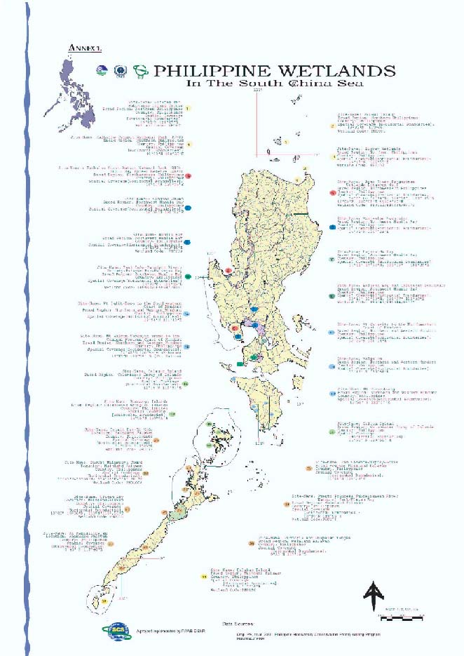
2 NATIONAL REPORT ON WETLANDS IN SOUTH CHINA SEA PHILIPPINES
The total biodiversity of Philippine wetlands is comprised of 1,616 species of aquatic plants and 3,675
species of aquatic fauna (DENR, 1997). But these numbers include those species that originate in
marine and brackish waters. The amount and extent of biological data available for inland waters are
not commensurate to the physical extent of inland waters, and where available, there is uneven
representation of data (e. g., some areas are more studied than others are). Most information about
Philippine wetlands consists of inventories with very limited ecological assessments and analysis
(Santos-Borja, 2002). Figure 1 shows Map of Wetlands Connected to the South China Sea.
Figure 1
Map of Wetlands Connected to the South China Sea.
2.2
Philippine Wetlands of International Importance
Four Philippine wetlands of international importance are recognized under the Ramsar Convention.
These are the Tubbataha Reef Marine National Park in Palawan, Olango Island Wildlife Sanctuary in
Cebu, Naujan Lake National Park in Oriental Mindoro, and, Agusan Marsh Wildlife Sanctuary in
Northeastern Mindanao. Additionally, there are several peat swamps, or more accurately freshwater
swamps with peat, found in the Sab-a basin in southern Leyte, in Liguasan Marsh and Agusan Marsh
in Mindanao.Unfortunately, none of these are linked to the South China Sea.
Reversing Environmental Degradation Trends in the South China Sea and Gulf of Thailand
NATIONAL REPORT ON WETLANDS IN SOUTH CHINA SEA PHILIPPINES 3
2. SITES
PRIORITIZATION
Based on a review of past, current and continuing projects, studies on economic valuation, legislation,
institutional and administrative arrangements and the GIS database and other information, it appears
that a lot of information resources are available. However, the quality and reliability of this information
remains to be validated. Some of the information is old (e.g., directory of Philippine wetlands from
1990) while some is simply absent (e.g., data on half of the wetlands in the directory are not
available). In the initial listing of Philippine wetlands, 63 sites were identified, of which 11 sites were
directly or indirectly connected to the South China Sea. The most recent validated data would be from
the PBCPP (Ong et al. 2002) where the 28 sites were identified. This was supplemented by
information from Key Conservation Areas identified by Mallari et al (2001), where threatened birds
occupy wetlands connected to the South China Sea, and by Scott (1989), Davies et al., (1990) and
Talaue-McManus (2000).
Furthermore, as discussed earlier regarding the level and quality of information on Philippine
wetlands; as exemplified by most recent data on Manila Bay where it is at least six- years-old and
referred to wetland types other than those that are of immediate concern to the South China Sea
project. This is a recurring theme throughout the search for data on the three wetland habitats and
ecosystems. Thus the subsequent discussions are still based mainly on the biodiversity of coral reefs,
mangroves, seagrass and seaweeds.
2.1
Identification Process of Initial Long List
The Philippines implemented the Philippine Biodiversity Conservation Priority-setting Program
(PBCPP), a priority-setting process that identified 170 integrated terrestrial and inland waters and 36
integrated marine priority areas for biodiversity conservation (Ong et al. 2002). On top of this, another
206 sites were identified by the thematic working groups, which later formed the basis of the
integrated priority areas. This was a second iteration of the country's National Biodiversity Strategy
and Action Plan (NBSAP). The Protected Areas and Wildlife Bureau of the Department of
Environment and Natural Resources (PAWB-DENR) spearheaded the PBCPP, with technical
assistance from the Biodiversity Conservation Program of the UP Center for Integrative and
Development Studies (BCP-UPCIDS) and the Philippine Program of Conservation International (CI
Phil).
The consensus building process of the PBCPP began in January 2000 and culminated in December
2000 during an international workshop attended by more than 200 local and international natural and
social scientists from more than 100 institutions. The results of this workshop were further refined and
the output released to the public in September 2002. The PBCPP used published information and
experts' opinion to determine priority areas according to taxa (plants, arthropods, fishes, amphibians,
reptiles, birds and mammals) and themes (inland waters, marine and socio-economic). A total of 206
thematic and taxa-based priority areas were identified. These thematic and taxa-based priority areas
were then overlaid to produce polygons of areas that encompassed themes and taxa, thereby
producing the 206 national level priority areas (170 terrestrial and inland waters and 36 marine priority
areas). Detailed information about the methodology used in setting the priorities is available at Ong et
al. 2002.
Twenty-eight of these priority areas were initially identified as meeting the requirements of being a
Philippine wetland and at the same time directly linked to the South China Sea (SCS). This initial list
was further supplemented by information about additional areas identified in the Key Conservation
Sites by Haribon Philippines and Birdlife International (Mallari et al. 2001), the Transboundary
Diagnostic Analysis (Talaue-MacManus 2000) and the Directory of Philippine Wetlands prepared by
the Davies et al. (1990) and Scott (1989), bringing the list to a total number to 33 areas as part of the
initial l list. From the 33 areas short-listed for consideration as an investment priority by the South
China Sea project; these were grouped based on their regional locations. Nine regional groupings,
with the number of specific sites indicated in parenthesis, were identified:
1) Northern Philippines (4) - Batanes and Babuyanes Group of Islands, Buguey Wetlands,
Palui Island and Kalbario Patapat National Park
2) Northwestern Philippines (2) - Agno River-Pangasinan Wetlands-Lingayen Gulf, Bataan
Natural Park -Subic Bay Forest Reserve
3) Northwest Manila Bay (3) - Candaba Swamp, Mariveles Mountains, Manila Bay
Reversing Environmental Degradation Trends in the South China Sea and Gulf of Thailand
4 NATIONAL REPORT ON WETLANDS IN SOUTH CHINA SEA PHILIPPINES
4) Southwest Manila Bay (1) - Laguna Lake
5) Taal Lake-Pansipit River-Balayan Bay-Batangas Bay (2) - Taal Lake-Pansipit River and
Balayan Bay-Calatagan Peninsula
6) Northern and Western Mindoro (5) - Mt. Calavite, Mt. Iglit-Baco, Mt. Halcon-Sablayan,
Malpalon, Mt. Hinunduang,
7) Calamianes Group of Islands (3) - Caluit Island, Busuanga Island and Culion
8) Mainland Palawan (7) - Bacuit Bay-El Nido, Malampaya Sound, San Vicente-Taytay-
Roxas forests, Puerto Princesa Subterranean River National Park, Ulugan Bay,
Anapalan-Victoria Ranges, Mt. Mantalingahan
9) Balabac Group of Islands (1) - Balabac
In the process of selecting the areas for consideration as an investment area for the next phase of the
South China Sea project, the following steps were undertaken to narrow down the priority areas. The
first step was to go back to the title of the project, "Reversing Environmental Degradation of the South
China Seas and the Gulf of Thailand," to guide the selection process. The National Wetlands
Committee agreed that reversing environmental degradation trends include:
1. Maintenance and protection of remaining pristine environment, which encompass on-site
interventions to protect existing biodiversity.
2. Restoration of degraded environment, which encompasses on-site interventions to
restore lost biodiversity. Restoration activities refer to activities that will lead to the
recovery and rehabilitation of degraded areas and the delisting of threatened species
from the threatened category because their population level has increased to a level that
ensures their survival.
3. Prevention of degradation by removing and reducing the cause of degradation that
encompass off-site interventions to remove/reduce cause of loss of biodiversity to
maintain the good condition of the site. Prevention activities remove factors that threaten
the population of priority species. Prevention activities involve off-site activities, dealing
with factors outside of the areas and species being protected.
It was also agreed that based on the above definitions, prevention activities should form part and
parcel of any restoration or protection and maintenance activities, since investments made in
restoration or protection and maintenance will be negated if no prevention activities are undertaken
simultaneously, i.e. factors that contribute to the degradation of good sites, and those that further
degrade degraded areas are not removed.
Furthermore, the National Wetland Committee also agreed that environmental degradation is
measured in terms of:
1. Loss of biodiversity
2. Pollution
3. Decrease in fish productivity
For this element of the selection, loss of biodiversity is the primary determinant in the selection of an
area while the pollution and decrease in fish productivity were secondary considerations. Loss of
biodiversity includes the loss of habitat in terms of the area of such habitats (quantity), the status of
the habitat (quality), the number of threatened species found in the said areas (quantity), and the level
of diversity of species found in the said areas, particularly of endemic species (quality). Philippine
wetlands that qualify under the South China Sea project are those wetlands that that directly
contribute to the environmental degradation of the South China Sea. Areas that are recipient of South
China Sea effects s were excluded in the selection process.
Once the National Wetland Committee agreed upon these parameters, the 33 short-listed areas were
reviewed again. Immediately, the Buguey wetlands, Palaui Island and the Batanes and Babuyan
Islands in Northern Luzon were dropped off the list as they were determined to be affected by the
South China Sea rather than contributing to the environmental degradation of the South China Sea.
The fourth area, the Kalbario-Patapat National Park was more an offsite source of degradation and its
relationship to the South China Sea was several steps removed. This had the effect of removing the
Northern Philippines as a region for consideration.
Reversing Environmental Degradation Trends in the South China Sea and Gulf of Thailand
NATIONAL REPORT ON WETLANDS IN SOUTH CHINA SEA PHILIPPINES 5
The six sites from Northern and Western Mindoro were also removed from the list, as five were
forests on mountains and several steps removed from the South China Sea. This also had the effect
of removing Mindoro from the next level of analysis.
The forests in the mountains of mainland Palawan (San Vicente-Taytay-Roxas, the Anapalan-Victoria
Ranges and Mount Mantalingahan) were also excluded from the next level of selection as these were
more offsite sources of degradation and their relationship to the South China Sea was several steps
removed.
Balabac was also excluded from the next level of selection as very little information is available about
the site compared to the other candidate sites, thus more energy would be required before a decision
can be made regarding Balabac.
The remaining areas in the six regions were then classified if they require restoration activities,
protection, and/or maintenance activities.
Restoration:
1. Northwest Manila Bay
Candaba Swamp-Pampanga River-Mariveles Mountains-Manila Bay
2. Southwest Manila Bay:
Laguna Lake-Pasig River-Manila Bay-Northwest Cavite
3. Northwestern
Philippines
Pangasinan Wetlands-Lingayen Gulf-Agno River
4. Mainland
Palawan
Malampaya Sound
Maintenance:
1) Northwestern
Philippines
Zambales Coast-Subic Bay-Bataan National Park
2) Taal Lake-Pansipit River-Balayan Bay-Batangas Bay
3) Calamianes
4) Mainland
Palawan
El Nido
PPSRNP/Ulugan Bay
Prevention:
1) Northwestern
Philippines
Amburayan-Abra Rivers draining into the Ilocos Coast
Pangasinan Wetlands-Lingayen Gulf-Agno River
Zambales Coast-Subic Bay-Bataan National Park
2) Northwest Manila Bay
Candaba Swamp-Pampanga River-Mariveles Mountains-Manila Bay
3) Southwest Manila Bay:
Laguna Lake-Pasig River-Manila Bay-Northwest Cavite
4) Taal Lake-Pansipit River-Balayan Bay-Batangas Bay
5) Calamianes
6) Mainland Palawan Areas
El Nido
Puerto Princesa Subterranean River National Park/Ulugan Bay
Malampaya Sound
2.2
Selection of Priority Areas Based on the Type of Reversing Activities
The rationale for the grouping was to make the selection fairer by comparing apples with apples, i.e.,
by comparing areas that require similar primary activities whether restoration, or for protection and
maintenance.
Reversing Environmental Degradation Trends in the South China Sea and Gulf of Thailand
6 NATIONAL REPORT ON WETLANDS IN SOUTH CHINA SEA PHILIPPINES
2.2.1 Restoration Activities
From the medium list of six regions, four were identified as priority for restoration, of which two areas
were selected as priority areas for investment for different reasons. One is the Southwest Manila Bay
while the other is the Malampaya Sound. Southwest Manila Bay was selected as a model problem
area. From a biodiversity point of view, Manila Bay would seem dead if its current biodiversity status
were assessed. However, it is an important biodiversity area historically and data from the PEMSEA
and MBEMP-TWG-RRA (2004) report indicates that Manila Bay still contains remarkable biodiversity
and performs critical environmental services. It is also the type locality for the Olive Ridley Turtle. It is
a model problem area because of the onslaught of unplanned development, the multitude of
stakeholders with competing vested interests in the sub-region and the scale of the area that needs to
be covered, among others.
Furthermore, the National Wetland Committee firmly believes that if Manila Bay can be successfully
restored, then there is no place else in the South China Sea and the Gulf of Thailand where
restoration work cannot be done. Lessons learned from the restoration efforts in Manila Bay could be
invaluable to the rest of the South China Sea and the Gulf of Thailand where similar conditions exist.
On the other hand, comparatively speaking, Malampaya Sound is in the early stages of degradation
and thus it would take less effort and resources to restore it back to good condition, than Manila Bay.
Hence it is considered to be a model demonstration site since the size of the area under consideration
is manageable, the level of awareness and participation of stakeholders involved are comparatively
high than in other areas.
2.2.2 Protection and/or Maintenance Activities
From the medium list of six sub-regions, four were identified as priority for protection and/or
maintenance activities, of which three areas were selected as priority areas for investment, again for
different reasons. These areas are: 1) Taal Lake-Pansipit River-Balayan Bay-Batangas Bay, 2)
Calamianes, and, 3) PPSRNP-Ulugan Bay.
Taal Lake-Pansipit River-Balayan Bay-Batangas Bay was selected as a priority for protection and
maintenance activities because if present degradation trends continue, then it is likely to go the way of
Manila Bay. Hence intervention is urgently needed to ensure that the degradation trends are reversed
as soon as possible.
On the other hand, the biodiversity of the Puerto Princesa Subterranean River National Park
(PPSRNP)/Ulugan Bay, and the Calamianes in Palawan are in better shape than the other regions,
and thus would require less effort and resources to maintain in their current condition. Between the
PPSRNP/Ulugan Bay and the Calamianes, PPSRNP has the advantage of being declared a World
Heritage Site, and Ulugan Bay is proposed to be included as part of expanded PPSRNP, and
consequently as part of the World Heritage Site.
2.2.3 Final Site Selection for Investment
In the final selection of sites for the development of investment proposals, the choices were narrowed
down to two areas, the Malampaya Sound for restoration, and the Taal Lake-Pansipit River-Balayan
Bay-Batangas Bay was selected as a priority for protection and maintenance. Other factors such as
local government unit interest and local community participation were taken into consideration in the
final selection.
3.
THREATS TO WETLANDS IN THE PHILIPPINES
3.1
Direct Causes of Loss of Wetlands
With this framework as a guide, the different factors identified in previous assessments undertaken
about the threats to wetlands and causes of wetlands loss, were reformulated as the major direct
causes of wetland loss in the Philippines (DENR, 1997; Santos-Borja, 2002; Ong et al., 2002).
However, these are again a broad identification and not specific to the three type of habitats and
ecosystems in the South China Sea context:
Reversing Environmental Degradation Trends in the South China Sea and Gulf of Thailand
NATIONAL REPORT ON WETLANDS IN SOUTH CHINA SEA PHILIPPINES 7
1)
Habitat Loss and Deterioration
a) Conversion of wetlands into other land uses with perceived higher economic value
such as aquaculture farms, resorts and reclamation areas, among others. The
operations of these economic activities further exacerbate the destruction of
wetlands by ensuring that the process becomes irreversible when this leads to
further pollution due to the indiscriminate use of artificial feeds and overstocking.
b) Diversion of rivers for irrigation and the construction of dams that leads to -
i. Detrimental impacts on the movement of migratory fish species
ii. Drying up of riverbeds
iii. Modification of the habitat of the riverine flora and fauna
2)
Resource Use and Exploitation
a) Over
fishing
b) Over harvesting of forest products
c) Over harvesting of freshwater products
3)
Pollution and Climate Change
a) Pollution from domestic, industrial and agricultural sources that in turn lead to water
quality problems like massive algal blooms and oxygen depletion.
4)
Introduction of exotic species and disease
a) Leads to the displacement if not extinction of endemic and native species through
i. Predation
ii. Competition for food and other resources
iii. Proliferation due to lack of natural predators.
3.2
Indirect Causes of Loss of Wetlands
In turn, these direct causes have underlying causes as well. Some of these underlying causes are:
1)
Socio-economic pressures
a) Poverty
b) Illiteracy
c) Population
d) National and local politics
2)
Environmental Policy and Regulations
a) Limited if not lack of enforcement
b) Where present, it is biased towards development at all cost
c) Subsidies provided to some economic activities such as the promotion of
aquaculture in the 1970s and 1980s which led to the wholesale conversion of
mangroves into fishponds.
4.
LEGISLATION, INSTITUTIONAL AND ADMINISTRATIVE ARRANGEMENTS
Laws that directly apply to wetlands are few and are more frequently encountered in other general
laws that regulate access to natural resources, jurisdictions over territory and management, and
prohibition of certain acts. Examples are:
1. Resource access provisions of the Philippine Constitution,
2. Congressional acts dealing with water bodies that comprise wetlands,
3. Regulations granting tenure
4. Water code
5. Foreshore
regulations
6. A myriad of environmental regulations that affect wetlands by licensing or restricting actions
that eventually impact many ecosystems as well but without referring to wetlands specifically.
Any one or more of these regulations address broader issues with wide-ranging implications on the
use of resources including in these areas, such as the water code. Examples are laws requiring
environmental impact assessments, building permits, sanitation code, wildlife act, cave act and many
other environmental laws.
Reversing Environmental Degradation Trends in the South China Sea and Gulf of Thailand
8 NATIONAL REPORT ON WETLANDS IN SOUTH CHINA SEA PHILIPPINES
4.1
Legal provisions with direct impact on wetlands
Legal provisions by themselves may not have an impact on wetlands unless implemented. These are
a potential backbone for any advocacy to protect and conserve wetlands. Due to their breadth of
scope and lack of enforcement, however, enforcement agencies have had a great deal of discretion in
choosing which areas and which acts to enforce. This exercise of discretion can be seen in two ways -
- agencies can strategize to make maximum use of their enforcement resources, or they can act only
on the basis of complaints or personal preferences. As such, the identification of gaps may be difficult
since there are many laws that remain unenforced but do not quite constitute a gap in the legislation.
What needs to be studied is whether these laws do, indeed, constitute gaps simply because they are
impossible to fully implement. It is not, therefore, sufficient to say that there are laws and
implementation is lacking, when the very deliberation of the law itself did not consider the realistic
capacity to enforce.
4.2
Access to the resources
Ownership of wetlands is necessarily the primary factor in assessing whether degradation can be
arrested. The Philippine Constitution and the Water Code of the Philippines are both clear in declaring
wetlands as part of the public domain and incapable of alienation, except for wetlands that are part of
ancestral waters, which became susceptible to open access and the tragedy of the commons. Lakes
and rivers were especially vulnerable as accelerated population growth put pressure on the drainage
and sewerage systems built for much lower numbers, and rivers began to double as sewer systems in
highly urbanized areas.
The problem of open access was dealt with by a provision that large-scale exploitation of all natural
resources in the public domain will only be undertaken by the State directly or in joint venture,
production sharing and co-production while small-scale utilization by Filipino citizens could still be
allowed by Congress through law. This small-scale utilization specifically included "cooperative fish
farming, with priority to subsistence fishermen and fish workers in rivers, lakes, bays and lagoons".
Such provision requiring democratization of access and equity in resource distribution was directly
relevant to the utilization of wetlands.
Among such laws that can be used to give flesh to this mandate of the Constitution are the Local
Government Code and the Philippine Fisheries Code of 1998. The Local Government Code allows
the local council, or Sangguniang Bayan, to grant fishery privileges to erect fish corrals, oyster,
mussels or other aquatic beds or bangus fry areas, within a definite zone of the municipal waters, as
determined by it. The Philippine Fisheries Code of 1998 also prioritizes qualified fishing cooperatives
and/or associations as well as small and medium enterprises as defined under Republic Act No.
8289, in the section governing the disposition of lands for fishery purposes.
Other legislation that has great impact on wetlands, specifically tidal flats, is the Public Land Act that
provides for foreshore leases. The foreshore includes tidal flats and estuaries, which shall be
disposed of to private parties only by lease and not otherwise and only upon a declaration by the
President, upon recommendation by the Secretary of the Department of Environment and Natural
Resources, that such foreshore land is not necessary for public service. The lease contract must
contain a provision that easements reserved by existing law or by laws enacted shall be respected.
The Civil Code of the Philippines provides for easements of five meters from the high water line on
coasts of agricultural lands and twenty meters on coasts of forestlands that must be respected.
Foreshore areas are also dealt with in the Water Code and the Forestry Decree of 1975. Apart from
regulating the use and disposition of foreshore areas, the Water Code also has wide-ranging
implications if religiously enforced. It identifies state ownership of rivers and their natural beds,
continuous or intermittent waters of springs and brooks running in their natural beds, and the beds
themselves; natural lakes, lagoons and seawater.
From this enumeration, virtually all wetlands are already covered. All uses of these state properties
would require a water permit to be legal with very few exceptions that refer to domestic, small-scale
usage. However, the law was not accompanied by the resources needed to undertake such massive
regulatory infrastructure, especially considering a very long and broken up coastline as that of the
Philippines.
Reversing Environmental Degradation Trends in the South China Sea and Gulf of Thailand
NATIONAL REPORT ON WETLANDS IN SOUTH CHINA SEA PHILIPPINES 9
The recently passed Clean Water Act may also be of use in wetland protection. Specifically the
provisions that prohibit dumping of waste in, and the provisions directing the establishment of water
quality management areas, a national sewerage and septic waste management program, and the
imposition of wastewater discharge charges.
4.3
Management and conservation jurisdiction
The Philippine Fisheries Code defines municipal waters to include wetlands but exempts areas falling
under the National Integrated Protected Areas System (NIPAS) from the definition. As such, wetlands
of the public domain may either be municipal waters or protected areas. Inland waters and tidal flats
that are not NIPAS areas are municipal waters under the first part of the definition while lagoons fall
under the second part, whether the lagoon be part of a NIPAS area or not. For NIPAS areas that are
inland waters or tidal flats, jurisdiction over management is vested in the Protected Area Management
Board with specific mandates to the DENR. Both local government authorities who retain jurisdiction
over them in the exercise of their general welfare functions, and the Protected Area Management
Boards (PAMBs) who are responsible for biodiversity conservation and sustainable development, can
be seen to have different jurisdictional coverage over the same territory.
Due to lack of appropriation for the implementation of the NIPAS Act, however, many PAMBs of
wetland areas are hardly equipped with the technical and financial capacity for hard-nosed
management. Under the Clean Water Act, a four-person body called a governing board is mandated
to be established for designated Water Quality Management Areas. Apart from these, self-reporting,
permitting and other monitoring requirements can be used to pinpoint urgent problems with respect to
important wetlands. Certain government agencies are vested with jurisdiction over wetlands, but by
the nature of their function, view them not in terms of habitat and biodiversity, but in terms of their
value as real estate and economic commodity. These are the Public Estates Authority that have
jurisdiction over all reclamation projects, and as such has disposition of these prime properties, and
the Philippine Port Authority, which by its nature operates facilities in tidal flats. These are both
attached agencies of the Department of Public Works and Highways, which is accountable for these
jurisdictions in terms of environmental impact only in the Environmental Impact Assessment process.
Management and conservation by municipal authorities range from very good management to
neglectful, unregulated and permissive exploitation. Because of the demonstration of hugely
successful local government management in many areas, the likelihood of successful management of
wetlands may lie in local government units hands, particularly since these areas are not contiguous
and should be seen as integral to the entire territory of the local government units rather than isolated
patches of water bodies.
Other agencies have specialized jurisdictions over wetlands. Those involved in scientific research
include the Philippine Council for Aquatic and Marine Resources Development - Department of
Science and Technology and the state universities. On the other hand, agencies involved in
enforcement include the Philippine National Police (PNP) Maritime Command -Department of Interior
and Local Government that took over the police functions of the Philippine Coast Guard over
municipal waters; and, the Philippine Coast Guard, which enforces fisheries laws in the high seas,
ensures maritime safety, and marine pollution laws. Agencies involved in institutional coordination on
aspects relating to fisheries and coastal resources management include the Presidential Commission
on Anti-Illegal Fishing and Marine Conservation, the Inter-Agency Task Force on Coastal Environment
Protection, and the Marine and Ocean Affairs- Department of Foreign Affairs.
4.4 Enforcement
Problems
Public interest lawyers, local governments and other concerned citizens and groups may use existing
and applicable laws to protect specific wetlands that are deemed important, but their total
enforcement to protect most wetlands as habitats is limited. This is not only due to lack of resources
but a failure in the lawmaking process to identify prohibitions that are realistic and which will remain in
the books. Nevertheless, the Civil Code does state that laws are only repealed by subsequent ones,
and their violation or non-observance shall not be excused by disuse, or custom or practice to the
contrary. As such, while it is frustrating to hear about unimplemented laws, the opportunity they
present is much better than not having them at all.
Reversing Environmental Degradation Trends in the South China Sea and Gulf of Thailand
10 NATIONAL REPORT ON WETLANDS IN SOUTH CHINA SEA PHILIPPINES
The Civil Code enumerates all the officers and agencies that the law deputizes to enforce it along with
other fishery regulations. Other competent government officials and employees, barangay leaders
and officers and members of fishing associations who have undergone training on law enforcement
may be designated in writing by the Department of Agriculture as deputy fish wardens in the
enforcement of this Code and other fishery laws, rules and regulations. Furthermore, the law
mandates that the Department of Justice embark on a program to strengthen the prosecution and
conviction aspects of fishery law enforcement though augmentation of the current complement of
state prosecutors and through their continuous training and reorientation on fishery laws, rules and
regulations.
Enforcement depends on a strong awareness among enforcers as to what the law provides along with
a strong belief that it is a law that will be beneficial to people. Due to the many different overlaps in
jurisdiction, inconsistencies and the necessity to harmonize many different laws governing the same
resources, enforcement agencies have not been updated on the latest legal interpretation.
4.5
Other General Laws that may apply to wetlands
Seen from the perspective of reducing the degradation factors of wetlands, a great deal of attention
needs to be paid to land based causes of degradation. As such, the forestry code, the Philippine
Mining Act of 1995, easement provisions under various laws including the Civil Code, the Ecological
Solid Waste Management Act and the Environmental Impact Assessment System are only a few that
effect n wetlands. These effects are felt especially where solid waste, effluents and tailings are
allowed to collect and damage tidal flats, estuaries, and lagoons. These are laws useful to local
implementers and managers, but the processes involved in the licensing, permitting and planning in
each area and project are tedious to use on a countrywide scale to protect wetlands. Also, a general
enforcement of good laws such as the Ecological Solid Waste Management Act will no doubt have an
incidental, but nevertheless gargantuan, impact on wetlands. Those wetlands to which urbanized and
populated areas drain into including tidal flats, which, by the nature of wind and wave patterns tend to
gather more solid waste, will necessarily benefit from a strict implementation of the law.
4.6 Local
Policies
The Manila Bay, Laguna Lake and the Pasig River are three bodies of water that have been under
several local policies and policy disputes, and the variety of their experiences is instructive of what
can work. The major problems confronting these connected wetlands are drainage, run-off and
sewerage from the surrounding areas, notably the Metropolitan Manila area. The Laguna Lake
Development Authority has a basin-wide mandate for it to exercise the functions required to affect the
lake. It has full authority to issue permits for the use of the lake and for developments in the whole
catchment area of the lake. Its multiple uses had already been subjected to economic valuation
studies and innovative policies such as user fee systems and permits for the release of effluents have
been initiated with favorable results. The Pasig River and Manila Bay continue to act as the sewerage
system of metro Manila, and the projects for clean up, have failed to take this major contributing factor
into consideration. A closed season for commercial fisheries was declared in the entire Manila Bay in
the 1990s and fully lapsed after five years without having been enforced. Despite the state of its
waters, though, other uses such as recreational, navigational and fishing still remain.
The Lingayen Gulf Coastal Area Management Program is a program that operated over a period of
six (6) years and covered twenty (20) municipalities. It generated a database for planning, with data
on fisheries, and attempted to establish regulations based on catch per unit effort and maximum
sustainable yields. The program later directed efforts towards education and the generation of local
political will when the first plans proved too difficult. The National Economic Development Authority
uses the Lingayen Gulf Coastal Area management Program experience as a model since it created
an institutional arrangement to coordinate planning and implementation resulting in policy directives to
reduce and eliminate commercial fishing within the Gulf, improved law enforcement and reduced
levels of illegal fishing, a detailed integrated management plan for the municipal waters and coastal
resources of Bolinao, guidelines for improved aquaculture development and mangrove reforestation
projects.
Reversing Environmental Degradation Trends in the South China Sea and Gulf of Thailand
NATIONAL REPORT ON WETLANDS IN SOUTH CHINA SEA PHILIPPINES 11
As a result of being a prime diving destination, Balayan Bay has had several marine sanctuaries
declared in the municipalities of Bauan, Mabini and Tingloy. While the sanctuaries themselves cover
areas further at sea than the tidal flats, regulations usually also affect the tidal flat. Some of these
sanctuaries are covered by private and non-governmental agreements among resource users. These
agreements serve as the management regime and regulatory scheme for the sites. Some such
examples are the resource management agreement under the sanctuary ordinance granted to
peoples' organizations, clam stewardship agreements between non-government organizations
seeding giant clams and the resort owners, and other such private initiatives. To date, no user fee
system has been established for the lucrative diving industry as the dive sites are scattered over
several municipalities and the resorts are concentrated on the mainland, thereby risking an unequal
benefit for sanctuary managers in outlying islands. A more integrated approach, however, is crucial at
this stage when rapid industrialization is taking place on the other side of the bay from the
sanctuaries. It would seem that massive development of heavy industries such as cement plants,
power plants and other manufacturing factories are slated to be constructed facing the bay. The lack
of coordination between the small fishermen on the western side and those employed by the diving
industry and the resorts on the eastern side might result in long-term degradation of the resource
base. Batangas province has an integrated Fisheries and Aquatic Resources Management Council
created in pursuit of the Fisheries Code, but no other bay-wide entity has the mandate or authority to
specifically address these problems.
The degradation of resources in Taal Lake galvanized local community action in pressing for more
regulation. The early 90s saw the enactment of Provincial Ordinance No. 4 that regulates fishing on
the lake as well as other uses such as fishcage development and the dismantling of fishpens on the
Pansipit River in 1997 and 2001. These dismantlings were also in consonance with the Master Plan
for Development prepared for the lake by the defunct Presidential Commission on Tagaytay-Taal. The
management plan, therefore, has no official imprimatur. The lake area was proclaimed a protected
landscape in 1997. Currently, management jurisdiction rests with the PAMB with the province
retaining ordinance and local taxation power to promote its general welfare. The nine towns and two
cities also create similar ordinances, such as the garbage ordinance and the ordinance prohibiting jet
skis.
Palawan is the ideal example of delegation of management powers over wetlands to the local
government. In 1993, the DENR entered into a Memorandum of Agreement with the City of Puerto
Prinsesa over what was then 3,900 hectares of the Puerto Princesa Subterranean River National Park
(PPSRNP). The agreement worked, with the City underwriting a third of the cost of park operations
while park revenues covered the rest. This is a good example of national government support for local
management that has resulted in conservation. The PPSRNP has also increased considerably in size
from 3,900 hectares to approximately 22,000 hectares. Most of the area of expansion is already
covered by Certificates of Ancestral Domain Claims (CADC) where Ancestral Domain Management
Plans have been approved by the DENR, recognized by the City and are in full force and effect. Here,
then, is a situation where management is apportioned among the City for the most part, the
indigenous peoples, and the DENR for enforcement in the expansion areas not covered by CADC.
The clarity and consensus among the groups as to the jurisdiction and authority of each and the
representativeness of community, local government and national government stakeholders in the
management seems to be working.
4.7
Strategies in reduction of degradation factors
Considering a long history of distrust of the law and the legal system among those primarily
dependent on wetland resources, there is a need for creative, appropriate and practicable policies as
well as strategic application of existing law. As can be seen from the above analyses, the applicable
laws are either too broad to be practicably enforced or too strict to be implemented. Community
initiatives and meta-legal strategies are important so that other laws with indirect impact can be used
whenever a wetland area is threatened by particular activities, such as the industrial development
proposals. Apart from communities, composite teams have been proven to work in proper
implementation of fishery laws in marine areas. Based on the experience and general capacity to
enforce, there are many available options for the protection of wetlands and the reduction of
degrading factors thereon. Projects that threaten wetlands directly can be questioned under any
number of regulatory laws from the Environmental Impact Assessment System to the water code,
local government requirements and many other laws.
Reversing Environmental Degradation Trends in the South China Sea and Gulf of Thailand
12 NATIONAL REPORT ON WETLANDS IN SOUTH CHINA SEA PHILIPPINES
The Philippines is a Contracting Party to the Ramsar Convention, Convention on Biological Diversity,
the Basel Convention, and the Convention on Migratory Species, among the many international
agreements the country has entered into. In line with the country's obligations under the RAMSAR
Convention, four sites have been designated as wetlands of international importance, with two of
these having a peripheral impact at best on the South China Sea, particularly Lake Naujan in Mindoro
and Tubattaha Reefs in Palawan.
Pursuant to Department Administrative Order 97-17 prescribing the criteria for selection of wetlands
critical to biodiversity, 133 sites have been selected. As with any government agency, the PAWB-
DENR has limited resources to spread out to as many as 133 sites, despite their importance. As such,
it may be well to prioritize those sites to determine interventions that would be strategic and highly
selective. An example, for waterbirds, would be to assess topographical maps for potential nesting
and roosting sites and mark off only a small part of some wetlands for on-the-ground protection
activities. Without substantial infusions of funding, the designation of these sites critical to biodiversity
is in danger of remaining paper declarations. These identified habitats can then be endorsed to local
governments or even local volunteer groups with merely the guidance of the national level agencies
as to their importance and means of protection.
In general, management of many wetlands still seems to be tied up with management of the
associated ecosystems for tidal flats, and for lakes and rivers, in integrated ways such as Fisheries
and Aquatic Resource Management Councils, or integrated local ordinances of the towns with territory
on the coasts of the lakes or lagoons. With rivers, catchment area management seems to be the most
effective management solution so that the policies that have general application can be applied not
only with respect to the wetland itself but to activities in the catchment area affecting the wetland. One
prime example is the catchment area management of the Puerto Princesa Subterranean National
Park.
In all these instances, it bears noting that the best policies can only see proper implementation with a
management structure: (a) that is locally based but nationally endorsed; (b) that understands the
flexibility required in policy application thereby having the ability to focus on certain regulations with
the greatest impact, and, (c) that has a consensus building mechanism and participation processes
among the multiple users of the resource.
Another important part of a workable implementation strategy would be to send a message that
breaking the law would no longer be tolerated and would be met with punishment. Choosing a solid
law, fully enforcing it and sustaining enforcement would focus efforts of the multi-sectoral teams
instead of dissipate energies on the breadth of regulations. In choosing the law to fully implement, one
must be reminded that the implementation should be fair and consistent, that observance of the law
should bear visible results, and that it is realistic. Implementation of this one law could serve as the
lynch pin for other violations and destructive activities. In the country, one such law that sees
consistent implementation and observance is the vehicle registration requirements. In the way that
smoke-belching regulation was tied up with this requirement, the government hopes to use the
registration process to arrest smoke belching. If boat licensing would be implemented the same way,
and boats can be checked while near shore or docked, a good number of fishery violations could be
prevented. It may well be that such a lynch pin law would be the provisions of the water code which
make the obstruction of waterways a criminal act. The same obstruction is also penalized in the
Fisheries Code.
A National Wetlands Policy will surely help rationalize laws and policies on access to wetland
resources, management jurisdictions and enforcement, but it should also consider a menu of options
for institutions as close to the ground as possible, which can be used appropriately and in a timely
manner; in order to protect specific wetland areas and their associated ecosystems.
A National Wetlands Action Plan had been developed by PAWB-DENR, however this has not been
subjected to a wider stakeholder consultation, thus had remained unimplemented in general. This will
be part of the work of the newly created National Wetlands Committee that the South China Sea
project has established.
Reversing Environmental Degradation Trends in the South China Sea and Gulf of Thailand
NATIONAL REPORT ON WETLANDS IN SOUTH CHINA SEA PHILIPPINES 13
REFERENCES
Calumpong, H. P. 1994. Status of mangrove resources in the Philippines. pp. 215-228. In: C. R.,
Wilkinson, S. Sudara, L. M. Chow (eds). Proceedings of the Third ASEAN-Australia Symposium
on Living Coastal Resources, May 16-20, 1994, Chulalongkorn University, Bangkok, Thailand.
Consultative Forum. Living Coastal Resources of Southeast Asia: Status and Management
Report.
Davies, J., P.M. Magsalay, R. Rigor, A. Mapalo and H. Gonzales. 1990. A Directory of Philippine
Wetlands: A preliminary compilation of information on wetlands of the Philippines. Cebu City:
Asian Wetlands Bureau Philippines and Haribon Foundation.
DENR. 1997. National Biodiversity Strategy and Action Plan/Philippine Biodiversity: An Assessment
and Action Plan. Bookmark, Inc. Makati, Philippines. 298 pp.
Environmental Science for Social Change (ESSC). 1999. Decline of Philippine Forest. The
Bookmark, Inc., Makati City.
Fortes, M. D. 1994. Status of seagrass beds in ASEAN. pp. 106-109. In: C. R. Wilkinson (ed)
Proceedings of ASEAN-Australia Symposium on Living Coastal Resources. 3rd October 1994,
Bangkok, Thailand. Consultative Forum. Living Coastal Resources of Southeast Asia: Status and
Management Report.
Gomez, E. D., P. M. Alińo, W. Y. Licuanan, H. P. Yap. 1994. Status report of the coral reef of the
Philippines. pp. 57-76. In: C. R., Wilkinson, S. Sudara, L. M. Chow (eds). Proceedings of the 3rd
ASEAN-Australia Symposium on Living Coastal Resources, May 16-20, 1994, Chulalongkorn
University, Bangkok, Thailand. Consultative Forum. Living Coastal Resources of Southeast Asia:
Status and Management Report.
Hall, R. 1998. The Plate tectonics of Cenozoic Southeast Asia and the distribution of land and sea.
Pp. 99-132. In: R. Hall and J. D. Holloway (eds.) Biogeography and Geological Evolution of
Southeast Asia. Backhuys Publishers, Leiden, The Netherlands.
Heaney, L. R., and P. S. Ong., R. A. Mittermeier and C. G. Mittermeier. 1999. The Philippines. Pp.
308-315. In: R. A. Mittermeier, C. G. Mittermeier and N. Myers (eds). Hotspots: Earth's
biologically richest and most endangered terrestrial ecoregions. Conservation International and
Cemex, Mexico City.
Mallari, N. A. D., B. R. Jr. Tabaranza, and M. J. Crosby. 2001. Key Conservation Sites in the
Philippines: A Haribon Foundation and Birdlife International Directory of Important Bird Areas.
Bookmark, Inc., Makati City, Philippines.
Myers, N., R. A. Mittermeier, C. G. Mittermeier, G.A. B. Fonseca and J. Kent. 2000. Hotspots:
Earth's biologically richest and most endangered terrestrial ecoregions. Nature: 403: 853-858
Ong, P. S. 2004. The State of Philippine biodiversity: Changing mindsets amidst the crisis. Paper
presented at the 7th International Conference on Philippine Studies, June 16-19, 2004, Leiden,
The Netherlands.
Ong, P. S., L. E. Afuang and R. G. Rosell-Amball (eds.) 2002. Philippine Biodiversity Conservation
Priorities: A Second Iteration of the National Biodiversity Strategy and Action Plan. Department
of Environment and Natural Resources-Protected Areas and Wildlife Bureau, Conservation
International Philippines. Biodiversity Conservation Program University of the Philippines Center
for Integrative and Development Studies and Foundation for the Philippine Environment. Quezon
City, Philippines.
PEMSEA AND MBEMP TWG-RRA. 2004. Manila Bay: Refined Risk Assessment. PEMSEA
Technical Report No. 9. 168 pp. Global Environment Facility/United Nations Development
Programme/International Maritime Organization Regional Programme on Building Partnerships
in Environmental Management for the Seas of East Asia (PEMSEA) and the Manila Bay
Environmental Management Project (MBEMP) Technical Working Group for Refined Risk
Assessment (TWG-RRA), Quezon City, Philippines.
Roberts, C. M., C. J. McClean, J. E. N. Veron, J. P. Hawkins, G. R. Allen, D. E. McAllister, C. G.
Mittermeier, F. W. Schueler, M. Spalding, F. Wells, C. Vynne, T. B. Werner. 2002. Marine
biodiversity hotspots and conservation priorities for tropical reefs. Science 295: 1280-1284.
Reversing Environmental Degradation Trends in the South China Sea and Gulf of Thailand
14 NATIONAL REPORT ON WETLANDS IN SOUTH CHINA SEA PHILIPPINES
Santos-Borja, A. C. 2002. Inland Waters Group. pp. 47-48. In: P. S. Ong, L. E. Afuang and R. G.
Rosell-Amball (eds.) 2002. Philippine Biodiversity Conservation Priorities: A Second Iteration of
the National Biodiversity Strategy and Action Plan. Department of Environment and Natural
Resources-Protected Areas and Wildlife Bureau, Conservation International Philippines.
Biodiversity Conservation Program University of the Philippines Center for Integrative and
Development Studies and Foundation for the Philippine Environment. Quezon City, Philippines.
Scott, D. A. (ed) 1989. A Directory of Asian Wetlands. Gland, Switzerland and Cambridge, U. K.:
International Union for the Conservation of Nature and Natural Resources.
Talaue-McManus, L. 2000. Transboundary Diagnostic Analysis for the South China Sea. EAS/RCU
Technical Report Series No. 14. UNEP, Bangkok, Thailand.
Reversing Environmental Degradation Trends in the South China Sea and Gulf of Thailand


United Nations
UNEP/GEF South China Sea
Global Environment
Environment Programme
Project
Facility
NATIONAL REPORT
on
Wetlands in South China Sea
THAILAND
Mr. Narong Veeravaitaya
Focal Point for Wetlands
Department of Fisheries Biology
Faculty of Fisheries, Kasetsart University
50 Paholyothin Road, Bangkhen
Bangkok 10900, Thailand
NATIONAL REPORT ON WETLANDS IN SOUTH CHINA SEA THAILAND
Table of Contents
1. INTRODUCTION.............................................................................................................................1
2. STATUS OF WETLANDS IN THE GULF OF THAILAND .............................................................1
2.1 CHARACTERISTICS AND TYPES OF WETLANDS IN THE GULF OF THAILAND.....................................1
2.2 MAJOR THREATS TO WETLANDS.................................................................................................3
3. LEGAL ASPECTS AND INSTITUTIONAL FRAMEWORK REGARDING COASTAL
WETLANDS IN THAILAND............................................................................................................5
3.1 REVIEW AND ANALYSIS OF LEGAL ASPECTS RELEVANT TO WETLAND MANAGEMENT.....................6
3.2 INTERNATIONAL AGREEMENTS RELEVANT TO WETLAND MANAGEMENT ........................................9
3.3 REVIEW OF POLICIES AND CABINET RESOLUTIONS ON WETLAND MANAGEMENT IN THAILAND........9
3.3.1 Policy Framework..........................................................................................................9
3.3.2 Cabinet Resolutions Relevant to Coastal Wetland Management .................................9
3.4 REVIEW AND ANALYSIS OF INSTITUTIONAL FRAMEWORK ............................................................10
3.4.1 Government Line Agencies.........................................................................................10
3.4.2 Local Government Organization .................................................................................13
4. BIODIVERSITY IN NOTABLE WETLANDS OF THE GULF OF THAILAND .............................14
5. ECONOMIC VALUATION OF WETLANDS.................................................................................21
5.1 ECONOMIC VALUATION OF WETLANDS ......................................................................................21
5.2 POTENTIAL ECONOMIC USE OF WETLANDS UNDER THE PROJECT AREA .....................................21
6. PROPOSED STRATEGIC PLAN FOR WETLAND MANAGEMENT IN THE GULF OF
THAILAND....................................................................................................................................22
6.1 VISION ....................................................................................................................................22
6.2 MISSIONS................................................................................................................................22
6.3 STRATEGIC GOALS...................................................................................................................22
6.4 OBJECTIVES............................................................................................................................22
6.5 STRATEGIES AND MEASURES....................................................................................................22
6.6 INDICATORS OF SUCCESS ........................................................................................................24
6.7 PROCESSES FOR ENSURING SUCCESSFUL ADOPTION OF THE PROPOSED ACTION PLAN ................25
REFERENCES......................................................................................................................................25
List of Tables and Figures
Table 1
Types, Numbers and Areas of Wetlands in Each Region of Thailand
Table 2
Number of Flora and Fauna Found in each of the 13 Wetlands Identified
Table 3
Number of Flora and Fauna Found in 13 Wetlands and Identified as Globally Threatened
under IUCN Red List
Table 4
Types of Bird Species Found in 13 Wetland sites Identified
Table 5
Percentage of 13 Wetlands Classified by Type and Direct Use Value
Figure 1
Extent of Thai Wetland Sub-component under South China Sea Project
NATIONAL REPORT ON WETLANDS IN SOUTH CHINA SEA THAILAND 1
1. INTRODUCTION
Thailand is a South eastern Asian country located between latitude 5 45/ and 20 30/ N and
longitude 97 30/ and 105 45/ E, covering a total area of approximately 513,115 square kilometres.
A joint study by the Royal Forest Department and IUCN (World Conservation Union) in 1989 found
that Thailand possessed 42 wetlands of international importance, particularly as habitats for migratory
species, accounting for 25,100 square kilometres, or roughly 4.9 percent of the total area of the
country. These sites include well known mangrove forests, swamp forests, rivers, seas and
freshwater ponds like Kwan Phayao of Phayao Province, Nong Han of Sakon Nakhon Province, Bung
Borapet of Nakhon Sawan Province, Songkhla Lake of Songkhla Province, Sam Roi Yot National
Park in Prachuap Khirikhan Province and Thale Noi Wildlife Non-hunting Area in Phatthalung
Province. The study also documented several other wetlands which, although not of international
importance, were found to exhibit long and close relationships with generations of local inhabitants.
2.
STATUS OF WETLANDS IN THE GULF OF THAILAND
2.1
Characteristics and Types of Wetlands in the Gulf of Thailand
The inventory was conducted to compile, list and classify wetlands nationwide. The project which was
implemented during the period 1996-1999, found at least 42,653 wetlands, covering a total area of no
less than 36,616.16 square kilometres or 7.5 percent of the country. Freshwater wetlands accounted
for 44.8 percent of all wetlands in the country whereas coastal wetlands covered 55.12 percent.
Riparian systems, such as rivers, canals and creeks were identified as the most common types of
wetlands and accounted for at least 25,008 sites, followed by static reservoirs such as lakes and
ponds, with no less than 14,128 sites. North eastern Thailand was found to accommodate the highest
number of wetlands with 14,750, while the southern region was found to have the largest total area of
wetlands with 28,465.88 square kilometres (as detailed in Table 1). The inventory also listed at least
61 wetlands of international importance, 108 sites of national importance and 42,396 locally important
wetlands (OEPP3, 1999).
Table 1
Types, Numbers and Areas of Wetlands in Each Region of Thailand.
North
Northeast
Central and East
South
System /Region
Number
Area
Number
Area
Number
Area
Number
Area
(sites)
(km2)
(sites)
(km2)
(sites)
(km2)
(sites)
(km2)
Sea, coastal areas
- - -
-
387
670.89
869
19,513.545
& estuaries
Rivers, canals,
5,461 1,116.74
8,053 1,091.54
8,380
163.56 3,114 393.067
creeks&flood plains
Lakes, ponds &
4,573 1,678.46
6,168
836
2,228 2,352.86 1,159
3,643.173
reservoirs
Swamps or
539 26.05 368
49.79
750
142.19 336
4,916.097
marshes
Unidentified
-
- 161
21.8
7
- 100
>
1,000
Total
10,573 2,821.25 14,750
1,99.13
11,752 3,329.50 5,578
28,465.88
Note: excluding paddy fields. Sources: OEPP, 1999.
Central region: This region is characterized by lower plains with some undulated areas. The lower
half of the region stretches towards the Gulf of Thailand and is dominated by river deltas, particularly
that formed in the estuary of Chaopraya River (Bangkok Plain Accumulation of river sediment in the
deltas has long enriched the areas with nutrients, making them the most important areas for rice
cultivation. The four major rivers of the region that discharge into the Gulf of Thailand are the Bang
Prakong, Chaopraya, Tachin and Mae Klong Rivers.
Eastern region: Topography of the Eastern region is dominated by coastal mountain ranges and
hills. Notable ranges include Chantaburi Range in the centre of the region where a number of short
rivers that discharge into the Gulf of Thailand originate; Bunthad Range which is a natural border
between Thailand and Cambodia; and San Kumpang Range which separates the region from the
i
3 Office of Environment Policy and Planning.
Reversing Environmental Degradation Trends in the South China Sea and Gulf of Thailand
2 NATIONAL REPORT ON WETLANDS IN SOUTH CHINA SEA THAILAND
central region. Coastal plains in the regions were mostly formed by river sedimentation along
estuaries. Mangrove forests are commonly found in these plains, especially along coastlines of
Chanthaburi and Trat Provinces. Coastal areas in other provinces, however, largely consist of
beaches. Many islands can be found offshore, with Chang, Kud and Lan islands among the most
notable.
Southern region: The region is a peninsular with the Gulf of Thailand on the East Coast and
Andaman Sea on the West Coast. The East Coast can be characterized by the elevation of the land,
creating relatively even coastlines with many beautiful beaches. Songkhla Lake is the largest and
most notable lagoon of the region, accommodating a mixture of freshwater and marine ecosystems
that support significant biodiversity. On the other hand, the West Coast was formed by the sinking of
landmass, resulting in uneven coastlines and many islands along the shorelines. Series of mountain
ranges act as a topographic backbone of the region. These include the Phuket Range that stretches
from the Chumphon to Phangnga province, followed by the Nakhon Si Thummarat Range in the
central section and the San Kala Kiri Range which acts as a natural border between Thailand and
Malaysia.
The project sites are located in 18 provinces. These areas are mostly elevated land connected to
coastlines by slopes and located in 11 major basins, including the Bang Prakong, Chaopraya, Tachin,
Mae Klong, Phetchaburi, Tapi and Pattani river basins as well as the Songkhla Lake Basin. Fifteen
major rivers discharge into the Gulf of Thailand. These include the Trat, Welu, Chanthaburi, Pang
Lard, Prasair, Rayong, Bang Prakong, Chaopraya, Tachin, Mae Klong, Pranburi, Chumphon, Tapi,
Tark Bai and Sai Buri rivers. , Twenty-seven natural sites were identified worthy of conservation by
the Cabinet Decision of 1990. These sites are Oak Taru Mountain, Ratchada Pisak beach (Sai Mor
Beach), Sai Ree beach, Chao Samrarn beach, Jomtien beach, Pattaya beach, Bang San beach, Sri
Chang island, Sai Kaew beach (Samet island). Mae Rumperng beach. Nara Thut beach, Kung
Vimarn beach, Mae Pim peninsula, Kung Kra Ban peninsula, Tarn Ku bay, Ngu (Snake) mountain,
Chao Lai mountain, Wang mountain, Hua Hin beach, Tao (Turtle) beach, Don Hoi Lot, Singa
peninsula, Thale Nai (lagoon) in the Ang Thong islands, Chei Wong beach, Thale Noi, Songkhla lake
and Kukut Waterfowl park.
The national inventory of wetlands conducted between 1996-1999 found that the total area of
wetlands was highest in Southern Thailand with 28,465.88 square kilometres. Further compilation of
information on wetlands adjacent to the Gulf of Thailand under the project focused on four groups of
wetlands: coastal areas (including rocky shores, sand beaches and mudflats), swamp forests,
estuaries; and freshwater reservoirs, such as lakes and ponds. The compilation, which excluded
mangrove forests, coral reefs and seagrass beds, found that wetlands in the Gulf of Thailand cover a
total area of no less than 2,909.70 square kilometres and could extend to another 12,477.37 square
kilometres if areas up to a depth of 10 meters along the shoreline are taken into account. Wetlands
included in the compilation are also those found inland outside the boundaries of saline barrier lines,
originally established by Land Development Department to identify suitable sites for shrimp farming.
The project areas cover 4 square kilometres of estuaries, 443.5552 square kilometres of mudflats and
388.0464 square kilometres of sandy beaches. Furthermore, approximately 9,188.2432 square
kilometres of lands outside the saline barriers (Figure 1)
Reversing Environmental Degradation Trends in the South China Sea and Gulf of Thailand
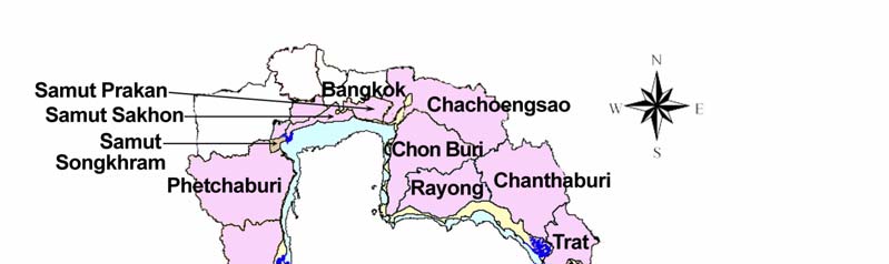
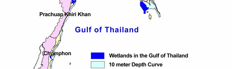
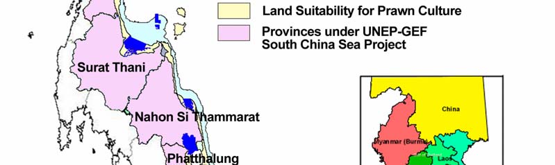
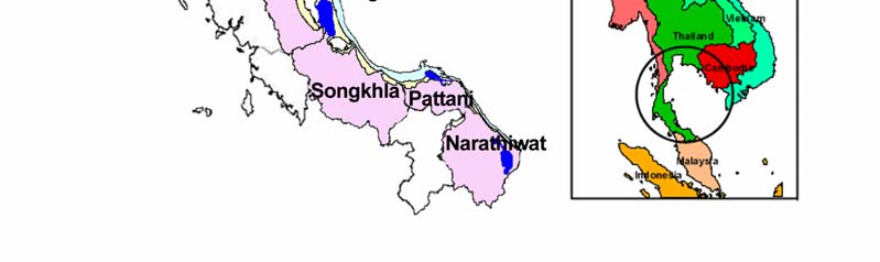
NATIONAL REPORT ON WETLANDS IN SOUTH CHINA SEA THAILAND 3
Figure 1
Extent of Thai Wetland Sub-component under South China Sea Project.
2.2
Major Threats to Wetlands
Most of the wetlands in Thailand are safeguarded and maintained by a protected area system, which
includes national parks, wildlife sanctuaries and wildlife non-hunting areas. Despite being officially
identified as public lands, several important wetlands remain a vital part of daily life of Thais,
particularly those in rural areas who have relied on wetland services and resources for generations.
By not being included in the protected area system, these wetlands have been vulnerable to
encroachment and other development activities. For example, freshwater ecosystems in the
floodplains of northern and central Thailand have been adversely affected by greater demand for
agricultural land use; mangrove forests along the coastlines and estuaries of the Gulf of Thailand, and
on both shorelines of southern Thailand have been severely damaged by aquacultural operations;
while swamp forests and marshlands in north eastern and southern Thailand are now facing
degradation due to some development projects.
Despite the value and benefits derived from wetlands, the ecosystem continues to be directly and
indirectly destroyed at an alarming rate. Wetlands of international importance are constantly under
serious threats, despite all the protective measures that have been put in place. The Asian Wetland
Directory indicates that 47 percent of the 42 listed wetlands in Thailand are under moderate to
seriously high threat, 8 percent are under some form of protection, while only 2 percent are
Reversing Environmental Degradation Trends in the South China Sea and Gulf of Thailand
4 NATIONAL REPORT ON WETLANDS IN SOUTH CHINA SEA THAILAND
adequately protected. There has not yet been any quantitative assessment of wetlands nationwide,
however numerous evidence suggests a significant reduction in the number and size of natural
wetlands. This include the decline in the total area of mangrove forests from 3,680 square kilometres
in 1961 to only 1,680 square kilometres in 1996 (OEPP, 2002b), while the number of man-made
reservoirs has been increasing.
Surveys and monitoring of qualitative changes occurring in the wetlands also remain inadequate.
There is, however, a trend indicating deterioration in water quality and biodiversity among wetlands
throughout the country. The main causes for loss of wetlands in Thailand can be summarized as
follows:
1) Increase in the population: Modern socioeconomic development has significantly increased
the exploitation of wetland resources and generated larger demand for conversion of the
ecosystem for development activities.
2) Inefficient use of wetlands: Inappropriate use of wetlands, particularly conversion of natural
wetlands for farming, marine aquaculture, industry, urban expansion and infrastructure
development, have all adversely affected the wetland hydrology, by disrupting the water flow
in and out of the ecosystem. Both civil engineering projects such as road construction, and
commercial development, such as tourism, can seriously impact ecological functions of
wetlands and locals whose daily life depends on such functions, if due attention is not paid to
preservation of such ecosystems.
3) Wetland management problems: Despite the value and benefits derived from wetlands, the
society at large, including public and private organizations and general public in both urban
and rural areas, do not have adequate and accurate knowledge and understanding of
wetland ecosystems. This results in the lack of due appreciation and recognition of the true
function, value and benefits of wetlands and eventually, in inappropriate use of the
ecosystem. Coordination between public agencies in managing wetlands is often inadequate,
while relevant laws and regulations are usually ineffective in enforcement and, in many
cases; do not facilitate sustainable management of wetlands.
Under this project, significant continuation in the loss of wetlands in the Gulf of Thailand was
observed. A most notable example is swamp forests which have been documented as covering a
total area of 640 square kilometres, with scattered communities in the eastern region (Trat province)
and large communities in southern Thailand, particularly in Narathiwat province where the swamp
forests accounted for nearly 453.36 square kilometres. A survey of swamp forests in Narathiwat
province in 1985 reported that Phru To Daeng forest in Tak Bia, Su Ngai Patee and Su Ngai Golok
districts was the only remaining large patch of swamp forest in the province and covered an area of
no more than 80 square kilometres. A later survey by Santisuk (1991) found that Phru To Daeng
further shrank to mere 16 square kilometres or less. Another example was provided in the 2001
Annual Report on Status of Environmental Quality, where mangrove forests were reduced from 3,680
square kilometres in 1961, to only 1,680 square kilometres in 1996 (OEPP, 2002b). Major problems
that have threatened the long-term existence of wetlands in the Gulf of Thailand can be summarized
as follows:
Continuous loss of wetlands: Loss of wetlands generally results from their conversion for
development activities such as cultivation, housing and tourism. Activities outside the wetlands such
as infrastructure and industrial development, particularly dam and reservoir construction, often
disrupted the replenishment of wetlands, made the ecosystem more accessible for cultivation and
hence, indirectly encouraged more encroachment by landless locals. This pattern was frequently
found in several mangrove forests including those at Welu River Estuary (Chanthaburi province), Pak
Phanang bay (Nakhon Si Thammarat province), Pattani bay (Pattani province) and Ban Don bay
(Surat Thani province) as well as in swamp forests in Thale Noi Wildlife Non-hunting Area
(Phatthalung province), Phru Kan Tulee (Surat ThanipProvince) and Phru To Daeng (Narathiwat
province).
Biodiversity loss: Thailand is rich in genetic, species and ecosystem diversity. Such diversity is
especially evident in wetlands where pools of genetic diversity have long played an integral role in
supporting local livelihoods for generations. The numbers of wetland species and their populations
have recently been on the decline, particularly among aquatic animals, due to inappropriate
harvesting. Use of illegal and destructive fishing tools, driven by economic demand for greater
Reversing Environmental Degradation Trends in the South China Sea and Gulf of Thailand
NATIONAL REPORT ON WETLANDS IN SOUTH CHINA SEA THAILAND 5
production, has effectively depleted fishery stocks in wetlands, while introduction of invasive alien
species, like giant mimosa, golden apple snails and exotic fish, further contributed to the reduction of
native plants and indigenous fish species. Illegal hunting also has adverse effects on wildlife of
wetlands and has caused local extinction of some species.
Ecological degradation of wetlands: Several wetlands are now under threat from eutrophication
with rapid growth in vegetation and increased sedimentation from runoff. The ecological viability of
wetlands has also been seriously affected by logging, particularly in mangrove and swamp forests,
and more frequent forest fires, which result in reduction of native plants and deterioration of their
ecology. Pollution has become more severe with the expansion of urban areas and tourism. These
activities generate a vast amount of solid waste and wastewater, which are often discharged into
wetlands without any effective treatment. Agricultural land use in adjacent areas has further
compounded this problem with the use of pesticides and fertilizers. In addition to contamination of
both surface and underground water with toxic chemicals, these agricultural agents increase nutrient
concentration in water which induces rapid growth of micro-flora (algae bloom), significantly reducing
the dissolved oxygen and disrupts animal and plant food chains in the wetlands. Irrigation projects,
such as dam and reservoir construction, have affected wetlands by restricting the natural flow of
water into the reservoirs; while factories, power-plants and oil tanks along the riverbanks and
shorelines continue to contaminate estuaries and coastal areas with wastewater, toxicants,
hazardous waste, petroleum substances and high temperature discharges.
Lack of coordination between partners and stakeholders: With ever increasing demand for the
exploitation of wetland resources by local communities, utilization of the resources without due regard
to biodiversity value, and the need for conservation and sustainable use, frequently results in conflicts
between users. Any activity in wetlands, therefore, requires comprehensive participation of central
and local authorities, including both conservation and development agencies, private sector, local
administration and communities to decide ways and means for resource utilization that best meet the
carrying capacity of the ecosystems. Area based management is a critical component in realizing
such processes, while revising work plans in accordance to changing circumstances could prevent
more conflicts and enable greater equity in sharing the benefits of the resources.
Lack of adequate knowledge on wetland management: Ecosystem diversity of wetlands with
inclusion of freshwater and brackish water, reservoirs, riparian systems, coastal areas, swamp forests
and mangrove forests, has made the comprehension of the concepts of wetlands, its value, including
biodiversity, rather difficult among the general public. Therefore managing wetlands must be carried
out in an integrated manner where equal attention is paid to ecological protection and socio-economic
demands. This can only be achieved effectively with databases and networking which are the
backbone of informed decision making, and a basis in disseminating knowledge to every stakeholder.
Lack of human resources and competent authorities: To ensure more efficient and productive
management of wetlands, the ever increasing diversity of problems and obstructions, multi-level
coordination from the international community (i.e. the Ramsar Convention) to local communities has
to be adequately addressed and effectively dealt with. Despite appointment of the National
Committee on Wetland Management by the National Environment Board (with ONEP as the
secretariat) in 1993, the amount and complexity of wetland problems has been gradually
overwhelming the capacity of the Committee. Institutional restructuring, including improvement of
personnel responsible for wetlands at central and local levels, should be carried out not only to
enhance effectiveness in problem resolution, but also to promote local communities to become more
responsible for the management of their wetland resources.
3.
LEGAL ASPECTS AND INSTITUTIONAL FRAMEWORK REGARDING COASTAL
WETLANDS IN THAILAND
Currently, there is no specific and comprehensive legislation governing wetlands in Thailand.
However, laws relevant to wetland conservation and sustainable utilization are scattered throughout
the body of legislation. This has resulted in little or no coordination between various governmental
agencies responsible for wetland management.
The control of natural resources in wetlands is presently the responsibility of numerous governmental
agencies. Apart from that, the structure of governmental organization in Thailand is divided as the
central government, provincial governments, and local governments. The present Thai Constitution
Reversing Environmental Degradation Trends in the South China Sea and Gulf of Thailand
6 NATIONAL REPORT ON WETLANDS IN SOUTH CHINA SEA THAILAND
1997 provides comprehensive decentralization to local governments and local communities for
natural resources and environment conservation. Furthermore, the charter also provides the right and
liberty for the public to participate in decision-making process of natural resources management.
The government decided to reform the bureaucratic system in October 2002. This is considered the
first stage of the reform process because there are still many problems in the structure of government
organizations. Current reforms have created more overlap of responsibilities and authorities for
several agencies. It is anticipated that the reform process could be completed in two to five years.
It is believed that sustainable resource management could be achieved given an effective legal and
institutional framework. This chapter reviews and analyzes the legal framework relevant to coastal
wetland management in Thailand. It also reviews the policy of the government towards coastal
wetland conservation and utilization. In addition, the institutional framework for coastal wetland
management in Thailand is also examined.
3.1
Review and Analysis of Legal Aspects Relevant to Wetland Management
There are many pieces of law concerning wetland management and conservation in Thailand. These
laws directly or indirectly govern wetland management. They include:
(1) Constitution, B.E. 2540 (1997)
(2) Fisheries Act, B.E. 2490 (1947)
(3) Wildlife Reservation and Protection Act, B.E. 2535 (1992)
(4) National Environmental Quality Promotion and Preservation Act, B.E. 2535(1992)
(5) Navigation in the Thai Waters Act, B.E. 2456 (1913)
(6) National Reserved Forest Act, B.E. 2507 (1964)
(7) National Park Act, 2504 (1961)
(8) Town Planning Act, B.E. 2518 (1975)
(9) Building Control Act, B.E. 2522 (1979)
(10) Tambol Administrative Organization Act, B.E. 2537 (1994)
(11) Provincial Administrative Organization Act, B.E. 2540 (1997)
1.
Constitution, B.E. 2540 (1997)
Thailand's Parliament endorsed a new constitution on Saturday, September 27, 1997, in a combined
House and Senate vote of 578 to 16 (with 55 abstentions). Among the main features, the new
constitution gives people additional rights and freedoms, and defines and limits the role of the
government more clearly. The new constitution will radically change the political landscape of
Thailand. It aims to eliminate or at least minimize unnecessary political influence on administration,
and enhance transparency, accountability, responsibility, and fairness. It provides for an independent
election commission, citizen's access to an anti-corruption body to oversee politicians elected to
office, proportional representation for a portion of seats, a stipulation that senators and provincial
village chiefs be elected instead of appointed, and a requirement that cabinet ministers resign from
their parliamentary seats. There is a clear stipulation to accelerate the process of administrative
decentralization to empower people; this would necessitate the establishment of many new acts. The
new constitution pays greater attention o social sectors including emphasis on education, with a goal
to make 12 years of education compulsory. It also obliges the government to pay sufficient attention
to social welfare and environmental conservation.
2.
Fisheries Act, B.E. 2490 (1947)
This law was enacted in 1947 and has been revised twice in 1953 and 1985. This act is executed by
the Minister of Agriculture and Cooperatives through the director-general of the Department of
Fisheries. This act directly governs fishing activities in the coastal areas. The act classifies fisheries
by using an area approach into four categories; (1) Preservation fisheries, (2) Concession fisheries,
(3) Reserved fisheries, and (4) Public fisheries.
In relation to wetland management, the Fisheries Act generally protects both coastal and inland
wetlands from fishing activities and environmental degradation activities. Apart from that, this act also
prevents the illegal occupation of wetlands, illegal destruction of wetlands, and so on by establishing
protected areas, both coastal and inland, as preservation fisheries, and does not allow any fishing
activities. The act also protects endangered species, which have habitats in wetlands. However, law
enforcement is the main difficulty in implementation, which leads to constant wetlands loss.
Reversing Environmental Degradation Trends in the South China Sea and Gulf of Thailand
NATIONAL REPORT ON WETLANDS IN SOUTH CHINA SEA THAILAND 7
3.
Wildlife Reservation and Protection Act, B.E. 2535 (1992)
This act repealed and replaced the old Wildlife Reservation and Protection Act, B.E. 2503 (1960).
Only the Royal Forest Department (RFD) was responsible for the old Wildlife Law. However, both
RFD and the Department of Fisheries (DOF) are responsible for the current Wildlife Reservation and
Protection Act, B.E. 2535 (1992). This is because the definition of wildlife in this act includes aquatic
animals, and the DOF is responsible for aquatic animals and crocodiles, whereas the RFD is
responsible for terrestrial animals and birds.
This act creates two lists of endangered species; (i) the list of reserved species notified by royal
decree, and (ii) the list of protected species notified by ministerial regulation. The act prohibits
hunting, possessing, breeding, trading, importing and exporting any species on these two lists.
However, if some species can be bred in captivity until the second generation of offspring animals;
trade, possession, export and import of such species shall be allowed pursuant to CITES regulations.
Therefore, this act also creates another list of captive breeding species notified by ministerial
regulation. Examples of endangered species bred in captivity include crocodiles, pythons, Asian bony
tongue fish, etc.
4.
National Environmental Quality Promotion and Preservation Act, B.E. 2535 (1992)
This act has been revised and replaced the old act of 1975. The Ministry of Science, Technology and
Environment (MOSTE) is responsible for this law. Upon the enactment of this law in 1992, MOSTE
was also restructured by dividing environmental agencies into three agencies: (i) Office of
Environmental Policy and Planning (OEPP), (ii) Pollution Control Department (PCD), and (iii)
Department of Environmental Quality Promotion (DEQP).
The Ministerial Regulations of Article 55 of this act sets quality standards for discharged industrial
waste water, but does not include waste water discharged from aquaculture. This act requires
environmental impact assessment (EIA) for large-scale projects. Furthermore, Articles 43, 44 and 45
of this act empower the minister of MOSTE to proclaim ministerial regulations determining
"environmentally protected areas" and "pollution control areas" in addition to regulating the activities
in such areas. However, it lacks enforcement because MOSTE has inadequate staff in the provinces.
Normally, provincial police and various provincial government offices are relied upon for enforcement.
This act could serve as a legal instrument to protect wetlands by designating wetlands as
"environmentally protected areas" whether private wetlands or public wetlands. The "environmentally
protected areas" can be established by ministerial regulation. Furthermore, restricted activities within
"the environmentally protected area" can also be proclaimed by ministerial regulation as well. It can
be concluded that these provisions are more flexible and applicable to wetland management and
conservation in comparison to other legal instruments. However, the enforcement of this act relies on
competent officers of other governmental line agencies such as the Police Department, Royal Forest
Department, Department of Fisheries, Royal Thai Navy, Harbour Department, etc.
5.
Navigation in the Thai Waters Act, 2456 (1913 revised in 1992)
This was enacted in 1913 but it has been revised several times, and the latest is No. 14 in 1992. The
Department of Harbour, Ministry of Transportation and Communication is responsible for this act. The
main objectives of the act are to regulate navigation and water transportation in the Thai waters,
regulate the construction of vessels, including fishing vessels, register all vessels, and issue licenses
to vessel officers. In addition, it also prohibits the disposal of wastes into the watercourse either from
the vessels or from land-based sources.
Article 117 prohibits the construction of anything over the water or under the water without prior
permission from the Harbour Department. The construction of commercial ports, fishing ports,
marinas, piers must be done only after obtaining permission from the Harbour Department.
In relation to coastal aquaculture, the Department of Fisheries must seek approval from the
Department of Harbour before granting permission for reserved fisheries, for coastal stationary fishing
gear, cage culture and shellfish culture. Likewise, the Department of Harbour must seek approval
from the Department of Fisheries before granting permission for the construction in water courses or
action which may cause alternation of water courses.
Reversing Environmental Degradation Trends in the South China Sea and Gulf of Thailand
8 NATIONAL REPORT ON WETLANDS IN SOUTH CHINA SEA THAILAND
In relation to wetland management, this act regulates the construction or encroachment of public
wetlands both inland and coastal. Moreover, the act also prohibits the disposal of waste into wetlands
in order to prevent pollution and contamination.
6.
The National Reserved Forest Act, B.E. 2507 (1964)
This act aims to protect reserved forests and natural resources within reserved forests. Previously, an
intensive survey was carried out over a very long period of time, to identify the area of intended
reserved forest before a Ministerial Regulation was proclaimed designating a national reserved forest.
The enactment of National Reserved Forest Act in 1964 aimed to change such procedures by
requiring advanced notification of designation of areas intended as reserved forest. Any person who
is not satisfied, is entitled to challenge by petition to the Head of District Office within 90 days from the
effective date of the Ministerial regulation. In practice, however, there are many villagers who occupy
and utilize areas of reserved forests. In this regard, this act recognizes the preoccupation right and
utilization right only to persons who have land title deeds issued by the Department of Lands pursuant
to the Land Code, B.E. 2497 such as Chanode, N.S.3, S.K.1, etc.,. These procedures also applied to
mangrove reserved forests. Therefore, there are several villagers who still have preoccupation and
utilization rights in the mangrove reserved forests, which they can use to legally exploit mangrove
forests depending on the mangrove zones classified by cabinet resolutions.
7.
The National Park Act, B.E. 2504 (1961)
This act aims to protect natural resources and environment within national park areas similar to that
of the National Reserved Forest Act. However, national park is supposedly more protected than
national reserved forest because the National Park Act does not allow any utilization within national
park areas. The main objective of the act is to maintain the natural resources within National Parks
intact for education and aesthetic interests of the public. Marine national parks and national parks
along the coasts automatically protect mangrove forests. Presently, there are many marine and
coastal national parks along the coasts of Thailand. Although strictly speaking, they are legally
protected, there are still many illegal encroachments and utilization in national parks. Examples
include several illegal shrimp farms in Khao Sam Roi Yot National Park, in Prachuap-khirikhan
province.
Wetlands situated within national parks are automatically protected. The national park can be
established by royal decree. Currently, Thailand has established 102 national parks, which include 81
terrestrial national parks and 21 marine parks covering an area of 52,149.12 square kilometres
equivalent to 9.82 percent of the total land area of the country. The government is preparing to
establish another additional 36 national parks covering an area of 18,150.543 square kilometres
(Royal Forest Department, 2001).
8.
Town Planning Act, B.E. 2518 (1975)
This act has been revised three times, the third time in 1992. This act empowers a competent
authority namely the Town and Country Planning Department, Ministry of the Interior, to classify an
area as an industrial zone, commercial zone, residential zone, agricultural zone and so on. However,
it should be noted that such zoning is based on environmental concerns and purposes.
Before designating town and country planning in any area, a public hearing shall be organized
according to Article 19 of the act. All stakeholders in that area will attend the public hearing. In
addition, every five years there will be an evaluation of such proclamation of town and country zoning
for public evaluation pursuant to Article 26.
In coastal areas, the provincial authority can proclaim town and country planning within its territory.
The provincial public works officer and the local government are the competent officials of this act.
9.
Building Control Act, B.E. 2522 (1979)
The Minister of Interior executes this act. The act empowers the local government to be the
competent officer of this act. The local government includes the Provincial Administrative
Organization, Municipality, Tambol Administrative Organization, Bangkok Metropolitan, and Pattaya.
The Minister of Interior proclaims the ministerial regulation in any locality and the local government
issues the by-law for its own purposes pursuant to the ministerial regulation. This act can be a useful
legal instrument to control building in coastal areas.
Reversing Environmental Degradation Trends in the South China Sea and Gulf of Thailand
NATIONAL REPORT ON WETLANDS IN SOUTH CHINA SEA THAILAND 9
10.
Tambol Administrative Organization Act, B.E. 2537 (1994)
This act is also executed by the Ministry of Interior. The main objective of this act is to decentralize
the administration to the sub-district level (Tambol). The Tambol Administrative Organization (TAO)
committee is comprised of elected local people. The TAO has the duty and responsibility to conserve
the natural resources within its territory, and also has the duty to formulate its annual development
plan and issue regulations to direct activities within its territory.
The TAO is financed from two sources (i) collecting taxes from activities within its territory, and (ii)
annual budget provisions from the central government. The act stipulates that the fisheries tax, and
other taxes generated from the utilization of natural resources within its territory will be given to the
TAO. For example, the Department of Fisheries currently collects a fisheries tax and gives such tax to
the TAO. Likewise, Royal Forest Department collects entrance fees for national parks and gives such
fees to the TAO.
In relation to wetland management, the TAO could conserve wetlands by establishing local
committees to manage wetlands located in its territory. In addition, the TAO can also collect taxes
from the utilization of such wetlands. The TAO also can play an important role in community-based
management of wetlands and other natural resources.
11.
Provincial Administrative Organization Act, B.E. 2540 (1997)
After the enactment of the Tambol Administrative Organization Act, B.E. 2537 (1994), the Provincial
Administrative Organization Act, B.E. 2540 (1997) was enacted to be compatible. This Act empowers
the Provincial Administrative Organization (PAO) to formulate provincial development plans,
coordinate and cooperate with TAOs, allocate budgets to TAOs, and to protect and conserve natural
resources and environment in its territory.
The PAO can help conserve wetlands in coastal areas based on its development plans. As
mentioned earlier, the Provincial Administrative Organization is authorized as the competent official of
several laws such as the Building Control Act, B.E. 2522 (1979).
3.2
International Agreements Relevant to Wetland Management
Thailand is a contracting party to many international agreements relevant to wetland management
such as the Ramsar Convention, CITES, Convention on Biological Diversity (CBD), World Heritage
Convention. The details of them can be shown as follow:
The Convention on Wetlands of International Importance, Especially as Waterfowl Habitat;
The Convention on International Trade in Endangered Species of Wild Fauna and Flora
(CITES);
The Convention Concerning the Protection of the World Cultural and Natural Heritage;
The Convention on the Conservation of Migratory Species of Wild Animals;
The UN Convention on the Law of the Sea, 1982 (UNCLOS);
The Convention on Biological Diversity, 1992.
3.3
Review of Policies and Cabinet Resolutions on Wetland Management in Thailand
3.3.1 Policy
Framework
· National Economic and Social Development Plan No.9 (2002-2006);
· Wetland Policy and National Sub-Committee on Wetland Management (NCWM);
· Policies, Measures and Plans on Wetland Management for 1998-2002;
· Strategic Measures on Conservation of Wetlands of National and International Importance
(Cabinet Resolution in August 1, 2000);
· The National Wetland Management Plan for 2003-2007.
3.3.2 Cabinet Resolutions Relevant to Coastal Wetland Management
There are many Cabinet Resolutions relevant to wetland management (focused on coastal area,
mangrove and beaches) including:
3.3.2.1 On June 27, 1979, the Cabinet passed the resolution "the Recommendations of the National
Mangrove Resources Committee on the Protection and Conservation of Mangrove Resources".
Reversing Environmental Degradation Trends in the South China Sea and Gulf of Thailand
10 NATIONAL REPORT ON WETLANDS IN SOUTH CHINA SEA THAILAND
3.3.2.2 On August 19, 1980, the Cabinet passed the resolution "the Measures for Mangrove
Exploitation".
3.3.2.3 On June 29, 1982, the Cabinet passed the resolution "the Measures for the Use of Mangrove
Area by the Government Sector".
3.3.2.4 On May 1,1984, the Cabinet passed the resolution "the Recommendations from the 4th
Seminar on Mangrove Ecosystems". The resolution includes three recommendations. The Cabinet
has also empowered the Ministry of Agriculture and Cooperatives.
3.3.2.5 On December 15, 1987, the Cabinet passed the resolution "the Classification of Mangrove
Area Utilization in Thailand".
The Cabinet has agreed to adopt the resolution proposed by the Ministry of Agriculture and
Cooperatives concerning the classification of mangrove area utilization in Thailand. The mangrove
area utilization in Thailand will be grouped as conservation and economic zone. Mangrove Economic
Zone covers a total area of 3,297.70 square kilometres which is divided into two categories as zone A
and B. Thus the classification of mangrove area utilization will be as (i) mangrove conservation zone
(ii) mangrove economic zone A, and (iii) mangrove economic zone B.
3.3.2.6 On August 1, 1989, the Cabinet passed the resolution "the Reservation and Protection for
Mangrove Areas in Surattani Province and Nakhon Si Thammarat province"
3.3.2.7 On February 6, 1990, the cabinet passed the resolution "Resolving the Mangrove
Encroachment in Eastern Thailand".
3.3.2.8 On February 27, 1990, the Cabinet passed the resolution "the Recommendation From the 6th
Seminar on Mangrove Ecosystem".
3.3.2.9 On June 4, 1991, the cabinet passed the resolution "the Urgent Measures for Coastal
Resources Concerning Mangrove and Corals"
3.3.2.10 On July 23, 1991, the Cabinet passed the resolution "the Study Report on the Present
Situation of Mangrove and Coral in Thailand".
3.3.2.11 On February 17, 1992, the Cabinet passed the resolution "the Resolution of the National
Environment Board on the Policy, Measure and Working Plan for Coastal Resources and
Environment Management of Thailand".
3.4
Review and Analysis of Institutional Framework
3.4.1 Government Line Agencies
According to the Constitution of 1997, the system of Thai government is organized at two levels as
the central government and local government. The central government is the largest public sector
body. Previously, the Thai government was made up of 15 Ministries. Recently, the Parliament has
passed two bills, namely the Public Administration Act, B.E. 2545 (2002) and the Restructuring
Governmental Ministries, Offices and Departments Act, B.E. 2545 (2002) which came into force on
October 3, 2002. This has resulted in a restructuring of the government into 20 Ministries:
Office of the Prime Minister, Ministry of Defence, Ministry of Finance, Ministry of Foreign Affairs,
Ministry of Education, Ministry of Culture, Ministry of Tourism and Sports, Ministry of Agriculture and
Cooperatives, Ministry of Transportation, Ministry of Information and Communication Technology,
Ministry of Commerce, Ministry of the Interior, Ministry of Justice, Ministry of Labour and Social
Welfare, Ministry of Science and Technology, Ministry of Natural Resources and Environment,
Ministry of Public Health, Ministry of Industries, Ministry of Energy Development and Ministry of Social
Development and Human Security.
The policy of restructuring the government is to group the organizations with similar work functions
into the same Ministry. However, many government organizations still want to retain authority,
manpower and budget. Therefore, they retain some work functions. This has created duplication of
work and overlapping power with the newly established government organization. It will take time to
resolve these issues.
Reversing Environmental Degradation Trends in the South China Sea and Gulf of Thailand
NATIONAL REPORT ON WETLANDS IN SOUTH CHINA SEA THAILAND 11
Apart from the duplication of work and power among government agencies, there are also the legal
problems.The government has to review and revise many laws that are implemented by the
government agencies.
There are several Ministries involved in wetland management. They are:
3.4.1.1 Ministry of Natural Resources and Environment
The Ministry of Natural Resources and Environment (MONRE) was established by combining various
departments of the Ministry of Agriculture and Cooperatives (MOAC) and Ministry of Science,
Technology and Environment (MOSTE). The Ministry of Natural Resources and Environment is
comprises of several departments that deal with wetlands. The core agencies are as follows:
Department of National Park, Wildlife and Flora
This Department is divided from former Royal Forest Department (RFD). It takes around 70 percent
of the work from the former Royal Forest Department. This Department enforces two pieces of
legislation, namely the Wildlife Reservation and Protection Act, B.E. 2535 (1992) and the National
Park Act, B.E. 2504 (1961). All wetlands situated within protected areas such as national parks,
wildlife sanctuary areas and non-hunting areas are under the responsibility of this department. This
department is also responsible for all marine national parks .The Director General of the National
Park, Wildlife and Flora Department is responsible for the protection and management of wetlands in
protected and conservation areas, the protection of wetland flora and fauna and the principal training
of wetland managers and rangers.
Department of Marine and Coastal Resources
This department was established by transferring some work dealing with marine and coastal
resources from the Department of Fisheries, Department of Land Development, and Royal Forest
Department. This department enforces several pieces of legislation such as the Fisheries Act, B.E.
2490 (1947), the Wildlife Reservation and Protection Act, B.E. 2535 (1992), the National Reserved
Forest Act, B.E. 2507 (1964). All wetlands within mangrove forests and beaches are the responsibility
this department.
Office of Natural Resources and Environment Policy and Planning
This office was formerly called the Office of Environmental Policy and Planning (OEPP). Under the
new ministry, It has been renamed the Office of Natural Resources and Environment Policy and
Planning (ONEP). Its tasks are the coordination and cooperation with numerous governmental and
non governmental agencies. This office is also responsible for the formulation of wetland policy and
planning, both inland and coastal, the co-ordination of regulations, guidance, monitoring and
evaluation of reports on the implementation of national policy on the management of wetlands. In
addition, it also holds responsibility for the training programmes on wetlands management, the
establishment of "environmentally protected areas", and the focal point for the Ramsar Convention in
Thailand.
Department of Pollution Control
This department was transferred from the Ministry of Science, Technology and Environment. It is
responsible for controlling pollution from all sources including inland and coastal. This department
enforces the National Environmental Quality Promotion and Preservation Act, B.E. 2535 (1992). This
department is also responsible for the determination of water quality standards for both freshwater
and coastal water, establishing "pollution control areas", and monitoring, control and surveillance of
water quality.
Department of Water Resources
This Agency (formerly called the Office of Rural Development) was transferred from the Ministry of
the Interior and combined with some units of the Royal Irrigation Department and Office of the
National Water Resources Policy Committee. This agency will have overall responsibilty for inland
reservoir, wetlands and 25 river basins in Thailand.
Reversing Environmental Degradation Trends in the South China Sea and Gulf of Thailand
12 NATIONAL REPORT ON WETLANDS IN SOUTH CHINA SEA THAILAND
3.4.1.2 Ministry of Agriculture and Cooperatives
Many tasks of the Ministry of Agriculture and Cooperatives have been transferred to the Ministry of
Natural Resources and Environment especially natural resources and environment aspects.
However, this transformation is not yet complete. This can be observed by the duplication of work and
overlap of power between several agencies. It requires time to readjust. Currently, several agencies
within the Ministry of Agriculture and Cooperatives still retain the work and legal power with regard to
wetland management. The core agencies dealing with wetland management include the following:
Royal Forest Department
The Royal Forest Department (RFD) has transferred 70 percent of its work to the Department of
National Park, Wildlife and Flora and 10 percent of its work on mangrove to the Department of Marine
and Coastal Resources. Currently, it retains around 20 percent of work mainly outside protected
areas. This department is responsibile for production forests and their influence on wetlands systems,
and enforcement of the Forest Act, B.E. 2484 (1941) and the National Reserved Forest Act, B.E.
2507 (1964).
By the end of 2003, the government had proclaimed the Royal Decree to transfer RFD to the Ministry
of Natural Resources and Environment. Currently, the Ministry of Natural Resources and
Environment is working to resolve the overlap and duplication of authority, manpower and budget
allocations between the Department of National Park, Wildlife and Flora and the Royal Forest
Department.
Department of Fisheries
The Department of Fisheries (DOF) has the responsibility for aquatic species conservation and
wetlands (as fish habitats) protection. It has transferred some work on marine and coastal resources
to the Department of Marine and Coastal Resources. However, it still retains the same work on
marine and coastal resources with it. Thus, there is a duplication of work and overlapping of legal
power with the Department of Marine and Coastal Resources. This department enforces the Fisheries
Act, B.E. 2490 (1947).
Department of Land Development
The Department of Land Development has the responsibility for technical guidance in the
management of wetlands and the use of soil associated with the use of water. It provides the
technical information on management of coastal wetlands.
Royal Irrigation Department
The Royal Irrigation Department has the responsibility to regulate the water utilization, to provide
water support to farmers and other water users and to construct the irrigation infrastructure.
3.4.1.3 Ministry of the Interior
This ministry has the responsibility for the coordination and guidance for provincial government and
local government, which is responsible for activities related to planning, implementation and control of
the wetland management at provincial and local levels. However, there is one agency dealing directly
with the implementation of wetland management.
Department of Land
The Department of Land enforces the Land Code, B.E. 2497 which is responsible for directing the
allocation of land for each individual according to the national and regional land use plans and legal
requirements. The issuance of land title deeds in coastal areas must be controlled.
3.4.1.4 Office of the Prime Minister
National Economic and Social Development Office
This office is responsible for coordinating and planning government programmes and finance
concerned with the management of the wetlands and their resources.
Reversing Environmental Degradation Trends in the South China Sea and Gulf of Thailand
NATIONAL REPORT ON WETLANDS IN SOUTH CHINA SEA THAILAND 13
3.4.1.5 Ministry of Tourism and Sport
Tourism Authority of Thailand (TAT)
This office is responsible for developing tourism in wetlands, including coastal wetlands such as
mangrove forests, beaches, etc. It also formulates the National Tourism Plan, promotes tourism in
coastal areas, enhances eco-tourism for coastal areas.
3.4.1.6 Ministry of Public Health
This ministry is responsible for establishing the standards of public hygiene closely associated with
water quality and waste disposal. Also responsible for the raw materials, including water, their
processing and quality control procedures used for manufacturing medicine.
3.4.1.7 Ministry of Industries
This ministry is responsible for providing information on quality standards of raw materials and
regulating the water discharged from the industries to wetland resources.
3.4.1.8 Ministry of Transportation
Marine Department
This department is established by the combination of the Harbour Department and the Office of
Mercantile Marine. This department enforces the Navigation in Thai Waters Act, B.E. 2456. It is
responsible for regulating navigation in Thai waters and protecting the watercourses. Therefore, by
virtue of the act this department also regulates construction in coastal areas, and controls the
disposal of waste into coastal area.
3.4.2 Local Government Organization
The local administrative system of Thailand can be classified as (I) Provincial Administrative
Organization (PAO), and (ii) Tambol Administrative Organization (TAO).
3.4.2.1 Provincial Administrative Organization (PAO)
The Provincial Administrative Organization (PAO) is established by the Provincial Administrative
Organization Act, B.E. 2540. Every province has one Provincial Administrative Organization that has
the responsibilities to coordinate with other governmental organization and other local administrative
organization such as Tambol Administrative Organization (TAO). PAO also has the duty to protect
and conserve natural resources and environment in its territory. In this respect, PAO is also
responsible for protecting and conserving wetlands in its territory.
3.4.2.2 Tambol Administrative Organization (TAO)
The Tambol Administrative Organization (TAO) is established by the Tambol Administrative
Organization Act, B.E. 2537. It is also responsible for wetland management in its territory. Currently,
TAO plays an essential role in protecting and conserving wetlands because the people residing in the
village usually utilize wetlands for their livelihood. Therefore, the loss of wetlands would have a direct
effect on their quality of life.
Weaknesses
Within its legal framework, Thailand has many pieces of legislation protecting wetlands. The legal
mechanism for protecting wetlands could be more effectively applied by establishing protected areas
such as National Parks, wildlife sanctuary areas, non-hunting areas, aquatic sanctuary areas, and
environmentally protected areas according to the management plan and relevant legislation. Thailand
has adequate laws in place for establishing protected areas. Furthermore, many pieces of law also
protect endangered species within wetlands and protected areas. And, the laws restrict some
activities which may cause degradation to wetlands.
The constraints of legal protection, however, arise from fragmented laws, overlapping jurisdiction in
some areas, ineffective law enforcement, lack of compliance, and centralized power. Although
wetlands within the protected area system are considered well protected and remain in good
Reversing Environmental Degradation Trends in the South China Sea and Gulf of Thailand
14 NATIONAL REPORT ON WETLANDS IN SOUTH CHINA SEA THAILAND
condition, the government should establish many more coastal protected areas, set the program to
enhance compliance, allocate sufficient budget resources for law enforcement, and increase public
participation for wetland management and conservation.
Within its institutional framework, the policy of the present government to reform governmental
agencies came into effect on October 3, 2002. However, there are still many problems among various
ministries, especially ministries involved in natural resources and environment. The two core
Ministries are the Ministry of Natural Resources and Environment and the Ministry of Agriculture and
Cooperatives. Several departments under these two ministries still duplicate work, have unclear
duties and authority, overlapping authorities, and lack of coordination and cooperation. In fact, the old
ministries and departments have tendency to retain their powers and budget, and do not want to
transfer them to other ministries.Therefore, there is an urgent need for the government to consider
additional changes in its institutional framework.
Suggestions
Within the legal framework, the government should speed up its review and make any necessary
changes in the legal framework to accommodate the implementation of wetland management and law
enforcement by various government agencies. While the process of amending laws in Thailand
usually takes long time, this particular legal review should take priority. With regard to wetland
conservation, there will be a strong link to institutional arrangement of governmental organization.
Therefore, the mandate and responsibilities of government agencies should be made clear first.
Then, the legal framework can be reviewed and revised accordingly. Furthermore, the manpower and
budget could be more effectively allocated with a clear mandate. The fragmentation of laws is not
harmful as long as the laws are not contradictory. Likewise, overlapping duties and power of various
governmental agencies can tolerated if there is good inter-agency coordination and cooperation.
Constitutionally, the management of coastal wetlands is the responsibility of the government and
should be governed by laws and regulations of various governmental agencies. Basically, wetlands
within the protected area system are protected by laws and managed by government. However,
wetlands outside protected areas are normally managed by communities or private enterprises. In
this connection, Tambol Administrative Organization (TAO) could play an essential role in
strengthening local community participation in managing and conserving coastal wetlands. Moreover,
the establishment of community-based management also could contribute to the effective coastal
wetland management. In this respect, TAO can issue regulations compatible with its needs. Apart
from that, local communities can also set the rules as part of the social order within its locality to
manage and conserve coastal wetlands.
4.
BIODIVERSITY IN NOTABLE WETLANDS OF THE GULF OF THAILAND
Literature reviews were carried out for 13 notable wetlands in the Gulf of Thailand. The review further
confirmed these13 wetlands as important habitat for wildlife, particularly globally threatened species
as identified by the IUCN Red List. Of the total 48 threatened species (that include 34 species of
birds, 7 species of mammals, 3 species of fish and 4 species of vascular plants) of flora and fauna
found in these wetlands, three species were classified as critically endangered, 5 species was listed
as endangered, 16 species were categorized as vulnerable while 24 species were classified as near
threatened.
One wetland site was found to support threatened species of all four IUCN Red List categories and
the highest number of threatened species. This was Pak Panang Bay with 19 threatened species of
Flora and Fauna (three critically endangered, one endangered, seven vulnerable and eight near
threatened species). Khao Sam Roi Yot National Park was found to contain no critically endangered
species but, nevertheless, supports 18 other threatened species (two endangered, eight vulnerable
and eight near threatened species), and Thale Noi Wildlife Non-hunting Area, where Thailand's first
Ramsar site is located, was found to contain no critically endangered species and endangered
species but, nevertheless, supports 16 other threatened species (5 vulnerable and 11 near
threatened species).
In addition to accommodating threatened species, these 13 wetlands were found to play an important
role in providing shelters and feeding sites for many migratory birds. Up to only 178 migratory bird
species were recorded in the wetlands.
Reversing Environmental Degradation Trends in the South China Sea and Gulf of Thailand
NATIONAL REPORT ON WETLANDS IN SOUTH CHINA SEA THAILAND 15
The largest number of migratory bird species were recorded in Khao Sam Roi Yot National Park, with
154 species. In addition, 144 species of resident birds and 17 species of birds with both residential
and migratory populations, were also found in the national park. Common migratory birds found in the
13 wetlands include Common Kingfisher (Alcedo atthis), Barn Swallow (Hirundo rustica), Common
Sandpiper (Actitis hypoleucos) and Chinese Pond Heron (Ardeola bacchus). Phru To Daeng Wildlife
Sanctuary was identified as the site with the highest number of resident bird species (at least 164
species). Therefore, it could be concluded that each wetland is important for different groups of
animal and plant species.
4.1.1 Birds
Of the approximately 978 species of birds found in Thailand (Bird Conservation Society, 2004), no
less than 486 species were recorded in the 13 wetlands, accounting for 49.69 percent of the total.
These include 178 migratory species, 289 resident species and 19 species of partially migrating birds.
Of 486 bird species, 34 species were identified under IUCN Red List. 3 endangered species were
identified, which are, Greater Adjutant (Leptoptilos dubius) of Khao Sam Roi Yot National Park,
Nordmann's Greenshank (Tringa guttifer) of Khao Sam Roi Yot National Park, Thale Sap Wildlife
Non-hunting Area and Pattani Bay and Black-faced Spoonbill (Platalea minor) of Pattani Bay.
Seven species of birds were found distributed in 12 of the 13 wetlands. Five of them, which are
Greater Coucal (Centropus sinensis), Spotted Dove (Streptopelia chinensis), Scarlet-backed
Flowerpecker (Dicaeum cruentatum), Common Myna (Acridotheres tristi ) and Large-billed Crow
(Corvus macrorhynchos) were recorded at every site except Don Hoi Lot, while another two species,
Collared Kingfisher (Halcyon chloris) and Brahminy Kite (Haliastur indus), were documented in all the
sites except Phru Kan Tulee.
4.1.2 Mammals
Of the approximately 292 mammal species found in the country (OEPP, 2002b), at least 100 species
were documented in the wetlands, accounting for 34.24 percent.
Otter Civet (Cynogale bennetti) of the Phru To Daeng Wildlife Sanctuary was the only endangered
species found, while four other species were identified as vulnerable. These species are Pig-tailed
Macaque (Macaca nemestrina) which was found in the Phru To Daeng Wildlife Sanctuary, Thung
Kha-Savi Bay, Pak Phanang Bay and Phru Kan Tulee; Smooth-coated Otter (Lutrogale perspicillata)
which was documented at the Thale Noi Wildlife Non-hunting Area, Phru To Daeng Wildlife Sanctuary
and Pak Phanang Bay; Stump-tail Maeaque (Macaca arctoides) of the Mu Koh Chang National Park
and Fishing Cat (Prionailurus viverrinus) of the Thale Noi Wildlife Non-hunting Area. Two near
threatened species were also identified.
From a study of nine sites (Thale Noi Wildlife Non-hunting Area, Mu Koh Chang, Khao Sam Roi Yot
National Park, Phru To Daeng Wildlife Sanctuary, Mu Koh Ang Thong National Park, Welu Estuary,
Thung Kha-Savi Bay, Pak Phanang Bay and Phru Kan Tulee), Crab-eating Macaque (Macaca
fascicularis) was identified as the most common found to be present in eight sites with the Mu Koh
Chang National Park as the exception.
4.1.3 Reptiles
Of the approximately 318 reptile species found in the country (OEPP, 2002b), at least 101 species
were documented in the wetlands, accounting for 31.76 percent.
At present, the status of reptiles in Thailand is categorized at national level according to OEPP
(1997). 2 endangered species were recorded in the wetlands, including the Green Turtle (Chelonia
mydas) and Hawksbill turtle (Eretmochelys imbricata) which were found in the Mu Koh Ang Thong
National Park.
4.1.4 Amphibians
Of the approximately 122 amphibian species found in the country (OEPP, 2002b), at least 44 species
were documented in the wetlands, accounting for 36.06 percent from a study of nine sites.
At present, the status of amphibians in Thailand is categorized at national level according to the
OEPP (1997). Two vulnerable species were recorded in the wetlands.
Reversing Environmental Degradation Trends in the South China Sea and Gulf of Thailand
16 NATIONAL REPORT ON WETLANDS IN SOUTH CHINA SEA THAILAND
4.1.5 Fish
Of the approximately 2,279 species of fish found in the country (OEPP, 1997), at least 454 species
were documented in the wetlands, accounting for 19.92 percent.
A couple of vulnerable species were recorded in the wetlands, including Zebra Shark (Stegostoma
fasciatum) found in the Thung Kha Bay-Savi Bay and Seahorse (Hippocampus kuda) in the Welu
River Estuary. Near threatened species include Bluespotted Ribbontail Ray (Taeniura lymna) found in
the Mu Koh Ang Thong National Park. Species richness was found to be highest at the Pattani Bay
with 215 species.
4.1.6 Plants
Of the approximately 10,000-15,000 vascular plant species (Tree, mangrove plant, aquatic plant)
found in the country (Pengklai, 2003), at least 517 species were documented in the wetlands.
All three critically endangered species, Dipterocarpus grandiflorus, Parashorea stellata, Shorea
farinosa and one vulnerable species, Shorea leprosula were found in the Pak Phanang Bay whereas
the species richness was found to be highest at the Thale Noi Wildlife Non-hunting Area with 260
species.
4.1.7 Seaweed and Seagrasses
Of the approximately 63 species of marine algae found in the country (Lewmanomont and Ogawa,
1995), at least nine species were documented in the wetlands, accounting for 14.28 percent and out
of the 12 species of seagrasses found in the country, five species were documented in the Pattani
Bay, accounting for 41.66 percent.
4.1.8 Plankton
At least 266 phytoplankton species were recorded in the wetlands including the Welu River Estuary,
Ban Don Bay, Khao Sam Roi Yot National Park, Thale Noi Wildlife Non-hunting Area, Phru To Daeng
Wildlife Sanctuary, Thung Kha-Savi Bay, Pattani Bay and Pak Phanang Bay. 94 zooplankton species
were documented in the Thale Noi Wildlife Non-hunting Area, Pattani, Phru To Daeng Wildlife
Sanctuary, Thung Kha-Savi Bay and Pak Phanang Bay.
Phytoplanktons were categorized in seven families which were Cyanophyceae (26 species),
Chlorophyceae (83 species), Chrysophyceae (four species), Dictyochophyceae (two species),
Euglenophyceae (six species), Bacillariophyceae (120 species), and Dinophyceae (25 species).
Species richness of phytoplanktons was found to be highest at the Welu River Estuary with 103
species.
Zooplanktons were classified in 14 phylum which were Protozoa (18 species), Rotifera (13 species),
Cnidaria (one species), Ctenophora (one species), Chaetognatha (one species), Bryozoa (one
species), Platyhelminthes (one species), Nematoda (one species), Annelida (two species),
Arthropada (36 species), Mollusca (two species), Cirripedia (two species), Echinodermata (three
species), and Chordata (three species). Species richness of zooplanktons was found to be highest at
the Pak Phanang Bay with 69 species.
4.1.9 Insects
Of the approximately 3,867 insect species found in the country (Hutacharern and Tubtim, 1995), at
least 74 species were documented in the wetlands, accounting for 1.91 percent. Species richness of
insects was found to be highest at the Thung Kha-Savi Bay with 37 species while the lowest was
recorded at the Thale Noi Wildlife Non-hunting Area with 21 species.
Other groups of organisms
Of the approximately 861 decapod (shrimp, lobster and crab) species found in the country (Naiyanetr,
1998), at least 133 species were documented in the wetlands, accounting for 7.66 percent. Species
richness of decapods was found to be highest at the Thung Kha-Savi Bay with 78 species.
Reversing Environmental Degradation Trends in the South China Sea and Gulf of Thailand
NATIONAL REPORT ON WETLANDS IN SOUTH CHINA SEA THAILAND 17
Of the approximately 534 mollusc (shellfish and squid or cuttlefish) species found in the country
(Suvatti,1938), at least 36 species were documented in the wetlands, accounting for 6.74 percent.
Species richness of mollusc was found to be highest at the Pattani Bay with 14 species.
At least 173 benthos species were documented in the wetlands of Pattani Bay, Phru To Daeng
Wildlife Sanctuary and at Pak Phanang Bay. Species richness of benthos was found to be highest at
the Pattani Bay with 149 species.
At least 61 species of invertebrates were documented in only three wetlands: Don Hoi Lot, Thung
Kha-Savi Bay and Pattani Bay. Species richness of benthos was found to be highest at the Pattani
Bay with 50 species.
Table 2 illustrates Number of Flora and Fauna Found in each of the 13 Wetlands Identified; Table 3
shows Number of Flora and Fauna Found in 13 Wetlands and Identified as Globally Threatened
under IUCN Red List.
Table 4 shows types of Bird Species Found in 13 Wetland sites Identified.
Reversing Environmental Degradation Trends in the South China Sea and Gulf of Thailand
18 NATIONAL REPORT ON WETLANDS IN SOUTH CHINA SEA THAILAND
Table 2
Number of Flora and Fauna Found in each of the 13 Wetlands Identified.
ea
ea
nting Ar
nting Ar
Sanctuary
No. Groups
y
o
t National Park
e Non-hu
e Non-hu
ng National Park
y
o
-
Savi Bay
a
in 13 wetlands
n
a
tional Park
r
Estuar
u
lee
To Daeng Wildlife
Welu River
Don Hoi Lot
Koh Chang N
Ban Don Bay
Khao Sam Roi Y
Thale Noi Wildlif
Thale sap Wildlif
Phru
Mu Koh Ang Th
Thung Kha Bay
Pattani Bay
Pak Phanang Ba
Phru Kan T
Total numbe
of flora and fau
1 Birds
7425, 33
183, 4 727
4633
3156 2022 14317
19420 5322
11526, 33 9333
22630, 33
4732
486
2 Mammal
825
-
227
-
145
72
-
6120 1622
1926
-
5330
1632
100
3 Reptiles
125
-
307
-
356
282
-
5020 1422
2926
-
5230
2532
101
4 Amphibians
-
-
127
-
216
122
-
1720 522
726
-
2030
732
36
5 Fishes
5233
33
117
3533
346
302
10616, 19 4221 7522
8626, 33
2158, 9, 33
14029, 30, 33 2932
454
6 Plants
6033
-
-
3933
1346 2602 2515, 16
1421 1833
4326, 33
9512, 33
12230, 31, 33 3532
517
7
Seaweeds and Seagrasses
-
-
-
-
-
-
316
-
-
-
138, 13
-
-
14
8 Phytoplankton
10324
-
-
6923
175
651
-
3521 -
1426, 28
7310
9130
-
266
9 Zooplankton
-
-
-
-
-
271
1821 -
5526, 28
418, 11, 14
6930
-
94
10 Insects
-
-
-
-
306
-
2117, 18
- - 3726
-
-
-
72
11
Decapods (Shrimp, Lobster and Crab)
2533
123
-
933
206
22
-
- - 7826
369, 33
4229, 30, 33
-
133
12
Molluscs (Shellfish and Squids)
-
103
-
-
46
32
-
- - 1226, 27
149, 33
229, 30
-
36
13 Benthos
-
-
-
-
-
-
-
421 -
-
1498, 14
2030
-
173
14 Invertebrates
-
53
-
-
-
-
-
- - 626
508
-
-
61
Sources of Data
1OEPP (1999c)
2OEPP. (2000)
3Sukprapapond (1994)
4OEPP (1996b)
5OEPP (1996a)
6OEPP (1999b)
7 Forest Land Resources Division (n.d.a)
8Intarasuk (1999)
9Haochareon et al. (1997) 10Leangtuwapraneet et al. (1998a) 11Leangtuwapraneet et al. (1998b)
12Chanchula.andBenjama (1995)
13Reongchoy and Leangtuwapraneet (1998) 14Intanai (1993) 15Atanmas and Jitpukdee (n.d.)
16Leknim (1997)
17Thailand Institute of Scientific and Technological
18Wattasit and Chuseang (1987) 19Chunhapran and Sritakol (1997)
20Pitayakajornwut (editor) (1996)
Research (1982)
21Tancharanukit and Wongrat (1990)
22Forest Land Resources Division n.d.b) 23La-ongsiriwong et al. (1997)
24Sungjampa (2003)
25Kasetsart University (2000) 26Jun-aad et al. (n.d.) 27Awakiet (1983) 28Sumpawapol and Intara-augsorn
(2001)
29Sritakol et al. (2003) 30Royal Irrigation Department (1996) 31Kaewwongsri and
32OEPP
Bumrungrat 1997)
(2002a)
33OEPP (1999a) 34Data Updated and revised by Sonjai Hawanon, Sanid Aksornkaew and Nopparat Bumroongrug (2004)
Reversing Environmental Degradation Trends in the South China Sea and Gulf of Thailand
NATIONAL REPORT ON WETLANDS IN SOUTH CHINA SEA THAILAND 19
Table 3
Number of Flora and Fauna Found in 13 Wetlands and Identified as Globally Threatened under IUCN Red List.
Birds
Mammals
Fish
Plant
Subtotal
Wetlands
Total
CE EN VU NT CE EN VU NT CE EN VU NT CE EN VU NT CE EN VU NT
Welu River Estuary
-
-
1
-
-
-
-
1
-
-
1
-
-
-
-
-
-
-
2
1
3
Don Hoi Lot
-
-
-
-
-
-
-
-
-
-
-
-
-
-
-
-
-
-
-
-
-
Wetlands in Mu Koh Chang National Park
-
-
-
-
-
-
1 1
-
-
-
-
-
-
-
-
-
-
1
1
2
Ban Don Bay
-
-
1 1
-
-
-
-
-
-
-
-
-
-
-
-
-
-
1
2
3
Wetlands in Khao Sam Roi Yot National Park
-
2 7 8
-
-
-
1
-
-
-
-
-
-
-
-
-
2
7
9
18
Wetlands in Thale Noi Wildlife Non-hunting Area
-
-
3 6
-
-
2 1
-
-
-
-
-
-
-
-
-
-
5 11
16
Wetlands in Thale Sap Wildlife Non-hunting Area
-
1 1 1
-
-
-
-
-
-
-
-
-
-
-
-
-
1
1
1
3
Phru To Daeng Wildlife Sanctuary
-
-
2 7
-
1 2 2
-
-
-
-
-
-
-
-
-
1
4
9
14
Wetlands in Mu Koh Ang Thong National Park
-
-
-
1
-
-
2 1
-
-
-
1
-
-
-
-
-
-
2
3
5
Thung Kha Bay-Savi Bay
-
-
1 3
-
-
1 1
-
-
1
-
-
-
-
-
-
-
3
4
7
Pattani Bay
-
2 1 3
-
-
-
-
-
-
-
-
-
-
-
-
-
2
1
3
6
Pak Phanang Bay
-
-
3 6
-
-
4 2
-
-
-
-
3 1
-
3
1
7
8
19
Phru Kan Tulee
-
-
-
-
-
-
1 1
-
-
-
-
-
-
-
-
-
-
1
1
2
Total of Flora and Fauna for each Group
-
3 10 21
-
1 4 2
-
-
2 1 3 1
-
-
3
5 16 24
48
Total Grand
34
7
3
4
48
Remark :
CE = Critically
Endangered
EN = Endangered
VU
=
Vulnerable NT
=
Near
Threatened
Reversing Environmental Degradation Trends in the South China Sea and Gulf of Thailand
20 NATIONAL REPORT ON WETLANDS IN SOUTH CHINA SEA THAILAND
Table 4
Types of Bird Species Found in 13 Wetland sites Identified.
Types
Total of Bird
Wetlands
Migratory bird
Resident bird Migratory and Resident
species
(species)
(species)
bird (species)
Welu River Estuary
21
48
5
74
Wetlands in Thale Noi Wildlife Non-hunting Area
60
128
14
202
Don Hoi Lot
12
6
0
18
Wetlands in Khao Sam Roi Yot National Park
154
144
17
315
Wetlands in Mu Koh Chang National Park
10
56
6
72
Pattani Bay
43
46
4
93
Wetlands in Thale sap Wildlife Non-hunting Area
63
72
8
143
Phru To Daeng Wildlife Sanctuary
21
164
9
194
Wetlands in Mu Koh Ang Thong National Park
13
40
0
53
Ban Don Bay
12
32
2
46
Thung Kha Bay-Savi Bay
33
74
8
115
Pak Phanang Bay
84
127
15
226
Phru Kan Tulee
6
37
4
47
Reversing Environmental Degradation Trends in the South China Sea and Gulf of Thailand
NATIONAL REPORT ON WETLANDS IN SOUTH CHINA SEA THAILAND 21
5.
ECONOMIC VALUATION OF WETLANDS
5.1
Economic Valuation of Wetlands
The identified wetlands under the UNEP-GEF project area are 13 sites (Table 5). They are Wetlands
in Thale Noi Wildlife Non-hunting Area, Don Hoi Lot, Wetland in Khao Sam Roi Yot National Park,
Wetland in Mu Koh Chang National Park, Pattani Bay, Wetland in Thale Sap Non-hunting Area,
Saiburi River, Wetland in Phru To Daeng Wildlife Sanctuary, Wetland in Mu Koh Ang Thong National
Park, Ban Don Bay, Welu River Estuary, Thung Kha Bay-Savi Bay, Pak Phanang Bay and Phru Kan
Tulee.
The main direct use of wetland type "lagoon" is for fishery, aquaculture, agriculture, aquatic plant,
water supply, transportation, recreational and tourism purposes, as well as education and research
(8% each).
Table 5
Percentage of 13 Wetlands Classified by Type and Direct Use Value.
Direct Use Value
Wetland
Aquatic
Fuel wood
Herbal
Transportatio Recreation/
Education/
Fishery Aquaculture Agriculture
Type
Plant
and
medicine
Water supply
n
Tourism
Research
Timber
Site % Site % Site % Site % Site % Site % Site
% Site % Site % Site %
Lagoon
1
7.69
1 7.69 1
7.69
1 7.69 0
0
0
0
1
7.69
1 7.69 1
7.69
1
7.69
Tidal Flat
7 53.85 6 46.15 6 46.15 3 23.07 8 61.54
1 7.69 5 38.46 4 30.77 8 61.54 7 53.85
Peat and 3 23.07 2 15.38 3 23.07 2 15.38 3 23.07
2 15.38 3 23.07 1 0 3 23.07 3 23.07
swamp
Estuary 5 38.46 6 46.15 6 46.15 3 23.07 6 46.15
0 0 5 38.46 4 30.77 6 46.15 6 46.15
Mangrove 6 46.15 5 38.46 6 46.15 3 23.07 7 53.85
1 7.69 5 38.46 3 23.07 7 53.85 7 53.85
Others
2 15.38 2 15.38 2 15.38 2 15.38 2 15.38
1 7.69 2 15.38 1 7.69 2 15.38 2 15.38
Total
24
22
24
14
26
5
21
14
27
26
Note: percentage calculated from 13 Wetlands
The main direct use of wetland type "tidal flat" is for recreation and tourism (62%), fuel wood and
timber (62%), followed by fishery (54%) as well as education and research (54%), aquaculture (46%),
agriculture (46%), water supply (38%), transportation (31%) and aquatic (23%) respectively.
The main direct use of wetland type "peat and swamp" is for fishery, agriculture, fuel wood and
timber, water supply, recreation and tourism as well as education and research (23% each).
The main direct use of wetland type "estuary" is for aquaculture; agriculture, fuel wood and timber,
recreation and tourism as well as education and research (46% each) followed by fishery and water
supply (38% each).
When considering the indirect use of the selected wetlands under the UNEP-GEF, it is found that all
wetlands under the project area provide the indirect use value of flood control. The other indirect use
values are nutrient retention (85%), groundwater recharge (85%), shoreline stabilization (69%), and
salt water intrusion (46%).
5.2
Potential Economic Use of Wetlands under the Project Area
The past and current status of the use of wetlands would be useful to estimate the future potential
use on those pieces of wetlands. Based on the available secondary data, a summary of impact
causes and effects are formulated. When looking into the impact effects occurred from the use of
wetlands, the main effect is the impact to the environment. The past use of wetlands has affected the
deterioration of environment and ecosystems. In addition, damage to wildlife and plants were found.
Reduction of species of birds and fish were also reported. Forestland degradation was also noticed.
Ecotourism is reported as a future potential use of some wetlands such as wetland in Thale Noi
Wildlife Non-hunting Area. Fishery, aquaculture and agricultural activities are found to have future
potential utilization in many wetlands such as wetlands in Phru To Daeng Wildlife Sanctuary (Phru To
Daeng Swamp Forest). However, the benefits from the economic use of wetlands need to be
quantified in order to compare with the alternative options. Pearce and Turner (1990) stated that
Reversing Environmental Degradation Trends in the South China Sea and Gulf of Thailand
22 NATIONAL REPORT ON WETLANDS IN SOUTH CHINA SEA THAILAND
given the general, on-going loss of wetlands and the uncertainties surrounding the precise magnitude
and significance of wetland services and functions, a comparison between the development benefits
for the use of wetlands and the preservation benefits derived from wetland conservation is required. A
safe minimum standard rule for this comparison is available.
In conclusion, the past and current use of wetlands in the Gulf of Thailand has produced
environmental degradation. Hence, policy related to environmental improvement is required not only
for the conservation but also for the preservation of future use. Nevertheless, according to the on-
going development projects in this area, a wise or sustainable use of wetlands under the project area
must be encouraged.
6.
PROPOSED STRATEGIC PLAN FOR WETLAND MANAGEMENT IN THE GULF OF
THAILAND
To solve these problems, proposed strategic plan which is consisted of vision, missions, strategic
goals, objectives, strategies and measures are needed to be set up as follows;
6.1
Vision
"Wetlands in the Gulf of Thailand were preserved, conserved and rehabiltated by integrated wetland
management with participation of all stakeholders, in order to enable sustainable use of the
ecosystem".
6.2
Missions
1. Preserving, conserving and rehabilitating natural resources and environments of wetlands in
the Gulf of Thailand.
2. Enabling sustainable utilization of natural resources of wetlands in the Gulf of Thailand in
accordance to their carrying capacities.
3. Promoting the responsible agencies in order to reduce conflicts derived from utilization of
natural resources in wetlands among stakeholders.
6.3
Strategic goals
1. Formulation of a plan on integrated management of important wetlands with participatory
processes.
2. Establishment of responsible agencies and community networks for wetland conservation.
3. Study and Prioritization of wetlands in the Gulf of Thailand in accordance to their potential
and conditions.
6.4
Objectives
1. To develop programs to strengthen knowledge and understanding of central and local
administration as well as communities on conservation and wise use of wetlands.
2. To promote public participation in planning for preservation, conservation and sustainable
utilization of wetlands.
3. To support establishment of responsible agencies and community networks for wetland
conservation and utilization.
4. To develop and promote establishment of wetland information center in pilot area to
demonstrate, provide training on, and exchange knowledge on wetland management to
relevant personnel for further adoption in the field.
5. To revise, assess and re-prioritize different types of wetlands in the Gulf of Thailand, in order
to obtain baseline information for administering wetland management.
6. To develop systems for participatory monitoring and assessment of wetland management,
with mechanisms for information dissemination.
6.5
Strategies and measures
The above objectives are to be realized with the following 5 strategies.
Reversing Environmental Degradation Trends in the South China Sea and Gulf of Thailand
NATIONAL REPORT ON WETLANDS IN SOUTH CHINA SEA THAILAND 23
Strategy 1: Preservation, Conservation and Rehabilitation of Wetland Ecosystem with
participation process, consisting of the following measures.
1.1 Formulation of management plans for wetlands of different significance in order to enable
effective conservation and wise use: Pilot sites are to be selected to represent each type of
wetland in undertaking management actions. These include identification of their actual
boundaries and buffer zones, appropriate landuse zoning in the wetlands and adjacent
areas and regulating certain potentially problematic activities, like ecotourism, with
community participation.
1.2
Promoting traditional management, conservation, rehabilitation and sustainable use of
freshwater wetland ecosystems of local communities: Swamp forests have continued to be
lost through conversion of the forests into farmlands, sedimentation, and forest fire during dry
seasons. To rectify this situation, community operated pilot projects on traditional wetland
management would reveal effective and practical means for conservation of the freshwater
wetlands. Activities that generate income from appropriate use of wetland resources, are also
to be promoted.
1.3 Promoting traditional management, conservation and rehabilitation of coastal wetland
ecosystems of local communities: Coastal wetlands, including rocky shores, beaches,
mudflats and saltwater lakes, have deteriorated due to the increase in tourists' waste and
wastewater discharge from upstream areas. Development of community operated pilot
projects on wetland management and promotion of environmentally sound utilization of
wetland resources among coastal communities, are to be implemented to solve this problem.
1.4 Participatory monitoring and inspection of wetland utilization: Wetland protection volunteers
are to be organized to monitor, inspect and assess whether wetland conservation is carried
out in accordance to the existing policies, measures and plans. The volunteers also will be
responsible for coordinating management as well as conducting monitoring and surveillance
of potentially harmful activities in the wetlands.
Strategy 2:
Building Awareness on Importance and Values of Wetlands. Enhancing knowledge
and awareness of the general public and those involved in wetland management
from both public and private sector at national and local levels, on value and
importance of wetlands is urgently needed. This can be achieved with the following
measures.
2.1 Campaigning for better awareness and wider understanding of value and importance of
wetlands and necessity of their sustainable use: The campaign is to be conducted with
continuous public relations activities at national and local levels. These activities would
include publication of newsletters, pamphlets, posters and other user-friendly documents;
organizing exhibitions, radio/television programs; producing documentaries and delivering
updated news and information through the Internet. Additional campaigning activities are to
be organized for the youth, such as slogans, painting and photo competitions and youth
camps.
2.2 Establishing natural study centres and providing non-formal education at importance
wetlands: Natural study centres, are to be established at a number of important wetlands to
enhance capacity in information dissemination to students and interested public. The centres
are to be capable of producing their own publications and equipped with several learning
facilities such as natural trails, training rooms and exhibition halls. It is also expected that the
centres could produce their own experts and conduct public relations activities with local
communities.
Strategy 3: Strengthening capacity of institutions and their personnel on conservation and
sustainable use of wetlands. With the current involvement on wetland management
by various groups including public officials at central and local levels, academics,
local communities and NGOs, strengthening of their capacity, including enhancing
multi-discipline knowledge on wetlands, is crucial to ensure a common understanding
and to reduce conflicts in management. This can be realized with the following
measures.
Reversing Environmental Degradation Trends in the South China Sea and Gulf of Thailand
24 NATIONAL REPORT ON WETLANDS IN SOUTH CHINA SEA THAILAND
3.1 Promoting creation of networks for exchanging knowledge, news and information between
public agencies and communities and between communities themselves: This is to be
achieved by informing the public of the government's policies and plans at both regional and
local levels, and through their participation in review and assessment of wetland
conservation. Networks for exchanging knowledge on conservation and sustainable use of
wetlands among community leaders between those in the same province and between
provinces are also to be organized.
3.2 Organizing training courses, meetings and seminars on wetland conservation and regulations
related to wetlands: Training is to be provided for public servants at central and local levels,
those from private sector and communities, focusing initially on wetlands of international and
national importance.
3.3 Develop curricula on wetland management: This includes development of curricula on
wetland management for local schools, with the primary aim of enhancing awareness on
importance of wetlands. Other associated activities are to be consisted of organizing training
and field trips for personnel to built their skills in providing formal and non-formal education
on wetlands and in working with public and private organizations (from both central and local
level) on wetland management activities. Student and teacher handbooks on wetland
conservation are also to be published.
Strategy 4: Building better databases for wetland management with research and studies,
consisting of the following measures.
4.1 Promoting and supporting surveys, studies and research on status and utilization of wetlands:
These research and studies are aimed to classify and formulate management plans for
wetlands in the Gulf of Thailand as well as to prioritize, revise and reorganize geographical
information systems (GISs) of the wetlands.
4.2 Gathering ecological and natural resources information of important wetlands in each
category: This action, including waterfowl surveys in important wetlands, assessment of fish
status, inventories of plant and animal species in important swamp forests and studies of
invasive alien species, is to be conducted to review the conservation of each wetland site.
4.3 Conducting feasibility studies on possible revision of existing laws and regulations related to
wetland management plans: These studies could reveal more effective means for wetland
protection under the exiting administrative frameworks.
4.4 Supporting economic valuation of wetlands: Determination of actual value is to be conducted
for wetlands at all levels.
4.5 Promoting establishment of networks among wetland researchers. Networks are to be
created to enable exchange of information between organizations involved in wetland
management, domestically and internationally. A centre for coordinating database networks
may also be established to facilitate information exchange between networks.
Strategy 5: Promoting international cooperation on conservation and sustainable use of
wetlands, with the following measures.
5.1 Promoting cooperation with international organizations: This includes exchanging news,
information and experience on conservation and sustainable use of wetlands through
networks and web sites among groups of countries such as those in South China Sea and
Mekong River.
5.2 Promoting national profile on wetland conservation in global forums: National profile on
conservation can be enhanced by organizing international seminars, participating in
international meetings and arranging field trips overseas.
6.6
Indicators of Success
1. Formulation of conservation and sustainable use plans for at least 5 important wetlands.
2. Substantial dissemination of technical information on wetlands, including inclusion of wetland
contents in school curricula.
Reversing Environmental Degradation Trends in the South China Sea and Gulf of Thailand
NATIONAL REPORT ON WETLANDS IN SOUTH CHINA SEA THAILAND 25
3. Establishment of at least 5 community networks for conservation and sustainable use of
wetlands.
4. Establishment of at least one wetland information center in order to provide systems for
monitoring and assessing wetlands in the Gulf of Thailand.
5. Completion of survey, review and assessment of wetlands situation in the Gulf of Thailand
6. Prioritization of wetlands in the Gulf of Thailand and a list of potential inductees in the
Ramsar Convention's list of wetlands of international importance (Ramsar site).
6.7
Processes for ensuring successful adoption of the proposed action plan
1. Creating understanding about work plans, measures and projects of the action plan among
relevant organisations.
2. Supporting participation of local administrations, such as provincial committees, in
implementing activities with communities.
3. The National Committee on Wetland Management, under the National Environment Board,
becoming a focal point in making policies on preservation, conservation and utilization of
natural resources and environments in wetlands.
REFERENCES
Atanmas, C. and Y. Jitpukdee. n.d. Aquatic Plants in Kookud. Department of Biology. Faculty of
Science. Prince of Songkla University. (in Thai)
Awakiet, S. 1983. Study on Change of Mangrove area in Tung Kla Bay-Savy Bay. Chumporn
Province by using Satellite Data. A thesis submitted in partial fulfillment of the requirements for
the degree of Master of Science. Faculty of Forestry. Graduate School. Kasetsart University. (in
Thai)
Bird Conservation Society. 2004. Nok Kang Kan Magazine. 21(4) : 3
Chanchula, P.and C. Benjama. 1995. Study on Nutrition Value of Native Plants in Pattani bay as
Animal Feed. Department of Technology and Industry. Faculty of Science and Technology.
Prince of Songkla University. Pattani Campus. (in Thai)
Chunhapran, A. and T. Sritakol. 1997. Diversity and Seasonal Group of Aquatic Animal in Aquatic
Reserve area in Songkla Lake. Tambon Ku Kud, Ampur Satingpra, Songkla Province. Coastal
Aquaculture Research Institute. Department of Fisheries. Ministry of Agriculture and
Cooperatives. (in Thai)
Forest Land Resources Division. n.d. The Master Plan on Management of Koh Chang National
Park, Trat Province. Royal Forest Department. Ministry of Agriculture and Cooperatives.
Bangkok. (in Thai)
Forest Land Resources Division. n.d.a Basic Information on the Master Plan on Management of
Mo Koh Chang National Park, Trat Province. Royal Forest Department. Ministry of Agriculture
and Cooperatives. Bangkok. (in Thai)
Haochareon, K., S. Hayeesamae, N. Kumlungdee, W. Karntanud and S Punpol. 1997. Survey on
Biological Data in Pattani Bay. Department of Technology and Industry. Faculty of Science and
Technology. Prince of Songkla University. Pattani Campus. (in Thai)
Hutacharern, C. and N. Tubtim. 1995. Checklist of Forest Insects in Thailands. OEPP. Bangkok,
Thailand.
Intanai, I. 1993. Ecology of Fauna in Seagrass Bed (Halophila ovalis) in Pattani Bay. Faculty of
Science and Technology. Prince of Songkla University. Pattani Campus. (in Thai)
Intarasuk, K. 1999. Distribution and Diversity of Marine Fauna in Seagrass bed of Pattani bay in
Season. A thesis submitted in partial fulfillment of the requirements for the degree of Master of
Science. Department of Marine Science. Graduate School. Chulalongkorn University. (in Thai)
Jun-aad, T., Y. Choyngen, P. Chunsuwan, A. Tirawatananon and S.Sukkaew. n.d. Forest and
Wildlife in Mu Koh Chumporn National Park. In Basic Data of Mu Koh Chumporn National Park.
Chumporn Province. National Park, Wildlife and Plants Conservation Department. (in Thai)
Reversing Environmental Degradation Trends in the South China Sea and Gulf of Thailand
26 NATIONAL REPORT ON WETLANDS IN SOUTH CHINA SEA THAILAND
Kaewwongsri, P., and N. Bumrungrat. 1997. Study on Characteristic on Mangrove Plants in Lam
Talumpuk, Pakpanang Bay, Nakorn Sri Thammarat Province. In National Seminar on Mangrove
Ecosystem No.10. Management and Conservation in Mangrove: Lessen Learnt in the past 20
years, 25-28 August at JB Hotel, Hadyai. Songkla Province. National Committee on Mangrove
Natural Resources. The Office of National Research Institute. (in Thai)
Kasetsart University. 2000. Project on Formulation of Guideline on Wetland Management Planning
(final report). (in Thai)
La-ongsiriwong, N., Y. Pridalumpabud and T. Sunbuka. 1997. Survey on Water Quality and
Phytoplankton in Ban Don Bay, Klong Tatong and Klong Ram. Surat Thani Province. Research
and Coastal Aquaculture Institute. Department of Fisheries. Ministry of Agriculture and
Cooperatives. (in Thai)
Leangtuwapraneet, C., R. Reongchoy, C. Kaewsritong, Y. Kosolhemmanee, K. Kulchat and N.
Yigdumnun . 1998b. Zooplankon in Pattani Bay In Research Project in Pattani Phase 2 entitled
" Monitoring Environmental Change and Assessment of Toxic Circumstance of Living Organism
in Pattani Bay and entitled Survey for Monitoring Biological Basic data and Environment in
Pattani Bay. Faculty of Science and Technology. Prince of Songkla University. Pattani Campus.
(in Thai)
Leangtuwapraneet, C., R. Reongchoy, K. Kulchat, C. Kaewsritong, N. Yigdumnun and Y.
Kosolhemmanee. 1998a. Phytoplankon in Pattani Bay In Research Project in Pattani Phase 2
entitled " Monitoring Environmental Change and Assessment of Toxic Circumstance of Living
Organism in Pattani Bay and entitled Survey for Monitoring Biological Basic data and
Environment in Pattani Bay. Faculty of Science and Technology. Prince of Songkla University.
Pattani Campus. (in Thai)
Leknim, W. 1997. Biology and Ecology of Thale Sap Wildlife Non-hunting area (Ku Kud) in Song Kla
Basin. Fish Species and Management and Conservation Guideline. Prince of Songkla Journal
19(2) : 131-140. (in Thai)
Lewmanomont, K. and H. Ogawa. 1995. Common Seaweeds and Seagrassed of Thailand. Faculty
of Fisheries, Kasetsart University. Bangkok.
Naiyanetr, P. 1998. Checklist of Crustacean Fauna in Thailand (Decapod and Stomatopoda). OEPP.
Bongkok, Thailand.
OEPP. 1996a. Sam Roi Yot Wetlands Study and Management Planning Project. Final Report
(Volume 1: Main report). Faculty of Environment and Resources Studies. Mahidol University.
Bangkok. (in Thai)
OEPP. 1996b. The Project on "Formulation of Environmental Conservation Plan at Don Hoi Lot,
Samut Songkram Province" (final report volume 1-2 Chapter 1-9). Ministry of Science,
Technology and Environment, Bangkok. (in Thai)
OEPP. 1997. Proceeding on Status of Biodiversity in Thailand. Ministry of Science, Technology and
Environment, Bongkok, Thailand. (in Thai)
OEPP. 1999. An Inventory of Wetlands of International and National Importance in Thailand. Ministry
of Science, Technology and Environment, Bangkok. 414 pages. (in Thai)
OEPP. 1999a. An Inventory of Wetlands of International and National Importance in Thailand.
Ministry of Science, Technology and Environment, Bangkok. 414 pages. (in Thai)
OEPP. 1999b. Biodiversity in Sam Roi Yod Wetland. Ministry of Science, Technology and
Environment. Bangkok. 128 pages. (in Thai)
OEPP. 1999c. Study on Conservation and Protection of Priority Wetlands:Thale Noi Wildlife Non-
hunting Area. Volume 4 (Appendices). Thai Engineering Consultant Co,Ltd. Bangkok. (in Thai)
OEPP. 2000. Biodiversity in Thale Noi Wetland. Ministry of Science Technology and Environment.
Bangkok. (in Thai)
OEPP. 2002. National Report on Implementation of the Ramsar Convention. Ministry of Science,
Technology and Environment. Bangkok.
Reversing Environmental Degradation Trends in the South China Sea and Gulf of Thailand
NATIONAL REPORT ON WETLANDS IN SOUTH CHINA SEA THAILAND 27
OEPP. 2002a. Biodiversity in Phru Kan Tulee Wetland. Ministry of Science Technology and
Environment. Bangkok. (in Thai)
OEPP. 2002b. National Report on the Implementation of Conversation on Biological Diversity.
Ministry of Science, Technology and Environment, Bongkok, Thailand.
Pearce, D.W. and R.K. Turner. 1990. Economics of Natural Resources and the Environment.
Harvester Wheatsheaf.
Pengklai, C. 2003. Biological Researches in Thailand. proceeding of a technical meeting entitled
"Thai Resources" Nature of Life". Bangkok.
Pitayakajornwut, P. (editor). 1996. Wildlife in Phru To Deang. Pa Pru Sirintorn Research and
Natural Education Center in Pikuntong Development Education Center(King project). Narathiwat
Province. Amarin Printing and Publishing Co., Ltd., Bangkok. (in Thai)
Reongchoy, R. and C. Leangtuwapraneet. 1998. Species and Biomass of Macro Sea Weed in
Pattani Bay In Research Project in Pattani Phase 2 entitled " Monitoring Environmental Change
and Assessment of Toxic Circumstance of Living Organism in Pattani Bay and entitled Survey
for Monitoring Biological Basic data and Environment in Pattani Bay. Faculty of Science and
Technology. Prince of Songkla University. Pattani Campus. (in Thai)
Royal Forest Department. 2001. National Park in Thailand. (in Thai)
Royal Irrigation Department. 1996. Feasibility and Environmental Impacts Study on Pakpanang
Watershed Development King Project. Nakorn Si Thammarat Province. Main report No.1. Final
report. Paul Consultant Co., Ltd., Southeast Asia Technology Co., Ltd. and Creative Technology
Co., Ltd., Bangkok (in Thai)
Santisuk, T. 1991. Peat Swamp Forest. Chulalongkorn University. Bangkok. (in Thai)
Sritakol, T., C. Ratanachai and A. Autsawa-aree. 2003. Species, Diversity and Aquatic Production
in Pakpanung Estuary in 2002. Technical Report No. 1/2003. Research and Coastal Aquaculture
Institute. Department of Fisheries. Ministry of Agriculture and Cooperatives. (in Thai)
Sukprapaporn, K. 1994. Study on Biodiversity of Ecosystem in Don Hoi Lot (Maeklong Estuary)
Samut Songkram Province. Chulalongkorn University. Bangkok. (in Thai)
Sumpawapol, S. and P. Intara-augsorn. 2001. Species and Abundance of Plankton found in Green
Mussel Aquaculture Area, Chumporn Province. Department of Fisheries. Ministry of Agriculture
and Cooperatives. (in Thai)
Sungjampa, P. 2003. Relationship between Environmental Factors and Phytoplankton Distribution in
Welu River Estuary. Chanburi and Trat Province. A thesis submitted in partial fulfillment of the
requirements for the degree of Master of Science. Department of Marine Science. Graduate
School. Kasetsart University. (in Thai)
Suvatti, C. 1938. Molluscs of Siam. Bureau of Fisheries, Bangkok.
Tancharanukit, W. and P. Wongrat. 1990. Study on Water Quality and Aquatic Animal Resources in
Phru To Deang. Narathiwat Province. Faculty of Fisheries. Bangkok. (in Thai)
Thailand Institute of Scientific and Technological Research. 1982. Study on Ecology for
Conserving Waterfowl in Thale Sap Songkla (Volume 2). National Research Council of Thailand.
(in Thai)
Wattasit, S. and W. Chuseang. 1987. Survey on Butterfly and Damselfly in Thale Sap Wildlife Non-
hunting area. Prince of Songkla Journal. 10 : 33-37 (in Thai).
Reversing Environmental Degradation Trends in the South China Sea and Gulf of Thailand


United Nations
UNEP/GEF South China Sea
Global Environment
Environment Programme
Project
Facility
NATIONAL REPORT
on
Wetlands in South China Sea
VIET NAM
Dr. Mai Trong Nhuan
Focal Point for Wetlands
Viet Nam National University, Hanoi
144, Xuan Thuy road, Cau Giay district
Hanoi, Viet Nam
NATIONAL REPORT ON WETLANDS IN SOUTH CHINA SEA VIET NAM
Table of Contents
1
INTRODUTION ...............................................................................................................................1
2
COASTAL WETLANDS AND DISTRIBUTION..............................................................................1
2.1 ESTUARIES................................................................................................................................1
2.2 INTER-TIDAL FORESTED WETLANDS.............................................................................................2
2.3 COASTAL BRACKISH/SALINE LAGOONS ........................................................................................3
3. ECONOMIC EVALUATION OF COASTAL WETLAND SITES......................................................6
4. THREATS TO COASTAL WETLANDS IN VIET NAM ...................................................................9
4.1 POPULATION PRESSURE AND POVERTY .......................................................................................9
4.2 IMPORTS OF ALIEN PLANT VARIETIES AND CONSEQUENCES.........................................................10
5. WETLAND MANAGEMENT..........................................................................................................11
5.1 OVERVIEW ON THE WETLAND MANAGEMENT IN VIET NAM...........................................................11
5.1.1 Current status of wetland management in Viet Nam ..................................................11
5.1.2 Suggestions to enhance wetland management ..........................................................20
5.2 OVERVIEW OF LEGISLATION SYSTEM FOR WETLAND, MANAGEMENT, UTILIZATION AND
CONSERVATION IN VIET NAM .................................................................................................... 23
5.2.1 Evaluation of achievement and limitation of the national legislation system ..............23
5.2.2 Some general comments on enhancement of the legislation systems for wetland
management, utilization and conservation in Viet Nam..............................................29
REFERENCES......................................................................................................................................30
List of Tables and Figures
Table 1
Area of some estuaries in Viet Nam
Table 2
Surface potentialities of muddy sand flats in Inter-tidal zone (unit:ha)
Table 3
Surface and size of coastal lagoons in Trung Bo
Table 4
Economic evaluation wetland of Bach Dang Estuary
Table 5
Economic evaluation wetland of Van Uc Estuary
Table 6
Economic evaluation wetland of Balat Estuary
Table 7
Economic evaluation wetland of Day Estuary (Kim Son Tidal Flat)
Table 8
Economic evaluation wetland of Tam Giang Cau Hai Lagoon
Table 9
Economic evaluation wetland of Thi Nai Lagoon
Table 10
Economic evaluation wetland of Tien Estuary
Table 11
Economic evaluation wetland of Southwest Ca Mau Tidal Flat
Table 12
Inventory, assessment of threats to agricultural land in coastal regions and north-
eastern islands in Viet Nam
Table 13
Prediction of potential consequences when agricultural land is lost or replaced
Figure 1
Area and distribution of coastal lagoons in the central Viet Nam
Figure 2
Institutional framework of Viet Nam wetland management
NATIONAL REPORT ON WETLANDS IN SOUTH CHINA SEA VIET NAM 1
1 INTRODUTION
Viet Nam is situated in a central position within the Southeast Asia region. Mainland Viet Nam is
located between the latitudes of 23o22'N in the Dong Van Highlands (Lung Cu Commune, Ha Giang
Province) and 8o37'30" N in the Ca Mau Cape; longitudinally from 102o10'E at Mount Pulasan (A Pa
Chai Commune, Lai Chau Province) and 109o24'E at the Hon Gom Peninsula (Khanh Hoa Province).
The coastal coordinates have not been precisely determined because there still have been no
officially agreed and ratified agreements between the countries lying around the East Sea (South
China Sea). The mainland surface area is approximately 330,991km2, while the territorial waters and
economic executive zones cover an area of approximately 1,000,000km2.
2
COASTAL WETLANDS AND DISTRIBUTION
2.1 Estuaries
Estuarine areas are widely distributed throughout the coastline of Viet Nam from the north to the
south, and include more than 100 large river estuaries. On average, for every 20km of coastline there
is an estuary (Table 1). They are dynamic entities, continually changing and differing from one
another in their nature and evolutionary pathways.
The characteristics distinguishing estuarine areas from coastal zones are the prevailing
geomorphologic processes at work. The formation of estuarine areas relies upon interaction between
sea and river activities. The hydrologic system and the water quality change seasonally, correlating
with the volume of river water. The geographical limits which determine the extent and size of the
estuary are determined by a variety of criteria, the two most important are: The upper limit of the
estuarine area, which correlates to the highest monthly average tide level in the year; The lower limit,
defined as that part of the continental shelf which during the lowest tide is submerged to a depth no
greater than 6m (according to the salinity the width is greater, but the depth is also 6m).
Table 1
Area of some estuaries in Viet Nam.
Zone
Name of estuary
Area
Author
Bach ang Estuary
80.358 ha
Tien Yen - Ba Che Estuary
31.268 ha
Dam Ha - Ha Coi Estuary
(Nguyen Duc Cu,
Northeast Bac Bo
Ha Long Estuary
42.971 ha
1996)
Total square of river
10.707 ha
mouths
197.238 ha
Thai Binh River mouth
17.000 ha
Bac Bo Delta Plain
(Le Dien Duc,1998)
Red River mouth
100.000 ha
(Nguyen Chi Thanh,
Estuary in coastal Trung Bo region
125.000 ha
2003)
10.000 tidal flat;
75.000 ha -
(Nguyen Chi Thanh,
Dong Nai Estuary
coastal tidal flat
2003)
West Nam Bo regions
899.251 ha
Estuarine areas and coastal tidal flats of the Red River system extend from Do Son to Lach Truong
for about 145km. This width of the system identified from the national dyke to the line of mean sea
level can reach 15km at Ba Lat, but 500m at the Van Ly Shore. The total area of the tidal flat is
452,000ha, of which there are 188,000ha (41.6%) of the high tidal flats and a further 264,000ha
(58,4%) of low tidal flats (Nguyen Chu Hoi et al., 1996).
Estuarine areas and coastal tidal flats of the Mekong System: The estuary of the Mekong River is the
largest deltaic estuary in the country. It extends along the coast from the Dong River Estuary to the
Long Phu area; a distance of is about 200km. The total area of the natural tidal zone is about
600,000800,000ha, of which 70 80% are high tidal flats, with the remainder low tidal flats.
An important feature of the Mekong Estuarine area is its natural development despite the absence of
a sea dyke separating the rice fields from the sea. During the rainy season the estuarine area extends
its area 40 60km2, across the rice plains, flooding the area for 4 - 5 months/year and for 7 - 8
months/year, 20 - 30km2.
Reversing Environmental Degradation Trends in the South China Sea and Gulf of Thailand
2 NATIONAL REPORT ON WETLANDS IN SOUTH CHINA SEA VIET NAM
Estuarine areas and coastal tidal flats of central Viet Nam are a section of coast line characterised by
short and steep river systems, and lies within the shore zone influenced by tectonic uplifting. As a
result, the surface areas of deltas are small. The Ma River and Ca River Estuaries have rather high
tidal amplitude of 2.8 - 3.6m, and a non-uniform daily tidal system that forms a rather large tidal flat.
The surface area of the Ma River estuarine tidal flat is about 2,000 3,000ha, and for the Ca River
about 1,000 2,000ha.
Funnel-shaped estuarine areas
These areas are funnel-shaped in morphology and develop contrary to the processes of
accumulation-erosion to form deltaic estuarine types. Funnel-shaped estuarine areas tend to
encroach toward the mainland. Throughout Viet Nam the following typical funnel-shaped estuarine
areas can be found.
East Bac Bo funnel-shaped estuarine area and coastal tidal flats include small estuarine and tidal
zones that extend from Mong Cai to Yen Lap along the East Bac Bo coast (Cua Luc, Tien Yen, Ha
Coi and Ka Long). The total area of high tidal flats occupies approximately 40,000ha and well-
developed mangrove forests found there are believed to be the best intact examples in the North
coast. The total surface of the low tidal flats is about 20,000ha.
Funnel-shaped estuarine area and coastal Tidal flats of the Bach Dang River lies to the north of the
Red River Deltaic Estuary, extending from Do Son Township to Yen Lap and including Pha Lai - Ben
Trieu. The submerged shore zone extends from the basic shoreline to a depth of 10m and runs from
seaward of Hon Dau Island to southwest of Cat Ba Island.
The Thai Binh River system flows into an area that includes both the Lach Tray and Cua Cam
Estuaries. The total estuarine area is approximately 95,000ha including high tidal flat with mangrove
forest, low tidal flat without mangrove forest and the submerged tidal zone.
Funnel-shaped estuarine area and coastal tidal flats of the Dong Nai River (East Nam Bo Region) is
the largest funnel-shaped estuarine area in the country, having a total estuarine area of about
120,000ha. Of this area, 75,000ha consist of high tidal flat with mangrove forest, low tidal flat without
mangrove forest, and the remaining 35,000ha, is a dense tidal channel network.
Estuarine areas in lagoons
The tidal estuarine areas between the cities of Hue and Nha Trang influence considerably the
ecological environment of coastal lagoons. The size of the estuarine tidal flats depends on the height
of water within the lagoon when it is closed or upon the tidal amplitude of the sea when it is open.
2.2 Inter-tidal
forested
wetlands
These wetlands are distributed in almost all lowland areas of the Mekong River plain (and, before
1940, within small marshlands of the Red River delta), and in a small number of other locations.
According to national surveys up to the year 2001, the area of mangrove forest in Viet Nam is only
155,200ha. Statistical data in 1995 showed that the Province of West Nam Bo has the highest
potential area of muddy sand flats in inter-tidal zone (Table 2).
In his Doctoral Thesis of Phan Nguyen Hong (1995) divided the mangrove forests in Viet Nam into 4
main regions:
Northeast Coast (from Mong Cai to Do Son Cape). Formerly, along this section of coast
the mangrove forests were rather well developed, especially in the north where there were
large tracts of land with a variety of mangrove species, including: Mangrove (Rhizophora
stylosa), Bruguiera (Bruguiera gymnorhira), Candelia candel, and Aegyceras (Aegyceras
corniculatum). At present, the mangrove forest has been severely degraded by excessive
exploitation and in some places only small trees or shrubs still exist. In some locations, the
mangrove forest has been replanted; but recently it has been destroyed for construction of
shrimp-culture lakes.
Coastal area of the Bac Bo Plain (from Do Son Cape to Lach Truong). Mangrove forests
have only occurred in estuaries (Kien Thuy, Tien Lang - Hai Phong) with brackish-water
trees, such as Cypress (Sonneratia caseolaris). In this region exclusively mangrove forests
have been planted to protect sea dykes (Thai Thuy, Tien Hai - Thai Binh and Xuan Thuy -
Nam Dinh). During recent years, much forest area has been destroyed for the construction
of aquaculture lakes.
Reversing Environmental Degradation Trends in the South China Sea and Gulf of Thailand
NATIONAL REPORT ON WETLANDS IN SOUTH CHINA SEA VIET NAM 3
Table 2
Surface potentialities of muddy sand flats in Inter-tidal zone (unit:ha).
Locality Potential
Potential
square
No
Bac Bo Provinces
84.502
49.100
1 Quang
Ninh
28.000
20.00
2 Hai
Phong
13.000
11.400
3 Thai
Binh
15.252
6.270
4
Nam Ha
22.650 8.570
5 Ninh
Binh
5.600
2.860
Trung Bo Provinces
33.155
19.714
6 Thanh
Hoa
11.996
7.990
7 Nghe
An
3.974
1.974
8 Ha
Tinh
9.000
6.337
9 Quang
Binh
2.335
2.233
10 Quang
Tri
1.880
1.180
11
Thua Thien Hue
4.000
SouthTrung Bo Provinces
21.780
16.162
12
Quang Nam - Da Nang
9.360
6.260
13 Quang
Ngai
4.819
2.407
14 Binh
inh 2.747
2.647
15 Phu
Yen
1.000
1.000
16 Khanh
Hoa
1.046
1.040
17 Ninh
Thuan
400
400
18 Binh
Thuan
2.408
2.408
East Nam Bo Provinces
23.510
10.564
19
Ba Ria - Vung Tau
10.160
4.064
20 Dong
Nai
2.350
500
21
Ho Chi Minh City
11.000
6.000
West Nam Bo Provinces
467.480
278.858
22 Long
An
34.574
13.400
23 Tien
Giang
8.100
6.295
24 Ben
Tre
33.156
32.643
25 Tra
Vinh
109.00
38.935
26 Soc
Trang
470.600
27.200
27 Minh
Hai
197.050
151.685
28 Kien
Giang
28.000
8.700
Coastal area of central Viet Nam (from Lach Truong to Vung Tau). In general, natural
conditions here are unfavourable for the development of mangrove forests. Along the coast
there are no mangrove forests, other than within estuarine areas, on some peninsulas (Cam
Ranh, Quy Nhon) or on some salt-water lakes, such as Lang Co and others.
Nam Bo Coast (from Vung Tau to Ha Tien). In this region the mangrove forests are well
developed with an abundant variety of species and large tree sizes (some of which reach 30 -
40 m high). Previous exploitation of this area has been at a tolerable level. Almost all
mangrove species of South East Asia exist here with the most widespread being: Bruguiera
(Bruguirea cylindrical), Mangrove (Rhizophora apiculata), White Avicenne (Avicennia alba),
Avicenne (A. officinalis), White cypress (Sonneratia alba), Cypress (S. ovata), closer to the
mainland Sour cypress (S. caseolaris), Nipa (Nypa fruticans) and other species of brackish-
water environments. In some places Nipas grow or are planted in large fields.
2.3
Coastal brackish/saline lagoons
A lagoon is a body of water separated from the sea by a barrier (sand bar or coral reef) and opened to
the sea by one or more entrances.
In Viet Nam, typical coastal lagoons are concentrated along the coastline of central Viet Nam and
extend from Thua Thien Hue to Ninh Thuan. This stretch of coastline includes 12 lagoons, resulting in
a density of one lagoon per 50 km of shoreline.
Lagoon and wetland types are of a variety of different sizes (Table 3), depending on the prevailing
hydrologic system, regional geography and geology. The Tam Giang - Cau Hai Lagoon system
constitutes an area of approximately 216 km2, the smallest is the Nuoc Man Lagoon at Quang Ngai
Province (2,8 km2), and the remainder have an average area of between 15 - 30 km2 (Table 3). If one
excludes the sand barriers located on the outside of lagoons, the total area of the 12 coastal lagoons
of central Viet Nam coast is about 447.7 km2 (Figure 1).
Reversing Environmental Degradation Trends in the South China Sea and Gulf of Thailand
4 NATIONAL REPORT ON WETLANDS IN SOUTH CHINA SEA VIET NAM
Table 3
Surface and size of coastal lagoons in Trung Bo.
Size (km)
Shape (m)
Geographic
Lagoon
Square (km2)
coordination
Length
Width Media
Maxi-mum
16016' - 16043' N
Tam Giang - Cau Hai
216 68
2-10
1,6
4
107019' - 107055' E
16012' - 16916' N
Lang Co
16 6,1
4
1,2
2
108001' - 1080 E
15025' - 15033' N
Truong Giang
36,9 14,7
4
1,1 2
108001' - 108005' E
14042' - 14044' N
An Khe
3,5 2,9
1,1
1,3
2
109003' - 109000' E
14017' - 14042' N
Nuoc Man
2,8 2,3
1,2
1,0
1,6
109003' - 109012' E
14017' - 14014' N
Tra O
14,4 6,2
2,1
1,0
1,6
109014' - 109008' E
14010' - 14014' N
Nuoc Ngot
26,5 8,5
3,1
0,9
1,4
109009' - 109012' E
13044' - 13055' N
Thi Nai
50 15,6
3,9
1,2
2,5
109012' - 109019' E
13013' - 13038' N
Cu Mong
30,2 17,6
2,2
1,6
3,5
109012' - 109019' E
13013' - 13038'N
O Loan
18 9,3
1,9
1,2
2
109015' - 109023' E
12041' - 12047' N
Thuy Trieu
25,5 17,5
3
109019' - 109023' E
12016' - 12027' N
Nai
8 6
3,5
2,8
3,2
109009' - 109017' E
Source: Dang Trung Thuan (2000) Study on the Tra O Swamp wetland area with the aim to restore the aquatic product
resource and sustainable development of the area around lagoon.
BiÓn ®
Tam Giang
BiÓ
0
T
a
5
m
K
G
m
1
0
i
a
n
g
C
n
ö
a
T
T
h
B
h
u
u
Ó
i
ű
Ë
n
n
P
h
T
A
¸
ó
n
®
(
T
«
T
a
m
n
h
ő
G
g
a
i
T
a
n
h
i g
Ş
n
-
C
C
H
Ç
Ç
u
u
u
T
ő
C
Ő
)
H
H
a
T ö a
a
i
«
®
i
h
i
Ö
n
n
Cöa ThuËn
«ng
g
0
5 10
Thuű Tó
Cöa
L¨ ng C«
Km
Tő HiŇn
CÇu Hai
H¶i V©n
Ph¸ Tam Giang - CÇu Hai
0 1 2
(Thőa ThiŞn HuŐ)
Km
§ Çm L¨ ng C«
(Thöa ThiŞn HuŐ)
Reversing Environmental Degradation Trends in the South China Sea and Gulf of Thailand
NATIONAL REPORT ON WETLANDS IN SOUTH CHINA SEA VIET NAM 5
B
B
i
i
Ó
Ón
n
®«
n
®
g
«
Mňi
An khŞ
n
An Hoµ
g
Tr- ęng Giang
0 1 2
K m
N- í c MĆn
0 1 2
K m
§ Çm T r- ęng Giang
Mňi
(Qu¶ng ng· i)
Sa Huúnh
§ Çm An K hŞ vµ § Çm N- í c M Ćn
(Qu¶ng Ng· i)
Cöa H µ Ra
BiÓ
N
n
-
®
í
«
c
n
N
g
gät
T rµ ć
0 1 2
0 1 2
Km
Km
Cöa § « Gi
T rµ ć
§ Çm
(B×nh § Ţnh)
§ Çm N- í c Ngät
(B×nh § Ţnh)
B¸ n ®¶o
Ph- í c M ai
0 1 2
ThŢ Ną i
Km
B
i
M ňi
Ó
n
K Ş Gµ
®
«
0 1 2
n
Cď M«ng
Quy Nh¬n
g
Km
§ Çm Cď M «ng
§ Çm T hŢ Ną i
(Phó YŞn)
(B×nh § Ţnh)
Reversing Environmental Degradation Trends in the South China Sea and Gulf of Thailand
6 NATIONAL REPORT ON WETLANDS IN SOUTH CHINA SEA VIET NAM
0 1 2 Phó L- ¬ng
Km
Th
¤
uű
T
L
riŇu
T uy An
oan
0
1 2
Km
B¸ n § ¶o
Cam Ranh
§ Çm ¤ L oan
§ Çm T huű T r iŇu
(Phó YŞn)
(Kh¸ nh Hoµ)
0
1
2
Km
Ną i
Nói Quýt
Vông Phan Rang
§ Çm Ną i
(Ninh ThuËn)
Figure 1
Area and distribution of coastal lagoons in the central Viet Nam.
3.
ECONOMIC EVALUATION OF COASTAL WETLAND SITES
The methods used for economic evaluation of certain Viet Nam coastal sites were selected based on
an assessment of site characteristics and considering global practice. This is the first time that this
approach has been used in Viet Nam for economic evaluation on selected wetland sites (Bach Dang
Estuary - Table 4; Van Uc Estuary - Table 5; Ba Lat Estuary - Table 6; Kim Son Tidal Flat - Table 7;
Tam Giang - Cau Hai Lagoon - Table 8; Thi Nai Lagoon - Table 9; Tien Estuary - Table 10; Southeast
Ca Mau Tidal Flat - Table 11) in Viet Nam. The economic evaluation results for each demonstrated
site are presented in the tables below:
Table 4
Economic evaluation wetland of Bach Dang Estuary.
Low value
High value
Direct value
Estimated value (VND)
in USD*
Estimated value (VND)
in USD*
Timber 65,840
4.30
74,500
4.87
Fuelwood 28,000
1.83
32,500
2.12
Indirect value
Aquaculture 5,625,000
367.65
6,432,000
420.39
Marine product collection**
850,000
55.56
1,150,000
75.16
Medicinal plants
n/a
n/a
n/a
n/a
Tourism 12,400
0.81
15,600
1.02
Environmental value
Stabilizing micro-climate, improving air quality, water
n/a n/a
n/a n/a
quality, preventing the site from storm surge, etc.
Total Economic Value (+) (per ha)
6,581,240
430.15
7,704,600
503.57
Reversing Environmental Degradation Trends in the South China Sea and Gulf of Thailand
NATIONAL REPORT ON WETLANDS IN SOUTH CHINA SEA VIET NAM 7
Table 5
Economic evaluation wetland of Van Uc Estuary.
Low value
High value
Direct value
Estimated value
Estimated
in USD*
in USD*
(VND)
value (VND)
Timber 85,250
5.57
92,450
6.04
Fuelwood 46,500
3.04
52,400
3.42
Indirect value
Aquaculture 8,530,000
557.52
9,520,000
622.22
Marine product collection**
1,564,000
102.22
1,645,000
107.52
Medicinal plants
14,200
0.93
15,600
1.02
Tourism 9,800
0.64
11,200
0.73
Environmental value
Stabilizing micro-climate, improving air quality,
water quality, preventing the site from storm
n/a n/a n/a
n/a
surge, etc.
Total Economic Value (+) (per ha)
10,249,750
669.92
11,336,650
740.96
Estimated TEV
Table 6
Economic evaluation wetland of Balat Estuary.
Low value
High value
Direct value
Estimated
Estimated
in USD*
in USD*
value (VND)
value (VND)
Timber 103,620
6.77
108,200
7.07
Fuelwood 82,500
5.39
86,400
5.65
Indirect value
Aquaculture 13,500,000
882.35
15,000,000
980.39
Marine product collection**
2,640,000
172.55
2,860,000
186.93
Honey 112,000
7.32
132,000
8.63
Medicinal plants
15,600
1.02
18,500
1.21
Tourism 12,000
0.78
15,000
0.98
Environmental value
Stabilizing micro-climate, improving air quality,
water quality, preventing the site from storm
15,100,000 986.93
16,400,000
1,071.90
surge, etc.
Total Economic Value (+) (per ha)
31,565,720
2,063.12
34,620,100
2,262.75
Estimated TEV
254,475,574,524
16,632,390.49
279,099,283,577
18,241,783.24
Source: Adapted from Birdlife International (2003), Adger & Tri (1997).
Table 7
Economic evaluation wetland of Day Estuary (Kim Son Tidal Flat).
Low value
High value
Direct value
Estimated
Estimated
in USD*
in USD*
value (VND)
value (VND)
Timber 105.200
6.88
112.400
7.35
Fuelwood 74.500
4.87
80.420
5.26
Indirect value
Aquaculture 10.560.000
690.20
11.260.000
735.95
Marine product collection**
1.256.000
82.09
1.450.000
94.77
Medicinal plants
12.500
0.82
13.500
0.88
Tourism 14.500
0.95
16.400
1.07
Environmental value
Stabilizing micro-climate improving air quality
water quality. preventing the site from storm
n/a n/a
n/a
n/a
surge. etc.
Total Economic Value (+) (per ha)
12.022.700
785.80
12.932.720
845.28
Reversing Environmental Degradation Trends in the South China Sea and Gulf of Thailand
8 NATIONAL REPORT ON WETLANDS IN SOUTH CHINA SEA VIET NAM
Table 8
Economic evaluation wetland of Tam Giang Cau Hai Lagoon.
Low value
High value
Direct value
Estimated
Estimated value
in USD*
in USD*
value (VND)
(VND)
Timber
n/a n/a n/a n/a
Fuelwood
n/a n/a n/a n/a
Indirect value
Aquaculture
16,850,000 1,101.31 18,450,000 1,205.88
Fishing
14,260,000 932.03
16,740,000
1,094.12
Marine product collection**
n/a n/a n/a n/a
Tourism
15,200 0.99 18,500 1.21
Environmental value
Stabilizing micro-climate, improving air quality,
water quality, preventing the site from storm
n/a n/a n/a n/a
surge, etc.
Total Economic Value (+) (per ha)
31,125,200 2,034.33 35,208,500 2,301.21
Estimated TEV
0.00
0.00
Table 9
Economic evaluation wetland of Thi Nai Lagoon.
Low value
High value
Direct value
Estimated
Estimated
in USD*
in USD*
value (VND)
value (VND)
Timber
n/a n/a n/a n/a
Fuelwood
n/a n/a n/a n/a
Indirect value
Aquaculture
8,452,000 552.42
10,520,000 687.58
Organized Fishing
5,200,000 339.87
6,345,000 414.71
Marine product collection**
n/a n/a n/a n/a
Tourism
16,450 1.08 17,500 1.14
Environmental value
Stabilizing micro-climate, improving air quality,
water quality, preventing the site from storm
n/a n/a n/a n/a
surge, etc.
Total Economic Value (+) (per ha)
13,668,450 893.36
16,882,500
1,103.43
Estimated TEV
Table 10
Economic evaluation wetland of Tien Estuary.
Low value
High value
Direct value
Estimated
Estimated
in USD*
in USD*
value (VND)
value (VND)
Timber
145,600 9.52
158,200
10.34
Fuelwood
86,500 5.65 92,000 6.01
Coal
n/a n/a n/a n/a
Indirect value
0
Aquaculture
21,450,000 1,401.96 22,480,000 1,469.28
Organized fishing
16,500,000 1,078.43 18,200,000 1,189.54
Marine product collection**
4,850,000 316.99
6,270,000 409.80
Tourism
160,000 10.46 220,000 14.38
Environmental value
0
Stabilizing micro-climate, improving air quality,
water quality, preventing the site from storm
n/a n/a n/a n/a
surge, etc.
Total Economic Value (+) (per ha basis)
43,192,100 2,823.01 47,420,200 3,099.36
Reversing Environmental Degradation Trends in the South China Sea and Gulf of Thailand
NATIONAL REPORT ON WETLANDS IN SOUTH CHINA SEA VIET NAM 9
Table 11
Economic evaluation wetland of Southwest Ca Mau Tidal Flat.
Low value
High value
Direct value
Estimated
Estimated
in USD*
in USD*
value (VND)
value (VND)
Timber
123,500 8.07
138,800 9.07
Fuelwood
124,300 8.12
145,000 9.48
Coal
56,200 3.67 75,000 4.90
Indirect value
0
Aquaculture
19,394,000 1,267.58 22,459,000 1,467.91
Organized fishing
28,485,000 1,861.76 32,031,000 2,093.53
Marine product collection**
9,495,000 620.59
12,677,000 828.56
Tourism
2,456,000 160.52
2,761,000 180.46
Environmental value
Stabilizing micro-climate, improving air quality,
water quality, preventing the site from storm
surge, etc.
n/a n/a n/a n/a
Total Economic Value (+) (per ha basis)
60,134,000 3,930.33 70,286,800 4,593.91
Source: Adapted from Dang Trung Tan (2000).
Note: * unorganised fishing and marine product collection conducted by household members occasionally or seasonally.
** Currency exchange rate: September 2002, US$1= VND15,300.
(+) TEV is estimated on the basis of total area of the identified wetland site.
n/a: not available.
4.
THREATS TO COASTAL WETLANDS IN VIET NAM
4.1
Population pressure and poverty
Population growth creates increasing pressure on natural resources, both in the Red River and
Mekong Deltas, and in some delta wetland areas suitable for agriculture.
A growing population demands increased production and processing of resources, which discharge a
great volume of wastes, including toxic substances, into the environment.
The impact of population growth on natural resources is also reflected in the process of product
consumption that results in the disposal of many artificial materials such as packages, cans, waste
food, broken appliances, and so on, into the environment.
Interaction between humans and the natural environment is also evident in the process of distribution
and circulation of products. In addition to environmental pollution at the production and consumption
locations, the environment is also gravely threatened with degradation by the circulation, transport
and distribution processes of materials collected from the natural environment.
The population in Nghia Hung District, Nam Dinh Province continues to grow and is causing
increasing pressure on marine resources. The average agrarian land area per labourer for communes
in Nghia Hung District is 25.3sq.m. This area is sufficient to sustain food production, but not for
economic development. Another adverse trend is that farmland is shrinking due to rapid population
growth and changes in the use of land, so that people cannot rely on agriculture to improve their life.
Since the moved towards a market economy, coastal economic regions have found that aquaculture
and aquatic products can be successfully exploited for export. There has been widespread strong
development of shrimp culture swamps since the late 80s, plus the spreading of enclosing nets along
the coastal regions in the Red River Delta since the middle of the 1990s. Thousands of hectares of
mangrove-forest have been destroyed and hundreds of hectares of tidal flats dug up, and
contaminated, with disastrous effect on the natural processes of the mangrove forest ecosystem.
Especially, irregular land sales, have given rise to fractious disputes over ownership so that resources
management becomes even more complex.
Reversing Environmental Degradation Trends in the South China Sea and Gulf of Thailand
10 NATIONAL REPORT ON WETLANDS IN SOUTH CHINA SEA VIET NAM
Aquaculture and fishing activities are highly attractive because the market demand for marine
products is growing. According to one survey, the average income for a labourer from aquaculture
and natural resources exploitation is the highest amongst occupations in the locality (income is
VND30,000-50,000/capita/day). At present, a large and growing number of people in a district
participate in aquaculture, resources development and other relevant activities (such as procurement,
transport and constructing swamps service).
Hence, the demographics as expressed through the economic system range of activities (natural
resources development, production, processing the materials into products, then distribution,
consumption) affect the environment greatly. In each stage of the production cycle, people dispose
wastes into the environment. Waste disposal becomes an environmental problem, especially as
toxicity increases along with the industrialization process.
4.2
Imports of alien plant varieties and consequences
Up until 2002, 114 alien aquatic species have been imported into Viet Nam, of which ten were
brackish fishes, five were shrimps and sea crustaceans, four molluscs, 15 salt water algae. In general,
this has increased Viet Nam's aquatic product output, but there are negative effects on local gene
fund preservation.
Polygamy leads to a decrease in pure bred local animal communities
-
Import of animals is likely to introduce some diseases
-
Import of many new varieties may threaten local varieties already at risk.
- Invasion by alien botanical species may threaten local fauna and flora communities. For
instance, in the Mekong delta plain, penetration by Eichhornia crassipes forms thick mats on
the water surface, preventing light from penetrating underwater, competing with most other
aquatic plants, and choking rivers and canals.
In 1980s, Mimosa pigra seeds were carried by the Mekong from Thailand to Viet Nam where they
dispersed broadly in agricultural land areas and became a danger because they could stand long
flood conditions, they developed strongly, overcoming common crops and the natural weed food of
some rare wild animals, and also inhibited the water supply systems of the agricultural land areas.
Yellow snails Pomacea sp., shortly after being imported into Viet Nam, created a plague, causing
serious destruction of paddy fields in many agrarian places, including brackish areas.
Lack of knowledge and awareness of people
Although Viet Nam's government issued Decree no. 109/2003/ND dated 23/9/2003 regarding
preservation and sustainability of agricultural land, in reality, competent agencies do not have
sufficient resources to implement the decree, and few people are aware of the new decree's content.
Thus agricultural land in general, and coastal, riverside agricultural land in particular, remain under
much economic, and population pressure and are exposed to potential threats.
Based on survey, statistics, and assessments of major threats to coastal tidal agricultural land,
Nguyen Duc Cu (1997) has ranged of the level of threats in a raking from 1 to 15 and determined the
influence of the threats for each study area (Table 12). In addition, the war effect (toxic chemicals and
bombs) is still also considered as one of the main threats to the coastal wetland.
Table 12
Inventory, assessment of threats to agricultural land in coastal regions and north-eastern
islands in Viet Nam.
No Region
Threatens to tidal wetland
1 2 3 4 5 6 7 8 9 10 11 12 13 14 15
1
Bach
Dang
+ + + + + + + + + + + + +
2
Ha
Long
Bay
+ + + + + + +
3
Cua
Luc
Bay
+ + + + + + + +
4
Tien
Yen-Ba
Che + + + + + + + + + +
5
am
Ha-Ha
Coi
+ + + + + + + +
6
Ka
Long
+
Note: 1. Agricultural land reclamation; 2. Sea fish cultivation swamp embankment; 3. Mangrove deforestation; 4. Over-exploitation
of sea products; 5. transportation; 6. erosion; 7. shrimp farming; 8. Fishing with explosives and electric nets; 9. Ground
grading; 10. Fishing with toxic chemicals; 11. Construction of water reservoirs; 12. Exploitation of shell flats, sandbanks; 13.
Duck farming; 14. Water bird hunting; 15. Construction of salt fields. Source: Nguyen Duc Cu, (1997).
Reversing Environmental Degradation Trends in the South China Sea and Gulf of Thailand
NATIONAL REPORT ON WETLANDS IN SOUTH CHINA SEA VIET NAM 11
Based on different sources it has been summarized an assessment of some major impacts of natural
agricultural land change to other natural resource types. The findings apply not only to the present,
but are predicted to continue unless an effective remedy can be found (Table 13).
Table 13
Prediction of potential consequences when agricultural land is lost or replaced.
Status of Resource
The change of wetland
Natural resource
Future
type
Current
(non-improving)
Coastal wetland
Land
Serious erosion in coastal
Continue to be erosed
- Increase in agricultural
zone
Continuous increase in degraded land,
area
Increasing the area of
salinized land.
depleted land, salinized land
- Increase in aquaculture
Decline of mangrove forest
Quality of water
Salinization
Polluted by chemical waste (source from
area.
agriculture, industry)
- Increase in salt marsh
Biodiversity of
Bio-degradation in coastal
High potential trend to further degradation.
area
mangrove ecosystem
zone
- Reduction in mangrove
Bio-diversity
Degradation
area.
Degradation trends
characteristic of
Non-existence of various land based and
inland and marine
aquatic species.
ecosystem
Natural disasters such as storms, floods, erosion, drought, and sea level rise threaten both the
coastal wetlands and local people.
A prolonged drought in late 2003 and early 2004 dried up reservoirs, ponds, rivers, and underground
water, so that not only ten thousands of hectares of winter-spring and spring-summer crops lacked
water but salinity penetration also increased. In the Go Cong coastal district, salty water intruded into
fields 30-40 days earlier than in 2003. Over 80% of the people in communes along West Vam Co
River suffer serious shortage of water for production and daily activities. According to a notice from
the metrological service, in Ben Tre, the highest salinity measured in Giao Hoa - An Hoa is 3-4g/l, in
Ham Luong River (in Phu Khanh) 5-7g/l; and in Co Chien River (in Huong My) 8-10g/l). The salinity
situation is predicted to be even more serious in March 2004.
Ten thousand shrimp cultivation swamps along the shore also lack fresh water to flush salinity from
their waters.
The existence of many fresh water animals is threatened and some protective Sonneratia caseolaris
forests along the Tra Vinh, Ben Tre, Kien Giang coastlines are beginning to die due to excessive salt.
Results of research under Viet Nam - Netherlands Program "Assessment of the coastal vulnerability"
warn that if the present deforestation continues, the sea level will rise by 1m and about 40,000km2 of
the Vietnamese coastal zone will be entirely flooded, of which 90% is in the Mekong Delta Provinces.
5. WETLAND
MANAGEMENT
5.1
Overview on the wetland management in Viet Nam
5.1.1 Current status of wetland management in Viet Nam
System of state management bodies at central level
The basic for identifying the competence and responsibilities of the government in management and
conservation of wetland is stipulated under Article 9, Provision 7 (stating the implementation of
policies on protecting, improving, reproducing and effectively utilizing resources) and Article 10,
Provision 5 of the Law on Governmental Organization (No 32/2002/QH-10, dated 25/12/2001) which
was promulgated pursuant to the State President's Decree No 04/2002/L-CTN dated 7/1/2002.
Accordingly, government "shall determine the concrete policies on environmental protection,
improvement and conservation; centrally steer the resolution of environmental degradation in focal
areas; monitor pollution; provide rescue and remedies in case of environmental incidents".
Reversing Environmental Degradation Trends in the South China Sea and Gulf of Thailand
12 NATIONAL REPORT ON WETLANDS IN SOUTH CHINA SEA VIET NAM
Ministries and Ministry-level bodies affiliated with the government are responsible for exercising
governmental functions in specified areas. Under Article 2 of the Prime Ministerial Decision No
845/TTg, dated 22/12/1995 on the adoption of the Action Plan for Biodiversity, central-level bodies are
responsible for wetland management as follows: The Ministry of Natural Resources and Environment
(formerly, the Ministry of Science, Technology and Environment) acts as a linking body, holding major
responsibilities in wetland management; the Ministry of Plans and Investment is responsible for capital
investment in the wetland management; the Ministry of Agriculture and Rural Development, the
Ministry of Fisheries, National Centre of Natural Sciences and Technology, the Ministry of Education
and Training and State Committee of Mountainous areas and Ethnic Minorities.
Article 38 of the Law on Environmental Protection sets out the administrative system for managing the
environment in general and the wetlands in particular:
"The Government shall exercise unified State management of environmental protection throughout
the country. The Ministry of Natural Resources and Environment shall be responsible to the
Government for exercising the function of State management of environmental protection. All
ministries, ministry-level agencies and other Government bodies shall, within the scope of their
respective functions, powers and responsibilities, cooperate with the Ministry of Science, Technology
and Environment in carrying out environmental protection within their sectors and in establishments
under their direct supervision. The People's Committees of provinces and cities directly under the
Central Government shall exercise their State management function for environmental protection at
the local level. The Provincial Department of Natural Resources and Environment shall be responsible
to the People's Committees of provinces and cities directly under the Central Government, for
environmental protection in their localities."
The Law on Environmental Protection thus is the legal authority for Viet Nam's system of
environmental and wetland management at both central and local levels, and is the source mandating
collaboration among these bodies (Figure 2).
The establishment of a ministry with focal authority in natural resources and environment reflects both
the Viet Nam Communist Party and the national Government viewpoints towards the sustainable
development of natural resources and environmental protection. On the other hand, this demonstrates
to the implement the Polit bureau's Directive No 36/CT-TW, dated 25/6/1998 on intensifying
environmental protection activities in the period of industrialization and modernization. It's a fact that
government currently attaches due attention to enhancing wetland management through the functions
of ministries and ministry-level agencies.
Reversing Environmental Degradation Trends in the South China Sea and Gulf of Thailand
NATIONAL REPORT ON WETLANDS IN SOUTH CHINA SEA VIET NAM 13
Ministry of Investment and
Provincial Department of Fishery
Planning
Fishery Resource
Provincial Department of
Conservation
Flood Prevention and Dyke
Department
Maintenance Management
Ministry of Fishery
Department of
Pilsciculture
Provincial Department of
- Fishery
- Agriculture
and
Rural
Development
-
Natural Resource and
Environment
Department of Flood
-
Flood Prevention and
Prevention and Maintenance
Dyke Maintenance
Management
Management
Ministry of
- Transportation
Agriculture and
-
Provincial Agency of
Rural
Forest Management.
Development
Department of Water Resource
and Irrigational Works
WETLANDS
Viet Nam Environment
Protection Agency
District department of
- Fishery
- Agriculture
and
Rural
Development
Ministry of
- Natural
resource
and
Natural
Department of Land
Environment
Resources and
Registration
-
Flood Prevention and
Environment
Dyke Maintenance
Management
- Transportation
Department of Land Resources
-
Provincial agency of forest
management.
Agency of Water Resources
Commune leaders
Ministry of
General
Transportation
Department of
Farmers
Tourisms
Figure 2
Institutional framework of Viet Nam wetland management.
Ministries and Ministry-level agencies
The Ministry of Natural Resources and Environment (MONRE) is the central body with primary
responsibility for wetland management.
Under the Governmental Decree No 91/2002/ND-CP, dated 11/11/2002 (hereafter, "Decree No
91/2002"), on functions, liabilities, competence and organization of MONRE, the Ministry acts as a
governmental body exercising the state function in management of land, water, mineral resources,
Reversing Environmental Degradation Trends in the South China Sea and Gulf of Thailand
14 NATIONAL REPORT ON WETLANDS IN SOUTH CHINA SEA VIET NAM
environment, hydrographic meteorology, land map and survey throughout the country; state
management of public services and represents the ownership of state shares in enterprises operating
in the field of land, water, mineral resources, environment, hydrographic meteorology, land map and
survey in accordance with the applicable laws.
The MONRE has reorganized and consolidated its structure in accordance with Decree No 91/ND-CP
as follows: Department of Land, Department of Land Registration and Statistics, Department of
Environment, Department of Environmental Impacts Evaluation; Department of Hydrographic
Meteorology, Department of Law Enforcement, Office of Environmental Protection, Office of Water
Resource Management and other departments, offices, centres, institutes.
The MONRE's responsibilities and the authority include:
1. Submitting regulations and legal and policy opinions in respect of Ministry functions such
as land, water, mineral resources, environment, hydrographic meteorology, land map and
survey; Promulgating legally normative documents within the scope of the Ministry's
functions and mandated authority;
2. Organizing and steering the implementation of the adopted documents, projects and
strategies;
3. Promoting international cooperation in the areas of management functions;
4. Conducting and supporting scientific research;
5. Exercising state management over the operation of non-governmental organizations and
associations within mandated functions;
6. Discharging other duties for which it is responsible in specified areas of land, water,
mineral resources, environment, hydrographic meteorology, land map and survey.
This comprehensive list, abstracted from the regulations promulgated pursuant to Decree No
91/2002, clearly constitutes sufficient legal authority for the MONRE to discharge its responsibility for
wetland management. It replaces the regulations of Governmental Decree No 22/CP, dated
22/5/1993 (hereafter, "Decree No 22/CP, 1993"), on the liabilities, competence and structural
organization of the Ministry of Science, Technology and Environment (authority for wetland
management over the last ten years), with regulations that more clearly and specifically describe the
MONRE's natural resource and environment management MONRE responsibility and authority. It is a
more transparent legal ground for the establishment of a management system to effectively organize
and manage wetland areas. As discussed above, the MONRE is responsible for state wetlands
management. However, the MONRE is a newly-born organization and is still in the process of
structural consolidation, so wetlands management has for the last ten years has been entrusted to the
Ministry of Science, Technology and Environment (MSTE) and the Environment Department.
Pursuant to the Decree No 22/CP, 1993, the MSTE is responsible for environmental protection,
specifically including:
1. Formulating and drafting environmental policies, legal documents, and standards, and
submitting them to the government for enactment;
2. Organizing the implementation of national projects on environment and sustainable
development approved by the government;
3. Monitoring the adherence of major socio-economic development projects to environmental
protection requirements before submission to the government for approval;
4. Providing local agencies with guidelines on skills for environmental management and
protection.
The Environment Department (now, the Viet Nam Environmental Protection Agency (VEPA)) is
responsible for the following wetland management functions:
1. Studying projects, policies and laws applicable to wetlands environmental protection;
2. Studying, listing and mapping wetland areas;
3. Establishing, developing and managing the wetlands surveying system;
4. Conducting training and education to enhance the awareness of protection and intelligent
utilization of wetland;
5. Developing international relations in the field of wetland conservation.
Reversing Environmental Degradation Trends in the South China Sea and Gulf of Thailand
NATIONAL REPORT ON WETLANDS IN SOUTH CHINA SEA VIET NAM 15
The Environment Office has a vice-chairman responsible for wetland management and conservation
issues, using human resources from the Natural Conservation Office and related organizations. In
2001, the Environment Office in collaboration with agencies such as the Forest Control Office and
FIPI of the Ministry of Agriculture and Rural Development, and supported by IUCN, published
"Wetlands of high value of biodiversity and environment in Viet Nam" including 68 wetlands sites with
information about current management information on them.
Listing, locating and identifying objects to be conserved is the first step in the process of major
wetlands planning at national level. There remain numerous wetlands yet to be listed. It is necessary
to position these wetlands on maps, draft statutory management authority applicable to them, and
submit "The system of wetlands" to the Government for approval.
Over the past years, the MSTE has, through the Environment Department, effectively discharged its
responsibility as a national linking body in implementing the Convention on Biodiversity and the
Ramsar Convention. The MOSTE had major responsibilities for wetland management and has
actively coordinated actions with other ministries and agencies, such as the Ministry of Agriculture and
Rural Development; the Ministry of Fisheries; the General Department of Land Survey (now part of
MONRE) and provincial Departments of Science, Technology and Environment (now Administrative
MONRE).
Ministry of Agriculture and Rural Development (MARD) is a governmental body responsible for
state management of agriculture, forestry, irrigation and rural development. This includes drafting
legal documents on forest management and protection (including wetland nature reserves parks),
drafting plans for the development and management of nature reserves and national parks for
government's approval or ratifying such projects submitted by localities; managing scientific research,
and the applying technological advances to protecting conservation parks' ecology. These examples
make it clear that many wetlands (or parts of wetlands) have been planned and classified pursuant to
or consistent with laws on forest protection and improvement and that the MARD has had a
considerable role in wetland conservation. This is especially so in respect of mangrove forest ecology
and certain species of birds. In MARD's management structure, the Forestry Control and Forestry
Development Departments are involved in wetlands planning, consulting policies on forest protection
and development, flora and fauna conservation, and overseeing the wetland natural conservation
parks planned as part of the "particular-purposed forest system", which was submitted by MARD to
the Government and approved in 1997. It includes some wetland conservation parks such as Xuan
Thuy and Tien Hai. Integrated in the Forestry Control Department's structure, the Environmental and
Natural Conservation Division is responsible for assisting the department to exercise its forest
biodiversity management and conservation function.
Ministry of Fisheries (MOFI) is charged with managing fisheries, a mandate which includes
aquaculture, and the exploitation, processing, protection and development of fishery resources (under
the Decree 50/CP, dated 21/6/1994). MOFI is responsible for drafting legal documents, policies and
projects on fishery development and protection, including wetlands (because applicable laws define
wetlands as places which "have water surface available for aquaculture"), for the Government
approval. The function of MOFI in protecting and developing fishery resources also involves many
other wetland- conservation organizations concerned with biodiversity because MOFI development
policies typically have impacts on the biodiversity of wetlands and, in particular, changes to the living
environment of water birds. Over-exploitation of fishery resources leads to the pollution and
degradation of wetlands and the diminution of water bird food sources. MOFI's functions involve the
management of wetland exploitation and use, rather than their conservation. At present, MOFI
entrusts the management and protection of fishery resources to the Department of Fishery Resources
Management and Protection.
Ministry of Culture and Information (MOCI) manages culture and information involving the
conservation and preservation of historic, cultural and environmental relics. (Decree 81/CP, dated
8/11/1993). Under the Decision dated 08/2001, the Prime Minister charged MOCI with "directly
managing and organizing the establishment of nationally-classified and internationally- recognized
cultural, historical and environmental forests". MOCI entrusts the Department of Conservation and
Museums with assisting the Minister in this function. Currently, Viet Nam possesses about 33 cultural-
historical-environmental relics, primarily cultural-historical ones. In practice, some wetlands, like Ho
Lac (Dac Lak), are placed under the management of Forest Management Board.
Reversing Environmental Degradation Trends in the South China Sea and Gulf of Thailand
16 NATIONAL REPORT ON WETLANDS IN SOUTH CHINA SEA VIET NAM
General Department of Tourism (GDT) exercises state management over tourist activities
nationwide (Decree 20/CP, dated 27/12/1992). Among its functions, GDT is responsible for providing
guidelines on hotel skills, planning for tourism development, particularly ecotourism, which closely
involves the management of wetlands. On 22/6/1993, the Government issued the Resolution No
45/CP on renovating the management and developing tourism industry. In line with this resolution,
Prime Ministerial Decision No 307/TTg dated 24/5/1995 approved the master plans for tourism
development from 1995 to 2000. In addition, ordinances on tourism passed by National Assembly's
Standing Committee have improved the party and state's policy and legal framework in management
of tourism. Actually, the party and state have taken the sound approach of combining tourism
development and environmental protection in an eco-tourism program, thereby introducing
opportunities to tap into wetlands potentials. However, it is essential that GDT work closely with
MONRE to set forth appropriate management policies over wetlands, and to avoid their over-
exploitation and degradation.
Ministry of Planning and Investment (MPI) (pursuant to Decree 175/CP, dated 1/11/1995) is a
governmental body, which acts as a general advisor on national strategy and socio-economic
development planning, exercises state government management of domestic and foreign investment,
and assists the government to coordinate and regulate major national economic development
objectives. The functions of MPI include domestic and foreign investment project evaluation; serving
as a linking body in coordinating, managing and utilizing ODA (Official Development Assistance); and
cooperating with the Ministry of Finance to draft and submit for Government approval plans to allocate
the state budget and revenue to ministries, ministry-level agencies and localities. MPI also is
responsible for wetlands investment projects. In essence, it is the responsibility of MPI to integrate
national policies on wetlands development into the general national strategy of socio-economic
development, so that wetlands are utilized in the most "intelligent" manner, contributing to national
development.
Ministry of Finance is a governmental body responsible for exercising unified state management
over finance, accountancy and state budget through out the country (Decree 178/CP, dated
28/10/1994). The Ministry of Finance responsibilities include the guidelines pursuant to which
provincial People's Committees estimate annual state budgets; cooperating with the Ministry of
Planning and Investment to establish financial plans, socio-economic development projects and
annual infrastructure building projects; exercising unified management and steering over tax and fees
collection for state budgets; organizing the allocation of expenditures from state budget; distributing
investment capital for infrastructure building and granting preferential credits for state development
projects; unifying management of state-owned capital assets and resources; inspecting real assets of
all public institutions and financial partners of the State; and drafting legal y normative financial
documents. The Ministry of Finance is jointly responsible with the Ministry of Planning and Investment
for reviewing investment projects and budgeting for wetland development. The General Department of
Taxation, the State Treasury, and the State Financial Inspection are bodies integrated into the
Ministry of Finance's structure, and maintain close professional relations with wetland conservation
commissions.
Other Ministries: The decision of Prime Minister No 845TTg of December 22, 1994 on the bio-
diversity action plan has expressly made several other ministries responsible for certain aspects of
wetlands management as follows:
"Ministries of Education and Training, of Labour-War Invalids and Social Welfare, of Health,
Committee for Ethnic Minorities & Mountainous Areas, in their socio-economic programs, must give
much priorities to fields and areas in connection with bio-diversity protection, as well as take the
initiative to work with Ministry of Natural Resources and Environment and Ministry of Planning and
Investment on mutually concerned issues". In practice, many ministries have co-ordinated their bio-
diversity protection efforts, and have designated wetlands as a specific field. As one major example,
the Ministry of Education and Training, which has extended environmental education programs to
schools and tailored them to different grade levels, is an excellent example. Nevertheless, there are
few Ministerial programs specifically emphasizing wetlands. For example, neither the Ministry of
Communication nor Transport (responsible for managing the utilization of waterways and wetlands in
river and coastal areas), nor the Ministry of Industry (which, through the Corporation of Electricity and
Power manages "hydroelectric lakes", which are artificial wetland lakes) offers such a program.
Reversing Environmental Degradation Trends in the South China Sea and Gulf of Thailand
NATIONAL REPORT ON WETLANDS IN SOUTH CHINA SEA VIET NAM 17
It is remarkable that the responsibility for management of wetlands areas viewed as special natural
resources--is fragmented among a multitude of governmental organizations, with each body
concerned only with an ambiguous aspect of this resource. For example, the Ministry of Agriculture &
Rural Development is responsible for forest management in wetland areas, pursuant to the Law on
Forest Protection and Development. Yet, the Ordinance on Aquatic Resources Protection and
Development makes the Ministry of Fisheries responsible for managing aquatic resources in wetland
areas. Thus, each lawfully could act on the same wetland area. Likewise, "salty wetlands" are
administered by the Ministry of Agriculture and Rural Development, while other ministries are
responsible for wetland areas such as ponds and lakes. In sum, ministerial spheres of authority and
responsibility in respect of wetland management are indistinct, a major issue.
The system of local management bodies
The local executive function is reposed in People's Committees at different levels. Under the Law on
the Organization of People's Council and People's Committee, the People's Council, the local state
power body, is organized into three administration units of different levels: province, district and
commune. The People's Committee is elected by the People's Council, and is its executive body.
The duties of the People's Committee include building the plan for socio-economic development, the
budget, and the reserved fund for the localities to be presented and approved by the People's
Council; promulgating procedures to implement the Resolution of the People's Council on socio-
economic development and issuing proposals to re-construct a proper organization of local bureau,
including demarcation of local administration borders. Those duties are prioritised pursuant to
People's Committees principles.
In sum, the provincial People's Committee is the local management body with authority over wetlands,
and it supplies guidance to the Department of Natural Resources and Environment, Department of
Agriculture & Rural Development, Department of Aquatic Products, Department of Planning &
Investment, and to the People's Committee at different levels (district and commune).
The provincial People's Committee is assigned the following missions: Designing the programs to
manage and conserve local wetlands, in accordance with the local strategy for socio-economic
development; promulgating policies and regulations on wetland management in conformity with local
socio-economic conditions, to promote the wise use of wetlands; planning and managing wetlands
within the province and delegating certain authority to agencies directly under the province; managing
vital wetland areas as ratified and authorized by the government; co-ordinating with People's
Committee of provinces contiguous to wetland areas under its authority; Working with specific wetland
management agencies, such as the Ministry of Natural Resources & Environment, the Ministry of
Agriculture & Rural Development, and the Ministry of Fisheries; conducting inquiries and inspections
concerned with the protection and conservation of wetlands in local territory.
Provincial People's Committees are responsible for wetland conservation, for conducting scientific
research, and for funding these efforts from the local budget, but may work with a "Wetland
Management Board", an advisory organization directly under the authority of the provinces. In many
provinces, wetland planning is being co-ordinated with forest planning, Management Boards are being
established to assist in such efforts, and in designing "green tourism" wetland development projects.
The most significant and predictable problems on the provincial path to managing and cultivating
wetlands are money: the limited provincial budgets typically can't afford any significant investment in
the region.
"Provincial Concerned Services" are specialized agencies, which implement the state management
mission within the province. They are the right hand of both the District and the Commune People's
Committees in wetland management. The Department of Natural Resources & Environment (formerly,
the Department of Science, Technology & Environment) is responsible for wetland environmental
quality and natural resources; the Department of Agriculture & Rural Development/Agency for Forest
Control is responsible for forest management in natural sanctuaries (it has statutory authority and
responsible for particular-purposed forests); Service of Fisheries is in charge of aquatic cultivation and
commercial fishing (in a few provinces and cities which are the primary responsibility of Service of
Agriculture & Rural Development); Service of Culture and Information is charged with managing
Reversing Environmental Degradation Trends in the South China Sea and Gulf of Thailand
18 NATIONAL REPORT ON WETLANDS IN SOUTH CHINA SEA VIET NAM
historical and cultural monuments and the environment, including wetland areas; Service of Land &
Land Survey (currently part of Service of Natural Resources & Environment) deals with land
management, of which wetland is an important component; Service of Planning & Investment and
Service of Finance are concerned with investment and budgets for wetland management and
conservation activities; and district level and communal People's Committees.
Department of Natural Resources & Environment (formerly The Department of Science, Technology &
Environment): Documents stipulating DONRE function and duties are written in general terms and
emphasize provincial environment management, but they do not adequately detail that Department's
wetland management and conservation mission. The Law on Environmental Protection makes the
DONRE responsible to the Provincial People's Committee for environmental protection within the
province. In fact, DONRE activities are far more extensive and include the following wetland
management programs:
1. Joint responsibility with the Departments of Agriculture, Fisheries and Land as consultants
to provincial People's Committees in the promulgation of documents dealing with wetland
management (such as reviewing local wetland projects, and particularly the adequacy of
coastal wetlands environmental protection);
2. Plan for managing and protecting the wetland environment and natural resources.
3. Use funds from the Department's budget to conduct or commission basic research on and
surveys of the environment (including land, water, flora and fauna), to acquire data useful
in sanctuary planning and the management, protection, conservation and sustainable
development of wetland areas;
4. Enforce provincial wetland sanctuary conservation laws.
The DMRE's Department of Land Administration, currently a component of Department of Natural
Resources and Environment) is concerned with land use planning and investment for wetland nature
reserves. It drafts the procedures for land registration, silviculture land allocation, and grants the
silviculture land-right certifications for Board of Particular-purposed Forest Management (wetland
areas). The Department of Land Administration has in fact emphasized general land management,
and thus silviculture land management usually reverts by default to the Agency for Forest Protection.
The Department of Agriculture & Rural Development/Agency for Forest Control is the authorized
agency at the local level with responsibility for aiding the provincial People's Committee with
agriculture & rural development matters, including managing, protecting and developing wetland
sanctuary forests (Circular 94-2001/TT-BNN-TCCB). The Agency for Forest Protection is assigned the
following wetland management tasks: Enforce forestry law; create and implement plans, policies and
proposals to protect local forests; manage the development of forest resources as well as silviculture
land use; provide concrete and professional guidance to the Wetland Board of Management and the
Division of Forest Protection directly under the Board, pursuant to the statutory mandate for particular-
purposed forest management. In some provinces, the Agency for Forest Protection directly manages
wetland sanctuaries or national parks located in wetland areas. In such circumstances, this agency
creates different Management Boards to execute the mission.
The Department of Planning & Investment has helped to appraise projects investing in provincial
wetland areas, to manage the distribution of fundamental construction capital, and co-ordinating with
the Service of Finance to allocate the planned budget among various on-going activities and
programs in wetland areas.
The Department of Finance, in co-ordination with Department of Planning & Investment, presides over
the allocation of budget spent for ongoing programs of wetland sanctuaries; follows up and manages
capital of all kinds (including assets and national natural resources within such sanctuaries); jointly
appraises investment projects, and has primary financial management responsibility for wetland
sanctuaries. In addition, The Service of Finance specializes on financial inspection within wetland
nature reserves.
Other provincial-specific department tend to fulfil tasks concerning local wetland management tasks
assigned by provincial People's Committees or, under certain forms of international cooperation,
participate as a direct partner in a project.
Reversing Environmental Degradation Trends in the South China Sea and Gulf of Thailand
NATIONAL REPORT ON WETLANDS IN SOUTH CHINA SEA VIET NAM 19
State management body at district level
The District People's Committee has legal responsibility for the following tasks: Create an in-district
wetland management and development plan; develop lists of proposed wetland sanctuaries and
present them to the Provincial People's Committee for approval Communal People's Committees in
respect of wetland protection and development schemes and plans; allot land (based on specific
functions of the wetlands) under the decision authority for the district level; form Boards of
Management to work on in-district nature reserves, ranked for particular-purposed forests and buffer
zones.
District levels appear weak in respect of their function as national scientific-technological &
environmental agencies responsible for wetland management. In most localities, these functions,
though important, are allocated among different local specific branches. Thus, at the local levels, the
national wetland management function is mainly assumed by two district-level People's Committee's
assistants: the Office for Agriculture & Rural Development (assisting district-level People's
Committees with the national forest management function) and the Office for Land Survey (assisting
district-level People's Committees with the state management function in land, including silviculture
land). Personnel organization problems in the two offices have inhibited their effectiveness in
assisting district-level People's Committee to discharge their national wetland management
responsibilities.
State management agencies at communal levels
At present, the communal People's Committee's responsibilities in wetland management include:
managing and planning for communal wetland protection and development; setting up projects of
land-allocation for households in buffer zones, managing buffer zone exploitation, raising awareness
and guidance of wetland protection for local people on wetland sanctuaries; identifying forest and
silviculture land areas; keeping records of wetland development; co-ordinating with Forestry Control
and other relevant organisations to protect the wetlands; educating, mobilizing and instructing people;
and imposing financial penalties on law violators.
In fact, the above missions, although mandated by law, are beyond communal authorities'
capabilities. Communes in regions possessing wetland sanctuaries historically have taken sound
measures to protect the wetlands (in the way of forest protection), but most of the communal cadres
have a pay roll and significant difficulties are still related to personnel. Most of the cadres, whose
professional competence is not quite satisfactory, are under the People's Council and Committee's
tenure.
The salient features of the national wetland
To sum up, the system of state management bodies supervising wetland, though organized from
centre down to local levels, is still mutating as experience suggests more efficient approaches to
management structure, functions, and duties, and the development of managerial competence.
The salient features of the national wetland management system in Viet Nam can be summarized as
follows:
Several ministries and agencies at the central and local levels responsible for wetland management
discharge their functions without integrating coastal and wetland areas. There is at present no
effective contact or cooperation between ministries and agencies in wetland management. This leads
to two major questions in current wetland management situation: 1) Is it wise to establish a body
taking responsibility for wetland management, protection and conservation or, 2) Would developing a
suitable system between indicated agencies and departments in wetland joint management,
exploitation, protection and conservation be preferable?
National wetland management systems in Viet Nam are decentralized. In the north of Viet Nam, the
national wetland management system is organized in 3 levels: ministerial, provincial, and district. In
the south, Viet Nam aqua-silvicultural farms belonging to the Ministry of Agriculture and Rural
Development are allocated to local farmers, who individually use and manage wetlands and coastal
forests.
Reversing Environmental Degradation Trends in the South China Sea and Gulf of Thailand
20 NATIONAL REPORT ON WETLANDS IN SOUTH CHINA SEA VIET NAM
Viet Nam uses a "top down" approach to management. Most of decisions concerning policies,
strategies are imposed by the central government on local government. Moreover, there is no
community participation in implementing decisions that sometimes are inefficient and inappropriate.
Community-based management is an approach that has just recently emerged and is not yet firmly
established. It expands local roles in wetland management, an urgent need. However, there is not yet
efficient cooperation between central and local government or among local governments. Although
there are a number of community-managed wetlands (such as lakes, lagoons, and estuaries)
managed by communities, despite this experience communities have been effective only in managing
exploitation, but in not raising public awareness of the need for wetland protection and conservation.
Viet Nam's national system of Viet Nam land, water, and coastal forest management has helped to
order land use systematically; however, it still suffers from manager and stakeholder ignorance of
wetland functions and importance. This has led to poor wetland planning and use decisions and
ineffective strategy. Moreover, decentralization of management is unclear, because decisions on
interest and responsibility of management levels are ambiguous and overlapping. This causes overlap
of different plans by different authorities on some wetland areas and inadequate attention to others.
Transferring management responsibility also has caused adverse effects, such as a puzzling loss of
natural resources; for example, the Dam Doi wetland. It was transferred through five services between
1975 and 1985 and each transfer was accompanied by the loss of more natural resources. Lack of
planning or inconsistent planning in wetland use is also a reason for the low effectiveness in wetland
management, besides leading to environment conflicts over wetland utilization and resulting in the
loss of natural resources. Insufficient planning may result from insufficient regard to and adjustment
for regional conditions (natural, social and economical). Wetland management planning sometimes
creates a conflict with local demands. Ineffective cooperation between different organizations charged
with wetland management may result decisions based on incomplete information, as well as overlap
in wetland planning. There are few experienced experts and officers, and no research and
management team available to link community with wetland managers, and so benefit from their
indigenous knowledge which could supplement the world's scientific and technical advances and
experiences. Top-down approach to wetland management does not meet communities' expectations.
In the traditional top-down approach to wetland management, senior managers tend to impose their
decision on junior management levels without understanding communities' expectation. This method
does offer the advantage of quick decision making and clear lines of authority and responsibility, but a
bottom- up approach or community-based management is preferred. The new management direction
is combining the top-down, bottom up, and sectoral approaches. This results in decisions based on
Vietnamese laws and according to the expectations of all management levels, from central
government to stakeholders. In general, management systems have paid inadequate attention to
facilities and human resources and to the people who work with wetlands and their conservation.
An overall assessment of Viet Nam's management and sustainable use of its wetlands Viet Nam
indicates several shortcomings; specifically, Viet Nam needs:
1
An empowered competent and capable agency to manage wetland and implementing Ramsar
Convention;
2
A management mechanism to coordinate overlapping organizational functions (e.g., ministries,
agencies, provincial people's committees and other levels of local authorities and professional
bodies);
3
A strategy for wetland management protection and sustainable development;
4 Systematically trained, qualified, capable personnel in management and implementation of
works relating to wetland;
5
More effective communication of wetland issues.
5.1.2 Suggestions to enhance wetland management
National strategies, plans and action programs should be established and implemented
It is essential to build national strategies, action plans and action programs on wetlands for the basis
of the following principles: Those strategies and plans must guarantee the targets of conservation and
sustainable development for the sake of national interest and local people's livelihood. They must be
designed for the whole nation, together with local-level policies and plans in conformity with practical
situation in each locality and consistent with the national-level ones. They must be comprehensive
Reversing Environmental Degradation Trends in the South China Sea and Gulf of Thailand
NATIONAL REPORT ON WETLANDS IN SOUTH CHINA SEA VIET NAM 21
enough to cover all kinds of wetlands and wetland areas in Viet Nam, including coastal wetlands,
inland wetlands, natural and man-made wetlands and the wetlands in Red River delta, Mekong delta
and highland region. It is important to integrate the professional management policies of
governmental bodies in different fields (such as Ministry of Natural Resources & Environment, Ministry
of Agriculture & Rural Development, Ministry of Fishery, General Department of Tourism) in the
national wetland strategies, action plans and programs for management, conservation, utilization,
rehabilitation and development of wetlands towards a unified national policy. Great emphasis must be
laid on constructing a law based on sustainable economic activities (eco-tourism, eco-agriculture, and
eco-aquaculture) in line with wetland protection and conservation. Above all, a sound supporting
mechanism, particularly a financial one, a clear roadmap for the effective implementation of such
strategies, plans and programs.
Enhancement and enforcement of the wetland management institutions
Wetland management institutions must be enhanced and enforced in the following ways: Legal
institutions regulating wetland management system developed synchronously at all levels, including
responsibilities and rights of state bodies. It is necessary to establish a National Steering Committee
(or a National Steering Council) on wetlands that should be run under the Prime Minister's direction
and headed by a Vice Prime Minister. There should be established a Regulation Management
Committee, an inter-sector agency whose responsibility is collaboration and co-ordination for wetland
management with participation by related line ministries such as Ministry of Natural Resources and
Environment (a Vice-Minister should be Vice-chairman), MARD, Ministry of Fishery, Ministry of
Culture and Information, Ministry of Investment and Planning, Ministry of Finance, Ministry of Justice,
Ministry of Education and Training and other agencies. A team of specialists should be established to
help the committee.
The competence of wetland management agencies should be increased through development of a
framework. Specialized wetland management units from the Ministry of Natural Resources and
Environment, other ministries, and relevant central government bodies should be assigned clear
authority and responsibility. It is particularly important to strengthen district level agencies and
committees, which participate in direct management of wetland areas. Increased emphasis on
education and training will assist progress toward these objectives. Careful planning is an essential
part of managing a system of wetland reserves. Finally, it is strongly recommended that a
management model for wetland reserves corresponding to actual Viet Nam conditions be created.
Implementation of wetland management supporting measures
The following wetland management supporting measures are recommended: Dissemination of
information intended to educate the average citizen about wetland functions, values, conservation
techniques and sustainable use; strengthening incentives and support policies to better local peoples'
quality of life and to facilitate the community's participation in effective wetland management and
sustainable use under the Ramsar Convention; providing financial support for sustainable wetland
uses; establishing a wetland conservation fund; Seeking financial support from agricultural taxes,
profits from tourism, and other services.
Strengthening wetland management conservation and utilization measures
Consolidation of wetland management, conservation and utilization measures must be accomplished
in different ways, such as establishing a management and action system for conservation of the high-
valued wetland areas which have been confirmed by the Viet Nam Environment Protection Agency
(VEPA); following-up on policy implementation and activities concerned with wetland protection and
sustainable use (this responsibility should be assigned to local agencies); developing plans for
wetland rehabilitation and providing incentives, technical support, and preferential loans for fresh
water sources protection and improvement; encouraging development of ecological models and
environment-friendly use for coastal and marine sea-aquaculture; enforcing strict compliance with
wetland conservation and sustainable use laws, including prosecution of criminal acts to the full extent
of the law.
Reversing Environmental Degradation Trends in the South China Sea and Gulf of Thailand
22 NATIONAL REPORT ON WETLANDS IN SOUTH CHINA SEA VIET NAM
Conservation, sustainable use planning coastal bio-diversity
Generally, a socio-economic master plan for the management of coastal ecosystems is necessary to
promote biodiversity conservation and sustainable utilization. It should individually consider
development activities such as agriculture, salt marsh, waterway traffic, tourism, especially
aquaculture, and fishery planning, so as to methodically promote management objectives such as the
natural recovery capability of each type of aquatic or land resource. Conservation and sustainable use
of bio-diversity should be the objectives and the community-based, ecological approach method
should be used. It will be necessary to develop and implement models of sustainable utilization of
coastal biodiversity.
The planning and development of aquaculture models are based on following principles: Keeping
ecological balance within the area (the ratio of aquaculture area and area of natural coastal wetland
should be optimal); ensuring conservation and improvement of important functions and values of
coastal wetland; ensuring sustainable use of wetland resources and a sustainable livelihood for local
people.
When developing planning for wetland management areas, natural reserves, and artificial breeding
flats: Natural reserves include zones prohibiting all exploitation, or limiting exploitation. They often are
created where aquatic species concentrate for delivery, immature animals congregate year round, or
at certain periods in certain places; for instance, oyster breeding ground, natural crab, shrimp
enclosures. Construction of such reserves has great significance for the protection and sustainable
development of aquatic resources in particular and in general as a management approach to
estuarine and coastal wetlands.
Developing and implementing resources management statute
The enactment of the Decree-law on aquatic resources protection is of crucial, strategic significance
in coastal wetland area wetlands management. It authorizes regulation of the working relationship
between responsible administrative bodies, State budget expenditures for aquatic and wetland
resource management, and registering piscicultural activities (including fisheries, aquaculture, aquatic
resource research) with the provincial Aquatic Resources Protection Division. Piscicultural data such
as species identification and habitat, swamp number and location, and culturing activities assist
administrative authorities with information helpful to making numerous decisions, including adjusting
commercial trade activity, introducing or transferring environment-based aquaculture models and
management methods of wetland areas, and striving for environmental protection consistent with
producing a high and stable income.
Finally, effectively enforcing laws prohibiting destructive fishing practices (such as using electrical
pulses, dynamite, chemical substances, and small-mesh fishing nets) is a matter of utmost urgency.
That work will be carried out best with active participation of relevant agencies, departments and local
authorities and communities.
Gradually transferring rights to water surface use and marine development
Instruction No.64 of the government on agricultural land allocation sets out legal rights and duties in
respect of water rights and marine development transfer. The transfer of water surface use right to
organizations and individuals for aquatic products exploitation, culture, protection and development
can provide important benefits to society. The transfer of water surface use rights to local fishermen
raises unique issues which require distinctive points. Farmers can cultivate their land entirely
interdependently, while fishermen harvest and culture on wetland areas that lack clear borders. At
present, allocating rights to use surface water is done only for piscicultural households and on a small
scale. Much more comprehensive surface water rights allocations are likely in the future, however, so
it is necessary to urgently develop planning and transfer of water surface use rights in wetland areas
for aquatic resources.
In sum, the wise, proper, and well-managed use of wetlands, with the community's participation in
wetland conservation, is vital task to the success of the management objectives for Viet Nam's
wetland areas. The existing legal framework, to be augmented by the national action plans, programs
on conservation and sustainable development of wetland areas, Viet Nam will further facilitate this
process.
Reversing Environmental Degradation Trends in the South China Sea and Gulf of Thailand
NATIONAL REPORT ON WETLANDS IN SOUTH CHINA SEA VIET NAM 23
5.2
Overview of legislation system for wetland, management, utilization and conservation
in Viet Nam
5.2.1 Evaluation of achievement and limitation of the national legislation system
Before acceding to the Ramsar Convention, wetlands resource law was mostly integrated into the
legal framework on conservation of natural resources in general. That was and is inadequate there
remains no distinct and complete legal document or policy on wetlands.
Since Viet Nam became a member of the Ramsar Convention, the number of legal documents on
conservation of natural resources and wetlands has increased and the regulatory scheme has
become more comprehensive.
In the Convention as legal documents currently in force, the notion "wetland" is only referred to but no
definition is given. In most legal documents currently in force, "wetland" is defined variously as "land
with water surface for aquaculture", "national park", "nature reserve", "mangrove forest", "alluvial
plain", "coastal flood plain". According to Decree of Vietnamese government No 109/2003 ND-CP,
wetland is determined as areas with water, endowed with typical ecosystems, high biodiversity and
functions to maintain water cycles and ecological balance and are of international and national
importance (article 1).
Thus, Vietnamese legislation, so far, has met the requirement in respect to the management,
utilization and conservation of wetland areas in particular as well as ecosystems and biodiversity in
general
Review of some legislative documents concerning wetland
Among the legal documents currently in force in Viet Nam, some already use the notion of wetland
such as decisions, directives of the Prime Minister, the Council of Ministers on establishment of nature
reserves covered by wetland areas, especially areas with diversified ecosystems (such as Tram
Chim, U Minh Thuong, Thanh Phu, Lung Ngoc Hoang wetland nature reserves). (Directive No 167/CT
dated 18 August 1992 of the Council of Ministers, Decision No 253/1998QD/TTg dated 29 December
1998. These documents also have articles stipulating the obligation to preserve the wetland nature
reserve areas, especially for organizations and individuals carrying out activities inside and around
these nature reserve areas.
- The 1992 Constitution
The 1992 Constitution is a basic law, a legal document of highest legislative importance in Viet Nam.
It stipulates the basic general principles, is a legal framework to guide the development and
implementation of the whole legal system in general and the legislation on wetland in particular.
The 1992 Constitution has established that government (state) own the wetland areas and the bio-
resources of the wetland ecosystems. This is an important legal basis for protection wetland areas in
general and for development of legislation on wetland in particular. This is shown by the advantages
of the State when it issues the Decisions on establishment of national nature reserves. Only the State,
acting on behalf of the "people" (the sole owners), has the legal authority to manage wetland areas
comprehensively and to use them in a sustainable manner. The law confers upon the state an
unrestricted right to use and to dispose of land; thus, a decision by the state to establish a nature
reserve may not be challenged by other landowners. And the state will compensate legal user for
taking the land without involving the landowner.
- The 1993 Law on Environmental Protection and related documents
The Law on Environmental Protection ("LEP") is a general legal document on the environment,
including the management and conservation of wetland areas. "Wetland" is defined in this document
as the "land covered with water for aquaculture", "agriculture land", "water resources".
The provisions governing the exploitation, utilization and conservation of wetland ecosystems are set
out in Articles 12, 13, 14 of this law and in other related laws. This collection forms the essence of
Vietnamese wetland protection law and includes some expressly imposing organizational and
individual duties to protect various wild plant and animal species, biodiversity, and the forest and sea
ecosystems.
Reversing Environmental Degradation Trends in the South China Sea and Gulf of Thailand
24 NATIONAL REPORT ON WETLANDS IN SOUTH CHINA SEA VIET NAM
Article 19 of the LEP also stipulates the right of the state to control the import and export of wetland
plant and animal species, and genetic and microbiological resources related to environmental
protection.
Besides its scattered provisions specifically addressed to management of wetlands and wetland
ecosystem components, the LEP includes a separate chapter (Chapter IV) which authorizes State
management of the environment, including inspection and monitoring activities, and prosecution of
violators.
Decree 175/CP (18 October 1994), supplemented by periodically issued Ministry of Science,
Technology and Environment circulars, detail and guide implementation of the LEP.
The LEP has created a legal framework for the management and sustainable utilization of natural
resources, including many provisions applicable to wetlands, and is the fundamental law applicable to
wetland management and sustainable utilization. It provides a fairly comprehensive authority for the
government and relevant ministries and sectors to promulgate more detailed and concrete regulatory
documents.
However, the LEP and documents issued pursuant to its authority set forth only general provisions on
environment (including the components of wetland), and have not addressed the specific
characteristics of wetland areas. In this law there is still no reference to the notion of "wetland" and
still not considered an element of the environmental system in Viet Nam.
- The 1996 Civil Code and related documents
The Civil Code is a legal document of great legislative importance that contains provisions
guaranteeing the intellectual property rights of organizations and individuals who have made
inventions, utility solutions during the process of exploitation and utilization of wetlands.
Although it is not a document stipulating directly issues of wetland protection, the provisions of the
1996 Civil Code are partly related to wetland biodiversity, in particular the protection of inventions and
utility solutions.
- The Ordinance on protection and development of aquatic resources and related regulatory
documents
This system of documents consists of: the Ordinance on protection and development of aquatic
resources (25 April 1989), Decree 195/HDBT (2 June 1990) guiding the implementation of the
Ordinance on protection and development of aquatic resources; Circular 04 (30 August 1990) guiding
the implementation of the above Ordinance and Decree.
As wetland is a specific resource, the area of wetland used for aquaculture is very large. And since
aquatic resources are large, their aggregate exploitation and cultivation economic value is high, and is
crucial to living standards, especially of those people residing in areas with wetlands. The term
"wetland" is defined in this document as "the land with water surface for aquaculture ", "water logged
land". The Ordinance on protection and development of aquatic resources is an important legal
document; it serves as a legal basis for protection of the wetland, especially the biodiversity,
components of the wetland. Wetland is the main habitat of aquatic species and the protection of
aquatic resources is crucial to protecting their habitat. This is stipulated in detail in Article 2 of this
Ordinance which authorizes organizations and individuals to exploit aquatic resources, but strictly
prohibits all actions injurious to the aquatic resources (including habitat of aquatic species, and
mangrove and upstream forest destruction). However, the system of these documents is still
dispersed; many provisions still have not high effect. The provisions of this Ordinance and its related
documents govern mainly the economic aspects of wetland.
Some of Viet Nam's current legislative documents of use directly the concept of wetlands. Examples
include decisions, instructions of Prime Minister and the Minister Council on establishment of
reserves, wetland areas, especially those with diversified ecosystems such as Tram Chim, U Minh
Thuong, Thanh Phu, Lung Ngoc Hoang natural reserves..." (Instruction No. 169/CP, dated 18/8/1992,
of Minister Council, Decision No. 253/1998/QD/TTD, dated 29/12/1998). The documents also have
provisions imposing a duty of wetland areas protection, in particular, for organizations and individuals
operating in and around those reserves.
Reversing Environmental Degradation Trends in the South China Sea and Gulf of Thailand
NATIONAL REPORT ON WETLANDS IN SOUTH CHINA SEA VIET NAM 25
- Government decree No. 109/2003/ND-CP, dated September 23, 2003 on the conservation and
sustainable development of wetland is the first legal document addressed exclusively to wetlands.
The decree includes six chapters, 27 articles, including: general provision, inventory, planning of the
conservation and sustainable development of wetlands, awards and handling violation and
implementation provision. In Articles 5, 6, 7 and other provisions, the decree specifies as follows:
Article 5: The Governance of the conservation and sustainable development of wetlands
1. The Governance activities of the conservation and sustainable development of wetlands shall
include:
-
Research and inventories of wetlands;
- Development of relevant mechanisms, policies and legislation to support the conservation
and sustainable development of wetlands;
- Planning of use of wetlands for the purposes of conservation and socio-economic
developments;
-
Management of wetlands that have been localized for the purposes of protection;
- Management of sectoral activities to harvest resources and potentials of wetlands by
agriculture, fisheries, tourism, transportation, irrigation, hydropower and other sectors relating
to the conservation and sustainable development of wetlands;
- Inspection, surveillance, and dealing with any violations against the conservation and
sustainable development of wetlands;
- Encouragement and facilitation of the participation of local communities, particularly local
people living within wetlands in the protection of their ecosystems, biodiversity resources and
environment;
- Extension of international cooperation in the field of conservation and sustainable
development of wetlands.
2. The Government shall uniformly exercise its governance of the conservation and sustainable
development of wetlands.
The Ministry of Natural Resources and Environment shall exercise its governance of the conservation
and sustainable development of wetlands national wide.
Article 6. Activities to be encouraged
The State shall encourage organisations, individuals and human communities in carrying to the
following activities:
- To protect ecosystems, valuable and endangered genera and species of flora and fauna,
especially migratory species of birds and wetland environment.
-
To rehabilitate degraded and/or over-harvested wetland ecosystems.
- To participate in the surveillance of any activities to harvest wetlands by any organizations
and individuals; and;
- To detect and timely notify the functional agencies of any acts against regulations on the
conservation and sustainable development of wetlands.
Article 7. Acts to be prohibited
The following acts against wetlands shall be strictly prohibited:
-
Logging and destruction of mangrove forests, and any operations which can alter the nature
of wetlands, destroy or damage their regionally characteristic ecosystems, and cause
pollution and degradation to wetlands;
- Fishing of inland freshwater ad marine species of fauna and others in egg-laying and brood
feeding grounds;
- Exploiting of natural resources or construction of works on alluvial plain where mangrove
forests are being naturally regenerated;
- Application of destructive fishing practices, namely electrical pulse, dynamites, chemicals,
toxic substances, and fishing nets with the mesh size against fisheries regulations within
wetlands;
- Introduction of alien species of fauna and flora into wetlands environments causing
unbalanced ecology and modified genetics of indigenous species of fauna and flora;
Reversing Environmental Degradation Trends in the South China Sea and Gulf of Thailand
26 NATIONAL REPORT ON WETLANDS IN SOUTH CHINA SEA VIET NAM
- Dumping of solid wastes and discharges of industrial wastewater and other substances
containing toxic chemicals without or with treatment but not meeting the national environment
standards;
-
Disposal of wastes and construction of waste landfills within wetlands; and
- Other actions those are likely to do harm to the benefits and living conditions of human
communities living within wetlands and their neighbourhoods.
Article 8. Contents of wetlands inventory and research
Contents of wetlands inventory and research shall include:
- Investigation and research of functions of surface and underground water regulation, and
economic, ecological, cultural and social values as well as benefits o biodiversity that
wetlands provide.
-
Inventory and research of genera and species of fauna and flora inhabiting, living and growing
within wetlands, especially highly endangered and migratory species.
- Investigation
and
assessment
of the current state of the conservation and development of
wetlands.
-
Sociological survey and research of human communities whose livelihood relies on resources
provided by wetlands.
- Establishment of wetlands database to serve as grounds on which wetlands use plans and
planning would be developed for the purpose of the conservation and sustainable
development thereof.
- Periodical inventories of the national capital stock of wetlands by regions and categories for
their better management.
Article 9. Responsibility division and authority decentralisation for wetlands investigation and research
The Ministry of Natural Resources and Environment shall develop a master plan on baseline
investigation and environmental assessment of wetlands nationwide; and be primarily responsible for
the investigation and research of wetlands of national or international important that are within the
jurisdiction of many sectors and provinces.
The Ministry of Agriculture and Rural Development and the Ministry of Fisheries shall be responsible
for their sectoral investigation and research of wetlands of international or national importance that
are within the jurisdiction of many provinces.
Department of Natural Resources and Environment of provinces and cities directly under the central
Government shall be primarily responsible for the investigation and research of wetlands other than
those stated in Clause 1 and Clause 2 of this Article.
Article 10. Grounds and contents of wetlands planning
The planning of wetlands must be based on the following grounds:
-
Socio-economic development master planning as well as land use planning and plans already
approved by the competent State agencies;
-
Demand for the conservation and sustainable development of wetlands;
- The
Ramsar
Convention;
- Functions of wetlands to maintain ecological balance regulate water cycles and biodiversity
as well as economic potentials and advantages that they provide.
-
Contents of wetlands conservation and sustainable development planning include:
-
Identification of directions and objectives of the conservation and sustainable development of
wetlands;
-
Identification of the scope and acreage of wetlands;
-
Definition of contents of the conservation and sustainable development of wetlands;
- Identification of major measures for the conservation and sustainable development of
wetlands;
- Prediction of and early warning of environmental incidents as well as developing and
undertaking of relevant measures to prevent and reduce adverse impacts on the environment.
Reversing Environmental Degradation Trends in the South China Sea and Gulf of Thailand
NATIONAL REPORT ON WETLANDS IN SOUTH CHINA SEA VIET NAM 27
Article 11. Planning responsibilities and approval power
The Ministry of Natural Resources and Environment shall be primarily responsible for planning the
conservation and sustainable development of wetlands prescribed in Clause 1, Article 9 of this
Decree and submitting them to the Prime Minister for approval.
The Ministry of Agriculture and Rural Development and the Ministry of Fisheries shall be primarily
responsible for planning their sectoral conservation and sustainable exploitation of wetlands
prescribed in Clause, Article 9 of this Decree and submitting them to the Prime Minister for approval.
The provincial/municipal Departments of Natural Resources and Environment shall assume the prime
responsibility for planning the conservation and sustainable exploitation of wetlands prescribed in
Clause 3, Article 9 of this Decree and submitting them to the People's Committees of provinces and
cities directly under the Central Government for approval.
In general, Viet Nam laws partly meet the requirements of management, utilization and conservation
of wetland in particular and bio-diversity in general. However, in practice, this legislative system still
shows some weak points relating to rights, duties, and responsibilities of organizations and individuals
in management, utilization and conservation of wetland area.
The achievement of the national legislative system for wetland management, utilization and
conservation
As a participant in Ramsar Convention and other international agreements concerned with
environmental protection (e.g., Biodiversity Convention, CITES, and UNCLOS) Viet Nam has devoted
considerable effort to building a legal and policies wetland management framework.
The Communist Party of Viet Nam has developed a strategic ideological base laid down in a number
of the Party's Resolutions during the renovation period from 1986. These include Directive 36/CT-TW,
dated 25 June 1998, by Politburo on strengthening environmental protection during the period of the
country's industrialization and modernization from 1996. It is addressed generally to increasing
environmental protection and has become the strategic guideline and de facto model for the legal,
policy and institutional framework being constructed to protect the environment in all fields, including
those indirectly related to wetland conservation and management. A key provision, "Reasonable
exploitation and use of the natural resources, protection of biodiversity and nature", has become a
basis for developing and improving policies, relevant to management, conservation, wise use and
recovery of wetland.
Limitation of the national legislative system for wetland management, utilization and conservation
Viet Nam's recently-constructed legal and policy framework broadly incorporates law and policy
considerations into an approach to wetlands management, but it has certain inherent limitations, as
described below:
The legal provisions are inadequate. Most do not directly regulate wetland management and
conservation and many of them are concentrated on special-use forest management through which
wetlands can be managed. Those provisions directly regulating wetland management and
conservation are mainly issued by ministries or the competent bodies at local level but high central
bodies such as National Assembly. Among them there are some legal documents issued by the
former Council of Ministers or the Prime Minister. Effective wetland management and conservation
requires legal authority entitled to the highest respect, at least in the form of a Government Decree.
Besides, the government's Decree No 109 - the first legal document on wetland management and
conservation, the legal provisions on wetland management and conservation are scattered among
many laws and regulations, such as the Law on Forest Protection and Development, the Land Law,
the Ordinance on Aquatic Resources Protection and Development, The Law on Fishery Resources
and many other sub-legal regulations such as decree guiding the implementation of laws or
ordinances. In fact, many regulations embodied in different legal documents are overlapping or too
general, making their practical implementation difficult.
Reversing Environmental Degradation Trends in the South China Sea and Gulf of Thailand
28 NATIONAL REPORT ON WETLANDS IN SOUTH CHINA SEA VIET NAM
The existing legal provisions (including those directly or indirectly relating to wetlands) do not regulate
all the issues concerning the wetland conservation and management. Even the Land Law, an
important legal document stipulating land grades and land use has no provision on wetland. Thus,
wetland utilization and protection are regulated by provisions on forestland, agriculture land or
special- use land.
Most wetland use and exploitation law (including that applicable to the components of wetland
ecosystem) are concerned with economic aspects (for example the provisions laid down in the
Ordinance on Aquatic Resources Protection and Development or legal documents issued by local
authorities), with protection measures such as administrative fines for wrongful acts, and with
conservation (especially conservation of waterfowls whose habitats are wetlands). Some wetland
conservation laws prohibit certain extreme fishing methods, and there are a few provisions on wetland
recovery.
The laws directly applicable to wetlands protection mainly are decisions or instructions of the Prime
Minister regulating land grade and management devolving for wetlands (such as national parks or
wetland nature reserves), in which there are some provisions on wetland, fauna and flora
conservation. In fact, however, laws directly regulating particular aspects of wetland management and
conservation do not include penalties for their violation. Moreover, many socio-economic
considerations were omitted from the drafting process. As a result, these legal documents have not
been effective; for example, those providing measures against alien species or those regulating
exploitation and protection of aquatic resources in lagoons or ponds where farmers' income is based
mainly on fishing.
The legal documents issued by local Peoples Committees have not met enough requirements of
wetland management and conservation. In the fact, most of them are considered as detailed
implementing documents for higher effective legal documents promulgated by the government and
ministries. They have not counted the socio-economic conditions of the province itself. Furthermore,
those documents usually contain administrative measures and they do not achieve the specific
measures to attract public participation in conservation and management of wetland and its
biodiversity.
There are insufficient provisions laid down in the legal documents issued by both central and local
authorities intended to regulate wetland planning and promote the wise use of protected areas and
their buffer zones. The most symbolic problem is that no master-plan of wetlands management has
been approved yet by the government. Such a master plan is essential to effective national wetlands
management. The government should issue these necessary rules for management of Wetlands
Nature Reserves System.
At present time, there is no unified and clear policy to protect, to expand or to narrow wetland areas.
For many reasons, the importance and value of wetlands have been not been popularly understood,
so wetlandsand especially estuarine and coastal wetlandshave in many cases been considered
bare lands, easily adapted to different uses; for example, converting coastal wetlands to agricultural
land. The policies upon which land use change have been based clearly favour economic
development over wetland conservation. Finally, the legal requirements for wetland planning are
inadequate. For all of the above-mentioned reasons, wetlands continue to suffer pollution,
degradation and decreasing wetland area.
Although competent authorities have issued policies and legal documents on wetland protection, a
series of wetlands of high value are not well or effectively protected, managed and conserved.
According to the newest statistics of National Environmental Agency (NEA) in "Wetlands of high value
for biodiversity and environment" published in 2001, many wetlands such as lake Chu (Phu Tho
Province), Thai Binh Estuary (Tien Lang District- Hai Phong City), Cau Hai Lagoon (Thua Thien-Hue),
Thi Nai pond (Binh Dinh Province) have suffered from inadequate management and conservation
measures.
As matters of fact, a number of legal terms and notions relevant to wetlands have not been applied in
unified way in legal documents and policies. This makes more difficult for governmental bodies,
individuals and organizations to perform provisions for wetland management, exploitation, utilization,
recovery and development.
Reversing Environmental Degradation Trends in the South China Sea and Gulf of Thailand
NATIONAL REPORT ON WETLANDS IN SOUTH CHINA SEA VIET NAM 29
Though Viet Nam has paid much attention to the implementation of commitments arising from
international treaties (Ramsar Convention and others) and has taken into account these international
obligations in drafting and enacting legal documents, these efforts have been of marginal
effectiveness in wetlands conservation.
Despite the broad system of legal documents stipulating sanctions for wrong acts (including
compensations, fines, administrative fines and penalties), the sanctions for violations of biodiversity
coservation legal rules remain inadequate. The fines are low in the context of improved current
economic and social conditions. Deforestation and rare aquatic species exploitation causes damages
to environment in general and biodiversity in particular. These ecological losses may be irreversible,
or take years to recover. Low fines are unlikely to effectively change the behaviour of violators who
easily can afford to pay them.
Viet Nam has developed a system of legal documents and policies to implement the international
obligations laid down in the Ramsar Convention and similar agreements concerned with wetland
protection. However, these documents do not meet the Ramsar Convention "wise use" requirement.
One of the effectiveness of the implementation of the international obligations arising from these
international treaties has also evaluated through building and performance of legal documents and
policies on wetland management and conservation.
So far, highly effective normative legal documents of such as laws, decree-laws, decrees of
Vietnamese government lack specific, separate regulations demonstrating uniform state management
of wetland targeting socio-economic development, environment protection, creating specific legal
framework to manage and exploit wetland's potentials properly, serving the purpose of wetland's
sustainable development.
5.2.2 Some general comments on enhancement of the legislation systems for wetland
management, utilization and conservation in Viet Nam
In order to enhance efficiency as well as overcome the shortcomings of wetland management,
utilization and conservation, it is necessary to revise and amend Viet Nam's legal framework on
wetlands as follows:
Developing and strengthening the legislated system for wetland management, utilization and
conservation
A legislative system should be developed in systematic, scientific, precise and feasible
manner. It is important to collect statistics and documents on legislation concerning wetland
as well as to evaluate the existing legislation documents in order to reject provisions that do
not correspond to the facts, and to fully evaluate the feasibility of each provision and
document. To increase legal designation effectiveness concepts such as "wetland" and "wise
use" must be clarified, taking account to existing shortcomings. Another urgent task is
promoting of the participation of community and local authorities to enhance and develop new
wetland regulatory standards based on scientific and economic criteria, and developing an
institutional system for their administration. International cooperation regarding Vietnamese
wetland, and conformity of Viet Nam's legal framework with international standards should be
assessed. International cooperation will be an important basis helping Viet Nam complete
laws on wetland.
Legalize the concepts of wetlands for consistency and to promote the practical and even-
handed application of the laws. The concepts should be officially used in documents, with
clear interpretation.
In wetland-related documents, it remains necessary to include other regulations that clearly
define the functions, values of wetland and combine wetland management, utilization and
conservation with professional management.
It is high time that the government issues a decree, or at least an ordinance on wetland that
clearly stipulates the system, organization and authorized state body for wetland
management and utilization. Wetland can't implicitly be seen and thus managed as part of
farming or silviculture land.
Reversing Environmental Degradation Trends in the South China Sea and Gulf of Thailand
30 NATIONAL REPORT ON WETLANDS IN SOUTH CHINA SEA VIET NAM
Both central and local level management bodies must initiate appropriate policies to
encourage and help reduce risks of dealing with wetlands. On the one hand, this would surely
encourage people to intensify production activities on the wetland areas, and on the other
hand, restrict the adverse impacts on wetlands, thus reducing risks.
If tax policy on farm land (for rice and vegetable growing) is applied to wetlands available for
aquaculture, there are two possibilities: One is the failure to encourage aquaculture farmers to
use the water-face to develop fishery; two is the loss of revenue for state budget as the use
value of land with water-face available for aquaculture may be higher than that of farm land.
Therefore, it is most rational to separate the management of land with water-face from that of
farming land.
REFERENCES
Adger & Tri, 1997. Valuing the products and services of mangrove restoration. Commonwealth
Forestry Review. Vol. 76. pp. 198-202.
Birdlife Internatinal, 2003. NN trong s cân bng-Chin lc cân bng vŕ hŕi hňa trong qun lý tŕi
nguyęn NN BSCL. Birdlife International, The Royal Netherlands Embassy, Vin Sinh thái vŕ
Tŕi nguyęn Sinh vt (song ng Anh Vit).
ng Trung Thun vŕ nnk, 2000. Nghięn cu vůng NN m Trŕ nhm khôi phc ngun li thy
sn vŕ phát trin bn vng vůng ven m. NXB Nông nghip.
Lę Dięn Dc, 1998. Báo cáo tng quan v NN Vit Nam. Trung tâm nghięn cu Tŕi nguyęn vŕ Môi
trng, i hc Quc gia Hŕ Ni.
Nguyn Chí Thŕnh vŕ nnk, 2003. H thng phân loi NN Vit Nam. Lu Phân vin iu tra Qui
hoch Rng II, tr.60-62.
Nguyn c C vŕ nnk, 1996. Bin ng NN vůng châu th sông Hng. Tp chí các khoa hc v
trái t s 4, Hŕ Ni, tr 368-374.
Nguyn c C, 1997. Các e da môi trng quan trng n h sinh thái NN triu (tidal wetland)
vůng ven bin ông bc Vit Nam". Tuyn tp hi tho khoa hc Qun lý vŕ k hoch hoá bo
tn ngun li DSH vůng ven bin. Trung tâm Nghięn cu Tŕi nguyęn vŕ Môi trng-i hc
Quc gia Hŕ Ni, Ban Qun lý vnh H Long. Thŕnh ph H Long.
Phan Nguyęn Hng vŕ nnk, 1995. Xây dng khung chin lc vŕ chính sách qun lý, bo v s
dng bo v RNM Vit Nam. Hŕ Ni 9-1995.
Reversing Environmental Degradation Trends in the South China Sea and Gulf of Thailand