
G
I
W
A R
E
G
I
O
N
A
L A
S
S
E
S
S
M
E
Global International
The Global International Waters Assessment (GIWA) is a holistic, globally
N
T
S
comparable assessment of all the world's transboundary waters that recognises
Waters Assessment
the inextricable links between freshwater and coastal marine environment and
integrates environmental and socio-economic information to determine the
impacts of a broad suite of influences on the world's aquatic environment.
Broad Transboundary Approach
The GIWA not only assesses the problems caused by human activities manifested by
the physical movement of transboundary waters, but also the impacts of other non-
B
hydrological influences that determine how humans use transboundary waters.
R
A
Z
I
Regional Assessment - Global Perspective
L C
U
The GIWA provides a global perspective of the world's transboundary waters by assessing
R
66 regions that encompass all major drainage basins and adjacent large marine ecosystems.
R
E
N
The GIWA Assessment of each region incorporates information and expertise from all
T
countries sharing the transboundary water resources.
Global Comparability
In each region, the assessment focuses on 5 broad concerns that are comprised
of 22 specific water related issues.
Integration of Information and Ecosystems
The GIWA recognises the inextricable links between freshwater and coastal marine
environment and assesses them together as one integrated unit.
The GIWA recognises that the integration of socio-economic and environmental
information and expertise is essential to obtain a holistic picture of the interactions
between the environmental and societal aspects of transboundary waters.
Priorities, Root Causes and Options for the Future
The GIWA indicates priority concerns in each region, determines their societal root causes
and develops options to mitigate the impacts of those concerns in the future.
This Report
This report presents the assessment of the GIWA region Brazil Current, including drainage
basins and their associated coastal/marine zones. Three separate sub-regions have been
assessed within the region: the South/Southeast Atlantic Basins, East Atlantic Basins,
and Săo Francisco River Basin. Increased anthropogenic pressures due to economic
development and urbanisation in the coastal area have polluted the water environment
and caused severe impact on important ecosystems such as coastal plains and mangrove
ecosystems. Significant changes in the suspended solids transport/sedimentation
dynamics in the river basins due to unsustainable land use practices associated to intense
deforestation and damming has caused increasing erosion of coastal zones, siltation of
riverbeds, and modified the stream flows resulting in periods of water scarcity and flooding
Brazil Current
in some basins. The root causes of pollution and habitat and community modification are
identified for the bi-national Mirim Lagoon Basin, a transboundary freshwater body shared
between Brazil and Uruguay, and Doce River Basin that hosts biomes of global importance.
GIWA Regional assessment 39
Potential remedial policy options are presented.
Marques, M., Knoppers, B., Lanna, A.E., Abdal ah, P.R. and M. Polette
Global International
Waters Assessment
Regional assessments
Global International
Waters Assessment
Regional assessment 39
Brazil Current
GIWA report production
Series editor: Ulla Li Zweifel
Report editor: Marcia Marques
Editorial assistance: Johanna Egerup, Malin Karlsson
Maps & GIS: Niklas Holmgren
Design & graphics: Joakim Palmqvist
Global International Waters Assessment
Brazil Current, GIWA Regional assessment 39
Published by the University of Kalmar on behalf of
United Nations Environment Programme
© 2004 United Nations Environment Programme
ISSN 1651-9404
University of Kalmar
SE-391 82 Kalmar
Sweden
United Nations Environment Programme
PO Box 30552,
Nairobi, Kenya
This publication may be reproduced in whole or in part and
in any form for educational or non-profit purposes without
special permission from the copyright holder, provided
acknowledgement of the source is made. No use of this
publication may be made for resale or for any other commercial
purpose whatsoever without prior permission in writing from the
United Nations Environment Programme.
CITATIONS
When citing this report, please use:
UNEP, 2004. Marques, M., Knoppers, B., Lanna, A.E., Abdallah, P.R.
and Polette, M. Brazil Current, GIWA Regional assessment 39.
University of Kalmar, Kalmar, Sweden.
DISCLAIMER
The views expressed in this publication are those of the authors
and do not necessarily reflect those of UNEP. The designations
employed and the presentations do not imply the expressions
of any opinion whatsoever on the part of UNEP or cooperating
agencies concerning the legal status of any country, territory,
city or areas or its authority, or concerning the delimitation of its
frontiers or boundaries.
This publication has been peer-reviewed and the information
herein is believed to be reliable, but the publisher does not
warrant its completeness or accuracy.
Printed and bound in Sweden by Sunds Tryck Öland AB.
CONTENTS
Contents
Preface
9
Executive summary
11
Acknowledgements
15
Abbreviations and acronyms
16
Regional definition
20
Boundaries of the Brazil Current region
20
Physical characteristics of the Brazilian portion of the region
23
Physical characteristics of the Uruguayan portion of the region
33
Socio-economic characteristics of Brazil
35
Socio-economic characteristics of Uruguay
48
Assessment
51
Freshwater shortage
52
Pollution
58
Habitat and community modification
69
Unsustainable exploitation of fish and other living resources
76
Global change
80
Priority concerns
84
Causal chain analysis
86
Patos-Mirim Lagoon system
Introduction
86
System description
87
Methodology
94
Causal chain analysis for Unsustainable exploitation of fish Patos Lagoon
94
Causal chain analysis for Pollution Mirim Lagoon
96
Conclusions
99
Doce River basin
Introduction
100
System description
101
Methodology
104
Causal chain analysis for Pollution Doce River basin
104
Causal chain analysis for Habitat and community modification Doce River basin
108
Conclusions
108
CONTENTS
Policy options
109
Patos-Mirim Lagoon system
Definition of the problems
109
Policy options
110
Recommended policy options
113
Performance of the chosen alternatives
114
Conclusions and recommendations
116
Doce River basin
Definition of the problems
117
Policy options
117
Recommended policy options
118
Performance of the chosen alternatives
119
Conclusions and recommendations
121
Conclusions and recommendations
122
References
126
Annexes
141
Annex I List of contributing authors and organisations involved
141
Annex II Detailed scoring tables
143
Annex III Detailed assessment worksheets
155
Annex IV List of important water-related programmes and assessments in the region
173
Annex V List of conventions and agreements
175
The Global International Waters Assessment
i
The GIWA methodology
vii
Preface
This report presents the results of the strategic impact assessment
The Atlantic Basin of Uruguay (Vertiente Atlántica, in Spanish), a narrow
carried out for marine and freshwater resources and the associated
strip of land with small sub-basins that drain toward the Atlantic Ocean,
living resources of the Brazil Current region, which is part of the
could not be classified as Brazil Current according to oceanographic
Global International Waters Assessment Project GIWA-UNEP/GEF. The
criteria and therefore it is addressed separately in the text. This coastal
scoring procedure was based on: (i) expert opinion obtained during
zone is actual y part of the Patagonian Shelf Large Marine Ecosystem.
workshops, with the participation of experts on the Brazil Current
with different scientific backgrounds and from several institutions
In each sub-region, environmental impacts were assessed and scored
and geographical regions of Brazil Current; (i ) expert advice; and
issue by issue (e.g. modification of stream flow, pol ution of existing
(i i) information and data gathered from different sources. The results
supplies, changes in the water table) and then consolidated with an overal
from the first Scaling & Scoping exercise for the Brazil Current region was
score by concern and sub-region (e.g. Freshwater shortage in South/
based on a workshop with the participation of experts with different
Southeast Atlantic Basins). Final y, based on three scores given to the sub-
backgrounds and regional knowledge. The final scores presented in
regions, an overal score for each concern was given to the Brazil Current
this report resulted from a revision of the preliminary scored, based on
(e.g. Freshwater shortage). If differences in fractions between scores
a more detailed assessment, when impact indicators were col ected
resulting from weighting and averaging procedures are taken into
mostly from local, regional and national documentation and scientific
consideration (e.g. scores 2.1, 2.3, 2.5), it is possible to identify priorities
publications. This information in the format of impact indicators is
among concerns, for each sub-region and for the Brazil Current. Using
presented in the text and/or included in Annex I I (Detailed assessment
this procedure, Săo Francisco River Basin, for instance, had as the main
worksheets). Few international databases (e.g. Large Marine Ecosystem
concern, Freshwater shortage with the main causative issue being
programme, FAO database) were accessed. This approach was taken
modification of stream flow. South/Southeast Atlantic Basins and East
in order to be as precise as possible in the scoring procedure, using
Atlantic Basins had as the main concern Pol ution, and the main causative
specific catchment basins/coastal zone information to substantiate the
issue, suspended solids. If the fractional differences in the score figures are
degree of severity of impacts given to each issue and concern, both
ignored, impacts caused by four of five GIWA concerns in the Brazil Current
present and future (predictive analysis).
(freshwater shortage, pol ution, habitat and community modification,
overexploitation of fish and other living resources) received moderate
To reduce the difficulty of scoring a largely diverse region such as
overal score. The concern global change, received slight overal score.
the Brazil Current region, a further sub-division was made during the
scaling procedure, leading to the identification of three distinct GIWA
Selection based on differences in fractions of the score figures was not
sub-regions; 39a South/Southeast Atlantic Basins; 39b East Atlantic
considered, in principle, a robust enough procedure to define the main
Basins and 39c Săo Francisco River Basin. The scoring procedure was
concern. Priority was therefore established according to the precedence
then carried out sub-region by sub-region and the scores obtained
of each concern, compared to the other concerns. Coincidently, the
were subsequently aggregated for the whole GIWA region 39 Brazil
priority based on precedence coincided with the priority previously
Current.
based on differences in fractions among scores. Pol ution was the
concern that met both criteria.
PREFACE
9
This precedence was established from the findings that pol ution causes
increased impacts of freshwater shortage and habitat and community
modification and that pollution is also one of the factors that promote
reduction of fish stocks, which in turn, contributes to increase the
severity of the impacts due to unsustainable exploitation of fish.
Pol ution is also, among al concerns, the one that shows most evidence
of health and economic impacts in the Brazil Current region, mostly
associated to microbiological pol ution, eutrophication, chemical
pollution and spil s. The way pollution contributes to the raising of the
other concerns is illustrated in different sections of the report.
When analysing the impact indicators included in Annex I I, it can be
seen that the information/data gathered varies, regarding reliability
and quality. It is also observed that more information is available for
South/Southeast Atlantic Basins than for the other sub-regions (East
Atlantic Basins and Săo Francisco River Basin). This reflects the historical
condition of higher socio-economic and scientific development found
in the South and Southeast geographical regions of Brazil, when
compared to other regions of the country, a condition that has been
gradually changed through a policy of investments and incentives to
the other regions of Brazil. Relatively little information was found for
the portion of Mirim Lagoon located in Uruguayan territory, as well
as the Atlantic Basin of Uruguay regarding environmental and socio-
economic impacts associated to water resources, coastal zone and
associated living resources, which indicates the need for closer effective
cooperation between the countries and for generation of primary data
within the area.
10
GIWA REGIONAL ASSESSMENT 39 BRAZIL CURRENT
Executive summary
Regional definition
between the undeveloped northern Brazil, the often drought-affected
GIWA region 39 Brazil Current is a tropical/sub-tropical ocean margin
northeastern Brazil, and the much more prosperous and industrialised
governed by western boundary currents, a passive continental shelf,
southeastern and southern Brazil. The southeastern and the southern
and moderate continental run-off (Walsh 1988, Ekau & Knoppers in
Brazil are together responsible for more than 75% of the Brazilian GDP.
press). It extends along the Brazilian coast from the Săo Francisco River
Therefore, although Brazil Current region is almost 100% Brazilian
estuary (10° 30´ S, 32° W) in the northeastern Brazil, to Chui (34° S, 58° W)
territory (excepting 2.3% that belong to Uruguay), it shows an extremely
in the southern Brazil. Its length, excluding contours of bays and islands,
high diversity regarding social, cultural and economic aspects, which in
is 4 150 km, or 58% of the Brazilian coastline (GERCOPNMA 1996). The
turn, reflect on the nature and severity of the impacts.
Brazil Current region's catchment area inside Brazil is 1 403 mil ion km2
and the portion inside Uruguay, corresponding to approximately 52%
In the Brazil Current region, a typical developing economy situation
of the Mirim Lagoon Basin (and 2.3% of the Brazil Current continental
has been established: economic and demographic growth exceed
area), is 33 000 km2. The Brazilian component of the Brazil Current
development of necessary urban and industrial infrastructure (Lacerda
catchment area includes the entire states of Espírito Santo (ES) and
et al. 2002). Littoralisation, a variant of urbanisation with the movement
Rio de Janeiro (RJ) and from northeast to south, part of the states of
of people from the countryside to the coastal cities, is the predominant
Pernambuco (PE), Alagoas (AL), Sergipe (SE), Bahia (BA), Minas Gerais
trend in Latin America, which the Brazil Current il ustrates quite wel .
(MG), Goiás (GO), Săo Paulo (SP), Paraná (PR), Santa Catarina (SC) and
Anthropogenic pressures exhibit two major features; large cities
Rio Grande do Sul (RG).
either affect the coastal waters or estuaries directly when located
on the coastline, or contribute to coastal change indirectly through
Uruguay is divided in 18 departamentos (political/administrative units).
their location in catchments which carry the urban waste load. In the
Five of them are partial y or entirely included in the Mirim (Merín in
Brazil Current, the main pressures/driving forces and the respective
Spanish) Lagoon basin and subsequently part of the Brazil Current
environmental issues generated by them are:
region. These five departamentos are: Cerro Largo, Lavalleja, Maldonado,
Urbanisation: consumption of water, microbiological pol ution,
Rocha and Treinta y Tres. Two of them (Rocha and Maldonado) also form
eutrophication, suspended solids, habitat and community
the Atlantic Basin of Uruguay with a coastal zone with high potential for
modification;
tourism, that hosts livestock and rice plantation as the main economic
Industry: consumption of water, chemical pollution;
activities.
Agriculture: consumption of water for irrigation, increased nutrient
and suspended solids loads, chemical pol ution, eutrophication,
The Brazil Current region encompasses geographical portions of
habitat and community modification;
"three Brazils" as revealed by the UNDP Human Development Index
Power generation: stream flow modification due to damming,
(UNDP 2001): the northeastern, southeastern and southern Brazil. In
habitat and community modification;
Brazil, the poorest 20% have only 2.6% of the total national wealth;
Mining: chemical pol ution, suspended solids, habitat and
the richest 20% have 65% (IBGE 2001). This extremely uneven wealth
community modification;
distribution has been historical y associated with the contrasts
Fisheries: reduction of fish stocks, pollution;
EXECUTIVE SUMMARY
11
Aquaculture: eutrophication, habitat and community modification;
the fact that eutrophication has become a common phenomenon in
Transport: spil s.
reservoirs (Azevedo 1996, Costa & Azevedo 1994, Teixeira et al. 1993,
Proença et al. 1996, Diário do Vale 2001). More frequently recorded has
For the purpose of the GIWA assessment, Brazil Current was divided in
been the association between water pol ution and water-borne diseases
three regions: South/Southeast Atlantic Basins, East Atlantic Basins, and
such as microbiological and parasitic infections (CETESB 1990 in Governo
Săo Francisco River Basin. Medium-sized basins or groups of smal basins
do Estado de Săo Paulo 2002, IBGE 2001, COPPE & UFRJ 2002, Governo
in the sub-regions were numbered according to the former classification
do Estado de Săo Paulo 2002). Increasing gastrointestinal symptoms
by the Brazilian National Agency of Electric Energy (ANEEL) and not the
related to the time of exposure to polluted beaches was described by
newer sub-division of the Brazilian basins, according to the Brazilian
CETESB (1990), in Governo do Estado de Săo Paulo (2002). In Paraíba do
National Agency of Waters (ANA) (PNRH 2003). This presentation is
Sul River basin (East Atlantic Basins), the incidence of microbiological
intended to help those readers that are not familiar with the Brazilian
infection and parasitic diseases varies among municipalities, from
or Uruguayan geography to locate, on the map, the basins mentioned
0-30% (IBGE 2001) and is seems to be related to the average income.
in different sections and to identify the areas in Brazil Current where the
As regards risks to human health, cases of schistosomiasis have been
issues and impacts are occurring.
registered all over the Săo Francisco River Basin. In the upper portion
of the Basin, there are health problems resulting from microbiological
Assessment
factors and problems resulting from chemical pollution are suspected,
The assessment of the Brazil Current region identified the fol owing
but not confirmed, due to lack of proper investigations. While the
priority concerns in the three individual sub-regions assessed: South/
percentage of the population affected is smal , the degree of severity
Southeast Atlantic Basins and East Atlantic Basins, Pol ution with
is high, due to the poverty level among those affected.
suspended solids as the main causative issue; Săo Francisco River
Basin, Freshwater shortage with modification of stream flow as the
Episodes of temporary freshwater scarcity have been registered,
main causative issue.
mostly due to chemical pol ution caused by industrial activities in
some populated basins. In 2003, an accident in a paper-pulp industry
Changes in the suspended solids transport/sedimentation dynamics
located in Minas Gerais state, on a tributary of the Paraíba do Sul River,
due to deforestation and erosion is the main cause of silting,
which flows through Rio de Janeiro state, caused a transboundary issue
modification of stream flow and periods of water scarcity and flooding
due to pollution of the downstream portion of the basin, resulting in
in South/Southeast Atlantic and East Atlantic Basins (e.g. Itajaí Val ey
interruption of the water supplies during weeks, which affected about
and Doce River basin respectively). Diversion of water from one basin
600 000 inhabitants of northern Rio de Janeiro state. Therefore, the
to another to meet the demands for consumption (e.g. transfer of
causative link between Pol ution and other environmental concerns
water from Paraíba do Sul River in East Atlantic Basins to supply the
assessed as equal y severe supported the decision of selecting
Rio de Janeiro littoral basin in South/Southeast Atlantic Basins) has
Pollution as the most important concern for the Brazil Current region.
caused increased sedimentation/silting in the estuary that receives the
The combined assessment of the three sub-regions resulted in the
transposed water (Sepetiba Bay in East Atlantic Basins), which generates
fol owing ranking of concerns:
pol ution and habitat modification. At the same time, significant
1. Pollution;
reduction of sediment transport in the original basin due to damming
2. Habitat and community modification;
has caused extensive erosion of the coastline, destroying fringes of
3. Freshwater shortage;
mangrove forests, dunes and small vil ages around the Paraíba do Sul
4. Overexploitation of fish and other living resources;
River estuary, and promoting depletion of fish stocks.
5. Global change.
Eutrophication in lagoons, estuaries and bays along Brazil Current coast
Causal chain and policy option analyses
placed downstream densely occupied urban areas, industrial activities
The Causal chain analysis methodology was developed special y for
and agriculture fields is currently a serious environmental issue. In
the GIWA project and was previously tested in selected aquatic system
reservoirs for water supply, eutrophication is becoming a serious issue
in Brazil Current (Marques 2002, Marques et al. 2002). The Causal chain
in both South/Southeast Atlantic as wel as East Atlantic Basins. Few, but
and policy option analyses were carried out for two selected aquatic
extremely severe episodes of human intoxication due to hepatotoxins
systems: the transboundary bi-national water body Mirim Lagoon
released in the water after algal blooms have been recorded, as has
(South/Southeast Atlantic Basins), shared by Uruguay and Brazil and the
12
GIWA REGIONAL ASSESSMENT 39 BRAZIL CURRENT
EXECUTIVE SUMMARY
13
Doce River basin, a medium-sized transboundary basin shared by the
In Doce River basin the major environmental and socio-economic
Brazilian states of Minas Gerais and Espírito Santo (East Atlantic Basins).
impacts due to pol ution have a transboundary nature, since
Săo Francisco River Basin, a natural candidate for further analyses due to
deforestation and land uses practiced by the state responsible for the
the high importance such river has in the national context, has already
upstream portion of the basin (Minas Gerais) during decades has caused
been the focus of an important GEF/UNEP project (Diagnostic analysis
severe environmental and socio-economic impacts to the downstream
and strategic action program for the integrated management of the
portion of the basin, which belongs to another state (Espírito Santo). In
Săo Francisco River basin and its coastal zone), and only for this reason,
brief, the main environmental problems that lead to socio-economic
was not included in the list of selected aquatic systems. Through these
impacts in the basin arise from the fol owing factors (Gerenciamento
case studies, the causative links and the main root causes responsible
Integrado da Bacia do Rio Doce 2003): (i) generalised deforestation
for pol ution in Brazil Current were addressed. In the particular case
and mismanagement of agricultural soils that led to loss of fertility and
of the Patos-Mirim Lagoon system, although the main focus in terms
speedy erosion, and consequently, to loss of agricultural productivity,
of causal chain and policy options analyses was put on pol ution in
increased rural poverty and migration to the outskirts of large cities;
Mirim Lagoon, a causal chain analysis for the overexploitation of fish
(ii) siltation of riverbeds caused by erosion, leading to reduced stream
was also constructed for the Patos Lagoon. In the case of the Doce
flow during the dry period and increased problems during floods,
River basin, the causal chain was analysed for pollution and the habitat
with effects on urban supply, irrigated agriculture and public safety;
and community modification. It was thus possible to find out that both
(i i) floods, resulting from natural conditions but worsened by the
concerns have some root causes in common. In this model, policy
human flood plain occupation, deforestation, soil erosion and siltation;
options tailored to reduce one of these concerns will also reduce the
(iv) vulnerability of reaches where domestic supply intake points are
other, which represents a desirable win-win situation.
located, considering previous accidental toxic pol ution events, in
several regions in the basin, with potential risks to public health; and
Mirim Lagoon, a truly international freshwater body, is a shal ow Atlantic
(v) the precariousness of basic sanitation (networks, sewage treatment,
tidewater lagoon on the border between Brazil (state of Rio Grande do
disposal of solid wastes) and the lack of drinking water supply in several
Sul) and Uruguay. It is approximately 190 km long and 48 km across
urban agglomerations and rural communities, reflecting on public
at its widest point, covering an area of 3 994 km2. A low, marshy bar
health and on the economy. The main root causes for Doce River basin
containing smal er lagoons, separates the Mirim Lagoon from the
are: (i) Governance (basin-wide management plan not implemented yet,
Atlantic Ocean. It drains northeastward into the Patos Lagoon. Mirim
and lack of legitimacy in negotiations commanding decisions regarding
Lagoon is considered one of the most important water resources in
investments); (i ) Knowledge (insufficient training regarding best land
Uruguay. The main economic activity in the basin is agriculture, mostly
use practices); and (iii) Economic (existing economic distortions, such
rice plantation, which is highly dependent on water from the Mirim
as non-correction of negative externalities resulting in pol ution and
Lagoon for irrigation. The main environmental concern is pol ution due
inefficient use of water).
to the use of chemical fertilisers and pesticides. Root causes behind
agricultural practices are: (i) Governance (lack of ful implementation
Five policy options were proposed and three of them were selected
of the bi-national basin integrated management plan and lack of
as those that should be implemented in the first stage: (i) participatory
autonomy and authority of the control agencies to face pressures
plan for flood control; (i ) production of the manual to prepare City
from economic development); (ii) Knowledge (insufficient information
Statutes (Ordinances); and (i i) pilot project for basin reforestation
regarding environmental functions of wetland and lagoon system
associated with the enhancement of family agriculture.
and insufficient training regarding sustainable use of water and soil);
and (iii) Economic (lack of efficient economic instruments to promote
Challenges and recommendations for future actions
sustainable use of water and land).
The ranking of environmental concerns and issues in Brazil Current
region or any other GIWA region in the world, regarding the severity of
Nine complementary policy options were proposed for Mirim
their impacts is likely to change as time goes by and also as a result of
Lagoon, among them, two were selected as the best candidates to be
policies and initiatives implemented and the development of different
implemented in a first stage: (i) creation of the bi-national Mirim Lagoon
economic sectors. The transformation of the GIWA assessment from
Basin Committee and empowerment of the Brazilian and the Uruguayan
the status of a project into a continuous assessment would represent:
Mirim Lagoon Agencies; and (i ) technical and professional training on
(i) significant and continuous support to the decision making process
pol ution minimisation and control associated to agriculture activities.
towards a more sustainable use of water and associated living resources;
12
GIWA REGIONAL ASSESSMENT 39 BRAZIL CURRENT
EXECUTIVE SUMMARY
13
(ii) better understanding of the environmental problems with updated
and easy-to-access information for increasing cooperation between the
governments that share the water bodies; and (i i) a valuable source
of information/data for development of advanced knowledge and
awareness among stakeholders regarding the importance of rational
land occupation and use of water resources, costal zones and their
associated living resources.
14
GIWA REGIONAL ASSESSMENT 39 BRAZIL CURRENT
Acknowledgements
The Brazil Current Regional Task Team would
like to acknowledge the following:
The Rio de Janeiro State University (UERJ), the Rio de Janeiro Agricultural
Research Company (PESAGRO-RIO) and the Noel Rosa Culture and
Research Foundation, for hosting and supporting the project.
The institutions included in Annex I (universities, government agencies
and NGOs), the National Agency of Water (ANA), and the Ministry of
Environment (MMA) in Brazil, for facilitating access to information.
The Scientific Director and the Southern Hemisphere Coordinator of
GIWA, for their valuable support during the execution of the project.
The GIWA Core Team and the external peer-reviewers, for editing,
reviewing, and helping to improve this report.
The Global Environment Facility (GEF), the United Nations Environment
Programme (UNEP), and the Swedish International Development
Agency (Sida), for providing the task team with the necessary funding.
ACKNOWLEDGEMENTS
15
Abbreviations and acronyms
AB
Abrolhos Bank
EMBRAPA-CPACT
AL
Alagoas State
Brazilian Company Agriculture Research-Temperate
ANA
National Agency of Water (Brazil)
Climate Agriculture Center
ANEEL
National Agency of Electric Energy (Brazil)
ENSO
El Nińo Southern Oscilliation
ANTAQ
National Agency of Water Transport (Brazil)
ES
Espírito Santo State
APA
Environmental Protection Area
FAO
United Nations Food and Agricultural Organization
BA
Bahia State
FAPCZ
Federal Action Plan for the Coastal Zone
BC
Brazil Current
FATMA
Santa Catarina Environment Foundation (Santa Catarina
BOD
Biochemical Oxygen Demand
State)
CADAC Environmental Accident Record
FEAM
State Foundation for the Environment (Minas Gerais state)
CBD
Convention on Biological Diversity
FEPAM
State Foundation for Environmental Protection (Rio Grande
CCA
Causal Chain Analysis
do Sul state)
CDZF
Commission for Joint Development of Transboundary
FUNASA Fundaçăo Nacional de Saúde / Brazil Ministry of Health
Zones
GDP
Gross Domestic Product
CEPERG Centro de Pesquisas e Gestăo dos Recursos Lagunares e
GEF
Global Environment Facility
Estuarinos
GERCO
Programa Nacional de Gerenciamento Costeiro
CETESB State Company of Environmental Technology and Basic
GHG
Green House Gas
Sanitation (Săo Paulo state)
GO
Goiás State
CGC
General Commission of Brazilian-Uruguayan Coordination
HDI
Human Development Index
CIDE
Centro de Informacőes e Dados do Rio de Janeiro
IADB
Inter-American Development Bank
CLM
Commission for Development of Mirim Lagoon Basin
IBAMA
Brazilian Institute for the Environment
COD
Chemical Oxygen Demand
IGAM
Minas Gerais Institute of Water Management
CONAMA National Council of Environment
INMET
National Meteorological Institute, Brazil
CPRM
Company of Mineral Resources Research
IPCC
Intergovernmental Panel on Climate Change
CZ
Confluence Zone
ITCZ
Inter-Tropical Convergence Zone
DGRNR General Directory of Renewable Nature Resources
IWC
International Wildlife Coalition
DINAMIGE National Directorate of Mining and Geology
JICA
Japan International Cooperation Agency
DNAEE
National Department of Water and Electrical Energy (Brazil)
MERCOSUR
DNH
Dirección Nacional de Hidrografía (Uruguay)
Mercado Común del Sur / Southern Common Market
DNOCS Brazilian National Department of Works Against the
MG
Minas Gerais State
Drought
MMA
Brazilian Ministry of Environment
EEZ
Exclusive Economic Zone
MRE
Brazilian International Trade Ministry
MSY
Maximum Sustainable Yield
16
GIWA REGIONAL ASSESSMENT 39 BRAZIL CURRENT
ABBREVIATIONS AND ACRONYMS
17
NBC
North Brazil Current
NGO
Non Governmental Organisation
OSE
National Administration of Sanitary Works (Uruguay)
PARNA National Park of Lagoa do Peixe
PE
Pernambuco State
PLE
Patos Lagoon Estuary
PO
Policy Option
PR
Paraná State
PRENADER
Programa de Manejo de Recursos Naturales y Desarrol o
del Riego (Uruguay)
PROBIDES Conservation of Biodiversity and Sustainable Development
Programme for the Eastern Wetlands (Uruguay)
PRODES Clean-up programme of hydrographic basins
RG
Rio Grande do Sul State
RJ
Rio de Janeiro State
SACW
South Atlantic Central Waters
SACZ
Southwest Atlantic Convergence Zone
SC
Santa Catarina State
SE
Sergipe State
SEAMA State Secretariat for Environmental Issues (Espírito Santo
state)
SEC
South Equatorial Current
SNIU
National Urban Information System (Brazil)
SO
Southern Oscil ation
SP
Săo Paulo State
STW
Surface tropical Waters
TW
Tropical Water
UFAL
Federal University of Alagoas
UFBA
Federal University of Bahia
UNDP
United Nations Development Programme
UNEP
United Nations Environment Programme
UNESCO United Nations Educational, Scientific and Cultural
Organization
16
GIWA REGIONAL ASSESSMENT 39 BRAZIL CURRENT
ABBREVIATIONS AND ACRONYMS
17
List of figures
Figure 1
The continent, coast and shelf of the Brazil Current region and surrounding area. . . . . . . . . . . . . . . . . . . . . . . . . . . . . . . . . . . . . . . . . . . . . . . . . . . . . . . . . . . . . . . . . . . . . . . . . . . . . . 20
Figure 2
Sub-division of the Brazil Current region: Săo Francisco River Basin (basins 40-49); East Atlantic Basins (basins 50-59);
and South/Southeast Atlantic Basins (basins 80-88). . . . . . . . . . . . . . . . . . . . . . . . . . . . . . . . . . . . . . . . . . . . . . . . . . . . . . . . . . . . . . . . . . . . . . . . . . . . . . . . . . . . . . . . . . . . . . . . . . . . . . . . . . . . 21
Figure 3
Aerial view of Săo Francisco River. . . . . . . . . . . . . . . . . . . . . . . . . . . . . . . . . . . . . . . . . . . . . . . . . . . . . . . . . . . . . . . . . . . . . . . . . . . . . . . . . . . . . . . . . . . . . . . . . . . . . . . . . . . . . . . . . . . . . . . . . . . . . . 23
Figure 4
Köppen type climate classification of Brazil and its coastal zone. . . . . . . . . . . . . . . . . . . . . . . . . . . . . . . . . . . . . . . . . . . . . . . . . . . . . . . . . . . . . . . . . . . . . . . . . . . . . . . . . . . . . . . . . . . . . . . 26
Figure 5
Annual precipitation and evapotranspiration.. . . . . . . . . . . . . . . . . . . . . . . . . . . . . . . . . . . . . . . . . . . . . . . . . . . . . . . . . . . . . . . . . . . . . . . . . . . . . . . . . . . . . . . . . . . . . . . . . . . . . . . . . . . . . . . . . 26
Figure 6
Chlorophyll a concentration in the coastal area. . . . . . . . . . . . . . . . . . . . . . . . . . . . . . . . . . . . . . . . . . . . . . . . . . . . . . . . . . . . . . . . . . . . . . . . . . . . . . . . . . . . . . . . . . . . . . . . . . . . . . . . . . . . . . . 28
Figure 7
Overview of the Atlantic Forest: Tijuca National Park in Rio, the largest urban forest in the world. . . . . . . . . . . . . . . . . . . . . . . . . . . . . . . . . . . . . . . . . . . . . . . . . . . . . . . . . . . . . . 30
Figure 8
Present and original cover of the Atlantic Rainforest. . . . . . . . . . . . . . . . . . . . . . . . . . . . . . . . . . . . . . . . . . . . . . . . . . . . . . . . . . . . . . . . . . . . . . . . . . . . . . . . . . . . . . . . . . . . . . . . . . . . . . . . . . . . 31
Figure 9
Red mangrove tree in clear waters. Boipeba Island, southern Bahia state, East Atlantic Basins. . . . . . . . . . . . . . . . . . . . . . . . . . . . . . . . . . . . . . . . . . . . . . . . . . . . . . . . . . . . . . . . . 32
Figure 10 Map showing the area of the six hydrographic basins of Uruguay. . . . . . . . . . . . . . . . . . . . . . . . . . . . . . . . . . . . . . . . . . . . . . . . . . . . . . . . . . . . . . . . . . . . . . . . . . . . . . . . . . . . . . . . . . . . . . 34
Figure 11 International protected areas and reserves in Brazil Current region. . . . . . . . . . . . . . . . . . . . . . . . . . . . . . . . . . . . . . . . . . . . . . . . . . . . . . . . . . . . . . . . . . . . . . . . . . . . . . . . . . . . . . . . . . . . 35
Figure 12 Brazilian regions.. . . . . . . . . . . . . . . . . . . . . . . . . . . . . . . . . . . . . . . . . . . . . . . . . . . . . . . . . . . . . . . . . . . . . . . . . . . . . . . . . . . . . . . . . . . . . . . . . . . . . . . . . . . . . . . . . . . . . . . . . . . . . . . . . . . . . . . . . . . . . . 36
Figure 13 Population growth rate per decade in Brazil and three Brazilian regions partially included in the Brazil Current region: the Northeast,
Southeast and South regions. . . . . . . . . . . . . . . . . . . . . . . . . . . . . . . . . . . . . . . . . . . . . . . . . . . . . . . . . . . . . . . . . . . . . . . . . . . . . . . . . . . . . . . . . . . . . . . . . . . . . . . . . . . . . . . . . . . . . . . . . . . . . . . . . . 37
Figure 14 Brazil Current population densities. . . . . . . . . . . . . . . . . . . . . . . . . . . . . . . . . . . . . . . . . . . . . . . . . . . . . . . . . . . . . . . . . . . . . . . . . . . . . . . . . . . . . . . . . . . . . . . . . . . . . . . . . . . . . . . . . . . . . . . . . . . . 37
Figure 15 Ipanema beach, Rio de Janeiro: Example of littoralisation observed along Brazil Current coastal zone (East Atlantic Basins). . . . . . . . . . . . . . . . . . . . . . . . . . . . . . . . . . . 38
Figure 16 Parati, Rio de Janeiro state littoral, one of the cities attractive due to both history/architecture and nature values (East Atlantic Basins).. . . . . . . . . . . . . . . . . . . . . . . 38
Figure 17 Rural workers in Rio Grande do Sul state. . . . . . . . . . . . . . . . . . . . . . . . . . . . . . . . . . . . . . . . . . . . . . . . . . . . . . . . . . . . . . . . . . . . . . . . . . . . . . . . . . . . . . . . . . . . . . . . . . . . . . . . . . . . . . . . . . . . . . . 40
Figure 18
Catch in Large Marine Ecosystem 15, South Brazil Shelf (1950-2000), corresponding to sub-region South/Southeast Atlantic Basins and the Rio de Janeiro littoral.. . . . . 43
Figure 19 Catch in Large Marine Ecosystem 16, East Brazil Shelf (1950-2000), corresponding to East Atlantic Basins excluding the Rio de Janeiro littoral,
plus the GIWA region Brazilian Northeast. . . . . . . . . . . . . . . . . . . . . . . . . . . . . . . . . . . . . . . . . . . . . . . . . . . . . . . . . . . . . . . . . . . . . . . . . . . . . . . . . . . . . . . . . . . . . . . . . . . . . . . . . . . . . . . . . . . . . . 43
Figure 20 Areas of importance in terms of coastal/marine biodiversity in Brazil Current and some petroleum prospecting areas. . . . . . . . . . . . . . . . . . . . . . . . . . . . . . . . . . . . . . . . . 46
Figure 21 Catch Large Marine Ecosystem LME 14, Patagonian Shelf (1950-2000), where the sub-basin 89 Vertiente Atlántica is included. . . . . . . . . . . . . . . . . . . . . . . . . . . . . . . . . 49
Figure 22 Explored areas in the Itajaí River basin and the occurrence of flood events per year in Blumenau city in 20 year intervals (1850-1990). . . . . . . . . . . . . . . . . . . . . . . . . . 54
Figure 23 Săo Francisco River Basin. . . . . . . . . . . . . . . . . . . . . . . . . . . . . . . . . . . . . . . . . . . . . . . . . . . . . . . . . . . . . . . . . . . . . . . . . . . . . . . . . . . . . . . . . . . . . . . . . . . . . . . . . . . . . . . . . . . . . . . . . . . . . . . . . . . . . . 55
Figure 24 Aerial view of Rio de Janeiro. . . . . . . . . . . . . . . . . . . . . . . . . . . . . . . . . . . . . . . . . . . . . . . . . . . . . . . . . . . . . . . . . . . . . . . . . . . . . . . . . . . . . . . . . . . . . . . . . . . . . . . . . . . . . . . . . . . . . . . . . . . . . . . . . . . 59
Figure 25 Rodrigo de Freitas Lagoon, Rio de Janeiro (East Atlantic Basins).. . . . . . . . . . . . . . . . . . . . . . . . . . . . . . . . . . . . . . . . . . . . . . . . . . . . . . . . . . . . . . . . . . . . . . . . . . . . . . . . . . . . . . . . . . . . . . . 60
Figure 26 Infections and parasitic diseases (% of population affected) in municipalities of Paraíba do Sul River Basin (Minas Gerais, Săo Paulo and Rio de Janeiro states). 65
Figure 27 Estimated child mortality (<1 year old) per 1 000 births in the municipalities inside each state included in Paraíba do Sul River basin. . . . . . . . . . . . . . . . . . . . . . . . . . 66
Figure 28 True-colour French SPOT-3 satellite image of Rio de Janeiro. . . . . . . . . . . . . . . . . . . . . . . . . . . . . . . . . . . . . . . . . . . . . . . . . . . . . . . . . . . . . . . . . . . . . . . . . . . . . . . . . . . . . . . . . . . . . . . . . . . 66
Figure 29 Priority basins in terms of freshwater fish biodiversity/endemism in the Atlantic Rainforest in Brazil Current. . . . . . . . . . . . . . . . . . . . . . . . . . . . . . . . . . . . . . . . . . . . . . . . . . . 73
Figure 30 Biomass of phytoplankton in the river, estuary and the sea contiguous to the Săo Francisco River. . . . . . . . . . . . . . . . . . . . . . . . . . . . . . . . . . . . . . . . . . . . . . . . . . . . . . . . . . . . . . . 74
Figure 31 Biomass of microplankton in the river, estuary and the sea contiguous to the Săo Francisco River. . . . . . . . . . . . . . . . . . . . . . . . . . . . . . . . . . . . . . . . . . . . . . . . . . . . . . . . . . . . . . . 74
Figure 32 Biomass of macroplankton in the river, estuary and the sea contiguous to the Săo Francisco River. . . . . . . . . . . . . . . . . . . . . . . . . . . . . . . . . . . . . . . . . . . . . . . . . . . . . . . . . . . . . . 74
Figure 33 Fish production at the Săo Francisco River estuary. . . . . . . . . . . . . . . . . . . . . . . . . . . . . . . . . . . . . . . . . . . . . . . . . . . . . . . . . . . . . . . . . . . . . . . . . . . . . . . . . . . . . . . . . . . . . . . . . . . . . . . . . . . . . 75
Figure 34 Fish production in the Itraipu River, tributary of Săo Francisco River basin.. . . . . . . . . . . . . . . . . . . . . . . . . . . . . . . . . . . . . . . . . . . . . . . . . . . . . . . . . . . . . . . . . . . . . . . . . . . . . . . . . . . . . 75
Figure 35 The main causal-effect relationships among the five GIWA concerns in the Brazil Current region. . . . . . . . . . . . . . . . . . . . . . . . . . . . . . . . . . . . . . . . . . . . . . . . . . . . . . . . . . . . . . 85
Figure 36 Mirim Lagoon and its drainage basin. . . . . . . . . . . . . . . . . . . . . . . . . . . . . . . . . . . . . . . . . . . . . . . . . . . . . . . . . . . . . . . . . . . . . . . . . . . . . . . . . . . . . . . . . . . . . . . . . . . . . . . . . . . . . . . . . . . . . . . . . . 87
Figure 37 Erosion at Torotama Island. . . . . . . . . . . . . . . . . . . . . . . . . . . . . . . . . . . . . . . . . . . . . . . . . . . . . . . . . . . . . . . . . . . . . . . . . . . . . . . . . . . . . . . . . . . . . . . . . . . . . . . . . . . . . . . . . . . . . . . . . . . . . . . . . . . . 92
Figure 38 Causal chain diagram for the concern Unsustainable exploitation of fish and other living resources in Patos-Mirim Lagoon system.. . . . . . . . . . . . . . . . . . . . . . . . . . . 94
Figure 39 Causal chain diagram for the concern Pollution in Mirim Lagoon. . . . . . . . . . . . . . . . . . . . . . . . . . . . . . . . . . . . . . . . . . . . . . . . . . . . . . . . . . . . . . . . . . . . . . . . . . . . . . . . . . . . . . . . . . . . . . 97
Figure 40 Doce River basin. . . . . . . . . . . . . . . . . . . . . . . . . . . . . . . . . . . . . . . . . . . . . . . . . . . . . . . . . . . . . . . . . . . . . . . . . . . . . . . . . . . . . . . . . . . . . . . . . . . . . . . . . . . . . . . . . . . . . . . . . . . . . . . . . . . . . . . . . . . . . . 100
Figure 41 Doce River basin climate types. . . . . . . . . . . . . . . . . . . . . . . . . . . . . . . . . . . . . . . . . . . . . . . . . . . . . . . . . . . . . . . . . . . . . . . . . . . . . . . . . . . . . . . . . . . . . . . . . . . . . . . . . . . . . . . . . . . . . . . . . . . . . . . 101
Figure 42 Specific stream flows in the Doce River basin. . . . . . . . . . . . . . . . . . . . . . . . . . . . . . . . . . . . . . . . . . . . . . . . . . . . . . . . . . . . . . . . . . . . . . . . . . . . . . . . . . . . . . . . . . . . . . . . . . . . . . . . . . . . . . . . . 102
Figure 43 Water distribution/use in the Doce River basin.. . . . . . . . . . . . . . . . . . . . . . . . . . . . . . . . . . . . . . . . . . . . . . . . . . . . . . . . . . . . . . . . . . . . . . . . . . . . . . . . . . . . . . . . . . . . . . . . . . . . . . . . . . . . . . . 102
Figure 44 Degree of erosion in the Doce River basin. . . . . . . . . . . . . . . . . . . . . . . . . . . . . . . . . . . . . . . . . . . . . . . . . . . . . . . . . . . . . . . . . . . . . . . . . . . . . . . . . . . . . . . . . . . . . . . . . . . . . . . . . . . . . . . . . . . . . 103
Figure 45 Water quality in the Doce River basin. . . . . . . . . . . . . . . . . . . . . . . . . . . . . . . . . . . . . . . . . . . . . . . . . . . . . . . . . . . . . . . . . . . . . . . . . . . . . . . . . . . . . . . . . . . . . . . . . . . . . . . . . . . . . . . . . . . . . . . . . 103
Figure 46 Doce River basin and its main environmental problems.. . . . . . . . . . . . . . . . . . . . . . . . . . . . . . . . . . . . . . . . . . . . . . . . . . . . . . . . . . . . . . . . . . . . . . . . . . . . . . . . . . . . . . . . . . . . . . . . . . . . . . 103
Figure 47 Causal chain diagram for the main concern Pollution and its issues in Doce River basin: Comprehensive version. . . . . . . . . . . . . . . . . . . . . . . . . . . . . . . . . . . . . . . . . . . . . . 106
Figure 48 Causal chain diagram for the main concern Pollution and its issues in Doce River basin: Version focused on the main sectors and root causes. . . . . . . . . . . . . . . . 107
Figure 49 Causal chain diagram for the main concern Pollution and its issues in Doce River basin: Selected root causes for policy options analysis.. . . . . . . . . . . . . . . . . . . . . 107
Figure 50 Causal chain diagram for the main concern Habitat and community modification in Doce River basin. . . . . . . . . . . . . . . . . . . . . . . . . . . . . . . . . . . . . . . . . . . . . . . . . . . . . . . 108
Figure 51 Policy options for mitigating pollution in Mirim Lagoon basin, their links and selected options to be implemented. . . . . . . . . . . . . . . . . . . . . . . . . . . . . . . . . . . . . . . . . . . 113
18
GIWA REGIONAL ASSESSMENT 39 BRAZIL CURRENT
ABBREVIATIONS AND ACRONYMS
19
List of tables
Table 1
Hydrological characteristics in the Brazilian part of Brazil Current. . . . . . . . . . . . . . . . . . . . . . . . . . . . . . . . . . . . . . . . . . . . . . . . . . . . . . . . . . . . . . . . . . . . . . . . . . . . . . . . . . . . . . . . . . . . . 24
Table 2
Physical and chemical characteristics of Brazil Current.. . . . . . . . . . . . . . . . . . . . . . . . . . . . . . . . . . . . . . . . . . . . . . . . . . . . . . . . . . . . . . . . . . . . . . . . . . . . . . . . . . . . . . . . . . . . . . . . . . . . . . . . 29
Table 3
Contribution of each region to the Brazilian GDP.. . . . . . . . . . . . . . . . . . . . . . . . . . . . . . . . . . . . . . . . . . . . . . . . . . . . . . . . . . . . . . . . . . . . . . . . . . . . . . . . . . . . . . . . . . . . . . . . . . . . . . . . . . . . . . 36
Table 4
Population growth rate in Brazilian states entirely or partially included in the Brazil Current region. . . . . . . . . . . . . . . . . . . . . . . . . . . . . . . . . . . . . . . . . . . . . . . . . . . . . . . . . . . . 37
Table 5
Hydroelectric power plants in South/Southeast Atlantic Basins 1997-2006. . . . . . . . . . . . . . . . . . . . . . . . . . . . . . . . . . . . . . . . . . . . . . . . . . . . . . . . . . . . . . . . . . . . . . . . . . . . . . . . . . . . . 42
Table 6
Ports in Brazil Current with annual movement of goods above 10 million tonnes.. . . . . . . . . . . . . . . . . . . . . . . . . . . . . . . . . . . . . . . . . . . . . . . . . . . . . . . . . . . . . . . . . . . . . . . . . . . . . . 45
Table 7
Sewage coverage in Brazil. . . . . . . . . . . . . . . . . . . . . . . . . . . . . . . . . . . . . . . . . . . . . . . . . . . . . . . . . . . . . . . . . . . . . . . . . . . . . . . . . . . . . . . . . . . . . . . . . . . . . . . . . . . . . . . . . . . . . . . . . . . . . . . . . . . . . 46
Table 8
Basic sanitation indicators for urban households in Brazil.. . . . . . . . . . . . . . . . . . . . . . . . . . . . . . . . . . . . . . . . . . . . . . . . . . . . . . . . . . . . . . . . . . . . . . . . . . . . . . . . . . . . . . . . . . . . . . . . . . . . . 47
Table 9
Scoring table for South/Southeast Atlantic Basins, East Atlantic Basins and Săo Francisco River Basin.. . . . . . . . . . . . . . . . . . . . . . . . . . . . . . . . . . . . . . . . . . . . . . . . . . . . . . . . . 51
Table 10
Water availability and demand per sector. . . . . . . . . . . . . . . . . . . . . . . . . . . . . . . . . . . . . . . . . . . . . . . . . . . . . . . . . . . . . . . . . . . . . . . . . . . . . . . . . . . . . . . . . . . . . . . . . . . . . . . . . . . . . . . . . . . . . 53
Table 11
Water demand/water availability ratio in basins of the Brazil Current region where water demand (D) is higher than available water (Q).. . . . . . . . . . . . . . . . . . . . . 53
Table 12
Remaining domestic organic load, based on estimated values. . . . . . . . . . . . . . . . . . . . . . . . . . . . . . . . . . . . . . . . . . . . . . . . . . . . . . . . . . . . . . . . . . . . . . . . . . . . . . . . . . . . . . . . . . . . . . . . . 60
Table 13
Collection and final disposal of municipal solid waste in Brazil Current. . . . . . . . . . . . . . . . . . . . . . . . . . . . . . . . . . . . . . . . . . . . . . . . . . . . . . . . . . . . . . . . . . . . . . . . . . . . . . . . . . . . . . . . 63
Table 14
Lagoons and wetlands in the state of Rio Grande do Sul, Brazil and in the departamentos of Rocha and Maldonado,
Uruguay: Main impact sources and threats to the habitat and ecosystems. . . . . . . . . . . . . . . . . . . . . . . . . . . . . . . . . . . . . . . . . . . . . . . . . . . . . . . . . . . . . . . . . . . . . . . . . . . . . . . . . . . . . 71
Table 15
Variability and impacts of El Nińo and La Nińa on different Brazilian and GIWA regions.. . . . . . . . . . . . . . . . . . . . . . . . . . . . . . . . . . . . . . . . . . . . . . . . . . . . . . . . . . . . . . . . . . . . . . . 80
Table 16
Priority concerns selected for each basin in GIWA region 39, Brazil Current. . . . . . . . . . . . . . . . . . . . . . . . . . . . . . . . . . . . . . . . . . . . . . . . . . . . . . . . . . . . . . . . . . . . . . . . . . . . . . . . . . . . . 85
Table 17
Water demand in Patos Lagoon and Mirim Lagoon basins. . . . . . . . . . . . . . . . . . . . . . . . . . . . . . . . . . . . . . . . . . . . . . . . . . . . . . . . . . . . . . . . . . . . . . . . . . . . . . . . . . . . . . . . . . . . . . . . . . . . . 89
Table 18
Main economic activities in the Patos-Mirim Lagoon system. . . . . . . . . . . . . . . . . . . . . . . . . . . . . . . . . . . . . . . . . . . . . . . . . . . . . . . . . . . . . . . . . . . . . . . . . . . . . . . . . . . . . . . . . . . . . . . . . . . 92
Table 19
Main root causes associated to the main concerns for Patos-Mirim Lagoon system. . . . . . . . . . . . . . . . . . . . . . . . . . . . . . . . . . . . . . . . . . . . . . . . . . . . . . . . . . . . . . . . . . . . . . . . . . . . 99
Table 20
Main economic activities in Doce River basin. . . . . . . . . . . . . . . . . . . . . . . . . . . . . . . . . . . . . . . . . . . . . . . . . . . . . . . . . . . . . . . . . . . . . . . . . . . . . . . . . . . . . . . . . . . . . . . . . . . . . . . . . . . . . . . . . 102
Table 21
Summary of root causes for Pollution and Habitat and community modification in Doce River basin. . . . . . . . . . . . . . . . . . . . . . . . . . . . . . . . . . . . . . . . . . . . . . . . . . . . . . . . . 108
Table 22
Probable direct, indirect, option, bequest, and existence benefits for PO-5. . . . . . . . . . . . . . . . . . . . . . . . . . . . . . . . . . . . . . . . . . . . . . . . . . . . . . . . . . . . . . . . . . . . . . . . . . . . . . . . . . . . 115
Table 23
Probable direct, indirect, option, bequest, and existence benefits for PO-7.. . . . . . . . . . . . . . . . . . . . . . . . . . . . . . . . . . . . . . . . . . . . . . . . . . . . . . . . . . . . . . . . . . . . . . . . . . . . . . . . . . . . 115
Table 24
The costs for PO-5 and PO-7.. . . . . . . . . . . . . . . . . . . . . . . . . . . . . . . . . . . . . . . . . . . . . . . . . . . . . . . . . . . . . . . . . . . . . . . . . . . . . . . . . . . . . . . . . . . . . . . . . . . . . . . . . . . . . . . . . . . . . . . . . . . . . . . . . . 115
Table 25
Probable direct, indirect, option, bequest, and existence benefits for PO-1. . . . . . . . . . . . . . . . . . . . . . . . . . . . . . . . . . . . . . . . . . . . . . . . . . . . . . . . . . . . . . . . . . . . . . . . . . . . . . . . . . . . 120
Table 26
Probable direct, indirect, option, bequest, and existence benefits for PO-2. . . . . . . . . . . . . . . . . . . . . . . . . . . . . . . . . . . . . . . . . . . . . . . . . . . . . . . . . . . . . . . . . . . . . . . . . . . . . . . . . . . . 120
Table 27
Probable direct, indirect, option, bequest, and existence benefits for PO-3. . . . . . . . . . . . . . . . . . . . . . . . . . . . . . . . . . . . . . . . . . . . . . . . . . . . . . . . . . . . . . . . . . . . . . . . . . . . . . . . . . . . 120
Table 28
The costs for PO-5 and PO-7.. . . . . . . . . . . . . . . . . . . . . . . . . . . . . . . . . . . . . . . . . . . . . . . . . . . . . . . . . . . . . . . . . . . . . . . . . . . . . . . . . . . . . . . . . . . . . . . . . . . . . . . . . . . . . . . . . . . . . . . . . . . . . . . . . . 120
List of boxes
Box 1
Water domain issues in the Doce River basin waters.. . . . . . . . . . . . . . . . . . . . . . . . . . . . . . . . . . . . . . . . . . . . . . . . . . . . . . . . . . . . . . . . . . . . . . . . . . . . . . . . . . . . . . . . . . . . . . . . . . . . . . . . . . 101
18
GIWA REGIONAL ASSESSMENT 39 BRAZIL CURRENT
ABBREVIATIONS AND ACRONYMS
19
Regional definition
Marques, M. and B. Knoppers
This section describes the boundaries and the main physical and
Boundaries of the Brazil
socio-economic characteristics of the region in order to define the
Current region
area considered in the regional GIWA assessment and to provide
sufficient background information to establish the context within
Brazil Current, GIWA region 39, is a tropical/sub-tropical ocean margin
which the assessment was conducted.
governed by western boundary currents, a passive continental shelf
and moderate continental run-off (Walsh 1988, Ekau & Knoppers 1999).
Elevation/
N o
Depth (m)
r t h B
North Brazil
r
Amazon (40b)
a
0°N
z
Shelf LME (17)
i
4 000
l
North region
C u rr
S o u
2 000
e
t h E q .
n
C u r r e n t
t
3°S
1 000
500
100
Brazil Northeast (40a)
0
Pernambuco
-50
Northeast region
E
Alagoas
10°S
-200
10°S
Sergipe
-1 000
z i l C u r r e n t
East Brazil
Bahia
ra
13°S
Săo Fransisco
-2 000
Shelf LME (16)
B
River Basin (39c)
Brazil
East Atlantic
Abrolhos
Minas Gerais
Basins (39b)
East region
Bank
egions
Espírito Santo
20°S
Cape Săo Tomé
Rio de Janeiro
22°S
Săo Paulo
A r
Paraná
t
Southeast region
S O U T H A T L A N T I C O C E A N
rre n
Santa Catarina
u
C
a
r
i
n
e
-
L
M
South Brazil
Shelf LME (15)
il
South/Southeast
z
Atlantic Basins (39a)
29°S
Rio Grande do Sul
ra
B
30°S
20°C Winter
P
h
y
s
i
o
g
r
a
p
h
i
c
M
South region
GIW
Uruguay
33°S
East Uruguay
Patagonian shelf
East Atlantic Basin
LME (14)
of Uruguay (39)
© GIWA 2004
50°W
40°W
30°W
Figure 1
The continent, coast and shelf of the Brazil Current region and surrounding area.
Limits according to: Climate (Nimer 1972); tidal regimes (tide tables, Brazil Navy); western boundary currents NBC, South Equatorial Current SEC and Brazil Current BC (Peterson & Stramma 1990);
geological regions (Gerra 1962); geographical regions (Cruz et al. 1985); Large Marine Ecosystems LME 15, 16, 17 (Large Marine Ecosystems 2003) and; Brazil Current GIWA sub-regions South/
Southeast Atlantic, East Atlantic and Săo Francisco River Basin (the delta of the Săo Francisco River Basin is too smal to be shown); and GIWA region 40a Brazilian Northeast and 40b Amazon.
20
GIWA REGIONAL ASSESSMENT 39 BRAZIL CURRENT
REGIONAL DEFINITION
21
It extends along the Brazilian coast from the Săo Francisco River delta
In Uruguay, five departamentos (political/administrative units) are
(latitude 10° 30´ S and longitude 32° W) in the northeastern Brazil,
entirely or partial y included in the Mirim's Lagoon catchment area:
to Chui River (latitude 34° S and longitude 58° W) in the southern
Cerro Largo, Treinta y Tres, Laval eja, Rocha and Maldonado.
Brazil (Figure 1). Its length, excluding contours of bays and islands, is
4 150 km or 58% of the Brazilian coastline (GERCO-PNMA 1996). The
The Brazil Current offshore-oceanic boundary fol ows the 200 nautical
total catchment area is 1.403 mil ion km2 inside the Brazilian territory
mile Exclusive Economic Zone (EEZ), as it encompasses the entire shelf
and 33 000 km2 (Mirim Lagoon portion) inside the Uruguayan territory.
down to its base and the western boundary currents. In the north at
For the purpose of the GIWA assessment, Brazil Current harbours three
about 10° S to 15° S it includes part of the South Equatorial Current
major, physical y and economical y distinct, drainage areas with small
(SEC), which impinges directly upon the shelf, and from about 15° S to
changes from the original division (ANEEL 2002): the Săo Francisco River
34° S, the southward meandering Brazil Current (BC) up to the reaches
Basin (0.634 mil ion km2), the East Atlantic Basins (0.545 mil ion km2)
of the Southwest Atlantic Convergence Zone (Figure 1). The tectonical y
and the South/Southeast Atlantic Basins (0.224 mil ion km2). The
passive Atlantic coast has only one large-sized basin (>200 000 km2 in
Uruguayan land portion that drains towards Brazilian territory (Mirim
area), which is the Săo Francisco River Basin (40-49 in Figure 2), a few
Lagoon) corresponds to 2.3% of the total regional area (Figure 2). The
medium-sized basins (10 000-200 000 km2 in area) and a large number
Brazil Current includes the entire Brazilian states of Espírito Santo and
of smal -sized basins (<10 000 km2 in area).
Rio de Janeiro, and part of the states of Pernambuco (PE), Alagoas (AL),
Sergipe (SE), Bahia (BA), Minas Gerais (MG), Goiás (GO), Săo Paulo (SP),
The GIWA region Brazil Current is essentially compatible with the old
Paraná (PR), Santa Catarina (SC) and Rio Grande do Sul (RG) (Figure 1).
definition of the Brazil Current Large Marine Ecosystem (Sherman 1993).
However, after the recent redefinition of Brazil's LMEs (Ekau & Knoppers
in press), the GIWA region Brazil Current now includes about half of the
Sub-regions
LME 16 East Brazil Shelf and the entire LME 15 South Brazil Shelf (Figure 1).
48
39a - South/Southeast Atlantic Basins
o
49
In recognition of the diversity of typological characteristics governing
39b - East Atlantic Basins
Săo Francisc
39c - Săo Francisco River Basin
the drainage basins and their adjacent shelf-oceanic realms, as previously
47
50
Aracaju
Grande
46
51
mentioned, the Brazil Current region gained three sub-regions:
Salvador
45
39a South/Southeast Atlantic Basins
52
53
39b East Atlantic Basins
44
43
nhonha
Jequiti
39c Săo Francisco River Basin
42
Brazil
54
55
41
Belo Horizonte Doce
Recently, the Brazilian coastal basins were sub-divided by the National
40
Vitoria
56
Agency of Water (ANA) (ANA 2002a) in a different number of basins,
57
58
Rio de Janeiro
compared to the former division used by the National Agency of Electric
59
Niteroi
80
Energy (ANEEL) (ANEEL 2002). However, for the objective of the GIWA
Santos
Paraguay
81
assessment and with the sole purpose of facilitating the geographical
82
identification of different basins, it was decided to keep the ANEEL's
83
Florianopolis
classification with numbers representing medium-sized basins (52,
Argentina
86
84
54, 56, 58, 81, 83, 87, 88) or areas encompassing several small basins or
85
Porto Alegre
sub-basins (40-49, 50, 51, 53, 55, 57, 59, 80, 82, 84, 85, 86). Eastern Mirim
Uruguay
87
Melo
Lagoon in the territory of Uruguay, has a small strip of land that forms
88
Treinta Y Tres
the Uruguay Atlantic Basin or Vertiente Atlántica (89 in Figure 2). From
Cebollati
Rocha
89
the oceanographic/marine point of view this area cannot be classified
as Brazil Current and therefore, it was assessed independently from the
© GIWA 2004
rest of the Brazil Current region.
Figure 2
Sub-division of the Brazil Current region: Săo Francisco
River Basin (basins 40-49); East Atlantic Basins (basins 50-
59); and South/Southeast Atlantic Basins (basins 80-88).
In the next sections, the drainage areas identified with numbers in
Note: Each number in the map (original y used by the National Agency of Electric
Energy-ANEEL) represents either a medium-sized basin or several smal -sized basins.
Figure 2 wil be frequently referred to, to facilitate the geographical
The strip of land marked as 89 in the map forms the Atlantic Basin of Uruguay
(Vertiente Atlántica in Spanish), which is assessed separately from Brazil Current.
location of the assessed impacts.
20
GIWA REGIONAL ASSESSMENT 39 BRAZIL CURRENT
REGIONAL DEFINITION
21
Geographical settings
the marine environment. A periodical breaching of the sand bars,
The GIWA region Brazil Current covers, entirely or partial y, three of
al ows seawater inflow in some coastal lagoons, connecting them with
Brazil's five main economic regions (Silveira 1964, Cruz et al. 1985, see
the Atlantic Ocean and creating an abundant and cyclic biological
also Socio-economic characteristics of Brazil) and one of Uruguay's
diversity. Important archaeological sites, approximately 5 000 years
regions (Uruguayan East region). Along the Brazilian coast, Brazil Current
old, exist in this area. Evidence is found of the existence of pre-historical
includes a minor fraction (approximately 310 km) of the Northeastern
communities that constructed monuments known as cerritos de indios,
Brazil (from 10° 30´ S, 42° W to 13° S, 38° W) and the entire Eastern Brazil
where people were buried.
(13° S, 39° W to 22° S, 42° W), Southeastern Brazil (22° S, 42° W to 28° 30´ S,
52° W) and Southern Brazil (28° 30´ S, 52° W to 34° S, 58° W) geographical
The East Atlantic Basins (50-59 in Figure 2) extends between latitudes
regions. The lower sector of the inland of Săo Francisco River Basin
10° and 23° S and longitudes 37° and 46° W with a north-south
belongs to the Northeastern Brazil and the remainder, together with
orientation and is set between the Săo Francisco River basin and the
the entire East Atlantic Basins (Figure 1), belong to the Eastern Brazil.
coast. It drains parts of the states of Sergipe, Bahia, Minas Gerais and
The southern boundary of the East Atlantic Basins at Cape Săo Tomé
Săo Paulo and the entire states of Espírito Santo and Rio de Janeiro.
(22° S) corresponds to the limit between the Eastern and Southeastern
Its southern extent is limited by the Mantiqueira range, state of Rio de
Brazil. The South/Southeast Atlantic Basins includes parts of both the
Janeiro, its western extent by the Espinhaço range and towards the
Southern and the Southeastern Brazil.
north by the Diamantina Plateau and the Trombador range.
The Brazilian portion of South/Southeast Atlantic Basins extends
The Săo Francisco River Basin (Figure 3) covers the area between
between latitudes 22° and 32°S and longitudes 44° to 54°W with a
latitudes 7° and 21° S and longitudes 35° and 47° 40´ W, and 7.5% of the
northeast-southwest orientation and drains parts of the states of
Brazilian territory. It is an inland drainage basin about 2 700 km long
Săo Paulo, Paraná, Santa Catarina, Rio Grande do Sul towards the
with a single outlet at the coast. It is divided into the upper, middle,
coast. The Uruguayan portion of South/Southeast Atlantic Basins
lower-middle and lower reaches, including the Săo Francisco delta
corresponds to the administrative divisions (departamentos) of Cerro
plain. The upper reaches of the Săo Francisco River Basin in the south,
Largo, Treinta y Tres, Laval eja, Rocha and Maldonado included in Mirim
state of Minas Gerais, are delimited by the Canastra and Vertentes
Lagoon basin that drains through the Săo Gonçalo channel into the
ranges, which separate it from the Rio Grande River basin. To the east,
Patos Lagoon, which in turn is connected to the Atlantic Ocean. South/
it is separated from the East Atlantic Basins by the Serra do Espinhaço
Southeast Atlantic Basins harbours two distinct sectors: (i) the southern
range and the Diamantina Midlands. From south to north, it traverses
wide sector covering the Uruguay portion of Mirim Lagoon and the
via an extensive depression created by the Atlantic high plain and the
Brazilian area of the state of Rio Grande do Sul, the southern part of
Central Brazilian Plateau, as far as the city of Barra. Henceforth, it diverts
the state of Santa Catarina, between the cities of Chuy and Laguna,
towards the northeast reaching the city of Cabrobó and thereafter to
along the coast, and the inland, river carved, Meridian high plain, up
the southeast until the Săo Francisco delta, at the frontier of the state
to the border with the Paraná River basin; and (ii) the northern narrow
of Sergipe and Alagoas. The upper and middle reaches in the states of
sector that extends within parts of the states of Santa Catarina, Paraná,
Minas Gerais and Bahia comprise 83% of the basin, 16% comprising its
Săo Paulo and is backed by the Atlantic range paral el to the coast.
lower-middle and lower reaches, in the states of Pernambuco, Alagoas
and Sergipe, and the remaining 1% to the west, in the state of Goiás and
The Atlantic basin of Uruguay (89 in Figure 2) is one of the five
the Federal District (ANA 2002a).
hydrographical basins of Uruguay. It is formed by part of the Rocha and
Maldonado departamentos. It is a narrow strip of land with a coastline
about 220 km long (from the Brazil-Uruguay border, down to, and
including Punta del Este). This area encompasses part of the Humedales
del Este, and has several dunes and lagoons such as Garzón, Rocha,
Castil os and Negra. This area has in common with the state of Rio
Grande do Sul, southern Brazil, the fact that its dunes are formed by the
action of the winds that promote an accumulation of sand taken from
the surrounding beaches. Due to the intense accumulation of deposits,
these zones became relatively isolated and almost independent from
22
GIWA REGIONAL ASSESSMENT 39 BRAZIL CURRENT
REGIONAL DEFINITION
23
Figure 3
Aerial view of Săo Francisco River.
(Photo: José Caldas/SocialPhotos)
Physical characteristics of the
Brazilian portion of the region
Drainage basins
of the entire basin's discharge to the coast. The southern sector (basins
The Brazilian portion of the South/Southeast Atlantic Basins comprises
85 to 87) is more complex, comprising inland and coastal basins, some
nine basin/group of basins (80-88) distributed in two distinct sectors.
of which are interlinked, and approximately half of the basin 88 lies
The average flow in the basins is 4 300 m3/s, the specific flow 19.2 l/s/km2,
outside the boundary of the state of Rio Grande do Sul, in the Uruguayan
the average precipitation 1 394 mm/year and evaporation 789 mm/year
territory. Most of the freshwater input to the coast is delivered via the
(Table 1). The northern sector, between the states of Săo Paulo (basin 80)
large Patos-Mirim Lagoon system, the average annual freshwater flow
and Santa Catarina (basin 84), is characterised by an array of smal -sized
rate through this estuary is 4 000 m3/s, and the remainder of the coast
rivers. The Ribeira-Iguape (state of Săo Paulo) and the Itajai rivers (state
receives minor freshwater input via coastal lagoons. The most important
of Santa Catarina) are the most important, they account for about 10%
rivers are the Mampituba, Jacuí, Taquari and Jaguarăo.
22
GIWA REGIONAL ASSESSMENT 39 BRAZIL CURRENT
REGIONAL DEFINITION
23
Table 1
Hydrological characteristics in the Brazilian part of
climatic and flow regimes. About 50% of the drainage basin lies within
Brazil Current.
the Brazil Drought Polygon of the Northeast. Its river sources lie in the
Basins/
Area
Rainfall
Evaporation Average flow Specific flow
humid Canastra Mountains in Minas Gerais. Part of the middle and the
sub-basins1
(km˛)
(mm/year)
(mm/year)
(m3/s)
(l/s/km2)
80-88
224 000
1 394
789
4 300
19.2
lower-middle sectors are governed by semi-arid conditions and the
54-59
303 000
1 229
847
3 670
12.1
Săo Francisco delta by humid conditions. About 84% of the rainfal is
50-53
240 000
895
806
608
2.8
lost by evaporation, 11% corresponds to the river run-off and about 5%
replenishes the water table. Săo Francisco River Basin has 36 tributaries,
40-49
634 000
916
774
2 850
4.5
Note: 1Used by the National Agency of Electric Energy (ANEEL). (Source: ANEEL 2002)
of which 19 are perennial, the most important being the Paraopeba,
das Velhas and Verde rivers on the right bank, and the Paracatu, Urucuia,
The East Atlantic Basins comprises 10 groups of basins (50-59 in Figure 2)
Caranhanha, Corrente and Grande rivers on the left bank. Except for
with over 35 smal to medium-sized rivers, al oriented towards the coast.
the Verde River, the watersheds of these rivers lie outside the Drought
The mean annual water volume of the East Atlantic Basins is 117 km3
Polygon and, although they represent only 50% of the basin's total area,
and the average flow is 4 350 m3/s. The Basins are characterised by a
they account for 85% of low water flow and 74% of the entire basin's
climatic gradient with dryer conditions in the middle and upper reaches
flow delivered to the coast (ANA 2002a).
of the northern watersheds and humid conditions all along the central
and southern watersheds. The run-off yield of the rivers increases
Lakes are scarce in the Atlantic Rainforest region, but the lower Săo
considerably from north to south. The small southward located basins
Francisco River and the lower alluvial reaches of the largest rivers of the
of Rio de Janeiro state (basins 59 in Figure 2), which drains the coastal
East Atlantic Basins, contain temporary and permanent flood plain lakes.
lagoons and the Bays of Guanabara, Sepetiba and Angra dos Reis of the
The rivers of the East Atlantic Basins and particularly the Săo Francisco
state of Rio de Janeiro has been al otted to the South/Southeast Atlantic
River Basin are spiked by many smal , medium and large-sized dam
Basins. In this way, the boundaries of the South/Southeast Atlantic Basins
reservoirs (ANEEL 2002).
become coincident to the Large Marine Ecosystem (LME) 15 South Brazil
Shelf, which makes it possible to share information directly between
Geomorphology and geology
the GIWA region and the LME 15. The mean annual freshwater input of
The coastal zone of Brazil is defined by four geomorphological
this sector is 3 670 m3/s, the run-off yield 12.2 l/s/km2, and precipitation
provinces, the Northern Quaternary (4° N to 3° S) or the Amazon plain,
and evaporation, 1 229 mm/year and 847 mm/year, respectively. About
the Eastern Tertiary (3° to 20° S), the Southeastern Granitic (20° to
60% of the total mean annual discharge of the East Atlantic Basins is
29° S), and the Southern Quaternary (29° to 34° S) (Figure 1) (Guerra
accounted for by the three medium-sized (catchment basins from
1962, Asmus 1984, Tomazel i & Vil wock 1996). The Tertiary province
50 000 to 100 000 km2) and transboundary rivers: the Jequitinhonha
includes the entire GIWA regions Brazilian Northeast (40a) and East
(393 m3/s), Doce (947 m3/s) and Paraíba do Sul (859 m3/s), and 9% by
Atlantic Basins, with the hinterland of the lower portion of the Săo
smal -sized catchment basins (from 5 000 to 50 000 km2). These include
Francisco River Basin. The Tablelands or "Tertiary Barreira Formations",
the Mucuri (113 m3/s) and the Săo Mateus (81 m3/s), located north of the
is the most important and extensive geomorphological unit of the area.
Doce River, and the Itapemirim (74 m3/s) and the Itabapoana (57 m3/s),
These have an extremely flat surface with deeply incised flat-bottom
located between the Doce and the Paraíba do Sul rivers. The stretch
val eys, comprised of unconsolidated Late Tertiary al uvial sediments.
between the Jequitinhonha and Doce rivers is characterised by a large
These may outcrop as fossil bluffs along the shoreline, representing
number of smal -sized rivers, which flow out to sea along the coast of
a significant reservoir of sediment to the coastal waters. The coast is
the Abrolhos Bank. Apart from the Mucuri River, their average annual
largely restricted to a narrow littoral fringe up to a few kilometres wide
discharge lies in the range of 10 to 30 m3/s (ANA 2002a).
(Lacerda et al. 1993a), but wider Quaternary coastal plains are embedded
with deposits of various origins, such as beach-ridge plains, wetlands
The Săo Francisco River Basin is composed of 10 sub-basins (40-49 in
and coastal dune fields. The widest plain is found along the northern
Figure 2), feeding the 2 700 km long Săo Francisco River, at various
section of the granitic coast (20° to 23 °S), at the transition between East
points along its course. The Săo Francisco River delivers an average
and Southeast regions, with the Paraíba do Sul River delta. The southern
annual water volume of 106 km3 to the northeastern coast, its average
Quaternary coast (southern South/Southeast Atlantic Basins), harbours
flow is 2 850 m3/s and the run-off yield is low, at 4.5 l/s/km2. The mean
the extensive Pleistocene/Holocene Patos-Mirim Lagoon system and
annual precipitation is 916 mm/year and evaporation 774 mm/year
more than 60 Holocene coastal lagoons.
(Table 1). Due to its large extension, it is characterised by different
24
GIWA REGIONAL ASSESSMENT 39 BRAZIL CURRENT
REGIONAL DEFINITION
25
The Atlantic mountain range of pre-Cambrian metamorphic and igneous
from the sub-tropical high-pressure systems of both hemispheres
rocks runs paral el to the coast along most of the region. The mountain
to the equatorial through low pressure. The thermal discontinuity is
range is set closest to the coast and is steepest in southeastern Rio de
accompanied by frequent torrential rainfall. During summer-autumn,
Janeiro state and Săo Paulo, as in the case of the Mantiqueira range,
ITCZ migrates southwards towards the transition zone of GIWA region
with regional altitudes of 1 200 to 1 800 m. It harbours the mountain
Brazilian Northeast (40a) and East Atlantic Basins/Săo Francisco River
peaks of the Agulhas Negras massif up to 2 785 m and the Caparaó
Basin, bringing about intense rainfal and its displacement to the north
massif up to 2 890 m. To the north, the Espinhaço range, backed by the
in winter-spring induces dry conditions.
Săo Francisco Basin, exhibits altitudes of 1 000 to 1 200 m and peaks
up to about 2 000 m. Further north, the Diamantina Plateau and the
El Nińo/La Nińa
Trombador range, vary in altitudes of 500 to 800 m. Podzols, rich in iron,
Phenomena such as the El Nińo/La Nińa also play a crucial role in
dominate the southern coastal and inner parts and Latosoils, the central
the Brazil Current region, disrupting some of the "normal" climatic
and northern parts of the East Atlantic Basins.
conditions. During El Nińo conditions, the polar frontal systems are
blocked and diverted eastwards out to the Atlantic and trade winds are
Climate
barred at the front. The blockage system extends from southern Peru
Air-masses
to southern Brazil and its position oscil ates in relation to the degree of
The Brazil Current region forms part of the Brazilian Inter-tropical
enhancement of the sub-tropical jet stream and, of course, intensity
Domain, characterised by a warm climate of equatorial and tropical
of the El Nińo phenomenon. This situation provokes an anomalously
types. It is control ed by the circulation of five air-masses (Nimer 1972):
high rainfal in the blocking zone and drought northward, as wel as
the Inter-Tropical Convergence Zone (ITCZ); the Equatorial Continental
modification of the wind patterns, and consequently of the wind-driven
(Ec); the Equatorial Atlantic (Ea); the Tropical Atlantic (Ta); and the Polar
littoral dynamics. The position of the blockage system corresponds
Atlantic (Pa). Their circulation and spatial extent vary according to season.
more or less to the intense El Nińo event of 1982/1983, that is, between
As hurricanes do not occur in the South Atlantic, the climate is mainly
20° S and 25° S. In contrast, when La Nińa events prevail, the north of
defined by the Tropical and Polar Atlantic air masses associated with
the East Atlantic Basins undergoes intense rainfal .
ITCZ. The northeastern and eastern coasts are therefore dominated by
the south-easterly and easterly trade winds. Along the eastern coast, a
Köppen type climates and precipitation
divergence zone of the trade winds occurs and northeasterly trade winds
Brazil Current presents tropical and sub-tropical climates. According
blow southwards. The northeasterly winds prevail during austral spring
to the detailed climate classification of Köppen (Nimer 1972) Brazil
and summer and rarely surpass speeds of 5 m/s. The seasonal variation
Current encompasses the fol owing specific climatic regimes (Figure 4):
of the South Atlantic high pressure cel produces an oscil ation of the
"As" (tropical humid with winter/ autumn rainfalls) characterises the
divergence zone between 10° and 20° S and also in the direction of the
northern stretch from Săo Francisco River delta down to Salvador in
trade winds. Summer forms the exception as it is the only season during
Bahia state; "Af" (tropical humid with rainfal al year long) goes from
which the Equatorial Continental air-mass (warm and humid) reaches the
Todos os Santo Bay point down to southern Bahia; and "Aw" (tropical
East Atlantic Basins. Ec, formed in the warm Amazon by the oceanic winds
humid with dry winter/wet summer) governs the western Săo Francisco
from the North Equatorial air-mass, expands towards the southeast and
River Basin and the central part of the East Atlantic Basins down to Rio
is responsible for the typical high summer rainfal along the coast. The
de Janeiro state. The climate in the eastern, middle and lower Săo
Tropical Atlantic air mass (warm and relatively humid) from the ocean is
Francisco River Basin as wel as the northwestern East Atlantic Basins
dominant along the coast of the South/Southeast Atlantic Basins and is
is "BSh" (semi-arid hot with dry winter). The upper Săo Francisco River
also responsible for the summer rainfal in the area. In fal and winter, Ec
Basin in Minas Gerais and close portions of the East Atlantic Basins are
retreats north-westwards back to the Amazon. The Equatorial Atlantic
"Cwa" (sub-tropical, wet and hot summer) and Cwb (sub-tropical wet
(mild and humid at the surface) and the Tropical Atlantic air-masses
and mild summer). A small portion of the East Atlantic Basins and most
cover the East Atlantic Basins/Săo Francisco River Basin and the South/
of the South/Southeast Atlantic Basins present Köppen climate type
Southeast Atlantic Basins, respectively. They induce a lower rainfal along
"Cfa" (sub-tropical humid, rainfall all year long, hot summer) and "Cfb"
the coastal zone, but stil possess sufficient humidity to deliver rainfal
(sub-tropical humid with rainfall all year long and mild summer).
when barred by the Atlantic mountain range, which runs paral el to the
coast along most of the Brazil Current region. The ITCZ represents the
The average annual precipitation and evapotranspiration are shown in
convergence zone of the southeast and northeast trade winds, driven
Figure 5. The annual precipitation along the coast of South/Southeast
24
GIWA REGIONAL ASSESSMENT 39 BRAZIL CURRENT
REGIONAL DEFINITION
25


to the coast, the hinterland of the northern portion of East Atlantic
BSh
Basins and of the lower portion of Săo Francisco River Basin is tropical
Am
o
As
dry with semi-arid conditions (Köppen type "BSh" in Figure 4). Autumn-
Săo Francisc
winter rainfall occurs from March to August and the dry season is from
Aracaju
Aw
Grande
September to February.
Salvador
Currents
nhonha
Jequiti
Western boundary currents
Af
The surface waters of the Brazil Current region are governed by
Belo Horizonte Doce
the South Equatorial Current (SEC) in the northeast, the southward
Cwa
Cwb
Vitoria
meandering Brazil Current (BC) in the east, southeast and south
Rio de Janeiro
(Figure 1) and the Brazil Undercurrent or South Atlantic Central Waters
Niteroi
(SACW), which flow northwards below BC along the shelf-edge.
Santos
Three branches of the South Equatorial Current (SEC) impinge directly
Cfa Cfb
Florianopolis
upon the shelf and coast between 7° and 17° S (Figure 1) (Stramma
Porto Alegre
et al. 1990). This area represents the Northern tropical transition zone of
East Atlantic Basins/Săo Francisco River Basin and GIWA region Brazilian
Melo
Northeast (40a). At about 7° to 10° S, a total of 12 Sv (1 Sv = 1 million
Cebollati
Treinta Y Tres
m3/s), or more, from the SEC flows northwestward as the North Brazil
Rocha
© GIWA 2004
Current (NBC) (da Silveira et al. 1994) and, at around 15° S, only 4 Sv form
Figure 4
Köppen type climate classification of Brazil and its
the weak southward flowing Brazil Current (BC). More is transferred from
coastal zone.
the SEC to the BC along the eastern and southeastern Brazil, at a rate
As = Tropical humid with winter rainfal ; Af = Tropical humid with frequent rainfal ;
Aw = Tropical humid with wet summers; Aw= Tropical humid with wet autumn and
of 5% per 100 km (Evans & Signorini 1985, Peterson & Stramma 1991).
summers; Cfa = Temperate humid and warm summers; Cfb = Sub-Tropical humid
with uniformly distributed rainfal , cool summer and white frost winter; Cwa =
The Abrolhos bank and the Vitória-Trindade ridge form a topographical
Highland Tropical wet summers and dry winters; Cwb = Highland Tropical wet and
cool summers and dry winters; BSh = Tropical dry semi-arid winter rainfal .
barrier to the BC, inducing fundamental changes and spatial variability
(Source: Nimer 1972)
in physical, chemical and biological features over the shelf and along the
Annual precipitation (mm)
Actual annual evapotranspiration (mm)
shelf edge (Castro & Miranda 1998, Ekau & Knoppers 1999). Eddies along
0
0
the eastern shelf edge and cyclonic vortices at the southern edge (i.e.
500
500
1 000
1 000
Vitória Eddy) (Schmid et al. 1995) of the Abrolhos bank are generated.
1 500
1 500
Coastal upwelling of nutrient-rich South Atlantic Central Waters
2 000
(SACW) characterises the area south of Abrolhos in spring and summer
3 000
(Summerhayes et al. 1976), resulting in higher primary production (Gaeta
et al. 1999). Off the state of Rio de Janeiro, where the coast and shelf
abruptly deflects in an east-west direction, one encounters the focus
of the Cabo Frio upwelling, enhanced by the frequency and intensity
© GIWA 2004
of the northeast trade winds and the specific geomorphological
Figure 5
Annual precipitation and evapotranspiration.
configuration of the shelf. At Cabo Frio, mesoscale eddies are detached
(Source: USGS 2002)
from the BC. Some are driven southwestwards to the coast of the state
Atlantic Basins and East Atlantic Basins is between 1 000 and 1 500 mm,
of Rio de Janeiro. The impact of the Brazil Current on the coast and
except for some sectors of the states of Rio de Janeiro and Săo Paulo
middle shelf system from Cape Săo Tomé and the South Brazil Bight
("Aw") with 1 500 to 2 000 mm and the coast of the state of Bahia with
gradually diminishes towards the south. The BC meanders along the
1 850 to 2 400 mm ("Af") (Nimer 1972). Precipitation exhibits a typical
shelf-edge and its Surface Tropical Waters (STW) mix with shelf waters.
unimodal seasonal pattern, with highest rainfal in austral spring
The Southeast and South regions are subject to more intense shelf edge
(September to November) and summer (December to February) and
and wind-driven coastal upwelling of the SACW, particularly in summer
lowest in fal (March to May) and winter (June to August). In contrast
and at Cape Santa Martha (28° S) (Bakun 1993, Garcia 1997).
26
GIWA REGIONAL ASSESSMENT 39 BRAZIL CURRENT
REGIONAL DEFINITION
27
The sector between 28° and 37° S is considered as the Southern Sub-
Săo Tomé, is denominated by Castro & Miranda (1998) as the Abrolhos-
tropical Transition Zone of the Brazil Current and Patagonian Shelf
Campos Region (15° to 23° S). The Abrolhos Bank accounts for 56% of
regions. It is affected by the Southwest Atlantic Convergence Zone
the shelf area of the East Atlantic Basins/Săo Francisco River Basin and
(SACZ), which expands and contracts at the shelf and offshore, coastal
lies directly in the pathway of the southward flowing Brazil Current,
and shelf-edge upwel ing of SACW, freshly fuel ed by the Malvinas
inducing fundamental changes of its physical regime. The shelf of
Current, and the La Plata River plume edging northwards along the
the South/Southeast Atlantic Basins is less diverse, as the shelf-edge
coast. The continent and inner shelf also harbours the large Guaraní
essential y fol ows the perimeter of the coastline, being concave in the
Aquifer, shared by both regions.
southeast and more or less rectilinear in the south. Shelf widths vary
between 80 and 220 km, being widest off Santos Bay, state of Săo Paulo.
Coastal currents, waves and tides
The shelf break varies in depth from 40 to 80 m in the east, similar to
Information on the behaviour of coastal currents is relatively scant,
that of the GIWA region Brazilian Northeast (40a), and 100 to 160 m in
except for some regions characterised by intense port activities. In
the South/Southeast Basins. The depth of the base of the shelf slope
general, they flow northwards paral el to the coast, particularly during
is from 1 600 to 3 600 m in the East Basins and 2 000 to 3 600 m in the
calm weather conditions, but their behaviour becomes highly dynamic
South/Southeast Basins. The slope gradient in the east and northeast is
during the seasons characterised by the frequent alternation between
high (1:5, 11°) and reaches a maximum of 28° at the Abrolhos bank.
northeast trade winds and the passage of southeast fronts. Off the state
of Rio de Janeiro, the coastal current regime is more complicated, due to
The continental shelf bottom
the east-west orientation of the shoreline, and the impact of upwelling
The East and South/Southeast Brazil Shelf sectors differ considerably in
and eddies. At the coast of the Abrolhos bank, coastal currents are
their sediment distribution and benthic habitats (Mil iman 1975, Lana
directly affected by the configuration of the coast parallel reefs, they
et al. 1996). The transition zone between tropical habitats of the north
flow southward during prevalence of northeast winds and velocities are
and sub-tropical to temperate habitats of the south is set between
augmented in the narrow reef channels. The south-southeastern and
Cape Săo Tomé and Cabo Frio, state of Rio de Janeiro. In general, the
part of the eastern coasts up to the Abrolhos bank are dominated by
sediments to the south contain less carbonates, in comparison to the
semi-diurnal microtides (0-2 m) and the remainder of the eastern coast
north (Melo et al. 1975, Summerhayes et al. 1976). The South/Southeast
by mesotides, up to 3 m. The entire coastal region is classified as a high
Shelf harbours several sedimentary provinces (Mil iman 1975, Mahiques
wave energy coast, conditioned by the variation in trade winds along the
et al. 1999). Sediments with more than 50% of calcium carbonate are
east, and is related to movements of the offshore high-pressure centres.
encountered off Cabo Frio and to the north. These also form a band
The sea waves general y impinge the coast at periods less than 7 second
along the outer shelf between Cabo Frio and Rio Grande do Sul, with
and more than 50% have amplitudes of more than 1 m. Eastern waves
coral ine algae progressively being substituted by mol uscs, cirripeds
dominate the East Atlantic Basins/Săo Francisco River Basin throughout
and Foraminifera.
the year and southeast waves in the south, particularly in winter.
The sediments of the shelf-edge and slope are fine, with a sandy fraction
The shelf
dominated by planktonic foraminiferans. Some muddy deposits at the
The shelf (Figure 1) has a diverse geomorphological configuration,
edge harbour remnants of crinoids, anthozoans and polychaete tubes.
with eminent differences between East Atlantic and South/Southeast
The internal and middle shelf areas off Cabo Frio are rich in quartz and
Atlantic Basins (Martins & Coutinho 1981, Knoppers et al. 1999b).
the mid-shelf sediments to the south are mainly made up of silt and
The shelf area, delimited at the shelf-edge by the 200 m isobath, is
clay. The coastal sediments are composed of 90% well worked sand and
107 000 km2 for the East Atlantic Basins/Săo Francisco River Basin and
gravel and finer terrigenous material at river mouths. Typical organic
303 000 km2 for the South/Southeast Atlantic Basins. The shelf of the
rich sediments, as found in regions with continuous upwelling, are not
East Atlantic Basins includes three wel -defined sectors. A northern
present. The main invertebrate groups of unconsolidated intra-littoral
sector, from the Săo Francisco River delta to the Royal Charlotte Bank
sediments are the molluscs, decapods, echinoderms and polychaetes.
(20-50 km wide), a central sector corresponding to the Abrolhos Bank,
with maximum widths of about 245 km, and a southern sector up to
Off Rio Grande do Sul state (South/Southeast Atlantic Basins),
Cape Săo Tomé, with widths of 45 to 90 km. The narrowest shelf with a
234 macro-invertebrate species are found, with most belonging to the
width of 8 km is found off Salvador, Todos os Santos Bay, state of Bahia.
mid-shelf area between 60 and 120 m depth, characterised by silty-
The sector including the Royal Charlotte and Abrolhos banks to Cape
clay sediments (Lana et al. 1996). The East Brazil Shelf is dominated
26
GIWA REGIONAL ASSESSMENT 39 BRAZIL CURRENT
REGIONAL DEFINITION
27
by carbonate sediments over its entire mid- and outer regions (Melo
et al. 1975). Bioclastic carbonate gravel and sands with free living
non-articulated coral ine red algae Halimeda, benthic Foraminifera
and mollusc debris are also encountered in some regions of the inner
shelf (Martins & Coutinho 1981). The inner shelf is a mixing zone of
siliclastic and carbonate sediments. The siliclastics originate from the
rivers, coastal erosion of the fossil bluffs of the Tertiary Tablelands,
and from earlier deposits during lower sea level stands (Leăo 1996).
The carbonates are autogenic from growth of calcareous organisms,
including red and green algae.
At the mouths of the Săo Francisco, Jequitinhonha, Doce and
Paraíba do Sul rivers siliclastic sediments are deposited and interrupt
the dominance of the carbonate facies (Martins & Coutinho 1981,
Leăo 1996). Coral reefs occur along most of the carbonate province and
the main carbonate sediments are mollusc shel s, debris of calcareous
algae, bryozoans, benthic Foraminifera tests, and echinoids.
Water masses and nutrients of shelf-oceanic waters
The region is characterised by four main water masses (Castro & Miranda
1998): the Brazil Current; Surface Tropical Waters of the Brazil Current;
South Atlantic Central Waters; and Coastal Waters. Apart from the South
Atlantic Central Waters, which represent the source of coastal and shelf-
edge upwel ing, al are oligotrophic in nature, poor in nutrients and
phytoplankton biomass.
Figure 6
Chlorophyll a concentration in the coastal area.
Chlorophyll a concentration from satellite Aqua-MODIS, average for 2003. The
figure includes from north to south: GIWA region 40b Amazon, GIWA region 40a
The main physical-chemical characteristics of the water masses are
Brazilian Northeast and GIWA region 39 Brazil Current, followed by the small
presented in Weber et al. (1994), Nienscheski & Baumgarten (1997) and
upper portion of GIWA region 38 Patagonian Shelf with the La Plata River estuary
in the bottom of the figure showing a high concentration of chlorophyll a.
Castro & Miranda (1998). The Coastal Waters are in general restricted to
(Source: NASA 2004)
a very narrow band along the shore and may only be encountered a few
kilometres off the coast in front of the larger river systems of the East
Shelf corresponds to a Class II LME with moderately high productivity
Brazil Shelf. The nutrient and phytoplankton biomass concentrations
(Sherman 1993). The productivity is high in the south and decreases
of the Coastal Waters are low due the smal nutrient yields of the
towards the southeast. East Brazil Shelf corresponds to a Class I I LME,
watersheds and the efficient dilution by the Surface Tropical Waters
with a low productivity and a diverse food web (Sherman 1993).
of the Brazil Current (Ekau & Knoppers 1999). Coastal upwel ing is
seasonal and foci occur from the southern part of the Abrolhos Bank
The composite plot of chlorophyll a concentrations from the SeaWiFS
to about Cape Santa Marta in the south (Castro & Miranda 1998, Ekau
satel ite image in Figure 6 reflects the higher potential for primary
& Knoppers 1999).
production in the south portion of the South America Atlantic coast
(upper portion of GIWA region 38 Patagonian Shelf and the South/
Productivity of the shelf waters
Southeast Atlantic Basins) as wel as the upper coast corresponding
The most productive regions of the Brazilian shelf are the North Brazil
to GIWA region 40b Amazon. In the south, multiple sources sustain
Shelf LME 17 (part of GIWA region 40b Amazon) and the South Brazil
production, such as the Patos-Mirim Lagoon system and La Plata River,
Shelf LME 15 (South/Southeast Atlantic Basins, plus basins 59 in Figure 2,
and coastal, shelf-edge and offshore (cyclonic vortices) upwel ing
corresponding to Rio de Janeiro littoral basins). The least productive
(Seeliger et al. 1997). Primary production is marked by spatial and
is the East Brazil Shelf LME 16 (basins 58-50 of East Atlantic Basins
seasonal variability. Rates are higher during summer, when upwelling
and part of part of GIWA region 40a Brazilian Northeast). South Brazil
of SACW is frequent.
28
GIWA REGIONAL ASSESSMENT 39 BRAZIL CURRENT
REGIONAL DEFINITION
29
Table 2
Physical and chemical characteristics of Brazil Current.
The plankton communities
South Atlantic
The complex pattern of water mass distribution of the LME East Brazil
Surface
Brazil
central waters
Coastal
Parameter
tropical
Current
(upwelling at
waters
Shelf and especial y around the Abrolhos Bank (AB) is reflected by the
waters
50 m)
distribution of plankton biomass and composition (Brandini et al. 1997).
Temperature (°C)
>22
>18
>6>18
>18
Highest biomass and individual densities of pico-, nano-, micro- and
Salinity ()
>39.9
>35.9<36.9
>34.6<35.9
<35.9
macro-plankton characterise the southern coast and the Abrolhos Bank
Dissolved oxygen (mg/l)
4.5-5.0
4.2-5.0
4.5-5.5
4.0-5.5
(Susini-Ribeiro 1999). The microplankton community in the East Brazil
Orthophosphate (M)
0.05-0.2
0.05-0.3
0.8-1.5
0.1-0.4
Shelf is dominated by pico- and nanoplankton, showing concentrations
Dissolved inorg. nitrogen (M)
0.1-0.5
0.1-0.6
10-18
0.3-3.0
typical for shelf and oceanic habitats. Among these, autotrophic pico-
Dissolved silicate (M)
1.0-4.0
2.0-5.0
5-15
2.0-6.0
plankton forms the dominant group in the cold-water mass, reaching
Chlorophyll a (g/l)
0.05-0.2
0.2-0.4
0.2-6
0.4-2.0
concentrations of up to 110 µg C/l on the southern shelf. The very
(Source: Knoppers et al. 1999a)
high ratio of total heterotrophic bacteria versus total heterotrophic
nanoplanktonic flagel ates suggests that the system is dominated by
Table 2 shows the physical and chemical characteristics of Brazil
microbial processes, which means flagel ates transfer bacterial biomass
Current. Primary production rates in coastal and upwel ing waters off
directly to higher trophic levels. The microbial-planktonic food web is
Rio de Janeiro vary between 0.3 and 1.3 gC/m2/day. In the mid- and
heterogeneous and very diverse (Susini-Ribeiro 1999). The distribution
outer shelf waters off the coast of the Sao Paulo and Paraná states,
patterns of different taxonomic groups and the microplankton are
between 0.1 and 0.5 gC/m2/day, and in the south off the Rio Grande
defined by a clear separation of the SACW-upwel ing impacted shelf
state between 0.3 and 2.9 gC/m2/day. The average annual primary
community coming from the southern part, and the warm-water
production of the shelf off the Patos Lagoon system is 160 gC/m2/day
community influenced by the BC (Brandini et al. 1997, Ekau & Knoppers
(Brandini et al. 1997, Seeliger et al. 1997, Ekau & Knoppers 1999).
1999).
The East Brazil Shelf harbours low productive regions, as indicated by
Indicator species such as several copepods e.g. Clausocalanus furcatus,
the distribution of chlorophyl a (Figure 6), due to the impact by the
Undinula vulgaris, Nannocalanus minor, Scolecithrix danae, Lucicutia
SEC. The productivity of the SEC and the western boundary currents lies
flavicornis, Euchaeta marina for tropical water; Temora stylifera, Calanopia
within the range of 0.02 to 0.2 gC/m2/day. The Brazil Current off Cabo
americana, Acrocalanus longicornis and Calanoides carinatus for neritic
Frio has a primary productivity of 0.2 gC/m2/day. The coastal, shelf and
water, shows that the area between the southern edge of Abrolhos Bank
offshore waters of the East between 16° and 22° S are characterised by
and Cape Săo Tomé/Cape Frio is a transition zone from a northern tropical
a high spatial variability of primary production.
warm water community to a southern colder, upwel ing community
with changes in the trophic web structure. The macrozooplankton is
At the Royal Charlotte Bank, towards the north of the Abrolhos Bank,
dominated by calanoid and cyclopoid copepods. The oligotrophic
primary production rates in fal lie within the range of 0.1 to 0.5 gC/m2/day,
character of the eastern shelf system and its diverse food web structure is
over the Abrolhos Bank within 0.3 and 0.8gC/m2/day, and the south of
in clear contrast to the Southeast-South shelf system. Mesopelagic species
the Abrolhos Bank within 0.3 and 1.1 gC/m2/day (Gaeta et al. 1999).
dominate the ichthyofauna community in the Brazil Current with water
depths more than 200 m. On the Abrolhos Bank, demersal ichtyoplankton
Highest rates have been recorded at the inner shelf, where coastal
species dominate the system, largely herbivorous fish, possibly relying on
upwelling waters of SACW proliferate along the bottom at 50 m depth.
the primary production of benthic algae. Thus the food web here with
Medium to high rates characterise the oceanic waters south of the
a high diversity in herbivorous fish is in sharp contrast to the southeast
Abrolhos Bank in the cyclonic Vitória Eddy (Schmid et al. 1995). The
Brazilian system, where diversity is low at the herbivorous level with only
eddy moving towards the shelf creates upwel ing of nutrient-rich SACW,
three species: sardine (Sardinel a brasiliensis), anchovy (Engraulis anchoita)
enhancing productivity in sub-surface waters. The lower southern
and Maurolicus spp. (Matsuura pers. comm.).
part of the East region seems to be a distinct functional region, where
primary production may temporarily be sustained by three different
Biomes
sources, the medium-sized Paraíba do Sul and Doce rivers, coastal
The predominant original forest covering the Brazil Current (land area)
upwelling and probably also the Vitória Eddy, when it reaches the shelf
was the Atlantic Rainforest, which stretched from north to south of
(Ekau & Knoppers 1999).
the Brazilian Atlantic coast (the origin of the forest's name), and has
28
GIWA REGIONAL ASSESSMENT 39 BRAZIL CURRENT
REGIONAL DEFINITION
29
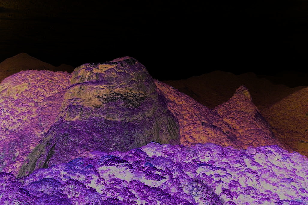
Figure 7
Overview of the Atlantic Forest: Tijuca National Park in Rio, the largest urban forest in the world.
(Photo: Corbis)
been severely impacted by human activities, mostly in the portion
Grande do Sul, Santa Catarina, Paraná, Săo Paulo, Rio de Janeiro, Minas
included in the Brazil Current. Fragments of Atlantic Rainforest are
Gerais, Espírito Santo, Bahia, Sergipe, Alagoas, Pernambuco and Goiás.
found in the whole Brazil Current region. Another biome, "Caatinga",
The other Brazilian states that host part of the Atlantic Rainforest
or dry thornbush, adapted to severe climate conditions is found in the
are: Rio Grande do Norte, Ceará, Piauí (GIWA region 40a Brazilian
East Atlantic Basins and Săo Francisco River Basin. Final y, "Cerrado",
Northeast); Mato Grosso and Mato Grosso do Sul (GIWA region 38
or high plain bush, biome is found in smal areas of the East Atlantic
Patagonian Shelf).
Basins and approximately half of the Săo Francisco River Basin. The
natural moorland formations Sulinos Fields, which appears mainly in
The most important fragments of Atlantic Rainforest are found along
the high areas of the south of the South/Southeast Atlantic Basins in
the southern granitic sector of the South/Southeast Atlantic Basins,
Rio Grande do Sul state has been greatly altered by forest fires, cattle
along stretches of the steep relief coastal mountain range of the
raising and crop plantation. Approximately 2.5% of the area is conserved
states of Santa Catarina, Paraná, Săo Paulo and Rio de Janeiro. In the
with the original vegetation. Araucária Forest exists in small sections in
East Atlantic Basins, the most important forest fragments are located
high areas (above 600-800 m), and has been also impacted by intense
in the southern part of the state of Bahia, between the Jequitinhonha
human activities, mainly as a result of the timber trade at the start of
and the Caravelas coastal plains; the Pardo River basin harbours a lush
the last century. Salt marshes and mangroves are found along different
rainforest reserve close to the coast. About five centuries ago, when
portions of the Brazilian coast, the Brazil Current portion being the most
Brazil was colonised by Portugal, the Atlantic Rainforest covered 15%
impacted due to anthropogenic activities.
(1.29 mil ion km2) of Brazil's territory (Figure 8). About 92.7% of this
coverage has disappeared. Only 7.3% (94 000 km2) of the original forest
Atlantic Rainforest
remains today (Fundaçăo SOS Mata Atlântica & INPE 2002). The Atlantic
The domain of the Atlantic Rainforest biome includes a group of forest
Rainforest is the second most endangered ecosystem in the world,
formations encompassing 17 Brazilian states, among them, all 12 states
after the already almost extinguished forest of Madagascar Island off
that are entirely or partial y included in the Brazil Current region: Rio
the coast of Africa. Based on recent studies, the Atlantic Rainforest
30
GIWA REGIONAL ASSESSMENT 39 BRAZIL CURRENT
REGIONAL DEFINITION
31
to the Atlantic Rainforest. The majority belong to the East Atlantic
Present forests
Basins. It is estimated that the rainforest hosts 261 species of mammals
(73 of them are endemic species), 620 species of birds (160 endemics)
Original forests
and 260 species of amphibians (128 endemics). For some groups, such
as primates, more than two thirds are endemic species. Seven species
that disappeared recently were from the Atlantic Rainforest. Among
202 species threatened, 171 are found in Atlantic Rainforest. Among
10 000 species of plants, 50% are endemic. The level of endemism
increases significantly when the species are separated by groups: 53.7%
of trees; 64% of palm trees; and 74.4% of bromeliads. Many plants with
pharmaceutical values which have not been properly studied are found
in the Atlantic Rainforest. Even in the fragmented shape it is today, the
forest guarantees water supply and quality of life for more than 70% of
the Brazilian population. The regulation of water flow, the soil fertility,
climate and stability of hills have been attributed to the forest. The
deforestation rate of the Atlantic Rainforest is extremely high: 2.5 times
the deforestation rate observed in the Amazon Forest during the
period 1990-1995 (Fundaçăo SOS Mata Atlântica & INPE 2002). During
this period, 500 317 ha of forest were deforested. If this rate continues,
in 50 years the forest wil disappear from the private properties. The
Brazilian state that had the highest deforestation rate was Rio de Janeiro:
140 372 ha, or 13.13% of the state's forest in only five years.
Biodiversity in freshwater fish associated to the Atlantic Rainforest
The existence of a high number of independent and relatively small
drainage basins, additional y separated by the mountain chains,
favoured the reproductive isolation during the evolutionary process
© GIWA 2004
Figure 8
Present and original cover of the Atlantic Rainforest.
in the Atlantic Rainforest. As a consequence, a very high degree of
(Source: Loveland et al. 2000, UNEP-WCMC 2004)
endemism, mostly of smal -size freshwater fish is found. Among 38
identified hotspots in terms of fish endemism in the Atlantic Rainforest,
has been considered the highest priority for biodiversity conservation
29 are placed in the region Brazil Current and one is partial y located in
in the American continent. Even the remaining 94 000 km2 are not
Brazil Current and partial y located in the biome South Fields of Brazil
equal y distributed among the different forested areas that form the
(which is part of GIWA 38 Patagonia Shelf) (MMA 2000).
biome. Several of these forest areas are almost extinguished, in bad
conservation, or not properly protected in conservation units. The
Mangrove
Atlantic Rainforest hosts a unique biological diversity, with extremely
(Extracted from Dov Por 2003)
high degree of endemism, resulting from the evolutionary process that
The Brazilian coast has, in a surface of around 20 000 km2, from Cape
made it geomorphological y isolated from other areas.
Orange, in Amapá (GIWA region 40b Amazon), to the municipality of
Laguna, in Santa Catarina (South/Southeast Atlantic Basins), a narrow
Particularly in the Brazil Current, the Atlantic Rainforest had an important
strip of mangrove forest cal ed "manguezal" or "mangue" (Figure 9) or
influence on the existing biodiversity of aquatic species that present
mangrove swamp. This is composed of a small number of tree species
the highest degree of endemism among fish species. The devastation
and develops mainly in estuaries and river mouths, where there is salt
process suffered by the Atlantic Rainforest due to anthropogenic
water and places semi-protected from the action of the waves, but
pressures in the Brazil Current is a valuable indicator of the pressures also
open to receive sea waters.
imposed on the aquatic systems nourished by the forest. Most of the
Brazilian plants and animals listed as endangered species are endemic
30
GIWA REGIONAL ASSESSMENT 39 BRAZIL CURRENT
REGIONAL DEFINITION
31
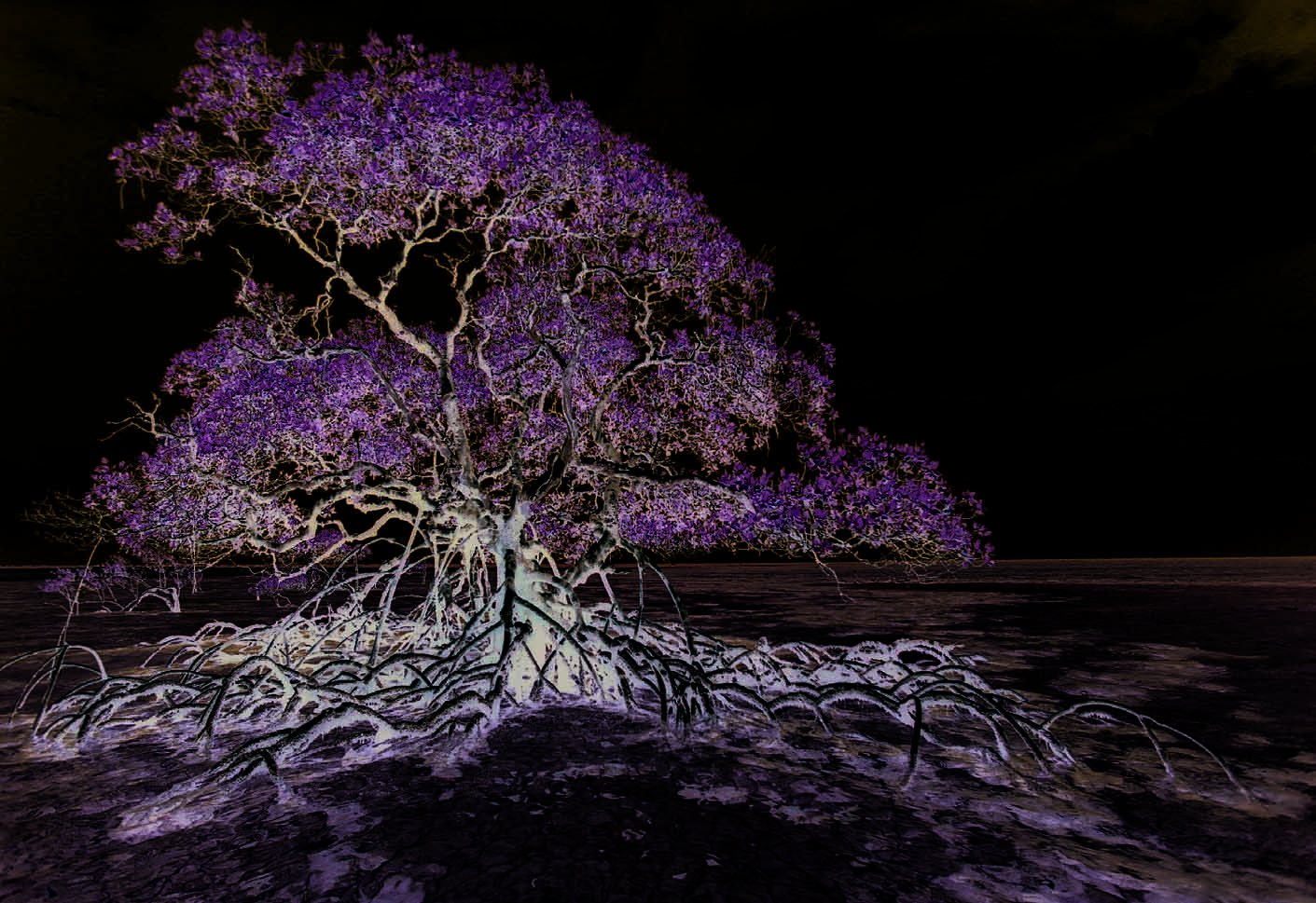
Figure 9
Red mangrove tree in clear waters. Boipeba Island, southern Bahia state, East Atlantic Basins.
(Photo: Luiz C. Marigo/Still Pictures)
According to Dov Por (2003), the mangrove ecosystem is an environment
be considered one of the most productive natural biomes in Brazil. Three
with a good supply of nutrients, where under the muddy soils there is
main tree species constitute the mangrove forests: the red or "bravo"
a tissue of roots and vegetable matter partial y decomposed, a kind
mangrove Rhizophora mangle, the white mangrove Laguncularia racemosa
of peat. In the estuaries, the muddy beds are crossed by tidal creeks
and the "seriba" or "seriuba" black mangrove Avicennia germinans. A few
("gamboas") used by fauna for movement between the sea, rivers and
species can be added to the flora of mangrove such as ferns, Spartina
the mangrove. Brazil has one of the largest extensions of mangrove in the
grass, the bromelia Til andsia usneoides, the lichen Usnea barbata and the
world. Underrated in the past because the presence of the "mangue" was
yel ow hibiscus. In the north of the country, the thick mangrove forests
intimately associated to yel ow fever and malaria, the mangrove has long
have trees which might reach 20 m of height. In the northeast of Brazil,
been considered an inhospitable environment, due to the presence of
there is a kind of mangrove known as "dry mangue", with smal -sized trees
different species of mosquitoes. Until the mid 1970s, the "progress" of the
in a sub-stratum of high salinity. In the southeast of Brazil, the mangrove
coast was considered to be equivalent to clean beaches, landfil s, ports
has the aspect of a shrub forest. Rich algae communities grow over
confined by concrete, and cultivation areas. Despite the great economic
the buttress roots of trees, in the area covered by the tide. The trunks
and social importance of this biome, during decades such perception
permanently exposed and the tree tops are poor in epiphytic plants. The
was in part responsible for the construction of ports, bathing resorts and
fauna includes various species of crabs, forming enormous populations in
coastal roads, reducing the extension of the mangroves. Contrary to other
the muddy beds. Many fish species of the Brazilian coast depend on the
forests, mangroves are not rich in species, but stand out for the great
food sources of mangrove at least in their young phase. Oysters, mussels
abundance of the populations living in them. For this reason, they may
and barnacles feed by filtering smal fragments of vegetable residues,
32
GIWA REGIONAL ASSESSMENT 39 BRAZIL CURRENT
REGIONAL DEFINITION
33
rich in bacteria, from the water. Prawns also enter the mangroves to feed
Physical characteristics of the
during high tide. Typical birds are few, due to the smal diversity of flora.
Uruguayan portion of the region
The abundance of fish attracts predators such as some species of shark
and dolphins. The yel ow chin al igator Caiman latirostris and the frog Bufo
Uruguay is one of the smal est of the South American republics.
marinus may occasional y be found there.
Geographical y, Uruguay is situated in the southern sub-tropical zone
of the South American Continent, between 30° and 35° S and 53°
Mangroves, used by the "sambaqui" men (tribes which inhabited
and 58° W. It is bounded to the north by Brazil, to the southeast by
the Brazilian coast during the pre-Columbian period) more than
the Atlantic, and is separated from Argentina by La Plata River in the
7 000 years ago, and since then by the populations who succeeded
south and by Uruguay River in the west. The country has an area of
them, have provided, and provide protein rich food for the Brazilian
176 215 km2. Topographical y, it is located in the transition area from
coastal population.
the Brazilian plateaux to the Pampean plains. The landscape is made
up of hil y meadows broken by streams and rivers. There is a string
Restinga
of beaches along the coast. The country enjoys 680 km of fine sandy
(Extracted from Mantovani 2003)
beaches on the Atlantic and the La Plata River. The country is divided in
Restinga is a term used to designate the coastal plains lowland biome
19 political and administrative divisions (departamentos). The northern
covered by marine deposits, resulting from the retreat of ocean
and the northeastern frontiers separating Uruguay from Brazil fol ow
levels around 5 000 years ago, during the Quaternary. Fol owing the
natural geographical lines. The eastern frontier is the Atlantic Ocean.
retreat, lacustrine and fluvial deposits have occurred, containing, in
Uruguay's capital is Montevideo.
part, material originating from the Crystal ine Complex escarpments,
characteristic in the south and southeast coasts of Brazil, or from the
Boundary between Brazil and Uruguay
sandstone of the Formaçăo Barreiras. These plains lowlands are situated
The boundary between Brazil and Uruguay is approximately 985 km
within humid tropical climate, with no dry season, and average annual
long. It is demarcated by marker pil ars and rivers, including the
rainfal s of around 1 700 to 2 000 mm (Mantovani 2003).
Jaguarăo River (Yaguarón in Spanish) and the Quarai River (Cuareim
in Spanish). In addition to the rivers, which comprise about 60% of the
Caatinga
boundary, the boundary line passes through Mirim Lagoon (Merin in
(Extracted from Rodrigues 2003)
Spanish) and fol ows the hil s of Cuchil a de Santa Ana and the Cuchil a
Right in the sub-equatorial zone, between the Amazon Forest and the
Negra. Disputes existed about the sovereignty of Brasileira Island at the
Atlantic Rainforest, are found the caatingas in the northeast of Brazil.
mouth of the Quarai River and to the identity of the Arroio Invernada.
They cover around 700 000 km2, approximately 10% of the national
The boundary between the mouth of the Arroio Săo Miguel (Arroyo
territory. The climate is semi-arid, with average annual temperatures
San Miguel in Spanish) in Mirim Lagoon and the headwaters of the
between 27°C and 29°C, and with rainfall averages less than 800 mm.
Arroio da Mina was determined by the treaty of October 30, 1909. On
The inhospitability of the caatinga climate arises especial y from the
May 7, 1913, the boundary in the Arroio Săo Miguel was modified by
irregularity in the distribution of rain in time and space. The superficial
a convention signed in Rio de Janeiro. Between 1920 and 1935, the
drainage is intense, since the soils are shal ow and situated over
land segments of the Brazil-Uruguay boundary were demarcated by
crystalline rocks (Rodrigues 2003).
pil ars. On December 20, 1933, a convention was signed in Montevideo
with respect to the legal status of the boundary. Subject to various
Cerrado
fluctuations, the mouth of the Arroyo Chuy was established official y
(Extracted from Pivel o 2003)
by an exchange of notes between Brazil and Uruguay on July 21, 1972
Cerrado is the regional name given to the Brazilian savannahs.
(International Boundary Study 1979).
Around 85% of the great plateau which occupies Central Brazil was
original y dominated by the cerrado landscape, representing around
Climate
1.5 to 2 mil ion km2, or approximately 20% of the country's surface.
Uruguay is the only South American country total y included in the
The cerrado region's typical climate is hot, semi-humid and notably
temperate zone. The climate in Uruguay is almost homogeneous and
seasonal, with rainy summers and dry winters. The annual rainfal is
in the whole country it is defined as temperate-humid "Cfa" type,
around 800 to 1 600 mm. The soils are general y very old, chemical y
according to Köppen's classification. The average annual temperature
poor and deep (Pivel o 2003).
is 16°C in the south and 19°C in the north. The monthly average
32
GIWA REGIONAL ASSESSMENT 39 BRAZIL CURRENT
REGIONAL DEFINITION
33
temperature varies from 7°C in July up to 31°C in January. The monthly
precipitation is uniformly distributed during the year, with a slight
Q
increase during the autumn. Periods of drought and intensive rainfal s
uarai
39
that cause floods are frequent during the summer. The relative humidity
Uruguay River
o
varies from 70% to 75% (Severova 1997). The rainfall regime according
emb
o
Negr
to the average values from 400 monitoring stations in Uruguay, shows
ay
Tacuar
38
alo
Urugu
few contrasts regarding space and time (Corsi 1978). The rainfall spatial
Queguay Grande
Canal de Săo
Gonc
Negro River
Jaguar
distribution shows a decreasing gradient in the section northeast-
ăo
o
southwest, with a maximum annual value of 1 400 mm in the northeast,
Negr
Mirim Lagoon
the boundary between Uruguay and Brazil where Mirim Lagoon
Yi
is found, and the minimum values of 900 mm at the La Plata River
Cebollati
La Plata River
S
Santa Lucia
(Corsi 1978). March is the month with the highest values (maximum of
basin West
ant
River
a L
140 mm) and December shows the lowest values (minimum 60 mm in
ucia
La Plata River
East Atlantic basin
of Uruguay
basin East
Punta del Este
Rocha). Regardless this distribution of average values, rainfal in Uruguay
© GIWA 2004
is marked by very high irregularity and variability. Extreme events have
Figure 10 Map showing the area of the six hydrographic basins of
been recorded such as drought periods during 1891-1894, 1916-1917,
Uruguay.
1942-1943, 1964-1965 and 1988-1989. Years with especial y high rainfall
(Source: EROS Datacenter 2003)
and many flooding events were recorded for 1914, 1959, 1983 and 1992
(Severova 1997).
Among these basins, those of importance for the present assessment
Drainage basins
are Mirim Lagoon and the Atlantic Ocean Basin, which together form
A dense network of rivers covers the Uruguayan territory. Large rivers
the east region of Uruguay, briefly described below.
belonging to the Atlantic slope and important basins exist, such as
La Plata River basin and the Uruguay River basin. These rivers and
The Uruguayan east region includes five departmentos that form the
their tributaries are of utmost importance as communications routes.
Mirim Lagoon basin and the Uruguay Atlantic basins (Figure 10). They
The superficial water flow is approximately 65 000 m3, with a run-off
are: (i) Cerro Largo, Treinta y Tres, Laval eja, Rocha and Maldonado that
coefficient of 0.35. According to Dirección Nacional de Hidrografía
form Mirim Lagoon and (i ) Rocha and Maldonado that form the Atlantic
(DNH), the country is divided in six large hydrographic basins, among
basins. The east region of Uruguay occupies an area of 48 537 km2 (27.3%
them four are considered international water bodies and two are
of Uruguay territory) and has a population of 390 495 inhabitants,
considered national water bodies as fol owing (Severova 1997):
which gives a population density of only 0.8 inhabitants per km2. The
Mirim (Merín in Spanish) Lagoon basin with 28 278 km2 in the
Uruguayan east region extends from the east of the Cuchil a Grande
Uruguayan territory (shared by Uruguay and Brazil and part of the
through the Mirim Lagoon to the coast of the Atlantic Ocean. In the
Brazil Current region);
north, the Jaguarăo River forms the boundary to Brazil and in the
Atlantic Ocean basins (Vertiente Atlántica) with 9 300 km2 (assessed
south, this region has as the limit, the coastal zone of La Plata River. The
independent from the Brazil Current region);
Uruguayan east region presents a variety of landscapes with strings,
La Plata River basin with 11 772 km2 in the Uruguayan territory
val eys and the coastal plain. La Cuchil a Grande Mountains is prolonged
(shared by Uruguay and Argentina included in GIWA region 38
to the west and divides the waters that drain to the Uruguay River and
Patagonian Shelf);
to the La Plata River from the waters that drain to the Mirim Lagoon.
Uruguay River basin with 45 612 km2 in the Uruguayan territory
The Jaguarăo River, originating in Brazil, together with the Mirim Lagoon
(shared by Uruguay and Argentina, included in GIWA region 38
forms the boundary between the two countries.
Patagonian Shelf);
Negro River basin with 69 500 km2 in the Uruguayan territory and a
very smal portion in the Brazilian territory (included in GIWA region
38 Patagonian Shelf);
Santa Lucia River basin with 13 517 km2 (100% Uruguayan basin,
included in GIWA region 38 Patagonian Shelf).
34
GIWA REGIONAL ASSESSMENT 39 BRAZIL CURRENT
REGIONAL DEFINITION
35
Lagoon systems in southern Brazil and northern
to 3 m. The combination of factors like sea currents and coastal type,
Uruguay
have resulted in the high productivity of Peixe Lagoon system and have
In southern Brazil and in the coastal portion of the departamentos of
made it of international importance for migratory shorebirds, such as
Rocha and Maldonado in Uruguay there are several systems of large
Calidris canutus, C. fuscicollis, Pluvialis squatarola and Limosa haemastica.
coastal lagoons and wetlands that support a very rich biodiversity. In
Peixe Lagoon connects to the sea via a temporary channel, when it
Brazil it is worth to mention the group of lakes north of Tramandaí;
functions as an estuary. Pexie Lagoon is designated as a Wetlands of
the group of lakes of Osorio; the sub-system south of Tramandaí; the
International Importance (Ramsar) (Figure 11).
Banhado Grande system; the Peixe Lagoon system; the Banhado do
Taim system; and the Mirim and Patos Lagoon system. Noteworthy
in Uruguay are the Rocha Lagoon; Negra Lagoon and Santa Teresa
marshes (Laguna Negra y Bańados Santa Teresa); Castil os Lagoon;
Socio-economic characteristics
Garzón and José Ignacio lagoons; Mirim Lagoon and San Miguel
of Brazil
marshes (Laguna Merín y Bańados de San Miguel). The Patos Lagoon,
the largest one, covers 10 360 km2 (Diegues 1999). The system of Peixe
Brazil and Uruguay form, together with Argentine and Paraguay, the
Lagoon includes five lagoons with a medium depth ranging from 0.3
Common Market of the South (MERCOSUR). With the MERCOSUR,
about 200 mil ion consumers representing 75% of the gross national
product of the whole of South America, as wel as an important
Caatinga
source of raw materials, constitute one single market. This common
Historic Centre of
Salvador de Bahia
market implies the free circulation of goods, services and productive
elements between the member states, with a common external tariff
Discovery Coast Atlantic Forest Reserves
for the goods coming from third countries. The region Brazil Current
encompasses portions of Northeast, Southeast and South regions of
Historic Centre of the Town of Diamantina
Brazil and on average it can be said that the economic growth rate in
Brazil Current during 1985-1997 varied from below to equal the national
Discovery Coast Atlantic Forest Reserves
economic growth rate (IBGE 2000a).
Historic Town of Ouro Preto
Sanctuary of Bom Jesus do Congonhas
Southeast Atlantic Rainforest Reserve
In Brazil, 27 states form five geographical regions that are identified from
the social, cultural and economical points of view (Figure 12). Patterns of
development and sectorial activities fol ow different dynamics in these
geographical regions. The regions are: North, Middle-West, Northeast,
Southeast and South (Figure 12). Most of social and economic
Peixe Lagoon
National Park
information made available by the official sources is aggregated
according to these geographical regions (IBGE 2000b). GIWA region 39
Brazil Current includes parts of three geographical regions: Northeast,
Eastern wetlands and coastal fringe
Southeast and South. In this section, the social as well as the economic
characterisation of the Brazil Current wil be presented, as much as
© GIWA 2004
possible for the whole region or for each sub-region: South/Southeast
Name
Country
Area (ha)
Status of protection
Eastern wetlands and coastal fringe
Uruguay
435 000
Wetlands of International Importance (Ramsar)
and UNESCO-MAB Biosphere Reserve
Atlantic Basins, East Atlantic Basins and Săo Francisco River Basin. Where
Caatinga
Brazil
19 899 000
UNESCO-MAB Biosphere Reserve
Discovery Coast Atlantic Forest Reserves
Brazil
111 930
World Heritage Convention
such level of aggregation is not possible, the information is presented by
Historic Centre of Salvador de Bahia
Brazil
0
World Heritage Convention
Historic Centre of the Town of Diamantina
Brazil
0
World Heritage Convention
geographical region; in the format it is available in official publications.
Historic Town of Ouro Preto
Brazil
0
World Heritage Convention
Peixe Lagoon National Park
Brazil
34 400
Wetlands of International Importance (Ramsar)
The economic analysis will focus on the last 10 to 20 years and trends
Atlantic Rainforest Biosphere Reserve*
Brazil
29 473 484
UNESCO-MAB Biosphere Reserve
Sanctuary of Bom Jesus do Congonhas
Brazil
0
World Heritage Convention
for the next 10 to 20 years.
Southeast Atlantic Rainforest Reserve
Brazil
1 691 750
World Heritage Convention
* The Atlantic Forest Biosphere Reserve (RBMA) covers about 1/3 of the Atlantic Rainforest's biome area (17 states, 3 408 municipalities), where about
119 million inhabitants are to be found, almost 68 % of the Brazilian's total population. The RBMA Core Zones includes several parks and other protected areas,
such as the Discovery Coast Atlantic Forest Reserve.
GIWA region 39, the Brazil Current, encompasses geographical portions
Figure 11 International protected areas and reserves in
of the "three Brazils", as revealed by the UNDP Human Development
Brazil Current region.
(Source: UNEP-WCMC 2003)
Index (UNDP 2001): the Northeast, Southeast and South regions. In
34
GIWA REGIONAL ASSESSMENT 39 BRAZIL CURRENT
REGIONAL DEFINITION
35
During 1985 to 1997, the Brazilian economy increased at an average
Roraima
rate of 2.7% yearly, with a recessive period at the beginning of the
Amapa
1990s (Reis 2000). From 1995 to 2002 the average rate was even lower:
2.3% yearly (Mercadante 2003). In 1999, the Gross Domestic Product
Amazonas
Para
Maranhao
Ceara Rio Grande do Norte
(GDP) had attained 480 billion USD. Approximately 62% of the GDP are
Paraiba
Piaui
Pernambuco
generated by the service sector, 35% by manufacturing, mining and
Acre
Tocantins
Alagoas
Rondonia
Sergipe
quarrying (including construction and public utilities) and only 8% by
Bahia
Mato Grosso
agriculture (Reis 2000). The importance of the service sector reflects,
Distrito Federal
Goias
on one hand, the economic and technological trends typical of the
Minas Gerais
contemporary world and, on the other, the absorption of labour by
Mato Grosso do Sul
Espírito Santo
Săo Paulo
Rio de Janeiro
the informal sector during two decades of relatively low availability of
Brazilian regions
Paraná
formal jobs. Economic growth differed among the Brazilian regions
North
Santa Catarina
during 1985 to 1997, as fol ows:
Northeast
Rio Grande do Sul
The Middle-West and the North (the only two Brazilian regions that
Middle-West
do not form part of the Brazil Current) have been the frontiers of the
Southeast
South
economic growth, presenting economic growth rates 1.5 to 2 times
© GIWA 2004
higher that the national average rate, during this period;
Figure 12 Brazilian regions.
From north to south, region 39 includes part of the states of Pernambuco PE,
The Northeast fol owed the national economy pattern of growth;
Alagoas AL, Sergipe SE, Bahia BA (northeast region), a small portion of Distrito
Federal DF, states of Minas Gerais MG, Espírito Santo ES, Rio de Janeiro RJ, Săo
The Southeast presented a relatively lower growth rate during the
Paulo SP (southeast region), Paraná PR, Santa Catarina SC, Rio Grande do Sul RS
(south region).
period until 1994, matching the national average afterwards;
The South inverted this pattern, with a higher growth rate until 1994
Brazil, the poorest 20% have only 2.6% of the total national wealth;
and a lower growth rate from 1995 to 1997.
the richest 20% have 65% (IBGE 2001). This extremely uneven
wealth distribution has been historical y associated to the contrasts
Demography
between the undeveloped northern Brazil, the often drought-affected
The average demographic density in Brazil is approximately
northeastern Brazil and the much more prosperous and industrialised
20 inhabitants per km2, ranging from 1.9 inhabitants per km2 in the
southeastern and southern Brazil. The Southeast and the South regions
Amazon region to 126 inhabitants per km2 in the southeastern Brazil.
are together responsible for more than 75% of the Brazilian Gross
Some drainage areas in Brazil Current are particularly populous, and the
Domestic Product (GDP) (Table 3). Therefore, although the Brazil Current
Rio de Janeiro littoral basins (59 in Figure 2) have the highest population
region is almost 100% Brazilian territory (except for the catchment area
density: 606 inhabitants per km2 (PNRH 2003).
of Mirim Lagoon in Uruguay), it shows an extremely high diversity
regarding social, cultural and economic aspects. The North region,
Recent data show a profound transformation in the Brazilian
which has an area bigger than the Southeast and South together
demographic dynamics. The results of the demographic surveys carried
(Figure 12), generates less than 5% of the GDP. The next biggest region
out in 1991 and 2000 (IBGE 2000b) confirm a deceleration in population
from the geographical viewpoint, the Middle-West, generates just
growth rate nation-wide, which resulted in a similar growth rate in those
over 5% of the GDP, although a trend towards an increase in the rate of
regions that form the Brazil Current (Figure 13). The growth rate for
development growth has been observed (IBGE 2001).
the Brazilian population, which was 2.8% in the period 1950-1980, fell
to 1.9% in the period 1980-1991 and to 1.5% in the period 1991-2000
Table 3
Contribution of each region to the Brazilian GDP.
(Ferreira 2000). Additional y, the recent demographic dynamics show
Region
% of GDP
a new feature: not only has the fertility fal en to levels lower than
North
4.4
ever in the history of Brazil, but other components of demographic
Middle-West
5.3
dynamics, mortality and migration, no longer behave as in the past. The
Northeast1
13.8
transformation in the age structure shows clearly the population aging
Southeast1
59.4
(Ferreira 2000). All these changes indicate that Brazil is moving towards
South1
17.1
a more developed-country demographic structure type. Even so, the
Total
100.0
Note: 1Partially included in the GIWA Brazil Current region. (Source: IBGE 2000a)
absolute number of inhabitants to be added to the present population
36
GIWA REGIONAL ASSESSMENT 39 BRAZIL CURRENT
REGIONAL DEFINITION
37


the Brazil Current region. During the last decades, the percentage of
the population living in urbanised areas varied from 67% in Bahia (the
50
least urbanised state in the region) to 96% in Rio de Janeiro state (the
40
r
a
t
e
(%)
Brazil
Northeast
most urbanised state in the region) (IBGE 2000b). In most states, the
t
h
Southeast
30
r
o
w
South
rural population growth was negative (Table 4).
g 20
10
u
l
a
t
i
o
n
Table 4
Population growth rate in Brazilian states entirely or
partially included in the Brazil Current region.
P
o
p
0
1950-1960
1960-1970
1970-1980
1980-1991
1991-2000
Population growth rate (annual average %)
Years
Total population
Urban population
Rural population
Figure 13 Population growth rate per decade in Brazil and three
Brazilian regions partially included in the Brazil Current
1980-
1991-
1980-
1991-
1980-
1991-
Brazilian state
1991
2000
1991
2000
1991
2000
region: the Northeast, Southeast and South regions.
(Source: IBGE 2000b)
Pernambuco
1.36
1.18
2.66
2.05
(-) 1.15
(-) 1.23
Alagoas
2.18
1.29
3.87
2.93
0.23
(-) 1.51
during the next 20 years may be considered huge. Projections of
Sergipe
2.47
2.01
4.50
2.70
(-) 0.60
0.48
the Brazilian population indicate that the population of 169.5 mil ion
Bahia
2.09
1.09
3.79
2.52
0.11
(-) 1.33
inhabitants (IBGE 2000b) wil become 207.6 mil ion inhabitants in
Minas Gerais
1.49
1.43
2.50
2.47
(-) 0.95
(-) 2.30
2020. This implies 38 million more people, with a lower proportion of
Espírito Santo
2.31
1.97
3.68
2.79
(-) 0.70
(-) 0.72
young people and a higher proportion of elderly. About 58.43 million
Rio de Janeiro1
1.15
1.30
1.49
1.39
(-) 3.73
(-) 0.74
inhabitants (approximately one third of Brazilian population) live in the
Săo Paulo
2.13
1.78
2.56
1.85
(-) 2.01
0.78
Brazil Current region (IBGE 2000b).
Paraná1
0.93
1.39
3.01
2.58
(-) 3.03
(-) 2.62
Urbanisation and littoralisation trends
Santa Catarina
2.06
1.85
3.69
3.10
(-) 0.90
(-) 1.77
Rio Grande do Sul
1.48
1.22
2.64
1.95
(-) 1.48
(-) 1.52
The demographic density of Brazil Current is shown in Figure 14.
Note: 1The only states where the annual population growth rate increased during the period.
A trend towards urbanisation and littoralisation has been observed in
(Source: IBGE 2000b)
The South/Southeast Atlantic Basins host a population of 6.81 million
inhabitants and the East Atlantic Basins have an estimated population
of 48.86 mil ion inhabitants (IBGE 2000b), among them, 11.19 mil ion
live in the Rio de Janeiro state littoral (basins 59 in Figure 2). The Săo
Salvador
Francisco Basin hosts about 13.95 mil ion inhabitants (IBGE 2000b),
distributed among 503 municipalities, with 26.4% living in the Belo
Horizonte metropolitan area (state of Minas Gerais) - only 1% of the
whole drainage area (Plano Nacional de Recursos Hídricos 2003).
Belo Horizonte
The majority of the population is living in cities and in most states of
Rio de Janeiro
the region, littoralisation (increasing concentration of the population
Population density
Curitiba
(inhabitants/km2)
and economic activities in coastal cities) is observed (Figure 15). The
0
pressure on the water resources and further demand for sanitation
2
5
infrastructure (water supply, sewage col ection, solid waste col ection)
25
Porto Alegre
is a priority issue, particularly in the coastal cities.
50
100
500
2 500
Economic sectors
5 000
Tourism
100 000
Tourism is one of the most important driving forces towards coastal
occupation in Brazil and it is expected to expand further during the
Figure 14 Brazil Current population densities.
(Source: ORNL 2003)
coming years. The participation of tourism in the national economy has
36
GIWA REGIONAL ASSESSMENT 39 BRAZIL CURRENT
REGIONAL DEFINITION
37
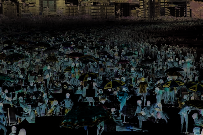

In South/Southeast Atlantic Basins, tourist attractions additional to the
beaches are the thermal waters in Rio Grande do Sul (Iraí) and Santa
Catarina (Gravatal and Santo Amaro da Imperatriz), and the water sports
practiced in the lagoon systems.
In East Atlantic Basins, the importance of tourism is il ustrated by
(FGV 1998):
More than 2 000 km of coastline, from the Săo Sebastiăo Island (SP)
to Aracaju (SE);
Several coastal cities have become tourist centres, such as: Salvador,
Ilhéus and Porto Seguro (BA); Vitória and Guarapari (ES); Rio de
Janeiro, Cabo Frio, Búzios, Angra dos Reis and Parati (Figure 16)
(RJ); Ubatuba, Caraguatatuba and Ilha Bela (SP);
Non-coastal cities of historical importance in Minas Gerais, National
Parks for ecotourism in Serra da Bocaina, Caparaó, Chapada
Figure 15 Ipanema beach, Rio de Janeiro: Example of
Diamantina, Monte Pascoal;
littoralisation observed along Brazil Current coastal
Rivers intensively used by the local communities for leisure and
zone (East Atlantic Basins).
(Photo: Ricardo Funari/SocialPhotos)
water sports (e.g. Jequitinhonha River, basin 54 in Figure 2).
increased regularly since 1993, moving from 1 091 million USD in that
year to 3 996 million USD in 1999 (IBGE 2000a), fol owing the increase
in the number of tourists that visited Brazil during the same period. For
this reason, the Federal Government and a large number of state and
city administrations have given increasing attention to this sector. The
annual average rate of increase during the 1990s was 14.3%, surpassing
the world average rate of growth for tourism, which was 10% per year
during the same period (IBGE 2000a). However, these values are still
very low when compared with those of leading countries in the world
as tourist destinations (e.g. France and Spain). About 30.3% of al the
tourists visiting the region come from Argentina, making the Brazilian
revenue from tourism to a large extent dependent on Argentina's
economy. The Argentinean tourists come mostly to region Brazil Current
coastal cities, in Santa Catarina, Paraná and Rio de Janeiro states. The
economic crisis faced by Argentina during recent years has probably
affected this tourism. The second largest group of tourists coming to
Brazil is European (Ryff 2000). Tourism is particularly accentuated on the
Brazilian coast due to its exceptional landscape, open oceanic beaches,
dunes, pleasant climate and cultural attractions. The coastal zones of the
GIWA region Brazil Current and Brazilian Northeast comprise the most
visited area of Brazil by national and international tourists. Among the
18 Brazilian cities that received the highest number of tourists during
the 1990s, nine cities are located on the coast of Brazil Current. Rio de
Janeiro city continues to be by far the most visited Brazilian city by
foreign tourists. Florianópolis is ranked second, due to the Argentinean
Figure 16 Parati, Rio de Janeiro state littoral, one of the cities
attractive due to both history/architecture and nature
tourists (Ryff 2000). Adequate sanitation infrastructure is particularly
values (East Atlantic Basins).
important to keep the attractiveness of these tourism centres.
(Photo: Corbis)
38
GIWA REGIONAL ASSESSMENT 39 BRAZIL CURRENT
REGIONAL DEFINITION
39
Săo Francisco River Basin has a considerable potential (not yet
it the biggest industrial park of the south of Brazil, fol owed by
developed) to become a tourism attraction for sport fishing,
the val ey of Taquari-Antas River. The industrial activities include:
additional y to those already wel -visited historical cities such as Ouro
textile, metal-mechanical, leather, chemical, computer, electric
Preto and Sabará (both in MG).
material and communication. About 90% of the existing mineral
coal in Brazil is found in Rio Grande do Sul state and Santa Catarina.
Industry
Rio Grande do Sul state also hosts the largest industrial park for
The industrial sector in Brazil suffered major oscil ations during the
wheat and soybeans processing, and some other important food
1990s and went through a significant structural change, as a response to
industries of the country.
external and domestic economic changes. During this period, industry
shrank in relative terms, as the average growth rate (1.4% per year)
In East Atlantic Basins where the industrial activity achieves the greatest
was lower than the general economic growth. The average for the
economic importance, there are six identified important areas as fol ow
five years of expansion observed in the mid-1990s was only 4.5%
(FGV 1998):
(IBGE 2000a). Growth restrictions were mainly high interest rates and
The Aracaju Metropolitan region (basin 50 in Figure 2, Sergipe state)
low levels of incentives for exportation. On the other hand, during
with many industries related to petroleum exploitation processing,
this period, as a response to the increasing competition, companies
non-metal mining and food processing (e.g. orange juice).
became more efficient and the productivity increased at an average
The metropolitan region of Salvador (basin 51 in Figure 2, Bahia
annual rate of 8.78% during the 1990s. Efficiency and competitive
state), with the Petrochemical Pole of Camaçari, metal-mechanical
advantage also brought greater environmental awareness. Particularly
and food processing.
in large enterprises, a greater care and efficiency when using natural
The "Steel Val ey" in the Upper Doce River (basin 56, Minas Gerais
resources (water, energy, raw materials in general) and policies for waste
state), with metal urgy, paper and pulp, food processing, besides
minimisation, has been announced. Some important initiatives, in this
an intensive mining activity.
period, can be seen in the control of water resources pol ution. The
The Vitória Metropolitan region (basin 57, Espírito Santo) with the
National Law for Water Resources No. 9 433, of 1997, established the
steel company of Tubarăo, Vale do Rio Doce Company, Aracruz
national policy for the water resources and created the national system
(cellulose), Garoto (confectionery) among others.
for water resources management. Although the implementation of the
The Val ey of Paraíba do Sul River (basin 58, Săo Paulo, Minas
law has been slow and not implemented yet in most of the country,
Gerais and Rio de Janeiro states) with the largest industries in the
some progress can be observed. It is expected that the pol uter pays and
municipalities of Resende, Barra Mansa and Volta Redonda (RJ), such
the user pays principles, associated to a decentralised management, will
as the National Steel Company, Dupont of Brazil and Cyanamid. In
result in the financial resources generated through water use charging
Săo Paulo, the main production is chemical, petrochemical, steel,
in a given basin, being invested in the same basin.
mechanical, food, clothes and the only Brazilian aeronautic industry.
In Minas Gerais, the industrial activities are metal urgy, chemical,
In South/Southeast Atlantic Basins, the main industrial areas are
textile, paper, and food processing.
(FGV 1998):
The Rio de Janeiro Metropolitan region (part of basins 59,
In Săo Paulo littoral, the industrial pole of Cubatăo works closely
Rio de Janeiro state) includes petroleum, ship construction,
integrated to the Port of Santos. Main industries are petroleum,
metal urgy, chemical, besides food processing, textile, clothes,
petrochemical and chemical.
and pharmaceutical, among others. In the Guanabara Bay basin,
In Paraná littoral basins, the industries operate integrated to the
for instance, there are 7 000 industries of different sizes, typologies
Port of Paranaguá. Mining activities are widely spread al over these
and polluting potential.
basins.
In Santa Catarina littoral, 10 000 smal , medium and large-sized
According to the environmental protection agencies of three states
industries represent two thirds of the whole industrial park of
(RJ, SP and MG) that are part of Paraíba do Sul River basin, Rio de
the state, and employ the major part of the state labour force.
Janeiro has 700 industries registered, Săo Paulo has 2 370 (mostly in
415 large-sized industries operate their own water supply system
the municipalities of Jacareí, Săo José dos Campos and Taubaté), Minas
with surface or groundwater origin.
Gerais has 2 000 (approximately half of them, in Paraibuna River basin,
In Rio Grande do Sul state, 11 000 industries are concentrated
especial y in the municipality of Juiz de Fora). Other municipalities in
in the Porto Alegre Metropolitan region (Guaíba Lake) making
Minas Gerais with industrial activity of importance are Cataguazes and
38
GIWA REGIONAL ASSESSMENT 39 BRAZIL CURRENT
REGIONAL DEFINITION
39

Ubá (FGV 1998). Other areas where industrial activity has some regional
from 84 million USD in 1995 to 300 million USD in 2001 (Caixeta 2001).
importance are Feira de Santana (BA), Vitória da Conquista (BA), Ilhéus
Chicken meat exports went from 641 million USD to 1.3 billion USD and
(BA) and Cachoeira do Itapemirim (ES) (FGV 1998).
bovine meat exports grew from 180 mil ion USD to 800 mil ion USD over
the same period (Caixeta 2001). Other factors, apart from the external
In Săo Francisco River Basin the main industrial areas correspond to:
market, which contributed to production and export growth were:
Belo Horizonte in MG (upper Săo Francisco); Barreiras in western Bahia
changes in technology, such as direct planting, increasing sanitary
(middle Săo Francisco); Petrolina, Juazeiro (lower-middle Săo Francisco)
control and changes in logistics fol owing investment in transport
and Jaguarari (BA); and Arapiraca in AL (lower Săo Francisco). The main
infrastructure (Caixeta 2001). The development occurred mainly in
industrial sectors in the Basin are chemical, metal urgy, non-metal
the states of Paraná, Bahia, Săo Paulo (included in the Brazil Current
minerals, textile, clothes, and food processing with emphasis on vegetal
region), Goiás, Mato Grosso do Sul and Mato Grosso (GIWA region 38
oil processing (Haddad in FGV 1998). Municipalities that have recently
Patagonian Shelf). The agricultural development in different systems of
developed special industries are Barreiras (soybean and other vegetable
Brazil Current is presented below.
oils), and Petrolina (fertilisers, soil amendment products). Only in Belo
Horizonte city, in Săo Francisco Basin, the number of jobs offered in the
In the littoral portion of South/Southeast Atlantic Basins agriculture
industry sector increased during the period of 1985 to 1994 (Oliveira
activity is less developed than in other parts of the Basins due to
& Lacroix in FGV 1998). This study also showed that in some areas, the
physiographic conditions (soil, water availability and climate) and socio-
population employed by the industry was reduced significantly during
cultural characteristics (FGV 1998). The exceptions are the basins of
1985 to 1994. This effect was observed in the food processing industry
Patos and Mirim Lagoons that have soil particularly suitable for irrigated
of Petrolina and Juazeiro (BA) and Montes Claros (MG). The same study
rice, and the basins of Vacacaí, Taquari-Antas, Alto, Baixo Jacuí, Pardo,
pointed out that in national terms, the new industries have been
Sinos, Caí and Gravataí rivers, in Rio Grande do Sul state (FGV 1998). The
concentrated in the northeastern Brazil littoral or in south/southeast
agriculture economical y important in the Rio Grande do Sul portion
cities.
of the Basins (Figure 17) includes rice, potato, orange, apple, soybean
and wheat. Subsistence agriculture includes beans, manioc, corn, and
Agriculture
potato. The commercial plantations in South/Southeast Atlantic Basins
The last decade confirmed the success foreseen in years past and
are banana (found al over the littoral), coffee (SP, PR) and sugar cane
showed levels of production and productivity beyond the expectations
(SC, RS). Livestock for meat, milk and wool production in Rio Grande do
in the agricultural sector. This occurred, despite the Brazilian energy
Sul represents 80% of the total animal raising in the Basins, where large
crisis and rationing that affected especial y the Brazilian East and
areas of natural pasture exist due to the biome Southern Fields (Campos
Northeast (both included in the Brazil Current region) after an unusual
Sulinos in Portuguese).
prolonged drought period, as wel as the near collapse of the Argentine
economy and international conflicts. The Brazilian agriculture sector has
never exported as much before, reaching a record in productivity, new
agro-industrial efficiency gains and new markets. Gaps that appeared in
foreign markets because of the reappearance of the mad cow disease
in Europe, along with foot and mouth disease were fil ed mainly by
Brazilian exports. From January to September 2001, according to data
from the Development Ministry Foreign Trade Department, shipments
were worth 2.1 bil ion USD, a 50% jump on the figures for the same
period the year before (Caixeta 2001).
Agriculture GDP, which currently stands at around 34 bil ion USD
(80 bil ion BRL) was expected to grow 4.1% in 2001 compared with
1.7% growth in the economy in general (Caixeta 2001). Productivity of
grain production jumped from 57.8 mil ion tonnes of grain produced on
37.8 million ha (1990/1991) to 100 million tonnes of grain in almost the
Figure 17 Rural workers in Rio Grande do Sul state.
same area (38.3 million ha in 2001/2002). Pork meat exports increased
(Photo: Ricardo Funari/SocialPhotos)
40
GIWA REGIONAL ASSESSMENT 39 BRAZIL CURRENT
REGIONAL DEFINITION
41
In East Atlantic Basins, agriculture is one of the most important supports
Brazil has been changing gradual y from an almost exclusively
of regional development. The basins of Vaza-Barris, Real and Itapicurú
hydropower source of electricity supply, to a combined matrix that
rivers as well as in the Recôncavo, northern Bahia (East Atlantic Basins,
includes other energy sources. According to the Thermoelectric
part of 50 in Figure 2), developed consortia cultivations that combine
Priority Plan (PPT) (Plano Prioritário de Termelétricas), announced by
corn with beans, manioc with sisal, and have a number of typical fruits
the Federal Government at the beginning of 2000, 49 thermal units
cultivation such as acerola, cashew, pineapple, orange, passion fruit,
for energy production wil be in place by the year 2003. These new
besides cacao (FGV 1998).
thermoelectric plants will generate 16 200 MW. Of these, 42 will run on
natural gas, and 17 will be located in the state of Săo Paulo.
Agriculture in the Săo Francisco Basin has expanded, due to irrigated
plantations and integration between agriculture and industry (agro-
The intensification of use of natural gas to generate electricity has some
industry). When large-scale production increases, the agro-industry is
controversial aspects. One of them is that such a policy will increase
a decisive instrument to guarantee the sale of the harvest. This close
Brazilian dependency on non-renewable energy resources, which
association is observed in Petrolina and Juazeiro (BA) and in northern
already represent 58% of the total energy supply in Brazil (Santos in
Minas Gerais, which have 150 000 ha irrigated. The main result has been
John & Campanili 2000). According to thermodynamic calculations,
an increasing growth of non-traditional crops with high market value.
58.2% of the energy comes from non-renewable sources and 41.8% from
Irrigation in lower-middle Săo Francisco increased fruit production
renewable sources. From the total amount of energy supply (renewable
(papaya, mango, watermelon and grapes). Cultivation in favourable
and non-renewable), about 46.7% comes from petroleum and only
climatic strips in the arid regions has resulted in increased cocoa
14% comes from hydropower plants (Santos in John & Campanili 2000).
and pineapple production. Increases in tomato, coffee and rubber
Another controversial aspect is that, despite the fact that natural gas is
production are due to favourable ecological conditions in specific
cleaner than oil, the Brazilian contribution to greenhouse gases emissions
physiographic zones in the northeast portions of the Basin: the lower-
and other important gases is likely to increase (e.g. nitrogen oxides that
middle Săo Francisco, the Agreste, the Cerrado and the Zona da Mata.
contribute to the formation of "bad ozone" at low altitude, and sulphur
However, serious environmental issues have arisen in Săo Francisco Basin
dioxide that contributes to the acid rain). The water demand for cooling
due to agriculture activities, such as: (i) soil salinisation in some areas as
systems of thermal power plants, existing or under construction, is not a
a consequence of improper irrigation techniques; and (ii) modification
significant environmental issue, due to the use of closed systems.
of stream flow of Săo Francisco River as a result of the cascade of dams
original y constructed for energy purposes, also affecting the transport
The South/Southeast Atlantic Basins is supplied by the South/Southeast/
of sediments to the coast.
Middle-West Interconnected Electric System, whose electricity comes
from Itaipu and Paraná systems, Iguaçu, Uruguay and Jacuí rivers (part
Energy
of GIWA region 38 Patagonian Shelf), complemented by coal-based
The energy crisis faced by the country during 2001, due to water
thermoelectric plants (Candiota, Tubarăo and Charqueadas) (FGV 1998).
shortage in reservoirs, highlighted the need for an efficient strategic
Thus, although several smal and medium-sized hydropower plants
plan, changes in the energy matrix and significant investments. An
and thermoelectric plants exist in South/Southeast Atlantic Basins, this
unusual y long dry period of two years brought the levels of reservoirs
basin imports most of its energy from another basin. Any expansion of
in the Middle-West and Southeastern Brazil down to 20% and in the
electricity generation inside the South/Southeast Atlantic Basins would
Northeast down to almost 8% of their capacities. The energy shortage
be thermoelectric and use coal and gas imported from Argentina and
associated to international economic factors affected the Brazilian
Bolivia because the possibilities for expansion of energy generation
economy and reduced the GDP expectations for 2001. Regions part
from hydropower sources are limited in the Basins. However, there are
of the Brazil Current were among the most affected in the country.
several possibilities for construction of small hydropower plants, mostly
However, the energy crisis in 2001 had a positive effect as it brought
in the states of Santa Catarina and Rio Grande do Sul (Table 5). According
the issue to the public discussion with participation of different
to the National Plan for Electric Power 2015 prepared by Eletrobrás, the
stakeholders. The need of significant investments to expand the energy
South/Southeast Atlantic Basins represents 2.7% of the hydroelectric
supply has been emphasised (hydroelectric and thermo-electric plants
power in the country (FGV 1998).
as well as the distribution and transmission system). Privatisation and
large-scale use of natural gas are likely to result in changes regarding
In the East Atlantic Basins there are several hydropower plants, from
environmental impacts from energy production and consumption.
large-sized (Funil, Ilha dos Pombos, Mascarenhas and Salto Grande) to
40
GIWA REGIONAL ASSESSMENT 39 BRAZIL CURRENT
REGIONAL DEFINITION
41
smal -sized plants (less than 5 MW). Additional y, large-sized industries
Moxotó, Paulo Afonso and Xingó, all of them placed in cascade, which
operate their own generation systems (e.g. Usina Sá Carvalho by Acesita,
gives to the system low operational flexibility (FGV 1998).
Usina Brecha by Aluminas and Usina Piracicaba by Belgo-Mineira). The
National Plan 2015 includes the following new hydropower plants for
Navigation
the East Atlantic Basins, representing more than 3 000 MW of instal ed
In the South/Southeast Atlantic Basins waterways are relevant in the
power:
state of Rio Grande do Sul, mostly in the Patos Lagoon, Guaíba Lake and
Basin 51 Paraguaçu River: Pedra do Cavalo plant (300 MW);
Jacuí River, with the ports of Rio Grande, Porto Alegre and Estrela that
Basin 54 Jequitinhonha River: Irapé (420 MW) and Itapebi (375 MW);
make access to the petrochemical pole of Triunfo, with approximately
Basin 56 Doce River: Aimorés (396 MW), Resplendor I (363 MW),
600 km navigable. The Săo Gonçalo Channel make navigation
Baguari I (169 MW) and Pilar (150 MW), Porto Estrela (112 MW), Picada
possible from Uruguay to the Port of Rio Grande and the Porto Alegre
(100 MW), Manhuaçu (100 MW);
Metropolitan region (RS). In Santa Catarina state, waterways are active
Basin 58 Paraíba do Sul River: Simplício (180 MW) and Sapucaia
in the fol owing rivers: Tubarăo (40 km), Araranguá (40 km) and Una
(300 MW).
(30 km), in the south littoral and in the rivers Itajaí-Açu and Western Itajaí
(130 km) in the Itajaí River basin only during some periods of the year.
Săo Francisco River Basin supplies hydroelectricity to the Northeast
In Săo Paulo state, the rivers Ribeira do Iguape (70 km), Juquiá (54 km),
region and the state of Minas Gerais and is an important connection
Una D'Aldeia (62 km) and Itanhaém/Iguapeú (60 km), have only local
between two large electricity generation systems in the country:
significance as waterways.
the South/Southeast/Middle-West system and the North/Northeast
system. Regardless the hydro-meteorological difference between the
The waterway transport in East Atlantic Basins have no longer the
North/Northeast and South/Southeast regions of Brazil, the hydropower
importance it had in the past. Roads replaced the waterways as the
potential is shared between these two systems. Săo Francisco River
main transportation system in these Basins, and only a smal -scale
Basin has a hydroelectricity potential estimated at 21 000 MW. The
transportation of people and goods remains. The topography of the
Basin has 14 hydroelectric power plants instal ed, although an inventory
region, as wel as the highly variable river flows are the main limiting
carried out identified the potential for 180 medium to large-sized plants.
factors. Additional y, as a consequence of deforestation and inadequate
The capacity instal ed at present generates more than 50 mil ion MW
use of soil in agricultural areas, advanced process of silting is observed
annual y, which represent 19% of the national hydroelectricity
in several rivers, as for instance, the Doce River, making fluvial transport
generated in the country. The hydroelectric power plant Tręs Marias
impossible in 143 km, previously used for transport, in the section
is electrical y connected to the South/Southeast/Middle-West system
between Regęncia (foz) and Mascarenhas (MG) (FGV 1998).
and hydraulical y connected to the rest of the Săo Francisco system,
which includes the hydroelectric power plants: Sobradinho, Itaparica,
The Săo Francisco River has two main waterway sections and a third one
with limited use: the first (1 312 km), between Pirapora/MG and the cities
Table 5
Hydroelectric power plants in South/Southeast Atlantic
of Juazeiro (BA) and Petrolina (PE) presents navigable conditions al year;
Basins 1997-2006.
the second (208 km), between Piranhas (AL) and the river mouth. A third
Installed capacity
Start of initiation of
Hydroelectric plants River
State
(MW)
operation
section (150 km) is from Juazeiro (BA) downstream to Santa Maria da Boa
Palmeiras (expansion)
Bonito
SC
7
Jan/1999
Vista (PE). The Grande River is navigable along 370 km of its extension,
Passo do Meio
Antas
RS
30
Jul/1999
between Barreiras and the mouth. The Corrente River is navigable
Monte Claro
Antas
RS
130
Jul/1999
Guaporé-APE
Guaporé
RS
20
Dec/1999
along 110 km, from the mouth to Santa Maria da Vitória (BA). Despite
Cubatăo -Sul
Cubatăo
SC
45
Jan/2000
the strategic location of Săo Francisco River Basin as an important
Salto-aml.
Itajaí-Açu
SC
8,1
Mar/2000
interregional connection, its use as waterway is currently very reduced,
D.Francisca
Jacui
RS
125
Dec/2000
differently from the recent past, when fluvial transport made possible
Portobel o-APE
Garcia
SC
15
Mar/2001
development of economic centres, such as Juazeiro, Petrolina, Barra,
Bom Retiro
Taquari
RS
25
Aug/2002
Salto Pilăo
Itajaí-Açu
SC
220
Oct/2002
Xique-Xique, Pirapora and Januária. The decline of this activity is
Funil-Ribeira
Iguape
SP
150
Apr/2004
illustrated by the transport of goods that in 1987 was 120 000 tonnes,
Capivari
Braço do N. SC
25
Apr/2004
but in 1994 was only 26 000 tonnes. Since then, the activity has been
Tijuco Alto-APE
Iguape
SP
144
Jan/2005
further reduced (FGV 1998).
Batatal
Iguape
SP/PR
75
Apr/2007
(Source: ELETROBRÁS National Plan for Electric Power 1993-2015)
42
GIWA REGIONAL ASSESSMENT 39 BRAZIL CURRENT
REGIONAL DEFINITION
43
Fisheries
The commercial species in this LME include sardines, oysters, shrimp,
Despite the relatively small relevance in terms of contribution to GDP,
anchovy and hake. Information on the exploitation of fish stocks is
fisheries in Brazil have the highest social significance. Along the Brazilian
not available for al areas and species. Regarding freshwater fisheries,
coast, and especial y along the Brazil Current region, fishing is a dynamic
the South/Southeast Atlantic is a privileged area, mostly due to Patos
activity. It represents a labour-intensive activity, responsible for about
and Mirim Lagoons (RS), and the group of lagoons in the littoral of Rio
800 000 direct jobs, and approximately four million people depend on
Grande do Sul state and Santa Catarina state. The fishery potential is
the sector.
likely to be bigger in the coastal zones, close to the lagoon systems
where crustaceous and other estuarine species complete their
Annual y, Brazil produces about 700 000 tonnes of fish. Approximately
reproductive cycle.
70% come from the ocean, 20% from freshwater source and nearly 10%
from fish-farming, a practice which has grown considerably during
The coast of East Atlantic Basins together with the estuary of Săo
recent years. There is still room to expand the national fishery industry.
Francisco Basin are included in the Large Marine Ecosystem LME 16,
However, the supposedly enormous potential that might be indicated
East Brazil. It is considered a Class I I, low productivity (<150 gC/m2/year)
by thousands of kilometres of coast and some of the largest watersheds
ecosystem based on SeaWiFS global primary productivity estimates
in the world is not entirely real, in large part due to environmental
(Ekau & Knoppers in press). It has a more diverse food web than the LMEs
reasons. The most productive coast of the Brazil Current, the South/
to the north (LME 17 North Brazil Shelf) and to the south (LME 15 South
Southeast Atlantic Basins correspond to the Large Marine Ecosystem
Brazil Shelf), but lower production. Studies on primary productivity for
LME 15 South Brazil Shelf, which is considered a Class I , moderately
this LME are scant. Information on the exploitation of fish stocks is not
high productivity ecosystem (150-300 gC/m2/year), based on SeaWiFS
available for all areas and species. The annual catch during the period
global primary productivity estimates (Ekau & Knoppers in press). Food
of 1950-2000 in the LME 16 is shown in Figure 19, which aggregates the
webs are moderately diverse, but productivity is extremely high in the
coast of the East Atlantic Basins and Săo Francisco to two sub-regions
southern portion. Productivity decreases towards the north. Primary
of another GIWA region; Brazilian Northeast.
production is marked by spatial and seasonal variability. Rates are higher
during the summer, with the upwelling of South Atlantic Central Water.
The importance of freshwater fisheries in East Atlantic Basins may be
The South Brazilian Bight is very productive and accounts for over 50%
il ustrated by the production in 1993, in only four dams operated by
of Brazil's commercial fisheries yield. The marine annual catch during
the period of 1950-2000 in the Large Marine Ecosystem 15 South Brazil
Shelf is shown in Figure 18.
350 000
Other fishes and inverts
Molluscs
300 000
Crustaceans
160 000
Sharks & Rays
Other fishes and inverts
Scorpion-fishes
250 000
140 000
Molluscs
Flatfishes
Crustaceans
Salmons smelts, etc.
Sharks & Rays
Cod-likes
120 000
Scorpion-fishes
200 000
Tuna & Billfishes
Flatfishes
a
t
c
h
(tonnes)
Perch-like
100 000
C
Salmons smelts, etc.
Herring-like
150 000
Cod-likes
Anchovies
a
t
c
h
(tonnes)
80 000
Tuna & Billfishes
C
Perch-like
100 000
60 000
Herring-like
Anchovies
40 000
50 000
20 000
0
1950 1955 1960
1965 1970 1975 1980 1985 1990
1995 2000
0
1950
1955
1960
1965
1970
1975
1980
1985
1990
1995
2000
Year
Year
Figure 19 Catch in Large Marine Ecosystem 16, East Brazil Shelf
Figure 18 Catch in Large Marine Ecosystem 15, South Brazil Shelf
(1950-2000), corresponding to East Atlantic Basins
(1950-2000), corresponding to sub-region South/
excluding the Rio de Janeiro littoral, plus the GIWA
Southeast Atlantic Basins and the Rio de Janeiro littoral.
region Brazilian Northeast.
(Source: Large Marine Ecosystems 2003)
(Source: Large Marine Ecosystems 2003)
42
GIWA REGIONAL ASSESSMENT 39 BRAZIL CURRENT
REGIONAL DEFINITION
43
the departamento Nacional de Obras contra a Seca (DNOCS), which
of 22 650 tonnes, fol owed by Rio Grande do Sul (17 448 tonnes),
was over 1 300 tonnes (Agostinho 1994). Freshwater fishing is carried
Paraná (16 537 tonnes), Săo Paulo (15 830 tonnes) and Rio de Janeiro
out by smal fishing communities in the rivers of East Atlantic Basins.
(4 500 tonnes). The production of the states entirely or partial y included
Low productivity is essential y due to great seasonal variation in flows,
in the East Atlantic Basins/Săo Francisco River Basin is 13 474 tonnes or
with drastic reduction of accumulated volumes during the dry season,
about 12% of the national production. Bahia leads with 8 070 tonnes,
which explains the ichthyofauna concentration in large reservoirs.
fol owed by Rio de Janeiro (4 500 tonnes), Pernambuco (1 910 tonnes),
Therefore, the management of these artificial lakes through the release
Sergipe (1 703 tonnes), Espírito Santo (970 tonnes), Minas Gerais
of juveniles has a great regional importance as an alternative to the
(500 tonnes), the Federal District (216 tonnes) and Alagoas (105 tonnes)
consumption of meat as a protein source, and creation of new jobs in
(Ostrensky et al. 2000, Pereira et al. 2000, Pezzato & Scorvo Filho 2000,
the contexts of existing deficiencies. In basins 50, 51 and 52 there are six
Poli et al. 2000).
aquaculture stations, with a capacity to produce more than 12 million
juveniles per year.
The six categories of cultured organisms are freshwater fish, prawn,
frogs, marine shrimp, clams and oysters (Valenti 2000). Freshwater fish
A study for the National Plan of Water Resources (FGV 1998), emphasised
represent about 80%, marine shrimp about 14% and the remainder,
the need for systematic studies to produce bio-statistical data in Săo
including oysters and mussels, 6% of the total. Of the 67 freshwater
Francisco Basin making it possible to estimate the stocks of the existing
species being produced, tambaqui (Colossoma macroporium), tilapia
fish species. More recent studies show a drastic reduction of ichthyofauna,
(Oreocromis niloticus), common carp (Cyprinus carpio) and the prawn
associated to changes in sediments and nutrients transport in the Săo
Macrobrachium rosenbergi are the major players. Tilapia and tambaqui
Francisco River and estuary (Machmann de Oliveira 2003).
are now also reared in dam reservoirs, river lakes and net cages along
the Săo Francisco River Basin; the lower river portion is now under
Aquaculture
intensive development. Tilapia, carp and also trout (mountainous
Brazilian aquaculture is a young entrepreneurship developed largely
regions) are intensively reared in the south and in part in the southeast,
over the last three decades. Its historical development and fast growth
and freshwater shrimp largely in the northeast of Brazil. Mariculture also
harbour some interesting features. The 1970s were characterised
comprises both native and exotic species, including the mussels Perna
by experimental cultivation at universities and specific research
perna, Mytel a falcata and Mytel a quyanensis, the oysters Crassostrea
centres, the 1980s by the movement from the laboratories to the
gigas and Crassostrea brasiliensis, and the shrimp Litopenaeus schimiti
fields, the implementation of commercial projects and adaptation of
and Litopenaeus vannamei (Brandini et al. 2000).
technologies, and the 1990s by its consolidation in various sectors
and enhanced governmental support. Its consolidation in the early
In 1996, the state of Santa Catarina alone was responsible for an annual
1990s, with an annual production of 30 000 tonnes, emerged at a time
production of 7 500 tonnes of the mussel Perna perna and 314 tonnes
when the commercial fisheries sector was experiencing its decline
of the oyster Crassostrea gigas (Poli et al. 2000). Today, the state is the
and a lack of organised information and definition at the institutional
largest mussel producer of Latin America with 11 500 tonnes for the
level still existed. By the late 1990s, the production increased to about
year 2000 (FAO 2000). Aquaculture of the shrimp Litopenaeus vennami
115 358 tonnes (1998) with a gross income of 200 million USD and the
has also found wide acceptance and now represents 95% of the shrimp
Brazilian government implemented the programme "Aquaculture for
cultivated. Its total production attained 25 000 tonnes (6 500 ha) in the
Sustainable Development" (Castagnol i 1996, Valenti 2000). In 1999,
year 2000 and is one of the major export products of the industrial
the Brazilian fisheries production through capture was estimated at
fisheries.
655 000 tonnes and the aquaculture production was at 119 750 tonnes
(FAO 2000). Estimates indicate that aquaculture production in Brazil may
Obtaining reliable statistical data for aquaculture in Brazil is a complex
reach 500 000 tonnes by the end of the next decade (Val e & Proença
issue. The socio-economic relevance of Brazils' aquaculture cannot
2000). Brazil now occupies rank 26 of the world's production by weight
solely be measured by its total production and gross income, but
and rank 22 by gross income (FAO 2000).
particularly also by its role for the sustenance of local populations.
About 100 000 registered aquafarmers with an area equivalent to
The states entirely or partial y included in the South/Southeast Atlantic
80 000 ha are spread over the countries vast territorial area (many
Basin, are responsible for 77 465 tonnes or 63% of Brazil's production of
being remote) and the long coastal zone, spiked by manifold mangrove
115 398 tonnes in 1998. Santa Catarina leads with an annual production
estuaries, coastal lagoons and rocky shores.
44
GIWA REGIONAL ASSESSMENT 39 BRAZIL CURRENT
REGIONAL DEFINITION
45
Before aquaculture was recognised as an economical y viable activity
of goods (export and import) in 10 ports of the South region (RS, SC,
and organised statistical data col ection existed, many species were
PN, SP) was 75.7 million tonnes; in 16 ports in the Southeast (SP, RJ, ES,
being utilised at the subsistence level by local populations, such as fresh
MG) was 277 mil ion tonnes, and in 7 ports in the Northeast region
water fish and shrimp in small water reservoirs and marginal river lakes
included in the Brazil Current (BA, SE, AL, PE) it was 38.3 million tonnes.
of the northeast, and mussels and oysters of the southeastern coast.
Thus, in 2001, 387.7 million tonnes of goods were shipped through the
Many of these activities are now control ed by cooperative units, some
Brazil Current region 170.8 mil ion tonnes of this in the South/Southeast
of which are included in the statistics and others not. A large number
Atlantic Basins and 216.9 million tonnes in the East Atlantic Basins/Săo
of the smal -scale production units have recently been implanted for
Francisco River Basin (Table 6).
"catch and pay" sport fisheries, responsible for part of the fast growth
of aquaculture. They are widespread and their production is relatively
The most important ports in South/Southeast Atlantic Basins are:
difficult to ascertain. Another important sector undergoing fast growth
Port of Santos (SP): Exports represented 63% of the total amount
in the South and Northeast regions of Brazil is larviculture of fish,
(14.4 billions USD) and the imports, 13.4 billions USD (Companhia
molluscs, shrimps and lobsters. One of the purposes is to restock with
Docas do Estado de Săo Paulo 2003).
larvae and juveniles some of the species commercial y overexploited by
Porto of Săo Sebastiăo (SP): The main commodity circulating is
the fisheries industries, particularly shrimps and lobsters.
petroleum and its derivatives, by Petrobrás.
Port of Paranaguá (PR): The main export corridor for grains and
Harbour activity
wood from the South region. The first product is wood, with
According to the Directory of Ports and Marine Coasts of Brazil
1.26 mil ion tonnes exported in 2002, fol owed by the second
(IBAMA 2002) the Brazilian ports trade a total of 400 mil ion tonnes
product - paper, with 276 000 tonnes exported, and 23 000 tonnes
per year, which represent 40 million tonnes of bal ast water discharged
imported in 2002 (Administraçăo do Porto de Paranaguá 2003);
every year in Brazilian coastal waters. The majority of Brazilian ports
Port of Rio Grande (RS): Soybean alone represents 8 million tonnes
have no adequate infrastructure from the environmental viewpoint,
exported (Porto do Rio Grande 2003).
for management of residues generated by the dock activities, nor
contingency plans for accidents or port expansion and modernisation.
East Atlantic Basins also host important ports, such as:
In the Brazil Current, there are 33 ports that can potential y generate
Port of Tubarăo (ES): This private port in Vitória municipality,
impacts on the littoral due to intense dock activities, and represent a
belonging to the Vale do Rio Doce Company. It is considered
risk of spil s both at the coast and in the ocean. In 2001, according to
the largest maritime port for movement of iron ore and pel ets in
the National Agency of Aquatic Transport (ANTAQ 2001), the movement
the world. The movement of goods was 65 million tonnes of iron
mining and pel ets per year but its capacity is for 80 million tonnes.
Table 6
Ports in Brazil Current with annual movement of goods
This port also has a movement of 1.5 million tonnes of grains per
above 10 million tonnes.
year. Recently, an expansion enlarged its capacity by 6 mil ion
Goods
Brazil Current
Port (state)
additional tonnes used by Petrobrás, among others.
(mil ion tonnes 2001)
Aratu (Bahia)
20.6
Port of Rio (RJ): Movement of goods at the harbour: steel products,
Praia Mole (Espírito Santo)
19.0
paper, wheat, vehicles and containers. Outside the harbour:
Tubarăo (Espírito Santo)
68.2
petroleum and its derived products.
East Atlantic Basins
Ponta do Ubu (Espírito Santo)
10.9
Port of Sepetiba (RJ): The main goods circulating through the Port
Rio de Janeiro (Rio de Janeiro)
15.5
of Sepetiba are: coal, aluminium, zinc and iron.
Port of Angra dos Reis (RJ): The main goods are: steel and wheat,
Sepetiba (Rio de Janeiro)
39.1
petroleum and petroleum-based products.
Angra dos Reis (Rio de Janeiro)
18.2
Săo Sebastiăo (Săo Paulo)
46.9
Oil exploitation
Santos (Săo Paulo)
48.2
Oil exploitation and shipping in the coastal zones, although on a lesser
South/Southeast
Paranaguá (Paraná)
28.3
Atlantic Basins
scale than oil and gas offshore activities, represent one of the greatest
Săo Francisco do Sul (Santa Catarina)
14.0
pressures on the coastal ecosystems (IBAMA 2002). The ending of
Porto Alegre (Rio Grande do Sul)
10.3
Petrobrás's exploitation monopoly had as the immediate consequence,
Rio Grande (Rio Grande do Sul)
17.6
(Source: ANTAQ 2001)
a large increase in the number of exploited areas (Figure 20).
44
GIWA REGIONAL ASSESSMENT 39 BRAZIL CURRENT
REGIONAL DEFINITION
45
Sanitation
Areas of importance in
terms of biodiversity and
At the present, sanitation in Brazil demands very high investments to
petroleum prospecting
achieve an acceptable level of coverage. At least 1.3 to 2.5 billions USD
Petroleum prospecting areas
must be invested annual y over a 10 year period to improve the current
Areas of importance in biodiversity
low coverage, particularly for sewage, and fulfil the future demand.
Extremely high
Presently, 52.5% of the municipal sewage in Brazil is col ected and only
Very high
18% is treated (IBGE 2001). Since 1998, investments in sanitation have
High
been awaiting better definition of the rules and legal instruments for
Insufficient information
the sector. Clear definition of ownership, and therefore responsibility
(Federal, State, Municipal) has been needed for enabling fundraising.
However, a considerable level of investments may be expected in this
sector over the next 20 years, as well as a more active participation of
the private sector, stimulated by the new national sanitation policy.
A regional analysis (Table 7) reveals that the Northeast region
(partial y included the Brazil Current region) has the poorest sewerage
infrastructure among all Brazilian regions.
Table 7
Sewage coverage in Brazil.
Sewerage connection Other forms (septic tank etc.)
No sewerage facility
© GIWA 2004
Region
(%)
(%)
(%)
Figure 20 Areas of importance in terms of coastal/marine
North
54.7
40.8
4.5
biodiversity in Brazil Current and some petroleum
prospecting areas.
Northeast1
36.3
38.7
25.0
(Source: Claudio Egler, pers. comm.).
Southeast1
84.2
13.8
2.0
South1
69.0
28.8
2.3
In mid-1998, the National Contingency Plan to Combat Oil Spills was
Middle-West
41.1
54.0
4.8
drafted and since then it has been slowly consolidated. Petrochemical
Total in Brazil
64.6
26.9
8.5
activity affects mainly the coast included in Brazil Current, where there
Note: 1Partially included in the GIWA Brazil Current region. (Source: FGV 1998)
are oil terminals and oil pipeline networks with adjacent petrochemical
complexes. Low altitude coastal areas, subject to flooding, are
particularly vulnerable to oil spil s.
The analysis carried out state by state reveals aspects that have been
hidden in the regional analysis presented in Table 7. The sanitation
Besides the dockside activities of the oil sector, there are large oil
indicators show that in the states entirely or partial y included in the
dril ing platforms in the southeast and northeast regions of Brazil.
Brazil Current, the percentage of urban households connected to the
Petrochemical centres close to oil refineries near the coastal zone
water supply, possessing internal plumbing and general network,
represent high environmental risks, associated to the vulnerability of
ranges from 97.8% (Săo Paulo) to 80.2% (Alagoas). The highest
natural systems.
percentage of urban households connected to the sewage col ection
system is 86.6%, also found in Sao Paulo and the values fall significantly
The primary source of sea-based pol ution is related to the offshore
below the national average in seven states that form the Brazil Current
dril ing for oil and gas, which impact the marine environment in the
(Table 8).
fol owing ways: oil spills and emissions, including dissolved organic
compounds, chemicals, trace metals, radioactive materials and
Regarding the percentage of treated sewage, the state of Bahia, with
inorganic salts; and pipelines and instal ation of infrastructure to receive
39.8%, although part of Northeast region, presents a coverage better
material produced at the platforms. However, most of the accidents
than the national average (20.7%), whilst the states of Pernambuco,
are related to the load-unload of oil and derivatives at the terminals
Alagoas, Sergipe, Minas Gerais, Espírito Santo (Southeast region),
operated by Petrobrás and the ageing of the world fleet, as well as the
Santa Catarina and Rio Grande do Sul (South region) are placed below
deficiency in professional training (IBAMA 2002).
the national average. The transboundary basins in the East Atlantic
46
GIWA REGIONAL ASSESSMENT 39 BRAZIL CURRENT
REGIONAL DEFINITION
47
Table 8
Basic sanitation indicators for urban households in
the basis for a Brazilian programme for the conservation of biodiversity
Brazil.
and its sustainable use, as well as for implementing measures to meet
Water supply
Sewerage
Treated sewage
State1
the commitments undertaken by Brazil in relation to the Convention
(%)
(%)
(%)
on Biological Diversity (CBD). An entire chapter (Chapter VI: article 225)
Pernambuco
83.1
24.9
14.9
of the Federal Constitution is devoted to the environment.
Alagoas
80.2
11.0
3.1
Sergipe
84.4
21.9
19.5
Federal Water Law No. 9 433 of the 8th of January, 1997
Bahia
81.9
37.9
39.8
Adequate drainage basin management is decisive for the conservation
Minas Gerais
94.3
84.2
5.8
of biodiversity in the different Brazilian biomes, as wel as for the
Espírito Santo
95.5
60.8
19.9
maintenance of the social and economic activities in each basin.
Rio de Janeiro
88.7
58.6
32.2
For this reason, the approval by the national congress of the Water
Săo Paulo
97.8
86.6
32.5
Resources Law No. 9 433 in 1997 was of major importance, which
Paraná
96.4
38.8
20.0
established a new National Policy for Water Resources (Política Nacional
Santa Catarina
90.7
11.1
11.6
de Recursos Hídricos) and established the principles for their adequate
Rio Grande do Sul
93.1
12.1
6.4
management. These principles are:
Total in Brazil
89.2
52.5
20.7
Note: 1Brazilian states entirely or partially included in Brazil Current. (Source: FGV 1998)
The water belongs to public domain;
Water is an asset in short supply and of economic value;
Basins, Doce (Minas Gerais and Bahia) and Paraíba do Sul (Sao Paulo,
In case of water shortage, priority wil be given to domestic and
Minas Gerais and Rio de Janeiro), show coverage levels as fol owing
then animal supply;
(FGV 1998):
Multiple uses must be considered during planning and
The percentage of urban households connected to the water
management;
network ranges from 75% in the Doce River basin to 91% in the
The use of water requires permission;
Paraíba do Sul River basin.
The use of water must be paid for;
The percentage of urban households connected to sewerage
Water resource management will be managed in units comprised
ranges from 45% in the Doce River basin to 69% in the Paraíba do
of drainage basins, a group of basins, a single basin or sub-basin,
Sul River basin.
supervised by committees, with the regional Water Board as the
The percentage of sewage treated ranges from values close to zero
Executive Secretary, and representatives from the state, sectorial
in basin 59 (Rio de Janeiro state coastline) and Doce River basin,
users, and civilian society.
to 11.2% in the Paraíba do Sul River basin. Of the basic sanitation
services, that concerning sewage is the least present in Brazil.
Ever since the Water Code in 1934, the energy sector has been the
prevalent sector when planning water resources management,
These figures reveal that the water supply coverage is acceptable in
particularly for surface waters. Since the National Agency of Waters
national terms. The situation as regards sewage col ection is severe
(ANA) was created (Law No. 9 984, 17 July, 2000), multiple uses gains
in states from al three different regions that form the Brazil Current,
the ruling position in strategic planning. Water resource plans are being
not only the poorest one, the Northeast. This may be interpreted as
prepared using the drainage basin as the basic management unit. These
the result of insufficient public investments, stil unclear rules for the
plans wil al ow for a diagnosis of the current status of water resources; an
private sector participation and areas of poverty also found in the most
analysis of alternatives for population growth, productive activities and
economical y developed regions.
changes in soil use; a comparison between availability of water resources
and future demand; the definition of strategies and priorities to improve
Legal framework
water quality and its rational use; the definition of priority measures and
A list with the main environmental conventions and agreements
programmes; the definition of priorities for granting access; guidelines
associated to water resources and coastal zone management in the Brazil
and criteria for water rates; and the definition of proposals for creating
Current, particularly those between Brazil and Uruguay, is presented in
areas subject to restriction for the protection of water resources. The
Annex V. This section focuses on the general legal framework and
National Plan for Management of Water Resources is in preparation, and
current national policy, directly related to water resources and coastal
adjustments wil have to be made to state management plans already
management. The 1988 Federal Constitution of the Republic provides
existing so as to make them compatible. Since 2000, additional y,
46
GIWA REGIONAL ASSESSMENT 39 BRAZIL CURRENT
REGIONAL DEFINITION
47
technical support and new programmes implemented by ANA with the
period 1970-2000 was 0.6% per year. This is one of the lowest population
support of the National Secretariat of Water are changing the scenario
growth rates in South America and the country presents one of the
towards more efficient sanitation systems.
highest levels of literacy in South America: 97.3% (CIA World Factbook
2003).
Integrated coastal management
The Brazilian Government became involved in coastal preservation
Economic sectors
and management during the 1970s when degradation of ecosystems
Uruguay's economy is characterised by an export-oriented agricultural
increased due to industrialisation and urban growth (Lamardo
sector, a wel -educated workforce, and high levels of social spending.
et al. 2000). Coastal management is supported by the Federal
After averaging growth of 5% annual y in 1996-1998, in 1999-2001 the
Constitution in Brazil, which defined the coastal zone as national
economy suffered from lower demand in Argentina and Brazil, which
property (1988). In the same year, the government implemented
together account for nearly half of Uruguay's exports (CIA World
the National Plan of Coastal management PNGC with the Law
Factbook 2003). Despite the severity of the trade shocks, Uruguay's
No. 7 661. In 1995 the National Programme of Coastal Management
financial indicators remained more stable than those of its neighbours.
(GERCO) (Programa Nacional de Gerenciamento Costeiro) proposed
GDP fel by 1.3% in 2000 and by 1.5% in 2001. The GDP (in terms of
decentralisation with the objective of giving more initiative to the
purchasing power parity-baseline 2001, in CIA World Factbook 2003)
states and municipalities, according to the local conditions and
was 31 bil ion USD. The GDP per capita (purchase power parity per
demands. In paral el with the Ecological-Economic Diagnosis, the
capita) was 9 200 USD. The labour force occupation in 2001 was 14% in
Ministry of Environment (MMA) has coordinated the implementation
the industry sector, 16% in the agriculture sector and the remaining 70%
of the National Programme for Coastal Management involving al of
in the service sector (CIA World Factbook 2003). In 2001, the agriculture
17 coastal states and their municipalities, along the Brazilian Atlantic
sector (including cattle raising) contributed with 6% to the GDP, and the
coast. The main objective of GERCO is to realign public national policies
industry sector (dedicated in large part to the processing of agricultural/
which affect the coastal zone to integrate the activities of the states and
cattle products) contributed with 29% to the GDP. The remaining 65%
municipalities and incorporate measures for sustainable development.
came from services and others (CIA World Factbook 2003).
To this end, GERCO has been involved in: (i) a training scheme which
has included many technicians of state and municipal environmental
The average growth of the GDP during the period 1990-1997 was 3.5%
agencies, as wel as manuals and guides on coastal management
annual y (Guia do Mundo, 1997). The annual GDP was 19 971 mil ion USD
techniques and options; (ii) a project for the elaboration of models and
(Guia do Mundo 2002). The total exports by Uruguay represented
alternatives to improve the methodological basis for coastal zoning
4 511 million USD (Guia do Mundo 2002). During the period 1990-1997,
(diagnoses and scenarios); (i i) mapping; (iv) norms for management
the annual exports increased annual y by 4.6% (Guia do Mundo 2002).
plans; and (v) the construction of an analytical economic model,
The main exported products were meat, rice, leather, vehicles, wool and
specifical y to meet the needs of the programme.
electricity. The total imports reached similar value: 4 563 mil ion USD
(Guia do Mundo 2002). During 1990-1997, the import grew annual y
17.1% (Guia do Mundo 2002). The main imported products were: fuel,
chemical products, electric machinery, metal-manufactured products
Socio-economic characteristics and transport products (Guia do Mundo 2002, CIA World Factbook 2003,
of Uruguay
Romero 2003). The main economic partners of Uruguay, in descending
level of importance are: Argentine, Brazil and Paraguay (MERCOSUR
Demography
countries), Portugal, Spain and United States of America.
In 1999, Uruguay had a population of 3.314 mil ion inhabitants (Guia
do Mundo 2002) with an average population density of 19 inhabitants
Agriculture
per km˛. Approximately 70% of the country's population lives by the
The agricultural sector is oriented towards the production of cattle
coast and 90% in the main cities (the capitals) of the political units
in natural pastures, milk (dairy products) and grains (which take up
(departamentos). Montevideo, the capital of Uruguay is the most
approximately 5% of the Uruguayan territory). The climatic conditions
densely populated city, with 1.4 mil ion inhabitants. According to the
al ow the cultivation of both sub-tropical and temperate crops; wheat
same census, in 1996 the rural population represented only 9.2% of
and barley during winter, and corn, rice, sunflower and sorghum during
the total population. The average population growth rate during the
summer. Most of the products derived from livestock raising (meat, milk
48
GIWA REGIONAL ASSESSMENT 39 BRAZIL CURRENT
REGIONAL DEFINITION
49
and wool), barley, rice and citrus are exported, and represent 85% of
Fisheries
the total exports. In the Uruguay East region that encompasses the
As mentioned previously, the Uruguayan strip of land numbered as 89
Mirim Lagoon and the Atlantic Basin of Uruguay (Vertiente Atlántica),
in Figure 2 corresponds to the Atlantic basin of Uruguay or Vertiente
agriculture is basical y dedicated to livestock, including cattle and sheep.
Atlántica basin in Spanish and is part of the Uruguayan East region.
Cattle raising is particularly important in the departamentos of Cerro
From the oceanographic and ecosystem viewpoints this area cannot
Largo and Treinta y Tres, where the cattle density is higher than in the
be included as part of Brazil Current. Differently from the Uruguayan
rest of the region. Pig raising is the main activity in the departamento
portion of the Mirim Lagoon, which drains to Patos Lagoon and then, to
of Rocha. In the south of Laval eja, the production of milk has been
the Brazil Current coast, the Vertiente Atlántica is associated to the Large
intensified but, together with the Maldonado departamento, this area
Marine Ecosystem LME 14 Patagonian Shelf, which form GIWA region
is essential y occupied with arable agriculture; the main products are
38 Patagonian Shelf. This area is here assessed independently from the
corn and crops for the food industry, such as sunflower. Rice is mostly
Brazil Current. Regarding the primary productivity, it is described as
cultivated in the lowlands of Treinta y Tres, Cerro Largo and Rocha. The
the LME 14.
rice fields were established on the margins of the rivers Cebol atí, Olimar,
Tacuarí and the Mirim Lagoon. Rice has performed successful y during
The Patagonian Shelf Large Marine Ecosystem LME 14 extends
the recent years and the area planted expanded. In a few years, Uruguay
from Uruguay to the Strait of Magel an. It has a total area of about
has changed from rice importing to exporting status. Rice cultivation
2.7 million km2, but only its northern 200 km coastline portion, down
in the region is highly dependent on great amounts of water. Due to
to Punta del Este, are part of the basin 89 Vertiente Atlántica. The
this reason the rice fields were established in lowlands of the eastern
continental shelf is relatively narrow in this north portion but widens
side and the Mirim Lagoon basin, where the water is taken mostly
progressively to the south, after the Atlantic Basin of Uruguay, where
from the rivers Cebol atí and Olimar. About 89% of the cultivated area
it reaches a width of about 850 km. The LME 14 has a distinctive
corresponds to the Mirim Lagoon basin. The departamentos of Treinta
bathymetry and hydrography from LME 15. It is influenced by two
y Tres, Rocha and Cerro Largo concentrate 77.5% of the rice fields.
major wind-driven currents: the northward flowing Falklands/Malvinas
Harvested rice is threshed in rice mil s. The rice exported is pre-cooked
Current and the southward flowing Brazil Current (Bakun 1993). The two
in plants located in Treinta y Tres. The exportation is directed to the EU,
currents provide the LME with a distinctive ecological boundary to the
Israel and Chile among others. The domestic market consumes 25% of
east. The LME is therefore, a composite area with a unique combination
the whole production.
The country has a dynamic private sector engaged in the development
1 000 000
of irrigation. The national policy is to stimulate the diversification and
Other fishes and inverts
intensification of the agriculture sector (Programa de Exportaciones
900 000
Molluscs
Crustaceans
de Productos No Tradicionales Agropecuarios (PENTA)) through
800 000
Sharks & Rays
private initiatives. Products with higher commercial value (horticulture
Scorpion-fishes
700 000
Flatfishes
for export, such as garlic, onion, strawberry, tomato, etc.) and citrics
Salmons smelts, etc.
have received special attention. Increases in the summer cultivation
600 000
Cod-likes
Tuna & Billfishes
of corn, sunflower and soybeans in rotation with winter grains (wheat
(tonnes) 500 000
Perch-like
Herring-like
or barley) are also planned. The actions of the Uruguayan irrigation
a
t
c
h
C 400 000
Anchovies
programme (PRENADER) for the next years include feasibility studies
for construction of smal irrigation systems for individual farmers and
300 000
farmer's associations. Regarding the large or medium sized irrigation
200 000
projects, studies have been carried out about options to promote
100 000
projects of col ective investments that do not compromise other
0
water uses. The programmes to assist those producers involved with
1950 1955 1960 1965 1970 1975 1980 1985 1990 1995 2000
non-traditional agriculture, training in irrigation, assessment of aquifers,
Year
use of geographical information systems and the pilot programme of
Figure 21 Catch Large Marine Ecosystem LME 14, Patagonian
Shelf (1950-2000), where the sub-basin 89 Vertiente
micro-basins will continue.
Atlántica is included.
(Source: Large Marine Ecosystems 2003)
48
GIWA REGIONAL ASSESSMENT 39 BRAZIL CURRENT
REGIONAL DEFINITION
49
of characteristics. Differently from the neighbour LME 15 South Brazil
Legal framework
Shelf (which is Class I moderately high productivity ecosystem
The main institutions related to the water resources and associated
150-300 gC/m2/year), the Patagonian Shelf LME is considered a Class
living resources in Uruguay are:
I, highly productive (>300 gC/m2/year) ecosystem based on SeaWiFS
The Uruguayan irrigation programme (PRENADER), which is formed
global primary production estimates, and so is the basin 89. While the
by: (i) the government (Ministry of Livestock, Agriculture and Fishing
southward flowing Brazil Current is warm and saline, the northward
(MGAP); Ministry of Transport and Public Works (MTOP); and the
flowing Falklands/Malvinas Current carries cool, less saline, nutrient-rich
Planning and Financial Office) and; (ii) the farmers representatives,
sub-antarctic water towards the equator. The two currents mix their
assisted by the World Bank, which has supported the irrigation
waters at a Confluence Zone (CZ). The CZ is a wide area characterised
expansion, according to a sustainable use of water and soil;
by intense horizontal and vertical mixing. The exchange of water masses
The Department of Water Resources that belongs to the Hydraulic
of different temperatures and salinity affects the biological productivity.
division of the National Directory of Hydrology in the Ministry
The characteristics and dynamics of the CZ, however, are stil poorly
of Transport and Civil Works, as wel as the General Directory of
understood. The LME 14 provides a favourable reproductive habitat
Renewable Nature Resources (DGRNR), in the Ministry of Livestock,
for anchovies and sardines, when physical processes such as upwelling
Agriculture and Fishing;
and mixing combine favourably in special configurations (Bakun 1993),
The Ministry of Industry and Energy, through the National
so that fish larvae remain close to food sources. The LME 14 is rich in a
Directorate of Mining and Geology (DINAMIGE), in charge of
variety of fishery resources (Figure 21), including hake (Common hake
the inventory and management of groundwater resources in
and Patagonian hake), anchovy, squid, southern blue whiting, red
Uruguay;
shrimp and sardines.
The National Administration of Sanitary Works (OSE), responsible
for the water supply in Uruguay and the sanitation outside the
Energy sector
capital Montevideo, where the Municipal authority of Montevideo
The total production of electricity in Uruguay is equivalent to
is responsible for the water supply and sanitation;
5.7 bil ion kWh and the total consumption is 5.89 bil ion kWh (Guia
The Ministry of Industry, Energy and Mining is responsible for the
do Mundo, 1996). The power generation in Uruguay is based on
energy policy in the country, meanwhile the National Administration
hydropower (95.4%), fossil fuels (3.9%) and others (0.7%) (CIA World
of Electric generation and transmission is responsible for
Factbook 2003).
generation and transmission of energy. The Technical Commission
of Salto Grande (Uruguayan and Argentinean) is in charge of the
Mining
management of the Hydropower Plant of Salto Grande.
The extraction industry is also of some importance in the East region of
Uruguay. In the departamento of Maldonado, stone for civil construction
In Uruguay, two laws rule the water uses: the Water Code (Law No.
and for ornamentation such as granite and marble are extracted.
4 859, 1978) and the Law of declaration of irrigation for agricultural
purposes, without risk for the other legitimate uses. Based on the
Tourism
second law, the Adivsory Commission of Irrigation, formed by the MGAP,
The tourism sector is increasing in Uruguay, mostly during summer
MTOP, Ministry of Economy and Finances, Ministry of Housing, Territorial
in the coastal zone, due to: (i) investments from the neighbouring
Planning and Environment and the representation of private entities,
countries and from the USA; (ii) investments in highways construction
advises the government on the concessions of financial support,
and other infrastructure projects; and (iii) improvement of the service
irrigation fees and execution of hydraulic works. Regional committees
sector. In the East region, the tourism during the summer and the
of irrigation, coordinate the users in the equable distribution of water
autumn is the main activity in the coastal zone formed by the Vertiente
during deficit periods; opinion about new concessions; civil works
Atlántica. The service sector is intense on the coast. Tourism is more
and other initiatives, updating of the register of hydraulic works and
intensively developed in the Uruguayan coastal zone of the La Plata
inspection of them. There are also the Agrarian Societies of Irrigation,
River, where the capital of Montevideo is located. The environmental
for those farmers that want to form groups to obtain concessions and
impacts due to urbanisation are also more significant outside the
other rights and permissions.
Atlantic coast of Uruguay where relatively preserved beaches are still
found. In the Vertiente Atlántica, Punta del Leste is worth to mention
as a traditional tourist city.
50
GIWA REGIONAL ASSESSMENT 39 BRAZIL CURRENT
Assessment
Marques, M. and B. Knoppers
This section presents the results of the assessment of the impacts of each of the five predefined GIWA concerns i.e. Freshwater shortage,
Pollution, Habitat and community modification, Overexploitation of fish and other living resources, Global change, and their constituent
issues and the priorities identified during this process. The evaluation of severity of each issue adheres to a set of predefined criteria
as provided in the chapter describing the GIWA methodology. In this section, the scoring of GIWA concerns and issues is presented in
Table 9. Detailed scoring information is provided in Annex II of this report.
Table 9
Scoring table for South/Southeast Atlantic Basins, East Atlantic Basins and Săo Francisco River Basin.
South/Southeast Atlantic Basins East Atlantic Basins
Săo Francisco River Basin
p
a
c
t
s
u
n
i
t
y
p
a
c
t
s
u
n
i
t
y
p
a
c
t
s
u
n
i
t
y
e
n
t
a
l
m
p
a
c
t
s
m
e
n
t
a
l
m
p
a
c
t
s
m
e
n
t
a
l
m
p
a
c
t
s
m
i
c i
m
c
o
r
e
*
*
c
o
r
e
*
*
c
o
r
e
*
*
o
m
i
c i
m
o
m
i
c i
m
o
m
p
a
c
t
s
p
a
c
t
s
p
a
c
t
s
p
a
c
t
s
p
a
c
t
s
p
a
c
t
s
E
n
v
i
r
o
n
m
i
m
E
c
o
n
o
m
H
e
a
l
t
h i
O
t
h
e
r c
i
m
O
v
e
r
a
l
l S
P
r
i
o
r
i
t
y
*
*
*
E
n
v
i
r
o
n
m
i
m
E
c
o
n
o
m
H
e
a
l
t
h i
O
t
h
e
r c
i
m
O
v
e
r
a
l
l S
P
r
i
o
r
i
t
y
*
*
*
E
n
v
i
r
o
n
m
i
m
E
c
o
n
o
m
H
e
a
l
t
h i
O
t
h
e
r c
i
m
O
v
e
r
a
l
l S
P
r
i
o
r
i
t
y
*
*
*
Freshwater shortage
1.8*
1.8
1.0
1.7
1.7 3
1.7*
2.4
1.4
2.7
2.1 3
2.0*
2.3
2.3
2.6
2.3 1
Modification of stream flow
2
2
3
Pol ution of existing supplies
2
2
1
Changes in the water table
1
1
2
Pollution
2.0*
2.7
2.3
2.0
2.4 1
2.1*
2.7
2.3
2.3
2.5 1
1.9*
1.7
2.0
2.0
2.0 3
Microbiological pol ution
2
2
1
Eutrophication
2
2
1
Chemical
2
2
2
Suspended solids
3
3
3
Solid waste
2
2
1
Thermal
1
1
0
Radionuclide
0
0
0
Spil s
2
2
1
Habitat and community modification 2.6*
2.3
1.4
2.3
2.2 2
2.6*
2.3
1.4
2.3
2.2 2
2.4*
2.3
1.4
2.2
2.2 2
Loss of ecosystems
2
2
2
Modification of ecosystems
3
3
3
Unsustainable exploitation of fish
2.7*
1.7
1.0
1.0
1.6 4
2.8*
2.0
1.3
2.0
2.0 4
2.2*
2.1
1.0
1.5
1.7 4
Overexploitation
3
3
3
Excessive by-catch and discards
3
3
2
Destructive fishing practices
3
3
2
Decreased viability of stock
2
2
1
Impact on biological and genetic diversity
2
2
2
Global change
1.3*
1.8
1.1
1.7
1.5 5
0.9*
1.1
0.7
1.4
1.1 5
1.4*
1.4
1.4
1.8
1.6 5
Changes in hydrological cycle
2
2
2
Sea level change
1
1
1
Increased UV-B radiation
0
1
0
Changes in ocean CO2 source/sink function
0
0
0
Assessment of GIWA concerns and issues according to scoring criteria (see Methodology chapter)
The arrow indicates the likely direction of future changes.
T
T
T
T
C
C
C
C
Increased impact
No changes
Decreased impact
P
A 0 No known impacts
P
A 1 Slight impacts
P
A 2 Moderate impacts
P
A 3 Severe impacts
I
M
I
M
I
M
I
M
* This value represents an average weighted score of the environmental issues associated to the concern. ** This value represents the overall score including environmental, socio-
economic and likely future impacts. *** Priority refers to the ranking of GIWA concerns.
ASSESSMENT
51
Freshwater shortage
and multiple demands and conflictive uses (particularly the excessive
T
T
T
C
South/Southeast
C
East Atlantic C
Săo Francisco
use in irrigation), aggravated by pol ution, which limits the potential
P
A
P
A
P
A
I
M
Atlantic Basins
I
M
Basins
I
M
River Basin
uses of water (PNRH 2003).
Brazil's territory holds 8% of al the freshwater in the world. However,
80% of this amount is found in Amazon region and the other 20%
According to the indicator "mean discharge per capita", (m3/year/inhabitant)
is unevenly distributed in the rest of the territory where 95% of the
used to define water availability, the Brazil Current encompasses areas
Brazilian population is concentrated. Scarcity due to climate conditions
that fit basical y in three different categories (PNRH 2003): Regular
is found in the semi-arid region named "The Drought Polygon" that
(1 000-2 000 m3/year/inhabitant), Sufficient (2 000-10 000 m3/year/
encompasses several states in the Northeast Brazil region. Thus, despite
inhabitant) and Rich (10 000-100 000 m3/year/inhabitant). There are only
of the total large amount of water in the country, this is a resource that
two exceptions in the Brazil Current that fal below the category Regular
requires efficient regional management and pollution control to avoid
availability; the basins in the littoral of Rio de Janeiro state (59 in Figure 2),
conflicts raised by multiple uses.
which is classified in the category Poor (500-1 000 m3/year/inhabitant),
mainly due to high population density, and the upper portion of the
The concern Freshwater shortage was considered as first priority in
East Atlantic Basins in Sergipe and Bahia states (50 in Figure 2), classified
Săo Francisco Basin, and third priority in both East Atlantic Basins and
in the category of Very Poor (less than 500 m3/year/inhabitant), mainly
South/Southeast Atlantic Basins. These results il ustrate the differences
due to climate conditions.
between the sub-regions and the importance of assessing the issues
separately in each sub-region, before assessing the whole region.
Non-consumptive uses of water are those that do not consume water
Although freshwater shortage was considered to cause moderate
and, for that, do not need to be considered in the water budget.
impacts in Brazil Current sub-regions, scarcity of water already occurs
However, these uses may still cause restrictions for the water resources
in specific areas where a combination of high population density and
management. Non-consumptive uses are those usual y performed
medium to low specific discharges is found (PNRH 2003). Wherever
directly in the river stream such as electricity generation, transport,
this situation is controlled by efficient engineering and management
aquaculture and leisure/recreational activities. Consumptive uses
practices, such as flow regulation, groundwater exploitation or transfer of
consume part of the water budget and are basical y performed outside
water from another basin, environmental and socio-economic impacts
the river stream, such as human and animal consumption, irrigation and
due to freshwater shortage were assessed as slight to severe. The scoring
industrial uses. The consumptive uses, or simply, consumption, of water
procedure for the concern freshwater shortage was based on the degree
in each sub-region of the Brazil Current are briefly commented below.
of severity as a result of anthropogenic pressures. Areas suffering from
freshwater shortage due to existing climatic conditions, regardless of
Irrigation is developing along different models. In southern/
human activities, only received high score if the impacts due to natural
southeastern Brazil, private investments predominate (similar to
causes were significantly worsened by anthropogenic pressures.
irrigation projects in Uruguay), with emphasis on rice fields and grain
crops (upper Săo Francisco River Basin and the southeast portion of
There are catchment areas in Brazil (particularly in GIWA region 39
South/Southeast Basins). In these areas the investments in irrigation
Brazil Current) where, despite the high natural availability of water,
depend on the return obtained from the sale of the crops. In semi-
unplanned and disorganised settlement has created problems of
arid portions of the East Atlantic Basins, the public sector is the main
disputes over water, mainly due to scarcity of water of required quality.
investor for stimulating regional development in an area with severe
Portions of the South/Southeast and East Atlantic Basins fit into this
social problems. In this latter region investments in the cultivation of
category. At the other extreme, there are areas with low natural water
traditional crops, such as corn and beans, have not given the expected
availability, such as the semi-arid sub-middle and lower portion of the
return and the focus has moved to irrigated fruit production with
Săo Francisco Basin, where an association between low rainfal and high
greater added value and economic return. This shift has altered the
evaporation is found (PNRH 2003). In this area, uneven distribution of
characteristics of both seasonal and total annual demand for water
rainfal throughout the year and in multi-annual periods further worsens
(PNRH 2003).
the scarcity of water. It is in the semi-arid areas, such as the lower Săo
Francisco Basin, that drought hits hardest. In contrast, in the upper
In Uruguay, hydrological studies have shown that during spring-
course of Săo Francisco River, as wel as in most of East Atlantic and
summer seasons, water deficit is observed in the majority of the soils,
Southeast/South Atlantic Basins, freshwater shortage is raised by high
which represents a constraint for agriculture development during these
52
GIWA REGIONAL ASSESSMENT 39 BRAZIL CURRENT
ASSESSMENT
53
seasons. Irrigation became a common practice in Uruguay agriculture
Table 10 Water availability and demand per sector.
after the implementation of the Programme of Natural Resources and
Avail-
Demand per economic sector (m3/s)
Sub-region
ability
Irrigation Development (PRENADER ) (Programa de Recursos Naturales
(m3/s)
Urban Rural Livestock Industry Irrigation
Total
y Desarrol o del Riego). About 7 700 km˛ of land were irrigated in
South/Southeast Basins
813
41.5
9.1
6.0
34.2
294.9
385.7
1993 (CIA World Factbook 2003). Irrigation is used on large scale for
% sub-regional demand
10.8
2.4
1.6
8.9
76.5
47.5
rice production, including the Mirim Lagoon basin, under the Law of
East Atlantic Basins
1 063
65.7
31.3
12.1
35.8
104.6
249.6
Irrigation (Ley de riego), which should prevent the soil degradation.
% sub-regional demand
26.3
12.5
4.9
14.4
41.9
23.5
Irrigation is also used local y in fruit and vegetable production.
Săo Francisco Basin
1 077
35.3
8.7
7.8
12.9
138.2
203.0
% sub-regional demand
17.4
4.3
3.8
6.4
68.1
18.8
(Source: PRNH 2003)
In the South/Southeast Atlantic Basins, irrigation alone is responsible
for 77% of the total consumption of water, fol owed by the human
Table 11 Water demand/water availability ratio in basins of the
supply, which is about 11% of the total demand (Table 10). Although
Brazil Current region where water demand (D) is higher
than available water (Q).
the Rio de Janeiro Metropolitan region hosts 9 million inhabitants, the
Area
P1
E2
Q3
q4
D/Q
littoral of Rio de Janeiro has low water availability (76 m3/s) and depends
Basin
(km2)
(mm)
(mm)
(m3/s)
(l/s/km2)
(%)
on transfer of water for 90% of its demand from another basin, the
Itapicuru & Vaza-barris basin
67 761
950
915
75
1.1
144.3
Paraíba do Sul River. According to the state water sewage company,
Paraguaçu River basin
71 134
1 073
974
224
3.1
182.1
CEDAE, this water transfer is the only way to supply demand of the Rio
Rio de Janeiro Littoral basin
19 698
1 344
699
403
20.5
109.3
de Janeiro littoral (59 in Figure 2), which is situated entirely in the littoral
Săo Paulo Littoral basin
4 893
1 823
1 217
94
19.2
102.1
plain (PNRH 2003). Due to the large areas cultivated with rice, irrigation
Rio Grande do Sul Littoral basin
56 654
1 381
731
1 168
20.6
231.3
in the Guaíba Lake and Mirim Lagoon basins (both in Rio Grande do
Note: 1P=Precipitation, 2E=Evapotranspiration, 3Q=Mean flow over a longer period, 4q=Specific
flow. (Source: PNRH 2003)
Sul state, southern South/Southeast Atlantic Basins) represents almost
60% of the total consumption of water in the South/Southeast Atlantic
production mostly in the upper Săo Francisco usual y requires more
Basins. If the human consumption in Rio Grande do Sul state (with a high
water due to intensive husbandry; and (ii) the consumption of water by
urban concentration in Guaíba River Basin) is added to this figure, more
other animals (e.g. pig and chicken) is not included in this calculation.
than 75% of the total consumption of the South/Southeast Atlantic
The other consumptive demands come from industry, mostly in the
Basin occur inside the state of Rio Grande do Sul. As shown in Table 11,
upper Săo Francisco in Minas Gerais state (responsible for 60% of the
the demand in the littoral of Rio Grande do Sul surpasses the water
industrial uses) and sub-middle Săo Francisco (e.g. Petrolina/Juazeiro
availability (231%) where water supply is achieved through regulation
municipalities that host a number of industries). The highest demand/
of reservoirs (PNRH 2003).
availability ratio (13.5%) is found in the upper Săo Francisco due to the
high urban demand. The lowest ratio (1.4%) is found in the lower Săo
In the East Atlantic Basins, the urban consumption (26.3%) shows the
Francisco (PNRH 2003).
highest demand compared to the human consumption in other sub-
regions (Table 10). This result reflects the strong influence of the Rio de
In some basins of the South/Southeast Atlantic and East Atlantic Basins,
Janeiro Metropolitan area (RJ), Salvador (BA), Vitória (ES) and Aracaju
water demand exceeds the available water resources (Table 11). This
(SE). The Paraíba do Sul River basin (58 in Figure 2), supplies not only
situation requires special management policies such as flow regulation,
the demands in the Basins, but also 9 million inhabitants and activities
preservation of springs, groundwater exploitation and transfer of
carried out outside the Basins, in Rio de Janeiro littoral (59 in Figure
water from other basins or, in the last resort, rationing (PNRH 2003).
2). More than 60% of the total demand for water in the East Atlantic
Nevertheless, considering South/Southeast Atlantic and East Atlantic
Basins is concentrated in the Paraíba do Sul River basin. The semi-arid
Basins together, the demand is comfortably below the average available
portion of the East Atlantic Basins suffers restrictions of water supply
water.
for irrigation purposes.
In South/Southeast Atlantic and East Atlantic Basins water quality is
In the Săo Francisco River Basin, irrigation is by far the main
more important than water quantity from the environmental viewpoint.
consumptive use of water, corresponding to about 68.1% of the total
In Săo Francisco Basin, quantity is the main concern and changes in the
water consumption in the Basin. It is likely that animal consumption
stream flow due to damming have severely affected the ecosystems and
is underestimated due to the fol owing aspects: (i) cattle for milk
the aquatic diversity, as well as the sediment transport to the coast.
52
GIWA REGIONAL ASSESSMENT 39 BRAZIL CURRENT
ASSESSMENT
53
Environmental impacts
45
18
Modification of stream flow
% explored area
40
16
Modification of stream flow produces moderate environmental impact
Flood number in 20 years
in the South/Southeast Atlantic and East Atlantic Basins, but produces
35
14
ears
severe environmental impacts in Săo Francisco River Basin. Stream
(%) 30
12
flow monitoring has been carried out in many rivers in Brazil. In 2002,
25
10
the monitoring network in Brazil had 8 144 stream flow monitoring
20
8
stations monitored by different institutions, among them, 948 stations
Explored area
15
6
which also monitor water quality (PNRH 2003). However, in some cases
F
lood number in 20 y
the quality of the data needs to be improved. One methodological
10
4
constraint highlighted in Clark & Dias (2003) is that stream flow versus
5
2
water level function adjustments are required when erosion takes place,
0
0
yet col ecting the necessary data is constrained by the fact that many
1870
1880
1890
1900
1910
1920
1930
1940
1950
1960
1970
1980
1990
2000
2010
of the stations are remote and difficult to access. There are indications
Year
Figure 22
of modification of stream flow in many rivers in the Brazil Current. Few
Explored areas in the Itajaí River basin and the
occurrence of flood events per year in Blumenau city in
studies have addressed this issue in a scientific long-term perspective,
20 year intervals (1850-1990).
which would be necessary to address more precisely the causes of flow
(Source: IPA/FURB in Comitę do Itajaí 2002)
modification. Some illustrations of stream flow modification leading to
both freshwater scarcity and flooding are described below.
Basins decreases from north to south because of the climate gradient,
which varies from semi-arid in the north to humid in the south. This is
Modification of stream flow is observed in several rivers in South/
also seen in the seasonal variations of river flows, where the northern
Southeast Atlantic Basins, not always related to freshwater shortage. In
flows are intermittent and the southern are perennial. The area with
some basins, the impacts can be considered as severe. One example
the worst freshwater shortage is therefore the northern coastal area. In
occurs in Santa Catarina state. Intensive deforestation has caused
addition to climate, the construction of dams and use of the water for
erosion, reduction of water infiltration and siltation of riverbeds, which in
multiple purposes (e.g. drinking water and irrigation) on many rivers
turn is associated to increased flooding in the Val ey of Itajaí River (basin
has changed the water balance in the region. Even excluding the
83 in Figure 2). Associated to climatic conditions, changes in land cover
atypical low levels of rainfall during 2000-2001, there is a clear decrease
have caused water scarcity and flooding in this area. In the upper Itajaí
in water flow compared to historical values in tributaries of medium-
River basin, deforestation of the hil sides and degradation of riparian
sized basins in the East Atlantic Basins, including the transboundary
vegetation lead to impacts on watercourses, which dry up due to silting
basins of Contas, Jequetinhonha, Mucuri, Doce and Paraíba do Sul
(Frank 1995). Deforestation has reduced the soil capacity for rainwater
rivers. In order to investigate flow changes and statistical significance
storage and has affected the stream flow. Increased human activity in
of these, in the Paraíba do Sul River, stream flow time series data taken
urban and rural regions has reduced the areas not subject to flooding
from one monitoring station (Guaratingetá) were analysed from the
(Frank 1995). During the drought periods, freshwater availability for
beginning of the 20th century (Marengo et al. 1998), using the Mann-
human consumption and irrigation in the higher parts of the Itajaí Val ey
Kendal statistical method. A significant trend towards flow reduction
has decreased. However, the most severe socio-economic impacts are
(negative trend) was observed in this important water supply body. The
due to flooding in the lower parts. The floods have been a long-term
same statistical model ing applied to the rainfal data taken from the
problem for Itajaí Val ey and since 1850, 67 floods have been recorded
upper and middle portions of the basin showed no significant changes
in the city of Blumenau. However, since the 1920s, when occupation of
(Marengo et al. 1998). The reduction observed in the stream flow was
the upper part of Itajaí Valley expanded, the frequency of smaller floods
therefore imputed to anthropogenic activities in the basin.
has increased (Figure 22).
The Doce River basin (56 in Figure 2) has an area of 83 500 km2, 86%
Freshwater shortage in the East Atlantic Basins is a result of
located in Minas Gerais state and 14% in Espírito Santo state. During the
the combination of regional and local weather conditions and
last decades, the River has suffered from progressive land degradation.
anthropogenic causes. The region is characterised by a sharp gradient
Progressive erosion contributes to the pol ution with suspended
of climate. For natural reasons, freshwater shortage in the East Atlantic
solids and siltation of riverbeds. Pasture with an excessive number of
54
GIWA REGIONAL ASSESSMENT 39 BRAZIL CURRENT
ASSESSMENT
55
animals per hectare (overgrazing) and deforestation of steep slopes
have been the main cause of erosion, fol owed by the type of grass
Juazeiro/Petrolina
1000
(Agriculture)
600
in the pasture areas, and annual burning as a routine agriculture
48
Alagoas state
(livestock)
practice. These practices reduced the productivity in the region with
49
600
Xingó
a tendency to replacement of pasture by Eucalyptus trees, which resist
47
1 000
to low fertility and high acidity of the soil. In the Doce River basin, the
1 400
sub-basins specific flows vary from 5-10 to 30-35 l/s/km2, and there is
Barreiras
46
a significant stormwater run-off due to silting (suspended solids issue)
and low infiltration rate, causing a shortage of water for vegetation,
groundwater recharge and consequently more erosion and stream flow
45
modification. The consequence is drought or flooding, depending on
the climatic conditions.
Dams
44
43
1000
Annual rainfall (mm)
Although the severity of environmental impacts due to freshwater
Irrigation
Montes claros
Development hot spots
shortage in the Brazil Current as a whole was moderate, specifical y in
42
Mineral extraction
2000
Săo Francisco Basin the issue modification of stream flow has caused
Main conflicts
1 400
severe environmental impacts according to the criteria: significant
41
60% National Production of Pb, Cu, Au, Cd, Gipsy
increased silting or erosion due to changing in flow regime. As
95% National production of stones, diamonds
75% National production of Zn, S and others
previously mentioned, this basin is partial y located in the Brazilian
40
0
200 Kilometres
semi-arid region (The Drought Polygon). Although rainfal rates
© GIWA 2004
in excess of 1 300 mm per year prevail in the upper Săo Francisco
Figure 23 Săo Francisco River Basin.
area, as one travels downstream, the climate changes and becomes
(Source: PNRH 2003)
gradual y drier, changing from a humid tropical climate in the upper
part, to sub-humid, semi-arid, and then returning to sub-humid near
Pollution of existing supplies
the coast (Figure 23). There is clear evidence of declining flow rates
The issue pol ution of existing supplies as part of the concern Freshwater
of Săo Francisco River streams, particularly those located in the semi-
shortage is assessed in more details under the concern Pol ution, where
arid region. Similarly to the investigation carried out for Paraíba do Sul
different issues related to pol ution of freshwater and coastal/marine
River (Marengo et al. 1998), time series analysis for Săo Francisco River
water are investigated. Here, pol ution wil be briefly addressed and the
stream flow (Juazeiro station) were carried out from the beginning
emphasis wil be put instead on water scarcity aspects due to pol ution.
of the 1900s (Marengo et al. 1998). Using the Mann-Kendal statistic
Since in a causal chain analysis perspective, if pol ution is the cause of
method, significant trends towards flow reduction (negative trend)
water scarcity, the policy options and initiatives to be proposed wil
were observed. Rainfal time series analysis for the region did not
focus on pol ution. Pol ution of existing supplies was assessed as causing
show any negative trend. Therefore, the stream flow reduction was
moderate environmental impacts in South/Southeast Atlantic and East
again imputed to anthropogenic activities in the basin. Irrigation is an
Atlantic Basins and slight environmental impacts in Săo Francisco River
activity of little significance restricted to the driest months in the upper
Basin. The majority of the Brazilian rivers which are monitored for water
Săo Francisco River but becomes essential and is intensively practiced
quality (surface, sediments and groundwater) have incomplete time
in the middle and lower Săo Francisco.
series and monitoring methodological problems. Therefore, pol ution
severity in water supplies at regional level might be underestimated
Above al , the construction of a cascade of dams along Săo Francisco
due to insufficient available information. In 2001, the Brazilian National
River has resulted in flow regulation and reduction of the peak flows
Agency of Water (ANA) estimated, based on monitoring programmes
as wel as an increase in evaporation of the order of 10-12% from the
and data, that about 70% of all rivers included in the South/Southeast
constructed reservoirs (ANA 2002b). As a consequence, during the
Atlantic and East Atlantic Basins of the Brazil Current and the contiguous
last years, a significant reduction in sediment transport has occurred,
GIWA region 40a Brazilian Northeast, were pol uted as a consequence
particularly after the construction of Xingó Dam. Severe impacts such
of human activities. ANA concluded that these rivers are contaminated
as coastal erosion and reduction of primary productivity are noticed
by pesticides, fertilisers, industrial effluents, domestic sewage due
(Machmann de Oliveira 2003).
to inappropriate land use and occupation and the by-products of
54
GIWA REGIONAL ASSESSMENT 39 BRAZIL CURRENT
ASSESSMENT
55
mining and deforestation. The southeastern Brazilian coast is the most
the upstream Săo Paulo state (Diário do Vale 2001, O Globo 2001); and
industrialised and urbanised part of the South American coast and has
(i ) an accident with the Cataguazes paper-pulp plant, located in the
the largest industrial parks and ports of the sub-continent (Lacerda
upstream Minas Gerais state, causing contamination downstream in the
et al. 2002). Insufficient or lack of treatment for both domestic as wel as
north of Rio de Janeiro state, resulting in increased mortality among
industrial sewage represents a serious threat to the freshwater supplies.
domestic animals and interruption of domestic supply (FEEMA 2003a,
In the whole Brazil Current, the most common widespread type of
FEEMA 2003b) (for details, see Annex I I). Due to their importance as
pol ution is the organic load/nutrients discharged into rivers, mainly
water supply bodies and the transboundary management complexities,
from untreated domestic sewage, which is in part naturally mitigated.
the basins of Paraíba do Sul River and Doce River are priority candidates
Other important types of pol ution of water supply bodies (e.g.
for governmental actions.
chemical, suspended solids and spil s) are more site-specific and depend
on the sector activities in each basin. Chemical pol ution comes mostly
The main sources of pol ution in Săo Francisco Basin are domestic
from industries and agriculture along river catchments and pol ution
sewage, industrial wastewater, and diffuse pollution by pesticides and
by heavy metals (mostly in sediments) has been the most frequently
fertilisers from agricultural areas. Although freshwater shortage is the
studied. Due to recent episodes in both South/Southeast Atlantic and
first priority concern in Săo Francisco Basin, pol ution is not the main
East Atlantic Basins, pol ution by toxins released during algal blooms
cause (see Modification of stream flow in Săo Francisco Basin). Excluding
in reservoirs and lagoons is gaining importance in the environmental
the upper Săo Francisco Basin (Belo Horizonte Metropolitan area),
debate (for details, see section on Pol ution and Annex I I).
pol ution was considered as having moderate impact on freshwater
shortage. The Belo Horizonte Metropolitan area in the upper Săo
In some parts of the coast of Săo Paulo, for instance, sewage is pumped
Francisco is alone responsible for 54% of the domestic organic load
straight into rivers or the sea, although thanks to the efforts of the local
discharged in the whole basin. Besides domestic and industrial sewage,
and the state government during the last decade, the problem has
mining and mineral processing industry is also an important source
been reduced (Municipality of Santos 1997). Rivers contaminated with
of pollution in the upper Săo Francisco Basin. The sugar cane alcohol
heavy metals and other hazardous substances is found in the Ribeira
industry stil discharges large amounts of wastewater into the upper
Val ey, in the Săo Paulo portion included in South/Southeast Atlantic
Săo Francisco, although some improvement has been noticed since
Basins. Among the most severe cases of water pollution in the South/
the start of the practice of using waste from transformation of alcohol
Southeast Atlantic Basins, the Val ey of Itajaí (83 in Figure 2) and the
to irrigate agriculture.
Guaíba Lake (87 in Figure 2) should be mentioned. In the Guaiba Lake,
the main pol ution sources are the domestic sewage, metal industry,
In Uruguay East region, the impacts of increasing activities such
food and textile industry and sand extraction. In the Itajaí Val ey the
as agriculture, livestock and tourism on the water quality have not
main sources are sugar cane and alcohol production.
been ful y addressed. In this region, many cities with 10 000 to 20 000
inhabitants are found in the heart of agricultural areas. In some of these
Although the environmental impacts in the East Atlantic Basins
cities and their surroundings, levels of nitrates higher than the threshold
resulting from contamination of existing water bodies were considered
limits have been found in wel s used for human supply and other uses.
moderate, there are basins that suffer from severe impacts, such as
This pol ution seems to be limited to local aquifers and the pol utant
some tributaries of the transboundary rivers in the Brazil Current:
transport parameters vary from area to area (JICA 1994). In many cases,
Paraíba do Sul, Doce, Jequitinhonha and Pardo. Pol ution of these
groundwater pol ution is related to bad construction of wells, inefficient
water supplies has transboundary implications and has caused periods
wastewater management and lack of protection of the wel s and the
of water scarcity/rationing. Economic activities in the upstream state
recharge areas (Anido 2003).
such as mining, agriculture, urbanisation and industry are polluting the
water that supplies the downstream state. These implications are now
Changes in the water table
addressed by the states sharing the drainage basins through interstate
For South/Southeast Atlantic and East Atlantic Basins the environmental
basin Committees, recently created, according to the Brazilian Federal
impacts due to changes in the water table were considered slight.
Water Law No. 9 433, 8th January, 1997. Two recent episodes involving
However, Săo Francisco Basin suffers from moderate environmental
Paraíba do Sul River il ustrate the severity of this transboundary issue
impact. In Brazil, the volume of groundwater has been estimated at
and the risk of water scarcity downstream: (i) an event of algal bloom in
112 000 km3 and there are approximately 300 000 wel s being used and
the Funil Reservoir in Rio de Janeiro due to pollution transported from
over 10 000 new wel s are bored every year (PNRH 2003). In contrast to
56
GIWA REGIONAL ASSESSMENT 39 BRAZIL CURRENT
ASSESSMENT
57
the monitoring of surface water, groundwater monitoring in Brazil is
Socio-economic impacts
much more fragmented, being the responsibility of the state, instead
Economic impacts
of the federal government (Clark & Dias 2003). The state Company of
The economic impacts due to anthropogenic activities arising from
Mineral Resources Research (CPRM) has been organising a databank
freshwater shortage in the Brazil Current were considered moderate in
(SIAGAS) for groundwater quality that hopeful y wil help to improve
all sub-regions at present but with a clear tendency to be aggravated
the information available. The use of groundwater for supply purposes
in the future. In South/Southeast Atlantic and East Atlantic Basins
varies from basin to basin. In the sub-basin of Taquari-Antas in Rio
during the 1990s, due to the low economic growth rate, the federal
Grande do Sul state (South/Southeast Atlantic Basins), for instance,
and the state governments made limited investments to avoid water
74 out of 111 municipalities are total y dependent on groundwater
scarcity. Diversion of river course for water transfer are costly and
for human consumption. In Paraíba do Sul River basin (58 in Figure 2)
environmental y questionable. The project proposed for Săo Francisco
groundwater is mostly used by the industries that need higher quality of
River to transfer water to the semi-arid portion of the basin has been
water and such use is more relevant in the state of Săo Paulo (Taubaté). In
exhaustively discussed during decades, with no clear conclusion about
the Brazil Current region, a high number of wel s have been abandoned
its convenience. Water policy is becoming more and more restrictive.
or deactivated due to salinisation of the water. Among groundwater
According to the Federal Law of Water No. 9 433 8th January 1997, plans
contaminants in Brazil, the most important is nitrogen (ammonium
for any new sectorial activity dependent on water supply must be
(NH ), nitrite (NO ) and nitrate (NO )) as a consequence of the low
submitted to the basin committees formed by local/state government
4
2
3
percentage of sewage col ection and treatment. Irrigated agriculture
authorities, water users and representatives of stakeholders in order to
also contributes to elevated levels of nitrate in the groundwater. As a
obtain a permission to use a set quantity of water. Loss of opportunities
consequence of growing industrialisation and agriculture with irrigation
for investments by economic sectors is likely to occur in those basins
and intensive use of fertilisers, other pol utants that have become
where such authorisation wil be limited by the availability of water.
important are phosphate, sulphur, selenium, mercury, cadmium, lead
In Săo Francisco Basin, where water scarcity is associated to quantity
and zinc.
and climate conditions more than quality, economic impacts due to
freshwater shortage are likely to turn from moderate to severe during
Groundwater pol ution has been detected in Săo Francisco Basin, where
the coming 20 years due to the worsening of the fol owing: (i) limitation
the dependency on this supply of water is greater than in the rest of the
in agricultural productivity; in the municipalities of Petrolina, Juazeiro
Brazil Current region. Two geological formations coexist in Săo Francisco
and Pilăo, hundreds of fruit fields are dependent on irrigation, although
Basin. The potential of crystalline rocks and their overlying soils as water
energy generation has been a priority in this basin; (i ) limitation in future
resources is limited due to lack of permeable aquifer volume, rendering
development of water-dependent activities; in upper Săo Francisco, the
such resource insufficient for human consumption. The largest reserves
Tręs Marias hydropower plant restricts water consumption upstream
of groundwater are located in sedimentary rocks and their associated
of the dam, which impairs hydropower generation; and (iii) limitation
soils. Some areas intended for agriculture have been impaired by
due to low quality of the water; in the Rio das Velhas tributary, the uses
salinisation, resulting in a loss of cultivation capacity in those areas. In
of water for agricultural purposes, as wel as for public supplies are
northern Bahia state, the use of groundwater for domestic, agricultural
restricted due to very low quality of the water. Other sectors affected
and industrial purposes is considerably higher than in southern Bahia,
by the low water quality are fishing, aquaculture and tourism.
where it is used mostly for industrial purposes. During periods of
drought in Săo Francisco Basin, the use of groundwater compensates
Health impacts
for the water scarcity in non-perennial rivers. The drainage area bound
In South/Southeast Atlantic and East Atlantic Basins as a consequence of
to the north by the Săo Francisco Basin and to the south by the
the investments in water treatment and supply made by the state and
Todos os Santos Bay in Bahia state (50 in Figure 2) shows regional scale
municipal governments, health impacts due to freshwater shortage is
of salinisation, and perennial waterways are drying up. In the basins of
considered to be slight at present. However, many coastal cities with
Vaza-Barris, Sergipe and Piauí-Fundo-Real, for instance (50 in Figure 2)
a fast-growing tourism industry wil require significant additional
the salinisation of wells is documented in areas of extensive cattle
investments to fulfil the demands. Rationing due to water quality has
farming and non-irrigated agriculture.
been the strategy used when the treatment required to make potable
water demands longer residence time in treatment stations, or more
sophisticated procedures than usual. This has been the case in the
water treatment facilities of Guandu that supplies 8 million inhabitants
56
GIWA REGIONAL ASSESSMENT 39 BRAZIL CURRENT
ASSESSMENT
57
of the Rio de Janeiro Metropolitan area. In March 2003, the previously
basins that fit mostly in three categories: rich, sufficient and regular,
mentioned accidental release of a large volume of toxic waste water
which indicate that based on the quantity assessment, freshwater
from the Cataguazes paper-pulp plant caused severe pol ution and
shortage is assessed as having moderate impact in the Brazil Current
health impacts were only avoided by interruption of water supply to
region. However, such an indicator does not take into consideration
600 000 people living in the Lower Paraíba do Sul in Rio de Janeiro
different degrees of economic development inside the Brazil Current
state. However, the pol ution did kil al the fish and mortality among
region, population vulnerability, the anthropogenic pressures and the
domestic animals were registered. In Săo Francisco River Basin, the
quality aspects of the water supply. The environmental impacts due to
health impacts due to water scarcity were deemed as moderate with
freshwater shortage are likely to increase moderately during the next
tendency to severe, particularly in the semi-arid portion of the Basin,
two decades as a result of slow economic and population growth,
due to the great number of people affected, and the duration, since the
aggravated by the littoralisation trend that wil probably slow down
impacts are suffered frequently.
during the coming decades. However, the most remarkable increase
foreseen, in terms of severity of the impacts, wil be the economic
Other social and community impacts
ones. In order to face the increasing demand for water and mitigate
Social impacts occur due to floods in the South/Southeast Atlantic and
the pol ution of existing supplies and reduce or, at least keep the
East Atlantic Basins caused by the set of events: deforestation - erosion
impacts on human health and other social impacts under control,
- reduction of infiltration - siltation of rivers - modification of stream
significant response from the society, in terms of investments and
flow - increased flooding. Damage to houses built in the hills during
raised operational costs will be required.
intensive rainfal s in the rainy season (summer) are registered in many
cities. There is also an increasing consumption of mineral water among
middle-class citizens as a consequence of the public perception that
the water quality in the rivers is low, regardless the fact that the water
Pollution
in the distribution system is treated and therefore potable. The social
T
T
T
C
South/Southeast
C
East Atlantic C
Săo Francisco
P
A
P
A
P
A
I
M
Atlantic Basins
I
M
Basins
I
M
River Basin
impacts where considered moderate in the South/Southeast Atlantic
and East Atlantic Basins. In the lower-middle and lower Săo Francisco
Aquatic pol ution can be defined as the introduction of man-made
Basin, severe social and other community impacts are described as a
substances into the aquatic environment which are harmful to life
consequence of freshwater shortage; migration of populations (about
and to human or animal health (e.g. pesticides, hydrocarbons, PCBs)
20%) occurs between not too distant locations (Machmann de Oliveira,
and the increase to harmful levels of natural y occurring elements (e.g.
pers. comm.). Other social impacts worth mentioning are changes in
heavy metals, suspended solids, organic nutrients). According to the
the family structure due to replacement of fishing by other economic
criteria of the GIWA assessment, the concern Pollution was assessed as
activities caused by the depletion of fish stock, as a consequence of
moderate in South/Southeast Atlantic Basins and Săo Francisco River
damming and changes in the stream flow, and reduction of fish as a
Basin, and severe in East Atlantic Basins. The concern was ranked as the
protein source. Significant morphological changes observed in the lower
priority in the South/Southeast Atlantic and East Atlantic Basins and
Săo Francisco River, due to stream flow regulation, are causing cultural
the third priority in Săo Francisco River Basin (see Annex I ). The same
changes. As a consequence of a large number of sandbanks along the
impact score but diverging priorities are due to the relative position
waterway, navigation, a traditional activity on Săo Francisco River, is now
the concern received inside each region. For the whole of the Brazil
very difficult and only possible for smal boats. In the Atlantic Basin of
Current region, Pol ution was assessed as having the highest priority.
Uruguay (89 in Figure 2) assessed independently from the Brazil Current
Evidence and indications that back this decision are presented below
region, although the water scarcity is currently considered as producing
and in Annex II .
slight environmental and socio-economic impacts, these impacts are
expected to increase due to the seasonal population increases associated
The pol ution issues of great importance for the Brazil Current are
with the development of the tourism sector and the urbanisation of the
microbiological pol ution, eutrophication, chemical pol ution and
Atlantic coast of Uruguay during the coming decades.
spills. In the Brazil Current region, these issues are usual y associated
to the process of littoralisation observed in Latin America (Hinrichsen
Conclusions and future outlook
1998) and are likely to cause moderate to severe environmental
According to the water availability indicator mean discharge per capita
impacts, particularly downstream of areas of high urban/industrial
(m3/year/inhabitant), currently, the Brazil Current region encompasses
density. The severity of socio-economic impacts wil depend on the
58
GIWA REGIONAL ASSESSMENT 39 BRAZIL CURRENT
ASSESSMENT
59
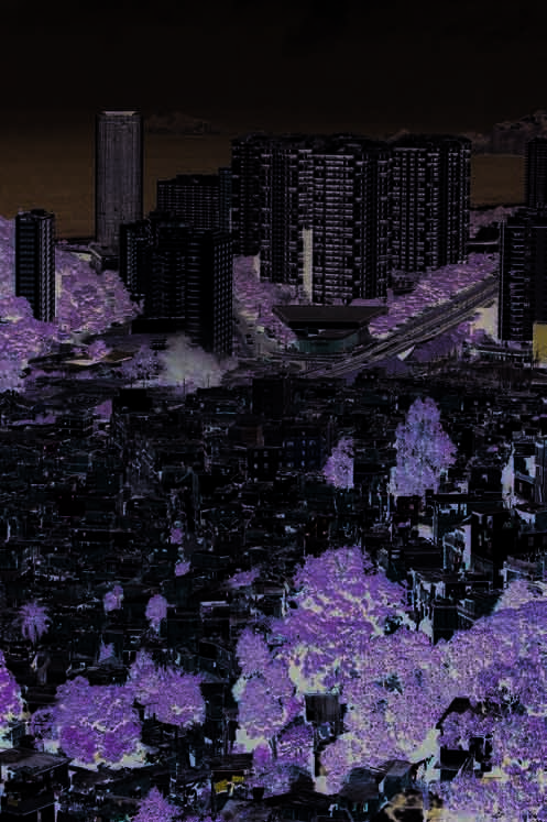
Those river basins in the Brazil Current densely occupied with
settlements have shown values of faecal coliforms above the threshold
limit established by the Brazilian National Council of Environment
(CONAMA) Resolution No. 020/1986 for waters in Class 2 (can be used
for water supply after conventional treatment and for direct contact
recreation activities such as swimming). Annex I I includes information
and references about average faecal coliforms concentration values
found in Paraíba do Sul River and Doce River (East Atlantic Basins) as
wel as in Săo Francisco River. Only in the upper Săo Francisco does
microbiological pol ution produce significant impact due to the sewage
discharge without treatment from the Metropolitan region of Belo
Horizonte, that hosts 2 million inhabitants (IGAM 2001).
According to the Brazilian Law (CONAMA Resolution No. 274/2000) a
segment of coastline (beach) is considered proper for bathing (meaning
direct contact and recreational uses) if 80% or more of water samples
during a 5 week-period do not exceed the threshold limit of 1 000 MPN
(Most Probable Number) faecal coliforms per 100 ml of water. Otherwise
it is considered inappropriate for bathing and the community is informed
via media. Monitoring programmes for thousand sampling points on the
Brazil Current coast using faecal coliforms as indicator are carried out
by local governments. Based on periodic results, the authorities have
recommended restrictions for recreational uses to several beaches
located downstream urban centres in basical y al coastal municipalities.
Figure 24 Aerial view of Rio de Janeiro. The Rocinha slum
Similarly to what occurs with rivers, beaches located downstream
spreading down and out to meet the wealthy area.
(Photo: Corbis)
densely populated urban centres or metropolitan areas are more likely
to be contaminated by faecal coliforms in concentrations above the
society's response to the problem on a local and regional scale. Large
threshold limit, in the littoral of al the states which make up the coastline
cities and metropolitan areas in the Brazil Current, from north to south
of the Brazil Current. Rainfal regime has an important influence on the
(metropolitan area/state) are: Salvador/BA, Vitória/ES, Rio de Janeiro/RJ
quality of the coastal waters. Intense/long rainfal s increase the stream
(Figure 24), Santos/SP, Joinvil e/SC, Florianópolis/SC, Tubarăo/SC, Porto
flows and after these events the beaches receive the most contaminated
Alegre/RS and Pelotas/RS. In these areas, the transport, dilution and
discharges. It should be highlighted that the majority of beaches in the
assimilation capacity of receiving waters may be exceeded.
Brazil Current littoral are considered proper for bathing al year around
but they are located outside urban centres and fortunately represent the
For the case where pol ution associated to the sub-regional water
major extent of the Brazil Current littoral. The efforts spent recently by
availability is such that the supply is impacted, this impact was
state and municipal governments with increasing investments in sewage
considered in the previous section Freshwater shortage. However,
col ection and treatment are likely to produce gradual improvements,
it was advisable to assess pollution of freshwater sources in the present
as the case of Săo Paulo state in the South/Southeast Atlantic Basins
section, regardless of whether it causes freshwater shortage or not.
(Municipality of Santos 1997, Săo Paulo 2002). In Annex I I, average values
of faecal coliforms, mostly in bays and lagoons in both South/Southeast
Environmental impacts
and East Atlantic Basins are shown.
Microbiological
Environmental impacts due to microbiological pol ution were assessed
Eutrophication
as moderate in the South/Southeast Atlantic and East Atlantic Basins
The remaining organic load (organic load as BOD /day discharged in
5
and slight in Săo Francisco River Basin according to the fol owing.
recipient waters, including treated and untreated effluents) discharged
in the Brazil Current region is shown in Table 12 (PNRH 2003). The
58
GIWA REGIONAL ASSESSMENT 39 BRAZIL CURRENT
ASSESSMENT
59
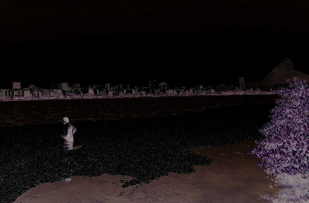
Table 12 Remaining domestic organic load, based on estimated
to Brazilian standards (CONAMA Resolution No. 020/86). The quality
values.
parameters considered, among others, are: BOD (Biological Oxygen
Domestic organic load
Sub-region
% in the country
Demand), COD (Chemical Oxygen Demand), nutrients, faecal coliforms
(tonnes of BOD /day)
5
and heavy metals. Rivers that serve the purpose of human supply after
South/Southeast Atlantic Basins
1 042
16.4
conventional treatment and primary contact (e.g. swimming) have been
East Atlantic Basins
1 258
19.8
initial y placed as Class 2 or, in the worse case, as Class 3, but should
Săo Francisco River Basin
498
7.8
never be of lower quality than that.
(Source: PNRH 2003)
Although eutrophication is not widespread in the coast and rivers
higher value observed for East Atlantic Basins when compared to the
(the reason environment impacts are assessed as moderate), in
others is due to the basins in the littoral of Rio de Janeiro state (59 in
those areas where it occurs, the environmental impacts as wel as
Figure 2), which alone contributes with 469 tonnes per day (Figure 25).
the socio-economic impacts are certainly severe. The assessment of
Paraíba do Sul River basin (58 in Figure 2) contributes with 235 tonnes
eutrophication divides the Brazil Current in two categories:
BOD per day (PNRH 2003). In addition, domestic sewage, run-off from
South/Southeast Atlantic and East Atlantic Basins that show
5
agricultural areas and industrial effluents can be added. Owing to the
moderate environmental impacts due to eutrophication observed
natural attenuation capacity of the waterways, the impacts caused by
in lagoons, bays, affecting coral reefs and constructed reservoirs
the organic load in water supply bodies are mostly observed at lagoons,
(with episodes of fish kil s) and;
bays and constructed reservoirs, the last of which usual y have two
Săo Francisco Basin where the environmental impact observed
functions: electricity generation and water supply.
is due to the reverse problem: low concentration of nutrients
mostly in the middle-lower and lower Săo Francisco River, as a
Annex I I includes examples of rivers in the Brazil Current region, which
consequence of the trapping of sediments/nutrients in dams,
are important water supply bodies and due to the low quality found in
which has caused a decrease in primary productivity (see Annex II )
some monitoring stations they are classified as Classes 3 or 4, according
(Machmann de Oliveira 2003). The environmental impact was not
Figure 25 Rodrigo de Freitas Lagoon, Rio de Janeiro (East Atlantic Basins). Death of tonnes of fish during summer due to oxygen
depletion, as a consequence of the increasing organic load and temperature rise.
(Photo: JOAO P. NGELBRECHT/UNEP/Still Pictures)
60
GIWA REGIONAL ASSESSMENT 39 BRAZIL CURRENT
ASSESSMENT
61
assessed as unknown or absent, but as slight impact due to the
colonies, competing with the corals for space and inhibiting the
eutrophication process and blooms of toxic algae recorded in some
settlement of new coral larvae.
reservoirs such as Paulo Afonso and Itaparica (Braga et al. 1999).
Eutrophication in reservoirs constructed for energy generation and
Several bays, estuaries, lakes and lagoons downstream from urban
water supply, as well as in aquaculture tanks is a matter of great concern.
centres show different degrees of eutrophication, Guanabara Bay in
Eutrophic conditions have been described in reservoirs located in all
Rio de Janeiro state (59 in Figure 2), being the most severe case. Anoxia
three sub-regions in the fol owing states: Pernambuco, Sergipe, Bahia,
or low oxygen levels (<3 mg/l) occur in lowland watersheds, estuaries
Minas Gerais, Rio de Janeiro, Săo Paulo and Paraná, Santa Catarina, Rio
and coastal lagoons and significantly affect coastal embayments
Grande do Sul (for references, see Annex I I). Algal blooms episodes in
(Lacerda et al. 2002). Fish kills due to low concentration of dissolved
bays, lagoons and in constructed reservoirs in South/Southeast Atlantic
oxygen associated with the proliferation of algae or algal toxins are not
and East Atlantic Basins include species like: Microcystis aeruginosa,
uncommon events in Conceiçăo Lagoon (Sierra de Ledo & Soriano-Serra
Microcystis flos-aquae, Anabaena spp., Lyngbya confervoides, Sinychocystis
1999) in Santa Catarina state and Patos Lagoon estuary in Rio Grande do
aquatilis (f. salina), Phormidium spp., Cylindrospermopsis raciborski and
Sul state. According to the Standard Trophic State Indexes (Nixon et al.
Coelosphaerium naegelianum. Fish kills are recorded in some aquatic
1986, Rast et al. 1989), used to classify the trophic level of a water body
systems (for references, see Annex II ).
and that take into consideration particulate organic carbon, nitrogen
and phosphorus concentration, dissolved oxygen and chlorophyl a,
Chemical pollution
the following systems have eutrophic to hypertrophic conditions (for
In South/Southeast Atlantic Basins, chemical pol ution is causing
details and references see Annex II ):
moderate impacts (for references, see Annex I I). The industrial park of
Guanabara Bay, Sepetiba Bay and Coastal Lagoons of Rio de Janeiro
Cubatăo on the coast of Săo Paulo state are responsible for pol ution
state;
along the coastline. Analyses of Santos estuary sediments demonstrated
Ribeira do Iguape River, Santos Bay, Cananeia Lagoon in Săo Paulo
that the coast has received effluents with high concentrations, above
state;
threshold limits, of heavy metals, such as zinc, mercury, chromium,
Coastal Lagoons in Santa Catarina state;
copper and lead, mainly released by the factories in Cubatăo and now
Patos Lagoon in Rio Grande do Sul state.
concentrated in the marine sediments. In Santa Catarina state, the
use of pesticides in rice plantations and fruit farms in the Itajaí River
In the north of Bahia littoral (East Atlantic Basins), signs of
basin, in addition to intense industrial activity in the city of Joinvil e is
eutrophication processes impacting the coral reefs distributed
responsible for coastal chemical pollution. Concentrations of cadmium
along a smal strip of discontinuous carbonate build-ups have been
and nickel have been detected in biotic components of mangroves in
described (Costa et al. 2000). Coral reefs extend for 20 km along the
Santa Catarina state.
northern coast of the state. Over the last 15 years, this region has
experienced an acceleration of general y unplanned urbanisation,
In Rio Grande do Sul state, the use of pesticides and agricultural run-
with the irregular and indiscriminate use of septic tanks in urban
off, mostly from rice plantation in the catchment area of Patos-Mirim
centres contaminating the groundwater. High densities of macroalgae
Lagoon system, are the main causes of pollution, fol owed by industrial
and heterotrophic organisms were found impacting Guarajuba coral
wastewater discharges and titanium mining. Heavy metals have also
reefs (downstream of a densely urbanised area) when compared to
been found in high concentrations in the water column of Patos
Papa Gente reefs (downstream an underdeveloped area). A model
Lagoon in Rio Grande do Sul. High concentrations of heavy metals in
of nutrient enrichment via groundwater seepage, according to Costa
the estuarine sediments of Rio Grande do Sul have been associated to
et al. (2000) is a plausible mechanism to explain the eutrophication
industrial activities such as petrochemical, metal urgical, pulp-paper and
occurring in Guarajuba coral reefs. Costa et al. (2000) suggest that the
refineries. BHC (benzene hexachloride), chlordane, DDT and PCBs have
infiltration of nutrients and pathogens is facilitated by both the soil
been detected in mussels on the coast of Brazil Current (see Annex II ).
permeability and an accentuated hydraulic head, which eventual y
Organochlorine compounds in the mollusc's tissues were detected in
leads to the percolation of nutrient-rich groundwater seaward to the
the coastal zone of Rio de Janeiro state (Cabo Frio, Guanabara Bay),
reefs. Higher availability of nutrients in Guarajuba coral reefs is affecting
Sao Paulo state (Santos Bay), Paraná state (Paranaguá Bay) and Rio
the trophic structure in the study area, especial y in Guarajuba, with
Grande do Sul state (Patos Lagoon). Pyrite waste (iron sulphide)
increased macroalgal growth, reducing light penetration to the coral
generated by mining activities in carboniferous reserves in south of
60
GIWA REGIONAL ASSESSMENT 39 BRAZIL CURRENT
ASSESSMENT
61
Santa Catarina state has been contaminating the water bodies (PNRH
conventional water treatment. A total of 649 samples were analysed
2003). In the Itajaí Val ey, the combination of textile industry, irrigated
for 25 parameters. Currently, 59 monitoring stations are operating
rice and pig raising represents a source of chemical pollution.
(Gerenciamento Integrado da Bacia do Rio Doce 2003).
In East Atlantic Basins, chemical pol ution is responsible for moderate
Jequitinhonha River Basin (54 in Figure 2) is environmental y impacted
environmental impacts (for references, see Annex I I). The coast of Rio
mostly by mining and agriculture. Historical y, the River has been
de Janeiro state (mostly bays such as: Guaratiba, Sepetiba, Mangaratiba,
intensively exploited for precious stones, gold and other ores. Paraíba
Angra dos Reis and Guanabara Bay) has suffered environmental
do Sul River Basin (Săo Paulo, Minas Gerais and Rio de Janeiro states) is
impacts over the past decades due to chemical pol ution, mostly from
also considered one of the hot spots, in terms of chemical pol ution,
industry; heavy metals are found in sediments above threshold limits,
due to the heavy industrial park, mining and agriculture developed
which together with urban effluents are responsible for a reduction in
in the Basin. There are several publications reporting heavy metals
marine/estuarine life. One of the largest natural fish breeding grounds,
concentrations above the threshold limits for chromium, cadmium,
Sepetiba Bay, has been under severe impacts due to silting, pol ution
nickel, copper, arsenic and mercury in river sediments and suspended
and mangrove destruction. The construction of Sepetiba Port and
solids (see Annex I I). High concentrations of phenols were detected
the activity of dredging to deepen the shipping channel have caused
at several sampling points of the Paraíba do Sul. Transport of mercury
impacts on the Bay due to resuspension of heavy metals accumulated in
from inland to the coastal zone has been described (Lacerda et al. 1993b,
the sediments. Heavy metals such as cadmium, zinc, lead and chromium
Veiga 1997, Lacerda & Salomons 1998).
have been found on the Rio de Janeiro coast in the suspended material,
sediments and in the biota (mussels, oyster, macroalgae) of bays in Rio
In Săo Francisco Basin, chemical pol ution, particularly due to heavy
de Janeiro state (Sepetiba Bay and Guanabara Bay). Evidences from the
metals are expected to occur, particularly in the Belo Horizonte
Paraíba do Sul River, Doce River and Jequitinhonha River reveals heavy
Metropolitan area in the upper Săo Francisco, where industrial activities
metals concentrations in the sediments above threshold limits. Abrupt
and mining areas have been significant (PNRH 2003) (see also the case
changes in the river flows can make these metals available to the food
study Mining in Săo Francisco Basin). The environmental impacts due to
chain. Increasing suspended solids discharge due to deforestation for
chemical pollution in Săo Francisco Basin were assessed as moderate.
urbanisation, agriculture and timber exploitation has caused severe
economic impacts in important reservoirs such as Funil on the Paraíba
Suspended solids
do Sul River. Deterioration of water quality in rivers and reservoirs due
The impacts of suspended solids are severe in many areas of the Brazil
to pol ution and groundwater salinisation by irrigated land contribute
Current region. Deforestation of large areas, hil sides, and removal of
to the limited availability of freshwater in the Basins. In Sergipe state,
riparian vegetation along tributaries facilitating soil erosion, has resulted
hydrocarbons contamination is related to discharge of oil production
in increasing siltation of riverbeds and/or coastal zones. Diversions and
water. Occurrence of fish and mussel kil s related to washing out of textile/
damming of waterways are also seriously affecting the erosion-accretion
organic effluents has been described. In Bahia state (Todos os Santos Bay)
equilibrium of the riverbeds and the coastline. The impacts associated
mercury is found 2 to 5 times higher than the baseline levels in hot spots
to suspended solids are either due to the excess of suspended solids
(Lacerda et al. 2002). Mucuri River is the best example of a river affected
(turbidity, siltation, etc.) or due to reduction of sediment yield (coastal
by Eucalyptus spp. plantation and the associated paper industry.
erosion, primary productivity decrease). The same river may have both
impacts, in different locations.
Doce River Basin (Minas Gerais and Bahia states) is one hot spot for
pollution and has as the main chemical polluting sources mining and
The specific discharges of rivers in the eastern Brazil are natural y
industry, mostly steel industry. The results of monitoring data obtained
low and the construction of dams has increased the retention of
during the period 1993-1996, compared to 1985-1990 (Gerenciamento
suspended solids in the basins. Erosion along the river basin is an
Integrado da Bacia do Rio Doce 2003), revealed that in general terms an
important factor in deteriorating the quality of the water in most
improvement of water quality occurred in 33% of all sampling points, a
rivers in the east, also provoking silt deposition along riverbeds and
worsening was observed in 21% sampling points, while 46% remained
flooding. This increases during rainy seasons because of erosion of
at the same level of pollution. Based on water quality parameters, the
unprotected margins. Engineering works for transfer of water for
quality of Doce River in many monitoring stations was classified as
supply purposes also means transfer of solid matter across catchment
Class 3, the lowest quality permitted for supply purposes after receiving
basins. In Sepetiba Bay (Rio de Janeiro littoral), for instance, diversion
62
GIWA REGIONAL ASSESSMENT 39 BRAZIL CURRENT
ASSESSMENT
63
of the adjacent Paraíba do Sul River basin (both in the East Atlantic
Table 13 Collection and final disposal of municipal solid waste in
Brazil Current.
Basins) to supply the Rio Janeiro Metropolitan area, starting in the 1950s
has resulted in a ten-fold increase in the freshwater discharge to that
Collection
Final disposal
(%)
bay and increased sedimentation from about 60 mg/cm2/year in the
State1
Adequate (%)
Inadequate (%)
early 1970 to >320 mg/cm2/year in the 1990s (Forte 1996, Barcel os &
Pernambuco
84.7
38.0
62.0
Lacerda 1994, Barcel os et al. 1997). On the other hand, at the mouth of
Alagoas
91.0
6.50
93.5
the Paraíba do Sul River, on the north coast of Rio de Janeiro state and
Sergipe
89.6
2.20
97.8
about 300 km from Sepetiba Bay, extensive erosion of the coastline
Bahia
85.0
39.6
60.4
Minas Gerais
91.9
38.0
62.0
is destroying fringes of mangrove forests, dunes and smal vil ages in
Espírito Santo
91.8
49.4
50.5
the area, due to lack of sediment transport (Dias & Silva 1984). In this
Rio de Janeiro
94.3
45.9
54.1
example, suspended solids transport/sedimentation dynamics that
Săo Paulo
98.8
42.4
57.6
cause pollution problems in one basin is indirectly causing habitat and
Paraná
97.0
39.0
61.0
community modification in another basin.
Santa Catarina
96.8
53.7
46.3
Rio Grande do Sul
97.3
49.6
50.4
Brazil is the one of the world's largest iron ore producers and exporters.
Brazilian average (for urban areas)
91.2
40.5
59.5
Iron has traditional y been the country's largest export product,
Note: 1Brazilian states entirely or partially included in Brazil Current. Figures in red indicate values
below the national average for collection/adequate final disposal. (Source: IBGE 2002)
accounting for 5% of the total value of mineral exports. Production in
2000 was 200 mil ion tonnes, of which 158 mil ion tonnes was exported.
(Table 13) (IBGE 2002). The poorest coverage is found in the shanty
Japan, Germany, China and South Korea were the main importers. One
towns and the periphery of metropolitan regions and in the northeast
of the most productive areas is the Iron Quadrangle of the state of
portion of the Brazil Current region where the percentage col ected is
Minas Gerais (East Atlantic Basins). Important metal urgical industrial
below the national average value.
activities, such as the giant Compania do Vale do Rio Doce are located
in the Minas Gerais state, where reserves have been estimated at
When it comes to final disposal, the scenario is much worse; open
1.3 billion tonnes of high iron grade hematite and 4.3 billion tonnes of
dumps are stil the most common final disposal option in many
rich itabirites. Mining is one of the activities responsible for soil erosion/
municipalities. The range varies from the best case: 53.7% of the
pollution in the region.
municipal solid waste with appropriate final disposal in Santa Catarina
(in South/Southeast Atlantic Basins) to the worst case: 22% in Sergipe
Diversion and damming of Săo Francisco River are seriously affecting
state (in East Atlantic Basins).
the erosion-accretion equilibrium of its estuary. These effects are most
apparent where water resources are scarce, as the case of middle-lower
Thermal
and lower Săo Francisco River Basin. The total discharge of sediments
More research is needed to investigate the extension and the effects
in the Săo Francisco River estuary that in 1983 was 6 mil ion tonnes
of thermal pollution in Brazil Current. Based on the current knowledge,
per year was in 2000 reduced to 410 000 tonnes per year. This residual
there is no large-scale or significant output of effluents exceeding
transported sediment is likely to be material generated in the lower Săo
temperatures in receiving bodies in the Brazil Current region. The
Francisco, since the sediments generated upstream are trapped in the
environmental impacts in South/Southeast and East Atlantic Basins
cascade of reservoirs (Machmann de Oliveira 2003).
were assessed as slight and unknown in Săo Francisco River Basin. The
expansion of the number of thermal power plants in the region, as a
Solid waste
result of the energy sector policy, will probably increase the impacts of
In the Brazil Current region, major efforts have been made by city
thermal pollution.
authorities in an attempt to reduce litter as much as possible, and keep
clean the urban centres and beaches with the greatest influx of tourists,
Radionuclides
since this is a considerable source of income. Educational campaigns
There is a potential risk for accidents in the region of Angra dos Reis in
have had positive results in changing citizens' behaviour. Col ection
Rio de Janeiro, because of the nuclear power plants Angra I, I and III
of municipal solid waste in the states entirely or partial y included in
(South/Southeast Atlantic Basins). However, as regards these plants,
the Brazil Current varies from 98.8% in Săo Paulo (in South/Southeast
the operation, maintenance and the radioactive waste deposits are
Atlantic Basins) down to 84.7% in Pernambuco (in East Atlantic Basins)
considered adequately monitored and well control ed.
62
GIWA REGIONAL ASSESSMENT 39 BRAZIL CURRENT
ASSESSMENT
63
Spills
de Caxias refinery to the Ilha d'Água Terminal was broken (IBAMA 2002);
Several smal -, medium- and large-scale spil events involving oil, grease
and (ii) an accident with the P-36 platform in Campos, also in the state
and a number of chemical/hazardous substances have been registered
of Rio de Janeiro, that sunk after an explosion. During these accidents,
in the marine, coastal and freshwater bodies of the Brazil Current region,
millions of litres of oil leaked into the water bodies, resulting in serious
particularly in South/Southeast and East Atlantic Basins. In few cases,
impacts on the regional ecosystems. These accidents bring a question
recovery of habitats and species after the accidents has been described.
mark to the effectiveness of environmental quality certificates, such as
In recent years, legal actions and high penalties have been applied.
ISO 9 000 and ISO 14 000, given out to the companies responsible. More
examples of spil s are presented in Annex II .
In South/Southeast Atlantic Basins spills have been registered in Săo
Paulo littoral (Săo Sebastiăo Channel), Santa Catarina littoral (e.g.
In Săo Francisco Basin the environmental impacts due to spills were
Paranaguá Bay), Paraná state and Rio Grande do Sul littoral. Port
assessed as slight.
activities, mainly in Săo Paulo and Paraná states, contribute to frequent
small to medium-sized spil s. According to the Environmental Accident
Socio-economic impacts
Record (CADAC) of the Environmental Protection Agency of the state
Economic impacts
of Săo Paulo (CETESB), during the period from January 1980 to February
Basical y, there are two categories of economic impacts resulting
1990, there were 71 accidents involving oil and derivatives along the
from pol ution. First those associated to loss of opportunities or loss
Săo Paulo coast, causing serious damage to estuary communities. The
of the economic value of goods due to the low quality of the water
Centre South Ducts and Terminals (TEBAR-DTCS) on the Săo Paulo coast
resources/water environment, reduced options for water uses; and
is the country's main sea terminal, accounting for around 55% of all
second increasing water treatment and surveil ance costs and costs
oil transported in Brazil. A large number of accidents, including leaks
associated to recovery of degraded areas and penalties. In the Brazil
and accidental oil spil s have been recorded during routine operations:
Current region, in the first category, impacts of pol ution on tourism
191 accidents between 1974 and 1994 (Poffo et al. 1996) and 18 between
and fishing, loss of property value, and exploitation of more expensive
1995 and 1998, contributed to chronic pol ution in nearby areas. As a
alternative sources (e.g. groundwater, instead of surface water) are
result of these spills, rocky coast and sand beach ecosystems have
found. The second category also found in Brazil Current includes costs
been systematical y affected. The coastal environment which is most
of construction, operation, maintenance of water treatment plants,
frequently affected are the coastal areas and beaches located in Săo
costs for recovering/remediation of pol uted areas and penalties against
Sebastiăo and Bela Island, mainly inside the channel, because of their
companies responsible for accidents (e.g. major spil s events). Taking
proximity to the sources of pollution. However, coasts and beaches all
into account al these aspects, the economic impacts due to pol ution in
along the Săo Paulo coast have been affected to a lesser extent by oil
the Brazil Current were considered severe. Investments for treatment of
and derivatives (Poffo et al. 1996). Every year, around 3.5 million m3 of
water bodies and remediation due to accidents and spil s in the marine
sediments are removed from the estuary to provide passage for large
environment are already high, with a tendency to worsen in the near
ships. This activity, apart from the impact on several benthonic animals,
future as the economic development expands.
promoted the re-suspension of toxic substances which are deposited
in the sediment on the riverbed, increasing the spectrum of action and
Eutrophication alone is already responsible for severe economic impacts
the impact of this activity, which can stretch into areas adjacent to the
in reservoirs in South/Southeast Atlantic Basins (COPPE/UFRJ 2002).
Santos Bay and have a transboundary effect.
Significant investments for pol ution abatement and/or maintenance
costs associated to pollution in the South/Southeast and East Atlantic
Frequent spills of smaller proportion are common in Todos os Santos
Basins are found in Marques (1995), MPO et al. (1999), Lamardo et al.
Bay/BA, Vitória/ES and Guanabara and and Sepetiba bays/RJ (East
(2000), CETESB (2001), COPPE & UFRJ (2002), COPPE/UFRJ (2002) and
Atlantic Basins). However, episodes of more serious proportions have
Sistema de Gestăo Integrado da Bacia do Rio Paraíba do Sul (2003).
been described as, for instance, 1 500 litres of oil spil ed from a Cypriot
Gradual improvement of the awareness among citizens and more
company that was docked at Tubarăo Port, Vitória/state of Espírito Santo
efficient legal instruments are likely to promote enforcement. More
(Ministério Público Federal 1999). Two large-scale accidents occurred
efficient enforcement wil probably lift the insurance costs. Examples
during the period 2000-2001 involving the Company Petrobrás: (i) in
of recent penalties applied due to spil s are found in Ministério Público
January 2001, 1.3 million litres of oil spil ed into Guanabara Bay (part of
Federal (1999), Luiz & Monteiro (2000), IBAMA (2002), O Globo (2002a)
59, Figure 2), Rio de Janeiro state, after the pipe that connected Duque
and O Globo (2002b) (see also Annex I I). Some densely populated
64
GIWA REGIONAL ASSESSMENT 39 BRAZIL CURRENT
ASSESSMENT
65
Carangola
Visconde do Rio Branco
Muriaé
Itaperuna
Rio Mur
Rio Pomba
iae
Leopoldina
Rio
Juiz de Fora
Guarus
do Peixe
Cruz das Almas
Rio Paraíba do Sul
Rio Preto
Tręs Rios
Nova Friburgo
Rio Paraíba do Sul
Infectious and
Agulhas Negras Resende
parasitic illnesses
Barra Mansa
Volta Redonda
(% of population affected)
a
araib
Rio de Janeiro
0
Rio P
Taubaté
0.1 - 2.5
Săo José dos Campos
2.6 - 5.0
Jacareí
5.1 - 15.0
Săo Paolo
15.1 - 30.0
© GIWA 2004
Figure 26 Infections and parasitic diseases (% of population affected) in municipalities of Paraíba do Sul River Basin (Minas Gerais,
Săo Paulo and Rio de Janeiro states).
(Source: Based on data from IBGE 2001)
areas of the Brazil Current littoral have already experienced economic
Săo Paulo (1999). In the Paraíba do Sul River Basin (East Atlantic Basins)
losses, mostly in tourism, which is a natural vocation for the region and
the incidence of microbiological infection and parasitic diseases
employs a large contingent of people. In the significant reduction of
varies among municipalities from 0%-30% (Figure 26 and Figure 27)
fish stocks due to changes in suspended solids/nutrients transport
(IBGE 2001). For more details see Annex II .
dynamics is responsible for moderate to severe economic impacts in
the fisheries sector. Siltation in the upper and middle Săo Francisco is
Regarding risks to human health in Săo Francisco Basin, cases of
causing an economic impact on fluvial navigation, an important means
schistosomiasis have been registered al over the Basin. In the upper
of transportation within the basin.
Săo Francisco there are health problems resulting from microbiological
contamination and the suspicion of problems resulting from chemical
Health impacts
pollution, which are not confirmed, due to lack of proper investigation.
Health impacts due to water pol ution is mostly associated to the
While the percentage of the population affected is smal , the degree
absence of sewerage system and therefore, to the low-income areas.
of severity is high, due to the poverty level of those affected, among
Health impacts due to eutrophication in water supply reservoirs
whom the frequency of occurrence of this problem is high.
and aquaculture tanks have recently become an issue of concern in
South/Southeast Atlantic Basins as wel as in East Atlantic Basins. At
Other social and community impacts
least two episodes of severe health impacts, with hundreds of cases
Among the social and other community impacts due to pol ution,
of intoxication fol owed by death due the presence of hepatotoxins
the loss of recreational and aesthetic values of many beaches can be
released in the water supply after algae blooms have been recorded
mentioned. This occurs from northeast down to south of the Brazil
(Azevedo 1996, Costa & Azevedo 1994, Teixeira et al. 1993, Proença et al.
Current region, in the coastal area and bays downstream densely
1996). More frequent is the association between water pol ution and
urbanised centres. Another example is the impacts on Environmental
health impacts related to water-borne diseases such as microbiological
Protection Areas (APAs) occurring after large-sized spil s, such as those
and parasites diseases (Governo do Estado de Săo Paulo 2002).
which occurred in Guanabara Bay (East Atlantic Basins), affecting the
Increasing gastrointestinal symptoms related to the time of exposure
APA of Guapimirim. This area represents the largest mangrove area
to pol uted beaches was described by CETESB in Governo do Estado de
on the Rio de Janeiro coast. Fluvial transportation is limited in those
64
GIWA REGIONAL ASSESSMENT 39 BRAZIL CURRENT
ASSESSMENT
65
40
Săo Paulo
35
Rio de Janeiro
ths 30
Minas Gerais
25
20
15
10
o
r
tality per 1 000 bir
5
M
0
1989
1990
1994
1998
Year
Figure 27 Estimated child mortality (<1 year old) per 1 000 births
in the municipalities inside each state included in
Paraíba do Sul River basin.
(Source: Based on data from IBGE 2001)
waterways that have suffered most by siltation, where there are also
social impacts due to flooding. Below, five case studies of pol ution
associated to different sectors are briefly presented. Pollution has also
been considered one of the causes of reduction of fish stocks, which
Figure 28
causes social impacts in hundreds of communities of fishermen along
True-colour French SPOT-3 satellite image of
Rio de Janeiro.
the coast of the Brazil Current region.
North is at top. Rio de Janeiro (light blue, at centre right) is just to the north of the
mountainous Tijuca Forest (green, lower frame). At upper right is Guanabara Bay.
The Atlantic Ocean is in the lower frame.
Case 1: Mining activities in Jequitinhonha River
(Photo: Earth Satellite Corporation/Science Photo, Library)
basin (East Atlantic Basins)
stresses affecting these systems is discharge of domestic effluents and
Jequitinhonha River basin is a transboundary system that encompasses
the petrochemical industry, emissions of trace elements, changes in
53 municipalities, has a total area of 69 997 km2, 65 517 km2 (93.6%) of
sediment loading generated by river basin activities and other impacts
which in Minas Gerais state and 4 480 km2 (6.4%) in Bahia state, and a
by port activities.
population of 900 000. Gold, diamonds and other precious stones are
the main natural resources explored. Although rich in mineral resources,
Guanabara Bay (23o45´S, 44o45´W) represents an example of one of
the Jequitinhonha Val ey (named by the UN the "Val ey of Misery" in
the most severely impacted systems of the Brazil Current region.
1974) hosts one of the poorest populations in Brazil. Mining is the activity
The bay (384 km2) measures 28 km from west to east and 30 km from
with the heaviest impact on the water resources in the region. Intensive
north to south, has a 131 km perimeter, and a mean water volume of
dredging practices during many decades have changed the watercourse
1.87 bil ion m3. The residence time is about 22 days and the average
and caused pol ution by mercury. Mining has also caused losses of
annual fresh water input from 35 smal rivers is 125 m3/s and peaks
riparian vegetation, ecosystems modification, erosion and silting. Some
in January/summer. Tides are mixed and mainly semi-diurnal with a
of the impacts due to mining during the last decades are considered
range of 0.7 m. The salinity varies from 21 to 34.5 with weak vertical
irreversible. Besides mining, other activities that pol ute the River are the
salinity stratification. The bay is located in a Tertiary depression, named
use of pesticides and discharge of untreated sewage. Forest destruction
the Guanabara rift. There are many out-crops of Precambrian origin
has also contributed to erosion. Contamination by microorganisms and
abound the Guanabara Bay basin, such as is the case of the 400 m high
turbidity (suspended solids) are the most common parameters along the
Sugar Loaf. Elevated paleo-beaches and marine terraces from the Late
River which do not comply with standards. The socio-economic impacts
Quaternary are common around the bay. The climate is "Aw" according
include e.g. loss of transportation, which is no longer possible in the
to the Köppen classification with an average annual rainfal of 1 173 mm,
River. Sandbanks are seen in many portions of the River.
and highest rainfall in summer.
Case 2: Industry and urbanisation in Guanabara
The bay is one of the most polluted and eutrophic bays of Brazil. The
Bay basin (East Atlantic Basins)
overall mean of chlorophyll a in the bay is 57 mg/m3, the inner section
The Rio de Janeiro littoral includes the City of Rio de Janeiro and
130 mg/m3 and primary production lies in the order of 400 gC/m2/ year.
the bays of Guanabara (Figure 28) and Sepetiba. Among the major
The water quality is indicated by average faecal coliform counts of the
66
GIWA REGIONAL ASSESSMENT 39 BRAZIL CURRENT
ASSESSMENT
67
order of 1 000 MPN/100 ml (Most Probable Number/ml), but may
undoubtedly the most important mining activity of the region, both
attain one to two magnitudes higher in some restricted areas with
for its economic importance and that of associated infrastructure, and
sewage outfal . The urban population of Rio de Janeiro and 12 other
the magnitude of its pits and waste and tailings deposits. The fol owing
surrounding cities is 11 mil ion. The domestic run-off of the 8 mil ion
figures illustrate the importance of this activity: the annual tonnage of
population which live directly within the catchment is stil largely
iron mined is 56 million tonnes per year; 55 million tonnes per year of
untreated and there are more than 12 000 industries in the basin. Two
waste material are removed and disposed of in heaps alongside the
oil refineries process 17% of the national oil and the bay suffers from
excavations; 17 mil ion tonnes per year of tailings are deposited in tailing
chronic oil pollution and sporadic spil s. About 18 tonnes of petroleum
dams or ponds.
hydrocarbons enter the bay daily, 85% via urban run-off. Suspended
solids with heavy metals accumulate at the bottom. At least 2 000 ships
As a result of the removal of waste and the exploitation of ore, voids are
dock in the port of Rio de Janeiro, in Brazil second only to Santos port.
formed due to mining excavations at a rate of more than 40 000 mł/year.
Dredging takes place continuously to a depth of 17 m. Besides urban
The deepening of these pits nearly always requires lowering the
and industrial areas, the basin consists of agricultural fields and cattle
water level of the aquifers. The iron formations in which the iron
grazing lands. The Atlantic Rainforest still extends to the shoreline in a
ore deposits are inserted, are the geological formations having the
few places and is only intact on the steep slopes of the Atlantic Range.
greatest potential for water in the area. These iron formations together
The interior of the bay is fringed by 90 km2 of mangroves, threatened by
with other geological formations with different groundwater potential,
oil and firewood cutting. Landfil s located in the Guanabara Bay basin
comprise a synclinal geological structure systems of great size, forming
around the bay receive 10 000 tonnes of solid wastes daily. A number
large groundwater basins, known geological y as the Moeda and Dom
of open dumps are also found in the basin. Spil s have destroyed fishing
Bosco Aquifer systems, associated to the synclinals of the same name.
grounds, fouled rivers and estuaries, polluted mangrove swamps, and
These two large aquifer systems, apart from their large potential for
kil ed seabirds, fish and crustaceans. Out of 6 000 industries, 52 are
water storage and availability, are responsible for the greater share
responsible for 80% of the industrial pol ution discharged in the bay.
of water supply to the surface springs in the Upper Rio das Velhas
Navigation in the inner part of the bay is no longer possible.
basin. In turn, this basin, through catchment of the Rio das Velhas and
Morro Redondo Systems, with respective water flows of 5.20 mł/s and
There is no marine life as such, in many parts of the bay. Fishing has
0.60 mł/s, supplies nearly 50% of the requirements of the Belo Horizonte
decreased by 90% during the last 20 years and the mangrove areas
Metropolitan region. The most critical situation in the basin occurs in
have been reduced to 50% their original size and the 53 beaches are
the Água Suja (Dirty Water) stream and on the stretch of River das
not recommended for swimming due to pollution. Notwithstanding
Velhas downstream from the point at which these two watercourses
the accentuated degradation, the bay is still important for fisheries,
meet. Its waters contain high values for organic load, turbidity related
supporting 6 000 families. The annual catch measures 3 000 tonnes
to domestic sewers and effluents from small industries, as well as from
(2 700 of fish, 200 of mussels, 100 of shrimp). About 30 species of birds are
other sources such as rainwater drainage in both urban and rural areas
resident and dolphins used to be abundant. The sediment accumulation
and by mining liabilities.
rate is estimated to be 1 cm/year although in some regions it increases
to 4 cm/year. Since 1994, with a loan obtained from Inter-American
Chemical pol ution has been detected, e.g. high concentrations of
Development Bank (IDB) and the Overseas Economic Cooperation
arsenic which are found, show averages wel above the threshold
Fund (OECF) the state government is investing in water supply, sewage
value define by the resolution CONAMA No. 020/86, and which may be
col ection and treatment, drainage and solid waste projects.
the consequence of the former gold mining activities in the region and
the geochemical characteristics of the local terrain, and the genesis of
Case 3: Mining in Săo Francisco Basin
which is caused through the decomposition of rocks mineralised with
Ore mining activities (now declining) have been highly damaging, as the
gold bearing sulphides. The most serious problem appearing in the
effluents of such activity usual y contain heavy metals and can contain
Itabirito River is its load of suspended solids, caused by iron ore mining
cyanides. There has been intensive mining activity over centuries in the
operations. The River's organic load is still kept within limits, allowing
upper reaches of the basin of Săo Francisco's tributary, Rio das Velhas,
its natural oxidation, along the course of the River. The morphology
which has an area of 2 000 km˛. Coincidental y, this basin is inscribed in
of the riverbeds of the water courses in the region show an excellent
the geological context of the wel -known Iron Quadrilateral in the state
capacity for physical aeration being ful y oxygenated at the majority
of Minas Gerais. Iron ore mining, fol owed by gold and gems has been
of observation points. There are signs though, that future increased
66
GIWA REGIONAL ASSESSMENT 39 BRAZIL CURRENT
ASSESSMENT
67
organic load may change this situation. Downstream, upon mixing
Case 5: Pollution in the Uruguayan portion of
with the main stream of the Săo Francisco, the pollution in the waters
Mirim Lagoon (South/Southeast Atlantic Basins)
of the tributary of the Velhas River is diluted and quality improves,
The Uruguay East region is not a highly industrialised region and has a
with reductions in the concentration of faecal coliforms and chemical
relatively low population density, particularly in the Mirim Lagoon basin
pollutants. Poor management of municipal and industrial solid wastes
(89 in Figure 2). According to the National Environmental Survey carried
occurs, but this problem causes no major identifiable impact other than
out by OPP et al. (1992), the main environmental problems in Uruguay
aesthetic ones. There is no proper col ection, transportation or final
at that time were related to: (i) internal causes (land use for agriculture,
disposal of these wastes. In the Săo Francisco catchment area, a very
urban occupation of the coastal zones, deforestation, pol ution of water
small proportion of the population is supplied with treated water.
supplies, highway and infrastructure development); (ii) transboundary
causes, such as the pol ution of the La Plata River (GIWA region 38,
Case 4: Suspended solids in Săo Francisco Basin
Patagonian Shelf) and pol ution of the air due to the thermoelectric
Between the middle and lower Săo Francisco River Basin a cascade of
power plants in Brazil; and (i i) potential impacts due to international
reservoirs, such as Xingó have been constructed for power generation.
development projects (e.g. construction of regional waterways, bridges
These reservoirs trap most of the suspended solids (FUNDEPES 2001) and
and highways). Since this national evaluation was made, livestock and
reduces the nutrients in the water. When the water loses gradient and
rice production in the Mirim Lagoon basin and tourism in the Atlantic
flows slowly along the last 200 km until reaching the estuary, the River
Basin of Uruguay have increased significantly. Pollution in the Atlantic
starts meandering, with consequent formation of sand banks and very
Basin (89 in Figure 2) is assessed as producing slight environmental
low concentration of suspended solids. Inadequate agricultural practices
and socio-economic impacts, mostly related to the seasonality of the
represent another environmental problem in this basin. Irrigation
population during the summer. With the development of this economic
projects have caused soil salinisation in some parts of the Basin.
sector, the impacts wil probably become moderate, particularly the
economic impacts due to the investments required to keep the
Siltation is a serious problem over wide/ecological y significant areas
environment clean and thus maintain the tourist flux.
and has resulted in markedly changed biodiversity and mortality
of benthic species with concomitant changes in the nature of
Conclusions and future outlook
deposited sediments. In the upper and middle Săo Francisco River
The overal impacts due to pol ution was assessed as moderate in
solid particles originating from mining, farming and livestock activities
South/Southeast Atlantic Basins and Săo Francisco River Basin, and
and from urban plotting areas form sandbanks along the river
assessed as severe in East Atlantic Basins, based on a large amount of
channel. Silt transportation occurs mainly as bottom load and very
mostly proxy indicators. It is necessary to investigate more thoroughly
little in suspension. In the sub-basin of the Pará River, in the upper
the environmental effects these pol utants cause on the living resources.
Săo Francisco, mining of clay, sands, granite, coal and, in the past,
There is also a need for detailed epidemiological and economic studies
gold occur. Gypsum mining occurs in the Brígida River sub-basin. The
to highlight the existing associations between pol ution and economic-
Paraopeba River sub-basin witnesses an increase in sand exploitation
health impacts in the Brazil Current, where socio-economic activities
and iron ore mining to meet the expansion of the civil construction
associated to densely populated cities have imposed a heavy burden
and export. Other aggravating factors are connected with suspended
on water resources, expressed as pol ution. Chronic as wel as acute
solids from widely expanding agricultural and livestock activities. The
health impacts due to toxins released after algal blooms in reservoirs
problem of eutrophication in the Săo Francisco Basin occurs only in
and aquaculture tanks must be careful y investigated and monitored.
some reservoirs in the tributaries. In fact, there is a lack of nutrients in the
The information available indicates that for the next 20 years even a
main stream. A very low concentration of nutrients is noted in coastal
slow economic growth rate wil generate economic impacts mostly
areas as a result of a declining inflow of sediments and nutrients caused
associated to pol ution abatement. Yet it is likely that costs for
by the construction of dams. The smal er municipalities along the Săo
insurances and penalties for polluting will increase in the future, which
Francisco Basin are not benefited by any sewage treatment, resulting
hopeful y wil prevent the intensification of impacts on the environment
in organic pollution of local water supplies.
and human health. A number of governmental initiatives, such as the
Clean-up Programme of Hydrographic Basins (PRODES), created in
March 2001 in Brazil under the responsibility of the National Agency
of Water (ANA) is expected to contribute to the pol ution abatement
mostly the one associated to municipal sewage.
68
GIWA REGIONAL ASSESSMENT 39 BRAZIL CURRENT
ASSESSMENT
69
Habitat and community
Environmental impacts
modification
Loss of ecosystems or ecotones
This issue refers to the destruction of aquatic habitats. For the purpose
T
T
T
C
South/Southeast
C
East Atlantic C
Săo Francisco
P
A
P
A
P
A
I
M
Atlantic Basins
I
M
Basins
I
M
River Basin
of the GIWA assessment, recent loss will be measured as a loss of pre-
defined habitats over the last two to three decades. In the Brazil Current
The Brazil Current is composed of the drainage basin, the coastal and
loss of ecosystem has moderate environmental impact and applies
the shelf-oceanic compartments, all with a large number of habitats
mostly to parts of the coastline and river catchment areas with high
and ecosystems. The drainage basin contains the main biome Atlantic
population densities.
Rainforest; some portions of other biomes, such as Restingas (coastal
sand spits), Caatinga (dry thornbush) and Cerrado (high plain bush); lakes
Littoralisation-urbanisation, tourism, petroleum exploitation, several
and the man-made dams and reservoirs (see Regional definition). The
existing large-sized ports, agriculture and more recently, aquaculture are
coast includes various types of estuarine systems, like coastal lagoons,
the main sectors causing that generate severely impacted compartments
typical drowned river valley estuaries, bays, river-delta estuaries,
in the Brazil Current from north to south: Todos os Santos Bay (BA), Vitória
wetlands (mainly mangroves), beach-ridges and dunes. The shelf-
Bay (ES), Guanabara Bay, Sepetiba Bay and Grande Island Bay (RJ) in East
oceanic realm contains the nutrient poor (Brazil Current) and nutrient
Atlantic Basins; and Paranaguá Bay (PA) and Patos-Mirim Lagoon complex
rich (upwel ing) pelagic waters and the benthic organic- and carbonate-
in South/Southeast Atlantic Basins. The expansion of tourism and land
rich (calcareous algae and coral reefs) systems. The Atlantic Rainforest
occupation along the littoral with fast construction of hotels, resorts and
and the Brazil Current are common to the entire region. Several river
summerhouses has impacted important coastal ecosystems such as
basins are classified as extremely important regarding freshwater fish
restingas and mangroves. Changes in the sediment transport dynamics
biodiversity (MMA 2000). The profile around estuaries, bays and coastal
due to land-based activities in the coast are considered one of the most
lakes is of fragile formations. Due to complex dynamics, formations
serious environmental issues (IBAMA 2002).
and dimensions, when altered by natural or human pressures, these
environments are irreversibly damaged. Land use has become a major
There are several endemic species in the convergence region of the
driving force for both terrestrial and aquatic ecosystem modification and
western South Atlantic and migration of decapod crustaceans (crabs,
loss. Littoralisation has imposed a burden on habitats and communities.
shrimp) and fishes, which use the estuaries as breeding grounds in the
Information substantiating the assessment is briefly presented below.
marshy areas (Rio Grande do Sul state), mangroves (e.g. Santa Catarina
and Rio de Janeiro states), sea grass areas and shal ow small bays. Peixe
Fishing in the Brazil Current region is dependent on species that
Lagoon (Lagoon of Fish), in Rio Grande do Sul, acts as an important
spend a significant part of their life cycle in mangrove areas. Among
resting and feeding area for migratory birds. The floral composition
these are crab species such as Ucides cordatus, Cal inectes danae
of the mangroves is very important for the associated fauna and the
and Cardisoma guanhumi. The bivalves, Mytel a guyanensis, Macoma
relatively low biodiversity and greater fragility in the South/Southeast
constricta, Anamalocardia brasiliana and Crassostraea rhizophorae,
Atlantic Basins emphasise the importance of its conservation. In the
which are an important source of income for populations living
extreme southern Atlantic, rice-farming irrigation and application of
along the Brazilian coast, are also species dependent on mangrove
pesticides and fertilisers fol owed by run-off into natural systems have
forests. Species important to commercial fishing which are also
destroyed marshes and have had a severe impact on lakes. In the estuary
dependent on mangroves for the completion of their life cycles are
of Patos-Mirim Lagoon, Tramandaí and Laguna, overexploitation of fish
the fish species, Mugil sp., Centropomus sp., Sardinella aurita, Brevoortia
has also impacted the habitats (BDT 2001). In Patos Lagoon estuary, 10%
tyrannus, Dicentrarchus labrax (sea bass), "Manjuba" Curimatella lepidura
of marshland was lost during the last 40 years. The annual rate of loss of
(similar to Whitebait), Bagre marinus (catfish) and the shrimp, Penaeus
marsh area in this estuary is 0.25% (Seeliger & Costa 1997). The estuaries
spp. Mangrove destruction in the Brazil Current region has therefore a
and bays located around the cities of Rio Grande, Tramandaí and Torres
direct impact on fisheries.
(Rio Grande do Sul state), Itajaí, Laguna and part of Săo Francisco do
Sul (Santa Catarina state) have suffered impacts due to river discharge
Moderate to severe environmental impacts are exerted on estuaries,
of organic pollutants and increasing oxygen demand. Two important
bays, coastal lagoons, rocky foreshores, marshes and humid coastal
environmental protected areas in Rio Grande do Sul are highlighted:
regions in the Brazil Current. There is more information available for
(i) the Ecological Station of Taim and (ii) the National Park of Lagoa do
the South/Southeast Atlantic Basins than for the other sub-regions.
Peixe-PARNA included in the UNESCO Network of Biosphere Reserves.
68
GIWA REGIONAL ASSESSMENT 39 BRAZIL CURRENT
ASSESSMENT
69
The Rio-Săo Paulo highway connects the most industrialised and
Littoral of Espírito Santo and Rio de Janeiro states (East Atlantic
populated areas of South America. The Rio-Santos highway throughout
Basins) and Sao Paulo (South/Southeast Atlantic Basins):
the coastal zone exerts direct pressure over the costal ecosystems. One of
industrialisation, uncontrol ed urbanisation and il egal land
the greatest causes of biodiversity loss and reduction of fish stocks in Ilha
occupation, land speculative business associated to tourism,
Grande Bay, part of Rio de Janeiro littoral (East Atlantic Basins) has been
mineral extraction, transport;
the destruction of mangrove ecosystem that currently occupies an area of
Littoral of Paraná, Santa Catarina and Rio Grande do Sul states
2 000 ha, which represents 50% of the original formation. The intensive soil
(South/Southeast Atlantic Basins): agriculture, irrigation projects,
excavation and transport for construction of the Rio-Săo Paulo highway,
cattle farming, il egal land occupation, coal processing and
the division of land into lots and urbanisation, associated to the regional
introduction of alien species, pol ution, deforestation and
rainfal regime, have caused intensive erosion and significant increase
tourism.
of suspended solids in coastal waters. The impacts include smothering
of benthonic species, interference with the filtering species and fish
The mangrove ecosystem along Bahia state littoral (East Atlantic
respiration. Associated with this uncontrol ed urbanisation, there are
Basins) presents higher biodiversity than mangroves in the South/
ports, oil terminals, aquaculture, introduction of alien species and run-off
Southeast Atlantic Basins. In the estuaries, endemic species of fish,
of fertilisers and pesticides (BDT 2001). The construction of decks, wal s
crab fish and mol uscs, as wel as migratory species of turtles and
and land reclamation has destroyed the rocky foreshores and modified
birds have been identified. In Santa Cruz, Espírito Santo state littoral,
the beaches (IBAMA 1997). In Guanabara Bay, the mangrove ecosystem has
the extraction of calcareous algae and muddy sands is impacting the
been reduced, owing to: (i) the operation of the Gramacho metropolitan
landscape, the geological stability, the biodiversity and the genetic flux
landfil that receives about 7 000 tonnes per day of solid waste; (i ) the
of fauna and flora. Deforestation and changes in the sedimentation-
il egal exploitation of mangrove wood for the brick industries in the
erosion equilibrium within the estuaries cause significant impacts on
environmental protection area of Guapimirim, which was created to
ecosystems. A decrease of approximately 5% of the total sediment
preserve the mangrove; and (i i) occupation by low-income population.
flux has been considered the critical threshold (Lacerda et al. 2002),
beyond which the coastal system has shown evidence of significant
Sepetiba Bay (Rio de Janeiro littoral) is a semi-enclosed water body
deterioration and coastal erosion. This level of change results in loss
located just before the Grande Island Bay in the direction Rio-Santos.
of mangrove areas, such as occurs in the River Paraíba do Sul delta
It is connected to the sea in the east by a smal shal ow inlet with
(Salomăo et al. 2001).
little water flow which crosses 40 km2 of extensive mangrove forests
(Lacerda et al. 2002). The sediment transport and sedimentation rates
In Brazil, the coral reefs are found along 3 000 km from Maranhăo as
in the bay have changed dramatical y, due to civil engineering work
far as southern Bahia (East Atlantic Basins), making up the only reef
during the 1950s, with water transfer from another basin (River Paraíba
systems in the South Atlantic. The main coral species on these reefs
do Sul) for the purpose of supplying the Rio de Janeiro Metropolitan
occur only in Brazilian waters, where they form structures unparal eled
area. The sedimentation rate increased from 30 mg/cm2/year to over
in other regions.
250 mg/cm2/year. The impacts on the bay's ecosystems have not been
properly addressed.
There are major gaps in knowledge, mainly in terms of mapping of
biological communities and data on oceanographic physical and
The Brazilian salt marshes flora can be characterised as being of low
chemical parameters and biological interactions (BDT 2001). The
biodiversity, when compared with other types of vegetation in Brazil.
coast of Bahia state has 20 km of coral reefs and over the last 15 years,
Considering the whole set of habitats which form salt marshes, the
this region has experienced an acceleration of general y unplanned
biodiversity found is high. However, when each individual ecosystem is
urbanisation, with the irregular and indiscriminate use of septic tanks
considered on its own, the biodiversity is relatively low (BDT 2001). The
in urban centres contaminating the groundwater. High densities
salt marsh fauna has been little studied, requiring systemic information
of macroalgal and heterotrophic organisms were found impacting
on the composition of fauna communities along different points of the
Guarajuba coral reefs. A model of nutrient enrichment via groundwater
coast, which could be provided by a larger number of inventories with
seepage is the mechanism proposed to explain the eutrophication
reliable listings, including data on the relationship between them and the
occurring in coral reef systems on the northern coast of Bahia (Costa
vegetation. The main anthropogenic pressures on the salt marshes in the
et al. 2000). Data suggest that the great availability of nutrients is
Brazil Current can be distributed by region as fol ows (BDT 2001):
affecting the trophic structure in Guarajuba, with increased turf and
70
GIWA REGIONAL ASSESSMENT 39 BRAZIL CURRENT
ASSESSMENT
71
macroalgal growth, reducing light penetration to the coral colonies,
land cover types are: the coastal wetlands; Butia palm associations
competing with them for space and inhibiting the settlement of new
(B. yatay); herbaceous communities of Cyperaceae, Juncaceae,
coral larvae (see Annex II ).
Gramineae (Scirpus californicus, Typha spp., Zizaniopsis bonaerensis etc.);
and conifer woodland with Pinus atlantica. In 1997, 235 687 people lived
Modification of ecosystems or ecotones
in this biosphere reserve developing activities such rice plantation,
The state of Rio Grande do Sul (South/Southeast Atlantic Basins)
cattle raising, hunting of fur and aquatic mammals (MAB 2003). Some
and the 500 000 ha of lowlands in the departamentos of Rocha and
100 000 tourists visit the reserve annual y. The ecosystem is threatened
Maldonado in Uruguay that form the "Bańados del Este" (eastern
with serious changes as livestock raising gradual y gives way to rice
wetlands) host together a number of lagoons and wetlands with
fields. Pesticides are now being used and there has been an attempt to
the highest importance in terms of biodiversity (Figure 11). In 1976,
dry the lake areas and alter the water levels in the flood zones. Sites of
"Bańados del Este" (32° to 35° S; 53° to 55° W) in the departamento
prehistoric archaeological interest also exists that need to be protected
of Rocha, was declared as a "biosphere reserve". The eastern wetlands
for their study and preservation defining their patrimonial value. The
region comprises a remarkable complex of ecosystems of high
environmental and the socio-economic impacts were both assessed
biological diversity and very rich wild life (MAB 2003). Low hil s on rocky
as severe at present, with a tendency of increase during the coming
substratum also occur on the ocean coast and several coastal lagoons
years, due to the tourism and the agriculture sectors. According to the
are among the features of the region. Most of them are separated
MAB programme (MAB 2003), the biosphere reserve has developed
from the sea by a narrow sand bar, which regularly opens al owing the
several planning and territorial management activities, incorporating
entrance of seawater. The biosphere reserve is the only area in Uruguay
the environmental dimension in local economic and social systems,
where Butia palms exist covering an area of almost 70 000 ha. At present,
local participation and knowledge generation (MAB 2003).
the palm is at risk of extinction, due to the ageing of the shoots and the
lack of renovation of the buds that are eaten by the cattle. Cyperaceae,
Table 14 shows the main lagoons and wetlands in the region comprised
Juncaceae, Gramineae, and also Monte psamofilo and extensive stands
by Rio Grande do Sul (South/Southeast Atlantic Basins), Uruguay East
of conifers are dominant in the herbaceous community. The indigenous
region and the main impact sources and threats against these habitat
fauna remains almost intact except that the marsh deer (Lastocerus
and ecosystems (Menegheti 1998). Noteworthy in Uruguay are: the
dichotomus) is now local y extinct. The major ecosystem types are
Rocha Lagoon; "Laguna Negra y Bańados Santa Teresa" (Negra Lagoon
temperate grasslands and coastal wetlands. The major habitats and
and Santa Teresa marshes); Castil os Lagoon; Garzón and José Ignacio
Table 14 Lagoons and wetlands in the state of Rio Grande do Sul, Brazil and in the departamentos of Rocha and Maldonado, Uruguay:
Main impact sources and threats to the habitat and ecosystems.
s
e
s
a
n
d
Lagoon/wetland system
a
n
d u
l
o
w
i
n
g
e
n
t
a
t
i
o
n
m
i
n
i
n
g
o
d
i
f
i
c
a
t
i
o
n
U
r
b
a
n l
A
g
r
i
c
u
l
t
u
r
e l
u
s
e
s
T
o
u
r
i
s
m
T
r
a
n
s
p
o
r
t
P
e
t
r
o
l
e
u
m
M
D
a
m
P
o
l
l
u
t
i
o
n
H
a
b
i
t
a
t
f
r
a
g
m
S
t
r
e
a
m f
m
O
v
e
r
e
x
p
l
o
i
t
a
t
i
o
n
Group of lakes in north Tramandai
x
x
Group of lakes in Osorio
x
x
x
x
South of Tramandai
x
x
x
x
Banhado Grande system
x
x
x
x
x
x
x
x
B
r
a
z
i
l
Peixes Lagoon system
x
x
x
x
x
x
x
x
Banhado do Taim system
x
x
x
x
x
Patos Lagoon system
x
x
x
x
x
x
x
x
x
Mirim Lagoon (Brazilian portion)
x
x
x
x
x
x
x
Mirim Lagoon and Bańados San Miguel-Los Indios
x
x
x
x
x
x
x
Rocha Lagoon
x
x
x
x
x
x
x
Garzon and Jose Ignacio Lagoon
x
x
x
x
x
x
x
U
r
u
g
u
a
y
Negra Lagoon and Bańados de Santa Teresa
x
x
x
x
x
x
Castil os Lagoon and Arroyo Valizas
x
x
x
x
x
x
x
(Source: based on information available in Menegethi 1998)
70
GIWA REGIONAL ASSESSMENT 39 BRAZIL CURRENT
ASSESSMENT
71
Lagoons; and "Bańados de San Miguel" (San Miguel marshes). Inside
(see Diegues 1999 and the Causal chain analysis for Patos-Mirim Lagoon).
Brazil, the lakes north of Tramandaí; the Osorio Lakes; the lakes south
Among the most serious threats to the Patos Lagoon ecosystem are the
of Tramandaí; "Banhado Grande" (marshes); Peixe Lagoon; "Banhado
drainage for rice culture, the fishing of shrimp (Penaeus sp.) and mul et
do Taim" (marshes); and Patos Lagoon stand out. Additional y, there is
(Mugil sp.) during the spawning season, hunting, and land speculation
the Mirim ("Merín" in Spanish) Lagoon, which is an international water
in the beach area (Diegues 1999). In the Uruguayan portion of Mirim
system, with the upstream portion in Uruguay and the downstream
Lagoon basin, for instance, there are wetland areas replaced by rice
portion in Brazil. Inside the Brazilian territory, Mirim's waters drain
plantation while some wetland areas are stil preserved. Those still
into the Patos Lagoon through the Sao Sebastiăo channel (Wetlands
preserved are extremely important sites of resting for species such as
International 2003). These lagoons and marshes have suffered due to
Phimosus infuscatus and Plegadis chihi (Threskiornitidae). Field surveys
extended development of rice fields, while the coasts in general are
have identified 500 members of Phoenicopterus chilensis, 262 Cygnus
threatened by the disorganised encroachment of tourism and urban
melanecoryphus and 293 Coscoroba coscoroba, 1 563 Anas georgica
development. A project administered by PROBIDES (a local NGO), with
and 1 804 Dendrocygna bicolour (Menegheti 1998). The priority in the
the support of the Global Environment Facility (GEF), seeks innovative
Uruguayan portion of Mirim Lagoon basin, in terms of conservation are:
solutions for the management of the eastern Uruguay wetlands. These
wetland ecosystems; marginal forest; lagoon and wetland landscapes;
are the coastal lagoons of Veiana, Fundo, Paura and Pai Joăo. This project
aquatic plants, palms and riparian trees; turtles (tortuga de canaleta
includes the Brazilian Lagoon Peixe, which is connected to the sea via an
Platenys spixi ); birds such as aguatero (Nycticryphes semicol aris), gal ineta
ephemeral channel, making the lagoon function as an estuary.
overa (Ral us maculatus), doradito copetón (Pseudocolopteryx sclateri),
pato criol o (Cairina moschata), caracolero (Rostrhamus sociabilis),
The lacustrine system of Peixe, for instance, includes five lagoons with
gaviotín lagunero (Sterna trudeaui), pajonalera pico curvo (Limnornis
a medium depth ranging from 0.3 to 3 m. The National Park of Peixe
curvirostris), pajonalera pico recto (Limnoctites rectirostris), curutié
Lagoon is located in the state of Rio Grande do Sul, 220 km south of
ocráceo (Cranioleuca sulphurea), viudita (Heteroxolmis dominicana)
Porto Alegre and has an area of 34 400 ha. It is a large lowland area
and capuchino pecho blanco (Sporophila palustris); and historical and
situated in the middle section of the coastal plains of the Rio Grande
archaeological heritage.
do Sul. It includes representative samples of the ecosystems of the
Rio Grande do Sul coastal zone such as salt marshes, coastal dunes
Most of the Brazilian plants and animals currently on the list of
and lagoons, woods, grassy marshes, beach strips and marine area.
endangered species are endemic to the Atlantic Rainforest (BDT 2001),
Dunes which run paral el to the shoreline are a distinct feature and are
which currently represents 7% of the original biome. Fragmentation
formed by wind-borne deposits of sandy quartz material. The unique
of habitats leads to a gradual reduction of genetic diversity in the
environment of Peixe Lagoon is one of the most spectacular sanctuaries
populations affected, leading to their disappearance over the medium
of migratory birds in al of South America. Important species include
or long-term. Such process has taken place for instance, in Paraíba do
Limosa haemastica and Calidris canutus. This is the only place in Brazil
Sul River basin.
where one can find flocks of Phoenicopterus chilensis al year round.
In the far north of the region, which is mainly a refuge, thousands
Regarding fish biodiversity, disturbances in sediment transport
of waterfowl such as Cygnus melanocoryphus, Coscoroba coscoroba,
dynamics have been pointed out as the cause of extinction of several
and several wild ducks including Dendrocygna viduata, D. bicolor, Anas
species of fish in the neartic region. There are 165 species of fish species
georgica, A. flavirostris and Netta peposaca, occur. The Brazilian Institute
at risk of extinction in Brazil, according to the official list of the Brazilian
for the Environment and Renewable Natural Resources (IBAMA) owns
Institute for the Environment (IBAMA). The main causes are constructed
10% of the Park's land with the remainder either being private property
dams, forest destruction and pol ution of waterways (Bomfim 2003). The
or federal property. Land use consists of extensive herd breeding, rice
states of Goiás, Rio Grande do Sul and Bahia (the latter two included
and onion farming, shrimp and mul et fishing in the lagoon, and net
respectively in South/Southeast Atlantic and East Atlantic Basins) are the
fishing in the sea, fishing with trawlers (at a range of 3 nautical miles),
Brazilian states where 87% of these species are concentrated (Bomfim
hunting, tourism and swimming. Reforestation with Pinus and the
2003). In the list of endangered species, some found in the Brazil Current
logging of native woods also occurs.
region are presented below (Bomfim 2003):
Smal -sized fishes like cascudos, lambaris, peixe limpa-fundo,
In Brazil, Patos Lagoon covering 10 360 km2, suffers pollution resulting
guarus, bagres found in small rivers of the Atlantic Rainforest might
from the discharge of untreated chemical and organic effluents
disappear as a consequence of deforestation;
72
GIWA REGIONAL ASSESSMENT 39 BRAZIL CURRENT
ASSESSMENT
73
Vermelha (Brycon vermelha) in the River Mucuri (East Atlantic Basins)
eliminated more sensitive fish species. Those sub-basins which still
is threatened by deforestation, pol ution and plans to construct
present good water quality are used as the last refuge for local species.
hydropower plants in Minas Gerais and Bahia states;
In some sections of the Grande River, discharge of effluents is magnified
Surubim (genus Steindachneridion) in Jequitinhonha and Doce
by the relatively low stream flow and the impacts are deformities and
rivers (East Atlantic Basins) is threatened by pol ution, deforestation
lesions in Hypostomus affinis and Rhamdia parahybae. In the tributary,
and hydropower plants;
the Muriaé River, the increased microbiological pollution, and BOD and
Andirá (Henochilus wheatlandi ) only found in a tributary of the
COD has caused the disappearance of fish species. In the Lower-Paraíba
Doce River (East Atlantic Basins) is threatened by overfishing and
do Sul from Săo Fidélis to the river estuary, there are a large number of
the plans to construct hydropower plants;
lenthic water bodies (swamps, lakes and pools) fed by flooding from the
Peracuca (Kalyptodoras bahiensis) in the Paraguaçu River that
Paraíba do Sul. This section has a small slope with an average value of
discharges into Todos os Santos Bay (Bahia state) has been wiped
0.22 m/km. Due to recent disappearance of flooding as a consequence
out by river silting;
of stream flow control by damming; these systems have been badly
Pira-tamanduá (Conorhynchos conirostris) has economic importance
affected. A marked aspect along the Paraíba do Sul is the large number
in the Săo Francisco River where it can reach more than 10 kg. The
of aquaculture farms. This is more prevalent in the middle and upper
main threats are the hydropower plants and pollution;
reaches of the River and the species cultivated include snapper, tilapia
Annual smal -sized fishes (approximately 10 cm length) are highly
(Tilapia rendal i), Characidae, Cichlydae, carp, tambacú and African
endemic species living in marshes and swamps. In the Caatinga
catfish. Aquaculture imposes risk of accidental introduction of alien
biome (see Regional definition) they are cal ed cloud fishes by the
species into the Basin.
locals because they appear and suddenly disappear, returning
in the next rainy season. They have the highest importance as
Fish biodiversity
protein source for the local and poor communities. In Rio Grande
Extremely important
o
do Sul (South/Southeast Atlantic Basins), the main threat is the
Sao Francisc
Very important
rice plantation. Deforestation and urban development are the
Aracaju
Grande
Important
main threats in Săo Paulo and Rio de Janeiro littoral and Bahia
Salvador
littoral. 52 species of annual fishes are included in the list of 165
Insufficient knowledge
endangered species (Bomfim 2003).
Jequitinhonha
Biodiversity of freshwater fishes in the River Paraíba do Sul (East Atlantic
Belo Horizonte
Doce
Basins), where endemism reaches the highest level due to the Atlantic
Vitoria
Rainforest, is classified as extremely important (Figure 29) according to
the classification of the Brazilian Ministry of Environment (MMA 2000).
Rio de Janeiro
Niteroi
However, water quality deterioration of Paraíba do Sul tributaries has
Santos
created barriers to genetic interchanges between different populations
of ichthyofauna species. Genetic interchange is currently confined to
Florianopolis
tributaries where better water quality and environmental integrity are
found.
Porto Alegre
Melo
Lack of information about ichthyofauna biodiversity before deforestation
Cebollati
Treinta Y Tres
makes it impossible to evaluate the magnitude of the impacts of
Rocha
deforestation on local ichthyofauna during the last two to three
decades. However, it can be inferred that changes act more on groups
© GIWA 2004
which depend on visual orientation for capturing their prey, affected
Figure 29 Priority basins in terms of freshwater fish biodiversity/
endemism in the Atlantic Rainforest in Brazil Current.
by increased sediments/suspended solids in the waterways, as it seems
Almost all areas extremely important regarding fish biodiversity are inside the
to be the cause for a decline in the Brycon species. In some sections
Brazil Current region: among 35 freshwater bodies of importance for freshwater
fish biodiversity marked on the map, 24 are inside the region. The area with the
of the River Paraíba do Sul (between Resende and Volta Redonda and
highest endemism of fishes is formed by a group of rivers in Rio de Janeiro state
(e.g. Paraíba do Sul and Săo Joăo Rivers).
downstream Juiz de Fora), domestic and industrial pol ution loads
(Source: MMA 2000)
72
GIWA REGIONAL ASSESSMENT 39 BRAZIL CURRENT
ASSESSMENT
73
The results obtained from a detailed study about anthropogenic
impacts and aquatic biodiversity in the Doce River (Minas Gerais
2.0
Winter
and Bahia states in East Atlantic Basins) showed that the biodiversity
Spring
1.5
Summer
of ichthyofauna found in the basin is low and the ichthyofana is
3
Autumn
1.0
composed by species that show a wide geographical distribution and
ml/m
high tolerance to environmental changes and pollution (Barbosa et al.
0.5
2000). These results indicate that significant ichthyofauna biodiversity
0.0
reduction has already occurred. Among the main economic activities are
River
Estuary
Sea
those associated to steel industry, mining, agriculture and monoculture
Figure 30 Biomass of phytoplankton in the river, estuary and the
with timber production (Eucalyptus). The causes behind biodiversity
sea contiguous to the Săo Francisco River.
reduction is likely to be increasing turbidity, increased organic load and
Note: Biomass measured as biovolume. (Source: Machmann de Oliveira 2003)
reduced oxygen content of the water, together with chemical pol ution
(de Paula et al. 1997).
2.0
Winter
The construction of dams and stream flow regulation in the Săo
Spring
1.5
Francisco River Basin has caused the elimination of rapids, isolation
Summer
3
Autumn
of marginal lagoons and margin niches, sandy bottoms due to the
1.0
ml/m
reduction of terrigenous inflows and some fish species that need
0.5
the currents to reach sexual maturity has therefore disappeared.
0.0
The rice plantation and other water demanding crops in the Basin
River
Estuary
Sea
has been largely impacting the region and these very cultures have
Figure 31 Biomass of microplankton in the river, estuary and the
been subjected to the attacks of rodent epidemics. The elimination of
sea contiguous to the Săo Francisco River.
riverine belts (riverine forests) has resulted in riverbank erosion. Such
Note: Biomass measured as biovolume. (Source: Machmann de Oliveira 2003)
erosion has directly affected the presence of shoals and, therefore,
the fishing activities, as the destruction of such ecosystems impacted
the reproduction of several fish species. Fluvial navigation has been
2.0
directly affected due to siltation and the formation of large sand banks.
Winter
Spring
1.5
The introduction of alien fish and mol usc species has occurred over
Summer
3
Autumn
the years in the lower Săo Francisco region. It is planned an increase
1.0
ml/m
in the hydropower capacity of the cascade of reservoirs on the Săo
0.5
Francisco, to meet the regional demand for energy. Considering the
0.0
present level and flow of the River, which has no capacity to transport
River
Estuary
Sea
the sediments accumulated in many sandbanks, and for the sake of
the environment, it has been proposed (Machmann de Oliveira 2003)
Figure 32 Biomass of macroplankton in the river, estuary and the
sea contiguous to the Săo Francisco River.
that the new reservoirs should operate during some weeks every year
Note: Biomass measured as biovolume. (Source: Machmann de Oliveira 2003)
at full discharge rate, in order to reproduce the natural flooding, which
was suppressed by the cascade of reservoirs. During this "artificial high
stream flow", the sediments deposited in sandbanks wil be transported
sediment deficit in coastal areas, erosion and modification of ecological
to the oceanic region, minimising erosion and biomass depletion due
niches. Figures 30, 31 and 32 show the trophic status of the pelagic
to lack of nutrients. The environmental benefits are clear but the direct
ecosystems through measurement of biomass of phytoplankton,
and indirect costs of such operational procedure need to be defined
microplankton and macroplankton in the Săo Francisco River, the River's
in more details. The lower Săo Francisco River and its estuary, located
estuary and the contiguous sea (Machmann de Oliveira 2003).
at the coastal boundary of and shared by Alagoas and Sergipe states,
has suffered significant morphological changes due to stream flow
In al seasons, the values of plankton biomass found in lower Săo
regulation as a consequence of the cascade of constructed dams.
Francisco River, estuary and contiguous sea were extremely low, close
Significant reduction of sediment/nutrient transport has caused
to the lowest limit expected for coastal zones, indicating that the River
74
GIWA REGIONAL ASSESSMENT 39 BRAZIL CURRENT
ASSESSMENT
75
contributes very little for the planktonic production in the coastal zone
The size of economic and public sectors affected by the habitat and
(Machmann de Oliveira 2003). This is likely to be the main cause of the
community modifications were considered large in South/Southeast
low level of fish production recorded at the River's mouth (Figure 33)
and East Atlantic Basins, and smal Săo Francisco River Basin. The
and some tributaries (Figure 34).
frequency/duration of these impacts once they occur was considered
continuous, since losses and significant modifications of habitats are
hardly reversible.
100 000
80 000
Health impacts
Health impacts in the region due to habitat and community
(kg/year)
60 000
modification include major risks for humans from disease caused by
tion
habitat alteration, such as proliferation of disease agents. Low-income
40 000
population is particularly exposed to these kinds of impacts.
F
ish produc
20 000
Other social and community impacts
Social and community impacts in the region include: reduced capacity
0
1998
1999
2000
of local populations in meeting basic human needs, particularly in Săo
Year
Francisco River Basin where fish stocks have been drastical y reduced;
Figure 33 Fish production at the Săo Francisco River estuary.
and changes in work opportunities, loss of aesthetic and recreational
(Source: Machmann de Oliveira 2003)
values, mostly in the coastal areas of region South/Southeast and East
Atlantic Basins where loss of habitats have reduced the beach and the
120 000
stability of the coastline. Loss and/or modification of ecosystems and
100 000
ecotones have also created generational inequity, loss of scientific
and cultural heritage since the disappearance of aquatic species is
80 000
(kg/year)
irreversible.
tion 60 000
40 000
Socio-economic impacts associated to habitat and community
F
ish produc
modifications and sectorial activities are also addressed in other
20 000
chapters of this report (e.g. the Causal chain analysis).
0
1974
1975
1998
1999
Year
Conclusions and future outlook
Figure 34 Fish production in the Itraipu River, tributary of
After land settlement and water resources exploitation, modification
Săo Francisco River basin.
of aquatic habitats is one of the first impacts observed. Particularly in
(Source: Machmann de Oliveira 2003)
high densely populated regions, such as the coastal zone of the Brazil
Current region, not surprisingly, the impacts are severe. The expansion
Socio-economic impacts
of tourism in both the Brazil Current coastal zone and the Atlantic
Economic impacts
Basin of Uruguay (Vertiente Atlantica 89 in Figure 2) represent a serious
The economic impacts due to habitat and community modification
threat to those coastal ecosystems that are still preserved. This concern,
in the Brazil Current were considered moderate with tendency of
together with pol ution, was considered as a priority concern for the
worsening. Economic impacts include: loss of revenues from tourism;
Brazil Current region. The common root causes and sector activities
loss of property value; reduction of fisheries; increased costs for coastal
responsible for both pol ution and habitat and community modification
areas maintenance due to higher vulnerability to erosion, lower stability
will be highlighted during the causal chain and policy options analyses
of coastline, recovery costs after the occurrence of floods; costs with
performed for selected aquatic systems. Habitat and community
maintenance and recuperation of river banks; and control of alien
modification as well as pollution is responsible for part of the observed
species. Even with a short-medium term economic return obtained
depletion of fish stocks (which is also caused by unsustainable
with the economic sectors, this compensation does not eliminate the
exploitation) and part of the changes in the hydrological cycles (which
aforementioned losses.
are also a result of the global changes). The precedence position of
74
GIWA REGIONAL ASSESSMENT 39 BRAZIL CURRENT
ASSESSMENT
75
these two concerns in a causal chain connecting al concerns was
In clear contrast to the South/Southeast, the oligotrophic character of
also taken into consideration when establishing the priority concerns.
the marine component of the East and Northeast is related to its diverse
Knowledge about the ecosystems in the Brazil Current region is limited
food web structure (Matsuura 1998, Ekau & Knoppers 1999). Common to
and better assessments of the impacts of anthropogenic activities are
both sectors, however, are the mesopelagic species of the Brazil Current,
dependent on better inventories.
along and beyond the shelf edge. Their ichthyoplankton serve as food
for higher trophic level carnivorous fish. A considerable fraction of the
commercial fisheries of this oceanic realm is tuna, including Thunnus
albacares, Thunnus atlanticus, Thunnus thynnus thynnus and Katsumonus
Unsustainable exploitation of
pelamis. The catches of the northern sector of the East Atlantic Basins
fish and other living resources
are similar to those of GIWA region 40a, being dominated by snappers,
crabs (Ucides cordata), shrimps (Penaeus schimiti ), lobsters (Panulirus
T
T
T
C
South/Southeast
C
East Atlantic C
Săo Francisco
P
A
P
A
P
A
I
M
Atlantic Basins
I
M
Basins
I
M
River Basin
sp.) and some mul et (Mugil sp.). On the Abrolhos Bank (Bahia state
littoral), demersal species dominate the system. The food web at
Based on global productivity estimates from SeaWiFS, the Brazil Current
the Abrolhos Bank, with a high diversity in herbivorous fish, possibly
portion corresponding to the LME 15, Large Marine Ecosystem South
relying on the primary production of benthic algae, is in sharp contrast
Brazil Shelf (Figure 1), is considered Class I : Moderately high productive
to the South/Southeast where diversity is low at the herbivorous level
ecosystem (150-300 gC/m2/year). This productivity is reduced as one
(Matsuura 1998).
moves northwards and the LME 16, East Brazil Shelf (Figure 1), is
classified as Class I I: Low productivity ecosystem (<150 gC/m2/year).
In the Atlantic Basin of Uruguay (89 in Figure 2, assessed separately
LME 16 has a more diverse food web but has the lowest productivity
from Brazil Current), fishing has different dynamics from those found
of Brazilian marine ecosystems.
in Brazil Current. The Patagonian Shelf LME 14 (highly productivity
ecosystem) provides a favourable reproductive habitat for anchovies
Estimates of the potential annual fisheries yields of Brazil up to depths
and sardines, when physical processes such as upwel ing and mixing
of 200 m made by Yesaki (1974) are 1 400 to 1 700 tonnes and 1 100
combine favourably in special configurations (Bakun 1993), so that fish
to 1 600 tonnes by demersal and pelagic fisheries respectively.
larvae remain close to food sources. There are favourable reproductive
The potential of the South/Southeast Atlantic Basins is about five
habitats for smal , pelagic-spawning clupeids (Bakun & Parrish 1991).
times higher (950 tonnes) than the potential of the East Atlantic
Common hake is abundant on the northern shelf and off of Uruguay
Basins (200 tonnes). The GIWA region 40a Brazilian Northeast has a
and southern Brazil. The Atlantic anchovy (Engraulis anchoita) is a key
mere 100 tonnes (Hempel 1971). The estimates are about two-fold
species in the trophic system (Bakun 1993). Only Argentina targets
higher than Brazils total annual fisheries catches (IBGE statistics for
the Atlantic anchovy, and it is presently under-exploited. It inhabits
1980-1994 in Paiva 1997), which fluctuated around 750 000 tonnes in
an extended stretch of coastal habitat from Cabo Tres Puntas in
the 1980s, declined towards about 600 000 tonnes in the early 1990s
south-central Argentina to Cabo Frio in Rio de Janeiro (upper limit
and recovered by about 10% thereafter (Matsuura 1998, Paiva 1997,
of South/Southeast Atlantic Basins). It spawns in the southeastern
Matsuura 1998, FAO 2000). The East Atlantic Basins and the GIWA region
Brazilian Bight from late winter to early summer, and is a temperate
40a Brazilian Northeast account for similar catches with 41 000 tonnes
rather than a tropical species, occurring at depth or in upwel ing
and 39 000 tonnes, respectively, and the South/Southeast Basins
plumes (Bakun 1993). Uruguay has an artisanal fishery of croakers and
425 000 tonnes (South=75 000 tonnes, Southeast=350 000 tonnes).
weakfishes. In Bańados del Este, the project PROBIDES financed by GEF
stimulates the production of smoked fish in order to aggregate value
In the southeast, sardines (Sardinella brasiliensis) and mackerel (Scomber
to the product and reduce the pressure on the fish stocks exerted by
japonicus) are most important by weight, reflecting the pelagic oriented
the artisanal fishing colonies. Since this region receives tourists all year
production in the area. In the south, demersal fish biomass is higher
around, selling a more expensive product is not a problem.
than in the southeast. The important fisheries species are the demersal
hake (Merluccius hubbsi) and sciaenids (Umbrina canosai, Micropogonias
Environmental impacts
furnieri), but also shrimps (Xiphopenaeus kroyeri, Panaeus paulensis,
Overexploitation
Panaeus brasiliensis), and pelagic anchovies (Engraulis anchoita) and
The severe impacts of overexploitation of fish applies to the marine
sardines (Sardinella brasiliensis) (Paiva 1997).
component of the Brazil Current region as a whole, as fol ows:
76
GIWA REGIONAL ASSESSMENT 39 BRAZIL CURRENT
ASSESSMENT
77
The fluctuations of Brazils total catches may be attributed to manifold
and vil ages. The industrial statistics are sounder, because catches are
natural and cultural impacts, as exemplified for the sardine and anchovy
restricted to a few major state ports. The relative importance of artisanal
fisheries of the South/Southeast Atlantic Basins (Bakun & Parrish 1991,
fisheries diminishes from north to south, supporting the argument that
Paiva 1997, Matsuura 1998). The sardine fishery recorded a maximum
statistics of the South/Southeast Atlantic Basins are more reliable (Paiva
catch of 228 000 tonnes in 1973, fol owed by a declined in the fol owing
1997).
years up until 1986 when catches were down to 90 000-140 000 tonnes
per year and has since suffered a near col apse. Major declines were due
Artisanal fisheries practiced at the littoral of Rio de Janeiro, Săo Paulo,
to recruitment failures in 1975 and 1987, attributed to oceanographic
Paraná, Santa Catarina and Rio Grande do Sul (South/Southeast
anomalies, such as less intense intrusions of the northward flowing
Atlantic Basins) have been about 22% of the total commercial catch
colder nutrient rich South Atlantic Central Waters (SACW) onto the inner
(Paiva 1997). As artisanal fisheries capture have a much larger amount
shelf and coastal regions. The process is control ed by atmospheric/
of species with lower biomass than industrial fisheries, they have a
oceanic conditions of regional scale. On the other hand, some fish
different impact upon biodiversity. Better statistics are thus particularly
stocks in South/Southeast Atlantic Basins have become either ful y
necessary for the tropical oligotrophic waters with high biodiversity of
exploited or overexploited, raising doubts if the level of exploitation
the East Atlantic Basins and the GIWA region 40a Brazilian Northeast
can be sustained without impairing the productivity and integrity of
(Paiva 1997). In Sepetiba Bay, state of Rio de Janeiro littoral, traditional
the ecosystems. A 90% reduction of the catches of viviparous shark
fishing communities have almost disappeared and workers have moved
occurred at the Patos Lagoon estuary and Netuna spp. has also been
to other activities.
overexploited (Montu & Gloeden 1982, Haimovici et al. 1997). Fish stocks
in Sepetiba Bay have declined 20% during the last decade (Lacerda et al.
In Barbitonga Bay, state of Santa Catarina (South/Southeast Atlantic
2002). Dramatic declines due to overexploitation have been registered
Basins) overexploitation of crab, shrimp and mollusc in the mangrove
for the lobster fisheries in the northern sector of the East Atlantic Basins,
areas can be observed. There is overexploitation of these groups in
including the estuary of Săo Francisco River and especial y in another
the mangroves of the South/Southeast Atlantic Basins: the Itajaí-Açú
GIWA region 40a Brazilian Northeast. Examples of marine fish species
River estuary, the Camboriú River estuary and the Porto Belo Bay, state
whose exploitation exceeds the Maximum Sustainable Yield (MSY) in
of Santa Catarina, which has severely affected the stocks. In the coast
Săo Francisco River and estuary are: large prawns, catfish, sea shrimp.
of the state of Rio Grande do Sul (South/Southeast Atlantic Basins)
It is worth mentioning that a reduction in the production of some
artificial lakes and reservoirs have been under much pressure from
important species, particularly of shrimps (more details, see Habitat and
sport fishing, which is often carried out il egal y, and no evaluation is
community modification) in Săo Francisco River, has been the result of
made of its impact.
reduction of sediment/nutrients transport due to flow regulation by
dam construction and the subsequent dramatic reduction in primary
Artisanal landings for East Atlantic Basins and Săo Francisco River
productivity, fol owed by a drop in the ichthyofauna production in the
Basin (states of Espírito Santo, Bahia, Sergipe and Alagoas) have been
Basin and at the River mouth. Such impact on biodiversity dramatical y
estimated to account for up to 80% of the total commercial catches,
reduced the stocks and limited even further the sustainability of
which is even higher than for region 40a Brazilian Northeast with
fisheries in this basin.
about 59%. Although most of the state of Alagoas belongs to Brazilian
Northeast, its landings originate in large part from the area of the Săo
The commercial fisheries statistics of Brazil continue to be a difficult
Francisco river mouth and shelf.
issue. The socio-economic characteristics of the fishing industries are
highly variable, due to the large geographical extension of the coast
The lagoon systems in the states of Rio Grande do Sul and in the
(8 400 km), local to regional differences of the productivity of coastal
Uruguayan East region hosts important lagoon systems in a total
waters and cultural influences upon the industries. A particular problem
of 13, according to the Wetlands International. Eight lagoon systems
for the gathering of reliable statistical data is the coexistence of artisanal
are suffering overexploitation of fish: Peixe Lagoon system; Laguna
and industrial fisheries. The former accounts for about 40% of Brazils
Castil os and Arroyo Valizas do Taim; both Brazilian and Uruguayan
total fisheries catches (Paiva 1997), operating with a fishing fleet of
portions of Mirim Lagoon; Patos Lagoon; Laguna de Rocha; Laguna
23 000 smal to medium-sized boats, in contrast to the industrial coastal
Negra y Bańados de Santa Teresa; Laguna Garzón y Laguna José Ignacio;
fleet with 1 630 boats and the industrial oceanic fleet with 52 boats
and Bańados San Miguel-Los Indios.
(FAO 2000). Its landings are local-scale at numerous small fishing ports
76
GIWA REGIONAL ASSESSMENT 39 BRAZIL CURRENT
ASSESSMENT
77
Excessive by-catch and discard
then were uniformly distributed. Discharge of domestic sewage in
By-catch and discard is currently one of the main problems being
parts of the River with low circulation has dramatical y increased faecal
faced in the coastal area outside the Paraná state coast section (South/
coliforms, BOD and COD.
Southeast Atlantic Basins), mainly in the areas between the cities of Ilha
Comprida and Pontal do Sul. Trawlers have constantly acted il egal y
Impact on biological and genetic diversity
near the beaches, at depths of less than 2 m, and within the area
There are several examples of species undergoing alterations of the
forbidden under federal law. Apart from the capture of juvenile and
biological diversity among native species on the Brazilian coast. For
adult fish during reproduction periods, these boats discard enormous
example, on the northern Rio Grande do Sul coast (South/Southeast
quantities of small and valueless dead fish close to the beach, causing
Atlantic Basins) the porrudo (Trachaelyopterus lucenai) was introduced
an impact due to organic build-up. An equal y undesirable practice is
into the region, probably through irrigation systems for rice plantations.
that the city councils clean the beaches, removing sand along with the
Fish farm activities are expanding, especial y using alien species, such
fish remains, which worsens the problem in the water. Commercial fish
as carp (Ciprinus spp.), with potential for invasion of natural systems
populations have shrunk and some of them are in critical condition in
and the introduction of diseases and pathogens among native species.
the lagoons of northern Rio Grande do Sul coast. Discards occur, even
Changes have been seen in the composition and genetics of native fish
if in small quantities, inasmuch as accidental fishing is in large part used
species fol owing the introduction of species in the dams of the state of
for human consumption. If species of little direct economic importance
Minas Gerais as well as shrimp farms in the state of Bahia (East Atlantic
comprising accidental fishing are considered, the impact score might
Basins). In more than one sub-basin of Sergipe, hybrids were seen and
go up. Accidental fishing of juvenile fish jeopardises the MSY.
the local disappearance of some species of ichthyofauna is suspected
to be a result of the introduction of alien species. There is also a record
The excessive by-catch and discard in the mouth of the Săo Francisco
of parasite species which came with the breeders to the farms. Among
River is severe. However, considering the Săo Francisco Basin as a whole,
benthic organisms, the Melanoides tuberculata and some species
the impact was considered moderate. Maritime discards are traditional y
of Macrobrachium spp. were accidental y introduced. The species
high. Trawling of any one area of seabed is occurring 1 to 10 times
Melanoides tuberculata has been responsible for the disappearance of
per year. The introduction of tilapia species, tucunaré (Cichlydae) and
native gastropods and for being home to some life cycles of trematodes
tambaqui (Characidae) in some areas of the Săo Francisco Basin has
which cause diseases in fish and man.
threatened native species, due to food competition. Additional y, the
tucunaré eats eggs and young forms of native species. In ocean fishing,
Socio-economic impacts
80% is by-catch (on the Sergipe and Alagoas coast this can reach 90%)
Economic impacts
with discards around 60%, the boats retaining only those species with
Most species of fish, crustacean and mol uscs in southern estuary
the higher market value, due to their limited capacity.
regions are of great importance considering not only the formal but
also the informal economy, sustaining a high number of traditional
Destructive fishing practices
fishermen who have lived for generations off this activity. Fishing of
There is the general practice of trawling, affecting all demersal species.
shrimp, crab, mussels, oysters, catfish and other species are part of the
Valuable species such as shrimp, line species such as Serranidae, pelagic
tradition of fishing families in Rio Grande do Sul and Santa Catarina since
species (sardine, tuna) and benthonic species (Portunidae, mussels,
the last century. In turn, line fishing for more valuable species such as
crab) are exploited above the MSY level. Many habitats are lost because
verne, namorado, red porgy, and others (many for export) also shows
of trawling. The use of bombs or poison is seen in most estuaries in
signs of overfishing.
the state of Sergipe (East Atlantic Basins). There are indications along
the entire Bahia coast (East Atlantic Basins) of the use of explosives for
Industrial fishing in the state of Rio de Janeiro as wel as the states of
fishing, destroying reefs and mangroves.
Bahia and Espírito Santo (East Atlantic Basins) has been hit hard over the
years with falling sardine production, and the closure of many salting
Decreased viability of fish stocks
and canning companies. On the coast of the state of Săo Paulo (Santos
There has been an increase in the number of disease occurrences and
and Guarujá), industrial fishing and fish food industry are important
there is data on malformation, tumours, loss of scales and increases in
economic activities with processing factories for export. On the other
mycoses. In some sub-basins, such as Muriaé River in the city of Muriaé,
hand, small and artisanal fishing is in freefal , due to overexploitation in
in the past few years some local species have disappeared, which until
coastal and near regions, and direct competition from large fleets.
78
GIWA REGIONAL ASSESSMENT 39 BRAZIL CURRENT
ASSESSMENT
79
On a sub-regional scale, the size of the economic sector affected by
Other social and community impacts
overexploitation of fish and other living resources is considered small
Several fishing colonies have been closed and the labour force has
in comparison with the whole economy of the South/Southeast
been diverted into services associated to tourism. Canoeing and fish
Atlantic and East Atlantic Basins, where other sectors (e.g. industry,
(dourado) festival are tourism activities in the Paraíba do Sul River
agriculture, energy, services, etc.) represent the largest component
(in the East Atlantic Basins), mainly along the Minas Gerais section of the
of the economy. In these sub-basins, the economic impact as regards
Paraibuna River for canoeing, and in Itaocara where the dourado festival
the size of economic sectors affected by non-sustainable exploitation
attracts many fishermen from other areas. Professional fishermen in the
of fish resources was considered to be moderate. However, in Săo
Paraíba do Sul River basin, state of Rio de Janeiro portion, have been
Francisco Basin, fisheries play a relatively more important role in the
traditional y organised into four colonies. As reported by the Brazilian
basin economy and the economic impact is moderate.
Institute for the Environment (IBAMA), these associations have gradual y
disintegrated and currently only two colonies remain. A similar trend
The degree of impact (cost, output changes, etc.), although limited
has been observed all over the Brazil Current. It should be noted that
to one economic sector (differently from freshwater shortage, which
fishing has the highest social significance, as a subsistence activity not
affects several sectors) is classified as moderate to severe. This means
accounted for in the formal economy. Traditional fishing is intrinsic to
that the sector suffering the impact (fisheries, both industrial and
coastal communities, consolidating the importance of estuarine species
artisanal) has suffered it severely. From the frequency point of view,
as a social, cultural and economic element in the region.
the economic impacts varies from frequent to continuous, although
some stocks might recover up to the previous level, depending on the
In the Săo Francisco Basin, even though the size of economic sectors
management strategy.
affected and the number of people's health affected are deemed small
in comparison to the economy and population of the Basin, the degree
As a consequence of the declining stocks and interruption of industrial
and severity of impacts have been deemed high and permanent, taking
activities (fish salting and canning) unemployment in the industrial
into account that if the Basin's fish shoals are jeopardised, this would
sector associated to seafood processing increased. Some processing
result in the end of subsistence activities.
industries replaced the local raw material by imported material.
Sardinel a brasiliensis, for instance is stil caught in Brazilian coastal
Conclusions and future outlook
waters, particularly from Cabo Frio and Angra dos Reis (Rio de Janeiro
Severe environmental impact on fish species and other living
littoral), Santos (Săo Paulo littoral) and Itajaí (Santa Catarina littoral), all
resources in the Brazil Current is a consequence of overexploitation,
littorals of South/Southeast Atlantic Basins. However, Sardina pilchardus
use of destructive fishing practices, decreased viability due to pol ution
and Sardinel a aurita are imported from Venezuela, among other sources
and destruction of coastal ecosystems such as mangroves, which are
(Silva & Batista 2003).
important for the reproductive cycle of several species. Regarding
economic impacts, the fisheries sector has a peculiar condition in
Health impacts
the Brazil Current, since it constitutes a relatively smal portion of the
Health impacts associated to overexploitation of fish would occur if
GDP, to which other economic sectors such as industry, agriculture,
the protein original y obtained from fish could not be replaced by
urbanisation, tourism, energy, and services, provide a much bigger
other sources of animal protein. This has not been the case of the
share. However, severe impacts are seen on the fisheries sector
majority of fishing communities in South/Southeast and East Atlantic
economy, affecting the population directly dependent on the sector
Basins, where the labour force available due to reduction of fish stocks
(e.g. fishermen and their families, food industry).
is usual y occupied by the service sector in the coastal zone of the
Brazil Current. However, given that this occupation does not absorb
In the Brazil Current, the development of aquaculture mostly in South/
100% of the labour force, the degree of impact might be considered at
Southeast Atlantic Basins and Săo Francisco River Basin has been a
least slight. In Săo Francisco River Basin although poverty among the
clear trend during the last two decades. The state of Santa Catarina
communities is worse than in the other sub-regions, health impacts
(South/Southeast Atlantic Basins) has been the states with the greatest
were considered moderate.
growth. The environmental impacts of this growing activity should
not be neglected and must be properly addressed to avoid the severe
environmental destruction due to aquaculture observed in other parts
of the world, such as Asia.
78
GIWA REGIONAL ASSESSMENT 39 BRAZIL CURRENT
ASSESSMENT
79
Global change
Regardless the incomplete picture (Calder 1999) about the role played
T
T
T
C
South/Southeast
C
East Atlantic C
Săo Francisco
by forests in the regional hydrological cycle, if the extent of deforestation
P
A
P
A
P
A
I
M
Atlantic Basins
I
M
Basins
I
M
River Basin
were to expand to substantial y larger areas, rainfall is expected to be
Climate change can be seen as one of many pressures on the water
reduced in the centre-south region of Brazil (GIWA region 38 Patagonian
resources. Freshwater shortage and pol ution il ustrate alterations in the
Shelf), and south region of Brazil, as a consequence of reduction in
hydrological systems of the Brazil Current region as a consequence of land
evapotranspiration (Lean et al. 1996). According to the same principle,
use and land-management practices, which often lead to deterioration
the large-scale deforestation of the Atlantic Rainforest in the Brazil
in the resource baseline. For rivers in semi-arid lands included in the
Current during the 20th century (currently, only 7% of the original forest
Brazil Current region, significant negative trends of river flow have been
area remains, according to Fundaçăo SOS Mata Atlântica & INPE 2002)
detected, but these variations seem to be related to consumption
has probably affected the hydrological cycle, resulting in increased
by agriculture and damming, rather than climate-induced changes
surface temperatures, decreased evapotranspiration and reduced
(INRENA 1994, Marengo 1995, Marengo et al. 1998). Global warming and
precipitation. However, there is insufficient data to substantiate this
sea level raise are likely to influence the hydrological cycle, agricultural
hypothesis.
yield and threaten human health and property security (IPCC 2001). The
association between climate changes and the fluctuation of Brazilian
As regards El Nińo, there are evidences of changes in hydrological
sardine catches has been investigated (Rossi-Wongtschowski et al.
cycles and ocean currents as a result of the El Nińo Southern Oscil ation
1996). However, complex climatic patterns, which result in part from
(ENSO). In the sub-tropical area of Brazil, precipitation exhibits a long-
interactions of atmospheric flow with topography, intermingled with
term change, with a sharp increase in the period 1956-1990 after a dry
land use and land-cover change, make it difficult to identify common
period during 1921-1955 (Barros et al. 1995). South Brazil is the region
patterns of vulnerability to climate change in a given region (IPCC 2001).
most impacted by these changes. The effects of El Nińo and La Nińa in
Global warming and regional climate change resulting from land-
Brazilian territory are presented in Table 15.
cover change may be acting synergistical y to exacerbate stress over
the region's tropical ecosystems (IPCC 2001). In several cities in South/
Table 15 Variability and impacts of El Nińo and La Nińa on
different Brazilian and GIWA regions.
Southeast Brazil, studies on long-term time series for temperature,
Climatic/Hydrological
Observation
from the beginning of the 20th century, indicate warming tendencies
Brazilian region Source
variable
period
(Sansigolo et al. 1992). This could be attributable to urbanisation effects
Severe droughts
Northeast Brazilc
Silva Dias & Marengo 1999
1901-1997
or to systematic warming observed in the South Atlantic Ocean since the
Decrease in precipitation Northern Amazond Aceituno 1988, Richey et al.
1931-1998
during rainy season
Northeast Brazil
1989, Marengo 1992
beginning of the 1950s (Venegas et al. 1996, Venegas et al. 1998).
El
Negative large
1930-1998
Nińoa
Silva Dias & Marengo 1999,
anomalies of rainfall
Northeast Brazil
1912-1989
Hastenrath & Greischar 1993
during rainy season
1849-1984
Based on available information, Brazil Current sub-regions are differently
High precipitation and
Southern Brazile
Rebel o 1997
1982-1983
impacted by some issues of the concern Global change, as briefly
flooding
Increase in precipitation, Northern Amazon Marengo et al. 1998,
1970-1997
il ustrated below. For the South/Southeast Atlantic Basins, there is more
La
higher run-off
Northeast Brazil
Meggers 1994
Paleoclimate
Nińab
information substantiating the impacts than for the other sub-regions.
Severe droughts
Southern Brazile
Grimm et al. 1996 and 2000
1956-1992
Notes: aExtremes of the Southern Oscillation (SO) are responsible in part for a large portion of
climate variability at inter-annual scales in Latin America. El Nińo (ENSO) events represent the
Environmental impacts
negative (low) phase of the SO. bLa Nińa is the positive (high) phase of the SO. cIncludes GIWA
region 40a Brazilian Northeast and the semi-arid portion of the Săo Francisco River Basin. dPart
Changes in the hydrological cycle and ocean circulation
of GIWA region 40b Amazon. eIncludes the south portion of GIWA sub-region39 South/Southeast
Atlantic Basins and the upper Patagonian Shelf, GIWA region 38 .
For South/Southeast Atlantic Basins and particularly for the semi-arid
portion of the two other sub-regions, environmental impacts due
El Nińo/La Nińa disrupts some of the "normal" climatic conditions
to global changes were assessed as moderate. Based on that, the
described in the Regional definition. During El Nińo, the polar frontal
severity of environmental impacts for the whole of the Brazil Current
systems are blocked and diverted eastwards out to the Atlantic and
was assumed to be moderate. The criterion was: "Extreme events such
trade winds are barred at the front. The blockage system extends from
as flood or drought are increasing". Although there is no definitive
southern Peru to southern Brazil and its position oscil ates in relation
evidence, for the South/Southeast Atlantic Basins, a second criterion
to the degree of enhancement of the sub-tropical jet stream and, of
supporting the moderate score that would also apply is: "Aquatic
course, intensity of the El Nińo phenomenon. This situation provokes an
productivity has been altered as a result of global phenomena such
anomalously high rainfall in the blocking zone and drought northward,
as ENSO events".
as well as modification of the wind patterns, and consequently of the
80
GIWA REGIONAL ASSESSMENT 39 BRAZIL CURRENT
ASSESSMENT
81
wind-driven littoral dynamics. ENSO leads to floods in the southern
stations from August 1996 to August 2000, using beach seine hauls.
portion of the South/Southeast Atlantic Basins (Rio Grande do Sul,
Species were grouped as fol ows: (i) estuarine resident; (i ) estuarine
Santa Catarina and Paraná states), in the Atlantic Basin of Uruguay
dependent; (i i) marine vagrant; and (iv) freshwater vagrant. Species
(89 in Figure 2) and in the GIWA region 38 Patagonian Shelf, provoking
diversity was evaluated by H' index, species richness by the rarefaction
the reverse effect in the rest of the Brazilian coastal regions. The upper
method and evenness by the Evar index. Confidence intervals were
Săo Francisco Basin fol ows the pattern of the southern portion of
obtained by the bootstrap method. The El Nińo phenomenon causes
South/Southeast Atlantic Basins: the more El Nińo intensifies, the more
higher than average rainfal in southern Brazil and directly affects
rain wil fal (positive effect). The semi-arid portion of Săo Francisco
river discharge, which changes salinity in estuaries. Rainfal exceeded
Basin and GIWA region 40a Northeast Brazil, exhibits anomalously dry
the average and salinity was lower than average during the studied
conditions during these periods (Table 15) (IPCC 2001). On the contrary,
El Nińo event. Fish species diversity was higher in Patos Lagoon (South/
under the influence of La Nińa, rainfal is significantly reduced in the
Southeast Atlantic Basins) estuary during the El Nińo, and this was
southern portion of South/Southeast Atlantic Basins; meanwhile in the
strongly influenced by an increase in the number of freshwater species,
northeast region rainfall increases. Northern Amazon (in GIWA region
and to a lesser extent, due to an increase in species evenness.
40b Amazon) fol ows the pattern of the northeast coast.
Sea level change
During the period 1982-1983, El Nińo caused severe drought in the north
The environmental impacts due to changes in sea level, were
of Brazil and flooding in the south. The rainfall in Santa Catarina (events
considered slight. According to IPCC (2001), a slightly rising rate of global
with more than 900 mm) for instance, caused severe socio-economic
warming and sea levels have been observed in the world. Model ing
impacts (Rebel o 1997) (see also Socio-economic impacts in this
indicates that there will be an increase in the frequency and intensity
section). Despite heavy rains during El Nino, a reduction in the average
of atmospheric fronts, leading to growing problems of coastal erosion
stream flow of some major rivers in the Brazil Current has occurred
because of so-cal ed spring tides, a phenomenon which is most evident
during the last decades, as a result of damming and consumption.
in the south portion of the South/Southeast Atlantic Basins and in the
neighbouring GIWA region 38 Patagonian Shelf. In the South/Southeast
Stream flow in Uruguayan rivers exhibited a negative trend from 1901
Atlantic Basins many engineering constructions along the coast have
to 1970, which reversed after this period. Multidecadal variability is
been destroyed during the last decade. The sea level along the Brazilian
also observed in discharges in Uruguay (Genta et al. 1998). However,
coast has been subjected to changes between 18-40 cm per century
in other parts of South America outside Brazil Current, there has been
(IPCC 2001) and there has been a sea level rise in the middle section of
an increase of stream flow since 1970s in northwest Amazon (Marengo
the Brazilian coast, which is found to be within the normal worldwide
et al. 1998) and since 1960s in the southeastern part of South America
variation and changes in ocean streams. Studies of vulnerability to sea
(Patagonia region in Argentina) (Genta et al. 1998).
level rise (Perdomo et al. in IPCC 2001) have suggested that countries
such as Uruguay could suffer adverse impacts, leading to losses of
According to IPCC (2001), on decadal to centennial time scales, changes
coastal land and biodiversity, saltwater intrusion, and infrastructure
in precipitation and run-off may have significant impacts on mangrove
damage. Likely impacts would be multiple and complex, with major
forest communities. There are indications that major declines of sardines
economic implications.
stocks previously credited exclusively to overexploitation, in some years
(e.g. 1975 and 1987) were mainly due to oceanographic anomalies, such
Rising sea level may eliminate mangrove habitat at an approximate rate
as less intense intrusions of the northward flowing colder nutrient rich
of 1% per year (IPCC 2001). Decline in some of the region's fisheries at a
South Atlantic Central Waters (SACW) onto the inner shelf and coastal
similar rate would be observed because most commercial shel fish use
regions. The process is control ed by atmospheric/oceanic conditions
mangroves as nurseries or refuges. Coastal inundation stemming from
of regional scale. However, the contribution of each concern (Global
sea level rise or flatland flooding resulting from climate change may
change and Unsustainable exploitation of fish) to the decline of sardine
seriously affect mangrove ecology and associated human economy
stocks in the Brazil Current is not ful y understood.
(IPCC 2001). Sea level in a global change perspective is associated to
temperature increase. Temperature anomalies related to the El Nińo
Garcia and Vieira (2001) analysed the species composition and species
event and coral bleaching has long been observed along the Brazilian
diversity in the Patos Lagoon estuary before, during, and after the 1997-
coast. In Abrolhos archipelago, an environmental protected area in the
1998 El Nińo. A total of 20 hauls were made monthly at four beach
littoral of Bahia state in the East Atlantic Basins that has been studied
80
GIWA REGIONAL ASSESSMENT 39 BRAZIL CURRENT
ASSESSMENT
81
regarding the environmental impacts (Ekau 1999), two episodes of
activity in the Brazil Current region. Protection, replenishment, and
coral bleaching have been recorded related to a rise of sea surface
stabilisation of existing beaches might represent a relevant mitigation
temperature (Leăo 1999). The first episode was during a sea surface
to the economic impacts. However, it is difficult to separate the
temperature anomaly in the summer of 1994 when 51-88% of colonies
impact of climate-induced sea level rise from erosion associated with
of the genus Mussismilia were affected (Castro & Pires in Leăo 1999). The
changes in the sediment transport dynamics due to damming and the
second one was related to the strong ENSO event that begun by the
continuous effect of the sea on the coast.
end of 1997 in the Pacific Ocean, and also caused a rise of the sea surface
temperature on the eastern coast of Brazil. The most affected species
In South/Southeast Atlantic Basins, the economic impact due to flooding
were Porites branneri and Mussismilia hispida, both with more than 80%
caused by El Nińo/La Nińa is severe and affects many economic sectors,
of their colonies total y bleached, M. hartti with an average of 75% of its
however, these impacts are not continuous. The sectors more affected
colonies affected, and Porites asteroides with all colonies showing some
by flooding are: services, urban/housing, transport, industry, agriculture
sign of bleaching (Leăo 1999). According to the authors, although the
and fishing. Civil engineering works for flood prevention and recovery
species Agaricia agaricites did not show a total y bleached colony, more
of affected areas represent considerable costs to the local, state and
than 90% of them had a pale colour.
eventual y, federal governments, and also contribute to the economic
impacts. Silviculture is a major land use in Brazil and is expected to
Increased UV-B radiation as a result of ozone depletion
expand substantial y over coming decades (Fearnside 1998). Climatic
There is no known impact of increased UV-B radiation as a result
change can be expected to reduce silvicultural yields to the extent
of ozone depletion in the South/Southeast Atlantic Basins and Săo
that the climate becomes drier in major plantation states such as
Francisco River Basin, and slight impact in the East Atlantic Basins.
Minas Gerais and Espírito Santo (East Atlantic Basins) among other
However, the destruction of the ozone layer would probably increase
parts of Brazil, as a result of global warming and/or reduced water
the effects of UV-B radiation.
vapour transport from the Amazon River (Eagleson 1986). Dry-season
changes can be expected to have the greatest impact on silvicultural
Changes in the ocean CO source and sink function
yields. Modelling results (Gates et al. 1992) indicate that annual rainfall
2
The are no known impacts of changes in CO source/sink function in the
changes would cause yields to decrease by 8% in southern Brazil
2
aquatic systems of Brazil Current. On a global level, there are indications
(South/Southeast Atlantic Basins) and increase by 4% in the northeast
of modifications in the CO exchange between the atmosphere, the
(East Atlantic Basins and Săo Francisco River Basin). During the June-
2
land and the sea. These indications support the theory that global
July-August (JJA) rainfal period, yields would decrease 14% in southern
changes could interfere in the ocean's function as a CO source/sink.
Brazil, and 21% in the northeast (Fearnside 1999).
2
However, on the Brazil Current's level, there are no sufficient studies
or information on this matter. No known impact is, therefore, the most
Potential effects of climate change in Brazil suggest changes of 4 to 4.5°C
appropriate assessment for environmental impacts due to this issue.
in surface temperature as a result of increased CO concentrations (de
2
Siqueira et al. 1994, de Siqueira et al. 1999). Agriculture is impacted
Socio-economic impacts
by temperature increase in different ways: (i) it reduces crop yields
Economic impacts
by shortening the crop cycle; and (i ) it reduces fishing and forestry
One methodological approach recently applied to assess economic
productivity (IPCC 2001). Based on General Circulation Models (GCMs)
impacts due to global changes is to estimate the aggregate monetised
and long-term crop model forecasts, decreased yields for some crops
impact, based on current economic conditions and populations, for a
in South/Southeast Atlantic Basins (e.g. wheat, maize) are expected due
1.5 to 2.5°C temperature increase (Tol et al. in Beg et al. 2002). According
to increase in the temperature (IPCC 2001). In Uruguay, a yield reduction
to this criteria, developing countries have greater economic vulnerability
of 5 to 10% is foreseen (Baethgen & Magrin 1995). However, this impact
to climate change. At lower levels of climate change, damages might be
might be felt mostly in the Uruguayan portion of region 38 Patagonian
mixed across regions; for example, poorer countries are likely to be net
Shelf, where the main wheat plantations are found. It has been pointed
losers, and richer countries might gain from moderate warming.
out that lack of consistency in the various GCM precipitation scenarios
makes it difficult to make a precise assessment of crop production under
Economic activities such as tourism and fishing, settlements and
climate change, even when the relationships between precipitation and
structures are particularly vulnerable to physical changes associated
crop yields are wel known. Some of the relatively weak cold surges
with sea level rise. Tourism is one of the most prominent economic
may exhibit unusual intensity, causing frosts and low temperatures in
82
GIWA REGIONAL ASSESSMENT 39 BRAZIL CURRENT
ASSESSMENT
83
coffee-growing areas of southeastern Brazil (South/Southeast Atlantic
affected by flooding, including 135 cities, and 300 000 inhabitants
Basins), resulting in heavy damage and losses in coffee production
that needed to leave their homes. Taking only the city of Blumenau,
(Marengo et al. 1997).
the magnitude of the flooding event is il ustrated by the fol owing
indicators (Defesa Civil de Blumenau, in Rebel o 1997):
Health impacts
31 days of duration (from 6 of July to 5 August 1983);
The magnitude of the impacts of climate change on health primarily
On the 9th July 1983, the Itajaí River reached its highest water level:
depends on the size, density, location, and wealth of the population.
15.34 m above normal;
It is likely that extreme weather events increase death and morbidity
The previous experience of flooding at this level of severity was
rates (injuries, infectious diseases, social problems, and damage to
recorded in the year 1911;
sanitary infrastructure) particularly in developing countries (IPCC 2001).
50 000 inhabitants moved out from their homes and 38 000
There is evidence that the geographical distribution of vector-borne
households were affected.
diseases (e.g. malaria, dengue) in Brazil change when temperature
and precipitation increase. On longer time scales, El Nińo and La Nińa
The harvesting losses in 1983 due to the flooding included (Rebel o 1997):
cause changes in disease vector populations and the incidence of
State of Rio Grande do Sul: 693 777 tonnes;
water-borne diseases in Brazil. The exact distribution of these diseases,
State of Santa Catarina: 1 626 298 tonnes;
however, is not clear (IPCC 2001). Additional y, floods represent risks
State of Paraná: 1 568 700 tonnes.
mainly to the population that live in risky areas, not only from the safety
but also from the health viewpoint, because of water-borne diseases.
Conclusions and future outlook
Areas of high risk include all poor settlements and shanty towns on hill
Among the global climate changes foreseen for the next 100 years, in a
slopes and river banks in metropolitan areas of the Brazil Current in both
"business as usual" scenario, the most significant ones for Brazil and in
South/Southeast and East Atlantic Basins.
particular for GIWA region 39 Brazil Current are associated to changes
in the hydrological cycle and ocean circulation such as temperature
Other social and community impacts
and sea level rise, changes in the rainfall regime and alterations in the
Flood and drought periods are related to migrations or relocations,
distribution of extreme climate events, such as drought and flooding
giving rise to social and community impacts, which affect a significant
(Nobre 2001). However, insufficient information or lack of significant
part of the population. The severity of the impact is high during events
impacts due to some issues means that the overal impact for Global
but the duration is short and not frequent, since episodes of population
change is slight. The information available global y seems to indicate
displacement from areas affected are usual y fol owed by the return
that a general worsening on environmental as well as socio-economic
of the displaced population to their original area. According to IPCC
impacts is foreseen due to global changes. However, to express this
(2001), under climate change conditions, subsistence farming might
expectation, the GIWA baseline is too short (year 2020) and it would
be severely impacted in areas such as the Northeast region of Brazil,
be pointless to predict changes in such a short time, the reason the
which includes the upper part of East Atlantic Basins and the lower
severity of impacts remains the same in the future conditions of GIWA
Săo Francisco River Basin. In many coastal societies, cultural values are
(see Annex I ). The fol owing comments refer to the expected impacts
associated to the use of a wide range of natural products from the
in a long-term perspective, as has been discussed global y.
coastal wetlands and surrounding waters (Field 1997). Sea level change
and erosion promote changes in the coastal environment.
Although climate change may bring benefits for certain regions of Latin
America (e.g. rainfall intensification in semi-arid areas during La Nińa),
During the last two decades, the most severe El Nino events in the
increasing environmental deterioration, combined with changes in
Brazil Current region occurred in 1982-1983, 1986-1987 and 1997-1998
water availability and agricultural lands, may reduce these benefits to a
(Rebel o 1997). The floods was considered a result of synergy between
negligible level (IPCC 2001). The adaptive capacity of socio-economic
El Nińo and stream flow changes due to land erosion and siltation (See
systems in Latin America is very low, particularly with respect to extreme
Pollution, Suspended solids). In the south portion of South/Southeast
climate events, and vulnerability is high. Some economic and health
Atlantic Basins severe socio-economic impacts have taken place
problems could be exacerbated in critical areas, fostering migrations
(Rebel o 1997). During the event 1982-1983, three states were most
from rural and small urban settlements into major cities and giving rise
impacted: Rio Grande do Sul, Santa Catarina and Paraná. Of the total
to additional stress at the national level and, at times, adversely affecting
area of the state of Santa Catarina (95 000 km2), 79% (75 000 km2) were
international relations between neighbouring countries (IPCC 2001).
82
GIWA REGIONAL ASSESSMENT 39 BRAZIL CURRENT
ASSESSMENT
83
Therefore, under climate change conditions the risks to human health
economic growth, associated to institutional weakness and governance
may increase.
failure, which are common root causes of environmental degradation
in developing countries. The fifth GIWA concern, Global change is
According to Beg et al. (2002), although climate change does not feature
dependent on anthropogenic activities occurring in a global context,
prominently within the environmental or economic policy agenda of
plus complex interactions with global climate; therefore local/regional
developing countries, evidence shows that some of the most adverse
impacts caused by global changes does not necessarily reflect the
effects of climate change wil be in developing countries, where
local/regional anthropogenic pressures.
populations are most vulnerable and least likely to easily adapt to
climate change. According to Beg et al. (2002), climate change could
The results of the GIWA assessment confirmed that the majority
exacerbate current inequalities due to uneven distribution of damage
of the Brazil Current drainage basins fit into the above-description
costs, in addition to the cost of mitigation and adaptation efforts.
and therefore, not surprisingly, the overal impacts caused by four of
Some synergies already exist between climate change policies and the
five environmental concerns in the Brazil Current were considered
new sustainable development agenda in some developing countries,
moderate with trend of becoming severe, if no clear and strong
including Brazil and Uruguay, such as energy efficiency, renewable
response is given by society. Such parity of severity of four concerns
energy, transport and sustainable land use policies (La Rovere 2002).
represents a difficulty when establishing their priority rank for further
In Brazil, renewable energy production and efficiency improvements
analysis (Causal chain analysis and Policy options analysis), as required
in energy use in the 1980s have made a significant contribution to
by the GIWA assessment protocol. The need to select a priority concern
reducing green house gas (GHG) emissions. The programme of energy
arises from the limited availability of financial and human resources to
efficiency improvements in the use of electricity (PROCEL) alone, has
support the initiatives needed to mitigate the impacts. If differences in
led to significant GHG emission mitigation (La Rovere 2002). La Rovere
fractions of units between scores calculated from the weighting and
(2002) also predicts that changes in rainfal patterns and in ENSO
averaging procedures were considered significant, the ranking could
induced by climate change may further affect the already limited
be established (e.g. score 2.4 for Pol ution, considered higher than
availability of water resources and aggravate the risk of famines due to
score 2.2 for Habitat and community modification). However, the scores
the disruption of agricultural and cattle raising activities.
become the same if the decimal fractions are rounded off (e.g. score 2
for Pollution; score 2 for Habitat and community modification).
Understandably, vulnerability to the adverse impacts of climate change
is one of the most crucial concerns of developing countries engaged
Criterion of precedence
in climate policy discussions, which including the countries that form
After the degree of severity of the impacts is scored, in the case of
GIWA region 39 Brazil Current (Brazil and Uruguay). It is also a critical
equality between concerns, there is a further criterion based on the
element in planning any long-term climate and development strategy.
concerns' precedences (Figure 35), which is useful to give them priority
According to IPCC (2001), climate change does not in itself stimulate
rank.
development of new adaptive strategies, but it encourages a more
adaptive, incremental, risk-based approach to water management.
Concerns and their constituent issues may be linked in a causal chain.
One concern, for instance, can be one of the causes that lead to
another concern. The Assessment section illustrates several situations
in the Brazil Current when such causal links occurs. Concerns may
Priority concerns
also be linked to each other through their combined impacts and/or
common causes. The scoring procedure combined with the analysis
Establishing the priority concern for further analysis
of the precedence function in sub-regions (Figure 35) revealed that
Drainage basins and coastal zones in developing countries, densely
the concerns Pol ution or Freshwater shortage are placed as the first
occupied, heavily exploited in terms of their natural resources and
priority depending on the system studied (Table 16) and Habitat and
with diverse and increasing economic activities, are likely to suffer from
community modification is the second priority in al systems. According
moderate to severe impacts due to at least four of the five GIWA concerns
to the GIWA methodology, where the precedence function increases
(Freshwater shortage, Pollution, Habitat and community modification,
the importance of a concern for policy purposes, this should be taken
and Unsustainable exploitation of fish and other living resources). This
into account in ranking of priorities. The most relevant causal-effect
is the result of high anthropogenic pressures due to population and
relationships among different concerns in the Brazil Current, based on
84
GIWA REGIONAL ASSESSMENT 39 BRAZIL CURRENT
ASSESSMENT
85
available information of impacts summarised in Figure 35, indicate that,
Table 16 Priority concerns selected for each basin in GIWA
region 39, Brazil Current.
among them, pollution is the concern that contributes to raise all the
39a South/Southeast Atlantic Basins
other main concerns.
Rank
39c Săo Francisco River Basin
39b East Atlantic Basins
1st
Pol ution
Freshwater shortage
Selecting the aquatic systems for causal chain and policy
options analyses
2nd
Habitat and community modification
Habitat and community modification
Due to the existing diversity in the Brazil Current regarding different
Unsustainable exploitation of fish and other
3rd
Pol ution
living resources
aspects (biodiversity, water availability, economy, social and cultural
Unsustainable exploitation of fish and other
4th
Freshwater shortage
aspects, etc.), it is very unlikely that one policy option proposed for the
living resources
whole region Brazil Current would have a good performance in terms of
5th
Global change
Global change
effectiveness, efficiency, equity, political feasibility and implementation
capacity. Therefore, in order to elaborate policy options with good
4. The aquatic system is strategic in terms of multiple uses (human
performance in terms of these criteria, it is necessary to focus on
consumption, irrigation, industrial supply, etc.) or in terms of the
specific aquatic systems inside the region. Having this in mind, some
importance of the habitats, ecosystems and biodiversity hosted
aquatic systems or "hot spots" included in the Brazil Current region were
and threatened by anthropogenic activities (coral reef, endemic
selected. To select aquatic systems for the Causal chain analysis four
species of fish, etc).
criteria were considered:
1. The aquatic systems is international (shared by more than one
Only one aquatic system in the Brazil Current region meets criterion 1:
country) and therefore, present transboundary issues;
Mirim Lagoon in South/Southeast Atlantic Basins, which is a bi-national
2. The aquatic system is a one-nation transboundary system (shared
aquatic system shared by Brazil and Uruguay. A number of aquatic
by more than one state), and present a high degree of complexity
systems in the Brazil Current meet criteria 2, 3 and 4. Among them,
in terms of planning and management of integrated strategic plans,
the Doce River basin in East Atlantic Basins was selected. It is a national
in the executive spheres of more than one state;
transboundary basin shared by two states: Minas Gerais and Bahia and
3. The aquatic system suffers environmental and/or socio-economic
represents a common environmental problem in Brazil Current basins:
impacts at a degree of severity representative of/or higher than the
Pol ution associated to land use, erosion, changes in the transport/
degree of severity assessed for the whole region Brazil Current;
sedimentation dynamics of suspended solids, siltation of rivers and
flooding. Based on the assessment results, Săo Francisco River Basin
can be seen as one of the strongest candidate for further causal chain
39a South/Southeast
and policy options analysis. However, an on going GEF/UNEP project
Atlantic Basins
I. Freshwater
39b East Atlantic Basins
is already carrying out the policy options analysis and significant
shortage
39c Săo Francisco Basin
investments from both national and international sources are already
39a,b
39b,c
planned for the mentioned Basin.
39c
39c
39a,b
III. Habitat
II. Pollution
modification
39a,b,c
39a,b,c
39a,b
39a,b
39a,b
IV. Unsustainable
39a
exploitation of living
V. Global change
resources
Figure 35 The main causal-effect relationships among the five
GIWA concerns in the Brazil Current region.
Numbers in the cycles represent the sub-regions where the link is substantiated.
Dashed arrows are those causal links with controversial or still-inconclusive
indications supporting them.
84
GIWA REGIONAL ASSESSMENT 39 BRAZIL CURRENT
ASSESSMENT
85
Causal chain analysis
Lanna, A.E., Marques, M., Abdal ah, P.R. and M. Polette
This section aims to identify the root causes of the environmental and socio-economic impacts resulting from those issues and concerns
that were prioritised during the assessment, so that appropriate policy interventions can be developed and focused where they will
yield the greatest benefits for the region. In order to achieve this aim, the analysis involves a step-by-step process that identifies the
most important causal links between the environmental and socio-economic impacts, their immediate causes, the human activities
and economic sectors responsible and, finally, the root causes that determine the behaviour of those sectors. The GIWA Causal chain
analysis also recognises that, within each region, there is often enormous variation in capacity and great social, cultural, political and
environmental diversity. In order to ensure that the final outcomes of the GIWA are viable options for future remediation, the Causal
chain analyses of the GIWA adopt relatively simple and practical analytical models and focus on specific sites within the region. For
further details, please refer to the chapter describing the GIWA methodology.
Patos-Mirim Lagoon system
Introduction
Quaternary sand plains where sand dunes, lagoons, littoral fields and
swamps predominate represent the dominant landscape along the
In addition to its environmental, economic and social importance, both
southern Brazilian coast. Several economic activities such as fishing,
in Brazil and Uruguay, the Mirim Lagoon stands out because it is the
cattle raising, agriculture and tourism are wel developed (Tagliani 2002).
only transboundary water body in GIWA region 39 Brazil Current. The
The central landscape of the coastal area is dominated by the Patos-
Patos-Mirim Lagoon system is located on the coastal plain of Rio Grande
Mirim-Mangueira Lagoon system, and this system constitutes one of
do Sul in Brazil, which lies between 29° 18' and 33° 48' S, occupying
the largest lagoon systems in the world. It includes several temperate
a strip adjacent to the Atlantic Ocean, 620 km long by approximately
habitats, saline wetlands, submerged fields and estuarine areas.
70 km wide (Figure 46).
The shal ow estuarine waters provide habitats that are essential to
coastal fishing in the south of Brazil, which in the past accounted for
In 1963 the Bi-national Commission for Development of the Mirim
approximately 25% of the total Brazilian catch.
Lagoon Basin (CLM) was created to promote development in this
catchment area, shared by Brazil and Uruguay. The strategic importance
Mirim Lagoon, together with the Săo Gonçalo Channel, is 185 km
of Mirim Lagoon is illustrated by the fact that it is considered one of the
long (in the south-north direction) with a total surface of 3 750 km2,
most important freshwater resources in Uruguay.
2 750 km2 (73% of the surface) in Brazilian territory, and 1 000 km2 (27%
of the surface) in Uruguayan territory. The Mirim Lagoon drainage
86
GIWA REGIONAL ASSESSMENT 39 BRAZIL CURRENT
CAUSAL CHAIN ANALYSIS
87
Figure 36 Mirim Lagoon and its
drainage basin.
The bi-national Mirim Lagoon shared
by Brazil and Uruguay is connected to
the Brazilian Patos Lagoon (upper right
corner) by the Săo Sebastiăo Channel.
The system is connected to the ocean
Porto Alegre
through the Patos estuary in the coast
of Rio Grande do Sul state.
Patos
Lagoon
Brazil
Pelotas
Rio Grande
Săo Gonçalo
Melo
Channel
Yaguarón Mirim
Uruguay
Lagoon
Manguiera
Lagoon
Treinta Y Tres
0
100 Kilometres
© GIWA 2004
basin has a total area of 62 250 km2, 47% being located in Brazilian
The concern Pol ution was investigated in more detail for the Mirim
territory (29 257 km2) and 53% (32 992 km2) in Uruguayan territory.
Lagoon system in order to identify the causes that made this concern the
Patos Lagoon has a drainage area of 31 050 km2, entirely located in
highest priority for region 39 Brazil Current. An additional causal chain
Brazilian territory (PNRH 2003). The Brazilian population of the Patos-
analysis was performed for the concern Unsustainable exploitation of
Mirim Lagoon system is approximately 5.6 mil ion and 91.2% live in
fish and other living resources, since it is particularly important for the
urban areas, the main cities being the capital of the state of Rio Grande
Patos Lagoon system. Only pol ution in the Mirim Lagoon wil be further
do Sul (Porto Alegre, to the north of Patos Lagoon), Pelotas (near the
studied for the purpose of policy option analysis.
southern part of Patos Lagoon, close to Săo Gonçalo Channel) and
Rio Grande. The labour force is concentrated in the rice processing
industry and government services. The principal economic activities
on the Brazilian side of the Patos-Mirim Lagoon system are: agriculture,
System description
livestock, industry, urban development, fishing and tourism. On the
Uruguayan side the main activities are livestock and rice cropping.
The description of one of the largest lagoon systems in the world, the
Environmental, social and economic impacts in Mirim Lagoon are
Patos-Mirim Lagoon system, is equivalent to the description of the
aggravated by different development policies and strategies acting in
coastal plain of Rio Grande do Sul, basical y the southern part of the
each of the countries, causing a lack of synchronisation in the common
plain and the northern portion of Uruguay.
use of a single aquatic system.
86
GIWA REGIONAL ASSESSMENT 39 BRAZIL CURRENT
CAUSAL CHAIN ANALYSIS
87
Location, demographic settings and sanitation
The Brazilian side corresponds to the areas of the municipalities in the
Patos Lagoon (30° 30'S and 32° 12'S) has a surface area of approximately
far south of the state of Rio Grande do Sul, while the Uruguayan side
10 150 km2, and is 250 km long and 40 km wide. It is relatively shal ow,
includes the departmentos in the north and northeast of the country.
with mean depths of 5 m. It is connected to the Atlantic Ocean through
The municipalities on the Brazilian side of Mirim Lagoon Basin are:
the Barra do Rio Grande channel, which is 20 km long, 1 to 2 km wide
11 municipalities existing before the 1960s: Santa Vitória do Palmar,
and 12 m deep. The smal tidal range of 0.32 m at the mouth of the
Rio Grande, Pelotas, Jaguarăo, Herval do Sul, Arroio Grande, Pedro
Lagoon limits the intrusion of salt water, which reaches only to a point
Osório, Pinheiro Machado, Piratini, Canguçu and Bagé, plus another
known as Ponta da Ilha da Feitoria. Seawater can penetrate further
nine municipalities created after 1960. On Uruguayan territory, there
north when the water level of the Patos Lagoon is low (Cal iari &
are five departamentos (political and administrative units): Cerro Largo,
Tagliani 2000a). The Patos-Mirim Lagoon system on the Brazilian side
Treinta y Tres, Laval eja, Rocha and Maldonado. In 1995, the total
is responsible for a GNP of 5.5 billion USD, corresponding to 24% of the
Uruguayan population of the Mirim Lagoon Basin was 185 000. The rural
total GNP generated by all the 467 municipalities of Rio Grande do Sul
population is widely dispersed, only 1.09 inhabitants/km2. Most rural
state (IBGE 2000). Some of the main cities of Rio Grande do Sul state,
dwel ers depend on livestock activities. Some 80% of the population
such as Porto Alegre (the capital, in the north of Patos Lagoon), Pelotas
lives in urban centres of which three have more than 25 000 inhabitants,
(in the southern segment of the Patos Lagoon) and Rio Grande (in the
13 have 1 000 to 10 000, and 17 have fewer than 1 000 inhabitants.
estuarine region) are located in this region (Cal iari & Tagliani 2000a).
The rice industry is an important business for these smal er towns and
In 2002, the whole basin of Patos Lagoon had an urban population of
cities whose populations provide various business services and urban
4 778 870 and a rural population of 434 979 inhabitants (PNRH 2003).
amenities - housing, electricity, water, sanitation and communications
The Brazilian population of Mirim Lagoon/Săo Gonçalo Channel Basin
- with the labour force in jobs created by local government. Along
includes an urban population of approximately 306 708 inhabitants,
the Atlantic coast, tourism is increasingly the mainstay of income
whereas only 53 203 persons live in the rural area (PNRH 2003). The
generation.
fraction of town dwel ers in these two basins (Patos and Mirim) is
higher than 85%. According to PNRH (2003), 93.1% of the households
Geology and geomorphology
are connected to the water supply system, a figure that is higher than
The evolutionary history of the Patos-Mirim Lagoon system was
the Brazilian national average (89.2%). However, sewerage covers only
decisively influenced by the development of a complex multiple
12.1% of the households in Rio Grande do Sul, which is well below the
barrier, resulting from eustatic changes in the sea level during the
national average (52.5%). The percentage of sewage treated in the
Quaternary (Vil wock 1984). At least four successive transgressive-
state of Rio Grande do Sul is even lower (6.4%), well below the national
regressive cycles deposited discontinuous sand barriers paral el to the
average (20.7%).
coast. Littoral transport generated by waves progressively isolated the
lagoon system, except for the channel, through which the waters of the
The Săo Gonçalo Channel connects the Mirim and Patos lagoons from
extensive drainage basin reach the ocean. In general, the system can
southwest to northeast. The channel is 62 km long, 200 to 300 m wide
be classified as a partial y closed lagoon (Calliari et al. 1998). At the peak
and 6 m deep. A port at Pelotas, bridges and a dam are located on this
of the transgressive process, which took place during the Holocene
channel. The flow in the channel can be in both directions, depending
(5 100 BC), a higher sea level formed a marine abrasion cliff on the
on the water levels in the lagoons and the wind. A dam was constructed
Multi-complex barrier, as well as in the lagoon terraces existing at the
to prevent saltwater intrusion into the Mirim Lagoon during drought
margins of the Patos-Mirim. The fol owing regression closed the barrier
periods.
(isolating the Patos Lagoon system) through the deposition of the last
barrier (Barrier IV). This last event also al owed the instal ation of a retro-
Mirim Lagoon's eastern boundary is the Atlantic Ocean, over 250 km,
barrier lagoon system, the best known of which is Mangueira Lagoon
from the fortress of Santa Tereza (department of Rocha in Uruguay) up
in the extreme southern portion of the coastal plain. The vast lagoon
to the Rio Grande Bar (Rio Grande do Sul state in Brazil). To the north,
terraces along the Săo Gonçalo Channel, as wel as a complex system of
the boundary is an arc that extends from the municipality of Rio Grande
elongated sand spits formed during this last event (Calliari 1997, Calliari
to Canguçu; to the west, from Canguçu to Bagé, fol owing the dividing
& Tagliani 2000a).
line of the departments of Cerro Largo and Treinta y Tres. To the south,
it is limited by part of the dividing line between the department of
Laval eja, and in an arc from Piraraia to the fortress of Santa Tereza.
88
GIWA REGIONAL ASSESSMENT 39 BRAZIL CURRENT
CAUSAL CHAIN ANALYSIS
89
Hydrography
fine quartz sand, and most (95%) have a low gradient. Only a 45 km
There are three main lagoons in the area: Patos, Mirim and Mangueira,
stretch of shore south of Albardăo lighthouse (33° S) is composed of
and an additional number of smal lagoons distributed along the
coarse shell fragments and fine quartz sands. These beaches display a
coastline. These water bodies receive waters from the two drainage
higher gradient (4°), erosional scarps at the backshore, and frequently
basins (Patos-Mirim) which cover 60% of Rio Grande do Sul state and
well developed beach cusps (Calliari & Klein 1993, Calliari & Klein 1995,
a small portion of the Uruguayan territory. All of this water, after being
Klein & Cal iari 1995, Seeliger et al. 1997). Based on morphodynamic
col ected by the lagoonal bodies on the western border, is discharged
characteristics, the beaches are considered general y intermediate, but
into the Atlantic Ocean via the Rio Grande Channel (Calliari & Tagliani
immediately south of 32° and 33° S the beaches are dissipative and
2000a).
intermediate/reflective, respectively.
On the Uruguayan side, the strip of land between the Mirim Lagoon
The Mirim Lagoon has a mean annual flow of 440 mł/s and Patos
Basin and the Atlantic Ocean is named in Spanish Vertiente Atlántica
Lagoon, 647 mł/s. The mean specific flow of Mirim Lagoon is 15 l/s/km2
and is numbered as 89 in Figure 2. The eastern border of both
and Patos Lagoon is 21 l/s/km˛. Sediments of fluvio-marine and aeolian
lagoons (Patos and Mirim) is characterised by a long sandy strip,
origin associated with acid and basic volcanic rocks predominate in the
which extends lateral y to the ocean. Since it is a flat area and has a
portion corresponding to the Patos-Mirim Basin, located in Rio Grande
high permeability and porosity, the drainage pattern is poor. Major
do Sul. The sediments form porous aquifers, with a mean discharge of
watercourses are insignificant. However thousands of smal washouts
2 mł/h, which could possibly reach 10 mł/h (PNRH 2003). The
(ephemeral creeks), which drain the dune fields, located behind the
productivity of the groundwater wells increases in the area of the
frontal dunes, contribute with significant amounts of freshwater and
Guaraní Aquifer (mainly located in GIWA region 38 Patagonian Shelf),
sand size sediment to the surf zone. Both the ephemeral creeks and all
with discharges ranging from 30 to 70 mł/h. The volcanic rocks form
the other small water bodies represented by ponds and swamps play
fractured aquifers, with wel s having flows ranging from 5 to 50 mł/h
a very important ecological role for the coastal avifauna. To the west
(PNRH 2003). Along the whole coastline of the basin, there are porous
of the lagoon system the drainage network is very different, being a
aquifers associated with marine and al uvial sediments, with wells
transition between the highlands of the shield and the low flat areas
discharging around 5 mł/h. In these regions there is a risk of saline
of the coastal plain. The main watercourses are directed from west to
intrusion and the aquifer is highly vulnerable to contamination
east. The more important watercourses that enter the coastal lagoon
(PNRH 2003). The situation concerning water availability and demand
system include the fol owing rivers from south to north: Jaguarăo or
for the Patos-Mirim system is presented in Table 17. The total water
Yaguarón in Spanish (the River that defines the border between Brazil
demand in the Patos Lagoon Basin is 62.8 mł/s, which is 9.7% of the
and Uruguay and therefore is a bi-national river), Piratini, Pelotas, Turuçu
mean flow in the Basin. The total demand is higher in the Mirim Lagoon/
(Arroio Grande), Camaquă and Jacuí. As they reach the low flat areas of
Săo Gonçalo Basin, 101.3 m3/s. Of the two lagoons, irrigated agriculture,
the coastal plain, close to the regional base level, they start to meander
particularly for rice fields, imposes the highest pressure on the water
in open val eys with weak currents. The sediment load (mainly sand)
resources.
is deposited in such areas. Uruguayan rivers which flow into the Mirim
Table 17 Water demand in Patos Lagoon and Mirim Lagoon
Lagoon are: San Miguel, San Luis, Estero, Pelotas, Tacuarí and Cebol atí
basins.
- with its tributaries Altérez, Olimar and Parao.
Patos Lagoon basin
Mirim Lagoon basin
Demand
m3/s
%
m3/s
%
The Săo Gonçalo Channel, which connects the Mirim Lagoon to the
Human
0.4
0.6
1.1
1.1
Patos Lagoon, is exceptional y important from several environmental
Animal
0.9
1.4
0.8
0.8
and socio-economic standpoints since it is the only outflow of Mirim
Irrigation
61.1
97.3
98.4
97.1
Lagoon. Until 1977, when a dam was built, salinisation problems were
Industrial
0.4
0.6
1.0
1.0
common, causing serious problems to the rice cultures irrigated by its
Total
62.8
100
101.3
100
waters. Additional y, the potable water for Rio Grande municipality
Mean annual flow (m3/s)
647
440
came from the Săo Gonçalo, through a 20 km long constructed channel.
(Source: PNRH 2003)
Except for sandstone, basalt and volcano-clastic rock formations near
29°, which offer a certain degree of shelter, the 653 km long coastline
between 29° S and 35° S is total y exposed. Beaches are composed of
88
GIWA REGIONAL ASSESSMENT 39 BRAZIL CURRENT
CAUSAL CHAIN ANALYSIS
89
Climate
of sea birds and coastal birds in the south of Brazil - the Peixe Lagoon
According to IBGE (1986), the climate in the state of Rio Grande do
National Park, in the municipality of Mostardas, state of Rio Grande
Sul is characterised by the presence of abundant rainfal , without
do Sul. Climate instability is the cause of loss of productivity in these
defining the existence of a dry period throughout a normal year. The
sectors, as well as of disturbances in urban life (frequent flooding) and
total annual mean precipitation varies from 1 200 mm in the littoral
in the health of the population (Calliari & Tagliani 2000b).
strip to 1 700 mm in the northern areas of the state. The climate in the
coastal area, between latitudes 29° and 34° S, is control ed by the high
The portion of Mirim Lagoon basin in Uruguayan territory is defined as
pressure centre of the South Atlantic anticyclone, whose latitudinal
temperate-humid "Cfa" type, according to Köppen's classification. The
migration causes the injection of polar air into the lower latitudes
average annual temperature is 19°C. The rainfal reaches an annual value
(polar frontal system) at 6 to 10-day intervals, modifying and influencing
of 1 400 mm in the northeast, the boundary between Uruguay and
the seasonal cycle of the climate. The closeness of the sub-Tropical
Brazil, which is considered the region with the highest average rainfall
Convergence Zone and the stabilising influence of the Patos-Mirim
in Uruguay (Corsi 1978).
Lagoon system give the coastal region a temperate-warm and marine
characteristic. Associated with the fauna and flora distribution pattern,
Soil
it characterises a temperate-warm biogeographical transition zone
The soil distribution on the coastal plain displays a more or less
(Klein 1998, Seeliger & Costa 1998). The inter-annual rainfal variations
uniform pattern with a distribution roughly paral el to the current
in the southwest Atlantic, with long periods of rain or drought, appear
coastline (Delaney 1962). This suggests firm control by the geological-
to be associated to the effects of the El Nińo Southern Oscil ation
geomorphologic evolution of the region. General y, the higher areas
Cycle effects over the global climate (see Assessment, Global change),
of the crystal ine basement to the west are characterised by the
directly influencing the amount of continental freshwater discharged,
predominance of non-hydromorphic soils, with abundant rock outcrops
and therefore the biogeochemical processes in coastal and marine
which are not recommended for agricultural purposes. In the transition
ecosystems of the Southwest Atlantic (Klein 1998). In the Köppen
from the coastal plain, the wavy topography characterises the "coxilhas"
classification, the Rio Grande do Sul coastal plain is included in type "C"
formed by rocks of granitic composition where the yel ow-red podzolic
(sub-tropical and humid), characterised by a mean annual temperature
soils predominate. Such soils are moderate to wel drained, with variable
of 17.5°C, January and February being the warmest months and June
fertility and there is some restriction to their use due to their high
and July the coldest (Moreno 1961). Wind is the main agent responsible
susceptibility to laminar erosion. In these regions, agriculture plays a
for the coastal dynamics since it acts markedly on the development and
significant role and some areas have actual y been used as multi crop
migration of the coastal dune field. The strong influence of the South
areas by smal properties (BDT 2001). In the Quaternary sedimentary
Atlantic Anticyclone determines a wind regime for the south coast of
domain, the gentle relief displays elevations ranging from 20 to 60 m.
Brazil, with a predominance of winds from the northeast quadrant in
In such areas the hydromorphic minerals (plain-soils with low humidity)
the months of spring and summer, and of the west-southwest winds
predominate. These areas are highly favourable to annual rice cultures
in the winter months, associated with the passage of cold fronts
which are periodical y irrigated. On the inundated plains, at the border
(Tomazel i 1993). The Holocene dune field of Rio Grande do Sul, with
of the lagoon bodies, hydromorphic diversified soils occur. Due to the
a mean width ranging from 5 to 8 km along the more than 600 km
high risk of inundation (saltwater intrusion in the Lagoon) they are used
coastline, according to Tomazel i (1993), corresponds to one of the
as pasture for cattle during the summer months. In the barrier islands
most significant active eolian systems in Brazil. The age of the dune
region at the lagoon margins there is a widespread use of lagoon
field was estimated as less than 1 500 years which is interpreted as
terraces for irrigated rice culture (Tagliani 2002). Soils with medium
possibly resulting from a rise in the relative sea level, associated with
fertility and poor drainage consist of a mixture of fine sand and clay. The
a tendency to coastal erosion, making sediments previously retained
higher areas, corresponding to the Pleistocene marine barriers, are used
by embryonic and frontal dunes available (Tomazel i 1993). The dune
for grasslands (cattle) and onion crops on smal properties. In partly
field is control ed by a system of high-energy winds, whose dominant
flooded areas (beach ridges of Rio Grande), and the borders of the sea
direction (northeast-southwest) drives the free dunes inland, at a
and lagoon, the soil is too sandy for agriculture (hydromorphic podzol
rate of 10 to 38 m/year, transgressing over lagoons, lakes, and coastal
and quartzy sands), but extensive portions of these areas are being
swamps. This situation, which is responsible for the segmentation of
used for forest plantation of Pine. The quartzy sands of the beaches and
many lagoons in a rosary along the coast, creates a critical situation for
dunes do not have any potential agricultural use, although they are of
one of the ecological y most important areas for the migratory cycle
value for conservation. The constantly flooded plains are constituted
90
GIWA REGIONAL ASSESSMENT 39 BRAZIL CURRENT
CAUSAL CHAIN ANALYSIS
91
from completely sandy and clayey soils, badly to very badly drained
The wetlands are an important element in determining the natural
(humic gley, not very humic gley, thiomorphic organic soil, solonchack,
landscape, and constitute low altitude water-saturated areas, lying on
hydromorphic podzol), that are also not appropriate for agriculture and
quaternary plains and covered with hydrophilic vegetation. With the
are only used for livestock in the summer months (Tagliani 2002).
intense dynamics resulting from the physical process operating in the
area, there is a growing tendency to increase the wetlands as a result
Vegetation
of the transgressive sand sheets. The vegetation, which grows over
The combination of geological, geomorphological, climatic, hydrologic
the unconsolidated quartz sands, constitutes a continuous strip along
and pedological attributes, as discussed above, determines the
the barrier island. Non-woody plants exclusively colonise the coastal
composition of plant cover in the region. A survey performed by
foredunes, whilst woody climax vegetation is restricted to older inland
Tagliani (2002) for the central portion of the coastal plain, identified
dunes (Seeliger et al. 1997). Owing to the recent formation of the
a pattern of distribution for the vegetation and current land use. The
coastal plain, most species are migrants from neighbouring provinces,
survey general y describes the situation found throughout the coastal
and endemic species are rare. The terrains that lie more distant from
plain, especial y as regards current uses. The vegetation of the Pioneer
the coastline, as well as the obliterated dunes, display a higher diversity
Formation Areas (IBGE 1986) is typical of the first occupation phases of
and biomass mainly due to a more stable substrate which is under the
new soils, and is independent of the climate and sparsely distributed
influence of the water table. Seeliger (1992) identified 71 foredune
throughout the coastal plain. The species may be non-woody and
species which exhibit perennial, as wel as annual species (Cordazzo
woody with a variable range of botanical forms adapted to the different
& Seeliger 1987). In the Uruguayan portion of the Mirim Lagoon, those
soil conditions. None of the 1 072 species of Phanerogams analysed by
wetlands still preserved are extremely important resting sites for birds
Rambo (1954) is endemic, and non-woody species of the central Brazil
such as Phimosus infuscatus and Plegadis chihi (Threskiornitidae). Field
savannahs predominates (Tagliani 2002).
surveys have identified 500 members of Phoenicopterus chilensis, 262
Cygnus melanocoryphus and 293 Coscoroba coscoroba, 1 563 Anas
In the areas of marine influence, the distribution of the plant community
georgica and 1 804 Dendrocygna bicolour (Menegheti 1998).
shows a direct association with the geomorphology. This in turn has
conditioned the development of different soils in the region. The relief
The littoral fields represent the predominant vegetation community
in this area shows a great variety of forms, reflecting not only the origin
in regional terms. They include al the non-woody formations of low
of the Quaternary region, but also the high natural dynamism induced
height and similar taxonomic composition according to the habitat
by the wind. Even with the micro changes in the relief, which favour
occupied. The geomorphology occupied by these fields includes
the preferred location of woody or non-woody species, the region is
terraces, barriers, eolian sheets, obliterated dunes and beach ridges.
relatively homogeneous in the floristic sense. With the exception of a
Changes in composition and structure are due to wel -defined soil-
few woody species, the areas that are not flooded are wide fields formed
related factors. The native forests are characterised by a restinga (coastal
mostly by grass, rushes (juncos) and cyperaceous. The anthropogenic
sandspit) forming elongated narrow clusters paral el to the coastline
activities have strongly modified the natural landscape, characteristical y
(Calliari & Tagliani 2000a).
represented by cattle and rice and onion cultures, besides the
intense use of land for pine. The woody species are associated with
Intertidal marshes occupy the island borders and margins of the Patos
watercourses, in the primary forest, at the side of the barrier, scarps and
Lagoon estuary, and are essential y flooded by brackish water, and
lagoon terraces (Tagliani 2002, Cal iari & Tagliani 2000a).
occupied by annual and perennial tidal marsh and wetland plants
(Costa & Davy 1992). According to Costa (1987), there are approximately
Forest plantation with exotic species occupies a large area. Pine is
70 species in the lower estuarine marsh flora. This community plays an
more frequent than Eucalyptus. Both occupy old sandy fields. In
essential role in the stability of the substrate, control ing erosion, serving
Săo José do Norte city, the pine forests occupy an area of 12 839 ha
as habitat for several organisms and constituting an important source
and the eucalyptus only 2.6 ha. However, in the city of Rio Grande, the
of detritus for the estuarine food chain (Cordazzo & Seeliger 1998). This
area occupied by pine is about 2 727 ha, while eucalyptus occupies
plant community is found predominantly in the estuarine portion of
only discontinuous areas with a total of 5 094 ha. The pine forests in
the Patos Lagoon around the city of Rio Grande, where it occupies an
both municipalities were planted preferential y over obliterated dunes
area of 59 km2.
and eolian aspersion sheets behind the active dune fields (Cal iari &
Tagliani 2000a).
90
GIWA REGIONAL ASSESSMENT 39 BRAZIL CURRENT
CAUSAL CHAIN ANALYSIS
91
Economy
Environmental impacts
Due to better access, the north coast of Rio Grande do Sul state has
Among environmental impacts acting on the Patos-Mirim Lagoon
the most popular bathing resorts, giving rise to a more homogeneous
system, there are those that are due to natural causes and those that
urban settlement along the coast. As one moves away from the
are due to anthropogenic activities. The main immediate causes of
coastline towards the slopes of the Serra do Mar Mountains, agriculture
environmental impacts are sea level rise, agriculture and livestock. In
and livestock activities are developed on small properties. It should be
the Uruguayan portion of Mirim Lagoon Basin, for instance, there are
mentioned that fishing is a highly important and traditional activity
significant wetland areas replaced by rice plantation, which has caused
throughout the lagoon system. It is the oldest economic activity in the
habitat and community modification as wel as pol ution related to
region, involving, throughout the system, a large number of artisanal
changes in the sediment transport dynamics, nutrients and chemical
fisheries. The development process that this region underwent, al owed
pollutants run-off from agriculture areas.
industrial fishery plants to be established in the municipality of Rio
Grande, and the mode of fishing became industrial. Fishing activities
Suspended solids transport/sedimentation dynamics
have an economical y important role in creating income and jobs in
Erosion along with other immediate causes have produced loss of
the region. The presence of the Rio Grande Channel, which connects
habitats in the Patos-Mirim system. The vulnerability of the Lagoon
the Patos Lagoon and the Atlantic Ocean in the extreme south of Brazil,
system and its adjacent lands to sea level rise was briefly addressed
enabled the development of port activities, and consequently the
by Muehe and Neves (1995a, b). Besides erosion in the coastal area,
setting up of various industries (fertilisers, oil/petrol, fishing, soybean
sea level rise causes an increase in salt water intrusion with impacts on
derivates, etc.). They constitute an industrial district in the municipality
fisheries and water uses such as irrigation. The major impacts related to
of Rio Grande, which is very important in the socio-economic context
erosion are loss of habitat and loss of public and private property. The
of the Patos-Mirim Lagoon region as it creates income and jobs. In
combination of mesoscale tropical storms and tides of larger amplitude
terms of agricultural aptitude, a large part of the area studied consists
produce marked erosion along the Rio Grande do Sul coastline and
of soils for annual crops, and approximately 3 500 000 ha are potential y
suitable for rice cultivation. The crop stands out as the main activity
developed in the Patos-Mirim Lagoon system, especial y in the Mirim
Lagoon Basin (both on the Brazilian and the Uruguayan side), where
irrigation represents the main water demand. Most of the water
consumption comes from the cultivation of rice by flooding. The
increasing importance of the rice cultivation for the economy of the
state of Rio Grande do Sul is il ustrated by the fact that in 2002/2003,
rice cultivation in Rio Grande do Sul occupied 951 000 ha and produced
5 million tonnes. Compared to the values registered during the 1920s
(1922/1923), these figures represented an increase of 2.5 times the
productivity, 11.2 times the cultivated area and 27 times the total annual
production (Agroagenda 2003).
Figure 37 Erosion at Torotama Island.
Table 18 Main economic activities in the Patos-Mirim Lagoon
(Photo: Lauro Júlio Calliari)
system.
along the margins of the lagoons. Such a combination has a greater
Sector
Economic activity
probability of occurring during April and May. Many areas of the Patos
Deforestation/Reforestation with Pinus and Eucalyptus.
Agriculture
Production of rice, soybean, corn, vegetables, greens and fruits,
estuary are undergoing severe erosion processes, especial y around the
annual crops.
Primary sector
islands of Torotama (Figure 37) Leonídio, the beaches of Laranjal and the
Livestock
Breeding of cattle, pigs and sheep.
inner portion close to the Patos Lagoon inlet (Cal iari & Tagliani 2000b).
Fishing
Fishing activity - fish catch.
Deforestation is present throughout the Patos-Mirim system. The areas
Secondary
Rice processing, chemistry (fertilisers), oil production, food,
Industry
sector
tanneries etc.
have been occupied with livestock, agriculture and urban areas. This
Tertiary sector
Tourism/Port
Trade and services.
resulted in the releases of large amount of suspended solids, ultimately
(Source: PNRH 2003)
changing the water quality and increasing the turbidity. Increasing
sedimentation also requires more frequent dredging, aggravating the
92
GIWA REGIONAL ASSESSMENT 39 BRAZIL CURRENT
CAUSAL CHAIN ANALYSIS
93
sediment erosion-transport-deposition cycle. Siltation causes loss of
Socio-economic impacts
habitats in the Patos-Mirim system and impacts on navigation activities,
Socio-economic impacts identified in the Mirim Lagoon and addressed
which require more frequent dredging, increasing the frequency
in the Causal chain analysis are mainly associated to pol ution due to
of impacts on the quality of water, particularly turbidity with great
land use, in which there is an outstanding presence of rice plantation,
influence on primary productivity and the trophic chain (PNRH 2003).
cattle and pig raising and urban development, the latter more intense
in the Brazilian portion of the Basin. In Patos Lagoon, in addition to the
Inadequate occupation of flood plains or lakes and rivers
mentioned activities, industrial development and tourism are placed
Floods frequently occur in the Patos-Mirim basin and they affect mainly
among the important economic activities. The socio-economic
the low-income populations living in the cities. They are usual y the
impacts described below are associated with the concern Pol ution
result of inadequate occupation of the flood plains. Periodical floods
and also with Habitat and community modification and Unsustainable
occur on the large flood plains around the lagoon systems and the main
exploitation of fish. The socio-economic impacts are:
water courses affecting over 500 000 ha in a 10 to 15 year period. Low-
Higher cost of water treatment due to pollution, since all the water
income neighbourhoods on the outskirts of cities occupy regions that
that supplies the city of Rio Grande, for instance, comes from the
are not appropriate for housing, causing deforestation, which worsens
Săo Gonçalo Channel and Mirim Lagoon;
erosion, among other effects.
Increasing health risks and costs associated with pol ution affecting
the population that lives in the Patos-Mirim Basin;
Discharge of untreated domestic sewage and industrial
Increasing risk to human health and costs associated with flooding
effluents and agriculture run-off
and irregular occupation of coastal areas in the Patos-Mirim
The discharge of untreated domestic sewage and industrial effluents is
system;
concentrated mainly in the Patos Lagoon in the region of Pelotas and Rio
Increasing risks of international conflicts, as a consequence of the
Grande municipalities in Brazil. With urban and industrial development,
deterioration of the water quality in the bi-national water body
there has been a significant increase in the emission of these effluents.
Mirim Lagoon;
The level of effluent treatment is very low, significantly compromising
Transaction costs involved in the negotiation processes of water
the quality of surface sources of water. The contamination caused by
use in order to treat different types of pol ution, and to solve
the excessive use of pesticides and fertilisers on the rice crops, although
institutional conflicts inherent to fishing activities;
not ful y studied in the Patos-Mirim system, is another important factor
Fewer options for the development of tourist activities (ecotourism)
that involves environmental aspects of chemical pollution.
and aquaculture, since loss of significant wetland areas, the
presence of erosion, chemical pol ution and nutrient discharge
Unsustainable exploitation of fish
modify the quality of the water resources. The aesthetic value,
The impacts on fish and fisheries must also be considered for the
which is a crucial factor for tourism may also be reduced;
Patos-Mirim system. Chemical pol ution in the lagoon system may
Loss of income due to the unsustainable exploitation of fish in
contribute to the reduction of fish stocks, aggravating the impacts of
the region. The economic impact shows itself in lower catches in
inappropriate fishing practices, which have been used throughout the
extractive fishing, especially of fish with a high market value. The
economic development of the Patos-Mirim system, constituting a risk
social impact of overexploitation practices is poverty for most of
of extinction of these resources.
the people in the sector i.e. the artisanal fishermen, who have no
alternatives for income at present.
Besides reduction of fish stocks, changes in the composition of species,
biological diversity, the food chain structure, as wel as the extinction of
fish species have been observed, especial y those with high commercial
value. Especial y in the Patos Lagoon, overexploitation of fish has been
one of the main environmental problems. Over the years, urbanisation,
development of fishing technologies and processing, and market has
put pressure on the natural resources. This affects the lagoon system by
extinction and change in the species composition, as wel as impacting
the living resources of the sea, which is related to changes in the food
web and in biological diversity.
92
GIWA REGIONAL ASSESSMENT 39 BRAZIL CURRENT
CAUSAL CHAIN ANALYSIS
93
Methodology
especial y loss of habitat in the system. The Mirim Lagoon Basin
was occupied with livestock, and this was the predominant activity
The methodological procedure to assemble the causal chains for
throughout the economic development process until recently, when
Pol ution and Overexploitation of fish in the Patos-Mirim Lagoon
rice fields expanded in the Basin. In contrast, in Patos Lagoon, industrial
system consisted of: (i) system characterisation (site, geography, soil,
and port activities have historical y been the most important activities.
vegetation, climate, hydrography); (i ) identification of the predominant
In this context they are important in order to identify root causes of
socio-economic activities in the study area; (i i) identification of the
pol ution. These two economic activities are concentrated in the
main environmental impacts due to the pressures exerted by the
municipality of Rio Grande. The discharge of industrial effluents from
economic activities; and (iv) identification of the main socio-economic
e.g. fertiliser-producing plants and oil refineries into the estuary of Patos
impacts present in the Patos-Mirim Lagoon system and their links to
Lagoon without appropriate treatment is responsible for contamination
the environmental impacts. The immediate causes and the economic
of the lagoon with heavy metals and other substances.
activities that generate the environmental and socio-economic
impacts were identified. Considering the information col ected (socio-
economic/environmental impacts, activities in different sectors and the
links between them), the root causes common to the environmental
Causal chain analysis for
problems were identified.
Unsustainable exploitation of
fish Patos Lagoon
Throughout the Patos-Mirim system inadequate land occupation in the
estuarine areas is common, mostly associated with the phenomenon
of urbanisation in the Patos Lagoon basin and agriculture/livestock
One of the concerns chosen for Causal chain analysis in the Patos-
in Mirim Lagoon basin. Erosion and sedimentation/silting processes
Mirim Lagoon system was unsustainable exploitation of fish (Figure 38),
are derived from land use, and cause serious environmental impacts,
which is an environmental concern of highest importance worldwide,
Socio-economic
GIWA
Environmental
GIWA
Immediate
Sectors/
impacts
concern
impacts
issues
causes
Activities
Root causes
Potential risk for
Fisheries
Demographic
Depletion of key
conflicts between
Over-
Increasing fleet
High concentration of
species
users and
exploitation
and pressure
people, particularly in
over the fish
countries sharing
the Patos Lagoon
the aquatic
stocks
Basin
system
Changes in the
Economic
aquatic food web
Excessive
High market value
Employment
by-catch and
Urbanisation
of some species
reduction
discard
Excessive effort
Increasing
leading to the
over species with
regional/local
increasing pressure
high market value
markets and
consumption
Loss of income
Changes in the
Technological
Destructive
Unsustainable
aquatic habitats
Improper use of the
fishing
exploitation of
and community
practices
available technology
fish and other
structure
Industry
Reduced
living resources
Increasing
capacity to meet
Knowledge
demand of raw
human needs
Deficient education
(food)
material for the
and training on
food industry
sustainable
Impacts on the
exploitation of fish
biological and
Aquatic ecosystem
genetic
Loss of
degradation
diversity
Agriculture
recreational
Socio-economic
Run-off of
Discharge of
values
Poverty among
pesticides and
pollutants and
artisanal fishermen
fertilisers from
increasing nutrient
agriculture areas
discharge
Institutional
Decreasing fish
Loss of cultural
weakness, leading
Increased
viability due to
heritage
vulnerability to
to lack of
pollution and
invasion by alien
enforcement
diseases
species
Governance
Lack of
implementation of
an integrated
bi-national
management plan
Figure 38 Causal chain diagram for the concern Unsustainable exploitation of fish and other living resources in Patos-Mirim Lagoon system.
94
GIWA REGIONAL ASSESSMENT 39 BRAZIL CURRENT
CAUSAL CHAIN ANALYSIS
95
addressed by the United Nation Conference on Environment and
Lagoon estuary are clearly seen, specifical y in the Mangueira Lagoon.
Development (Chapter 17 in UNCED 1992). As mentioned previously
Industrial and domestic effluents are constantly discharged into the
in this section, fishing activities are very important in the Patos-Mirim
Patos Lagoon Estuary due to the lack of public sanitation and sewage
system, particularly in Patos Lagoon, in various ways: social, historical,
treatment. Landfill and clandestine/irregular occupations without any
cultural, environmental and economic. Since the end of the 19th century,
kind of urban infrastructure are common on the banks of Mangueira
fishing has been an economic activity in the region. Fishing activities
Lagoon. Different types of solid waste are disposed into this lagoon,
benefit from the migrations of crustaceans and fish into and out of
which causes bad odours and pol ute the site, affecting the health of the
the Patos Lagoon estuary. This estuary is the most important breeding
people living on the banks (EIA/PRG 1998). This scenario contributes
and growth area for most of the fish and crustaceans commercial y
also to the reduction of camarăo-rosa viability. This information
exploited on the southern coast of Brazil (Chao et al. 1986). This region
supports the identification of root causes for the concern Unsustainable
concentrates most of the subsistence and smal -scale (artisanal) fishing
exploitation of fish, which are shown in the causal chain (Figure 38) and
in the south (Chao et al. 1986, Reis 1994). More than 90% of the total catch
are briefly discussed below.
of artisanal fishing in the state of Rio Grande do Sul comes from Patos
Lagoon and the adjacent coast. The landed catch of artisanal fishing of
Root causes
teleostei fish and the adjacent marine region ranges from 43 705 tonnes
Demographic: High concentration of people
(1972) to 13 121 tonnes (1989), and at one point represented 42.6% of the
There are high concentrations of people, particularly in the Patos
total catch landed in the port of Rio Grande. However, in recent years,
Lagoon Basin. Larger population encourages il egal fishing, both
this type of fishing has undergone a strong decline and is now simply
because of the market pressure in order to obtain more products
an alternative means of subsistence (Reis 1994, Haimovici et al. 1998).
for consumption and due to the possibility of working in a segment
The current picture is so serious that, according to data from CEPERG/
inherent to the Patos-Mirim Lagoon region: artisanal fishing.
IBAMA (Monteiro & Caldasso 2001) the mean catch landed by artisanal
fishing in Patos Lagoon and the adjacent marine region, during the
Economic: Market pressure
period from 1998 to 2001, was 8 396 tonnes per year, which is a fraction
The existence of a strong market for fishing products has contributed
of historical levels. Artisanal fishing in the estuary, which at one time
over time to more dynamic economic mechanisms to boost fishing
point involved approximately 10 000 fishermen, now involves less than
activities. Because of the possibilities of revenues from fishing, the
4 000 (Reis et. al. 1994, Reis & D'Incao 2000). Reis (1994) ascribes the
fishing economy became strong and production increase-oriented.
current low landings to factors such as the high proportion of juveniles
Because this was done in a disorganised way it led to a process of
captured, the fishing of adults during reproductive periods, overfishing,
economic self-destruction and, especial y, to the exhaustion of the
and environmental degradation.
environmental resource (due to overexploitation).
According to Abdal ah (1998), the introduction of synthetic nets and
Technological: Improper use of technology
modern transport and storage, after 1945, and the federal public
One of the root causes that culminate in the unsustainable exploitation
policy of incentives to fishing in Brazil, implemented in the mid-1960s,
of fish is the presence of modern technologies at the disposal of the
contributed to the current state by encouraging increased production,
fisheries process. As instruments and boats were developed with
without taking into account the size of the fish stocks. This, together
equipment to find and catch fish faster, there was higher production.
with the lack of research and planning, the use of inadequate
However, many of these technologies are not sustainable, for instance,
fishing methods and the lack of enforcement, caused the col apse
in terms of the ideal size of the fish captured, and therefore these
of estuarine stocks of miragaia, corvina and bagre (catfish) by the
improvements render the fish extinct.
1970s. One of the main fishing products in the Patos Lagoon Estuary
is now the pink shrimp, camarăo-rosa (Penaeus paulensis). A region in
Governance: Lack of implementation of a bi-national integrated
the Patos Lagoon Estuary recognised as having a high potential for
management plan
the natural production of camarăo-rosa is the Saco da Mangueira, an
In order to achieve sustainable fishing in the Patos-Mirim Lagoon
environmental conservation area located near the access channel to
system legitimacy and effectiveness of an integrated management
the port of Rio Grande and next to an urban area occupied by dense
plan is required. This plan should involve both Uruguay and Brazil.
industrial activities e.g. fertiliser industries, oil refinery, soybean oil
Currently, isolated measures are observed, such as establishing periods
processing plant, and others. In this context, effects on the Patos
of closed fishing season, based on agreements among a number of
94
GIWA REGIONAL ASSESSMENT 39 BRAZIL CURRENT
CAUSAL CHAIN ANALYSIS
95
stakeholders. These initiatives, although positive, are insufficient to
Socio-economic: Poverty among artisanal fishermen
eliminate overexploitation and destructive practices and to change
The low income of artisanal fishermen in the Patos-Mirim Lagoon
the mindset in the fisheries sector. There is a proposal to integrate
system is a root cause of unsustainable fishing. The working conditions
the different segments involved in this activity but, in practice, few
characterised by instability and temporary employment favour lack of
real y participate, and there are mainly isolated actions. In a complex
awareness among fishermen. The activity performed by many of them
productive system, those actions do not have the strength to
(especial y the temporary fishing of the camarăo rosa (Penaeus paulensis)
change the current trend. In the context of fishing in the Patos-Mirim
- new scientific name Farfantepenaeus paulensis - in the Patos Lagoon
system, the existence of conflicts among different actors involved in
estuary) is focused on exploitation for immediate sale of the products,
fisheries (IBAMA, federal, state and municipal governments, research
without taking into account the future existence of the resource. This
and extension institutes and universities, city administrations, local
is a mindset that acts together with disrespect to the existing fishery
secretariats, local organisations, etc.), creates obstacles to orienting
rules, rendering these instruments inefficient.
the activity towards a sustainable path. The scenario described above
justifies the assumption that governance, or the lack of skil in social,
Selected root causes
political, technical and economic organisation, is one of the main root
After this brief description of root causes of unsustainable exploitation
causes of the presence of an unsustainable activity in the Patos-Mirim
of fish, the fol owing main root causes are highlighted for the policy
Lagoon system.
options: Knowledge, Economy and Governance. They were considered
the most important among those surveyed, and provide a relevant
Institutional: Lack of enforcement
contribution to the unsustainable exploitation of the fish in the Patos-
This root cause is present in most explanations of the lack of
Mirim system, acting more objectively and directly. Ways of mitigating
effectiveness of rules and laws established in Brazil. In the specific
the problem may be more effective when these root causes are
case of the Patos-Mirim Lagoon system, inefficient enforcement
eliminated.
contributes to the existence of unsustainable exploitation of fish. This
lack of enforcement occurs for several reasons; economic (low pay for
the inspectors), institutional weakness, and social and cultural aspects
(issues of ethics, principles and values).
Causal chain analysis for
Pollution Mirim Lagoon
Knowledge: Deficient education and training regarding
sustainable exploitation of fish
The causal chain diagram for the concern Pol ution in Mirim Lagoon
Knowledge of how to support sustainable fishing is not yet widely
is presented in Figure 39. Over the years, agricultural activity has
disseminated in the Patos-Mirim system. Much research has been
intensified rice cultivation, which occupies a large area around Mirim
performed to increase the knowledge about the fish biology and
Lagoon, using the lagoon system to support the production. The
some initiatives have been supported by the government to develop
activity currently demand 97.1% of the water used from the Mirim
sustainable fishing (IBAMA 2002). However, fol owing the rest of the
Lagoon and is dependent on the use of agro-chemicals such as
world, the studies have frequently focused on the biological aspects,
pesticides and fertilisers. The presence of these activities for almost
rather than management aspects (Dolmann 2003). Managerial changes
30 years has generated contaminated run-off to the Lagoon, decreasing
are necessary to eliminate the unsustainable practices not only in Patos-
the water quality and contaminating the living aquatic resources, which
Mirim Lagoon system but al over the Brazil Current region. Besides
in turn contributes to the reduction of the fish stocks. Reduction in soil
incomplete information, there is a lack of trained people working in
fertility has impacted the economy in a region where agriculture is one
the sector. This is easy to understand if we consider that training and
of the most important sectors.
technical support in different economic sectors have usual y focused
on productivity and profit maximisation, instead of focusing on
Root causes
sustainability. Only during recent years, the concept of sustainability
Governance 1: Lack of implementation of a bi-national
became real y part of the Brazilian government agenda and can be
integrated management plan for the Mirim Lagoon Basin
found in important national programmes, for instance, related to
The diplomatic relations between Brazil and Uruguay have
agriculture (Silva 1999), coastal management, and fisheries (Instituto
been strengthened during the last years due to three factors
do Milęnio 2004).
(Radiobrás 2003): (i) gradual development of the integration ideal
96
GIWA REGIONAL ASSESSMENT 39 BRAZIL CURRENT
CAUSAL CHAIN ANALYSIS
97
Socio-economic
GIWA
Environmental
GIWA
Immediate
Sectors/
impacts
concern
impacts
issues
causes
Activities
Root causes
Loss of wetland
Alteration of
Costs associated
Agriculture
Governance 1
areas and
Suspended
erosion /
to water treatment
Deforestation and
Lack of implementation of
migratory
solids
sedimentation
wetland
a bi-national integrated
species
rates
replacement by
management plan for
Increased risk to
rice plantation
Mirim Lagoon Basin
human health
Governance 2
Institutional weakness and
Reduced
Agriculture
Costs of dredging
lack of autonomy of the
viability of
Improper land
state agencies at the
aquatic species
Increase
use techniques
required level, considering
Eutrophication
discharge of
the pressures from the
Pollution
nutrients
Reduction of future
economic sectors
uses and options
Agriculture
Economic
Changes in
Intensive use of
Absence of efficient
Potential risk for
community
pesticides and
economic instruments to
international
structure
fertilisers
promote sustainable use of
conflicts
water and land
Potential risk for
Discharge of
Agriculture
institutional
heavy metals,
Run-off from
conflicts
Chemical
Knowledge
persistent
livestock areas
Reduction of
pollution
Insufficient information and
organic
primary
training in sustainable use
compounds
Reduction of the
productivity
of natural resources, such
and others
Industry
Fisheries sector
as best land and water use
Insufficient
due to decreasing
practices
treatment of
fish viability
effluents
Demographic
High concentration of
Urbanisation
human population in the
Insufficient
coastal zone and irregular
treatment of
land occupation
wastewater
Socio-economic
Poverty among the
inhabitants in the drainage
area, disorganised land
occupation and
ineffectiveness of
economic control
Figure 39 Causal chain diagram for the concern Pollution in Mirim Lagoon.
Note: Some causes in the economic sectors (e.g. deforestation and wetland replacement by rice plantation) also contribute to Habitat and community modification.
illustrated by the establishment of the eastern South America common
Mirim Lagoon Basin (CLM). The initiatives of integrated water resource
market, MERCOSUR; (ii) affinities between countries regarding regional
management for Mirim Lagoon Basin have received attention during
and international problems as expressed in different arenas; and
recent years. There have been several initiatives (studies, projects and
(i i) revitalisation of transboundary contracts and agreements. According
programmes) inside Brazil but they have failed in implementing a
to recent agreement, priority should be given to the common agenda in
bi-national integrated action plan for sustainable development of the
environment and agriculture sector (Radiobrás 2003). The energy sector
Basin. An example of such an attempt was the Regional Program of the
has been one of the important economic activities that brought the
Mirim Lagoon Basin, PR35, by the FAO/UNO at the end of the 1960s and
countries together. Additional y, Brazil is the main business partner
the beginning of the 1970s (Borba 2002). This programme included a
of Uruguay. In 1998 Brazil imported 34.4% (790 mil ion USD) of total
comprehensive study of the Basin, to provide an instrument that
Uruguayan exports. In the same year, Brazil exported 719 million USD
would help in establishing institutional agreements regarding the use
to Uruguay, which represented 20.1% of the total imports of Uruguay.
of the water and land resources. Such a programme should highlight
The transboundary cooperation between the countries had as the
not only the possibilities of investments to develop the area, but also
institutional starting point the General Commission of Brazilian-
produce, via technical reports, a strategy for sustainable resource use
Uruguayan Coordination (CGC), and then, the Commission for Joint
to be supported by both countries. A mixed Brazil-Uruguay Committee
Development of Transboundary Zones (CDZF). Among existing
was established to deal with matters related to the Mirim Lagoon. In
bi-national commissions, there is The Commission for Development of
practice, this document has not been used since the mid-1970s.
96
GIWA REGIONAL ASSESSMENT 39 BRAZIL CURRENT
CAUSAL CHAIN ANALYSIS
97
Attempts to implement different projects proposed in the report
Knowledge: Insufficient information regarding ecosystem
failed to activate institutional y the Regional Program of the Mirim
function and insufficient training in sustainable use of natural
Lagoon Basin, PR35. The lack of harmonised legal instruments between
resources (land and water use)
countries, among other constraints, made it impossible to implement
Taking into account the different studies already performed, which
an integrated management plan for the Mirim Lagoon Basin. Besides
favour technical knowledge about the aquatic ecosystem (Delaney
the difficulty in establishing international agreements and consensus,
1962, Vil wock 1984, Klein & Cal iari 1995, Muehe & Neves 1995a,
the Mirim Lagoon Basin encounters the same difficulty on a national
Muehe & Neves 1995b, Calliari 1997, Calliari et al. 1998, Seeliger & Costa
level. Water use conflicts that arise are dealt by different institutions,
1998, Calliari & Tagliani 2000a, Calliari & Tagliani 2000b, Tagliani 2002);
which often have superimposed roles to play as far as enforcing the law.
information about the Patos-Mirim Lagoon ecosystem is stil considered
Even if the Mirim Lagoon on the Brazilian side, is located in a single state
insufficient. If the Mirim Lagoon is considered alone, the insufficient
(Rio Grande do Sul), many entities co-exist, and their actions are often
investments to generate knowledge and organise information is even
not integrated. Most of them have legal attributes that influence water
worse, together with the lack of necessary information is the lack of
use, protection and management. For instance, The Brazilian National
technical training in the use of the natural resources of the system,
Agency of Waters (ANA) and the Ministry of the Environment (MMA)
which is necessary for a sustainable use by different sectors. This
are responsible for water rights assignment in the Mirim Lagoon and
insufficient knowledge and training has been present throughout the
Jaguarăo River.
process of land occupation over the years. If the volume of information
available about the ecosystem's functions, limitations and potentials,
On the state level, the Environment State Secretariat of Rio Grande do
and training to perform in those more significant sectors is intensified,
Sul is responsible for the water rights assignment in the tributaries of
a positive attitude towards mitigation of pol ution in the Patos-Mirim
the Mirim Lagoon that flows in the state territory. As to environmental
Lagoon system might be expected. Although changing attitudes is very
licensing, there is the Brazilian Institute of the Environment and
complex, information and education may facilitate attitude change
Renewable Natural Resources (IBAMA), and the Rio Grande do Sul
(Eagly & Chaiken 1993).
State Foundation for Environmental Protection (FEPAM). The lack of
communication between these entities that are responsible for the
Economic: Absence of efficient economic instruments
environment may lead to conflicts. There is a lack of integration for this
The different economic instruments, which currently circulate in the
institutional arrangement to work efficiently and effectively. A much
economic literature, such as compensation mechanisms, rates, taxes
simpler political/administrative system is found in the Uruguayan side
(GTZ 1995, Anderson & Lohof 1997, UNEP 2000) are not yet being applied
of the Basin, where four departments share the portion of the Basin in
in the Patos-Mirim Lagoon system. Absence of these instruments is
the Uruguayan territory, but the central government is in charge.
expressed in negative externalities, and environmental wear and tear
appears. The economic activities in place such as agriculture, livestock
Governance 2: Institutional weakness and lack of autonomy
and industry are profitable economic activities in the Basin. A growing
of state agencies at the required level, considering the current
demand from the domestic market, supported by the current system,
pressures of economic development
provides the conditions to make the existing economic activities
The root cause identified here is related to the interaction of institutional
important, so that together with the root cause of governance -
weakness and economic power, and that some institutions have
of the weak autonomy of agencies when faced with pressures for
the possibility to act exclusively according to their own economic
economic development - generate different immediate causes, such
interests, particularly in developing countries. Very often such power
as: (i) inappropriate land use, and (i ) unsustainable agriculture practices
has historical roots, with political support and representation being
highly dependent on chemicals.
highly articulate. Such a scenario might be simply addressed as "lack
of enforcement". When institutions do not have the skil s to establish
Socio-economic: Poverty among the inhabitants of the Patos-
the agreements advocated by law or any other instrument, the
Mirim Lagoon system
sovereignty of stakeholders' economic objectives prevails. This reality
A large part of the population in the Patos-Mirim Lagoon Basin is
accounts for the fact that very often, the economic activity still tries to
considered poor. This fact is shown by the observations throughout
maximise the profit in a short-term perspective, in disagreement with
the region, and confirmed by the Human Development Index (HDI)
the sustainable development principles and society cannot set aside
(IBGE 2000). Poverty is one of the causes that help to explain the
effective enforcement tools.
disorganised urban occupation and the ineffectiveness of economic
98
GIWA REGIONAL ASSESSMENT 39 BRAZIL CURRENT
CAUSAL CHAIN ANALYSIS
99
controls, such as taxes to be borne by the population, considering the
autonomy of state agencies) and Socio-economic, are deeper rooted
population as an active participant in the pollution process.
and present a level of complexity and constraints beyond the scope of
the present study.
Demographic: High concentration of human population in the
coastal zone and irregular occupation of areas - shanty towns
The phenomenon of high urbanisation rate in Brazil is a characteristic
of the second half of the 20th century. It is associated to the process of
Conclusions
concentration of activities (and income) in the secondary (processing)
and tertiary (services) sector that developed in the urban environment,
Based on the description of the Patos-Mirim Lagoon system, the
to the detriment of the primary sector (agriculture). The high
environmental, as well as socio-economic impacts, two main concerns
concentration of people particularly in cities along the coastal zone
were selected for the causal chain analysis purpose: Pol ution and
is one of the root causes of pol ution. In the case of the Patos-Mirim
Unsustainable exploitation of fish. The main root causes selected for
system, the population that is concentrated in the coastal zone lives
policy options analysis were Knowledge, Economic and Governance.
primarily in the municipalities of Pelotas and Rio Grande (Mirim drainage
Table 19 summarises the main root causes.
area inside Brazil) and close to beaches (South Coastal Plain - Patos
Lagoon). Economic activities such as port activity in the municipality
Table 19 Main root causes associated to the main concerns for
Patos-Mirim Lagoon system.
of Rio Grande, greatly contributed to the rise in population in this region,
Root
Unsustainable exploitation of fish
Pollution
and to pol ution. Another major economic activity that attracted the
cause
(Patos Lagoon)
(Mirim Lagoon)
population to the region was fishing, which, at the beginning of the
- Lack of implementation of an
- Non-implementation of a bi-national basin
integrated management plan for
integrated management plan for Mirim
20th century, added a significant number of workers such as artisanal
fisheries sector
Lagoon
Governance - Insufficient existing measures
- Lack of autonomy of the agencies at the
fishermen. The income concentration process, urbanisation, growth
required level to face the pressures of the
in the service sector, together with the rise in population, are events
economic development
- Market pressure
- Lack of of efficient economic instruments to
that sustain the concentration of people in the region under study,
Economic
minimise pol ution
and consequently cause the occupation of improper areas in the
- Insufficient information and training - Insufficient information regarding the lagoon
Knowledge
for the sustainable exploitation of
system functions and training concerning the
cities in coastal zones. These areas now suffer negative externalities,
fish.
use of land and water
expressed in the form of pol ution, modification/loss of habitats and
overexploitation of fish.
Table 19 shows that the root causes chosen as the most relevant for
Selected root causes
both concerns, are the same: Governance, Economic and Knowledge.
When analysing the above-mentioned root causes, it was assumed
The explanations inherent to each root cause essential y coincide in
that the most relevant ones for the proposals of policy options
both concerns. The concern Pol ution was identified as the priority
associated to Pol ution in Mirim Lagoon system are: Governance 1
concern for the whole Brazil Current. In different parts of the previous
(Lack of implementation of a bi-national integrated management plan);
sections including this one, it has been frequently mentioned that
Knowledge; and Economic (Figure 39).
pollution is considered as one of the causes for habitat and community
modification as wel as the depletion of fish stocks. Based on these
It was assumed that these root causes were at the core of the issues to
arguments, pollution was selected for the purpose of conducting the
be targeted and that they should benefit from the implementation of
Policy options analysis.
adequate policies and investments. In setting up the causal chain for
Pol ution, these root causes appear linked to almost al causes in the
economic activities identified in the chain. Although the other root
causes were not selected for the purpose of policy options, it does not
mean that they are less important than the selected ones. However, the
working hypothesis is that when mitigating the root causes described
as Governance 1, Knowledge and Economic, better chance of success
might be expected. It is also considered that other root causes such
as Demographic, Governance 2 (Institutional weakness and lack of
98
GIWA REGIONAL ASSESSMENT 39 BRAZIL CURRENT
CAUSAL CHAIN ANALYSIS
99
Doce River basin
Brazilian states: Minas Gerais and Espírito Santo. The Doce River basin
has the largest basin surface in the Southeast coastal region, according
to the division of the National Waters Resources Plan (Figure 40) and
is the second largest basin of the Brazil Current region after the Săo
© GIWA 2004
Francisco River Basin.
The whole drainage basin covers 83 400 km2, 86% located in the state of
Suaçui Grande
Espirito Santo
Minas Gerais and 14% in the state of Espírito Santo. According to Lacerda
Minas Gerais
(Brazil)
(Brazil)
Governador Valadares
et al. (2002), it is a medium-sized basin, in the context of Latin American
Santo Antonio
Săo Jos
rivers (between 10 000 to 200 000 km2 in area).
E
spinhaço
Panc
é
as
Ipatinga
Linhares
The major socio-economic impacts in the Basin have a transboundary
Colatina
uaçu
Piracicaba
úlia
nature. The Minas Gerais state, responsible for the upstream portion of
Manh
Guandu
Santa J
the Basin, has practiced a development policy and strategy that during
Matip
Casc
ó
decades has caused severe environmental and socio-economic impacts
Manart
a
Elevation (m)
to the downstream portion of the Basin; the Espírito Santo state. The
200
majority of economic activities (e.g. mining, agriculture, urbanisation)
r
a
ie
Piranga
u q i
400
Ressaquinha
and the impacts generated by them are found in the Piracicaba River
t n a M
600
basin, a tributary located in the state of Minas Gerais. However, the major
800
concern, Pol ution with its main associated issue, suspended solids, is
0
100
Kilometres
1000
behind the major socio-economic impacts caused by flooding that
2404
occurs throughout the Basin, as wel as other relevant pol ution issues
Figure 40 Doce River basin.
Doce River basin includes two Brazilian states: Minas Gerais and Espírito Santo,
such as chemical and microbiological pol ution. Box 1 provides a further
both in sub-region East Atlantic Basins.
explanation of the water domain issues in the Doce River basin.
Introduction
The Doce River basin hosts a portion of the Atlantic Rainforest, one of
the most important biomes of the world, stretching from the Rio Grande
According to the conventional definition used for transboundary
do Norte (in GIWA region 40a Brazilian Northeast) down to the southern
waters, the Brazil Current region has no other water system in this
extreme of Brazil. The Atlantic Rainforest is characterised by the highest
category, except for the Mirim Lagoon in the South/Southeast Atlantic
diversity and endemism of species including aquatic species, plants,
Basin. Therefore, the criteria to select aquatic systems inside the Brazil
insects, reptiles and mammals (Mittermeier et al. 1982). Inside this large
Current region for Causal chain and Policy options analyses purposes
biome, there is a regional diversity that fol ows biogeographic patterns
were based on a wider concept of the transboundary nature of the
with known endemism, such as the endemism found in the Doce
aquatic systems and the way issues are expressed. The criteria used to
River basin (Kinsey 1982). Because of the high degree of deforestation
select systems for further analysis were:
experienced by the Atlantic Rainforest (only 6-8% of the original area stil
The aquatic system is shared by two or more Brazilian states;
exists), it is considered one of the endangered tropical ecosystems in the
The aquatic system present chal enges and complexities related to
world, with several species at risk of extinction (Bernardes et al. 1990).
geo-political aspects of water resources/coastal zone management
and planning, similar to those observed in international water
Causal chain analysis was performed for two closely associated concerns:
bodies;
Pol ution and Habitat and community modification. The main outcome
The aquatic system hosts concerns/issues of global relevance, such
from the Causal chain analysis is that the economic sectors causing the
as unique biodiversity and ecosystems.
problems as wel as the root causes are the same for both concerns.
Consequently, policy options addressing the causes of Pol ution wil also
The Doce River basin fulfils the above criteria, which is the reason why
address the causes of Habitat and community modification. Such a win-
it was selected for further studies and Policy options analysis. The Doce
win situation improves the cost-effectiveness of the proposals.
River basin lies in the Southeastern Region of Brazil, and is shared by two
100
GIWA REGIONAL ASSESSMENT 39 BRAZIL CURRENT
CAUSAL CHAIN ANALYSIS
101
Box 1
Water domain issues in the Doce River basin waters.
public sanitary sewerage systems, only 4.7% of the latter being treated
A characteristic of the Brazilian Water Resources System is that the water, from a
constitutional viewpoint, may be in the domain of the individual states or of the
(IBGE 2000). The population with water supply and the percentage of
federal government. Waters in the state domain are the groundwater located under
its territory and the surface waters of the water bodies (lakes and rivers) that are
col ected sewage treated is below the Brazilian average, equal to 81.5%
entirely located within the territory of that state. Waters in the federal government
domain are the surface waters of water bodies that are transboundary, either
and 17.8% respectively. However the population covered by a public
because they are in more than one state, or in a neighbouring country. In the case
sanitary sewerage network is above the Brazilian average of 47.2%.
of the Doce River basin, the waters flowing in the Doce River are in the federal
government domain. However the waters flowing in most of its tributaries, such as
those of Piracicaba River, are in the domain of the state where this tributary has its
source and mouth. This establishes a triple domain for the waters to be the object
Climatic and hydrologic characteristics
of the concession of rights of use. Those of the Doce River are to be granted by the
National Agency of Water (ANA), a federal entity. Those of the tributaries belonging
Figure 41 identifies the boundaries of the climatic regions in Doce River
to the state of Minas Gerais, such as Piracicaba River, by the Minas Gerais Institute
basin. Four types of climate are found in the basin, according to the
of Water Management (IGAM) (Instituto Mineiro de Gestăo das Águas). Those of
the tributaries belonging to the state of Espírito Santo, by the State Secretariat
Köppen classification:
for Environmental Issues of Espírito Santo (SEAMA) (Secretaria de Estado para
Assuntos de Meio Ambiente). Licensing potentially polluting activities in Brazil is
On the slopes of the Mantiqueira and Espinhaço mountains and
part of the National System of the Environment. In this case the following coexist: a
national agency, the Brazilian Institute of the Environment and Renewable Natural
in the southern area of the Basin, a high altitude tropical climate
Resources (IBAMA), and state agencies: State Foundation for the Environment of
Minas Gerais (FEAM) (the Fundaçăo Estadual do Meio Ambiente de Minas Gerais)
predominates with summer rainfal s and mild summers;
and the aforementioned SEAMA, in the state of Espírito Santo. The National Council
At the sources of the Doce River tributaries, the climate is high
of the Environment establishes the competencies for licensing potentially polluting
activities. In brief, in one and the same basin, five organisations coexist, with
altitude tropical, with wet and warm summers;
legal attributions that may affect the use, protection and management of waters
belonging to three jurisdictions, two of them at state-level and one of them federal.
In the middle and lower reaches of the tributaries and in the Doce
Three of them have attributions to grant water use rights: ANA, IGAM and SEMA;
three of them have attributions related to environmental licensing: IBAMA, FEAM
River itself, a warm climate with summer rainfal s predominates;
and SEAMA. This institutional arrangement presents great risks of inefficiency
and ineffectiveness in the sustainable management of water and environmental
In a small region to the southeast, the climate is sub-tropical with
resources, due to the lack of communication and cooperation, and the mechanisms
distributed rainfall and hot summers.
to provide these. A river basin plan is the most logical alternative to integrate the
actions of these entities harmoniously.
The highest rainfal rates are found on the slopes of the Mantiqueira
and Espinhaço mountains, and in the southern part of the basin, in
System description
the order of 1 500 mm per year. The rainfall rates diminish gradual y as
far as the town of Aimorés, and then begin to rise again towards the
coast. According to the Water Resources National Plan (PNRH 2003), the
Geographic and demographic settings
mean annual precipitation in the basin is 1 238 mm and annual mean
The Doce River, the main watercourse in the Basin, has its source in
the municipality of Ressaquinha, at an altitude of over 1 000 m, in the
mountain ranges of the Espinhaço and Mantiqueira complex, state of
Aw
Minas Gerais, under the name of Piranga River. It runs 853 km to its
Cfa
mouth at the Atlantic Ocean, close to the district of Regęncia, in the
Suaçui Grande
Cwa
municipality of Linhares, state of Espírito Santo. Over 230 municipalities,
with almost 500 districts, are ful y or partial y contained in the Doce
Minas Gerais
Cwb
River basin. The population of these municipalities is 2.26 million in the
Săo José
Panc
urban areas and close to 1 million in the rural areas, and an urbanisation
Santo Antonio
as
rate of approximately 70% (IBGE 2000). Urban growth in the Basin is
lower than the average values found in the states of Minas Gerais and
Piracicaba
Santa Júlia
Manhuaçu
Espírito Santo. There is a general exodus from rural areas. The analysis
Guandu
of demographic data shows that the region in the Basin cal ed "Vale do
Matipó
Manart
Espírito Santo
Aço" meaning "Steel Val ey", in the River Piracicaba sub-basin located
Casca
in the state of Minas Gerais, has the highest population density, with
Piranga
migration to one of its largest cities: Ipatinga. Consequently, there
© GIWA 2004
is a trend towards a diminishing population in municipalities with
Figure 41 Doce River basin climate types.
up to 20 000 inhabitants, representing approximately 93% of the
Doce River Basin climate types, according to Köppen's classification. "Aw "- tropical
hot and wet summer; "Cwa" - tropical of altitude (sub-tropical) wet and hot
municipalities in the Doce River basin. In year 2000, about 69.2% of the
summer; "Cwb"- tropical of altitude (sub-tropical) wet and mild summer; "Cfa"
- sub-tropical well-distributed rainfall and hot summer.
Basin population was served by public water supply systems, 57.6% by
(Source: Gerenciamento Integrado da Bacia do Rio Doce 2003)
100
GIWA REGIONAL ASSESSMENT 39 BRAZIL CURRENT
CAUSAL CHAIN ANALYSIS
101
and social development of this region that has an outstanding position
Specific stream flow (l/s/km2)
in terms of Value Added Tax (VAT) on sales and services, and in the
< 5
15-20
participation in resources of the Municipalities Participation Funds.
Suaçui Grande
5-10
> 25
10-15
Water consumption in the Basin is estimated at 39.07 m3/s, i.e. about
10% of the Q
at the mouth (PNRH 2003), with a distribution among
95%
users il ustrated in Figure 43. Irrigation dominates the consumption while
Santo Antonio
Săo José
Pancas
industry, despite its economic relevance, consumes relatively little. The
organic load generated in the Basin is estimated at 118 tonnes BOD /day
5
(PNRH 2003).
Manhuaçu
Santa Júlia
Piracicaba
Guandu
Urban
Matipó
Manart
demand
Casca
17%
Piranga
Rural
© GIWA 2004
demand
9%
Figure 42 Specific stream flows in the Doce River basin.
(Source: Gerenciamento Integrado da Bacia do Rio Doce 2003)
Animal
demand
5%
evapotranspiration is estimated at 827 mm. At the mouth of Doce River
Irrigation
a 95% permanence stream flow of 368 m3/s is estimated (Q is the
demand
Industrial
95%
61%
demand
value in the observed stream flow record that is surpassed by 95% of
8%
the daily observations, used as a measure of water availability), with an
average stream flow of 1 136 m3/s. Figure 42 shows the distribution of
Figure 43 Water distribution/use in the Doce River basin.
(Source: PNRH 2003)
specific flows in the Basin, which, on average, is 13 l/s/km2.
Economy
Environmental impacts
Timber as wel as mineral extraction play an important role in the
Since almost al of the native vegetation cover in Doce River basin
economy of the Basin. The integrated examination of physical,
has been removed or reduced due to timber extraction, extensive
biological, socio-economic and cultural aspects enables the
livestock breeding and agriculture, erosion has carried off the basin
identification of great internal heterogeneity in the Doce River basin.
soils, and speeding up the siltation of riverbeds and reservoirs. Figure
The natural potential of the region determines or limits the spatial
44 illustrates the levels of severity of erosion in the Basin. Gold mining
location of economic activities. The main activities are presented in
activities have destroyed river banks, worsening erosion and siltation,
Table 20. The industrial sector significantly contributes to the economic
and contaminating the rivers with mercury. Toxic pol ution due to
intense mineral and industrial activity in the River Piracicaba sub-
basin has pol uted the water and downstream rivers. The pol utants
Table 20 Main economic activities in Doce River basin.
discharged with domestic sewage, industrial and mining wastes have
Sector
Economic activity
significant impacts on water quality in the Doce and Piracicaba rivers.
Agriculture
Eucalyptus, sugar cane, vegetables and fruit, cocoa, hog farming
and livestock and dairy and meat cattle.
Figure 45 il ustrates the quality observed at the monitoring points,
Primary sector
Mining
Iron, gold, bauxite, manganese, limestone, precious stones etc.
considering water quality as established by the National Council of
Agro-
Sugar and alcohol, dairy products.
Environment (CONAMA), Resolution No. 020 of 1986.
industry
Steel mil s, metal urgy, mechanics, chemistry, food, beverages,
Secondary sector Industry
alcohol, textiles, tanneries, paper and paper pulp etc.
Socio-economic impacts
Hydropower
Instal ed capacity of 326 MW in hydropower plants.
generation
The erosion and siltation processes affect primary production and also
Tertiary sector
Services
Trade and services to support the industrial complexes.
make floods worse during the wet seasons and reduce the stream flow
(Source: PNRH 2003)
during the dry periods, causing scarcity of water supply in several cities.
102
GIWA REGIONAL ASSESSMENT 39 BRAZIL CURRENT
CAUSAL CHAIN ANALYSIS
103
Erosion
Water
Very high
Low
quality classes
Suaçui Grande
Class 3
Medium
Very Low
Suaçui Grande
Class 4
Santo Antonio
Săo José
Santo Antonio
Săo José
Pancas
Pancas
Manhuaçu
Manhuaçu
Santa Júlia
Piracicaba
Santa Júlia
Piracicaba
Guandu
Guandu
Matipó
Manart
Manart
Casca
Matipó
Casca
Piranga
Piranga
© GIWA 2004
© GIWA 2004
Figure 44 Degree of erosion in the Doce River basin.
Figure 45 Water quality in the Doce River basin.
(Source: Gerenciamento Integrado da Bacia do Rio Doce 2003)
In 59 sections of the Doce River basin, water quality monitoring indicated Class 3
or 4 (based on CONAMA, Resolution No. 020/1986), despite the fact that guidelines
indicate that water quality should be at least Class 2 based on assigned uses (see
Annex III, Note 3).
Although most of the large industries have invested in environmental
(Source: Gerenciamento Integrado da Bacia do Rio Doce 2003)
control systems, industrial pol ution by smal and medium-sized
industries is still a problem in the Basin. Basic sanitation is critical: many
The precarious state of basic sanitation (networks, sewage
towns have problems with the quality of water supply, there is a lack
treatment, disposal of solid wastes) and the lack of drinking water
of investment in sewerage networks, there is practical y no sewage
supply in several urban agglomerations and rural communities,
treatment, and solid wastes are deposited mainly along river banks.
reflecting on public health and on the economy.
In brief, the main environmental impacts that lead to socio-economic
A schematic il ustration of the most degraded areas is found in
problems in the Basin arise from the fol owing factors (Gerenciamento
Figure 46.
Integrado da Bacia do Rio Doce 2003):
Generalised deforestation and mismanagement of agricultural soils
that led to loss of fertility and high erosion rates, and consequently
to loss of agricultural productivity, increased rural poverty and
migration to the outskirts of large cities;
Siltation of riverbeds caused by erosion, leading to reduced stream
Minas Gerais
Governador
flow during the dry period and increased problems during floods,
Valadares
with effects on urban supply, irrigated agriculture and public
safety;
Linhares
Ipatinga
Floods, resulting from natural conditions but worsened by the
Colatina
human occupation of the flood plain, deforestation, soil erosion
Vale do Aço
Piracicaba
and siltation;
Espírito Santo
Vulnerability of reaches where the intake of domestic supply are
located, considering previous accidental toxic pollution events, at
Ponte Nova
Dams
several points in the Basin (the cities of Ponte Nova, Governador
Pollution from the steel
industry, mining and silting
Valadares, in Minas Gerais, and Colatina in Espírito Santo, cities in
Flood prone areas
the Vale do Aço (Steel Val ey) in Minas Gerais, among others), with
Eroded soils
© GIWA 2004
(silting and floods)
potential risks to public health;
Figure 46 Doce River basin and its main environmental problems.
(Source: PNRH 2003)
102
GIWA REGIONAL ASSESSMENT 39 BRAZIL CURRENT
CAUSAL CHAIN ANALYSIS
103
Methodology
erosion, which in turn, generated two paral el sequences of impacts. On
one hand, accelerated erosion and siltation aggravated the problems of
The methodology adopted to prepare the Causal chain analysis was
flooding and caused considerable risks to the population living in the
to invert the course of the causal chain. In other words, based on the
upstream portion of the Basin. On the other hand, the soil degradation
main socio-economic impacts identified in the Doce River basin, the
increasingly reduced the agriculture productivity, resulting in the
environmental impacts that cause them were sought. The immediate
migration of the people from the countryside to the outskirts of the cities.
causes of the latter and the economic sectors activities that generate
An excessive concentration of low-income and unemployed people in
them, due to the non-sustainable management of land and water
the cities, without adequate infrastructure (e.g. sewage col ection and
resources, were identified.
treatment) caused pol ution due to the organic load, in addition to the
suspended solids. The industrialisation process in the Basin, especial y in
Considering the activities in the economic sectors and their un-
the Piracicaba River Val ey, stimulated by the iron mining and processing,
sustainable management, the root causes that enabled or encouraged
caused chemical pol ution. Suspended solids, increasing organic load,
this unsustainable scenario were sought. For this purpose, several
microbiological and chemical pollution increased the risk of health
technical reports on studies and plans concerning the Basin were
problems due to consumption of low quality water. Six root causes
analysed, and specialists from the Brazilian National Agency of
have been identified for the causal chain of Pol ution. Two of them are
Water (ANA) who work with activities in the Doce River basin were
related to aspects of governance as discussed below.
interviewed. These activities include mobilising society to create the
management committee for the Doce River basin, and the preparation
Root causes
of an action agenda for the committee. Since the GIWA concerns
Governance 1: Lack of basin-wide management plan
Pol ution, and Habitat and community modification were identified
Due to the lack of a master plan in the Basin, several managerial
as priority concerns in the Assessment, the causal chains pertinent to
problems are identified, contributing to the worsening of pol ution
them were identified. It was decided that the problems do not result
problems. A basin plan could establish an inter-institutional structure
only from the environmental vulnerability of the basin, but rather from
for communication and cooperation, and harmonise the water use
the institutional framework and management framework of the basin.
demands, especial y those related to its consumption and use as a
The situation of the basin, with respect to these two frameworks, was
receiving body for wastes. Above al , the integrated management
considered in detail, cross matching information from the reports
should take into account the upstream uses in the Basin, especial y
consulted with the current stage of implementation of the National
waste discharges and quality demands of downstream domestic
Water Resources Management System, and with the ANA specialists'
and agricultural users. The state and federal water resources and
perception of the problems. Based on this analysis, the root causes
environmental entities, for instance, should have a common agenda
were identified and the causal chains for the Pollution and Habitat and
for water protection actions (granting rights of use, licensing potential y
community modification were constructed. The causal chains related
polluting activities), which would be negotiated in the plan.
to the selected GIWA concerns Pollution and Habitat and community
modification are presented below.
Box 1 provides a further explanation of this issue, which arises from
the characteristics of water domain, established by the Brazilian
constitution. Equal y, an integrated plan including different economic
sectors should be established, especial y among the industry, mining,
Causal chain analysis for
agriculture and urbanisation sectors, the first three being the main
Pollution Doce River basin
agents of degradation (urban supply from pol uted sources and
worsening of floods). The urban sector also causes degradation
The concerns chosen for causal chain analysis in Doce River basin were
(untreated sewage discharged into watercourses, inadequate land
Pollution and Habitat and community modification. The historical
occupation causing erosion and obstructing the free flow of the waters).
occupation of Doce River basin was associated with mining and
The current lack of integration, resulting from this multiplicity of entities
exploitation of iron and precious metals, together with agricultural
and sectors acting in the Basin, renders the balancing of the interests
practices that did not consider proper management of soil and water,
of the different stakeholders difficult. A river basin plan would lead to
fol owed by the intensive use of wood as fuel. These economic activities
the negotiations needed to promote the balance and harmonisation
destroyed the major portion of the Basin's native vegetation, created soil
of interests. One of the relevant aspects of the absence of a river basin
104
GIWA REGIONAL ASSESSMENT 39 BRAZIL CURRENT
CAUSAL CHAIN ANALYSIS
105
plan is the lack of "city statutes" (called "urban master maps" in Brazil,
Economics: Economic distortions are not correct
which guide the occupation of land, limiting inadequate uses) which,
Although foreseen by the National Water Resources Policy, economic
when they do exist, do not take water-related demands into account.
instruments to promote more sustainable use of natural resources,
This has led to: (i) the occupation of hill slopes, worsening the problem
such as charging for water use, have not yet been implemented in the
of erosion and later siltation of bodies of water; and (ii) building in the
Basin. This results in inefficient use of water, and the non-correction of
river flooding zones, which has the effect of containing the waters and
negative externalities, the clearest example of which is water pollution
greatly worsening flooding problems upstream. The built up areas
(Mendes & Motta 1997).
themselves may suffer flooding and during large floods the obstacles
that have been artificial y created may be destroyed, and flood waves
Knowledge: Insufficient training regarding best land use practices
may be generated, with catastrophic effects downstream.
The problems of inadequate land occupation are exemplified by
the agricultural management adopted in the Basin, which caused
Governance 2: Lack of legitimacy in negotiations commanding
generalised deforestation, the removal of gal ery forests, land
decisions regarding investments
erosion and loss of its productive potential. It is also observed in the
Manoeuvring by powerful stakeholders and their influence over the
inappropriate location of structures on the steep hillsides and in the
government creates a risk that the government may make decisions
river flood zone. It is assumed that these practices are mostly the result
of doubtful legitimacy value, which wil privilege certain powerful
of insufficient training regarding best land use practices.
groups, without taking the public interest into account. An aspect
that contributes to this lack of legitimacy is that there is not enough
Socio-economics: Poverty among the population living in the
public involvement in decision-making. The Management Committee
Doce River basin
of the Doce River basin is currently being set up, but it will take some
This root cause is almost always present in any causal chain analysis
time until its action becomes effective to solve this problem. A lack of
performed in Brazil, since it is not possible to ignore the impacts
instruments for public participation is also observed, i.e. instruments
of poverty on the environmental concerns and issues addressed
that wil encourage, guide and promote the mobilisation of society
by the GIWA assessment. Poverty, together with the demand to
with a view to taking on the role that the National Water Resources
immediately overcome adverse living conditions, makes it difficult to
Policy expects it to perform in the decision process that is part of
use economic instruments in environmental management, chal enges
water management. According to the National Water Resources Policy
the implementation of the rules and legal standards, and prevents the
(in accordance to the Agenda 21, UNCED 1992), among other principles
transfer of basic knowledge regarding the relations between man-
it is established that the water resources in Brazil shall be managed in
society-environment. The reason for this is that the economic logic
an integrated approach with participation of different stakeholders. It
which makes it possible to adopt economic instruments is based on
can be observed that, due to the lack of this participation and social
a relationship of exchanges, or the market. In a situation of poverty,
control, the public institutions lack accountability, which makes it
there is no such exchange relationship, strictly speaking, since the poor
easier to exempt them from being held responsible for basin pollution
have comparatively little to offer and a lot to demand. Poverty leads
problems: the causes of problems are always "the others" (Montada
to social exclusion, which in turn, induces (or encourages) those who
2001), and there is no clear definition of responsibilities regarding the
suffer it, to behave outside the legal rules or norms that govern society.
failure of water quality management.
It is not, directly, the cause of ignorance, but since it monopolises all
the individual's resources to overcome the problems it causes, poverty
Final y, contributing to this problem, the Brazilian judicial system takes too
prevents planning for the medium or long-term, and, thus, from setting
long to execute legal procedures, which helps create a lack of definition
aside some time to learn.
of guilty parties, and, what is equal y bad, leads to the late identification
of responsibilities when very little or nothing can be done, in terms of
Demographic: Population growth & migration to cities followed
mitigating measures. The other root causes are related to economics
by illegal land occupation - shanty towns
(economic distortions are not correct), lack of knowledge (insufficient
This root cause is generated by the impoverishment of the rural
training regarding best land use practices), socio-economic (poverty
population, caused by population growth together with loss of soil
among the population living in the Basin) and demographic (population
productivity. The causes of high urbanisation rate are those already
growth and migration to cities fol owed by il egal land occupation -
indicated (Demographic root cause of pol ution in the Patos-Mirim
shanty towns). Some of their characteristics are discussed below.
Lagoon system). The Doce River basin exhibits this phenomenon,
104
GIWA REGIONAL ASSESSMENT 39 BRAZIL CURRENT
CAUSAL CHAIN ANALYSIS
105
one of the consequences of which is the "swel ing" of the cities. This
confirmed by the severity of degradation problems that are perceived
root cause is partly a consequence of the previous root cause: poverty.
in the Basin, related to microbiological and chemical pol ution,
However, its causes may go beyond this. Population growth, together
eutrophication and suspended solids.
with loss of productivity in the rural area (which in turn may be caused
by erosion) generates a search for work opportunities in the cities, in
The inappropriate occupation of the riverbeds, one of the immediate
the secondary and tertiary sectors of the economy. As the city becomes
causes that generate increased suspended solids and siltation,
crowded, increasing demand for housing leads to higher prices. As a
aggravated by the inappropriate use of land, also worsens the floods
result, a significant portion of the migrants settle in urban areas
with risk of damage to life and property. This socio-economic impact
where housing is lower, particularly in regions farther away from the
was listed in the pol ution causal chain due to the relevance of the
downtown area. For the interests of this causal chain analysis, the most
problem in the Basin, and the fact that its consequences are analogous
important issue is the il egal occupation of land with significant risks of
to pol ution, although the GIWA methodology does not list this
flooding or other natural disasters.
problem as a socio-economic impact. In other words, like pol ution, the
worsening of floods is an undesirable side effect of human activities.
Selected root causes
Figure 47 (Causal chain diagram for Pol ution) shows that some root
The socio-economic and demographic root causes are probably less
causes have a greater number of causal relations with the sector
relevant in accounting for the Basin pollution process in this case. The
activities. The number of connections cannot, a priori, be considered
proposal of policy options to mitigate the latter root causes is also
a good criterion to rank the root causes according to their relevance.
less credible over the short and medium-term. Figure 47 presents a
In this case, however the most important root causes in the process of
comprehensive version of the causal chain analysis for the concern
pol ution of the Doce River basin waters are precisely those that are
Pollution in Doce River basin. Figure 48 summarises the most relevant
grouped under the class of Governance, Economics and Knowledge,
causal chain links for Pol ution. Figure 49 shows the causal links selected
and that have closest connections to the sector activities. This is
for further consideration and policy option analysis.
Socio-economic
GIWA
Environmental
GIWA
Immediate
Sectors/
impacts
concern
impacts
issues
causes
Activities
Root causes
Aquatic
Untreated
Urbanisation
Loss of water
Governance 1
organisms
urban
Microbiological
Land
supplies
Lack of a basin-wide
infection and
wastewater
pollution
occupation
management plan
diseases
discharge
without
infrastructure
Solid waste
Increased risk for
disposed in
human health
Redox changes
Governance 2
open dumps,
Agriculture
Lack of legitimacy on
uncontrolled
Deforestation
negotiations
landfills
Eutrophication
commanding decisions
Increased algal
Litigation costs
regarding investments
blooms
Increasing
Agriculture
remobilisation
with improper
and leaching
Pollution
land use
Increased risk for
Changes in
techniques
Economic
interstate conflicts
community
Economic distortions
Pollutant
structure
not corrected
Suspended
transported
solids
through storm
Agriculture
water run-off
Loss of property
use of pesticide
Increased
value
and other
erosion of coast
Knowledge
chemicals
and river banks/
Insufficient training on
Soil erosion,
Loss of tourism
channels
best land use practices
sediments
and recreational
remobilisation
values
and leaching
Chemical
Mining
Increased
Demographic
pollution
(hematite,
Increasing risk of
sediments
Population growth &
sand, gold
floods and related
deposition
migration to cities
Modification of
mining)
damage to human
followed by illegal land
stream flow
lives and
occupation - shanty
properties
towns
Habitat change/
Point source
Industry
loss
discharge of
with insufficient
Socio-economic
Loss in the
chemical
effluent
Poverty among the
fisheries sector
pollutants
treatment
population living in
the Basin
Figure 47 Causal chain diagram for the main concern Pollution and its issues in Doce River basin: Comprehensive version.
106
GIWA REGIONAL ASSESSMENT 39 BRAZIL CURRENT
CAUSAL CHAIN ANALYSIS
107
Socio-economic
GIWA
Environmental
GIWA
Immediate
Sectors/
impacts
concern
impacts
issues
causes
Activities
Root causes
Loss of water
Aquatic
Discharge of
Governance 1
Urbanisation
supplies
organisms
untreated urban
Lack of a basin-
Land occupation
infection and
wastewater
wide management
without
diseases
Microbiologica
plan
infrastructure
l pollution
Solid waste
Increased risk
disposed in
Habitat change/
Governance 2
for human health
open dumps,
loss
Lack of legitimacy
uncontrolled
Agriculture
on negotiations
Chemical
landfills
Deforestation
commanding
pollution
Redox changes
decisions
Increasing
regarding
Litigation costs
remobilisation
investments
and leaching
POLLUTION
Agriculture
Algal blooms
Eutrophication
with no proper
Pollutant
land use
transported
techniques
Increased risk
through storm
Economic
for interstate
Changes in
water run-off
Economic
conflicts
community
distortions not
structure
corrected
Soil erosion,
Agriculture
Suspended
sediments
use of pesticide
Increasing
solids
remobilisation
and other
Knowledge
erosion of coast
and leaching
chemicals
Increased risk of
Insufficient
and river banks/
floods and
training on best
channels
related damage
land use
to human lives
Modification of
practices
and properties
stream flow
Increasing
sediments
deposition
Figure 48 Causal chain diagram for the main concern Pollution and its issues in Doce River basin: Version focused on the main sectors and
root causes.
Socio-economic
GIWA
Environmental
GIWA
Immediate
Sectors/
impacts
concern
impacts
issues
causes
Activities
Root causes
Governance 1
Urbanization
Lack of a basin-wide
Land occupation
management plan
Increasing
without
erosion of coast
infrastructure
and river banks/
channels
Increasing
Increased risk for
remobilisation
human health
and leaching
Governance 2
Lack of legitimacy on
Agriculture
negotiations
Deforestation
commanding
decisions regarding
investments
Pollution
Soil erosion,
Suspended
sediments
solids
remobilisation and
leaching
Economic
Economic distortions
not corrected
Agriculture
with no proper land
Increased risk of
use techniques
floods and related
damage to human
Knowledge
lives and
Insufficient training
Increasing
properties
Modification of
on best land use
sediments
stream flow
practices
deposition
Figure 49 Causal chain diagram for the main concern Pollution and its issues in Doce River basin: Selected root causes for
policy options analysis.
106
GIWA REGIONAL ASSESSMENT 39 BRAZIL CURRENT
CAUSAL CHAIN ANALYSIS
107
Causal chain analysis for
Conclusions
Habitat and community
modification Doce River basin The causal chain analyses for Pollution and for Habitat and community
modifications have their main root causes as outlined in Table 21.
Table 21 Summary of root causes for Pollution and Habitat and
The causal chain analysis presents common root causes for Habitat and
community modification in Doce River basin.
community modification and Pol ution, except for the Demographic
Root cause Pollution and Habitat and community modification
(Figure 50). In this case, the analyses and characterisations performed
Basin-wide management plan not implemented yet. Lack of legitimacy in negotiations
Governance
for the concern pol ution are valid to a large extent. Therefore, it
commanding decision regarding investments.
can be assumed that some root causes generate two sequences of
Economic
Economic distortions are not correct.
effects related to pol ution and habitat and community modification,
Knowledge
Insufficient training regarding best land use practices.
respectively. Policy options selected to minimise/solve one of these
concerns probably will have a similar effect on the other concern.
The policy options selected wil contribute to mitigating these root
causes and thus to the mitigation of the problems of Pol ution and
Habitat and community modification.
Socio-economic
GIWA
Environmental
GIWA
Immediate
Sectors/
impacts
concern
impacts
issues
causes
Activities
Root causes
Governance 2
Economic losses
Loss of biodiversity
Agriculture
Lack of
due to floods
Introduction of
legitimacy on
Deforestation
agriculture
negotiations
species and
commanding
Loss of natural
pasture
decisions
productivity
Loss of
regarding
Health losses due
ecosystem or
investments
to flood (water-
ecotones
Agriculture
borne diseases)
Loss of natural
Inappropriate
protection from
Erosion and loss
land use
erosion
Governance 1
of soil fertility
techniques and
Lack of a basin
Costs of
unsustainable
management plan
responding to
harvesting
not implemented
risks of flood
Habitat and
practices
Loss of migratory
yet
Community
species and altered
Modification
migratory patterns
Increased
suspended
Loss of
Mining
solids, turbidity
Economic
aesthetic value
(hematite, sand,
and silting of the
Economic
and recreation
Changes in
gold)
rivers
distortions not
ecosystem stability
corrected
Reduced
Modification of
capacity to meet
ecosystem or
Changes in animal
human needs
ecotones
Water pollution
Knowledge
and plant
with pesticides
(food, fuel)
Insufficient
community structure
and increased
Agriculture
training on
discharge of
Use of pesticide,
land use best
nutrients
and other
practices
Costs of
chemicals
Changes in
restoration of
migratory paterns
damaged
ecosystems
Increase
Socio-economic
vulnerability for
Poverty among
opportunistic
the population
invaders
living in the Basin
Intergenerational
inequity
Figure 50 Causal chain diagram for the main concern Habitat and community modification in Doce River basin.
108
GIWA REGIONAL ASSESSMENT 39 BRAZIL CURRENT
Policy options
Abdal ah, P.R., Marques, M., Lanna, A.E. and M. Polette
This section aims to identify feasible policy options that target key components identified in the Causal chain analysis in order to
minimise future impacts on the transboundary aquatic environment. Recommended policy options were identified through a pragmatic
process that evaluated a wide range of potential policy options proposed by regional experts and key political actors according to a
number of criteria that were appropriate for the institutional context, such as political and social acceptability, costs and benefits and
capacity for implementation. The policy options presented in the report require additional detailed analysis that is beyond the scope
of the GIWA and, as a consequence, they are not formal recommendations to governments but rather contributions to broader policy
processes in the region.
Patos-Mirim Lagoon system
Before preparing the policy options to be recommended for the chosen
to a checklist of criteria, wil be indicated. Pol ution is a selected concern
concern (Pollution), it should be emphasised that the success of future
for both lagoons in the Patos-Mirim Lagoon system; however, the
actions is associated with their connection to the legal policies and
anthropogenic activities that cause the pol ution are lagoon-specific.
institutions acting in the system studied. Thus, in the case of the studied
In Mirim Lagoon, the main activities causing pol ution are limited to:
aquatic systems, for instance, those policy options selected should be in
use of pesticides, fertilisers and other chemical products; and erosion/
harmony with the national policy concerning water resources and, also,
sedimentation dynamics caused by deforestation and conversion of
provide the basis for joint action with the governmental agencies and
land and wetland areas into rice and cattle fields, resulting in increased
the ministries of the environment of both Brazil and Uruguay. The Policy
suspended solids in the water. Patos Lagoon basin, which is more
options analysis for the Patos-Mirim Lagoon system wil focus mostly on
densely populated, has many important sources of pol ution, such as:
Mirim Lagoon basin, the bi-national component of the system.
those presented for Mirim Lagoon; chemical pol ution by heavy metal
and persistent organic compounds as a result of industrial activities such
as petrochemical, metal urgical, pulp and refineries; and urbanisation
and tourism. The Policy options analysis wil focus mostly on Mirim
Definition of the problems
Lagoon, since it is the only truly international water body, although
there are indications that Patos Lagoon is more severely impacted
Based on the Causal chain analysis for Pol ution in Patos-Mirim Lagoon
by pol ution than Mirim Lagoon, and there is more data/information
system, a number of policy options to minimise the environmental
substantiating the assessment made for Patos Lagoon (see Annex I I)
problem wil be proposed. Those with the best performance, according
than Mirim Lagoon.
POLICY OPTIONS
109
Policy options
plan is to focus on chemical pol ution resulting from agriculture, for
the purpose of mitigating and/or eliminating this problem. In order
The policy options listed here are attuned to the root causes identified
to control suspended solids/chemical pol ution caused by land use
in setting up the causal chain for pollution in the Patos-Mirim Lagoon
practices, particularly agriculture, the primary pol uters (farmers)
system, i.e. Knowledge, Governance and Economic. The root causes are
should necessarily be involved in setting up this plan (UNCED 1992
associated to activities in different economic sectors and the immediate
Chapter 32 Strengthening the role of farmers), either directly or
causes provoked by them. Based on this, some policy options are
through their legal representatives (association of farmers), together
described below.
with the other stakeholders involved in setting up the PO-1 described
above. This policy option should build on common agreement with
PO-1: Plan for the control & prevention of
representatives from the Brazilian and Uruguayan governments. For
suspended solids/chemical pollution - PC&PP
the plan to achieve success, it is necessary that they also participate
The proposal is to constitute a plan for the control and prevention (PC&PP)
in preparing and constituting the goals and actions to mitigate and/
to act in the Patos-Mirim Lagoon system. This implies establishing an
or eliminate, whenever possible, the chemical pol ution concerned.
institutional arrangement required for its implementation as a legal/
The legal/institutional character of this plan would receive favourable
institutional apparatus. The proposal is to involve representatives of
support when highlighting the coexistence of a potential y pol uting
different sectors and organisations (UNCED 1992 Chapters 23-34 ) which
activity and areas of environmental protection and ecological reserves,
act and are dependent on the system studied, directly and indirectly
such as the Ecological Reserve of Taim. This reserve is located on the
linked to the use of the water resources in the Patos-Mirim system
margins of Mirim Lagoon, in the extreme south of Brazil, and is an area
Lagoon (integrating the Ministry of the Environment, National Agency
considered as having extremely high ecological relevance, and as part
of Water, Municipal and State Secretariats, NGOs, companies with a
of the Federal Action Plan for the Coastal Zone (FAPCZ). PO-2 is a plan
high potential for pollution, municipalities involved, class and category
that will be added to the PO-1, where a plan is outlined for the whole
representatives, Universities, technical and research institutions). Such
Patos-Mirim system, including an international vision.
a plan wil create means and strategies to minimise and mitigate the
negative impacts caused by suspended solids and chemical pollution
PO-3: Plan for the control & prevention of
and establish consensus to minimise/eliminate these impacts. It is
pollution from industrial production - PC&PP/
proposed that the PC&PP wil be the legal document of reference,
Industry
backed up by local, regional, national and bi-national agents, in the
Chemical pol ution was identified in the Patos-Mirim system mainly
decisions concerning the use of the aquatic systems of the Patos-Mirim
around Patos Lagoon, with the presence of potential y pol uting
system. This first policy option would include the organisation and
industries (fertilisers, oil, oil derivates and refinery) which, without
discussion of the Patos-Mirim system data, and a dynamic preparation
adequate effluent treatment, contaminate a large part of the estuary
of programmes to be implemented over the short and medium-
of Patos Lagoon. Heavy metals and other pollutants have an impact on
term, which would have the effect both of preventing and mitigating
the environment and aggravate human health problems. The general
chemical pol ution during the process of their implementation. This
purpose of this policy option is the same as described in PO-1, although
proposed plan would be developed using two approaches: (i) a plan
the focus is now put on the industrial sector: close cooperation and
to control and prevent chemical pollution resulting from farming; and
participation of representatives of industry is required in preparing this
(ii) a plan to control and prevent chemical pollution from industry. They
plan (UNCED 1992 Chapter 30 Strengthening the role of businesses and
would constitute different policy options that once implemented,
industries). Among the stakeholders to be engaged, no international
would add to the PC&PP.
organisation is required (as in the case of PO-1), since the root causes
are confined to Brazilian territory. The presence of stakeholders involved
PO-2: Plan for the control & prevention of
in the fisheries sector (industrial and artisanal) is essential in setting
suspended solids/chemical pollution from
up this plan, since this wil al ow the integration between conflicting
agriculture - PC&PP/Agriculture
economic activities, such as industry and fisheries, which are dependent
The intensive use of pesticides and agricultural chemicals on crops,
on common natural resources. Thus, increasing the synergy between
especial y in rice cultivation, an activity that is developed around
the activities and setting up a plan backed by legal and institutional
the Mirim Lagoon, is a serious problem causing contamination of the
severity, the conditions to reduce chemical pollution due to industrial
water of this lagoon system. Thus, the idea of setting up a separate
activities in the Patos-Mirim system are given.
110
GIWA REGIONAL ASSESSMENT 39 BRAZIL CURRENT
POLICY OPTIONS
111
PO-4: Empowerment of the Mirim Lagoon
option to reactivate the Bi-national Commission. In the new political
Bi-national Commission - Brazil & Uruguay
context, better results are expected from such joint initiatives, based
In the 1960s, when concern about regional development in the extreme
on the participatory approach and engagement of representatives of
south of Brazil became an issue, the FAO/UNO prepared Regional
society and agents representing the democratic governments. This
Program 35 "Regional Program of the Mirim Lagoon Basin", which
would enable the Commission to act competently in the international
highlighted possible investments and directions for development in
negotiation process of common interest to both countries and to the
the region (Borba 2002). Proposals for investments in specific projects
world, since Mirim Lagoon boasts wetland ecosystems strategical y
for the whole region of the Mirim Lagoon basin were developed
important for world biodiversity. In the new context, the Bi-national
covering both the Brazilian and Uruguayan territories. The Bi-national
Commission Brazil & Uruguay might act to support the aspects of
Commission Brazil & Uruguay, which was set up during the 1960s
"governance" highlighted in the previous policy options. The Bi-national
to perform joint initiatives in the Mirim Lagoon, with Brazilian and
Commission might influence the process of prevention and control of
Uruguayan agents, acted satisfactorily to address the problems and
suspended solids and chemical pol ution in the Mirim Lagoon basin,
issues inherent to the proposal of regional development. However,
enabling the preparation of more effective projects and initiatives and
the attempts at institutional activation of Regional Program 35 were
therefore, fundraising.
frustrated, and the economic activities in the region began to be
developed without planning (Borba 2002). During the years, each
PO-5: Creation of Mirim Lagoon Basin
country has established its own agenda, as illustrated by investments
Committee and empowerment of the Brazilian
throughout the period (e.g. building a lock in the Săo Gonçalo Channel
and the Uruguayan Mirim Lagoon Agencies
to protect the rice crops from intrusion of saline water). Although
This proposed policy option is to organise a Bi-national Basin Committee
there are occasional demonstrations of reciprocal interests of both
with sufficient political profile in terms of representation of stakeholders.
countries in the Mirim Lagoon development, in practice, neither Brazil
The aim is to establish common agreements between pol uters/users of
nor Uruguay stopped maintaining separate contacts with the United
the Mirim Lagoon system, for the future sustainable international use of
Nations Special Funds for fundraising (Borba 2002). During more recent
the water resource. Several international agreements about sustainable
years an attempt was made by both national governments in the spirit
use of water have been made (UNCED 1992, WSSD 2002). In the Brazilian
of the development of the Southern Common Market (MERCOSUR).
view, this committee should be supported by and also support the
Some bi-national initiatives for water quality monitoring and evaluation
Mirim Lagoon Agency, located in the city of Pelotas/Rio Grande do
of fish stocks were started at the end of the 1990s. Currently, there is
Sul, which was created and meant to have a strong technical/scientific
the Mirim Lagoon Agency, located in the city of Pelotas/Rio Grande do
profile to prepare proposals for the basin with scientific backing.
Sul, with focus on aspects inherent to the Lagoon in Brazil. Recently
A similar Mirim Lagoon Agency should be created on the Uruguayan
an important legal instrument to help reactivating the Commission
side, both agencies being the executive agents of the Committee's
was signed by the President of Brazil: the Act (Decree) No. 4 258,
strategic plan. It is worth mentioning that the formulation of basin
04 June, 2002. The Decree approved the internal regulation by the
committees associated with basin agencies is defined by the Brazilian
Brazilian section of the Bi-national Brazilian-Uruguayan Commission
Federal Water Resources Law No. 9 433 enacted on January 8, 1997. The
for the Development of the Mirim Lagoon (SB/CLM), connecting it
existence of this Committee will give the necessary political support to
to the Ministry of National Integration. These initiatives indicate that
the Mirim Lagoon Agencies (Brazilian and Uruguayan) in their capacities
there is a positive atmosphere towards reactivation of the Bi-national
to implement measures. The Committee and the agencies are meant
Commission. When analysing the difficulties experienced during the
to be the starting point for effective reactivation of the Bi-national
past it should be taken into account that during 1960s to 1970s both
Commission Brazil & Uruguay (PO-4).
countries were under military dictatorships, which made it difficult to
implement participatory decision-making processes. Another important
PO-6: Implementation of an environmental
factor that explains the difficulties of a joint initiative regarding water
information system for the Patos-Mirim Lagoon
and land use between Brazil and Uruguay is that land ownership was
system
concentrated in the hands of a few big landowners. The landowners
In any political strategy for water resources management and
were obviously connected to political power or were themselves in a
sustainable development it is of paramount importance to make
powerful political position. The analysis of previous experiences with
information available to: (i) support the assessments and assign
bi-national initiatives becomes important when discussing the policy
priorities to environmental and socio-economic concerns and issues; (i )
110
GIWA REGIONAL ASSESSMENT 39 BRAZIL CURRENT
POLICY OPTIONS
111
support research activities and development of the technical/scientific
control, covering the related environmental problems and issues. The
knowledge about the area studied; (i i) educational and awareness
product of such a policy option is the human capital in both countries
campaigns (e.g. classify and disclose lists of industries ranked by
that wil be able to deal with environmental problems, specifical y those
their environmental profiles); (iv) facilitate monitoring activities and
relevant for the Mirim Lagoon basin. The training programme should
enforcement; and (v) support decision making processes. The basic
involve professionals at technical level, so that they can structure and
information included in a databank/information system should
organise themselves to foster integration, reduce conflicts and generate
include:
consensus on resolutions of aspects of soil erosion and chemical
Characterisation and description of the basin with the main features
contamination. Thus, training courses would be set up for the different
mapped;
actors involved in these matters. Besides the technical matters, the
Environmental status of the water resources, ecosystems and
training would include relevant topics such as establishing monitoring
habitats;
networks for pol ution, strengthening a data base, building public
Sources of pollution geographical y located in maps;
awareness through public information, and establishing a dialogue
Sources, types, patterns and levels of pol ution and analysis of
with local, municipal and national governments about the matter. The
trends;
importance of awareness raising and public participation is promoted
Information about institutional and legal deficiencies to be
by the international action plan for sustainable development, Agenda
solved;
21 (UNCED 1992 chapter 36). This policy option is associated to PO-6
Continuous strategic impact assessment with periodic release of
(Implementation of an environment information system).
information;
Links to other sources of relevant information in both countries
PO-8: Economic instruments for pollution
and in the world, e.g. international programmes and projects about
mitigation in the Lagoon system - Incentives
wetlands, biodiversity, pol ution prevention/control programmes
This policy option is to give support to the implementation of the "user
and strategies, environmental and economic sectors legislation in
pays" and "pol uter pays" principle. The Brazilian Federal Water Law
both countries and international environmental legislation, etc.
No. 9 433 enacted on January 8, 1997, institutionalises these concepts,
partial y removing the burden from the public coffers. The law makes
This item would be constructed with a broad survey of biological
it clear that water may only be used by those who have permission
and ecological studies, impacts assessment, feasibility studies for
to do so, and charges for water use and pol ution by creating a fund
engineering civil works, socio-economic aspects of different sectors
that might be used in the basin to carry out projects of recovery,
(e.g. agricultural practices such as irrigation, use of pesticides and
remediation and sustainable use of the resources. As a support to the
fertilisers) performed in the catchment area of the Patos-Mirim Lagoon
effective implementation of the law, it is proposed to specify economic
system in both countries. The basic proposal of this policy option is
incentives that can act efficiently in the Patos-Mirim system. To create
the development of an efficient Information System, ranging from
market mechanisms in order to compensate for the reduction and/or
the Federal Government structure to the lower instances (local and
elimination of pol ution is an incentive that is very much the focus of
municipal), creating interrelated networks concerning the cause-effect
the regulating agency of the Ministry of the Environment, Brazil, for
of possible actions involving the issue of environmental pol ution.
applications specifical y related to agricultural production. Efficiency
The idea is to supply an efficient instrument for legal, institutional
in choosing anti-pol ution economic incentives in the Patos-Mirim
and operational functions, in order to integrate the information
system will be possible, based on the use of specific information to be
about pol ution into the decision-making process of licensing
outlined by PO-6.
and enforcement, and making the implementation of economic
instruments more efficient.
PO-9: Pilot Project to reorganise the productive
activity (Alternative: Ecotourism) on Marinheiros
PO-7: Technical and professional training
Island, as a way of reducing the pollution caused
This policy option is to prepare and implement an education and
by the use of fertilisers
training programme to fulfil the objectives of minimising/eliminating
pol ution. The goal is to improve the knowledge about the Mirim
The Marinheiros (Sailor's) Island is an island in the Patos Lagoon close to
Lagoon basin and sustainable practices in the economic sectors, such as
the cities of Rio Grande and Pelotas. The Island is inhabited by artisanal
water and land use, soil conservation, and agriculture pest and disease
fishermen, who are also smal farmers, basical y producers of greens
112
GIWA REGIONAL ASSESSMENT 39 BRAZIL CURRENT
POLICY OPTIONS
113
and vegetables (Maciel 1998). These products supply a large part of
Recommended policy options
the Rio Grande municipality market and also a significant part of the
Pelotas municipality market. However, this production is based on
One set of policy options (PO-1, PO-2 and PO-3) encompasses
intensive use of chemical fertilisers, thus contributing to pol ution of
alternatives related to the development of a bi-national integrated plan
Patos Lagoon. This policy option is aimed at mitigating the pollution,
for pol ution control and prevention, and documents and guidelines
implementing a pilot project to reorganise economic activities on
to deal with the problem in the Mirim Lagoon system. To elaborate
the Island and encouraging the development of ecotourism rather
and execute these plans, there is a need for strongly supported and
than agricultural activity. Besides the tourism potential identified on
dedicated basin committees and agencies, from both scientific and
the Marinheiros Island, the Island presents high aesthetic value, with
political viewpoints. International agreements such as WSSD (2002)
dunes and natural lagoons (Maciel 1998). The implementation of this
emphasise the importance of strengthening the capacity of national
project would make it possible to increase the income of the artisanal
and regional programmes in order to manage impacts of ocean
fishermen/farmers who are currently in a situation of poverty, according
pollution (WSSD 2002 paragraph 33b).
to the census of socio-economic statistics and surveys performed by
the Brazilian Institute of Environment (IBAMA) - Rio Grande Regional
Policy options related to the creation and/or empowerment of
Office. This socio-economic situation is linked to the slump in the
those already existing organisations are described in PO-4 and PO-5.
economic activity of artisanal fisheries in the Patos Lagoon, and
A third group is illustrated by PO-6 and PO-7, which aim to supply the
also to the high cost-benefit ratio observed in the production of
organisations with updated information and trained professionals and
vegetables and greens in this region (Maciel 1998). The idea is to
communities that wil implement sustainable practices to reduce the
propose incentives to the families living in the Marinheiros Island to
erosion/sedimentation rates and reduce pol ution associated to land
stimulate investment in ecotourism projects that would be developed
use and agriculture activities. PO-8 and PO-9 represent respectively, an
for this Island. It is likely that this new activity would become more
additional incentive for compliance and a concrete case study where
profitable than the current pol uting agricultural production within a
pol ution is mitigated through replacement of a currently pol uting
short-time perspective. Additional y, this new activity would imply the
economic activity by a more profitable and environmental y sustainable
substitution of conventional agriculture (intensive use of fertilisers) by
economic activity. The next section describes why PO-5 and PO-7 were
sustainable practices (organic agriculture) that would be developed
selected as those that should receive priority for implementation,
integrated with the ecotourism. Besides mitigating the problem of
although the entire set of policy options is considered to be an
pol ution (considered an environmental benefit), it would generate
integrated way to approach the problem.
socio-economic benefits and improve income and health conditions
for the locals. This policy option is seen as a complementary initiative
The prioritised policy options (PO) are:
to PO-2. Figure 51 outlines the policy options suggested, in order to
PO-5: Creation of the Bi-national Mirim Lagoon Basin Committee
explain the links between them.
and empowerment of the Brazilian and the Uruguayan Mirim
Lagoon Agencies;
PO-7: Technical and professional training.
PO-1
PC&PP1
PO-2
PO-3
PC&PP-Agriculture
PC&PP-Industry
These options were chosen because they address the most basic
PO-6
conditions required to deal with the concern Pol ution in the Mirim
PO-5
Information System
PO-4
Bi-National Mirim
Bi-National Commission
Lagoon system, which does not detract from the importance of the
Lagoon Basin
Brazil & Uruguay2
PO-7
Committee with two
Technical and Professional
other options. Considering that the main root causes identified behind
implementing agencies
Training
suspended solids and chemical pol ution were Knowledge, Governance
PO-8
Economic Incentives
and Economic, the implementation of these policy options wil act
r
u
g
u
a
y
a
n
a
g
e
n
c
y
B
r
a
z
i
l
i
a
n
a
g
e
n
c
y
U
PO-9
directly toward two of these root causes (Knowledge and Governance)
Pilot Project: Ecotourism
Marinheiros Island
and will create the basic conditions for the third cause (Economic) in a
Figure 51 Policy options for mitigating pollution in Mirim
second stage, through the development of PO-8 Economic incentives,
Lagoon basin, their links and selected options to be
as proposed in the previous section. The reasons for choosing only
implemented.
1
two policy options and why the others were not chosen at this stage
PC & PP = Control and Prevention of Pollution. 2 Already existing structures which
need support to perform.
are as fol ows:
112
GIWA REGIONAL ASSESSMENT 39 BRAZIL CURRENT
POLICY OPTIONS
113
Participatory activities to be developed when implementing
Effectiveness
PO-5, in the process of negotiations (working on the root cause of
Estimating the impact of the option: It is estimated that the impact
Governance) will be dynamic and this will reflect positively on the
will be favourable in the skil -building and training process of different
management of these problems;
players involved in water use in the Mirim Lagoon system (PO-7) and
The outcomes of the technical and professional training (PO-7) wil
also in the organisation of these different players and stakeholders, to
have reflections on economic sectors causing pol ution, enabling
establish sustainable management of water resources in Mirim Lagoon
information and knowledge to flow and also constituting technical
(PO-5). Quantitative values cannot be established for the policy option
and professional support to prepare and set up the management
outlined.
plan for these water resources, as proposed by PO-1, PO-2 or PO-3;
According to the diagram presented in Figure 51, PO-5 and PO-7 are
Concerning risks and obstacles: Serious failures in implementing PO-5
likely to provide support for other options that might be implemented
may occur, if the basin committee is not established in a participatory
in a second stage, in order to render the results more efficient;
manner. In this case, lack of backup of al stakeholders involved, may
PO-5 is essential to give strength and an executive profile to
result in "pre-established" biased consensus. This failure may be avoided
perform to the existing Bi-national Commission;
if the composition of basin committees strictly obeys the rules of
The exclusion of PO-1 or PO-2 and PO-3 from the priority set is due
representation in basin committees expressed in the Brazilian Federal
to the estimated time and technical support they would require;
Water Law No. 9 433, 1997, and its regulation, which has no counterpart
The complexity of PO-4 is much greater, since it requires international
on the Uruguayan side. An obstacle associated with PO-7 may be the
negotiations. However, since the Bi-national Commission of Brazil
non-attendance of a critical mass of professionals and personnel to be
and Uruguay for the Mirim Lagoon is already in place and, based
trained or the attendance by a non-qualified group. This problem would
on recent governmental initiatives demonstrating that the issue is
be minimised by a strategic programme of recruitment of technicians,
gaining importance in the diplomatic agenda of both countries,
farmers, representatives of local government institutions, among others.
the empowerment of the Commission wil be achieved by
The professionals require training and maybe competent professionals
implementing PO-5 and PO-7.
from other areas of Uruguay and Brazil, and eventual y from abroad
would be needed.
Final y, PO-7 is one of the most important options insofar as the
existence of an efficient information system is a crucial instrument
Under favourable conditions it is expected that:
to control pol ution in the Mirim Lagoon system. However, this
PO-5: This option wil be successful in constituting a Bi-national
option requires rigorous and systematic work to col ect and organise
Basin Committee, which wil act to integrate opinions from different
information, infrastructure (computers, databank), paid personnel,
segments of the society and wil have the committee agencies
network construction, and above al , guarantee of continuity over a
from both sides to implement and execute the agreed initiatives.
period of at least a number of years. A new global y harmonised system
Its success is related to participation and capacity to achieve
for the clarification and labelling of chemicals is suggested to be ful y
consensus among the pol uters/users (e.g. farmers) and those
operational by 2008 (WSSD 2002 paragraph 23c). Thus, PO-7 was
who seek the abatement of pollution (e.g. environmental NGOs).
identified as a first stage to achieve PO-6 in a second stage.
PO-7: This option wil be successful when implemented by a team of
competent professionals who can recruit properly, set up high quality
courses and training programmes and stimulate and encourage the
participants. Providing the participants with practice during and after
Performance of the chosen
the training wil inspire them to act according to a sustainable use of
alternatives
land and water resources, causing minimal pol ution.
It is clear that the implementation of the selected policy options does not
Under adverse conditions it is expected that:
produce a complete solution to pol ution in the Mirim Lagoon system, but
PO-5: The lack of real interest in working on the issue of pollution
it wil produce a dynamic evolution of actions throughout the development
for the purpose of sustainable use of natural resources could lead to
process. These actions should be expressed in satisfactory results basical y
failure in establishing the agreements needed to control pollution.
related to knowledge and governance. The options were submitted to the
The idea of setting up a Committee that should help to reactivate
criteria of effectiveness and efficiency, giving the results below.
and give more dynamics to the Bi-national Commission Brazil
114
GIWA REGIONAL ASSESSMENT 39 BRAZIL CURRENT
POLICY OPTIONS
115
and Uruguay may lead to scepticism in society about bi-national
Table 22 Probable direct, indirect, option, bequest, and
initiatives. It may even further delay the process of integrating
existence benefits for PO-5.
environmental management.
Benefits
PO-5: Bi-national Mirim Lagoon basin Committee
PO-7: There is a possibility that the professionals chosen for
Reduction in the costs of transactions by reducing international conflicts; and reduction of
Direct
chemical pol ution and the costs to treat water for human supply.
recruiting, skil -building and training wil not be sufficiently
Healthier and more productive aquatic ecosystems regarding fish stocks due to reduction
competent. Maybe they wil fail to motivate the audience in
of pol ution; long-term improvement of human health, particularly regarding occupational
Indirect
health (farmers) due to reduction of contact with chemical products; idem to water
environmental issues and the replacement of pol uting practices
consumers.
with sustainable ones. Such a failure would result in lack of interest,
Protection of the aquatic environment, which in the future may be of economic value, with
Option
an option for aquaculture and/or ecotourism in a system with unpol uted water.
lack of motivation and inefficiency.
Protection of the historical and cultural heritage for future generations, by not modifying
Bequest
habitats and structures, caused by pol ution.
Protection of species that might otherwise become extinct with the intensification of
Efficiency
Existence
pol ution in the Mirim Lagoon basin; and preservation of natural wetlands with high
biodiversity value and that host important migratory species.
Lists of probable direct, indirect, options, bequest and existence
benefits, for each option, are presented in Table 22 and 23.
Table 23 Probable direct, indirect, option, bequest, and
existence benefits for PO-7.
Costs
Benefits PO-7: Technical and professional training
Reduction of conflicts, optimising time and resources for pol ution reduction actions; easier
The costs for each policy option are presented in Table 24.
Direct
implementation of initiatives to reduce pol ution by a qualified group of professionals.
Healthier and more productive aquatic ecosystems regarding fish stocks due to reduction of
Equity
Indirect
pol ution; reactivation of the fisheries by re-population practices; reduction of costs to treat
water for human supply; long-term improvement of human health.
The net winners and net losers and their gains and losses are from a
Protection of the (aquatic) environment which may, in the future, be of economic value,
Option
with the option for aquaculture and/or ecotourism in a system with unpol uted waters.
general perspective and considering common objectives, the whole
Protection of the historical and cultural heritage for future generations, by not modifying
Bequest
society (poor and rich, rural and urban, from industry, from commerce
habitats and structures, caused by pol ution.
and agriculture), which gains from the implementation of a Bi-national
Protection of species that may become extinct as the use of chemicals in the Mirim Lagoon
basin is intensified; protection of ecological reserves (Taim, Peixe Lagoon National Park)
Existence
Mirim Lagoon Basin Committee and a Technical and professional
that may become extinct as pol ution and their adverse effects on the environment
increase.
training programme. From a more limited perspective a few winners
and losers can be classified, according to both policy options PO-5 and
Table 24 The costs for PO-5 and PO-7.
PO-7: the direct beneficiaries wil be the entire population that lives in
Policy option
Costs
PO-5:
Contract for the mobilisation team; contract for specialised consultants; costs
the basin, who wil recover the right to have unpol uted water, a pleasant
Bi-national Mirim
of equipment (rental) and other costs; travel ing costs, accommodation, daily
environment, and reduced health risks due to pol ution. The entire society
Lagoon Basin
al owance for consultants and stakeholders to participate in the meetings; costs of
Committee
meetings (rent of rooms, contract for support personnel, material, etc.).
gains with the potential opportunities for future development of new
Contract for professional team; contract for specialised consultants; costs of
economic sectors (e.g. ecological agriculture, ecotourism). The loss could
PO-7: Technical
equipment (rental) and other costs (production of training material); travel ing
and professional
costs, accommodation, daily al owance for field visits in areas to be examined,
be highlighted only if justified by the internalisation of environmental
training
logistics; travel ing costs for the professional team and the participants in the
training programme.
costs by the potential y pol uting productive activities (mostly crops),
which would have to adjust to the prevailing environmental standards.
In other words, landowners who use conventional agriculture productive
processes (intensive use of chemical products to produce rice in the
Political feasibility
Mirim Lagoon basin) may have some economic losses, particularly
According to the Brazilian International Trade Ministry (MRE 2003),
in the short-term perspective during the restructuring period when
the diplomatic relationship between Brazil and Uruguay has been
new agricultural practices must be accommodated. For these types
strengthened during recent decades due to three factors: (i) gradual
of selected policy options, it is not possible to perform quantitative
implementation of the integration ideal il ustrated by the establishment
estimates (physical and/or monetary units) of the gains and losses.
of the MERCOSUR (the South Common Market including original y
However, from a perspective of equity and social justice (included
Brazil, Argentina, Uruguay and Paraguay); (i ) affinities between
well-being), it can be assumed that market mechanisms (Huber et
countries regarding regional and international problems as expressed
al. 1998) favour fair exchanges. Therefore, based on the assumption
in different arenas; and (i i) revitalisation of transboundary contracts
that exchanges are fair, the benefits received by the gainers are the
and agreements. The energy sector, primarily electricity, has been
equivalent of costs incurred by the losers. Based on current knowledge
one of the important economic activities that brought the countries
it is not possible to measure this result quantitatively.
together. Additional y, Brazil is the main business partner of Uruguay. In
114
GIWA REGIONAL ASSESSMENT 39 BRAZIL CURRENT
POLICY OPTIONS
115
1998 Brazil imported 34.4% (790 mil ion USD) of the Uruguayan exports.
integrated management plan. The fact that one sector appears to
In the same year, Brazil exported to Uruguay 719 mil ion USD, which
be dominant made it easier to direct and indicate the policy options.
represented 20.1% of the total imports by Uruguay. The transboundary
The choice of two policy options among nine original y proposed
cooperation between the countries had the General Commission
was based on the fact that: (i) the implementation of the others
of Brazilian-Uruguayan Coordination (CGC) as the institutional
depends upon preparation of the adequate institutional/governance
starting point, and then, the Commission for Join Development of
environment for development of an integrated basin management
Transboundary Zones (CDZF). Among existing bi-national commissions,
plan; (i ) these two options represent a necessary support to strengthen
there is The Commission for Development of Mirim Lagoon basin
and empower the existing Bi-national Brazil-Uruguay Commission for
(CLM). The initiative of integrated water resource management for
Mirim Lagoon; and (i i) less time and resources (financial and human)
Mirim Lagoon basin is a topic that has received attention during
are required for these two options than for the others, before significant
recent years. However, the effective implementation of an integrated
results are achieved. In analysing the feasibility criteria of the project
and efficient management plan has not yet occurred. This favourable
(effectiveness, efficiency, equity, political feasibility and implementation
political scenario should overcome any eventual resistance by isolated
capacity), aspects favourable to the implementation of these two
segments of the agriculture sector in the basin.
chosen options were identified, as well as risks of failure. In the criteria
that highlighted possibilities of failures, strategies to eliminate them
Implementation capacity
were briefly mentioned.
Basical y, there is a potential capacity to implement the policy options
proposed. This may come from the national government agencies
Both policy options PO-5 (Creation of Mirim Lagoon Basin Committee
in Uruguay and Brazil, from the state of Rio Grande do Sul, and the
and empowerment of the Brazilian and the Uruguayan Mirim Lagoon
Uruguayan departments included in Mirim Lagoon basin, as wel as
Agencies), and PO-7 (Technical and professional training), have similar
research and teaching institutions, such as the Brazilian Company of
characteristics of learning and developing skil s in the communities and
Agriculture Research (EMBRAPA), Brazilian Institute of Environment
may act simultaneously, exchanging information and solving difficulties.
(IBAMA/CEPERG), University of Rio Grande Foundation (FURG), Federal
This synergy is likely to minimise the risks of failure for both options.
University of Rio Grande do Sul (UFRGS), and the Uruguayan National
Institute of Agriculture Research (INIA) among others. Some recent
Final y, if successful y implemented, these two policy options will
initiatives of developing a participative fishing management have
automatical y act as an empowerment mechanism for the existing
demonstrated that the capacity to mobilise local communities for
Bi-national Commission for the development of Mirim Lagoon basin
specific programmes exist (CEPERG 2003).
(PO-4). These options wil also create favourable conditions and increase
the feasibility for implementation of more chal enging or costly options,
such as PO-1/2/3, PO-6, PO-8 and PO-9.
Conclusions and
recommendations
After performing the Causal chain analysis for Pol ution in Mirim Lagoon
system, it was observed that pol ution has three main immediate
causes: suspended solids (disturbed erosion/sedimentation ratio);
chemical pol ution (use of pesticides); and an enrichment of the
water body with nutrients, increasing the risk of eutrophication (use of
chemical fertilisers in agriculture). All immediate causes are associated
to agriculture as the main economic sector causing pol ution in
Mirim Lagoon basin, where land use is also causing fragmentation/
modification of habitats in a wetland region of great importance from
the biodiversity viewpoint. When searching for the root causes, three
main groups of causes appeared: lack of knowledge, lack of economic
incentives and governance failure, and lack of a bi-national basin
116
GIWA REGIONAL ASSESSMENT 39 BRAZIL CURRENT
POLICY OPTIONS
117
Policy options
Doce River basin
PO-1: Participatory plan for flood control
As a flood control plan is the main demand in the basin, it is proposed
The Policy option analysis conducted through the GIWA project
that it should be prepared by the same institutional arrangement that
should necessarily be developed within the scope of implementing
is to implement it. This should be a social organisation constituted
the National Water Resources Policy, with the support of the Brazilian
of different sectors of society. Actions should involve environmental
National Agency of Water (ANA) (Agęncia Nacional de Águas) and the
education, reorganisation of the territorial space and in some cases,
Secretariat of Water Resources of the Ministry of the Environment. It
structural measures with the financial support of the communities
should support the implementation of the Doce River Basin Committee
and/or of the government authorities. The reason for this strategy is
that had its first meeting in April 2003 (Comitę da Bacia Hidrográfica
that flood problems in the basin are aggravated by human activities,
do Rio Doce 2004) when the main chal enges and the expectation of
both due to inadequate management of land in the rural area and due
different stakeholders were discussed. Since then, the Committee has
to occupation of the flood plain in urban areas.
been preparing an agenda of initiatives in the basin. It is proposed that
the policy options suggested should act together with this initiative, to
The attempt to involve these stakeholders in preparing the flood
initiate projects that contribute to the implementation of the agenda
control plan is a way to increase the understanding of the impacts
approved by the Committee. The agenda of the Doce River basin
humans cause, and thus induce them to take measures to avoid
Committee is to propose a number of activities that may possibly be
causing such problems. When stakeholders from the states of Minas
included in the projects to be described below.
Gerais and Espírito Santo are involved, as well as those from the Federal
Government, an experience of cooperative action is sought, which will
make it possible to overcome obstacles created by the situation of
multiple responsibilities and jurisdictions over the waters and the land
Definition of the problems
(UNCED 1992).
The Causal chain analysis performed and interviews with the specialists
PO-2: Manual to prepare City Statutes
of the Brazilian National Agency off Water (ANA) (Mr. Rodrigo Flecha and
(Ordinances)
Ms. Flávia Barros, personal communication) gave rise to the conclusion
The main problems of the Doce River basin, generated in the urban
that the main problem of the basin in terms of socio-economic impacts
areas, are a result of inadequate land use, through the occupation
is the risk to life and property caused by floods. The floods are caused
of the flood plain. This contributes to the intensification of erosion
by different factors that determine changes in the sediments transport
processes, the pol ution of water sources, increased flooding, and
dynamics such as soil erosion and siltation, with the consequent
other negative factors. This project wil aim to prepare a manual to
reduction of the run-off capacity of the watercourses.
guide the Statutes of the Cities in the basin, which can be employed
by administrators for more adequate land use and zoning. It may
They are also aggravated by the occupation of river flood plains in urban
guide the city administrations in the procedures required to control
areas, causing retention of the flow with consequent flooding upstream,
the main impacts caused by harmful land occupation, including land
and danger of flash floods downstream. The policy options presented
with excessively steep slopes, which causes erosion, those located in
aim to solve this problem. Since the perception of stakeholders in the
flood plains and, also those whose waters drain into the sources of
basin coincides with this prioritisation, any initiative to mitigate these
water supply. This manual is to be disseminated by the Doce River
impacts can count on their support. This is also a good criterion to
Basin Committee, which, therefore, should participate in writing it. The
be considered in the policy options analysis, since such support will
participation of political leaders into the implementation process is very
increase the feasibility and probability of success.
important (Hens 1996). This policy option is proposed as a complement
to PO-1, which deals with the flood problem in a generic form. PO-2
targets one of the specific causes of the problem.
116
GIWA REGIONAL ASSESSMENT 39 BRAZIL CURRENT
POLICY OPTIONS
117
PO-3: Pilot project for basin reforestation,
One of the main uses of this system will be flood control. The already
associated with the enhancement of family
existing flood alert system wil be added to it. However, the system
agriculture
conceived is intended to go beyond simply warning about the
One of the main problems in the basin is the erosion of mining areas
occurrence of floods. Among other possibilities, it wil map the flood
and abandoned grazing areas located in areas previously occupied by
risk areas, identify improvements to be implemented, make it easier to
the Atlantic Rainforest. This contributes to the intensification of erosion
mobilise society around priority policy options, etc.
processes, the pol ution of sources of water, worsened flooding, and
other negative factors. The pilot project is proposed to mitigate this
problem by providing incentives for family farming that would occupy
these areas with self-sustainable projects that would recover the areas
Recommended policy options
at the same time as they would generate income.
The selected policy options (PO) are:
PO-3 is proposed as a complement to PO-1; the latter deals with the
PO-1: Participatory plan for flood control;
flood problem in a generic form. PO-3 targets one of the specific causes
PO-2: Manual to prepare City Statutes (Ordinances);
of the problem.
PO-3: Pilot project for basin reforestation associated with the
enhancement of family agriculture.
PO-4: Green incentives application
This policy option is part of the line of green incentives proposed in
These were selected because they are all oriented to solving the main
studies by the Brazilian National Agency of Water in the agricultural
socio-economic impacts (see the Causal chain analysis diagram for
environment. It is intended to compensate the farmers who promote
Doce River basin, Figure 47) identified in the basin associated to the
environmental protection practices, mainly those that have a potential
floods (PO-1) and they also act on the two main root causes: inadequate
to mitigate flood problems with practices such as appropriate land use
occupation of the land in the urban area (PO-2) and inadequate
and preservation of riparian vegetation. Thus, the pol uter pays principle
management of the land in the rural area (PO-3). Besides this, these
could be "turned around" in certain cases, generating the principle
options also act on three of the other root causes outlined below.
that could be cal ed "water protector-creditor" (Irrigaçăo e Tecnologia
Moderna 2002). The viability of this approach to the basin and the
Governance: Lack of basin-wide management plan
incentives to be offered should be evaluated by this policy option.
Although the participatory plan for flood control (PO-1) is not a basin-
wide management plan, it may be considered a phase of this. Since it
PO-5: Information system on water resources in
affects everyone, this wil al ow the basin stakeholders to be trained
the Doce River basin
to prepare a more ambitious plan, encouraged by a socio-economic
The purpose of this project is to integrate the different stakeholders
impact that has a great potential for action. Because it involves farmers
that have databases of interest in the field of water resources and the
in seeking new alternatives for agricultural management, PO-3 wil have
environment in the Doce River basin. The aim is to build a decentralised
a relevant demonstrative effect, which wil enable its dissemination
information system based on the principle of the "Clearing-House
throughout the Doce River basin, wherever applicable mitigating the
Mechanism", made available via the Internet, in order to provide
effects of land misuse. It also presents a potential for organising groups
greater flexibility in seeking, col ecting, compiling and disseminating
of stakeholders that are essential for the success of public policies.
data on the basin. The "Clearing-House Mechanism" is a facilitation
system in which the Focal point, in this case the Brazilian Ministry
Governance: Lack of legitimacy in negotiations requiring
of the Environment, does not necessarily need to have a centralised
decisions regarding investments
database, but acts as a link to the web pages that have the information.
A participatory plan such as that of PO-1, with a potential to mobilise the
The system acts as a web in which all points interact with each other.
stakeholders to prepare it, is a safe step to ensure the legitimacy of the
The main function of the Focal point is to standardise the information
negotiations that will be held for this purpose. This will be an important
that will be available via the Internet. This should improve and facilitate
and probably irreversible step for the stakeholders to establish a new
the process of management, monitoring and enforcement of the public
water management paradigm, based on a participatory decision
and private actions in the basin and decision-making, and increase and
process that will reinforce the role of the Doce River Basin Committee.
further disseminate knowledge of the Doce River basin.
118
GIWA REGIONAL ASSESSMENT 39 BRAZIL CURRENT
POLICY OPTIONS
119
Knowledge: Insufficient training regarding best land use
Under favourable conditions it may be expected that:
practices
PO-1 will be successful in promoting a Participatory plan for flood
PO-2 and PO-3 aim to develop and disseminate knowledge and hold
control throughout the Doce River basin, with the participation of
training on its applications in the urban and rural areas. With these
all the stakeholders, especial y the farmers who adopt inadequate
two policy options, the knowledge needed to promote changes
management practices and the people who occupy the flood
in the current unsustainable practices regarding land use and soil
plains. The municipal governments that are sensitive to the need for
occupation wil be organised and structured with the participation
the adoption of city statutes that take water demands into account
of al stakeholders of importance in the basin, particularly the Basin
participate actively in this.
Committee members. The material wil be made available and will
PO-2 has a technical team to prepare the manual that is
be disseminated by the Committee itself. This strategy is expected to
joined by the stakeholders, particularly those members of the
perform better than implementing a conventional training programme
Basin Committee, with sufficient knowledge of the technical,
planned, organised and offered by experts only.
environmental, social, legal, political and institutional aspects,
which wil permit the preparation of a manual to be adopted by
the municipal administrations to write their city statutes.
PO-3 has a technical team prepared for this chal enge that is joined
Performance of the chosen
by the stakeholders members of the Basin Committee. The groups
alternatives
of farmers involved have already been identified. Sustainable
options must be offered for family farming, generating income
It should be understood that the root causes originate from a process of
with appropriate management of the soil, and recovering degraded
centralised water management without stakeholder involvement. The
areas.
policy options aim to modify this process and therefore their results
must be evaluated not by products created, but by the substantive
Under unfavourable conditions the scenarios could be:
quality of the water management that, with their aid, will be gradual y
There is no interest in the participation of stakeholders in preparing
implemented in the basin. The evaluation of the effectiveness and
PO-1, the Participatory plan for flood control. It becomes a
efficiency of the policy options should be performed, therefore,
conventional, technocratic plan, aiming to undertake projects
not by considering the products, but by considering the actual, real
or non-structural measures that have not been discussed and
modifications in the water management process.
approved by the stakeholders. For this reason, no change occurs
in the relationship between society and the environment, and the
Effectiveness
human activities that aggravated the flood problems in the basin
The root causes identified in the casual chain analysis are to be mitigated
continue to exist.
not by achieving structural interventions, but mostly by non-structural
The technical team prepares the manual PO-2 alone with no
changes in the forms of water management in the Doce River basin. For
participation of the stakeholders and the Basin Committee does
this reason, quantitative values that may estimate the effectiveness of
not know or finds it difficult to identify the technical, environmental,
the policy options cannot be proposed. It is understood that the policy
social, legal, political and institutional aspects that are involved in
options will have a positive impact on the process of organising society
preparing the city statutes. The manual becomes a document that
to manage water resources based on a participatory and decentralised
is unrelated to the reality of the basin, and is not adopted by the
approach (UNCED 1992).
municipal administrations in writing their city statutes (ownership
failure).
The obstacles and risk of project failure may result from attempts to
The technical team prepares the PO-3 alone or with the participation
implement it in paral el with the water management in the Doce River
of the Basin Committee but with no direct engagement of the
basin, promoted by the Secretariat of Water Resources and by the
main affected group, the farmers, and cannot define viable socio-
National Agency of Water of the Brazilian Ministry of the Environment,
economic alternatives for alternative soil management in degraded
and by entities from the states of Minas Gerais and Espírito Santo. These
areas with the participation of family farming. Or, even if it is
wil be minimised if the policy options are developed as mentioned
successful in this definition, it does not manage to attract farmers
previously within the scope of the initiative promoted by those
who are not ready to adopt new alternatives for land management
institutions and with their approval.
(ownership failure).
118
GIWA REGIONAL ASSESSMENT 39 BRAZIL CURRENT
POLICY OPTIONS
119
Analysing the spectrum of scenarios, it is observed that PO-3 is the
Table 25 Probable direct, indirect, option, bequest, and
one that presents the highest risks, because besides the technical
existence benefits for PO-1.
expertise and the Basin Committee participation, it requires the highest
Benefits
PO-1: Participatory plan for flood control
commitment of the stakeholders, particularly the farmers. PO-2 presents
Direct
Reduction of damages and deaths caused by floods.
the lowest risks, since it requires a competent technical team and the
Increased work life of reservoirs due to less siltation; reduction in dredging costs; the
Indirect
possibility that, eventual y a waterway will be become feasible.
participation of the Basin Committee, which is already organised,
Protection of species that may acquire economic value in the future when siltation of rivers
Option
is reduced.
to prepare a qualified manual for the city statutes. This wil make it
Bequest
Protection of the historical and cultural heritage for future generations by reduced floods.
relatively easy to have it adopted by the municipal administration, if
Existence
Protection of species that might become extinct if the siltation process is intensified.
necessary induced to do so by the states or the Union.
Table 26 Probable direct, indirect, option, bequest, and
Efficiency
existence benefits for PO-2.
Benefits PO-2: Manual to prepare City Statutes (Ordinances)
The lists of probable direct, indirect, option, bequest and existence
Reduction of damages and deaths due to floods; and reduction of costs of intake and
benefits, for each project, are presented in Table 25, 26 and 27.
Direct
treatment of water for supply.
Indirect
Reduction of costs for changes in infrastructure as a result of the growth of cities.
Costs
Protection of species that may, in future, acquire economic value to reduced siltation of
Option
the rivers.
The types of costs for each policy option are presented in Table 28.
Bequest
Protection of the historical and cultural heritage for future generations, by reduced floods.
Existence
Protection of species that might become extinct if the siltation process intensifies.
Equity
Table 27 Probable direct, indirect, option, bequest, and
Since the projects proposed are oriented towards better water
existence benefits for PO-3.
management, they do not have specific beneficiaries, because al of
PO-3: Pilot project for basin reforestation associated with the enhancement of
Benefits
society will benefit directly or indirectly from them. However, if we seek
family agriculture
Direct
Reduction of damages caused by erosion and siltation; increased agricultural production.
to focus on the most immediate beneficiaries, the fol owing benefits
Indirect
Reduction of costs of housing migrants on the outskirts of the cities.
may occur:
Protection of species that may, in future, acquire economic value, reducing deforestation,
PO-1: Participatory plan for flood control - this should directly
Option
soil erosion and siltation of the rivers.
benefit the population subjected to flood damage. However,
Protection of the historical and cultural heritage for future generations by reduced erosion
Bequest
process, siltation and floods.
its indirect effects, connected to sediment reductions in the
Protection of species that might become extinct if erosion, siltation and floods are
Existence
watercourses will benefit the riparian population.
intensified.
PO-2: Manual to prepare city statutes (Ordinances) - this will
Table 28 The costs for PO-5 and PO-7.
directly benefit the urban population, which will be less exposed
Policy option
Costs
to flood risks if its advice is obeyed in the city statutes. The riparian
Contract of the mobilisation team; contract for specialised consultancies
PO-1: Participatory plan for regarding pertinent aspects; payment of transport and the stay of
population located upstream from the urban areas wil also directly
flood control
stakeholders to participate in the meetings; costs of meetings (rental of
benefit from the reduction in water impoundment flood effects.
rooms, contract with support staff, materials, etc.).
PO-2: Manual to prepare
Indirectly, the riparian population downstream from the areas
Contract with a technical team.
City Statutes (Ordinances)
improved as advised by the city statutes wil also benefit from
PO-3: Pilot project for basin Contract with a technical team; investments in the areas of the pilot-policy
reforestation associated
sediment reduction.
options selected; costs of disseminating the results of the pilot-projects:
with the enhancement of
leaflets, audio-visual materials, site visits, etc.
PO-3: Pilot project for basin reforestation associated with the
family agriculture
enhancement of family agriculture - this wil benefit the farmers
involved directly. Indirectly it wil benefit the riparian population,
Political feasibility
due to the reduction in the amount of sediment transported in the
There ought to be no opposition to the implementation of the policy
rivers.
options. The PO-1 and PO-3 should have the participation of society,
which reduces the potential for conflicts. PO-2 foresees writing a manual
The selected policy options aim to generate public good, and therefore,
to prepare City Statutes (Ordinances), which also does not generate
contribute to the wel -being. In al cases, investments must be made by
conflicts. The implementation of the city statutes may be the object of
the government, at the federal, state and municipal levels.
opposition, especial y by those who hold interests that wil be restricted.
Insofar as these interests are social y legitimate, compensation may be
foreseen, reducing the potential for conflicts.
120
GIWA REGIONAL ASSESSMENT 39 BRAZIL CURRENT
POLICY OPTIONS
121
Implementation capacity
There is already an implementation capacity both in the basin and in
the states where it is located. This occurs both in the public sphere,
at the federal, state and municipal levels and in the private spheres
and third sector entities (NGOs). The mobilisation process of society
to create the Doce River Basin Committee during the last years created
this capacity, which wil facilitate the implementation of the selected
policy options.
Conclusions and
recommendations
The policy options selected for the Doce River basin were: PO-1
Participatory plan for flood control; PO-2 Manual to prepare City
Statutes (Ordinances); and PO-3 Pilot project for basin reforestation
associated with the enhancement of family agriculture. The policy
options were proposed to address the root causes of Pollution, which
in some cases are common root causes for the concern Habitat and
community modification. The options have equity, political feasibility
and implementation capacity, as long as they are conceived and
implemented with the participation of the stakeholders currently
involved in the implementation of the Doce River Basin Committee.
It is emphatical y recommended that any initiative to be implemented
should start by approaching the Secretariat of Water Resources (SNRH)
and the Brazilian National Agency of Water (ANA), which play a relevant
role in the aforementioned process of improving water management
in the basin.
120
GIWA REGIONAL ASSESSMENT 39 BRAZIL CURRENT
POLICY OPTIONS
121
Conclusions and recommendations
Drainage basins and coastal zones in developing countries which are
modification of stream flow. This, in turn, is associated with the cascade
densely occupied, heavily exploited in terms of their natural resources,
of reservoirs built for power generation, and is aggravated by the semi-
and facing economic growth are likely to suffer from moderate to
arid conditions in the middle-lower and lower Săo Francisco. In this
severe environmental impacts regarding different issues. This is due
basin, the social impacts due to freshwater shortage are considered
to a combination of the anthropogenic pressures associated with
severe. In al three sub-regions of the Brazil Current, the economic
institutional weakness resulting in lack of enforcement and governance
impacts associated with freshwater shortage are considered moderate
failure, which are frequently among the root causes of environmental
at present, but with a strong tendency to become severe in a near
degradation in developing countries. The current status of water
future. The reasons for anticipating such worsening are: (i) demand for
resources, coastal zones and the associated living resources in the Brazil
water is going to increase as a consequence of economic development
Current region fits into the above-mentioned scenario.
and population growth (although the economy in the region has
slowed down during recent years); (i ) pol ution of existing supplies
When analysing the severity of impacts for three separate sub-regions,
currently assessed as causing moderate impacts wil demand significant
only 3 among 22 issues were assessed as "no known impact": pol ution
investments during the coming years if the water supply shall meet the
by radionuclides, UV-B radiation increase due to ozone layer depletion
quality standards required; and (iii) water-use charging and increasing
and changes in ocean CO source/sink functions. The majority of the
penalties and fees due to pol ution of existing supplies are foreseen as a
2
issues were assessed as causing moderate impacts and few issues were
consequence of institutional strengthening and population awareness.
assessed as causing severe or slight impacts. The fol owing issues were
There have been some demonstrations that the national, state and
assessed as severe, regarding the environmental impacts they produce:
municipal governments wil treat freshwater shortage as a priority
suspended solids (South/Southeast Atlantic Basins, East Atlantic Basins
during the coming years, which makes it possible to anticipate some
and Săo Francisco River Basin); ecosystems modification (South/
slight reduction of health and social impacts in the East Atlantic Basins
Southeast Atlantic Basins, East Atlantic Basins and Săo Francisco River
and the Săo Francisco River Basin and no worsening in South/Southeast
Basin); overexploitation of fish (South/Southeast Atlantic Basins, East
Atlantic Basins. Săo Francisco River Basin is already the focus of a GEF
Atlantic Basins and Săo Francisco River Basin); excessive by-catch and
- Brazilian government initiative, the project `Integrated Management
discard (South/Southeast Atlantic Basins, East Atlantic Basins and Săo
of Land-Based Activities in the Săo Francisco River Basin', within the
Francisco River Basin); destructive fishing practices (South/Southeast
international waters focal area of GEF. Several sub-projects are expected
Atlantic Basins, East Atlantic Basins); and modification of stream flow (Săo
to reduce the pollution problem in this basin.
Francisco River Basin). Some issues were assessed as causing moderate
environmental impacts due to the fact they are restricted to special areas
For the narrow strip of land that forms the Atlantic Basin of Uruguay
(e.g. eutrophication and chemical pol ution). However in those areas
(assessed separately from the Brazil Current) freshwater shortage is
where they occur, the impacts caused were considered severe.
considered to produce slight impacts in the present conditions but
these impacts are expected to increase due to the development of
The most severe impact related to Freshwater shortage in the Brazil
tourism in the region.
Current region is found in the Săo Francisco River Basin and is caused by
122
GIWA REGIONAL ASSESSMENT 39 BRAZIL CURRENT
CONCLUSIONS AND RECOMMENDATIONS
123
Pol ution was the most controversial concern when assessing the
those most affected. In the Brazil Current region, the biodiversity in
severity of the impacts due to scaling and methodological aspects.
freshwater systems is closely related to the Atlantic Rainforest biome,
Pol uted sites (hot spots) assessed as being severely impacted are
which was responsible for the development of extremely high degree
usual y restricted to bays, estuaries and lagoons frequently placed
of endemism in fishes, among others. Due to the complex dynamism,
downstream of populated and industrialised urban areas or intensively
formation and dimension, when altered by natural or human pressures
exploited areas in terms of mining, or agriculture. If the area severely
(only 7% of the original area of the Atlantic Rainforest is left) these
impacted is compared to the whole Brazil Current Basin area in terms
environments are irreversibly damaged. Land use, such as waterways
of km2, it can be considered smal . Additional y, most of the information
diversion, damming, and coastal zone occupation have contributed to
about pollution is available in the form of proxy indicators (e.g. heavy
the severe environmental impacts on habitats and ecosystems. Even
metals concentration in sediments, COD); few data about the
in an optimistic scenario for 2020, when a more effective response
environmental impacts that the pollution is causing on living resources
from society towards biodiversity preservation is expected, losses that
is available. Nevertheless, the proxy environmental impact indicators
have already occurred are irreversible and therefore, the assessment for
associated with the unquestionable socio-economic impacts due to
future conditions remains severe. Socio-economic impacts associated
pollution reveal that this concern has the highest priority in the Brazil
to the Habitat and community modification concern were considered
Current region. For many issues that form the concern Pol ution, such as
moderate and include reduction of fish stocks and associated loss
microbiological, eutrophication, chemical pol ution, assessed as causing
in revenue, increase in costs associated with the control of disease
moderate impact could easily be replaced by severe impact, if the "hot
vectors and invasive species, loss of scientific value and generational
spot approach" was used, instead of the relative geographical extension
inequity, among others. Expansion of aquaculture in several states of
of the affected area. Among eight environmental issues associated with
Brazil Current is a matter of concern since there is a risk of aggravation
the concern Pol ution, the issue suspended solids was considered to
in the habitat and community modifications if aquaculture is not carried
cause severe environmental impacts in al sub-regions of Brazil Current.
out in a proper way. The impacts associated with this concern in the
In several basins, significant changes in particle transport/sedimentation
Atlantic Basin of Uruguay, were assessed as moderate, with a trend of
dynamics are the immediate cause of: siltation (e.g. Sepetiba Bay in
being stabilised due to the awareness and international and national
South/Southeast Atlantic Basins, and Doce River Basin in East Atlantic
initiatives.
Basins); coastal erosion (e.g. Săo Francisco River estuary and Paraíba do
Sul River estuary in East Atlantic Basins); eutrophication and trapping
Based on global productivity estimates from SeaWiFS, the South/
of sediments in reservoirs (e.g. Funil Reservoir in Paraíba do Sul River,
Southeast Atlantic Basins, corresponding to the Large Marine Ecosystem
East Atlantic Basins) and oligotrophic conditions and decrease in
LME 15, is considered Class II - moderately high productive ecosystem
productivity downstream some reservoirs (e.g. middle-lower, lower Săo
(150-300 gC/m2/year). The East Atlantic Basins and Săo Francisco estuary
Francisco River and its estuary). In al these cases, significant habitat and
are considered Class I I - low productivity ecosystem (<150 gC/m2/year).
community modifications have been registered. The economic impacts
In these ecosystems, inadequate fishing practices can produce severe
due to pol ution were considered severe in South/Southeast Atlantic
impacts on the stocks and the maximum sustainable yield (MSY) is
Basins and East Atlantic Basins and moderate in the Săo Francisco River
often compromised. The environmental impacts due to unsustainable
Basin with a tendency of aggravation mostly due to the increase of costs
practices by some economic sectors are aggravated by pollution and
associated to water treatment and remediation and recovery of pol uted
ecosystem modifications, such as the mangrove ecosystem. Regarding
sites. Pollution in the Atlantic Basin of Uruguay was assessed as causing
socio-economic impacts due to unsustainable exploitation of fish and
slight impacts with a tendency of becoming moderate in the future.
other living resources, a peculiar situation is presented: although
However, tourism also tends to increase its self-regulation mainly due to
fisheries as a sector has been severely impacted due to unsustainable
the fact that when the environmental quality is reduced, tourism moves
practices, when the whole regional economy was taken into account,
to cleaner areas and/or the revenue per tourist is reduced.
the relative economic and social impacts caused by this concern were
considered moderate, particularly in South/Southeast Atlantic Basins
As previously mentioned, high population density and diversified
where the whole economy is stronger and more diversified than in
economic activities, which are heavily dependent on water and
East Atlantic Basins and the Săo Francisco River Basin. Based on this
associated living resources in developing countries, are likely to
argument, the severe environmental impacts caused by the concern
develop from moderate to severe impacts. When this occurs, the
were not sufficient to place it as the number one priority. Additional y,
ecosystems associated with the aquatic environment are among
the position of precedence (meaning that a certain concern contributes
122
GIWA REGIONAL ASSESSMENT 39 BRAZIL CURRENT
CONCLUSIONS AND RECOMMENDATIONS
123
to producing another one) that Pollution and Habitat and community
for flood control; (ii) elaboration of the manual to prepare the City
modification have over Unsustainable exploitation of fish lifts the first
Statutes (Ordinances); and (iii) a pilot project for basin reforestation
two concerns to a higher position in the priority rank. The Atlantic Basin
associated with the enhancement of the sustainability of family
of Uruguay is associated with the Large Marine Ecosystem LME 14
agriculture.
Patagonian Shelf, which in contrast to the Brazil Current is considered
In both aquatic systems (Mirim Lagoon and Doce River), the
Class I - highly productive ecosystem (>300 gC/m2/year). Unlike the
policy options selected have equity, political feasibility and
Uruguay coast of the La Plata River, the impacts of unsustainable
implementation capacity, as long as they are conceived and
exploitation of fish and other living resources on the Atlantic coast are
implemented with the close participation of the stakeholders,
still moderate.
particularly those that take part of the Bi-National Commission for
the Mirim Lagoon and the Doce River Basin Committee.
Among the issues that form the concern Global change, changes in
Aggregation of data/information generated by both Brazil and
the hydrological cycle and ocean circulation is the issue with more
Uruguay and completion of studies to fill the gaps in knowledge
evidence of impacts in the Brazil Current region, mostly associated
should be performed to support an integrated management
with the effects of El Nińo and La Nińa in the South Atlantic Basins and
strategy for the bi-national Mirim Lagoon Commission.
in the semi-arid portion of Săo Francisco River Basin. Changes in the
Continuous assessments should be carried out in hot spots/
hydrological cycle were assessed as causing moderate impacts and sea
selected drainage basins of Brazil Current and associated coastal
level change as slight impact. All other issues were assessed as causing
zones (e.g. Paraíba do Sul, Doce, Itajaí-Açu and Jequitinhonha river
unknown impacts, mostly due to lack of information at a regional level.
basins) where anthropogenic activities have caused moderate to
The same scores were extended to the Atlantic Basin of Uruguay.
severe impacts. The priority issues should be: (i) changes in land
use, erosion/sedimentation equilibrium and impacts on freshwater
Final recommendations
and coastal zones; (ii) chemical pollution associated with industry;
The fol owing recommendations arise from the assessment carried out
and (iii) eutrophication of reservoirs for water supply, lagoons, lakes
for the Brazil Current region and the Atlantic Basin of Uruguay:
and bays.
When searching for the root causes responsible for pollution and
These studies and experiences in selected initiatives should be used
habitat and community modification in two selected aquatic
as model/demonstration units to prevent the aggravation of the
systems (Mirim Lagoon and Doce River), three main groups of root
impacts in other drainage basins/coastal zones suffering the same
causes were identified: (i) governance failure when implementing
pressures. The results of this assessment should be available in an
integrated management plans; (ii) economic distortions that need
easy and cheap format (e.g. project website), including the data
to be corrected as wel as lack of economic incentive tools; and
and/or information generated by the studies.
(i i) insufficient knowledge and training regarding sustainable water
Regional studies on global change and the resulting impacts must
and land use practices. These causes are likely to be found in the
be carried out, particularly for UV-B radiation increase due to ozone
root of many environmental concerns in other aquatic systems in
layer depletion, on which there is little information, although there
the Brazil Current region and therefore, special attention should
is some evidence indicating that this issue might be more relevant
be paid to them when developing strategic development plans at
under present conditions than has previously been considered.
municipal, regional and national levels.
Studies associated with urbanisation and tourism development in
The policy options prioritised for the selected system Mirim
the Atlantic Basin of Uruguay should be carried out as a starting
Lagoon were: (i) creation of the Mirim Lagoon Basin Committee
point for implementing policies for development of sustainable
as an empowerment mechanism for the existing Bi-national
tourism. The area boasts important lagoons and coastal ecosystems
Commission for the development of Mirim Lagoon basin; and
with valuable biodiversity, which are stil relatively preserved,
(ii) implementation of technical and professional training, focusing
and which represent an enormous potential for ecotourism.
mostly on the agriculture sector and sustainable land/water use
Urbanisation, tourism, rice fields and livestock are the main activities
practices.
to be regulated in order to mitigate and prevent pol ution and
For the second selected system Doce River, the policy options
habitat and community modification.
proposed to address the root causes of pol ution are also
Integrated management of drainage basins and their associated
expected to mitigate some root causes of habitat and community
coastal zone has already been part of governmental plans/agendas
modification. They were: (i) implementation of a participatory plan
during many years; however, it is necessary to prioritise it with
124
GIWA REGIONAL ASSESSMENT 39 BRAZIL CURRENT
CONCLUSIONS AND RECOMMENDATIONS
125
empowerment of the implementing agencies and the society
initiatives, if any significant change in the current trend of fast
deterioration of the natural resources in the Brazil Current region
should be realised.
124
GIWA REGIONAL ASSESSMENT 39 BRAZIL CURRENT
CONCLUSIONS AND RECOMMENDATIONS
125
References
Abdal ah, P.R. (1998). Atividade pesqueira no Brasil: Política e Evoluçăo.
ANA (2002a). Overview of Hydrographical Regions in Brazil.
Tese de Doutorado. Escola Superior de Agricultura "Luiz de Queiroz",
National Agency of Water ANA. Retrieved in May 2003 from:
Universidade de Săo Paulo.
www.ana.gov.br.
Aceituno, P. (1988). On the functioning of the Southern Oscil ation in
ANA (2002b). The Evolution of Water Resources Management in Brazil.
the South American sector, part I: surface climate. Monthly Weekly
Brasilia, National Agency of Water ANA, 2002.
Review, 116: 505-524.
Anderson, R.C. and Lohof, A.Q. (1997). The United States Experience with
Administraçăo do Porto de Paranaguá (2003). Dados estatísticos.
Economic Incentives in Environmental Pollution Control Policy. U.S.
Movimentaçăo de Cargas - Por Tipo de Mercadorias 1991/2002:
Environmental Protection Agency, Washington, D.C.
Carga Geral. Retrieved in May 2003 from: www.pr.gov.br/portos.
ANEEL (1999). Projeto Qualidade das Águas e Controle da Poluiçăo
Agostinho, A.A. (1994). Pesquisas, monitoramento e manejo da fauna
Hídrica: Bacia Hidrográfica do Rio Paraíba do Sul. Superintendęncia
aquática em empreendimentos hidrelétricos. In: Seminários sobre
de Estudos e Informaçőes Hidrológicas SIH. Agęncia Nacional de
fauna aquática e o setor elétrico brasileiro. Caderno I: Fundamentos.
Energia Elétrica ANEEL. CD Rom.
Rio de Janeiro, COMASE/ELETROBRÁS.
ANEEL (2002). Bacias Hidrográficas no Brasil - Fluviometria. Agencia
Agroagenda (2003). Principais variedades de arroz no mercado serăo
Nacional de Energia Elétrica ANEEL Retrieved in May 2002 from:
apresentadas ao público da 14Ş abertura da colheita. Retrieved in
http://www.aneel.gov.br/.
March 2004 from: http://www.agroagenda.com.br/noticias
Anido, C. (2003). Monitoreo de calidad y cantidad de águas subterrâneas
Alexander, L.M. (1993). Regional approach to Large Marine EcoSub-
en cuencas côn zonas rurales y urbanizaciones. Retrieved in May
regions. In: Sherman, K., Alexander, L.M., Gold, B.D. (eds.) Large
2002 from: http://www.iica.org.uy/p1-17-pon9.htm.
Marine EcoSub-regions V: Stress, mitigation and sustainability of
ANTAQ (2001). Anuário Estatístico: Movimentaçăo Geral de Cargas nos
large marine ecoSub-regions. AAAS Publ. 92 (39s): 225-226.
Porto. Agęncia Nacional de Transportes Aquaviários. Retrieved in
Amado-Filho, G.M., Andrade, L. R., Reis, R. P., Bastos, W. and Pfeiffer, W.
May 2003 from: http://www.antaq.gov.br
C. (1997). Heavy metal concentration in seaweed species from the
Argento, M.S.F. (l989). The Paraíba do Sul retrogradation and the Atafona
Abrolhos Reef region, Brazil. In: Proccedings of the VI I International
environmental impact. p. 267-277. In: Neves, C.F. and Magoon, O.T.
Coral Reef Symposium, Panama, 2: 183-186.
(eds.) Coastline of Brazil, American Society of Civil Engineers. New
Amado Filho, G. M., Andrade, L. R., Karez, C. S., Farina, M. and Pfeiffer,
York.
W. C. (1999). Brown algae species as biomonitors of Zn and Cd at
Arnel , N. and Liu, C. (2001). International Panel for Climate Change
Sepetiba Bay, Rio de Janeiro, Brazil. Marine Environment Research,
IPCC. Chapter 4 Hydrology and Water Resources. In: J.J.McCarthy,
48: 213-224.
O.F.Canziani, N.A. Leary, D.J.Dokken, K.S.White (eds). Climate Change
Almeida, M.T., Baumgarten, M.G. and Rodrigues, R.M.O. (1993).
2001: Impacts, Adaptation and Vulnerability. Inter-Governmental
Identificaçăo das possíveis fontes de contaminaçăo das águas que
Climate Change Panel IPCC. UNEP/WMO. Cambridge University
margeiam a cidade do Rio Grande. Série Documentos Técnicos em
Press. UK.
Oceanografia 06, Fundaçăo Universidade Rio Grande-FURG, Rio
Grande, Brazil.
126
GIWA REGIONAL ASSESSMENT 39 BRAZIL CURRENT
REFERENCES
127
Asmus, H.E. (1984). Geologia da margem continental brasileira. In:
Barros V, Castańeda M.E., Doyle M. (1995). Recent precipitation trends in
Schobbenhaus, C., Campos, D.A, Derze, G.R. and Asmus, H.E. (eds.).
Southern South America to the East of the Andes: An indication of
Geologia do Brasil. Departamento Nacional da Produçăo Mineral
a mode of climatic variability. In: Proceedings of the Latin America
(DNPM): 443-472.
workshop on greenhouse gas emissions of the energy sector and
Azevedo, S.M.F.O. (1996). Current studies on toxic cyanobacteria (blue-
their impacts. COPPE/UFRJ, 1995. Rio de Janeiro.
green algae) of Brazilian water bodies. In: Proceedings of the VII
Baumgarten, M.Z.B., Niencheski, L.F.H. and Kuroshima, K.N. (1995).
Reuniăo Brasileira de Ficologia, Caxambu.
Qualidade das águas estuarinas que margeiam o município do
Azevedo, S.M.F.O. (1998). Toxinas de Cianobactérias: Causas e
Rio Grande (RS): Nutrientes e detergente dissolvidos. Atântica, Rio
conseqüęncias para a Saúde Pública Medicina On line, Vol. 1:3,
Grande (17): 17-34.
Ano I (Jul/Ago/Set).
BDT (2001). Avaliaçăo e Açőes Prioritárias para a Conservaçăo da
Baethgen, W.E. and Magrin, G.O. (1995). Assessing the impacts of climate
Biodiversidade da Zona Costeira e Marinha. In: Banco de Dados
change on winter crop production in Uruguay and Argentina using
Tropicais BDT. Retieved in July 2001 from: http://www.bdt.org.br.
crop simulation models. In: Rosenzweig, C. and A. Iglesias (eds.)
Beg, N., Morlot, J.C., Davidson, O., Afrane-Okesse, Y., Tyani, L., Denton,
Implications of Climate Change for International Agriculture: Crop
F., Solona, Y., Thomas, J.P., La Rovere, E.L., Parikh, J.K., Parikh, K. and
Modeling Study. American Society of Agronomy (ASA), Special
Rahman, A.A. (2002). Linkages between climate changes and
Publication No. 59, Madison, WI, USA, p. 207-228.
sustainable development. Climate Policy 2: 129-144.
Bakun, A. (1993). The California Current, Benguela Current and
Bernardes, A.T., Machado, R.M., Rylands, A.B. (1990). Fauna brasileira
Southwestern Atlantic Shelf ecoSub-regions: A comparative
ameaçada de extinçăo. Fundaçăo Biodiversitas. Belo Horizonte.
approach to identifying factors regulating biomass yields. 199-224.
Bernardes, G.P. and Ponte, P. (2002). Análise e Soluçőes Mitigadoras das
In: Sherman K, Alexander LM, Gold BD (eds). Large Marine EcoSub-
Regiőes afetadas pela inundaçăo de Janeiro de 2000, Município de
regions V: Stress, Mitigation and Sustainability of Large Marine
Guaratinguetá, SP. 2001. Revista Digital da UNESP. Retrived inJune
EcoSub-regions. AAS Publ. 92/39S.
2002 from: http://www.feg.unesp.br/revistadigital.
Bakun, A. and Parrish, R.H. (1991). Comparative studies of coastal pelagic
Bezerra, E. (1996). A Marragem do Castanhăo e a Transposiçăo do Rio Săo
fish reproductive habitats: the anchovy (Engraulis anchoita) of the
Francisco. Universidade Federal do Ceará, Fortaleza, 53 p.
south-western Atlantic. ICES J. Mar. Sci., 48: 343-361.
Bidone, E.D., Silva Filho, E.V., Guerra, T., Barroso, L.V. and Oval e, A.R.C.
Barbosa, F.A.R., Souza, E.M.M., Vieira, F., Renault, G.P.C.P., Rocha, L.A.,
(1999). Natural and Cultural Nutrient Levels in rivers of Smal Coastal
Maia-Barbosa, P.M., Oberdá, S.M. and Mingoti, S.A. (1997). Impactos
watersheds, S-SE, Brazil. In: Knoppers, B., Bidone, E.D. and Abrăo, J.J.
Antrópicos e Biodiversidade Aquática. In: MMA-Ministério do Meio
(eds.) Environmental Geochemistry of Coastal Lagoon Sub-regions,
Ambiente. 2000. Avaliaçăo e açőes prioritárias para conservaçăo
Rio de Janeiro, Brazil. . UFF/ FINEP. Série Geoquímica Ambiental 6:
da biodiversidade da Mata Atlântica e Campos Sulinos. MMA,
89-103.
Conservation International do Brasil, SOS Mata Atlântica Foundation,
Boldrini, C.V., Eysink, G.G.J. and Martins, M.C. (1989). Avaliaçăo preliminar
Biodiversitas Foundation, Instituto de Pesquisas Ecológicas, SMASP,
da contaminaçăo por metais pesados na água, sedimento e
SEMAD/Instituto Estadual de Florestas-MG, Brasília.
organismos aquáticos do Rio Cubatăo. Relatório Técnico CETESB.
Barcel os, C. and Lacerda, L.D. (1994). Cadmium ad zinc source
Bomfim, P. (2003). Nova lista do Ibama relaciona mais de 160 espécies
assessment in Sepetiba Bay and basin. Environmental monitoring
de peixes que podem ser banidas da natureza. Revista Pesca, v. 69.
and Assessment 29: 183-199.
Junho, 2003.
Barcel os, C. Lacerda, L.D. and Ceradini, S. (1997). Sediment origin and
Borba, J.V.S. (2002). Programa Regional 35 na Bacia da Lagoa Mirim: Um
budget in Sepetiba Bay (Brazil). An approach based on multi-
projeto internacional num espaço binacional. IV Coloquio sobre
element analysis. Environmental Geology 32: 203-309.
Transformaciones Territoriales. Mesa Temática: Frontera, Identidades
Barcel os, C. and Lacerda, L.D. (1994). Cadmium and Zinc source
y Integración Regional. August 21-23, 2002. Montevideo. 19p.
assessment in Sepetiba Bay and basin. Environmental Monitoring
Braga, J.D., Braga, E.G.P., Pereira, S.M.B., Leça, E.E. and Texeira, M.G.
Assessment 29: 183-199.
(1999). Programa de Controle de macrófitas aquáticas no comlexo
hidrelétrico de Paulo Afonso e na UHE Itaparica. XV Seminário
Nacional de Produçăo e Transmissăo de Energia Elétrica. Foz do
Iguaçu, 17-22 Oct 1999.
126
GIWA REGIONAL ASSESSMENT 39 BRAZIL CURRENT
REFERENCES
127
Braga, E.S., Bonetti C.V.D.H., Burone, L., Bonetti Filho, J. (2000).
Castro, B.M. and Miranda, L.B. (1998). Physical oceanography of the
Eutrophication and bacterial pol ution caused by industrial and
western Atlantic continental shelf located between 4°N and 34°S.
domestic wastes at the Baixada Santista Estuarine. Marine Pol ution
In: Robinson AR and Brink KH (eds.), The Sea, vol 11:209-252. John
Bul etin, 40(2):165-173.
Wiley and Sons, New York.
Brandini, F.P., Lopes, R.M., Gutseit, K.S., Spach, H.L. and Sassi, R. (1997).
CBH/PSM (1995). Relatório de situaçăo dos recursos hídricos das bacias
Planctologia na plataforma continental do Brasil: Diagnose e revisăo
hidrográficas do Rio Paraíba do Sul e Serra da Mantiqueira. 1995.
bibliográfica. Brasília: Ministério do Meio Ambiente dos recursos
In: D.S. Amorim, (1998). Qualidade das águas do Rio Paraíba do Sul
hídricos e da Amazônia legal (MMA), Comissăo Interministerial para
no Vlade do Paraíba (Dissertaçăo de Mestrado em Planejamento
os recursos do Mar (CIRM), Fundaçăo de Estudos do Mar (FEMAR).
Urbano. Universidade do Vale do Paraíba, Săo José dos Campos,
Brandini, F., Da Silva, A.S. and Proença, L.A.O. (2000). Oceanografia e
UNIVAP.
Maricultura. p.107-142. In: Aquicultura no Brasil. Bases Para um
Centro Internacional de Investigaciones para el Desarol o. (2003). La
Desenvolvimento Sustentável. Valenti, W.C., Poli, C.R., Pereira,
cuenca de la Laguna Mérin en Uruguay.
J.A. and Borghetti, J.R. (eds.) CNPq/ MCT-Ministério da Cięncia e
CEPERG (2003). Lagoa Mirim Esperança de uma nova realidade. Centro
Tecnologia, Brasília.
de Pesquisa e Gestăo dos Recursos Pesqueiros Lagunares e
Caixeta, N. (2001). Crise, só no dicionário. Revista Exame, Ano 35 v. 753
Estuarinos CEPERG do Instituto Brasileiro de Meio Ambiente IBAMA.
(23): 44-58.
Ceperg News July 14, 2003. Rio Grande.
Calder, I.R. (1999). The Blue Revolution: Land Use and Integrated Water
CETESB (2001). Relatório da qualidade das águas internas do estado
Resources Management. ISBN 1-85383-634-6.
de Săo Paulo. Companhia Estadual de Engenharia e Saneamento
Cal iari, L. J. and Klein, A.H.F. (1993). Características morfodinâmicas e
Básico Cetesb, Săo Paulo, SP.
sedimentológicas das praias oceânicas entre Rio grande e Chuí, RS.
Chao, N.L., Vieira J.P. and Barbieri L.R.R. 1986. Lagoa dos Patos as a nursery
Pesquisas, 20 (1): 48-56.
ground for shore fishes off southem Brazil. In: IOC/FAO Workshop
Calliari, L. J. and Klein, A. H. F. (1995). Variabilidade das praias oceânicas
on recruitment in tropical coastal demersal communities.
entre Cassino e Chuí, R.S. Publicaçăo Esp. Inst. Oceanogr. S.Paulo,
CIDE (2003). Centro de informaçőes e dados do Rio de Janeiro. 2003.
11: 55-63.
Retrived in Jan. 2003 from: http://www.cide.rj.gov.br
Cal iari, L.J., Speranski, N. S. and Boukareva, I. (1998). Stable focus of
Ciudad del Carmen, Campeche, México, 21-25 April. Intergov Oceanogr
wave rays as a reason of local erosion at the southern Brazilian
Comm Workshop Rep 44 [Sppl]:144-150.
Coast. SI (26) Journal of Coastal Research.19-23. Proceedings of the
Clark, R.T. and Dias, P.L.S. (2003). As necessidades de observaçăo e
International Coastal Symposium (ICS98), Fort Lauderdale, Florida.
monitoramento dos ambientes brasileiros quanto aos recursos
Calliari, L.J. and Tagliani, C. R. A. (2000a). Potential impacts of sea level
hídricos. Versăo 1.0 Preliminar. Centro de Gestăo de Estudos
rise on the Rio Grande do Sul coastal plain with focus on the Patos-
Estratégicos. CT- Hidro Fundo Setorial de Recursos Hídricos.
Mirin Lagoon System. Departamento de Oceanografia Geológica.
Comitę da Bacia Hidrográfica do Rio Doce (2004). Retrieved March 2004
FURG, Rio Grande.
from: http://www.cbhriodoce.org.br
Cal iari, L.J. and Tagliani, C. R. A. (2000b). Caracterizaçăo da área de
Comitę do Itajaí (2002). A Bacia Hidrográfica do Itajaí: Enchentes.
estudo: Zona costeira do Rio Grande do Sul. Departamento de
Retrieved in May 2002 from: www.comiteitajai.org.br/bacia/
Oceanografia Geológica. FURG, Rio Grande.
enchente.php.
Carmichael, W.W., An. J.S., Azevedo, S.M.F.O., Lau, S., Rinehart, K.L.,
Companhia Docas do Estado de Săo Paulo. (2003). Santos atinge novo
Jochimsen, E.M., Holmes, C.E.M and Silva, J.B. (1996). Analysis for
Record anual de movimentaçăo. Assessoria de Comunicaçăo Social
microcystins involved in outbreak of liver failure and death of
CDESP. Săo Paulo.
humans at a hemodialysis center in Caruaru, Pernambuco, Brazil. IV
COPPE/UFRJ (2002). Projeto Gestăo dos Recursos Hídricos da Bacia
Simpósio da Sociedade Brasileira de Toxinologia.
Hidrográfica do Paraíba do Sul. Plano de Recursos Hídricos para a
Carneiro, M.E. (1998). Origem, transporte e destino de matéria biogęnica
fase inicial de cobrança na Bacia do Rio Paraíba do Sul. PGRH-RE-
e hidrocarbonetos no estuário do Rio Paraíba do Sul. Tese. PhD.
010.RO. Volume 1. Coordenaçăo de Pesquisa e Pós-Graduaçăo em
Thesis. Departamento de Geoquímica - Universidade Federal
Engenharia COPPE, Universidade Federal do Rio de Janeiro UFRJ.
Fluminense. Niterói, RJ, Brazil.
Rio de Janeiro, Brazil.
Castagnolli, N.(1996). Aquicultura para o ano 2000. Conselho Nacional
de Pesquisa CNPq, Brasília.
128
GIWA REGIONAL ASSESSMENT 39 BRAZIL CURRENT
REFERENCES
129
Cordazzo, C.V. and Seeliger, U. (1987). Composiçăo e distribuiçăo da
de Siqueira, O.J.F., Farias, J.R.B. and Sans, L.M.A. (1994): Potential effects
vegetaçăo nas dunas costeiras ao sul de Rio Grande (RS). Cięncia e
of global climate change for Brazilian agriculture: applied simulation
Cultura (S. Paulo) 39 (3): 121-124.
studies for wheat, maize and soybeans. In: Rosenzweig, C. and A.
Cordazzo, C.V. and Seeliger, U. (1998). Guia Ilustrado da Vegetaçăo
Iglesias (eds.) Implications of Climate Change for International
Costeira do Extremo Sul do Brasil. Rio Grande: Editora da FURG,
Agriculture: Crop Model ing Study. EPA 230-B-94-003, U.S.
1998. 275p.
Environmental Protection Agency, Washington, DC, USA.
Corsi, W.C. (1978). Clima. In: Avances en Pasturas IV. Miscelánea 18:
de Siqueira, O., Sal es, L. and Fernandes, J. (1999). Efeitos potenciais
255-256. Centro de Investigaciones Agrícolas Alberto Böerger. La
de mudancas climaticas na agricultura brasileira e estrategias
Estanzuela. Uruguay.
adaptativas para algumas culturas. In: Memorias do Workshop
Costa, C.S.B. 1987. Aspectos da ecologia populacional das plantas
de Mudancas Climaticas Globais e a Agropecuaria Brasiloeira, 1-17
dominantes das dunas costeiras do Rio Grande do Sul, Brasil. MSc
de Junho 1999, Campinas, SPO, Brasil. Brasil, p. 18-19. Ministério do
Thesis, Univ. Rio Grande, Brasil.
Transporte. 2002. Avaliaçăo da contribuiçăo da navegaçăo do SF ao
Costa, C.S.B. and Davy, A.J. (1992). Coastal salt marsh communities of
incremento da competitividade da agricultura na bacia. Projeto de
Latin America: In: Seeliger, U. (ed) Coastal plan communities of Latin
Gerenciamento Integrado das Atividades em terra na bacia do Rio
America. Academic Press, New York, p.179-199.
Săo Francisco (ANA, GEF, PNUMA,OEA) Departamento de Hidrovias,
Costa, S.M. & Azevedo, S.M.F.O. (1994). Implantaçăo de um Banco de
MT. Relatório Técnico disponível em CD.
Culturas de Cianofíceas Tóxicas. Iheringia-Série Botânica, 45: 69-74.
Diário do Vale (2001). Rio Paraíba do Sul: Poluiçăo deixa Saae-VR em
Costa, H. (1998). Uma avaliaçăo da qualidade das águas costeiras do
alerta máximo. Diário On Line Cidade. http://www.uol.com.br/
Estado do Rio de Janeiro. Projeto Planagua CEMADS/GTZ. FEMAR.
diariodovale/arquivo/2001/novembro/20/page/fr-cidade.htm.
Rio de Janeiro.
Dias, G.T. and Silva, C.G. (1984). Geologia de depósitos arenosos costeiros
Costa, O.S.Jr., Leăo, M.A.N., Nimmo, M. and Atril , M.J. (2000). Nutrification
emersos - Exemplos ao longo do litoral fluminense. In: Lacerda, L.D.,
impacts on coral reefs from northern Bahia, Brazil. Hydrobiologia
Araújo, D.S.D., Cerqueira, R. and Turcq, B. (eds): Restingas: Origem,
440: 307-315. Kluwer Academic Publisher.
Estrutura,Processos. EDUFF, Niteroi.
Coutinho R, Vil aça R.C., Magalhăes C.A., Apolinário M, Muricy G. (1993).
Diegues, A.C. (1999). Human Populations and coastal wetlands:
Influęncia Antrópica nos Ecossistemas Coralinos da Regiăo de
Conservation and management in Brazil. Ocean and Coastal
Abrolhos, Bahia, Brasil. Acta Biológica Lepoldensia, 15 (1): 133-144.
Management 42: 187-210.
CPRM (2001). Mapa de Geoquímica Ambiental do Estado do Rio de
DNAEE (1990). Projeto Rio Doce. Gerenciamento Integrado da Bacia
Janeiro. Companhia de Pesquisa de Recursos Minerais. Rio de
do Rio Doce: Diagnóstico, Plano Diretor, Simulaçăo Financeira.
Janeiro.
Departamento Nacional de Águas e Energia Elétrica DNAEE,
Cruz O, Coutinho P.N., Duarte G.M., Gomes A.M.B., and Muehe D. (1985).
Brasília.
Brazil. In: Bird ECF and Schwartz ML (eds.), The world´s coastline.
Doulman, D.J. (2003). Observaçőes sobre o Panorama da Pesca
New York, van Nordstand Reinhold Co.: 85-91.
Mundial. Organizaçăo das Naçőes Unidas para Alimentaçăo e
da Silveira, I.C.A., Miranda, L.B., Evans, D.L., Stevenson, M.R. and Inostroza,
Agricultura. FAO Meeting, Rome, February 24-28, 2003. Retrieved
H.M. (1994). On the origin of the North Brazil Current. Journal of
from: http://usinfo.state.gov/journals/ites/0103/ijep/doulman.htm
Geophysical Research, 99 (C11): 22 501-22 512.
Dov Por, F. (2003). EcoSub-regions - Brazilian Environment: Mangrove
Delaney, P.J.V. (1962). Consideraçőes sobre a fisiografia e a geologia da
Biome. In: Brazilian Embassy in London website www.brazil.org.uk
planície costeira do Rio Grande do Sul. Universidade Federal do Rio
retrieved in May, 2003.
Grande do Sul, Publ. Avulso Geol. no.2, Porto Alegre.
Eagleson, P.S. (1986). The emergence of global-scale hydrology. Water
De Paula, J.A., Barbieri, AF., Guerra, C.B., Landau, E.C., Vieira, F., Barbosa,
Resources Research, 22(9): 6-14.
F.A.R., Costa, H.S.M., Guerra. L.P., Monte-Mór, R.L.M., Simőes, R.F.,
Eagly, A.H. and Chaiken, S. (1993). The Psychology of Attitutes. Orlando,
Braga, T.M. (1997). Biodiversidade, Populaçăo e Economia: Uma
Harcourt Brace & Company.
Regiăo da Mata Atlântica. UFMG/CEDEPLAR-ECMVS, PADCT/CIAMB.
Ekau, W. (1999). Topographical and hydrographical impacts on
Belo Horizonte, Junho.
macrozooplankton community structure in the Abrolhos Bank
region, East Brazil. Arch. Fish. Mar. Res. 47(2/3): 307-320.
128
GIWA REGIONAL ASSESSMENT 39 BRAZIL CURRENT
REFERENCES
129
Ekau, W. and Knoppers, B.A. (1999). An introduction to the pelagic Sub-
Fearnside, P.M. (1999). Plantation forestry in Brazil: the potential impacts
region of the East and Northeast Brazilian shelf. Archive of Fishery
of climatic change. Biomass and Bioenergy, 16(2): 91-102.
and Marine Research, 47 (2/3): 113-132.
Fearnside, P.M. (1998). Plantation forestry in Brazil: projections to 2050.
Ekau, W. and Knoppers, B.A. (in press). A review and redefinition
Biomass and Bioenergy, 15(6): 437-450.
of the large marine ecosystems of Brazil. In: K. Sherman and
FGV (1998). Plano Nacional de Recursos Hídricos. Fundaçăo Getúlio
G. Hempel (eds.). Large Marine EcoSub-regions of the World:
Vargas FGV. 9 Volumes. Rio de Janeiro.
Trends in Exploitation, Protection and Research. Elsevier Science.
Fernandes, H.M., Cardoso, K., Godoy, J.M.O. and Paatchineelam,
Amsterdam.
S.R. (1993). Cultural impact on the geochemistry of sediments
EROS DataCenter (2003). Hydro1K. Retrieved Nov. 2003 from:
in Jacarepaguá Lagoon, Rio de Janeiro, Brazil. Environmental
http://edcdaac.usgs.gov/gtopo30/hydro/
Technology Letters 14, 93-100. Ferreira, H. O. 1995. Aporte de
Escritório da Bacia do Rio Doce. (1999). Inventário de Estudos e
hidrocarbonetos de petróleo para a Baía de Guanabara. MSc. Thesis.
Propostas: Bacia do rio Doce. Convęnio SRH/I CA/IGAM/FUNARBE,
Departamento de Geoquímica, Instituto de Química, Universidade
Relatório Final.
Federal Fluminense, Niterói, RJ, Brazil.
Estudo de Impacto Ambiental do Porto de Rio Grande. (1998). EIA/PRG.
Ferreira, C.E.C., (2000). Population. In: Instituto Brasileiro de Geografia
Rio Grande/RS, Brasil.
e Estatística IBGE, 2000. Brazil in Figures. ISSN 0103-9288. Rio de
Evans, D.L. and Signorini, S.R. 1985. Vertical structure of the Brazil
Janeiro, Brazil.
Current. Nature 315: 48-50.
Field, C. (1997). La restauración de ecosistemas de manglar. In: Field, C.
FAO (1997). Review of the state of world fishery resources: Marine
(ed.) Managua, Editora de Arte, (in Spanish). Managua.
fisheries. 6. Southwest Atlantic. FAO Fisheries Circular No. 920
Forte, C.M.S. (1996). Determinaçăo das taxas de sedimentaçăo na porçăo
FIRM/C920, Rome.
nordeste da Baía de Sepetiba utilizando dataçăo com radioisótopo
FAO (2000). Fishery statistics. FAO yearbook vol 86/1 1998, FAO, Rome.
210Pb. M.Sc Thesis, Departamento de Geoquímica, Universidade
FAO The Regional Program 35 Regional Program of the Mirim Lagoon
Federal Fluminense, Niterói.
basin. The Food and Agriculture Organization FAO/UNO.
Frank, B. (1995). Uma abordagem para o gerenciamento ambiental:
FATMA (2003). Boletim de Balneabilidade. Fundaçăo do Meio Ambiente.
A bacia hidrográfica do Rio Itajaí, com ęnfase no problema das
FATMA. Retrieved in January 2003 from: www.fatma.sc.gov.br/
enchentes. PhD Thesis. Universidade Federal de Santa Catarina.
seerviços/balnea/boletim.htm
Programa de Pós-graduaçăo em Engenharia de Produçăo.
FEAM (2002). Zoneamento das Águas de Minas Gerais. Fundaçăo
Florianópolis.
Estadual do Meio Ambiente do Estado de Minas Gerais FEAM.
Freitas, M.A.V. (2003). O Estado das Águas no Brasil: 2001-2002. Agęncia
http://www.feam.br. Accessed in October 2002.
Nacional de Águas ANA. FUNASA (2000). Programa de Controle da
FEEMA (1990). Projeto de recuperaçăo gradual do ecossistema da Baía
Esquistossomose, Maceió, AL, Brazil. Fundaçăo Nacional de Saúde.
de Guanabara, Rio de Janeiro. Fundaçăo Estadual de Engenharia do
Fundaçăo SOS Mata Atlântica, INPE (2002). Atlas dos Remanescentes
Meio Ambiente FEEMA. Rio de Janeiro.
Florestais da Mata Atlântica 1995-2000. Situaçăo original (Domínio
FEEMA (1991). Qualidade das águas do Estado do Rio de Janeiro 1987-
da Mata Atlântica do Decreto Federal 750/93) e Situaçăo atual. SOS
1989. Volume IV. Baía de Guanabara e Baía de Sepetiba. Fundaçăo
Mata Atlântica e Instituto National de Pesquisas Espaciais INPE.
Estadual de Engenharia do Meio Ambiente.
Relatório Final. Săo Paulo.
FEEMA (2003a) FEEMA faz avaliaçăo sobre os danos causados
FUNDEPES (2001). Estudo hidrodinâmico sedimentológico do baixo
pelo acidente com a indústria Cataguazes de papel. http://
Săo Francisco, estuário e zona costeira adjacente Projeto de
www.feema.rj.gov.br/noticias.asp?chave=67. Retrieved in 28/04/
Gerenciamento Integrado das Atividades em terra na bacia do
2003.
Rio Săo Francisco (Hydrodinamical sedimentology study of lower
FEEMA (2003b). FEEMA divulga resultado do monitoramento das
Săo Francisco (estuary and coastal zone), adjacent to the Project of
águas do Rio Pomba e Paraíba do Sul. Retrieved in April 2003 from:
Integrated Management of land-based activities of Săo Francisco
http://www.feema.rj.gov.br/noticias.asp?chave=64. .
River. In Portuguese). (ANA, GEF, PNUMA, OEA). Technical Report.
FEMAR (1998). Uma avaliaçăo da qualidade das águas costeiras do
Available in CD. Available in CD.
Estado do Rio de Janeiro. Projeto Planágua SEMA/GTZ. Fundaçăo
de Estudos do Mar. 1998. Ed. FEMAR, RJ.
130
GIWA REGIONAL ASSESSMENT 39 BRAZIL CURRENT
REFERENCES
131
Gaeta, A.S., Lorenzetti, J.Á., Miranda, L.B., Susini-Ribeiro, S.M.M., Pompeu,
GTZ (1995). Compensation and Incentive Mechanisms for the
M., and De Araujo, C.E.S. (1999). The Victoria Eddy and its relation
Sustainable Development of Natural Resources in the Tropics: Their
to the phytoplankton biomass and primary productivity during
Socio-cultural Dimension and Economic Acceptance. Deutsche
the austral fall of 1995. Archive of Fishery and Marine Research 47
Gesellschaft für Technische Zusammenarbeit (GTZ) GmbH. Division
(2/3): 253-270.
for Forest Resources Management and Conservation of Nature (OE
Garcia, C.A.E. (1997). Water masses and transports. In: Seeliger U,
424). Maren Tomforde. Evastr. 6, 22089 Hamburg, Germany.
Odebrecht, C., Castel o, JP (eds.). Subtropical Convergence
Guerra, H.T. 1962. O Litoral Atlântico. Paisagens do Brasil. Instituto
Environments. Springer Verlag, Heidelberg.
Brasileiro de Geografía e Estatistica IBGE. Rio de Janeiro.
García, N.O. and W.M. Vargas, (1997). The temporal climatic variability
Guia do Mundo. (2002). Retrived in May 2002 from: http://www.
in the "Rio de la Plata" basin displayed by river discharges. Climate
guiadelmundo.org.uy/.
Change, 102: 929-945.
Haimovici, M., Castel o, J.P. and Vooren, C.M. (1997). Chapter 9: Fisheries.
Garcia, A.M. and Vieira, J.P. (2001). O aumento da diversidade de peixes
Pages 183-196. In: Seeliger, U., Odebrecht, C. and Castel o, J.P. (eds).
no estuário da Lagoa dos Patos durante o episódio El Nino 1997-
Subtropical Convergence Environments: The coast and sea in the
1998. ATLÂNTICA, Rio Grande, 23:133-152.
southerwestern Atlantic. Berlin, Springer-Verlag.
Gates, W.L., J.F.B. Mitchel , G.J. Boer, U. Cubasch, and V.P. Meleshko (1992).
Haimovici, M., Castello, J.P. and Vooren, C.M. (1998). Pescarias. In: Seeliger
Climate model ing, climate prediction and model validation. In:
U, Odebrecht C, Castel o J. P. (eds). Os ecossistemas costeiro e
Houghton, J.T., B.A. Callander, and S.K. Varney (eds.) Climate Change
marinho do extremo sul do Brasil. Editora Ecoscientia, Rio Grande
1992: The Supplementary Report to the IPCC Scientific Assessment.
Brasil, p. 205-218.
Cambridge University Press, Cambridge, United Kingdom and New
Hastenrath, S. and Greischar, L. (1993). Further work on northeast Brazil
York, NY, USA, p. 97-134.
rainfall anomalies. Journal of Climate, 6: 743-758.
Genta, J.L., G. Perez-Iribarren, and C.R. Mechoso (1998). A recent
Hempel, G. 1971. Southwest Atlantic. In: Gul and, J.A. (ed). Fish resources
increasing trend in the streamflow of rivers in southeastern South
of the ocean. Oxford: Fishing News Books. p. 146-152.
America. Journal of Climate, 11: 2858-2862.
Hempel, G. and Sherman, K. (1993). Scientific and organizational aspects
GERCO-PNMA (1996). Macro-diagnóstico da zona costeira do Brasil na
of Large Marine Ecosystems. In: Sherman, K., Alexander, L.M. and
escala da uniăo. Gerenciamento Costeiro, Programa Nacional do
Gold, B.D. (eds.) Large Marine Ecosystems V: Stress, mitigation and
Meio Ambiente. Brasília, Ministério do Meio Ambiente MMA.
sustainability of large marine ecoSub-regions. AAAS Publ. 92 (39s):
Gerenciamento Integrado da Bacia do Rio Doce. (2003). Retrieved in 07/
18-23.
01/2003 from: http://www.hidricos.mg.gov.br/bacias/doce.htm
Hens, L. (1996). The Rio Conference and thereafter. In: Nath, B. Hens,
Goodwin, K.L. and Giani, A. (1997). Cyanobacteria in an eutrophic
L. and Devuyst, D. (eds.) Sustainable Development. Brussels, VUB,
tropical reservoir: seasonality and vertical distribution. Verh. Intern.
University Press.
Verein. Limnol. 26: 1702-1706.
Hilsdorf, A.W.S. and Petrére, M. (2002). Concervaçăo de peixes na bacia
Goodwin, K. and Giani, A. (1998). Blooms de algas azuis no Reservatório
do rio Paraíba do Sul. Cięncia Hoje, 30 (180): 62-65.
da Pampulha: o efeito das macrófitas no seu aparecimento. Anais
Hinrichsen, D. (1998). Coastal Waters of the World: Trends, Threats and
do VI I Seminário Regional de Ecologia 8: 1239-1245.
Strategies. ISBN 1-55963-382-4.
Governo do Estado de Săo Paulo. (2002). Chapter 6. Water Resources
Huber, R.M., Ruitenbeek, J. and da Motta, R.S. (1998). Market based
Management. In: Agenda 21 in Săo Paulo: 1992-2002. Governo do
instruments for environmental policymaking in Latin America
Estado de Săo Paulo.
and the Caribbean: Lessons from eleven countries. World Bank
Grimm, A., Teleginsky, S.E. and Freitas, E.E.D. (1996). Anomalias de
Discussion Paper No. 381. 93p. Washington.
precipitaçăo no Sul do Brasil em eventos de El Nińo. In: Congresso
Hubold, G. (1980). Hydrography and plankton off southern Brazil and Rio
Brasileiro de Meteorologia, 1996, Campos de Jordăo. Anais,
de la Plata, August - November 1977. Atlântica, 4: 1-22.
Sociedade Brasileira de Meteorologia, Brasil. (in Portuguese).
Huszar, V.L.M., Domingos, P., Arcifa, M.S. and Castilho, M.S.M. (1992).
Grimm, A.M., Barros, V.R. and Doyle, M.E. (2000). Climate variability in
Estudo Ecológico integrado na Lagoa da Barra, Maricá, Rio de
southern South America associated with El Nińo and La Nińa events.
Janeiro, I I. Estrutura dinâmica de comunidades planctônicas. In:
Journal of Climate, 13: 35-58.
Anais do Simpósio sobre Estrutura, Funcionamento e Manejo de
Ecossistemas, UFRJ, Rio de Janeiro, maio, 1992.
130
GIWA REGIONAL ASSESSMENT 39 BRAZIL CURRENT
REFERENCES
131
IBAMA (1997). Parque Nacional da Bocaina: Plano de Manejo. Etapa I.
IPCC (2001). Chapter 14: Latin America. In: J.J.McCarthy, O.F.Canziani, N.A.
Julho, 1997. Instituto Brasileiro de Meio Ambiente IBAMA. Brasília.
Leary, D.J.Dokken, K.S.White (eds). Climate Change 2001: Impacts,
IBAMA (2002). Geo-Brasil 2002: Perspectivas do meio ambiente no
Adaptation and Vulnerability. Inter-Governmental Climate Change
Brasil. Ed. Instituto Brasileiro de Meio Ambiente IBAMA. ISBN 85-
Panel IPCC. UNEP/WMO. Cambridge University Press. UK.
7300-144-5.
Irrigaçăo e Tecnologia Moderna (2002). Irrigante poderá receber bônus
IBAMA/CEPERG (2000). Ministério do Meio Ambiente. IBAMA. Relatório
ao tornar-se um produtor de águas: Entrevista com Antonio Felix
do desembarque da pesca artesanal no Rio Grande do Sul. Rio
Domingues, Superintendente de Cobrança da ANA. ITEM No
Grande.
54: 56-59.
IBGE (1986). Levantamento dos Recursos Naturais: Folha SH. 22 Porto
IWC (2003). International Wildlife Coalition. Retrieved in May 2003 from:
Alegre e parte das Folhas SH.21 Uruguaiana e SI.22 Lagoa Mirim.
http://www6.via-rs.com.br/iwcbr/
Volume 33. Rio de Janeiro: IBGE.
JICA (1994). The study on recuperation of the Guanabara Bay ecosystem.
IBGE (2000a). Brazil in Figures. Instituto Brasileiro de Geografia e
Japan International Cooperation Agency JICA, Kokusai Kogyo Co.
Estatística IBGE. ISSN 0103-9288. Rio de Janeiro, Brazil.
Ltd, 8 Vol. Tokyo.
IBGE (2000b). Censo Demográfico 2000: Primeiros resultados da
Jimenez, J. and Maia, L.P. (1999). Aeolian dune migration, Northestern
amostra. IBGE, www.ibge.gov.br. Retrived in May 2002.
Brazil. Sedimentology 46: 689-701.
IBGE (2001). Síntese dos Indicadores Sociais 2000, Rio de Janeiro. Instituto
John, L. and Campanili, M. (2000). Fontes renováveis e hidrelétricas
Brasileiro de Geografia e Estatística IBGE. ISBN 85-240-0843-1.
já săo menos representativas e investimentos em pesquisa năo
IBGE (2002). Indicadores de Desenvolvimento Sustentável: Brasil 2002.
beneficiam conservaçăo ou reduçăo de impactos ambientais.
Rio de Janeiro: Instituto Brasileiro de Geografia e Estatística IBGE.
Cięncia e Meio Ambiente. Agęncia Estado.
ISBN 85-240-0888.
Kinsey, W.G. (1982). Distribution of some neotropical primates and
IGAM (2001). Avaliaçăo das Interferęncias Ambientais da Mineraçăo
the model of Pleistocene refugia. In: Prance, G.T. (ed.). Biological
nos Recursos Hídricos da Bacia do Alto Rio das Velhas, Projeto de
diversification in the tropics. New York: Columbia University Press.
Gerenciamento Integrado das Atividades em terra na bacia do Rio
Kjerfve, B., Ribeiro, C.HA., Dias, G.T.M., Filippo, A.M., Quaresma, V.D.S.
Săo Francisco. Instituto Mineiro de Gestăo de Águas IGAM. ANA,
(1997). Oceanographic characteristics of an impacted coastal bay:
GEF, PNUMA,OEA. Technical Report. Available in CD.
Baia de Guanabara, Rio de Janeiro, Brazil. Continental Shelf Research,
INMET (2002). Instituto Nacional de Meteorologia INMET. Retrieved in
17 (13): 1609-1643.
July 2002 from: www.inmet.gov.br.
Kjerfve, B., Seeliger, U. and Lacerda, L.D. (2001). A summary of natural and
INRENA (1994). Descargas de los Rios y Almacenamiento de Reservorios
human-induced variables in coastal marine ecoSub-regions of Latin
y represas de la Coasta Peruana. Instituto Nacional de Recursos
America. Pages 341-353. In: Seeliger, U. and Kjerfve, B. (eds): Coastal
Naturales IRENA. Minist. de Agricultura, Lima, Peru.
marine ecoSub-regions of Latin America. Springer Verlag, Berlin.
Instituto Ambiental do Paraná (2003). Boletins de Balneabilidade.
Klein, A.H.F. and Cal iari, L.J. (1995). Variaçőes em Suscetibilidade a Erosăo
Retrieved in June 2003 from: www.pr.gov.br/iap/praias.html
ao Longo da Costa do Rio Grande do Sul, Brasil: Trecho Rio Grande-
Instituto de Biologia/UFBa (2002). Análise de padrőes espaciais e
Torres. (COLACMAR) VI Congresso Latinoamericano de Cięncias del
sazonais na distribuiçăo e abundância do fitoplâncton, zooplâncton
Mar. Mar del Plata, Argentina.
e ictioplâncton na regiăo da foz do rio Săo Francisco. Projeto de
Klein, A.H.F. (1998). Clima Regional. In: Seeliger, U., Odebrecht, C. and
Gerenciamento Integrado das Atividades em terra na bacia do Rio
Castel o, J.A. (eds.) Os Ecossistemas Costeiro e Marinho do Extremo
Săo Francisco (ANA, GEF, PNUMA,OEA) Technical Report. Instituto
Sul do Brasil. Editora Ecoscientia, Rio Grande, p. 5-7.
de Biologia/Universidade Federal da Bahia, 2002. Available in CD.
Knoppers, B., Carmouze, J.P. and Moreira-Turcq, P.F. (1999a). Nutrient
Instituto do Milęnio (2004). Retrieved January 2004 from: http://
dynamics, metabolism and eutrophication of lagoons along the
www.mileniodomar.gov.br
East Fluminense coast, State of Rio de Janeiro, Brazil. In: Knoppers,
Instituto Xingó (2002). Recomposiçăo da ictiofauna reofílica do baixo
B., Bidone, E.D. and Abrao, J.J. (eds.) Environmental Geochemistry of
Săo Francisco. Projeto de Gerenciamento Integrado das Atividades
Coastal Lagoon Sub-regions, Rio de Janeiro, Brazil. UFF/FINEP. Série
em terra na bacia do Rio Săo Francisco (ANA, GEF, PNUMA,OEA)
\Geoquímica Ambiental 6: 123-154.
Technical Report. CD.
Knoppers, B.A., Figueiredo, A.G. and Ekau, W. (1999b). The coast and
shelf of east and northeast Brazil and material transport. Geo-
Marine Letters 19: 171-178.
132
GIWA REGIONAL ASSESSMENT 39 BRAZIL CURRENT
REFERENCES
133
Knoppers, B. and Kjerfve, B. (1999). Coastal lagoons of Southeastern
Lamardo, E. Z., Bícego, M.C., Castro-Filho, B.M., Miranda, L.B. and Prósperi,
Brazil: Physical and chemical characteristics. Chapter 3. pp. 35-
V.A. (2000). Chapter 47: Southern Brazil: p. 731-747. In: Sheppard,
62. In: Estuaries of South America. Their geomorphology and
C.R.C. (ed). Seas at the Mil ennium: An Environmental Evaluation.
dynamics. Peril o, G.M.E., Piccolo, C. and Pino-Quivira, M. (Eds.).
I. Regional Chapters: Europe, the Americas and West Africa. Ed.
Springer Verlag, Berlin.
Amsterdam, Pergamon Press.
La Rovere, E.L., (2002) Climate change and sustainable development
Lamparel i, C.C., Moura, D.O., Rodrigues, F.O. and Vicent, R.C. (1993).
strategies: a Brazilian perspective, Paper commissioned by the
Biomonitoramento de ecossistemas aquáticos e de transiçăo -
OECD. Federal University of Rio de Janeiro, Brazil. Retrieved in
Manguezais. Săo Paulo, Relatório Técnico CETESB, 1.
September 2002 from: http://www.oecd.org/env/cc.
Large Marine EcoSub-region. (2003). Large Marine Ecosystems in the
Lacerda, L.D., Souza, C.M.M. and Pestana, M.H.D. (1988). Geochemical
World. Retrieved in May 2003 from: http://www.edc.uri.edu/lme/.
distribution of Cd, Cu, Cr and Pb in sediments along the southern
Lean, J., C.B. Bunton, C.A. Nobre, and P.R. Rowntree, (1996): The simulated
Brazilian coast. In: U. Seeliger, L. D. Lacerda and S. R. Patchinnelam
impact of Amazonian deforestation on climate using measured
(eds.) Metals in Coastal Environments of Latin America, pp. 86-89.
ABRACOS vegetation characteristics. In: Gash, J.H.C., C.A. Nobre,
Spriger, Berlin.
J.M. Roberts, and R.L. Victoria (eds.) Amazonian Deforestation
Lacerda, L.D. (1993). Conservation and sustainable utilization of
and Climate. John Wiley and Sons, Chichester, United Kingdom,
mangrove forests in Latin America and afgrica regions: Part I. ISME
p. 549-576.
Mangrove EcoSub-regions Reports, No 2, International Society for
Leăo, Z.M.A.N. (1996). The coral reefs of Bahia: Morphology, destruction
Mangrove EcoSub-regions, Okinawa.
and the major environmental impacts. Anais Academia Brasileira de
Lacerda L.D., De Araújo D.S.D. and Maciel N.C. (1993a). Dry coastal
Cięncias, v. 68, n. 3, p. 439-452.
ecosystems of the tropical Brazilian coast. In: E. Maarel (ed.)
Leăo, Z.M.A.N. (1999). Abrolhos-The south Atlantic largest coral reef
Ecosystems of the world 2B. Elsevier, Amsterdam.pp. 477-493.
complex. In: Schobbenhaus, C., Campos, D.A., Queiroz, E.T., Winge,
Lacerda, L.D., Carvalho, C.E.V., Rezende, C.E. and Pfeiffer, W.C. (1993b).
M., Berbert-Born, M. (eds.) Sítios Geológicos e Paleontológicos do
Mercury in sediments from the Paraíba do Sul River continental
Brasil. Retrieved in March 2002 from: http://www.unb.br/ig/sigep/
shelf, SE-Brazil. Marine Pollution Bul etin 26: 220-222.
sitio090/sitio090.htm.
Lacerda, L.D. and Salomons, W. (1998). Mercury contamination from gold
Ledo, B.S. and Soriano-Sierra, E.J. (1994). Atributos e processos
and silver mining. A chemical time bomb. Springer Verlag, Berlin.
condicionantes da hidrodinâmica na Lagoa da Condeiçăo, Ilha de
Lacerda, L.D., Marins, R.V., Barcel os, C. and Knoppers, B. (2001). River
Santa Catarina, Brasil. pp.113-121 In: I I Simpósio de Ecossistemas
basin activities, impact, and management of anthropogenic trace
da costa brasileira - subsídios a um gerenciamento ambiental, V.3.
metal and sediment fluxes to Sepetiba Bay, Southeastern Brazil.
FURG, Rio Grande.
Chapter 13. pp.203-212. In: B. Von Bodingen, K.K. Turner (Eds).
Lima, N.R.W., Lacerda, L.D., Pfeiffer, W. C. and Fiszman, M. (1986).
Science and Integrated Coastal Management. Dahlem University
Temporal and spatial variability in Zn, Cr, Cd and Fe concentrations
Press, Berlin.
in oyster's tissues (Crassostrea braziliana L.) from Sepetiba Bay, Brazil.
Lacerda, L.D., Kremer, H.H., Kjerfve, B., Salomons, W., Crossland, J.I.M.
Environmental Technology Letters 7: 453-460.
and Crossland, C.J. (2002). South American Basins: LOICZ Global
Lima, E.F.A. (1997). Determinaçăo de Cádmio, Cobre, Cromo e Zinco
Change Assessment and Synthesis of River Catchment-Coastal Sea
em mexilhőes Perna perna Linné, 1758 do litoral do Estado do Rio
Interaction and Human Dimenson. LOICZ Reports and Studies No
de Janeiro Brasil. Dissertaçăo de Mestrado, Pontificia Universidade
21. ISBN 1383-4304. Amsterdam.
Católica PUC, Rio de Janeiro.
Lana, P.C., Camargo, M.G., Brogim, R.A. and Isaac, V.J. (1996). O bentos
Loveland, T.R., Reed, B.C., Brown, J.F., Ohlen, D.O., Zhu, J., Yang, L.
da costa brasileira. Avaliaçăo crítica e levantamento bibliográfico.
and Merchant, J.W. (2000). Development of a Global Land Cover
Ministério do Meio Ambiente, dos Recursos Hídricos e da Amazônia
Characteristics Database and IGBP DISCover from 1-km AVHRR Data.
Legal (MMA), Comissăo Interministerial para os recursos do Mar
International Journal of Remote Sensing, 21:1 303-1 330.
(CIRM), Fundaçăo de Estudos do Mar (FEMAR).
Lúcio, P. (2000). Proliferaçăo de roedores nas margens do baixo Săo
Francisco, Workshop - Proposta para nortear a elaboraçăo do plano
de revitalizaçăo do baixo Săo Francisco, ministério da Integraçăo
Nacional, Canindé do Săo Francisco/SE.
132
GIWA REGIONAL ASSESSMENT 39 BRAZIL CURRENT
REFERENCES
133
Luiz, E. and Monteiro, T. (2000). O Estado de Săo Paulo. Petrobrás é
Marques, M. (2002). Causal Chain Analysis Applied to Transboundary
multada em mais de R$ 51 mil hőes. O Estado de Săo Paulo, 26/
Waters: The Concern Pol ution in Paraíba do Sul River Basin,
01/2000.
Brazil. In: First International Symposium on Transboundary Waters
Machmann de Oliveira, A. (2003). Projeto de Gerenciamento Integrado
Management. Monterrey. Mexico. Proceedings of the 1st ISTWM.
das Atividades Desenvolvidas em Terra na Bacia do Săo Francisco.
2002. V. I: 623-630.
Sub-projeto 1.1. A Estudo hidrodinamico-Sedimentologico do Baixo
Marques, M., Knoppers, B., Machmann Oliveira, A. (2002). Transboundary
Săo Francisco, Estuário e Zona Costeira Adjacente AL/SE. Relatório
Basin of Săo Francisco, Brazil: Environmental Impacts and Causal
Final. ANA/GEF/PNUMA/OEA. 35p.
Chain Analysis. In: First International Symposium on Transboundary
Maciel, M.W. (1998). A educaçăo ambiental como instrumento na
Waters Management. Monterrey. Mexico. Proceedings of the 1st
busca de soluőes para os problemas socioambientais na Ilha
ISTWM. Associación Mexicana de Hidrologia, 2002. V. I: 487-494.
dos Marinheiros. Série Meio Ambiente em Debate, Vol. 28, 104p.
Martins, L.R. and Coutinho, P.N. 1981. The Brazilian continental margin.
Brasília.
Earth Science Review 17: 87-107.
Madrid, R. (1999). Programa de apoio ao desenvolvimento do
Matsuura, Y. (1998). Brazilian sardine (Sardinel a brasiliensis) spawning
cultivo de camarăo no Brasil. Ministério da Agricultura e do
in the southeast Brazilian Bight over the period 1976-1993. Revista
Abastecimento. Departamento de Pesca e Aquicultura. Available
Brasileira de Oceanografia. 46(1): 33-43.
at: www.agricultura.gov/dpa.
Medeiros, P.R.P. (2003). Aporte fluvial, transformaçăo e dispersăo
Magro, M., Cergole, M.C. and Rossi-Wongtschowski, C.L.D.B. (2000).
do material biogęnico no estuário do Rio Săo Francisco, após a
Síntese de Conhecimentos dos Principais Recursos Pesqueiros
construçăo da Usina Hidroelétrica do Xingó (AL/SE). PhD. Thesis.
Costeiros Potencialmente Explotáveis na Costa Sudeste-Sul do
Departamento de Geoquímica, Instituto de Química, Universidade
Brasil: Peixes. Ministério do Meio Ambinete, Brasília.
Federal Fluminense, Niterói, RJ, Brazil. 139p.
Mahiques, M.M. de, Mikshima, Y. and Rodrigues, M. (1999). Characteristics
Meggers, B.J., (1994): Archaeological evidence for the impact of mega-
of the sedimentary organic matter on the inner and middle
Nińo events on Amazon during the past two mil ennia. Climatic
continental shelf between Guanabara Bay and the Săo Francisco
Change, 28(1-2): 321-338.
do Sul, south-eastern Brazilian margin. Continental Shelf Research,
Melo, U., Summerhayes, C.P. and El is, J.P. (1975). Salvador to Vitória,
v. 19, n. 6, p. 775-798.
Southeastern Brazil. In: Upper continental margin sedimentation
Mantovani, W. (2003). Ecosystems - Brazilian Environment: Restinga
off Brazil. Contribution to Sedimentology, Stuttgart, v. 4: 78-116.
(Reef) Biome. 2003. In: Brazilian Embassy in London website.
Mendes, F.E. and Motta, R.S. (1997). Instrumentos Econômicos para o
Retrieved in May 2003 from: www.brazil.org.uk.
Controle Ambiental do Ar e da Água: Uma Resenha da Experięncia
Marengo, J. (1992). Interannual variability of surface climate in the
Internacional. Texto para Discussăo No 479, Instituto de Pesquisas
Amazon basin. International Journal of Climatology, 12: 853-863.
Econômicas e Aplicadas IPEA. 62pp. Rio de Janeiro.
Marengo, J. (1995). Variations and change in South American stremflow.
Menegat, R. (ed.) (1998). Atlas Ambiental de Porto Alegre. Editora
Climate Change, 31: 99-117.
Universidade UFRGS. Universidade Federal do Rio Grande do Sul.
Marengo, J., Nobre, C.A. and Sampaio, G. (1997). On the associations
Porto Alegre, Brazil.
between hydrometeorological conditions in Amazonia and the
Menegheti, J.O. (1998). Capítulo 11. Lagunas Uruguayas y Sur de
extremes of the Southern Oscil ation. In: Consecuencias Climáticas e
Brasil. In: Los Humdelaes de América Del Sur - Una Agenda para
Hidrológicas del Evento El Nińo a Escala Regional y Local. Extended
la Conservación de la Biodiversidad y las Políticas de Desarrol o.
Abstracts of "Memorias Técnicas," Seminario Internacional, 26-29
Wetlands International (In Spanish).
noviembre 1997, Quito, Ecuador. p. 257-266 (in Spanish).
Melges-Figueiredo, L. H. Herms, F., Pereira, S., Hamacher, C., Meniconi,
Marengo, J.A., Tomasel a, J. and Uvo, C.B. (1998). Trends in streamflow
M., Carreira, R., Costa, E., Lima, A Araújo-Guerra, L., Cunha, A
and rainfal in tropical South America: Amazonia, eastern Brazil
and Almeida, D. (1993). Hydrocarbon distribution in the coastal
and northewestern Peru. Journal of Geophysical Research, 103
environment of Ilha Grande Bay under influence of a Maritime
(D2):1775-1783.
Petroleum Terminal. Third Latin American Congress on Organic
Marques, M. (1995). The Solid Waste Component in the Guanabara Bay
Geochemistry, Manaus. Extended Abstracts, p. 90-93.
Clean up Programme. In: Marques, M., Hogland, W. (Org.). Latin
American-Swedish Seminar on Solid Waste Management. Rio de
Janeiro June 20-21, 1997. Ed: Lund University, 1997.
134
GIWA REGIONAL ASSESSMENT 39 BRAZIL CURRENT
REFERENCES
135
Melges-Figueiredo, L.H. (1999). Investigaçăo das contribuiçőes
Moreira, J.C. and Piveta, F. (1997). Human environmental contamination
antrópicas e naturais em sedimentos costeiros utilizando-se
by mercury from industrial uses in Brazil. Water Air and Soil Pol ution
hidrocarbonetos marcadores. PhD Dissertation, Departamento
97: 241-246.
de Química, Pontifícia Universidade Católica, Rio de Janeiro, RJ,
Moreno, J. A. 1961.Clima do Rio Grande do Sul. Porto Alegre: Secretaria
Brazil. 151p.
da Agricultura do Estado do Rio Grande do Sul.
Mercadante, A (2003). FCH, a ficçăo e a realidade. Jornal O Globo,
MPO/SEPURB/PQA-ABC-PNUD-UFRJ/COPPE. (1999). Controle da
Caderno O País. 20 de junho de 2003.
Poluiçăo Hídrica Industrial: Programa Estadual de Investimentos
Mil iman, J.D. 1975. A Synthesis. In: Upper continental margin
da Bacia do Rio Paraíba do Sul-RJ (Control of Water Pol ution by
sedimentation off Brazil Contribution to Sedimentology. Stuttgart,
Industries: State Programme of Investments in Paraíba do Sul
v. 4: 151-175.
River Basin. Portuguese). Projeto BRA/96/017. COPPE/UFRJ. Rio de
Ministério da Saúde. 1983. Estatísticas de mortalidade - Brasil, Brasília/
Janeiro.
DF.
MRE Ministério de Relaçőes Exteriores MRE (2003). Relaçőes
Ministério Público Federal. (1999). Procedimento Administrativo MPF
Exteriores: Cone Sul-Uruguai. Official retrieved in June 2003
nş 08107.000016/99-40 de Açăo Civil Pública contra a empresa
from: www.mre.gov.br/cdbrasil/itamaraty/web/port/relext/mre/.
OCEAN LINES COMPANY LTDA devido ao acidente com o navio
website
Sarah Val eta no Porto de Tubarăo, Vitória/ES.
Muehe, D. and Neves, C. (1995a). Potential impacts of sea-level rise
Ministério da Saúde. (1998). Estimativa da Mortalidade infantil por
on the metropolitan region of Recife, Brazil. Journal of Coastal
microregiőes e municípios. DATASU.
Research, special issue 14: 116-131.
Mittermeier, R.A., Coimbra-Filho, A.F., Constable, I.D., Rylands, A.B. and
Muehe, D. and Neves, C. (1995b). The implications of sea level rise on
Valle, C. 1982. Conservation of primates in the Atlantic Forest regions
the Brazilian coast: a preliminary assessment. Journal of Coastal
of Eastern Brazil. International Zoo Yearbook, 22: 2-17.
Research, special issue, 14: 54-78.
MMA (1996). Perfil dos Estados Litorâneos do Brasil: Subsídios e
Municipality of Santos. (1997). Santos Beaches Recovery Programme
implantaçăo do programa Nacional de Gerenciamento Costeiro.
International Council for Local Environmental Initiatives (ICLEI). Earth
Ministério do Meio Ambiente, Recursos Hídricos e da Amazônia
Summit +5. Special Session of the General Assembly to Review and
Legal MMA. Brasília.
Appraise the Implementation of Agenda 21. Retrieved in June 2000
MMA (2000). Avaliaçăo e açőes prioritárias para conservaçăo da
from: http://www.un.org/esa/earthsummit/w-santos.htm
biodiversidade da Mata Atlântica e Campos Sulinos. Ministério do
NASA (2004). SeaWiFS project. Provided by the SeaWiFS Project, NASA/
Meio Ambiente MMA, Conservation International do Brasil, SOS
Goddard Space Flight Center and ORBIMAGE. Retrieved February
Mata Atlântica Foundation, Biodiversitas Foundation, Instituto
2004 from: http://oceancolor.gsfc.nasa.gov
de Pesquisas Ecológicas, SMASP, SEMAD/Instituto Estadual de
Nicholls, R. and Leatherman, S. (1994). The potential impacts of
Florestas-MG, Brasília.
accelerated sea-level rise on developing countries. Journal of
MMA (2003). Ministério do Meio Ambiente MMA. Retrieved in February
Coastal Research, special issue, 13: 24-37.
2003 from: www.mma.gov.br/port/ascom/imprensa/outubro99/
Nienscheski, L.F., Windom, H.L. and Smith, R. (1994). Distribution of
informma157.hyml
particulate trace metals in Patos Lagoon Estuary. Marine Pollution
Montada, L. (2001). Denial of responsibility. In: Auhagen, A.E. and
Bul etin 28: 96-102.
Bierhoff, H-W. (eds), Responsibility. The many faces of a social
Nienscheski, L.P. and Baumgarten, M.G. (1997). Environmental Chemistry.
phenomenon. London, Routledge.
pp. 20-33. In: Seeliger, U., Odebrecht, C. and Castel o, J.P. (Eds.).
Monteiro, S.M.M. and Caldasso, L.P. (2001). A regulaçăo da Pesca
Subtropical Convergence Emvironments: the coast and sea in the
Artesanal no Município do Rio Grande/ RS. Centro de Estudos de
southwestern Atlantic. Springer Verlag, Berlin.
Economia e Meio Ambiente. Fundaçăo Universidade Federal do Rio
Nienscheski, L.F. and Baungarten, M.G. (1998). Avaliaçăo do Potencial
Grande FURG. Retrieved March 2004 from: http://www2.furg.br/
Sustentável dos Recursos Vivos na Zona Econômica Exclusiva.
depto/dceac/ceema
Oceanografia Química: Levantamento Bibliográfico e Estado Atual
Montu, M and Gloeden, I. (1982). Morphological alterations in Acartia
do Conhecimento. FEMAR, Rio de Janeiro.
tonsa (Saco da Mangueira, Lagoa dos Patos, Brasil). Arquivos de
Nimer, E. 1972. Climatologia da regiăo Nordeste do Brasil. Revista
Biologia e Tecnologia 25(3/4): 361-369.
Brasileira de Geografia 34(2): 3-51.
134
GIWA REGIONAL ASSESSMENT 39 BRAZIL CURRENT
REFERENCES
135
Nisighima, N.F. (1999). Aplicaçăo da Cromatografia a Líquido de
Pereira, J.A., Da Silva, A.L.N. and Correia, E.S. (2000). Situaçăo atual da
Alto Desempenho (HPLC) na purificaçăo e separaçăo de
Aquicultura na Regiăo Nordeste. Valenti, W.C., Poli, C.R., Pereira, J.A.
hidrocarbonetos de sedimentos das regiőes de Santos e Cananéia,
and Borghetti, J.R. (eds.) In: Aquicultura no Brasil. Bases Para um
Săo Paulo, Brasil. Dissertaçăo de Mestrado. Instituto Oceanográfico,
Desenvolvimento Sustentável. CNPq/ MCT-Ministério da Cięncia e
Universidade do Estado de Săo Paulo IOUSP. Săo Paulo.
Tecnologia, Brasília. p.267-288.
Nixon, S.W., Oviatt, C.A., Frithsen, J. and Sullivan, B. (1986). Nutrients and
Perin, R., Fabris,G., Manante, S., Rebelo-Wagener, A, Hammacher, C., and
the productivity of estuarine and coastal marine Sub-regions. J. of
Scotto, S. (1997). A five-year study on the heavy-metal pollution of
the Limnology Society of South Africa 12: 43-71.
Guanabara Bay sediments (Rio de Janeiro, Brazil) and evaluation
Nobre, C. (2001). Mudanas climticas globais: possveis impactos nos
of the metal bioavailability by means of geochemical speciation.
ecossistemas do pas. Parcerias Estratgicas, 12: 239-258.
Water Research 31: 3017-3128.
Odebrecht, C., Seeliger, U., Coutinho, R. and Torgan, L. 1987. Floraçőes
Peso-Aguilar, M.C. and Verani, J.R. (1995). Macoma constricta (Bivalvia-
de Microcystis (cianobactérias) na Lagoa dos Patos, RS. p. 280-
Tellinidae) as a biomonitor of chronic environmental contamination
287. In: Anais do I Simpósio Brasileiro de Ecossistemas da Costa
by petroleum in Todos os Santos Bay (Salvador-BA-Brazil). In:
Sul e Sudeste. Academia de Cięncias do Estado de Săo Paulo, Săo
Williams, W.D. and Sládecková, A. (eds). Internationale Vereinigung
Paulo.
für Theoretische und Angewandte Limnologie. International
Odebrecht, C. and Abreu, P.C. (1997). Microalagae. In: Seeliger, U.,
Association of Theoretical and Applied Limnology Verhandlungen
Odebrecht, C. and Castel o, J.P. (eds.). Subtropical Convergence
- Proceedings. Travaux. Congress in Sao Paulo. Vol. 26, Part 4. 1998.
Environments: the coast and sea in the southwestern Atlantic.
VI I. ISBN 3-510-54048-4.
Springer Verlag, Berlin. p.34-77.
Peterson, R.G., and L. Stramma, (1990): Upper-level circulation in the
O Globo. (2001). Toxina de algas no sistema Guandu. 25/11/2001.
South Atlantic Ocean, Progress in Oceanography, 26: 1-73.
O Globo. (2002a). Rebocador vazou 3.300 litros de óleo em naufrágio.
Peterson, R.G. and Stramma, L. (1991). Upper-level circulation in the
24/07/2002.
South Atlantic Ocean. Progress in Oceanography 26: 1-73.Plano
O Globo. (2002b). Petrobrás multada em R$1,2 mil hăo por vazamento
Nacional de Recursos Hídricos (2003). Agęncia Nacional de Águas
em Angra dos Reis. 25/09/2002.
ANA, Secretaria Nacional de Recursos Hídricos SNRH. Rev. 01. Abril/
O Globo. (2003a). Vazamento envenena água de várias cidades. Jornal
2003. Available at: http://www.ana.gov.br.
O Globo. 01/03/2003.
Pezzato, L.E. and Scorvo Filho, J.D. 2000. Situaçăo atual da Aquicultura na
O Globo. (2003b). Estado libera água em mais quatro cidades. 22/04/
Regiăo Sudeste. In: Valenti, W.C., Poli, C.R., Pereira, J.A. and Borghetti,
2003.
J.R. (eds). Aquicultura no Brasil. Bases Para um Desenvolvimento
OPP/OEA/BID. (1992). Estudio Ambiental Nacional. Secretaría
Sustentável. CNPq/ MCT-Ministério da Cięncia e Tecnologia, Brasília.
Ejecutiva para Asuntos Económicos y Sociales. Departamento de
p. 303-322.
Desarrol o Regional y Medio Ambiente. Oficina de Planeamiento
Pivel o, V.R. (2003). Ecosystems - Brazilian Environment: Caatinga Biome.
y Presupuesto/Banco Interamericano de Desarrol o/ Organización
In: Brazilian Embassy in London website. Retrieved in May 2003
de los Estados Americanos. 1992. Organización de los Estados
from: www.brazil.org.uk .
Americanos. Washington, D.C., Estados Unidos.
Poffo, I.R.F., Nakasaki, A. Eysink, G.G.J., Heitzman, S.R., Cantăo, R.F.,
ORNL (2003). Landscan 2002. Oak Ridge National Laboratory. Retrieved
Midaglia, C.L.V., Caetano, N.A., Sepra, R.R., Aventuarto, H. and
November 2003 from http://www.ornl.gov/gist
Pompéia, S.L. (1996). Dinâmica dos vazamentos de óleo no Canal de
Ostrensky, A., Borghetti, J.R. and Pedini, M. (2000). Situaçăo atual da
Săo Sebastiăo. Săo Paulo, Relatório Técnico CETESB, vol. 1 and 2.
Aquicultura Brasileira e Mundial. In: Valenti, W.C., Poli, C.R., Pereira,
Poli, C.R., Grumann, A. and Borghetti, J.R. (2000). Situaçăo atual da
J.A. and Borghetti, J.R. (eds.) Aquicultura no Brasil. Bases Para um
Aquicultura na Regiăo Sul. In: Valenti, W.C., Poli, C.R., Pereira, J.A.
Desenvolvimento Sustentável. CNPq/ MCT-Ministério da Cięncia e
and Borghetti, J.R. (eds.) Aquicultura no Brasil. Bases Para um
Tecnologia, Brasília. p. 353-382.
Desenvolvimento Sustentável. CNPq/ MCT-Ministério da Cięncia
Paiva, M.P. (1997). Recursos Pesqueiros estuarinos e marinhos do Brasil.
e Tecnologia, Brasília. p. 323-354.
Editora Universidade Federal do Ceará-UFC. Fortaleza.
Parque Nacional da Serra da Bocaina. (1997). Plano de Manejo, Etapa 1.
Julho 1997. Retrieved in May 2003 from: http://www.paraty.com.br/
bocaina/14proble.htm
136
GIWA REGIONAL ASSESSMENT 39 BRAZIL CURRENT
REFERENCES
137
Porto do Rio Grande. (2003). Soja impulsiona os números do Porto.
Rorig, L.R., Yunes, J.S., Kuroshima, K.N., Schetinni, C.A.F., Pezzuto, P.R.
Últimas Notícias. Retrieved in May 2003 from: www.portoriogrand
and Proença, L.A.O. (1998). Studies on the ecology and toxicity of
e.com.br/ Portobrás. (1979). Plano diretor portuário do Brasil. Parte
Thrichodesmium spp. blooms in southern Brazilian coastal water.
A. Cadastro. Porto de Rio Grande - RS. Empresa de Portos do Brasil,
In: Reguera, B., Blanco, J., Fernándes, M.L. and Wyatt, T. (ed) Harmful
S.A. 1979.
Algae. Xunta de Galicia and Intergovernmental Oceanographic
Proença, L.A, Rorig, L., Barreiros, M.A and Lagos, N. (1996). Primeiro
Commission of UNESCO. Paris. 1998.
registro de ácido okadaico, uma toxina diarréica, em moluscos
Rossi-Wongtschowski, C. L. D. B., Saccardo, S. A. and Cergole, M. C. (1996).
cultivados no sul do Brasil. In: Proceedings of the VI Reuniăo
Are fluctuations in Brazilian sardine catches related to global-scale
Brasileira de Ficologia, Caxambu (SP), August 1996.
climate changes? An. Acad. Bras. Ci. 68 (Supl. 1): 239-250.
Prósperi, V.A, Eysink, G.G.J. and Saito, L.M. (1998). Avaliaçăo do grau de
Ryff, T. (2000). Tourism. In: Instituto Brasileiro de Geografia e Estatística
contaminaçăo do sedimento ao longo do canal de navegaçăo do
IBGE, 2000. Brazil in Figures. ISSN 0103-9288.
Porto de Santos. Relatório Técnico CETESB. Săo Paulo.
Salomăo, M.S.M.B., Molisani, M.M., Oval e, AR.C., Rezende, C.E., Lacerda,
Radiobrás (2003). Comunicado conjunto ŕ imprensa após visita de
L.D. and Carvalho, C.E.V. (2001). Particulate heavy metal transport
trabalho do presidente da República Oriental do Uruguai ao Brasil
in the lower Paraíba do Sul River basin, sourtheastern Brazil.
12 de maio de 2003. Brasília.
Hydrological Processes, 15:587-593.
Rast, W., Smith, V., Thornton, J. (1989). Characteristics of Eutrophication.
Sansigolo, C., Rodriguez, R. and Etchichury, P. (1992). Tendęncias nas
In: S. Ryding and W. rast (ed). The control of eutrophication in lakes
temperaturas médias do Brasil. Anais do VII Congreso Brasileiro de
and reservoirs. UNESCO and Parthenon, Paris. p. 37-63.
Meteorología, 1: 367-371 (in Portuguese).
Rebello, E. (1997). Anomalias Climáticas e Seus Impactos no Brasil durante
Săo Paulo (2002). Agenda 21 em Săo Paulo 1992-2002. Secretaria de
o Evento "El Nino" de 1982-83 e Previsăo para o Evento "El Nińo" de
Estado do Meio Ambiente. Săo Paulo: SMA, 2002. ISBN 85-86624-
1997-1998. Instituto Nacional de Meteorologia. Brasilia. 4p.
21-7.
Reis, E.G. (1994). Pesca Artesanal de teleósteos no estuário da Lagoa
Schmid, C., Schäfer, H., Podestá, G. and Zenk, W. (1995). The Vitória
dos Patos e costa do Rio Grande do Sul. Atlântica (Rio Grande) 16:
Eddy and its relation to the Brazil Current. Journal of Physical
55-68.
Oceanography 25(11): 2532-2546.
Reis, E.G. and D'Incao, F. (2000). The present status of artisanal fisheries
Seeliger, U. (1992). Coastal foredunes of southern Brazil: Physiography,
of extreme southern Brazil: an effort towards community based
habitats, and vegetation. In: Seeliger, U. and Mooney, H. (eds.)
management. Ocean and Coastal Management, 43 (7): 18.
Coastal Plant Commmunities of Latin America. Califórnia: Academic
Reis, E. J. (2000). National Accounts. In: Instituto Brasileiro de Geografia
Press, 1992. p. 367-379.
e Estatística IBGE, 2000. Brazil in Figures. ISSN 0103-9288.
Seeliger, U., Costa, C.S.B. and Abreu, P.C. (1997). Primary production
Ribeiro, C.H.A. (1996). Uma analise da qualidade de água da Baia
cycles. In: Seeliger, U., Odbrecht, C. and Castel o, J.P. (eds.)
de Guanabara entre 1980 e 1993. MSc. Thesis. Departamento
Subtropical convergence environments: the coast and sea in the
de Geoquímica, Instituto de Química, Universidade Federal
southwestern Atlantic. Springer, Berlin, p 65-70.
Fluminense, Niterói, RJ, Brazil.
Seeliger, U., Odebrecht, C. and Castel o, J.P. (1997). Subtropical
Richey, J., C. Nobre, and C. Deser, (1989). Amazon River discharge and
convergence environments: the coast and sea in the southwesten
climate variability: 1903 to 1985. Science, 246: 101-103.
Atlantic. Springer-Verlag, Berlin, 308p.
Rodrigues, M.T.U. (2003). Ecoregions - Brazilian Environment: Caatinga
Seeliger, U. and Costa , C.S.B. (1997). Chapter 10: Human and natural
Biome. In: Brazilian Embassy in London website. Retrieved in May
impacts. p.197-203. In: Seeliger, U., Odebrecht, C. and Castel o, J.P.
2003 from: www.brazil.org.uk
(eds): Subtropical convergence environments: the coast and sea in
Romero, R. (2003). Características Geográficas y Socioeconómicas del
the southwesten Atlantic. Springer-Verlag, Berlin.
Uruguay. Retrieved in June 2003 from: www.inia.org.uy/disciplinas/
Seeliger, U. and Costa, C.S.B. (1998). Impactos Naturais e Humanos. In:
agroclima/uruguay_gral.htm.
Seeliger U, Odebrecht C, Castello J. P. (eds). Os ecossistemas costeiro
e marinho do extremo sul do Brasil. Editora Ecoscientia, Rio Grande
Brasil, p. 205-218.
Segundo, G. H.C. (2001). Caracterizaçăo hidrodinâmica-sedimentológica
do Estuário e Delta do rio Săo Francisco, Dissertaçăo de Mestrado,
Universidade Federal de Alagoas.
136
GIWA REGIONAL ASSESSMENT 39 BRAZIL CURRENT
REFERENCES
137
Seiffert, W.Q. and Loch, C. (2000). A importância do Cadastro Técnico
Sistema de Gestăo Integrado da Bacia do Rio Paraíba do Sul (2003).
Multifinalitário para o desenvolvimento do cultivo de camarőes
Qualidade da água - Bacia Paraíba do Sul. Retrived in 15/02/2003
marinhos no Estado de Santa Catarina. In: Proceedings of the
from: http://www.pbs.ana.gov.br
Congresso Brasileiro de Cadastro Técnico Multifinalitário. FSC
SNIU (2000). Sistema Nacional de Indicadores Urbanos SNIU. Ministério
Florianópolis. 15 a 19 de Outubro 2000. COBRAC.
das Cidades. Retrived in April 2001 from: www.cidades.gov.br.
Severova, V. (1997). El Clima: Características Generales del Clima sobre
Souza, M.F.L. (1993). Distribuiçăo espacial sazonal e fontes fluviais de
Uruguay. Diciembre de 1997 - Red Académica Uruguaya (RAU). http:
nutrientes Lagoa de Araruama-RJ. Tese de Mestrado, Universidade
//members.fortunecity.es/rodelu/clima.htm.
Federal Fluminense, Inst. de Química, Departamento de
Sherman, K. (1993). Large Marine EcoSub-regions as global units for
Geoquímica 1993. Niterói.
marine resources management - An ecological perspective: 3-14.
Souza, W.F.L. (2002). A interface terra-mar leste do Brasil: tipologia,
In: Sherman K, Alexander LM, Gold BD (eds). Large Marine EcoSub-
aporte fluvial, águas costeiras e plataforma continental. PhD. Thesis.
regions V - Stress, Mitigation and Sustainability of Large Marine
Departamento de Geoquímica, Instituto de Química, Universidade
EcoSub-regions. AAS Publ. 92/39S.
Federal Fluminense, Niterói, RJ, Brazil. 239p.
Sierra de Ledo, B. and Soriano-Serra, E. (eds). (1999). O Ecossistema
SRH/MG (2003). Gerenciamento Integrado da Bacia do rio Doce. -
da Lagoa da Conceiçăo. Fundo Especial de Proteçăo ao Meio
Secretaria de Recursos Hídricos do Estado de Minas Gerais SRH.
Ambiente-FEPEMA, Governo do Estado de Santa Catarina. Editora
Retrieved in February 2003 from: http://www.hidricos.mg.br/
IOESC, FEPEMA N 4. 423p.
bacias/doce/htm
SIGRH-SP (1999). Sistema integrado de gerenciamento de recursos
Stramma, L., Ikeda, Y. and Peterson, R.G. (1990). Geotropic transport in
hídricos do Estado de Săo Paulo: Relatório Zero BRPS. Săo Paulo.
the Brazil Current region North of 20°S. Deep-Sea Research 37(12):
205p.
1875-1886.
SIH/ANEEL (1999). Projeto Qualidade das Águas e Controle da Poluiçăo
SUDENE. (1994). Marcos históricos e reflexőes sobre a açudagem e
Hídrica. Superintendęncia de Estudos e Informaçőes Hidrológicas
seu aproveitamento -Superintendęncia do Desenvolvimento
SIH. Agęncia Nacional de Energia Elétrica ANEEL.
do Nordeste. Ministério da Integraçăo Regional, Recife.Série
Silva, E.R.A. (1999). Programa Nacional de Fortalecimento da Agricultura
Hidrológica 30.
Familiar Relatório Técnico das Açőes Desenvolvidas no Período
Suguio, K., Martin, L., Bittencourt, A C.S.P., Dominguez, J.M.L., Flexor,
1995/1998. Instituto de Pesquisas Econômicas e Aplicadas IPEA
J.M. and Azevedo, A E.G. (1985). Flutuaçőes do nível relativo do
Texto para discussăo No 664. ISSN 1415-4765. Brasília.
mar durante o Quaternário Superior ao longo do litoral brasileiro
Silva, G.R. and Batista, A.M. (2003). Processos Industriais e Sistemas de
e nas implicaçőes na sedimentaçăo costeira. Revista Brasileira de
Tratamento de Efluentes na indústria de Conserva de Pescado:
Geocięncias 15(4): 273-286.
Estudo de caso Coqueiro Indústria de Pescado, RJ. Monografia de
Summerhayes, C.P., De Melo, U. and Barretto, H.T. (1976). The influence
Especializaçăo em Engenharia Sanitária e Ambiental, Universidade
of upwel ing on suspended matter and shelf sediments off
do Estado do Rio de Janeiro, UERJ. 65p.
southeastern Brazil. Journal of Sedimentary Petrology 46(4): 819-
Silva Dias, P. and Marengo, J. (1999). Águas atmosféricas. In: da Cunha
828.
Rebouças, A., B. Braga Jr., and J.G. Tundizi (eds.) Águas Doces no
SUPRG. (1996). Arquivos da Superintendęncia do Porto de Rio Grande.
Brasil-capital Ecológico Usos Múltiplos, Exploraçăo Racional e
Rio Grande.
Conservaçăo IEA/USP, p. 65-116. (in Portuguese).
Susini-Ribeiro, S.M.M. (1999). Biomass distribution of pico, nano and
Silveira, J.D.A. 1964. Morfologia do litoral. In: Azevedo, A. (ed.). Brasil
micro-phytoplankton on the continental shelf of Abrolhos, East
a terra e o homem. Săo Paulo, Companhia Editora Nacional: 253-
Brazil.. Archive of Fishery and Marine Research, 47(2/3):271-284,
305.
Tagliani, C.R.A. (2002). A mineraçăo na porçăo média da Planície Costeira
Sistema de Meteorologia e Recursos Hídricos de Minas Gerais. (2003).
do Rio Grande do Sul: estratégia para a gestăo sob um enfoque de
Sistema de Alerta: Bacia do Doce. Retrieved in June 2003 from:
Gerenciamento Costeiro Integrado. 2002. 252 f. Porto Alegre, RS.
http://www.2xr.com.br/simge/alerta/doce/sistema/historico_
Tese de Doutorado - Instituto de Geocięncias, Programa de Pós-
enchentes/
graduaçăo em Geocięncias, Universidade Federal do Rio Grande
Sistema de Gestăo Integrado da Bacia do Rio Paraíba do Sul, (2003).
do Sul, Porto Alegre.
Qualidade da água - Bacia Paraíba do Sul. Retrived in 15/02/2003
from: http://www.pbs.ana.gov.br .
138
GIWA REGIONAL ASSESSMENT 39 BRAZIL CURRENT
REFERENCES
139
Taniguchi, S., Montone, R.C., Weber, R.R., Lara, W.H. and Sericano,
UNCED (1992). United Nation Conference on Environment and
J.L. (1999). The International Mussel Watch Programm in Brazil.
Development, Agenda 21, the United Nations Programme of Actions
Assessment of Coastal Marine Pollution. Marine Pollution Bul etin,
from Rio. New York, UN Department of Public Information.
submitted.
UNDP (2001). Human Development Report Indicators 2001. United
Teixeira, M.G.L.C., Costa, M.C.N., Carvalho, V.L.P., Pereira, M.S. and Hage,
Nation Development Programme UNDP. Retrieved in January
E. (1993). Gastroenteritis epidemic in the area of the Itaparica, Bahia,
2002 from: www.undp.org/
Brazil. Bul etin of PAHO, 27 (3): 244-253.
UNEP (2000). Overview on Land-Based Sources and Activities Affecting
The MAB Program. (2003). Biosphere Reserve Information. Uruguay.
the Marine, Coastal and Associated Freshwater Environment in the
Bańados del Este. UNESCO. Retrieved in January 2003 from: http:
Upper Southwest Atlantic Ocean. UNEP/GPA Coordination Office
//www2.unesco.org/mab/br/brdir/directory/biores.asp.
(2000) Regional Seas Report and Studies No 170. 57pp. ISBN 92-
The World Factbook. (2003). Uruguay. Central Inteligence Agency
807-1827-4.
CIA USA. Retrieved in June 2003 from: http://www.cia.gov/cia/
UNEP (2000). Chapter 3. Policy Responses - Latin America and
publications/factbook/index.html.
the Caribbean. Economic instruments. In: GEO-2000 Global
Todaro, A.R. (2001). Levantamento de dados pretéritos sobre a ictiofauna
Environmental Outlook. Earthscan, Division of Environmental
e carcinofauna do baixo Săo Francisco, Projeto de Gerenciamento
Information, Assessment and Early Warning (DEIA&EW) UNEP,
Integrado das Atividades em terra na bacia do Rio Săo Francisco
Nairobi.
(ANA, GEF, PNUMA,OEA) Technical Report. Available in CD.
UNEP-WCMC (2003). World Database on Protected Areas. Retrieved
Tomazelli, L.J. (1993). Regime de ventos e a taxa de migraçăo das dunas
November 2003 from http://sea.unep-wcmc.org/wdbpa/
eólicas costeiras do Rio Grande do Sul, Brasil. Pesquisas (Porto
index.htm
Alegre) 20 (1): 18-26.
UNEP-WCMC (2004). Original forest cover. Retrieved January 2004 from
Tomazel i, L.J. and Villwock, J.A. (1996). Quaternary geological evolution
UNEP Geo Data Portal at http://geodata.grid.unep.ch
of Rio Grande do Sul coastal plain, Southern Brazil. Anais Academia
UruguayNatural. (2003). Uruguay en imágenes. Retrieved in May 2003
Brasileira de Cięncias 68(3): 373-382.
from: http://www.turismo.gub.uy/ecoturismo/fotos01.htm.
Torgan, L.C., Odebrecht, L.C. and Niencheski, L.F.H. (2000). Variaçăo
USGS (2002). Global GIS database; Global Climate Database. CD-rom.
espacial da estrutura de tramanho do fitoplancton na Laguna dos
U.S. Department of the Interior, U.S. Geological Survey, Flagstaff,
Patos, sul do Brasil. Revista Atlântica. Rio Grande, 22.
AZ, USA.
Torres, R.J. (2000). Uma Análise preliminar dos processos de dragagem
Vale Verde. (2002). Retrieved in December 2002 from: http://
do Porto de Rio Grande, RS. Tese de Mestrado em Engenharia
www.valeverde.org.br/empresas/valeverde/rio2.htm Valentini, E.
Oceânica, Fundaçăo Universidade Rio Grande FURG. Rio Grande.
(1996). Um modelo de balanço sedimentológico para o litoral do
190p.
Ceará. p. 251-259. In: Anais do I Encontro Nacional de Engenharia
UFAL (2002). Determinaçăo da carga de nutrientes no Săo Francisco
de Sedimentos, Rio de Janeiro.
na regiăo da foz e o impacto das cheias artificiais no seu controle
Valenti, W.C., Poli, C.R., Pereira, J.A. and Borghetti, J.R. (2000). Aqüicultura
- Projeto de Gerenciamento Integrado das Atividades em terra na
no Brasil. Editora CNPq. Ministério de Cięncia e Tecnologia-MCT,
bacia do Rio Săo Francisco. Universidade Federal de Alagoas UFAL.
Brasília. 399p.
Projeto ANA, GEF, PNUMA, OEA. ANA. Brasília.
Valenti, W.C. (2000). Aquaculture for Sustainable Development.
UFBA (2002). Impacto da agricultura nos recursos hídricos subterrâneos
In: Valenti, W.C., Poli, C.R., Pereira, J.A. and Borghetti, J.R. (eds.)
no Rio Verde/Jacaré (BA). Projeto de Gerenciamento Integrado das
Aquicultura no Brasil. Bases Para um Desenvolvimento Sustentável.
Atividades em terra na bacia do Rio Săo Francisco. Universidade
CNPq/ MCT-Ministério da Cięncia e Tecnologia, Brasília. 17-24p.
Federal da Bahia. (ANA, GEF, PNUMA, OEA) Technical Report. CD.
Val e, R.P. and Proença, C.E.M. (2000). Evoluçăo e Perspectivas da
UNCED (1992). Chapter 17. Protection of the oceans, al kinds of seas,
Aquicultura no Brasil.p. 383-398. In: Valenti, W.C., Poli, C.R., Pereira,
including enclosed and semi-enclosed seas, and coastal areas
J.A. and Borghetti, J.R. (eds.) Aquicultura no Brasil. Bases Para um
and the protection, rational use and development of their living
Desenvolvimento Sustentável. CNPq/ MCT-Ministério da Cięncia e
resources. In: Agenda 21. Report of the United Nations Conference
Tecnologia, Brasília.
on Environment and Development. Rio de Janeiro.
Veiga, M.M. (1997). Introducing new technologies for abatement of
global mercury pol ution in Latin América. UNIDO/CTEM, Rio de
Janeiro.
138
GIWA REGIONAL ASSESSMENT 39 BRAZIL CURRENT
REFERENCES
139
Venegas, S., L., Mysak, L., and Straub, N. (1996). Evidence for interannual
and interdecadal climate variability in the south Atlantic.
Geophysical Research Letters, 23, 2673-2676.
Venegas, S., L. Mysak, and N. Straub, (1998): Atmospherre-ocean coupled
variability in the south Atlantic. Journal of Climate, 10, 2904-2920.
Vil wock, J.A. 1984. Geology of the Coastal Province of Rio Grande do Sul,
Southern Brazil. A Synthesis. Pesquisas, Porto Alegre, n.16, p. 5-49.
Walsh, J.J. (1988). On the nature of continental shelves. San Diego,
Academic Press Inc.
Web-Resol. (2002). Aterro Metropolitano de Gramacho. Retrieved in
June 2002 from: http://www.resol.com.br.
Weber, R., Knoppers, B. and Fil man, R. (1994). Oceanografia química:
descriçăo e importância dos parâmetros químicos utilizados. In
Diagnóstico ambiental oceânico e costeiro das regiőes sul e sudeste
do Brasil. Petrobrás: Rio de Janeiro. 14-24 (3): 254-363.
Waingerg, A.A. (2000). Impactos sócio-econômicos, geraçăo
de emprego, renda e divisas. In: I Seminário Internacional.
Perspectivas e Implicaçőes da Carcinocultura Estuarina no Estado
de Pernambuco. Recife 2000. p.151-165.
WEHAB (Water, Energy, Health, Agriculture, Biodiversity) working group,
at the WSSD in Johannesburg (2002). A Framework for Action on
Water and Sanitation. United Nations Department of Economic and
Social Affairs, Division for Sustainable Development.
Wetlands International. (2003). Retrieved in May 2003 from: http://
www.wetlands.org/.
WSSD (2002). World Summit on Sustainable Development.
Johannesburg Summit 2002. Key Outcomes of the Summit. New
York, UN Department of Public Information.
Yesaki, M. 1974. Os recursos de peixes de arrasto ao largo da costa do
Brasil. Programa.de Pesquisa e Desenvolvimento Pesqueiro/ Série
Documentos Técnicos, Rio de Janeiro, 8: I-II + 1-47.
Yunes, J.S., Salomon, P.S., Matthiensen, A., Beattie, K.A., Raggett, S.L.
and Codd, G.A. (1996). Toxic bloom of cyanobacteria in the Patos
Lagoon estuary, southern Brazil. Journal of Aquatic Ecosystem
Health, 5: 223-229.
Yunes, J.S., Matthiensen, A., Parise, M., Salomon, P.S., Raggett, S.L., Beattie,
K.A., and Codd, G.A. (1997). Microcystis aeruginosa growth stages
and the occurence of microcystins in Patos Lagoon, southern Brazil.
VII International Conference on Harmful Algae, Vigo, 18-21.
140
GIWA REGIONAL ASSESSMENT 39 BRAZIL CURRENT
Annexes
Annex I
List of contributing authors and organisations involved
Institutions responsible for the GIWA Assessment in region 39 Brazil Current
Department of Sanitary and Environmental Engineering, Rio de Janeiro State University UERJ, Rio de Janeiro
Area of Studies and Environmental Assessment AEDA, Empresa de Pesquisa Agropecuária do Estado do Rio de Janeiro PESAGRO-RIO
Foundation of Culture and Research Noel Rosa
Expert network (Participants in the workshops)
Name
Institutional affiliation
Country
State
Field of work
Ass. Prof. Marcia Marques Region 39 Focal point/GIWA
Rio de Janeiro State University (UERJ)
Brazil
Rio de Janeiro
Impact assessment/pol ution
Coordinator for the Latin America and the Caribbean region
Hydraulics Research Institute (IPH)
Prof. Antonio Eduardo Lanna
Brazil
Rio Grande do Sul
Water resources management
Federal University of Rio Grande do Sul
Center of Exact and Natural Sciences
Ass. Prof. Arno Machmann de Oliveira
Brazil
Alagoas
Sedimentology
Federal University of Alagoas (UFAL)
Department of Geochemistry
Ass. Prof. Bastiaan Knoppers
Brazil
Rio de Janeiro
Aquatic biochemistry
Fluminense Federal University (UFF)
Department of Biological Oceanography, Oceanographical Institute (IO)
Prof. Carmen L. Wongtschowski Rossi
Brazil
Săo Paulo
Marine biology
Săo Paulo University (USP)
Department of Geography, Institute of Geosciences
Ass. Prof. Cláudio Antonio G. Egler
Brazil
Rio de Janeiro
Geography/natural resources
Federal University of Rio de Janeiro (UFRJ)
MSc. Dione Marinho Castro
State Foundation of Engineering and Environment (FEEMA)
Brazil
Rio de Janeiro
Enviornmental planning/geography
Geoprocessing Laboratory
Prof. Jorge Xavier da Silva
Brazil
Rio de Janeiro
Remote sensoring/geoprocessing
Federal University of Rio de Janeiro (UFRJ)
Ass. Prof. Eduardo Marone
Center of Marine Studies (CEM)
Brazil
Paraná
Physical oceanography
Department of Sanitary and Environmental Engineering
Ass. Prof. Elmo Rodgrigues
Brazil
Rio de Janeiro
Water resources/institutional issues
Rio de Janeiro State University (UERJ)
Nucleum of Oceanographic Studies
Ass. Prof. Erminda da C. G. Couto
Brazil
Bahia
Biological oceanography
State University of Santa Cruz (UESC)
Department of Geography Institute of Geosciences
Ass. Prof. Gisela Aquino Pires do Rio
Brazil
Rio de Janeiro
Geography/institutional issues
Federal University of Rio de Janeiro (UFRJ)
Dr. Henrique Chaves
National Agency of Waters (ANA)
Brazil
Brasília, DF
Water resources management
Coordination of the Water Quality Programme, River Paraíba do Sul
Eng. Jander Duarte Campos
Brazil
Rio de Janeiro
Water resource management
(PNUD/SERLA/SEMA/COPPE/UFRJ)
Department of Oceanography
Ass. Prof. Mario Luiz Gomes Soares
Brazil
Rio de Janeiro
Marine biology/coastal ecosystems
Rio de Janeiro State University (UERJ)
MSc. Manuel P. Sanches
President of Guanabara Bay Institute (IBG)
Brazil
Rio de Janeiro
Political sciences/environmental policy
ANNEXES
141
Nucleum of Oceanographic Studies
Ass. Prof. Marcelo Friederichs Landim
Brazil
Bahia
Biological oceanography
State University of Santa Cruz (UESC)
Center of Technology, Land and Ocean Sciences
Ass. Prof. Marcus Polette
Brazil
Santa Catarina
Oceanography
University of Val ey of Itajaí (UNIVALI)
Ass. Prof. Marilene Ramos
Getúlio Vargas Foundation (FGV)
Brazil
Rio de Janeiro
Water resources management
Ass. Prof. Patrízia Raggi Abdal ah
Rio Grande University Foundation (FURG)
Brazil
Rio Grande do Sul
Economy/environment economy
Laboratory of Submarine Technology
Dr. Paulo Hargreaves
Brazil
Rio de Janeiro
Fisheries/oceanography
Technological Center Federal University of Rio de Janeiro (UFRJ)
Ass. Prof. Paulo da Cunha Lana
Centro de Estudos Marinhos (CEM)
Brazil
Paraná
Marine biology
Oceanographic Institute
Prof. Yara Schaffer-Novel i
Brazil
Săo Paulo
Oceanography/coastal ecosystems
Săo Paulo University (USP)
Technical/administrative support
Name
Institutional affiliation
Country
State
Field of work
Mr. Alceu Mendel Junior
Rio de Janeiro State University (UERJ)
Brazil
Rio de Janeiro
Cartography/mapping
Geog. Angela Alves
Rio de Janeiro State University (UERJ)
Brazil
Rio de Janeiro
Geoprocessing/mapping
Mr. Daniel Sal e
Rio de Janeiro State University (UERJ)
Brazil
Rio de Janeiro
Administration
Environmental engineering/indicators
Eng. Fábio Kaczala
Rio de Janeiro State University (UERJ)
Brazil
Rio de Janeiro
searching
Mr. Genilson Golveia
Rio de Janeiro State Agriculture Research Company (PESAGRO-RIO), Niterói Brazil
Rio de Janeiro
Geoprocessing/Mapping
Eng. Maurício Manzano
Rio de Janeiro State University (UERH)
Brazil
Rio de Janeiro
Indicators searching
Environmental engineering/indicators
Eng. Renato J. de Queiroz Leite
Rio de Janeiro State University (UERJ)
Brazil
Rio de Janeiro
searching
142
GIWA REGIONAL ASSESSMENT 39 BRAZIL CURRENT
ANNEXES
143
An
A n
n ex I
n
I
ex I
De
D ta
e i
ta lie
l d sc
d s o
c r
o i
r n
i g ta
n
b
g ta l
b e
l s
e : South/Southeast Atlantic Basins
I: Freshwater shortage
II: Pollution
Weight
Weight
Environmental
Environmental
Environmental issues
Score
Weight %
averaged
Environmental issues
Score
Weight %
averaged
concern
concern
score
score
1. Modification of stream flow
2
35
Freshwater shortage
1.8
4. Microbiological
2
15
Pol ution
2.0
2. Pol ution of existing supplies
2
40
5. Eutrophication
2
15
3. Changes in the water table
1
25
6. Chemical
2
15
7. Suspended solids
3
15
Criteria for Economic impacts
Raw score
Score Weight %
8. Solid wastes
2
15
Size of economic or public sectors
Very small
Very large
2
25
affected
0
1
2
3
9. Thermal
1
5
Degree of impact (cost, output changes
Minimum
Severe
2
50
etc.)
0
1
2
3
10. Radionuclide
0
5
Occasion/Short
Continuous
Frequency/Duration
1
25
0
1
2
3
11. Spil s
2
15
Weight average score for Economic impacts
1.8
Criteria for Health impacts
Raw score
Score Weight %
Criteria for Economic impacts
Raw score
Score Weight %
Very small
Very large
Number of people affected
1
35
Size of economic or public sectors
Very small
Very large
0
1
2
3
2
35
affected
0
1
2
3
Minimum
Severe
Degree of severity
1
35
Degree of impact (cost, output changes
Minimum
Severe
0
1
2
3
3
35
etc.)
0
1
2
3
Occasion/Short
Continuous
Frequency/Duration
1
30
Occasion/Short
Continuous
0
1
2
3
Frequency/Duration
3
30
0
1
2
3
Weight average score for Health impacts
1.0
Weight average score for Economic impacts
2.7
Criteria for Other social and
Raw score
Score Weight %
community impacts
Criteria for Health impacts
Raw score
Score Weight %
Number and/or size of community
Very small
Very large
2
35
Very small
Very large
affected
0
1
2
3
Number of people affected
2
35
0
1
2
3
Minimum
Severe
Degree of severity
1
35
Minimum
Severe
0
1
2
3
Degree of severity
2
35
0
1
2
3
Occasion/Short
Continuous
Frequency/Duration
2
30
Occasion/Short
Continuous
0
1
2
3
Frequency/Duration
3
30
0
1
2
3
Weight average score for Other social and community impacts
1.7
Weight average score for Health impacts
2.3
Criteria for Other social and
Raw score
Score Weight %
community impacts
Number and/or size of community
Very small
Very large
2
35
affected
0
1
2
3
Minimum
Severe
Degree of severity
1
35
0
1
2
3
Occasion/Short
Continuous
Frequency/Duration
3
30
0
1
2
3
Weight average score for Other social and community impacts
2.0
142
GIWA REGIONAL ASSESSMENT 39 BRAZIL CURRENT
ANNEXES
143
III: Habitat and community modification
IV: Unsustainable exploitation of fish and other
living resources
Weight
Environmental
Weight
Environmental issues
Score
Weight %
averaged
Environmental
concern
Environmental issues
Score
Weight %
averaged
score
concern
score
Habitat and community
12. Loss of ecosystems
2
40
2.6
Unsustainable
modification
14. Overexploitation
3
35
2.7
exploitation of fish
13.Modification of ecosystems or
15. Excessive by-catch and
ecotones, including community
3
15
3
60
discards
structure and/or species
composition
16. Destructive fishing practices
3
20
17. Decreased viability of stock
2
15
through pol ution and disease
Criteria for Economic impacts
Raw score
Score Weight %
18. Impact on biological and
2
15
genetic diversity
Size of economic or public sectors
Very small
Very large
2
30
affected
0
1
2
3
Degree of impact (cost, output changes
Minimum
Severe
2
40
etc.)
0
1
2
3
Criteria for Economic impacts
Raw score
Score Weight %
Occasion/Short
Continuous
Frequency/Duration
3
30
0
1
2
3
Size of economic or public sectors
Very small
Very large
1
30
affected
0
1
2
3
Weight average score for Economic impacts
2.3
Degree of impact (cost, output changes
Minimum
Severe
2
40
etc.)
0
1
2
3
Criteria for Health impacts
Raw score
Score Weight %
Occasion/Short
Continuous
Frequency/Duration
2
30
0
1
2
3
Very small
Very large
Number of people affected
2
35
0
1
2
3
Weight average score for Economic impacts
1.7
Minimum
Severe
Degree of severity
1
35
0
1
2
3
Criteria for Health impacts
Raw score
Score Weight %
Occasion/Short
Continuous
Frequency/Duration
1
30
0
1
2
3
Very small
Very large
Number of people affected
1
35
0
1
2
3
Weight average score for Health impacts
1.4
Minimum
Severe
Degree of severity
1
35
Criteria for Other social and
0
1
2
3
Raw score
Score Weight %
community impacts
Occasion/Short
Continuous
Frequency/Duration
1
30
0
1
2
3
Number and/or size of community
Very small
Very large
2
35
affected
0
1
2
3
Weight average score for Health impacts
1.0
Minimum
Severe
Degree of severity
2
35
0
1
2
3
Criteria for Other social and
Raw score
Score Weight %
Occasion/Short
Continuous
community impacts
Frequency/Duration
3
30
0
1
2
3
Number and/or size of community
Very small
Very large
1
35
affected
0
1
2
3
Weight average score for Other social and community impacts
2.3
Minimum
Severe
Degree of severity
1
35
0
1
2
3
Occasion/Short
Continuous
Frequency/Duration
1
30
0
1
2
3
Weight average score for Other social and community impacts
1.0
144
GIWA REGIONAL ASSESSMENT 39 BRAZIL CURRENT
ANNEXES
145
V: Global change
Weight
Environmental
Environmental issues
Score
Weight %
averaged
concern
score
19. Changes in the hydrological
2
50
Global change
1.3
cycle
20. Sea level change
1
30
21. Increased UV-B radiation as a
0
10
result of ozone depletion
22. Changes in ocean CO 2
0
10
source/sink function
Criteria for Economic impacts
Raw score
Score Weight %
Size of economic or public sectors
Very small
Very large
2
35
affected
0
1
2
3
Degree of impact (cost, output changes
Minimum
Severe
3
35
etc.)
0
1
2
3
Occasion/Short
Continuous
Frequency/Duration
0
30
0
1
2
3
Weight average score for Economic impacts
1.8
Criteria for Health impacts
Raw score
Score Weight %
Very small
Very large
Number of people affected
1
35
0
1
2
3
Minimum
Severe
Degree of severity
2
35
0
1
2
3
Occasion/Short
Continuous
Frequency/Duration
0
30
0
1
2
3
Weight average score for Health impacts
1.1
Criteria for Other social and
Raw score
Score Weight %
community impacts
Number and/or size of community
Very small
Very large
2
35
affected
0
1
2
3
Minimum
Severe
Degree of severity
2
35
0
1
2
3
Occasion/Short
Continuous
Frequency/Duration
1
30
0
1
2
3
Weight average score for Other social and community impacts
1.7
144
GIWA REGIONAL ASSESSMENT 39 BRAZIL CURRENT
ANNEXES
145
Comparative environmental and socio-economic impacts of each GIWA concern
Types of impacts
Environmental score
Economic score
Human health score
Social and community score
Concern
Overall score
Present (a)
Future (b)
Present (c)
Future (d)
Present (e)
Future (f)
Present (g)
Future (h)
Freshwater shortage
1.75
2.3
1.8
3.0
1.0
1.1
1.7
1.4
1.7
Pol ution
2.0
2.7
2.7
3.0
2.3
2.4
2.0
2.2
2.4
Habitat and community
2.6
2.7
2,3
2,4
1.4
1.6
2.3
2.4
2.2
modification
Unsustainable exploitation of fish
2.7
2.7
1.7
1.7
1.0
1.0
1.0
1.2
1.6
and other living resources
Global change
1.3
1.4
1.8
1.9
1.1
1.2
1.2
1.8
1.5
If the results in this table were not giving a clear prioritisation, the scores were weighted by assigning different relative importance to present/future and environmental/socio-economic impacts in the
following way:
Weight averaged environmental and socio-economic impacts of each GIWA concern
Present (%) (i)
Future (%) (j)
Total (%)
50
50
100
Other social and
Environmental (k)
Economic (l)
Health (m)
Total (%)
community impacts (n)
25
25
25
25
100
Types of impacts
Time weight averaged
Time weight averaged
Time weight averaged
Time weight averaged
Time weight averaged overall
Social and community
Environmental score (o)
Economic score (p)
Human health score (q)
score
Concern
score (r)
Rank
(a)x(i)+(b)x(j)
(c)x(i)+(d)x(j)
(e)x(i)+(f)x(j)
(g)x(i)+(h)x(j)
(o)x(k)+(p)x(l)+(q)x(m)+(r)x(n)
Freshwater shortage
2.0
2.4
1.0
1.5
1.7
3
Pol ution
2.4
2.8
2.4
2.1
2.4
1
Habitat and community
2.7
2.4
1.5
2.4
2.2
2
modification
Unsustainable exploitation of fish
2.7
1.7
1.0
1.1
1.6
4
and other living resources
Global change
1.4
1.8
1.1
1.8
1.5
5
146
GIWA REGIONAL ASSESSMENT 39 BRAZIL CURRENT
ANNEXES
147
Annex II
Detailed scoring tables: East Atlantic Basins
I: Freshwater shortage
II: Pollution
Weight
Weight
Environmental
Environmental
Environmental issues
Score
Weight %
averaged
Environmental issues
Score
Weight %
averaged
concern
concern
score
score
1. Modification of stream flow
2
30
Freshwater shortage
1.7
4. Microbiological
2
15
Pol ution
2.1
2. Pol ution of existing supplies
2
40
5. Eutrophication
2
15
3. Changes in the water table
1
30
6. Chemical
2
15
7. Suspended solids
3
25
Criteria for Economic impacts
Raw score
Score Weight %
8. Solid wastes
2
5
Size of economic or public sectors
Very small
Very large
3
20
affected
0
1
2
3
9. Thermal
1
5
Degree of impact (cost, output changes
Minimum
Severe
3
50
etc.)
0
1
2
3
10. Radionuclide
0
5
Occasion/Short
Continuous
Frequency/Duration
1
30
0
1
2
3
11. Spil s
2
15
Weight average score for Economic impacts
2.4
Criteria for Health impacts
Raw score
Score Weight %
Criteria for Economic impacts
Raw score
Score Weight %
Very small
Very large
Number of people affected
1
35
Size of economic or public sectors
Very small
Very large
0
1
2
3
2
35
affected
0
1
2
3
Minimum
Severe
Degree of severity
2
35
Degree of impact (cost, output changes
Minimum
Severe
0
1
2
3
2
35
etc.)
0
1
2
3
Occasion/Short
Continuous
Frequency/Duration
1
30
Occasion/Short
Continuous
0
1
2
3
Frequency/Duration
3
30
0
1
2
3
Weight average score for Health impacts
1.4
Weight average score for Economic impacts
2.7
Criteria for Other social and
Raw score
Score Weight %
community impacts
Criteria for Health impacts
Raw score
Score Weight %
Number and/or size of community
Very small
Very large
2
35
Very small
Very large
affected
0
1
2
3
Number of people affected
2
35
0
1
2
3
Minimum
Severe
Degree of severity
2
35
Minimum
Severe
0
1
2
3
Degree of severity
2
35
0
1
2
3
Occasion/Short
Continuous
Frequency/Duration
1
30
Occasion/Short
Continuous
0
1
2
3
Frequency/Duration
3
30
0
1
2
3
Weight average score for Other social and community impacts
1.7
Weight average score for Health impacts
2.3
Criteria for Other social and
Raw score
Score Weight %
community impacts
Number and/or size of community
Very small
Very large
2
35
affected
0
1
2
3
Minimum
Severe
Degree of severity
2
35
0
1
2
3
Occasion/Short
Continuous
Frequency/Duration
3
30
0
1
2
3
Weight average score for Other social and community impacts
2.3
146
GIWA REGIONAL ASSESSMENT 39 BRAZIL CURRENT
ANNEXES
147
III: Habitat and community modification
IV: Unsustainable exploitation of fish and other
living resources
Weight
Weight
Environmental
Environmental
Environmental issues
Score
Weight %
averaged
Environmental issues
Score
Weight %
averaged
concern
concern
score
score
Habitat and community
12. Loss of ecosystems
2
40
2.6
Unsustainable
modification
14. Overexploitation
3
30
2.8
exploitation of fish
13.Modification of ecosystems or
15. Excessive by-catch and
3
25
ecotones, including community
discards
3
60
structure and/or species
composition
16. Destructive fishing practices
3
25
17. Decreased viability of stock
2
10
through pol ution and disease
Criteria for Economic impacts
Raw score
Score Weight %
18. Impact on biological and
2
10
genetic diversity
Size of economic or public sectors
Very small
Very large
2
35
affected
0
1
2
3
Degree of impact (cost, output changes
Minimum
Severe
2
35
etc.)
0
1
2
3
Criteria for Economic impacts
Raw score
Score Weight %
Occasion/Short
Continuous
Frequency/Duration
3
30
0
1
2
3
Size of economic or public sectors
Very small
Very large
0
35
affected
0
1
2
3
Weight average score for Economic impacts
2.3
Degree of impact (cost, output changes
Minimum
Severe
3
35
etc.)
0
1
2
3
Criteria for Health impacts
Raw score
Score Weight %
Occasion/Short
Continuous
Frequency/Duration
3
30
0
1
2
3
Very small
Very large
Number of people affected
2
35
0
1
2
3
Weight average score for Economic impacts
2.0
Minimum
Severe
Degree of severity
1
35
0
1
2
3
Criteria for Health impacts
Raw score
Score Weight %
Occasion/Short
Continuous
Frequency/Duration
1
30
0
1
2
3
Very small
Very large
Number of people affected
0
35
0
1
2
3
Weight average score for Health impacts
1.4
Minimum
Severe
Degree of severity
2
35
0
1
2
3
Criteria for Other social and
Raw score
Score Weight %
Occasion/Short
Continuous
community impacts
Frequency/Duration
2
30
0
1
2
3
Number and/or size of community
Very small
Very large
2
35
affected
0
1
2
3
Weight average score for Health impacts
1.3
Minimum
Severe
Degree of severity
2
35
Criteria for Other social and
0
1
2
3
Raw score
Score Weight %
community impacts
Occasion/Short
Continuous
Frequency/Duration
3
30
0
1
2
3
Number and/or size of community
Very small
Very large
1
35
affected
0
1
2
3
Weight average score for Other social and community impacts
2.3
Minimum
Severe
Degree of severity
2
35
0
1
2
3
Occasion/Short
Continuous
Frequency/Duration
3
30
0
1
2
3
Weight average score for Other social and community impacts
2.0
148
GIWA REGIONAL ASSESSMENT 39 BRAZIL CURRENT
ANNEXES
149
V: Global change
Weight
Environmental
Environmental issues
Score
Weight %
averaged
concern
score
19. Changes in the hydrological
1
50
Global change
0.9
cycle
20. Sea level change
1
30
21. Increased UV-B radiation as a
1
10
result of ozone depletion
22. Changes in ocean CO 2
0
10
source/sink function
Criteria for Economic impacts
Raw score
Score Weight %
Size of economic or public sectors
Very small
Very large
2
35
affected
0
1
2
3
Degree of impact (cost, output changes
Minimum
Severe
1
35
etc.)
0
1
2
3
Occasion/Short
Continuous
Frequency/Duration
0
30
0
1
2
3
Weight average score for Economic impacts
1.1
Criteria for Health impacts
Raw score
Score Weight %
Very small
Very large
Number of people affected
1
35
0
1
2
3
Minimum
Severe
Degree of severity
1
35
0
1
2
3
Occasion/Short
Continuous
Frequency/Duration
0
30
0
1
2
3
Weight average score for Health impacts
0.7
Criteria for Other social and
Raw score
Score Weight %
community impacts
Number and/or size of community
Very small
Very large
2
35
affected
0
1
2
3
Minimum
Severe
Degree of severity
1
35
0
1
2
3
Occasion/Short
Continuous
Frequency/Duration
1
30
0
1
2
3
Weight average score for Other social and community impacts
1.4
148
GIWA REGIONAL ASSESSMENT 39 BRAZIL CURRENT
ANNEXES
149
Comparative environmental and socio-economic impacts of each GIWA concern
Types of impacts
Environmental score
Economic score
Human health score
Social and community score
Concern
Overall score
Present (a)
Future (b)
Present (c)
Future (d)
Present (e)
Future (f)
Present (g)
Future (h)
Freshwater shortage
1.7
2.6
2.4
3.0
1.4
1.3
1.7
2.5
2.1
Pol ution
2.1
2.8
2.7
3.0
2.3
2.1
2.3
2.4
2.5
Habitat and community
2.6
2.8
2.3
2.4
1.4
1.5
2.3
2.4
2.2
modification
Unsustainable exploitation of fish
2.8
2.8
2.0
2.0
1.3
1.3
2.0
2.0
2.0
and other living resources
Global change
0.9
1.1
1.1
1.3
0.7
1.0
1.4
1.5
1.1
If the results in this table were not giving a clear prioritisation, the scores were weighted by assigning different relative importance to present/future and environmental/socio-economic impacts in the
following way:
Weight averaged environmental and socio-economic impacts of each GIWA concern
Present (%) (i)
Future (%) (j)
Total (%)
50
50
100
Other social and
Environmental (k)
Economic (l)
Health (m)
Total (%)
community impacts (n)
25
25
25
25
100
Types of impacts
Time weight averaged
Time weight averaged
Time weight averaged
Time weight averaged
Time weight averaged overall
Social and community
Environmental score (o)
Economic score (p)
Human health score (q)
score
Concern
score (r)
Rank
(a)x(i)+(b)x(j)
(c)x(i)+(d)x(j)
(e)x(i)+(f)x(j)
(g)x(i)+(h)x(j)
(o)x(k)+(p)x(l)+(q)x(m)+(r)x(n)
Freshwater shortage
2.2
2.7
1.3
2.1
2.1
3
Pol ution
2.5
2.8
2.2
2.4
2.5
1
Habitat and community
2.7
2.4
1.4
2.4
2.2
2
modification
Unsustainable exploitation of fish
2.8
2.0
1.3
2.0
2.0
4
and other living resources
Global change
1.0
1.2
0.9
1.4
1.1
5
150
GIWA REGIONAL ASSESSMENT 39 BRAZIL CURRENT
ANNEXES
151
Annex II
Detailed scoring tables: Săo Francisco River Basin
I: Freshwater shortage
II: Pollution
Weight
Weight
Environmental
Environmental
Environmental issues
Score
Weight %
averaged
Environmental issues
Score
Weight %
averaged
concern
concern
score
score
1. Modification of stream flow
3
40
Freshwater shortage
2.0
4. Microbiological
1
15
Pol ution
1.9
2. Pol ution of existing supplies
1
40
5. Eutrophication
1
5
3. Changes in the water table
2
20
6. Chemical
2
20
7. Suspended solids
3
35
Criteria for Economic impacts
Raw score
Score Weight %
8. Solid wastes
1
15
Size of economic or public sectors
Very small
Very large
3
30
affected
0
1
2
3
9. Thermal
0
5
Degree of impact (cost, output changes
Minimum
Severe
2
50
etc.)
0
1
2
3
10. Radionuclide
0
0
Occasion/Short
Continuous
Frequency/Duration
2
20
0
1
2
3
11. Spil s
1
5
Weight average score for Economic impacts
2.3
Criteria for Health impacts
Raw score
Score Weight %
Criteria for Economic impacts
Raw score
Score Weight %
Very small
Very large
Number of people affected
2
50
Size of economic or public sectors
Very small
Very large
0
1
2
3
1
35
affected
0
1
2
3
Minimum
Severe
Degree of severity
3
30
Degree of impact (cost, output changes
Minimum
Severe
0
1
2
3
2
35
etc.)
0
1
2
3
Occasion/Short
Continuous
Frequency/Duration
2
20
Occasion/Short
Continuous
0
1
2
3
Frequency/Duration
2
30
0
1
2
3
Weight average score for Health impacts
2.3
Weight average score for Economic impacts
1.7
Criteria for Other social and
Raw score
Score Weight %
community impacts
Criteria for Health impacts
Raw score
Score Weight %
Number and/or size of community
Very small
Very large
3
20
Very small
Very large
affected
0
1
2
3
Number of people affected
1
35
0
1
2
3
Minimum
Severe
Degree of severity
2
40
Minimum
Severe
0
1
2
3
Degree of severity
3
35
0
1
2
3
Occasion/Short
Continuous
Frequency/Duration
3
40
Occasion/Short
Continuous
0
1
2
3
Frequency/Duration
2
30
0
1
2
3
Weight average score for Other social and community impacts
2.6
Weight average score for Health impacts
2.0
Criteria for Other social and
Raw score
Score Weight %
community impacts
Number and/or size of community
Very small
Very large
1
35
affected
0
1
2
3
Minimum
Severe
Degree of severity
2
35
0
1
2
3
Occasion/Short
Continuous
Frequency/Duration
3
30
0
1
2
3
Weight average score for Other social and community impacts
20
150
GIWA REGIONAL ASSESSMENT 39 BRAZIL CURRENT
ANNEXES
151
III: Habitat and community modification
IV: Unsustainable exploitation of fish and other
living resources
Weight
Weight
Environmental
Environmental
Environmental issues
Score
Weight %
averaged
Environmental issues
Score
Weight %
averaged
concern
concern
score
score
Habitat and community
12. Loss of ecosystems
2
60
2.4
Unsustainable
modification
14. Overexploitation
3
30
2.2
exploitation of fish
13.Modification of ecosystems or
15. Excessive by-catch and
2
30
ecotones, including community
discards
3
40
structure and/or species
composition
16. Destructive fishing practices
2
20
17. Decreased viability of stock
1
10
through pol ution and disease
Criteria for Economic impacts
Raw score
Score Weight %
18. Impact on biological and
2
10
genetic diversity
Size of economic or public sectors
Very small
Very large
1
35
affected
0
1
2
3
Degree of impact (cost, output changes
Minimum
Severe
3
35
etc.)
0
1
2
3
Criteria for Economic impacts
Raw score
Score Weight %
Occasion/Short
Continuous
Frequency/Duration
3
30
0
1
2
3
Size of economic or public sectors
Very small
Very large
0
30
affected
0
1
2
3
Weight average score for Economic impacts
2.3
Degree of impact (cost, output changes
Minimum
Severe
3
40
etc.)
0
1
2
3
Criteria for Health impacts
Raw score
Score Weight %
Occasion/Short
Continuous
Frequency/Duration
3
30
0
1
2
3
Very small
Very large
Number of people affected
1
40
0
1
2
3
Weight average score for Economic impacts
2.1
Minimum
Severe
Degree of severity
1
40
0
1
2
3
Criteria for Health impacts
Raw score
Score Weight %
Occasion/Short
Continuous
Frequency/Duration
3
20
0
1
2
3
Very small
Very large
Number of people affected
0
40
0
1
2
3
Weight average score for Health impacts
1.4
Minimum
Severe
Degree of severity
1
40
0
1
2
3
Criteria for Other social and
Raw score
Score Weight %
Occasion/Short
Continuous
community impacts
Frequency/Duration
3
20
0
1
2
3
Number and/or size of community
Very small
Very large
1
40
affected
0
1
2
3
Weight average score for Health impacts
1.0
Minimum
Severe
Degree of severity
3
40
Criteria for Other social and
0
1
2
3
Raw score
Score Weight %
community impacts
Occasion/Short
Continuous
Frequency/Duration
3
20
0
1
2
3
Number and/or size of community
Very small
Very large
0
50
affected
0
1
2
3
Weight average score for Other social and community impacts
2.2
Minimum
Severe
Degree of severity
3
25
0
1
2
3
Occasion/Short
Continuous
Frequency/Duration
3
25
0
1
2
3
Weight average score for Other social and community impacts
1.5
152
GIWA REGIONAL ASSESSMENT 39 BRAZIL CURRENT
ANNEXES
153
V: Global change
Weight
Environmental
Environmental issues
Score
Weight %
averaged
concern
score
19. Changes in the hydrological
2
60
Global change
1.4
cycle
20. Sea level change
1
20
21. Increased UV-B radiation as a
0
10
result of ozone depletion
22. Changes in ocean CO 2
0
10
source/sink function
Criteria for Economic impacts
Raw score
Score Weight %
Size of economic or public sectors
Very small
Very large
2
35
affected
0
1
2
3
Degree of impact (cost, output changes
Minimum
Severe
2
35
etc.)
0
1
2
3
Occasion/Short
Continuous
Frequency/Duration
0
30
0
1
2
3
Weight average score for Economic impacts
1.4
Criteria for Health impacts
Raw score
Score Weight %
Very small
Very large
Number of people affected
1
35
0
1
2
3
Minimum
Severe
Degree of severity
2
35
0
1
2
3
Occasion/Short
Continuous
Frequency/Duration
1
30
0
1
2
3
Weight average score for Health impacts
1.4
Criteria for Other social and
Raw score
Score Weight %
community impacts
Number and/or size of community
Very small
Very large
2
35
affected
0
1
2
3
Minimum
Severe
Degree of severity
2
40
0
1
2
3
Occasion/Short
Continuous
Frequency/Duration
1
25
0
1
2
3
Weight average score for Other social and community impacts
1.8
152
GIWA REGIONAL ASSESSMENT 39 BRAZIL CURRENT
ANNEXES
153
Comparative environmental and socio-economic impacts of each GIWA concern
Types of impacts
Environmental score
Economic score
Human health score
Social and community score
Concern
Overall score
Present (a)
Future (b)
Present (c)
Future (d)
Present (e)
Future (f)
Present (g)
Future (h)
Freshwater shortage
2.0
2.2
2.3
2.6
2.3
2.1
2.6
2.5
2.3
Pol ution
1.9
2.5
1.7
2.1
2.0
1.8
2.0
2.3
2.0
Habitat and community
2.4
2.8
2.3
2.5
1.4
1.4
2.2
2.4
2.2
modification
Unsustainable exploitation of fish
2.2
2.0
2.1
2.3
1.0
1.1
1.5
1.6
1.7
and other living resources
Global change
1.4
1.5
1.4
1.9
1.4
1.5
1.8
1.9
1.6
If the results in this table were not giving a clear prioritisation, the scores were weighted by assigning different relative importance to present/future and environmental/socio-economic impacts in the
following way:
Weight averaged environmental and socio-economic impacts of each GIWA concern
Present (%) (i)
Future (%) (j)
Total (%)
50
50
100
Other social and
Environmental (k)
Economic (l)
Health (m)
Total (%)
community impacts (n)
25
25
25
25
100
Types of impacts
Time weight averaged
Time weight averaged
Time weight averaged
Time weight averaged
Time weight averaged overall
Social and community
Environmental score (o)
Economic score (p)
Human health score (q)
score
Concern
score (r)
Rank
(a)x(i)+(b)x(j)
(c)x(i)+(d)x(j)
(e)x(i)+(f)x(j)
(g)x(i)+(h)x(j)
(o)x(k)+(p)x(l)+(q)x(m)+(r)x(n)
Freshwater shortage
2.1
2.5
2.2
2.6
2.3
1
Pol ution
2.2
1.9
1.9
2.1
2.0
3
Habitat and community
2.6
2.4
1.4
2.3
2.2
2
modification
Unsustainable exploitation of fish
2.1
2.2
1.1
1.6
1.7
4
and other living resources
Global change
1.5
1.7
1.4
1.8
1.6
5
154
GIWA REGIONAL ASSESSMENT 39 BRAZIL CURRENT
ANNEXES
155
Annex III
Detailed assessment worksheets
Report Sheet 1: Description of indicators substantiating ENVIRONMENTAL IMPACTS
Region 39a South/Southeast Atlantic Basins/Concern: POLLUTION/Issue: MICROBIOLOGICAL/Score: 2
Environmental impact
Extent or area
Duration and Reli-
Avail-
Explanation or justification how the indicator supports the conclusion made
Format
Source
indicator (unit)
covered
frequency
ability ability
in the Assessment
Weekly
Among the rivers that discharge at the littoral of Săo Paulo state, 80% are responsible
Faecal coliforms
Săo Paulo state littoral
Public Governo do Estado
Report
sampling in 124 High
for the variability in terms of appropriateness for swimming (according to CONAMA1)
(MPN/100ml)
(427 km)
access
de Săo Paulo 2002
beaches
found in different beaches, related to discharge of untreated sewage.
Santos Bay and basin,
Faecal and Total
Public
Upper section of the basin with sewage outlets: 3.6 mil ion MPN/100 ml (total coliforms)
Report
Săo Paulo state
1996-1998
High
Braga et al. 2000
coliforms (MPN/100 ml)
access
and 1.64 mil ion MPN/100 ml (faecal coliforms)2.
(3 000 km2)
In the monitoring programme conducted by the state of Santa Catarina environmental
Santa Catarina state
agency, FATMA, there are 182 sampling points distributed along 500 km of coastline,
Feacal coliforms
Public
Report
littoral (500 km of
1976-2003
High
FATMA 2003
which are weekly sampled from December to March (Summer season). Otherwise,
(MPN/100 ml)
access
coastline)
mothly sampling. Aggregated data: 23% of the samples were classified as Not proper for
primary contact, according to the threshold limit of the CONAMA Resolution 20/86.
8 km close to the highest
Based on the data obtained at 46 sampling points taken from the most densely occupied
Faecal coliforms
density and close to
Dec. 2002 to
Public Instituto Ambiental
Report
High
section of the littoral, 37% of the samples were above the threshold limit established
(MPN/100 ml)
rivers, channels and
Mar. 2003
access
do Paraná 2003
for primary contact.
sewage regions
Guaíba Lake (Patos
Faecal coliforms
Public
Report
Lagoon, Rio Grande do
1998
High
Menegat 1998
Upper section: 4 000 to 20 000 MPN/100 ml, Lower section: l 000 MPN/100 ml.
(MPN/100 ml)
access
Sul state) (10 000 km2)
Notes:1CONAMA is the Conselho Nacional de Meio Ambiente (National Council for Environment in Portuguese).
2 According to the CONAMA Resolution 20/86 of June 18th, 1986, regarding total coliforms indicator, the "appropriateness for swimming" class of a certain monitored point in a beach is established by the Maximum Probable
Number (MPN) of total coliforms found in 80% of the samples obtained from the same sampling point during each five-week period. The classification for appropriateness for swimming is: Excel ent (minimum of 80% of
the samples with a maximum of 1 250 MPN/100 ml; Very good (80% of the samples with a maximum of 2 500 MPN/100 ml); Satisfactory (minimum of 80% of the samples with a maximum of 5 000 MPN/100 ml); Not proper
for primary contact (the samples do not comply with any of the previous limits). For freshwater, the CONAMA Resolution establishes that 80% of a minimum of five samples taken monthly in any month shall not exceed
the fol owing limits: Class 1 (200 MPN/100 ml of faecal coliforms or 1 000 MPN/100 ml of total coliforms); Class 2 (1 000 MPN/100 ml of faecal coliforms or 5 000 MPN/100 ml of total coliforms); Class 3 (4 000 MPN/100 ml
of faecal coliforms or 20 000 MPN/100 ml of total coliforms); Class 4 (both faecal as well as total coliforms above the previous limits). For al owed uses of freshwater according to different classes established in the same
CONAMA Resolution, see Note 3).
154
GIWA REGIONAL ASSESSMENT 39 BRAZIL CURRENT
ANNEXES
155
Report Sheet 2: Description of indicators substantiating ENVIRONMENTAL IMPACTS
Region 39b East Atlantic Basins/Concern: POLLUTION/Issue: MICROBIOLOGICAL/Score: 2
Environmental impact
Extent or area
Duration and Reli-
Avail-
Explanation or justification how the indicator supports the conclusion made in the
Format
Source
indicator (unit)
covered
frequency
ability
ability
Assessment
Doce River basin
Freshwater quality in 1998; % of stations; Total coliform MPN/100 ml
1985 -1990
(Minas Gerais and
Class 4: 40 % 20 000 to 50 000, Class 3: 27.5% 5 000 to 20 000, Class 2: 32.5% 5 000.
Total coliforms
and 1993-1997
Public
DNAEE 1990,
Report
Bahia states):station
High
Classes 3 and 4 are found along the entire Doce River; Class 2 in tributaries less pol uted by
(MPN/100 ml)
sampling 4
access
SRH/MG 2003
grid of 59 sampling
sewage on the upper lower medium sectors For the multiple uses supplied by this river, the
times per year
points
quality class should not be worse than Class 2.
1985-1990
Freshwater quality in 1998; % of stations; Total coliform MPN/100 ml
Doce River
Faecal coliforms
and 1993-1997
Public
DNAEE 1990,
Class 4: 40 % 5 000 to 20 000, Class 3: 30 % 1 000 to 5 000, Class 2: 30 % 1 000.
Report
basinStation grid of
High
(MPN/100 ml)
sampling 4
access
SRH/MG 2003
Classes 3 and 4 along the entire Doce River For the multiple uses supplied by this river, the
40 sampling points
times per year
quality class should not be worse than Class 2.
Water quality class in 1998, % of stations; Streptococcus sp. MPN/100 ml
Report
Doce River basin
1985-1990 and
Free
Worse than Class 4: 16%; > 10 000, Class 4: 39 % 2 000 to 10 000, Class 3: 12 % 1 000 to 2 000,
Streptococcus sp.
Data
DNAEE 1990
Station grid of 59
1993-1997 4
High
public
Class 2: 33 % 1 000.
(MPN/100ml)
table and
SRH/MG 2003
samples
times per year
access
Sampling points with water quality worse than Class 4, were observed in highland and lower
map
sectors of the basin.
Paraiba do Sul River
Untreated municipal
basin PSRB (Sao
Public
IBGE 2000,
1 940 405 m3/day of freshwater is supplied but only 94 440 m3/day of the wastewater is
Report
2000
Medium
sewage (m3/day)
Paulo, Minas Gerais,
access
SNIU 2000
treated. About 29 % of houses have no sanitary facilities.
Rio de Janeiro states)
Upper and middle
Public
PSRB, Minas Gerais
1997
Medium Access
state
Lower PSRB, Rio de
Public
> 4 000 MPN/100 ml in 80 % of the samples.
Faecal coliforms
1997
High
Reports
Janeiro state
access
SIH/ANEEL 1999 According to the water quality criteria established by CONAMA (1986)3, these values surpass to
(MPN/100 ml)
PSRB and Jaguari
Public
the threshold of Class 2 defined for Paraiba do Sul River.
1997
Medium
River, Săo Paulo state
access
Paraiba do Sul River
Public
1974-1998
High
basin
access
Paraíba do Sul River
Faecal coliforms
Public
Report
estuary
1996
High
FEMAR 1998
At sewage outlets: < 1 000 MPN/100 ml. Coastal waters and beaches: 0 MPN/100 ml.
(MPN/100 ml)
access
(2 000 km2)
Coastal lagoons of
Faecal coliforms
Public
FEEMA 1991,
Highly variable numbers in different lagoons.From Maricá Lagoon to Araruama Lagoon:
Report
Rio de Janeiro state
1987-1996
High
(MPN/100 ml)
access
FEMAR 1998
< 250 MPN/100 ml, Metropolitan lagoons: > 4 000 MPN/100 ml.
(600 km2)
FEEMA 1991,
Guanabara Bay and
JICA 1994,
Upper portion of the bay: > 4 000 MPN/100 ml (up to 72 000 MPN/100 ml at sewage outlets).
Faecal coliforms
basin (4 500 km2), in
Public
Ribeiro 1996,
Report
1987-1998
High
Central portion of the bay: > 50 and < 1 000 MPN/100 ml, Lower portion of the bay: > 25 and
(MPN/100 ml)
Rio de Janeiro state
access
Kjerfve et al.
< 250 MPN/100 ml.
littoral
1997, FEMAR
1998
Faecal coliforms
LOICZ
Southeastern coast of
Public
Lacerda et al.
High concentration of faecal coliforms (5 000 MPN/100ml) are found in beaches in the
Several
High
(MPN/100 ml)
Report
Brazil (20o -30 o S)
access
2001
southeastern Brazil.
Sepetiba and Ilha
Faecal coliforms
Grande Bays in Rio de 1987-1989
Public
FEEMA 1991
At sewage outlets: > 4 000 MPN/100 ml. In the central and lower sections of the bays: from
Report
High
(MPN/100 ml)
Janeiro state
1996-1998
access
FEMAR 1998
0 to less than 250 MPN/100 ml.
(1 400 km2)
3CONAMA Resolution No 020/86 defines the classes for water bodies in Brazil, according to threshold limits and permitted uses. According to this resolution the water bodies are classified into five classes (special, Class 1,
2, 3 and 4), based on the water uses. The rivers in the special class are those that can be attained only in completely preserved basins, which have not suffered anthropogenic impacts, due to the requirement of complete
absence of pol ution. The Class 1 rivers are those that, among other uses can irrigate crops that grow close to the ground and are eaten raw, without peeling. Class 2 waters are those that need conventional treatment to
become potable but can be used for primary contact (e.g. swimming). Class 3 waters can only be used for public supply once they have received conventional treatment and no primary contact is al owed. Class 4 waters are
those that can be used only for landscape composition and navigation.
Report Sheet 3: Description of indicators substantiating ENVIRONMENTAL IMPACTS
Region 39c Săo Francisco River Basin/Concern: POLLUTION/Issue: MICROBIOLOGICAL/Score: 2
Environmental impact
Reli-
Avail-
Explanation or justification how the indicator supports the conclusion
Format Extent or area covered Duration and frequency
Source
indicator (unit)
ability ability
made in the Assessment
The average concentration of faecal coliforms from 62 samples col ected in one
Faecal coliforms
Middle Săo Francisco
One sampling event with
Public
FEAM
Report
Low
sub-basin was 2 400 NPM/100ml, which corresponds to water quality Class 3 (see
(MPN/100 ml)
River basin 73 912 km˛
62 samples
access
2002
Notes 2 and 3).
Domestic sewage
Entire Săo Francisco River
Public
IBGE
In the entire basin only 28.1% of the population is connected to a sewage network
network (% of population Report
Census every five years
High
basin 640 000 km˛
access
2000
and 23.5% have on-site sewage disposal such as septic tank.
connected)
156
GIWA REGIONAL ASSESSMENT 39 BRAZIL CURRENT
ANNEXES
157
Report Sheet 4: Description of indicators substantiating ENVIRONMENTAL IMPACTS
Region 39a South/Southeast Atlantic Basins/Concern: POLLUTION/Issue: EUTROPHICATION/Score: 2
Environmental impact
Extent or area
Duration and Reli-
Avail-
Explanation or justification how the indicator supports the conclusion
Format
Source
indicator (unit)
covered
frequency
ability ability
made in the Assessment
Standard trophic state
indexes (Rast et al. 1989,
Santos Bay and
Nixon et al. 1996).
State
Braga et al. 2000,
basin, Ribeira de
Discharge of untreated domestic sewage and industrial effluents in the basin.
Nutrient concentration
governmental
Public CETESB in Governo do
Report
Iguape River and
High
Santos Bay: varies from eutrophic to hypertrophic conditions. Ribeira de Iguape
(g/l), ratios, particulate,
monitoring
access
Estado de Săo Paulo
Cananéia Lagoon
- Cananéia Lagoon: mesotrophic conditions.
organic carbon, dissolved
programme
2002
(28 000 km2)
oxygen (mg/l) and
chlorophyll a (g/l)
Coastal Lagoons of
Ledo & Soriano-Sierra
Public
Lagoons under eutrophic to hypertrophic conditions. References cited for the
Report
Santa Catarina state
1984-1994
High
1994, Knoppers et al.
Standard trophic state
access
individual lagoons also embed some information on nutrient loading.
(100 km2)
1999b
indexes (Rast et al. 1989,
Nixon et al. 1996).
Baumgarten 1995,
Nutrients concentration
Baisch et al. 1997,
(g/l) and ratios,
Nienscheski &
Patos Lagoon, basins
particulate organic carbon,
Public Baumgarten 1997,
Eutrophic in the upper section, mesotrophic in the lower sections and oligotrophic
Report
and lower estuary
1985- 1997
High
N and P (g/l), BOD (mg/l)
access
Odebrecht & Abreu
in the estuary.
(10 000 km2)
and chlorophyll a (g/l)
1997, Seeliger et. al.
1997, Almeida et al.
1993
Registration of algal
Barra Lagoon in
Few blooms of cyanobacteria have been observed in Barra Lagoon, Maricá,
blooms; species
Conference
Public
Maricá, Rio de
1990-1992
High
Huszar et al. 1992
Rio de Janeiro state, when fish kil s where reported and the toxicity of the causative
identification and toxicity
paper
access
Janeiro
organism (Sinychocystis aquatilis f. salina) was demonstrated.
test in laboratory
The fish production thorugh the marine aquiculture increased from 2 385 tonnes in
1994 to 7 260 tonnes in 1998, and 15 000 tonnes in 1999 within an area of 5 000 ha.
In 2003 this area was expected to expand to 35 000 ha (seven times the area in
1999) generate 35 000 direct jobs, 140 000 indirect jobs and a production of 100 000
Madrid 1999, Wainberg
Significant growth of the
Scientific
Santa Catarina state
Public
tonnes/year, equivalent to 400 mil ion USD/year. Santa Catarina state is the main
1994-1999
High
2000, Seiffert & Loch
aquaculture activity
paper
littoral
access
producer of mol uscs through marine aquaculture and shrimp culture is expanding
2000
in the state. The risk of eutrophication has increased. Severe environmental impacts
due to the expansion of the marine aquaculture is expected based on the former
experience in several countries and continents, unless effective environmental
control is implemented.
In the Patos Lagoon catchment basin there are more than 3 mil ion inhabitants
living in several cities, towns, fishing vil ages and summer resorts. From the
north, a drainage basin of approximately 200 000 km2 formed by several rivers,
provides 75-80% of freshwater to the Patos Lagoon and estuary. Massive blooms
of toxic cyanobacteria Microcystis sp., particularly Microcystis aeruginosa have
Odebrecht et al. 1987,
been observed during the last 15 years in the Patos Lagoon. Odebrecht et al.
Yunes et al. 1997,
Scientific
(1987) described blooms of Mycrocistis aeruginosa in the limnic waters and at the
High concentration of
Several events
Yunes et al. 1996, Rorig
papers
Patos Lagoon
Public
estuary. Up to 9 000 g Chl a/l was found; the microcystin concentration was up to
nutrients and toxic algal
during 1987-
High
et al. 1998, Baumgarten
and
(30°20'S to 32°10'S)
access
1.1 g/mg dry weight. Since 1987 several algal bloom events have been reported.
blooms (g/l)
1998
et al. 1995, Garcia
reports
Eutrophic conditions were found in the upper section of Patos Lagoon. The blooms
1997, Niencheski &
of Microcystis aeroginosa in Patos Lagoon have been associated to favourable
Baumgarten 1998
environmental conditions, including pH, temperature and nutrients availability
(Niencheski & Baumgarten 1998). During spring, high values of ammonia, nitrate
and silicate were found, causing eutrophication and blooms in the estuarine waters
close to Rio Grande municipality; high concentrations of phosphate were assumed to
be caused by the fertiliser factories located in the basin (Baumgarten et al. 1995).
156
GIWA REGIONAL ASSESSMENT 39 BRAZIL CURRENT
ANNEXES
157
Report Sheet 5: Description of indicators substantiating ENVIRONMENTAL IMPACTS
Region 39b East Atlantic Basins/Concern: POLLUTION/Issue: EUTROPHICATION/Score: 2
Environmental impact
Extent or area
Duration and
Reli-
Avail-
Explanation or justification how the indicator supports the conclusion
Format
Source
indicator (unit)
covered
frequency
ability ability
made in the Assessment
Guanabara Bay,
Basins: Discharges of untreated domestic sewage and industrial effluents.
Sepetiba Bay, Ilha
JICA 1994
Standard trophic state
Public
Guanabara Bay: hypertrophic in the upper section and eutrophic in the lower
Report
Grande Bay and
1994-1998
High
FEMAR 1998
indexes (Rast et al. 1989
access
section. Sepetiba Bay: eutrophic in the upper section and mesotrophic in the
respective basins
Kjerfve et al. 2001
and Nixon et al. 1996)
lower section. Angra dos Reis Bay: oligotrophic conditions.
(10 400 km2)
Nutrients (g/l), ratios,
Dissolved oxygen has significantly declined and algal growth is evident. Many of
particulate organic
Public
Report
Sepetiba Bay
Several
High
Lamardo et al. 2000
the references cited for the individual sub-regions also embed some information
carbon, dissolved oxygen
access
on nutrient loading.
(mg/l) and chlorophyll a
(g/l)
Coastal Lagoons of
FEMAR 1998
Basins: Variable degree of untreated domestic sewage. Lagoons under eutrophic
Public
Report
Rio de Janeiro state
1985-1997
High
Bidone et al. 1999
to hypertrophic conditions increased by their high residence times. During
access
(600 km2)
Knoppers et al. 1999a summer some fish kil s have been observed.
Report of
This part of the bay is considered the most pol uted one, due to organic load. The
Concentration of
the State
State
Western margin of
Public
average dissolved oxygen is 3.1 mg/l near the bottom. It presents anoxic bottom
chlorophyll a (g/l) and
Environm.
monitoring
High
FEEMA 1990
Guanabara Bay
access
mud, excessive level of ammonia and phosphate. The chlorophyll concentration
dissolved oxygen (mg/l)
Protection
programme
exceeds 130 g/l as compared to the average level of 57 g/l.
Agency
Piauitinga River,
Standard trophic state
MSc
Sergipe state (river,
1995-1997
Public
Effluents from a fertiliser plant and citric industries. Eutrophic conditions in the
indexes (Rast et al. 1989
High
Souza 1993
Thesis
reservoirs and inner
monthly
access
entire reservoirs and inner part of the estuary.
and Nixon et al. 1996)
estuary) (77 km2)
Nutrient concentrations
Cachoeira River, Bahia
Restricted
M.F.L. Souza
High ammonium concentrations in the estuarine waters. Presence of untreated
Table
2000
Low
(mg/l)
state (3 700 km2)
access
(pers. comm.)
sewage discharge upstream (City of Itabuna) and the estuary (City of Ilhéus).
Quantitative
assessment of benthic
Coral reefs extend from 20 km along the north coast of the state of Bahia.
organisms in the reef
2 coastal coral reef
During the last 15 years, this region has experienced an acceleration of general y
Samples
flat; Concentration
regions in Bahia state
unplanned urbanisation, with the construcition of septic tanks in urban centres
taken from
(mg/l) of nitrate, nitrite,
with different levels
contaminating the groundwater. High densities of macroalgae and heterotrophic
coastal lakes,
ammonia, phosphate
of human occupation:
organisms were found impacting Guarajuba coral reefs but not Papa Gente reefs.
Scientific
groundwater
Public
and silicate; indicator
Guarajuba reefs
High
Costa et al. 2000
A model of nutrient enrichment via groundwater seepage is the mechanism
paper
and coral reefs
access
of microbiological
(densely urbanised
proposed (Costa et al. 2000) to explain the eutrophication occurring in coral reefs
during both
contamination E. coli.
area) and Papa Gente
on the northern coast of Bahia. The data suggest that the high availability of
rainy and dry
The results found
reefs (under-developed
nutrients is affecting the trophic structure in Guarajuba, with increased turf and
seasons in 1997
evoke the effects of
area)
macroalgae growth, reducing light penetration to the coral colonies, competing
eutrophication on this
with them for space and inhibiting the settlement of new coral larvae.
coral reef ecoregion.
During the 1980s the eutrofication process in the Pampulha reservoir resulted
in frequent blooms of phytoplankton and some fish kil s. During 1984/1995
Pampulha artificial
the blooms were associated to Cylindrospermopsis raciborski . In 1989 the blue-
lake in Belo Horizonte,
Public
Goodwin & Giani
Algal bloom
Paper
1980s
High
green algae Microcystis aeruginosa, represented the major portion of annual
Minas Gerais, Upper-
access
1997 and 1998
phytoplankton biomass in the reservoir. More recently this species has shown
SFRB
blooms together with M. flosaquae and/or Coelosphaerium naegelianum during
August and October excluding the years 1993 and 1995.
1995-1996
Standard trophic state
Discharges of untreated domestic sewage and organic matter from sugar cane
MSc
Estuary and coastal
and state
indices from Rast et al.
Public
Carneiro 1998
processing. Mesotrophic estuary and Oligotrophic coastal waters. Many of the
Thesis,
waters of Paraiba do
monitoring
High
1989 and Nixon et al.
access
Costa 1998
references cited for the individual sub-regions also embed some information on
Reports
Sul River (2 000 km2)
programme
1996
nutrient loading.
since 1996
Industrial effluent load
Total inputs: Organic matter: 177 tonnes/day,
estimates, remaining
Paraiba do Sul River
Public
Total suspended solids: 215 tonnes day,
Report
1997
Medium
COPPE/ UFRJ 2002
after treatment
basin
access
Total Nitrogen: 1.1 tonnes/day,
(tonnes/day)
Total Phosphorus: 2.2 tonnes/day.
Municipal wastewater,
Total inputs Organic matter: 103 tonnes/day, Total suspended solids: 43 tonnes/
pol utant load that
day. Total Nitrogen: 16 tonnes/day, Total Phosphorus: 7 tonnes/day. The values
Public
remains after applying
Report
Paraiba do Sul River
1997
Medium
COPPE/ UFRJ 2002
represent approximately 36 % of raw loads. Values obtained by per capita indices
access
the standard reduction
and the application of reduction factors considering the absence, presence and
factor (tonnes/day)
degree of sewage treatment.
Increase of organic
Upper Paraiba do Sul
1978, 1988 and
Public
From 1978 to 1995 an increase from 20 to 78 tonnes BOD /day of untreated
matter loads expressed in Report
River basin, Săo Paulo
Medium
CBH-PSM 1995
5
1995
access
effluents is estimated.
BOD loads (tonnes/day)
state
Efficiency of wastewater
treatment plants
Upper Paraiba do Sul
Public
Report
1997
Medium
SIGRH-SP 1997
Only 10 % of the organic loads of col ected wastewater remain.
expressed in % of BOD
basin, Săo Paulo state
access
5
(kg/day)
Except for some stretches along the middle Paraiba do Sul River basin and at
Paraiba do Sul River
Public
SIGRH-SP 1997
Dissolved oxygen (mg/l)
Report
1974-1998
Medium
effluent discharge point, the river is well oxygenated due to its physiographic and
basin
access
SIH/ANEEL 1999
hydrological characteristics.
158
GIWA REGIONAL ASSESSMENT 39 BRAZIL CURRENT
ANNEXES
159
P-tot, dissolved inorganic
Above permissible levels for Class 2 according to the water quality standards
Paraiba do Sul River
1997 and
Public
phosphorus and
Report
Medium
SIH/ANEEL 1999
(CONAMA 1986). Regarding total phosphorous content: most of the river presents
basin
1974 1998
access
ammonia (mg/l)
mesotrophic conditions and in some stretches, eutrophic conditions.
Significant accumulation of total phosphorus in Funil Reservoir according to the
monitoring during 1978-1979 and during 1989-1990. About 64% of the total P
P-tot mass balance in
input was deposited in the reservoir. In 1991 this cummulative value was reduced
Funil reservoir (% of P-tot
Funil Reservoir (PSRB
1978-1979
Public
Report
High
SIH/ANEEL 1999
down to 45% of the previous value. Due to lack of more recent data the cause
input that remains in the
- Rio de Janeiro)
1989-1990
access
of this reduction cannot be confirmed. It might be either due to a tendency of
reservoir)
higher exportation of P, variability due to sampling procedure or variation in the
hydraulic discharge.
The mass balance indicates that part of the oxygen demand in the reservoir
occurs due to nitrification processes, observed as reduction of ammonia, partial y
Oxygen demand due to
Funil Reservoir (PSRB-
1978-1979
Public
transformed in organic N and the increase in the amount of nitrate as output
nitrification processes in Report
High
SIH/ANEEL 1999
Rio de Janeiro)
1989-1991
access
from the reservoir. Nitrite values were too low and were not considered in the
the reservoir
analysis. The global net budget of N-tot (organic + inorganic) does not indicate
accumulation in the reservoir (output minus input of N).
Significant changes in the species composition due to eutrophication in Funil
Reservoir. During 1978-1979: low density and large diversity of phytoplankton
Qualitative and
species in Funil. Group of chlorophycea prevailed in number of species and
quantitative changes
1978-1979
Funil Reservoir
Public
individuals (50 % of the total) meanwhile cyanoficeas (dominant forms in
in phytoplankton
Report
compared to
High
SIH/ANEEL 1999
(PSRB-Rio de Janeiro)
access
eutrophic environment) were 17%. In 1989: The cyanophycea became the
associated to
1989
dominant group during almost all year reaching levels of relative abundance
eutrophication
higher than 90% during summer when the blooms are observed for Microcystis
flos-aquae aeruginosa, Microcystis sp., Oscil atoria sp. and Anabaena sp.
Middle and lower PSRB
Public
Above permissible levels for Class 2 according to the water quality standards
BOD (mg/l)
Report
states of Minas Gerais
1997
Medium
SIH/ANEEL 1999
5
access
(CONAMA 1986).
and Rio de Janeiro
Upper Paraíba do Sul
Public
Above permissible levels for Class 1; Some tributaries surpassing water quality
BOD (mg/l)
Report
1997
Medium
SIH/ANEEL 1999
5
River, Săo Paulo state
access
standards for Class 2 (CONAMA 1986).
Report
Doce River basin,
1985-1990,1993-
Public
DNAEE 1990
Overall classification of the basin: Class 3 with a range of 0.5 to 1.5 mg/l.
Ammonia (mg/l)
Data table Station grid of 59
1997, sampling
High
access
SRH-MG(2003
Mean levels < 1 mg/l at all sampling stations.
and map
samples
4 times per year
Report
Doce River basin
1985-1990 1993-
Public
DNAEE 1990
Overall classification of the basin:Class 4 with values higher than 0.025 mg/l.
Total phosphate (mg/l)
Data table Station grid of 59
1997 4 times
High
access
SRH-MG 2003
Phosphate mainly in the form of orthophosphate.
and map
samples
per year
Freshwater quality according to BOD (1998):
5
Class 3 in 17 % of the sampling stations (5 to 10 mg/l);
Report
Doce River basin
1985-1990 1993-
Class 2 in 15 % of the sampling stations (3 to 5 mg/l);
Free public DNAEE 1990
BOD (mg/l)
Data table Station grid of 59
1997 4 times
High
Class 1 in 68 % of the sampling stations (< 3 mg/l)
5
access
SRH-MG 2003
and map
samples
per year
The highest BOD conc. was found downstream urban centers of Doce River basin
(Ipatinga and Governador Valadares cities) and along the Piracicaba, Cratinga,
Guandu and Manhuaçu tributaries.
Freshwater quality according to COD values (1998):
Report
Doce River basin
1985-1990 1993-
Class 4 in 2 % of the sampling stations (40 to 80 mg/l);
Free public DNAEE 1990
COD (mg/l)
Data table Station grid of 59
1997, 4 times
High
Class 3 in 25 % of the sampling stations (25 to 40 mg/l);
access
SRH-MG 2003.
and map
samples
per year
Class 2 in 73 % of the sampling stations (< 25 mg/l);
Highest COD conc. in the upper-medium and lower-middle Doce River basin.
Report
Doce River basin
1985-1990 1993-
Dissolved Oxygen
Free public
In general the waters are well oxygenated. During the period, one value was
Data table Station grid of 59
1997, 4 times
High
SRH-MG 2003
(mg/l)
access
recorded below 5 mg/l.
and map
samples
per year
Report Sheet 6: Description of indicators substantiating ENVIRONMENTAL IMPACTS
Region 39c Săo Francisco River Basin/Concern: POLLUTION/Issue: EUTROPHICATION/Score: 1
Environmental impact
Duration and Reli-
Avail-
Explanation or justification how the indicator supports the conclusion made in the
Format Extent or area covered
Source
indicator (unit)
frequency
ability ability
Assessment
Paulo Afonso and Itaparica
The environmental impact due to eutrophication was scored as slight due to the eutrophication
Blooms of toxic algae in
Public Braga et al.
Report
reservoirs in the Săo
Several years
High
process and blooms of toxic algae recorded in some reservoirs such as Paulo Afonso and
reservoirs
access
1999
Fracisco River basin
Itaparica.
158
GIWA REGIONAL ASSESSMENT 39 BRAZIL CURRENT
ANNEXES
159
Report Sheet 7: Description of indicators substantiating ENVIRONMENTAL IMPACTS
Region 39a South/Southeast Atlantic Basins/Concern: POLLUTION/Issue: CHEMICAL POLLUTION/Score: 2
Environmental impact
Duration and Reli-
Avail-
Explanation or justification how the indicator supports the conclusion
Format
Extent or area covered
Source
indicator (unit)
frequency
ability
ability
made in the Assessment
Concentration of organic
Public
compounds and PCBs in
Report
Coast of Brazil (2 600 km)
1993
High
UNEP 2000
Total BHCs, Chlordane, Total DDTs, Total PCBs in five sites.
access
mussels (mg/g)
Concentration of
Ubatuba and Săo Sebatiăo,
Public
Report
1987
High
UNEP 2000
High concentrations of organochlorines.
organochlorines (ng/g)
Săo Paulo state
Access
Estuaries in Santos and Săo
Concentration of heavy
Public
Report
Vicente, Săo Paulo state
1998
High
UNEP 2000
High concentrations of heavy metals as a result of industrial activities.
metals in water (mg/l)
Access
(400 km)
PAHs concentration (g/g)
MSc
Santos Estuary, Sao Paulo
Public
Nisighima
High concentrations of total PAHs, close to the industrial complexes of Cubatăo
Several years
High
in sediments
Thesis
state
access
1999
were found: 0.08-42.39 g/g, levels that can affect benthic organisms.
Bivalves sampling during the International Watch Programme IMW 1991-1992
Concentration of
Santos Estuary and
Public
Taniguchi et al. were used to access the occurrence of selected chlorinated hydrocarbons and PAH
chlorinated hydrocarbons
Report
1991-1992
High
Guanabara Bay
access
1999
along the Brazilian coast. The highest concentration of these compounds were
and PAHs
measured in Santos and Guanabara Bay.
Metals and cholorinated
Cubatăo complex, Santos
Public
Boldrini et al.
High concentrations of metals and chlorinated organics found in sediments, water
Report
Several years
High
organics
Estuary
access
1989
and aquatic organisms such as fish and crabs.
The port of Paranaguá is considered the third most important in Brazil. Due to
Intensive port acitivites
Iguape, Cananéia and Port of
Chapter of
Public
Lamardo et al. inadequate handling of chemical products the port activities contribute to the
and inadequate handling of
Paranaguá in Santa Catarina Not given
Medium
book
access
2000
degradation of Santa Catarina littoral, including estuarine lagoons of Iguape,
chemical products
state
Cananéia and Paranaguá.
Concentration of Cr, Ni and
The coal mining complex in Santa Catarina, located between Florianopolis and
Zn, iron oxide, low pH in
Public
Lamardo et al. Cabo de Santa Marta Grande discharges effluents with high acidity (low pH),
Report
State of Santa Catarina coast Unknown
Medium
effluents and impacts on
access
2000
iron oxide and heavy metals such as Cr, Ni and Zn. It has been reported that these
artisanal fisheries
pol utants are affecting artisanal fisheries.
Concentrations of Cd and
Mangroves at Itacorubí
Public
Ni in biotic components of
Report
municipality Santa Catarina 1996
High
UNEP 2000
High concentrations of heavy metals associated to industrial activities.
access
mangroves (ppm)
state (5 km2)
Mangroves at Itacorubí
Concentrations of heavy
Public
Report
municipality, Santa Catarina 1989
High
UNEP 2000
High concentrations of heavy metals associated to industrial activities.
metals in sediments (g/g)
Access
state
The excessive application of pesticides over large areas of agricultural lands
Proxy indicator of chemical LOICZ
Catchment area of Patos
Public
Lacerda et al.
Several
High
around Patos Lagoon (e.g. 890 000 ha with only rice plantation) is likely to
pol ution: pesticides use
Report
Lagoon, Rio Grande do Sul
Access
2002
contribute to the pol ution of the estuary.
Heavy metals
High concentrations of heavy metals as a result of Industrial activities such as
concentrations in estuarine
Patos Lagoon, Rio Grande do
Public
Report
1988
High
UNEP 2000
petrochemical, metal urgical, pulp and refineries, whose effluents are discharged
sediments (g/g, dry
Sul state (10 000 km2)
access
in the rivers.
weight)
Niencheski &
Heavy metals in the water
Patos Lagoon, Rio Grande do
Public
High concentrations of metals in the water column. Pb up to 20 g/l, Cd up to
Report
1997
High
Baumgarten
column (g/l)
Sul state (10 000 km2)
access
6.5 g/l. Other pol utants were phenol up to 30 g/l and oil up to 30 mg/l.
1997
160
GIWA REGIONAL ASSESSMENT 39 BRAZIL CURRENT
ANNEXES
161
Report Sheet 8: Description of indicators substantiating ENVIRONMENTAL IMPACTS
Region 39B east Atlantic Basins/Concern: POLLUTION/Issue: CHEMICAL POLLUTION/Score: 2
Environmental impact
Duration and Reli-
Avail-
Explanation or justification how the indicator supports the
Format
Extent or area covered
Source
indicator (unit)
frequency
ability
ability
conclusion made in the Assessment
Presence of hydrocarbons due
Japaratuba River and inner
Not
Hydrocarbon concentrations related to chronic discharge of oil
to anthropogenic activities,
MSc Thesis
estuary, Sergipe state
Medium Restricted Souza 1993
mentioned
production water.
(g/l)
(4 000 km2)
Presence of hydrocarbons due
Sergipe River and inner
1995
Hydrocarbon concentrations related to chronic discharge of oil
to anthropogenic activities,
MSc Thesis
estuary, Sergipe state
bimonthly
Medium Restricted Souza 1993
production water.
(g/l)
(3 800 km2)
sampling
Public
Fish kil s related to chemical
Piauí River and inner estuary,
access/
Reported annual occurrence of fish and mussel kil s related to the
pol ution, one event per basin
PhD Thesis
1996
High
Souza 2002
Sergipe state (4 200 km2)
Personal
washing out of textile/organic effluents from a reservoir.
annual y
comm.
Public
Seeliger & Costa
Concentrations of Hg (g/l)
Paper
Todos os Santos Bay, Bahia
1980s
High
Hg concentrations reach about 2-5 times baseline levels in hot spots.
access
1998
Heavy metals concentrations
Upper Paraiba do Sul River
Public
Conc. higher than permissible levels for Cr, Cd, Ni and Hg. Abides to
Report
1997
High
SIGRH-SP 1999
(mg/l)
basin, Săo Paulo state
access
Class 2 of water quality (CONAMA 1986).
Middle and lower PSRB,
Conc. higher than permissible levels for Cu, Cd, Zn, As and Al in water
Heavy metals concentrations
Public
ANEEL 1999,
Report
Minas Gerais and Rio de
1997
Medium
samples. Water quality standard either Class 2 or 3 (CONAMA 1986),
(mg/l)
access
COPPE/UFRJ 2002
Janeiro states
depending on presence of industrial point sources.
Heavy metals concentrations
Middle and lower PSRB (only 1998-1999
Public
Conc. higher than permissible levels for Cu, Cd, Zn, As and Al in
in suspended matter and
Report
High
CPRM 2001
Rio de Janeiro)
392 samples
access
sediments (192 samples) and suspended solids (200 samples).
sediments (mg/g)
Public
SIGRH-SP 1999,
Concentraion of phenol higher than permissible levels for Class 2
Phenol concentrations (mg/l)
Reports
Paraiba do Sul River basin
1997
Medium
access
SIH/ANEEL 1999
(CONAMA 1986).
In March 29, 2003 about 1.2 bil ion litres of contaminated water
Contamination of existing
PSRB Source: Industrial
entered into PSRB at Minas Gerais state, after wastewater from an
National
water supply by sodium
hazardous waste reservoir
FEEMA 2003a
accident in the industry Cataguases Papeis Ltda (paper-pulp industry).
newspaper,
sulphate, calcium hypoclorite,
in Cataguazes- Minas Gerais.
Public
and b
40 municipalities in Minas Gerais and Rio de Janeiro states were
Official
April 2003
Medium
heavy metals, lignine; change
Affected area: Several
access
O Globo 2003a
affected. Fisheries, agriculture, tourism were the most impacted
reports; TV
of pH from 7.6 up to 11 and
municipalities in Northern
and b
sectors.
news
death of animals and fishes
Rio de Janeiro state
Fisheries kil s and intoxication of animals in the region due to
consumption of contaminated water (reptiles, birds, cattle, horses).
Heavy metals concentrations
Rio de Janeiro state coastal
Public
High concentrations of some heavy metals as a result of industrial
in surface coastal waters
Report
1991
High
UNEP 2000
zone (400 km)
access
activities.
(nmol/kg)
Presence of hydrocarbons and
Cabo Frio, Rio de Janeiro
Public
Lamardo et al.
Oficial Report
1997
High
Presence of hydrocarbons and chlorinated organics.
chlorinated organics
state
access
2000
Lima et al. 1997,
Several
Concentration of Cd and Zn in
Public
Lacerda et al. 1988, Several studies demonstrate contamination of sediments and biota by
scientific
Sepetiba Bay, Rio de Janeiro
Several years
High
sediments and biota
access
Amado Filho et al.
Cd and Zn in Sepetiba Bay.
papers
1999
Total mercury concentration
Sepetiba Bay, Rio de Janeiro
Public
High levels of heavy metals concentrations as a result of industrial
Report
1996
High
UNEP 2000
(mg/l)
state (400 km2)
Access
activities and Sepetiba harbor.
Lacerda et al.
High concentrations (equal or higher than acceptable levels of Zn, Mn
Concentration of Zn, Mn, Pb, Cr Scientific
Public
Sepetiba Bay
Several years
High
1988, Niencheski & and Pb in the suspended material. Cr and Cd in the water and bottom
and Cd (g/l)
papers
access
Baugarten 1998
sediments).
High levels of Zn were recorded. Records of particulate metals
Jacarepaguá Lagoon sub-
Concentration of Zn in the
Scientific
Public
Fernandes et al.
accumulated in the trophic chain. The author indicate that the steel
region (Jacarepaguá, Tijuca
Several years
High
trophic chain (g/l)
paper
access
1993
chemical industries located around the lagoonal complex may be
and Camorim Lagoons)
responsible.
Barcel os 1994,
Guanabara and Sepetiba
Lacerda et al.
Heavy metals above the
Public
High concentrations of Cd, Cu and Zn in bivalves at Sepetiba Bay/RJ,
Report
Bays and Ribeira do Iguape
1988
High
2001, Lacerda et al.
threshold limits (g/l)
access
20 times more than the maximum al owed for human consumption.
River (32 000 km2)
1993b, Seelinger
1988
Samples
Lima et al. 1986,
Among organisms from different taxonomic groups, oyster (Cassostrea
Concentrations of heavy metals Scientific
Sepetiba Bay, Rio de Janeiro taking in
Public
Lacerda et al. 1988, brasiliana) and macroalgae had the highest Cd and Zn concentrations.
in oysters Cassostrea brasiliana
High
papers
state
different
access
Amado Filho et
Some organisms had concentration 4-25 times higher than those from
and macroalgae
years
al. 1999
nearby clean areas.
Cabo Frio, Guanabara Bay,
Contamination of biota by
Public
Report
Santos Bay, Paranaguá Bay,
1996
High
UNEP 2000
Organochlorines compounds found in tissue of bivalve mol uscs.
organochlorines (mg/g)
access
Patos Lagoon (2 600 km2)
160
GIWA REGIONAL ASSESSMENT 39 BRAZIL CURRENT
ANNEXES
161
Report Sheet 9: Description of indicators substantiating ENVIRONMENTAL IMPACTS
Region 39c Săo Francisco River Basin/Concern: POLLUTION/Issue: CHEMICAL POLLUTION/Score: 2
Environmental impact
Duration and Reli-
Avail-
Explanation or justification how the indicator supports the conclusion made in the
Format Extent or area covered
Source
indicator (unit)
frequency
ability ability
Assessment
Tributary of the upper Săo
Public
Maximum As concentration: 0.340 mg/l; average concentration: 0.029 g/l. Total load: 838 kg/year.
Arsenic (mg/l)
Report
1994 1998
High
Francisco basin 2 000 km˛
access
The affected area is a small portion of the Săo Francisco basin.
Tributary of the upper Săo
Public
IGAM
Zn average concentration 0.16 mg/l. Total load: 5 367 kg/year. The affected area is a small portion
Zinc (mg/l)
Report
1994 1998
High
Francisco basin 2 000 km˛
access
2001
of the Săo Francisco basin.
Tributary of the upper Săo
Public
Cu average concentration 0.05 mg/l. Total load: 1 677 Kg/year. The affected area is a small portion
Copper (mg/l)
Report
1994 1998
High
Francisco basin 2 000 km˛
access
of the Săo Francisco basin.
Report Sheet 10: Description of indicators substantiating ENVIRONMENTAL IMPACTS
Region 39a South/Southeast Atlantic Basins/Concern: POLLUTION/Issue: SUSPENDED SOLIDS/Score: 3
Duration
Environmental impact
Extent or area
Reli-
Avail-
Explanation or justification how the indicator supports the conclusion made in
Format
and
Source
indicator (unit)
covered
ability
ability
the Assessment
frequency
Estuary of Patos
Public
Intense dredging from 1980 to 1995, ranging from 1 200 to 1 800 000 m3, depending on
Dredge material (m3)
Report
1996
Medium
SUPRG 1996
Lagoon (900 km2)
Access
the site.
The estimated amount of suspended solids that reach the Patos Lagoon Estuary is 2 mil ion
Suspended solids reaching
Baisch pers. comm. tonnes per year (Baisch, pers. comm.) Part of this amount is deposited in the estuary,
Patos Lagoon
Public
the Patos Lagoon
Report
Unkown
Medium
Portobrás 1979,
beaches, lowlands, and channels. Another part is exported to the ocean and a third portion
Estuary
access
estuarine zone
Torres 2000
(1.4 mil ion m3/year) is responsible for silting of the canal and port area (Portobrás 1979).
The amount of marine sediments entering into the estuary zone is not estimated.
Report Sheet 11: Description of indicators substantiating ENVIRONMENTAL IMPACTS
Region 39b East Atlantic Basins/Concern: POLLUTION/Issue: SUSPENDED SOLIDS/Score: 3
Environmental impact
Extent or area
Duration and Reli-
Avail-
Explanation or justification how the indicator supports the conclusion
Format
Source
indicator (unit)
covered
frequency
ability
ability
made in the Assessment
Suspended solids
Industrial effluents: suspended solids: 215 tonnes/day.
load remaining in the
Paraiba do Sul River
Public
wastewater discharged
Report
1997
Medium
SIH/ANEEL (1999)
basin
access
after treatment
Municipal effluents: suspended solids: 43 tonnes/day.
(tonnes/day)
Estuary and coastal zone
Paraiba do Sul River
Carneiro 1998, Muehe Reduction of suspended solids loads, associated to dams construction, resulting
Public
erosion: Loss of suspended Reports
estuary and coastal
1989-1999
High
& Neves 1995a and b
in coastal erosion and instability. The amount of sediment delivery is about
access
solids (tonnes/year)
zone
Argento 1989
0.6-2.0 mil ion tonnes/year. Loss of habitats and valuable proprieties.
Lower Paraiba do Sul
Loss of seasonal
Public
Report
River basin, Rio de
Since 1970s
High
SIH/ANEEL 1999
Construction of dams almost suppressed seasonal inundation of floodplains.
inundation of floodplains
access
Janeiro state
Suspended solids
High rates of suspended solids accumulation in the reservoir (70-80% of the input).
Funil
Funil Reservoir in
1978-1979
Public
accumulated in the
High
COPPE/UFRJ 2002
This can compromise de electric power generation and represent a risk factor in the
Reservoir PSRB (RJ)
1989-1991
access
reservoir (% of input)
sustained energy in a medium- long-term perspective.
Suspended solids concentrations exhibit a highly heterogeneous distribution in the
sub-basins and along the Doce River itself. In general, it's a turbid river, with the
Report
1985-1990
Doce River basin
highest concentrations in its upper middle sector defined by Classes 3 and 4 (range
Total Suspended solids
Data
1993-1997,
Public DNAEE 1990 SRH/MG
station grid of 59
High
from 100 to 1 000 mg/l). The upper regions are characterised by low concentrations
(mg/l)
table and
sampling 4
access
2003
samples
(e.g. 1-10 mg/l, Class 1). The average annual value at the rivers mouth is 130 mg/l.
map
times/ year
The main causes of increase is the soil and river margin erosion. The river is subject to
siltation. Deforestation has been one of the main processes inducing erosion.
Coastal Lagoons of Rio
Sedimentation rate in lagoons: between 0.1-0.6 cm/year and approx. 1 cm/year in
Sedimentation rates
Public Knoppers et al. 1999a
Report
de Janeiro state
1999
High
highly impacted metropolitan lagoons.
(cm/year)
access
and b
(600 km2)
Guanabara and
Sepetiba Bay: Around 320 mg/m2/year during 1971-1995. Increased ten-fold since
Sedimentation rates (mg/
Sepetiba Bays and
Public Lacerda et al. 2001,
1900. Guanabara Bay: 0.2 (lower section) to 2.0 cm/year (upper section).
Report
1999
High
m2/year) or (cm/year)
basins
access
Forte 1996
(7 500 km2)
Small rivers of coastal
Slightly impacted: 10-30 mg/l, Highly impacted: > 100 mg/l.
Suspended solids load
Public Knoppers et al. 1999a
Report
lagoons of Rio de
1985-1990
High
(mg/l)
access
and b
Janeiro state (600 km2)
162
GIWA REGIONAL ASSESSMENT 39 BRAZIL CURRENT
ANNEXES
163
Report Sheet 12: Description of indicators substantiating ENVIRONMENTAL IMPACTS
Region 39c Săo Francisco River Basin/Concern: POLLUTION/Issue: SUSPENDED SOLIDS/Score: 3
Environmental impact
Extent or area
Duration and Reli-
Avail-
Explanation or justification how the indicator supports the conclusion
Format
Source
indicator (unit)
covered
frequency
ability ability
made in the Assessment
2001-2002
Total suspended solids
Lower SFRB and river
Public
Significant reduction of suspended solids to a range of 2-10 mg/l due to the
PhD thesis
Monthly
High
Medeiros 2003
(mg/l)
mouth (200 km)
access
construction of dams.
sampling
Reduction of sand bank migration and stagnation of sand transport due to reduced
Submerged sand bank in
Lower basin and river
Public
Report
1999-2001
High
Segundo 2001
river flow and elimination of flood flow conditions by the Xingó Dam, 170 km from
the river
mouth 200 km
access
the river mouth. Modification of fish habitats.
Tributary of the Upper
Public
High turbidity
Report
Săo Francisco basin
1994 1998
High
IGAM 2001
Increasing turbidity associated to mining and agriculture.
access
2 000 km˛
Jimenez & Maia 1999,
Delivery of sediments is about 10-50% of critical load. Erosion of adjacent beaches
Sao Francisco River
Public
Sediment critical load (%) Report
1986 and 2003
High
Bezerra 1996, Valentini
already evident. Total load about 10 bil ion tonnes/year. Decreased in time down
mouth
access
1996, Medeiros 2003
to the present value due to suspended matter retaining in dams.
Report Sheet 13: Description of indicators substantiating ENVIRONMENTAL IMPACTS
Region 39a South/Southeast Atlantic Basins/Concern: POLLUTION/Issue: SPILLS/Score: 2
Environmental impact
Duration and
Reli-
Avail-
Explanation or justification how the indicator supports the conclusion made
Format Extent or area covered
Source
indicator (unit)
frequency
ability
ability
in the Assessment
Weber & Bícego The DTCS oil terminal has been operating since 1967. Between 1985 and 1994,
Registration of spil s
Săo Sebastiăo Channel, Săo
Public
Papers
Several
Medium
1991, Poffo et
145 accidents occurred. The worst case occurred with the Brazilian Marina tanker in
(number of events)
Paulo littoral
access
al. 1996
1978, when 6 000 m3 of oil spil ed into the Channel.
0.19 to 8.52 g/l of petroleum hydrocarbons have been found between Nov 1985 to
Total hydrocarbons in water
Weber & Bícego
Report, Săo Sebastiăo Channel, Săo
Nov 1985 to Aug
Public
Aug 1986 (Weber and Bícego 1991) in the Sao Sebastiăo Channel and adjacent areas.
(g/l of Carmópolis oil
High
1991,Zanardi
paper
Paulo state littoral
1986
access
0.15-4.9 g/l Carmópolis oil equivalents were found between October 93 to April 95
equivalents)
et al. 1999b
(Zanardi et al. 1999b).
Săo Paulo state littoral
Public
18 200 tonnes of oil were spil ed in the coasts of Săo Paulo state between 1974 and
Oil spil s (tonnes)
Report
1996
High
UNEP 2000
(400 km)
access
1994.
Sao Sebastiăo Channel, in
Public Poffo et al.
In Săo Paulo coast, where the DTCS oil terminal is located 145 accidents were registred
Oil spil s (number of events) Report
1985-1994
High
Săo Paulo state littoral
access
1996
during the period of 1985-1994.
NGOs
Oil Terminal in Săo Francisco
Public
Flooting pipes of the oil terminal from a offshore platform caused the spill of 100 000
Event of oil spill (litres)
Set 1997
Medium
IWC 2003
website do Sul, Santa Catarina state
access
litres of petrolium.
Paranaguá Bay, Santa
Public
392 000 litres of nafta spil ed from the ship Norma (Petrobrás), after an accident in the
Spill (event) nafta
Report
18 Oct 2001
High
IBAMA 2002
Catarina 3 000 m2 affected
access
littoral of Paraná state.
Săo Francisco do Sul in Santa
Public
Spill (event) oil
Report
5 Oct 2001
High
IBAMA 2002
150 000 litres of petrol spil ed at 8 km of the coast of Santa Catarina state.
Catarina state
access
4 000 litres of diesel oil spil ed from a broken pipe (Petrobrás) in Caninana reach,
Public
Spill (event)
Report
Paraná state
16 Feb 2001
High
IBAMA 2002
tributary of Nhundiaquara River. Impacts on mangrove, contamination of animals
access
were registered. Fishing was suspended during one month.
Public
86 000 litres of oil spil ed from a cargo (Petrobrás); pol ution reached the beaches of
Spill (event)
Report
Littoral of Sao Paulo state
Nov 2000
High
IBAMA 2002
access
Sao Sebastiăo and Bela Island in Sao Paulo.
Public
7 250 litres of oil spil ed from the ship Mafra (Petrobrás) in the Săo Sebastiăo channel,
Spill (event)
Report
Littoral of Sao Paulo state
16 Mar 2000
High
IBAMA 2002
access
littoral of Săo Paulo.
Rio Grande do Sul littoral
Public
18 000 litres of crude oil spil ed in Tramandaí during transfer from the ship to the
Spill (event)
Report
(3 km of Jardim do Eden
11 Mar 2000
High
IBAMA 2002
access
terminal Tedut of Petrobrás.
beach affected)
1975-1992
Accidents/spil s with large
Public
1975-1992: 2 spil s of large proportions (6 000 tonnes of oil in Guanabara Bay in 1975
Report
Brazilian littoral
compared to
High
IBAMA 2002
proportions
access
and 3 mil ion litres of oil in Bertioga in 1983), 1993-2001: 35 spil s of large proportions.
1993-2001
162
GIWA REGIONAL ASSESSMENT 39 BRAZIL CURRENT
ANNEXES
163
Report Sheet 14: Description of indicators substantiating ENVIRONMENTAL IMPACTS
Region 39b East Atlantic Basins/Concern: POLLUTION/Issue: SPILLS/Score: 2
Environmental
Duration and Reli-
Avail-
Explanation or justification how the indicator supports the
impact indicator
Format
Extent or area covered
Source
frequency
ability
ability
conclusion made in the Assessment
(unit)
Oil spil s due to
Japaratuba River and
High concentrations of oil and grease, surface oil slicks due to frequent
anthropogenic
MSc Thesis inner estuary, Sergipe
Unknown
Medium Restricted Souza 1993
discharge of oil.
activities
state(4 000 km2)
Oil spil s due to
Sergipe River and inner estuary, 1995
High concentrations of oil and grease, surface oil slicks due to frequent
anthropogenic
MSc Thesis
Medium Restricted Souza 1993
Sergipe state(3 800 km2)
bimonthly
discharge of oil.
activities
Surface film (oil slick)
Sergipe state shoreline
Public
Regional TV news, M.F.L. Crude oil spil s are frequently observed due to exploration and transport by
Text
Unknown
High
presence
(150 km2)
access
Souza pers. comm.
PETROBRAS; tar bal s commonly found over and inside sand beach.
Crude oil spill of unknown source covered the beaches with tar bal s; the
Surface film (oil slick), National
Bahia state littoral, from Morro
Public
Several national
March 2001
Medium
spill probably occurred far from the coast (presence of newly established
fish kil s
newspaper de Săo Paulo to Ilhéus (100 km)
access
newspapers
barnacles in the surface of tar bal s).
Bivalvia tel inidae
as a bioindicator of
Scientific
Todos os Santos Bay, Bahia
Public
Peso-Aguilar and Verani
1993-1994
High
Detection of contamination by petroleum in Todos os Santos Bay.
chronic environmental paper
state
access
1995
pol ution
Spill (event) natural
Salvador, Bahia 150 m of
Public
150 m of mangrove area affected by the natural gas that scaped from a
Report
20 Sep 2001
High
IBAMA 2002
gas
mangrove affected
access
station in Salvador, Bahia state.
Public
Oil from an Arabic ship spil ed (amount not informed) affecting the littoral
Spill (event)
Report
30 km of Bahia littoral affected 05 Oct 2001
High
IBAMA 2002
access
between Buraquinho and Coasta do Sauípe.
Oil run-off and spil s
Guanabara Bay, Rio de Janeiro
Public
About 18 tonnes/day of which, 84% come from urban run-off and effluent
Report
1981-1990
High
Ferreira 1995
(tonnes/day)
littoral
access
discharge. Oil spil s account for 0.2 tonnes/day.
Evidences of oil released by the Nuclear Power Plant Almirante Alvaro
Oil concentration in
Governm.
Sepetiba Bay, Rio de Janeiro
Public
MMA 1996, Melges-
Alberto, oil terminals and pipelines and oil tanker's anchorage at the Port of
water, sediments and
Several
High
Report
littoral
access
Figueiredo 1993,1999
Sepetiba (MMA 1996); sediments contaminated by hydrocarbons (Melges-
registration of spil s
Figueiredo 1999).
Oil spil s (number of
Indexed
Ilha Grande Bay and Sepetiba
Public
2 543 oil tankers shipped in Ilha Grande Bay and Septiba Bay and 53
1981-1990
High
Lamardo et al. 2000
events)
Book
Bay, Rio de Janeiro state littoral
access
oil spil s were registred.
Guanabara Bay (40 km2
Public
1.3 mil ion litres of oil spil ed after the pipe that connected Duque de Caxias
Oil spil
Report
18 Jan 2000
High
IBAMA 2002
affected)
access
refinery to the Ilha d'Água Terminal was broken.
Report Sheet 16: Description of indicators substantiating ENVIRONMENTAL IMPACTS
Region 39b East Atlantic Basins/Concern: POLLUTION/Issue: SOLID WASTE/Score: 2
Environmental impact
Duration and Reli-
Avail-
Explanation or justification how the indicator supports the
Format
Extent or area covered
Source
indicator (unit)
frequency
ability
ability
conclusion made in the Assessment
Litter including plastic
Visual
Cachoeira River and estuary, Bahia
M.F.L. Souza pers.
Presence of a large amount of solid wastes generated by the Itabuna
Unknown
Medium Restricted
materials (unmeasured)
observation state (3 700 km2)
comm.
population and dumped in the remnant riparian vegetation.
Visual
Mangrove at Cururupe River,
M.F.L. Souza pers.
Ilhéus dumpsite has received municipal, industrial and medical
Dumpsite area
Unknown
Medium Restricted
observation Bahia state
comm.
waste.
Disposal of solid wastes
Public
About 136 000 tonnes/day of solid wastes in the basin is disposed
Report
Paraiba do Sul River basin
2000
Medium
IBGE 2000
(tonnes/day)
access
in open dumps.
Disposal of solid wastes
Upper Paraiba do Sul River basin,
Public
Report
1997-1998
Medium
SIGRH-SP 1999
Increase from 12-21% of solid wastes with inadequate final disposal.
(%)
Săo Paulo state
access
Landfil s control and
15 landfil s in the middle and lower
Free public
15 landfil s investigated were considered inappropriate from an
Report
2002
High
COPPE-UFRJ 2002
monitoring
PSRB, Rio de Janeiro state portion
access
environmental point of view.
The operation of the Gramacho metropolitan landfill (no bottom
liner, no leachate or gas col ection) started about 30 years ago in
Destruction of
Duque de Caxias municipality on top of a mangrove area. Currently
1 mil ion m2 of
1 mil ion m2 of mangrove area at
it receives about 7 000 tonnes of solid waste per day generated by
mangrove area due to
Public
Paper
Guanabara Bay, Duque de Caxias
1970 - 2003
High
Marques 1995
4 municipalities of Rio de Janeiro state. In 1995, a leachate col ection
the construction of the
access
Municipality, Rio de Janeiro
and treatment system was instal ed. Over the years, the site received
metopolitan landfill of
both municipal as well industrial and hazardous wastes. There are
Gramacho
indications that during this period the Guanabara Bay has received
hazardous substances leaching from the landfil .
164
GIWA REGIONAL ASSESSMENT 39 BRAZIL CURRENT
ANNEXES
165
Report Sheet 17: Description of indicators substantiating SOCIO-ECONOMIC IMPACTS
Region 39a South/Southeast Atlantic Basins/Concern: POLLUTION
Socio-economic proxy
Extent or area
Duration and Reli-
Avail-
Explanation or justification how the indicator supports the conclusion made in
Format
Source
indicator (unit)
covered
frequency
ability ability
the Assessment
Investments for industrial pol ution abatement: The Cubatăo Pol ution Control Project
Investments made by
Cubatăo industrial
CETESB 1999
Public
implemented by the industries of Cubatăo, Săo Paulo (mostly air pol ution, water pol ution
the industry for pol ution
Report
complex in Sao Paulo
1983-1996
High
in Lamardo
access
and suspended particles) costed approximately 550 mil ion USD in investments during the
c
o
r
e
: 3
abatement (USD)
littoral
et al. 2000
period of 1983-1996.
p
a
c
t
s S
Săo Sebastiăo channel,
Public
The state environmental protection agency of Săo Paulo-CETESB charged Petrobrás with a
m Penalty due to spill of oil
Report
16 Mar 2002
High
IBAMA 2002
Săo Paulo
access
penalty of about 31 000 USD for the spill of 7 250 litres of oil in Săo Paulo littoral.
i
c i
Between March and August 1998, 3 mil ion m3 of sediments were dredged from Patos
Costs with dredging
Activities
MSc
Public
Lagoon. By the end of 1995 it was estimated that 1.2 mil ion m3 of sediments were
E
c
o
n
o
m
activities as a consequence
Patos Lagoon
carried out in
High
Torre 2000
Thesis
access
deposited into the estuary every year, originated from 2.0 mil ion m3 of sediments delivered
of erosion and silting
Mar-Aug 1998
by the basin.
Health risk due to occurrence of toxic algal blooms in reservoirs: Potential risk to
human health associated to the presence of hepatotoxin due to eutrophication and the
Evaluation of the potential
Several regions in
occurrence of toxic cyanobacteria in freshwater, particularly in reservoirs for water supply
risk associated to the
Azevedo
Brazil, including
Public
(Azevedo 1996). Laboratory investigations have confirmed the presence of toxic algae in
occurrence of toxic algae in Paper
Not given
High
1996, Costa &
South/Southeast and
access
the water supply reservoirs, artificial lakes, lagoons and rivers in the states of Pernambuco,
c
o
r
e
: 2
reservoirs for water supply
Azevedo 1994
East Atlantic Basins
Bahia, Minas Gerais, Rio de Janeiro (39b), and Săo Paulo and Paraná (39a). Aproximately
related to eutrophication
75% of the isolated bacteria had toxic effects when tested in bioassays. Some bacteria
p
a
c
t
s S
m
produced neurotoxins and some others, hepatotoxins (Costa & Azevedo 1994).
Health impacts associated to eutrophication related to aquaculture: In Santa Catarina state,
Report on okadaic
aquaculture has been stimulated by the government, causing a rapid increase in mussel
H
e
a
l
t
h i
acid (diarrhetic toxin)
Areas of aquaculture in
Public Proença et al. production (about 200% in five years) and the occurrence of toxic algal blooms. Recently,
Paper
1990-1995
High
associated to algal blooms
Santa Catarina state
access
1996
in the shel fish aquaculture region, the occurrence of the okadaic acid (diarrhetic toxin)
in aquaculture tanks
was registred (Proença et al. 1996) probably produced by Dinophysis sp. Cases of human
intoxication due to the toxin were registred in the nearby area during one bloom event.
164
GIWA REGIONAL ASSESSMENT 39 BRAZIL CURRENT
ANNEXES
165
Report Sheet 18: Description of indicators substantiating SOCIO-ECONOMIC IMPACTS
Region 39b East Atlantic Basins/Concern: POLLUTION
Socio-economic proxy
Extent or area
Duration and
Reli-
Avail-
Explanation or justification how the indicator supports the
Format
Source
indicator (unit)
covered
frequency
ability ability
conclusion made in the Assessment
About 17 mil ion USD in penalty against the paper-pulp factory Cataguazes
Penalty against industry due to
National
Pomba River (MG)
in Minas Gerais state due to the spill of 1.2 bil ion litres of hazardous
Public
O Globo 2003a
the transboundary accident with news
tributary of the
April 2003
High
wastewater discharged into Pomba River after the storage dam was
access
and b
hazardous wastewater
paper
Paraiba do Sul River
broken, causing death of animals and suspension of water supply in several
municipalities in the northern Rio de Janeiro state.
Sistema de
Two main events of flooding occurred as a consequence of improper land
Two main
Meteorologia e
Economic losses due to flooding
Public
use, causing erosion, reduction of soil infiltration and river siltation: the 1979
Report
Doce River basin
events: in 1979
High
Recurso Hídricos
events
access
event destroyed 4 424 houses and left 47 776 people with no home; the 1997
and 1997
de Minas Gerais
event destroyed 7 225 houses and left 57 705 people with no home.
2003
Ministério
A legal action against the Ocean Lines Company Ltd established a penalty of
Official
Port of Tubarăo,
One event in
Public
Penalty of about 2.5 mil ion USD
High
Público Federal
2.5 mil ion USD due to the spill of 1 500 liters of oil from one ship in the Port
Report
Espírito Santo state
1999
access
1999
of Tubarăo, Espírito Santo state.
Economic losses due to eutrophication in reservoir: In 1984, after 14 years
of operation, 3 units of the Funil hydropower plant needed maintenance
(COPPE/UFRJ 2002). The disassembling of these units was carried out during
1976. The hydropower operation was interrupted during 1 176 days. The
Economic losses due to the
Funil Hydropower
energy that stopped being produced during this period was equivalent to
interruption of the hydropower
Public
COPPE /UFRJ
c
o
r
e
: 3
Reports
Plant, Rio de Janeiro 1985-1990
High
35.3 mil ion USD or 28 USD/MWh. The maintenance costs were comparatively
generation plus maintenance
access
2002
state
low: 2.2 mil ion USD. The total economic impact was 37.5 mil ion USD. The
costs
diagnosis was corrosion of several parts of the system, mostly due to the
p
a
c
t
s S
m
eutrophication and the sediments accumulated in the reservoir, coming
i
c i
from the portion of the Paraiba do Sul River basin located in Săo Paulo state,
upstream Rio de Janeiro.
E
c
o
n
o
m
In 2001, the National Agency of Water ANA made available about
Paraiba do Sul River
Public
Pol ution mitigation costs
Report
2001
High
Freitas 2003
9 mil ion USD for investiments in the construction of municipal wastewater
basin
access
treatment plants.
Paraiba do Sul River
Public
COPPE/UFRJ
Investment for mitigation and contingency plan of sewage col ection, solid
Pol ution mitigation costs
Report
1997
High
basin
access
2002
waste disposal and urban drainage in the PSRB. Total cost: 900 mil ion USD.
During the period of 1996-2003, the Government of Rio de Janeiro invested
850 mil ion USD in sanitation projects with the loan from the Interamerican
Investment for pol ution
Guanabara Bay, Rio
Public
Report
1996-2003
High
Marques 1995
Development Bank IDB and the Japanese Overseas Economic Cooperation
abatement and water treatment
de Janeiro state
access
Fund OECF. The investments were mostly for construction of sewage
col ection and wastewater treatment plants in the basin of Guanabara Bay.
A penalty fee of about 26 mil ion USD (equivalent to 750 USD per ha
affected) was imposed by the Ministry of Environment due to the spill of
1.3 mil ion litres of oil spil ed in January 18, 2000 resulting from the accident
National
Guanabara Bay, Rio
Public
Luiz Monteiro
at Petrobras's refinery in Guanabara Bay. Environmental impacts included:
Penalty due to oil spil
news
de Janeiro state
Jan 2000
High
access
2000
marine animals and fish kil s and other impacts on the coastal ecosystems
paper
littoral
(e.g. 14 000 ha of mangrove in an environmental protected area). Economic
impacts affected at least 600 fishermen (suspension of fishing during 60 days
after the accident, damage to boats and fishing equipment, etc).
Intoxication/deaths and eutrophication in reservoirs: Strong evidence of
Cases of intoxication and deaths
PAHO
Public
Teixeira et al.
correlation between bloom of bacteria in Itaparica reservoir (Bahia state)
related to dialysis with pol uted
Bahia state
1988
High
Report
Access
1993
and 88 deaths, among 200 intoxicated people, due to dialysis in a clinic using
water
contaminated water between March and April 1988 (Teixeira et al. 1993).
Infectious and parasitic diseases are the main causes of diseases among
children (less than 1 year old). Hospital records in several municipalities
Infectious and parasitic diseases
Paraiba do Sul River
Public
in the upper Săo Paulo, middle Minas Gerais and northeasteastern Rio de
c
o
r
e
: 2
Report
1999
Low
(%)
basin
access
Janeiro attain 15 %, 33% and 48 %, respectively. Hospitalisation of the
total population is less than 20% for the entire basin and 2.6 to 5% at urban
p
a
c
t
s S
m
centers.
COPPE/UFRJ
Cases of waterborne diseases such as Leptospirosis and Schistosomiasis.
Upper Paraiba do
Waterborne diseases
Public
2002, IBGE 2000
Both diseases are common among poors that live in areas with no sewage
H
e
a
l
t
h i
Report
Sul River basin, Săo
1995
High
(% total deaths)
access
col ection and flooding events. Death among the total population varies
Paulo state
from 0.3-2.0%.
The rate of children mortality, presents a trend for increasing from the upper
Child mortality
Paraiba do Sul River
Very
Public
portion (20 deaths/1 000 inhabitants) to the lower portion of the basin (30
Report
1998
(deaths per 1 000 live births)
basin
Low
access
deaths/1 000 inhabitants). The highest mortality rates are found in the
coastal plains in Rio de Janeiro.
166
GIWA REGIONAL ASSESSMENT 39 BRAZIL CURRENT
ANNEXES
167
Income distribution along Paraiba do Sul River basin: The number of
minimum wages per capita along the main river course decreased from the
upper portion (state of Săo Paulo) down to the lower portion and coastal
Per capita income: proxy
IBGE 2000,
plain in the state of Rio de Janeiro, from a range of 1-3 times the minimum
Paraiba do Sul River
Public
indicator of pol ution due to low
Report
1991 and 1999
Medium
COPPE/ UFRJ
wage to 0.76-1.5 times the minimum wage, respectively. However, in
basin
access
sanitation coverage
2002
manifold systems characterised by rural activities, the minimum wage per
capita is lower, particularly in the Northwestern Rio de Janeiro (0-0.75 times
the minimum wage). Some municipalities of the middle and upper basin also
abide to these conditions.
The basin presents discrepancies regarding the per capita income between
highly industrialised and non-industrialised urban centers, along the main
river course of the basin: the Paraíba do Sul River. In 1999, the industrialised
Differences of income per capita
IBGE 2000,
cities of Săo José dos Campos (Săo Paulo state), Juiz de Fora (Minas Gerais
Paraiba do Sul River
Public
between Industrialised and non- Reports
1991,1999
Medium
COPPE/ UFRJ
state) and Volta Redonda (Rio de Janeiro state) exhibited respectively an
basin
access
industrialised cities
2002
average income per capita of 4.9, 3.3 and 2.6 times the minimum wage. In
contrast, the non-industrialised smal er cities of Cunha (SP), Mare de Espanha
(MG) and Săo Joăo da Barra (RJ) exhibited an average income per capita of
1.4, 1.5 and 1.5 times the minimum wage.
Reduction of the family per capita income as a result of migration of rural
Reduction of the family per
Paraiba do Sul River 1970, 1980,
Public
population to urban areas, which increased the unemployment rate of the
capita income (minimum
Report
High
IBGE 2000
basin
1991, 2000
access
cities. This trend is more intense in the states of Rio de Janeiro and Minas
wages/capita)
Gerais, than in Săo Paulo.
Increasing poverty in most of the municipalities of the basin occurred
between 1970 and 1991. The percentage of the population considered poor
varies among the municipalities. In 1991, it varied from 1% to 50% at the
c
o
r
e
: 2
Poverty status (% of population
Paraiba do Sul River
Public
Report
1970-1991
Medium
IBGE 2000
upper sector of the basin (Săo Paulo state). In the middle sector of the basin
classified as poor)
basin
access
(Minas Gerais and Rio de Janeiro states) it varied from 25% to 75 %. In the
p
a
c
t
s S
m
lower portion of the basin (northestern Rio de Janeiro state) it varied from
50% to 75%.
u
n
i
t
y i
Industrial wastewater discharged in a tributary of PSRB with environmental
m
and socio-economic impacts downstream in Rio de Janeiro state.
o
m
National
Pombas River
Transboundary conflict between Minas Gerais and Rio de Janeiro. About
n
d C
news
(Tributary of PSRB
Interruption of water supply due
1.2 bil ion litres of hazardous wastewater entered into Pomba River coming
papers,
in the Minas Gerais
FEEMA 2003a
to an accident with discharge of
Public
from the pulp-paper industry Cataguazes Papeis Ltd. This hazardous effluent
o
c
i
a
l a
TV news,
portion) and the
April 2003
High
and b
industrial wastewater into the
access
was transported downstream to Rio de Janeiro state and caused the death of
Govern
downstream portion
O Globo a and b
existing water supply system
many animals and the interruption of the water supply for 8 municipalities
mental
in Rio de Janeiro
O
t
h
e
r S
in northern and northwestern Rio de Janeiro, affecting 600 000 inhabitants.
Reports
state
Irrigation, water supply, fisheries and tourism were the main economic
sectors affected.
Eutrophication in reservoirs/Increase in mineral water consumption:
During Nov-Dec 2001 (summer) more than 3 mil ion inhabitants of
different municipalities in Rio de Janeiro noted a strong smell in the water
coming from the tap. After many attempts to explain this problem, the
State Secretary of Environment - based on the diagnosis made by the
1) Presence of Anabaena sp. in
Environmental Protection Agency FEEMA - official y declared that the smell
the reservoir for water supply
National
was due to the presence of algal biomass in the Funil reservoir, which was
Part of Rio de
2) Very low water level in the
and
released to the water distribution system. Previous events of algal blooms
Janeiro state,
reservoir after a long dry period
regional
have been reported in the reservoir. The smell felt at the tap was probably
Baixada Fluminense
3) Smell in the water due to the
news
caused by the presence of geosmine, an organoclorate substance produced by
and Paraíba do Sul
presence of geosmine (substance papers, TV
Public
Diário do Vale
cyanobacteriaa (O Globo, 19 November 2001). One possible explanation why
cities (39b) and Tręs Nov 2001
Medium
produced by algaes)
news in TV
Access
2001
the biomass has never reached the distribution system before is that the algal
Rios representing a
4) Increasing consumption of
channels,
biomass usual y occupies the upper part of the water column and the water
total of more than
mineral water indicated by the
from Nov
for energy generation and supply is taken from an outlet close to the bottom.
3 mil ion inhabitants
disappearance of the stocks
16 to Dec
During this particular summer, after a unusual y drought period, the reservoir
affected
from the supermarkets in several 20, 2001.
was fil ed with only 5% of its capacity. Intensive rainfall occurred after the
municipalities
long drought period. The biomass, once in the bottom was transported to
the turbines and then, to the water supply system. Another possible source
of algal biomass entering into the system before the water is treated and
distributed (Amador in O Globo, 19 Nov 2001) are 80 artificial eutrophied
lakes formed due to mining activities along the basin and the connection
between them and the river after the intense rainfall events.
166
GIWA REGIONAL ASSESSMENT 39 BRAZIL CURRENT
ANNEXES
167
Report Sheet 19: Description of indicators substantiating SOCIO-ECONOMIC IMPACTS
Region 39c Săo Francisco River Basin/Concern: POLLUTION
Environmental
Extent
Duration
Reli-
Avail-
Explanation or justification how the indicator supports the conclusion made in the
impact indicator Format
or area
and
Source
ability ability
Assessment
(unit)
covered
frequency
1 000 km
Significant
Ministério
Economic
along
Serious restriction in the fluvial navigation due to damming and siltation of the river channel, in
reduction of fluvial
Public
dos
impacts
Report
the Săo
1993-2002
High
a river that was once considered the "river of the national integration" due to its intensive use for
navigation as a
access
Transportes
Score: 2
Francisco
transport of goods between the southeast and the northeast of Brazil in the past.
transport option
2002
River
Cases of intoxication and deaths associated to eutrophication in reservoirs: In the beginning of
1996, 123 patients with chronic renal disfunction presented clinical symptoms compatible to
Number of
severe hepatoxicosis after being submitted to hemodialysis section in a clinic in Caruaru. Among
intoxication cases
Conference Caruaru
Azevedo 1996 them, 54 died within five months after the appearance of the symptoms. The clinic was supplied
and number of
paper;
city in
Public
and 1998,
with water from a regional reservoir. Previous events of algal blooms in the reservoir led to the
1996
High
deaths associated
scientific
Pernambuco
Access
Carmichael et hypothesis that the water used in the hemodialysis was contaminated by hepatoxines. The presence
Health
to the hemodialysis journal
state
al. 1996
of microcystin in the coal filter used in the water purification system in the clinic was confirmed
impacts
in a clinic
in laboratory tests by Prof. Wayne W. Carmichael, Wright State University, Ohio, USA, as well as
Score: 2
in blood and liver tissue from intoxicated patients (Azevedo 1996, Carmichael et al. 1996). In the
reservoir that supplied the city, it was found a predominance of cyanobacteria.
Waterborne
Public
FUNASA
16 786 persons examined in the Lower-Săo Francisco basin. 10% of them were infected with
Report
Lower SFRB 2000
High
diseases
access
2000
Schistosomiasis and 45% with other verm diseases.
Mortality due to
Public Ministério da
Report
SRFB
1980
High
503 deaths were registered in 1980 form infection by schistosomiasis in the Săo Francisco basin.
pol uted water
access
Saúde 1983
Report Sheet 20: Description of indicators substantiating ENVIRONMENTAL IMPACTS
Region 39a South/Southeast Atlantic Basins/Concern:HABITAT AND COMMUNITY MODIFICATION/Issue: ECOSYSTEM MODIFICATION/Score: 3
Environmental impact indicator
Extent or area Duration and Reli-
Avail-
Explanation or justification how the indicator supports the
Format
Source
(unit)
covered
frequency
ability ability
conclusion made in the Assessment
Alteration in the mangrove ecosystem
Santos estuary,
Public
Alteration of mangrove due to heavy metals contamination, solid waste,
Report
Unknown
High
Lamparel i et al. 1993
structure
Săo Paulo state
access
frequent oil spil s and discharge of industrial and domestic effluents.
As a consequence of intensified harbour activities, more than 500 tonnes
Laboratory demonstration of mutagenic
of sediments are dredged every year. This material has been disposed of in
effect caused by sediments and dredged
Cubatăo River
1998
Public
the ocean. The sediments are contaminated mainly with PAHs, particularly
material on Salmonel a typhirurium;
Report
basin in Santos
laboratory
High
Prósperi et al. 1998
Access
benzo(a)pyrene and metals, such as Hg, Ni, Cu, Pb and Zn. The mutagenic
impared embryo development of sea
estuary
tests
effect of these sediments was demonstrated in laboratory scale with
urchin Lytechinus sp.
bioindicators.
A decline of 90% in the viviparous shark's abundance (Rhinobathos horkeli ,
Decline of shark stocks (% decline in a
Scientific Patos Lagoon
Public
Haimovici et al. 1997,
20-year process High
Galeorhinus galeus) at the Patos Lagoon estuary during a 20-year period
20-year period)
paper
estuary
access
1998
associated to the loss of habitat and disturbances in the food web.
Patos Lagoon
Public
Seeliger & Costa 1997,
10% of the marsh area was lost during a 40-year period (1956-1996),
Wetland area loss (%)
Report
1997
High
estuary
access
Seeliger et al.1997
corresponding to an annual loss rate of 0.25% of marsh area at the estuary.
The fil ing of intertidal and shal ow water flats in the lower estuary for port,
Patos Lagoon
Public
Seeliger & Costa 1997,
Seagrass loss
Report
Along years
High
residential, and more recently, industrial development has decreased or
estuary
access
Seeliger et al. 1997
destroyed seagrass.
Patos Lagoon
Fishery stocks and biological
Public
Change in zooplankton community structure and anatomic anomalies were
Report
system
1993
High
Montu & Gloeden 1982
productivity threshold levels (%)
access
described. Overexploitation of Netuma spp. is described.
(10 000 km2)
The artisanal fishing represented 42.6% of the total fish landing in Rio
Patos Lagoon
Grande do Sul state during the 1970s. Since them, this percentage declined
Artisanal fishing: Reduction
Scientific
1972-1989
Public
Reis 1994, Haimovici
and the adjacent
High
to become a subsistence activity. From 1972 to 1989: the artisanal fishing
(tonnes/year) of teleosteos species
Paper
1998-2001
access
et al. 1998, IBAMA 2002
marine region
declined from 43 705 tonnes down to 13 121 tonnes. From 1998 to 2001 the
average was 8 396 tonnes/year.
Guaíba Lagoon, Unknown
Introduction of the bivalve Limnoperna fortunei, which became one of the
Introduction of alien species with
Public
Report
Rio Grande do
(detected in
High
IBAMA 2002
most severe environmental problems causing severe economic losses in
bal ast water
access
Sul state
April 2001)
reservoirs in southern Brazil.
168
GIWA REGIONAL ASSESSMENT 39 BRAZIL CURRENT
ANNEXES
169
Report Sheet 21: Description of indicators substantiating ENVIRONMENTAL IMPACTS
Region 39b East Atlantic Basins/Concern: HABITAT AND COMMUNITY MODIFICATION/Issue: ECOSYSTEM MODIFICATION/Score:3
Duration
Environmental impact
Extent or area
Reli-
Avail-
Explanation or justification how the indicator supports the conclusion made in the
Format
and
Source
indicator (unit)
covered
ability
ability
Assessment
frequency
Two occurrences of coral bleaching are registered to be related to a rise of the sea surface
temperature (Leăo 1999). The first one occurred due to a sea surface temperature anomaly
during the summer 1994 when 51% to 88% of colonies of the genus Mussismilia were affected
(Castro & Pires 1999). The second one is related to the ENSO event that begun by the end of
Abrolhos archipelago Two events
Coral bleaching associated
Public
1997 in the Pacific Ocean and caused a rise of the sea surface temperature in some regions of
Paper
coral reefs, Bahia
described in
High
Leăo 1999
to temperature rise
access
the eastern coast of Brazil. The most affected species were Porites branneri and Mussismilia
state
Bahia littoral
hispida, both with more than 80% of their colonies total y bleached, M. hartti with an average
of 75% of its colonies affected, and Porites asteroides with all colonies with some signal of
bleaching (Kikichi in Leăo 1999). Although the species Agaricia agaricites did not show total y
bleached colonies, more than 90% of them had a pale colour.
Todos os Santos Bay
Introduction of alien
and Guanabara Bay
Public
Introduction through bal ast water of the crab Charybdis hel erii found in Todos os Santos Bay
Report
Unknown
High
IBAMA 2002
species
(Rio de Janeiro state
access
and Guanabara Bay.
littoral)
Amado Filho
Abrolhos Archipelago
et al. 1997,
The papers describe the impacts on coral reefs due to coastal zone development, tourism,
Public
Impacts on coral reefs
Papers
coral reefs, Bahia
Continuous
Medium
Coutinho et al. overexploitation of natural resources and pol ution from urbanisation and industrial activities
access
state
1993, Leăo
particularly the exploitation of fossil fuels in deep waters.
1996, 1999
Due to the sediments and particles trapped in the basin caused by damming and the water
Paraiba do Sul River
Salomăo et al.
Mangrove and dunes
Scientific
Public
diversion for human supply, an extensive erosion of the coastline has been observed causing
delta, Rio de Janeiro
Unknown
High
2001, Dias &
alteration
paper
access
destruction of fringes of mangroves forest, dunes and small vil ages in the Paraíba do Sul River
state
Silva 1984
delta.
Decline in the fish
Lacerda 1993a, Fish stocks in Sepetiba Bay had a general decrease of 20% during the last decade (2 000 tonnes
stocks and biological
Sepetiba Bay
Public
Report
1993
High
Magro et al.
of sustainable annual catches). Specific severe decrease in some species (e.g. sardine) and loss
productivity characterised
(400 km2)
access
2000
of habitat along the southestern Brazilian coast.
by threshold levels (%)
Ilha Grande Bay,
Introduction of alien
Public
Introduction of the bivalve Isognomon bicolour; coral Nephthea curvata and Tubastraea coxima
Report
Sepetiba Bay, Lakes
Unknown
High
IBAMA 2002
species with bal ast water
access
with the bal ast water.
region
The Atlantic Rainforest in the Brazil Current region has the highest importance in terms
Classification of
of biodiversity, including freshwater fish biodiversity. The reason of the extremely high
biodiversity hot spots.
Freshwater fish
endemism found in the forest aquatic system is related to isolation from other basins during
Criteria: degree of
species associated to
Public
the evolution. Additional y, inside the Brazil Current region, the rivers Paraiba do Sul,
endemism among
Report
the Atlantic Forest
2000
High
MMA 2000
access
Doce, Jequitinhonha and Mucuri are transboundary waters classified within the category
freshwater fishes
(basical y the entire
of biological y extremely important, according to the criteria applied in the Ministry of
associated to the Atlantic
Brazil Current region)
Environment report (MMA 2000). All these basins have been profoundly impacted by
Rainforest
anthropogenic activities.
Report Sheet 22: Description of indicators substantiating ENVIRONMENTAL IMPACTS
Region 39c Săo Francisco River Basin/Concern: HABITAT AND COMMUNITY MODIFICATION/Issue: ECOSYSTEM MODIFICATION / Score: 3
Environmental impact
Extent or area Duration and Reli-
Avail-
Explanation or justification how the indicator supports the conclusion made in
Format
Source
indicator (unit)
covered
frequency
ability ability
the Assessment
Extinction of migratory fish and
Lower-SFRB
Public
Instituto Xingó
Report
1993-2002
High
The construction of a cascade of dams in the river has caused obstruction of fish migration.
shrimp in some areas
250 km
access
2002
Isolation of marginal lakes used as
Lower-SFRB
Public
Instituto Xingó
Report
1993-2002
High
The flow regulation extinguished flooding, inducing the loss of the marginal lakes.
reproductive habitat
100 km
access
2002
SFRB
Public
Instituto Xingó The Amazon fish Tucunaré thrives on fish eggs and larvae from others species. Tilapia sp.
Introduction of alien species
Report
1999-2002
High
2 700 km
access
2002
has been introduced as an alternative food source in aquaculture projects.
The plankton production and density in the river and estuary shows a total absence of
Instituto de
Loss of seasonality and decline of
Lower SFRB
Public
seasonal patterns. Before the construction of a cascade of dams, the river flow, nutrients
Report
1990-2001
High
Biologia/UFBa
biological production
200 km
access
and plankton biomass exhibited seasonal unimodal trends. Loss of productivity by
2002
plankton and fish yields.
168
GIWA REGIONAL ASSESSMENT 39 BRAZIL CURRENT
ANNEXES
169
Report Sheet 23: Description of indicators substantiating SOCIO-ECONOMIC IMPACTS
Region 39b East Atlantic Basins/Concern: HABITAT AND COMMUNITY MODIFICATION
Environmental
Extent
Duration Reli- Avail-
impact
Format or area
and
Source
Explanation or justification how the indicator supports the conclusion made in the Assessment
ability ability
indicator (unit)
covered
frequency
The agriculture sector suffered a significant reduction in its productive area from 1985 to 1995 in all
Paraiba do
Public
municipalities of the basin. After significant replacement of the original vegetation cover by agriculture
c
o
r
e
: 2 Reduction of
agriculture areas Report
Sul River
1985-1995
High
COPPE/UFRJ 2002
access
fields, agricultural lands were reduced about 46% in Săo Paulo, 35% in Minas Gerais, and 41% in Rio de
(%)
basin
Janeiro.
p
a
c
t
s
. S
m
The natural vegetation cover was replaced by pasture for livestocks. Intense degradation occurred along
i
c i Degraded pasture
Public
the entire basin, mainly in higher relief areas, some of which have been abandoned. Frequent fires and
Report
PSRB
2000
High
COPPE/UFRJ 2002
areas (%)
access
accelerated erosion have been described. At present, the pasture lands form 67.4% of the basins area,
E
c
o
n
o
m
including active pasture and abandoned areas. In total, a 17% reduction of the pasture area occurred.
Some PSRB
Public
Rural exodus rate Report
1970-2000 High
IBGE 2000
An agricultural exodus since 1970 has occurred with the rate of 16 000 inhabitants per year or 1.2 % per year.
cities
access
In contrast to the reduction of fish stocks in the river, aquaculture has become an alternative economic
Increasing
Lower-
Public
Valenti et al. 2000, activity. Over the last 20 years the sector grew rapidly, now amounting to about 70% of the total freshwater
aquaculture
Report
middle
1980-2000 High
access
COPPE/UFRJ 2002
fisheries. Trout, carp and tilapia are the main species groups. An adverse impact, however, has been the
development
PSRB
introduction of alien species, either from abroad or from other Brazilian freshwater basins.
Number of
Paraíba do
Public
fishermen
Report
Sul River
2000
High
COPPE/UFRJ 2002
Five professional fishermen colonies existed in the region. Nowadays, only two remain.
access
associations
coast
Urban floods
Analysis
Floods occur annual y at risk sites, but at different intensities. They induce damage or loss to private and
associated to
Paraiba do based on
industrial properties. The high risk areas are the wider floodplains of the river and the steeper mountain
Public
c
o
r
e
: 2
habitats/
Report
Sul River
20 years of High
COPPE/UFRJ 2002
flanks subject to uncontrol ed demographic expansion by the low income population, causing landslides and
access
ecosystem
basin
recurrence
increased erosion. The floods registered during 1997 and 2000, affected directly and indirectly 60 000 and
p
a
c
t
s S
changes
of floods
300 000 inhabitants, respectively, in the states of Minas Gerais and Rio de Janeiro.
m
Lower
About 220 000 ha of land are used for sugar cane plantations. Of these, 170 000 ha are temporary with
Sugar cane
Public
u
n
i
t
y i
Report
PSRB, Rio
1995/1996
High
COPPE/UFRJ 2002
144 500 ha al otted to the sugar cane industry. Clear burning, soil acidification, pesticide and fertiliser use are
production (ha)
access
m
de Janeiro
the main consequences and impacts.
o
m
Paty do
n
d c Excessive use
Alferes,
92.3% of the local agriculture make use of 33 active ingredients of pesticides at elevated levels, with a total
Public
of pesticides
Report
Rio de
1990
High
COPPE/UFRJ 2002
consumption of 6 885 kg, or 12.9 kg/ha. The impacts are not properly measured. Insecticides (organo-
o
c
i
a
l a
access
(kg/ha)
Janeiro,
phosphorate compounds) account for 2 488 kg and fungicides (dithiocarbamates) for 2 131 kg.
PSRB
O
t
h
e
r s
During the 1950s, the Paraíba do Sul River basin had an extensive fishing activity and exhibited high fish
COPPE/UFRJ
Paraiba do
biodiversity. Since then, the productivity and the number of species were drastical y reduced due to pol ution
Freshwater fish
Public
2002, CIDE 2001,
Report
Sul River
1951-1999
High
and changes in the stream flow. Current catches in the lower and middle sectors of the River amount to 1
(tonnes)
access
Hil sdorf & Petrere
basin
500 tonnes per year. The water quality bio-indicator "piabanha" (Brycon insignis), which was an important
2002
economic species is now nearly extinct.
Estuary
One proxy indicator of the reduction of the estuarine and coastal fish stocks is the total catch at the Rio de
and
Estuarine and
1985-1989
Hil sdorf & Petrére Janeiro coastal zone, since the local statistics for the estuary are scant. Average artisanal and industrial
coastal
Public
marine fish catch Report
compared to High
2002, CIDE 2001,
catches from 1985 to 1989 were 60 000 and 132 000 tonnes per year, respectively. From 1990 to 1994, the
waters of
access
(tonnes)
1990-1994
Paiva 1997
values were much less: 24 000 and 35 000 tonnes per year, respectively. In 1999, the direct landing of marine
Paraiba do
fish catches in Săo Joăo da Barra (estuarine portion of PSRB) was 4 500 tonnes per year.
Sul River
Report Sheet 24: Description of indicators substantiating SOCIO-ECONOMIC IMPACTS
Region 39c Săo Francisco River Basin/Concern: HABITAT AND COMMUNITY MODIFICATION
Environmental
Extent or area Duration and Reli-
Avail-
Explanation or justification how the indicator supports the conclusion made
impact
Format
Source
covered
frequency
ability
ability
in the Assessment
indicator (unit)
Economic
Reduction of
240 km along the
Public
Todaro
impacts
Report
1974-1999
High
Fisheries yield reduced by 86.4% in the last 25 years.
fisheries sector
lower-SFRB
access
2001
Score: 2
Health
Proliferation of
Personal
240 km along the
Un-
Lúcio
The flow regulation and the elimination of the flooding of the rivers margins induced
impacts
2002
Medium
rodents
communication lower SFRB
published 2000
the proliferation of rodents, which has affected human health and rice cultivation.
Score: 2
Other
200 km along the
social and
Population
estuarine zone
Public
IBGE
Interruption of fishing activity along the coastal zone and migration of the fisher
community
Map
1990-1997
Medium
migration
of Săo Francisco
access
2000
families to the cities.
impacts
River
Score: 2
170
GIWA REGIONAL ASSESSMENT 39 BRAZIL CURRENT
ANNEXES
171
Report Sheet 25: Description of indicators substantiating ENVIRONMENTAL IMPACTS
Region 39a South/Southeast Atlantic Basins/Concern: FRESHWATER SHORTAGE/Issue: MODIFICATION OF STREAM FLOW/Score: 2
Environmental impact
Duration and Reli-
Avail-
Explanation or justification how the indicator supports the conclusion
Format
Extent or area covered
Source
indicator (unit)
frequency
ability ability
made in the Assessment
Increment in water demand for
Catchment basin of the Patos
Public Seeliger &
Average annual increase of the water demand during a 35 year-period of 0.46-0.76
industrial and domestic use over Report
1997
High
Lagoon (200 000 km2)
Access Costa 1997
km3/year (total increase of 16.1-26.6 km3 during 35 years).
the last 35 years (km3/year)
Increment in water demand for
Catchment basin of the Patos
Public Seeliger &
Average annual increase of 3.89-9.31 km3/year (total increase of 136-326 km3 in a
irrigated rice cultivation over the Report
1997
High
Lagoon (200 000 km2)
Access Costa 1997
35 year-period).
last 35 years (km3/year)
Report Sheet 26: Description of indicators substantiating ENVIRONMENTAL IMPACTS
Region 39b East Atlantic Basins/Concern: FRESHWATER SHORTAGE/Issue: MODIFICATION OF STREAM FLOW/Score: 2
Environmental impact
Extent or area Duration and Reli-
Avail-
Explanation or justification how the indicator supports the conclusion made in the
Format
Source
indicator (unit)
covered
frequency
ability ability
Assessment
A number of dams constructed since the 1950s caused 25% reduction in the average flow, from
Stream flow changes due to
Paraiba do Sul
Public
Public
PhD thesis
1934-1999
Souza 2002
940 m3/s during the period 1934-1943, to 700 m3/s (1990-1999). A slight dampening of seasonal
dam construction (% in m3/s)
River basin
access
access
unimodal cycle was also observed.
Run-off: Heterogeneous pattern due to physiography and climate. The southwest and west basin
has a run-off ranging from 15-30 l/s/km2 and the lower-middle and lower Doce River basin exhibit
DNAEE 1990, an average run-off of 10-15 l/s/km2. The northern region presents the smal est run-off with 5-10 l/
Report
1939-1998
Public
Public SRH/MG
s/km2. However, both the rivers sources/springs in the highlands and northern sections of the basin
Stream flow changes (m3/s)
Data table Doce River basin daily
access
access
2003, Souza are now more frequently drying up, a matter of concern for the local populations. Deforestation and
and map
observations
2002
erosion has affected the recharge zones. River flow: The average annual river flow for the period
1939-1948 was 1 300 m3/s and for 1989-1998 it was reduced to 800 m3/s. The seasonal unimodal
pattern of river flow was not affected.
Report Sheet 27: Description of indicators substantiating ENVIRONMENTAL IMPACTS
Region 39b East Atlantic Basins/Concern: FRESHWATER SHORTAGE/Issue: CHANGES IN GROUNDWATER/Score: 2
Environmental impact
Duration and
Reli-
Avail-
Explanation or justification how the indicator supports the conclusion
Format
Extent or area covered
Source
indicator (unit)
frequency
ability ability
made in the Assessment
Aquifer overexploitation
Caçapava Aquifer, Paraiba do
Free public SIH/ANEEL
An aquifer deficit of 84% or 1 200 m3/s (difference between consumption and
Report
2000
Low
(m3/s)
Sul River basin
access
1999
recharge) was observed.
Report Sheet 28: Description of indicators substantiating ENVIRONMENTAL IMPACTS
Region 39c Săo Francisco River Basin/Concern: FRESHWATER SHORTAGE/Issue: MODIFICATION OF STREAM FLOW/Score: 2
Environmental impact
Duration and
Reli-
Avail-
Explanation or justification how the indicator supports the
Format
Extent or area covered
Source
indicator (unit)
frequency
ability ability
conclusion made in the Assessment
Lower-SFRB Xingó dam
Uniform flow pattern regulated by the dam at 2 060 mł/s. Elimination of
Flow regulation by dams
Free public
Report
(170 km from rivers
1993-2001
High
FUNDEPES 2001
flooding and as a consequence, the fertilisation of the rivers margin and
(mł/s)
access
mouth)
marginal lakes.
Low productivity at
Lower-SFRB Xingó dam
The large reservoir (70 bil ion m3) retains most of the rivers fine
Free public UFAL 2002, Medeiros
the estuary due to dam
Report
(170 km from rivers
1993-2002
High
sediments, organic matter and nutrients. Dams constructed upstream
access
2003
construction
mouth)
the Xingó Dam already retain a large fraction of the basins materials.
Middle-lower SFRB and
Free public Ministério dos
Uniform river flow regulation induced significant erosion of the river
Erosion of river banks
Report
lower SFRB (1 000 km
1993-2002
High
access
Transportes 2002
banks.
along the main river)
Ichthyofauna production
Middle-lower Săo
Free public Machmann Oliveira
(kg/year), Itraipú River in
Report
1974-1999
High
Significant reduction during the studied period (1974-1999).
Francisco
access
et al. 2003
Săo Francisco River basin
Ichthyofauna production
Free public Machmann Oliveira
(kg/year), estuary of Săo
Report
Lower Săo Francisco River 1998-2000
High
Significant reduction during the studied period (1998-2000).
access
et al. 2003
Francisco River basin
Report Sheet 29: Description of indicators substantiating ENVIRONMENTAL IMPACTS
Region 39c Săo Francisco River Basin/Concern: FRESHWATER SHORTAGE/Issue: POLLUTION OF EXISTING SUPPLIES/Score: 2
Environmental impact
Duration and
Reli-
Avail-
Explanation or justification how the indicator supports the conclusion
Format
Extent or area covered
Source
indicator (unit)
frequency
ability
ability
made in the Assessment
Groundwater contamination
Tributary in the upper
Free public
Report
1999-2000
High
IGAM 2001
Presence of arsenic in the groundwater wel s.
by arsenic
SFRB (2 000 km˛)
access
Report Sheet 30: Description of indicators substantiating ENVIRONMENTAL IMPACTS
Region 39b East Atlantic Basins/Concern: FRESHWATER SHORTAGE/Issue: CHANGES IN THE WATERTABLE/Score: 2
Environmental impact
Extent or area
Duration and Reli-
Avail-
Explanation or justification how the indicator supports the conclusion made in
Format
Source
indicator (unit)
covered
frequency
ability ability
the Assessment
Experimental demonstration of
Experimental irrigation
Public
In an experimental irrigated area of 100 km˛, which was representative of other aquifers in
Report
2000-2002
High
UFBA 2002
sinking of water table level
project (100 km˛)
access
the Săo Francisco River basin, in a 2-year period, the water table sank about 10 m.
170
GIWA REGIONAL ASSESSMENT 39 BRAZIL CURRENT
ANNEXES
171
Report Sheet 31: Description of indicators substantiating SOCIO-ECONOMIC IMPACTS
Region 39b East Atlantic Basins/Concern: FRESHWATER SHORTAGE
Environmental
Extent or area Duration and
Reli-
Avail-
Explanation or justification how the indicator supports the conclusion made
impact indicator
Format
Source
covered
frequency
ability ability
in the Assessment
(unit)
Economic impacts due to floods: Many municipalities/urban centres along the entire
river course are significantly affected by floods, which are caused by inappropriate land
Economic
use and modification of stream flow. In the states of Rio de Janeiro and Minas Gerais,
Economic losses due to
Paraiba do Sul
Floods of 20-year
Public
COPPE/
impacts
Report
High
60 000 inhabitants are directly affected and 300 000 are indirectly affected by annual
floods in urban areas
River basin
recurrency period
access
UFRJ 2002
Score: 2
floods with a 20-year recurrence period. The report states that no quantitative cost
assessment has been made available. Severe events occurred particularly in 1997 and
2000.
The agriculture sector has been reduced to a large extent. The urban and rural population
Proxy indicator of
changed as fol ow: 2.7 mil ion and 1.3 mil ion inhabitants respectively (1970) to 6.8
pol ution impacts:
mil ion and 0.8 mil ion inhabitants respectively (2000). Urbanisation rate of 132 000
Paraiba do Sul
Public
Other
change of urban and
Report
1970- 2000
High
IBGE 2000 inhabitants per year (or 4.9 % per year). Rural population decreasing of 16 000
River basin
access
social and
rural population and
inhabitants per year or 1.2 % per year). The figures indicate migration to the large cities
community migration
and urban expansion also increased industrialisation. The increasing urbanisation is a
impacts
proxy indicator of pol ution due to wastewater and waste generation.
Score: 2
Proxy indicator of
pol ution impacts:
Paraiba do Sul
Public
The average annual growth rate of the total population of the basin for the 31 year period
Report
1970- 2000
High
IBGE 2000
demographic expansion
River basin
access
is nearly 116 000 inhabitants per year.
rates (inhabitants/year)
Report Sheet 32: Description of indicators substantiating SOCIO-ECONOMIC IMPACTS
Region 39c Săo Francisco River Basin/Concern: FRESHWATER SHORTAGE
Environmental impact
Extent or area
Duration and Reli-
Avail-
Explanation or justification how the indicator supports the conclusion made
Format
Source
indicator (unit)
covered
frequency
ability ability
in the Assessment
Economic
Limitation in the agricultural
All semi-arid
Public UFBA
impacts
Report
2000-2002
High
Limited water resources impose limitations to agriculture expansion.
productivity
portion of SFRB
access
2002
Score: 2
Health
Salinisation of drink water
Public SUDENE Water quality decay in small reservoirs in the Săo Francisco River basin due to
impacts
Report
SFRB 300 000 km˛ 1903-1994
Medium
associated to droughts
access
1994
salinisation that occurs during frequent droughts.
Score: 2
Other
social and
Public IBGE
Regional migration due to increase of droughts, particularly in the sector within the
community Population migration
Report
SFRB 300 000 km˛ 1990-1997
Medium access 2000
"Drought Polygon" (mostly semi-arid climate).
impacts
Score: 3
172
GIWA REGIONAL ASSESSMENT 39 BRAZIL CURRENT
ANNEXES
173
Annex IV
List of important water-related programmes and assessments in
the region
GEF allocation/
Country/Region (Implementing agency)
Project title
Focal area/Project status
Co-financing amount
(million USD)
Country projects
Promoting Biodiversity Conservation and Sustainable Use in the Frontier Forests of Northwestern
Brazil (UNDP)
Biodiversity / Approved
6.98 / 9.13
Mato Grosso
Brazil (UNDP)
Climate Change Enabling Activity
Climate Change / Approved
1.50 /
Brazil (UNDP)
Biodiversity Enabling Activity
Biodiversity / Approved
0.94 /
Brazil (World Bank)
Amazon Region Protected Areas Program (ARPA)
Biodiversity / Approved
30.35 / 59
Brazil (UNDP)
Biomass Power Generation: Sugar Cane Bagasse and Trash
Climate Change / Approved
3.75 / 2.77
Brazil (UNEP)
Integrated Management of Land-Based Activities in the Săo Francisco Basin
International Waters / approved
4.77 / 15.44
Brazil (World Bank)
Energy Efficiency
Climate Change / Approved
20.0 / 180
Brazil (UNDP)
Hydrogen Fuel Cell Buses for Urban Transport
Climate Change / Approved
12.6/
Brazil (World Bank)
Biomass Power Commercial Demonstration
Climate Change / Approved
40.5 / 82
Brazil (UNDP)
Establishment of Private Natural Heritage Reserves in the Brazilian Cerrado
Biodiversity / Approved
0.75 / 0.10
Brazil (World Bank)
National Biodiversity Project
Biodiversity / Approved
10 / 10
Brazil (World Bank)
Brazilian Biodiversity Fund
Biodiversity / Approved
20 / 5
Brazil (UNEP)
Integrated Watershed Management Program for the Pantanal and Upper Paraguay River Basin
International Waters/Approved
6.62 / 9.78
Brazil (UNDP)
Biomass Integrated Gasification / Gas Turbine Project
Climate Change / Approved
8.12 /
Uruguay (UNDP)
Clearing House Mechanism Enabling Activity
Biodiversity / Approved
0.01 /
Enabling Activity: Uruguay's Second National Communication to the UNFCCC: Programs of General
Uruguay (UNDP)
Climate Change / Approved
0.60 / 0.29
Measures and Voluntary Greenhouse Gas Emissions Reduction
Uruguay (UNDP)
Climate Change Enabling Activity
Climate Change / Pipeline
0.70
Uruguay (UNDP)
Biodiversity Enabling Activity
Biodiversity / Approved
0.12 /
Uruguay (UNDP
Conservation of Biodiversity in the Eastern Wetlands
Biodiversity / Completed
3.00 /
Uruguay (UNDP)
Consolidation of the Bańados del Este Biosphere Reserve
Biodiversity / Completed
2.50 / 1.50
Uruguay (World Bank)
Landfill Methane Recovery Demonstration Project
Climate Change / Approved
1.0/ 3.09
Regional projects
Latin America / Caribbean (World Bank / IFC)
Terra Capital Biodiversity Enterprise Fund for Latin America (IFC)
Biodiversity / Approved
5 / 25
A Participatory Approach to Managing the Environment: An Input to the Inter-American Strategy
Latin America / Caribbean (UNEP
Multi Focal Areas / Approved
0.72 / 0.84
for Participation (ISP)
Demonstrations of Innovative Approaches to the Rehabilitation of Heavily Contaminated Bays in
Latin America / Caribbean (UNDP / UNEP)
International Waters / Approved
9.41 / 25.85
the Wider Caribbean
Latin America / Caribbean (World Bank)
Wider Caribbean Initiative for Ship-Generated Waste
International Waters / Completed
5.50 /
Latin America / Caribbean (UNEP)
Strategic Action Programme for Binational Basin of the Bremejo River
International Waters / Approved
3.22 / 2.74
Latin America / Caribbean (UNDP)
Regional Support for the Conservation and Sustainable Use of Natural Resources in the Amazon
Biodiversity / Approved
4.5 /
Latin America / Caribbean (UNDP)
Action for a Sustainable Amazon
Biodiversity / Cancel ed
3.8 /
Environmental Protection of the Rio de la Plata and Its Maritime Front: Pol ution Prevention and
Regional (Argentina, Uruguay) (UNDP)
International Waters / Approved
6.01 / 4.8
Control and Habitat Restoration
Regional (Chile, Brazil, Mexico) (UNDP)
An Indicator Model for Dryland Ecosystems in Latin America
Biodiversity / approved
0.75 /
Global projects
Global (UNDP)
Research Programme on Methane Emissions from Rice Fields
Climate Change / Approved
5 /
Global (UNDP)
Monitoring of Greenhouse Gases Including Ozone
Climate Change / Approved
4.8 / 1.2
Global (UNDP)
Global Biodiversity Assessment
Biodiversity / Completed
3.3 / 0.18
Global (UNDP / UNEP / World Bank
GEF Country Workshops
Multiple Focal Areas / Approved
3.51 / 1.11
172
GIWA REGIONAL ASSESSMENT 39 BRAZIL CURRENT
ANNEXES
173
Global (UNEP)
Regional y-Based Assessment of Persistent Toxic Substances
International Waters / Approved
3 /
Global (UNDP)
Small Grants Programme (Second Phase)
Multiple Focal Areas / Approved
31.62 / 30
Removal of Barriers to the Effective Implementation of the Bal ast Water Control and Management
Global (UNDP)
International Waters / Approved
7.61 / 3.83
in the Developing Countries
Global (UNEP)
Global Biodiversity Forum Phase II
Biodiversity / Completed
0.75 / 0.9
Directing Investment Decisions to Promote the Transfer of Cleaner and More Climate Friendly
Global (UNEP)
Climate Change / Approved
0.75 / 0.18
Technologies A Private Sector Clearinghouse
Global (UNDP)
Alternatives to Slash and Burn
Climate Change / Approved
3 / 4.5
Global (World Bank / IFC)
Solar Development Corporation
Climate Change / Approved
10 / 40
Global (UNDP / UNEP)
Biodiversity Planning Support Programme
Biodiversity / Approved
3.43 /0.8
Global (UNDP)
Global Change System for Analysis Research and Training (START)
Climate Change / Approved
7 /
Global (UNEP)
Global International Waters Assessment (GIWA)
International Waters / Approved
6.79 /
Global (UNDP)
Small Grants Programme
Multiple Focal Areas / Approved
13 / 3.5
Global (World Bank)
World Water Vision Water and Nature
International Waters / Completed
0.70 / 13.15
Global (UNDP)
Small Grants Programme
Multiple Focal Areas / Approved
1.94 /
Global (UNDP
Climate Change Capacity Building
Climate Change / Approved
0.90 /
Global (UNEP
Fuel Bus and Distributed Power Generation Market Prospects and Intervention Strategy Options
Climate Change / Approved
0.69
Climate Change Training Phase II Training Programme to Support the Implementation of the
Global (UNDP)
Climate Change / Approved
2.70 /0.50
UNFCCC
Global (World Bank / IFC)
Efficient Lighting Initiative
Climate Change / Approved
15.23 / 35.00
Global (UNDP / UNEP/ World Bank)
Strengthening Capacity for Global Knowledge-Sharing in International Waters
International Waters / Approved
Global (UNDP)
Small Grants Programme
Multiple Focal Areas / Approved
24 /
Capacity Building and Infrastructure: Participation in the Assessment, Methodology Development,
Global (UNEP)
Climate Change / Completed
2.8 / 2.9
and other Activities of the Intergovernmental Panel on Climate change (IPCC)
Global (UNDP)
Regional Oceans Training Programme
International Waters / Completed
2.58 / 2.6
Global (UNEP)
Mil ennium Ecosystem Assessment
Biodiversity / Approved
7.31 / 17.61
Global (World Bank)
Critical Ecosystems Partnership Fund
Biodiversity / Approved
25 / 75
Global (UNEP)
The Role of the Coastal Ocean in the Disturbed and Undisturbed Nutrient and Carbon Cycles
International Waters / Approved
0.72 / 0.46
Global (World Bank / IFC)
Renewable Energy and Energy Efficiency Fund (IFC)
Climate Change / Approved
30 / 210
Global (UNEP)
Assessments of Impacts and adaptation to Climate Change (AIACC)
Climate Change / Approved
7.85 / 4.61
Global (UNEP)
Technology Transfer Networks, Phase I
Multiple Focal Areas / Approved
1.28 / 1.28
Global (World Bank / IFC
Small and Medium Scale Enterprise Program (IFC, replenishment)
Multiple Focal Areas / Approved
16.50 / 36
Global (World Bank / IFC)
Small and Medium Scale Enterprise Program (IFC)
Multiple Focal Areas / Completed
4.30 / 15.20
Global (UNDP)
Small Grants Program (Second Operational Phase)
Multiple Focal Areas / Approved
22.82 / 24
Global (UNEP)
Development of National Bio-safety Frameworks
Biodiversity / Approved
26.09 / 12.34
Global Alternatives to Slash and Burn Agriculture
Global (UNDP)
Climate Change / Completed
3.00 / 3.37
Phase II
Global (UNDP / UNEP)
National Communications Support Programme
Climate Change / Approved
2.16 / 1.10
Biodiversity Data Management Capacitating in Developing Countries and Networking Biodiversity
Biodiversity / Completed
4.00 / 1.39
Information
Pilot Bio-safety Enabling Activity
Biodiversity / Completed
2.74 /
Global (Brazil, China, Ghana, Guinea, Kenya,
6.28 / 4.82
People, Land Management, and Environmental Change (PLEC)
Biodiversity / Approved
Papua New Guinea, Tanzania, Uganda) (UNEP)
Global (Burkina Faso, Mali, Nigeria, Senegal,
Egypt, Jordan, Kuwait, Morocco, Syria, Tunisia,
Promoting Best Practices for Conservation and Sustainable Use of Biodiversity of Global
Biodiversity / Approved
0.75 /
Mongolia, Pakistan, Brazil, Jamaica, Mexico)
Significance in Arid and Semi-arid Zones
(UNEP)
174
GIWA REGIONAL ASSESSMENT 39 BRAZIL CURRENT
ANNEXES
175
Annex V
List of conventions and agreements
Brazil
Part to
Antarctic-Environmental Protocol, Antarctic-Marine Living Resources,
Antarctic Seals, Antarctic Treaty, Biodiversity, Climate Change,
Climate Change-Kyoto Protocol, Desertification, Endangered Species,
Environmental Modification, Hazardous Wastes, Law of the Sea, Marine
Dumping, Nuclear Test Ban, Ozone Layer Protection, Ship Pol ution,
Tropical Timber 83, Tropical Timber 94, Wetlands, Whaling.
Signed but not ratified
None of the selected agreements.
Uruguay
Part to
Antarctic-Environmental Protocol, Antarctic-Marine Living Resources,
Antarctic Treaty, Species, Environmental Modification, Hazardous
Wastes, Law of the Sea, Ozone Layer Protection, Ship Pollution, Tropical
Timber 94, Wetlands.
Signed but not ratified
Marine Dumping, Marine Life Conservation, Nuclear Test Ban.
Specific agreements between Uruguay and
Brazil
Agreement on Fisheries and Preservation of Living Resources
(1969).
Cooperation Agreement for the Use of Natural Resources and the
Development of the Quaraí River Basin (1992).
Agreement on Environmental Issues (1995).
Treaty for the Development of the Mirim Lagoon.
Activities related to the management of natural
resources within the region
Fundaçăo Universidade Rio Grande FURG: Research programmes for
the Mirim Lagoon.
PROBIDES: Implementation of a management plan with components
of education, preservation and scientific approach within the public
area of El Potrerillo. The objective is to guarantee the conservation of
the psamophites which have been threatened by the urban expansion
around the San Ignacio Lagoon.
174
GIWA REGIONAL ASSESSMENT 39 BRAZIL CURRENT
ANNEXES
175
The Global International
Waters Assessment
This report presents the results of the Global International Waters
Adequately managing the world's aquatic resources for the benefit of
Assessment (GIWA) of the transboundary waters of the Brazil Current
al is, for a variety of reasons, a very complex task. The liquid state of
region. This and the subsequent chapter offer a background that
the most of the world's water means that, without the construction
describes the impetus behind the establishment of GIWA, its
of reservoirs, dams and canals it is free to flow wherever the laws of
objectives and how the GIWA was implemented.
nature dictate. Water is, therefore, a vector transporting not only a
wide variety of valuable resources but also problems from one area
to another. The effluents emanating from environmental y destructive
activities in upstream drainage areas are propagated downstream
The need for a global
and can affect other areas considerable distances away. In the case of
international waters
transboundary river basins, such as the Nile, Amazon and Niger, the
assessment
impacts are transported across national borders and can be observed
in the numerous countries situated within their catchments. In the case
of large oceanic currents, the impacts can even be propagated between
Global y, people are becoming increasingly aware of the degradation of
continents (AMAP 1998). Therefore, the inextricable linkages within
the world's water bodies. Disasters from floods and droughts, frequently
and between both freshwater and marine environments dictates that
reported in the media, are considered to be linked with ongoing global
management of aquatic resources ought to be implemented through
climate change (IPCC 2001), accidents involving large ships pol ute public
a drainage basin approach.
beaches and threaten marine life and almost every commercial fish stock
is exploited beyond sustainable limits - it is estimated that the global
In addition, there is growing appreciation of the incongruence
stocks of large predatory fish have declined to less that 10% of pre-
between the transboundary nature of many aquatic resources and the
industrial fishing levels (Myers & Worm 2003). Further, more than 1 bil ion
traditional introspective national y focused approaches to managing
people worldwide lack access to safe drinking water and 2 bil ion people
those resources. Water, unlike laws and management plans, does not
lack proper sanitation which causes approximately 4 billion cases of
respect national borders and, as a consequence, if future management
diarrhoea each year and results in the death of 2.2 mil ion people, mostly
of water and aquatic resources is to be successful, then a shift in focus
children younger than five (WHO-UNICEF 2002). Moreover, freshwater
towards international cooperation and intergovernmental agreements
and marine habitats are destroyed by infrastructure developments,
is required (UN 1972). Furthermore, the complexity of managing the
dams, roads, ports and human settlements (Brinson & Malvárez 2002,
world's water resources is exacerbated by the dependence of a great
Kennish 2002). As a consequence, there is growing public concern
variety of domestic and industrial activities on those resources. As a
regarding the declining quality and quantity of the world's aquatic
consequence, cross-sectoral multidisciplinary approaches that integrate
resources because of human activities, which has resulted in mounting
environmental, socio-economic and development aspects into
pressure on governments and decision makers to institute new and
management must be adopted. Unfortunately however, the scientific
innovative policies to manage those resources in a sustainable way
information or capacity within each discipline is often not available or
ensuring their availability for future generations.
is inadequately translated for use by managers, decision makers and
GLOBAL INTERNATIONAL WATERS ASSESSMENT
i
policy developers. These inadequacies constitute a serious impediment
The Global Environment Facility (GEF)
to the implementation of urgently needed innovative policies.
The Global Environment Facility forges international co-operation and finances actions to address
six critical threats to the global environment: biodiversity loss, climate change, degradation of
international waters, ozone depletion, land degradation, and persistent organic pol utants (POPs).
Continual assessment of the prevailing and future threats to aquatic
The overal strategic thrust of GEF-funded international waters activities is to meet the incremental
ecosystems and their implications for human populations is essential if
costs of: (a) assisting groups of countries to better understand the environmental concerns of
their international waters and work col aboratively to address them; (b) building the capacity
governments and decision makers are going to be able to make strategic
of existing institutions to utilise a more comprehensive approach for addressing transboundary
policy and management decisions that promote the sustainable use of
water-related environmental concerns; and (c) implementing measures that address the priority
transboundary environmental concerns. The goal is to assist countries to utilise the full range of
those resources and respond to the growing concerns of the general
technical, economic, financial, regulatory, and institutional measures needed to operationalise
public. Although many assessments of aquatic resources are being
sustainable development strategies for international waters.
conducted by local, national, regional and international bodies, past
United Nations Environment Programme (UNEP)
assessments have often concentrated on specific themes, such as
United Nations Environment Programme, established in 1972, is the voice for the environment
biodiversity or persistent toxic substances, or have focused only on
within the United Nations system. The mission of UNEP is to provide leadership and encourage
partnership in caring for the environment by inspiring, informing, and enabling nations and
marine or freshwaters. A globally coherent, drainage basin based
peoples to improve their quality of life without compromising that of future generations.
assessment that embraces the inextricable links between transboundary
UNEP work encompasses:
freshwater and marine systems, and between environmental and
Assessing global, regional and national environmental conditions and trends;
Developing international and national environmental instruments;
societal issues, has never been conducted previously.
Strengthening institutions for the wise management of the environment;
Facilitating the transfer of knowledge and technology for sustainable development;
Encouraging new partnerships and mind-sets within civil society and the private sector.
International call for action
University of Kalmar
University of Kalmar hosts the GIWA Co-ordination Office and provides scientific advice and
administrative and technical assistance to GIWA. University of Kalmar is situated on the coast of
The need for a holistic assessment of transboundary waters in order to
the Baltic Sea. The city has a long tradition of higher education; teachers and marine officers have
been educated in Kalmar since the middle of the 19th century. Today, natural science is a priority
respond to growing public concerns and provide advice to governments
area which gives Kalmar a unique educational and research profile compared with other smal er
and decision makers regarding the management of aquatic resources
universities in Sweden. Of particular relevance for GIWA is the established research in aquatic and
environmental science. Issues linked to the concept of sustainable development are implemented
was recognised by several international bodies focusing on the global
by the research programme Natural Resources Management and Agenda 21 Research School.
environment. In particular, the Global Environment Facility (GEF)
Since its establishment GIWA has grown to become an integral part of University activities.
The GIWA Co-ordination office and GIWA Core team are located at the Kalmarsund Laboratory, the
observed that the International Waters (IW) component of the GEF
university centre for water-related research. Senior scientists appointed by the University are actively
suffered from the lack of a global assessment which made it difficult
involved in the GIWA peer-review and steering groups. As a result of the cooperation the University
can offer courses and seminars related to GIWA objectives and international water issues.
to prioritise international water projects, particularly considering
the inadequate understanding of the nature and root causes of
environmental problems. In 1996, at its fourth meeting in Nairobi, the
causes of degradation of the transboundary aquatic environment and
GEF Scientific and Technical Advisory Panel (STAP), noted that: "Lack of
options for addressing them. These processes led to the development
an International Waters Assessment comparable with that of the IPCC, the
of the Global International Waters Assessment (GIWA) that would be
Global Biodiversity Assessment, and the Stratospheric Ozone Assessment,
implemented by the United Nations Environment Programme (UNEP) in
was a unique and serious impediment to the implementation of the
conjunction with the University of Kalmar, Sweden, on behalf of the GEF.
International Waters Component of the GEF".
The GIWA was inaugurated in Kalmar in October 1999 by the Executive
Director of UNEP, Dr. Klaus Töpfer, and the late Swedish Minister of the
The urgent need for an assessment of the causes of environmental
Environment, Kjel Larsson. On this occasion Dr. Töpfer stated: "GIWA
degradation was also highlighted at the UN Special Session on
is the framework of UNEP´s global water assessment strategy and will
the Environment (UNGASS) in 1997, where commitments were
enable us to record and report on critical water resources for the planet for
made regarding the work of the UN Commission on Sustainable
consideration of sustainable development management practices as part of
Development (UNCSD) on freshwater in 1998 and seas in 1999. Also in
our responsibilities under Agenda 21 agreements of the Rio conference".
1997, two international Declarations, the Potomac Declaration: Towards
enhanced ocean security into the third mil ennium, and the Stockholm
The importance of the GIWA has been further underpinned by the UN
Statement on interaction of land activities, freshwater and enclosed
Mil ennium Development Goals adopted by the UN General Assembly
seas, specifical y emphasised the need for an investigation of the root
in 2000 and the Declaration from the World Summit on Sustainable
iI
REGIONAL ASSESSMENTS
GLOBAL INTERNATIONAL WATERS ASSESSMENT
iII
Development in 2002. The development goals aimed to halve the
International waters and transboundary issues
proportion of people without access to safe drinking water and basic
The term "international waters", as used for the purposes of the GEF Operational Strategy,
sanitation by the year 2015 (United Nations Millennium Declaration
includes the oceans, large marine ecosystems, enclosed or semi-enclosed seas and estuaries, as
wel as rivers, lakes, groundwater systems, and wetlands with transboundary drainage basins
2000). The WSSD also cal s for integrated management of land, water and
or common borders. The water-related ecosystems associated with these waters are considered
living resources (WSSD 2002) and, by 2010, the Reykjavik Declaration on
integral parts of the systems.
Responsible Fisheries in the Marine Ecosystem should be implemented
The term "transboundary issues" is used to describe the threats to the aquatic environment
linked to globalisation, international trade, demographic changes and technological advancement,
by al countries that are party to the declaration (FAO 2001).
threats that are additional to those created through transboundary movement of water. Single
country policies and actions are inadequate in order to cope with these chal enges and this makes
them transboundary in nature.
The international waters area includes numerous international conventions, treaties, and
agreements. The architecture of marine agreements is especial y complex, and a large number
The conceptual framework
of bilateral and multilateral agreements exist for transboundary freshwater basins. Related
conventions and agreements in other areas increase the complexity. These initiatives provide
and objectives
a new opportunity for cooperating nations to link many different programmes and instruments
into regional comprehensive approaches to address international waters.
Considering the general decline in the condition of the world's aquatic
the large-scale deforestation of mangroves for ponds (Primavera 1997).
resources and the international y recognised need for a global y
Within the GIWA, these "non-hydrological" factors constitute as large
coherent assessment of transboundary waters, the primary objectives
a transboundary influence as more traditional y recognised problems,
of the GIWA are:
such as the construction of dams that regulate the flow of water into
To provide a prioritising mechanism that al ows the GEF to focus
a neighbouring country, and are considered equal y important. In
their resources so that they are used in the most cost effective
addition, the GIWA recognises the importance of hydrological units that
manner to achieve significant environmental benefits, at national,
would not normal y be considered transboundary but exert a significant
regional and global levels; and
influence on transboundary waters, such as the Yangtze River in China
To highlight areas in which governments can develop and
which discharges into the East China Sea (Daoji & Daler 2004) and the
implement strategic policies to reduce environmental degradation
Volga River in Russia which is largely responsible for the condition of
and improve the management of aquatic resources.
the Caspian Sea (Barannik et al. 2004). Furthermore, the GIWA is a truly
regional assessment that has incorporated data from a wide range of
In order to meet these objectives and address some of the current
sources and included expert knowledge and information from a wide
inadequacies in international aquatic resources management, the GIWA
range of sectors and from each country in the region. Therefore, the
has incorporated four essential elements into its design:
transboundary concept adopted by the GIWA extends to include
A broad transboundary approach that generates a truly regional
impacts caused by globalisation, international trade, demographic
perspective through the incorporation of expertise and existing
changes and technological advances and recognises the need for
information from al nations in the region and the assessment of
international cooperation to address them.
all factors that influence the aquatic resources of the region;
A drainage basin approach integrating freshwater and marine
systems;
The organisational structure and
A multidisciplinary approach integrating environmental and socio-
economic information and expertise; and
implementation of the GIWA
A coherent assessment that enables global comparison of the
results.
The scale of the assessment
Initial y, the scope of the GIWA was confined to transboundary waters
The GIWA builds on previous assessments implemented within the GEF
in areas that included countries eligible to receive funds from the GEF.
International Waters portfolio but has developed and adopted a broader
However, it was recognised that a truly global perspective would only
definition of transboundary waters to include factors that influence the
be achieved if industrialised, GEF-ineligible regions of the world were
quality and quantity of global aquatic resources. For example, due to
also assessed. Financial resources to assess the GEF-eligible countries
globalisation and international trade, the market for penaeid shrimps
were obtained primarily from the GEF (68%), the Swedish International
has widened and the prices soared. This, in turn, has encouraged
Development Cooperation Agency (Sida) (18%), and the Finnish
entrepreneurs in South East Asia to expand aquaculture resulting in
Department for International Development Cooperation (FINNIDA)
iI
REGIONAL ASSESSMENTS
GLOBAL INTERNATIONAL WATERS ASSESSMENT
iII
1
15
11
16
14
12
28
10
13
25
17
29
9
18
19
30
23
22
8 6 7
31
20
24
26
35
33
2
34
27
5
21
50
32
51
36
37
41
52
4
49
53
43
65
55
3
48
54
42
56
46
62
47
40b
40a
57
62
45b
39
59
45a
58
60
64
44
61
38
63
66
1
Arctic
12
Norwegian Sea (LME)
24 Aral Sea
36 East-China Sea (LME)
46 Somali Coastal Current (LME)
58 North Australian Shelf (LME)
2
Gulf of Mexico (LME)
13
Faroe plateau
25 Gulf of Alaska (LME)
37
Hawaiian Archipelago (LME)
47
East African Rift Valley Lakes
59 Coral Sea Basin
3
Caribbean Sea (LME)
14
Iceland Shelf (LME)
26 California Current (LME)
38 Patagonian Shelf (LME)
48 Gulf of Aden
60 Great Barrier Reef (LME)
4
Caribbean Islands
15
East Greenland Shelf (LME)
27 Gulf of California (LME)
39 Brazil Current (LME)
49 Red Sea (LME)
61
Great Australian Bight
5
Southeast Shelf (LME)
16
West Greenland Shelf (LME)
28 East Bering Sea (LME)
40a Brazilian Northeast (LME)
50 The Gulf
62 Small Island States
6
Northeast Shelf (LME)
17
Baltic Sea (LME)
29 West Bering Sea (LME)
40b Amazon
51
Jordan
63 Tasman Sea
7
Scotian Shelf (LME)
18
North Sea (LME)
30 Sea of Okhotsk (LME)
41
Canary Current (LME)
52 Arabian Sea (LME)
64 Humboldt Current (LME)
8
Gulf of St Lawrence
19
Celtic-Biscay Shelf (LME)
31
Oyashio Current (LME)
42 Guinea Current (LME)
53 Bay of Bengal S.E.
65 Eastern Equatorial Pacific
9
Newfoundland Shelf (LME)
20 Iberian Coastal (LME)
32 Kuroshio Current (LME)
43 Lake Chad
54 South China Sea (LME)
66 Antarctic (LME)
10
Baffin Bay, Labrador Sea,
21
Mediterranean Sea (LME)
33 Sea of Japan/East Sea (LME)
44 Benguela Current (LME)
55 Mekong River
Canadian Archipelago
22 Black Sea (LME)
34 Yellow Sea (LME)
45a Agulhas Current (LME)
56 Sulu-Celebes Sea (LME)
11
Barents Sea (LME)
23 Caspian Sea
35 Bohai Sea
45b Indian Ocean Islands
57 Indonesian Seas (LME)
Figure 1
The 66 transboundary regions assessed within the GIWA project.
(10%). Other contributions were made by Kalmar Municipality, the
Considering the objectives of the GIWA and the elements incorporated
University of Kalmar and the Norwegian Government. The assessment of
into its design, a new methodology for the implementation of the
regions ineligible for GEF funds was conducted by various international
assessment was developed during the initial phase of the project. The
and national organisations as in-kind contributions to the GIWA.
methodology focuses on five major environmental concerns which
constitute the foundation of the GIWA assessment; Freshwater shortage,
In order to be consistent with the transboundary nature of many of the
Pol ution, Habitat and community modification, Overexploitation of fish
world's aquatic resources and the focus of the GIWA, the geographical
and other living resources, and Global change. The GIWA methodology
units being assessed have been designed according to the watersheds
is outlined in the fol owing chapter.
of discrete hydrographic systems rather than political borders (Figure 1).
The geographic units of the assessment were determined during the
The global network
preparatory phase of the project and resulted in the division of the
In each of the 66 regions, the assessment is conducted by a team of
world into 66 regions defined by the entire area of one or more
local experts that is headed by a Focal Point (Figure 2). The Focal Point
catchments areas that drains into a single designated marine system.
can be an individual, institution or organisation that has been selected
These marine systems often correspond to Large Marine Ecosystems
on the basis of their scientific reputation and experience implementing
(LMEs) (Sherman 1994, IOC 2002).
international assessment projects. The Focal Point is responsible
for assembling members of the team and ensuring that it has the
Large Marine Ecocsystems (LMEs)
necessary expertise and experience in a variety of environmental
Large Marine Ecosystems (LMEs) are regions of ocean space encompassing coastal areas from river
and socio-economic disciplines to successful y conduct the regional
basins and estuaries to the seaward boundaries of continental shelves and the outer margin of the
major current systems. They are relatively large regions on the order of 200 000 km2 or greater,
assessment. The selection of team members is one of the most critical
characterised by distinct: (1) bathymetry, (2) hydrography, (3) productivity, and (4) trophical y
elements for the success of GIWA and, in order to ensure that the
dependent populations.
The Large Marine Ecosystems strategy is a global effort for the assessment and management
most relevant information is incorporated into the assessment, team
of international coastal waters. It developed in direct response to a declaration at the 1992
members were selected from a wide variety of institutions such as
Rio Summit. As part of the strategy, the World Conservation Union (IUCN) and National Oceanic
and Atmospheric Administration (NOAA) have joined in an action program to assist developing
universities, research institutes, government agencies, and the private
countries in planning and implementing an ecosystem-based strategy that is focused on LMEs as
sector. In addition, in order to ensure that the assessment produces a
the principal assessment and management units for coastal ocean resources. The LME concept is
also adopted by GEF that recommends the use of LMEs and their contributing freshwater basins
truly regional perspective, the teams should include representatives
as the geographic area for integrating changes in sectoral economic activities.
from each country that shares the region.
iV
REGIONAL ASSESSMENTS
GLOBAL INTERNATIONAL WATERS ASSESSMENT
v
The GIWA is comprised of a logical sequence of four integrated
components. The first stage of the GIWA is cal ed Scaling and is a
process by which the geographic area examined in the assessment is
defined and al the transboundary waters within that area are identified.
Once the geographic scale of the assessment has been defined, the
assessment teams conduct a process known as Scoping in which the
magnitude of environmental and associated socio-economic impacts
of Freshwater shortage, Pol ution, Habitat and community modification,
Unsustainable exploitation of fish and other living resources, and Global
Figure 2
The organisation of the GIWA project.
change is assessed in order to identify and prioritise the concerns
that require the most urgent intervention. The assessment of these
predefined concerns incorporates the best available information and
In total, more than 1 000 experts have contributed to the implementation
the knowledge and experience of the multidisciplinary, multi-national
of the GIWA il ustrating that the GIWA is a participatory exercise that
assessment teams formed in each region. Once the priority concerns
relies on regional expertise. This participatory approach is essential
have been identified, the root causes of these concerns are identified
because it instils a sense of local ownership of the project, which
during the third component of the GIWA, Causal chain analysis. The root
ensures the credibility of the findings and moreover, it has created a
causes are determined through a sequential process that identifies, in
global network of experts and institutions that can col aborate and
turn, the most significant immediate causes fol owed by the economic
exchange experiences and expertise to help mitigate the continued
sectors that are primarily responsible for the immediate causes and
degradation of the world's aquatic resources.
final y, the societal root causes. At each stage in the Causal chain
analysis, the most significant contributors are identified through an
analysis of the best available information which is augmented by the
expertise of the assessment team. The final component of the GIWA is
GIWA Regional reports
the development of Policy options that focus on mitigating the impacts
of the root causes identified by the Causal chain analysis.
The GIWA was established in response to growing concern among the
general public regarding the quality of the world's aquatic resources
The results of the GIWA assessment in each region are reported in
and the recognition of governments and the international community
regional reports that are published by UNEP. These reports are designed
concerning the absence of a global y coherent international waters
to provide a brief physical and socio-economic description of the
assessment. However, because a holistic, region-by-region, assessment
most important features of the region against which the results of the
of the condition of the world's transboundary water resources had never
assessment can be cast. The remaining sections of the report present
been undertaken, a methodology guiding the implementation of such
the results of each stage of the assessment in an easily digestible form.
an assessment did not exist. Therefore, in order to implement the GIWA,
Each regional report is reviewed by at least two independent external
a new methodology that adopted a multidisciplinary, multi-sectoral,
reviewers in order to ensure the scientific validity and applicability of
multi-national approach was developed and is now available for the
each report. The 66 regional assessments of the GIWA will serve UNEP
implementation of future international assessments of aquatic resources.
as an essential complement to the UNEP Water Policy and Strategy and
UNEP's activities in the hydrosphere.
UNEP Water Policy and Strategy
The primary goals of the UNEP water policy and strategy are:
(a) Achieving greater global understanding of freshwater, coastal and marine environments by
conducting environmental assessments in priority areas;
Global International Waters Assessment
(b) Raising awareness of the importance and consequences of unsustainable water use;
(c) Supporting the efforts of Governments in the preparation and implementation of integrated
management of freshwater systems and their related coastal and marine environments;
(d) Providing support for the preparation of integrated management plans and programmes for
aquatic environmental hot spots, based on the assessment results;
(e) Promoting the application by stakeholders of precautionary, preventive and anticipatory
approaches.
iV
REGIONAL ASSESSMENTS
GLOBAL INTERNATIONAL WATERS ASSESSMENT
v
References:
AMAP (1998). Assessment Report: Arctic Pol ution Issues. Arctic
Monitoring and Assessment Programme (AMAP), Oslo, Norway.
Barannik, V., Borysova, O. and Stolberg, F. (2004). The Caspian Sea Region:
Environmental Change. Ambio, 33:45-51.
Brinson, M.M. and Malvárez, A.I. (2002). Temperate freshwater wetlands:
types, status, and threats. Environmental Conservation, 29:115-133.
Daoji, L. and Daler, D. (2004). Ocean Pol ution from Land-based Sources:
East China Sea, China. Ambio, 33:98-106.
FAO (2001). Reykjavik conference on responsible fisheries in the marine
ecosystem. Iceland, 1-4 October 2001.
IOC (2002). IOC-IUCN-NOAA Consultative Meeting on Large Marine
Ecosystems (LMEs). Fourth Session, 8-9 January 2002, Paris,
France.
IPCC (2001). Climate Change 2001: The Scientific Basis. Contribution
of Working Group I to the Third Assessment Report of the
Intergovernmental Panel on Climate Change. In: Houghton,
J.T., Ding, Y., Griggs, D.J., Noguer, M., van der Linden, P.J., Dai, X.,
Maskel , K. and Johnson, C.A. (eds). Cambridge University Press,
Cambridge, United Kingdom and New York, NY, USA.
Kennish, M.J. (2002). Environmental threats and environmental future of
estuaries. Environmental Conservation, 29:78-107.
Myers, R.A. and Worm, B. (2003). Rapid worldwide depletion of predatory
fish communities. Nature, 423:280-283.
Primavera, J.H. (1997) Socio-economic impacts of shrimp culture.
Aquaculture Research, 28:815-827.
Sherman, K. (1994). Sustainability, biomass yields, and health of coastal
ecosystems: an ecological perspective. Marine Ecology Progress
Series, 112:277-301.
United Nations conference on the human environment (1972). Report
available on-line at http://www.unep.org
United Nations Mil ennium Declaration (2000). The Mil ennium
Assembly of the United Nations, New York.
WHO-UNICEF (2002). Global Water Supply and Sanitation Assessment:
2000 Report.
WSSD (2002). World Summit on Sustainable Development.
Johannesburg Summit 2002. Key Outcomes of the Summit,
UN Department of Public Information, New York.
vI
REGIONAL ASSESSMENTS
The GIWA methodology
The specific objectives of the GIWA were to conduct a holistic and global y
The assessment integrates environmental and socio-economic data
comparable assessment of the world's transboundary aquatic resources
from each country in the region to determine the severity of the
that incorporated both environmental and socio-economic factors
impacts of each of the five concerns and their constituent issues on
and recognised the inextricable links between freshwater and marine
the entire region. The integration of this information was facilitated by
environments, in order to enable the GEF to focus their resources and to
implementing the assessment during two participatory workshops
provide guidance and advice to governments and decision makers. The
that typical y involved 10 to 15 environmental and socio-economic
coalition of al these elements into a single coherent methodology that
experts from each country in the region. During these workshops, the
produces an assessment that achieves each of these objectives had not
regional teams performed preliminary analyses based on the col ective
previously been done and posed a significant chal enge.
knowledge and experience of these local experts. The results of these
analyses were substantiated with the best available information to be
The integration of each of these elements into the GIWA methodology
presented in a regional report.
was achieved through an iterative process guided by a special y
Table 1
Pre-defined GIWA concerns and their constituent issues
convened Methods task team that was comprised of a number of
addressed within the assessment.
international assessment and water experts. Before the final version
of the methodology was adopted, preliminary versions underwent
Environmental issues
Major concerns
an extensive external peer review and were subjected to preliminary
1. Modification of stream flow
testing in selected regions. Advice obtained from the Methods task
2. Pol ution of existing supplies
I Freshwater shortage
team and other international experts and the lessons learnt from
3. Changes in the water table
preliminary testing were incorporated into the final version that was
4. Microbiological
5. Eutrophication
used to conduct each of the GIWA regional assessments.
6. Chemical
7. Suspended solids
II Pollution
8. Solid wastes
Considering the enormous differences between regions in terms of the
9. Thermal
10. Radionuclide
quality, quantity and availability of data, socio-economic setting and
11. Spil s
environmental conditions, the achievement of global comparability
12. Loss of ecosystems
required an innovative approach. This was facilitated by focusing
III Habitat and community
13. Modification of ecosystems or ecotones, including community
modification
the assessment on the impacts of five pre-defined concerns namely;
structure and/or species composition
Freshwater shortage, Pollution, Habitat and community modification,
14. Overexploitation
15. Excessive by-catch and discards
IV Unsustainable
Unsustainable exploitation of fish and other living resources and Global
16. Destructive fishing practices
exploitation of fish and
change, in transboundary waters. Considering the diverse range of
17. Decreased viability of stock through pol ution and disease
other living resources
18. Impact on biological and genetic diversity
elements encompassed by each concern, assessing the magnitude of
the impacts caused by these concerns was facilitated by evaluating the
19. Changes in hydrological cycle
20. Sea level change
V Global change
impacts of 22 specific issues that were grouped within these concerns
21. Increased uv-b radiation as a result of ozone depletion
22. Changes in ocean CO source/sink function
(see Table 1).
2
THE GIWA METHODOLOGY
vii


political boundaries but were instead, general y defi ned by a large but
discrete drainage basin that also included the coastal marine waters into
which the basin discharges. In many cases, the marine areas examined
during the assessment coincided with the Large Marine Ecosystems
(LMEs) defi ned by the US National Atmospheric and Oceanographic
Administration (NOAA). As a consequence, scaling should be a
relatively straight-forward task that involves the inspection of the
boundaries that were proposed for the region during the preparatory
phase of GIWA to ensure that they are appropriate and that there are
no important overlaps or gaps with neighbouring regions. When the
proposed boundaries were found to be inadequate, the boundaries of
the region were revised according to the recommendations of experts
from both within the region and from adjacent regions so as to ensure
that any changes did not result in the exclusion of areas from the GIWA.
Once the regional boundary was defi ned, regional teams identifi ed all
the transboundary elements of the aquatic environment within the
region and determined if these elements could be assessed as a single
Figure 1
Illustration of the relationship between the GIWA
coherent aquatic system or if there were two or more independent
approach and other projects implemented within the
GEF International Waters (IW) portfolio.
systems that should be assessed separately.
The GIWA is a logical contiguous process that defi nes the geographic
Scoping Assessing the GIWA concerns
region to be assessed, identifi es and prioritises particularly problems
Scoping is an assessment of the severity of environmental and socio-
based on the magnitude of their impacts on the environment and
economic impacts caused by each of the fi ve pre-defi ned GIWA concerns
human societies in the region, determines the root causes of those
and their constituent issues (Table 1). It is not designed to provide an
problems and, fi nal y, assesses various policy options that addresses
exhaustive review of water-related problems that exist within each region,
those root causes in order to reverse negative trends in the condition
but rather it is a mechanism to identify the most urgent problems in the
of the aquatic environment. These four steps, referred to as Scaling,
region and prioritise those for remedial actions. The priorities determined
Scoping, Causal chain analysis and Policy options analysis, are
by Scoping are therefore one of the main outputs of the GIWA project.
summarised below and are described in their entirety in two volumes:
GIWA Methodology Stage 1: Scaling and Scoping; and GIWA Methodology:
Focusing the assessment on pre-defi ned concerns and issues ensured
Detailed Assessment, Causal Chain Analysis and Policy Options Analysis.
the comparability of the results between diff erent regions. In addition, to
General y, the components of the GIWA methodology are aligned
ensure the long-term applicability of the options that are developed to
with the framework adopted by the GEF for Transboundary Diagnostic
mitigate these problems, Scoping not only assesses the current impacts
Analyses (TDAs) and Strategic Action Programmes (SAPs) (Figure 1) and
of these concerns and issues but also the probable future impacts
assume a broad spectrum of transboundary infl uences in addition to
according to the "most likely scenario" which considered demographic,
those associated with the physical movement of water across national
economic, technological and other relevant changes that wil potential y
borders.
infl uence the aquatic environment within the region by 2020.
Scaling Defining the geographic extent
The magnitude of the impacts caused by each issue on the
of the region
environment and socio-economic indicators was assessed over the
Scaling is the fi rst stage of the assessment and is the process by which
entire region using the best available information from a wide range of
the geographic scale of the assessment is defi ned. In order to facilitate
sources and the knowledge and experience of the each of the experts
the implementation of the GIWA, the globe was divided during the
comprising the regional team. In order to enhance the comparability
design phase of the project into 66 contiguous regions. Considering the
of the assessment between diff erent regions and remove biases
transboundary nature of many aquatic resources and the transboundary
in the assessment caused by diff erent perceptions of and ways to
focus of the GIWA, the boundaries of the regions did not comply with
communicate the severity of impacts caused by particular issues, the
viii
REGIONAL ASSESSMENTS
THE GIWA METHODOLOGY
ix
results were distil ed and reported as standardised scores according to
Table 2
Example of environmental impact assessment of
the fol owing four point scale:
Freshwater shortage.
Weight
0 = no known impact
Environmental
Environmental issues
Score
Weight %
averaged
concerns
1 = slight impact
score
2 = moderate impact
1. Modification of stream flow
1
20
Freshwater shortage
1.50
3 = severe impact
2. Pol ution of existing supplies
2
50
The attributes of each score for each issue were described by a detailed
3. Changes in the water table
1
30
set of pre-defined criteria that were used to guide experts in reporting
Table 3
Example of Health impacts assessment linked to one of
the results of the assessment. For example, the criterion for assigning
the GIWA concerns.
a score of 3 to the issue Loss of ecosystems or ecotones is: "Permanent
Criteria for Health impacts
Raw score
Score Weight %
destruction of at least one habitat is occurring such as to have reduced their
Very small
Very large
surface area by >30% during the last 2-3 decades". The full list of criteria is
Number of people affected
2
50
0
1
2
3
presented at the end of the chapter, Table 5a-e. Although the scoring
Minimum
Severe
Degree of severity
2
30
0
1
2
3
inevitably includes an arbitrary component, the use of predefined
Occasion/Short
Continuous
Frequency/Duration
2
20
criteria facilitates comparison of impacts on a global scale and also
0
1
2
3
Weight average score for Health impacts
2
encouraged consensus of opinion among experts.
The trade-off associated with assessing the impacts of each concern
After al 22 issues and associated socio-economic impacts have
and their constituent issues at the scale of the entire region is that spatial
been scored, weighted and averaged, the magnitude of likely future
resolution was sometimes low. Although the assessment provides a
changes in the environmental and socio-economic impacts of each
score indicating the severity of impacts of a particular issue or concern
of the five concerns on the entire region is assessed according to the
on the entire region, it does not mean that the entire region suffers
most likely scenario which describes the demographic, economic,
the impacts of that problem. For example, eutrophication could be
technological and other relevant changes that might influence the
identified as a severe problem in a region, but this does not imply that all
aquatic environment within the region by 2020.
waters in the region suffer from severe eutrophication. It simply means
that when the degree of eutrophication, the size of the area affected,
In order to prioritise among GIWA concerns within the region and
the socio-economic impacts and the number of people affected is
identify those that will be subjected to causal chain and policy options
considered, the magnitude of the overal impacts meets the criteria
analysis in the subsequent stages of the GIWA, the present and future
defining a severe problem and that a regional action should be initiated
scores of the environmental and socio-economic impacts of each
in order to mitigate the impacts of the problem.
concern are tabulated and an overall score calculated. In the example
presented in Table 4, the scoping assessment indicated that concern I I,
When each issue has been scored, it was weighted according to the relative
Habitat and community modification, was the priority concern in this
contribution it made to the overal environmental impacts of the concern
region. The outcome of this mathematic process was reconciled against
and a weighted average score for each of the five concerns was calculated
the knowledge of experts and the best available information in order
(Table 2). Of course, if each issue was deemed to make equal contributions,
to ensure the validity of the conclusion.
then the score describing the overal impacts of the concern was simply the
arithmetic mean of the scores al ocated to each issue within the concern.
In some cases however, this process and the subsequent participatory
In addition, the socio-economic impacts of each of the five major
discussion did not yield consensus among the regional experts
concerns were assessed for the entire region. The socio-economic
regarding the ranking of priorities. As a consequence, further analysis
impacts were grouped into three categories; Economic impacts,
was required. In such cases, expert teams continued by assessing the
Health impacts and Other social and community impacts (Table 3). For
relative importance of present and potential future impacts and assign
each category, an evaluation of the size, degree and frequency of the
weights to each. Afterwards, the teams assign weights indicating the
impact was performed and, once completed, a weighted average score
relative contribution made by environmental and socio-economic
describing the overal socio-economic impacts of each concern was
factors to the overal impacts of the concern. The weighted average
calculated in the same manner as the overall environmental score.
score for each concern is then recalculated taking into account
viii
REGIONAL ASSESSMENTS
THE GIWA METHODOLOGY
ix
Table 4
Example of comparative environmental and socio-economic impacts of each major concern, presently and likely in year 2020.
Types of impacts
Environmental score
Economic score
Human health score
Social and community score
Concern
Overall score
Present (a)
Future (b)
Present (c)
Future (d)
Present (e)
Future (f)
Present (g)
Future (h)
Freshwater shortage
1.3
2.3
2.7
2.8
2.6
3.0
1.8
2.2
2.3
Pol ution
1.5
2.0
2.0
2.3
1.8
2.3
2.0
2.3
2.0
Habitat and community
2.0
3.0
2.4
3.0
2.4
2.8
2.3
2.7
2.6
modification
Unsustainable exploitation of fish
1.8
2.2
2.0
2.1
2.0
2.1
2.4
2.5
2.1
and other living resources
Global change
0.8
1.0
1.5
1.7
1.5
1.5
1.0
1.0
1.2
the relative contributions of both present and future impacts and
should be regarded as a framework to guide the analysis, rather than
environmental and socio-economic factors. The outcome of these
as a set of detailed instructions. Secondly, in an ideal setting, a causal
additional analyses was subjected to further discussion to identify
chain would be produced by a multidisciplinary group of specialists
overall priorities for the region.
that would statistical y examine each successive cause and study its
links to the problem and to other causes. However, this approach (even
Final y, the assessment recognises that each of the five GIWA concerns
if feasible) would use far more resources and time than those available
are not discrete but often interact. For example, pollution can destroy
to GIWA1. For this reason, it has been necessary to develop a relatively
aquatic habitats that are essential for fish reproduction which, in turn,
simple and practical analytical model for gathering information to
can cause declines in fish stocks and subsequent overexploitation. Once
assemble meaningful causal chains.
teams have ranked each of the concerns and determined the priorities
for the region, the links between the concerns are highlighted in order
Conceptual model
to identify places where strategic interventions could be applied to
A causal chain is a series of statements that link the causes of a problem
yield the greatest benefits for the environment and human societies
with its effects. Recognising the great diversity of local settings and the
in the region.
resulting difficulty in developing broadly applicable policy strategies,
the GIWA CCA focuses on a particular system and then only on those
Causal chain analysis
issues that were prioritised during the scoping assessment. The
Causal Chain Analysis (CCA) traces the cause-effect pathways from the
starting point of a particular causal chain is one of the issues selected
socio-economic and environmental impacts back to their root causes.
during the Scaling and Scoping stages and its related environmental
The GIWA CCA aims to identify the most important causes of each
and socio-economic impacts. The next element in the GIWA chain is
concern prioritised during the scoping assessment in order to direct
the immediate cause; defined as the physical, biological or chemical
policy measures at the most appropriate target in order to prevent
variable that produces the GIWA issue. For example, for the issue of
further degradation of the regional aquatic environment.
eutrophication the immediate causes may be, inter alia:
Enhanced nutrient inputs;
Root causes are not always easy to identify because they are often
Increased recycling/mobilisation;
spatial y or temporal y separated from the actual problems they
Trapping of nutrients (e.g. in river impoundments);
cause. The GIWA CCA was developed to help identify and understand
Run-off and stormwaters
the root causes of environmental and socio-economic problems
in international waters and is conducted by identifying the human
Once the relevant immediate cause(s) for the particular system has
activities that cause the problem and then the factors that determine
(have) been identified, the sectors of human activity that contribute
the ways in which these activities are undertaken. However, because
most significantly to the immediate cause have to be determined.
there is no universal theory describing how root causes interact to
Assuming that the most important immediate cause in our example
create natural resource management problems and due to the great
had been increased nutrient concentrations, then it is logical that the
variation of local circumstances under which the methodology will
most likely sources of those nutrients would be the agricultural, urban
be applied, the GIWA CCA is not a rigidly structured assessment but
or industrial sectors. After identifying the sectors that are primarily
1 This does not mean that the methodology ignores statistical or quantitative studies; as has already been pointed out, the available evidence that justifies the assumption of causal links should
be provided in the assessment.
x
REGIONAL ASSESSMENTS
THE GIWA METHODOLOGY
xi
responsible for the immediate causes, the root causes acting on those
The policy options recommended by the GIWA are only contributions
sectors must be determined. For example, if agriculture was found to
to the larger policy process and, as such, the GIWA methodology
be primarily responsible for the increased nutrient concentrations, the
developed to test the performance of various options under the
root causes could potential y be:
different circumstances has been kept simple and broadly applicable.
Economic (e.g. subsidies to fertilisers and agricultural products);
Legal (e.g. inadequate regulation);
Global International Waters Assessment
Failures in governance (e.g. poor enforcement); or
Technology or knowledge related (e.g. lack of affordable substitutes
for fertilisers or lack of knowledge as to their application).
Once the most relevant root causes have been identified, an
explanation, which includes available data and information, of how
they are responsible for the primary environmental and socio-economic
problems in the region should be provided.
Policy option analysis
Despite considerable effort of many Governments and other
organisations to address transboundary water problems, the evidence
indicates that there is stil much to be done in this endeavour. An
important characteristic of GIWA's Policy Option Analysis (POA) is that
its recommendations are firmly based on a better understanding of
the root causes of the problems. Freshwater scarcity, water pol ution,
overexploitation of living resources and habitat destruction are very
complex phenomena. Policy options that are grounded on a better
understanding of these phenomena wil contribute to create more
effective societal responses to the extremely complex water related
transboundary problems. The core of POA in the assessment consists
of two tasks:
Construct policy options
Policy options are simply different courses of action, which are not
always mutual y exclusive, to solve or mitigate environmental and
socio-economic problems in the region. Although a multitude of
different policy options could be constructed to address each root
cause identified in the CCA, only those few policy options that have
the greatest likelihood of success were analysed in the GIWA.
Select and apply the criteria on which the policy options will be
evaluated
Although there are many criteria that could be used to evaluate any
policy option, GIWA focuses on:
Effectiveness (certainty of result)
Efficiency (maximisation of net benefits)
Equity (fairness of distributional impacts)
Practical criteria (political acceptability, implementation feasibility).
x
REGIONAL ASSESSMENTS
THE GIWA METHODOLOGY
xi
Table 5a: Scoring criteria for environmental impacts of Freshwater shortage
Issue
Score 0 = no known impact
Score 1 = slight impact
Score 2 = moderate impact
Score 3 = severe impact
Issue 1: Modification
No evidence of modification of stream
There is a measurably changing trend in
Significant downward or upward trend
Annual discharge of a river altered by more
of stream flow
flow.
annual river discharge at gauging stations
(more than 20% of the long term mean) in
than 50% of long term mean; or
"An increase or decrease
in a major river or tributary (basin >
annual discharges in a major river or tributary Loss of >50% of riparian or deltaic
in the discharge of
40 000 km2); or
draining a basin of >250 000 km2; or
wetlands over a period of not less than
streams and rivers
There is a measurable decrease in the area
Loss of >20% of flood plain or deltaic
40 years (through causes other than
as a result of human
of wetlands (other than as a consequence
wetlands through causes other than
conversion or artificial embankment); or
interventions on a local/
of conversion or embankment
conversion or artificial embankments; or
Significant increased siltation or erosion
regional scale (see Issue
construction); or
Significant loss of riparian vegetation (e.g.
due to changing in flow regime (other than
19 for flow alterations
There is a measurable change in the
trees, flood plain vegetation); or
normal fluctuations in flood plain rivers);
resulting from global
interannual mean salinity of estuaries or
Significant saline intrusion into previously
or
change) over the last 3-4
coastal lagoons and/or change in the mean
freshwater rivers or lagoons.
Loss of one or more anadromous or
decades."
position of estuarine salt wedge or mixing
catadromous fish species for reasons
zone; or
other than physical barriers to migration,
Change in the occurrence of exceptional
pol ution or overfishing.
discharges (e.g. due to upstream
damming.
Issue 2: Pollution of
No evidence of pol ution of surface and
Any monitored water in the region does
Water supplies does not meet WHO or
River draining more than 10% of the basin
existing supplies
ground waters.
not meet WHO or national drinking water
national drinking water standards in more
have suffered polysaprobic conditions, no
"Pol ution of surface
criteria, other than for natural reasons; or
than 30% of the region; or
longer support fish, or have suffered severe
and ground fresh waters
There have been reports of one or more
There are one or more reports of fish kil s
oxygen depletion
supplies as a result of
fish kil s in the system due to pol ution
due to pol ution in any river draining a
Severe pol ution of other sources of
point or diffuse sources"
within the past five years.
basin of >250 000 km2 .
freshwater (e.g. groundwater)
Issue 3: Changes in
No evidence that abstraction of water from Several wel s have been deepened because Clear evidence of declining base flow in
Aquifers are suffering salinisation over
the water table
aquifers exceeds natural replenishment.
of excessive aquifer draw-down; or
rivers in semi-arid areas; or
regional scale; or
"Changes in aquifers
Several springs have dried up; or
Loss of plant species in the past decade,
Perennial springs have dried up over
as a direct or indirect
Several wel s show some salinisation.
that depend on the presence of ground
regional y significant areas; or
consequence of human
water; or
Some aquifers have become exhausted
activity"
Wel s have been deepened over areas of
hundreds of km2;or
Salinisation over significant areas of the
region.
Table 5b: Scoring criteria for environmental impacts of Pollution
Issue
Score 0 = no known impact
Score 1 = slight impact
Score 2 = moderate impact
Score 3 = severe impact
Issue 4:
Normal incidence of bacterial related
There is minor increase in incidence of
Public health authorities aware of marked
There are large closure areas or very
Microbiological
gastroenteric disorders in fisheries product
bacterial related gastroenteric disorders
increase in the incidence of bacterial
restrictive advisories affecting the
pollution
consumers and no fisheries closures or
in fisheries product consumers but no
related gastroenteric disorders in fisheries
marketability of fisheries products; or
"The adverse effects of
advisories.
fisheries closures or advisories.
product consumers; or
There exists widespread public or tourist
microbial constituents of
There are limited area closures or
awareness of hazards resulting in
human sewage released
advisories reducing the exploitation or
major reductions in the exploitation or
to water bodies."
marketability of fisheries products.
marketability of fisheries products.
Issue 5:
No visible effects on the abundance and
Increased abundance of epiphytic algae; or
Increased filamentous algal production
High frequency (>1 event per year), or
Eutrophication
distributions of natural living resource
A statistical y significant trend in
resulting in algal mats; or
intensity, or large areas of periodic hypoxic
"Artificial y enhanced
distributions in the area; and
decreased water transparency associated
Medium frequency (up to once per year)
conditions, or high frequencies of fish and
primary productivity in
No increased frequency of hypoxia1 or
with algal production as compared with
of large-scale hypoxia and/or fish and
zoobenthos mortality events or harmful
receiving water basins
fish mortality events or harmful algal
long-term (>20 year) data sets; or
zoobenthos mortality events and/or
algal blooms; or
related to the increased
blooms associated with enhanced primary Measurable shal owing of the depth range
harmful algal blooms.
Significant changes in the littoral
availability or supply
production; and
of macrophytes.
community; or
of nutrients, including
No evidence of periodical y reduced
Presence of hydrogen sulphide in
cultural eutrophication
dissolved oxygen or fish and zoobenthos
historical y well oxygenated areas.
in lakes."
mortality; and
No evident abnormality in the frequency of
algal blooms.
xii
REGIONAL ASSESSMENTS
THE GIWA METHODOLOGY
xiii
Issue 6: Chemical
No known or historical levels of chemical
Some chemical contaminants are
Some chemical contaminants are above
Chemical contaminants are above
pollution
contaminants except background levels of
detectable but below threshold limits
threshold limits defined for the country or
threshold limits defined for the country or
"The adverse effects of
natural y occurring substances; and
defined for the country or region; or
region; or
region; and
chemical contaminants
No fisheries closures or advisories due to
Restricted area advisories regarding
Large area advisories by public health
Public health and public awareness of
released to standing or
chemical pol ution; and
chemical contamination of fisheries
authorities concerning fisheries product
fisheries contamination problems with
marine water bodies
No incidence of fisheries product tainting;
products.
contamination but without associated
associated reductions in the marketability
as a result of human
and
catch restrictions or closures; or
of such products either through the
activities. Chemical
No unusual fish mortality events.
If there is no available data use the fol owing High mortalities of aquatic species near
imposition of limited advisories or by area
contaminants are
criteria:
outfal s.
closures of fisheries; or
here defined as
If there is no available data use the fol owing Some use of pesticides in small areas; or
Large-scale mortalities of aquatic species.
compounds that are
criteria:
Presence of small sources of dioxins or
If there is no available data use the fol owing
toxic or persistent or
No use of pesticides; and
furans (e.g., small incineration plants or
criteria:
If there is no available data use the fol owing
bioaccumulating."
No sources of dioxins and furans; and
bleached kraft/pulp mil s using chlorine);
Large-scale use of pesticides in agriculture
criteria:
No regional use of PCBs; and
or
and forestry; or
Indications of health effects resulting
No bleached kraft pulp mil s using chlorine Some previous and existing use of PCBs
Presence of major sources of dioxins or
from use of pesticides; or
bleaching; and
and limited amounts of PCB-containing
furans such as large municipal or industrial Known emissions of dioxins or furans from
No use or sources of other contaminants.
wastes but not in amounts invoking local
incinerators or large bleached kraft pulp
incinerators or chlorine bleaching of pulp;
concerns; or
mil s; or
or
Presence of other contaminants.
Considerable quantities of waste PCBs in
Known contamination of the environment
the area with inadequate regulation or has
or foodstuffs by PCBs; or
invoked some public concerns; or
Known contamination of the environment
Presence of considerable quantities of
or foodstuffs by other contaminants.
other contaminants.
Issue 7: Suspended
No visible reduction in water transparency; Evidently increased or reduced turbidity
Markedly increased or reduced turbidity
Major changes in turbidity over wide or
solids
and
in streams and/or receiving riverine and
in small areas of streams and/or receiving
ecological y significant areas resulting
"The adverse effects of
No evidence of turbidity plumes or
marine environments but without major
riverine and marine environments; or
in markedly changed biodiversity or
modified rates of release
increased siltation; and
changes in associated sedimentation or
Extensive evidence of changes in
mortality in benthic species due to
of suspended particulate No evidence of progressive riverbank,
erosion rates, mortality or diversity of flora
sedimentation or erosion rates; or
excessive sedimentation with or without
matter to water bodies
beach, other coastal or deltaic erosion.
and fauna; or
Changes in benthic or pelagic biodiversity
concomitant changes in the nature of
resulting from human
Some evidence of changes in benthic or
in areas due to sediment blanketing or
deposited sediments (i.e., grain-size
activities"
pelagic biodiversity in some areas due
increased turbidity.
composition/redox); or
to sediment blanketing or increased
Major change in pelagic biodiversity or
turbidity.
mortality due to excessive turbidity.
Issue 8: Solid wastes
No noticeable interference with trawling
Some evidence of marine-derived litter on
Widespread litter on beaches giving rise to
Incidence of litter on beaches sufficient
"Adverse effects
activities; and
beaches; or
public concerns regarding the recreational
to deter the public from recreational
associated with the
No noticeable interference with the
Occasional recovery of solid wastes
use of beaches; or
activities; or
introduction of solid
recreational use of beaches due to litter;
through trawling activities; but
High frequencies of benthic litter recovery
Trawling activities untenable because of
waste materials into
and
Without noticeable interference with
and interference with trawling activities;
benthic litter and gear entanglement; or
water bodies or their
No reported entanglement of aquatic
trawling and recreational activities in
or
Widespread entanglement and/or
environs."
organisms with debris.
coastal areas.
Frequent reports of entanglement/
suffocation of aquatic species by litter.
suffocation of species by litter.
Issue 9: Thermal
No thermal discharges or evidence of
Presence of thermal discharges but
Presence of thermal discharges with large
Presence of thermal discharges with large
"The adverse effects
thermal effluent effects.
without noticeable effects beyond
mixing zones having reduced productivity
mixing zones with associated mortalities,
of the release of
the mixing zone and no significant
or altered biodiversity; or
substantial y reduced productivity or
aqueous effluents at
interference with migration of species.
Evidence of reduced migration of species
noticeable changes in biodiversity; or
temperatures exceeding
due to thermal plume.
Marked reduction in the migration of
ambient temperature
species due to thermal plumes.
in the receiving water
body."
Issue 10: Radionuclide No radionuclide discharges or nuclear
Minor releases or fal out of radionuclides
Minor releases or fal out of radionuclides
Substantial releases or fal out of
"The adverse effects of
activities in the region.
but with well regulated or wel -managed
under poorly regulated conditions that do
radionuclides resulting in excessive
the release of radioactive
conditions complying with the Basic Safety
not provide an adequate basis for public
exposures to humans or animals in relation
contaminants and
Standards.
health assurance or the protection of
to those recommended under the Basic
wastes into the aquatic
aquatic organisms but without situations
Safety Standards; or
environment from
or levels likely to warrant large scale
Some indication of situations or exposures
human activities."
intervention by a national or international
warranting intervention by a national or
authority.
international authority.
Issue 11: Spills
No evidence of present or previous spil s of
Some evidence of minor spil s of hazardous Evidence of widespread contamination
Widespread contamination by hazardous
"The adverse effects
hazardous material; or
materials in small areas with insignificant
by hazardous or aesthetical y displeasing
or aesthetical y displeasing materials
of accidental episodic
No evidence of increased aquatic or avian
smal -scale adverse effects one aquatic or
materials assumed to be from spil age
from frequent spil s resulting in major
releases of contaminants
species mortality due to spil s.
avian species.
(e.g. oil slicks) but with limited evidence of
interference with aquatic resource
and materials to the
widespread adverse effects on resources or
exploitation or coastal recreational
aquatic environment
amenities; or
amenities; or
as a result of human
Some evidence of aquatic or avian species
Significant mortality of aquatic or avian
activities."
mortality through increased presence of
species as evidenced by large numbers of
contaminated or poisoned carcasses on
contaminated carcasses on beaches.
beaches.
xii
REGIONAL ASSESSMENTS
THE GIWA METHODOLOGY
xiii
Table 5c: Scoring criteria for environmental impacts of Habitat and community modification
Issue
Score 0 = no known impact
Score 1 = slight impact
Score 2 = moderate impact
Score 3 = severe impact
Issue 12: Loss of ecosystems or
There is no evidence of loss of
There are indications of fragmentation Permanent destruction of at least one
Permanent destruction of at least one
ecotones
ecosystems or habitats.
of at least one of the habitats.
habitat is occurring such as to have
habitat is occurring such as to have
"The complete destruction of aquatic
reduced their surface area by up to 30
reduced their surface area by >30%
habitats. For the purpose of GIWA
% during the last 2-3 decades.
during the last 2-3 decades.
methodology, recent loss will be
measured as a loss of pre-defined
habitats over the last 2-3 decades."
Issue 13: Modification of
No evidence of change in species
Evidence of change in species
Evidence of change in species
Evidence of change in species
ecosystems or ecotones, including
complement due to species extinction
complement due to species extinction
complement due to species extinction
complement due to species extinction
community structure and/or species
or introduction; and
or introduction
or introduction; and
or introduction; and
composition
No changing in ecosystem function
Evidence of change in population
Evidence of change in population
"Modification of pre-defined habitats
and services.
structure or change in functional group
structure or change in functional group
in terms of extinction of native species,
composition or structure
composition or structure; and
occurrence of introduced species and
Evidence of change in ecosystem
changing in ecosystem function and
services2.
services over the last 2-3 decades."
2 Constanza, R. et al. (1997). The value of the world ecosystem services and natural capital, Nature 387:253-260.
Table 5d: Scoring criteria for environmental impacts of Unsustainable exploitation of fish and other
living resources
Issue
Score 0 = no known impact
Score 1 = slight impact
Score 2 = moderate impact
Score 3 = severe impact
Issue 14: Overexploitation
No harvesting exists catching fish
Commercial harvesting exists but there One stock is exploited beyond MSY
More than one stock is exploited
"The capture of fish, shel fish or marine
(with commercial gear for sale or
is no evidence of over-exploitation.
(maximum sustainable yield) or is
beyond MSY or is outside safe
invertebrates at a level that exceeds the
subsistence).
outside safe biological limits.
biological limits.
maximum sustainable yield of the stock."
Issue 15: Excessive by-catch and
Current harvesting practices show no
Up to 30% of the fisheries yield (by
30-60% of the fisheries yield consists
Over 60% of the fisheries yield is
discards
evidence of excessive by-catch and/or
weight) consists of by-catch and/or
of by-catch and/or discards.
by-catch and/or discards; or
"By-catch refers to the incidental capture
discards.
discards.
Noticeable incidence of capture of
of fish or other animals that are not the
endangered species.
target of the fisheries. Discards refers
to dead fish or other animals that are
returned to the sea."
Issue 16: Destructive fishing
No evidence of habitat destruction due Habitat destruction resulting in
Habitat destruction resulting in
Habitat destruction resulting in
practices
to fisheries practices.
changes in distribution of fish or
moderate reduction of stocks or
complete col apse of a stock or far
"Fishing practices that are deemed to
shel fish stocks; or
moderate changes of the environment;
reaching changes in the environment;
produce significant harm to marine,
Trawling of any one area of the seabed
or
or
lacustrine or coastal habitats and
is occurring less than once per year.
Trawling of any one area of the seabed
Trawling of any one area of the seabed
communities."
is occurring 1-10 times per year; or
is occurring more than 10 times per
Incidental use of explosives or poisons
year; or
for fishing.
Widespread use of explosives or
poisons for fishing.
Issue 17: Decreased viability of
No evidence of increased incidence of
Increased reports of diseases without
Declining populations of one or more
Col apse of stocks as a result of
stocks through contamination and
fish or shel fish diseases.
major impacts on the stock.
species as a result of diseases or
diseases or contamination.
disease
contamination.
"Contamination or diseases of feral (wild)
stocks of fish or invertebrates that are a
direct or indirect consequence of human
action."
Issue 18: Impact on biological and
No evidence of deliberate or accidental Alien species introduced intentional y
Measurable decline in the population
Extinction of native species or local
genetic diversity
introductions of alien species; and
or accidental y without major changes
of native species or local stocks as a
stocks as a result of introductions
"Changes in genetic and species diversity No evidence of deliberate or accidental
in the community structure; or
result of introductions (intentional or
(intentional or accidental); or
of aquatic environments resulting from
introductions of alien stocks; and
Alien stocks introduced intentional y
accidental); or
Major changes (>20%) in the genetic
the introduction of alien or genetical y
No evidence of deliberate or accidental
or accidental y without major changes Some changes in the genetic
composition of stocks (e.g. as a result
modified species as an intentional or
introductions of genetical y modified
in the community structure; or
composition of stocks (e.g. as a result
of escapes from aquaculture replacing
unintentional result of human activities
species.
Genetical y modified species
of escapes from aquaculture replacing
the wild stock).
including aquaculture and restocking."
introduced intentional y or
the wild stock).
accidental y without major changes in
the community structure.
xiv
REGIONAL ASSESSMENTS
THE GIWA METHODOLOGY
xv
Table 5e: Scoring criteria for environmental impacts of Global change
Issue
Score 0 = no known impact
Score 1 = slight impact
Score 2 = moderate impact
Score 3 = severe impact
Issue 19: Changes in hydrological
No evidence of changes in hydrological Change in hydrological cycles due
Significant trend in changing
Loss of an entire habitat through
cycle and ocean circulation
cycle and ocean/coastal current due to
to global change causing changes
terrestrial or sea ice cover (by
desiccation or submergence as a result
"Changes in the local/regional water
global change.
in the distribution and density of
comparison with a long-term time
of global change; or
balance and changes in ocean and coastal
riparian terrestrial or aquatic plants
series) without major downstream
Change in the tree or lichen lines; or
circulation or current regime over the
without influencing overall levels of
effects on river/ocean circulation or
Major impacts on habitats or
last 2-3 decades arising from the wider
productivity; or
biological diversity; or
biodiversity as the result of increasing
problem of global change including
Some evidence of changes in ocean
Extreme events such as flood and
frequency of extreme events; or
ENSO."
or coastal currents due to global
drought are increasing; or
Changing in ocean or coastal currents
change but without a strong effect on Aquatic productivity has been altered
or upwel ing regimes such that plant
ecosystem diversity or productivity.
as a result of global phenomena such
or animal populations are unable to
as ENSO events.
recover to their historical or stable
levels; or
Significant changes in thermohaline
circulation.
Issue 20: Sea level change
No evidence of sea level change.
Some evidences of sea level change
Changed pattern of coastal erosion due Major loss of coastal land areas due to
"Changes in the last 2-3 decades in the
without major loss of populations of
to sea level rise has became evident; or
sea-level change or sea-level induced
annual/seasonal mean sea level as a
organisms.
Increase in coastal flooding events
erosion; or
result of global change."
partly attributed to sea-level rise
Major loss of coastal or intertidal
or changing prevailing atmospheric
populations due to sea-level change or
forcing such as atmospheric pressure
sea level induced erosion.
or wind field (other than storm
surges).
Issue 21: Increased UV-B radiation as No evidence of increasing effects
Some measurable effects of UV/B
Aquatic community structure is
Measured/assessed effects of UV/B
a result of ozone depletion
of UV/B radiation on marine or
radiation on behavior or appearance of
measurably altered as a consequence
irradiation are leading to massive loss
"Increased UV-B flux as a result polar
freshwater organisms.
some aquatic species without affecting
of UV/B radiation; or
of aquatic communities or a significant
ozone depletion over the last 2-3
the viability of the population.
One or more aquatic populations are
change in biological diversity.
decades."
declining.
Issue 22: Changes in ocean CO
No measurable or assessed changes
Some reasonable suspicions that
Some evidences that the impacts
Evidences that the changes in
2
source/sink function
in CO source/sink function of aquatic
current global change is impacting the
of global change have altered the
source/sink function of the aquatic
2
"Changes in the capacity of aquatic
system.
aquatic system sufficiently to alter its
source/sink function for CO of aquatic
systems in the region are sufficient to
2
systems, ocean as well as freshwater, to
source/sink function for CO .
systems in the region by at least 10%.
cause measurable change in global CO
2
2
generate or absorb atmospheric CO as a
balance.
2
direct or indirect consequence of global
change over the last 2-3 decades."
xiv
REGIONAL ASSESSMENTS
THE GIWA METHODOLOGY
xv


G
I
W
A R
E
G
I
O
N
A
L A
S
S
E
S
S
M
E
Global International
The Global International Waters Assessment (GIWA) is a holistic, globally
N
T
S
comparable assessment of all the world's transboundary waters that recognises
Waters Assessment
the inextricable links between freshwater and coastal marine environment and
integrates environmental and socio-economic information to determine the
impacts of a broad suite of influences on the world's aquatic environment.
Broad Transboundary Approach
The GIWA not only assesses the problems caused by human activities manifested by
the physical movement of transboundary waters, but also the impacts of other non-
B
hydrological influences that determine how humans use transboundary waters.
R
A
Z
I
Regional Assessment - Global Perspective
L C
U
The GIWA provides a global perspective of the world's transboundary waters by assessing
R
66 regions that encompass all major drainage basins and adjacent large marine ecosystems.
R
E
N
The GIWA Assessment of each region incorporates information and expertise from all
T
countries sharing the transboundary water resources.
Global Comparability
In each region, the assessment focuses on 5 broad concerns that are comprised
of 22 specific water related issues.
Integration of Information and Ecosystems
The GIWA recognises the inextricable links between freshwater and coastal marine
environment and assesses them together as one integrated unit.
The GIWA recognises that the integration of socio-economic and environmental
information and expertise is essential to obtain a holistic picture of the interactions
between the environmental and societal aspects of transboundary waters.
Priorities, Root Causes and Options for the Future
The GIWA indicates priority concerns in each region, determines their societal root causes
and develops options to mitigate the impacts of those concerns in the future.
This Report
This report presents the assessment of the GIWA region Brazil Current, including drainage
basins and their associated coastal/marine zones. Three separate sub-regions have been
assessed within the region: the South/Southeast Atlantic Basins, East Atlantic Basins,
and Săo Francisco River Basin. Increased anthropogenic pressures due to economic
development and urbanisation in the coastal area have polluted the water environment
and caused severe impact on important ecosystems such as coastal plains and mangrove
ecosystems. Significant changes in the suspended solids transport/sedimentation
dynamics in the river basins due to unsustainable land use practices associated to intense
deforestation and damming has caused increasing erosion of coastal zones, siltation of
riverbeds, and modified the stream flows resulting in periods of water scarcity and flooding
Brazil Current
in some basins. The root causes of pollution and habitat and community modification are
identified for the bi-national Mirim Lagoon Basin, a transboundary freshwater body shared
between Brazil and Uruguay, and Doce River Basin that hosts biomes of global importance.
GIWA Regional assessment 39
Potential remedial policy options are presented.
Marques, M., Knoppers, B., Lanna, A.E., Abdal ah, P.R. and M. Polette