The Regional Organization for the
Conservation of the Environment of the Red
Sea and Gulf of Aden
Survey of Habitats in Djibouti and
Plans for their Protection
PERSGA Technical Series No. 5
PERSGA Jeddah 2003
PERSGA - 'The Regional Organization for the Conservation of the Environment of the Red Sea and Gulf of
Aden' is an intergovernmental organisation dedicated to the conservation of the coastal and marine
environments in the region.
The Regional Convention for the Conservation of the Red Sea and Gulf of Aden Environment (Jeddah Convention)
1982, provides the legal foundation for PERSGA. The Secretariat of the Organization was formally established in
Jeddah following the Cairo Declaration of September 1995. The PERSGA member states are Djibouti, Egypt, Jordan,
Saudi Arabia, Somalia, Sudan, and Yemen.
PERSGA, P.O. Box 53662, Jeddah 21583, Kingdom of Saudi Arabia
Tel.: +966-2-657-3224. Fax: +966-2-652-1901. Email: persga@persga.org
The "Survey of Habitats in Djibouti and Plans for their Protection" was carried out as a joint project between
PERSGA and ALECSO following approval from the Second PERSGA Council Meeting on 26/10/1996. The report
was prepared by Dr. Alec Dawson Shepherd and Mr. Tom Burkitt of Hunting Aquatic Resources (UK) under contract
to PERSGA and with the financial support of ALECSO.
The work was carried out through project number 04-1703 as contract C-13/PERSGA/97.
The full text for this report with data tables and the accompanying Access database are available from PERSGA.
The comments expressed in this document represent the opinion of the author(s) acting in their own capacities and
do not necessarily represent the views of PERSGA or the agencies that assisted with funding the preparation of the
report. Any outlines or descriptions presented do not imply the expression of any opinion, on the part of PERSGA or
any funding agency, concerning the legal boundaries of any state, territory, city limit, frontier or boundary.
This publication may be reproduced in whole or in part and in any form for educational or non-profit purposes
without the permission of the copyright holders provided that acknowledgement of the source is given. PERSGA
would appreciate receiving a copy of any publication that uses this material as a source.
This publication may not be copied, or distributed electronically, for resale or other commercial purposes without
prior permission, in writing, from PERSGA.
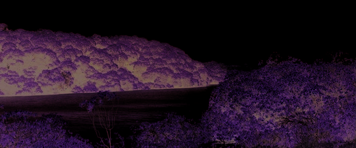
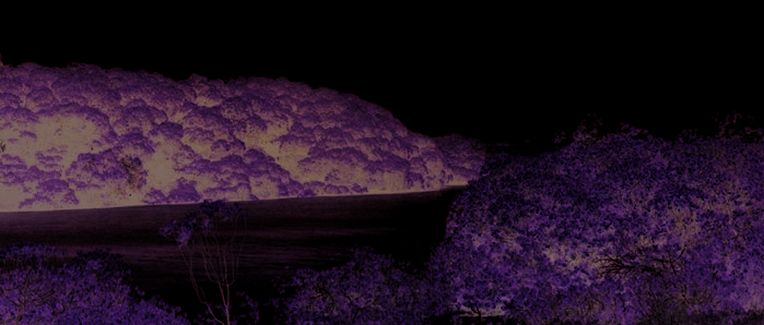
Cover photograph: Mangroves, Djibouti
This publication may be cited as:
PERSGA/ALECSO. 2003. Survey of Habitats in Djibouti and Plans for their Protection. PERSGA Technical Series No. 5.
PERSGA, Jeddah.
© 2003 PERSGA
Table of Contents
List of Figures.................................................................................................................................ii
Executive Summary ......................................................................................................................iii
Résume des études de terrain et observations ŕ Djibouti ........................................................vii
Introduction ....................................................................................................................................1
Methods ...........................................................................................................................................3
The Pressure-State-Response Model...........................................................................................3
The Database System ..................................................................................................................6
The Field Survey .......................................................................................................................10
Statistical Analysis.....................................................................................................................16
Results............................................................................................................................................17
Beach/Shoreline Indicators: Quadrat Method...........................................................................17
Reef Indicators: Secchi Disk Measurements of Visibility ........................................................18
Reef Indicators: Reef Edge Quadrat Method............................................................................18
Reef Indicators: Twenty Minute Reef Edge Assessment Swims ..............................................20
Overall Assessment ...................................................................................................................29
Iles Moucha and Ile Maskali.....................................................................................................29
Khor Ambado and Sable Blanc.................................................................................................32
Djibouti City Area .....................................................................................................................33
Iles des Sept Frčres....................................................................................................................34
Collines de Godoria, Khor Angar, Ras Siyyan .........................................................................35
Environmental Management Plan..............................................................................................37
The Djibouti Biodiversity Protectorates Authority (DBPA) .....................................................40
Areas of Special Environmental Interest ..................................................................................42
Visitor Management Guidelines..................................................................................................45
Iles Moucha and Ile Maskali.....................................................................................................45
Khor Ambado ............................................................................................................................55
Reefs and Beaches in Vicinity of Djibouti City........................................................................60
References ....................................................................................................................................63
Appendices ....................................................................................................................................65
Appendix 1: Project Planning Matrix for Implementation of the EMP ...................................66
Appendix 2: The Maps..............................................................................................................69
Appendix 3: Abbreviations and Acronyms ...............................................................................85
Appendix 4: Glossary................................................................................................................86
Appendix 5: Acknowledgements ..............................................................................................88
i
Survey of Habitats in Djibouti and Plans for their Protection
List of Figures
Figure 1: The Pressure-State-Response Model
Figure 2: The structure of the Data Management System
Figure 3: An example of a Universal Field Survey Datasheet
Figure 4: An example of a Shoreline and Beach Intertidal Field Survey Datasheet
Figure 5: An example of a Reef (sessile) Survey Datasheet
Figure 6: An example of a Reef (mobile) Survey Datasheet
Figure 7: An example of a completed Shoreline and Beach Intertidal Field Survey Datasheet
Figure 8: Characteristics of a typical fringing reef
Figure 9: Percentage cover of various lifeforms and abiota for seventy two reef assessment
quadrats
Figure 10: Percentage cover of various life forms and abiota in reef edge swims
Figure 11: Numbers of selected sessile (benthic) biota counted in reef assessment edge samples
Figure 12: Numbers of giant clams counted in reef assessment samples
Figure 13: Numbers of angelfish (totals of those selected for observation) in reef edge assessment
samples
Figure 14: Numbers of butterflyfish (totals of those species selected for observation) in reef edge
assessment samples
Figure 15: Numbers of grouper (totals of those species selected for observation) in reef edge
assessment samples
Figure 16: Numbers of grunt in reef edge assessment samples
Figure 17: Numbers of snapper in reef edge assessment samples
Figure 18: Evidence of human impact in reef edge assessment samples
ii
Executive Summary
Introduction
the adoption of the Precautionary Principle
approach to sustainable development.
This document provides a brief and
descriptive summary of observations made to
Field-work Programme
investigate the status of reefs and coastal
habitats at selected sites in the Republic of
Djibouti between 15th and 30th April 1998.
A total of 181 geo-referenced locations were
Recommendations for an Environmental
surveyed, comprised of 66 beach/shoreline
Management Plan and visitor management
quadrats, two beach/shoreline edge samples, 72
guidelines for key areas are proposed.
reef assessment quadrats, 34 reef assessment
edge samples, seven miscellaneous terrestrial
samples. Fifty two turbidity measurements were
The selected sites include: Iles Moucha and
taken by Secchi disc. One hundred and twelve
Ile Maskali, Khor Ambado and Sable Blanc,
features were assessed in the coral reef edge
Djibouti city reefs, Iles des Sept Frčres, Collines
swims including the living and non-living
de Godoria, Khor Angar, and Ras Siyyan.
substrates, selected fish species and selected
indicators of human impact.
Methods
Information using the selected indicators
was collected in the field using a series of
Rapid assessment and mapping of indicators
checklists designed to meet the requirements of
of resource status were undertaken on the coast
the survey objectives. All data collected during
and in the sea using a combination of quadrat
the survey have been installed on a data
sampling and edge surveys. All assessment sites
management system based on keywords. All
were geo-referenced for full GIS compatibility.
data were geographically referenced.
The method used can be repeated in order to
produce a robust and detailed dataset that will
give valuable information on changes in the
Preliminary Conclusions
status of natural resources.
The following preliminary conclusions can
The Pressure-State-Response model (PSR)
be drawn from the data with some confidence.
was used to identify sampling strategies and to
develop management guidelines for the study
area. A number of indicator species were
Coral Reefs
selected in order to support the PSR model. In
view of the potential for tourism development in
Almost all coral reefs at sites visited during
the country the PSR model is complemented by
this study were in average to good condition,
iii
Survey of Habitats in Djibouti and Plans for their Protection
and reef community structure appeared, in
fishermen were recorded at most sites. For
general, to be determined by natural
instance, Snappers (Lutjanidae) were found at
environmental factors, both present and
all sites. The presence of key indicator species
historical, rather than by human pressure.
such as the Humpheaded Wrasse (Cheilinus
However, signs of visitor pressure (for instance,
undulatus) suggests that fishing pressure is
fishing lines and litter) were observed at most
moderate to low in the areas surveyed. The
sites and these will increase in the future if left
grouper genus Plectropomus and the Bumphead
unmanaged. Evidence of coral breakage from
Parrotfish (Bolbometapon muricatum) were not
small anchors or trampling was found at the
recorded; these could be zoogeographical
resorts of Sable Blanc and Khor Ambado, but
effects.
this pressure is not severe at present levels.
Direct evidence of fishing activity (lines and
The site known as the `Japanese Garden' has
sport fishing by tourists) was observed in the
the highest live coral cover of the sites visited at
Moucha and Maskali reserve area.
Iles des Sept Frčres and has not been affected
negatively by the Crown of Thorns starfish
(COT) outbreak reported previously in the
Some reefs in the vicinity of Djibouti City
region.
Port are in good health despite the high turbidity
and discharge from Wadi Ambouli. The highest
live coral cover recorded during the entire
Severely degraded reefs with low living hard
survey period was, in fact, in the port area of
coral cover were only observed in one small
Djibouti City.
area at Maskali adjacent to the main beach, but
the exact cause of this degradation could not be
identified.
All of the degraded and moderately healthy
reefs have the potential for further recovery.
COT abundance at the sites visited is high
enough to cause concern and must be
Mangroves
monitored. However, COT abundance in
Djibouti is not currently at `plague' level, and
Grazing pressure, wood cutting, disease, and
previously infested sites have recovered well.
litter were noted in most mangrove stands
Most COT were observed at Sable Blanc and
visited on Iles Moucha and Maskali and on the
reefs of the Iles Moucha reserve. COT
mainland. These pressures need to be reduced.
abundance at other sites visited was negligible.
The site under most pressure from camel
grazing and wood cutting was at Ras Siyyan.
Substantial evidence of wood cutting was also
Long-Spine Urchins (Diadema) are not
found in the mangrove stands at Khor Angar and
currently a threat to most of the reefs visited.
Collines de Godoria.
Most Diadema were observed in the vicinity of
Djibouti City. Their populations require
monitoring.
Natural factors (high winds, restricted water
flow, insect infestation, possibly disease, and
extreme salinities) have killed parts of the
Fish populations at all reef sites were fairly
Moucha and Maskali mangrove. Similar effects
diverse and indicative of a healthy reef
are apparent in Khor Angar and Collines de
environment. Key groups that are targeted by
Godoria. Anthropogenic influences will be more
iv
Executive Summary
destructive when the mangrove system is
Additional environmental conservation is
already under this natural stress.
suggested for three areas considered to be under
particular threat from the immediate impact of
tourism. Specific visitor management guidelines
Abundance and distribution of mangrove in
have been developed for these areas, focussing
Djibouti is probably restricted by the limited
on the environmental pressures and the
habitat available for mangrove settlement.
responses of management to those pressures.
Seedlings and signs of reproductive
These areas are:
regeneration were not common, but this could
be a seasonal effect.
Iles Moucha and Ile Maskali,
Khor Ambado,
Beaches and Shoreline
Reefs of Djibouti City.
Turtle nesting occurs on Ile Maskali. Fresh
tracks and nests were recorded. Litter is
common on the beaches of Moucha/Maskali.
Environmental Management Plan
An Environmental Management Plan (EMP)
was proposed during a workshop with the
relevant in-country representatives. The
proposal achieved widespread support and
consensus. The plan calls for the establishment
of a single authority responsible for the
sustainable development of those areas
designated to be environmentally sensitive. It
was suggested that the authority be known as the
Djibouti Biodiversity Protectorates Authority
(DBPA). The EMP specifies that the operation
of the Authority and the management of the
areas should be guided by the Convention on
Biological Diversity and should aim to direct
part of the wealth generated from the areas into
effective environmental conservation
management.
v
Survey of Habitats in Djibouti and Plans for their Protection
vi
Résume des études de terrain et
observations ŕ Djibouti
Introduction
Programme des Etudes de Terrain
Ce document nous donne un bref résumé des
Le tableau 1 montre le programme détaillée
observations faites par deux consultants
des sites visités durant l'étude sur le terrain. Les
internationaux contracté par le PERSGA et
habitats clés (mangroves, plages, récifs
quatre cadres djiboutiens pour établir le statut
coralliens) diagnostiquées ŕ chaque site figurent
des récifs coralliens et des habitats côtiers et
dans celui-ci. Au total, dix jours ont été passés
marins dans quelques sites sélectionnés en
sur le terrain. Le tableau 2 indique le nombre
République de Djibouti.
d'études réalisées dans chaque type d'habitat clé.
Methode
Conclusions Preliminaires
L'équipe a utilisé une méthodologie
Les conclusions préliminaires suivantes
scientifique qui consiste ŕ réaliser des quadrants
peuvent ętre faites ŕ partir des observations avec
ŕ l'intérieur desquels la faune marine est
un certain degré de confiance:
échantillonnée. De plus une évaluation de la
couverture des récifs coralliens a été faite dans
chaque quadrant pour un diagnostic rapide et
Les Récifs coralliens
pour répertorier les indicateurs du statut des
ressources biologiques. Les positions en latitude
Le statut de presque tous les récifs coralliens
et longitude de tous les sites ont été répertoriés
visités varient entre une condition moyenne ŕ
en utilisant le Geographical Positioning System
bonne. Le tableau 3 indique le nombre des
(GPS). Cette méthode si elle est répétée dans le
études des récifs du tombant pour chaque
temps avec intensité produira une base de
catégorie de coraux vivants. La communauté
donnée détaillée et robuste. Aussi, ces données
des espčces vivants dans les récifs apparaissait
peuvent produire des séries valables
en général influencée par des facteurs
d'information qui seront utilisés pour suivre les
environnementaux actuels et historiques et non
changements du statut des habitats marins au
par des facteurs liés ŕ la pression humaine.
cours du temps. Des détails complémentaires de
Cependant, il y' a des indications d'une pression
cette méthode seront présentés dans le rapport
exercée par les visiteurs (filets et lignes de
final.
pęche, poubelle) observées dans la plupart des
sites et ceux-ci deviendront importants dans un
futur proche s'il y' a une absence d'une gestion
des habitats marins. Des preuves de coraux
endommagés par des ancres de petites tailles et
par le passage fréquent des visiteurs ont été
trouvés dans les plages de Sable Blanc et Khor
vii
Survey of Habitats in Djibouti and Plans for their Protection
Date
Lien
Ressource Diagnostique
19/04/98
Prés de Djibouti Ville
B
20/04/98
Khor Ambado
CR, B
21/04/98
Ile Maskali
CR, B, M
22/04/98
Iles Moucha
CR, B, M
23/04/98
Iles Moucha
CR, M
24/04/98
Khor Angar, Collines de Godoria
CR, M; CR, M
25/04/98
Les Sept Frčres et Ras Siyyan
CR; M
26/04/98
Sable Blanc
CR, B
27/04/98
Iles Moucha
CR
28/04/98
Prés de Djibouti Ville
CR
Tableau 1: Le Programme de Travail du PERSGA
B - Les plages
CR - Les récif coralliens
M - Les mangroves
Ressource
Nombre de Sites
Les plages
11
Les récif coralliens
Etudes périphériques: 34
Quadrants: 73
Les mangroves
56
Tableau 2: Nombre de sites étudiés en République de Djibouti par type d'habitat clé
Couverture des coraux vivants et durs (en %)
Nombre d'études des coraux périphériques
<10
3
10-19
1
20-29
6
30-39
7
40-49
8
>50
9
Tableau 3: Nombre d'études des récifs coralliens et leurs pourcentages de couverture dans les
différents sites
viii
Résume des études de terrain et observations ŕ Djibouti
Ambado, mais cette pression n'est pas sévčre
dans les zones visités. Le genre du Mérou
actuellement.
Plectropomus et celui du poisson Perroquet
Bolbometapon muricatum n'ont pas été trouvés
dans les zones étudiées. Les causes de l'absence
La zone des récifs des îles des Sept Frčres
de ces deux groupes peuvent ętre naturels, mais
appelé localement `le Jardin Japonais' a le taux
ceci nécessite des études plus détaillées.
le plus élevé de coraux vivants de toutes les îles
des Sept Frčres. Elle n'a pas été affectée de
façon irréversible par l'épidémie de l'étoile de
Des preuves évidentes d'une pęche (par
mer prédatrice, Acanthaster planci (COT), dont
example, lignes de pęche, pęche sportive par les
on a fait état dans des rapports précédents
touristes) ont été observés dans la réserve de
concernant Djibouti.
Maskali et ŕ Moucha.
Des coraux sévčrement dégradés ont été
Certains coraux proches du port de Djibouti
observés dans une petite zone a l'île Maskali
sont en bonne santé malgré la turbidité élevé et
opposée ŕ la plage principale. Les causes
le flux d'eau douce provenant de l'oued
exactes de cette dégradation n'ont pas été
d'Ambouli. Le récif avec le taux le plus élevé de
identifiées.
coraux vivants était observé dans cette zone.
L'abondance de COT est élevé ŕ un point tel
Mangroves
qu'elle présente un danger pour les coraux, mais
elle n'a pas atteint le stade de l'épidémie. La
La pression liée au pâturage des
majorité des COT ont été trouvées ŕ Sable Blanc
dromadaires, la coupe du bois, la maladie, et les
et au parc territorial de Moucha. Dix huit sur
déchets ont été notés dans la majorité des
trente quatre échantillons pour lesquels COT
mangroves visitées ŕ Moucha, Maskali, et sur la
était recherchée les contenaient. Cinq de ces
côte nord. Ces pressions doivent ętre réduites.
męme échantillons contenaient plus de dix COT.
Le site avec la plus forte pression était celui de
Ras Siyyan, et il y' avait une intense coupe de
bois a Khor Angar et Godoria.
Les oursins du genre Diadčme ne sont pas ŕ
l'heure actuelle une menace pour la plupart des
récifs visités. Le nombre le plus élevé d'oursins
Les facteurs naturels (vents forts, flux d'eau
ont été trouvés dans les récifs situés aux abords
réduit, épidémie d'insectes, maladie, salinité
de Djibouti et cela nécessite une surveillance.
élevé) ont détérioré des parties des mangroves
de Moucha et Maskali. Des effets similaires
existent ŕ Khor Angar et Godoria. Les
Les populations de poissons dans tous les
influences humaines peuvent ętre plus
récifs sont d'une diversité modérée et indiquent
destructrices quand les mangroves subissent
des récifs en bonne santé. Des groupes cibles de
déjŕ une pression naturelle.
poissons recherchés par les pęcheurs ont été
trouvés dans la plupart des sites. Par exemple,
les poissons de la famille des Vivaneaux
L'abondance et la distribution des
(Lutjanidae) sont présents dans tous les sites. La
mangroves ŕ Djibouti est probablement
présence d'indicateurs clés tel que le poisson
tributaire des habitats limités disponibles pour
Napoléon (Cheilinus undulatus) suggčre que
leur prolifération.
l'effort de pęche est d'un niveau bas ŕ modéré
ix
Survey of Habitats in Djibouti and Plans for their Protection
Les jeunes plants de mangrove et les signes
d'une reproduction étaient négligeables dans
tous les sites probablement parce que ce n'est
pas la bonne saison mais les fleurs étaient
présentes.
Plages
Les lieux de ponte des tortues sont localises
dans l'île de Maskali. Des traces récentes de leur
passage ainsi que les sites contenant leurs oeufs
ont été observes.
Les déchets sont trčs abondants dans les îles
Moucha et Maskali.
x
Introduction
General
UNEP/IUCN/WCMC (1988) provides a
cursory review of information on the coral reefs
The most recent analysis of the current state
of the Republic of Djibouti. There are some
of the Red Sea and Gulf of Aden was undertaken
early, detailed accounts of the reefs in the region
as part of the Strategic Action Programme
from GRAVIER, (1910a,b,c, 1911) cited in
(SAP) for the Red Sea and Gulf of Aden
UNEP/IUCN/WCMC (1988). Observations
(AHMED ET AL., 1997). Co-ordinated in the
made recently, in association with studies on the
region by the Regional Organization for the
fish trade (BARRATT and MEDLEY, 1998, 1990),
Conservation of the Environment of the Red Sea
indicate that reef health is poorest near Djibouti
and Gulf of Aden (PERSGA), the SAP was
City and best on the northern coast of the Gulf
funded by the Global Environment Facility
of Tadjoura and into the Bab el Mandeb. The
(GEF) and the governments of countries in the
early reports of GRAVIER had described
region. The objectives of the SAP were to
Djiboutian reefs as flourishing, and
evaluate current issues and resources in marine
anthropogenic pressures (UNEP/IUCN, 1988)
and coastal environments and to develop a
and Crown of Thorns outbreaks (PICHON, 1990)
programme of regional actions designed to
have since been stipulated as the most likely
address the issues over the next decade. Djibouti
causes of the significant reduction in the reef
is a recent signatory to the PERSGA regional
quality. The draft PERSGA Strategic Action
programme and is now committed to meeting
Programme Document (PERSGA, 1997a) and
these objectives. As part of the work programme
Country Report for the Republic of Djibouti are
for 1997-1998 PERSGA identified the need for
the most recent attempts to collate the available
surveys of natural coastal and marine habitats at
information on local coral reef status (PERSGA,
specified locations in Djibouti and the
1997b).
development of visitor and tourist management
guidelines for their protection.
Natural factors have historically limited the
development of mangroves and seagrass beds
The coastline of the Republic of Djibouti
along the coast (SHEPPARD ET AL., 1992). Where
extends for approximately 370 km; a third of
they do occur, and especially on the mainland,
this faces the narrow straits of the Bab el
mangroves have been reported as being under
Mandeb. The remainder of the coastline lies
intense pressure from a variety of anthropogenic
along the Gulf of Tadjoura between Obock in
activities as specified in the Country Report for
the north and the main port of Djibouti to the
the Republic of Djibouti (PERSGA, 1997b).
south. Coral reefs, mangrove, and seagrass
The alarming and increasing degradation rate of
habitats all occur but they have been reported as
coastal habitats - especially coral reefs - is
generally under-developed in comparison with
highlighted in these reports, although no
other locations in the Red Sea and Gulf of Aden
quantitative data are provided. As anticipated,
(UNEP/IUCN/WCMC, 1988).
human-induced pressure is reported as at its
greatest in the vicinity of the capital city.
1
Survey of Habitats in Djibouti and Plans for their Protection
Background
Project Strategy
The Work Programme approved by the
The fieldwork was carried out between 15th
PERSGA Council of Ministers in October 1996
and 30th April 1998. A recent appraisal of the
identified the need for a survey of habitats in
methods described can be found in the
Djibouti and recommendations for management
programme report for the Asian Development
actions to address current issues affecting the
Bank funded `Indonesian Marine Resources
marine and coastal environments and associated
Evaluation Programme', 1995-1997. A general
resources. To fulfil these objectives a Pressure-
review of the coastal resources at each site
State-Response (PSR) approach (see Methods)
visited during the study is given.
was adopted to identify strategies and introduce
effective management to the study areas.
The Environmental Management Plan
(EMP) was presented by the Djiboutian
The scope of work undertaken included:
counterparts at a Workshop held in the Palais du
Peuple, Djibouti City on April 30, 1998. A
an assessment of the status of habitats,
project proposal, based upon the logical
range of visitor activities, and impacts of
framework model, has been prepared for
these activities (identification of
implementation of the EMP (Appendix 1). The
pressure and assessment of state) at Iles
need for significant financial investment into
Moucha and Ile Maskali, Khor Ambado
visitor management and conservation of marine
and Sable Blanc, the reefs off Djibouti
resources on the Djiboutian coast cannot be
city, Iles des Sept Frčres, Collines de
over-emphasised. Specific management
Godoria, Khor Angar, and Ras Siyyan;
guidelines for key areas are presented in the
final section.
the development of specific visitor
management guidelines for the
conservation and sustainable use of Iles
Moucha and Ile Maskali, Khor Ambado
and the reefs offshore from Djibouti city
(response);
a one-day workshop to present the study
results and draft recommendations for an
Environmental Management Plan
(EMP).
Project Goal
To strengthen the capacity of the
government of Djibouti to undertake sustainable
management of resources while conserving
coastal and marine biodiversity.
2
Methods
The Pressure-State-Response Model
pressure indicators quantify the stresses
in the form of direct pressures, such as
fishing, trampling, grazing, diver
General
damage, wood cutting etc. (the human
activities and economic sectors which
This model was developed by the
produce the pressures are referred to in
Organisation for Economic Co-operation and
the model as driving forces);
Development (OECD) in 1993, and has been
state
indicators describe the
further refined by the Environmental Protection
environmental conditions of the water,
Agency (1994), UNEP (SWART ET AL., 1995),
coastline, and reef systems, and the
and the European Environment Agency
quality and quantity of specific natural
(WIERINGA, 1996). The validity of the model in
resources; and
the coastal context has been demonstrated by
OLSEN ET AL., (1997). Figure 1 depicts the basic
response indicators describe the actions
structure of the model. There are three types of
taken to improve the quality of the
indicators distinguished in the model.
environment. Due to the need to enhance
administrative capacity and
environmental management in Djibouti,
The definitions of the indicators, as applied
the Environmental Management Plan
in the present Technical Paper, are as follows:
(EMP) presented is focused primarily
upon response indicators.
PRESSURE - STATE - RESPO NSE (PSR) FR A MEW ORK
A PPL IED TO CO A STA L MA NA GEMENT
af ter OLSEN ETAL., (1997)
RESPO NSE
STATE
ICM Go v er n an c e
Co n d i tio n o f CZ
Is s u e Id en t i f i c at i o n
A c h i ev em en t o f
Pl an n i n g
i n t er m ed i at e p r o j ec t
Fo r m al i s at i o n
o b j ec t i v es
Progr ess on select ed ICM Issues thr ough
Im p l em en t at i o n
W el l b ei n g o f t h e
successi ve progr amme generat ion
Ev al u at i o n
ec o s y s t em
Q u al i t y o f l i f e
PRESSURES
Ex ter n al Fo rc es
A ls o
E c o n o m i c
U s e / v al u e
D em o g r ap h i c
B C S , ( 1 9 9 5 )
Political
D ri v i n g Fo r c es
In s t i t u t i o n al
Im pac t
Figure 1: The Pressure-State-Response Model
Figur e 2.1: Scematic of the Pr essur e-State-Response Fr amewor k
3
Survey of Habitats in Djibouti and Plans for their Protection
Environmental indicators selected during
provides an indication of frequent use or
the study were incorporated and structured into
accessibility to the reef system and mangroves.
the framework of the Pressure-State-Response
(PSR) model. The fieldwork undertaken relates
the framework of the PSR model to the EMP,
Fishermen often target certain species, and
developed to enhance the management of visitor
the abundance of these selected species is a
activities to coastal sites.
measure of the degree of fishing pressure. Target
groups include the snappers (Lutjanidae), grunts
(Haemulidae), wrasse (Labridae) and groupers
The fieldwork component concentrates on
(Serranidae). The humpheaded wrasse,
pressure and state assessment. Features of the
Cheilinus undulatus, is also a prime food-fish
environment (for instance, species, life forms,
subject to overfishing and included in this
and anthropogenic disturbances) were selected
survey. The bumphead parrotfish,
to serve as indicators of pressure on resources
Bolbometopon muricatum, is a large, shy
and their status. The EMP, however, addresses
species potentially attaining lengths of up to
the actions required (responses) in order to
130 cm and can occur in groups. The value of
ensure the sustainable utilisation of
noting the abundance of B. muricatum as an
environmental resources in the study region.
indicator of fishing pressure is a matter of
Capacity building is critical in order to ensure
debate, but the presence of shoals of this fish
that the PSR model operates in the future (in its
may indicate low fishing activity (LIESKE and
capacity to assess pressures, determine state,
MYERS, 1994), particularly spearfishing
and provide responses).
(J. KEMP, pers. comm.). It was also selected
because of the damage that it can inflict on
hermatypic corals which may, in certain
Justification of Chosen Indicators in the
circumstances, resemble anchor damage.
Light of the PSR Model
The following paragraphs offer a general
Many benthic fauna are subject to fishing
explanation of the method by which features of
and collection pressure. Such benthic fauna
the environment were categorised as either
include top-shells, sea cucumbers, giant clams
`pressure' or `state' indicators in order to assess
and lobsters. Of these, top-shells and lobsters
the resources of the field study areas.
are cryptic and nocturnal respectively. Their
value as fisheries resources is high, hence their
inclusion in this survey. Additional organisms
PRESSURE: Groups and Species Indicative
might be included as indicators of the curio
of Pressure on the Reef System
trade1.
An estimation of the degree of
anthropogenic stress that a marine community is
under can be obtained by examination of a set of
Larger species such as shark and turtle are
features which are indicative of that pressure.
included in a survey of this nature as both are
Pressure indicators included evidence of
under increasing pressure from fishing and
discarded or lost fishing line, nets, and traps.
because of their importance as tourist
Anchor damage (only noted as present or absent
attractions. These species have low reproductive
in this study) to corals is a pressure indicator, as
capacities so population recoveries following
is grazing in mangrove stands. In addition, any
impacts are slow. Turtles are internationally
other solid waste such as discarded rubbish
recognised as vulnerable fauna and are known to
1 A fairly extensive curio trade is reported in the Djibouti Country Report for the SAP. However, limited evidence was
observed other than 'roadside' trade with French nationals on their way to and from the yacht club and recreational beaches.
4
Methods
nest in Djibouti (PERSGA, 1997b). Their
included. Crown of Thorns starfish and long
inclusion as pressure indicators is justified on
spine sea urchin (Diadema) numbers are
these grounds.
considered to be important indicators of reef
health and the latter is possibly indicative of
human impact, specifically hydrocarbons and
STATE: Groups or Species Indicative of the
faecal indicators. Additionally, slate pencil
State of the Reef System
urchins (Heterocentrotus mammillatus) are
Some species, although not directly or
extremely abundant elsewhere in the Red Sea
significantly influenced by anthropogenic
and their numbers are potentially indicative of
activity, are believed to provide a general
the degree of bioerosion taking place in a reef
indication of the state, or "health", of a reef
system.
system. Many of the indicator species included
in the checklists of the present Technical Paper
are associated closely with the reef substrate.
The Precautionary Principle
These include butterflyfish, angelfish and some
triggerfish. Of these three examples,
butterflyfish are highly territorial and obligate
In light of the many different visitor
corallivores. They are also important aquarium
activities undertaken at the field study sites and
fish and are highly conspicuous. Angelfish and
in view of the status of the marine environment,
some triggerfish are also territorial. Monitoring
the Precautionary Principle has been adopted in
of these species indirectly monitors for subtle or
support of the Pressure-State-Response model.
sub-lethal change to the benthic reef
community. (For a discussion on the choice of
indicator species see AIMS (1997) and DAWSON
The Precautionary Principle is a
SHEPHERD ET AL., (1992)).
management strategy that allows for events that
may occur in the future and that may be
environmentally damaging. In many ways it is a
Of the benthic fauna, anemones are
predictive, rather than a responsive approach,
considered indicative of healthy hard coralline
which assumes a worst-case scenario even
communities. In such locations, algal
without full scientific justification, and
communities would be expected to be limited
mitigates accordingly. The Precautionary
and water clarity good. Sea urchins are similarly
Principle is embodied in the agreements of the
linked to the state of the environment. The
Earth Summit and inherent in the environmental
density of the long-spined urchin, Diadema, has
strategy for the 21st century, `Agenda 21'.
been shown to exhibit a negative relationship
Therefore, all governments who are signatories
with algal turf cover in the Gulf of Aqaba
to the Convention on Biological Diversity
(BENAYAHU and LOYA, 1977a), but the precise
(CBD) have endorsed the Precautionary
relationship between urchin density and algal
Principle.
coverage is not certain (GOREAU, pers. comm.).
Urchins are bioeroders and in high numbers can
contribute significantly to the destruction of reef
substrate. The Crown of Thorns starfish,
Acanthaster planci, is historically known to
have been a problem in some areas of the Red
Sea and also in Djibouti (PICHON, 1990). The
potential of this creature to cause widespread
devastation to a reef system means that
abundance measures for this species should be
5
Survey of Habitats in Djibouti and Plans for their Protection
The Database System
sampling method was utilised, thus
allowing the environmental scientist to
sub-divide and refine the method if
All data collected have been stored in a data
necessary,
management system (DMS). It is fully
Geographic Information System (GIS)
a keyword defining what element of the
compatible and provides a framework for
feature was examined (e.g. length,
storing and building-up an appropriate data set
width, percentage cover, count, presence
for management purposes.
or absence, etc..), and
a keyword defining what units of
Keyword Combinations and the
assessment were applied (e.g. degrees
Glossary ID
Celsius, metres, ppt, pH units, inches,
etc..).
Keywords are combined into sets; a set of
combined keywords includes:
Each set of combined keywords is identified
by a unique number code, and this is called the
a keyword defining the feature to be
Glossary ID (G-ID). For example, the G-ID for
assessed (e.g. sand, mud, Avicennia
Avicennia marina that has been visually
marina, halophyte, pH, salinity, giant
assessed in terms of its percentage cover is 563.
clams, turbidity, litter, etc..),
Similarly, the G-ID for Rhizophora mucronata
that has been visually assessed in terms of its
a keyword defining which sub-sampling
percentage cover is 657. Other G-IDs are
method was utilised (e.g. refractometer,
presented on the survey checklists (Figures 3, 4
Secchi disk, visual assessment, pH
and 5) and are accompanied, for reference
probe, tape measure, etc..),
purposes only, by the English or scientific name
of the feature.
a keyword defining which sub-sub-
PRESSURE - STATE - RESPONSE (PSR) FR A MEW ORK
A PPL IED TO COA STA L MA NA GEMENT
after OLSEN ETAL., (1997)
RESPONSE
STATE
ICM Go v er n an c e
Co n d i tio n o f CZ
Is s u e Id en t i fi c ati o n
A ch i ev em en t o f
Pl an n i n g
i n ter m ed i ate p r o j ec t
Fo r m al i s ati o n
o b j ec ti v es
Progress on selected ICM Issues through
Im p l em en tati o n
W el l b ei n g o f th e
successi ve programme generation
Ev al u at i o n
ec o sy s t em
Q u al i ty o f l i fe
PRESSURES
Ex ter n al Fo rc es
A ls o
E c o n o m i c
U s e / v al u e
D em o g r ap h i c
B C S , ( 199 5)
Political
D ri v i n g Fo r c es
In s t i tu t i o n al
Im pac t
Figure 2: The structure of the Data Management System
6


Methods
SAMPLE ID
NO. SHEET
Universal Field Datasheet
S-METHOD
REGION
COLLECTOR
PLACE NAME
PLACE SOURCE
DATE(START)
DATE(FINISH)
Sheet Check
Check date
START UTC
FINISH UTC
Data Entry
Entry Date
SAMPLE NOTES
continue overleafÎ
GEOREFERENCES
G-Code
GeoPS
S-Code
Spheroid
N/S
E/
Zon
Latitude/UTM-Northing
Longitude/UTM Easting
W
e
G-ID
Feature
SS
SSS
Value
G-ID
Feature
SS
SSS
Value
Figure 3: An example of a Universal Field Survey Datasheet
7
Survey of Habitats in Djibouti and Plans for their Protection
Survey Checklists
Filling in the Field Datasheets
A list of keyword combinations makes up a
The field datasheets with incorporated
field checklist. This list determines what
checklists are self explanatory. Terms appearing
features of the environment will be assessed and
on the sheets that may require clarification are
how. There could be many records on a checklist
defined in the glossary (Appendix 4).
- this makes the survey complex - or there could
be very few records on a checklist (for instance,
just Crown of Thorns (COT) and Diadema
When recording data on the Beach/Shoreline
during a Manta Tow survey [AIMS, 1997]).
Field Datasheet, and also the Universal Blank
However, all checklists are designed to meet the
Field Datasheet, it is important to understand
requirements of the survey objectives, and each
how to use the SS and SSS columns in order to
item added to the checklist should be justified
record multiple parameters about a particular
during any survey design process or pilot study.
feature. The following example aims to clarify
the use of these columns when recording data.
Figure 7 shows a completed datasheet with data
The length of the checklist and the items and
based upon the following example:-
features that are added to it are determined by
the nature of the survey, logistical constraints
Suppose the objective of an observation was
placed on the work, the nature of the
to note the percentage cover of Avicennia
environment, and personal knowledge of the
marina and also to give an indication of the
study area. Other factors will also influence
average height of the trees. For the purposes
checklist design, but the main principle is that a
of this example, let us assume that A. marina
well-designed checklist can provide a robust
covers 40% of the quadrat and that the
and standardised form to encourage disciplined
estimated average height of the trees is
field-data collection. Items included in a
1.5 m. The G-ID for A. marina (563) should
checklist should be environmental indicators of
be recorded in the G-ID column of the field
either pressure, state, or response.
datasheet; the feature name (i.e. A. marina)
should be recorded in the Feature column;
and then the percentage cover (i.e. 40%)
Any single checklist can be printed off
should be noted in the Value column. On the
separately and used in conjunction with a blank
next line, the G-ID for height in meters (24)
universal field survey datasheet (Figure 3) or
is placed in the G-ID column, the feature
incorporated into the design of a field survey
name (i.e. height) in the Feature column, and
datasheet. Figures 4, 5, and 6 illustrate the field
the estimated height (i.e. 1.5 m) in the Value
datasheets utilised for Beach/Shoreline
column. In order to link the two
Observations, Benthic or Sessile Features on
observations together, a number (for
reef edge swims, and Mobile Features on reef
instance, one) is entered into the SS column
edge swims respectively.
for both height and A. marina. So, the SS for
G-ID 563 is one and the SS for G-ID 24 is
one also. This tells us that the height
At each sample site the many features on the
assessment refers to A. marina and not to
checklist are worked through systematically
any other feature within the quadrat (for
(note: there is a one to many relationship
instance, Rhizophora mucronata) for which
between sample site and checklist records), and
average height was also assessed. The
each feature is assessed in turn according to the
number can be any number, but must be
overall method being applied.
unique to the combination of observations.
8


Methods
SAMPLE ID
NO. OF SHEETS
Shoreline/Beach Intertidal Field
Datasheet
S-METHOD
REGION
COLLECTOR
PLACE NAME
PLACE SOURCE
DATE(START)
DATE(FINISH)
Sheet Check
Check date
START UTC
FINISH UTC
Data Entry
Entry Date
SAMPLE NOTES
continue overleafÎ
GEOREFERENCES
G-Code
GeoPS
S-Code
Spheroid
N/S
E/
Zone
Latitude/UTM-Northing
Longitude/UTM Easting
W
G-ID
Checklist
G-ID
Feature
SS SSS
Value
G-ID
Feature
SS SSS
Value
537 Agriculture
403 Algal turf
154 Algal assemblage
563 Avicennia marina
545 Beach
617 Bridge
558 Building
552 Calcareous
85 Channel
634 Culvert
27 Depth
39 Direction
559 Dirt road
535 Domestic
534 Fisheries
573 Fishing Line
576 Fishing net
577 Fishing trap
335 Gravel
562 Halophyte
24 Height
546 Intertidal
542 Liquid waste
633 Mud
572 Other wetland
49 Photograph
105 Rock
33 Salinity
93 Sand
121 Seagrass
90 Silt
554 Solid jetty
543 Solid waste
560 Tarmac road
318 Temperature
553 Terrestrial
35 Turbidity
579 Vessel
11 Width
Figure 4: An example of a Shoreline and Beach Intertidal Field SurveyDatasheet
9
Survey of Habitats in Djibouti and Plans for their Protection
Sable Blanc
(Map 5)
Figure 7 indicates how the same
methodology as described in the above
Collines de Godoria
(Map 6)
paragraph can be applied to indicate the average
height of Rhizophora mucronata in the same
Khor Angar
(Map 7)
quadrat, the coverage of halophyte, and the
Iles des Sept Frčres
(Map 7)
direction and frame number of four photographs
taken from within the quadrat.
Ras Siyyan
(Map 7)
In total, 181 sample points were geo-
The Field Survey
referenced.
The Scope of the Survey
Geo-referencing the Sample Sites
The Country Report for the Republic of
In most cases the geo-references of each
Djibouti and previous experience of the Arabian
feature were recorded as Universal Transverse
region were used to develop preliminary
Mercator (UTM) co-ordinates from a hand-held
checklists, which were then refined as the
Global Positioning System (GPS). The
survey progressed.
reference spheroid adopted was the universal
spheroid, WGS84, and the GPS systems were
initialised using Djibouti City as the positioning
General survey strategy
datum. The sample site geo-references were
collected as Latitude and Longitude. Geo-
The study objectives required a rapid,
references were collected and stored in the DMS
broadly based assessment of the status of a wide
in decimal format to three decimal places (i.e.
variety of environmental features and also an
DD.MM.MMM where D represents degrees and
investigation into the many different stress
M represents minutes). See website at
factors acting upon these features. Therefore, a
http://www.cellspark.com/UTM.html for free
relatively large number of features were
conversion between UTM and Latitude &
assessed at the specific sites illustrated in
Longitude data.
Map 1. An alternative strategy, mapping the
distribution of a more limited number of
features over a wider area, was not considered
The GPS system used was the Magellan
suitable.
GPS 3000 XL (two individual units were used
for back-up). The Magellan model has enhanced
capacity for waypoint storage and also
Study locations
numerous features that make it a suitable model
for fieldwork. It has the capacity for fixing
Sample sites were assessed at eight distinct
positions in Latitude & Longitude and UTM.
locations (Map 1). The following figures display
One limiting factor of the GPS-based
the exact position of the sample sites at each
positioning system is the integral error in the
location. All maps can be found in Appendix 2.
satellite signal (known as Selective Availability)
introduced by the US government to maintain a
Iles Moucha and Ile Maskali
(Map 2)
military advantage. The size of the error
changes, but the Magellan GPS system can
Khor Ambado
(Map 3)
produce an average accuracy of 25 m or better
(MAGELLAN SYSTEMS CORPORATION, 1997).
Djibouti City
(Map 4)
10


Methods
SAMPLE ID
NO. SHEET
Reef (sessile) Datasheet
S-METHOD
REGION
COLLECTOR
PLACE NAME
PLACE SOURCE
DATE(START)
DATE(FINISH)
Sheet Check
Check date
START UTC
FINISH UTC
Data Entry
Entry Date
SAMPLE NOTES
continue overleafÎ
GEOREFERENCES
G-Code
GeoPS
S-Code
Spheroid
N/S
E/
Zone
Latitude/UTM-Northing
Longitude/UTM Easting
W
G-ID
Feature
Quadrat 1 : % Cover
G-ID
Feature
Quadrat 2: % Cover
403 Algal turf
403 Algal turf
147 Anemones (number)
147 Anemones (number)
155 Coralline algae
155 Coralline algae
144 Dead coral
144 Dead coral
145 Dead coral with algae
145 Dead coral with algae
335 Gravel
335 Gravel
123 Living hard coral
123 Living hard coral
157 Macroalgae
157 Macroalgae
93 Sand
93 Sand
159 Sargassum
159 Sargassum
121 Seagrass
121 Seagrass
90 Silt
90 Silt
138 Soft coral
138 Soft coral
139 Sponges
139 Sponges
162 Turf algae
162 Turf algae
49 Photo
49 Photo
27 Depth (minimum)
27 Depth (minimum)
27 Depth (maximum)
27 Depth (maximum)
27 Depth (measurements @)
27 Depth (measurements @)
33 Salinity
33 Salinity
318 Temperature
318 Temperature
34 Turbidity (secchi);35=visual
34 Turbidity (secchi);35=visual
G-ID
Feature
Number (edge)
G-ID
Feature
% Cover (edge)
147 Anemones
403 Algal turf
567 Crown of thorns starfish
155 Coralline algae
573 Fishing Line
144 Dead coral
576 Fishing net
145 Dead coral with algae
577 Fishing trap
335 Gravel
564 Giant clams
123 Living hard coral
393 Lobster
157 Macroalgae
565 Sea cucumber
105 Rock
330 Sea Urchin (Long spine)
93 Sand
569 Slate Pencil Urchin
159 Sargassum
575 Solid waste
121 Seagrass
566 Top Shell
90 Silt
138 Soft coral
139 Sponges
162 Turf algae
49 Photo
27 Depth (minimum)
27 Depth (maximum)
34 Turbidity (secchi);35=visual
Figure 5: An example of a Reef (sessile) Survey Datasheet
11
Survey of Habitats in Djibouti and Plans for their Protection
To limit the error introduced by this variable,
central point of selected quadrats. The direction
positioning was carried out from known surface
of the photograph was determined using a hand-
features or landmarks (e.g. surface buoys,
held compass.
wrecks, mangrove perimeter, tracks, boulders).
For reef assessments the GPS was carried
enclosed in two watertight bags (one within the
Sublittoral reef assessment
other).
In view of the importance of coral reefs in
marine-based tourism, most of the work
Beach/shoreline and Intertidal Survey
undertaken in the study was conducted on these
Procedures
systems. The protocol for reef assessment is best
performed with at least two observers, and is
Ten metre square quadrats were chosen at
comprised of three steps as follows:
strategically positioned locations on the coast.
Most quadrats were centred on the water's edge.
Visual assessment by snorkel of a 10 m by
Tidal range is small and, as the time of sampling
10 m quadrat centred on the demarcating
was noted, the data can be back-calculated to
line between the reef edge and the reef face
determine the tidal state at the time of sampling.
as shown in Figure 8 (see BEMERT and
ORMOND (1981) for definitions of the
descriptive terminology and reef zonation).
Geo-references in latitude and longitude
Figure 5 illustrates the field survey datasheet
were noted for each quadrat. Occasional
with these features incorporated from the
quadrats were sampled that were not centred on
checklist and easily viewable underwater.
the water's edge, especially when examining the
inland edge of mangrove stands. During the
Followed by:
study several criteria were used to determine
A timed 20-minute swim by snorkel along
where quadrats were sampled. These criteria
the line of the reef edge, starting at the
included the following:
quadrat, and noting the features within a
10 m wide band transect. Figure 6 illustrates
Presence of key features or hotspots,
the field survey datasheet with these features
Indication of impact or pressure on
incorporated.
biological resources,
Followed by:
Proximity of settlement.
An assessment by snorkel of a 10 m by
10 m quadrat at the end of the 20-minute
Principal checklist features noted in each
swim also centred on the demarcating line
edge sample and each quadrat sample are listed
between the reef edge and reef face.
on the Beach (Intertidal) Survey Datasheet
shown in Figure 4. The list of features and
G-IDs on the left of the form serve only as a
The above sequence generates three
conveniently placed reminder of the features
samples, one for each step. For example,
that may be observed within the quadrat. It is
Sample ID 991 and 993 are quadrat samples and
also possible to undertake the same work using
992 is a 20 minute reef edge swim sample. The
the universal survey datasheet (Figure 3).
geo-references of the start and finish quadrats
were taken as the start and finish, respectively,
of the 20-minute reef edge swim.
In most shoreline samples photographs were
taken in four directions at right angles from the
12


Methods
SAMPLE ID
NO. OF SHEETS
Reef (mobile) Survey Datasheet
S-METHOD
REGION
COLLETOR
PLACE NAME
PLACE SOURCE
DATE(START)
DATE(FINISH)
Sheet
Check date
Check
START UTC
FINISH UTC
Data
Entry Date
Entry
SAMPLE NOTES
continue overleafÎ
GEOREFERENCES
G-Code
GeoPS
S-Code
Sphe
N/S
E/W
Zone
Latitude/UTM-Northing
Longitude/UTM Easting
roid
G-ID
Feature
Number/Present G-ID
Feature
Number/Present
G-ID
Feature
Number/Present
585 Aeth rogaa
589 Pom imperator
610 Lab dimidiatus
641 Ac bifasciatus
590 Pom maculos
342 Lar quadriline
598 Balist viridesc
635 Pseudob flavi
632 Macropharyng
604 Bol muricatum
587 Pyg diacanthus
369 Ostraciidae
639 Car melanopt
638 Triaenodon ob
599 Oxymon halli
640 Car wheeleri
582 Variola louti
361 Plectroglyphid
583 Cp argus
340 Pom sulphure
395 Cp hemistikto
376 Pseu fridmani
584 Cp miniata
606 Sc ferrugineus
381 Cp oligosticta
607 Sc frenatus
611 Ch auriga
608 Sc niger
616 Ch austriacus
605 Sc sordidus
614 Ch fasciatus
628 Th klunzingeri
615 Ch lineolatus
338 Th lunare
612 Ch melannotu
594 Zeb veliferum
380 Ch mesoleuc
595 Zeb xanthuru
618 Ch paucifasci
619 Ch semilarvat
624 Chei undulatus
385 Ep fasciatus
388 Ep fuscogutt
389 Ep summana
341 Abudefduf spp.
390 Ep tauvina
596 Acanth sohal
592 Gen caudovitt
366 Amblyglyphido
620 Gonoc larvatu
602 Amp bicinctus
570 Green Turtle
586 Anthias squam
571 Hawksbill turtl
597 Balist undulat.
621 Hen diphreute
593 Ce. multispin
622 Hen intermed
603 Cetosc bicolor
588 Hol xanthotis
623 Ch fasciatus
643 Lutj argenitm
329 Ch lunulatus
367 Lutj bohar
370 Chro caerulea
600 Lutj gibbus
372 Chro dimidiata
373 Lutjmonostig
382 Ct striatus
636 Macolor niger
391 Dasc aruanus
613 Meg trifasciali
625 Epib insidiator
601 Plect gaterinus
629 Gom caeruleus
637 Plect pictus
630 Hal hortulanus
580 Plec maculatu
631 Hal marginatus
581 Plec truncatus
627 Hem fasciatus
591 Pom asfur
384 Hem melapter
Figure 6: An example of a Reef (mobile) Survey Datasheet
13


Survey of Habitats in Djibouti and Plans for their Protection
SAMPLE ID
9999
NO. OF SHEETS
1
Example Completed Shoreline/ Beach
Intertidal Field Datasheet
S-METHOD
234 10x10
Quadrat
REGION
Djibouti
COLLECTOR
ARDS & TB
PLACE NAME
Iles Moucha
PLACE SOURCE
British Admiralty Chart
DATE(START)
13/05/98
DATE(FINISH)
13/05/98
Sheet
TB
Check
26/05/98
Check
date
START UTC
13:42
FINISH UTC
13:58
Data Entry
TB
Entry Date
26/05/98
SAMPLE NOTES
There is a nearby sewerage outfall and a pile of litter on the strandline. There are many old car tyres. Approximately 100 Ibis are foraging
amongst the mangrove roots about 50 m from the quadrat. There are signs of moderate grazing pressure. No disease or cutting.
GEOREFERENCES
G-Code
GeoPS
S-Code
Spheroid
N/S
E/W
Zone
Latitude/UTM-Northing
Longitude/UTM Easting
1604
Magellan
110
WGS84
N
E
1304.431
04309.132
3000 XL
G-ID
Checklist
G-ID
Feature
SS
SSS
Value
G-
Feature
SS SSS
Value
537 Agriculture
563 Avicennia marina
1
40
403 Algal turf
24 Height
1
1.5
154 Algal assemblage 657 Rhizophora
2
20
563 Avicennia marina
24 Height
2
2.0
545 Beach
562 Halophyte
3
40
617 Bridge
49 Photograph
4
3
558 Building
39 Direction
4
0
552 Calcareous
49 Photograph
5
4
85 Channel
39 Direction
5
90
634 Culvert
49 Photograph
6
5
27 Depth
39 Direction
6
180
39 Direction
49 Photograph
7
6
559 Dirt road
39 Direction
7
270
535 Domestic
534 Fisheries
573 Fishing Line
576 Fishing net
577 Fishing trap
335 Gravel
562 Halophyte
24 Height
546 Intertidal
542 Liquid waste
633 Mud
572 Other wetland
49 Photograph
105 Rock
33 Salinity
93 Sand
121 Seagrass
90 Silt
554 Solid jetty
543 Solid waste
560 Tarmac road
318 Temperature
553 Terrestrial
35 Turbidity
579 Vessel
11 Width
Figure 7: An example of a completed Shoreline and Beach Intertidal Field Survey Datasheet
14
Methods
(Bemert and Ormond, 1981)
lagoon
reef crest
beach
back reef
reef flat
reef edge
reef face
reef slope
sea bed
Figure 8: Characteristics of a typical fringing reef
The depth range of each sample was noted
Specific Criteria for Selection of Fish Species
and incorporated into the database. Fish species
Fish for the checklist were selected using a
composition should be interpreted in light of the
variety of criteria reflecting those used
depth at which observations were made. Visual
elsewhere (DAWSON SHEPHERD ET AL., 1992) and
assessment never ranged deeper than 10 m
reflecting the need to address the PSR model.
because SCUBA assessment was not possible.
Nocturnal and cryptic species were not assessed.
Extremely rare fish, except those with particular
tourism or fisheries significance, were not
Percentage cover assessments
assessed because encounter could be due to
Certain sessile (benthic) features were
chance rather than to any other factor.
assessed for percentage cover for each reef
assessment quadrat and also for each reef edge
swim. These features were drawn from the list
All Red Sea butterflyfish and angelfish
of life-form categories developed for use in
(except for the Angelfish, Centropyge
surveys in South East Asia (AIMS, 1997).
multispinnis, which was noted as present or
Exceptions were "algal turf" which is a generic
absent because it is relatively ubiquitous and
term used to cover all forms of non-calcareous
cryptic) were counted because of their
algae that are too small to be distinguished by
importance as indicators of reef health. All
the unaided human eye as individual plants.
groupers and the humpheaded wrasse, Cheilinus
This contrasts with macroalgae which are large
undulatus, were counted, together with selected
enough to be distinguished as individual plants.
species of grunt and snapper and one species of
`Gravel' matches the term `rubble' used
Sparid, because of their significance in reef
elsewhere (AIMS, 1997).
fisheries. The bumphead parrotfish,
Bolbometopon muricatum, was also counted
because of its ability to damage coral in a way
Numerical Assessments
that may look like anchor damage and also
Certain sessile (benthic) and anthropogenic
because of its possible susceptibility to sport-
features were assessed numerically, and these
fishing pressure (LIESKE and MYERS, 1994).
are incorporated into Figure 5.
15
Survey of Habitats in Djibouti and Plans for their Protection
Workshop and Environmental
The presence or absence of various other
reef-dependent fish species was also noted.
Management Plan
These species were selected to provide
representatives of most of the families of reef-
dependent fish that were not counted. Presence
The survey and socio-economic data were
or absence was used because of logistical
used to prepare a draft Environmental
constraints and because it has been determined
Management Plan (EMP) that was submitted to
elsewhere (DAWSON SHEPHERD ET AL., 1992) that
the PERSGA focal point in Djibouti on the 26th
a reef fish community may be characterised
April 1998. After extensive discussions,
more efficiently by presence or absence of fish
amendments and translation into French, a
than by relative abundance.
public presentation was given at a Workshop on
30th April 1998. Amongst the invitees to the
presentation were representatives of all the
Statistical Analysis
major stakeholders in the region, including
Local Government, tourism organisations, the
Djiboutian Navy, and local scientific
Data collected during the study represent
institutions.
point samples over a wide area. Upon repetition
of the survey methodology, it will be possible to
decipher trends and patterns over time in the
Project Proposal
data. However, tests performed on the non-
parametric baseline data presented here will not
A logical framework for implementation of
be robust and may be misleading. Given the
the EMP was prepared following guidelines
wide geographical coverage of the study,
specified in the Manual of Project Cycle
variation is high. The value of parametric
Management (CEC, 1993) produced by the
statistics applied to the data of this study is low.
European Community. This framework is
Average values have been calculated in some
presented in Appendix 1.
cases, but they must be interpreted cautiously.
16
Results
Introduction
Beach/Shoreline Indicators:
Quadrat Method
This section of the report presents the data
collected on indicators of pressure and state
Mangrove
during the study. The location of each Sample
ID (S-ID) is shown in Map 2 to Map 7. No
Of the two species, Avicennia marina was
specific data were collected on response
most frequently encountered. Forty quadrats
indicators, although discussions throughout the
contained A. marina, 22 contained Rhizophora
field phase were geared toward developing the
mucronata, and 16 contained both species.
response measures and indicators addressed in
Percentage cover of A. marina ranged from a
the EMP. The section is structured as follows:
minimum of 5% at three sample sites on Iles
Moucha to a maximum of 70% at Khor Angar.
Percentage cover of R. mucronata ranged from a
Intertidal
minimum of 5% to a maximum of 50%
Beach/Shoreline Indicators: Quadrat
(observed at eight sites). Percentage cover of
Method - Pertinent data on mangroves
both species combined (i.e. total mangrove
and litter as assessed using the
within quadrats) ranged from 10% (in four
beach/shoreline quadrat method;
samples) to 80% at Collines de Godoria (S-ID
1038).
Sublittoral
Ten of the quadrats showed evidence of
Reef Indicators: Secchi Disk Method -
cutting; three of grazing; 14 of disease; nine of
measurements undertaken to estimate
litter; and four quadrats with mangrove showed
the visibility of the water column at
signs of other impacts including changes in
sample locations, at the time of
water circulation (Iles Moucha), wind damage
sampling;
(Iles Moucha), insect infestation, and vandalism
(graffiti on trees near the Sheraton Beach, Iles
Reef Indicators: Quadrat Method - Data
Moucha). Where both species of mangrove were
collected during reef edge quadrat
found in a sample quadrat, it was observed that
assessments;
disease, where it occurs, appeared to affect both
species. General observations appeared to
Reef Indicators: Reef Edge Swims -
indicate that this was also the case for a
Data on sessile and reef associated
suspected insect infestation at sites on Iles
pelagic indicators assessed during reef
Moucha and at Collines de Godoria.
edge swims. Sub-sections indicate
whether the data have been assessed as
Twenty-three quadrats (57%) showed no
percentage cover, numerically, or as
evidence of the pressure indicators assessed in
presence or absence.
this survey, although it was common for impact
indicators to be observed close to sample
locations.
17
Survey of Habitats in Djibouti and Plans for their Protection
Solid Waste (rubbish and litter) and
Reef Indicators: Reef Edge Quadrat
Liquid Waste
Method
Solid waste was recorded within 30
beach/shoreline quadrats. The number of
Seventy-two quadrats (10 m by 10 m) were
individual items recorded ranged from a single
visually assessed for percentage cover of
item to over 1000 items within one quadrat at
various life forms and abiota. Figure 9
Djibouti City (S-IDs 1122 and 1123). Items
illustrates the data for sessile indicators assessed
varied in composition, but the most frequently
in quadrats as compound bar graphs.
observed form of litter was plastic. On Ile
Maskali, and to a lesser extent on Iles Moucha,
dumping grounds were discovered in the
Living hard coral was absent from only two,
mangrove stands in the vicinity of the beach
(Ile Maskali S-ID 971 and Iles Moucha S-ID
chalets. The beaches of Ile Maskali, Iles
981), of the 72 quadrats. Where present,
Moucha, Khor Ambado, and Sable Blanc were
percentage cover ranged from 5%, offshore
all littered, but to varying degrees.
from the main tourism beach on Ile Maskali
(S-IDs 963 and 965), to 90% on Hamra Island,
Iles des Sept Frčres (S-ID 1058). At this latter
No beach tar or oil pollution was recorded in
site the dominant coral was Acropora, forming a
the samples. Liquid waste in the form of sewage
coral garden. In 26 samples, percentage cover of
was recorded at a sample site near Djibouti City
live hard coral was equal to, or greater than,
(S-ID 1121).
50%. Dead coral was observed in only one
sample quadrat on Iles Moucha (S-ID 1087). In
this quadrat percentage cover was low, with a
Reef Indicators: Secchi Disk
value of only 1%. However dead coral with a
Measurements of Visibility
covering of algae (DCA) was observed in 25
quadrats. Values for DCA ranged from a
minimum of 4% on Iles Moucha (S-ID 1087) to
Sixty-one measurements of visibility were
a maximum of 20%, on Ile Maskali (S-ID 959),
performed independently or in conjunction with
Sable Blanc (S-ID 1075) and Iles Moucha (S-ID
a reef quadrat or reef edge assessment. The
1089).
highest visibility - 35 m - was at Iles des Sept
Frčres. Turbidity is probably naturally low in
this region and sedimentation on coral
Soft coral was observed in 19 reef quadrat
communities was observed to be very light.
samples. The maximum observed soft coral
Waters around Djibouti City and Khor Ambado
cover was 40% at Kadda Dabali (S-ID 1049)
were highly turbid during the field period of this
and Rhounda Dabali (S-ID 1052).
survey.
Macroalgae were recorded in 38 of 72 reef
assessment quadrats. The percentage cover in a
quadrat ranged from 1% at Sable Blanc (S-ID
1068) to 60% at the Pecherie, Djibouti City
(S-ID 1117). A cover of 50% was recorded in the
vicinity of Iles Moucha at two sites (S-IDs 1003
and 981). No macroalgae were recorded during
quadrat assessments performed around the
islands of Iles des Sept Frčres.
18
Results
100%
90%
80%
70%
60%
50%
40%
30%
20%
10%
0%
944
946
947
949
951
953
957
959
960
962
963
965
969
971
972
974
975
977
978
980
981
983
984
986
100%
90%
80%
70%
60%
50%
40%
30%
20%
10%
0%
990
991
993
994
996
997
999
1000
1002
1003
1005
1028
1030
1031
1033
1046
1048
1049
1051
1052
1054
1055
1057
1058
100%
90%
80%
70%
60%
50%
40%
30%
20%
10%
0%
0
3
4
6
7
9
1060
1064
1066
1067
1069
1070
1072
1073
1075
1080
1081
1083
1084
1086
1087
1089
1
108
111
1111
111
111
111
111
111
Algal turf
Coralline algae
Dead coral
Dead coral with algae
Live hard coral
Sand
Gravel
Other
Soft c
Softoral
coral
Figure 9: Percentage cover of various lifeforms and abiota for seventy two reef assessment quadrats
19


Survey of Habitats in Djibouti and Plans for their Protection
Algal turf was observed in 13 of 72 quadrats.
observed, percentage cover exceeded 20% in all
Where observed, percentage cover ranged from
but three samples. Data are shown in Maps 2a to
5% at Khor Angar (S-ID 1028) to 25% at "Radio
7a.
Mast," - Djibouti City (S-ID 1111).
Macroalgae were recorded in 24 of the 34
Coralline algae was observed in 62 of 72
reef edge assessments. Percentage cover ranged
quadrats. Values ranged from 5% at 17 sites to a
from 1% at Sable Blanc (S-ID 1068) to a
maximum percentage cover of 60% at Sable
maximum of 60% at a site lying near the
Blanc (S-ID 1067).
Navigation Buoy off Ile Maskali (S-ID 970).
Macroalgae were not recorded during reef edge
swims performed at Iles des Sept Frčres.
Reef Indicators: Twenty Minute
Reef Edge Assessment Swims
Algal turf was observed in six of the 34 reef
edge assessment swims. Percentage cover in
Sessile Benthic Fauna: Percentage
those samples ranged from 5% at Khor Angar
Substrate Cover Assessments
(S-ID 1029) to 20% at Pecherie, Djibouti City
(S-ID 1118).
Results for the assessment of biotic and
abiotic benthic substrate features, measured as
percentage cover, in 34 reef edge swims are
Coralline algae was observed in 27 of 34
presented in Figure 10.
reef edge swims. The highest percentage cover
recorded was 48% at Sable Blanc (S-ID 1068).
A further 13 reef edge swims had a percentage
Percentage cover of living hard coral ranged
cover of 20% or more. These edge swims were
from 5% to 70% at Pecherie, Djibouti City
not concentrated geographically.
(S-ID 1109). Where living hard coral was
100%
90%
80%
70%
60%
50%
40%
30%
20%
10%
0%
4
1
9
2
7
0
3
6
5
8
1
4
2
5
8
5
8
2
8
1
4
0
3
6
9
2
5
2
5
8
2
5
8
0
0
2
3
4
5
5
5
6
6
7
7
8
8
8
1
1
1
109
94
94
95
95
96
96
97
97
97
97
98
98
99
99
99
10
10
10
10
10
10
10
10
10
10
10
10
10
10
10
1
11
11
11
Sample ID
Algal turf
Coralline algae
Dead coral
Dead coral with algae
Live hard coral
Soft coral
Sand
Gravel
Other
Figure 10: Percentage cover of various life forms and abiota in reef edge swims
20
Results
90
80
70
60
50
r
s
b
e
m
40
Nu
30
20
10
0
5
8
2
8
1
4
0
3
6
9
2
5
2
5
8
9
01
04
29
32
47
50
53
56
65
68
71
74
82
85
88
0
94
94
95
95
96
96
97
97
97
97
98
98
99
99
99
112
115
118
10
10
10
10
10
10
10
10
10
10
10
10
10
10
10
11
1
1
1
Samp l e ID
Crown of Thorns
Sea cucumber
Sea urchins (long spined)
Figure 11: Numbers of selected sessile (benthic) biota counted in reef assessment edge samples
Dead coral was observed in only one reef
Crown of Thorns starfish
edge swim at Sable Blanc (S-ID 1068). Dead
coral with algae (DCA) was noted in 21 reef
The number of Crown of Thorns starfish
edge swims. Values for DCA percentage cover
(COT) observed during the duration of the
ranged from 5% to 25% at Khor Ambado (S-ID
survey was low. Figure 11 illustrates the data for
945).
COT counted during reef edge assessment
swims. Aggregations of COT were not
observed. The maximum number of COT found
Soft coral was observed in 10 samples.
in any one sample was 14 on Iles Moucha (S-ID
Percentage cover ranged from 1% on Iles
1085) with a count of 12 individuals found at
Moucha (S-ID 1071 and 1088) to 35% at
Rhounda Dabali, Iles des Sept Frčres (S-ID
Rhounda Komayto, Iles des Sept Frčres (S-ID
1053). Counts of 11 starfish were observed in a
1047).
further three samples. In total, 96 Crown of
Thorns starfish were observed in the 34 reef
assessment swims.
Sessile Benthic Fauna - Numerical
Assessments
Giant clams
The results for counts of selected sessile
(benthic) biota in reef edge assessment swims
Giant clams were observed in all but three
are as follows:
samples (Figure 12). Samples which did not
contain giant clams were at Collines de Godoria
(S-ID 1032), Djibouti City South (S-ID 115),
Anemones
and at Pecherie, Djibouti City (S-ID 1118). The
number of clams observed ranged from one to a
Anemones were observed in 13 samples.
maximum of 52 at Sable Blanc (S-ID 1068).
The maximum number observed in any one
Thirteen samples contained more than 10 clams,
sample was seven at Rhounda Dabali, Iles des
and a total of 348 clams were observed in the 34
Sept Frčres (S-ID 1053).
reef edge swims.
21
Survey of Habitats in Djibouti and Plans for their Protection
60
50
40
r
s
e
b
30
m
Nu
20
10
0
945
948
952
958
961
964
970
973
976
979
982
985
992
995
998
001
004
029
032
047
050
053
056
065
068
071
074
082
085
088
12
15
18
1
1
1
1
1
1
1
1
1
1
1
1
1
1
1
1109
11
11
11
Sam ple ID
Figure 12: Numbers of giant clams counted in reef assessment samples
Lobster
Sea urchin (slate pencil)
A total of 15 lobsters were observed in six
Slate pencil urchins were recorded in only
reef edge swims. The maximum number
five of 34 samples. The maximum number of 17
observed in any one sample was six on Hamra
slate pencil urchins counted during a reef
Island, Iles des Sept Frčres (S-ID 1056).
assessment swim was at the Navigation Beacon
on Ile Maskali (S-ID 970). A further 11 were
counted at Sable Blanc (S-ID 1071). Nine
Sea cucumber
urchins were distributed between the remaining
three samples.
Sea cucumbers were observed in all but
three reef edge swims. Of the 34 reef swims, 10
contained 10 or more sea cucumbers. Counts
Top shells
ranged from one to a maximum of 30 on Iles
Moucha (S-ID 1082). In total, 284 sea
Top shells were found in only one sample.
cucumbers were observed during the reef edge
Two shells were found on Ile Maskali
assessment swims.
(S-ID 958).
Sea urchin (long spine)
Reef Associated Fish and Pelagic Fauna -
Numerical Assessments
The highest recorded count for long spined
sea urchin (Diadema) was 81 individuals,
The numbers, by family, of selected pelagic
counted at "Radio Mast", Djibouti City (S-ID
species observed in Reef Edge Assessment
1112). A further 80 individuals were also
Swims are as follows:
recorded during a reef swim at Sable Blanc
(S-ID 1065). In total 374 urchins were observed
during reef edge assessment swims. No large
aggregations of Diadema were observed.
22
Results
Turtles
Butterflyfish
Hawksbill turtles were observed in three
Total counts (the sum of counts for all
samples at Khor Angar (S-ID 1029), Collines de
species observed in this survey) are shown in
Godoria (S-ID 1032) and at "Radio Mast",
Figure 14. Of the ten species chosen for
Djibouti City (S-ID 1112). On each occasion
observation, two, Chaetodon auriga and C.
only a single animal was sighted.
austriacus, were not observed in any samples.
The most frequently observed species of
butterflyfish were Gonochaetodon larvatus (a
Shark
total of 510 individuals) and Heniochus
intermedius (a total of 45 individuals).
Sharks were observed in six samples. Four
sharks were sighted at Hamra Island, Iles des
Sept Frčres (S-ID 1056), while single
Chaetodon semilarvatus was observed in all
individuals were observed in all other samples.
samples. Counts ranged from one to 65 on Iles
Moucha (S-ID 1085). Twenty-two samples
contained 10 or more fish, and nine samples
Angelfish
contained over 20 individuals.
Total counts (the sum of all species) are
shown in Figure 13. Angelfish were observed at
Heniochus intermedius was also observed in
all sites. Counts around Iles Moucha ranged
all samples. Counts ranged from one at
from six (S-IDs 1004 and 1109) to 31 (S-ID
Pecherie, Djibouti City (S-ID 1118), to 48,
982). Twenty-eight samples contained 10 or
Hamra Island, Iles des Sept Frčres (S-ID 1056).
more angelfish. Of the six species selected for
Eighteen samples contained 10 or more
observation, Genicanthus caudovittatus was not
individuals, while six samples contained more
observed at any site, while Holocanthus
than 20.
xanthotis and Pomacanthus imperator were
observed at only three and five sites
respectively. Of these two, H. xanthotis was
Total butterflyfish counts (i.e. the sum of
observed as a group of 11 individuals at
counts for all species) in Reef Edge Assessments
Rhounda Komayto, Iles des Sept Frčres (S-ID
ranged from eight at Sable Blanc (S-ID 1068)
1047). Members of P. imperator were only ever
and Pecherie, Djibouti City (S-ID 1118), to 110
observed as solitary individuals.
on Iles Moucha (S-ID 1085). Fifty or more
butterflyfish were observed in 15 of 34 samples.
Arusetta (formerly Pomacanthus) asfur was
observed at all but one site at Kadda Dabali, Iles
des Sept Frčres (S-ID 1050). Counts for this
Triggerfish
species ranged from one to a maximum count of
20 at Ile Maskali (S-ID 961). Pomacanthus
Two species of triggerfish were surveyed.
maculosus was observed in 31 of 34 samples.
Sightings of Balistapus undulatus were
Counts ranged from one to 15 at Collines de
recorded as present or absent. This species was
Godoria (S-ID 1032), but 21 samples contained
observed in 23 of 34 samples. Data for
under 10 individuals. Pygoplites diacanthus was
Balistoides viridescens were recorded as counts.
observed in 21 samples. Counts ranged from
This species was recorded at 12 sites. The
one to 15, with 14 of those samples containing
maximum number observed in a single sample
under 10 individuals.
was six on Hamra Island, Iles des Sept Frčres
(S-ID 1056) and on Ile Maskali (S-ID 979).
23
Survey of Habitats in Djibouti and Plans for their Protection
7 0
6 0
5 0
4 0
s
er
b
m
Nu
3 0
2 0
1 0
0
945
948
952
958
961
964
970
973
976
979
982
985
992
995
998
001
004
029
032
047
050
053
056
065
068
071
074
082
085
088
109
112
115
118
1
1
1
1
1
1
1
1
1
1
1
1
1
1
1
1
1
1
1
S am p l e ID
Figure 13: Numbers of angelfish (totals of those selected for observation) in reef edge assessment samples
Parrotfish
grouper, Variola louti and Plectropomus
truncatus were not observed in any sample.
The Bumphead parrotfish, Bolbometopon
Cephalopholis miniata was only observed in
muricatum was not observed during any Reef
one sample at Khor Ambado (S-ID 945), while
Edge Assessment Swims.
a fourth species, Epinephelus tauvina, was only
observed in two samples at Rhounda Komayto,
Iles des Sept Frčres (S-ID 1047) and Sable
Grouper
Blanc (S-ID 1071). No species was ubiquitous
to all samples. The most frequently observed
Counts were recorded for 10 species of
species, both in terms of the number of samples
grouper during the present study. Two species of
it occurred in, and total number of individuals
1 2 0
1 0 0
8 0
s
er
b
6 0
Num
4 0
2 0
0
5
8
2
8
1
4
0
3
6
9
2
5
2
5
8
9
01
04
29
32
47
50
53
56
65
68
71
74
82
85
88
12
15
18
94
94
95
95
96
96
97
97
97
97
98
98
99
99
99
10
10
10
10
10
10
10
10
10
10
10
10
10
10
10
110
11
11
11
Samp le ID
Figure 14: Numbers of butterflyfish (totals of those species selected for observation) in reef edge assessment
samples
24
Results
60
50
40
rs
be 30
Num
20
10
0
945
948
952
958
961
964
970
973
976
979
982
985
992
995
998
1001
1004
1029
1032
1047
1050
1053
1056
1065
1068
1071
1074
1082
1085
1088
1109
1112
1115
1118
Sample ID
Figure 15: Numbers of grouper (totals of those species selected for observation) in reef edge assessment
samples
counted was C. hemistiktos. This species was
maximum of 30 again at Hamra Island, Iles des
absent from only two samples, on Iles Moucha
Sept Frčres (S-ID 1056). In this particular
(S-ID 995) and Pecherie, Djibouti City (S-ID
sample a total of 347 grunts were observed
1118). Counts of C. hemistiktos ranged from
(Figure 16).
two to 27, all counts of this grouper were in
areas containing living coral. This would
suggest that this grouper is territorial and evenly
Snapper
distributed.
Six species of snapper were numerically
assessed during this survey. One species,
The total number of groupers observed (i.e.
Lutjanus argentimaculatus, was not recorded in
sum of all counts for grouper species) in each
any sample, while a second species, Macolor
sample is shown in Figure 15. Counts ranged
niger, was only observed in one sample, Ile
from zero at Pecherie, Djibouti City (S-ID 1118)
Maskali (S-ID 979). L. kasmira was observed
to a maximum of 56 at Collines de Godoria
in 20 assessments, and counts ranged from one
(S-ID 1032). Twenty-eight samples contained
to a maximum of 260, Ile Maskali (S-ID 979)
10 or more groupers, while 17 samples
(Figure 17).
contained 20 or more groupers.
Lutjanus monostigma was observed in 29
Grunt
samples. Counts ranged from one on Iles
Moucha (S-ID 992) to a maximum of nearly
Grunts were observed in 32 of the 34 Reef
2000 at Kadda Dabali, Iles des Sept Frčres
Edge Assessment Swims. Plectorhynchus
(S-ID 1050). More than 1000 L. monostigma
gaterinus was observed in 30 samples. Counts
were also observed in a sample on Hamra Island
for this species ranged from one to a maximum
(S-ID 1056). More than 100 individuals were
of 317 on Hamra Island, Iles des Sept Frčres
recorded in ten Reef Edge Assessment Swims.
(S-ID 1056). P. pictus was observed in 10
samples. Numbers ranged from one to a
25
Survey of Habitats in Djibouti and Plans for their Protection
34 7
100
90
80
70
60
s
r
e
b
50
m
u
N
40
30
20
10
0
2
5
8
945
948
952
958
961
964
970
973
976
979
982
985
992
995
998
1
1
1
109
1001
1004
1029
1032
1047
1050
1053
1056
1065
1068
1071
1074
1082
1085
1088
1
11
11
11
S a m p l e I D
Figure 16: Numbers of grunt in reef edge assessment samples
Sparid
never exceeded 10 individuals in a single
assessment swim. The maximum of 10 was
One species of sparid, Acanthopagrus
recorded on Iles Moucha (S-ID 1088). The total
bifasciatus, was numerically assessed. This
number of sparids summed for all assessments
species was observed in nine samples. Counts
was only 31.
1988
1049
500
450
400
350
300
r
e
b
m
250
Nu
200
150
100
50
0
945
948
952
958
961
964
970
973
976
979
982
985
992
995
998
1001
1004
1029
1032
1047
1050
1053
1056
1065
1068
1071
1074
1082
1085
1088
1109
1112
1115
1118
Sa mp le ID
Figure 17: Numbers of snapper in reef edge assessment samples
26
Results
Wrasse
Zebrasoma xanthurum, was ubiquitous.
Z. veliferum was found in all but three samples.
Only one species of wrasse, Cheilinus
Ctenochaetus striatus and Acanthurus sohal
undulatus, the humpheaded wrasse, was
were recorded as present in 31 and 18 Reef Edge
identified. This fish was recorded in 14 samples.
Assessment Swims respectively.
The highest count was five, observed on Ile
Maskali (S-ID 970). In total 28 individuals were
observed during all of the 34 reef edge
Wrasse
assessment surveys. Pre-spawning of this
species was observed in the vicinity of the
Thirteen species of wrasse were recorded as
Maskali reserve.
present or absent. Of those, three species,
Gomphosus caeruleus, Thalassoma lunare and
Reef Associated Fish and Pelagic Fauna -
Larabicus quadrilineatus were present in all
Presence or Absence Assessments
samples. Halichoeres hortulanus was absent
from only two samples. In contrast,
T. klunzingeri
and
Macropharyngodon
The presence or absence of selected coral
bipartitus were absent from all samples.
reef fish in 34 reef edge assessment samples are
Although H. marginatus was only present in 15
as follows:
samples, the remainder of the thirteen wrasse
species was recorded in more than 20 Reef Edge
Assessment Swims.
Damselfish
Presence or absence of six species of
Other species
damselfish were noted in Reef Edge Assessment
Swims. Plectroglyphidodon spp. were not
Ostraciidae spp. (boxfishes) were only
observed in any sample. Chromis dimidiata was
present in four samples, while Oxymonacanthus
only observed in one sample on Hamra Island,
halli (the filefish) was absent from all samples
Iles des Sept Frčres (S-ID 1056). The most
as were Pseudochromis fridmani
and
frequently observed damselfish were Abudefduf
Pseudanthias squamipinnis. The absence of
spp. which were observed in all assessments.
O. halli is interesting because this species is an
obligate corallivore. Data for coral cover
demonstrates good coral cover at many sites.
Parrotfish
However, the data does not give information
regarding the coral species present and it may be
Five parrotfish were assessed for presence or
that despite adequate cover the specific coral
absence. Scarus ferrugineus was present in all
species on which O. halli feeds were absent
samples, and S. sordidus was absent from only
from the samples.
one sample at Rhounda Komayto, Iles des Sept
Frčres (S-ID 1047). S. niger was observed in 26
samples, and Cetoscarus bicolor was present in
Anthropogenic Pressure Indicators -
20 samples. S. frenatus was absent from all.
Numerical Assessments
The results of indicators of human activity
Surgeonfish
noted during Reef Edge Assessment Swims are
summarised as follows:
Of the four species of surgeonfish recorded
for presence or absence, one species,
27
Survey of Habitats in Djibouti and Plans for their Protection
Fishing line
was eight on Ile Maskali (S-ID 970). Six items
were recorded at Khor Ambado, Seghir (S-ID
Fishing line was observed in 19 of 34
952), and five in a sample at "Radio Mast",
samples (Figure 18). Of these, 10 samples
Djibouti City (S-ID 1112). In total 29 items were
contained two or more pieces of line, with a
counted whilst conducting Reef Edge
maximum count of five pieces of line observed
Assessment Swims.
in three assessments on Ile Maskali (S-IDs 964
and 970) and Iles Moucha (S-ID 1109).
Anchor Damage
Fishing nets
Damage to corals that was unequivocally
caused by anchoring was noted in nine Reef
Fishing nets were only observed in one
Edge Assessments. Two of these sites were
sample at Hamra Island, Iles des Sept Frčres
around Ile Maskali (S-IDs 958 and 961); three
(S-ID 1056). Only one net was observed in this
were off the beach at Sable Blanc (S-IDs 1067,
sample.
1068, and 1069); three were situated around Iles
Moucha (S-IDs 1084, 1085, and 1086). Signs of
minor anchor damage were noted also at
Fishing traps
Rhounda Dabali, Iles des Sept Frčres (S-ID
1053). Suspected damage from small anchors
Fishing traps were not observed in any
was observed outside locations to the south of
sample.
Ile Maskali and Iles Moucha. The reef flat at
Sable Blanc exhibited damage most likely to
have been caused by small anchors or by
Solid waste
trampling.
Solid waste was observed in 12 of 34
samples (Figure 18). The maximum number of
pieces of solid waste observed in one sample
8
7
6
5
s
r
e
b
4
m
Nu
3
2
1
0
5
8
2
8
1
4
0
3
6
9
2
5
2
5
8
1
4
9
2
7
0
3
6
5
8
1
4
2
5
8
2
94
94
95
95
96
96
97
97
97
97
98
98
99
99
99
1
109
115
118
100
100
102
103
104
105
105
105
106
106
107
107
108
108
108
1
11
1
1
Sam ple ID
Fishing line
Solid waste
Figure 18: Evidence of human impact in reef edge assessment samples
28

Scenes from Djibouti
Overall Assessment
Introduction
In contrast to the above, most other reef
sample sites around Iles Moucha and Ile
Maskali exhibited moderate to very good live
Discussion is limited because the data
coral cover. Indeed, live coral cover was
collected represent single point samples in time,
estimated at 30%, or over, in 31 of 34 samples.
and some general conclusions could be spurious
Sample sites on patch reefs and coral gardens in
if based upon such field data. For each location
the reserve to the south of Ile Maskali exhibited
visited, the general status of the habitats present
good live coral coverage with associated fish
is assessed based upon the data collected; the
populations that are, in general, characteristic of
range of visitor activities encroaching upon the
balanced reef systems. Live coral cover at sites
habitats is identified; and the impacts of the
on the fringing reefs to the north of Iles Moucha
activities are identified and discussed.
and Ile Maskali was moderate to good ranging
from 25 to 40% cover, and framework corals at
these sites appeared substantive and robust.
Iles Moucha and Ile Maskali
Additionally, the patch reefs in the channel
between Ile Maskali and Iles Moucha are
reasonably well developed in parts despite their
Status
shallow and accessible situation. BARRATT and
MEDLEY (1988) record poor coral offshore of the
Iles Moucha and Ile Maskali are known to
"Sheraton Beach" on Iles Moucha (S-IDs 991,
exhibit an unusual diversity of marine and
992, and 993). Here, the fringing reef fragments
coastal habitats in a very small area (PERSGA,
a little into patches of varying quality, but the
1997b). Previous reports indicate that the status
overall condition appeared average in relation to
of these resources is highly variable. From this
most other sites visited around the islands.
study it appears that visitor pressure is not on a
Hence, there may have been a moderate
scale sufficient to irrevocably damage the
recovery at this particular location. Otherwise,
environment of the archipelago. Effective
the study tends to corroborate the pattern of reef
management and implementation of the EMP
states observed by the earlier study of BARRATT
will result in the alleviation of pressure.
and MEDLEY (1988).
The reefs lying off the main beach of Ile
Turtles were observed offshore from Cha
Maskali (currently demarcated with mooring
Bouffar, Ile Maskali (S-ID 966), and evidence of
buoys) are in a very poor condition (S-IDs 963,
recent or current nesting was also recorded at
964, and 965). Towards the south-western tip of
this location. No indication of turtle nesting was
the island, near the navigation beacon (S-IDs
recorded on the beaches visited on Iles Moucha.
969, 970, and 971), the reefs are also very poor
Dolphin were present in the waters off Ile
and turbidity is very high.
Maskali. Pre-spawning of Cheilinus undulatus
was also observed.
29
Survey of Habitats in Djibouti and Plans for their Protection
walking through mangroves,
Mangroves occur on both Ile Maskali and
Iles Moucha where both Avicennia marina and
French military exercises.
Rhizophora mucronata occur. The growth of
R. mucronata on Iles Moucha could have been,
Pressures
in the recent past, amongst the most impressive
in the Red Sea and Gulf of Aden region. The
trees exhibit high density and impressive
Tourist activity is the most significant source
proportions. Natural factors, however, appear to
of pressure currently affecting the marine and
have resulted in a substantive die-back of the
coastal resources of Ile Maskali and Iles
R. mucronata. This may be due to a change in
Moucha. The intensity resulting from these
the water circulation patterns resulting from
activities increases sharply at the weekend in
beach movement. There appeared to be a natural
correlation with the greatly increased number of
sand bar across what was formerly a tidal
tourists making the journey from the capital city.
channel through to the mangrove stand. Water
circulation in a neighbouring tidal creek with
healthy mangroves appeared to be higher than
The study of corals around Iles Moucha and
that in the deteriorated stand. The appearance of
Ile Maskali revealed that no damage could be
the trees is characteristic of mangroves that have
attributed directly to in-water activities such as
had to face a reduction in water circulation due
SCUBA diving, swimming and snorkelling.
to coastal construction and land fill. Wind has
However, observations made at the other resorts
since toppled many of the trees and the
indicate that public awareness of the
remaining ones are now subject to attack from
consequences of damaging activities whilst
disease and insect infestation.
diving/snorkelling is very low. A more
substantive investigation of diver damage and
souvenir collection is recommended.
Seeds and flowering were recorded at low
levels on R. mucronata scattered around the
archipelago of Iles Moucha.
Damage, possibly attributable to small
anchors, was observed on the reefs in the
channel between Ile Maskali and Iles Moucha.
Visitor Activities
Additional coral breakage was observed in the
reserve, but the cause of this damage is not
The most significant visitor activities
certain. It can be difficult to attribute coral
affecting Iles Moucha and Ile Maskali relate to
breakage to anchoring, particularly when
tourism. The following activities were identified
anchors are small and the materials used for
in the area:
anchoring vary considerably. During the study,
only one sport fishing vessel was recorded
sport fishing by tourists and French
anchored in a particularly sensitive site to the
military personnel and subsistence
south of Ile Maskali. All other vessels
fishing by local fishermen using hook
encountered were moored to jetties, hauled up
and line,
onto the beach, or anchored on sand. The coral
gardens to the south of the islands and the table
SCUBA
diving, snorkelling, and
coral stands of Acropora on the sandy plateau
swimming,
near the fringing reef to the north of Iles
Moucha are highly vulnerable to anchoring.
boating and water skiing,
Extensive damage, however, was not detected.
chalet construction,
Further work is required to monitor vessel
activity at times of peak tourism.
bonfires (tourists and local fishermen),
30
Overall Assessment
Crown of Thorns starfish were not present in
appear to have been a recent problem, although
numbers indicative of a potential outbreak.
the potential risk for significant fire damage is
However, the presence of COT warrants close
now high due to the abundance of dead and dry
monitoring since their numbers can increase
wood. Anthropogenic pressures on the
dramatically over a short period of time and
mangroves include chopping for chalet
their effect can be devastating to reefs over a
construction and firewood, vandalism,
wide area.
trampling, and littering. Mangroves continue to
be used as dumping grounds on both Iles
Moucha and Maskali. This was especially true
Sites on the fringing reefs to the north of Iles
on Ile Maskali and to the rear of the chalets on
Moucha and Ile Maskali exhibited a relatively
the western beaches of Iles Moucha. Both local
high cover of broken Acropora now colonised
fishermen and tourists were responsible for the
by coralline algae. This breakage is probably not
littering and wood chopping for construction
the result of anchoring but reflects an historic
and firewood. Vandalism was confined to the
die-off, possibly as a result of a bleaching event,
tourist element judging by its nature. Owing to
with most breakage occurring subsequently due
the relative inaccessibility of the mangroves,
to wave action. However, living substrate cover
other pressures which seriously affect the
is substantive and may be indicative of a
mainland mangrove stands, such as grazing,
regenerating system.
were not recorded on Iles Moucha nor Ile
Maskali.
Currently there are no facilities on the
islands for sewage reception. Information on the
The beaches of Iles Moucha and Ile Maskali
main methods of removal was not detailed, and
are in good condition, although littering is an
the most likely explanation is that sewage is
unsightly problem in some locations,
discharged into the sea directly from the chalets
particularly on Ile Maskali. The litter may also
or from containers. At current levels, sewage
be a hazard to turtles and other marine fauna
discharge around Iles Moucha and Ile Maskali is
(CLARK, 1996). The apparent unchecked
unlikely to pose a significant threat to the
construction of chalets and absence of suitable
marine resources. Indeed, no direct evidence
receptacles for litter are the main causes of the
was observed during the present study of the
proliferation of litter, with both construction
detrimental effects of sewage pollution.
materials and consumables being discarded
However, the high percentage cover of
along the beaches and in the nearby shrubs and
macroalgae at sites of poor coral cover, on Ile
mangroves.
Maskali (S-ID 963) for instance, could indicate
eutrophic conditions (CLARK, 1996), although
this requires further investigation. Indeed, the
Often overlooked is the effect of visitor
potential threats of sewage discharge require
presence and noise on important wildlife that
investigation, particularly in light of the further
has to share habitats and resources with humans.
development of tourism planned for the area.
The presence of turtles nesting on Ile Maskali
draws attention to a potential conflict. Despite
only limited signs of physical disturbance on the
Natural impacts affecting the mangroves
beach, the presence of humans and the open
included disease, wind damage, and a possible
access of the beach could begin to deter turtle
insect infestation. Additionally, alterations in
nesting on this beach and may well have done so
water circulation appear to have affected
already at other locations. It is recommended
mangroves, especially R. mucronata, on Iles
that the full extent of turtle nesting on the
Moucha as previously discussed. Fire does not
archipelago be investigated.
31
Survey of Habitats in Djibouti and Plans for their Protection
Khor Ambado and Sable Blanc
the west of the main tourist beach. No
significant signs of recent bleaching, other than
Status
COT feeding scars, were recorded on the reef
face or reef flat. However, a significant number
of corals on the reef flat were broken, perhaps
Sample sites on the coastal fringing reefs of
from reef walking.
Khor Ambado were assessed as having an
average living hard coral cover of 52%. This is
high cover compared to many other sites in
Observations of fish were rendered difficult
Djibouti and elsewhere in the Red Sea despite
due to the poor visibility at Khor Ambado and at
very turbid conditions at the time of the survey.
times near Sable Blanc, but the data does not
BARRATT and MEDLEY (1988) also describe
suggest a population affected heavily by impacts
moderate coral conditions in spite of a high
such as fishing, sedimentation, and pollution.
sediment load in the water column and it could
Indeed the high counts of certain commercially
be that the coral community is relatively well
valuable species at Sable Blanc, such as wrasse
adapted to chronic sedimentation. Species
and snapper, were encouraging.
diversity of benthic and sessile organisms
appeared low relative to other study sites
visited, and Porites and Pocillopora spp. were
Visitor Activities
observed to be the dominant reef forming corals
on the reef edge and reef slope. Coral and other
Many tourists and military personnel visit
fauna were relatively rare on the back reef and
the resort of Khor Ambado from the capital city
reef flat.
each weekend. Access to the resort is only
possible with a 4-wheel drive vehicle, but this
does not appear to deter visitors at these peak
The fringing reef directly offshore from the
times. At other times during the week, visitor
tourist beach at Sable Blanc had large Porites
pressure appeared to be substantially lower.
coral cascades on a steep reef slope which
dropped off to sand at approximately 20 m.
Most colonies exhibited signs of minor impact
The predominant activities recorded at the
possibly due to disease or sedimentation
beach resort of Khor Ambado were:
damage. However as one progressed eastward
along the coast, the reef appeared in moderate to
swimming, snorkelling, and walking to
good condition with coral cover within samples
the reef edge,
of up to 80%. The influence of localised factors
such as wadi out-washing and run-off, rather
beach based activities such as barbecues,
than current visitor pressures, appeared to
bonfires, and other social gatherings,
dictate the overall reef condition.
dining and drinking at the restaurant
facilities available, and
The reef flat at Sable Blanc exhibited a
firewood collection (though no cutting
greater array of small coral colonies and living
was directly observed).
substrate cover than the reef flat at Khor
Ambado. No swim was performed over the reef
The activities at Sable Blanc were similar to
flat, but general observations indicated that the
those at Khor Ambado, but several vessels
predominant coral species on the reef flat were
visited the beach and were anchored
Pocillopora spp. Small colonies of Acropora
periodically up on the sand behind the reef flat.
were also present on the reef flat particularly to
32
Overall Assessment
No fishing activities from either beach were
Blanc than the actual number of COT recorded,
recorded, but a single vessel was observed
and this may indicate an under-estimation of the
anchored offshore and within a kilometre of the
COT numbers at the site.
beach at Khor Ambado. This vessel was
engaged in sport fishing and SCUBA diving.
Information from local people indicated that
Djibouti City Area
vessel traffic to these beaches, and sport fishing,
increased substantially at peak visitor times over
the weekend.
Status
The reefs of Djibouti are clearly under
Development of tourist amenities is not
pressure from Man. Despite this, the living hard
monitored and controlled on either of the
coral cover measured at sample sites in the
beaches at the present time.
vicinity of Djibouti City averaged 39% with a
maximum of 80% coral cover composed
predominantly of Pocillopora (S-ID 1110).
Pressures
Water turbidity was very high at all sites
investigated. Patches of coral substrate were
The draft SAP document (PERSGA, 1997a)
widely spaced and interspersed with mud and
and Country Report for Djibouti (PERSGA,
soft sediment. Living coral is currently able to
1997b) review all the general impacts affecting
persist in small patches around the capital and
the resources in the vicinity of Khor Ambado.
very close to the port area.
The main impacts recorded directly for both
Khor Ambado and Sable Blanc are as follows:
Mangrove stands in the vicinity of Djibouti
trampling of live coral on the reef flat
City are comprised of a single species,
(Sable Blanc and Khor Ambado),
A. marina. The mangrove stand judged in best
condition persists because of its position within
damage from small anchors on the reef
the security perimeter of the President's Palace.
flat at Sable Blanc (no moorings are
Other mangroves are currently offered no
currently installed),
protection. Anecdotal evidence and signs of
recent cutting indicate that the mangrove cover
littering of the reef flat at Sable Blanc,
within and around Djibouti City has been
littering of both beaches (Khor
reduced rapidly in the last five years or so.
Ambado was more heavily affected),
Growth and rejuvenation are stunted. Bird
populations, mostly flamingos and ibis,
beach disturbance from vehicle access at
continue to populate the remaining mangroves,
Khor Ambado,
but their numbers have reduced markedly
(N. MOHAMED, pers. comm.).
evidence of souvenir collection at Sable
Blanc for sale to tourists.
Visitor Activities
Crown of Thorns abundance at both beach
sites and further around the coast at Sable Blanc
Most human activity affecting the marine
was low, maximum of 11 (S-IDs 1065 and
and coastal resources in the vicinity of Djibouti
1068). However, the presence of COT at these
City relates to the daily activities of Djiboutian
sites warrants close monitoring. Potential
inhabitants of the city and refugees. Apart from
feeding scars were more abundant at Sable
small vessel traffic in the port area, most tourists
33
Survey of Habitats in Djibouti and Plans for their Protection
now appear to travel further for recreational
Currently the status of the coral habitats, as
activities and their affect on local resources is
shown from the sample swims, is good. Live
small.
coral cover for the islands averaged 34% (+/-
19%), and although this is not very high,
observations of general substrate diversity
The following activities were, however, in
indicate that most parts of the archipelago
limited evidence:
exhibit balanced and healthy reefs. Impact,
where it occurred, was difficult to attribute to
souvenir collection from reefs,
any specific cause and may simply reflect long-
term environmental disturbances. There are
hand-net and line fishing on fringing
specific localities, such as the site known as the
reefs, and
"Japanese Garden" off Kadda Dabali (S-IDs
1049, 1050, and 1051), which, if managed
subsistence collection of materials from
appropriately, have the potential to be very
mangrove stands.
attractive locations for tourism.
Pressures
Perhaps most importantly, no indications of
The main impact from tourist activities is
a COT epidemic, either current or recent, were
likely to be littering of beaches in the vicinity of
recorded in the samples. PICHON (1990)
the main hotels with coastal access. Water-
describes a COT outbreak at Iles des Sept Frčres
sports such as sailing, jet-skiing, and motor-
which was so severe that even the primary
boating are popular close to Djibouti, but the
structural corals were being destroyed.
impact of these activities is likely to be
Certainly, the "Japanese Garden" has escaped
negligible when compared with that of coastal
the results of any epidemic, should it have
development and large vessel shipping activity.
occurred there, and other patches of Acropora
encountered at the islands show no signs of a
recent epidemic. The findings of the present
The mangrove stands in the vicinity of
study may indicate that the scale of the original
Djibouti City were the most threatened of the
outbreak was localised, or that there has been a
sites visited during the study. Heavy littering
remarkable recovery in the reef system.
and sewage pollution is a problem. Cutting for
However, COT are present at Iles des Sept
construction and firewood is a significant
Frčres, and measures of their abundance should
pressure, and evidence of grazing was seen in
be a component of any future monitoring
the form of flocks of goats retreating from the
programme.
mangroves at Dorale and Balbala to the west of
the capital.
Visitor Activities
Iles des Sept Frčres
Visitor activities known to occur at Iles des
Sept Frčres include:
Status
snorkelling and SCUBA diving,
The rapid appraisal of reef resources formed
sport fishing,
only one day's input into the study, but revealed
some interesting observations.
subsistence fishing by local people (nets
and line discovered), and
34
Overall Assessment
illegal fishing by non-Djiboutian
nationals and non-tourists.
Siyyan represent a very valuable natural
resource base. Both Rhizophora mucronata and
Avicenna marina occur at Collines de Godoria
One vessel carrying tourists was moored
and Khor Angar, but only A. marina is present
overnight at the islands and visited several sites
at Ras Siyyan where the mangrove forms a very
including "the Japanese Garden". The vessel
long and narrow fringe along the beach-line. In
anchored on sand at this location since no
contrast, the mangrove stands at Collines de
mooring facilities are currently provided.
Godoria and Khor Angar are substantial, and
Passengers of the vessel engaged in snorkelling
perhaps half a kilometre or so wide in places
and diving activities around the boat. Only one
(the entire perimeter of these stands has not been
fishing vessel was encountered. General visitor
mapped). No flowers, seeds, or other signs of
activity around the islands was estimated as very
regeneration were recorded at any of the three
low at present, but tourism from the capital city
mangrove sites.
is said to be extending to Iles des Sept Frčres
more and more often.
The reefs at all three sites were briefly
surveyed in addition to the mangrove work. The
The proximity of these sensitive habitats to
reefs are not significantly affected by visitor
busy shipping traffic through the Bab el Mandeb
activities at the present time.
is a cause for concern, and verbal reports were
given of the continuing pressures from illegal
Yemeni and Somali fishing. However, these
Visitor Activities
activities were not witnessed during the survey.
The SAP document (PERSGA, 1997a) and
Country Report for Djibouti (PERSGA, 1997b)
Pressures
review general activities and threats to the
mangrove resources at these three locations. The
Currently, anthropogenic impacts around the
following non-tourist related activities were
islands are very low. Indicators of fishing
identified:
activity were observed (discarded net and line),
but there is no evidence that the present level of
mangrove cutting for construction and
local fishing is unsustainable. Other impacts are
firewood,
negligible, but careful monitoring of increased
visitor activity in the area is recommended due
fishing and collection of crustaceans and
to the unique nature of the habitat and its
molluscs in channels and from the roots
potential for revenue generation through well-
of mangroves,
managed tourism.
livestock grazing on mangroves
(particularly A. marina at Ras Siyyan),
Collines de Godoria, Khor Angar,
collection of molluscs and lobster from
Ras Siyyan
the reefs offshore of Collines de
Godoria.
Status
Pressures
Given that mangrove is generally limited in
the region, the mainland mangrove stands at
The main threat to the mangrove resources
Collines de Godoria, Khor Angar, and Ras
of these areas is direct habitat destruction
35
Survey of Habitats in Djibouti and Plans for their Protection
through the activities mentioned in the previous
Information from local fishermen suggests
paragraph. The most threatened of the three
that the level of impact on the mangroves may
stands of mangrove was at Ras Siyyan where
have been reduced in the year of the study due
anthropogenic impacts such as grazing and
to abnormally high rainfall in the highlands. It
cutting combined with disease and a possible
has often been the practice of local herdsman
insect infestation increases the pressure on the
and nomads to bring their livestock to the coast
trees. At all three sites, signs of human presence
to feed on the mangroves when plant material on
(including wood bundles and improvised
higher ground has been reduced by the onset of
shelters) were common on the periphery of the
summer. The onset of the dry season was
mangrove stands. Vehicle tracks were
delayed in the year of the study possibly due to
encountered at Khor Angar and several routes
the global effect of El Nino. Consequently,
for livestock access were observed in the
resources other than coastal mangroves may
mangrove of Collines de Godoria.
well have sustained grazing requirements.
36
Scenes from Djibouti
Environmental Management Plan
General Introduction
The establishment and operation of the
The Environmental Management Plan
Djibouti Biodiversity Protectorates
(EMP) reflects a precautionary response to
Authority;
actual and potential pressures identified during
the survey and from other sources. The EMP
The development of a monitoring
provides a framework for the development of
programme based on environmental
effective, long-term management. It aims to
indicators;
encourage the sustainable development and
sustainable utilisation of the biological
The development of a decision support
resources of the Djiboutian coastline.
tool to assist management planning;
Promotion of public awareness and
environmental education;
Central to the design and implementation of
the EMP is the establishment of a single
Capacity building for the DBPA and
Authority with a national mandate for
related organisations.
sustainable development. This Authority could
be known (possibly) as the Djibouti
Pre-conditions
Biodiversity Protectorates Authority (DBPA).
This Authority would be responsible for
The pre-conditions focus on the need for the
sustainable development of specific areas
Government to commit to the project through
recommended in any EMP. Such areas to be
the following activities. Firstly, the Government
`Areas of Special Environmental Interest'
is called upon to gazette the Djibouti
(ASEIs). It was indicated and agreed by the
Biodiversity Protectorates Authority and the
Djiboutian colleagues during development of
Areas of Special Environmental Interest.
the EMP that no suitable Authority existed and
Gazetting implies legal designation and
that a new Authority should be formed. This
empowerment to achieve the project purpose
view was endorsed by the National Workshop.
specified in this management plan. It is
implicitly recognised that this may include the
generation of revenue for the DBPA from the
A preliminary project planning matrix for
ASEIs. Secondly, Government would be
implementation of the EMP, based on a logical
required to provide a guarantee to meet the local
framework design2, is given in Appendix 1.
costs and recurrent funding for the Authority for
the lifetime of the project (5 years) and beyond.
The Plan focuses on five major inter-related
Donors should, for their part, commit to
outputs:
providing the external funding and resources as
required.
2 The logical framework is a management tool that aims to promote good project design and strengthen project implementation
and evaluation by clearly stating the defined logic and component of the project. The links within the framework should be log-
ical and related to each other. For instance, the purpose of the project should fulfil the goal. The internal logic of the framework
can be checked by asking the question 'how' in moving down the hierarchy and the question 'why' in moving up the hierarchy.
37
Survey of Habitats in Djibouti and Plans for their Protection
Output 1
Output 4
The first output establishes the DBPA,
One factor affecting the success of any
making it operational by the end of the first year
sustainable development area in the long-term is
of the project. Until this output has been
the degree of dissemination of the information
achieved the remaining four outputs are unlikely
to the wider public. It is particularly important
to be undertaken and indeed would have no
to deliver the message of sustainable use to the
sustainable effect if they were undertaken.
coastal consumer groups such as tourism
developers, industry and fishing communities.
Promotion of the DBPA through a public
Output 2
awareness programme would be another
Environmental indicators have been used as
valuable contribution to the EMP.
a tool to monitor environmental changes since
the beginning of the 1990s. However, their
applicability to marine systems, and specifically
Output 5
the Red Sea, has not been thoroughly explored.
The final Output focuses on the need for
The validity of the Pressure-State-Response
training staff at the DBPA in environmental
mechanism in integrated coastal management
management techniques. The problems
has been demonstrated by OLSEN ET AL., (1997)
associated with sending key members of staff
and it has been further justified in the section
away for long-term training, either at home or
titled `Methods'.
abroad, is recognised. Long-term training
programmes would remove key members of
staff from their duties in the Authority,
The environmental indicators selected for
significantly reducing the overall effectiveness
the fieldwork in the present study may be
of the organisation. Also, training of personnel
considered as the preliminary set of marine
to overseas higher education standards
environmental indicators for Djibouti. Clearly
frequently means that they are lost to the
the selection and subsequent monitoring of
organisation in the long-term. As such, there is
additional indicators will need to be established
the need to prioritise short-term (e.g. oil spill
as part of the overall Environmental
contingency planning, environmental indicators,
Management Plan. The Government should
environmental economics, ranger training, etc.)
formally agree the final list of selected
versus long-term training. The idea of long-term
environmental indicators.
overseas training should not be excluded,
particularly for younger people before they
commence formal employment. This allows
Output 3
them to apply learned skills. However, the
Once information concerning the
`learning-by-doing' and `on-the-job-training'
environmental indicators has been collected it
approach offered by short-term and distance-
will be essential to have easy access to, and
learning is now widely accepted, and prioritised
interpretation of, the data in order for it to be a
in the development project.
useful tool in the management process.
The effectiveness of the EMP approach and
The main activities involved in Output 3 will
the DBPA should be monitored on a regular
be the development of a Geographical
basis through national and international
Information System (GIS) support tool. Such a
workshops.
system should be compatible with the basic GIS
tools already available and those being
developed at ISERST.
38
Environmental Management Plan
Activities
Assumptions
Activities explain how the project will be
There are three major assumptions in the
accomplished and are the action components
logical framework which are external to the
needed to accomplish the outputs. A series of
project and cannot be managed by the project.
activities have been devised to meet each of the
They are:-
five outputs in the logical framework. These
activities are considered to be appropriate to the
situation encountered in April 1998. Activities,
Natural influences on key indicators are not
like outputs, are intended to be flexible,
significant
particularly over the lifetime of the project and
As the possible impact of natural processes
may be expected to change in the light of further
of future climate change on the environmental
discussions with the various agencies involved.
indicators cannot be evaluated, the project must
be designed on the assumption that the goal can
be fully achieved provided that there is no
The following activities associated with
significant impact through natural processes.
Output 1, the establishment and operation of the
DBPA, were agreed at the Workshop in
Djibouti:
Government commitment to project continues
In order for the project to be completely
the establishment of ASEIs;
successful and achieve the stated objectives, the
Government must be prepared to commit funds
the appointment of a Technical
and staff to the Authority until such time as the
Committee, charged with further
Authority might become self-sustaining. In
development of the EMP;
addition, meeting the pre-conditions of the
project should signify Government commitment
the development of a set of visitor
to the project.
management guidelines and the
application of those guidelines to the
proposed ASEIs;
Wealth generated to meet recurrent costs of
investigation into, and the development
management
of, recurrent funding mechanisms; and
The Environmental Management Plan for
the DBPA relies on the development of local
assessment of liability and legal
wealth generating mechanisms to meet the
procedures.
recurrent costs of the Authority in the long-term.
While these mechanisms will be established as
Objectively Verifiable Indicators
part of the EMP, there is no guarantee that they
will be totally effective. For example, collection
The indicators demonstrate results, and as
of revenues through litigation might be both
performance measures, they enable successful
time consuming and unproductive and therefore
accomplishment of the objectives to be
outside the control of the project.
recognised. As a result the indicators at the
Goal, Purpose, and Output levels have been
qualified and, where possible, quantified.
39
Survey of Habitats in Djibouti and Plans for their Protection
The Djibouti Biodiversity
resources contained within, above and below
Protectorates Authority (DBPA)
these areas. Wealth generated from the use of
natural resources can be linked directly to
meeting the costs of effective environmental
There are several precedents for single
management of these resources.
authority management of development areas in
the Red Sea:- Tourism Development Authority
in Egypt, Aqaba Region Authority in Jordan,
Operational Principles
Royal Commission for Jubail and Yanbu in
The legal articles of the DBPA should
Saudi Arabia.
specify that areas under the Authority will be
managed in an environmentally integrated and
sustainable manner according to the guidelines
However, none of the Authorities listed
specified in the Convention on Biological
above have a mandate specifically linked to
Diversity which Djibouti signed on 27th August
environmental conservation and sustainable
1995 and came into force on 28th January 1996.
development. The examples given are `sector
plus environment' rather than `environment plus
sector' and are used here to illustrate that there
Revenue Generating Powers
are sectoral authorities operating in the Red Sea
The DBPA needs to have a non-limiting
area that could be models for any new
range of revenue generating options. In
`environment-sector' authority. It might be more
accepting the principle of revenue generation it
advantageous to use examples taken from other
should be accepted also that the DBPA priority
parts of the world such as the Nature
is towards in-situ environmental conservation to
Conservancy in the USA, or the National Trust
fulfil national objectives within the framework
in the UK, the Marine Parks Authority in the
of the Convention on Biological Diversity and
Seychelles, or the Montego Bay Authority in
that revenue generation is purely to support
Jamaica. These might be better examples of
more effective environmental conservation. In
autonomous or para-statal authorities. In view of
addition, a mechanism should be established for
the fact that there is no existing authority in
channelling wealth generation from other
Djibouti with this integrated and holistic
sectors of the economy, particularly tourism, to
mandate, it is suggested that a new authority be
contribute to the costs of effective
formed or an appropriate, existing authority be
environmental management. It follows that the
so mandated.
Government has an obligation to subsidise
management costs should this be necessary.
It is worth noting that autonomous, semi-
autonomous, and para-statal delegation of
The Government should gazette agreement
responsibility by Government for environmental
to mechanisms for generating and disbursing
management and sustainable use of designated
revenues to meet the recurrent costs of
`areas' is now viewed as an opportunity rather
managing these areas. Mechanisms may
than a constraint by donors, NGOs, and the
include:-
private sector, and therefore attracts external
funding.
Government subsidies;
National Environmental Trust Fund
Title to Resources
grants;
The Government should gazette the DBPA
title to certain land and sea areas and the
Environmental cost-recovery and transit
levy on goods passing through
40
Environmental Management Plan
Djiboutian waters and on services (e.g.
tourist levy);
of Aden to support national and regional
environmental initiatives under the Jeddah
Entry and use licenses, leases on land
Convention.
and sea in ASEIs (individuals wishing to
use ASEIs for the purpose of recreation -
swimming, snorkelling, SCUBA diving
The risks to the coastal and marine
or sport fishing - would be charged a fee;
environments of the Red Sea and Gulf of Aden
charges would be levied for any tourist
from vessels in transit is reflected in high
beaches created, buildings erected);
potential pay-outs and insurance premiums. One
possibility may be to create a mechanism for
Revenue from environmental services
limiting liability of vessels who pay a transit tax
(e.g. waste oil reception facilities);
to a Regional Environmental Trust fund. Such
Regional Environmental Trust Fund.
contributions could be used to subsidise the
costs of developing capacity to mitigate against
environmental accidents. Nations bordering the
Infrastructure Development and Revenue
Red Sea should also move to maximise the
Generation
liabilities resulting from such accidents. The
It should be noted that the development
establishment of regional or national taxes is a
proposals for the DBPA should contain a
complex and difficult issue to resolve. However,
component for infrastructure improvements.
nations do have the right to set the conditions of
Suggestions to be evaluated include:-
passage through their waters provided that this
is accepted and notified by the International
sewage treatment works,
Maritime Organization (IMO).
solid waste reception, disposal or
recycling,
DBPA Managing Board
It is essential that the Authority operate
water management,
transparently, is open to public scrutiny, and is
energy generation and conservation,
operated under a duly constituted and
representative Board. Authority staffing should
environmental rehabilitation,
be the minimum necessary to provide a
Secretariat to the Board and to set and monitor
waste oil reception facilities.
contract compliance.
These are all infrastructure developments
that are considered to be critical to the control of
The Authority shall comprise:
land-based sources of pollution, which are
included in the Jeddah Convention, and the
A duly constituted and authorised
maintenance of biodiversity, which is regulated
Technical Board comprising
by the Convention on Biological Diversity.
representatives of Government agencies
Consideration should be given to allocating title
with interests in the designated
to the DBPA to manage and generate revenue
sustainable development areas
from these infrastructure developments.
including:-
Ministry of Agriculture, Fisheries
Red Sea Environmental Transit Tax
and Forests,
A system may be developed for charging
vessels transiting through the Red Sea and Gulf
Ministry of Education,
41
Survey of Habitats in Djibouti and Plans for their Protection
Ministry of Natural Resources,
Areas of Special Environmental
Ministry of Interior and Police,
Interest
Direction des Affairs Maritimes,
Institut Supérieur d'Etudes et de
The ASEIs specified in the Environmental
Recherches Scientifiques et
Management Plan are those considered, on
Techniques (ISERST),
initial survey, to:-
Djibouti Municipality.
represent the coastal and marine habitats
in Djibouti with the highest biodiversity,
Non-Governmental organisations should be
granted observer status if agreed by the board.
be highly sensitive or vulnerable to
human impacts and which should be
A Chairman who shall be representative
afforded some conservation status, and
of the Ministry of Environment, Tourism
generate or have the potential to generate
and Handicrafts.
wealth in support of effective
The Board shall meet at least six times a
environmental management.
year.
The areas recommended for inclusion in
Minutes will taken at Board meetings.
the EMP as Areas of Special Environmental
The Board shall employ a Managing
Interest (ASEIs) are indicated below, and
Director and such other essential
their general locations are indicated in
officials as may be necessary to fulfil its
Map 1.
duties.
Wherever possible the Board should
The importance of establishing boundaries
arrange to contract out such services as
for each selected area should be recognised, but
may be necessary to meet its mandate
it is also important that these boundaries should
including research and monitoring for
reflect the goals and objectives of the specific
management, environmental impact
area management plans (CLARK, 1996).
assessment and enforcement. The
Guidelines for possible boundaries have been
contracting out of services is central to
included in the list below:-
the efficiency of the Authority.
Contracting out of services will
The complex of islands and reefs and
minimise the recurrent costs reflected by
their associated resources within a 5 km
the alternative, which would be larger
radius:
numbers of Authority staff.
Iles Moucha and Ile Maskali,
Reporting and Accountability
The Board should report annually to the
Iles des Sept Frčres.
Council of Ministers, or equivalent, the
The area 1 km offshore and inshore of
actions taken within the DBPA
the high water mark of the following
programme.
mainland beaches:
The operations of the DBPA should be
Khor Ambado.
subject to annual independent
environmental and financial audit.
The area 1 km offshore and from the
high water mark to 500 m inland from
42
Environmental Management Plan
the edge of the mangrove fringe at the
following mainland locations:
Liability
It is essential that users likely to impact
Collines de Godoria,
those areas under the management of the DBPA
are held accountable for the full liability of
Ras Siyyan,
damage to the environment. This should
Khor Angar.
encourage investment in the necessary
preventative measures to limit liability and also
The whole of the mangrove stand in the
ensure adequate indemnity in the event of an
vicinity of the Presidents' Office in
accident.
Djibouti City:
The International Maritime Organization
Therefore, any party who deliberately, or
should be notified of these areas and asked to
through negligence, causes environmental
process international recognition of their
damage to an ASEI should be liable to the full
vulnerability and the consequent increased
assessed value of any damage caused as agreed
liability resulting from any damage to them by
under independent international adjudication
vessels, oil spills, etc.
organised through PERSGA.
It is assumed that, in time and if effective,
the DBPA should be given title to the
environmental management of and revenue
generation from additional areas.
43
Survey of Habitats in Djibouti and Plans for their Protection
44
Visitor Management Guidelines
General Introduction
series of responses, is indicated. Only those
pressures that are considered to be due to
visitors are considered in this section.
This section contains management
guidelines that address priority issues relating to
visitor pressures and conservation in the areas
Iles Moucha and Ile Maskali
visited. The management guidelines presented
in this report are justified by the adoption of the
precautionary principle (which is fundamental
Current Conservation Status
to the Convention on Biological Diversity),
The island complex contains two protected
general observations made on-site, and a review
areas, both of which are marine. These are:
of the available information. Other pressures
may occur and these must be considered as
Parc Territorial de Moucha, covering the
requiring additional management responses.
coral reef from the lighthouse at Moucha
to the Ile du Large (Banc Dankali not
incorporated). All fishing activities of
The specific Visitor Management Guidelines
any sort and collection of coral and
outlined in this section cannot be effectively
shellfish are prohibited.
implemented without first addressing the issue
of sustainable development and financing
The Réserve Intégrale de Maskali Sud
mechanisms in Djibouti as a whole. In addition,
from the Maskali beacon south to
detailed management should be developed to
11ş40'N, 43ş10'E. This is a strict reserve
take account of feedback from the users.
status and all aquatic and sub-aquatic
activities are prohibited.
Site-specific visitor management guidelines
are given for:
Recommended Status
That the entire island complex, including
Iles Moucha and Ile Maskali;
terrestrial resources, should be re-designated as
a National Park or a MultipleUse Management
Khor Ambado;
Area (MUMA) (CLARK, 1996). The latter
designation is preferred since this provides for
coral reefs offshore from Djibouti City.
the conservation of nature primarily oriented to
the support of economic activities, although
Pressure indicators identified during the
specific zones may be designated within these
field phase are considered for each of the
areas to achieve specific conservation objectives
locations listed above, and the current situation
(for instance, the protection of turtle beaches). It
is presented. The objective of the stated action is
is recommended that an Area of Special
given in order to maintain the focus for the
Environmental Interest (ASEI) around the
authorities. Finally, an appropriate response, or
archipelago be operated as a MUMA.
45
Survey of Habitats in Djibouti and Plans for their Protection
situation could improve and how new measures
Current Ecological Status of the Reefs:
could be enforced without a significant effort to
See results section.
improve surveillance and monitoring through
the implementation of the EMP presented in this
report. It is very important that the current users
Main Impacts: Human impact at the
are encouraged and educated into a different
weekend, expatriate tourism. There are no
pattern of resource use backed up by suitable
statistics for visitor use. It is assumed that the
penalties. Charges can be introduced gradually
relatively small ex-patriot population forms the
once the DBPA has become established. It may
bulk of the visitors and that each person is a
take as much as five years before annual costs
regular visitor.
can be recovered.
Enforcement:
The current lack of
It is important to develop a presence of
enforcement of the legal status of the islands and
enforcement backed up with effective statutory
a general disregard of the conservation status by
powers. A small force of rangers or wardens or
the users will make it more difficult to introduce
even an environmental patrol unit will
management options especially those based on
eventually be necessary to enforce the law and
financial control. At the present time, the
educate and assist users of the archipelago.
Department of Tourism has limited
Currently, statutory powers are not strong and
effectiveness in collecting the small fees, which
policing is not effective.
are due from the chalets constructed on the
islands. It is difficult to envisage how this
46
Visitor Management Guidelines
Visitor Management Guidelines Showing Each of the Pressures Identified During the
Course of the Project
PRESSURE
UNCONTROLLED ANCHORING AND LANDING
Status
Not illegal, even within the Park and Reserve. No restrictions currently in
place. Effects have been reported as widespread and damaging. Pressure is
likely to increase if unchecked.
Objective
To concentrate anchoring and landing activities into designated areas so as
to reduce pressure on sensitive and vulnerable locations.
Response
Precautionary zoning using demarcation buoys to indicate zones allowing
anchorage in certain locations only; no anchoring to be allowed outside
these areas. Recommended anchorages defined as follows:
Establish anchorage in sandy bay to south of Iles Moucha offshore from
the Sheraton Beach. Installation of zoning buoys.
Install mooring buoys to the north of Iles Moucha and Ile Maskali.
Installation supervised by the DBPA.
Provide adequate landing facilities for visitors at critical points near to
anchorages. All jetties to be constructed on pillars and paths provided
through coastal vegetation to avoid erosion.
Visitor information to be provided prominently at suitable locations and to
be provided through the military bases and the hotels.
Revenue
The DBPA must be empowered to obtain monies from fines in lieu of unpaid
fees and from illegal activities to fund environmental rehabilitation and
restoration.
Fees to be derived from access charges for the facilities.
Policing
Boats anchored outside demarcated anchorages should have fines imposed,
be confiscated or impounded and, if necessary, auctioned to pay for fine.
Policing by users (forum to be developed) who report violations to
appropriate authority.
47
Survey of Habitats in Djibouti and Plans for their Protection
PRESSURE
CONSTRUCTION OF CHALETS
Status
Currently allowed on paying small annual fee to ONTA. Restriction on
concrete bases, but not well enforced. Fees rarely paid and concrete bases
frequently constructed. Locations not under rigorous planning restrictions.
Consequently chalets have proliferated all over Iles Moucha and Ile
Maskali.
Objective
To regulate coastal development.
Response
To establish planning guidelines for any subsequent developments on the
islands.
Developments only to be allowed with express permission of the DBPA.
To stop all new chalet construction with immediate effect.
Demolish those breaking existing guidelines, or where fees have not been
paid.
Gradually upgrade or replace the remainder of the chalets.
Provide visitor facilities (accommodation) as part of the DBPA, all revenues
to accrue to the DBPA.
Establish camping area(s) for visitor overnight stays. No camping allowed
outside controlled areas. (See other pressure indicators of sewage and solid
waste disposal).
Revenue
The DBPA must be empowered to obtain monies from fines in lieu of unpaid
fees and from illegal activities to fund environmental rehabilitation and
restoration.
Fees from concessions and leases for existing chalets.
Policing
Unauthorised chalet or shelter construction, expansion or modification to be
penalised by fines.
Policing by users (forum to be developed) who report violations to the
DBPA.
Concessions and leases to be revoked on repetition of offence.
48
Visitor Management Guidelines
PRESSURE
LITTER (SOLID WASTE)
Status
Currently a significant problem affecting the mangroves and beaches of both
Ile Maskali and Iles Moucha. There are insufficient receptacles for
deposition of litter, and there is no authority, programme, or procedure for
systematic litter collection and disposal. No statutory controls are in place.
Objective
To reduce visual and physical impacts of litter disposal.
Response
Dumping of litter in the mangrove, on the beaches, and in the water to be
made illegal.
An appropriate subsidiary management authority established or existing
authority charged with provision of reception and disposal facilities on
public beaches.
Private operators to provide bins and to dispose of litter at agreed sites as a
condition of their operating license.
Litter bins to be installed every 250 m on the beach frontage, and at
accessible locations around the islands.
All chalets to install reception facilities.
Information and public awareness posters installed along beaches and on the
perimeters of the mangrove stands.
Fines imposed on tourist operators not providing adequate facilities and
individuals who litter.
Locations
All concessionaire beaches.
Mangrove perimeters.
Revenue
The DBPA must be empowered to obtain monies from fines in lieu of unpaid
fees and to fund environmental rehabilitation and restoration.
Concessionaires to be so authorised and to charge users an environmental
cost recovery fee as a condition of entering concessionaire areas.
Concessionaires to pay the DBPA for concessions.
Policing
The DBPA to allocate task of policing for illegal littering to wardens.
Random spot-checks and surveillance to be undertaken by wardens.
Policing by users (forum to be developed) who report violations to
appropriate authority (Direction des Affairs Maritimes and Direction de
l'Environnement).
Those who litter to be fined for each incident.
Concessionaires to be fined for each bin not emptied within 24 hours of
being notified. Concession to be revoked on repetition of offence.
49
Survey of Habitats in Djibouti and Plans for their Protection
PRESSURE
SPORT FISHING
Status
Extraction of fish prohibited in Ile Maskali reserve, but not elsewhere.
Enforcement of current restrictions is poor. Spear fishing is banned, but is
known to continue amongst expatriates. Local people and expatriates are
involved in fishing practice. Subsistence fishing occurs, but status not clear.
Other guidelines required to address this issue and to provide alternative
methods of subsistence to local people.
Objective
To reduce the reported depletion of commercially valuable reef associated
fish in the region, and to mitigate the impact on the reef ecosystem by
reducing the removal of key predators.
Response
Precautionary zoning to demarcate `no fishing' zones.
Individual tourists and tourism operators to pay licence fee for fishing within
specified areas in the ASEI.
Only line fishing and trolling under licence to be allowed in the ASEI.
Complete ban on extraction of fish or other fauna from any mangroves in the
ASEI.
Fines imposed for disregard of the prohibited measures.
Public awareness and information campaign established.
Revenue
The DBPA must be empowered to obtain monies from fines in lieu of unpaid
fees and from illegal activities to fund environmental rehabilitation and
restoration.
Fishing licence fee to be used by appropriate authority for environmental
rehabilitation and enforcement purposes.
Policing
Random spot checks on individual and tour operator licences to be
undertaken by wardens. Illegal fishing to be fined and vessel confiscated
upon repetition of the offence.
Policing by users (forum to be developed) who report violations to DBPA.
50
Visitor Management Guidelines
PRESSURE
DESTRUCTION OF MANGROVE
Status
Expatriates and local people responsible for chopping and collection of
wood for fires and construction. Vandalism by expatriates evident;
mangroves also under threat from littering.
Objective
To maintain or rehabilitate the mangrove of Iles Moucha and Ile Maskali.
Response
Impose complete ban on cutting and collection of wood for bonfires and
chalet or shelter construction.
Establish visitor exclusion zones to protect the most impacted mangrove
areas.
Bonfires on all islands only allowed subject to approval by the DBPA.
Extraction of fauna from mangroves only if licensed by the DBPA.
Concessionaires to provide litter deposit and collection points.
Impose fine for illegal cutting, and possible imprisonment for vandalism.
Public awareness and information programme to be introduced and co-
ordinated in the field by wardens.
Revenue
The DBPA must be empowered to obtain monies from fines in lieu of unpaid
fees and from illegal activities to fund environmental rehabilitation and
restoration.
Establishment of entry fees and concessions.
Policing
General surveillance and monitoring by team of wardens.
Policing by users (forum to be developed) who report violations to the
DBPA.
Concessionaires to lose their concession if the area is found to be
deteriorating through negligence as determined by an annual audit.
51
Survey of Habitats in Djibouti and Plans for their Protection
PRESSURE
DIVER DAMAGE, TRAMPLING, AND SOUVENIR COLLECTION
Status
The reefs of Iles Moucha and Maskali are under increasing pressure from
activities related to expatriate diving, tourism and exploration of reef flat
environments. Direct breakage of coral and extraction of souvenirs are two
such activities.
Objective
To prevent physical damage caused by in-water activities such as SCUBA
diving and walking over reef flats, and to reduce the trade in souvenir items
extracted from the reef and mangrove habitats.
Response
Regulate swimming activities in the vicinity of shallow reefs and demarcate
swimming and non-swimming areas.
Implement diver and swimmer environmental awareness programmes and
distribute information to tour operators.
Complete ban on souvenir collection within the borders of the ASEI.
Impose and enforce a ban on souvenir purchase and export in the Republic
of Djibouti as a whole.
Impose fines on expatriates for purchasing souvenirs and on people engaged
in souvenir collection and selling.
Provide compensation mechanisms for loss of livelihoods.
Revenue
The DBPA must be empowered to obtain monies from fines in lieu of unpaid
fees and from illegal activities to fund environmental rehabilitation and
restoration.
Funds for rehabilitation and enforcement can be obtained from diving
operator licence fee for the ASEI.
Establish access fees.
Policing
General surveillance and monitoring by team of wardens.
Policing by users (forum to be developed) who report violations to the
DBPA.
Spot checks on operator diving licences.
52
Visitor Management Guidelines
PRESSURE
THREATS TO TURTLE NESTING
Status
Turtle nesting is known to occur on Ile Maskali.
Objective
To minimise disturbance of turtle nesting on Iles Moucha and Ile Maskali.
Response
A study must be conducted to determine the full extent and timing of nesting
on the archipelago.
Demarcation of nesting grounds and gazetting of these localities.
Special status applied to these nesting grounds.
Limiting visits to the nesting grounds during nesting periods.
Information signs to inform visitors of nesting times and code of behaviour.
Public awareness programme and visitor information points to be
established at main nesting sites.
Visitor activities to be minimised in the vicinity of nesting grounds and
visitor access to be managed.
Boating activity to be restricted at nesting times in waters adjacent to the
nesting grounds.
Impose fines for disregard of protected area status.
Impose and enforce fines for purchase or selling of turtle carapaces in the
Republic of Djibouti.
Turtle and egg collection only with the approval of the DBPA and according
to its mandate.
Revenue
The DBPA must be empowered to obtain monies from fines in lieu of unpaid
fees and from illegal activities to fund environmental rehabilitation and
restoration.
Tourists can be asked for voluntary contributions to assist in turtle
conservation.
Establishment of access charges and concessions.
Policing
Surveillance and monitoring of the turtle nesting grounds by wardens.
On-the-spot fines and possible imprisonment for illegal disturbance or
capture of turtles or turtle eggs and disruption of the environment of turtle
nesting areas.
Policing by users (forum to be developed) who report violations to the
DBPA.
53
Survey of Habitats in Djibouti and Plans for their Protection
PRESSURE
SEWAGE
Status
There are no regulations governing the disposal of sewage on land or into
the waters of Iles Moucha and Maskali. At present sewage from the capital
does not affect the islands' habitats.
Objective
To maintain or enhance the marine habitats of Iles Moucha and Ile Maskali
by ensuring that unregulated sewage discharge from concessionaires (boats
and beach) does not occur.
Locations
All concessionaire beaches, vessels, and private chalets.
Response
All concessionaires to provide toilet facilities.
All concessionaires on the islands to provide sewage holding tanks or
facilities to treat sewage to secondary level to cope with the maximum
projected sewage load in their concessionaire area.
Concessionaires with sewage holding tanks must dispose of sewage to an
approved sewage disposal site (a treatment works or landfill) on the
mainland if possible.
Overflow of holding tanks must not be allowed.
Impose complete ban on sewage discharge into waters within the proposed
ASEI.
Revenue
Concessionaires to be so authorised and to charge users an environmental
cost recovery fee as a condition of entering concessionaire areas.
The DBPA must be empowered to obtain monies from fines in lieu of unpaid
fees and from illegal activities to fund environmental rehabilitation and
restoration.
Policing
General surveillance and monitoring by team of wardens.
Policing by users (forum to be developed) who report violations to the
DBPA.
Spot checks on concessionaire and individual sewage discharge
mechanisms. Concession to be revoked on repetition of offence.
54
Visitor Management Guidelines
Khor Ambado
Enforcement:
As for Iles Moucha and
Maskali.
Current Conservation Status:
None.
Visitor Management Guidelines:
It should be noted that the visitor management
guidelines have been compiled on the
Recommended Status:
assumption that the Environmental
The beach of Khor Ambado should be
Management Plan is implemented and that the
secured from uncontrolled development. The
products of that initiative (for instance,
EMP defines the demarcation of a proposed
environmental education) will be available at
ASEI encompassing Khor Ambado, the
the local level.
neighbouring bays and adjacent reefs.
Current Ecological Status and Main
Impacts on Reefs:
See Overall Assessment
section.
55
Survey of Habitats in Djibouti and Plans for their Protection
PRESSURE
DIVER DAMAGE, TRAMPLING, AND SOUVENIR COLLECTION
Status
The reefs of Khor Ambado are reported to be under increasing pressure from
these impacts. Direct breakage of coral from trampling was observed.
Souvenir collection still occurs, but is controlled by the poor visibility and
distance of the living reef from the beach.
Objective
To prevent physical damage caused by in-water activities such as SCUBA
diving and walking over reef flats, and to reduce the trade in souvenir items
extracted from the reef and mangrove habitats.
Response
Regulate swimming activities and demarcate areas of sensitivity -
particularly to the east of the main beach and the reefs lying off Khor
Ambado Seghir.
Implement diver and swimmer environmental awareness programmes and
distribute information to concessionaires.
Complete ban on souvenir collection within the boundaries of the ASEI.
Impose and enforce a ban on souvenir purchase and export in the Republic
of Djibouti as a whole.
Impose fines on expatriates for purchasing souvenirs and on people engaged
in souvenir collection and selling.
Examine compensation for loss of livelihood.
Revenue
The DBPA must be empowered to obtain monies from fines in lieu of unpaid
fees and from illegal activities to fund environmental rehabilitation and
restoration.
Funds for rehabilitation and enforcement can be obtained from diving
operator licence fee for the ASEI.
Concessionaires to be so authorised and to charge users an environmental
cost recovery fee as a condition of entering concessionaire areas.
Policing
General surveillance and monitoring by beach warden(s).
Policing by users (forum to be developed) who report violations to the
DBPA.
Spot checks on concessionaire diving licence.
56
Visitor Management Guidelines
PRESSURE
LITTER (SOLID WASTE)
Status
Currently a significant problem affecting the beach of Khor Ambado and
Khor Ambado Seghir. There are insufficient litter bins, and there is no
authority, programme, or procedure for systematic litter collection and
disposal. No statutory controls are in place.
Objective
To reduce visual and physical impacts of litter disposal, including impacts
on human health.
Response
Dumping of litter on the beach and in the water to be made illegal.
An appropriate subsidiary management authority established or existing
authority charged with provision of reception and disposal facilities on
public beaches.
Concessionaires to provide bins and to dispose of litter at agreed sites as a
condition of their operating license.
Litter bins to be installed every 100 m on the beach frontage, and at
accessible locations around the islands.
Information and public awareness posters installed along beach.
Fines imposed on tourist operators not providing adequate facilities and
individuals who litter.
Revenue
The DBPA must be empowered to obtain monies from fines in lieu of unpaid
fees and to fund environmental rehabilitation and restoration.
Concessionaires to be so authorised and to charge users an environmental
cost recovery fee as a condition of entering concessionaire areas.
Concessionaires to pay DBPA for concessions.
Policing
DBPA to allocate task of policing for illegal littering to wardens. Random
spot-checks and surveillance to be undertaken by wardens.
Policing by users (forum to be developed) who report violations to
appropriate authority (Direction des Affairs Maritimes and Direction de
l'Environnement).
People who litter to be fined for each incident.
Concessionaires to be fined for each bin not emptied within 24 hours of
being notified. Concession to be revoked on repetition of offence.
57
Survey of Habitats in Djibouti and Plans for their Protection
PRESSURE
SPORT FISHING
Status
No current controls on sport fishing in the area.
Objective
To reduce the reported depletion of commercially valuable reef associated
fish in the region, and to mitigate the impact on the reef ecosystem by
reducing the removal of key predators.
Response
All waters in the Khor Ambado ASEI specified in the EMP to be a
designated no fishing zone as a precautionary approach.
Fines imposed for disregard of the prohibited measures.
Public awareness and information campaign established.
Revenue
The DBPA must be empowered to obtain monies from fines in lieu of unpaid
fees and from illegal activities to fund environmental rehabilitation and
restoration.
Charges for access to concessionaire beach can be utilised for costs of
surveillance.
Policing
Random spot checks on individual and tour operator licences to be
undertaken by wardens. Illegal fishing to be fined and vessel confiscated
upon repetition of offence.
Policing by users (forum to be developed) who report violations to DBPA.
58
Visitor Management Guidelines
PRESSURE
UNCONTROLLED ANCHORING AND LANDING
Status
Effects have been reported as widespread and damaging. No direct record of
impact made in present study, but pressure is likely to increase if unchecked.
Objective
To concentrate anchoring and landing activities into a designated area so as
to reduce pressure on sensitive and vulnerable locations.
Response
Installation of approximately eight buoys at Khor Ambado and two at Khor
Ambado Seghir.
Installation to be supervised by the DBPA.
Provide adequate landing facilities for visitors at critical points near to the
anchorage. All jetty structures to be built on pillars.
Visitor information to be provided prominently at suitable locations and to
be provided through the military bases and the hotels.
Revenue
The DBPA must be empowered to obtain monies from fines in lieu of unpaid
fees and from illegal activities to fund environmental rehabilitation and
restoration.
Fees generated from access charges.
Policing
Boats anchored outside demarcated anchorages should have fines imposed,
be confiscated or impounded and, if necessary, auctioned to pay for fine.
Policing by users (forum to be developed) who report violations to the
DBPA.
59
Survey of Habitats in Djibouti and Plans for their Protection
Reefs and Beaches in Vicinity of
Current Ecological Status of Reefs and
Djibouti City
Beaches:
Turbidity and raw sewage
pollution are high. Reefs exhibiting high live
coral cover are present, but are patchy and not
Current Conservation Status:
widespread. Patch reefs are interspersed with
None.
mud. Beaches are heavily littered and there is
currently inadequate sewage treatment before
discharge close to the shore. Many beaches are
Recommended Status:
heavily polluted.
Public beaches must be clearly marked
and gazetted. Clear warnings of sewage outfalls
must be posted on public beaches. Sewage
Main Impacts on Reefs:
Sewage
treatment systems will have to be examined and
pollution, litter, sedimentation, fishing, souvenir
improved if marine tourism is going to be safely
collection.
developed and attracted to Djibouti City.
Main Impacts on Beaches:
L i t t e r ,
development and destabilisation, sewage.
60
Visitor Management Guidelines
PRESSURE
LITTER (SOLID WASTE)
Status
Currently a significant problem affecting all beaches of Djibouti City. There
are insufficient litter bins, and there is no authority, programme, or
procedure for systematic litter collection and disposal. No statutory controls
are in place.
Objective
To reduce visual and physical impacts of litter disposal and reduce the
effects on human health.
Response
Dumping of litter on the beach and in the water to be made illegal.
An appropriate subsidiary management authority established or existing
authority charged with provision of reception and disposal facilities on
public beaches.
Concessionaires to provide bins and to dispose of litter at agreed sites as a
condition of their operating license.
Djibouti Municipality to provide bins and to arrange disposal of litter on
public beaches and causeways.
Litter bins to be installed every 100 m on the beach frontage, and at
accessible locations.
Information and public awareness posters installed along beach.
Environmental education programme encouraged.
Fines imposed on concessionaires not providing adequate facilities,
information, and disposal support.
Fines imposed on individuals who litter.
Revenue
The DBPA must be empowered to obtain monies from fines in lieu of unpaid
fees and illegal activities to fund environmental rehabilitation amd
restoration.
Concessionaires to be so authorised and to charge users an environmental
cost recovery fee as a condition of entering concessionaire areas.
Concessionaires to pay the DBPA for concessions.
Policing
DBPA to allocate task of policing for illegal littering to wardens. Random
spot-checks and surveillance to be undertaken by wardens.
Policing by users (forum to be developed) who report violations to the
appropriate authority.
Individuals who litter to be fined for each incident.
Concessionaires to be fined for each bin not emptied within 24 hours of
being notified. Concession to be revoked on repetition of offence.
61
Survey of Habitats in Djibouti and Plans for their Protection
PRESSURE
SEWAGE
Status
The waters and beaches of Djibouti City are, in general, heavily polluted by
raw sewage discharged over beaches, into mangroves and directly into the
sea. Sewage is the main threat to development of marine tourism on the reefs
and coast of Djibouti City. Currently, public access beaches are a health
hazard.
Objective
To reduce the human health hazard, and to enhance the coastal and marine
habitat of Djibouti City.
Response
Sewage collection, treatment, and disposal plan should be developed and
implemented for Djibouti City.
Sewage treatment systems should be introduced to treat sewage at least to
secondary level.
Imposition of a complete ban on the discharge of raw sewage within 1 km
of public access beaches. Avoid discharges of treated sewage within 500 m
of a public access beach.
Disposal of sewage from vessels moored in the port area or within 5 km of
the city should be prohibited.
Municipality of Djibouti should develop guidelines for developers with
regard to installation of suitable waste disposal procedures.
Discharge of sewage and other forms of liquid waste into mangroves to be
banned.
Revenue
Concessionaires to be so authorised and to charge users an environmental
cost recovery fee as a condition of entering concessionaire areas.
The DBPA must be empowered to obtain monies from fines in lieu of unpaid
fees and from illegal activities to fund environmental rehabilitation and
restoration.
Policing
Beach wardens to undertake surveillance and monitoring of public access
beaches.
Spot checks on concessionaire and individual sewage discharge
mechanisms.
62
References
AHMED, G.M., DJIBRIL, A.D., and KRUPP, F.
CLARK, J. 1996. Coastal Zone Management
(1997) Strategic Action Programme for the
Handbook. Lewis Publishers/CRC Press.
Red Sea and Gulf of Aden: Djibouti Country
694 pp.
Report. PERSGA, Jeddah.
DAWSON SHEPHERD, A.R., WARWICK, R.M.,
AIMS. 1997. Survey Manual for Tropical
CLARKE, K.R., and BROWN, B.E. 1992. An
Marine Resources. Second edition. (English,
analysis of fish community responses to
S., Wilkinson, C. and Baker, V. eds).
coral mining in the Maldives. Environmental
Australian Institute of Marine Science.
Biology of Fishes 33 (4): 367-380.
Townsville. 390 pp.
EPA. 1994. A Conceptual Framework to
BCS. 1995. Jakarta Mandate. Thematic Issues.
Support the Development and Use of
Integrated Marine and Coastal Area
Environmental Information. Washington,
Management. Biodiversity Convention
D.C., USA.
Secretariat. Montreal, Canada.
LIESKE, E, and MYERS, R. 1994. Coral Reef
BARRATT, L. and MEDLEY, P. 1988. Report of
Fishes. Caribbean, Indian Ocean and
Mission to Djibouti: Assessment of the
Pacific Ocean including the Red Sea. Harper
Aquarium Fish Trade in Djibouti (3
Collins, London. 400 pp.
November - 12 December 1987). FAO
F1:TCP/DJI/6755 (A). Rome. 114 pp.
MAGELLAN SYSTEMS CORPORATION. 1997.
Magellan GPS 3000 XL Satellite Navigator
BARRATT, L. and MEDLEY, P. 1990. Managing
User Manual. Magellan Systems
multi-species ornamental reef fisheries.
Corporation. 960 Overland Court, San
Progress in Underwater Science 15: 55-72.
Dimas, California 91773, USA. 94 pp.
BEMERT, G. and ORMOND, R.F.G. 1981. Red Sea
OECD. 1993a. Coastal Zone Management.
Coral Reefs. Keagan Paul International
Integrated Policies. Organization for
Limited, London. 192 pp.
Economic Co-operation and Development,
Paris. 126 pp.
BENAYAHU, Y. and LOYA, Y. 1977. Seasonal
occurrence of benthic algal communities and
OECD. 1993b. OECD Core Set of Indicators for
grazing regulation by sea urchins at the coral
Environmental Performance Reviews.
reefs of Eilat, Red Sea. Proceedings 3rd
OECD/GD (93)179. Organization for
International Coral Reef Symposium,
Economic Co-operation and Development,
Miami. pp. 383-389.
Paris.
CEC. 1993. Project Cycle Management.
OLSEN, S., LOWREY, K., TOBY, J., BURBRIDGE, P.,
Integrated Approach and Logical
and HUMPHREY, S. 1997. Survey of current
Framework. Evaluation Unit Methods and
purposes and methods for evaluating coastal
Instruments for Project Cycle Management.
management projects and programmes
Commission of the European Communities.
funded by international donors. Coastal
Management Report #2200. Coastal
63
Survey of Habitats in Djibouti and Plans for their Protection
Resources Centre, University of Rhode
SWART, R., BAKKES, J., NIESSEN, L., ROTMANS,
Island, USA. 28 pp.
J., DE VRIES, B. and WETERINGS, R. 1995.
Scanning the global environment, a
PERSGA. 1996. Draft Country Report
framework for UNEP's reporting functions.
(September 1996): Sudan. Printed as
UNEP/EAP.TR/95-01.
PERSGA/GEF. 2001. Strategic Action
Programme for the Red Sea and Gulf of
WIERINGA, K. 1996. Towards integrated
Aden: Country Reports. World Bank,
environmental assessment supporting the
Washington, D.C. 205 pp.
community's environmental action
programme process. ESEE Inaugural
PERSGA. 1997a. Draft Strategic Action
International Conference on Ecology,
Programme for the Red Sea and Gulf of
Society and Economy. Paper.
Aden. Printed as: PERSGA/GEF. 1998.
Strategic Action Programme for the Red Sea
WORLD BANK. 1994. Coastal Zone Management
and Gulf of Aden. PERSGA, Jeddah. 90 pp.
and Environmental Assessment.
Environmental Assessment Sourcebook.
PERSGA. 1997b. Draft Country Report (July
Update No. 7. Environment Department,
1997) Republic of Djibouti. Printed in
The World Bank, Washington, D.C.
PERSGA/GEF. 2001. Strategic Action
Programme for the Red Sea and Gulf of
UNEP. 1982. Regional Convention for the
Aden: Country Reports. World Bank,
Conservation of the Red Sea and Gulf of
Washington, D.C. 205 pp.
Aden Environment. Protocol concerning
regional co-operation in combating
PERSGA. 1997c. Terms of Reference. Surveys
pollution by oil and other harmful
of Natural Habitats and Plans for their
substances in case of emergency. UNEP,
protection in Djibouti and Sudan. 11 pp.,
Nairobi. 27 pp.
Annex A. 5 pp. PERSGA.
UNEP/IUCN/WCMC. 1988. Coral Reefs of the
PICHON, M. 1990. Acanthaster planci: Une
World. Vol. 2: Indian Ocean, Red Sea and
Menace pour les recifs du Djibouti?
Gulf. (SHEPPARD, C.R.C. and WELLS, S.M.
Department of Life Sciences, ISERST,
eds.). UNEP Regional Seas Directories and
Djibouti.
Bibliographies. WCMC, Cambridge; IUCN,
Gland; and UNEP, Nairobi. 389 pp.
SHEPPARD, C., PRICE, A., and ROBERTS, C. 1992.
Marine Ecology of the Arabian Region:
Patterns and Processes in Extreme Tropical
Environments. Academic Press, London.
359 pp.
64
Appendices
65
Survey of Habitats in Djibouti and Plans for their Protection
Appendix 1: Project Planning Matrix for Implementation of the EMP
indicators
indicators
ests in new
PTIONS
SSUM
A
ernment commitment to
ernment commitment to
v
ernment inv
ealth generated meets
v
ealth generated meets
v
on-anthropogenic
o
on-anthropogenic
o
o
N
influences on key
are not significant.
G
project continues.
W
recurrent costs of
management.
Pre-conditions are met.
N
influences on key
are not significant.
G
project continues.
W
recurrent costs of
management.
G
institution.
TION
)
i
nutes
M
SOURCES OF VERIFICA
onitoring against baseline data
onitoring and audit reports
onitoring and audit reports
(DBPA
Audit reports
M
M
M
Suitable media productions
1. Board
2.
3.
4.
thority
u
TORS
the
the
ear
el by
ear 3.
eloped by
ear 1
Proectorates A
ironmental
end of y
BLE INDICA
ersity
ironment indicators
ear.
the end of y
ear 2 and fully
e material produced
ironmental deterioration.
)
ards.
Djibouti Biodiv
no env
ecision support tool dev
state of the env
BDPA created and functional by
end of the first y
Indicators selected and monitoring
programme in place by
2.
D
the end of y
operational by
Interpretativ
and distributed from end y
onw
eduction in the rate of env
OBJECTIVELY VERIFIA
Key
show
R
deterioration from the current lev
end of the project.
1.
2.
3.
4.
TRIX (PPM
A
elopment:
I
S
NNING M
eloped and
ed though
ironmental
eloped
ironmental
:
L
stems dev
Protectorates
GOA
ersity
RY PROJECT PLA
e.
established and
areness and env
INA
Building for Sustainable Dev
PURPOSE:
OUTPUTS:
INTERVENTION LOGIC
ironmental indicators dev
eloped to assist management
ed techniques for management of
onitoring programme based on
ecision support tool based on G
PRELIM
Capacity
Djibouti Biodiv
Authority
operational.
M
env
and operational.
D
dev
planning.
Public aw
education programme introduced
and effectiv
Status of marine resources improv
implementation of sustainable env
management plan.
Improv
marine and coastal ecosy
promoted.
1.
2.
3.
4.
66
Appendix 1: Project Planning Matrix for Implementation of the EMP (cont.)
ailable to
institution.
rnment continues to
e
Staff made av
participate.
v
est in new
o
G
inv
ities in Board papers
i
th certification
on-site
minutes
al of management plan and
onitoring and audit reports
onitoring and audit reports
ualified staff w
DBPA in place
DBPA staff in place
Approv
associated activ
DBPA audited accounts
Board papers and monitoring reports
M
M
Q
onitoring reports
5.
1.1
1.2 Board
1.3
1.4 Equipment
1.5
M
1.6
1.7
2.1
2.1
the end
ironmental
erheads
:
ear 5.
L
All BDPA and associated staff
trained in related env
management techniques by
of y
el
ironmental protection/rehabilitation
TA
perational costs/ov
r
av
il spill contingency
onsumables
iscellaneous
r
aining and publications
5.
BUDGET
Infrastructure costs
O
Equipment
International Staff
Local Staff
T
O
Env
C
M
T
TO
.
ate
ices and
eloped.
ironmental
to the BDPA.
the Board
and litigatory
serv
ersities, priv
anagement Plan for
elopment Area
ed by
Special Areas, b) a
and monitoring
niv
v
ernment agencies to
e
eillance and
, U
a higher authority
isory
s
TIVITIES:
building in DBPA staff,
O
C
ironmental indicators, based
G
A
ed by
ed.
hole of the Djibouti
OUTPUTS Cont.......
ide consultancy
elopment capacity
ironmental M
eloped and implemented,
ironmentally
ice.
management indicators, based
env
anagement Board selected and
stem of surv
ecurrent funding mechanisms
Capacity
local N
firms and gov
prov
enhance the sustainable
dev
DBPA infrastructure dev
M
approv
DBPA staff chosen and appointments
approv
Equipment selected and purchased
for a) general administration b)
transport.
Env
the w
Sustainable D
dev
incorporating: a) the establishment of
Env
sy
enforcement, c) best env
practice adv
serv
R
identified, approv
and introduced.
Assessment of liability
procedure.
Key
on pressure-state-response model
identified and monitored.
Key
on pressure-state-response model
identified and monitored.
5.
1.1
1.2
1.3
1.4
1.5
1.6
1.7
2.1
2.1
67
Appendix 1: Project Planning Matrix for Implementation of the EMP
Appendix 1: Project Planning Matrix for Implementation of the EMP (cont.)
ailable to
Staff made av
participate.
I
S
PA.
.
i
th certification
i
th certification
ersity
reports
proceedings
proceedings
e
materials
trained
.
D
onitoring and audit reports
onitoring
ualified staff w
ualified staff w
orkshop
orkshop
B
Functional database and G
M
Project reports and scientific papers
Q
Q
ork
ent of the DBPA to achieve
ew
3.1
3.2
3.3 Staff
4.1
4.2 Suitable
4.3 M
the C
for the effectiv
5.1
5.3 W
5.4 W
5.2
IONS
enue from these Biodiv
powerm
ers the DBPA to manage these
recurrent costs of the Authority
en areas indicated in the report as
PRE-CONDIT
the sev
designation and em
ettes*
ettes and empow
ettes regulations necessary
ides suitable office accommodation etc. for the BD
empts project from import duties.
legal
Protectorates.
plies
ersity
rnment gaz
im
ernment gaz
e
ernment gaz
ernment prov
ernment ex
ernment agrees to meet basic
v
v
v
v
v
v
o
o
o
o
o
o
G
Biodiv
G
protectorates according to the criteria set by
G
management of and generation of rev
Protectorates.
G
G
G
etting
az
1.
2.
3.
4.
5.
6.
*G
the goal and purpose specified in this logical fram
ities of
e
eloped data
ant
ant
i
thin the Authority
een the DBPA
/tourism groups.
stem functional.
orkshops held in
change of information.
orkshops held in Djibouti for
I
S techniques and
i
der distribution to the
change of ideas.
TIVITIES Cont........
lopment of interpretativ
C
ironmental applications.
e
elopment of a public relations
ironmental management themes.
ironmental management themes.
A
v
ecision support tool dev
r
aining programme for DBPA local
i
ssemination of information
e
ational w
D
entered and sy
Information from support tool
incorporated into the management
process.
T
staff in G
env
D
concerning the role and activ
the DBPA.
Dev
materials for use w
and for w
general public and to educational
establishments.
D
role for liaison betw
and local industry
International and national long-term
courses attended in relev
env
International and national short-term
courses attended in relev
env
International w
Djibouti for ex
N
general dissemination of information
and ex
3.1
3.2
3.3
4.1
4.2
4.3
5.1
5.2
5.3
5.4
68
Appendix 2: The Maps
Map 1: Map of the Coastline of Djibouti to show Survey Areas
Map 2: Sample locations - Iles Moucha and Ile Maskali
Map 2a: Coral cover (as percentage) in reef assessment swims - Iles Moucha and Maskali
Map 3: Sample locations - Khor Ambado
Map 3a: Coral cover (as percentage) in reef assessment swims - Khor Ambado
Map 4: Sample locations - Djibouti City
Map 4a: Coral cover (as percentage) in reef assessment swims - Djibouti City
Map 5: Sample locations - Tadjoura
Map 5a: Coral cover (as percentage) in reef assessment swims - Tadjoura
Map 6: Sample locations - Collines de Godoria
Map 6a: Coral cover (as percentage) in reef assessment swims - Collines de Godoria
Map 7: Sample locations - Khor Angar and Iles des Sept Frčres
Map 7a: Coral cover (as percentage) in reef assessment swims - Iles des Sept Frčres, Khor Angar,
and Ras Siyyan
69
Survey of Habitats in Djibouti and Plans for their Protection
70
Map 1: Map of the Coastline of Djibouti to Show
Survey Areas
Based on British Admiralty Map 9
Gulf of Aden
Approximate locations
100km 200km
of survey areas
o
43o
43o
42 30'
30'
ERITREA
Bab El Mandeb
Map 7/7a
Ras Siyyan
12 30
o
'
12o30'
Map 7/7a
Iles Sept Freres
Khor Angar
Map 7/7a
Collines de
Godoria
Map 6/6a
DJIBOUTI
12o
12o
Ras Bir
Sable Blanc
Tadjoura
Map 2/2a
Map 5/5a
Iles Moucha
Iles Maskali
Golfe de Tadjoura
Map 4/4a
GULF OF ADEN
Khor
Ghoubbet
Map 3/3a
Djibouti
Ambado
11 30'
o
Kharab
11 30'
o
SOMALIA
42 30'
o
43o
43 30'
o
71
45'
40'
o
o
1
1
1
1
box)
box)
box)
30
coloured
coloured
coloured
location
green
green
green
r
r
o
or
o
Paris
lue
lue
lue
b
b
location b
-
i
n
i
n
i
n
survey ID
I
D
sample ID
Moucha
Locations
#NC-38-xx-3
20
edge (Sample
quadrat (Sample
point (Sample
National
Iles
2000m
"Djibouti"
15'
site
15'
o
on
o
Sample
10
site
43
Geographique
43
1000m
2:
based
survey
Maskali,
contour
survey
1004
Ile
Institut
Map
marine
land
coast
reef
Map
depth
1003 1005
20
995
994
996
1023 1024 1026 1027
989
1018 1019 1020
1013 1014 1015 1016 1017 1021 1022 1025
998 1001
1002
Moucha
997 999
1
1000
Ile
993
991
992
1008 1009 1010 101 1012
1097 1099
987
103
988
1
1093
1098
101 102 100
1006 1007
1 1 1
1092
1096
1095 1094
990
1087
1089
1088
1090
1091
105
1
106 107
104
1 1
1
1084
1086
20
1085
985
984
986
958
957
979
959
10'
1083
10'
o
o
961
964
965
1082
43
978 980
20
969
43
962 963
983
981
967
982
968 966
1081
973
970
972
974
971
1080
1079
20
Maskali
Ile
975
977
976
N
45'
40'
o
1
o
1
1
1
72
45'
o
40'
o
1
1
1
1
30
Edge
40%
60%
80%
100%
20%
-
-
-
-
-
0
21
41
61
81
20
Reef
in
10
15'
15'
o
age)
o
43
43
Moucha
1004
Swims
Paris
-
contour
Ile
Percent
20
a
coast
reef depth
#NC-38-xx-3
National
(as
Maskali,
Ile
Assessment
"Djibouti"
Cover
on
995
Geographique
2000m
based
Coral
1:100,000
998 1001
992
Moucha
Institut
Map
Ile
Scale
1000m
Map2a:
1088
1085
20
958
985
979
10'
20
10'
o
o
982
964
1082
43
43
973
961
970
20
Maskali
Ile
976
45'
40'
o
1
o
1
1
1
73
36'
35'
o
o
1
1
1
1
945
ox)
ox)
b
b
box)
944
coloured
coloured
coloured
location
946
253
green
green
green
#
or
or
or
lue
lue
lue
b
b
location b
943
i
n
i
n
i
n
survey
I
D
sample
I
D
I
D
Chart
942
`AMBADO'
(1995)
edge (Sample
quadrat (Sample
point (Sample
Locations
200m
DE
Admiralty
01'
adjora
01'
T
o
o
site
43
de
43
British
site
20
100m
Sample
on
947
Golfe
survey
contour
3:
survey
based
948
marine
land
coast
reef depth
949
Map
MOUILLAGE
Map
10
20
AMBADO
20
20
00'
00'
o
o
43
43
10
N
36'
35'
o
1
o
1
1
1
74
36'
35'
o
o
1
1
1
1
945
01'
01'
o
o
43
43
20
948
10
20
AMBADO
20
20
40%
60%
80%
100%
20%
-
-
-
-
-
Edge
0
21
41
61
81
Reef
in
'
00'
00'
o
o
age)
43
43
10
253
#
Swims
`AMBADA
contour
Percent
DE
Chart
a
coast
reef depth
(as
Admiralty
Assessment
MOUILLAGE
(1995)
Cover
British
on
T
adjora
Coral
200m
based
de
3a:
Map
Golfe
100m
Map
36'
35'
o
1
o
1
1
1
75
40'
35'
30'
o
o
o
1
1
1
1
1
1
N
10
Curieuse
la
de
20
20
Banc
10'
10'
o
o
941
Heron
8
10
43
6
43
111
5
du
938
940
111
7 9
111
111 111
4
1078
Plateau
111
939
120
1
1077
956
DJIBOUTI
Heron
20
Port
109
1
Pingouin
1076
955
0
du
108
1
111
Banc
20
20
20
20
Houmbouli
2
Meteore
da
111
954
du
3
Recif
20
1111
111
Recif
20
box)
box)
box)
IGN
coloured
coloured
coloured
location
green
green
green
10
or
or
or
blue
blue
location blue
952
in
in
in
National
survey
ID
sample
953
ID
ID
Locations
#NC-38-XX-3
edge (Sample
quadrat (Sample
point (Sample
951
2000m
950
00'
site
00'
o
o
Sample
DJIBOUTI
"Djibouti"
1000m
site
43
Geographique
43
survey
4:
on
contour
survey
marine
land
coast
reef depth
Institut
Map
based
Map
40'
35'
30'
o
o
o
1
1
1
1
1
1
76
40'
35'
30'
o
o
o
1
1
1
1
1
1
0 1
Curieuse
la
de
20
0
2
Banc
10'
o
0
Heron
1
43
10'
o
du
8
5
43
111
111
Plateau
DJIBOUTI
Heron
20
Port
Pingouin
109
1
du
Banc
02
02
20
20
Houmbouli
Meteore
2
da
1
du
11
Edge
Recif
20
Recif
40%
60%
80%
100%
Reef
20%
-
-
-
-
-
in
0
21
41
61
81
20
age)
IGN
Swims
contour
Paris
Percent
-
a
coast
reef depth
0
1
(as
DJIBOUTI
National
#NC-38-XX-3
Assessment
952
Cover
"Djibouti"
2000m
00'
on
o
Geographiqu
00'
Coral
o
43
1000m
43
based
4a:
Institut
Map
Map
40'
35'
30'
o
o
1
o
1
1
1
77
50'
45'
o
o
1
1
1
1
00
00
o
o
43
43
N
1073
1074
1075
Blanc
1065
1066
1067
1069
Sable
1061
1068
1062
1064
55'
55'
o
o
42
42
1071
1070
1069
1072
adjoura
T
ox)
ox)
b
box)
b
coloured
coloured
coloured
reen
reen
location
g
green
g
r
r
o
or
o
lue
lue
lue
b
b
location b
i
n
i
n
i
n
National
survey ID
I
D
sample ID
#NC-38-XIX-4
Locations
edge (Sample
quadrat (Sample
point (Sample
2000m
adjoura"
site
"T
ADJOURA
site
Sample
T
Geographique
on
1000m
survey
5:
contour
survey
Institut
based
marine
land
coast
reef depth
Map
Map
50'
50'
o
50'
45'
o
o
o
42
1
1
1
1
42
78
50'
45'
o
o
1
1
1
1
00
00
o
o
43
43
1074
Blanc
Sable
1065 1068
55'
55'
o
o
42
42
Edge
1071
40%
60%
80%
100%
Reef
20%
-
-
-
-
-
in
0
21
41
61
81
adjoura
T
age)
Swims
Percent
Paris
-
contour
a
coast
reef depth
(as
ADJOURA
#NC-38-XIX-4
T
National
Assessment
Cover
adjoura"
"T
on
2000m
Coral
Geographique
based
5a:
Institut
1000m
Map
Map
'
50
0
'
5
'
50'
o
5
4
o
o
o
42
11
11
42
79
43o25'
43o30'
Map 6: Sample Locations
COLLINES DE GODORIA
Institut Geographique National
o
12o
12 15'
15'
Map based on "Khor Angar" #ND-38-11-1
1000m
2000m
marine survey site
edge survey
(Sample ID in blue or green coloured box)
land survey site
quadrat location
coast
(Sample ID in blue or green coloured box)
reef
point sample location
depth contour
(Sample ID in blue or green coloured box)
A b e a m m e l a
Collines de Godoria
1037
12o10'
1035
12 10'
o
1038
1031
1033
1039
1040
1032
1041
1034
1036
10
N
o
12o
12 05'
05'
10
43o25'
43o30'
80
43o25'
43o30'
Map 6a: Coral Cover (as a Percentage) in Reef Edge
Assessment Swims
COLLINES DE GODORIA
o
12o
12 15'
15'
Institut Geographique National - Paris
0 - 20%
Map based on "Khor Angar" #ND-38-11-1
21 - 40%
41 - 60%
coast
61 - 80%
1000m 2000m
reef
depth contour
81 - 100%
A b e a m m e l a
Collines de Godoria
12o10'
12o10'
1032
10
o
12o
12 05'
05'
10
43o25'
43o30'
81
30'
25'
o
20'
o
o
12
12
12
30'
30'
o
o
43
43
ox)
box)
b
box)
1-1
coloured
coloured
coloured
location
green
green
green
r
or
o
or
blue
blue
location blue
Komaytou
in
in
in
100
survey
ID
sample
ID
ID
National
#ND-38-1
edge (Sample
quadrat (Sample
point (Sample
Locations
100
Eale
2000m
le
Eounda
ANGAR
Angar"
site
1048
site
Sample
"Khor
Horod
1000m
survey
KHOR
Geographique
contour
7:
on
survey
1046
100
1050
1047
marine
land
coast
reef depth
Map
Institut
based
1049
1051
Map
Dabali
S
E
R
E
olka
Kadda
25'
R
T
25'
o
F
o
43
T
43
P
E
S
Dabali
S
E
IL
Eounda
1053
1052
1054
20
20
1029
1030
Hamra
1028
1057 1058
1044
1055
1045
1056
1043
10
1042
ANGAR
20'
o
20'
o
43
43
KHOR
Siyyan
1059
1060
SARRA
AN
D
A
N
30'
20'
o
25'
o
o
12
12
12
82
30'
25'
20'
o
o
o
'
12
12
30
12
30'
o
o
43
43
Edge
40%
60%
80%
100%
20%
-
-
-
-
-
Reef
0
21
41
61
81
Komaytou
100
in
100
Eale
Eounda
age)
le
1-1
Swims
Horod
contour
1047
Paris
Percent
-
100
a
ANGAR
coast reef depth
#ND-38-1
(as
1050
National
Angar"
Dabali
KHOR
S
Assessment
E
Cover
25'
R
25'
"Khor
o
o
E
olka
Kadda
R
T
on
43
F
43
T
Geographique
2000m
Coral
P
E
based
S
7a:
Dabali
S
Institut
E
Map
1000m
IL
Map
Eounda
1053
20
20
Hamra
1029
1056
10
20'
20'
o
o
ANGAR
43
43
KHOR
Siyyan
SARRA
AN
D
A
30'
25'
20'
o
o
o
12
12
12
83
84
Appendix 3: Abbreviations and Acronyms
Abbreviation
Full title
AIMS
Australian Institute of Marine Science
ALECSO
Arab League Educational Cultural and Scientific Organization
ASEI
Area of Special Environmental Interest
CBD
Convention on Biological Diversity
CEC
Commission of the European Community
COT
Crown of Thorns
DBPA
Djibouti Biodiversity Protectorates Authority
DC
Dead Coral
DCA
Dead Coral with Algae
DMS
Data Management System
G-ID
Glossary ID number
EPA
Environmental Protection Agency (USA)
EEA
European Environment Agency
ESEE
European Society for Ecological Economics
GIS
Geographic Information System
GPS
Global Positioning System
ID
Identification Code
IMO
International Maritime Organization
ISERST
Institut Superieur d'Etudes et des Reserches Scientifiques et Techniques
LHC
Living Hard Coral
MPAM
Ministčre du Port et des Affaires Maritimes
MUMA
Multiple-Use Management Area
OECD
Organisation for Economic Co-operation and Development
ONTA
Office National du Tourisme et de l'Artisanat
OVI
Objectively Verifiable Indicator
PERSGA
Regional Organization for the Conservation of the Environment of the Red Sea and
Gulf of Aden
PSR
Pressure-State-Response
SAP
Strategic Action Programme
S-ID
Sample ID number
SS
Sub-sample
SSS
Sub-sub-sample
TDA
Tourism Development Authority (Egypt)
UNEP
United Nations Environment Programme
UTC
Coordinated Universal Time (formerly Greenwich Mean Time GMT)
UTM
Universal Transverse Mercator
85
Survey of Habitats in Djibouti and Plans for their Protection
Appendix 4: Glossary
Keyword
Definition of primary synonym
Biological Diversity
The variability among living organisms from all sources including, inter alia,
terrestrial, marine and other aquatic ecosystems and the ecological complexes
of which they are part; this includes diversity within species, between species
and of ecosystems.
Checklist ID or Checklist
The unique number identifying a combination of Glossary ID's and forming
a particular field survey "checklist" in the database.
Conservation of the marine environment of the Red Sea and Gulf of Aden
Rational use by man of living and non-living marine and coastal resources in
a manner ensuring optimum benefit for the present generation while
maintaining the potential of that environment to satisfy the needs and
aspirations of future generations. Such a definition of the term "conservation"
should be construed as including conservation, protection, maintenance,
sustainable and renewable utilization, and enhancement of the environment.
Date (Start) or Date (End)
The boxes on the field datasheet that contain the start date and end date,
respectively, of the sample. The dates are in UTC.
Ecotourism
Tourism of a "scale that is small with limited ecological and social impacts"
in contrast to nature-based tourism where scale is not the distinguishing
feature but nature clearly is.
G-Code
The box on the field data sheet that contains the keyword code for the GPS
(e.g. Magellan 3000XL) used to locate the sample point.
GeoPS
The box on the field datasheet that contains the name of the GPS used to
locate the sample point.
Glossary ID (G-ID)
The unique number identifying a single combination of Keyword Codes and
associated keywords in the database.
Intergenerational Equity
Principle 3 of Rio Declaration. The right to development must be fulfilled so
as to equitably meet developmental and environmental needs of present and
future generations.
Intertidal Zone
The zone generally considered to be between MEAN HIGH WATER and
MEAN LOW WATER levels.
Keyword Code
The unique number identifying a keyword or phrase and its synonyms (in the
database).
Logical Framework
A set of related concepts describing the project in operational terms in matrix
form.
86
Appendix4: Glossary
Pollution (marine)
Introduction by man, directly or indirectly, of substances or energy into the
marine environment which results or is likely to result in such deleterious
effects as harm to living resources, hazards to human health, hindrance to
marine activities including fishing, impairment of quality for use of sea-water
and reduction of amenities.
Precaution (precautionary principle)
Where there is a threat of significant reduction or loss of biological diversity,
lack of full scientific certainty should not be used as a reason for postponing
measures to avoid or minimize such a threat.
Pressure
Pressure indicators quantify the stresses in the form of direct pressures, such
as fishing, trampling, grazing, diver damage, wood cutting, etc.
Reef Assessment
An assessment by using a fish checklist and anthropogenic and sessile
organisms checklists by swimming for 20 minutes along the fore reef slope
and reef face margin. See checklists in the database for detailed lists.
Reef Edge
A point on the seaward side of the reef crest, which is the highest point of the
reef. It may be a little lower than the reef crest and marks the beginning of
the reef face.
Response
Response indicators describe the actions taken to improve the quality of the
environment.
Sample ID
The unique number identifying and linking all the data from one sample.
State
State indicators describe the environmental conditions of the water, coastline,
and reef systems, and the quality and quantity of specific natural resources.
Start UTC/Finish UTC
The boxes on the field datasheet that contain the start and finish times,
respectively, of the sample. Times are in UTC.
Sub-Sample reference (SS)
The number entered into the SS column on the field datasheet that indicates
which observations are related within the quadrat.
Sub-Sub-Sample (SSS)
The number entered into the SSS column on the field datasheet that indicates
which observations are related within the Sub-Sample of a quadrat.
Sustainable development
Using resources in a way that meets the needs of the present without
compromising the ability of future generations to meet their own needs (The
World Commission on Environment and Development "Our Common
Future").
Zone (on field datasheet)
The box on the field datasheet that contains the UTM zone of the sample site
location.
87
Survey of Habitats in Djibouti and Plans for their Protection
Appendix 5: Acknowledgements
We should like to make particular note of the great courtesy and hospitality shown to us by so
many of the Djiboutian people. We would especially wish to commend our counterparts: Mr. Nasser
Djama Abdi, Dr. Guedda Mohamed Ahmed, and Dr. Nabil Mohamed. The assistance offered to us
by Dr. Chris Magin and Mr. Omar Habib of the GEF Djibouti Biodiversity Programme was
invaluable. Mr. Mohamed Ali Moumen deserves special thanks for the role that he played as the focal
point for PERSGA in Djibouti and for making every effort to facilitate our work.
Many other people were involved with our work programme and assisted us. Our thanks, in
particular, are extended to the following people:-
Dr. Dirar Nasr, Co-ordinator, PERSGA; Mr. Ahmed Osman Omar, Director of the MPAM;
Mr. A. Farah Badar, Director of the ONTA; Mr. Anis Abdallah Kamra, Director of ISERST;
Dr Idriss Guirreh Farah, Co-Director of ISERST; Mr. Kamil Mahfoud, Captain of ONTA vessel;
Mr Fouad Mohamed Ali, GIS specialist with ISERST; Captain Abdi Absieh, Captain of MPAM
vessel, Ali Oudoum.
We would like to thank all participants and contributors to the Workshop held at the Palais du
Peuple on the 30th April 1998 in which the findings of this survey and the management plan were
reviewed and discussed.
88
PERSGA Publications
1. PERSGA/UNESCO. 1980. Proceedings of Symposium on the Coastal and Marine Environment of the Red
Sea, Gulf of Aden and Tropical Western Indian Ocean, Vol. I, II and III. Khartoum, 9-14 January 1980.
(English).
2. PERSGA. 1982. Final Act of Jeddah Plenipotentiary Regional Conference on the Conservation of the
Marine Environment and Coastal Areas in the Red Sea and Gulf of Aden. (English & Arabic).
3. IUCN/MEPA/PERSGA. 1984. Report on the distribution of habitats and species in the Saudi Arabian Red
Sea. Parts 1 & 2 - Saudi Arabia Marine Conservation Programme, Report No. 4. Tropical Marine Resources
Unit, University of York. (English).
4 IUCN/MEPA/PERSGA.
1984. Management of Red Sea Coastal Resources: Recommendations for
Protected Areas Saudi Arabia Marine Conservation Programme, Report No. 5. Tropical Marine Resources
Unit, University of York. (English).
5. IUCN/MEPA/PERSGA. 1985. Distribution of habitats and species along the southern Red Sea coast of
Saudi Arabia - Saudi Arabia Marine Conservation Programme, Report No. 11. Tropical Marine Resources
Unit, University of York. (English).
6. IUCN/PERSGA. 1987. Distribution of habitats and species along the YAR coastline. Yemen Arab Republic
Marine Conservation Survey Volume 1. IUCN, Gland, PERSGA, Jeddah, Tropical Marine Resources Unit,
University of York. (English).
7. IUCN/PERSGA. 1987. Preliminary coastal zone management recommendations for the Yemen Arab
Republic. Yemen Arab Republic Marine Conservation Survey Volume 2. IUCN, Gland, PERSGA, Jeddah,
Tropical Marine Resources Unit, York. (English).
8. ALECSO-PERSGA/UNESCO. 1990. Red Sea, Gulf of Aden and Suez Canal: A Bibliography on
Oceanographic and Marine Environmental Research. (Morcos, S.A. & A. Varley, eds), UNESCO, Paris.
(English).
9. PERSGA. 1991. Red Sea and Gulf of Aden Environment Programme. Brochure. PERSGA/ALECSO.
(English & Arabic).
10. BEHAIRY, A.K.A., SHEPPARD C.R.C. & M.K. EL-SAYED. 1993. A Review of the Geology of Coral Reefs in
the Red Sea. UNEP Regional Seas Reports and Studies No. 152, prepared in co-operation with PERSGA.
(English)
11. UNEP/PERSGA. 1994. Legal Protection for the Environment of the Red Sea and Gulf of Aden. UNEP
Regional Seas Reports and Studies No. 163. UNEP. (Arabic).
12. PERSGA/UNEP/ACOPS/ROPME. 1995. Background papers `Sea to Sea Conference'. Regional
Conference on Sustainable Use of the Marine Environment of the Red Sea and Gulf of Aden (PERSGA) and
the ROPME Sea Area. Jeddah, 9-12 October 1995. (English & Arabic).
13. IOC/PERSGA. 1995. A Report on the IOC-PERSGA-ACOPS Workshop on Oceanographic Input to
Integrated Coastal Zone Management in the Red Sea and Gulf of Aden. (Halim, Y. & S. Morcos, eds).
Jeddah, 8 October 1995. IOC Workshop Report No. 126. IOC/UNESCO. (English).
14. UNEP/PERSGA. 1997. Assessment of land-based sources and activities affecting the marine environment
in the Red Sea and Gulf of Aden. UNEP Regional Seas Reports and Studies No. 166, UNEP. (English).
15. PERSGA/GEF. 1998. Strategic Action Programme (SAP) for the Red Sea and Gulf of Aden. Main report.
(English, French & Arabic).
16. PERSGA/GEF. 1999. Strategic Action Programme (SAP) for the Red Sea and Gulf of Aden: Project
Implementation Plan. (English, French & Arabic).
89
Survey of Habitats in Djibouti and Plans for their Protection
17. PERSGA/GEF. 2000. The Regional Organization for the Conservation of the Environment of the Red Sea
and Gulf of Aden (PERSGA) incorporating the Strategic Action Programme (SAP) for the Red Sea and Gulf
of Aden. A Brochure. (English/Arabic, and French).
18. PERSGA/IOC. 2000. A Report on the PERSGA/ALECSO/IOC/GLOSS-GOOS Workshop on Sea-level
Data Analysis for the Red Sea and Gulf of Aden Region. Jeddah, 15-19 April 2000. (English).
19. PERSGA/GEF. 2001. Strategic Action Programme (SAP) for the Red Sea and Gulf of Aden: Volume 2.
Country Reports. World Bank, Washington, D.C. (English).
20. PERSGA/GEF. 2001. Strategic Action Programme (SAP) for the Red Sea and Gulf of Aden: Volume 3a.
Navigation Risk Assessment and Management Plan. World Bank, Washington, D.C. (English).
21. PERSGA/GEF. 2002. Strategic Action Programme (SAP) for the Red Sea and Gulf of Aden: Volume 3b.
Living Marine Resources in the Red Sea and Gulf of Aden and Their Management. World Bank,
Washington, D.C. (English).
22. PERSGA/GEF. 2002. The Red Sea and Gulf of Aden Regional Network of Marine Protected Areas.
Regional Master Plan. PERSGA Technical Series No. 1. PERSGA, Jeddah. (English).
23. PERSGA/GEF. 2002. A Bibliography of Oceanographic and Marine Environmental Research 1985-1998.
Red Sea and Gulf of Aden Region. PERSGA Technical Series No. 2. PERSGA, Jeddah. (English).
24. PERSGA/GEF. 2002. Standard Survey Methods for Intertidal and Mangrove Biotopes. PERSGA Training
Workshop Report 2002 No. 1. PERSGA, Jeddah. (English).
25. PERSGA/GEF. 2002. Guidelines for Ornamental Fish Sampling, Data Collection and Analysis of the
Aquarium Fish Trade. PERSGA Training Workshop Report 2002 No. 2. PERSGA, Jeddah. (English).
26. PERSGA/GEF. 2002. Survey Designs for Marine Protected Areas. PERSGA, Jeddah.
27. PERSGA/GEF. 2003. Regional Action Programme for the Conservation of Coral Reefs in the Red Sea and
Gulf of Aden. PERSGA Technical Series No. 3. PERSGA, Jeddah. (English).
28. PERSGA/GEF. 2003. Status of the Living Marine Resources in the Red Sea and Gulf of Aden and Their
Management. PERSGA Technical Series No. 4. PERSGA, Jeddah. (Arabic).
90
.
.
:
.
.
.
.
.
"
"
.
.
:
.
·
·
.
(
.
"
"
"
.
"
.
"
"
.
.
"
"
.
.
Diadem
(
a)
.
.
.
.
sn
( appers)
.
(humpheaded wrasse)
.
(
)
bumphead parrotfish
(Plectropomus)
.
/
.(
)
.
.
.
:
.
.
.
.
)
(
.
.
.
1998
30 15
.
.
.
.
.
(
)
.
.(
)
(
)
.
/
66
181
34
72
/
."
"
52
.
7
111
.
.
.
.
.
:
.
)
.
.(1982)
.
1995
.
21583
53662
:
persga@persga.org :
( 966 2) 6521901 :
(
966 2) 6573224 :
"
"
/
.
1996
26
(
)
/
.
:
1703 04
C
-13/PERSGA/97
.
.
.
.
.
.
: