Prof. Dr. NIZAR IBRAHIM TAWFIQ (1944-2003)
It is with great regret that we have to announce the passing away of Dr. Nizar Tawfiq, the much loved and
admired Secretary General of PERSGA, on Saturday 23 August 2003.
Dr. Tawfiq will go down in history as a visionary and tireless worker for humanity and the planet. He was
one of the founders of environmental conservation within the Arab region. Through his leadership and
inspiration, he has advanced sustainable development and laid the foundations for national and
international organizations.
Dr. Tawfiq was born in the mountain city of Taif. After graduating with a degree in Chemistry and
Geology from the University of Riyadh he completed a Ph.D. in Organic Chemistry at the University of
Birmingham in England in 1971. Returning to his homeland he began his illustrious career as an Assistant
Professor in the Faculty of Education in Mekkah before rapid promotion to the position of Dean at the
Faculty of Science in King Abdul Aziz University (KAU), Jeddah. After a brief period as Professor of
Organic Chemistry at KAU, Professor Tawfiq was appointed Dean of the Faculty of Meteorology and
Environmental Studies.
University life came to an end in 1983 when Dr. Tawfiq was appointed as Director General of the
National Meteorology and Environmental Centre. In 1988 he became the Vice President of MEPA
(Meteorology and Environmental Protection Administration) and in 1997 took over the role of President.
Dr. Tawfiq's role on the world stage has been no less impressive; he has made a hugely valuable
contribution to the promotion of regional and international environmental initiatives. He was a key
member of the Saudi Arabian delegation that drafted and presented the working papers that led to the
signing and eventual ratification of the Regional Convention for the Conservation of the Red Sea and Gulf
of Aden Environment with its attached Protocol in 1982. Since 1987 he worked tirelessly for the benefit of
the environment and the citizens of the region as the Secretary General of PERSGA, the Organization he
helped to establish through the Convention. An innovator and partnership builder, Dr. Tawfiq guided
PERSGA in continued cooperation with ALECSO, UNESCO and UNEP establishing joint programmes
and projects for the marine environment and coastal habitats.
His significant leadership and role as negotiator and international mediator was central to the initiation and
realization of the Strategic Action Programme for the Red Sea and Gulf of Aden (SAP), a multi-million
dollar project funded by the GEF implementing agencies (UNDP, UNEP and World Bank) and the Islamic
Development Bank. As chief architect of this carefully planned initiative, he has made the single largest
contribution to regional marine conservation in recent history.
Alongside his tireless efforts for PERSGA, Dr. Tawfiq remained closely in touch with meteorology as the
Permanent Representative of Saudi Arabia with the World Meteorological Organization (WMO) from
1997 to 2002, and Saudi Arabia's Principal Delegate to the 13th Session of the World Meteorological
Congress in Geneva. His research on climate change and stratospheric ozone between 1992 and 1998 led
him to several meetings of the UNEP/WMO Intergovernmental Panel on Climate Change (IPCC) in his
capacity as Saudi Arabia's Delegate.
During his distinguished career Dr. Tawfiq has featured in many prestigious posts in various international
organizations such as the INECE (International Network for Environmental Compliance and
Enforcement), and ACOPS (Advisory Committee on Protection of the Sea). Dr. Tawfiq helped to establish
and was a member of the Board of the National Commission for Wildlife Conservation and Development
(NCWCD); he was an active member in CEDARE (Centre for Environment and Development for the
Arab Region and Europe) and was a member of the Council of our sister organization ROPME (Regional
Organization for the Protection of the Marine Environment) in Kuwait.
Dr. Tawfiq was the consummate professional; a leader of great stature but also of great humility. His
ready smile and attention to his colleagues' questions greatly endeared him to them.
Dr. Tawfiq leaves a widow and four children. He will be sorely missed not only by his immediate family
but by the whole family of fortunate individuals who were privileged to meet with him and to benefit from
his wisdom and foresight.
EDITORIAL
A Word from Dr. Nizar Tawfiq (Secretary General)
In an effort to improve communication with our readership and in response to
their many useful suggestions it gives me great pleasure to convey to you two
pieces of good news:
Firstly PERSGA is reissuing Al Sanbouk in a new format designed to convey
our message to a wider audience, to support our objectives, and to demonstrate
First
our commitment to protect the Red Sea and Gulf of Aden through activate
issue
participation between PERSGA and the regional community.
It was recognised that the development of PERSGA, supported recently by the
Strategic Action Programme, should be reflected by a parallel development in
the shape and contents of the regional newsletter. The first issue of Al Sanbouk
was produced in January 1996. The first upgrade took place with issue number
8 in October 1998 with the introduction of colour, and a second with issue
number 12 in November 2000. The reader will observe the change in layout
and contents in the present issue (Nr. 18) and we hope that it will achieve the
Issue
expected benefits and wide distribution in the media.
No. 8
The second piece of good news is the completion and installation of an
effective GIS. The topic is addressed in this issue of Al Sanbouk. There is no
doubt that the GIS requires the provision of specialised programmes, advanced
computer hardware, new information, and highly qualified technical personnel
to enter and analyse the data. The aim of the system is to change the data into
useful information.
Issue
No. 12
The PERSGA GIS includes various regional and national inputs such as digital
maps and satellite photos, and an environmental database including social and
economic characteristics as well as physical and biological data.
The GIS can be used in a variety fields such as environmental monitoring,
coastal and marine resource management, pollutant trajectory and other forms
of modelling (especially for oil spills).
The link between the GIS at PERSGA HQ and the Member States will provide
for continuous information exchange and update. An effective partnership will
be created between decision makers through the use of exchanged information.
Present
In the framework of participation between PERSGA and the private and civil
Issue
sectors of society, the distribution base of Al Sanbouk will be widened to
include new areas such as tourism, industry, and NGOs. We are pleased to
assure you that we are always keen to receive your suggestions and ideas for
future improvements of this, your newsletter, Al Sanbouk.
Demonstration Activities
The Mid Term Evaluation for the PERSGA-GEF Project `Implementing the Strategic Action plan
for the Red Sea and Gulf of Aden' recommended that the project be revised to include a number
of Demonstration Activities. This recommendation was endorsed by the Country Representatives
and the Implementing Agencies at the 4th Task Force Meeting held in Jeddah, May 2002.
The purpose of the Demonstration Activities is to ensure concrete delivery of project funds and
actions `on-the-ground' within each country. The Activities would address real solutions to some
of the threats and root causes as identified in the Country Reports, and as consolidated within the
Strategic Action Programme.
Since the 4th Task Force meeting many steps have been taken to initiate the Demonstration
Activities. Extensive communication with the countries of the region took place to reach an
agreement on suitable projects. The following were approved:
Djibouti
1
Execution of environmental management plan
2
Conservation and rehabilitation of mangroves in
Djibouti
3
Execution of eco-tourism plan for the Marine Protected
Areas in Îles des Sept Frčres, Moucha and Maskali in
addition to Godoria, Ghoubbet and Lac Assal
4
Development of partnerships between government
agencies and socio-economic stakeholders for the
effective creation of a MPA
5
Capacity building for MPA management
6
Using simple indicators for monitoring the state of the
marine environment
Egypt (not final)
1
Integral national approach for the management and
sustainability of coastal and marine resources of Sharm
El-Sheikh area, South Sinai, Egypt , within the regional
context of the PERSGA/SAP programme
Jordan
1
Incorporating artificial reefs in the Gulf of Aqaba
NE Somalia
1
A turtle nesting and seagrass bed assessment survey
2
Strengthening Institutional Capacity of the Ministry of
the Fisheries and Marine Environment
3
Assessment survey on the state of the key coastal and
marine habitats and species
NW Somalia
1
Establishment of data collection and monitoring centres
2
Strengthening institutional capacity of the Ministry of
Fisheries and Marine Environment
3
Monitoring marine biodiversity in NW Somalia
4
Development of effective partnership between agencies
and other stakeholders for successful implementation of
MPAs
Saudi Arabia
1
Establishing a GIS data centre for the Red Sea
Sudan
1
Use of biological indicators for monitoring Sudanese
coral reefs in the Port Sudan area
2
Rehabilitation of degraded mangrove stands along
Sudanese Red Sea coast
3
Rehabilitation of the public aquarium
4
Establishment of a pilot sea cucumber hatchery
5
Development of an effective partnership between
government and stakeholders
Yemen
1
Management and conservation of Yemen's Red Sea
coral reefs
2
Development of environmental data and GIS
3
Developing partnerships between government agencies
and stakeholders with regard to MPAs
4
Re-plantation of mangroves
Once the projects were settled, national consultants from each country were contracted to prepare
a single comprehensive project for each country, thereby minimizing the overhead costs of multi-
project management. This stage is now underway; actual implementation of the projects will
commence once it is complete.
During the last Sixth Task Force meeting held in April 2003, it was agreed that general rules and
procedures be applied when implementing the Demonstration Activities to ensure adequate
monitoring and sustainability of the projects. Therefore a regional Workshop will be held in
cooperation with UNDP (United Nations Development Programme) to train national, managerial
level specialists on the implementation and monitoring of the Demonstration Activities and the
sustainability of their outcomes.
Habitat & Biodiversity Conservation (HBC)
Preparations were completed for Turtle surveys to be conducted in Egypt, Djibouti and Sudan.
Regional and national consultants were hired to carry out the work and develop national and
regional status reports of turtles in the Red Sea. The surveys will continue until the end of June to
coincide with the peak of the turtle-nesting season.
Establishment of a Network of Marine Protected Areas (MPA)
· A high-resolution satellite image of the Sanganeb Atoll Marine National Park (Sudan) was
produced (need picture)
· The Site Specific Master Plans for the marine protected areas at Sanganeb, and Iles des Sept
Freres and Ras Siyyan (Djibouti), Belhalf Bir Ali, Doungonab Bay and Makawar Island
MPA's is being worked on and the contracted consultants will produce a draft of the MPA's.
· The Governorate of the Red Sea State has consented to the declaration of Dungonab as an
MPA and a letter has been sent to the Federal Government in Khartoum concerning that.
· Arrangements have been made for an exchange study visit to the Ras Mohammed Marine
Park for existing and future MPA managers from the region.
Marine Accident and Incident Investigation
A Workshop on "Marine Accident and Incident Investigation" was held in Port Sudan (2-6 March
2003). Training was given to regional personnel to improve their conduct during the investigation
of marine accidents.
The workshop was organized by PERSGA and attended by the Navigation Working Group
members together with relevant port officials. A welcoming address was given by HE the
Governor of the Red Sea Province of Sudan. The core presentations were given by Rear Admiral
John Lang, an International Maritime Organization (IMO) consultant. They concentrated on
various aspects of accident investigation such as methodology, case studies, the M.V. Limburg
incident and lessons learned. The participants visited Port Sudan Harbour, Bashyr Oil Terminal
and Suakin Port.
The support of IMO was welcomed and appreciated. The need to discover the causes of marine
incidents and to make the lessons learned known to the international maritime community was
recognised. The Workshop urged PERSGA to consider the need to provide additional assistance
to the regional states by developing a set of guidelines for marine accident and incident
investigation that will reflect best practice and will allow permanent investigation bodies to be set
up that are independent, impartial and consist primarily of persons with marine expertise.
A Protocol on Biodiversity Conservation and the Establishment of Protected Areas
The City of Hurghada (Egypt) hosted the first meeting of Legal and Technical Experts to discuss
the Protocol concerning Biodiversity Conservation and Establishment of Protected Areas. The
meeting, which took place during the period 15-17 March 2003, was initiated and funded by
PERSGA. Eighteen technical and legal experts from PERSGA Member Countries (Djibouti,
Egypt, Jordan, Saudi Arabia, Sudan and Yemen) were invited to this meeting under the auspices
of HE Prof. Dr. Mamdouh Riyadh, the State Minister for Environmental Affairs in Egypt. The
meeting was also attended by representatives from regional and international organizations such
as the Regional Organization for the Protection of the Marine Environment (ROPME), the
Regional Office for West Asia (ROWA/UNEP) and the Gulf Cooperation Council (GCC).
Technical and legal aspects of the Protocol and its annexes were discussed; the recommendations
that came out of these discussions reflected the concerns of the countries in finalizing the
Protocol.
PERSGA witnesses the opening of the Aqaba Marine National Park
PERSGA was invited to participate on the occasion of the opening ceremony of the Aqaba
Marine National Park in Jordan. The ceremony took place on the 30th of January 2003. A marine
life display was shown to promote public awareness in the importance of marine life and the need
for its protection in the Gulf of Aqaba, the Red Sea and Gulf of Aden.
PERSGA had carried out a feasibility study for a marine national park at Aqaba in the 1970s in
cooperation with IUCN.
A number of environmental societies and institutions participated in this public awareness
programme explaining the importance of biodiversity in the Red Sea and Gulf of Aden and the
threats it faces including pollution and industrial development.

A special area was designated for the PERSGA display, which showed the regional role of
PERSGA in the conservation of coastal and marine environments. A number of publications were
distributed in addition to a documentary film, which showed PERSGA's conservation activities.
The display was visited by a number of students from environmental clubs and also by various
sectors from within and outside Aqaba city in addition to decision makers.
Environmental Books for children of the Red Sea & Gulf of Aden
Jeddah, The Regional Organization for the Conservation of the Environment of the Red Sea
and Gulf of Aden (PERSGA), is arranging to distribute environmental books to over one hundred
schools in the region. Through the Public Awareness Programmes, PERSGA aims at raising the
marine environmental awareness of students and teachers. The books will be distributed to
schools that have already established environmental clubs.
Integrating these environmental issues into the school curricula informally will form a
connecting between education system and the surrounding communities.
The importance of raising environmental awareness within the PERSGA region among primary,
secondary and high school students is vital in connecting these children with their communities
and local environments, giving them the opportunity to collectively voice their concerns for the
environment.
These environmental books are the seeds of creating environmental awareness and raising the
level of concern in the generations of the future to understand that they have the capability and
can make a difference with the correct approach, attitude and knowledge in protecting,
conserving and even at times preventing man made environmental disasters.
ANNOUNCEMENT
PERSGA's Annual Students Competition
The Regional Organization for the Conservation of the Environment of the Red Sea and Gulf of
Aden (PERSGA) seeks to protect the marine environment by eliminating, reducing and
controlling all types of pollution and by undertaking the measures to safeguard coastal and
marine habitats and species.
In this context, the Strategic Action Programme (SAP) for the Red Sea and Gulf of Aden has
taken preventive and remedial measures for the protection of the environment. One aspect of the
Programme aims to promote public awareness of marine environmental issues and to
strengthening public participation in conservation activities.
Through SAP, PERSGA has planned an annual competition to promote awareness among the
public in general, and youth and students in particular, of the value of the marine environment
and its importance for the sustainable future of development in the region.
The global objectives of the competition include increasing marine environmental awareness,
raising the importance and value of the sea and its need for protection, and alerting the public of
the deep relationship between man and the sea that has existed for centuries.
An exhibition and award giving ceremony will take place on the 25th September 2003 to
congratulate the 1st prize winners of the competition as well as celebrate the achievements of
PERSGA.
New Publications
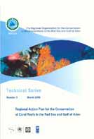
The SAP Annual Report for 2002 was printed at the beginning of second quarter of 2003 along
with two new issues of the PERSGA Technical Series; - The Regional Action Plan for the
Conservation of Coral Reefs in the Red Sea and Gulf of Aden (Technical Series Number 3) and
the Arabic Translation of The Status of Living Marine Resources in the Red Sea and Gulf of Aden
and their Management (Number 4).
The long awaited first issue of the Training Workshop Report (1998
No.1), titled Combating Oil Pollution was printed. The volume is in both
Arabic and English languages, and should prove useful to all researchers
and professionals within the region and internationally who are involved
in combating oil pollution. The report provides a summary of the
PERSGA/ALECSO training workshop with a synopsis of the contents of
the lectures.
The Sixth SAP Task Force Meeting
The Sixth Task Force meeting for the Strategic Action Programme for the Red Sea and Gulf of
Aden was held from 28-30 April 2003 in Jeddah, Saudi Arabia. The meeting was attended by
representatives from the PERSGA Member Countries, UNDP Riyadh and from the Islamic
Development Bank. Representatives from the GEF Implementing Agencies participated through
telephone conference.
The prompt payment by the Government of the Kingdom of Saudi Arabia of its contribution to
PERSGA for 2003 was praised. All the Implementing Agencies reaffirmed the need for secure
financial commitments from the Member State governments on a regular basis to provide the
necessary `enabling environment' for the donor community to become involved.
The importance of the new Demonstration Projects to the countries was stressed, these being a
vehicle for enhancing country ownership and the participation of communities in conservation
efforts through government-supported initiatives. Sustainability, strategic future planning, and
resource mobilization were also discussed.
A number of recommendations were forthcoming including the following:
· Task Force members should encourage their governments to declare the proposed
MPAs as official national MPAs, so that site specific management plans can be
implemented.
PERSGA should
· Collaborate with IDB in the preparation and design of specialised Workshops for
decision makers, technicians and experts from within the region to exchange
information and share concerns about environmental issues;
· Continue to work with member countries and through IMO to fulfil the requirements
of MARPOL;
· Seek approval from national governments for established MPAs to take part in the
proposed regional network of marine protected areas;
· Encourage Member State governments to become signatories to all conventions
related to the conservation of habitats and biodiversity, such as CITES;
· Work with the Implementing Agencies, especially the World Bank, to prepare an
Action Plan leading to a Donor Conference to take place in approximately 18-24
months;
· Proceed with establishment of a regional monitoring programme with the assistance of
the Mediterranean Action Plan and the Monaco laboratory.
Dr. Mahmoud Khamis El-Sayed joins SAP staff.
PERSGA has the honor to announce the joining of Dr. Mahmoud Khamis El-Sayed to its staff.
Dr. El-Sayed joined the Strategic Action Programme team as a Senior Technichal Advisor. He
started his duties at PERSGA Headquarters in March 2003. PERSGA and the SAP are certain
that Dr. El-Sayed is going to be a valuable addition to the SAP staff with his wide experience and
thorough insights.
Legislation concerning the protection of the coastal and marine environment
Ever since PERSGA was founded it has been concerned with environmental legislation. It
undertook the first regional study on the laws concerned with protection of marine and coastal
areas and fisheries in 1978, and issued a publication titled `Legislation concerning the coastal and
marine environments in the Red Sea and Gulf of Aden' in 1985. It produced another publication
jointly with UNEP titled `The range of legal protection for the environment of the Red Sea and
Gulf of Aden' in 1994. In 2002 PERSGA formed a specialized working group from the countries
of the region, in coordination with Focal Points and under the leadership of a regional consultant,
to collect and analyze relevant legislation. This study covers nine subjects: protection of the
natural environment and pollution combating, marine protected areas, habitat and biodiversity
conservation, living marine resources, ICZM, national contingency planning, environmental
databases, navigation safety, environmental education and public awareness.
The first draft of this study has been received by PERSGA and distributed to the countries for
their comments.
Remote Sensing Applications
The Regional GIS Technical Team, formed by PERSGA and representing GIS specialists from
the member countries, attended a Remote Sensing Applications Workshop in Cairo from 13-17
April. This was organized by CEDARE as part of their cooperation with PERSGA to establish a
regional GIS database to serve the Red Sea and Gulf of Aden area.
The course focused on integrated learning of remote sensing and GIS for coastal zone
management through hands-on training sessions. Theoretical aspects were covered in lectures.
MAIN ARTICLE
Geographic Information System for the Red Sea and Gulf of Aden
A Geographic Information System (GIS) is a computer program for storing, retrieving, analysing,
and displaying cartographic (map-based) data. GIS represents the Earth's features not only in
pictorial form, as in conventional paper maps, but as information or data. Using a GIS to deliver
geo-spatial data allows one to visually analyse any information that has a geographic reference.
GIS have been used in numerous natural resources applications. These applications can be
categorized as planning or management, process modelling, inventory, and assessment.
Data compilation representing spatial characteristics of significant features of the earth's surface
is undoubtedly a very important activity for any society. Not so long ago data was transformed
either to documents or paper maps. Quite justifiably, analysis of this data proved to be of
substantial difficulty: there were no means to incorporate different types of data in an integrated
format. A major breakthrough was achieved in the second half of the twentieth century through
the rapid development of computer technology, coupled with the development of mathematical
tools, which lead to the ability to store, retrieve and analyse spatial data. Nowadays, spatial
information systems, such as GIS, and remote sensing data are used widely in almost all aspects
of life.
As we become increasingly aware of the world's oceans and seas and the many resources they
contain, we have an inherent responsibility to preserve them. Researchers, organizations, and
professionals dedicated to understanding and analysing this dynamic and changing environment
are using GIS to develop marine applications.1
Understanding the environmental situation is an essential component of coastal resource
management. This usually requires a great deal of data, and an information system can provide
tremendous assistance in organizing, managing, understanding, and reporting this information.
Managing and mapping the two-thirds of the Earth's surface that is covered by salt water presents
a unique set of challenges.
As marine and coastal applications of GIS have gained acceptance in the scientific and
management community and the importance of this tool has become more widely acknowledged,
PERSGA decided to establish a regional GIS for use throughout the Region through the Strategic
Action Programme (SAP) for the Red Sea and Gulf of Aden. Highest priority has been placed on
strengthening GIS capacity in the field of coastal zone and environmental management. The
regional GIS database will be used as a tool for decision-making and management in coastal and
marine environmental conservation, contributing to the timely and effective implementation of
the SAP.
The Centre for Environment and Development (CEDARE), a regional not-for-profit organization
located in Cairo, was designated to provided advice and services to PERSGA regarding the
establishment and maintenance of the regional GIS database.
The Project
The first step towards achieving this ambitious goal was to build the capacity of PERSGA Lead
Specialists. This was achieved through the introduction of basic GIS and remote sensing
technology and applications, including hands-on-training on GIS visualization software (aimed at
familiarizing PERSGA's Lead Specialists with the use of GIS in assessment and planning), thus
enabling them to identify their component-specific GIS requirements.
The objective was to capitalize on the use of GIS and satellite remote sensing in coastal and
marine applications, with a focus on the extraction of information from satellite data.
The second step was to build the capacity of the key persons who will be in charge of maintaining
the GIS activities in their respective countries. A regional team of GIS specialists was established
(composed of one GIS specialist from each PERSGA member country). PERSGA, in
collaboration with CEDARE, have conducted several advanced GIS and remote sensing training
courses tailored for the GIS Technical Team members.
The third step was to conduct a regional assessment of GIS capacities and needs in co-ordination
with the regional GIS Technical Team members. CEDARE staff visited Djibouti (June 2002),
Jordan (June 2002), Saudi Arabia (May 2002), Yemen (April 2002) and Sudan (January 2003).
As the first step in a regional assessment of GIS capacities and needs, the main objectives of the
missions were to assess the present use of GIS in marine and coastal management, the need for
further capacity building, and the requirements to harmonize the GIS systems currently in use.
During the needs-assessment missions, all existing maps were reviewed, along with existing data
and departmental use; daily operations of various departments were analysed, including
assessment, planning and development, etc. The required GIS applications for each department
were reviewed. A GIS Implementation Plan was discussed with recommendations for the
installation of computer hardware, software and data conversion in each country.
Following the previous steps a regional database for PERSGA was developed; the database
currently includes data related to coastal, environmental and other issues identified in the needs-
assessment report. More than 400 GIS data layers have been prepared at the country and regional
level. MetaData for all the layers was developed and a data dictionary for the layers was created.
CEDARE has continued its effort to integrate all the available remotely sensed data covering the
Red Sea and Gulf of Aden. This remote sensing data includes Landsat data, Spot, Ikonos and
Radar imagery data images. Landsat Orthorectified Landsat Thematic Mapper Mosaics provided
by NASA were integrated and clipped for all the Red Sea region.
The integrated remote sensing data also include some high resolution images covering some of
the regions' coastal cities (Jeddah, Port Said, Suez, Sharm el Sheikh, Aden, etc.).
PERSGA's regional GIS database contains all of the UK Admiralty Charts covering the entire
Red Sea and Gulf of Aden region. The Admiralty Charts were provided by the UK Hydrographic
Office. They consist of over two hundred detailed navigational maps/charts and provide coverage
at a range of scales to suit the requirements of professional, commercial and research users.
The maps can be categorized as Large Scale charts covering harbours, anchorages and
navigational hazards, Medium Scale charts for coastal navigation and Small Scale charts for
offshore navigation and passage planning. Standard Navigational Charts are continually updated
and are fully corrected to ensure that they include all safety-critical navigational information.
The charts can be viewed, manipulated and maintained in ArcView software using Arcs
Extension and ARCS for GIS. The charts available for the project will be available in both raster
and vector formats.
Other Developments
Another important feature of this GIS, is that all the data specifically collected through each
PERSGA component, have been linked to the system. Such a comprehensive integration of data
will allow Lead Specialists, researchers, academics, and environmental institutions in the region,
to overlay all the available data and analyse it in an integrated way. For example, data covering
the historical sites of Aden, government districts & borders, fuel stations, fishing villages, fish
landing sites, fibre glass factories, desalination plants, fishing areas, ice factories, public and
private beaches, public roads and corniche sites, tourism projects, harbours, coral reefs, seagrass
beds, turtle and bird nesting sites, vegetation, wetlands, sandy and rocky coasts, islands, sensitive
areas, pressure areas, landfill, dredging, sewage outfalls, and cooling water areas are now
available in the GIS.
Data from the three proposed marine protected areas at Isles des Sept Frčres & Ras Siyyan in
Djibouti, Mukkawar Island, Dungonab Bay in Sudan and Bir Ali - Belhaf, Yemen were entered in
the regional GIS database and published through the PERSGA GIS map server. All marine
protected areas in the Red Sea region will be available on the system.
PERSGA has developed user-friendly modelling software that will assist in the data analysis and
data entry of the Red Sea and Gulf of Aden fishery (finfish, sharks, ornamental fishes). The
software is intended to include a complete database for the above mentioned groups and provide
in-depth analysis and calculations using different models. The overall objective of the program is
to assist in the development of a sustainable management strategy for transboundary fish stocks
and invertebrates.
Furthermore, a Geographic Biodiversity Information system is currently being added to provide
information for decision makers and researchers about the status of marine species in the Red Sea
and Gulf of Aden. Geographic locations of seabird nesting populations, turtles, coral reefs,
seagrass, mangroves, etc. have also been included within the system. Further development of this
data will include the development of a biodiversity map of the Red Sea.
The PERSGA GIS website was developed to act as a portal for all information that is being gathered
by the GIS project. GIS Internet Map server was installed on the PERSGA GIS workstation. The
ARC IMS will enable PERSGA member countries to integrate centralized GIS/Remote Sensing data
sources with internet data sources for display, query and analysis in an easy-to-use Web browser.
Conclusion
The PERSGA GIS databases have been designed to be simple and user-friendly. The database
structure allows users to browse data by region, country, theme, or by sensitive area. It also
allows users to view, query, evaluate and report monitoring data.
The development of the PERSGA regional GIS database project has achieved many objectives.
Among these, it allows experts, researchers, managers, scientists, regional and national
institutions in each country to store, retrieve, update, analyse and manipulate coastal resource
data.
The project has succeeded in building the capacity to create, use and maintain a coastal resource
inventory in each country, and to facilitate the sharing of coastal resource data within and
between countries in the Red Sea region.
LMR Future Activities
Meeting will be conducted at PERSGA Head Quarters in July 21-22. This meeting will be
attended by representatives from the National Institutions contracted by LMR on "Stock
assessment and Fishery Management of Invertebrates as well as the destructive impacts of
shrimp trawl fishing" They will discuss the technical issues and the implementation
processes.
In collaboration between LMR and HBC components required tools and equipments will
be purchased and delivered to support establishments of Regional Marine Resources
Reference Collection Centers at the Faculty of Marine Science, King Abdulaziz
University.
Two Faculty staff will attend training on management on reference collection centers
during July- August.
Technicians will attend on-the job training on Samples conservation, handling, recording
and presenting during August-September.
The HBC future activities (from June to September 03):
1. The Marine Turtles Surveys Reports in the process of being finalized and will be printed
soon.
2. Follow up on the development of the Regional Conservation Plans (RCP) for Mangrove,
Breeding Seabirds, and Marine Turtles. Six consultants were hired in June in order to
develop the RCPs. Cooporation with international agencies established such as BirdLife
International and FAO to assist PERSGA with the development of the RCPs.
3. Preparation for the workshops which will take place in September, in Jeddah, to finalise
the Regional Conservation Plans for, Mangrove, Breeding Seabirds, and Marine Turtles.
The workshops will be attended by, the regional representatives, the consultants, and the
HBC Regional Working Group members.
4. The upcoming month of September will be occupied with three very useful and important
meetings for the HBC component as by then the three RAP documents will finalized. The
RAP meetings will take place in Jeddah, each report will have a designated date to focus
on the importance of the subject and material to be trained on. The schedule for Sept is as
follows:
Date Title
8-9 September
Mangrove RAP
23-24 September Seabirds RAP
29-39 September Marine turtles RAP
Workshop on Environmental Legislation for Marine and Coastal Areas
PERSGA will hold a Workshop in Cairo during the period 15-17 September 2003 on `legislation
related to the protection of the marine and coastal environments in Red Sea and Gulf of Aden'. A
number of legal and technical experts will participate in this Workshop, drawn from the countries
of the region. It is expected that discussions will take into consideration the studies,
recommendations and information which were assembled in the recent collection and analysis of
laws prepared by national and regional consultants.
Future MPA activities:
A joint Marine protected Areas and Habitat and Biodiversity working group meeting will
be held in Jeddah during the last week September.
A training workshop will be held in Socotra Island Group Protected Areas in October the
participants are the present and future MPA managers.
Regional News
BEACH TAR ALONG THE RED SEA COAST OF YEMEN
"Quantitative Estimation & Qualitative Determination"
Thesis by: NABEEL A. A. AL-SHWAFI
The study was conducted to establish the distribution and the concentration of tar balls on
the Yemeni coast of the Red Sea. Nine stations representing this coast were sampled monthly
within the period from February 1998 to January 1999. The study of the hydrographical
parameters of coastal the Red Sea water, numbers and weights of tar balls and their residual of
hydrocarbons and the levels of trace elements provided an idea of the hydrocarbons and trace
elements pollution in the investigated area.
In light of the information concerning tar balls on the Yemeni coast of the Red Sea, the present
investigation was designed to provide information on the nature, location and levels of tar balls in
the Yemeni coast of Red Sea. The recorded numbers (1-37) and weights (146.10-1.50g) in the
southern part of the coast, appeared to be higher than the northern part (1-21), (0.70-45.6g) per
600 m2/30 days. The highest reported levels of tar apparently originated from oil spills and tanker
ballast water at the oil terminals. The average and range of tar weight indicate high variability in
beach tar concentrations from site to another and even among the different transects of the same
site.
The analyzed mean residual of petroleum hydrocarbons in tar balls were between 0.100- 1.560
µg/g the results obtained appears to be different values of depending on the condition of the sea
and the air.
The ratios detected were wide variations from 0.068 to 1.397, indicating that tar balls analyzed in
the study came from different sources and was attributed to the petroleum-rice deposits of the
region.
The Regional Environmental Monitoring Programme:
An Agreement is to be finalized between the Regional Organization for the Conservation of the
Environment of the Red Sea and Gulf of Aden "PERSGA and the Marine Environmental
Laboratory of the International Atomic Energy Agency (IAEA"), to cooperate in the development
of The Regional Environmental Monitoring Programme (REMP) for the RSGA Region.
Saudi Arabia to meet power demand while protecting environment
Tuesday, 1 July 2003: To help meet an increasing demand for electricity while protecting the
environment, Saudi Arabia's Ministry of Industry and Electricity is raising awareness about
energy conservation. It has set up a committee to promote energy conservation and to advise the
Government on energy conservation measures.
The country needs to satisfy rapidly increasing energy demands driven by economic and social
development. Despite its vast oil reserves, the cost of generating more electricity and expanding
the national grid is enormous. Large seasonal variations in electricity consumption due to
weather changes and low reserve generating capacity during the hot summer season are other
factors.
The burning of fossil fuels to release their energy results in the release of carbon dioxide and
other gases which contribute to the `greenhouse effect'. It is believed that this leads to global
warming, changes in weather patterns and a rise in sea levels. Low lying islands, often important
sites for nesting birds and turtles will be lost. Coral reefs may not be able to grow fast enough to
keep pace with the rising sea level and their important fisheries may decline. Their role as
coastal defence mechanisms will also be under threat.
To meet several energy challenges the Government is formulating a National Energy Efficiency
Programme with UNDP and UN agency consultants. UNDP Resident Representative Jose
Eguren said the programme aims to help the energy sector promote efficient, rational
consumption that is also more environmentally-friendly. Higher efficiency will also provide a
sustainable alternative to ever-increasing expansion of energy supply and generation capacity,
he noted.
UNDP will provide support services for the programme, including assistance with work
planning, coordination with the UN Department of Economic and Social Affairs, administration,
financial and reporting matters. These efforts will also help build local capacity in energy
conservation. The Government is providing nearly US$3.5 million for the full cost of the
project.
For further information please contact Mayssam Tamim, UNDP Saudi Arabia, or Nadine
Shamounki, UNDP Communications Office.
Nature clubs and the Environment
A non formal environmental workshop took place in Djibouti-city which involved teachers from
the primary and secondary schools. Some 33 teachers drawn from schools teaching in Arabic and
French were trained on basic environmental problems and how to run a nature club.
The workshop which took place at the Chamber of Commerce was opened by his excellencies the
Ministers of Environment and Education and the representative of the World Health Organization
in Djibouti (WHO). The minister of the Environment said in his speech that nature clubs are a
good initiative in the field of raising the awareness of schoolmates and the population in coastal
clubs of Djibouti, Tadjourah and Obock. Nature clubs are now in place in the inland cities of Ali-
Sabieh, Dikhil and Arta thanks to the financial support of WHO Djibouti office. The Minister
stressed the need to create a synergy between the different ministries and WHO to protect the
environment and the health of the population.
The Minister of Education also welcomed this initiative of strengthening environmental
education in our country schools. He added that it its nicely with the work under taken in this
field by this department in particular the Centre for Research, Information and Production
(CRIPEN) the representative of WHO stressed to need to establish cooperation with all ministries
dealing with the protection of the environment. He added that a clean environment is the key to a
good health. He informed the participants that during the celebration of the World Health day on
7th April 2003, Nature clubs have participated and mobilised the communities living close to the
schools.
After the opening ceremony, many national experts in the field of environment, population and
curriculum made several presentations for the teachers. After the presentations, teachers were
divided into three groups to focus on a particular theme (e.g. funding of nature clubs, work
plans).
The closing ceremony took place at the Ministry of Environment premises and the Minister
awarded the certificates and the clean up equipment for Nature clubs. The event was aired on
national TV.
Published in national newspaper La nation.
World Environment Day- 5TH June 2003
World Environment Day (WED) was established by the United Nations General Assembly in 1972 to
mark the opening of the Stockholm Conference on the Human Environment. Another resolution, adopted
by the General Assembly the same day, led to the creation of UNEP.
The World Environment Day, commemorated each year on 5 June is one of the principal vehicles through
which the United Nations stimulates worldwide awareness of the environment and enhances political
attention and action.
The World Environment Day theme selected for 2003 is Water - Two Billion People are Dying for It!
The theme calls on each of us to help safeguard the most precious source of life on our planet - water.
This theme has been chosen to support the United Nations International Year of Freshwater.
World Environment Day (WED) is celebrated in many ways, including street rallies, bicycles
parades, green concerts, essay and poster competitions in schools, tree planting, recycling
efforts, clean-up campaigns and much more. In many countries, this annual event is used to
enhance political attention and action.
Heads of State, Prime Ministers and Ministers of Environment deliver statements and commit
themselves to care for the Earth. More serious pledges are made which lead to the establishment
of permanent governmental structures dealing with environmental management and economic
planning. This observance also provides an opportunity to sign or ratify international
environmental conventions.
We in Puntland, on this World Environment Day, let us try to become, once again, part of the
world and think world. Let us share with the rest of the world on current Global Environmental
Issues alongside with our own. Peace is our prime need to mend our environmental problems.
The current "Peace and Reconciliation Process" taking place in Puntland is the path to a better
future
Degradation of Marine Habitats and an Estimation of their True Value
Marine habitats, especially coral reefs, contribute both directly and indirectly to the Egyptian
economy. They represent important tourist attractions. Conservation of these resources and their
protection from degradation is necessary. They are exposed to a number of threats and sources of
damage such as unplanned tourist development projects involving landfill and dredging, and
uncontrolled recreational activities such as diving and destructive fishing. A study carried out by
Dr. Ahmed Barrania (National Planning Institute) reviewed this subject in an attempt to define
the true value of the natural capital held in these resources and the cost of the damage resulting
from tourist activities.
It is known that coral reefs and mangroves represent `natural capital' owned by the community;
they have environmental, economic and social value just like agricultural land. If we try to find
out the value of the loss of these natural resources we discover the following:
1. The cost of losing the primary capital: several estimates indicate that the value of 1 m2 of
coral reef (replacement value) is US$3000, at 1997 prices. Based on an estimate of 4
million square metres of coral reef damaged as a result of tourism projects within the
study area, the total value of the loss of the primary capital is about 12 billion US dollars.
2. The loss of income from marine recreational activities: coral reefs are regarded as an
important factor in attracting international and local tourists to the Red Sea, especially
those who practice diving as a hobby. The reefs represent an income generator for tourism
development. A report describing environmental degradation in Egypt indicates that the
losses, based on degradation by tourists (Hurghada area), ranged between 595-850 million
Egyptian pounds in 1999. This represents 0.2 to 0.3% of the total local income in the
same year. (100 Egyptian pounds = 16.3 US dollars in 2003.)
3. The cost of shoreline protection: coral reefs and mangroves play a major role in protecting
shorelines from erosion. According to published estimates, the cost of constructing sea
defences to replace the coral reefs along the coast is estimated at 12.5 million US dollars
per kilometre. Based on the fact that the length of the coast in the study area that has been
effected by tourism developments and has been subject to dredging and land filling is
estimated at 105 km (north of Hurghada Safaga) the cost of protecting the coast would
amount to 1313 million US dollars.
4. The cost of the loss of fisheries resources: the annual production of coral reef fish was
estimated at 960 tonnes in 1984, most of it from species of high economic value. This
represented 9.6 million Egyptian pounds at 2001 prices. The production in 2001 was
estimated at 500 tonnes (value 5 million Egyptian pounds). That is to say the loss in
fisheries resources from 1984 to 2001 is estimated at 460 tonnes, with a value of 4.6
million Egyptian pounds.
Summary and Recommendations
These serious concerns should be brought to the attention of the tourism activities administration
and environmental policies should be developed to ensure protection of coral reefs and other
natural habitats. These should aim to stop any unacceptable impact resulting from activities
related to tourism. This can be achieved through preparation of operational plans for tourist
activities that consider these points:
1. Defining the threatened areas,
2. Defining the priorities for these areas according to the severity of the threats,
3. Preparation of procedures to tackle these threats. Procedures should contain individual and
community efforts that will not only benefit recreational and tourist activities of economic value
but also maintain the sustainability of the natural resources upon which tourism depends.
INTERNATIONAL NEWS
IMO PROTECTING WHALES
Shipping lanes will be changed in the Bay of Fundy starting July 1 in an effort to try to protect endangered
North Atlantic right whales. There are only about 350 of the creatures left in the world, and more than half
of them gather in a passage between New Brunswick and Nova Scotia each summer.
The Bay of Fundy includes a busy shipping lane, and many of the right whales have been killed in
collisions with commercial craft. During the past few decades, almost half of the 43 recorded deaths have
been caused by such accidents.
Last winter, Ottawa announced plans to move the shipping lanes away from the whales' summer feeding
grounds.
The proposal, to take effect this Canada Day (July 1), was welcomed by the International Maritime
Organization, a United Nations agency set up to improve the safety of ship traffic.
The agreement was established between shipping companies, environmental groups and government
officials, which took four years to complete. Irving Oil, which strongly backed the move, said it couldn't
be done overnight because of the complexity involved in moving invisible lines. Every ship operator must
be given new directions. New lanes steer clear of the whales "For these whales, spending their summers in
the Bay of Fundy has been like having their playground in the middle of a highway," said Cathy Merriman
of World Wildlife Fund Canada.
Her organization recently hailed the federal government "for taking this important step toward reducing
the whales' risk of collisions." If ships follow the new route, the odds of a North Atlantic right whale being
hit will drop by 80 per cent, according to experts.
"Studies show that saving just two females a year can help bring the population back, so this move is
critically important," according to Moira Brown, a senior scientist with the Canadian Whale Institute in
Bolton, Ontario and the Center for Coastal Studies in Provincetown, Mass.

The U.S. needs to adopt similar measures along the coast from Florida to Maine to reduce collisions
between ships and right whales there, Brown added.
Would similar measures reduce mammal collisions in the Red Sea and Gulf of Aden? Not enough
is yet known about the whale fauna of the region or the effects of maritime traffic on their well-
being. There is little data on the variety of species, their population levels, migratory patterns,
feeding habits or mortality.
The Red Sea and Gulf of Aden form an important transport route connecting Europe with East
Asia and Australia, a commercial artery particularly for the carriage of oil and other commodities.
The Red Sea is deep but narrow, with offshore coral reefs and bottlenecks at the south where
traffic flows through the Bab al Mandab and in the north where traffic moves into the Gulf of
Aqaba or Suez. The restricted waterway and the high volume of traffic increase the chances of
accidents occurring. Think of our beautiful heritage and how much can be done to conserve it.
Bizarre new jellyfish
A bizarre new species of jellyfish has been discovered in the deep waters off the Californian coast.
The bell-shaped creature spans a metre in diameter and has been nicknamed "big red", because of its
unusual deep red colour. The US and Japanese teams that discovered it say the species deserves its own
subfamily.
Tiburonia granrojo was discovered using video cameras attached to deep-
diving remotely operated vehicles. Its colour and shape set it apart from its
other gelatinous relatives, but it has another unusual characteristic -- a
complete lack of tentacles.
Instead, the jelly has four to seven fleshy arms that it uses to capture food.
While jellyfish species can normally be distinguished by the number of
tentacles they have, the number of arms differs between individual `big
reds'.
The creatures live at depths of 650 to 1500 metres. Although the species was
first observed in 1993, it has taken scientists until now to classify it and to
The "big red" jellyfish uses
confirm that it is indeed a new discovery. The jellies have now also been
its arms to feed (Image:
spotted in the Hawaiian islands and in Japanese waters.
MBARI)
Despite studying the elusive creatures for ten years, researchers say there are still many questions they
want to answer. "What does it eat? Who are its predators? And how does it reproduce?
Ocean Dumping and Ship Wastes
This section deals with ocean dumping and ship wastes. It includes nuclear waste
disposal, sewage outfalls, land-based materials or those that derive from shipping, such as
from cargo transport ships and passenger ships.
About 80-90% of the material dumped at sea results from dredging and currently
amounts to hundreds of millions of tons a year. Of the total material dredged, probably
two-thirds is associated with operations to keep harbours, rivers and other waterways
from silting up. The other third involves new works. Future dredging operations and the
requirement for ocean disposal are expected to follow current trends. The ocean disposal
of dredged material represents only 20-22% of the total dredged and the remainder is
mostly dumped in internal waters, or placed on land for disposal or productive purposes.
Approximately 10% of dredged sediments are heavily contaminated from a variety of
sources including shipping, industrial and municipal discharges, and land runoff.
Typical contaminants include heavy metals, such as cadmium, mercury and chromium;
hydrocarbons, such as oil; organochlorines such as pesticides; and nutrients such as
nitrogen and phosphorous. Disposal at sea of these materials carries the possibility of
acute or chronic toxic effects on marine organisms, and potential contamination of
human food sources.
It was recognized that ships, especially oil powered ships, could cause pollution and both
the United Kingdom and the United States introduced legislation in the 1920s to curb
discharges of oil resulting from operations such as tank cleaning. Attempts to tackle the
problem at an international level were unsuccessful, however, and the outbreak of World
Wear II resulted in the problem being deferred.
The potential for oil to pollute was finally recognised by the International Convention
for the Prevention of Pollution of the Sea by Oil, 1954. The Convention provided for
certain functions to be undertaken by the International Maritime Organization. OILPOL
54 prohibited the dumping of oily wastes within a certain distance from land and in
'special areas' where the danger to the environment was especially acute.
More Marine Species added to CITES
Endangered sharks, sea horses and sea cucumbers gain `historic' protection!
Governments attending a meeting of the Convention on International Trade in Endangered
Species (CITES) imposed controls on the trade in whale sharks and basking sharks, overturning
previous decisions. Both are in danger of disappearing as fisherman chase big profits by
supplying the Chinese with fins for shark-fin soup.
The listing of the two shark species came as CITES sought to extend its protection to commercial
marine fish - a major breakthrough for the conservation of marine species. Traditionally, CITES
has backed away from protecting commercial marine species as, in theory, they are protected by
other international agencies such as the UN Food and Agriculture Organization (FAO).
CITES also gave an Appendix II listing to sea cucumbers and 32 species of seahorses. Estimates
suggest a million seahorses are caught annually, mostly in Asian waters for western aquariums
and Chinese medicines.
In other decisions at the meeting, CITES agreed to:
Ban international trade in the Black Sea bottlenose dolphin amid fears that the population
is close to being wiped out by Russian traders supplying the aquarium trade,


Give an Appendix II listing to 26 species of Asian freshwater turtles, mostly from
Vietnam, which are being hunted to extinction for their meat.
The Red Sea and Gulf of Aden is rich with a diversity of species including marine mammals,
sharks, rays, invertebrates and ornamental fish. Management of the exploitation of such resources
is being conducted under the auspices of PERSGA through the activities of the Strategic Action
Programme (SAP). A fisheries database is being established, stocks are being assessed and
management measures are being created to conserve the existing shark, ray, and commercial
invertebrate resources.
Several specialized surveys have been conducted throughout region. Through the SAP PERSGA
is developing Regional Conservation Plans for marine turtles and for marine mammals. This will
help to safeguard the 18 marine mammal species found in the region. These efforts go alongside
the other international efforts taking place to protect and conserve these beautiful marine species.
Useful Internet Sites
http://www.oceansatlas.org/index.jsp
http://www.noaa.gov/
http://www.coreocean.org/Dev2Go.web?anchor=coml_home_page
http://www.coreocean.org/
http://www.unep.org/bsgn/about-us.asp
http://www.earthday.org/
http://www.iopcfund.org/
http://www.unep.ch/seas/
http://www.wri.org/
EVENTS CALENDAR
Name of Environmental Event
Venue
Date
"Defying Ocean's End" Global
Los Cabos,
30 May- 4 June
Marine Conference.
Mexico
"World Environment Day" 2003
Global
5 June 2003
Main International Celebration of WED
Beirut, Lebanon
Expert Consultation on Sustainable Field
Bangkok, Thailand
1-3 July 2003
Food Crop Development
2nd FAO/WHO Expert Consultation on
Geneva, Switzerland
21-25 July 2003
Microbiological Risk Assessment
World Day To Combat Desertification
Global
17 June 2003
and Drought
Hamburg, Germany
9th Celebration of CDD 2003
Workshop on the Biogeography and
Southampton, UK
16-18 June 2003
Biodiversity of the Chemo synthetic
Ecosystems
International Water Congress
New York
29 June- 2 July 2003
(Millennium Tower)
Strategic Environmental Assessment
Manchester, UK
3 July 2003
Directive Training Workshop
CoML Workshop on The
Newport OR USA
21-24 August 2003
Biodiversity of the Deep-Sea
Sediments, The Known, Unknown
and Unknowable
10th Deep Sea Biology Symposium
Coos Bay OR USA
25-30 August 2003
8th Sub-Committee on Dangerous
London, UK
22-26 September 2003
Goods, Solid Cargoes and Containers IMO Head Quarters
Al Sanbouk Middle Pull-out page
· PERSGA, The Regional Organization for the Conservation of the
environment of Red Sea and Gulf of Aden, it is an intergovernmental
body dedicated to the conservation of the coastal and marine
environments in the region.
· The Regional Convention for the Conservation of the Red Sea and
Gulf of Aden Environment (Jeddah Convention) 1982, provides the
legal foundation for PERSGA.
· The Secretariat of the Organization was formally established in Jeddah
following the Cairo Declaration of September region1995. The PERSGA
member states Djibouti, Egypt, Jordan, Saudi Arabia, Somalia, Sudan, and
Yemen.PERSGA started back in the early 1970's when the Arab League
Educational, Cultural and Scientific Organization (ALECSO) began a
programme for the protection of the environment of the Red Sea and Gulf
of Aden.
· In December 1998, the Secretary General of PERSGA and representatives
of the three Global Environmental Facility (GEF) partners UNDP, UNEP
and The World Bank launched the SAP in the widely publicised ceremony
in Jeddah, attended by the Members of PERGSA Council and the
numerous high ranking regional and international guests.(insert Photo)The
Implementation of the SAP, started immediately after the ceremony,
which required US$ 36 million over a five year duration period. It was
anticipated that the countries of the Region, the Global Environmental
Facility and selected international and bilateral donors will provide the
necessary funding.
· The Strategic Action Programme for the Red Sea and Gulf of Aden (SAP)
identifies the preventative and curative measures required by PERSGA
and the Member States to maintain the rich and diverse coastal and marine
resources of the region.