


INTEGRATED MANAGEMENT OF LAND BASED ACTIVITIES
IN THE SÃO FRANCISCO RIVER BASIN PROJECT
ANA/GEF/UNEP/OAS
Activity 1.1.A - Hydrodynamic and Sedimentologic Study of the Lower São
Francisco Basin, Estuary and Adjacent Coastal Zone-AL/SE
Executive Summary
HYDRODYNAMIC AND SEDIMENTOLOGIC STUDY OF
THE LOWER SÃO FRANCISCO BASIN, ESTUARY AND
ADJACENT COASTAL ZONE
UFAL - Universidade Federal de Alagoas
Maceió - AL
INTEGRATED MANAGEMENT OF LAND BASED ACTIVITIES
IN THE SÃO FRANCISCO RIVER BASIN PROJECT
ANA/GEF/UNEP/OAS
Activity 1.1.A - Hydrodynamic and Sedimentologic Study of the Lower São
Francisco Basin, Estuary and Adjacent Coastal Zone-AL/SE
Executive Summary of the Final Report
HYDRODYNAMIC AND SEDIMENTOLOGIC STUDY OF
THE LOWER SÃO FRANCISCO BASIN, ESTUARY AND
ADJACENT COASTAL ZONE
Coordinator
Arno Maschmann de Oliveira
Departamento de Geociências
Universidade Federal de Alagoas
Colaborators
Adriana Sales Reis
Instituto Xingó
Allysson Evangelista de Matos
FUNDEPES
Anderson Gonçalves Nunes
Instituto Xingó
Arthur de Oliveira Hernandez
UFAL
Christiane Sampaio de Souza
UFBA
Geórgenes Hilário Cavalcante Segundo
FUNDEPES
Helenice Vital
UFRN
Marco Vinícius Castro Gonçalves
UFAL
Newton Amaral Franco Júnior
Instituto Xingó
Oberdan Caldas de Oliveira
UFBA
Paulo de Oliveira Mafalda Júnior
UFBA
Rivaldo Couto dos Santos Júnior
Instituto Xingó
Werner Farkatt Tabasa
UFRN
Yatska de Oliveira Hernandez
UFAL
March 2003
ii
HYDRODYNAMIC AND SEDIMENTOLOGIC STUDY OF THE LOWER
SÃO FRANCISCO BASIN, ESTUARY AND ADJACENT COASTAL ZONE
EXECUTIVE SUMMARY
INTRODUCTION
Activity 1.1.A, "Hydrodynamic and Sedimentologic Study of the Lower São Francisco Basin,
Estuary and Adjacent Coastal Zone", coordinated by the Federal University of Alagoas, is part of
Component I (Environmental Assessment of the Basin) of the Integrated Management of Land
Based Activities in the São Francisco River Basin Project (GEF/ANA/OAS/UNEP). Its main
objective is to identify the present hydrodynamics of the lower course of the São Francisco River,
of the estuary and of the adjacent coastal zone, quantifying the current sediment transportation
and distribution, determining its interaction with the biotic productivity in the primary trophic
levels (phytoplankton, zooplankton e icthyoplankton).
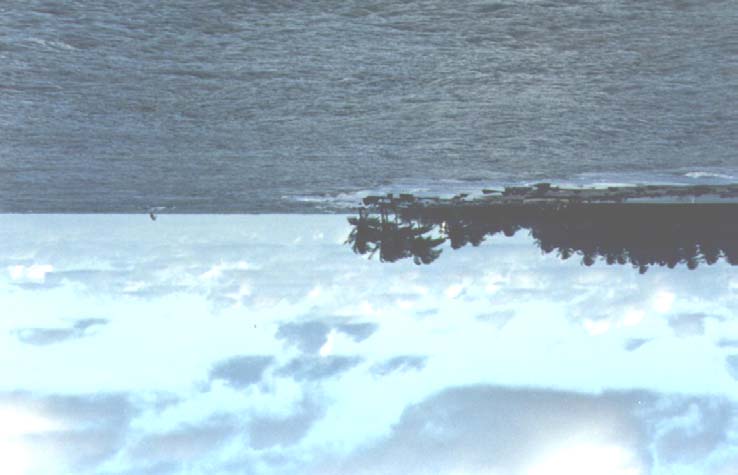
The area under study is located in the Lower
São Francisco Basin (Figure 1), following
the River, from the Xingo Hydropower Plant
to its mouth, and includes the adjacent
coastal zone (Figure 2). The Lower course of
the River has an extension of 265 km, which
represents less than 10% of its total length,
and presents segments with distinct
characteristics. Its upstream reach is boxed
into a canyon and its lower part, upon which
this study is focused, flows through alluvial
plains extending to the oceanic region.
The São Francisco River contains several
engineering works related to power
generation, water supply, navigation and
flood control. The most frequent structures
are the dams, which alter the hydrologic
regime, modifying the water discharges as
well as reducing the solid load downstream
from the barriers. The area of Xingo is
particularly important to this study.
Figure 1. The Lower São Francisco Basin.
This investigation evaluates the mechanisms responsible for sediment transportation in the area
of the mouth of the São Francisco River, by studying the forms of the bottom of the channel, with
high resolution seismic methods, viewing a better understanding viewing a better understanding
of the dispersion processes and of the destination of the sediments conveyed by the São Francisco
to the adjacent oceanic platform.
i
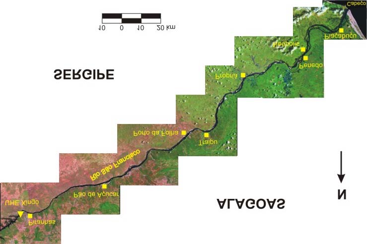
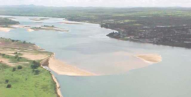
Figure 2. The Lower São Francisco, from Xingó Power Plant to the mouth of the River.
The present report is divided into eight chapters, covering the following topics:
1)
Physical characterization of the Lower São Francisco, including geology,
geomorphology, climate/precipitation, discharges and sediments.
2) Historic evolution of the River and of its estuary, the impact of reservoirs in the river
regulation and geomorphological changes.
3) Impact in mangrove and in beaches by the ,mouth of the River.
4) Morphological changes in the São Francisco, due to river regulation, erosion of banks
and sediment transport, resulting from anthropic actions.
5) Measures for preventing sediment deposition and erosion, caused by artificial floods to
remove sediments deposited in the river bed.
6)
Spatial and temporal distribution of the planktonic biomass with abundant
phytoplankton, zooplankton and icthyoplankton; and spatial and seasonal distribution of
the phytoplankton, zooplankton and icthyoplankton. Changes in the icthyofauna and
carcinofauna with the construction of reservoirs and their effect on the social and
economic conditions of the fishermen.
7) Conclusions and environmental impacts discussed in this study.
8) Recommendation of mitigating measures for the main environment related problems.
iii
1. PHYSICAL CHARACTERIZATION OF THE LOWER SÃO FRANCISCO
1.1. GEOLOGY AND GEOMORPHOLOGY
The Eastern-Northeastern coast of Brazil has been subject to a dropping of sea level, in the order
of five meters, in the past 5,000 years. As sea level dropped, an extensive and sand rich platform
was eroded and re-deposited as a series of progradating beach-ridges (Dominguez et al., 1987),
even where there are no fluvial systems. The source of sediments for this progradation might be
entirely provided by the convergence of tides induced by the coastal drift, into a shallow sandy
platform, where the delta of the São Francisco River was formed.
The course of the Lower São Francisco begins in a canyon in the relocated blocks of the Lower
São Francisco Pediplans, in the City of Paulo Afonso (BA), extending in form of waterfalls in a
rocky bed with gravels, for 100 km, until the proximity of the City of Pão de Açúcar (AL). This
course has been recently interrupted by the reservoir of the Xingo Hydropower Plant.
From Pão de Açúcar up to the mouth of the River, about 165 km, the declivity of the channel is
decreased, producing meanders that erode the sandy banks and the river bed. The geomorphology
of this reach begins into the exposed crust of the hilly marginal platform until the region of
Propriá (SE), passing to a sedimentary basin, where barren tablelands of the Barreiras Group, of
the Tertiary Period, predominate. The tablelands extend to the region of Penedo (AL), where the
vertex of the deltaic region is located, comprising sandy fields and the reminiscent of vegetated
dunes.
1.2
CLIMATE AND PRECIPITATION
The climate in the São Francisco Basin is warm, beginning with the semi-arid in the upstream,
undergoing a transition to sub-humid, in its Middle course, close to Belo Monte (AL), and then to
humid, close to the coastal zone. Precipitation ids the main phenomena characterizing the
climatic variations in the area.
The rainfall distribution in the Upper São Francisco and in the upper part of the Middle is
responsible for 75% of the discharges in the River. On the other hand, the climate in the Middle-
Lower and Lower São Francisco is very dry and presents a different seasonal rainfall distribution.
It is noticeable that the rainfall season in the Upper São Francisco begins in October and extends
to March, with greater concentration in the Summer. In Divinópolis (MG), with 200°05' S
latitude and 440°58' W longitude, and 644 m of altitude, area representative of the Region, with a
mean annual precipitation of 1,500 mm, the peak of precipitation (mean value of 283 mm) occurs
in December. The least rainy season is between the months of May and August, with the lowest
values (mean of 11 mm) being verified in July (Figure 30.
The rainy season in the semi-Arid begins in March and extends to August, with a greater
concentration in the winter. In Piranhas (AL), with 090°37' S latitude and 370°46' W longitude,
110 m of altitude, high, area representative of the Region, with 500 mm mean annual
precipitation, the peak of the precipitation (mean of 63 mm) occurs in May. The least rainy
period is from September to January (Figure 3).
iv
Figure 3. Mean monthly precipitation in Divinópolis (Upper São Francisco) and in Piranhas
(Lower São Francisco), for the 1942-1999 period.
There is a great inter-annual variability in the precipitation in the regions with small pluviometric
indices. Precipitation in Piranhas was around 1,000 mm, , in the year of 1977, and around 200
mm in 1955. Additionally, mean precipitation augments towards the littoral. From Piranhas, in
the Semi-Arid, to Piaçabu (AL), in the delta of the River, mean precipitation went from 500 to
1,200 mm.
1.3 RIVER
DISCHARGES
The mean long duration discharge in the São Francisco River, in Pão de Açúcar (AL) is 2,850
m3/s, with floods in May (4,900 m3/s) and dry spells in September (.1,500 m3/s). The discharges
in Pão de Açúcar (AL) have a close relation with the rainy season in Divinópolis (MG), in the
Upper São Francisco, with the peak discharges in the Lower segment occurring with a lag of two
months from peak precipitations in the Upper reach.
The climatic variations affecting the precipitations in the Upper and Middle São Francisco
establish the level of natural discharges in the River. Anthropic actions in the riverbed and in the
Basin result in water loses, by evaporation and/or evapotranspiration, modifying their spatial and
temporal distribution. However, no trends are noticed on discharges or climate in the Basin
At the estuarine zone, there are significant variations in the hourly discharges, due to the effect of
the flux and reflux of the semi-daily tides. The level of tides verified at the estuary, in Piaçabuçu,
varied from 0,88 and 1,81 m, in the quadrature and syzygy respectively, with average times of 5.7
and 6.7 hours for the uprising and receding tides respectively.
1.4 SEDIMENTS
The greatest production of sediments in the São Francisco River occur in the most humid areas of
the Upper and Middle stretches. Mean sediment load in Morpará (BA), between the Middle and
Middle-Lower reaches, was 21.5 million tons/year, for the 1978-1984 period. In Pão de Açúcar,
v
mean annual transportation of sediments was in the order of 12.5 million tons/year, between 1966
and 1968.
With the construction of a cascade of dams in the Middle-Lower and lower São Francisco, almost
the sediment load coming from upstream reaches are retained, and sediment transported in the
Lower stretch is limited to the material produced locally, by the erosion of banks and a really
small contribution of the permanent tributaries. However, the flow velocity is too small to convey
these sediments, constituted predominantly by medium and coarse sand, which results in the
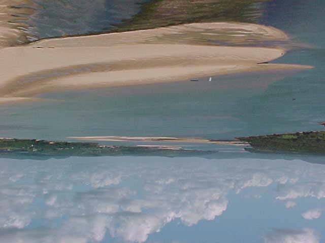
formation of banks in the riverbed (Picture 1). Transportation in the area of the delta results from
an interaction of estuarine currents with sediments coming from the river and from the sea.
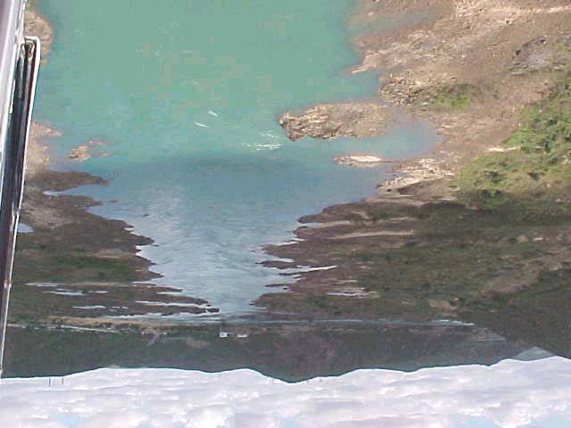
Picture 1. Detail of sandbanks in the São Francisco River, upstream from Propriá
(SE), in June 26th, 2001.
2.
HISTORIC EVOLUTION OF THE SÃO FRANCISCO RIVER AND ESTUARY
2.1 HISTORIC EVOLUTION OF THE SÃO FRANCISCO DELTA
The literature refers to the estuary of the São Francisco sometimes as wave-dominated delta
(Bacoccoli, 1971; Bandeira jr. et al., 1975 e 1979; Dias, 1981; Dias and Gorini, 1981), sometimes
as beach-ridge strandplains (Dominguez et al., 1981, 1987, 1992; Dominguez and Wanless,
1991).
The São Francisco mouth presents beach-ridge systems associated to rivers. It was interpreted by
Galloway (1975) as a wave-dominated delta, even though, according to Dominguez and Barbosa
vi
(1994), these beach-ridges are formed predominantly by the coastal drift. In this manner, the
estuary, given the occurrence of the coastal progradating line, deltaic plains and source of fluvial
sediments, might be considered a delta, although the beach-ridges in both sides of the river might
have different origins (Figure 4).
Figure 4. São Francisco's wave dominated delta.
The control over the distribution of sediments in the mouth of the São Francisco, particularly in
the estuary and delta, is made by the river influence and by maritime phenomena, responsible foe
the removal and deposition of the particles along the system.
In the adjacent oceanic region, the coastal drift, controlled by the regime of tides, has a critical
role with respect to the variability of the beach profiles, causing erosion and accumulation of
deposits.
It was noticed that the fine sediments are removed from the lower part of the beach and deposited
in the beach berms. However, as the area is directly impacted by the tides, the particles are
dragged by the back and forth movement. The fine sediments are, in great part, dragged to the
vii
higher platform of the wave washed banks, resulting in an upraised beach profile. The remaining
is carried off towards the Southwest, following the preferential direction of the local currents
(Northwest to Southwest).
The variation found in the left margin, at the foot of the beach, corresponds to sediments
characterized as medium and coarse sand, varying from 0.25 to 0.50 mm, while in the beach
berm in the same margin diameters vary from 0.125 to 0.250 mm, corresponding to fine to
medium sand. Thus, the fine sediments at the foot of the beach in the left margin are mostly
conveyed to the berm.
The granulometry of the sediment banks in the riverbed and in the delta varied from 0.125 to
0.250 mm, characterizing the particles as fine and medium sand, both possibly originated from
the coastal drift in the state of Alagoas. It was verified that the characteristics of the particles in
the channel downstream from Piaçabuçu (AL) and in the Cabeço Beach Region (SE), located at
the right margin, present similar variations, confirming the transport of sediments from the sea
into the River, during the rising tides.
According to seismic data collected in field surveys in the São Francisco River estuary, the
extension, the dimensions and the characteristics of the alluvial bottom forms are a direct result
of the balance between erosion and deposition in different parts of the bed. The sonography
produced information on the nature of the bottom, such as texture, composition and orientation of
forms.
A preliminary evaluation of these new sonography data made possible a description of the
various forms of river bottoms, the outline of the regional distribution and a discussion of their
relation with respect to the general flux structure of the currents. Three predominant bottom
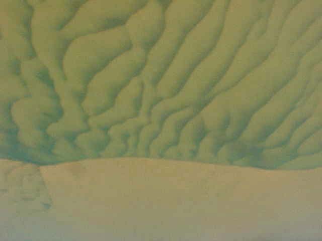
forms were identified, according to ASHLEY (1990): dunes, ripples and flat bottoms (Picture 2).
Picture 2. View of submerged dunes (06/26/2001)
viii
The dunes were classified, according to the primary description of their forms, as bi-dimensional
(2d-dunes) and tri-dimensional dunes (3D-dunes). The bi-dimensional forms present simple
prismatic cross-sections and originate cross-stratified beds, while tri-dimensional dunes are
characterized by sinuous crests, whose typical deposits are the trough cross-beddings.
In general, 3D-dunes are formed faster than 2D-dunes, assuming that other parameters, such as
granulometry and depth, are maintained constant. Samples collected in-situ show that the bed
formed by these dunes is predominantly constituted by fine and medium sands, moderately
selected.
The dunes in the estuary are big, presenting themselves with 40 m of extension and one meter of
height, but may vary from 30 to 90 m long and reach a 2 m of height. Fields with large
asymmetric dunes (1st order) might result from superposition of smaller symmetric dunes (2nd
order), showing the effect of the tides. The large dunes within the river channel can be up to 500
m long and 8 m high.
The dunes decrease progressively in extension and height, towards the mouth of the River, until
they present a form of symmetric undulations less than 1 m long and 0.3 m high, with straight
crests. Samples collected in situ show that the undulated bed is formed predominantly by fine
well selected sands.
Close to the River's margin and at the confluence of small tributaries, the flat bottoms are
noticed, where the fine sediments in the suspension are deposited. Locally, the type of bottoms
marked by dunes and ripples are intercalated with the flat bottoms.
2.2 RESERVOIR AND RIVER REGULATION IMPACTS ON GEOMORPHOLOGY
The Lower São Francisco Region has suffered significant geomorphological changes, in view of
river regulation. Today, in consequence of the great number of sand banks along the river bed,
navigation has become difficult, only being possible with small boats.
River regulation in the lower course of the River eliminated the strong currents of the floods, thus
reducing the cyclic sediment transportation potential of the River. The reduced capacity of
transporting sediments has permitted the accumulation of deposits that impair navigation and
alter the ecologic niches. Additionally, it imposes a deficit of sediments in the delta, for the
coastal drift, resulting in an accelerated erosion of some beaches by the mouth of the River.
3. ENVIRONMENTAL IMPACTS ON MANGROVE AND BEACHES BY THE
MOUTH OF THE SÃO FRANCISCO
3.1
LOCATION OF MANGROVE AND DUNES
There is a small mangrove vegetated area in the right margin of the São Francisco, close to its
mouth, which extends for three kilometers into the continent, for 20 km along the coast. This area
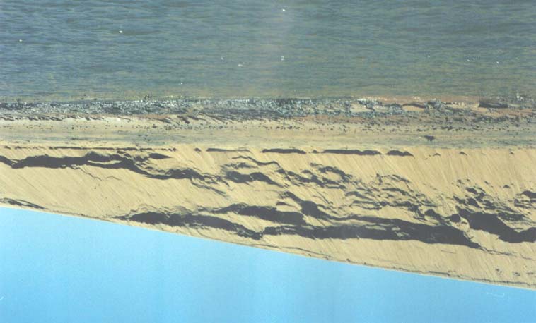
has been partially eroded in its extremity at The Cabeço Beach (Picture 3). For the rest of the
River, there are no floodplains or salt water lagoons fit for growing this type of vegetation.
ix
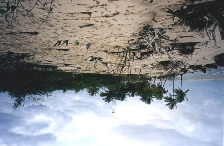
In the left margin, the coastal drift does not inflict a significant transport of sediments along the
littoral. The sediments which reach the beach berm are carried off by the wind and deposited on
the already formed dunes in the region (Picture 4). These dunes slowly migrate towards the River
and will provide the rising the and lowering tides, again, with sediments of maritime origin. This
is confirmed by the granulometric analysis of the particles found on the dunes, with grain sizes
varying from 0.125 to 0.250 mm, characterizing medium and fine sediments, similar to those in
the beach berm.
Picture 3. The Cabeço Beach (right margin) eroded by currents and tides (July/2000)
Picture 4. Dunes, in the left margin, covering old mangrove (July/ 2002).
x
3.2
TIDES AND CURRENTS REGIME IN THE ADJACENT COASTAL ZONE
Predominantly, the winds are in the Northeast direction (October to March) and Southeast
direction (April to September), with mean velocities of 2.1 and 2.2 m/s, respectively. Calmness is
verified in 10 to 20% of the time (Souza & Lima, 2000). This situation shows that winds are not
effective in producing waves that may affect basic mechanism for the development of tides and
coastal currents.
The tides developed in the open seas (Chart 1) shows little seasonal variations with respect to
height. They propagate in the ESE direction (112º azimuth), oscillating more to the East, in the
Summer, and to the South, in the Winter. The Alagoan margin of the São Francisco delta has a
normal alignment with the 1300 azimuth, while the Sergipean margin has normal alignment with
the 1700 azimuth. These alignments explain the transport of sediments by the coastal drift
towards Southeast, from Alagoas to Sergipe, forming the maritime sediment banks in the River's
delta (Picture 5).
Chart 1. Mean height of tides with different periods and seasonality
Station of year
Period
5.0 s
6.5 s
8.0 s
Summer
0.95 m
0.85 m
0.85 m
Fall
0.95 m
0.95 m
0.95 m
Winter
1.25 m
1.25 m
1.15 m
Spring
0.95 m
1.15 m
0.95 m
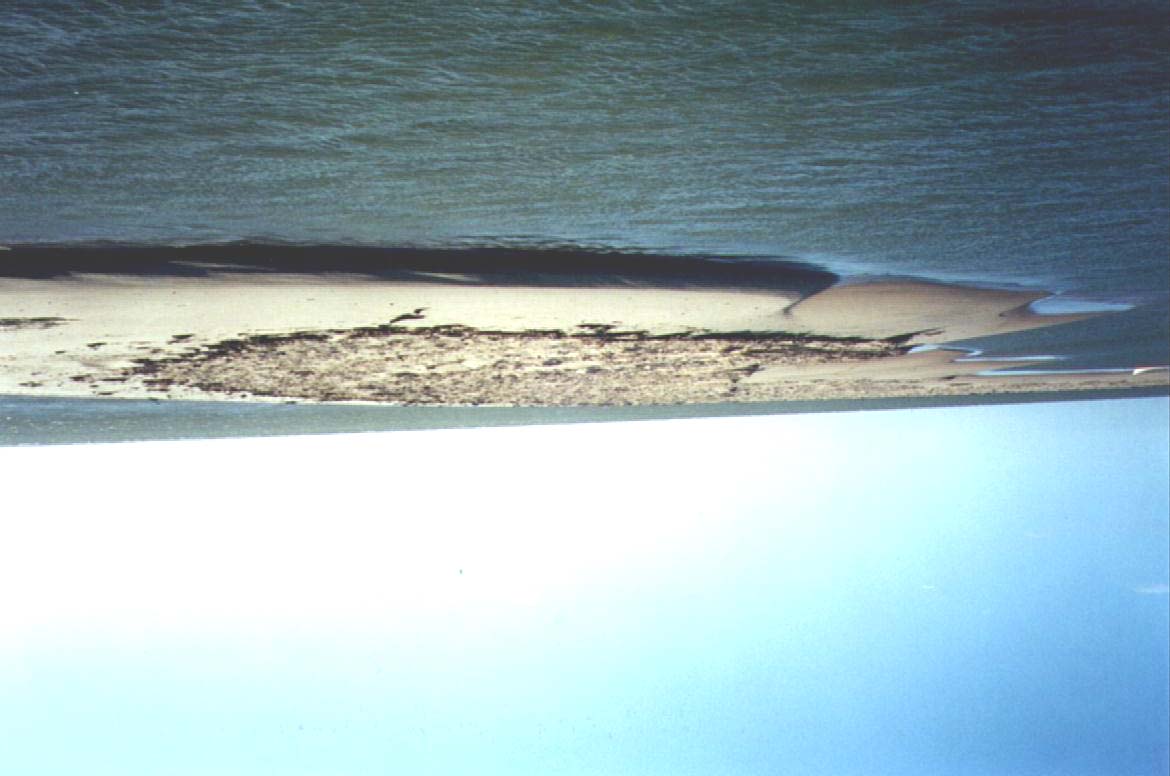
Picture 5. Sand banks in the Ocean (1km from the delta of the River), created by coastal
drift from Alagoas to Sergipe (July/ 2000).
The sediment transport by coastal drift created two sand strips in the right and left margins of the
River's mouth. The particles deposited in the left margin produced a longer semi-submerged
xi
strip, blocking the passage in the deeper canals. This way, the river flow, which had no barriers
previously, started to be deviated towards the right margin, creating a current in the direction of
the Cabeço Beach, resulting in a great erosion.
The beaches located in the right margin of the São Francisco delta are under a continuous erosion
process, caused mostly by the lack of sediment replacement. This sector has greater sediment
load due to coastal drift than the left margin, as the angle of incidence of waves is more
perpendicular in the Sergipean littoral.
The floods, which used to provide the Sergipean littoral with sediments coming from the Alagoan
side, no longer occur. As consequence, great part of the material transported along the Southern
beaches is not being replaced, resulting in an accelerated erosion. This erosion processes is
continuous and, in spite of being recent, is already bringing problems to the local population.
3.3 EROSION OF THE MARGINS AT THE MOUTH AND ADJACENT BEACHES
The transversal profiles at the Cabeço Beach, from January through May of 2001, presented a
characteristic typical of the Summer, when an enlargement of the beaches is observed. This
occurs because the waves reaching the beaches have a lower height and hit the coast in a less
oblique form, with less energy and drift power.
From May to September of 2001, there was a great recess in the Cabeço Beach, changing
completely its profile (Picture 6). This great change is explained by the fact that the survey was
carried out during the Winter (June to August), when the waves originate far from the beach and
have a great destructive power.
Picture 6. Details of the Cabeço Beach, eroded by currents and waves,
with berms dislocated towards the mangrove (Nov.2001).
xii
During the Winter, sediments were removed from the beach and part of it was carried off, by the
coastal drift, to the South. The other part, the finer particles, was transported into the continent,
making the beach berm recede and destroy some houses in a little village which still existed in
place.
4.
CHANGES IN THE FLUVIAL MORPHOLOGY
4.1 ANTHROPIC EFFECTS OF RIVER REGULATION
The São Francisco River, with mean annual discharge of 2,850 m³/s, has one of the greatest
discharges in Brazil, but with one the smallest sediment production per unit of drainage area. The
dimensions of the drainage basin and the construction of dams for power generation contribute to
this fact.
Beginning in the 50's, several dams were built in the River, altering its hydrologic regime. These
dams altered both the liquid discharge and the transport of solids, as they retain great part of the
sediments which otherwise would be conveyed to the coastal region. The last of these dams to be
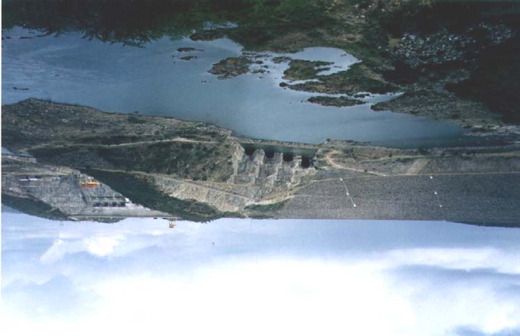
built, in the beginning of the 90's, was the one for the Xingó Power Plant (Picture 7).
Picture 7. View of the Xingó Power Plant dam (Jul.2000).
4.2 SEDIMENT TRANSPORTATION IN THE RIVER
The sediments found in the river channel correspond to medium and coarse sands (0.5 to 1.0
mm), while those found in the sand banks correspond to fine and medium sands (0.125 to 0.250
mm). Thus, in channels with more intense velocities the fine and medium sands are transported
until deposition on places with lower velocities, remaining the sands with coarser granulometry.
xiii
Intensive agricultural activities are practically nonexistent in the lower São Francisco, having,
therefore, insignificant impact on the sedimentologic behavior in the reach. The main problem in
the reduction in sediment transportation is related to the eradication of floods, due to the
construction of dams (Chart 2). In the São Francisco, The greater production of sediments is in
the Upper and Middle reaches, which have been almost totally retained and deposited in the
reservoirs.
Chart 2. Spatial and temporal variation in sediment transportation in the São Francisco
River
Drainage Discharge Transport.
Location Source Period
reach
area (km2)
(m3/s)
106
ton/year
Upper
Pirapora
CODEVASF
04/72-03/75
61,880
816
8.3
Pirapora
DNAEE 12/75
-11/82
61,880
775 7.2
Middle
Morpará
CODEVASF
12/68-02/75
344,800
2,519
20.2
Morpará
DNAEE 12/78-11/84
344,800
2,929
21.5
Middle-
Juazeiro
CODEVASF
01/67-02/75
510,800
2,666
24.8
Lower
Juazeiro
DNAEE 06/78-11/84
510,800
3,334
12.9
Lower
Pão de Açúcar CODEVASF
10/66-04/68
620,170
2,949
12.5
Propria
Milliman 1983
640,000 2,850 6.0
Propria
GEF S.F.
2001
640,000
1,660
0.64
It is noticed, in Chart 2, that sediment production in the Upper and Middle São Francisco does
not change much with time. However, in Juazeiro (Middle-Lower) there was a drastic reduction
in the 80's, compared to the 70's, due to the construction of the Sobradinho Dam, upstream from
Juazeiro, with a 20x109 m3 storage capacity. The dam retains great part of the sediments brought
by the River.
In the Lower São Francisco, there was a first great reduction in sediment transportation in the
80's, then a second in the year 2001. The latter results from the compounded impacts of the
sedimentation in the cascade of upstream reservoirs plus the eradication of floods after the
construction of the Xingó Reservoir.
The several dams in the São Francisco River unleashed a process of sediment trapping in their
reservoirs. With the cascade of barriers and the consequent elimination of the floods, the River
lost its capacity to transport the sediments and dunes were formed within the riverbed, in several
points (Picture 8). The main natural channels in the river were also modified by the deposition of
material (Figure 5).
xiv
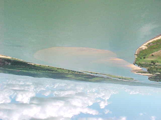
Picture 8. Semi-submerged sandbank, upstream from Própria SE (Jun.2001).
Figure 5. Transversal bathymetric profiles of the São Francisco River (Traipú,AL/1992-
1999), with different horizontal and vertical datum.
The water released by Xingó Power Plant contains a really small quantity of suspended
sediments. The downstream reach, close to the dam, presents a steep grade, with rapids and
turbulence (Picture 9), which, in conjunction with the small amount of suspended sediments,
contributes to the erosion of the gravel covered riverbed.
Picture 9. Eroded riverbed of the São Francisco, in Piranhas AL (Jun.2001)
xv
The transversal bathymetric profiles of the River, in the region close to the City of Piranhas
(Figure 6), had a V-shape, until 1990, with sediment deposits in its bed. After the filling of the
Xingó Reservoir, these deposits started to be eroded and the River started to deepen. In the year
2000, erosion in the bed stopped and the profile started to mold into an U-form. With the riverbed
directly on the rock, there was no longer sediments to be eroded.
Figure 6. Transversal bathymetric profiles of the São Francisco River (Piranhas, AL/1990-
and 2000), with different horizontal and vertical datum.
4.3 BANK
EROSION
The main cause of bank erosion is the flux and reflux of water, between the aquifer and the river
channel, during the hourly oscillation of the water level in the River, determined by the regime of
water releases by the Xingó Power plant (Figure 7).
Figura 7. Hourly discharge released at Xingo in the first quarter of 1998.
xvi
The filling of the River channel with sediments is directly related to the great sediment
production by erosion of banks (Picture 10) and to the lack of floods to carry this material
to the adjacent coastal zone.
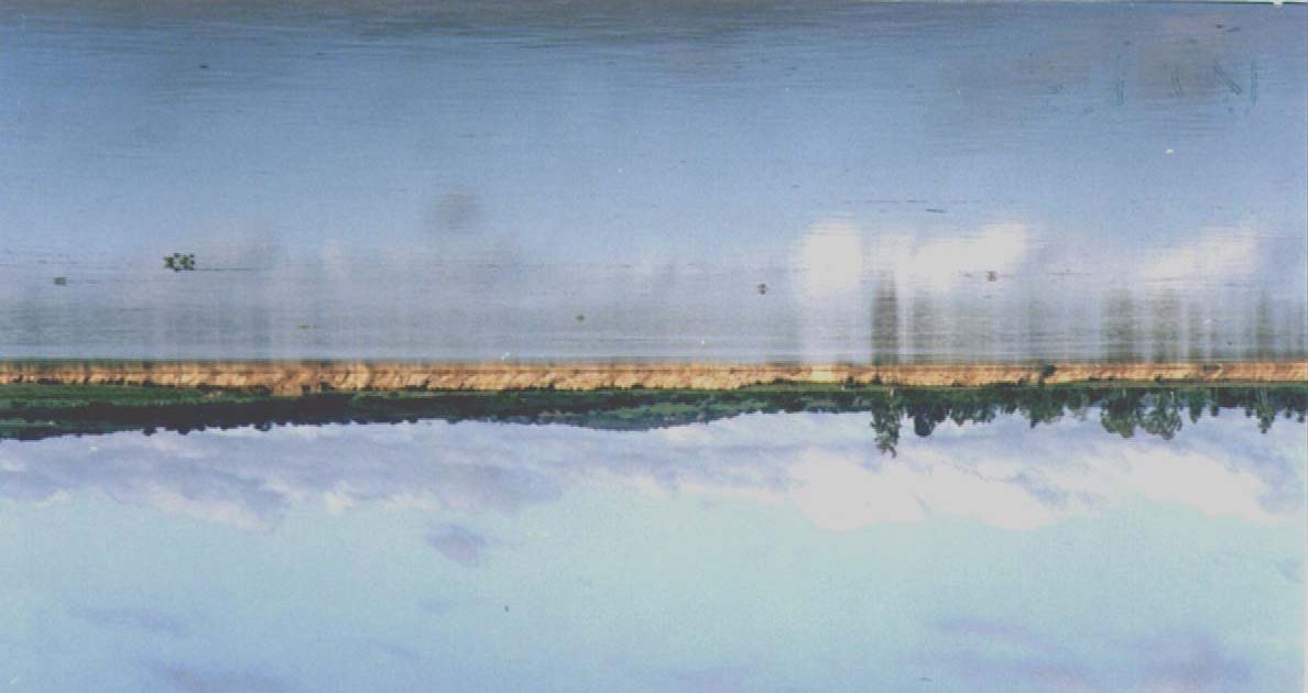
Picture 10. São Francisco River banks, under erosive process.
5.
MEASURES FOR PREVENTING EROSION AND SEDIMENTATION
5.1
PREVENTING RIVERBANK EROSION
The fast lowering of the water level in the River stimulates a great groundwater flow in the base
of the banks, removing part of the fine material, which used to contribute to its resistance, thus
favoring the sliding of the upper parts.
An effective measure for preventing bank erosion is re-regulating the discharges downstream
from the rocky section of the River, which begins in Pão-de-Açúcar. This will be possible with
the construction of a dam to release a constant flow, 24 hours a day. Such a project has already
been made by the Hydroelectric Company of the São Francisco (CHESF), in an effort to allow a
greater hourly oscillation in power generation by the Xingó Power Plant, without harming the
environment. Additionally, it would permit a more uniform power generation by Pão-de-Açúcar,
with releases without the hourly oscillations.
Another measure that will reduce bank erosion is the dragging of sediments of the river, as these
deposits impair the passage of the water, deviate the river talweg in the direction of the banks,
magnifying the erosive power of the submerged flow.
5.2. IMPACT OF FLOODS IN THE REMOVAL OF SEDIMENTS FROM THE RIVER
BED
The material deposited in the riverbed might be removed with the production of great discharges,
similar to the ones in natural floods (Figure 8). However, some time after an artificial flood, the
xvii
banks will start again to suffer a small erosion, creating a new provision of sediments, available
for being carried away by future artificial floods.
Figure 8. Natural discharge, presently regulated discharge and ecologic-minded discharges
in the São Francisco River, in Pão-de-Açúcar.
6.
SPATIAL AND TEMPORAL DISTRIBUTION OF THE PLANKTONIC BIOMASS
Considering the need to relate the transport of sediments with the fishing productivity, this study
used current and historic data on hydrology, plankton, icthyofauna, carcinofauna, modalities of
penaeid fishing and social and economic facts on the lower São Francisco (AL and SE).
6.1 OCCURRENCE AND ABUNDANCE OF PHYTOPLANKTON, ZOOPLANKTON
AND ICTHYOPLANKTON
One hundred and thirty one species of phytoplankton were identified in the São Francisco system,
including eight species of cyanophytes, 46 of chlorophytes, 50 of diatomaceas, 24 of
dinoflagellates and three rhodophyceaes (Figure 9). The cyanophytes occurred in the three
environments, even though with small representativity. The chlorophytes and rhodophyceaes,
with a relatively low abundance, were predominant in the river and in the estuary.
The bacillariophyta were more abundant in the estuary and in the sea. As bacilariofíceas foram
mais abundantes no estuário e no mar. The pirrophytes, on the other hand, did not occur in the
River and were more abundant in the sea than in the estuary, which is richer due to the
contributions from the River and from the ocean, in addition to having more species adapted to its
own environment.
xviii
Figure 9. Number of phytoplanktonic tax obtained in the River, in the estuary and in the
adjacent coastal zone of the São Francisco River (AL)
The taxonomic composition of the zooplankton obtained in the River complex included only five
animal phyla: Annelida, Mollusca, Crustacea, Chaetognata and Chordata. The Crustacea
Decapoda Group, particularly Caridea, Brachyura, and Penaeid, have commercial importance.
Despite the occurrence of zooplankton in the river, estuary and sea, the icthyoplanktonic
community in the São Francisco River presented itself little developed, compared to communities
in other places in the Northeastern Region. The relative abundance was dominated by the
Copepoda, which usually predominate in the relative abundance of zooplankton samples.
6.2 SEASONAL AND SPATIAL DISTRIBUTION OF THE PHYTOPLANKTON,
ZOOPLANKTON AND ICTHYOPLANKTON
In order to study the spatial distribution of the plankton, three masses of essentially tropical water
were characterized:
· Limnic Water, with conductivity between 60 and 75 µS/cm and temperature between 27.6
and 28.6°C, found at station R, in the São Francisco River.
· Estuarine Water, with salinity between 3.2 and 6.7 and temperature from 27.5 to 29.3°C,
found at station E, in the estuary of the River.
· Oceanic water, with salinity varying from 36.3 and 36.8 and temperature between 26.5 e
27.9°C, present in station M, in the adjacent coastal zone.
Regarding the influence of abiotic parameters on the spatial and seasonal standards of the
planktonic communities, it was possible to verify that temperature and pH, in view of the
uniformity in the distribution of their values, had no effect on their abundance and distribution.
However, in the maritime region, the high salinity and the transparency of the water stimulated
the laying of eggs, while the intermediate salinity and less transparency of the water in the
estuary favored the fish spawning. In the river, the lack of salinity was associated to higher values
of phytoplankton and zooplankton biomass.
xix
The trophic state of the pelagic ecosystem was evaluated based on the phytoplankton and
zooplankton biomasses (Figures 10, 11 and 12). Seasonality did no t interfere with the planktonic
production. At all times of the year, the values were verified to be close to the inferior limit
expected for coastal regions. For this reason they were considered extremely low, indicating the
little contribution of the river to the planktonic production in the coast.
Figure 10. Phytoplankton biovolume obtained in the river, in the estuary and in the sea, by
the mouth of the São Francisco River.
Figure 11. Microplankton biovolume in the river, in the estuary and in the sea ...
Figure 12. Macroplankton biovolume in the river, in the estuary and in the sea...
xx
6.3 CHANGES IN THE PRODUCTION OF THE ICTHYOFAUNA AND
CARCINIFAUNA, WITH THE CONSTRUCTION OF THE RESERVOIRS.
During this investigation, 190 fish larva, belonging to 7 orders and 12 families, were captured. At
least five of the families have commercial importance. Engraulidae (anchovies), Hemiramphidae
(needlefish), Gerreidae (mojarra), Sciaenidae (hake) and Balistidae (triggerfish). The
icthyoplanktonic community in the São Francisco River system presented little development,
compared to other location in the Northeastern Region, with reflex in the fish biology of the
species which should be using this system as a hatchery (Figure 13).
The São Francisco river-estuary-coast system is being little used as a site for laying eggs or for
hatching Young and juvenile fish, as indicated by the icthyoplankton densities bellow expected
values for tropical coastal zones. This, in part, is due to the failure to fill the marginal lagoons and
to the eradication of river rapids, with the construction of the Xingó Dam.
Figure 13. Density of fish larva (per 100 m3), in the São Francisco River System (Aug.2000
to May 2001).
6.4 SOCIAL AND ECONOMIC CONDITIONS OF THE FISHERMEN
Fishing production in the Lower São Francisco (Figure 14) is very low, with some emphasis to
the City of Piaçabuçu, where the fishermen also use fishing boats to reach oceanic regions far
from the mouth of the River.
The low income of the fishermen, who have no conditions to sail into the sea, is consequence of
this low fishing production. In Brejo Grande, in the estuarine area, the majority of the fishermen
have monthly income varying from 61 to 129 US dollars, and only 2% of them perceive more
than 240 dollars (Figure 15). This is a typical income distribution for all the fishermen villages in
the Lower São Francisco.
In the case of Piaçabuçu, where there is a great sea fishing production, the productivity increases
significantly, but the income distribution is not altered, because the owner of the larger boats
detains the profits of the fish caught.
xxi
Figure 14. Total icthyofauna production per Municipality in the Lower São Francisco,
1998-99 (Costa & Coelho, 2000).
Figure 15. Fishermen's income distribution, assessed in the Municipality of Brejo Grande
(SE), in the period of September/1998 to February/1999, with an Exchange rate
of one real to one US dollar (SOUZA, 1999).
xxii
7.
CONCLUSIONS AND IMPACTS
Physical Characterization:
The regions in the Upper and Middle São Francisco present higher annual precipitation (around
1,500 mm), while in the Lower stretch the mean is around 500 mm, in view of the different rain
production systems. In the Upper and Middle stretches, the rainy season extends from November
to March, with a 290 mm peak in December. For the Lower reach, it goes from March to August,
with a 63 mm maximum value in May. As a consequence, the hydrological seasonality of the
Lower São Francisco reflects the pluviometric seasonality of the Upper São Francisco.
Historic evolution of the River and estuary:
The suspended material, represented by the total solids in the suspension (TSS), is conveyed by
the River to the coastal zone. However, with the regulation of the flow, eradicating the floods,
and with the period of almost resting in the reservoirs, the concentration was drastically reduced,
resulting in transporting around 0.4 million tons, annually, to the Ocean. This is extremely low,
compared to other rivers with similar magnitude, throughout the World.
The greatest production of sediments in the São Francisco Basin happens in the Upper and
Middle regions, where the larger tributaries are located, as in Morpará (BA), for example, with
21.5 million tons a year. However, due to the presence of the dams, this sediment load is almost
totally retained, never reaching the Lower stretch.
Environmental impacts in the mangrove and beaches by the mouth of the River:
The beach erosion in Sergipe is a recent and continuous process, resulting from the lack of
replacement of sediments, which were previously supplied by the river floods. The beach profiles
in the left and right margins of the mouth of the São Francisco are characteristic of dissipative
beaches, where the waves wash all the beach face, carrying the finer sediments to the berm. The
period with the greatest erosion in the Cabeço Beach is the Winter, when bigger waves, more
oblique to the beach line, hit the littoral of Sergipe with greater energy, carrying particles away,
by coastal drift.
The finer sediments are drawn from the foot of the beach and deposited in the higher part, the
berm, and partially transported from there, by the wind. This contributes to the maintenance of
the dunes on the left margin. As all the beach is directly impacted by the waves, both fine and
coarser sediments are dragged by the coastal drift, which is controlled by waves originated away
into the Ocean.
The estuary of the São Francisco is most of the time of a well mixed type, with strong currents
and almost uniform salinity. It extends for almost 40 km, as its boundaries are related to the
influence of the tides, reaching the City of Penedo and presenting a saline tongue penetration of
five km, during the high tides.
Considering the lack of thermal seasonality in the estuarine and oceanic regions, three masses of
tropical waters were defined, with respect to salinity and conductivity: limnic waters (with
conductivity varying between 60 and 75 µS/cm and salinity close to zero); estuarine waters
(salinity between 3.2 and 6.7) and oceanic waters (salinity oscillating between 36.3 and 36.8).
xxiii
Changes in river morphology:
The sand banks along the Lower course of the São Francisco are consequence of the river
regulation by dams which control the floods, anteriorly responsible for the transportation of the
material accumulated in the riverbed. The production of sediments in this sector results from
erosion of banks in the margins.
The great amplitudes between maxima and minima discharges, such as the registered in 1948 and
1949 (minima of 1,400 m³/s, in the end of 1948, to a peak of 13,000 m³/s, in the beginning of
1949) ended in 1994, when flows were regulated between 2,000 and 3,000 m³/s. The non-
occurrence of low flows, which allowed the penetration of the saline tongue upriver, limited the
saline intrusion to the region close to the estuary.
The sediments transported by the river in the regime of small discharges are responsible for the
large transversal bottom formations, here denominated dunes, with predominance of the large
two-dimensional dunes. Those bottom forms (2-D and 3-D dunes) observed in the channel of the
São Francisco attest the capacity of the River in transporting sediments. The undulations, also
originated in conditions of low flows, predominate in the river-ocean interface and their
symmetric form indicate the influence of the currents of the tides.
Measures for reducing erosion and sedimentation:
An efficient measure to reduce bank erosion is re-regulating discharges upstream from the rocky
riverbed, starting at Pão-de-Açúcar. This will be possible with the construction of a reservoir to
release a constant flow, 24 hours a day. Such project has been elaborated by the São Francisco
Hydroelectric Company (CHESF), aiming to achieve a greater hourly oscillation at Xingó Power
Plant and, without harming the environment, generating energy with uniform daily discharges.
The material deposited in the riverbed, might be removed with the production of great flows,
similar to the natural floods. However, shortly after an artificial flood, the banks will suffer a
small erosion again, providing a new supply of sediments, available for being transported in the
future artificial floods.
Bank erosion provides a great quantity of coarse sediments that the river is not capable of
carrying away. These particles are transported by the currents in a helicoidal path in the meanders
of the riverbed and deposited in the banks of sediments in the bottom, thus intensifying the
meanders in the main channel of the River.
Spatial and temporal distribution of the planktonic biomass:
In view of the monotonous distribution of the temperature and pH values, these hydrologic
parameters did not affect in the formation of the spatial and seasonal patterns of the abundance
and distribution of the planktonic organisms in the São Francisco River system.
In the sea, the high salinity and transparence of the water were related to the laying of eggs, while
in the estuary, the intermediate salinity and lower transparence were related to fish farming
activities. In the River, the lack of salinity and the moderate transparence were associated with
higher values of the phytoplankton and zooplankton biomasses.
The small seasonal variability of the hydrologic parameters neutralized the possible influence of
the stations of the year on the phytoplankton, zooplankton and icthyoplankton production and
xxiv
density, with a total absence of seasonal patterns. This production, however, was greater in the
River, being intermediate in the estuary and smaller in the sea. The low levels in both biomass
and density throughout the year must be related to the low fishing productivity verified in the
mouth of the São Francisco.
The coastal zooplankton in the São Francisco system was dominated, in terms of wealth and
abundance, by the group of the crustaceous, specially Copepoda, Caridea and Brachyura, as
usually happens.
The São Francisco River presented little icthyoplanktonic wealth, with only 12 families
identified, with coastal association characterized by the Pelagic, Engraulidae and Syngnathidae,
and also by demersals (Gobiidae, Gerreidae, Sciaenidae and Soleidae), being little developed for
a tropical region.
The spatial pattern detected in the fish reproductive activities included the absence of pelagic
reproduction in the São Francisco River, laying of eggs in the coastal zone and little activity of
the fish larva production into the estuary. Such facts imposed negative reflection in the fishing
biology and, consequently, in the commercial capture of species which would be intensely using
this system as a hatchery.
The augmentation in knowledge on the existing links among the diverse approaches to the
Integrated Management Program, that are related to the mass of water and to the pelagic
communities (icthyofauna and plankton), will determine the actual need to implement, or not, a
monitoring program for those communities.
8. RECOMMENDATIONS
The chief recommendation is the monitoring of the evolution of environmental degradation, with
the erosion of river banks, deposition of sands in the riverbed and the progressive erosion of the
beaches. The purpose of this recommendation is a better quantification of future trends and the
assessment of mitigatory measures to be implemented.
Considering that elimination of the hourly water level oscillations downstream from Pão-de-
Açúcar will reduce bank erosion in the margin of the River, it is recommendable to build this
dam as soon as possible, as it is already expected in the operation of the augmented capacity of
Xingó.
A recommendation aimed at the sediment exclusion from the riverbed, which will prevent the
formation of sand banks, meanders and further bank erosion, is the annual production of small
controlled floods. These floods, with a few weeks duration, would reduce the size of submerged
dunes, which create meanders in the river talweg, besides providing additional load of sediments
for the delta.
8.1 Long term monitoring program for the dynamics of sediments
The Activity 1.1.A was able to identify the mechanisms for the production and transportation of
sediments in the Lower course of the River and in its mouth. However, it was not able to generate
xxv
enough information to allow medium or long range forecasts of the evolution of the river channel
and of its adjacent coastal zone, selecting the most efficient interventions or those with a lower
cost/benefit ratio.
Considering the dynamics of production and transportation of fine and sandy sediments in the
River and in its mouth, it becomes necessary to implement a long term monitoring program of the
evolution of the bathymetric levels and of the transport of sediments between Xingó's Dam and
the coastal zone. With these new series of information, it will be possible to use simulation
models to evaluate the effects of different interventions, monitoring the verified changes in the
system , calibrating and validating, with the new data, the forecast models.
The Federal University of Alagoas already has the infrastructure and the trained personnel for the
long term operation of a monitoring program, thus assuring the sustainability of the activity,
without need for additional financial support. This is a result of support offered by the GEF São
Francisco Project, in its first stage.
Nevertheless, implementation of a monitoring system with proper magnitude for the adequate
diagnosis and medium/long term forecasts of the river and coastal sedimentary dynamics, require
funds beyond those available in local institutions. The complementary support would be
necessary for a three-year period, after which the program would achieve sustainability, with
personnel and resources from local agents.
The program will be composed of three stages, each of them associated to a product:
1) The first one, 12 months long, will include an accurate geodesic survey, to establish a
network of geodesic marks, with accuracy level positioning and reference.
2) The second stage, to begin simultaneously with the first one, will be implemented in a
three year period. It will include bathymetric surveys and measurement of sediment
transport, at constant intervals, to identify geomorphological changes along the river
and in the adjacent coastal zone.
3) The third one, implemented in the third year, will proceed with the calibration and
validation of the mathematical models of sediment transport in the river and coastal
zone.
Chart 3. Cost of the three stages of the Monitoring Program (US$)
Products
Donor institution
counterpart
Global cost
1) Geodesic marks
85,600
245,000
330,600
2) identification of
390,500 985,000 1,375,500
geomorphological changes
3) Mathematical models of sediment
65,000 99,500 164,500
transport
Total costs
541,100
1,329,500
1,870,600
The main parameters to be monitored are the spatial and temporal variations of the velocities and
of sediment transport, including the migration of banks in the riverbed and in the adjacent coastal
xxvi
zone. Additionally, it will consider measurement of currents, of transported sediments, of water
transparency and of concentration of sediments in a column of water, besides accurate
bathymetric surveys in regions representative of the different types of sand banks.
In addition to the monitoring of the dynamics of sediments in the Lower São Francisco and
adjacent coastal zone, there should be a plan for monitoring erosion of margins, nutrients load,
chlorophyll concentration, productivity of the different trophic levels (phytoplankton,
zooplankton and icthyoplankton), the spatial and temporal variability of the bioecological
dynamics of native river, estuary and ocean species. It should also provide measures aimed at the
protection of the mangrove areas by the mouth of the River.
8.2. Systemic production of ecological regulated floods
The São Francisco River, in its natural condition, had annual floods which would remove
sediments from its riverbed, providing the delta with material for the coastal drift. With the flow
regulation, the provision of sediments coming from upstream reaches was retained in the
reservoirs and sediment produced in the region, by bank erosion, was deposited in the channel,
causing great environmental problems.
The augmentation of the installed power generation capacity is expected by CHESF, for the
cascade of reservoirs in the River, in order to meet the regional demand in the times of peak
consumption. It is recommendable that the National Water Agency (ANA) negotiate with them
the operation of those reservoirs on the maximum power generating capacity, without oscillation,
with a few weeks intervals.
With the River in the present level, the water currents go around the sediment banks, making
sharp curves close to the margins, flowing in helicoidal paths in the submerged banks, thus
contributing to the removal of the eroded material. The increase in discharge, in the water level
and, consequently, of the flow velocity over the submerged dunes will increase the river capacity
to convey sediments. This will destroy the submerged dunes, which induce the formation of
meanders in the river talweg and convey a great amount of sediments to the oceanic region.
Those ecological floods would be similar to the natural ones, therefore capable of augmenting
sediment transport and water turbidity, as it revolves the bed, as well as filling some marginal
lagoons. The River will be regulated in two levels: a high one, for a few weeks, in the station of
natural floods, and another with a lower level, for the remaining of the year.
The costs of those ecological floods are not very significant, as all the water for the small floods
will be producing energy. However, there will be an indirect cost for transferring the energy to
other regions of consumption and for reducing generation in the other power plants which
currently supply the respective regions. With a new reservoir operational rule, including
discharges for annual floods, probably there will be an increase in fishing productivity and a
reduction in the erosion of margins and beaches, in the adjacent coast. However, existing data
still do not allow a quantification of these benefits.
xxvii
8.3 Construction of the Pão-de-Açúcar hydroelectric dam
The construction of a hydroelectric dam upstream from Xingó, in Pão-de-Açúcar, already
planned by CHESF, to regulate hourly oscillations of discharges by Xingó, will reduce erosion of
margins. This erosion are caused, in part, by the slide of banks weakened by the current level
fluctuations, which generate a flux/re-flux between river and aquifer.
xxviii