Document of
The World Bank
FOR OFFICIAL USE ONLY
Report No: 34042-ID
PROJECT APPRAISAL DOCUMENT
ON
TWO PROPOSED GRANTS FROM THE
GLOBAL ENVIRONMENT FACILITY TRUST FUND
TO THE
INTERNATIONAL MARITIME ORGANIZATION
IN THE AMOUNT OF US$6.86 MILLION
AND TO THE
REPUBLIC OF INDONESIA
IN THE AMOUNT OF US$1.44 MILLION
FOR A
MARINE ELECTRONIC HIGHWAY DEMONSTRATION PROJECT
May 2, 2006
Transport Sector Unit
East Asia and Pacific Region
This document has a restricted distribution and may be used by recipients only in the
performance of their official duties. Its contents may not otherwise be disclosed without
World Bank authorization.
CURRENCY EQUIVALENTS
(Exchange Rate Effective December 2005)
Currency Unit = US$
Indonesia Rupiah 10,000 = US$1
Malaysia Ringgit 3.78 = US$1
Singapore Dollar 1.647 = US$1
FISCAL YEAR (International Maritime Organization and Republic of Indonesia)
January 1
Ł
December 31
ABBREVIATIONS AND ACRONYMS
AIS
Automatic Identification System
DGPS
Differential Global Positioning System
DGST
Directorate General of Sea Transport, Ministry of Transport
ECDIS
Electronic Chart Display and Information System
EMPS Environmental
Management and Protection System
ENC
Electronic Navigation Charts
GEF
Global Environmental Facility
FMR
Financial Monitoring Report
ICB
International Competitive Bidding
ICS
International Chamber of Shipping
IHO
International Hydrographic Organization
IMO
International Maritime Organization
INTERTANKO International
Association of Independent Tankers Owners
MEH
Marine Electronic Highway
MOE
Ministry of Environment (Republic of Indonesia)
MOT
Ministry of Transport (Republic of Indonesia)
MOU Memorandum
of
Understanding
PIP
Project Implementation Plan
PMO
Project Management Office
PSC
Project Steering Committee
STRAITREP
Straits of Malacca and Singapore Mandatory Ship Reporting System
TC Technical
Committee
TSS
Traffic Separation Scheme
ULCC
Ultra Large Crude Carrier
VLCC
Very Large Crude Carrier
WG Working
Group
Acting Vice President:
Jeffrey Gutman
Country Manager/Director:
Andrew Steer, Ian Porter
Sector Manager:
Jitendra N. Bajpai
Task Team Leader:
Sally Burningham
MARINE ELECTRONIC HIGHWAY DEMONSTRATION PROJECT
CONTENTS
A. STRATEGIC CONTEXT AND RATIONALE ...............................................................1
1. Country and sector issues...............................................................................................1
2. Rationale for Bank and Global Environmental Facility (GEF) involvement ................2
3. Higher level objectives to which the project contributes...............................................3
B. PROJECT DESCRIPTION ...............................................................................................3
1. Lending
instrument ........................................................................................................3
2. Program objective and phases........................................................................................4
3. Project development and global environment objectives and key indicators ................4
4. Project
components........................................................................................................5
5. Lessons learned and reflected in the project design.......................................................8
6. Alternatives
considered
and reasons for rejection .........................................................8
C. IMPLEMENTATION ........................................................................................................9
1. Partnership
arrangements...............................................................................................9
2. Institutional and implementation arrangements.............................................................9
3. Monitoring and evaluation of outcomes/results...........................................................10
4. Sustainability and Replicability ...................................................................................10
5. Critical risks and possible controversial aspects..........................................................10
6. Grant conditions and covenants ...................................................................................12
D. APPRAISAL SUMMARY ...............................................................................................15
1. Economic and financial analyses.................................................................................15
2. Technical......................................................................................................................15
3. Fiduciary ......................................................................................................................16
4. Social............................................................................................................................17
5. Environment.................................................................................................................17
6. Safeguard
policies........................................................................................................18
7. Policy Exceptions and Readiness.................................................................................18
Annex 1: Country and Sector or Program Background ....................................................19
Annex 2: Major Related Projects Financed by the Bank and/or other Agencies ............21
Annex 3: Results Framework and Monitoring ...................................................................22
Annex 4: Detailed Project Description.................................................................................26
Annex 5: Project Costs ..........................................................................................................35
Annex 6: Implementation Arrangements ............................................................................38
Annex 7: Financial Management and Disbursement Arrangements................................44
Annex 8: Procurement Arrangements .................................................................................49
Annex 9: Economic and Financial Analysis ........................................................................55
Annex 10: Safeguard Policy Issues.......................................................................................64
Annex 11: Project Preparation and Supervision ................................................................65
Annex 12: Documents in the Project File ............................................................................66
Annex 13: Statement of Loans and Credits.........................................................................68
Annex 14: Country at a Glance ............................................................................................71
Annex 15: Incremental Cost Analysis ..................................................................................73
IBRD Maps 34371 and 34372
A. STRATEGIC CONTEXT AND RATIONALE
1.
Country and sector issues
The Straits of Malacca and Singapore, situated between Sumatra and the Malay Peninsula, are
approximately 1,000 kilometers long, 300 kilometers wide at their north-west entrance, and just
12 kilometers wide at their south-east entrance, between Singapore and Indonesia's Riau
Archipelago. They are shallow, with narrow channels, irregular tides and shifting bottom
topography, and hence are hazardous to navigation for large ships. They are also rich in natural
resources on which many of the coastal inhabitants depend.
Despite their difficult navigational features, the Straits are the shortest and hence the preferred
shipping route between the Indian Ocean and the South China Sea, and for oil tankers trading
between the Persian Gulf and the fast-growing countries of East Asia. Over 200 very large crude
carriers and container ships pass through the Straits each day, and traffic is growing by 10
percent per year. There is also much cross-Strait traffic which cuts through the major shipping
lanes.
Recent enhancements in maritime safety infrastructure and regulatory mechanisms have
improved navigational safety and traffic flow. Singapore has an efficient radar-based ship
position monitoring system covering the Singapore Strait. In 1998, the three littoral states of
Republic of Indonesia, Malaysia, and Republic of Singapore jointly commissioned a mandatory
ship reporting system (STRAITREP) for the most congested 300 kilometer section of the Straits
from One Fathom Bank to the Singapore Strait, which combines radar and automatic ship
identification and tracking.
These recent improvements to navigational aids and facilities have reduced the frequency of ship
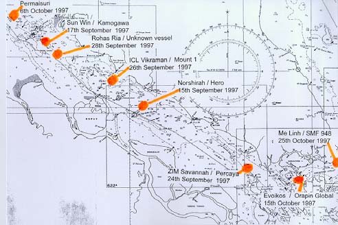
collisions, groundings and oil spills. However, several vessel collisions and groundings occurred
in the past five years that caused significant oil spills, such as those involving the `Natuna
Sea'(October 2000) and the `Singapora Timur' (May 2001). Total compensation claims for the
`Natuna Sea' accident were over US$127 million. A recent economic valuation of the natural
resources at risk in the Malacca Straits estimated them at U$5 billion and identified more than 50
species of marine coral and fish on the endangered species list. So, despite the improved
navigation system, the threat of collisions and groundings and of consequent environmental
damage is still significant and, with rapid traffic growth, is increasing.
The three littoral states have oil spill response capabilities and oil spill contingency plans,
including a cooperative response agreement. However, the several recent serious shipping
accidents highlighted the need for an improved ship management system, for quicker and more
accurate deployment of spill response equipment and manpower, and for more efficient
institutional arrangements for dealing with oil spills. In addition to more rapid response,
immediate access to information on spill location and track and the environmental resources at
risk are also needed if the impact of any spill is to be minimized. Better communication is the
key to more effective oil spill response, but a more effective ship monitoring and control system
is required to prevent major incidents, as well as to serve as early warning of their potential
environmental damage and where such damage will occur.
1
Recent advances in marine navigation, communications and environmental impact prediction
technologies offer an opportunity to upgrade existing systems to further reduce the risk of ship
accidents in the Straits and the environmental damage they cause. By providing mariners with
very accurate, real-time navigational information (depth, tide, and location of sand bars) the new
technologies could also reduce shipping costs by permitting safe navigation in poor weather and
optimal loading and may even reduce marine insurance costs.
The best-proven of the new marine navigation technologies is the "Marine Electronic Highway"
(MEH). First installed in Canada's St. Lawrence River in the early 1990s, a MEH combines an
Electronic Chart Display and Information System (ECDIS), an Automated Identification System
(AIS), shore-based marine information databases and advanced ship-to-shore communications.
The ECDIS involves the use of Electronic Navigation Charts which replaces traditional paper
charts as the ship operator's primary navigation tool. It shows the ship's exact location, plus real-
time data on water depth, tidal flow and navigational risks. The AIS gives shore controllers
precise information on ship location, direction and speed, which help them avert collisions or
groundings. The same data used to compile the electronic navigation charts can predict the
direction and speed of any oil spill movements and help to identify and deter ships that illegally
flush their bilges or dump other oily wastes. The foundation for this technology already exists in
the Straits and the littoral states are committed to its installation, however the cost to them of
developing and operating it, and the uncertainty of whether they can recover those costs, has
deterred them from making the investment. An external catalyst is needed to bring about the
new institutional arrangements between national governments, the International Maritime
Organization and the ship operators that are needed to make the system work.
2.
Rationale for Bank and Global Environmental Facility (GEF) involvement
The rationale for Bank involvement is that the Bank has a unique combination of convening
power and technical skills that can help the littoral states overcome the barriers that have
prevented implementation of the system until now. The Bank can facilitate collaboration
between the International Maritime Organization, the international institution responsible for
promoting environmentally-sound marine navigation, the International Hydrographic
Organization, responsible for marine mapping, major international ship-owner representative
organizations and the governments of the three littoral states. Financially, it can access the
resources of GEF, which, in its International Waters Focal Area, can provide grant or
concessional funding to help countries address major environmental threats to shared water
bodies, such as the Straits of Malacca and Singapore.
The Marine Electronic Highway Demonstration Project is consistent with one of the major
objectives of the GEF's International Waters Operational Program 10, as it will overcome the
barriers to the adoption of best-practice technology in marine navigation and pollution control in
the Straits, and thereby reduce the risk of contamination of an international water body. As the
project is a partnership between governments, the GEF and the private sector, it is also consistent
with one of the GEF's key strategic objectives, to promote public-private partnerships that
benefit the global environment.
2
GEF support for the Project is further justified because the Straits of Malacca and Singapore is a
zone of high marine biological diversity, rich in the marine fauna and flora that are characteristic
of tropical estuarine environments. The abundance of sea-grass beds, mangrove swamps, coral
reefs, and wetlands, enriches the associated coastal marine environments, which are also
stopovers for migratory birds on seasonal transition. Natural resource-related activities, such as
fishing and coastal tourism, are key to the regional economy. By catalyzing the development of
a Marine Electronic Highway that will protect these natural resources, the GEF can help achieve
global and local environmental benefits and poverty reduction, which is also the Bank's core
objective.
3.
Higher level objectives to which the project contributes
The Marine Electronic Highway (MEH) Demonstration Project is the first (demonstration) phase
of a proposed two-phase program to establish a MEH in the Straits of Malacca and Singapore.
The Demonstration Project's objective is to determine if a full-scale MEH for the Straits is
economically justified and financially feasible. If the MEH is successful in the Straits of Malacca
and Singapore, it has the potential to be extended to the whole shipping route from Europe and
the Middle East to East Asia. Other East Asian countries have already expressed interest in such
an extension and are awaiting the outcome of the demonstration phase before taking specific
actions on extension. There is also interest from states that are littoral to other major sea lanes in
applying the MEH principles and methods to their own regions.
B. PROJECT DESCRIPTION
1.
Lending instrument
The Bank mobilized co-financing for this project in the form of a Global Environment Facility
grant. This is the most appropriate co-financing instrument since: (a) the feasibility of the Marine
Electronic Highway (MEH) system that the Project will demonstrate and test is unproven, and
(b) the MEH system promises to deliver significant global as well as local environmental
benefits. The bulk of the non-Bank co-financing will be provided by the commercial shipping
industry, which is appropriate since it stands to gain commercial benefit from a successful MEH
system.
Commitment of the littoral states and other essential participants in the Project has been
confirmed by the signing of two Memoranda on September 8, 2005:
Ę a Memorandum of Understanding among the three littoral states, Indonesia, Malaysia,
Singapore, and the International Maritime Organization. Articles IIIA and IIIB of this
Memorandum show the roles and responsibilities of the International Maritime Organization
and the Republic of Indonesia (through the Ministry of Environment) respectively, and;
Ę a Memorandum on Arrangements among the three littoral states, Indonesia, Malaysia,
Singapore, and the International Maritime Organization, the International Hydrographic
Organization, the International Association of Independent Tanker Owners, and the
International Chamber of Shipping. This Memorandum indicates the arrangements for the
implementation of specific activities.
3
2.
Program objective and phases
The program's objective is to reduce the user costs and environmental damage of marine
navigation through the Straits of Malacca and Singapore (the Straits). These objectives will be
achieved by developing a Marine Electronic Highway (MEH) for the entire Straits
(approximately 1,000 kilometers) which will: (a) reduce the frequency of ship collisions in the
Straits' busy and congested sea lanes and port arrival and departure areas; (b) make marine
navigation in the Straits feasible more often in poor weather; (c) allow ships in transit to optimize
their loads for passage through the Straits; (d) facilitate more effective monitoring of vessel
operations, such as illegal bilge water releases, thus deterring such environmentally-damaging
behavior; and (e) generate more resources and increase capacity for environmental protection of
the Straits and its surrounding coasts.
This first phase Project will facilitate the program's objective by: (a) developing and testing a
demonstration MEH system for the most congested 300 kilometer section of the Straits; and (b)
based on the results of these tests and on international marine navigation law, assessing the
financial, economic, and legal feasibility and environmental benefits of developing a MEH
system for the entire Straits. If, based on the results of this assessment, the three participating
littoral states and representatives of the international shipping industry decide to develop such a
system, the project will prepare the design of, and financing and institutional plan for, a MEH
system covering the entire Straits.
The expected duration of the MEH Demonstration Project is four years and its total cost is about
US$17 million. The Project's implementation will be coordinated and technically supported by
the International Maritime Organization, on behalf of the littoral states. The Governments of
Indonesia, Malaysia and Singapore, primarily through their ministries responsible for marine
navigation and the environment, will collaborate on and steer the project. The trigger for moving
from phase one to phase two of the program to develop a Marine Electronic Highway for the
entire Straits of Malacca and Singapore will be a decision by the concerned governments and
representatives of the commercial shipping industry. The cost of such a system is not known at
this time, but will be estimated by the Project. The process of designing the Full-Scale MEH
system will take account of the rapid advances in marine navigation technology that are currently
occurring.
3.
Project development and global environment objectives and key indicators
The Project's development objective is to assist the Republic of Indonesia, Malaysia, the
Republic of Singapore and representatives of some of the large commercial ship owners that use
the Strait of Malacca and the Strait of Singapore, to collectively decide whether to establish a
marine electronic highway for the entire length of the Straits of Malacca and Singapore. The
indicator of the Project's success is that these key stakeholders reach a decision on this issue.
The Project's global environment objective is to improve maritime safety and reduce
environmental damage to the globally-significant shared natural resources of the Straits of
Malacca and Singapore. It will not be possible to determine with certainty if it has achieved this
objective in its short life. An evaluation of the Marine Electronic Highway demonstration
4
system's technical performance and the project stakeholders' decision whether to maintain
and/or expand it will indicate if this objective is likely to be achieved in the longer term.
4.
Project components
The Project has five components (see Annex 4 for a detailed description). The total Project cost
is US$17 million, of which US$8.3 million will be financed by the Global Environment Facility,
US$6.0 million by private sector participants (ship-owners), and US$2.7 million by the three
littoral states. The International Maritime Organization (IMO) will manage all components of the
project. The Republic of Indonesia will execute the Tide and Current Facilities of Component 2.
Component 1: MEH System Design, Coordination and Operation (US$2.88 million)
This component will provide for project management by the IMO on behalf of the participating
states, coordination of the design, development and operation of the MEH demonstration system
and also provide for key technical inputs to the project. The main functions will be performed by
the staff of a Project Management Office (PMO), which will operate under the responsibility of
the IMO. The PMO will be located on the island of Batam, Indonesia, almost directly across the
Straits from Singapore. It will be co-located with Indonesian Government's marine management
bureau that is responsible for the Indonesian waters of the MEH demonstration section and will
be housed in facilities provided and serviced by the Government of Indonesia.
The major tasks to be undertaken within this component will be:
1.
System Planning and International Maritime Organization Management
(a)
Management of the operational aspects of the Project by the International
Maritime Organization.
(b)
Development of a system for the management and on-line access and storage of
data and information, including links to the MEH Data Centers and financial and
economic assessments.
(c)
Development of criteria and measurable indicators for Project performance
assessment, including the carrying out of a baseline survey to compile and analyze data
and information covering a period of about thirty years up to the inception of the Project,
as a basis for evaluation of the impact of the MEH system.
2.
Project Management Office
(a)
Strengthening the capacity of the staff of the Project Management Office,
including relevant training.
(b)
Establishment of MEH Data Centers in the Republic of Indonesia, Malaysia and
the Republic of Singapore, including provision of relevant training to the staff of the
MEH Data Centers in operation and management of the MEH system and in data
handling and exchange.
3.
Project Steering Committee Support. Carrying out of meetings of the Project
Steering Committee (PSC), the Technical Committees (TCs) and the Working Groups
(WGs), including travel and accommodations for participants.
5
Incremental Operating Costs are included in the above component and covers costs which would
not have been incurred without the project and includes travel and per diem by staff of the PMO,
PSC, WGs and TCs, communications, consumables, advertising of bidding, printing and
publication of Project information, rental of meeting facilities, but excludes staff salaries.
Component 2: MEH System Development (US$7.04 million)
This component will provide for production of the navigational information on which the MEH
system will be based, and its incorporation into real-time Electronic Navigation Charts that ship
operators will be able to use to navigate with precision through the MEH demonstration section
of the Straits. These activities will be coordinated by the PMO, under the direction of the IMO,
and comprise the following sub components:
1.
Tide and Current Facilities. Tidal and current monitoring on the Republic of
Indonesia's coast of the Strait of Malacca, including provision of relevant equipment.
2. Hydrographic
Survey. (a) Carrying out of a hydrographic survey within the
designated traffic separation scheme in the Strait of Malacca within the Project Area and
(b) Provision of training to the hydrographic surveyors of the hydro-oceanographic
services of the Republic of Indonesia, Malaysia and the Republic of Singapore.
3. Electronic
Navigation
Charts. Production of high resolution electronic navigation
charts for the Project Area, including provision of relevant computer software licenses to
the Republic of Indonesia and to Malaysia.
4.
Information Exchange System. Establishment of a MEH information exchange
system, including data servers, data exchange protocols and training of staff in data
exchange.
Component 3: Ship-board Equipment and Communications (US$6.00 million)
Carrying out of testing of the demonstration MEH system by about 160 ships fitted with type-
approved electronic chart display and information systems, including internet connectivity. This
component will be executed by the owners of at least 160 large oil tankers and container ships
that regularly transit the Straits, and will be facilitated by two major ship owner representative
organizations, the International Association of Independent Tanker Owners (INTERTANKO)
and the International Chamber of Shipping (ICS). With the facilitation of INTERTANKO and
ICS, the ship owners will arrange that, by the end of year three, at least 160 of their ships that
regularly transit the Straits are fitted with internationally-approved Electronic Chart Display and
Information System and Automatic Identification System and have internet connectivityŁthese
elements comprise the suite of technical equipment required to use all the elements of the MEH
demonstration system. In addition, the ship owners will ensure that, once the MEH
demonstration system is operational, all of the 160 ships which are so equipped always use it
when transiting the Straits and provide detailed and timely feed-back on its performance to the
PMO and later to the independent experts tasked with evaluating the demonstration system and
6
assessing the costs, benefits and legal/financial feasibility of expanding it to cover the entire
Straits (see Component 5).
Component 4: Marine Environment Protection (US$0.85 million)
This component will be executed jointly by the institutions in the littoral states that are
responsible for marine navigation and environmental management and the International
Maritime Organization and will consist of the following activities:
1.
Oil Spill and Sand Wave Models. Carrying out of a modeling and analyses of: (i)
the likely movement of oil spills originating in the Project Area, and (ii) the sand wave
formation and movement in the Project Area.
2.
Sensitive Area Mapping. Research and development of options for providing
real-time geo-referenced environmental protection information to mariners navigating in
the Straits of Malacca and Singapore and for conservation and coastal resources
management and mapping of sensitive areas.
3. Emergency
Response
Systems. Carrying out of simulated oil and chemical spill
emergency response exercises to determine the cost-effectiveness and efficiency of the
MEH system in the event of chemical and oil spill incidents from ships.
Component 5: Information Dissemination, Evaluation and Scale-Up Plan (US$0.23 m)
This component will be managed by the IMO through the PMO, and will produce the following
outputs:
1. Website
and
Publicity. Production and dissemination of information through the
Internet on the MEH system, including technical reports, progress reports and a
newsletter, and carrying out of national and regional workshops and seminars to provide
information and seek feedback on the benefits and applicability of the MEH system.
2. Evaluation. (a) Assessment of the cost and benefits of the establishment and use
of the MEH system in terms of maritime safety and marine environment protection,
including (i) the development of criteria and measurable indicators for the socio-
economic assessment of the MEH system, and (ii) the carrying out of a socio-economic
survey to evaluate the benefits of the MEH system; (b) (i) Carrying out of an assessment
of the technical functionalities of the MEH system, including system performance, (ii)
Carrying out of a continuous monitoring of new and potential technologies that could be
linked to the MEH system or enhance its performance, including the carrying out of
technical evaluations on the new technologies to determine their suitability, value added
contribution, enhancing performance and cost effectiveness, (c) Carrying out of an
assessment of the MEH system, including institutional and legal aspects, and (d)
Consolidation of the technical, institutional, legal, financial and economic assessments of
the MEH system, including the implementation of the Project, and development of a
managing tool blueprint.
7
3. System
Development. Carrying out of marketing strategies to package and
market the MEH system and its marine information and other products, and the services
it could provide.
5.
Lessons learned and reflected in the project design
The concept of a Marine Electronic Highway (MEH) was initiated in Canada in the early 1990s
with the application of digital technology to navigation, particularly in the development of
Electronic Navigation Charts (ENCs) and the Electronic Chart Display and Information Systems
(ECDISs). The core of the Canadian version of the MEH was the integration and
interconnection of the ECDIS and the Automatic Identification System with powerful shore-
based databases to provide a basis for optimized shipping traffic management decisions.
Since 1995, the ECDIS has been widely deployed in Canada in the Great Lakes and the St.
Lawrence River corridor with considerable success, especially in assisting with navigating
through treacherous waters even in heavy fog conditions. However, standards for ENCs and the
unavailability of type-approved ECDIS during this early period led to the use of non-conforming
ECDIS by the Canadian shipping sector. Thus, many Canadian ships plying the Great Lakes and
the St. Lawrence Seaway had difficulty in switching to standardized technology subsequent to
the commercial launching of the first type-approved ECDIS in 1999, and the wider adoption of
the International Hydrographic Organization's S-57 (electronic chart standard). Although the
full MEH concept remains to be realized, the pioneering efforts in Canada have led to the
widespread adoption of ENCs and the ECDIS. Since 1999, several type-approved ECDIS have
appeared on the market, and many national hydrographic agencies have the capacity to produce
approved S-57 electronic navigation charts.
The utility of ENCs combined with ECDIS is now well accepted in the maritime industry as a
means to increase the safety of vessels and improve their commercial performance, particularly
in areas with restricted under keel clearance and water depth. Placing these technologies in the
framework of the MEH system will provide greater benefits not only for the shipping industry
but also for the marine environment sector. From the marine environment protection standpoint,
the reduction of vessel accidents and online availability of marine information could lead to
improved monitoring and lower response time to marine environmental incidents, and lower
clean-up costs and better quantification of damages, as well as enhanced management of the
coastal and marine resources in the Straits.
6.
Alternatives considered and reasons for rejection
The alternative of making incremental improvements to existing navigational facilities and ship
control systems in the Straits was considered but rejected because it has very limited potential for
reducing ship-related environmental damages or for improving navigational efficiency compared
with the proposed MEH system.
New technology is now under development that would enhance the value of the MEH. This
technology involves using real time satellite monitoring of the sea bed and depth of water, with
accuracy to within one meter. This, along with the application of real time tide and weather
8
information to mathematical models, would give vessel operators a much higher level of
confidence to load their ships with a reduced under keel clearance than an estimate of the
available water depth based on hydrographic surveys. However this technology is not yet proven
and its cost is unknown. The concept of the MEH is to make maximum use of available
technology and not use it as an experimental application of new technology. Although new
technologies have been rejected for now, their development will be monitored during the MEH
Demonstration Project and their viability reassessed before design of the Full-Scale MEH
project.
C. IMPLEMENTATION
1.
Partnership arrangements
The demonstration phase of the Project will be managed by the International Maritime
Organization, a United Nations organization with a global mandate for navigation safety and
marine environmental protection. The governments of the Republic of Indonesia, Malaysia and
Republic of Singapore have signed a Memorandum of Understanding that defines their relative
responsibilities under the project. Other partners in the project, that have signed a Memorandum
on Arrangements, are INTERTANKO (representing the owners of tanker vessels using the
Straits), the International Chamber of Shipping representing the interests of owners of container
vessels using the Straits, and the International Hydrographic Organization, the intergovernmental
organization with responsibility for the quality of hydrographic information included in marine
charts. Discussions are under way with other national governments that have expressed an
interest in participating in the Project.
2.
Institutional and implementation arrangements
The Project Steering Committee (PSC) established during the project preparation will continue to
act as the overall regional body to implement the MEH Demonstration Project. The three littoral
states of Indonesia, Malaysia and Singapore are permanent members of the PSC. The PSC will
participate in the annual GEF Project Implementation Review.
There are two grants to support the MEH project. The International Maritime Organization is the
Recipient of a US$6.86 million Grant and will be responsible for the management of the project
and all components except the sub-component on tide and current facilities. The second Grant is
to the Republic of Indonesia for US$1.44 million. The Office of the Deputy Minister for Nature
Conservation Enhancement and Environmental Destruction Control of the Ministry of
Environment is the coordinating Ministry for the Indonesian part of the Project. The Directorate
General of Sea Transport of the Ministry of Transport is the implementing agency. A Project
Management Office will be established to administer and manage the project on site. It will be
sited in Batam in Sumatra, Indonesia and will be hosted by the Republic of Indonesia.
9
3.
Monitoring and evaluation of outcomes/results
The objective of the Marine Electronic Highway (MEH) Demonstration Project is to determine
whether the Full-Scale MEH will be technically, politically, operationally, and financially viable.
Monitoring and evaluation of the progress and outcomes of the MEH Demonstration Project will
be an important contribution to a decision whether to proceed with the Full-Scale MEH. In
addition, there will be a mid-term review and annual reviews by the Project Steering Committee
(PSC), bi-annual internal reviews on project implementation as well as the results and outputs.
The PSC will participate in the annual GEF Project Implementation Review. The findings of
these reviews will be used to assess project progress and the need to modify approaches and the
mobilization of resources.
The key performance indicators as shown in Annex 3 will be used to assess the outputs and
impacts of the MEH Demonstration Project.
The Project Management Office (PMO) will be responsible for preparing terms of reference,
contracting and supervising the consultants who will undertake the basic monitoring and
evaluation tasks. One of the main results of the MEH Demonstration Project will be an
assessment of the viability of the Full-Scale MEH and of the conditions necessary for its
successful implementation and operation. Although the assessment will be made by consultants
contracted by and working under terms of reference prepared by the PMO, it is the PSC that will
have final responsibility for all conclusions of the monitoring and evaluation studies.
4.
Sustainability and Replicability
Although the Full-Scale MEH system is limited to the area of the Straits of Malacca and
Singapore, there is an intention that the scope should be extended to the whole of the sea-lanes
between the Suez Canal and the major ports of East Asia. There are other sea lanes with a high
density of shipping where the principles of the MEH could be applied, including the Black Sea
and Bosphorus, the Baltic Sea, the North Sea and English Channel, the River Plate, the Red Sea,
the approaches to the Panama Canal and the St. Lawrence Seaway (where the concept of a MEH
was first applied).
5.
Critical risks and possible controversial aspects
The MEH Demonstration Project's risks to the development and establishment of the Full-Scale
MEH are that the private sector will not be willing to commit, finance and implement the
activities designed to develop and establish the MEH system, as well as the lack of commitment
from governments to engage in such partnership arrangements. However, the implementation of
the two stages of the MEH means that ample time and effort will be provided for the
development and establishment of the Full-Scale MEH.
10
Potential risks
Risk Mitigation
Rating
This is a multi-national project,
During the Project preparation phase, the three states
S
requiring cooperation among states that involved in the Project have demonstrated a high level of
have not been consistent in maintaining cooperation and coordination of their respective activities.
such relations. In addition, the MEH
Their commitment, as well as the commitment of all other
covers international waters, where the
participating organizations, is further codified in the
authoritative institution is the IMO.
Memorandum of Understanding and the Memorandum on
c
a
l
The activities of shipping in
Arrangements, which have been signed by all parties
o
liti
international waters are subject to a
concerned. Other agreements will be developed in the
P
large number of conventions and
course of project implementation, which will cover
agreements that are administered by the partnerships with various agencies, organizations and
IMO, however it has few powers of
groups to carry out specific activities under the five Project
enforcement of these, other than by
components. These agreements will spell out the specific
persuasion and cooperation with
commitments of each of the parties whose participation is
industry.
essential to the success of the Project.
The MEH Demonstration Project will
The required managerial capacity and experience will be
M
involve a large number of agencies, the
provided by the IMO as project manager. The strength of
procurement of a large volume of
the IMO in this role was demonstrated during the Project
highly sophisticated equipment and the
preparation phase, as well as in numerous similar projects
r
i
al
integration of several different
that depend on international cooperation of a group of
technologies.
maritime littoral states in their mutual interest. The day-to-
a
nage
day management of the Project will be provided by a
M
specially recruited project management team under the
supervision of IMO and guidance of the Project Steering
Committee including the four Technical Committees and
two ad hoc Working Groups.
The MEH Demonstration Project is the
Since the required software and associated models does not
M
first to implement a coordinated set of
involve any new or innovative technology, this risk is
marine operational and environmental
considered minimal and not exceptional for a project based
i
cal
tools and as such is subject to the risks
on electronic procedures.
associated with such demonstration
Techn
projects, with the principal
technological risk being in the
provision of the needed software and
models.
The Project is fully dependent on
The three littoral states, INTERTANKO and ICS have
M
support from the shipping industry and, already committed to their financial contribution and these
in particular, on the willingness of the
commitments have been confirmed in the MOU and the
ship operators who make most use of
MOA, respectively. INTERTANKO and ICS have
the Straits of Malacca and Singapore to
committed that their members will supply at least 60 and
accept MEH-user charges and to invest
100 respectively, adequately equipped vessels. On-going
in equipping their vessels to use the
consultations with representatives of other shipping
a
l
MEH.
interests will be maintained in the expectation that further
nci
commitments to equipping ships to participate in the
demonstration project will be made. Importantly, owners
Fina
will continue to have the choice of not using the MEH and
passing the Straits completely, free of any charges.
The cost of the MEH Demonstration Project may exceed
S
the estimates in this Project Appraisal Document. Korea
and Japan have already expressed an interest in
contributing expert personnel, equipment, and/or financial
resources for the Project.
Overall Risk Rating
M
Risk Rating Ł H (High Risk), S (Substantial Risk), M (Modest Risk), N (Negligible or Low Risk)
11
6.
Grant conditions and covenants
6.1 Grant Agreement with the International Maritime Organization
Condition of Board Presentation
The International Maritime Organization (IMO) and the Republic of Indonesia have concluded a
Memorandum of Agreement, acceptable to the Bank, specifying the functions; staffing, including
support staff; facilities including office space to be provided to the Project Management Office in
Batam, as well as who will provide the required staff, facilities, and operating costs.
Conditions of Effectiveness
(a) The Global Environment Facility Trust Fund Grant Agreement shall have been executed on
behalf of the Republic of Indonesia and the Bank.
(b) The IMO shall have provided to the Bank a Project management memorandum, acceptable
to the Bank.
(c) The Project Implementation Plan, acceptable to the Bank, shall have been adopted by the
IMO and endorsed by the Republic of Indonesia, Malaysia and the Republic of Singapore.
Conditions for Continued Implementation
1.
The IMO shall take all steps necessary to ensure that the Project Steering Committee shall
be maintained until completion of the Project.
2.
The IMO shall, in accordance with the provisions of the Memorandum of Agreement,
establish by December 31, 2006, and, thereafter, maintain until the completion of the
Project, the Project Management Office, with term of reference and staff and at all times
acceptable to the Bank, including a Project Manager.
3.
The IMO shall, until completion of the Project, maintain at its headquarters a procurement
officer, acceptable to the Bank.
4.
The IMO shall prepare and furnish to the Bank a Project management memorandum,
acceptable to the Bank, setting forth the management tasks to be carried out by the
Recipient under the Project, including the estimated cost of each task.
5.
The IMO shall adopt and, thereafter apply in the implementation of the Project, the Project
Implementation Plan, acceptable to the Bank, which shall include the description of: (a)
implementation arrangements, (b) the procurement procedures set forth in the Grant
Agreement and standard procurement documentation, (c) reporting requirements, financial
management procedures and audit procedures as set forth in the Grant Agreement, (d) the
Project Performance Indicators set forth in the Grant Agreement, and shall not amend,
suspend, abrogate, repeal or waive any provisions of the Project Implementation Plan
without the prior agreement of the Bank.
6.
The IMO shall cause the Project Steering Committee to:
(a) furnish to the Bank for its review and comments not later than September 30 in each
year, commencing September 30, 2007, and until completion of the Project, draft revisions
to the Project Implementation Plan for the components of the Project not yet carried out,
with emphasis on the activities to be carried out in the following calendar year, including
12
the scope of the activities to be carried out, cost estimates, time based implementation
schedules, financing plan, budget arrangements, and the relevant procurement plan; and
(b) finalize the revised Project Implementation Plan by November 30 in each year,
commencing November 30, 2007, taking into account the comments of the Bank thereon.
7.
In carrying out Component 2.3 of the Project, the IMO shall provide all required technical
assistance to the Republic of Indonesia, Malaysia and the Republic of Singapore to ensure
the production of the electronic navigational charts by March 31, 2008.
8.
In carrying out Component 3 of the Project, the IMO shall provide the required technical
assistance to ensure that the International Association of Independent Tanker Owners and
the International Chamber of Shipping have each, by December 31, 2008, at least 60 and
100 ships, respectively, equipped with type-approved electronic chart display and
information systems, including internet connectivity.
9.
In carrying out Component 5 of the Project, the IMO shall:
(a) by May 31, 2010, furnish to the Bank the draft final report on the technical, financial,
economic, and legal feasibility of a scaled-up Marine Electronic Highway system for the
entire Straits of Malacca and Singapore; and
(b) by August, 2010, taking into account the comments of the Bank, furnish to potential
participants and beneficiaries of the full-scale Marine Electronic Highway system the
finalized feasibility study, including the design of an operational and financing plan and an
institutional structure for the scaled-up Marine Electronic Highway system.
10. The IMO shall:
(a) maintain policies and procedures adequate to enable it to monitor and evaluate on an
ongoing basis, in accordance with the indicators set the Grant Agreement, the carrying out
the Project and the achievement of the objectives thereof;
(b) prepare, under terms of reference satisfactory to the Bank, and furnish to the Bank, on
or about June 30 of each year, commencing June 30, 2007, a report integrating the results
of the monitoring and evaluation activities performed pursuant to the Grant Agreement on
the progress achieved in the carrying out of the Project during the period preceding the date
of said report and setting out the measures recommended to ensure the efficient carrying
out of the Project and the achievement of the objectives thereof during the period following
such date; and
(c) review with the Bank, by September 30 of each year, commencing September 30, 2007,
or such later date as the Bank shall request, the report referred to the Grant Agreement, and,
thereafter, take all measures required to ensure the efficient completion of the Project and
the achievement of the objectives thereof, based on the conclusions and recommendations
of the said report and the Bank's views on the matter.
11. The IMO shall:
(a) prepare, under terms of reference satisfactory to the Bank, and furnish to the Bank, on
or about September 30, 2008, a report integrating the results of the monitoring and
evaluation activities performed pursuant to the Grant Agreement, on the progress achieved
in the carrying out of the Project, including an assessment of the commitment of the
partners in the Project, the interest of other countries in the scaled-up marine electronic
highway, evaluation of new technologies and their potential applicability and inclusion in
the marine electronic highway, and determination of the need for Project restructuring, if
any.
13
(b) review with the Bank and with the parties to the Memorandum on Arrangements, by
December 31, 2008, the report referred to in the Grant Agreement, and, thereafter, take all
measures required to ensure the efficient completion of the Project and the achievement of
the objectives thereof.
6.2 Grant Agreement with the Republic of Indonesia
Condition of Board Presentation
The International Maritime Organization (IMO) and the Republic of Indonesia have concluded a
Memorandum of Agreement, acceptable to the Bank, specifying the functions; staffing, including
support staff; facilities including office space to be provided to the Project Management Office in
Batam, as well as who will provide the required staff, facilities, and operating costs.
Conditions of Effectiveness
(a) The GEF Trust Fund Grant Agreement shall have been executed on behalf of the
International Maritime Organization and the Bank.
(b) The Project Coordination Unit shall have been established
(c) The Project Implementation Unit shall have been established
(d) The Republic of Indonesia shall have established auditing arrangements, acceptable to the
Bank, including provisions to make the audit report available to the public.
(e) The Project Implementation Plan, acceptable to the Bank, shall have been adopted by the
Republic of Indonesia.
Conditions for Continued Implementation
1.
The Republic of Indonesia shall, until completion of the Project, remain a member of, and
an active participant in, the Project Steering Committee.
2.
The Republic of Indonesia shall, in accordance with the Memorandum of Agreement, cause
to be established by December 31, 2006, and, thereafter, maintained until the completion of
the Project, the Project Management Office, with facilities and support staff at all times
acceptable to the Bank.
3.
The Republic of Indonesia shall establish, and thereafter maintain until completion of the
Project:
(a) the Project Coordination Unit with terms of reference, facilities and staff at all times
acceptable to the Bank; and
(b) the Project Implementation Unit with term of reference, facilities and staff, including a
procurement officer and a financial officer, at all times acceptable to the Bank.
4.
The Republic of Indonesia shall adopt and, thereafter, apply in the implementation of the
Project, the Project Implementation Plan, acceptable to the Bank, which shall include the
description of: (a) implementation arrangements, (b) the procurement procedures set forth
in the Grant Agreement and standard procurement documentation, (c) reporting
requirements, financial management procedures and audit procedures as set forth in the
Grant Agreement, (d) the Project Performance Indicators set forth in the Grant Agreement,
and shall not amend, suspend, abrogate, repeal or waive any provisions of the Project
Implementation Plan without the prior agreement of the Bank.
14
5.
In carrying out Component 2.1 of the Project, the Republic of Indonesia shall, not later than
April 30, 2007, complete the purchase and installation of new tidal stations and the
upgrading of existing tidal stations.
6.
The Republic of Indonesia shall:
(a) maintain policies and procedures adequate to enable it to monitor and evaluate on an
ongoing basis, in accordance with the indicators acceptable to the Bank, the carrying out of
Component 2.1 of the Project and the achievement of the objectives thereof;
(b) prepare, under terms of reference satisfactory to the Bank, and furnish to the Bank, on
or about June 30 of each year, commencing June 30, 2007, a report integrating the results
of the monitoring and evaluation activities performed pursuant to paragraph (a) of this
Section, on the progress achieved in the carrying out of Component 2.1 of the Project
during the period preceding the date of said report and setting out the measures
recommended to ensure the efficient carrying out of Component 2.1 of the Project and the
achievement of the objectives thereof during the period following such date; and
(c) review with the Bank, by October 1 of each year, commencing October 1, 2007, or such
later date as the Bank shall request, the report referred to in the Grant Agreement, and,
thereafter, take all measures required to ensure the efficient completion of Component 2.1
of the Project and the achievement of the objectives thereof, based on the conclusions and
recommendations of the said report and the Bank's views on the matter.
D. APPRAISAL SUMMARY
1.
Economic and financial analyses
The Full-Scale Marine Electronic Highway (MEH) system has a very high economic rate of
return, with a pay-back period of less than one year. The probable savings in ship operating
costs in the first year of operation are several times greater than the total investment cost of the
project. Even when the annual operating and maintenance costs and future investment costs in
new hydrographic surveys are included, the economic rate of return is in excess of 100 percent
(details in Annex 9). This indicates that the cost savings to ship operators in the first year of
operation of the project are expected to exceed the total investment costs.
No financial analysis has yet been carried out, since the financial feasibility of the Full-Scale
MEH is one of the activities to be undertaken during this MEH Demonstration Project. The
financial feasibility depends on the operators of ships, who will benefit from the reduced under-
keel requirements of the Straits, being prepared to pay for the service that will enable them to
take advantage of the reduced clearance.
2.
Technical
From a technical standpoint, the critical aspects in the development of the MEH system will be
the integration of maritime safety technologies, marine environment protection systems and the
establishment of the managing tool (the full Technical Specifications of the MEH in the Straits
of Malacca and Singapore is available in the project file). The risk associated with project
implementation could be minimized by identifying and addressing the technical, socio-economic,
financial and legal issues and by quantifying and promoting the benefits of the MEH system.
15
The process will be a participatory approach and this will provide the opportunity for the
relevant stakeholders to own the development of the MEH system and propel it to its completion.
The co-operation initiated during the project preparation (PDF Block B phase) will be
strengthened by the participatory approach and serve as an impetus to stronger public-private
sector partnership and broader clientele (littoral States, user States, the private sector and
technology providers and users).
3.
Fiduciary
Financial Management (Annex 7). From a financial management perspective, the MEH
Demonstration Project is considered a low risk project. The financial management arrangements
for the MEH Demonstration Project activities implemented by the International Maritime
Organization (IMO) are acceptable. As a specialized agency of the United Nations, the IMO
follows acceptable accounting and reporting practices in accordance with the United Nations
System Accounting Standards. IMO received an unqualified opinion on its most recent financial
statements. IMO is a reputable United Nations agency with extensive experience in
implementing donor-financed projects. The nature of the Project procurement (i.e., a relatively
few contracts, each large in size) and resulting simplified accounting and reporting also
contribute to the low risk rating. Since about 15-20 percent of the grants will be used for the
procurement of equipment, physical inspection to confirm the proper use of Project funds will be
possible.
For the Republic of Indonesia component the Ministry of Transport will assign its own staff as
the financial officer for the Project, who will support the preparation of the Project interim un-
audited financial statement of the Project on quarterly basis. The payment verification will be
conducted under the finance unit of Directorate General Sea Transport of Ministry of Transport.
Procurement (Annex 8). A Procurement Capacity Assessment has been conducted as part of the
project preparation in accordance with the Revised Instructions for carrying out Assessment of
Agency's Capacity Assessment to Implement Procurement (2002). The objective is to evaluate
the capability of the implementing agencies and the adequacy of the procurement and related
systems in place, assess the risks, develop an action plan to enhance capacity and minimize risks,
and, to propose a suitable supervision plan (the full Procurement Capacity Assessment is
available in the project file).
The International Maritime Organization (IMO) is responsible for the US$6.86 million Grant and
will undertake procurement of goods and consultancy packages and provide overall management
of the Project for the three littoral states. The IMO system is established and functioning in
accordance with the applicable United Nations rules and regulations.
The Republic of Indonesia is responsible for the US$1.44 million Grant. The Office of the
Deputy Minister for Nature Conservation Enhancement and Environmental Destruction Control
of the Ministry of Environment is the coordinating Ministry for the Project. The Directorate
General of Sea Transport (DGST) of the Ministry of Transport is the implementing agency and
will undertake all the procurement required for Indonesian part of the Project, namely four goods
packages (Tidal Stations, DGPS Base Station, two AIS Base Stations, and Ocean Buoys).
16
The Assessment rated the project risk as "average" due to the following identified aspects: (i)
procurement activities consist of a limited number of packages, about nine goods procurement
and about 19 consultancy services; (ii) six of the packages for procurement of goods and non
consulting services will be conducted through international competitive bidding and three
packages will be procured through shopping procedures; and (iii) Technical Committees will be
established, with representatives of each of the implementing agencies, who will prepare the
specifications of the procurement packages.
The actions to mitigate the risks include: (i) the prior review thresholds are set lower than the
maximum thresholds for average risk projects; (ii) the Procurement Plan for the Project has been
established and will be updated when necessary; (iii) a Procurement Officer will be appointed in
MOT and the Officer in charge of procurement within IMO will provide coordination and
management of procurement activities; (iv) all the technical specifications and bidding
documents will be prepared well in advance of procurement implementation by the IMO and
MOT; and (v) a set of disclosure policies to increase public accountability of the Project will be
adopted.
4.
Social
The Project is expected to generate coastal development and environmental benefits for the
littoral states; global environment benefits by reducing the pollution of shared marine water
bodies; and economic benefits for the international shipping industry and their billions of
customers. It will further result in reduced vulnerability to catastrophic pollution for the coastal
states and the communities depending on the Straits' marine and coastal resources for their
livelihoods. The technological innovations associated with the Project's implementation and its
information generation and sharing aspects, in particular, are expected to significantly contribute
to improved environmental stewardship and natural resource management capacity across the
three littoral states. No direct or indirect adverse social impacts are expected.
5.
Environment
To the extent that no direct or indirect adverse impacts to the environment are associated with
this Project, it has been classified as an environmental category "C" project. The Project is
expected to have important positive environmental impacts on the Straits and the coastline of the
littoral states. The approach proposed under the Project will seek to significantly reduce marine
pollution risks and pressures in the Straits' area in a way that is environmentally sustainable.
Moreover, as an integral part of the Marine Electronic Highway (MEH) architecture an
Environmental Management and Protection System (EMPS) will be designed and implemented
for the demonstration area.
The EMPS component of the MEH system is an amalgamation of several models and systems.
This MEH Demonstration Project will evaluate several EMP models and systems for integration
into the MEH system including meteorological, oceanographic and environmental information
systems. The EMPS that will be evaluated are: (i) a 3-Dimensional hydrodynamic model; (ii) an
oil spill trajectory and fate model; (iii) coastal and ocean monitoring systems (e.g., tides and
current); (iv) environmental impact assessment; (v) an oil spill damage assessment model; (vi)
17
sensitivity mapping, and; (vii) static and dynamic environmental information integration into
ENC/ECDIS. The ENCs that will be produced from the hydrographic survey using multi-beam
technology will be used as base maps for these models including the sensitivity mapping.
Moreover, through the piloting of environmental marine information objects to supplement the
Straits' ENC, the project will not only provide mariners with key pollution prevention
information but will also provide access to key geo-spatial information to conservationists and
resource managers.
Existing models and systems in use by relevant authorities of the littoral States for marine
pollution prevention and response, environmental monitoring and coastal resource management
will be evaluated and harmonized for incorporation into the MEH system as appropriate. New
models and systems will also be included such for sand waves monitoring and chemical spill
response. Aside from the technical evaluation of the EMPS, related activities in other
components will be implemented to promote the participation of relevant stakeholders in the
environmental sector in the Project and also to ensure long term utility of the MEH system for
marine environment protection. Importantly, to the extent that such an effort entails bringing
together mariners, hydrographers, conservationists, scientists and resource managers, it will
enhance the open flow of marine geo-spatial information to environmental conservation and
resource management applications.
6.
Safeguard policies
Safeguard Policies Triggered by the Project
Yes
No
Environmental Assessment (OP/BP/GP 4.01)
[ ]
[X]
Natural Habitats (OP/BP 4.04)
[ ]
[X]
Pest Management (OP 4.09)
[ ]
[X]
Cultural Property (OPN 11.03, being revised as OP 4.11)
[ ]
[X]
Involuntary Resettlement (OP/BP 4.12)
[ ]
[X]
Indigenous Peoples (OD 4.20, being revised as OP 4.10)
[ ]
[X]
Forests (OP/BP 4.36)
[ ]
[X]
Safety of Dams (OP/BP 4.37)
[ ]
[X]
Projects in Disputed Areas (OP/BP/GP 7.60)*
[ ]
[X]
Projects on International Waterways (OP/BP/GP 7.50)
[X] [
]
Although the Project triggers OP/BP/GP 7.50, Projects on International Waterways, the
requirement of notification of other riparians does not arise. This is because the three littoral
states of the Strait of Malacca, namely Republic of Indonesia, Malaysia and Republic of
Singapore, are participating in the implementation of the Project, and are indeed the beneficiaries
of the Project and have signed a Memorandum of Understanding regarding their participation.
7.
Policy Exceptions and Readiness
The Project does not require any exceptions from Bank policies. The Project meets the Bank's
criteria for readiness for implementation.
* By supporting the proposed project, the Bank does not intend to prejudice the final determination of the parties' claims on the
disputed areas
18
Annex 1: Country and Sector or Program Background
Marine Electronic Highway Demonstration Project
The Straits of Malacca and Singapore are relatively shallow, hazardous to navigation, and
characterized by narrow channels, irregular tides and shifting bottom topography. The Straits are
also of global marine biodiversity significance, rich in the marine fauna and flora that
characterize tropical estuarine environments. Abundant sea grass beds, mangroves, coral reefs
and wetlands enrich the associated coastal marine environments, which are also stopover points
for migratory birds on seasonal transition. Marine natural resource-related activities such as
fishing and coastal tourism are very important sources of income for the millions of people living
in the coastal zone.
The Straits are also the preferred international route for the majority of ships en route between
the Persian Gulf and the Far East, mainly because the two alternative routes (the Lombok-
Makassar and Sunda Straits) add several days to the voyage. Recent enhancements in maritime
safety infrastructures and regulatory mechanisms in the Straits have improved navigational
safety, vessel traffic flow and the overall management of the Straits as a major international sea
lane. However, the volume of international traffic passing through the Straits or calling at its
ports is very heavy for such a confined and environmentally sensitive waterway and is increasing
steadily. In 2001, 146,265 vessels (>75 gross tons) called at the port of Singapore. Vessel
arrivals from 1995 to 2001 increased by an average of 6 percent per year for the Port of
Singapore and 11 percent for Port Klang in Malaysia. There is also substantial volume of cross-
Straits traffic between the three littoral States for trade and fishing. Notwithstanding the current
navigation system, the risk of ship collisions and groundings and of consequent environmental
and economic damage is high.
Ship-based sources contribute 20 percent of the marine pollution in the Straits and have acute
impacts on it. The major pollutants from ships are oil, chemicals, liquefied gases, sewage,
garbage, bilge water, ballast water and antifouling paints. The biggest concern is a catastrophic
oil spill due to collision and/or grounding of a very large tanker, thousands of which pass
through the Straits each year. An oil spill can cover a vast area of the sea's surface, as well as
neighboring beaches, and its damage can be considerable. The cost of cleaning-up an oil spill is
very high and its environmental impact on living resources, particularly sea birds and near-shore
sessile organisms, is significantly detrimental.
Despite recent incremental improvements to existing navigational aids and facilities in the Straits
of Malacca and Singapore that have reduced the incidence of ship collisions and grounding or of
chemical and oil spills (see Figure A1), there is still room for improvement. Although risk
assessment of tankers in the Straits based on tanker accidents in the period from 1982 to 1993
showed a relative constant risk at 0.029 percent (Malacca Straits: refined risk assessment,
GEF/UNDP/IMO Regional Program, 1999) a steady number of serious vessel accidents have
occurred in recent years, such as the 'Natuna Sea' (October 2000) and 'Singapora Timur' (May
2001). Total compensation claims for the 'Natuna Sea' from the three littoral States were over
US$127 million, but only 8.48 percent was paid due to unsubstantiated and disallowed claims,
especially on environmental and fishery-related damage.
19
Reduction in accident rate following implementation of the Traffic Separation Scheme
1.7 Pre December 1998 (Before Continuous
TSS), Eight COLLISIONS in 2 Months
INTERTANKO ASIAN PANEL
12
MEETING 2002
1.8
Post December 1998 (After Continuous
TSS), Six COLLISIONS in the last 3 Years
N Idaman/ Champion Peace 20th
October 2000
4
Norgas Discoverer/Greek
Fighter 15th June 2000
Yong Ann 2/B Melawis 2
3
23th November 2000
5
New Venture/Maritime
Fidelity 1st July 1999
6
Graceous/Lula 1
19th October 1999
Rowan/Singapura
Timur 28th May 2001
2
1
Source : Nippon Maritime Center
INTERTANKO ASIAN PANEL
13
MEETING 2002
Although the three littoral States of Republic of Indonesia, Malaysia and Republic of Singapore
have relatively good oil spill response capabilities, including oil spill contingency plans and
response facilities and a cooperative response agreement, several recent serious shipping
accidents have highlighted the need for quicker and better targeted deployment of spill response
equipment and manpower and more efficient institutional arrangements. Immediate access to
information on resources at risk, on spill location, and on the locations of stockpiled response
equipment would also raise the effectiveness and efficiency of an oil spill response.
20
Annex 2: Major Related Projects Financed by the Bank and/or other Agencies
Marine Electronic Highway Demonstration Project
Sector issue
Project
Latest supervision ratings
(Bank/GEF-financed projects
only)
Implementation Development
progress
objective
Bank/GEF financed
Protection of international
Oil Pollution Management for the
Satisfactory Satisfactory
waters from ship oil spills and South-west Mediterranean Sea
ship ballast water pollution
(TF028650 - Algeria, TF028651 -
Morocco and TF-028652 - Tunisia)
closed March 2001
Protection of international
Western Indian Ocean Oil Spill
Satisfactory Satisfactory
waters from ship oil spills;
Contingency Planning (Comoros,
ship navigational safety
Seychelles, Madagascar, Mauritius)
TF021424 closed January 2006
Protection of international
Western Indian Ocean Marine Highway
waters from ship oil spills and Development and Coastal and Marine
ballast water pollution; ship
Contamination Prevention (under
navigational safety
preparation)
Protection of international
Argentina: Coastal Contamination
Satisfactory Satisfactory
waters from ship oil spills;
Prevention and Sustainable Fisheries
ship navigational safety
Management TF028385 (expected to
close in December 2006)
Environmentally-sound
China Ship Waste Disposal
Satisfactory Satisfactory
disposal of ship wastes
TF028613 closed April 1998
Environmentally-sound
Caribbean Ship-Generated Waste
Unsatisfactory Unsatisfactory
disposal of ship wastes
Management closed
Other agencies
Protection of marine
Intergovernmental Oceanographic
resources and regional
Commission Regional Environment
environmental legislation
Program
Protection of international
Intergovernmental Oceanographic
waters ship-based pollution
Commission Regional Action Project
for Maritime Security
Protection of international
Inter-American Development Bank
waters from ship-based
Environmental Protection and Maritime
pollution
Transport Pollution Control in the Gulf
of Honduras (under preparation)
Protection of international
IMO/GEF/UNDP Global Ballast Water
waters from ship-based
Management Program
pollution
21
Annex 3: Results Framework and Monitoring
Marine Electronic Highway Demonstration Project
Project Development Objective/
Outcome Indicators
Use of Outcome Information
Global Environment Objective
Project Development Objective is
The littoral states and commercial
Year 4 - Surveys of littoral states'
to assist the Republic of Indonesia, shipping users of the Straits jointly and ship users' initial satisfaction
Malaysia, the Republic of
decide whether or not to develop a
with the demonstration system are
Singapore and representatives of
Marine Electronic Highway
used to refine it.
some of the large commercial ship
(MEH) for the entire Straits and an
owners that use the Strait of
Environment Fund, based on
Year 5 Ł If stakeholders express
Malacca and the Strait of
evaluation of this MEH
serious interest in developing Full-
Singapore, to collectively decide
Demonstration Project and a
Scale MEH for the entire Straits,
whether to establish a marine
cost/benefit and financial/legal
prepare technical design,
electronic highway for the entire
feasibility analysis of a potential
institutional arrangements and
length of the Straits of Malacca
Full-Scale MEH system for the
financing plan.
and Singapore.
entire Straits.
Global Environment Objective is
If their decision is positive, a full-
to improve maritime safety and
scale MEH for the entire Straits of
reduce environmental damage to
Malacca and Singapore and an
the globally-significant shared
Environment Fund are designed
natural resources of the Straits of
and a financing and institutional
Malacca and Singapore.
plan prepared.
Intermediate Results
Results Indicators for Each
Use of Results Monitoring
One per Component
Component
Component One:
Component One:
Component One:
Development and evaluation of a
PIPs prepared and implemented on Year 1 Ł Slow PIP execution
demonstration MEH system for the schedule and updated annually,
and/or project management
most congested 300 kilometer
financial management system
problems indicate need to assess
section of the Straits of Malacca
effective, disbursements on
adequacy of and if necessary
and Singapore is well coordinated, schedule.
upgrade Project Management
managed and technically
Office (PMO) facilities, staffing or
supported.
All partners report project
partner collaboration mechanisms.
management system is functioning
effectively.
Year 2 Ł Progress guides
performance assessment of all
Four MEH data centers
PMO members and PMO staff
established. Data production and
hiring/retention decisions.
management system functioning
satisfactorily.
Years 3/4 Ł Project completion
timetable adjusted, if necessary.
MEH demonstration system for
congested 300 kilometer section of
the Straits fully functional.
Component Two:
Component Two :
Component Two:
Clear, accurate and user-friendly
Indonesian navigational data
Year 2 Ł Failure to obtain required
Electronic Navigation Charts
gathering system in Straits
information indicates monitoring
(ENCs) are produced for the
upgraded and data provided to
and communications equipment is
Straits of Malacca and Singapore
MEH PMO.
not complete or fully functional.
and are made available to ships
transiting it that have the necessary Hydrographic survey of MEH area Year 3 Ł Inoperability of the ENC
22
electronic equipment to use them.
completed.
system indicates technical
problems and will delay project
Well-functioning ENCs for MEH
completion.
demonstration section of the Straits
available for use by appropriately-
equipped ships.
Component Three:
Component Three:
Component Three:
A significant number of large ships At least 160 large oil tankers and
Year 4 - The proportion of
that regularly transit the Straits are container ships that regularly pass
equipped ships using the MEH
equipped and their staff trained to
through the Straits are able and
system and their assessment of its
use all components of the Marine
choose to navigate through the
performance will guide refinement
Electronic Highway (MEH)
Straits using Electronic Navigation and promotion of it and color
system and their electronic
Charts and all other components of initial assessments of the
communication systems are fully
the demonstration MEH system.
feasibility of a potential Full-Scale
compatible with it.
MEH system.
Component Four:
Component Four:
Component Four:
Spatial and temporal factors that
Sand wave model for the Straits
Year 3 Ł Practical tests of sand
form and move sand waves in the
produced, tested and integrated
wave modeling system determine
Straits are analyzed, modeled and
into the MEH system.
if it's working satisfactorily.
built into MEH system.
Environmentally sensitive areas
Year 4 Ł Tests of the ENC system
Electronic Navigation Charts
within and near MEH
confirm environmentally sensitive
(ENCs) for the Straits show its
demonstration area mapped and
area data has been incorporated.
environmentally-sensitive areas.
incorporated into MEH system's
ENCs.
Year 4 Ł Monitoring of the
Environment staff in the three
exercises by senior national
littoral states can interpret marine
Environment staff in the three
environment officials will indicate
environment threat information
littoral states successfully
if the training for and organization
and respond effectively to marine
complete simulated marine
of them was effective and/or needs
environment emergencies.
environment emergency response
further improvement.
exercises.
Component Five:
Component Five:
Component Five:
Information on experience with
Well-designed and functioning
Stakeholder consultations indicate
developing the demonstration
Web Page created for MEH; suite
if dissemination program effective
MEH is effectively disseminated to of informative publications issued. and how it could be improved.
all regional and global
stakeholders.
Workshop held on demonstration
Stakeholder reactions to draft
system design and performance.
evaluation report indicate where
Economic and financial viability,
and how it needs to be improved.
environment benefits, and legal
Evaluation of potential economic,
feasibility of a Full-Scale MEH for financial and environmental
Stakeholder consultations on
entire Straits and an Environment
costs/benefits and legal feasibility
evaluation indicate if they're likely
Fund co-financed by it evaluated,
of MEH system, based on
to commit to Full-Scale MEH for
based on MEH Demonstration
performance of the demonstration,
the entire Straits and that this work
Project's performance.
approved by key stakeholders.
should be done.
Stakeholders decide whether to
If, based on evaluation,
develop Full-Scale MEH system
stakeholders decide to develop
for the entire Straits and initiate
Full-Scale MEH system for the
planning.
entire Straits, proposal for design,
financing plan, and institutional
arrangements prepared.
23
Arrangements for Results Monitoring
Target Values
Data Collection and Reporting
Outcome Indicators
Baseline
YR1
YR2
YR3
YR4
YR5
Frequency and Reports
Data Collection
Responsibility for
Instruments
Data Collection
The littoral states and commercial shipping users
No decision
100% During year 5
Agreed minutes of
IMO/The Bank
of the Straits jointly decide whether or not to
on a MEH
stakeholder
develop a MEH for the entire Straits and an
for entire
decision meeting on
Environment Fund, based on evaluation of the
Straits
possible MEH
demonstration project and a cost/benefit and
system for the
financial/legal feasibility analysis of a potential
entire Straits.
full MEH system for the entire Straits.
If their decision is positive, a Full-Scale MEH for
No Straits
100% By end of year 5
IMO/PMO
the entire Straits of Malacca and Singapore and an
MEH system
Environment Fund are designed and a financing
design/plan
and institutional plan for them prepared.
Results Indicators for Each Component
Component One:
PIPs prepared and implemented on schedule and
No activity
100% 100% 100% 100% 100% Semi-annual
Progress report
IMO/PMO
updated annually, financial management system
effective, disbursements on schedule.
All partners report project management system is
No activity
100% 100% 100% 100% 100% Annual PSC meetings
Stakeholder
IMO/The Bank
functioning effectively.
consultations
Four MEH data centers established. Data
No activity
80%
100% 100% 100% Semi-annual
Progress report
IMO/PMO
production and management system functioning
satisfactorily.
MEH demonstration system for congested 300
No activity
75%
100% Semi-annual
Progress report
IMO/PMO
kilometer section of the Straits fully functional.
Component Two:
Indonesian navigational data gathering system in
No activity
40%
100% 100% 100% 100% Semi-annual
Progress reports
Indonesian DG of
Straits upgraded and data provided to MEH PMO.
Sea Transport,
IMO/PMO
Hydrographic survey of MEH area completed.
No activity
20%
100% 100% 100% 100% Semi-annual
Progress report
IMO/PMO
Well-functioning ENCs for MEH demonstration
No activity
25%
100% 100% Semi-annual
Progress report
section of the Straits available for use by
IMO/PMO
appropriately-equipped ships in transit.
24
Component Three:
At least 160 large oil tankers and container ships
Ships use
80%
100% Quarterly
Reports from ships
Ship captains,
that regularly pass through the Straits are able and
Straits' Auto
using the MEH
IMO/PMO,
choose to navigate through the Straits using
Identification
INTERTANKO and
Electronic Navigation Charts and all other
System
ICS
components of the demonstration MEH system.
Component Four:
Sand wave model for the Straits produced, tested
No activity
25%
100% 100% 100% Semi-annual
Progress report
IMO/PMO
and integrated into the MEH system.
Environmentally sensitive areas within and near
No activity
25%
100% 100% 100% Semi-annual
Progress report
IMO/PMO
MEH demonstration area mapped and
incorporated into MEH system's Electronic
Navigation Charts.
Environment staff in the three littoral states
No activity
25%
100% 100% Semi-annual
Activity plans and
Env. agencies of
successfully complete simulated marine
completion reports
Indonesia, Malaysia
environment emergency response exercises.
and Singapore
Component Five:
Well-designed and functioning Web Page created
No activity
50%
75%
90%
100% Semi-annual
Progress report
IMO/PMO
for MEH; suite of informative publications issued.
Workshop on demonstration system design and
No activity
50%
100% On completion
Completion report
IMO/PMO
initial performance held.
Evaluation of potential economic, financial and
No activity
20%
100% On completion
Completion report
IMO/PMO
environmental costs/benefits and legal feasibility
of MEH system for entire Straits and Environment
Fund co-financed by it, based on performance of
the demonstration, approved by key stakeholders.
If, based on evaluation, key stakeholders decide to
develop Full-Scale MEH for the entire Straits,
No activity
100% On completion
Completion report
IMO/PMO
proposal for its design, financing plan and
institutional arrangements prepared.
25
Annex 4: Detailed Project Description
Marine Electronic Highway Demonstration Project
The objectives of the US$ 17 million Marine Electronic Highway Demonstration Project are:
(a)
to assist the Republic of Indonesia, Malaysia, the Republic of Singapore and
representatives of some of the large commercial ship owners that use the Strait of
Malacca and the Strait of Singapore, to collectively decide whether to establish a marine
electronic highway for the entire length of the Straits of Malacca and Singapore; and
(b)
to improve maritime safety and reduce environmental damage to the globally-
significant shared natural resources of the Straits of Malacca and Singapore.
The Project aims to establish whether or not a Full-Scale MEH system for the Straits of Malacca
and Singapore is economically and environmentally justified and is financially sustainable
through:
(a)
developing the MEH for the narrowest and most congested 300 kilometer section
of the Straits and demonstrating its value for improving navigation safety and marine
environmental protection,
(b)
facilitating the integration of marine environment systems and data flow and
information exchange through the MEH system,
(c)
developing the operational and administrative mechanisms for the sustainable
management of the MEH system,
(d)
evaluating the financial, economic and legal feasibility and the environmental
benefits of a Full-Scale MEH system covering the entire Straits and
(e)
developing the technical design of and the proposed legal, institutional and
financial arrangements for a Full-Scale MEH system covering the entire Straits, and
analyzing the feasibility of an MEH-linked Marine Environment Fund to support local
marine environmental conservation activities.
The total Project cost is US$17 million, of which US$8.3 million will be financed by the Global
Environment Facility (GEF), US$6.0 million by private sector participants (ship-owners), and
US$2.7 million by the three littoral states.
26
Project components
The Project has five components and a number of sub-components as follows:
Component 1: MEH System Design, Coordination and Operation (US$2.88 million)
This component will provide for project management by the International Maritime Organization
(IMO) on behalf of the participating countries, coordination of the design, development and
operation of the MEH demonstration system and also provide for key technical inputs to the
project. The main functions will be performed by the staff of a Project Management Office
(PMO), which will operate under the responsibility of the IMO. The PMO will be located on the
island of Batam, Indonesia, almost directly across the Straits from Singapore. It will be co-
located with Indonesian Government's marine management bureau that is responsible for the
Indonesian waters of the MEH demonstration section and will be housed in facilities provided
and serviced by the Government of Indonesia.
The major tasks to be undertaken within this component will be:
1.
System Planning and International Maritime Organization Management (US$0.53
million)
(a)
Management of the operational aspects of the Project by the International
Maritime Organization.
(b)
Development of a system for the management and on-line access and storage of
data and information, including links to the MEH Data Centers and financial and
economic assessments.
(c)
Development of criteria and measurable indicators for Project performance
assessment, including the carrying out of a baseline survey to compile and analyze data
and information covering a period of about thirty years up to the inception of the Project,
as a basis for evaluation of the impact of the MEH system.
This activity will develop long-term cost-effective and efficient system to handle the
management of data/information for online access and storage. It will also link up with a
number of activities dealing with the establishment of the MEH Data Centers and warehousing
including financial and economic assessment.
The MEH Demonstration Project is envisaged to lead to a Full-Scale MEH that will involve the
entire Malacca Straits. As such, it is necessary to evaluate the performance of this Project and as
an initial step this activity will deal with the development of criteria and measurable indicators
for project performance assessment taking into account the GEF, the Bank and IMO
requirements.
A consultative meeting will be organized to validate the criteria and indicators for performance
assessment of the MEH Demonstration Project
This activity will evaluate the impacts and contributions of the demonstration MEH system on
maritime safety and marine environment protection in the Straits of Malacca and Singapore. Part
of this task will be to carry out a baseline survey to compile and analyze data/information
27
covering a period of 30 years to the inception of the Project. The output of the baseline survey
together with data gathered in the course of Project implementation will be the basis for
evaluation of the impacts and contribution of the MEH system.
2.
Project Management Office (US$1.71 million)
(a)
Strengthening the capacity of the staff of the Project Management Office,
including relevant training.
(b)
Establishment of MEH Data Centers in the Republic of Indonesia, Malaysia and
the Republic of Singapore, including provision of relevant training to the staff of the
MEH Data Centers in operation and management of the MEH system and in data
handling and exchange.
To ensure that the MEH system is effective and efficient, competent staff must handle its
operation and maintenance. This sub-component will comprise capacity building for the MEH
system for the purpose of developing the skills and aptitude of personnel to operate and maintain
the MEH system including technical backstopping at the regional level. National staff assigned
to the Project's data centers will undergo training with a regional focus so that they will be able
to appreciate and understand the objectives, components, and implementation arrangements for
the Project.
This activity will support the establishment and commissioning of three MEH Data Centers in
Indonesia, Malaysia and Singapore including the selection of staff, organizational and
management structure. The efficient and effective operation and management of the MEH Data
Centers will depend on well-trained staff. This activity will support several short-term hands on
training for the staff of the MEH Data Centers covering operation and management, data
handling and exchange.
3.
Project Steering Committee Support (US$0.64 million). Carrying out of meetings
of the Project Steering Committee, the Technical Committees and the Working Groups,
including travel and accommodations for participants.
A Project Steering Committee (PSC) was established during the Project preparation period and
this will continue to be the directing force behind the project during the Demonstration phase.
Members of the PSC are the agencies that were denominated as the counterparts representing the
three participating states. The PSC is and will continue to be advised by the IMO and the two
shipping agencies that have committed ships to participate in the Demonstration phase will have
observer status. The Technical Committees (TCs) and Working Groups (WGs) already
established by the PSC will continue into the Demonstration phase (see Annex 6).
This sub-component will finance the travel and accommodation costs of the three littoral states in
attending meetings of the PSC and its TCs and WGs, which will be held in rotation among the
countries unless they agree otherwise as committee members. In general the meetings of the
PSC and its TCs and WGs will be concurrent. The costs of hire of facilities for the holding of
meetings will also be met from this sub-component.
Incremental Operating Costs (US$0.67 million) are included in the above component and covers
costs which would not have been incurred without the Project and includes travel and per diem
28
by staff of the PMO, PSC, WGs and TCs, communications, consumables, advertising of bidding,
printing and publication of Project information, rental of meeting facilities, but excludes staff
salaries.
Component 2: MEH System Development (US$7.04 million)
This component will provide for production of the navigational information on which the MEH
system will be based, and its incorporation into real-time electronic charts that ship operators
will be able to use to navigate with precision through the MEH demonstration section of the
Straits. These activities will be coordinated by the PMO, under the direction of the IMO, and
comprise the following sub components:
1.
Tide and Current Facilities (US$2.63 million). Tidal and current monitoring on
the Republic of Indonesia's coast of the Strait of Malacca, including provision of relevant
equipment.
Navigational safety facilities in the Indonesian coast of the Malacca Strait are very limited
compared to Malaysia and Singapore. Under this sub-component, Indonesia will procure certain
equipment such as Differential Global Positioning Systems (DGPS), Automatic Identification
Systems (AIS) and oceanographic equipment for tidal and current monitoring. Testing and
commissioning of the equipment is included.
2. Hydrographic
Survey
(US$3.21
million). (a) Carrying out of a hydrographic
survey within the designated traffic separation scheme in the Strait of Malacca within the
Project Area and (b) Provision of training to the hydrographic surveyors of the hydro-
oceanographic services of the Republic of Indonesia, Malaysia and the Republic of
Singapore.
This activity will comprise a bathymetry survey of the sea lanes of the Traffic Separation
Scheme within the project area of the Malacca Strait using multi-beam echo sounder and DGPS
to provide complete bottom coverage. The output of the multi-beam survey will be stored as a
high precision database that will be used to produce high quality Electronic Navigation Charts
(ENCs). This task will include refinement of the hydrographic survey work plan by the
Technical Committee on Hydrographic Survey and ENC production to ensure that the survey
adequately addresses the requirements of the project apart from the production of ENCs. The
hydrographic survey will be contracted out through an international competitive bidding process,
which will be conducted by the IMO in consultation with the PSC. The Hydrographic Offices of
the three littoral States will carry out a joint supervision of the hydrographic survey. A capacity
building component is included, mainly to provide training for the hydrographic surveyors of the
three littoral States, in particular for the Hydro-Oceanographic Service of the Indonesia Navy
(DISHIDROS) and the Hydrographic Department of the Royal Malaysian Navy.
3. Electronic
Navigation
Charts
(US$0.34
million). Production of high resolution
electronic navigation charts for the Project Area, including provision of relevant
computer software licenses to the Republic of Indonesia and to Malaysia.
29
Present ENCs in the Strait of Malacca from Jambo Ayer in the northern entrance to Karimun are
based on hard-copy paper charts with the scales of 1:300,000 and 1:200,000. In order to assess
the value added of high density ENCs (e.g., 1:10,000 scale) for through maritime traffic and port
approaches, a comparative assessment of the ENCs prepared using multi-beam technology with
DGPS and the current ENCs prepared under the Joint Four Nation Survey will be carried out.
Technical, economic, financial and market analyses will be conducted for comparative
evaluation as well as risk assessment with respect to groundings and collision avoidance
including maneuvering over a small area around the port. Specifically, this sub-component will
cover the following activities:
Procurement of the production software will be carried out by IMO through a competitive
bidding process with technical inputs from International Hydrographic Organization and the
Technical Committee for Hydrographic Survey and ENC production. Six licenses of ENC
production software will be procured through an international competitive bidding procedure.
There is a training component in the software package. Hydrographic data from the survey will
be processed through this software for the production of high resolution ENCs.
The ENCs will be produced by specialist cartographers of the Hydrographic Offices of Indonesia
and Malaysia. Production will cover evaluation of survey data format and compilation into S-57
data sets for Sector 1 to 6 of the Malacca Strait. Field verification and sea trials will be carried
out on the official ENCs produced as part of the final assessment before release for ship use.
Product packaging includes data encryption, marketing and distribution including evaluation and
formalization of data update mechanism. Official ENCs of Sectors 1 to 6 of the Malacca Strait
will be joined with the existing ENCs of Singapore waters providing streamlined ENCs of the
whole Project Area.
4.
Information Exchange System (US$0.86 million). Establishment of a MEH
information exchange system, including data servers, data exchange protocols and
training of staff in data exchange.
The core of the Marine Electronic Highway will be the exchange of data between various
systems that would otherwise be independent of each other. The Information Exchange System
will provide the hardware (data servers), software (data exchange protocols) and human
resources (training of staff) to permit these exchanges to take place. At the end of the MEH
Demonstration Project an assessment of the efficiency with which the data exchanges are able to
take place will be a critical component of its evaluation.
Component 3: Ship-board Equipment and Communications (US$6.00 million)
Carrying out of testing of the demonstration MEH system by about 160 ships fitted with type-
approved electronic chart display and information systems, including internet connectivity. This
component will be executed by the owners of at least 160 large oil tankers and container ships
that regularly transit the Straits, and will be facilitated by two major ship owner representative
organizations, the International Association of Independent Tanker Owners (INTERTANKO)
and the International Chamber of Shipping (ICS). With the facilitation of INTERTANKO and
ICS, the ship owners will arrange that, by the end of year three, at least 160 of their ships that
regularly transit the Straits are fitted with internationally-approved ECDIS and Automatic
30
Identification System (AIS) and have internet connectivityŁthese elements comprise the suite of
technical equipment required to use all the elements of the MEH demonstration system. In
addition, the ship owners will ensure that, once the MEH demonstration system is operational, all
of the 160 ships which are so equipped always use it when transiting the Straits and provide
detailed and timely feed-back on its performance to the Project Management Office and later to
the independent experts tasked with evaluating the demonstration system and assessing the costs,
benefits and legal/financial feasibility of expanding it to cover the entire Straits (see component
5). A minimum of 160 ships fitted with type-approved ECDIS and AIS, including internet
connectivity, have been committed by INTERTANKO and ICS to participate in the project.
These ships will participate to test-run the demonstration MEH system. The ECDIS will allow
the ships to use the official ENCs and together with AIS and Internet connectivity will enable the
flow of relevant information from the MEH Data Centers to the ships and vice versa.
Component 4: Marine Environment Protection (US$0.85 million)
This component will be executed jointly by the institutions in the littoral states that are
responsible for marine navigation and environmental management and the International
Maritime Organization and will consist of the following activities:
1.
Oil Spill and Sand Wave Models (US$0.49 million). Carrying out of a modeling
and analyses of: (i) the likely movement of oil spills originating in the Project Area, and
(ii) the sand wave formation and movement in the Project Area.
Sand waves in the Malacca Straits are well known phenomena but little understood. This sub -
component will include determination of the spatial and temporal factors that affect the behavior
of sand waves. Assessment of the factors through model development will be carried out for the
purpose of forecasting the phenomena with field-testing.
2.
Sensitive Area Mapping (US$0.33 million). Research and development of
options for providing real-time geo-referenced environmental protection information to
mariners navigating in the Straits of Malacca and Singapore and for conservation and
coastal resources management and mapping of sensitive areas.
This activity will include research and development of options for providing real-time geo-
referenced environmental protection information to mariners navigating in the Straits of Malacca
and Singapore and will also be available for conservation and coastal resources management
including sensitivity mapping. This supplemental navigation-related information to electronic
navigation charts will be developed in accordance with International Hydrographic Organization,
IMO and International Electrotechnical Commission standards.
3.
Emergency Response Systems (US$0.03 million). Carrying out of simulated oil
and chemical spill emergency response exercises to determine the cost-effectiveness and
efficiency of the MEH system in the event of chemical and oil spill incidents from ships.
This sub-component will provide simulated oil and chemical spill emergency response exercises
to determine the cost-effectiveness and efficiency of the MEH system in the event of chemical
and oil spill incidents from ships. Factors that will influence the success of chemical and oil spill
31
response and control will be critically evaluated in order to enhance the utility of the MEH
system in emergency response and control.
The Demonstration MEH system is envisaged as a multi-user system capable of providing
products and services not only to the shipping sector but also to those involved in marine and
coastal management in the Straits, in particular, on the prevention and response to chemical and
oil spills including deliberate discharges. Chemical and oil spill response and control are
emergency situations and as such, appropriate guidelines and protocols need to be developed
within the framework of the MEH system to avoid any disruption or system overload.
Component 5: Information Dissemination, Evaluation and Scale-Up Plan (US$0.23
million)
This component will be managed by the International Maritime Organization (IMO) through the
Project Management Office (PMO), and will produce the following outputs:
1. Website
and
Publicity (US$0.091 million). Production and dissemination of
information through the Internet on the MEH system, including technical reports,
progress reports and a newsletter, and carrying out of national and regional workshops
and seminars to provide information and seek feedback on the benefits and applicability
of the MEH system.
This sub-component will provide for the production and dissemination of information on the
MEH system (such as technical reports, progress reports and a newsletter) via the Internet. In
addition, national and regional workshops and seminars will be held, giving information and
seeking feedback on the benefits and applicability of the MEH system.
2.
Evaluation (US$0.06 million). (a) Assessment of the cost and benefits of the
establishment and use of the MEH system in terms of maritime safety and marine
environment protection, including (i) the development of criteria and measurable
indicators for the socio-economic assessment of the MEH system, and (ii) the carrying
out of a socio-economic survey to evaluate the benefits of the MEH system; (b) (i)
Carrying out of an assessment of the technical functionalities of the MEH system,
including system performance, (ii) Carrying out of a continuous monitoring of new and
potential technologies that could be linked to the MEH system or enhance its
performance, including the carrying out of technical evaluations on the new technologies
to determine their suitability, value added contribution, enhancing performance and cost
effectiveness, (c) Carrying out of an assessment of the MEH system, including
institutional and legal aspects, and (d) Consolidation of the technical, institutional, legal,
financial and economic assessments of the MEH system, including the implementation of
the Project, and development of a managing tool blueprint.
Economic and Social Evaluation.
The implementation of the MEH system is expected to have significant societal and economic
impacts, particularly among the three littoral states. This sub-component will assess the cost as
32
well as the benefits that accrued from the establishment and use of the MEH system in terms of
maritime safety and marine environment protection. It will also evaluate the effects and impacts
of the MEH functionalities against pre-MEH period on the coastal communities, the maritime
sector, and the public sector as well as those engaged in cross-channel trade. Specifically, this
sub-component will cover the following activities:
Development of criteria and measurable indicators for the socio-economic assessment of the
MEH system: This activity involves the preparatory phase for a socio-economic survey and
covers the development of criteria and measurable indicators for the socio-economic evaluation
of the MEH system. An appropriate survey questionnaire will be developed and statistical
analysis will be established.
Socio-economic survey to evaluate the benefits of the MEH system: This activity deals with the
conduct of a socio-economic survey for potential and target users of the MEH system and the
subsequently analysis of the survey results.
Operational feasibility
Assessment of the technical functionalities of the Demonstration MEH system: This activity will
cover system performance assessment of the Demonstration MEH system. The assessment will
be based on agreed measurable indicators to be established by the Technical Committees on
shore- and ship-based facilities such as interoperability, cost effectiveness, reliability, user
friendliness, access, authentication of sources of information, flexibility, effective response to
emerging needs, reduction in data collection burden and efficient use of resources, among others.
These indicators will be defined based on standards, performance criteria or existing practices.
Survey of new potential technologies for the MEH system: This sub component will fund
continuous monitoring of new and potential technologies in the market that could be linked to
the MEH system or to enhance its performance and enable it to meet the increasing needs of the
shipping industry as well as users from the other sectors. Applicable performance criteria,
standards and guidelines will be adopted in the integration of new technologies into the MEH
system. Technical evaluation will also be conducted on the new technologies to determine their
suitability, value added contribution, enhancing performance and cost effectiveness, among
others.
Financial feasibility and financing plan
This sub-component will provide an assessment of the financial viability of the MEH system
(use, access, flow of information, real time communication and provision of services, etc.),
which will cover the infrastructure, operation and management of the system as well as to
conduct market analysis for potential users (e.g., willingness to pay). It will also include a
review of potential revenue generation of additional value-added services. On the environmental
aspects, the financial feasibility will include an assessment of the revenues and costs of
integration of environmental systems.
33
A user survey will be undertaken to assess the acceptability of the proposed Full-Scale MEH.
The population of potential users to be surveyed will include all actual and expected future
maritime users of the Straits, including cross Straits users such as ferry operators.
There are many ways in which users could be charged for the services to be provided under the
Full-Scale MEH. A review of the methods will be undertaken within this sub-component to
assess their technical and operational feasibility and a recommendation will be presented to the
Project Steering Committee (PSC) for a decision on which method to adopt. It is the method
chosen by the PSC that will be included in the description of the Project included in the user
survey.
Once the user survey has been completed and before the PSC makes its final decision on whether
to proceed with the Full-Scale MEH, and if so how it will function, a consultative meeting with
potential users will be held to present the characteristics of the system to them and obtain their
reaction and receive any alternative proposals.
Institutional analysis and plan.
This activity will consolidate the output of several activities covering, technical, institutional,
legal, political, financial and economic assessment of the MEH system including the
implementation of the Project. The consolidated output will be the basis for the development of
a managing tool blueprint. The preliminary draft of a managing tool blueprint will be submitted
for a critical evaluation by a group of experts and to be followed by further refinement of such a
blueprint.
3.
System Development (US$0.077 million). Carrying out of marketing strategies to
package and market the MEH system and its marine information and other products, and
the services it could provide.
This sub-component focuses on marketing strategies to package and market the MEH system and
the essential marine information it carries, other products and the services it could provide, in
order to draw in potential users and partners, especially those who are dealing with coastal
management, marine environment management, certain non-governmental organizations, and
user States including relevant entities outside the three littoral States.
34
Annex 5: Project Costs
Marine Electronic Highway Demonstration Project
Local
Foreign
Total
Project Cost By Component and/or Activity
(US$
(US$
(US$
million)
million)
million)
1. MEH System Design, Coordination and
0.84
1.80 2.64
Operation1
2. MEH System Development
0.68
5.76
6.44
3. Shipboard Equipment and Communications
0.63
5.37
6.00
4. Marine Environment Protection
0.18
0.59
0.77
5. Dissemination, Evaluation and Scale-up Plan
0.05
0.17
0.22
Total Baseline Cost
2.38
13.69 16.07
Price and Physical Contingencies
0.22
0.71
0.93
Total Project Costs2
2.60
14.40 17.00
1International Maritime Organization management and technical supervision cost (US$0.5
million) and incremental operating costs (US$0.67 million) are included in Component 1.
2There are no identifiable taxes or duties and the total project cost, net of taxes, is US$17.00
million and the share of project cost net of taxes is 100 percent.
Base costs are estimated in December 2005 prices.
35
Detailed Project Cost by Sub-Component
Component Indicative
% of
GEF
%
Total Cost
Total
Financing
GEF
(US$)
Cost
(US$)
1. System Design, Coordination and
Operation
A. System Planning and IMO
500,000
500,000
Management
B. Project Management Office
1,550,000
1,110,000
C. PSC Support
590,000
375,000
Sub total
2,640,000
15.5%
1,985,000
75.2%
2. System Development
A. Tide and current facilities 2,400,000
1,310,000
B. Hydrographic survey
2,920,000
2,810,000
C. Electronic Navigation Charts
300,000
170,000
D. Information Exchange Systems
830,000
350,000
Sub total
6,450,000
37.9%
4,640,000
71.9%
3. Ship board equipment
6,000,000
35.3%
0
0.0%
4. Marine Environment Protection
A. Oil spill and wave models
440,000
440,000
B. Sensitive area mapping
300,000
300,000
C. Emergency Response system
30,000
30,000
Sub total
770,000
4.5%
770,000
100.0%
5. Dissemination, Evaluation and
Scaling up
A. Web site and Publicity
80,000
80,000
B. Evaluation
60,000
60,000
C. System Development
70,000
70,000
Sub total
210,000
1.3%
210,000
100.0%
Total without contingencies 16,070,000
94.5%
7,605,000
47.3%
Contingencies
930,000
5.5%
695,000 74.7%
Total 17,000,000
100.0
%
8,300,000
48.8%
Base costs are estimated in December 2005 prices
Equipment costs are based on prevailing market prices quoted by manufacturers and suppliers.
The costs of consulting services are based on those of recent contracts for similar services carried
out for International Maritime (IMO). The cost of the hydrographic survey is based on the rental
cost of survey ships and their operating cost, and reflects the current supply-demand situation for
the region.
Financing of the project will come from the participating governments, ship operators and the
Global Environment Facility (GEF). The governments will between them finance about 16
percent of the cost, the ship operators over 35 percent (for the on-ship equipment and crew
training), and the GEF slightly less than 49 percent. The GEF grant will be in two parts, one to
the government of Indonesia (US$1.44 million) to fund the purchase of essential equipment
(marine buoys) that Malaysia and Singapore already have or will finance from their own
resources and one grant to the IMO (US$6.86 million), to contract the hydrographic survey, the
36
various technical studies, and for the professional staff of the Project Management Office
(PMO). Indonesia has agreed to fund the secretarial staff of the PMO. It is probable that the
contribution from the ship operators will exceed the US$6.0 million indicated. This amount is
based on the participation of 120 ships and an investment of US$50,000 per ship, but the current
commitment is already for 160 ships. The number of participating ships is expected to be
significantly greater, the 160 being the number of commitments to participation at the time of
project preparation.
Project Costs by Funding Source
Source
US$ million
% of total
Indonesia 1.50
8.8
Malaysia 0.90
5.3
Singapore 0.30
1.8
Ship operators
6.00
35.3
GEF 8.30
48.8
Total 17.00
100.0
Source: World Bank estimates
Since this is a demonstration project and it will cover a period of four years, the cost estimates
are even less certain than usual. In particular, the costs of the hydrographic survey could be
different than estimated. The cost could be much higher because of the uncertain effect of the
need to avoid interference with commercial shipping on the rate of surveying that can be
maintained, but then it could be lower because of a short term excess supply of surveying
vessels.
There is also the possibility that a newly developed satellite based surveying method could
dramatically reduce the overall costs. Since the surveys would be carried out continuously in
real time, there would be no need for periodic resurveying and no need to develop and use the
sand wave and tidal models. The new surveying technique could give the actual depth of water
available as frequently as the satellite passes over the Straits, perhaps once every few hours.
This technology is now in advanced state of development and is expected to be available in the
early stages of this MEH Demonstration Project.
Given the current widespread interest in the project by governments of the states most likely to
benefit from the project and the prospect of a new technology that could dramatically enhance
the quality of the project, a mid-term review is more necessary than usual for the project. The
governments of some of the states that are potential beneficiaries of the MEH have recently
expressed an interest in participating in the design and implementation of the demonstration
project and in funding some of its activities. Responsibility for deciding whether such offers
should be accepted, and if so, under what conditions, rests with the Project Steering Committee,
but there has not yet been an opportunity to consider the offers.
37
Annex 6: Implementation Arrangements
Marine Electronic Highway Demonstration Project
General Approach to Implementation
The International Maritime Organization (IMO) is responsible for the management of the Project
and will initiate the startup activities covering procurement, recruitment of a project consultant
and the establishment of the Project Management Office (PMO). The startup period will initiate
the procurement and installation of Indonesia's project facilities as well as the hydrographic
survey under Component 2.B of the Project. The implementation schedules of the individual
Project components are shown in the Project Implementation Plan.
An implementation consultant will be hired during the startup period to launch the Project and
lay the ground work for the recruitment of a Project Manager. IMO will supervise and monitor
the work of the project consultant in close consultation with the World Bank, littoral States and
partners. IMO will also work with Indonesia (Ministry of Environment and the local authorities)
to establish the PMO in Batam through a Memorandum of Agreement.
IMO will delegate some level of authority to the Project Manager for a more direct, cost-
effective and efficient onsite administration and management of the Project. A standing
management procedure for the PMO in the implementation of the project covering procurement,
financial and administrative arrangements including backstopping from the IMO Headquarters
will be formulated and will be put into effect following the appointment of the Project Manager.
Project Steering Committee
The Project Steering Committee (PSC) established during the project preparation (PDF Block B
Grant period) will be re-established to act as the overall regional body to oversee the
implementation of project activities in both the demonstration and the full-scale stages of the
MEH. The PSC will provide the institutional arrangement for the development of the managing
tool, which will operate, administer and manage the MEH system on a sustainable basis under a
cooperative agreement among relevant stakeholders of the Malacca Straits. The PSC is
composed of the following lead agencies and organizations:
Permanent Members:
Ę
Indonesia - Ministry of Environment
Ę
Malaysia - Marine Department, Peninsular Malaysia
Ę
Singapore - Maritime and Port Authority
Secretariat
Ę
International Maritime Organization
Observers with Advisory and Consultative Status
Ę
International Hydrographic Organization
Ę
International Association of Independent Tanker Owners
Ę
International Chamber of Shipping.
38
The terms of reference and the organizational structure of the PSC (as revised and approved by
the third PSC Meeting during Project preparation (PDF Block B period)) including the Rules of
Procedure and terms of reference of Observers were approved by the first PSC Meeting,
Putrajaya, Malaysia in March 2001 (in Annex A of the Memorandum of Understanding). The
Memorandum of Understanding and the Memorandum on Arrangements further strengthen the
cooperation and collaboration among all parties to implement the Project.
International Maritime Organization
The International Maritime Organization (IMO) has for many years been associated with the
development of maritime safety and marine environment protection mechanisms that have direct
impacts on the Straits of Malacca and Singapore and developing close working relationship with
the three littoral States at both national and regional levels. The IMO is cognizant of the regional
and national sensitivities involved in the development, promulgation and implementation of
maritime safety and marine environment mechanisms in the East Asian Seas region, in
particular, the Straits, and has served as the focal point for regional and international consultation
and the development of appropriate instruments, which are already in place in the region.
IMO serves as the Secretariat of the PSC but in the course of implementing the MEH
Demonstration Project, the Project Management Office will carry out some of the secretariat
functions of IMO in the conduct of PSC meetings. IMO will sign a Grant Agreement with the
World Bank which outlines the agreed implementation arrangements for the project and the
financial management and procurement procedures. The IMO has the overall responsibility in
the management of the project and will implement its various activities as contained in the
Project Implementation Plan through the Project Management Office and will provide the
necessary administrative, management and technical support and inputs to the Project, technical
guidance to the PSC and undertake regular project review, monitoring and evaluation including
audit to improve project performance and delivery. It will also submit quarterly progress reports
for the Project.
Republic of Indonesia, Malaysia and Republic of Singapore
The littoral States of Indonesia, Malaysia and Singapore are the major players and beneficiaries
of this project. Aside from their membership in the Project Steering Committee, Technical
Committees and Working Groups, the littoral States will co-finance the implementation of this
Marine Electronic Highway (MEH) Demonstration Project by providing in-kind contributions
such as the use or access of maritime safety facilities, office space, equipment, utilities and
deployment of local experts. Only Indonesia will sign a special agreement with the Bank
regarding the procurement of maritime facilities to be installed in the Malacca Strait coast of
Sumatra, which will be utilized by the project. The littoral States together with their designated
National Focal Points, alternate Focal Points and lead/implementing agencies will work with the
project team in partnership with relevant stakeholders to implement the activities of the five
components of the MEH Demonstration Project including the development of the MEH Fund
and the governing body of the MEH system (institutional arrangement). The littoral States will
also work towards overcoming policy, institutional and legal barriers to the establishment of the
MEH system in the Straits of the Malacca and Singapore.
39
Republic of Indonesia
There are two Global Environment Facility grants to support the MEH Demonstration Project.
The International Maritime Organization is the Recipient of a US$6.86 million Grant and will be
responsible for the management of the project and all components except the sub-component on
tide and current facilities. The second Grant is to the Republic of Indonesia for US$1.44 million.
The Office of the Deputy Minister for Nature Conservation Enhancement and Environmental
Destruction Control of the Ministry of Environment is the coordinating Ministry for the
Indonesian part of the Project. The Directorate General of Sea Transport of the Ministry of
Transport is the implementing agency (and will undertake all the procurement required for the
Indonesian part of the Project). The Hydro-Oceanographic Service of the Navy of the Recipient
will be responsible for the maintenance and operation of the tidal stations and the Directorate
General of Sea Transport will be responsible for the maintenance and operation of the remaining
equipment procured under the Project. The Hydro-Oceanographic Service will represent the
Republic of Indonesia in the hydrographic surveys and the production of Electronic Navigation
Charts to be carried out by the International Maritime Organization. Specifically Indonesia will
execute the sub-component on tide and current facilities of Component 2 of the Project.
International Hydrographic Organization
As a partner, International Hydrographic Organization will also be an observer member of the
Project Steering Committee and will take part in the review and evaluation of the Project and the
implementation of its activities including membership in various technical committees and
working groups of the Project. Its major inputs to the Project will be to provide technical
assistance in the development and production of Electronic Navigation Charts (ENCs), the
development of ENC-based ecological or sensitivity maps and mapping services as well as
leveraging technical cooperation (e.g., training, expert advice, use of facilities/equipment) from
among its member States for the development of the Straits ENCs and related products.
International Association of Independent Tanker Owners and
International Chamber of Shipping
A keystone activity of the project is the demonstration exercise to evaluate the demonstration
MEH system involving ship to ship and ship to shore interactions (i.e., communication,
information/ data flow). The partnership with the International Association of Independent
Tanker Owners (INTERTANKO) and the International Chamber of Shipping (ICS) will ensure
that adequate commercial vessels will be made available for the technical evaluation of the MEH
system (currently, about 160 ships from the two organizations have been committed to the
project). Both INTERTANKO and ICS will identify ships that will be participating in the
project (i.e., ships that regularly ply the Straits) including assessment of onboard availability of
ECDIS and AIS as well as the use of digital technology, especially for Internet access.
INTERTANKO and ICS will also assist in monitoring participating ships to ensure that they
adhere to the requirements of the Project and also, to identify any constraints or problems that
may arise onboard the ships during its participation in coordination with the Project Management
Office. As partners, INTERTANKO and ICS will be observer members of the Project Steering
Committee with advisory and consultative status. Both organizations will take part in the review
40
and evaluation of the Project and the implementation of its activities as a member of the various
technical committees and working groups of the Project.
Potential Partners
Potential partners of the Project (subject to the approval of the Project Steering Committee
(PSC)) would include private sector partners such as technology providers like those engaged in
digital technology and telecommunications and in the environment sector. Again subject to PSC
approval, national governments of potential beneficiary countries (user states) might also
participate in the Project as observers with advisory and consultative status. These potential
partners could be involved in the development of various products and services of the MEH
system, including but not limited to online and real time communications and data exchanges,
packaging and marketing. The status of any actual additional partners would be decided by the
PSC.
Technical Committees and Working Groups
Four Technical Committees (TCs) and two Working Groups (WGs) will be established by the
Project Steering Committee (PSC) in the course of implementing the MEH Demonstration
Project to evaluate various technical issues and outputs of the project for the purpose of refining
project activities as well as activities slated for the Full-Scale MEH. The TCs and WCs will be
composed of relevant stakeholders of the MEH Demonstration Project and experts hired under
the Project including potential users under the direction of the PSC. The PSC will be developed
into the governing body or managing tool (i.e., corporate body) of the MEH system. This
corporate body will operate, administer, maintain and manage the MEH system within the public
private partnership framework. It is envisaged that the corporate body will be fully
commissioned at the latter part of the second stage of the MEH. The overall organizational
structure of the PSC, TCs and WGs is shown below:
MEH Demonstration Project
Organizational Structure
International
National Focal
Project Steering
Maritime
Point
Committee
World Bank
Organization
Project Management
Office
Technical Committees
Working Groups
41
The membership, frequency of meetings and responsibilities of the PSC, TCs and WCs are:
Project Steering Committee meetings
Technical Committee/
Meeting Membership
Responsibilities
Working Group
Project Steering
Annual National
Focal
Points
Overall policy directions/
Committee
International Maritime
strategies and guidance
Organization (IMO), Partners
TC on Survey and
Standing
Hydrographic Department of
Planning, implementation,
Electronic Navigation
Littoral States, Project
monitoring, evaluation
Charts (ENCs)
Management Office (PMO),
Survey and ENC
Partners
TC on Shore Base
Standing
Sea Transport (Indonesia),
Planning, implementation,
Infrastructure and
Marine Department
monitoring, evaluation
Facilities
(Malaysia), MPA
DGPS/AIS/Tide/Current
(Singapore), IMO, PMO,
Wind stations/Data Centers
KSTAS, DSMM, MMS, Dept
of Meteorology,
BAKOSUTANAL, Partners
TC on Ship Borne
Standing
Sea Transport (Indonesia),
ECDIS/AIS equipment
Equipment
Marine Department
Standards/compatibility
(Malaysia), MPA
Practical sea trials
(Singapore), IMO, PMO
TC on Environmental
Standing BAPEDAL
(Indonesia),
DOE Modeling, system integration,
System and Information
(Malaysia), DOE
environmental applications
(Singapore), IMO, PMO
WG on Cost Sharing
Ad hoc
Same as Project Steering
Sustainable financing
for the Full-Scale MEH
Committee
mechanism, managing tool
WG on MEH
Ad hoc
Same as Project Steering
Monitoring and evaluation, full-
Demonstration Project
Committee
scale project proposal
Evaluation
Project Management Office
A Project Management Office (PMO) will be established to administer and manage the Project
on site. The office will be sited in Batam in Sumatra, Indonesia, close to Singapore1 and will be
hosted by the Republic of Indonesia. The PMO has a pivotal role in the implementation of this
MEH Demonstration Project. It will carry out on site day to day operation, administration and
management of the Project. It will also assist the IMO in secretariat activities, in particular, for
the PSC, TCs and WGs and will come under the direct supervision of the Director of Marine
Environment Division, IMO. The PMO will have the following functions:
1
As agreed to at the Third PSC Meeting in Jakarta (October 13-15, 2003), the Meeting requested IMO to
carry out site assessment of Port Klang, Malaysia and Batam, Indonesia as potential PMO and to report back to the
PSC at its next session. At the Fourth PSC Meeting held in Singapore from December 15-16, 2003, the Meeting, at
its Intergovernmental Session, agreed that the PMO site is Batam, Indonesia.
42
Ę To manage the Project in accordance with the objectives and the planned activities set out in
this Project Appraisal Document and in the Project Implementation Plan with the guidance of
the PSC;
Ę To develop a detailed work plan for the implementation of Project activities including
milestones, schedules, monitoring strategies and evaluation/assessment criteria (e.g.,
updating the Project Implementation Plan);
Ę To handle the day-to-day administrative, financial and operation requirements of the Project;
Ę To organize, prepare and review relevant documents for the PSC and the TCs and WGs
including Project progress and technical reports;
Ę To provide assistance in the establishment of the MEH National Data Centers including
technical backstopping and monitoring of activities of such Centers;
Ę To organize Project workshops, training courses, meetings and related activities;
Ę To develop a database of local and international experts and specialists for participating in
Project activities and in the recruitment of project consultants; and
Ę To promote the activities of the Project, in particular, its products and services as well as to
strengthen partnerships with relevant stakeholders.
The PMO will have a Project Manager, one Administrative Assistant, four experts and support
staff that will be hired by the Project. The terms of reference and qualifications of the Project
Manager are available in the PIP. Senior staff of the PMO will be recruited through an
international competitive process, in line with the Bank's Guidelines, whilst employment will be
covered under IMO staff rules (series 100 and 200). The selection process for Project staff will
involve the littoral States and IMO. The Secretary-General of the IMO will appoint the senior
Project staff, including four experts/consultants to be recruited through an international
competitive bidding to assist the PMO in the implementation of project activities. Local support
staff will be nationally recruited through a competitive selection process. Since hiring a Project
Manager will require a long time, to facilitate an early start to implementation activities for the
first year of the project, the IMO is expected to contract an interim Project Launching Consultant
until the full time Project Manger can start his/her duties.
Mid-Term Review
It is planned to have a mid term review of the Project to review progress, and main problems and
ways to handle them, implementation till completion of the Project, assess commitment of the
partners to the Project as well as interest of countries to be involved in the Full-Scale MEH,
evaluate new technologies and their potential applicability and inclusion in MEH, as well as to
determine the need for Project restructuring, if any. This review is expected to involve IMO, the
World Bank, Indonesia's Ministry of Environment, the Project Steering Committee, as well as
representatives of all signatories to the Memorandum on Arrangements.
43
Annex 7: Financial Management and Disbursement Arrangements
Marine Electronic Highway Demonstration Project
A.
Assessment of the agencies' capacities to undertake Financial Management
From a financial management perspective, the Marine Electronic Highway (MEH)
Demonstration Project is considered a low risk project.
International Maritime Organization (IMO). The financial management arrangements for the
Marine Electronic Highway (MEH) Demonstration Project activities implemented by the IMO
are acceptable. As a specialized agency of the United Nations, the IMO follows acceptable
accounting and reporting practices in accordance with the United Nations System Accounting
Standards. IMO received an unqualified opinion on its most recent financial statements.
Republic of Indonesia. The Office of the Deputy Minister for Nature Conservation Enhancement
and Environmental Destruction Control of the Ministry of Environment is the coordinating
Ministry for the Project. The Directorate General of Sea Transport (DGST) of the Ministry of
Transport (MOT) is the implementing agency and will undertake all the procurement required
for Republic of Indonesia part of the Project, namely four goods packages. The funds under the
Grant will all be for these four goods packages only. The financial management arrangements
for the operations of MOT are acceptable subject to completion of the agreed action plan. The
assessment of MOT concluded that (i) a Project Implementation Unit will have to be established
by MOT with Navigation Director, DGST, as the head of the Satker, (ii) a Financial Officer
recruited and assigned to administer the project activities and (iii) a letter regarding the audit
arrangement should be submitted to BPKP. As Conditions of Effectiveness of the Grant, the
Project Implementation Unit shall have been established and the Republic of Indonesia shall
have established auditing arrangements, acceptable to the Bank, including provisions to make the
audit report available to the public.
B. Strengths
and
Weaknesses
International Maritime Organization. IMO is a reputable United Nations agency with extensive
experience in implementing donor-financed projects. The nature of the Project procurement (i.e.,
relatively few contracts, each being large in size) and resulting simplified accounting and
reporting also contribute to the low risk rating. Since about 15-20 percent of the grants will be
used for the procurement of equipment, physical inspection to confirm the proper use of Project
funds will be possible.
Republic of Indonesia. MOT will assign its own staff as the financial officer for the Project, who
will support the preparation of the Project interim un-audited financial statement of the Project
on quarterly basis. The payment verification will be conducted under the finance unit of DGST,
MOT.
44
C. Implementing
Entities
The Project will engage the three littoral states, Indonesia, Malaysia, and Singapore and a
number of international governmental and non-governmental organizations. Given the number of
counterparts, the Project will rely upon a Project Steering Committee to provide guidance,
review the Project progress and resolve obstacles to Project implementation. The implementing
agencies will be the International Maritime Organization and the Indonesia's Ministry of
Environment. The implementation arrangements for the Project are presented in Annex 6.
D. Funds
Flow
International Maritime Organization. For the activities implemented by IMO, the grant funds
will be disbursed from the Bank to the IMO in London. IMO will then make all necessary
payments. There are no counterpart funds involved in IMO's Project activities since all activities
are fully financed by the GEF Grant. IMO will use report-based disbursement procedures using
Financial Monitoring Reports (FMR). All documentation for the expenditures as reported in the
FMR would be retained at the IMO and shall be made available to auditors for the annual audit
and to the Bank, as requested. The Bank's disbursement would be for the six months projected
expenditures as reported in the FMR.
Republic of Indonesia. The Ministry of Transport (MOT) funds flow will follow the common
arrangement for donor-financed projects in Indonesia. A Special Account specifically for the
Project will be open by Ministry of Finance. The World Bank will deposit funds to the Special
Account as requested based on the Project quarterly FMR. To effect payments, the Head of
Satker at the MOT, with the assistance of the commitment maker and finance officer prepares
SPP (Surat Permintaan Pembayaran or Payment Request) for verification (for its eligibility to the
budget and documentation completeness) by the finance bureau within MOT who then issues
SPM (Surat Perintah Membayar or payment order). The finance unit then submits the SPM to
KPPN (Treasury Office of Ministry of Finance) , who in turn issues an SP2D (Bank transfer
instruction) to the central bank/ government bank. The payment will then be transferred directly
to the account of the respective vendor or consultant or contractor. Direct payment from the
Bank can also be processed as requested of the MOT with Ministry of Finance consultation.
E. Staffing
As indicated above, IMO has sufficient qualified staff to carry out the financial management
functions imposed by the GEF Grant to IMO. The financial management function of the Project
will be handled by a Finance Officer in both IMO and MOT.
F.
Accounting Policies and Procedures
International Maritime Organization. IMO accounts are maintained in accordance with its
Financial Regulations on an accrual basis. The Financial Regulations are adopted by the IMO
Assembly and are acceptable to the IMO Member States and other donors who finance IMO
activities. Externally-financed projects are subject to the same internal controls and reporting as
all other IMO funds. The IMO operates on a biannual financial period, with annual audited
45
financial statements. The IMO finance unit is responsible for the accounting and reporting on a
large number of externally-financed projects. IMO implements projects financed by bilateral
and multilateral donors, including France, United Kingdom, Japan, United States, European
Commission and United Nations agencies. IMO has sufficient capacity to take on the accounting
for the MEH Demonstration Project.
Republic of Indonesia. MOT will follow the government standardized accounting policies and
procedures. The transactions will include limited payments of four procurement packages of
equipment and their maintenance through out the period of the Project implementation.
G. Internal
Audit
MOT has its own internal audit unit, the Inspectorate General, which has a right to conduct an
audit assignment to the Project. The respected Inspectorate General mostly conducts operational
audits on all units under MOT, including Loan/Credit/Grant financed by donor agencies.
H. External
Audit
International Maritime Organization. As part of the United Nations, IMO is subject to the usual
United Nations audit requirements and procedures. IMO is currently audited by the Comptroller
and Auditor General of India and received an unqualified opinion on its financial statements for
the year ended December 31, 2004. The audited entity financial statements include an annex
with details for each of the numerous donor-financed projects implemented by the IMO. This
IMO entity audit report and auditor are considered acceptable to the Bank.
Republic of Indonesia. The MOT Project audit will be the annual Project accounts to be prepared
based on the quarterly FMRs. The MOT shall prepare the Project financial statement, including
disclosure of the special account, for audit by independent auditor acceptable by the Bank. The
annual audit report will be furnished to the Bank not later than six months after the end of the
government's fiscal year (June 30).
The audit requirement for this Project will be:
Type of Audit Report
Implementing Entity
Due Date
Entity financial statements International
Maritime
Six months after IMO's fiscal year
Organization
end (June 30)
Project Financial Statement
Ministry of Transport,
Six months after the end of the
Republic of Indonesia
Government fiscal year (June 30)
I. Reporting
and
Monitoring
International Maritime Organization. Financial Monitoring Reports (FMR) will be submitted on
a quarterly basis by IMO. The format of the FMR will be aligned with the normal periodic
financial reports prepared by IMO for each of its externally-financed projects. The format of the
normal IMO annual financial statements is acceptable. IMO prepares annual financial
statements for the entire organization, including annexes with detailed financial reports on each
46
externally-financed project. This format will provide a sufficient level of information to the
Bank.
Republic of Indonesia. Financial Monitoring Reports (FMR) will be submitted on a quarterly
basis by Ministry of Transport within 45 days of the end of the reporting quarter. For MOT, the
FMR format would cover the following:
(i) Financial Report
(ii) Output Monitoring Report
(iii) Procurement Management Report
The first report will cover the planning part of the report including Report 1-C Project Cash
Forecast, Report 3-A and 3-B for the amount of initial deposit required for the first six months of
Project implementation.
J. Information
Systems
IMO has suitable computerized information systems. However, MOT does not have
computerized accounting system at the Project level. The Financial Monitoring Reports will be
prepared by MOT using a simple Microsoft Excel program.
K. Disbursement
Arrangements
A Special Account denominated in US Dollars will be established at and maintained by IMO for
this Project. Also, a Special Account denominated in US dollars will be opened in the Central
Bank of Indonesia under the name of Ministry of Finance. The World Bank's disbursement
would be for the six months projected expenditures as reported in the FMRs. The management
of the Special Accounts would essentially be the responsibility of the Administrative Division of
IMO (assisted by PMO in Batam) and the MOT in Indonesia. Disbursements from the Bank
would be made to the Special Accounts based on the submission of the FMRs prepared by the
Administrative Division of IMO together with the PMO and the MOT in Indonesia. All
documentation for the expenditures as reported in the FMRs would be retained at the PMO and
the MOT and shall be made available to auditors for the annual audit and to the Bank during the
supervision missions.
47
The table below shows the estimated disbursements by quarter from the Grants to each of
Republic of Indonesia and the International Maritime Organization (IMO).
Disbursement of Republic of Indonesia and IMO Grants (US$ million)
Calendar
Indonesia
Indonesia
IMO
IMO
Total
Total
Year and
disbursement
cumulative
disbursement
cumulative
disbursement
cumulative
Quarter
disbursement
disbursement
disbursement
2006
ii 0.00 0.00 0.00 0.00 0.00 0.00
2006
iii 0.30 0.30 1.05 1.05 1.35 1.35
2006
iv 0.50 0.80 1.76 2.81 2.26 3.61
2007
i 0.50 1.30 1.76 4.57 2.26 5.87
2007
ii 0.05 1.35 0.18 4.74 0.23 6.09
2007iii 0.05 1.40 0.18 4.92 0.23 6.32
2007iv 0.04 1.44 0.14 5.06 0.18 6.50
2008
i 0 1.44 0.30 5.36 0.30 6.80
2008
ii 0 1.44 0.30 5.66 0.30 7.10
2008
iii 0 1.44 0.30 5.96 0.30 7.40
2008
iv 0 1.44 0.30 6.26 0.30 7.70
2009
i 0 1.44 0.30 6.56 0.30 8.00
2009
ii 0 1.44 0.30 6.86 0.30 8.30
L.
Global Environment Facility Grant Allocation
Allocation of the Global Environment Facility (GEF) Grant proceeds to International Maritime
Organization and Republic of Indonesia will be according to the following schedule:
Allocation of Grants to International Maritime Organization and Indonesia by Category
International
Republic
% of eligible
Category
Maritime
of
Total GEF
expenses to be
Organization
Indonesia
Financed
Goods 464,000
1,310,000
1,774,000
100%
Consultant's services
4,664,000
0
4,664,000
100%
Incremental operating cost
672,000
0
672,000
100%
Management (IMO)
500,000
0
500,000
100%
Unallocated (except
560,000
130,000
690,000 100%
management fee)
Total 6,860,000
1,440,000
8,300,000
100%
M. Supervision
Plan
The Bank will undertake implementation review of the Project on average once every six
months. This will include review of financial aspects of the Project, including review of the
Project's financial management and disbursement arrangements, quarterly financial monitoring
reports, Special Account, annual audited financial statements and auditor's management letter.
48
Annex 8: Procurement Arrangements
Marine Electronic Highway Demonstration Project
A. General
Procurement for the proposed Project would be carried out in accordance with the Bank's
"Guidelines: Procurement under IBRD Loans and IDA Credits" dated May 2004; and
"Guidelines: Selection and Employment of Consultants by World Bank Borrowers" dated May
2004, and the provisions stipulated in the Grant Agreements. The various items under different
expenditure categories are described below. For each contract to be financed by the Grants, the
different procurement methods or consultant selection methods, the need for pre-qualification,
estimated costs, prior review requirements, and time frame are agreed between the International
Maritime Organization (IMO) and the Ministry of Transport (MOT) of the Republic of Indonesia
and the Bank in the Procurement Plan. The Procurement Plan will be updated at least annually or
as required to reflect the actual Project implementation needs and improvements in institutional
capacity.
Procurement of Works: No works will be procured using funds from the Grants under this
Project. However, a small amount of civil works will be procured by the Government of
Indonesia using its own resources and procurement procedures.
Procurement of Goods and non Consulting Services: Goods and non consulting services
estimated to cost US$200,000 or more will be procured through International Competitive
Bidding (ICB). Goods estimated to cost less than US$200,000 may be procured through
Shopping on the basis of at least three written quotations obtained from qualified suppliers.
Selection of Consultants: Consultant services to be provided by consultant firms estimated to
cost US$100,000 or more will be procured through Quality and Cost Based Selection (QCBS)
method. Consultant services to be provided by consultant firms estimated to cost less than
US$100,000 may be procured through Consultants' Qualifications (CQS) method. Individual
Consultants will be selected in accordance with Section V of the Consultant Guidelines.
Operating Costs: The operating costs for the Project Management Office (PMO) covering
office supplies, utilities, operating and maintenance expenditures of equipment and vehicles,
fuel, communication, utilities, travel expenses, among others, will be disbursed on the basis of
annual budgets to be prepared by the IMO and agreed with the Bank.
The World Bank's Guidelines, Standard Bidding Documents to be used for each procurement
method, as well as Consultant Selection documents were provided to the implementing agencies
and the updated documents are available in the Bank's external web-site.
B. Assessment of the agency's capacity to implement procurement
International Maritime Organization (IMO). The IMO will be responsible for the procurement of
Goods and Consultant Services. The procurement under the grant for IMO will be implemented
by IMO, either though its Headquarter office or the PMO in Batam. The technical specifications
49
or Terms of Reference as the case may be, will be developed by the relevant Technical
Committee. In the case of items to be prepared during the first year of implementation, the
specifications were prepared by a consultant hired by IMO (acceptable to the Bank) during
implementation of the PDF Block B grant. These specifications will be reviewed and the bid
documents prepared by IMO. Procurement oversight within IMO is done through the IMO's
Internal Auditor. In addition, there is also an audit conducted by external Auditors.
Republic of Indonesia. The Office of the Deputy Minister for Nature Conservation Enhancement
and Environmental Destruction Control of the Ministry of Environment is the coordinating
Ministry for the Project. The Directorate General of Sea Transport of the Ministry of Transport
is the implementing agency and will undertake all the procurement required for Indonesian part
of the Project, namely four goods packages (Tidal Stations, DGPS Base Station, two AIS Base
Stations, and Ocean Buoys). The Hydro-Oceanographic Service of the Navy of the Recipient
will be responsible for the maintenance and operation of the tidal stations and the Directorate
General of Sea Transport will be responsible for the maintenance and operation of the remaining
equipment procured under the Project. Furthermore the Hydro-Oceanographic Service will
represent the Republic of Indonesia in the hydrographic surveys and the production of Electronic
Navigation Charts to be carried out by the International Maritime Organization.
Disclosure. To support the disclosure policy pilot by the Bank and Indonesia, it is agreed that
the Project is adopting the greater disclosure of information to the public. Guidelines on
disclosure of information to the public on project and procurement activities include the
following key actions:
(a)
The IMO and Indonesia will and the Bank may make publicly available, promptly after
completion of a mid-term review of the project carried out in accordance with the grant
agreement, the mid-term review report and the aide-memoire prepared for this purpose.
(b)
The IMO and Indonesia will and the Bank may make publicly available promptly after
receipt all final audit reports (financial or otherwise, and including qualified audit
reports) prepared in accordance with the grant agreements and all formal responses of the
government in relation to such reports.
(c)
The IMO and the Indonesia (and the Bank) will:
Ę
Make publicly available promptly after finalization the Procurement Plan and
schedules, including all updates thereof;
Ę
Make available to any member of the public promptly upon request all bidding
documents and requests for proposal issued in accordance with the procurement
provisions of the Grant Agreements, subject to payment of a reasonable fee to cover
the cost of printing and delivery. In the case of request for proposals, the relevant
documents will only be made available after notification of award to the successful
firm. Each such document will continue to be made available until a year after
completion of the contract entered into for the goods or services in question;
50
Ę
Make available to any member of the public promptly upon request all shortlists of
consultants and, in cases of pre-qualification, list of pre-qualified contractors and
suppliers.
Ę
Disclose to all bidders and parties submitting proposals for specific contracts,
promptly after the notification of award to the successful bidders / consultants, the
summary of the evaluation of all bids and proposals for such proposed contracts.
Information in these summaries will be limited to a list of bidders / consultants, all
bid prices and financial proposals as read out at public openings for bids and
financial proposals, bids and proposals declared non responsive (together with
reasons for such an assessment), the name of winning bidder / consultant and the
contract price. Such summaries will be made available to the public, promptly upon
request.
Ę
Make publicly available and publish widely, contract award information for all
contracts, promptly after such award; and
Ę
Make available, promptly upon request by any person or company, a list of all
contracts awarded in the three months preceding the date of such request in respect
of a project, including the name of the contractor / supplier / consultant, the contract
amount, the number of bidders / proposes, the procurement method followed and
the purpose of the contract.
Record-keeping: There is a mandatory requirement for maintaining written records of
procurement within both the IMO and Indonesia, however, they are not available to the general
public. All documents related to procurement activities will be mandated to be kept at the Project
Management Office during the course of the Project. With the use of the Bank Guidelines in this
Project, procurement documents will be made available to the public.
Staffing: Staff/Procurement Officers will be appointed in IMO and MOT to act as the focal
points on procurement issues during the course of the Project. The Procurement Officers in IMO
and MOT will provide the necessary coordination and management of procurement activities in
each of the Implementing Units.
The assessment of procurement risk in this Project is rated as `average' due to the following
reasons:
(a) Procurement activities consist of a limited number of packages, e.g. 8 goods, 1 non
consulting services and about 19 consultancy services packages (out of which six are for
firms, while the remaining are individuals);
(b) Six packages of goods and non consulting services will be procured through International
Competitive Bidding and three packages through Shopping;
(c) Technical Committees will be established, with representatives of each of the
Implementing Agencies, who will prepare the specifications of the procurement packages;
51
(d) An interim Project Launching Consultant will be recruited by IMO for the initial period of
the Project to expedite preparation while the selection of the Project Manager is being
processed. A Procurement Consultant will be hired to assist the project in its procurement
plan, in particular, for the first year of implementation. IMO has a procurement section
IMO has a procurement division which is familiar with the United Nations system, but has
little experience with World Bank procurement procedures. IMO procurement staff will be
trained in Bank procurement procedures prior to start up of Project implementation.
The agreed Procurement Action Plan to mitigate the "average" risk is given below.
Procurement Action Plan
Action Responsibility
Completion
Dates
Capacity enhancement by adding capacity
1. Head of General Services at IMO will coordinate and
IMO Completed
manage procurement under the respective Grants
Enhanced planning and controlling mechanisms
2. The draft procurement plan for the overall Project has
IMO,MOT Included
in
PIP
been prepared and will be finalized prior to effectiveness.
Updates of the Procurement Plan will be incorporated when
required.
3. The Bank's Standard Bidding Document and Standard
IMO, MOT
Included in PIP and
Request For Proposals will be used for the Project. These
Grant Agreements
will be prepared by the IMO prior to implementation of
procurement.
4. The prior review threshold is set lower than the maximum IMO, MOT
Completed
prior thresholds for average risk projects.
5. The Project will adopt a disclosure policy to increase
IMO, MOT
Included in PIP
public accountability of the Project.
C. Procurement Plan
To anticipate the procurement activities under this Project, a Procurement Plan was prepared by
the IMO. This Procurement Plan provides the basis for the procurement methods and includes
all packages that are anticipated under the Project, covering the whole period of implementation.
Any updates to the Plan will be incorporated accordingly as required throughout the Project
period. The Procurement Plan will be available in the Project's database and in the Bank's
external website, and will be updated in agreement with the task team annually or as required to
reflect the actual Project implementation needs.
D. Frequency of Procurement Supervision
In addition to the prior review supervision to be carried out from World Bank offices, the
capacity assessment of the implementing agencies has recommended a yearly supervision
mission to visit the field to carry out post review of procurement actions.
52
E. Details of the Procurement Arrangements
1.
Goods
(a)
List of goods contracts and the non consultancy services packages and method of
procurement is shown below:
Procurement of Goods Including Non-Consulting Services
1 2
3 4
5 6 7 8 9
Ref.
Contract
Estimated
Procurement
Domestic
Review
Expected
Comments
No
(Description)
Cost U$
Method
Preference
by Bank
Bid-Opening
(yes/no)
(Prior /
Date
Post)
1
Supply and
210,000
ICB 1
package No
Prior
October 2006 Procured
Installation of
consisting of:
by
GOI-
Marine Tech
3 units for 3
DGST
Infrastructure:
locations
Tide Stations
2
Supply and
1,100,000
ICB
No
Prior
January 2007
Procured
Installation of
by
GOI-
Marine
DGST
Navigation
Infrastructure:
i) DGPS
300,000
1 unit
Beacon Station
ii) AIS Base
250,000
2 units
Stations
iii) Ocean Data
550,000
1 unit
Buoy
3
Computer
84,000 Shopping 2
units
No Post
December
Procured
Server
2006
by IMO
4
Procurement of
360,000
No Prior
Procured
Software
by IMO
March 2007
i) ENC
60,000
Shopping
6 licenses
Production
Software
ii) Modeling
300,000
ICB
1 license
Sept, 2007
Software
5
Office
20,000 Shopping 1
lot
Yes
Post
October 2006 Procured
Equipment
by IMO
6 Hydrographic 2,810,000
ICB for non-
No
Prior
January
2007
Procured
Survey
consulting
by IMO
services
Total
goods
4,584,000
(b) ICB contracts estimated to cost above US$ 200,000 per contract or more and the first
shopping contract by Indonesia will be subject to prior review by the Bank.
53
2.
Consulting Services
(a)
List of consulting assignments and method of procurement is shown below:
Procurement of Consulting Services
No Contract Estimated
Selection
Review
Duration
Advert/
Cost
method
by
(Months)
Invitation
(US$)
Bank
1
Implementation advisor
72,000
IC
Prior
5 months
April, 06
2
Procurement Consultant
24,000
IC
Post
3 months
April, 06
3
Project Manager
388,000
IC
Prior
48 months
June, 06
4
Administrative Assistant
95,000
IC
Post
47 months
Sept, 06
5
Baseline survey
60,000
CQS
Post
4 months
October, 06
6 Network
Manager/
60,000
IC Post
4
months
October,
06
Webmaster
7
Data Center advisor
144,000
IC
Prior
18 months
Dec, 06
8
Maritime specialist
108,000
IC
Prior
15 months
January, 07
9 Maritime
Environment
72,000
IC
Post
9 months
March, 07
Specialist
10
MIO symbology
300,000
QCBS
Prior
12 months
March, 07
11 Economic
and
Financial
41,000
IC
Post
5 months
March, 07
Evaluation
12 Systems
manger
70,000
IC
Post
5
months
May,
07
13 Emergency
Response
30,000
CQS Post 5
months May,
07
System Design
14
Hydrodynamic model
200,000
QCBS
Prior
8 months
June, 07
15
Oil spill model
100,000
QCBS
Post
6 months
June, 07
16
Maritime economist
60,000
IC
Post
8 months
July, 07
17
MEH System Evaluation
41,000
IC Post
11months
August,
07
18
Sand wave model
110,000
QCBS
Prior
11 months
January, 08
19 System
Development
34,000
IC
Post
10 months
October, 08
Action Plan
Estimated total cost
2,009,000
Procurement methods for Consulting Contracts:
QCBS = Quality and Cost Based Selection
IC
= Individual Consultant
CQS
= Selection Based on Consultants Qualifications
(b)
Consultant services estimated to cost US$100,000 or more per contract for the selection
of consultants (firms) and individual consultant assignments estimated to cost US$100,000 or
more will be subject to prior review by the Bank as well as the first contract for the selection of a
firm using CQS and the first contract for selection of an individual consultant regardless of
value.
54
Annex 9: Economic and Financial Analysis
Marine Electronic Highway Demonstration Project
There are three potential impacts of the Marine Electronic Highway (MEH) that will result in
benefits to the littoral states and ship operators. First there will be a reduced risk of collisions and
groundings of ships, that will reduce the damage repair costs to ship operators (or in financial
terms, might result in reduced insurance premiums) and reduced costs of the clean-up of oil spills
to the littoral states, and less risk of interference to their maritime based economic activities,
mostly fishing and tourism. A further advantage, namely that of reduced impact of deliberate
spills and illegal discharges of oil and waste from passing ships, has not been quantified. This
will be attempted with the more detailed data that will be collected during the course of the MEH
Demonstration Project. Second, operators of the largest oil tankers will be able to load their
vessels with more oil, reducing the number of voyages and ship operating costs, as well as
further reducing the risk of collisions and groundings. There will also be reduced risk of damage
to the rich environmental resources of the Straits of Malacca. It is also possible that reducing the
risk of piracy will also be facilitated by some of the components of the MEH. However,
management of this risk is not one of the objectives of the MEH and will be dealt with separately
by the littoral states (they have recently declined Japanese assistance in this respect) and so has
not been evaluated as a benefit of this project. A final potential benefit, and another that has not
been evaluated, is that of increased capacity of the shipping lanes of the Straits, so that in the
long term future, fewer ships will be forced by capacity constraints to make longer voyages using
alternative routes.
The scale of all of these benefits is proportional to the related number, type and size of ships
passing through the Straits, so the first section of this Annex is a projection of shipping in the
Straits.
Shipping in the Straits of Malacca and Singapore
Although growth in the volume of shipping stagnated in 2003 at just over 62,000 ships, over the
period 1999 to 2003 the average annual rate of growth was over 9 percent. The two most
significant types of ships passing through the Straits are oil tankers and container ships, with the
number of the latter surpassing that of the former for the first time in 2002. Between them, they
account for more than two thirds of the total movements. There are therefore two drivers of
growth in the volume of shipping through the Straits namely demand for oil and the volume of
world trade, particularly exports from East Asia.
Oil demand and tanker movements
China2 recently passed Japan as the world's second highest oil consumer after the United States,
and the fifth largest oil importer (Japan is second after the United States and South Korea is
fourth). Some of the regions current net exporters, including Malaysia, will soon become net
importers. Current East Asia demand for oil of about 21 million barrels per day is expected to
2 China's Demand for Oil may make Thailand Canal a Reality, Global news, July 22, 2003
http://www.wbai.org/artman/publish/artilcle_505.php
55
increase to 38 million barrels per day between 2001 and 2025, a long term growth of more than
3.5 percent per year. However, as regional production is expected to remain constant at about 8
mbd, imports will need to grow at nearly 5 percent to satisfy demand.
The Middle East currently supplies about 65 percent of East Asia's oil, and despite the
emergence of alternative sources such as Kazakhstan and Siberia that could supply East Asia by
pipeline, the Middle East's contribution is expected to increase to more than 75 percent3.
Already fears that the Malacca Straits could become a bottleneck for this flow of oil are leading
to a revival of ideas of alternative routes such as the Kra Canal through the Thailand Peninsula,
however such projects are at least two decades away from realization4.
Number of Ship Movements recorded by the STRAITREP System
Month
1999 2000 2001 2002 2003
January
2,554 4,174 5,013 5,167 5,152
February 2,703 4,212 4,509 4,627 4,616
March
3,386 4,569 5,119 5,169 5,156
April
3,312 4,518 4,902 5,057 4,972
May
3,465 4,797 5,006 4,989 5,156
June
3,668 4,683 4,807 4,843 4,905
July
3,905 4,932 5,056 5,260 5,265
August
4,120 4,995 5,066 7,482 5,470
September 4,055 4,713 4,848 4,970 5,390
October
4,345 4,863 5,084 4,996 5,472
November 4,224 4,697 4,871 4,908 5,309
December 4,227 4,802 5,033 4,925 5,471
Total
43,964 55,955 59,314 62,393 62,334
Oil tankers make up just under one third of the total vessels passing the Straits, and of these
about 20 percent are either ultra large crude carriers (ULCCs) and very large crude carriers
(VLCCs) of over 250,000 dead weight tons. They are currently limited in the amount of oil they
can carry by the depth constraint of the Malacca Straits. The maximum depth for these vessels in
the eastbound channel of the Straits is 21 meters.
In 2002 there were 2,258 Eastbound transits of the Malacca straits by VLCCs, about one third of
them ULCC oil tankers of 250,000 dead weight tons or more, and they transported an average of
about 246,500 tons of oil per vessel on each voyage. These ULCCs are currently constrained in
the amount of oil they can carry by the limited depth of the Malacca Straits as there does not
appear to be any constraint at either their loading or discharging ports. However, neither the
maximum or average size of ULCCs passing through the Straits is expected to increase in the
foreseeable future, so the number of tankers transiting the Straits is likely to grow at the same
rate as oil imports from the Middle East, other than the impact of the MEH on allowing a greater
loading of ULCCs.
3 Long-term view and Strategic issues on Oil Supply-Demand in Asia, Northeast Asia Petroleum Forum, November
2003, http://www.wbai.org/artman/publish/article_505.php
4 Asia's Energy Insecurity is a Dilemma for the U.S., Asian Wall Street Journal, March 22, 2004.
56
With demand for oil exports through the Straits expected to grow by 5 percent per year, and
average size to increase by 3 percent per year, the number of ship movements would grow by 2
percent per year, reaching some 30,000 transits by 2025. Of these, almost 90 percent (27,000)
would be ULCCs of over 250,000.
Demand and Supply for Oil Products in East Asia
(thousands of tons)
1999
2020
Country Demand
Supply
Deficit
Demand
Supply
Deficit
Brunei 428
9,712
-9,284
1,109
11,204
-10,095
China 204,291
159,896
44,395
497,249
151,886
345,363
Chinese Taipei
38,227
44
38,183
51,085
0
51,085
Hong Kong
11,241
0
11,241
23,876
0
23,876
Indonesia 46,666
70,053
-23,387
100,023
42,040
57,983
Japan 266,438
746
265,692
288,359
0
288,359
Korea 99,913
446
99,467
163,045
446
162,599
Malaysia 22,231
37,348
-15,117
52,129
32,874
19,255
Philippines 17,682
41
17,641
36,996
1,124
35,872
Singapore 21,218
0
21,218
27,842
0
27,842
Thailand 33,859
4,138
29,721
73,117
3,560
69,557
Vietnam 7,532
15,331
-7,799
32,238
30,529
1,709
Total 769,726
297,755
471,971
1,347,068
273,663
1,073,405
Source: Asia Pacific Energy Research Center
Trade Demand and Container Ship Movements
World container trade reached about 55 million Twenty foot Equivalent Units, TEUs, in 2002
(excluding empty and transshipment containers), and East Asian ŁEurope container had been
growing at more than 10 percent per year for at least a decade.5 Loading volume in the region
made up 40 percent of the world total, but unloading made up only 28 percent, indicating East
Asia's high trade dependence on exports. While most East Asia exports are on the trans-Pacific
routes, about 30 percent are on the routes to Europe. Most, if not all, container ships en route
from East Asia to Europe, the Middle East and Africa pass through the Straits. There are also a
number of container ships on intra-Asia trade, North ŁSouth routes and on feeder routes to
Singapore, Port Klang and Tanjung Pelepas. Container ships on these routes currently make up
about 30 percent of the total movements through the Straits. Projections of the largest of these
movements, those from East Asia to Europe, are rather inconsistent, with long term growth rates
varying between 5 percent and 10 percent.
In 2003 these container ship movements through the Straits totaled about 20,000. In projecting
the future number, not only is it necessary to project the total container trade on these routes, but
5 Container Trade Supply Demand forecasts for Three Major east-West Trades, Research Office, Mitsui O.S.K Lines
http://www.mol.co.jp/research-e/report/annualreport2001.pdf
57
also the rapidly increasing average ship size, and the uncertain prospects for what has become
known as the Malacca Łmax design. While the average number of containers carrier per ship is
relatively low at less than 2,500 per ship, the largest container vessels presently using the Straits
can carry up to 8,500 containers, and this is probably the largest economically feasible for a
single screw vessel that can maintain current speeds and schedules. The next step up would be to
a double screw vessel, and if operated within the current constraints of the Malacca Straits would
be of about 250,000 gross tons and able to carry perhaps 15,000 containers. Although some
sources consider such a ship to be already technically and financially feasible, most experts
consulted do not believe that such a large container vessel will be operating for at least another
decade. So if the projections of about 8 million Twenty foot Equivalent Units of containers to be
transported westward through the Straits are to be realized, and the average ship size increases to
5,000 Twenty foot Equivalent Units, this would require 1,600 passages per year, or taking into
account the return voyages, almost 100 passages per day.
Total Ship Movements
Many different ship types make up the remaining number, including general cargo, mixed cargo,
ore and grain carriers, and a few passenger ships that have not been deterred by the recent piracy
attacks. If the numbers of these ships are assumed to increase at their historic rate of about 3.5
percent per year, and the resulting number is added to the projections of oil tankers and container
ships, the projected total for the year 2025 is almost double that recorded in 2003, representing
an average growth rate of about 3 percent.
Actual and Projected shipping movements in the Malacca Straits
Ship type
2002
2025
Non Very Large Crude
17,400
30,000
Ultra Large Crude Carriers
3,300
16,500
Container ships
23,000
34,200
Malacca Max
0
3,800
Other
18,600
41,000
Total 62,300
125,500
Source: World Bank estimates
58
Reduced accident risk and cost
Previous research on risk assessment of tankers in the Straits6 has shown the risk of accidents to
tanker traffic of approximately 0.029 percent per tanker passage through the Straits. The risk of
a major spill has been estimated at 10 percent of this, that is about 0.0029 percent per tanker.
There are several interacting characteristics of the MEH that could affect the probability of an oil
spill. First, the availability of accurate Electronic Navigation Charts and other electronic
navigation aides will allow more reliable navigation, which would reduce the risk. There is
however a chance that with the additional electronic measures available, more risks would be
taken thereby increasing the risk of a grounding, collision or spill. If the MEH allows a
reduction in the under keel clearance, it is reasonable to assume that this would still result in a
reduction in the risk of a grounding, compared to the operation of an unequipped vessel
operating with the existing under keel clearance. Combining these effects, it might be expected
that the overall risk of a major spill would reduce by at least 10 percent with the introduction of
the MEH.
There is not much economic or financial quantification of the costs of oil spills in the Straits.
One accident for which substantial evidence is available is used as the source for the reduced
costs of future accidents. The Natuna Sea incident, which occurred in October 2000, resulted in
a spill of about 7,000 tons or about 46,000 barrels of oil. The total clean-up cost was about
US$127 million, made up of US$102 million compensation to Indonesia for environmental
damage, about US$10 million in compensation, again mostly to Indonesia for fishing-related
compensation and about US$15 million in clean-up costs, mostly incurred by Singapore. This is
equivalent to about US$18,000 per ton of oil spilt, which is the unit cost used here.
Economic Evaluation
Taking the situation in 2002 as a base case, there were 20,700 transits of tanker vessels
(excluding LNG/LPG carriers). The average size of oil spills in the Malacca Straits in the period
1975 to 1997 was 5,680 tons, and using the average clean-up cost of US$18,000 per ton of oil
spilt with a total expected cost of about US$60 million per year. If the number of spills had been
reduced by 10 percent this would have resulted in a saving of some US$6 million per year.
Since about half of the coastline of the Straits is in Malaysian territory and about half in
Indonesian territory, these benefits would have been approximately equally divided between
these two littoral states.
When the same unit costs are applied to the projected number of tanker voyages through the
Straits, and the investment costs are taken to include operating and maintenance and resurveying
every four years, the net present value is about US$26 million (using a discount rate of 12
percent), the economic rate of return (ERR) is about 32 percent and the modified economic rate
of return (using a rate of return of 12 percent for reinvested benefits) is about 21 percent. These
values are robust to projections in the number of voyages, even with a continuation of the 2002
number of voyages the evaluation results are US$13 million for the net present value, 24 percent
for the ERR and 18 percent for the ERR. The switching value for costs (the cost increase needed
to result in a zero net present value) is an increase of about 240 percent, or for the benefits to be
6 Malacca Straits: Refined Risk Assessment, PEMSEA, 1999
59
reduced to 43 percent of their estimated value, or for costs to increase by 45 percent while
benefits reduce to 65 percent.
Summary of Economic Evaluation Results
Net Present Value
Economic
Modified Economic
Rate of Return
Rate of Return
Basic values
US$26 million
32%
21%
Constant voyages
US$13 million
24%
18%
Switching values
Cost + 240%
Cost + 240%
Cost + 240%
Benefits 43%
Benefits 43%
Benefits 43%
Cost +145%, Benefits
Cost +145%, Benefits
Cost +145%, Benefits
Source: World Bank estimates
These are conservative estimates as they do not allow for any benefits arising from reducing the
minimum required under-keel clearance or other benefits stemming from the MEH such as
reductions in minor oil spills and damage to vessels as a consequence of improved safety, less
congestion in the Straits, avoidance of the dumping of ships' waste & bilge, enhanced speed of
response to incidents, greater levels of real time information, reduced risks of loss of cargo and
fatal & non-fatal injuries to seafarers.
Reduced Under-keel Clearance
A further benefit stems from a possible reduction, if agreed, in the minimum required under-keel
clearance from 3.5 meters to 3.0 meters because of the more accurate and up-to-date
hydrographic information and availability of ENCs and other electronic navigation aids. This
should lead to increased loads for any tankers which are currently draft constrained7 (namely
VLCC vessels over 250,000 dead weight tons) resulting in fewer transits of the Straits.
In 2002, there were about 17,400 transits by conventional tankers and they carried an average of
about 80,000 tons per transit and 3,300 transits by VLCCs that carried an average of 246,500
tons of oil per transit. If the under keel clearance were to be reduced to 3.0 meters, the ULCCs
would have been able to transport about an additional 16,500 tons per laden voyage. That is, the
same amount of oil that in 2002 was transported in 1,000 transits by VLCCs could be transported
in 938 transits, a reduction of 62 laden transits.
These 62 transits would imply a saving of eight vessels employed only in the Middle East to Far
East trade. For these vessels the running costs per vessel are about US$7.8 million per year
(about US$62.4 million for 8 vessels) and the fuel cost savings of the 62 voyages would be a
further US$33 million per year, giving an annual saving for the 2002 volume of oil transported
of US$95.8 million. Using the same vessel operating costs, but the 2020 volume of oil
7 The authors have found no evidence that an extra 0.5 meters of draft would pose any difficulties for VLCCs
transiting the Malacca Straits and bound for ports in China, Japan or South Korea, since both China and South Korea
have ports that can accommodate ULCCs and China has some facilities that can accommodate VLCCs carrying up
to 270,000 tons of crude oil (Lloyd's Register -Fairplay Ports and Terminals Guide 2003-2004, various Drewry
Monthly Reports).
60
transported, would give a saving of about 1,000 voyages, equivalent to about 129 vessels and
annual cost saving for that year of about US$1.27 billion.
The size of these financial benefits to ship operators is an indication of the opportunities for
implementing a voluntary charging system for the MEH.
Additional Reduced Risk of Collision or Grounding
The saving in voyages would further reduce the cost of accidents by reducing the number of
voyages through the Straits. This would have amounted to about US$0.17 million in 2002 and
will be about US$2.69 million by 2020.7 (Note that, in these calculations, the risk of accidents
has been reduced by 10 percent to allow for the increased safety in navigation of vessels arising
from the operation of the Marine Electronic Highway (MEH)).
The estimates assume that when the MEH is operational most ships passing through the Straits
will be fitted with Electronic Chart Display and Information Systems even though the net
benefits accruing to ship owners from doing so could not be quantified8.
References:
[1]. Traffic figures 2002 for the Malacca and Singapore Straits come from
www.marine.gov.my/misc/statistic/kp_2002.
[2]. Marine Pollution Management in the Malacca/Singapore Straits: Lessons Learned. Published by
GEF/UNDP/IMO Regional Program for the Prevention and Management of Marine Pollution in the East Asian
Seas. March 1998. Table 13 p25
[3]. Malacca Straits: Initial Risk Assessment prepared by Peter Calow and Valery Forbes for the GEF/UNDP/IMO
Regional Program for the Prevention and Management of Marine Pollution in the East Asian Seas. March 1997.
Table 20 and pp61-63
[4]. Marine Pollution Management in the Malacca/Singapore Straits: Lessons Learned. Published by
GEF/UNDP/IMO Regional Program for the Prevention and Management of Marine Pollution in the East Asian
Seas. March 1998. Table 25 p103
[5]. Traffic figures 2002 for the Malacca and Singapore Straits come from
www.marine.gov.my/misc/statistic/kp_2002.
[6]. Swinnerton R. A description of regional shipping routes: navigational and operational considerations. December
1994. Table 4 p3.
[7]. Marine Pollution Prevention Management in the East Asian Seas: a Benefit-Cost Framework. Published by
GEF/UNDP/IMO Regional Program for the Prevention and Management of Marine Pollution in the East Asian
Seas. March 1999. pp22-24.
8 A sensitivity analysis was conducted which showed that the estimated total cost per barrel spilt could fall to below
US$1900 before the NPV became zero or alternatively the reduction in the risk of a major oil spill could fall to 6.9
percent for the same effect.
61
Appendix 1
Unit Costs of oil spills
This cost was derived from the Natuna Sea incident that occurred in October, 2000. The
estimated size of spill was 7,000 tons, equivalent to 46,340 barrels.
Country
Costs claimed in US $
Category
Singapore 12,751,196 Clean-up
Malaysia 342,106 Clean-up
Indonesia 2,051,822 Clean-up
Singapore 81,766 Fishing
Ł
related
Malaysia 238,159 Fishing
Ł
related
Indonesia 9,807,666 Fishing
Ł
related
Indonesia 101,730,500 Environmental
damage
Total Cost
127,003,225
Cost per ton
=
US$ 127,003,225/7000
=
US$
18,143.32
Cost per barrel
=
US$ 18,143.32/6.62
=
US$
2,740.68
Source: 2001 Annual Report of the International Oil Pollution Compensation Funds
Very Large Crude Carrier operating costs (US $)
The figures are based on a vessel with a capital cost of US$68 million and a life of 25 years.
The running cost elements include:
Manning, including victualling
US$ 892,000
Lubes and stores
US$ 386,000
Spares, R & M
US$ 263,000
Dry docking (annualized cost)
US$ 688,000
Insurance
US$
582,000
Administration US$
110,000
Miscellaneous
US$
65,000
Running costs per annum =
US$ 2,986,000
Capital costs* per annum =
US$ 4,825,000
Total operating costs per annum = US$ 7,811,000
* Annual capital costs calculated on a 5 percent rate of return over 25 years on an initial cost of
US$68 million.
62
Appendix 2
Fuel Adjustment Calculations
These figures calculate the effect on fuel consumption of carrying extra cargo as a result of a
reduction of 0.5 meters in under keel clearance and based on a cost of US$155 per ton of fuel.
Original payload of Very Large Crude Carrier (VLCC)
=
246,500 tons
Daily fuel consumption
=
97 tons
Reduced under keel clearance allows pay load of 263,000 tons
and the daily fuel consumption
=
98 tons
i.e. the vessel uses 1 extra ton of fuel for every additional 16,500 tons of payload.
Daily fuel consumption in ballast
=
82 tons
Assuming the longest voyage (Gulf-Yokohama) would take 21 days each way plus 3 days in
port, then the round trip would take 45 days and the vessel could make 8 round trips per annum.
In 2002 we have estimated that there were 1000 VLCC laden transits of the Straits. If each
VLCC can now carry an additional 16,500 tons of cargo this implies that, ceteris paribus, only
938 laden transits will be required to transport the same volume of oil.
1000 transits „ 8 round trips
=
125 ships
938 transits „ 8 round trips
=
117 ships
Assuming 350 working days each year, of which 24 are spent in port leaves 326 days at sea, half
of which will be laden and half in ballast.
Fuel consumption (laden)
=
98 tons/day
Fuel consumption (ballast)
=
82 tons/day
The fuel saved when sailing loaded using fewer ships and allowing for the payload penalty is
given by:
Number of ships x days at sea x fuel consumption
i.e.
(125 x 163 x 97) Ł (117 x 163 x 98) =
107,417 tons
The total savings (loaded)
=
107,417 tons x US$155
=
US$16,649,635
There are also fuel savings from making fewer ballast voyages:
8 x 163 x 82
=
106,928 tons @ US$155 per ton
=
US$16,573,840
Hence, the total fuel savings are US$16,649, 635 + US$16,573,840 = US$33,223,475
63
Annex 10: Safeguard Policy Issues
Marine Electronic Highway Demonstration Project
Projects on International Waterways
Although the Project triggers OP/BP/GP 7.50, Projects on International Waterways, the
requirement of notification of other riparians does not arise. This is because the three littoral
states of the Strait of Malacca, namely Republic of Indonesia, Malaysia and Republic of
Singapore, are participating in the implementation of the Project, and are indeed the beneficiaries
of the Project. The three states have signed a Memorandum of Understanding regarding their
participation.
Natural Habitats
The Project was further carefully assessed for possible implications related to OP/BP 4.04,
Natural Habitats, and it was concluded that the Project does not trigger it this safeguard.
Institutional Capacity for application of Safeguard Policies.
All institutions with Project implementation responsibilities have been already involved in the
implementation of World Bank projects and have the institutional capacity to apply the World
Bank's Safeguard's Policies, including for screening and mitigation of possible negative
environmental and/or social impacts. The implementing agencies will continue to assess the
potential for any such possible impacts throughout Project implementation.
64
Annex 11: Project Preparation and Supervision
Marine Electronic Highway Demonstration Project
Planned
Actual
Project Concept Note review
October, 2002
June 23, 2003
Appraisal
March, 2003
January 4, 2006
Negotiations March,
2003
February 10, 2006 with IMO
March 14, 2006 with Indonesia
Board approval
May 30, 2006
Planned date of effectiveness
July 1, 2006
Planned date of mid-term review
Planned closing date
June 30, 2011
Key institutions responsible for preparation of the Project:
The International Maritime Organization and the Republic of Indonesia, Malaysia and Republic
of Singapore.
World Bank staff and consultants who worked on the Project included:
Name Title
Unit
Marc Juhel
Original Task Manager
TUDTR
Robin Carruthers
Second Task Manager and Economist
TUDTR
Hatim Hajj
Third Task Manager until February 2006
EASTR
Sally Burningham
Task Team Leader from March 2006
EASTR
Robin Broadfield
Regional Coordinator, GEF
EASEN
Milen Dyoulgerov
Consultant
ENV
Guoy Tong Kiat
Maritime Specialist, Consultant
Firman Dharmawan
Procurement Specialist
EACIF
Imad Saleh
Procurement Specialist
EACIF
Richard Goss
Maritime Economist, Consultant
Novira Asra
Financial Management Specialist
EACIF
Karin Nordlander
Legal Advisor
LEGEA
Anthony Toft
Chief Counsel
LEGEA
Sri Oktorini
Team Assistant
EACIF
Bank funds expended to date on Project preparation:
1.
Bank resources:
US$364,763 as of end April, 2006
2. Trust funds: GEF Block B: US$560,826.52 (originally US$574,210 was signed with
US$13,383.48 subsequently cancelled)
Total:
US$925,589
Estimated Approval and Supervision costs:
1.
Remaining costs to approval:
US$13,000
2.
Estimated annual supervision cost: US$60,000 from the Global Environment Facility
65
Annex 12: Documents in the Project File
Marine Electronic Highway Demonstration Project
General Documents
Memorandum of Understanding September
2005
Memorandum on Arrangements
September 2005
Project Implementation Plan
November 2005
Global Environmental Facility Project Brief
June 2003
Regional Action Plan, for Phase I MEH
January 2002
Present Status of Development of the MEH
May 2003
Report of Proceedings of the:
First Project Steering Committee Meeting
March 2001
Second Project Steering Committee Meeting
May 2002
Third Project Steering Committee Meeting
October 2003
Fourth Project Steering Committee Meeting
December 2003
Economic/ Feasibility Studies
Feasibility Study, International Finance Corporation
1999
Cost Benefit Report for MEH, Cardiff University
June 2004
An Economic Approach to Maritime Legal Liability
January 2004
Benefit Ł Cost Analysis of Tourism Development and
Sustainability in the Malacca Straits, GEF/UNDP/IMO
June 1998
Environmental Studies/ Documents
Oil Spill Modeling in East Asia Region, UNDP/ KORDI
1997
Malacca Straits Environmental Profile, GEF/UNDP/IMO
1997
Marine Pollution Management in the Malacca/ Singapore
Straits : Lessons Learned, GEF/UNDP/IMO
March 1998
Natural Resource Damage Assessment and the Malacca
Straits, GEF/UNDP/IMO
March 1999
Sustainable Financing for Ship-based Pollution in the
Malacca Straits, GEF/UNDP/IMO
March 1999
Marine Pollution Prevention and Management in the East
Asia Seas: A Benefit ŁCost Framework, GEF/UNDP/IMO March 1999
Regional Consultative Workshop on the Recovery of Oil
Spill Clean-Up Costs and Pollution Damage
Claims, GEF/UNDP/IMO
September 1999
Malacca Straits: Refined Risk Assessment, GEF/UNDP/IMO
1999
Challenges and Opportunities in Managing Pollution in the
East Asia Seas, GEF/UNDP/IMO
March 1999
Proceedings of the Senior Experts Dialogue on Coastal
and Marine Policy, PEMSEA
July 2001
66
Environmental Strategy for the Seas of East Asia, PEMSEA
August 2001
Regional consultative Workshop on Strengthening Recovery
of Ship Pollution Clean-up Costs and damage Claims,
PEMSEA, Singapore
September 2001
Procurement and Financial Management documents
Consulting Services for Economic Analysis
June 2004
Technical Specification of the Marine Electronic Highway
System in the Straits of Malacca and Singapore
March 200
Procurement Plan
June 2005
Procurement Capacity Assessment
June 2004
Financial Management Assessment
June 2004
67
Annex 13: Statement of Loans and Credits
Marine Electronic Highway Demonstration Project
Difference between
expected and actual
Original Amount in US$ Millions
disbursements
ID FY
Purpose
IBRD
IDA
SF
GEF
Cancel.
Undisb.
Orig.
Frm.
Rev'd
P097535
2006
Community Recovery Through the KDP
0.00
0.00
64.70
0.00
0.00
51.20
0.00
0.00
P077175
2006 ID-Domestic Gas Market Development
80.00
0.00
0.00
0.00
0.00
80.00
0.00
0.00
P071296
2005
ID-USDRP
45.00 0.00 0.00 0.00 0.00
45.00 0.29 0.00
P076174
2005 ID-Initiatives for Local Govern. Reform 14.50
15.00
0.00
0.00
0.00 28.65 0.00 0.00
P078070
2005
Support for Poor and Disadvantaged Areas
69.00
35.00
0.00
0.00
0.00
102.12
0.00
0.00
P084583 2005
ID-UPP3
67.30 71.40 0.00 0.00 0.00 134.27 -0.34
0.00
P085133
2005
Govt Finl Mgt & Revenue Admin Project
55.00
5.00
0.00
0.00
0.00
56.31
0.64
0.00
P085374 2005
ID-Higher
Education
50.00 30.00 0.00 0.00 0.00 78.29 0.00
0.00
P092019
2005
Kecamatan Development Project 3B
80.00
80.00
0.00
0.00
0.00
153.68
52.11
0.00
P095883
2005 ID Reconstruction of Aceh Land Admin
0.00
0.00
25.00
0.00
0.00
25.50
0.00
0.00
P074290
2004 ID-Eastern Indonesia Regional Transport 2
200.00
0.00
0.00
0.00
1.00
173.00
29.67
0.00
P071318
2004
ID - Coral Reef Rehab and Management II
0.00
0.00
0.00
7.50
0.00
7.02
0.43
0.00
P071316
2004
ID - Coral Reef Rehab and Mgmt Prog II
33.20
23.00
0.00
0.00
0.17
51.00
0.36
0.00
P064728
2004
ID-Land Management and Policy Develop.
32.80
32.80
0.00
0.00
0.16
59.38
6.46
0.00
P059931
2003 ID-Water Resources & Irr.Sector Mgt Prog
45.00
25.00
0.00
0.00
0.00
69.95
33.16
0.00
P063913
2003 ID-Java-Bali Pwr Sector & Strength
141.00
0.00
0.00
0.00
0.00
136.84
88.09
0.00
P079156
2003
ID Third Kecamatan Development Project
204.30
45.50
0.00
0.00
0.00
74.20
33.78
0.00
P076271 2003
ID-PPITA
17.10 0.00 0.00 0.00 0.00 13.14 10.23
0.00
P073772
2003 ID-Health Workforce & Services (PHP 3)
31.10
74.50
0.00
0.00
0.00
97.00
42.12
0.00
P072852
2002
ID-UPP2
29.50 70.50 0.00 0.00 0.00 77.15 37.33 0.00
P073970
2002
ID-GLOBAL DEV LEARNING (LIL)
2.66
0.00
0.00
0.00
0.00
1.68
1.68
0.00
P040578
2002 ID-Eastern Indonesia Regional Transport
200.00
0.00
0.00
0.00
0.00
41.30
39.64
0.00
P049539
2001
ID-Provincial Health II
63.20
40.00
0.00
0.00
0.00
80.23
67.81
0.00
P040528
2001
ID-W. JAVA ENVMT MGMT
11.70
5.75
0.00
0.00
0.00
7.68
6.81
1.72
P073025 2001
ID-SECOND
KECAMATAN
208.90 111.30 0.00 0.00 0.00 61.60 46.97
0.00
DEVELOPMENT PROJECT
P068051
2001 ID-GEF-W. JAVA ENVT MGMT
0.00
0.00
0.00
2.54
0.00
2.05
10.00
2.12
P068949 2001
ID-LIBRARY
DEVELOPMENT
0.00 4.15 0.00 0.00 0.00 0.56 0.00 0.00
PROJECT Ł LIL
P059477
2000
ID-WSSLIC
II
0.00 77.40 0.00 0.00 0.00 43.65 34.00 0.00
P049545
2000
ID-PROVINCIAL HEALTH I
0.00
38.00
0.00
0.00
0.00
18.63
16.24
4.38
P040196
1999 ID-SUMATRA BASIC EDUCUATION
54.50
20.10
0.00
0.00
0.00
0.35
0.99
0.00
P041895
1999 ID-SULAWESI BASIC EDUC.
47.90
15.93
0.00
0.00
0.00
11.09
11.85
0.00
P036049 1999
ID-EARLY
CHILD
DEVELOPMENT
21.50 0.00 0.00 0.00 10.65 1.33 11.99 11.99
P040061
1998 ID - BENGKULU REGIONAL
20.50 0.00 0.00 0.00 5.00 4.63 9.63 4.63
DEVELOPMENT
P003993 1998
ID-SUMATRA
REG'L
RDS
234.00 0.00 0.00 0.00 50.00 7.08 57.08
1.40
Total:
2,059.66
820.33
89.70
10.04
66.98
1,795.56
649.02
26.24
68
STATEMENT OF INTERNATIONAL FINANCE CORPORATION's
Held and Disbursed Portfolio
In Millions of US Dollars
Committed Disbursed
FY Approval
Company
Loan
Equity
Quasi Partic.
Loan Equity Quasi Partic.
2004
BonaVista
School
1.00 0.00 0.00 0.00 1.00 0.00 0.00 0.00
2003
Buana
Bank
0.00 12.16 0.00 0.00 0.00 12.16 0.00 0.00
2006
Buana
Bank
5.00 0.00 0.00 0.00 0.00 0.00 0.00 0.00
1999
ITCF
40.00 0.00 0.00 0.00 0.00 0.00 0.00 0.00
LYON-MLF-Ibis
2.01 0.00 0.00 2.01 2.01 0.00 0.00 2.01
2004
Medan
NP
School
1.75 0.00 0.00 0.00 0.00 0.00 0.00 0.00
2002
P.T.
Gawi
11.50 0.00 0.00 4.07 5.35 0.00 0.00 4.07
1989
PT
Agro
Muko
0.00 2.20 0.00 0.00 0.00 2.20 0.00 0.00
1997
PT
Alumindo
4.78 0.00 0.00 0.00 4.78 0.00 0.00 0.00
1989
PT
Astra
0.00 0.20 0.00 0.00 0.00 0.20 0.00 0.00
1994
PT
Astra
0.00 0.19 0.00 0.00 0.00 0.19 0.00 0.00
2003
PT
Astra
0.00 0.12 0.00 0.00 0.00 0.12 0.00 0.00
PT
Astra
Otopart
0.00 0.70 0.00 0.00 0.00 0.70 0.00 0.00
2005
PT
Astra
Otopart
24.00 0.00 0.00 0.00 24.00 0.00 0.00 0.00
2005
PT Austindo N...
15.06
0.00
0.00 0.00 1.96 0.00 0.00 0.00
2000
PT
Bank
NISP
0.00 2.85 2.86 0.00 0.00 2.85 2.83 0.00
2002
PT
Bank
NISP
0.00 2.04 0.00 0.00 0.00 2.04 0.00 0.00
2004
PT
Bank
NISP
35.00 0.00 0.00 0.00 35.00 0.00 0.00 0.00
1997
PT
Berlian
0.00 3.35 0.00 0.00 0.00 0.00 0.00 0.00
1993
PT
Bina
Danatama
0.07 0.00 0.00 0.00 0.07 0.00 0.00 0.00
1996
PT
Bina
Danatama
0.00 0.00 3.62 6.73 0.00 0.00 3.62 6.73
2004
PT
Ecogreen
30.00 0.00 0.00 0.00 30.00 0.00 0.00 0.00
2005
PT
Ecogreen
25.00 0.00 0.00 0.00 15.00 0.00 0.00 0.00
PT
Grahawita
0.00 0.00 5.00 0.00 0.00 0.00 5.00 0.00
1991
PT
Indo-Rama
0.00 3.82 0.00 0.00 0.00 3.82 0.00 0.00
1995
PT
Indo-Rama
0.00 1.57 0.00 0.00 0.00 1.57 0.00 0.00
1999
PT
Indo-Rama
0.00 0.81 0.00 0.00 0.00 0.81 0.00 0.00
2001
PT
Indo-Rama
20.00 0.00 0.00 0.00 0.33 0.00 0.00 0.00
2003
PT
Indo-Rama
5.00 0.00 0.00 0.00 4.88 0.00 0.00 0.00
2004
PT
Indo-Rama
48.00 0.00 0.00 0.00 14.00 0.00 0.00 0.00
1992
PT
KIA
Keramik
0.23 0.00 0.00 2.00 0.23 0.00 0.00 2.00
1996
PT
KIA
Keramik
1.65 0.00 0.00 53.49 1.65 0.00 0.00 53.49
1995
PT
KIA
Serpih
4.50 0.00 0.00 49.50 4.50 0.00 0.00 49.50
1997
PT
Kalimantan
11.25 0.00 0.00 0.00 11.25 0.00 0.00 0.00
PT
Makro
0.00 2.61 0.00 0.00 0.00 2.61 0.00 0.00
2000
PT
Makro
0.00 1.25 0.00 0.00 0.00 0.79 0.00 0.00
1998
PT
Megaplast
4.38 2.50 0.00 0.00 4.38 2.50 0.00 0.00
1993
PT
Nusantara
0.00 0.00 10.16 7.90 0.00 0.00 10.16 7.90
2004
PT
Prakars
(PAS)
35.00 0.00 0.00 9.02 35.00 0.00 0.00 9.02
1997
PT
Sayap
2.50 0.00 0.00 0.00 2.50 0.00 0.00 0.00
2001
PT
Sigma
0.00 1.09 0.00 0.00 0.00 1.09 0.00 0.00
1995
PT
Viscose
9.38 0.00 0.00 2.92 9.38 0.00 0.00 2.92
2004
PT
Viscose
9.50 0.00 0.00 0.00 5.00 0.00 0.00 0.00
69
Committed Disbursed
FY Approval
Company
Loan
Equity
Quasi Partic.
Loan Equity Quasi Partic.
1997
PT
Wings
2.17 0.00 0.00 0.00 2.17 0.00 0.00 0.00
2003
SMM
3.00 0.00 0.00 0.00 0.00 0.00 0.00 0.00
2001
Sunson
11.62 0.00 0.00 7.35 11.62 0.00 0.00 7.35
2005
WOM
0.00 20.00 0.00 0.00 0.00 19.93 0.00 0.00
2004
Wilmar
20.00 0.00 0.00 0.00 20.00 0.00 0.00 0.00
Total portfolio:
383.35
57.46
21.64
144.99
246.06
53.58
21.61
144.99
70
Annex 14: Country at a Glance
Marine Electronic Highway Demonstration Project
East
Lower-
POVERTY and SOCIAL
Asia &
middle-
Indonesia
Pacific
income
Development diamond*
2005
Population, mid-year (millions)
221.3
1,870
2,430
GNI per capita (Atlas method, US$)
1,240
1,280
1,580
Life expectancy
GNI (Atlas method, US$ billions)
273.9
2,389
3,847
Average annual growth, 1999-05
Population (%)
1.4
0.9
1.0
Labor force (%)
2.7
1.1
0.7
GNI
Gross
per
primary
Most recent estimate (latest year available, 1999-05)
capita
enrollment
Poverty (% of population below national poverty line)
17
..
..
Urban population (% of total population)
46
41
49
Life expectancy at birth (years)
66
70
70
Infant mortality (per 1,000 live births)
31
32
33
Child malnutrition (% of children under 5)
27
15
11
Access to improved water source
Access to an improved water source (% of population)
70
78
81
Literacy (% of population age 15+)
91
90
90
Gross primary enrollment (% of school-age population)
111
113
114
Indonesia
Male
112
113
115
Lower-middle-income group
Female
110
112
113
KEY ECONOMIC RATIOS and LONG-TERM TRENDS
1985
1995
2004
2005
Economic ratios*
GDP (US$ billions)
87.3
202.1
254.3
287.2
Gross capital formation/GDP
28.0
31.9
23.2
22.2
Exports of goods and services/GDP
22.2
26.3
32.1
33.5
Trade
Gross domestic savings/GDP
29.7
30.6
27.9
26.6
Gross national savings/GDP
49.2
56.3
24.9
23.4
Current account balance/GDP
-2.2
-3.2
0.6
0.3
Domestic
Capital
Interest payments/GDP
2.7
3.1
4.6
1.7
savings
formation
Total debt/GDP
42.0
61.5
53.9
46.5
Total debt service/exports
28.8
29.9
-25.7
-27.0
Present value of debt/GDP
..
..
..
..
Present value of debt/exports
..
..
..
..
Indebtedness
1985-95
1995-05
2004
2005
2005-09
(average annual growth)
GDP
7.7
2.2
5.1
5.6
6.3
Indonesia
GDP per capita
5.9
0.8
3.6
3.8
4.9
Lower-middle-income group
Exports of goods and services
9.3
2.4
13.5
8.6
11.2
STRUCTURE of the ECONOMY
1985
1995
2004
2005
Growth of capital and GDP (%)
(% of GDP)
20
Agriculture
23.2
17.1
15.6
13.4
10
Industry
35.8
41.8
44.3
45.8
Manufacturing
16.0
24.1
28.7
28.1
0
00
01
02
03
04
05
Services
40.9
41.1
40.1
40.8
-10
-20
Household final consumption expenditure
59.1
61.6
63.7
65.2
-30
General gov't final consumption expenditure
11.2
7.8
8.4
8.2
GCF
GDP
Imports of goods and services
20.4
27.6
27.4
29.2
1985-95
1995-05
2004
2005
Growth of exports and imports (%)
(average annual growth)
Agriculture
3.4
2.4
4.1
0.6
40
Industry
9.7
2.1
3.9
4.2
20
Manufacturing
11.2
3.3
6.2
4.8
0
Services
7.9
2.2
6.8
9.1
-20
00
01
02
03
04
05
Household final consumption expenditure
6.5
3.3
9.4
7.4
-40
General gov't final consumption expenditure
4.6
3.6
4.0
8.1
-60
Gross capital formation
11.0
-3.4
6.4
4.2
Exports
Imports
Imports of goods and services
8.5
0.0
27.1
12.3
Note: 2005 data are preliminary estimates.
71
Indonesia
PRICES and GOVERNMENT FINANCE
1985
1995
2004
2005
Inflation (%)
Domestic prices
(% change)
25
Consumer prices
4.8
9.4
6.1
10.5
20
Implicit GDP deflator
4.3
9.7
6.3
13.7
15
10
Government finance
5
(% of GDP, includes current grants)
0
Current revenue
19.8
15.6
17.6
18.2
00
01
02
03
04
05
Current budget balance
-2.3
7.8
7.4
7.6
GDP deflator
CPI
Overall surplus/deficit
-1.0
4.1
-1.0
-0.5
TRADE
1985
1995
2004
2005
Export and import levels (US$ mill.)
(US$ millions)
Total exports (fob)
18,527
45,418
71,585
85,625
90,000
Fuel
..
10,465
15,803
19,155
80,000
Rubber
..
2,916
1,144
1,468
70,000
60,000
Manufactures
..
18,312
22,063
22,343
50,000
Total imports (cif)
10,259
40,629
46,525
57,600
40,000
Food
..
3,022
3,786
3,888
30,000
Fuel and energy
..
3,007
11,797
17,429
20,000
10,000
Capital goods
..
16,290
12,175
13,949
0
99
00
01
02
03
04
05
Export price index (2000=100)
..
24
107
124
Import price index (2000=100)
..
26
114
130
Exports
Imports
Terms of trade (2000=100)
..
95
94
95
BALANCE of PAYMENTS
1985
1995
2004
2005
Current account balance to GDP (%)
(US$ millions)
Exports of goods and services
19,371
52,923
89,783
89,783
16
Imports of goods and services
17,840
54,461
79,116
79,116
14
Resource balance
3,062
-3,076
10,667
10,667
12
10
Net income
-3,542
-11,748
-10,917
-10,768
8
Net current transfers
88
981
1,138
1,189
6
Current account balance
-1,923
-6,431
1,564
930
4
2
Financing items (net)
2,433
9,578
-1,255
-1,315
0
Changes in net reserves
-510
-3,147
-309
385
99
00
01
02
03
04
05
Memo:
Reserves including gold (US$ millions)
5,880
14,787
36,320
34,729
Conversion rate (DEC, local/US$)
1,110.6
2,248.6
8,938.9
9,504.0
EXTERNAL DEBT and RESOURCE FLOWS
1985
1995
2004
2005
Composition of 2004 debt (US$ mill.)
(US$ millions)
Total debt outstanding and disbursed
36,715 124,398
137,024
133,482
IBRD
3,590
12,503
8,943
8,131
A: 8,943
IDA
844
756
996
1,000
B: 996
G: 46,600
C: 9,758
Total debt service
5,823
16,416
-23,647
-24,855
IBRD
384
1,875
1,931
1,865
-D: 18,498
IDA
12
26
34
34
Composition of net resource flows
Official grants
273
501
29
134
Official creditors
980
1,129
-2,927
-3,017
Private creditors
154
2,303
554
-400
E: 47,945
Foreign direct investment (net inflows)
310
4,346
-3,408
-3,118
Portfolio equity (net inflows)
0
1,493
4,409
6,084
F: 41,280
World Bank program
Commitments
1,068
1,312
773
900
A - IBRD
E - Bilateral
Disbursements
777
2,090
649
646
B - IDA
D - Other multilateral
F - Private
Principal repayments
133
975
1,389
1,417
C - IMF
G - Short-term
Net flows
644
1,115
-740
-771
Interest payments
262
926
576
482
Net transfers
382
188
-1,316
-1,253
Development Economics
4/10/06
72
Annex 15: Incremental Cost Analysis
Marine Electronic Highway Demonstration Project
The Project's Strategic Context
1.
The Straits of Malacca and Singapore are relatively shallow, hazardous to navigation, and
characterized by narrow channels, irregular tides and shifting bottom topography. The Straits are
also of global marine biodiversity significance, rich in the marine fauna and flora that
characterize tropical estuarine environments. Abundant seagrass beds, mangroves, coral reefs
and wetlands enrich the associated coastal marine environments, which are also stopover points
for migratory birds on seasonal transition. Marine natural resource-related activities such as
fishing and coastal tourism, are very important sources of income for the millions of people
living in the coastal zone.
2.
The Straits are also the preferred international route for the majority of ships en route
between the Persian Gulf and the Far East, mainly because the two alternative routes (the
Lombok-Makassar and Sunda Straits) add several days the voyage. Recent enhancements in
maritime safety infrastructures and regulatory mechanisms in the Straits have improved
navigational safety, vessel traffic flow and the overall management of the Straits as a major
international sea lane. However, the volume of international traffic passing through the Straits or
calling at its ports is very heavy for such a confined and environmentally-sensitive waterway and
is increasing steadily. In 2001, 146,265 vessels (>75 gross tons) called at the port of Singapore.
Vessel arrivals from 1995 to 2001 increased by an average 6 percent per year for the Port of
Singapore and 11 percent for Port Klang in Malaysia. There is also substantial volume of cross-
Straits traffic between the three littoral States for trade and fishing. Notwithstanding the current
navigation system, the risk of ship collisions and groundings and of consequent environmental
and economic damage is high.
3.
Ship-based sources contribute 20 percent of the marine pollution in the Straits and have
acute impacts on it. The major pollutants from ships are oil, chemicals, liquefied gases, sewage,
garbage, bilge water, ballast water and antifouling paints. The biggest concern is a catastrophic
oil spill due to collision and/or grounding of a very large tanker, thousands of which pass
through the Straits each year. An oil spill can cover a vast area of the sea's surface, as well as
neighbouring beaches, and its damage can be considerable. The cost of cleaning-up an oil spill is
very high and its environmental impact on living resources, particularly sea birds and near-shore
sessile organisms, is significantly detrimental.
4.
Unfortunately, recent incremental improvements to existing navigational aids and
facilities in the Straits of Malacca and Singapore have not reduced the incidence of ship
collisions and grounding or of chemical and oil spills. Although risk assessment of tankers in the
Straits based on tanker accidents in the period from 1982 to 1993 showed a relative constant risk
at 0.029 percent (▒ 0.03=95 percent CL) [Malacca Straits: refined risk assessment,
GEF/UNDP/IMO Regional Programme, 1999], a steady number of serious vessel accidents have
occurred in recent years, such as the `Natuna Sea' (October 2000) and `Singapora Timur' (May
2001). Total compensation claims for the `Natuna Sea' from the three littoral States were over
73
US$127 million, however only 8.48 percent was paid due to unsubstantiated and disallowed
claims, especially on environmental and fishery-related damage.
5.
Although the three littoral States of Republic of Indonesia, Malaysia and Republic of
Singapore have relatively good oil spill response capabilities, including oil spill contingency
plans and response facilities and a cooperative response agreement, several recent serious
shipping accidents have highlighted the need for quicker and better targeted deployment of spill
response equipment and manpower and more efficient institutional arrangements. Immediate
access to information on the resources at risk, on spill location, and on the locations of stockpiled
response equipment would also raise the effectiveness and efficiency of an oil spill response.
The Baseline Scenario
6.
The littoral States of Republic of Indonesia, Malaysia and Republic of Singapore have
demonstrated and continue to demonstrate a strong commitment to navigational safety and
environmental management of the Straits. Each country has ratified the 1982 United Nations
Convention of the Law of the Sea (UNCLOS) and International Convention for the Prevention of
Marine Pollution from Ships (MARPOL 73/78), in addition to other IMO Conventions dealing
with navigational safety and pollution prevention and control. The three countries are also
signatories to the Tokyo Memorandum of Understanding on Port State Control, involving
inspection of vessels for validation of International Oil Pollution Prevention Certificates.
7.
Singapore initiated a Vessel Traffic Information Service in 1990. This comprehensive
radar and computer-based vessel traffic system, which covers the Singapore Strait, can show the
positions of up to 1,000 vessels at a time. In 1998, Malaysia commissioned a radar and vessel
traffic monitoring system at Port Klang, covering the Malacca Straits. In that year also, a
Differential Global Positioning System (DGPS) station was installed by Singapore and
Singapore released Electronic Navigation Charts for the Singapore Strait, which are fully
compliant with international standards. A DGPS station was recently installed by Malaysia in
Lumut Island north of One Fathom Bank is currently being tested.
8.
A Mandatory Ship Reporting System, STRAITREP, came into force on 1 December
1998, which requires designated vessels to report to the marine authorities of the littoral States
when transiting the Malacca and Singapore Straits via Very High Frequency voice radio
communication. Designated vessels entering the operational area report their name, call sign,
IMO identification number (if available), position, any hazardous cargo and any deficiencies that
could affect navigation. STRAITREP is divided into nine sectors, each with assigned Very High
Frequency channel. The operators provide information to each participating vessel about specific
and critical situations and traffic movements that could potentially cause problems, as well as
other information relevant to navigational safety.
9.
Under the Baseline (Business-as-Usual) Scenario, the littoral states will continue to
maintain and upgrade existing navigation systems and will establish a few new AIS and DPGS
reference stations to increase area coverage of maritime communications in the Straits. They
will also maintain their existing oil spill response capacity and facilities. They will continue to
monitor the environmental condition of the Straits on an ad hoc basis, but will lack
74
comprehensive information on the environmental condition of the Straits and detailed
information on whether individual ships are leaking oil or dumping bilge water and so will not be
able to effectively deter such behaviour. And will have no mechanism for sharing shipping or
environmental information or agreeing joint action on it.
10.
Ships passing through the Straits will continue to navigate from paper charts that are
invariably out-of-date. They will utilize the available AIS and DPGS facilities to monitor their
positions, but, due to the relatively high risk of collisions and groundings, some will be reluctant
to pass through the Straits at times of poor visibility, in bad weather or at low tide and will be
forced to load conservatively and to anchor and wait for more favourable navigational conditions
during bad weather.
11.
In sum, with the increasing volume of maritime traffic and port development in the
Straits, as well as the increasing mix of other uses (e.g., marine recreation, fisheries), the
capacity of the Straits to handle such shipping growth and diverse uses safely and efficiently will
be severely taxed. From the maritime safety standpoint, continued growth in shipping
movements will lead to more congestion and will require more intensive monitoring, especially
along critical areas of the Traffic Separation Scheme. The effects of this congestion will be
exacerbated by the Straits tricky weather conditions and its strong tidal regime. This combination
of factors will cause significant ship delays or diversions, more conservative ship loading and a
higher risk of collision and grounding. The environmental consequences of the aforementioned
outcomes will be an increasing number and magnitude of oil spills and more bilge water
discharges and chemical spills from ships.
The GEF Alternative Scenario
12.
Under the GEF Alternative Scenario, Indonesia, Malaysia and Singapore will: (a)
establish a Marine Electronic Highway (MEH) demonstration system, covering a 100 kilometer
section of the Straits of Malacca and Singapore from One Fathom Bank to the Horsburgh
Lighthouse, which roughly corresponds to the Traffic Separation Scheme, and in which shipping
is heavily concentrated and some of the MEH technology is already in operation; (b) assess its
domestic and global/regional benefits and its financial viability, and, if the benefits of a full scale
MEH for the entire Straits of Malacca and Singapore justify its cost and if it is financially viable,
(c) prepare a Phase 2 project to extend the demonstration system to entire Straits and facilitate its
replication on the entire Persian Gulf to the Far East shipping route, and (d) initiate marine
environment information sharing and management collaboration between the marine and
environmental institutions in the littoral states and between the littoral states.
13.
The MEH demonstration system will be an integrated and comprehensive regional
network of marine information technologies, comprising: (a) continuously updated and highly
accurate Electronic Navigation Charts (ENCs) for the target section of the Straits; and (b) ship-
based Electronic Chart Display and Information Systems (ECDIS) and ship Automatic
Identification Systems (AIS) installed on and operated by a significant number of the larger oil
tankers and container ships that regularly use the Straits. The system will be designed from the
end-users' perspective and requirements and will make full use of new technologies, their
applications and management. Other components will include the review of alternative
75
sustainable financing mechanisms, consistent with obligations associated with accession or
ratification of relevant international conventions, protocols, agreements and treaties; legal,
institutional and administrative arrangements; and political and public relations initiatives to
enhance the utility and acceptability of the MEH system and its long-term sustainability.
14.
The GEF Alternative Project will involve the following four key tasks/challenges:
1. Integration of existing marine information technologies and capacities within the three
littoral States with the new and innovative MEH technologies to meet marine transport
and environmental management needs of the three countries and the users of the Straits.
2. Institutional arrangements for installation and operation of the demonstration system,
including agreement among participating parties on the administrative, legal, financial
and operational aspects of a MEH managing organization, which will be responsible for
implementing this first phase MEH system in the Straits.
3. Quantification of the socio-economic benefits to the governments, industry/private
sector and the coastal communities of the MEH demonstration system and of a potential
full-scale system covering the entire Straits and assessment of its financial feasibility.
4. If the conclusions of the socio-economic and feasibility analyses are both positive and
the three littoral states decide to expand the MEH system to the entire Straits,
establishment of the inter-agency and inter-governmental partnerships required to
develop, finance, construct and operate the MEH as a potentially self-sustaining, revenue-
generating enterprise.
The GEF Alternative Project's Objective
15.
The project is the first, demonstration phase of a potential two-phase program to establish
and achieve widespread use of a Marine Electronic Highway (MEH) system in the Straits of
Malacca and Singapore. Its objective is to demonstrate, by establishing an MEH in the narrowest
and most congested section of the Straits, that an MEH for the entire Straits is economically and
environmentally justified and is financially viable and, by so doing, to catalyze the establishment
of a MEH for the entire Straits and its widespread use by ships passing through the Straits,
particularly large crude oil carriers and container ships which pose the greatest risk of causing
major environmental and economic damage to the Strait's biological resources.
The MEH Program's Global Environment and Development Goals
16.
The MEH program's local and global environmental goals (of which this project is the
first phase) are to reduce marine pollution and strengthen marine environmental management in
the Straits of Malacca and Singapore. Its economic/development objective is to reduce the cost
of ship transport through the Straits by improving marine navigational safety and efficiency. If
the MEH program shows that these goals can be achieved in a cost-effective and sustainable
manner, it is expected that the program will serve as a global demonstration of the MEH system
and thereby: (a) facilitate its extension to the entire shipping route from the Persian Gulf through
76
the Chinese Seas to the Yellow Sea and the Sea of Japan; and (b) trigger its replication world-
wide.
Incremental Costs of the MEH Demonstration Project
17.
The Incremental Costs of the GEF Alternative Project total about US$17.0 million. Of
this, private sector ship owners and operators will fund about US$6.0 million for the ship-based
equipment required to utilize the MEH; Indonesia, Singapore and Malaysia will fund about
US$2.7 million of investment in upgraded shore facilities to supply the additional real-time
information it requires; and the GEF is requested to fund the balance of US$8.3 million, which
will finance the system's detailed design and the initial start-up and operation of the MEH
management organization.
77
Incremental Cost Matrix
Component Baseline Alternative Domestic
Global/Regional
Benefits
Benefits
Integration of
Littoral States
Major
Significantly
Less
existing, standard
have established
improvement in
improved safety
environment-
marine navigation
various
maritime traffic
margin for vessel
related damage in
and environment
navigational aids
and environmental operations.
the Straits of
systems in the
and measures,
management
Malacca and
Straits of Malacca
including
through
Increase in
Singapore due to
and Singapore into mandatory
installation of an
operational
improved
a Marine
STRAITREP,
integrated,
efficiencies of
navigational
Electronic
which are
electronic MEH
vessels.
safety.
Highway System.
maintained and
system, which
slowly upgraded to would enable
Reduced
Lower ship fuel
marginally
interactive
incidence and
consumption and
improve safety of
tracking, guiding
risk of collisions,
greenhouse gas
navigation, reduce and monitoring of
possibly leading
emissions.
ship environmental larger ships
to lower
damage and
transiting, crossing insurance
Accessibility and
improve
or calling at ports
premiums.
exchange of
monitoring of
along the
marine
maritime traffic.
congested and
Lower oil spill
environmental
confined waters of response and
information at
the Straits.
clean-up costs.
any time at low
cost facilitates
Improved quality
better
and availability
conservation.
of marine
environment
Enhanced
information.
monitoring and
forecasting of
Greater use of
oceanographic,
local port
meteorological
facilities and
and
services.
environmental
conditions of the
Reduce congestion Straits, including
and more efficient biodiversity
vessel traffic
mitigates impact
management,
of shipping
including cross-
accidents.
Straits traffic.
Better oil spill
detection,
prediction and
more effective
response results
in less
environmental
damage from
78
Component Baseline Alternative Domestic
Global/Regional
Benefits
Benefits
spills that do
occur.
Improved
compliance with
marine
environment
conventions and
standards
Production of
Small scale
Production of
Same as above
Same as above
electronic charts
Electronic
high resolution
for the MEH
Navigation Charts
Electronic
system's 100
from the Four
Navigation
kilometer section
Nations Joint
Charts for the
of the
Survey completed
Straits will
Straits.
but not yet
enhance voyage
released or used.
planning and
Little use will be
navigational
made of them due
safety as well as
to their modest
reducing the risk
quality and
of groundings
coverage.
and collisions.
Marine
Advances and
Integration of
Same as above
Same as above
information
widespread utility
national maritime
technology
of Information and safety and marine
integration
communication
environment data
technology has
under the
resulted in various multimodal MEH
applications in the
system enables
maritime sector
rapid delivery of
including Internet
integrated
connectivity and e- information in real
commerce.
time, particularly
useful for marine
emergency
response and
maritime security.
Development of
Littoral States
Regional
Same as above
Same as above
MEH operations
have consistently
cooperation on the
and administrative carried out
establishment and
mechanisms.
regional
operation of the
cooperation to
MEH system
address common
develops
concerns on
mechanisms on
maritime safety
regional
and marine
collaboration and
environment
sustainable
protection.
financing and
79
Component Baseline Alternative Domestic
Global/Regional
Benefits
Benefits
institutional
arrangements that
include the private
sector.
Integration and
Pollution
Integrated and
Reduced risk of
Improved
enhancement of
preventive
multimodal
shipping accidents emergency
regional marine
measures in the
approach to
(groundings and
response (search
environment
Straits are in
pollution
collisions) in ports and rescue,
protection systems
place at the
prevention,
and congested sea
pollution
within the MEH
national and
response and
lanes and better
response) reduces
framework
regional levels,
management in
port maneuvers.
negative regional
which include
the Straits through
environmental
navigational
the Marine
Increased cargo
impacts of ship
aids, oil spill
Electronic
load due to better
accidents or
contingency
Highway system
definition of under pollution releases.
plans and
will ensure
keel clearance
response
effective, efficient
with updated and
Model of marine
programmes as
and timely
precise bottom
environmental
well as
intervention of
soundings.
information
environmental
spill incidents.
management and
monitoring.
Reduced damage
collaborative
Through
claims associated
response for other
Environmental
information and
with oil spills.
sea areas in the
monitoring in the
communication
world, especially
Straits is
technology,
Reduce queuing
along congested
generally
continuous and
time for vessels at
and busy
undertaken on an
real time
entering the
waterways.
ad hoc basis,
environmental
Traffic Separation
including
monitoring is
Scheme or ports.
collection of
achieved,
hydrographic
ensuring reliable
Better usage of
and
and accurate
port facilities.
oceanographic
assessments and
data.
forecasts.
Reduce red tape in
data acquisition,
Application of
Availability of sea- delivery and
environmental
based monitoring
access.
data in the Straits
devices for
is limited,
hydrographic and
particularly on
oceanographic
transboundary
parameters with
issues, including
telemetry
pollution
capability
response, due
significantly
technical and
enhance
resources
monitoring
limitations.
programs and the
use of
environmental data
80
Component Baseline Alternative Domestic
Global/Regional
Benefits
Benefits
for policy and
management
decisions.
Evaluation of the
No action.
The user States,
The evaluation
economic, social
private sector
takes full account
and environmental
partners and
of the
benefits of the
donors contribute
cost/benefit
demonstration
to a participatory
assessments of
MEH
evaluation of the
the three
MEH
participating
Demonstration
governments and
system as a
the MEH's private
precursor to its
sector partners.
possible expansion
to the entire
Straits.
Feasibility
Few resources
Establishment of a Better
More effective
assessment and
available for the
Revolving Fund
management of the conservation of the
design of an
environmental
and perhaps multi- coastal and marine globally
Environment Fund management of the and bilateral
resources of the
significant marine
for the Straits of
Straits of Malacca
agreements and
Straits on which
and coastal
Malacca and
and Singapore and arrangements to
many thousands of biological
Singapore.
no financial
address maritime
local people
resources of the
contribution from
safety and improve depend.
Straits of Malacca
users of the Straits. environmental
and Singapore.
management of the
Straits.
Design of the
No action.
If economically
Enhanced vessel
The MEH
Second Phase of
and financially
operating
Demonstration
the MEH System
feasible and
efficiency, higher
Project's global
covering the entire
environmentally
navigational safety environment
Straits and
justified,
standards linked
benefits are
promotion of its
development,
with integrated
extended to the
replication on the
financing and
marine
entire Straits of
Gulf-Far East ship
operation of a
environment
Malacca and
route and World-
MEH system for
protection and
Singapore,
wide.
the entire Straits
sustainable
potentially into the
and promotion of
development of the East Asian Seas,
its replication
coastal and marine Bay of Bengal and
elsewhere.
resources of the
Indian Ocean, and
entire Straits.
possibly in other
parts of the World.
81