GEF-IWCAM Regional Geographic Information Systems (GIS)
Workshop
Strategic Approaches to Application of GIS tools in Support of Planning for
Watershed and Coastal Areas Management
5 ş 6 July 2007
Roseau, Commonwealth of Dominica
Workshop Report
July 12, 2007
1
GEF-IWCAM Regional Geographic Information Systems (GIS)
Workshop
Strategic Approaches to Application of GIS tools in Support of Planning for
Watershed and Coastal Areas Management
Workshop Report
Table of Contents
Page
1. Introduction
4
2. Workshops recommendations
4
3. List of Recommendations made at the workshop
5
Appendix 1
Workshop Agenda
6
Appendix 2
Working Group Guidelines
8
Appendix 3
Working Group Reports: GIS Roadmap
10
Appendix 4
Working Group Reports: Demonstration Project
16
Appendix 5
List of Participants
19
2
GEF-IWCAM Regional Geographic Information Systems (GIS)
Workshop
Strategic Approaches to Application of GIS tools in Support of Planning for
Watershed and Coastal Areas Management
1.0 Introduction
The GEF-funded Integrating Watershed and Coastal Areas Management in Caribbean Small Island
Developing States (IWCAM) Project has as its overall objective strengthening the commitment and capacity
of all participating countries to implement an integrated approach to the management of watersheds and
coastal areas.
The Project recognizes the important role of Geographic Information Systems (GIS) technology as a tool for
integrated data analysis and management. It also recognizes the need to incorporate GIS technology in
various components of the project and aims to expand and improve GIS capacity and use in all
participating countries. In February 2006, the Project commissioned the conduct of a detailed capacity
needs assessment which provides the basis for the conceptual design of a Road Map. This Road Map will
guide the effective development and management of GIS resources which can be used to plan and
manage the region's aquatic resources on a sustainable basis.
The objective of the workshop is to seek regional consensus among GIS implementers and users in the
Caribbean on developing the Road Map mentioned above and effectively mainstreaming the use of GIS for
integrated watershed and coastal area management in the region.
At the end of the workshop, the following should be achieved:
Ě Revision of the draft Road Map based upon the inputs of workshop participants.
Ě A regional consensus for mainstreaming GIS would be built among key stakeholders.
Ě The network of key stakeholders would be strengthened.
2. Modality of the Workshop
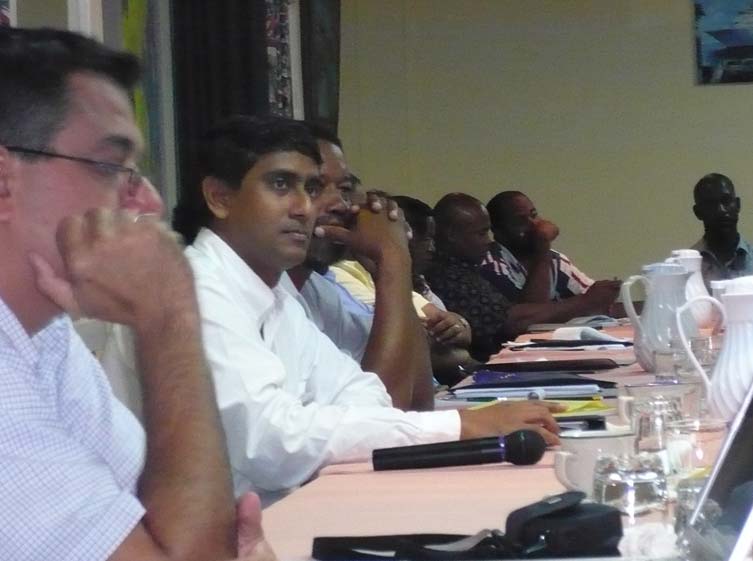
Based on the workshop agenda (Appendix 1), the workshop began with a short opening ceremony chaired by Ms.
Donna Spencer, the Communications, Networking, and Information Specialist at the IWCAM PCU. Ms. Spencer
welcomed all the workshop participants and thanked them for accepting the invitation to participate in the workshop.
She explained that Invitations had been extended to the National Focal Points in each Participating Country to
nominate a suitable person, as well as to persons from each PC who had responded to the questionnaire. Among
those participating were GIS generators and users as wel as decision-makers. This should be a good combination
for discussion of the way forward.
The opening remarks were made by Mr. Vincent Sweeney, the GEF-IWCAM Regional Project Coordinator who
welcomed the participants and gave a brief background to the Project. Following the opening ceremony, Dr. Jacob
Opadeyi made a presentation on the technical components of the draft GIS Roadmap. He was followed by Mr. Emil
Cherrington who presented the institutional components of the draft GIS roadmap. The two presentations were wel
received and followed by a question and answer session.
At the end of the formal presentations, Ms. Spencer introduced the working group sessions to the participants. The
participants were divided into three groups: A, B, and C and the working group guidelines (Appendix 2) were
explained to all participants.
3
The working groups worked on two topics: 1) review and modification of the draft roadmap and; 2) the review of how
GIS could be used in the Demonstration Projects. The reports of the working groups on each of these topics were
presented in he plenary sessions and are to be found in Appendices 3 and 4 respectively.
After receiving and discussing the reports of the working groups, participants went into a session aimed at charting
the way forward. The workshop participants made a number of recommendations provided in section 3 of this report.
The workshop ended on a high note with participants feeling productive and pleased to have contributed to the
IWCAM project. The list of workshop participants is in Appendix 5.
3.0 List of Recommendations made at the workshop
The following are the recommendations made by participants of the workshop:
Ě There is a need to document the GIS success stories / best practices in the Caribbean
Ě "Spatially enabling data col ection ş the demonstration projects should ensure all data collected are geo-
referenced using GPS receivers;
Ě There is a need to develop formal protocol for data col ection throughout the IWCAM project so as to
facilitate regional analysis and enable GIS
Ě Training in use of GPS and the integration of such data with GIS should be considered; thus there is a need
to acquire GPS receivers for demo projects.
Ě The relevance of GIS to the application of indicators / baselines should be investigated; IWCAM already has
a consultancy for the development of a framework for indicators
Ě There is a need for regional coordination of GIS activities across the Caribbean
Ě The need to embed GIS into national activities ş leveraging?
Ě The role of private sector and educational institutions in supporting GIS development should be enhanced.
Ě Regional col aboration in leveraging GIS resources should be explored (e.g. acquisition of new data)
Ě A regional data integration mechanism should be explored (e.g. common Caribbean datum?) and the
responsibility assigned to a regional focal institution(s).
Ě Various regional projects to support GIS mainstreaming should be leveraged (e.g. through use of the
IWCAM demo projects in countries with demo projects)
Ě There is a need to involve various national stakeholders in the GIS mainstreaming process
Ě The IWCAM Steering Committee should consider how funding resources might be al ocated to GIS activities
Ě There a need to identify a specialist group which can work with country demos to ensure that GIS is being
integrated into projects?
Ě Awareness of GIS should be created at CARICOM Ministerial level (designating person); the development
of a concept paper would be useful
Ě The IWCAM Project's informal GIS working group should be strengthened as a regional advisory body.
Ě The possibility of a likely follow-up meeting to be held in Cuba in September should be explored.
Ě Demonstration projects should have plans for sustainability / replicability
Ě There is a need to design and develop a common digital database for watershed management in the
Caribbean
Ě There is a need for a homogenized land cover / land use dataset for demonstration projects / PCs
Ě Opportunities for project networking and expert exchanges should be encouraged.
Ě IWCAM support for capacity-building activities, particularly in the area of environmental monitoring should
be considered ş can a few people be trained at Master's degree level in IWRM?
Ě The process needs to be guided by priorities identified by the national focal points
Ě Efforts should be made to obtain lists of groups of experts involved in GIS in the Caribbean (URISA,
IWCAM, etc.)
Training courses in areas listed below would also be useful:
Ě Use of GPS
Ě Training on metadata standards
4
Ě Groundwater / surface water modeling / monitoring
Ě GIS application development
Ě Integrated water resource management
Appendix 1: Workshop Agenda
5
AGENDA
Thursday 5 July - Day I:
Time
Activity
Responsibility
08:30-9:00
Registration
PCU
Administration
09:00-09:15
Opening
Remarks
Vincent
Sweeney,
Regional
Project Coordinator, IWCAM;
Ministry of Agriculture,
Forestry and Fisheries,
Dominica; Donna Spencer,
CNIS, IWCAM
09:15-10:15
The Road Map: Technical Components
Jacob Opadeyi, Consultant
10:15-10:45
The Road Map: Institutional Components
Emil Cherrington, Consultant
10:45-11:15
BREAK
11:15-12:45
Working Group Sessions
12:45-13:45
LUNCH
13:45-14:45
Working Group Sessions
14:45-15:00
BREAK
15:00-16:30
Working Group Sessions
Friday 6 July - Day II:
Time
Activity
Responsibility
08:30-09:30
Presentation of Working Group A Report and Discussion
Group A Rapporteur
09:30-10:30
Presentation of Working Group B Report and Discussion
Group B Rapporteur
10:30-11:00
BREAK
11:00-12:00
Presentation of Working Group C Report and Discussion
Group C Rapporteur
12:00-13:00
LUNCH
13:00-15:00
Plenary and Recommendations
Emil Cherrington and Jacob
Opadeyi
15:00-15:15
BREAK
15:15-15:45
Way Forward Jacob Opadeyi and PCU
15:45-16:00
Closing Vincent Sweeney
6
Appendix 2:
Working Group Guidelines
7
Working Group Guidelines
The intention of this two-day regional workshop and consultation is to bring together key stakeholders in
GIS and watershed management in the Caribbean to gain consensus on the development, use, and
management of GIS in the region. The workshop has been structured to include plenary discussions and
working group sessions in an effort to encourage dialogue among participants. Three working group
sessions are proposed. Each would handle at least one of the seven elements of road map as indicated
below:
Working Group Discussion Topics
A
1. Comprehensive needs assessment
2. Acquisition and management of data and databases
6. Development and management of institutional environment
B
3. Acquisition and management of technological resources
4. Development and management of human capacity
C
5. Development of products and services
7. Continuous monitoring and evaluation of the system
The first task for each of the working group sessions is to assign a Facilitator and a Rapporteur. The
facilitator manages the working group discussions to ensure that the discussion focuses around relevant
themes and key issues, stimulates participants through provocative questions and searches for consensus
on conclusions and recommendations. The facilitator should also actively encourage participation by all
participants. The Rapporteur will take notes on the findings of the working group session and present a
report to all workshop participants in the plenary session.
Each working group should first review the elements of the draft road map assigned to them and comment
on the appropriateness of the objective, issues, assumptions, and recommendations contained therein.
This should then be followed by suggestion on how to improve the draft road map towards effective
mainstreaming of GIS in the region. The working group may also suggest changes and propose a national
implementation plan. Specific recommendations should be made for presentation at the plenary session.
Adequate time has been provided for the working group and plenary discussions; however, to make
maximum use of the time available, participants are encouraged to:
Ě Review draft Mainstreaming Road Map prior to the workshop and identify refinements needed;
Ě Be considerate of other participants by not interrupting them or engaging in "side" conversations;
Ě Avoid "stories" when participating; be concise in providing comments, formulating questions, or
when making recommendations to the group; and,
Ě If you can, turn off cell phones during the workshop.
At the Plenary Working Technical Session, each working group will present the summary of their
discussion, recommendations, and seek consensus.
8
Appendix 3:
Working Group Reports: GIS Roadmap
9
Working Group Reports: GIS Roadmap
Working Group A: Components 1, 2, 6
Overview of Road Map:
Map is comprehensive and a number of key steps have been highlighted, however most of the members
expressed difficulty in reading the points. Key points were there but not easy to follow. The group engaged
in lengthy discussions on components 1, 2 and 6 and while a number of issues/concerns were raised,
repeated reviews revealed that most of these elements were already covered in the document.
1. Comprehensive needs and requirements assessment (p. 11 ş 14):
Ě Identification of critical success factors:
i.
Comprehensive review of strategies implemented by similar countries/SIDS (Fiji islands)
and analyse lesson learned.
2. Acquisition and Management of data and databases (p. 14 ş 17):
Ě Section is well laid out.
Ě Suggestion to rephrase second line item ` availability of medium-resolution and large
format scanner' to " Availability of specialized equipment" (Item is not a critical factor as
institutions may be at various stages with respect to GIS)
3. Development of end-user applications, products and services (p.22 ş 24):
Ě Activities, Methods and Options: (Add) - Develop user-friendly interface ( recognizing that end
users differ in term of needs i.e. decision- makers versus technical users so a user friendly
interface would bridge the gap)
Ě Challenges in Developing GIS Applications: (Add) Availability of funds
Ě Outputs and Outcomes
- Suggested list of GIS Applications-
1. Coastal Water-Quality Modelling -
2. Monitoring species abundance as it relates to the protection of important species in watershed
areas.
Discussion:
The Group recognized a number of common issues among the various countries with respect to the
implementation of GIS at a national level. These included:
- While GIS exists at the institutional level, there is a lack of overall national GIS strategies in
Participating Countries Haiti and Cuba highlighted mechanisms employed in order to tackle
this issue.
- Some countries also lack the resources to train people in GIS.
- There is also an overall lack of understanding of the uses of GIS for the management of critical
resources.
- The project-approach mechanism has also resulted in the redundancy of GIS applications
once the project is complete.
The suggestion therefore is to adopt a systematic approach to the implementation of GIS. Before
conducting a needs assessment, there needs to a public education campaign where real examples are
10
used and a process of implementing GIS and its use is simulated. This would demonstrate that GIS can
help in making decisions with respect to the management of the resource under review.
Working Group B: Components 3 and 4
I. Acquisition and management of technological resources (p. 17):
Goals and Objectives
Identify, acquire and manage available technologies that can adequately cater to the GIS needs of all stakeholders
thereby enhancing the region's capacity.
The following are the objectives to be fulfil ed:
Ě Allow for easy access to technological resources.
Ě Elimination of barriers to the transfer of data across national agencies and end-users.
Ě Facilitate a coordinated approach towards resource management and information dissemination.
Activities, Methods and Options
Explore free and open source GIS packaging
Outputs and Outcomes
Ě Data acquired through legal licence.
Ě Centralized institution created or identified for National GIS management (establish data securities, inform
information policies, data integration, data dissemination)
Ě Established integrated network to support the center (database servers, IT requirements)
Ě Development of a national GIS policy or framework
Critical Success Factors
Ě Selection of applicable and adaptable technologies.
Ě Easy access and transfer of data
Ě Institutionalized funding mechanism.
Ě Increase awareness of GIS benefits to the public with the aim of applying pressure on the government to
make it a priority
11
Component II: Development and Management of Human Capacity (p. 18 ş 20):
The consultant provided adequate guidance on human capacity enhancement, however though priorities would be
country specific the group identified several common areas of priority.
No.
Training Options Low priority
Medium
High
Comments
priority
priority
1 E-training
Separate
e-training
from
classroom training. E-training is
too individual dependent.
2 Regional
Participation
3 Short courses:
Courses
focused
on
Thematic
understanding the principles, not
mapping,
necessarily end user applications
metadata stds,
alone
GIS principles
4 Technician
level
Should be done simultaneously
training &
management
training
5 Retain
Trained
Provide sense of
Staff
accomplishment, keep the job
chal enging by creative thinking
projects
Critical success factors
Ě Demonstrated avenue for money generation using GIS
12
Working Group C: Component 5 and 7
Component V: Development and management of institutional environment (p. 20-22)
4.5.1 Goals and objectives
To identify [...] for effective inter-sectoral coordination of GIS
4.5.2 Activities, Methods and Options
a. Identification of tools, methods and resources [...]
b. Development of action plans using any of the following approaches as deemed applicable
Political Support
Awareness building seminars and pilot projects are complimentary (pilot projects utilized as a
demonstrated application)
Frame priority issues in a political context ş speak the language of politicians
"Selling" GIS applications as means for national compliance and standardized reporting
frameworks for international agreements
Managerial Support
Workshops and seminars (including awareness building seminars)
Newsletters and various online resources including user groups, discussion boards
Establishment of a National coordination inter-sectoral committee or use of existing coordinating committee
(dependant on the climate/culture in the individual countries)
Committee must have decision-making capabilities
Regulatory and legislative support
Establishment of department/clearing house/central repository for GIS (dependant on the level of
development, use and need of various countries) with clearly defined roles for all participating entities
Development of legislation for geospatial information management
Financial support
Projection of sales and revenues - including self-sustaining mechanism for cost-recovery
Capital budget for acquisition of data
Recurrent budget for maintenance of data
Public support
Fostering private sectors partnerships to create relevant applications for private and public sectors
Introduction of GIS from primary to tertiary school curricula
4.5.3 Outputs and Outcomes
List of critical [...] for GIS development, implementation and use across the countries from
project to national level domain
Typo "winning"
4.5.5 Identification of critical success factors
Demonstrated efficiency instead of "doing more with less"
13
Component VII: Monitoring and evaluation (p.24-25)
4.7.1 Goals and objectives
To develop [...] tools, methods and strategies that guide GIS implementation and continued
application
4.7.2 Activities, Methods and Options
Continuous monitoring and evaluation of the system and its components
Development [...] parameters including milestones and benchmarks
Identification of corrective or remedial actions to allow for refocusing were needed
a. Currency, accuracy and coverage of data
b. Development of monitoring tools, timelines ...
4.7.5 Identification of critical success factors
Some of the measurable parameters should be outlined possibly in tabular format (types of
benchmarks /indicators that can be utilized in M&E)
Recommendations: Workplan
Need for a decision tree to outline the major components of the roadmap and the feedback mechanisms
inherent in the process
Addition of a section outlining "best practices"/success stories in the Caribbean region
Need for common reporting methodologies especially for reporting under international agreements
Bridging the gap between the roadmap and the next level of implementation for each country
Need for a champion and leaders
14
Appendix 4:
Working Group Reports: Demonstration Project
15
Working Group Reports: Demonstration Project
Working Group A
Cuba's Demonstration Project: Application of IWCAM Concepts at Cienfuegos Bay and Watershed
Main environmental problems:
1. Pollution of freshwater systems (2 main rivers), domestic water supply and Bay area (tourist spot).
These result from increased contamination by organic wastes from surrounding industrial areas,
soil run-off and pesticide contamination.
2. Overfishing also affected the overall biodiversity of the watershed.
Stakeholders: Many institutions are associated with the bay and hold important data. The process of
monitoring the movement of pollutants from the watershed area into the bay has been active for 20 years.
20 years of data are available in manual and digital formats. The important issue here is the format in which
the data is stored and its capability for conversion.
Data types:
Land use, water quality indicators (pH, flora etc.), erosion, and sedimentation rates
Constraints/Challenges
1. Software and Hardware availability
2. Human Resource
3. Various stages of GIS development/use among stakeholder institutions.
4. Need for roadmap in order to implement GIS
Needs: (from IWCAM)
Overall needs are for IWCAM to facilitate technical cooperation (training, tools) with more advanced
Caribbean countries and regional initiatives and provide technological support.
Working Group B:
I. Demonstration Project ş Trinidad and Tobago
Buccoo Reef Trust (NGO). Aim is coral reef preservation from contributing factors such as bleaching,
human activities, nutrient loading, and sedimentation.
1. Wider concern is Ridge to Reef effect within the watershed and coastal zone.
II. Demonstration Project ş Antigua and Barbuda
Waste Water Management (Treatment Facility) needed for St. John's Harbor. Aim is to use the Best
Available Technology (BAT) and build local capacity. GIS application in ambient water quality data
collection, Socio-economic studies (demographic disruptions). Plan to hire a GIS consultant.
III Demonstration Project ş Bahamas
Two demo projects:
16
1. Exuma ş One of the smaller islands. Introduction of a Wastewater Treatment Facility (partner with
Clear Water Utilities) to treat demand from Regata activities. GIS application- ambient water quality
baseline information
2. Andros ş One of the larger islands, 80% wetlands. The development of Land Use and Zoning Plan.
IV Demonstration Project - Dominican Republic
Collaboration between the Ministry of Environment and the University of Santo Domingo to explore the
levels of contamination in the watershed looking at the main contributors (Industrial Zone) of pollution. Aim
is to educate the public as well as the industrial operators.
General Lessons Learnt for Positive Approach:
1. A clearly defined GIS strategy e.g. Research project personnel should make pol ution source trace
areas of research.
2. Incorporation of early learning (Secondary school level) and professional learning (Tertiary level) in
the application of GIS to conserve the Reef system (Citizen Science)
3. Dissemination of results via website, newsletters, science journals.
4. Ensure you have the technological capacity for the job at hand.
5. Each Demo project PC should assist others e.g. georeferencing techniques using GPS, creation of
data dictionaries, use of metadata standards such as ISO.
6. Obtain advice of how to col ect data that can be imported successfully into a GIS
Working Group C:
Demo Projects: Recommendations
Vincent asked: How can we (PCU) assist with meaningful GIS application in the projects?
Make sure data from baseline surveys is GIS compatible and that any modeling exercises can fit into GIS
(take GIS beyond just mapping)
Need for technical exchange with other countries
St. Kitts with Barbados & Jamaica in terms of groundwater monitoring and modeling
As an output of IWCAM, development of a common framework for groundwater monitoring and
assessment for the region
Need for specialized regional GIS training to overcome short-term capacity issues and to help build long-
term capacity
Long term objective ş legislative reform and policy setting
Use of GIS for public awareness initiatives and advocacy, especially above and beyond the IWCAM project
17
Appendix 5:
List of Participants
18
GEF- IWCAM Regional GIS Workshop 5 ş 6 July 2007,
Roseau, Commonwealth of Dominica
Countries
ANTIGUA
AND
Melesha Banhan
Hastin Barnes
BARBUDA Environment Officer/Technical
Water Planning Engineer
Assistant, IWCAM
Antigua Public Utilities Authority (APUA)
Environment Division
Cassada Gardens
Ministry of Tourism, Civil Aviation,
St. John's
Culture and the Environment
ANTIGUA AND BARBUDA
1 Prime Minister Drive
Tel: 268 ş 480 ş 7256
St. John's
Fax: 268 ş 462 ş 4233
ANTIGUA AND BARBUDA
E-mail: hastin@apua.ag or
Tel: 268 ş 562 ş 2568
kemba_barnes2000@yahoo.com
Fax: 268 ş 462 ş 4625
E-mail: m_banhan@yahoo.com
BH
Rochelle Newbold
GEF-IWCAM Project Manager
BEST Commission
Nassau Court
Nassau
The BAHAMAS
Tel: (242) ş 322 ş 4546
Fax: (242) ş 326 ş 3509
E-mail: bestnbs@hotmail.com
BA
Alex Ifill
Dr. Leo Brewster
Water Quality Technologist
Director
Barbados Water Authority (BWA)
Coastal Zone Management Unit (CZMU)
3 Spring Garden
Bay Street
St. Michael
St. Michael
BARBADOS
BARBADOS
Tel: (246) ş 425 ş 9110/1/2
Tel.: (246) ş 228 ş 5955
Fax: (246) ş 425 ş 9121
Fax: (246) ş 228 ş 5956
Mobile : 246-253-4469
E-mail: director@coastal.gov.bb
E-mail: alex.ifill@bwa.bb
19
CUB
Alain Mu˝oz Caravaca
Lorenzo Brito Galloso
Scientific Director
GIS Specialist
CEAC-CITMA
CIGEA ş CITMA
AP 5 CP 59350
Calle 20
Cienfuegos
Esq. 18-A
CUBA
Miramar, Playa
Tel: 53043965146
Ciudad Habana
Fax:
CUBA
Mobile : 5352631123
Tel.: (537) ş 202 ş 9351
E-mail: alain@ceac.cu
Fax.: (537) ş 204 ş 9031
E-mail: lorenzo@ama.cu lor01@yahoo.com
Marlen Perez Hernandez
Orleßns Garcia Fuentes
RAC-CIMAB Technical Specialist
RAC-CIMAB Technical Specialist
Centre of Engineering and
Centre of Engineering and Environmental
Environmental Management of Bays
Management of Bays and Coasts (CIMAB)
and Coasts (CIMAB)
Carretera del Cristo No. 3
Carretera del Cristo No.3.
Esq. Tiscornia
Esq. Tiscornia
Casablanca
Regla.C.
Regla.C
Habana
Habana
CUBA
CUBA
Tel.: (537) ş 862 ş 4387
Tel.: (537) ş 862 ş 4387
Fax.: (537) ş 866 ş 9681
Fax.: (537) ş 866 ş 9681
E-mail: marlen@cimab.transnet.cu
E-mail: orleans@cimab.transnet.cu
Mp42oale@yahoo.com.ar
DO
Ronald Charles
Andrew Magloire
Assistant Forest Officer
Chief Fisheries Officer
Forestry, Wildlife and National Parks
Fisheries Division
Division
Ministry of Agriculture, Fisheries, and the
Ministry of Agriculture, Fisheries, and
Environment
the Environment
Botanical Gardens
Botanical Gardens
Roseau
Roseau
COMMONWEALTH OF DOMINICA
COMMONWEALTH OF DOMINICA
Tel.: (767) ş 266 ş 3817; (767) ş 448 ş 2401
Tel.: (767) ş 266 ş 3817; (767) ş 448 ş
Fax: 767 448 0140
2401, Ext. 3817
E-mail: fisheriesdivision@cwdom.dm
Fax.: (767) ş 448 ş 7999
E-mail:
forestofficerprotection@cwdom.dm
DR
Juan Felipe Ditren Flores
Mariana PÚrez Ceballos
Nacional Focal Point
Directora de Informaciˇn Ambiental y de
Secretaria de Estado de Medio
Recursos Naturales
Ambiente y Recursos Naturales
Secretaria de Estado de Medio Ambiente y
Av. 27 de Febrero Esquina Tiradentes
Recursos Naturales
Plaza Merengue
Ave. Presidente Gonzßlez
Santo Domingo
Esquina Tiradentes
DOMINICAN REPUBLIC
Edificio La Cumbre
Tel.: (809) ş 472 ş 0626, ext. 250
Santo Domingo, D.N.
Fax.: (809) ş 472 ş 0631
DOMINICAN REPUBLIC
E-mail:
Tel.: (809) ş 472 ş 9510
sga.calidad@medioambiente.gov.do
Fax.: (809) ş 472 ş 7087
20
E-mail;
peremariana@gmail.com
Mobile : 809 501 2734
GR
Fabian Purcell
Planning Technologist
Physical Planning Unit
Ministry of Economic Planning &
Development
The Carnage
St. George's
GRENADA
Te: 473 440 2471/4635
ppu@spiceisle.com
/fmpurcell@netscape.net
HA
Paul Judex Edouarzin
Gina Porcena Meneus
Director of Awareness and Education
Directrice GÚnÚrale
Ministry of Environment
Centre Nacional de l'Information Geo-Spatiale
181 Haut Turgeau/Ave. Jean Paul II
4, Rue Faustin 1er
Port au Prince
Port-au-Prince
HAITI
HAITI
Tel : 509 245 0504/509 458 2750
Tel.: (509) ş 464 ş 6462; (509) ş 244 ş 9982
Fax : 509 245 7360
Fax : 509 245 5072
E-mail : judouarzin@yahoo.fr
E-mail: gporcena@yahoo.com
Mobile : 509 777 1910
Mobile : 509 464 6462
JA
Cecille Blake
National GIS Coordinator/Senior Director
Ministry of Agriculture and Lands, Spatial Data Management Division
191 Old Hope Road, Kingston 6, JAMAICA
Tel.: (876) ş 970 ş 0953
Fax.: (876) ş 702 ş 4565
E-mail: csblake@moa.gov.jm or cblake@cwjamaica.com
Mobile: 876 817 1950
SKN
M. Rene Walters
Dr. Halla Sahely
Physical Planning Officer
Assistant Water Engineer
Department of Physical Planning,
St. Kitts Water Services Department
Natural Resources and Environment
P.O. Box 80
Eulalie Building
Needsmust
Main Street
Basseterre
Charlestown
ST. KITTS AND NEVIS
ST. KITTS AND NEVIS
Tel.: (869) ş 466 ş 3070/1467/2485
Tel.: (869) ş 469 ş 5521, Ext. 2140
Fax.: (869) ş 466 ş 7901
Fax.: (869) ş 469 ş 7137
E-mail: halla@sahely.com
E-mail; corundum@hotmail.com or
renewalters@gmail.com
SLU
Vincent JN Baptiste
Rebecca Rock
Deputy Chief Surveyor
Officer in Charge ş Forestry Department GIS Unit
Survey and Mapping Unit
Ministry of Agriculture, Forestry and Fisheries
Ministry of Physical Planning
Sir Stanislaus James Building
P.O. Box 709
Waterfront
Castries
Castries
SAINT LUCIA
SAINT LUCIA
21
Tel.: (758) ş 468 ş 4492; Cell.: (758) ş
Tel.: (758) ş 450 ş 2231
584 ş 3695
Fax.: (758) ş 450 ş 2078
Fax.: (758) ş 451 ş 6958
E-mail: rock-rebecca@hotmail.com
E-mail: v_baptiste@hotmail.com
SVG
Janeel Miller
Corliss Murray
Environmental Officer/National Ozone
Land Surveyor
Officer
Physical Planning Unit, National Geographic
Ministry of Health and the Environment
Information System (NGIS)
Ministerial Complex
Paul Over
Kingstown
Kingstown
SAINT VINCENT AND THE
SAINT VINCENT AND THE GRENADINES
GRENADINES
Tel.: (784) ş 450 ş 0581
Tel.; (784) ş 485 ş 6992
E-mail; corliss_m@hotmail.com
Fax.: (784) ş 475 ş 2684
E-mail: janeelmiller@hotmail.com
Mobile: 784 454 6719
T&T
Shawn Garcia
Kamau Akili
Compliance Officer
Tobago Council for
Environmental Management Authority
Sustainable Development
(EMA)
Deputy Coordinator
8 Elizabeth Street
Office of the Chief Secretary
St.Clair
Tobago House of Assembly
Port of Spain
P.O. Box 5664
TRINIDAD AND TOBAGO
Scarborough
Tel.: (868) ş 628 ş 8042
TRINIDAD AND TOBAGO
Fax.: (868) ş 628 ş 9122
Tel: 868 660 7259
E-mail: sgarcia@ema.co.tt
Fax:868 660 7467
Mobile: 868 788 7992
E-mail: kakili@tstt.net.tt
Mobile: 868 796 0999
Vijay Datadin
GIS Specialist
Buccoo Reef Trust (BRT)
Cowie's Building
Carnbee Junction
Auchenskeoch Road
Carnbee
TRINIDAD AND TOBAGO
Tel.: (868) ş 636 ş 2000 or (592) ş 624
ş 4733
Fax.: (868) ş 639 ş 7333
E-mail: v.datadin@buccooreeftrust.org
Mobile : 868 324 0628
Consultants
Dr. Jacob Opadeyi
Emil Cherrington
Consultant/Coordinator,
Consultant
Centre for Geospatial Studies CAPNET
Water Center for the Humid Tropics of Latin
Faculty of Engineering
America & the Caribbean (CATHALAC)
The University of the West Indies
City of Knowledge
St. Augustine, Trinidad and Tobago
Panama City, Panama
Tel: 868 662 2002 ext. 3313
Te: (507) 317-1640
Fax: 868 663 7383
Fax: 507) 317-0127
Mobile: 868 777 7233
E-mail: emil.cherrington@cathalac.org
22
E-mail: jopadeyi@hotmail.com
International/Regional Organisations
UNEP/CAR/
Nadia-Deen Ferguson
RCU
Assistant Programme Officer (AMEP), UNEP CAR RCU
14 ş 20 Port Royal Street, Kingston, JAMAICA
Tel.: (876) ş 922 ş 9267 ; Fax.: (876) ş 922 ş 9292
E-mail: ndf.uneprcu@cwjamaica.com
IABIN
Dionne Newell
Senior Research Officer ş Entomology
IABIN National Focal Point, Natural History Division, Institute of Jamaica
10 ş 16 East Street, Kingston, JAMAICA
Tel.: (876) ş 922 ş 0620-6
Fax.: (876) ş 922 ş 1147
E-mail: zoology.nhd@cwjamaica.com
CEHI Christopher
Cox
Senior Programme Officer
Caribbean Environmental Health Institute (CEHI)
P.O. Box 1111, The Morne, Castries, SAINT LUCIA
Tel.: (758) ş 452 ş 2501
Fax.: (758) ş 453 ş 2721
E-mail: ccox@cehi.org.lc
GEF-IWCAM Project Coordinating Unit
GEF-
Vincent Sweeney
Donna Spencer
IWCAM
RTAG Nominee
Communications, Networking, and Information
PCU
Regional Project Coordinator,
Specialist
UNEP/IWCAM
GEF-IWCAM Project Coordination Unit
GEF-IWCAM Project Coordination Unit
C/O Caribbean Environmental Health Institute
C/O Caribbean Environmental Health
The Morne, P.O. Box 1111
Institute, The Morne, P.O. Box 1111
Castries, ST. LUCIA
Castries, ST. LUCIA
Tel: 758 452-2501, 452-1412
Tel: 758 452-2501, 452-1412
Fax: 758 453-2721
Fax: 758 453-2721
Email: dspencer@cehi.org.lc
E-mail: vincent.sweeney@unep.org
Sasha Beth Gottlieb
Una McPherson
Technical Coordinator
Administrative Officer
GEF-IWCAM Project Coordination Unit
GEF-IWCAM Project Coordination Unit
C/O Caribbean Environmental Health
C/O Caribbean Environmental Health Institute
Institute
The Morne, P.O. Box 1111
The Morne, P.O. Box 1111, Castries
Castries
ST. LUCIA
ST. LUCIA
Tel: 758 452-2501, 452-1412
Tel: 758 452-2501, 452-1412
Fax: 758 453-2721
Fax: 758 453-2721
Email: sgottlieb@cehi.org.lc
E-mail: una.mcpherson@unep.org
Magnalia Goldson
Bilingual Administrative Assistant
GEF-IWCAM Project Coordination Unit
C/O Caribbean Environmental Health
Institute. The Morne, P.O. Box 1111
Castries, ST. LUCIA
Tel: 758 452-2501, 452-1412
Fax: 758 453-2721
Email: mgoldson@cehi.org.lc
23