


Caribbean WaterWays
Newsletter of the GEF IWCAM Project
Volume 1, Issue 3
September 2007
In this issue:
Feature Article:
· Feature: A Partici-
PROJECT AREA
patory Approach
to Watershed Man-
A Participatory Approach to
agement: The
Drivers River Wa-
Watershed Management:
tershed, Jamaica
The Drivers River Watershed,
(pgs. 1,2,3)
Jamaica
· Background on the
IWCAM Project (pg.
Background
2)
Jamaica's Global Environment Facility-
· From Awareness
funded Integrating Watershed and
to Action (pg. 4)
Coastal Areas Management (GEF-
Project area highlighted in red dots
IWCAM) Demonstration Project, the
· Key Interventions
of the GEF-IWCAM
Driver's River Watershed Management
Demonstration
Area, is geared towards development
Project--Jamaica
and implementation of a model Water-
(pg. 4)
shed Area Management Mechanism
(WAMM) for Eastern Portland that incor-
· GIS in Support of
porates the lessons and experiences
Planning for Wa-
gained in other Watershed Management
tershed and
Units and Small Island Developing
Coastal Areas
Management (pgs.
States.
5, 8)
The overall degradation of the environ-
· Partnership at the
ment in the parish of Portland, Jamaica
National Level:
has resulted in growing concerns for its
NICs (pg. 6)
proper management. Environmental chal-
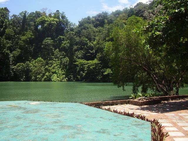
The Blue Lagoon
lenges are rooted in a number of interre-
· Partnerships at
lated causes, which have physical, socio-
Work (pg. 6)
economic and institutional dimensions.
The Drivers River Watershed Manage-
· GEF 4th Biennial
ment Unit is classified as the least de-
International Wa-
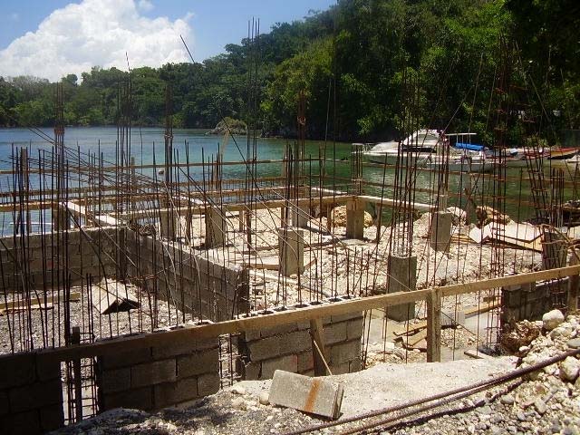
Sites of
graded watershed in the parish of Port-
ters Conference
interest in
land. It was chosen for the demonstra-
(pg. 7)
the Driv-
tion project as it was considered ideal for
ers River
· GEF-IWCAM Re-
Project
the introduction of interventions towards
gional GIS Work-
Manage-
preventing further degradation and for
shop (pg. 7)
ment
establishing a model Watershed Area
Area,
Management Mechanism (WAMM).
· GEF-IWCAM Dem- Portland,
onstration Project Jamaica
The project started off with reconnais-
Status Update (pg.
sance visits to the watershed by the Pro-
7)
ject Management Team to give them
(Continued on page 2)
www.iwcam.org
2
IWCAM Caribbean WaterWays Newsletter
(Continued from page 1)
greater insight into existing issues. Environmental
challenges to be addressed through project interven-
tions include:
· inappropriate garbage disposal,
· unapproved development along the coast-
line,
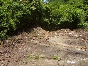
Destruction of wetland areas
· dumping of wetlands and agricultural activi-
ties along waterways,
· poor disposal of sewage.
Participatory Strategic
The Demonstration Project utilized a participatory
approach from the outset to shape its work plan. The
Planning Process
project employed a two-way process of dialogue,
negotiation and decision-making between project
staff and watershed stakeholders. This process has
proven to be inclusive and helpful and will continue
1. Current Reality Dialogue
An assessment of the current situation
to play an integral role in the project.
2. Shared practical Vision
A practical Vision of the desired future
3. Underlying Obstacles
Analysis of issues that are blocking process
4. Strategic Actions
Proposed priority action arenas to move ahead
Illegal construction along coastline
5. Implementation Planning
Three consultations were held over a two-month
Detailed plan to carry out the new strategy
period. They provided invaluable insight into the is-
sues impacting the project location and anticipated
outcomes resulting from project interventions.
BACKGROUND ON THE IWCAM PROJECT:
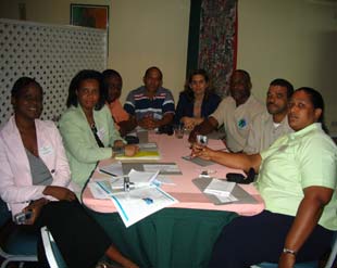
Consultation I: The Project Management Team
presentation to, and meeting with, the Portland
The Integrating Watershed and Coastal Areas Management in Caribbean Small
Parish Development Committee at the Portland
Island Development States (IWCAM) Project, with a value of USD 112 million,
Parish Council, May 31, 2007.
was approved by the Global Environment Facility (GEF) in May 2004. Imple-
menting agencies are the United Nations Environment Programme (UNEP) and
the United Nations Development Programme (UNDP). Executing agencies are
The Portland Parish Development Committee of the
the Secretariat of the Cartagena Convention (UNEP-CAR/RCU) and the Carib-
Portland Parish Council is the local government gov-
bean Environmental Health Institute (CEHI) and the UN Office of Project Ser-
ernance mechanism for community involvement.
vices (UNOPS). The thirteen participating SIDS are: Antigua and Barbuda, The
Bahamas, Barbados, Cuba, Grenada, Dominica, Dominican Republic, Haiti,
The objectives of this consultation were to:
Jamaica, Saint Kitts and Nevis, Saint Lucia, Saint Vincent and the Grenadines,
and Trinidad and Tobago. The length of the Project is 5 years and commenced in
· introduce the Parish Development Committee to
the second quarter of 2005. The Project Coordinating Unit is located at the CEHI,
the GEF-IWCAM Project;
as agreed by the Implementing and Executing Agencies and the participating
countries.
· pave the way for stakeholders' participation;
(Continued on page 3)
www.iwcam.org
3
IWCAM Caribbean WaterWays Newsletter
(Continued from page 2)
of organizations inclusive of public sector, private
· acquire background information on the water-
sector, NGOs and community-based organizations.
shed and how its management can fit into the
The workshop objectives were to:
local government process.
· invite participation in the Demonstration
Ownership of project interventions and the subse-
Project work planning process;
quent outputs and outcomes were successfully pro-
· position the group to arrive at decisions/
moted. Stakeholders pledged their participation and
proposed actions which are owned by
insisted that the process of incorporating their inputs
the stakeholders;
continue throughout the implementation phase.
· develop a work plan that takes into con-
sideration the realistic expectations of
Consultation II: The Project Management Team
participants, and promotes ownership of
met with the Portland officers of the Executing
process, outputs and responsibility for
Agency, the National Environment & Planning
outcomes.
Agency (NEPA), May 31, 2007.
Diagram I on page 2 summarizes the process that
Meeting objectives were to:
was used to engage participants in a strategic plan-
· discuss issues within the Drivers River
ning process at the stakeholders' workshop. Work-
Watershed;
shop activities followed all five steps of the Participa-
· discuss strengthening the capacity of
tory Strategic Planning Process: current reality dia-
NEPA, Portland in an effort to promote
logue; shared practical vision; underlying obstacles;
sustainable watershed and coastal area
strategic actions; and implementation planning. Par-
management;
ticipation in the entire workshop was excellent.
· identify key stakeholders for inputs and
assistance with the GEF-IWCAM project.
All three consultations achieved their objectives,
enabling the Project Management Unit to prepare the
The consultation helped the Project Management
Final Draft of the Work Plan and the Budget. The
Unit to identify areas of critical concern within the
following issues were also resolved:
study area as well as what can be done by GEF-
IWCAM to strengthen sustainable watershed man-
1. Agreement on project location, as the project
agement in the area.
document was inconsistent in defining the study
area.
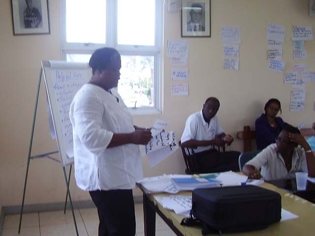
Consultation III: Drivers River Stakeholders
2. Establishment of a stakeholders working group
Workshop, June 27, 2007
that will guide the project.
3. Identification of groups in need of capacity
Seventeen persons participated in the Workshop
strengthening.
4. Identification of critical needs (relating to water-
shed management) to be addressed.
5. Establishment of a relationship with relevant
stakeholders within the Drivers River Watershed
Management Unit.
Participation of stakeholders will continue throughout
project implementation. The completed work plan
will be presented at another stakeholders' workshop
in September 2007 and the formal Project Manage-
ment Committee will have its first meeting soon after.
This article was provided by the GEF-IWCAM Jamaica
Participants in a stakeholders' workshop
Demonstration Project Management Unit.
which was held at the Portland Parish Council, Port
See Pg. 4 for key interventions made by this Demon-
stration Project.
Antonio. Participants were from a wide cross section
www.iwcam.org
4
IWCAM Caribbean WaterWays Newsletter
From Awareness to Action!
Key Interventions of the GEF-IWCAM
Demonstration Project - Jamaica
There are two international events taking place in Septem-
ber and October 2007 which have public education and
In consultation with stakeholders, several key interventions were agreed
awareness goals consistent with those of IWCAM and in
upon. These include:
which you may wish to participate in the future:
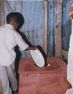
Community Sanitation Improvement
Approximately half of the
World Water Monitoring Day
total households within Driv-
ers River Watershed use pit
World Water Monitoring Day (WWMD), October 18, 2007, is
latrines and there are no
a global education and outreach event designed to promote
wastewater treatment sys-
personal stewardship and individual involvement in the protec-
tems in place. Secondary
information from the 2001
tion of world water resources. Participants conduct basic water
census revealed that of
quality monitoring tests and record their findings. The impor-
7,670 households, 3550
tance of monitoring water quality is stressed. The data collected
used pit latrines; statistics
through WWMD activities can give an annual snapshot of local
from the NGO Build Jamaica
water quality, and gives community groups, students, citizens,
Foundation indicate that 90%
and others the basic skills needed to participate in more formal
of basic schools have inade-
citizen monitoring programmes. Information collected from each
quate sanitary conveniences.
site over a number of years can provide insights into local water
The project will be replacing
Basic school pit latrine
quality trends over time. The website provides several useful
six pit latrines within schools
and communities with upgraded flush toilets and treatment systems
resources: media and community outreach templates which can
such as septic tanks and constructed wetlands. This intervention will
be adapted for local use; fact sheets on ground water; and, the
promote the social well being of beneficiaries as well as reduce water
Kid's Stuff features three books which teach about ground water
pollution.
and water pollution. Reports and summaries for past years,
including 2006 are also available.
Community Workshops and Training
Community training workshops will promote environmental awareness
Website: http://www.worldwatermonitoringday.org
in an effort to increase people's knowledge and awareness of the envi-
ronment as well as associated challenges. Training activities will seek
to develop the necessary skills and expertise to address the challenges,
encourage different attitudes, increase motivation and commitment so
The International Coastal Cleanup
that members of the community are able to make informed decisions
and take responsible action.
The 22nd Annual International Coastal Cleanup (ICC) will be
Mapping of community resources will also be used to identify commu-
marked on Saturday 15 September 2007. This is the largest
nity assets such as natural and manmade resources. For simplicity, the
one day event to clean oceans and waterways. The focus is on
community layout will be displayed on the ground using sticks, mud and
educating and empowering people to become a part of the ma-
stones. The main purpose of this exercise is for community members to
rine debris solution. In 2006, a total of 358,617 volunteers
appreciate assets that their community owns and to better understand
cleaned 34,560 miles of shoreline around the world.
the benefits to be derived from conservation.
All of the GEF-IWCAM Participating Countries, with the excep-
Transfer of Best Practices and Lessons Learned
tion of Cuba (which, as reflected in the 2006 Report, manages
Portland has had several projects, programmes and activities, which
to provide some data), are listed as international participants in
have attempted to address many of the same issues. Such projects
this activity which is coordinated worldwide by the Ocean Con-
include:
servancy (OC) operating out of Washington D.C.
1. The Ridge to Reef Watershed Project (R2RW)
2. The Coastal Water Improvement Project (CWIP 1 and 2)
Website: http://www.oceanconservancy.org/
3. Environmental Audits for Sustainable Tourism (EAST)
For more information on how to participate in ICC 2007, contact
Building upon lessons learned in previous interventions as well as docu-
your Country Coordinator. A complete list may be found on the
menting best practice is a fundamental aspect of the GEF-IWCAM
Project. As a result this Project will also seek to identify best practices
ICC website at:
from previous watershed management projects and community activi-
ties and implement them within the Drivers River Watershed.
http://www.oceanconservancy.org/site/DocServer/
Int_Coordinators.pdf?docID=1781
www.iwcam.org
5
IWCAM Caribbean WaterWays Newsletter
GIS in Support of Planning for Watershed and Coastal Areas Management
GIS technology is an important tool for integrated data analysis and management. Recognizing this, the GEF-IWCAM Pro-
ject decided to incorporate the use of GIS in various components. Mindful of the complexity and cost associated with effective and
efficient use of GIS, the Project commissioned the conduct of a detailed capacity needs assessment study that would guide the process
through development of a Road Map.
What are the benefits of GIS?
· integrated data storage and data retrieval capabilities.
· a more systematic approach for the collection of data.
· reduces the overall costs of data collection and management by facilitating data sharing among users.
· increases comparability and compatibility of diverse data sets.
· makes data accessible to a wider range of decision-makers.
· encourages the spatial analysis of environmental impacts that would otherwise be more easily ignored because of analytical diffi
culty or high cost.
· improves access to information and service to the general public
· supports the decision making process
· provides for effective communication on spatial issues
There are many examples of GIS applications relevant to watershed and coastal areas management:
Noise Pollution tracking and modeling
Environmental Impact assessment
Water Pollution tracking and modeling
Monitoring landslide occurrence
Air Pollution tracking and modeling
Hazard Risk analysis
Soil Pollution tracking and modeling
Non-point pollution analysis
Solid Waste management
Hydrological modeling
Flood hazard mapping and management
Sediment flow analysis
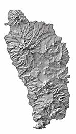
Hill-shaded map of Dominica
Coastal erosion modeling
Monitoring of af ected marine ecosystems (coral reefs)
Coastal Water-Quality Modeling
Monitoring species abundance as it relates to the protection of important
species in watershed areas.
The Road Map is based upon recommendations from the assessment which consisted of a desktop study which reviewed
the GIS capacity building activities in the Caribbean and a regional assessment of GIS capacity in the Caribbean as well as stakeholder
input via the Regional GIS Workshop (see page 7) which was held in Dominica in early-July. It consists of steps to be taken to bring
capacity up to a level where GIS data can be generated, manipulated and shared among Participating Countries within a common
framework. The actions to be implemented as a result of the assessment's recommendations would build data and information man-
agement capacity in participating countries and specifically at the level of the IWCAM Demonstration Projects.
The two background studies identified a number of common issues with respect to the implementation of GIS at a national level in
the region including:
· the lack of an overall national GIS strategy;
(Continued on page 8)
Examples of GIS products which may be offered to the public
GIS-assisted land use map
Drainage networks
Soil erosion potentials
Watershed boundaries
Transportation networks
Slopes and aspects
Digital elevation models
Water discharge points
Water quality sampling or monitoring
points
Trends in land use and land Waste disposal sites
cover
Flood hazard maps
Isoheytal maps
Depth of ground waters
Soil permeability
Special interest atlases
Land use maps
www.iwcam.org


6
IWCAM Caribbean WaterWays Newsletter
Partnerships at
Work
GEF-IWCAM Exhibit,
Innovation Market-
place, GEF 4th Biennial
International Waters
Conference, 31 July--3
August 2007
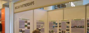
In a series of 6 posters
GEF-IWCAM's exhibit
described the types of
partnerships which are
fundamental to project
implementation:
· Introduction
· Internal Partnership:
PCU to PC Demon-
stration Projects.
· External: including
community level.
· National: the Na-
tional Intersectoral
Committees (on this
page).
· Regional: the IWRM
and GIS Informal
Working Groups.
· International level:
including other IW
projects such as the
Pacific IWRM Pro-
ject.
The series of posters is
available on the IWCAM
website:
www.iwcam.org
Under Information and
Publications, in a special
folder titled:
IWCAM Partnerships at
Work Posters
www.iwcam.org


7
IWCAM Caribbean WaterWays Newsletter
GEF 4th Biennial International Waters
GEF-IWCAM Regional Geographic Information Sys-
Conference
tems (GIS) Workshop, 5--6 July 2007, Roseau, Domin-
The 4th Biennial In-
ica
ternational Waters
Representatives from GEF-IWCAM Participating Countries took
Conference of the
part in a Regional GIS Workshop which had the objective of
GEF took place from
seeking regional consensus among GIS implementers and users
31 July 3 August
in the Caribbean on developing the Road Map (see article pg. 5)
2007 in Cape Town,
and effectively mainstreaming the use of GIS for integrated wa-
South Africa. Carib-
bean representatives
tershed and coastal areas management in the region.
included two repre-
sentatives from GEF-
By the end of the Workshop the following had been achieved:
IWCAM Participating
· Revision of the draft Road Map based upon the inputs of
Countries as well as
participants;
the IWCAM PCU and the Executing Indicators Jeopardy
· A regional consensus for mainstreaming GIS amongst
and Implementing Agencies (CEHI,
stakeholders; and
UNEP CAR/RCU, UNDP and UNEP). Specifically, Linford
Beckles from Tobago, Joseph Toussaint from Haiti, Vin-
· Strengthening of the network of key stakeholders.
cent Sweeney from the IWCAM PCU, Patricia Aquing from
CEHI, Chris Corbin from CAR/RCU, Isabelle Vanderbeck
Many recommendations were made, notably:
from UNEP and Paula Caballero from UNDP were present.
· The need to develop a formal protocol for data collection
throughout the GEF-IWCAM Project so as to facilitate re-
The GEF-IWCAM Project used the opportunity to present
gional analysis
posters on various partnerships, through the Innovation
and enable
Marketplace (which was the exhibition component of the
GIS; and
Conference; see pg. 6). GEF-IWCAM representatives used
this avenue to share information on the work being
· The need for
planned within the region and the experiences gained dur-
regional coordi-
ing development and early implementation of the project.
nation of GIS
Country representatives and the project management team
activities across
actively participated in a number of paral el sessions as
the Caribbean.
well as the plenary sessions. These served to inform and
educate participants on the GEF experiences world-wide
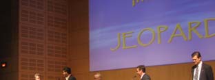
GIS Workshop Working Group
and the new requirements of the GEF. One of the more
innovative approaches used to sensitize participants to
GEF International Waters Indicators was the session on
"Indicators JEOPARDY", which was modelled after the
GEF-IWCAM Demonstration Project Status Up-
television game show. Vincent Sweeney of GEF-IWCAM
date (September 12, 2007)
was one of 4 contestants and "won" the competition!
Memorandum of Agreement with UNOPS Signed
Over 300 partici-
pants from all over
Antigua and Barbuda
Saint Kitts and Nevis
the world attended
the Conference,
The Bahamas*
Saint Lucia
representing most, if
Dominican Re-
not all, GEF Interna-
public
Trinidad and Tobago
tional Waters Pro-
Jamaica
jects.
Project Management Unit Established
IWCAM's Partnerships Exhibit, Innovative Marketplace
Antigua and Barbuda
Jamaica
The Bahamas*
Saint Lucia
Dominican Re-
public
Trinidad and Tobago
IWCAM E-Bulletins are regularly published on the Pro-
ject web site. These cover topics such as:
Completed GEF-IWCAM Workplan and Budget
· IWRM Roadmapping--Two Different Approaches
Antigua and Barbuda
Saint Lucia
· From Awareness to Action
Jamaica
Trinidad and Tobago
· Monitoring and Evaluation
Check them out!
* The Bahamas has two Demonstration Projects.
www.iwcam.org

8
IWCAM Caribbean WaterWays Newsletter
(Continued from page 5)
·
to help minimize the risk of failure in GIS implementation;
· the lack of resources to train GIS personnel;
· to identify issues that could impede the mainstreaming of
·
GIS.
the overall lack of understanding of the uses of GIS for
Towards the fulfillment of these aims, seven compo-
the management of critical natural resources; and,
nents were identified as being needed for the development and
· the use of project-approach mechanisms to develop GIS maintenance of effective mainstreaming of GIS at national levels
which often results in the redundancy of GIS applica-
in the Caribbean. These are:
tions.
1. Comprehensive needs and requirements assessment;
Current status of GIS infrastructure in the region as well as the 2. Acquisition and management of data and databases;
current level of global development in information and communi-
3. Acquisition and management of technological resources;
cation technologies were both considered in designing the Road 4. Development and management of human capacity;
Map. The scope of the Road Map covers the mainstreaming of 5. Development and management of institutional environment;
GIS at a national level. With some minor adjustment, the road-
6. Development of end-user applications, products and ser-
map may however, be adapted for programme-wide or region-
vices; and
wide use as well.
7. Monitoring and evaluation of the system.
The main aims of the Road Map are:
An IWCAM Informal GIS Working Group will be ex-
· to provide guidance to effective and efficient GIS implemen- panded to include more key stakeholders with knowledge of GIS
tation;
(as generators and users).
· to identify key resources required for GIS implementation;
· to identify key tasks that need to be performed;
Figure 2., below, shows the relationship between
Road Map components.
Figure 2.
Component 1: Comprehensive needs and requirements assessment
Component 2:
Component 3:
Acquisition and management of data and data-
Acquisition and management of technological re-
bases
sources
Component 4:
Component 5:
Component 6:
Development and management of
Development and management of
Development of end-user applica-
human capacity
institutional environment
tions, products and services
Component 7: Monitoring and evaluation of the implemented system
Participating Country Focal Points, Demonstration Pro-
jects and others are invited to submit articles. Please con-
tact Donna Spencer at dspencer@cehi.org.lc
Contact Information:
IWCAM Project Coordination Unit
P.O. Box 1111, The Morne, Castries, Saint Lucia
Tel: (758)-452-2501/1412; Fax: (758)-453-2721
E-mail: dspencer@cehi.org.lc
www.iwcam.org