


Caribbean WaterWays
Newsletter of the GEF IWCAM Project
Volume 1, Issue 2
June 2007
In this issue:
Feature Article:
· World Environ-
ment Day 2007-
Land-Use Planning and Wa-
Melting Ice -A
tershed Restoration in the
Hot Topic for
Caribbean SIDS!
Courland Watershed and
(pgs. 1,5,8)
Buccoo Reef Area, Tobago
· Feature: Land-
The IWCAM National Demonstration Project for
Use Planning
and Watershed
Trinidad and Tobago: Land-Use Planning and
Restoration in
Watershed Restoration in the Courland Water-
the Courland
shed and Buccoo Reef Area, on the island of
Watershed and
Tobago, is one of the more advanced GEF-
Buccoo Reef
IWCAM demonstration projects. In this article
Area, Tobago
Sandra Timothy, Demonstration Project Manager,
(pgs. 1,2,3,4)
gives some background to the project and shares
their experience so far.
· WED 2007 and
references (pg.2)
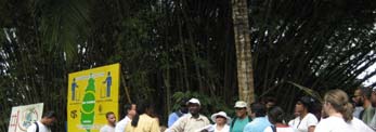
Tobago has been awarded the title of "World's
Best Eco-tourism Destination" by the prestigious
· Background on
World Travel Awards for the fourth consecutive
the IWCAM
year. Notwithstanding its rich ecosystems and
Project (pg. 2)
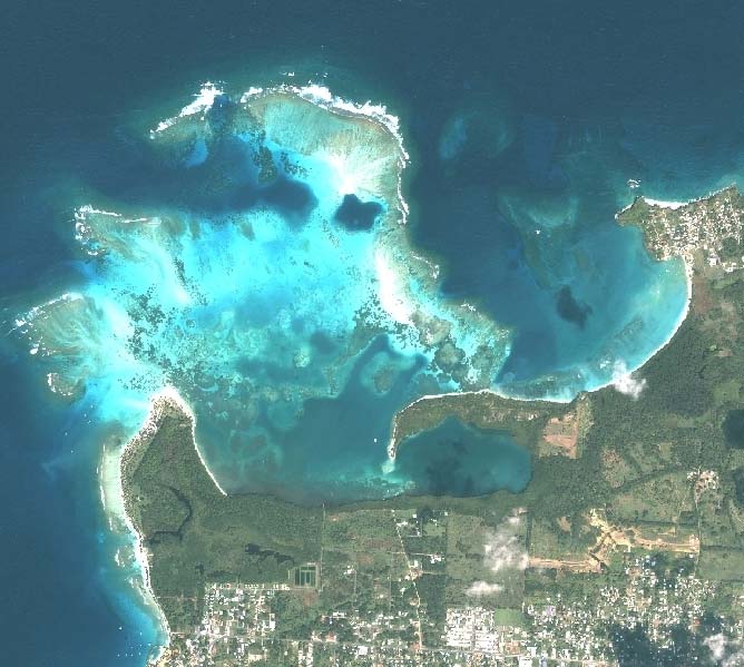
IKONOS image of Buccoo Reef and adjacent land, Tobago (2004)
such prestigious international awards, its natural
· IWCAM Training
resources, like those of its Caribbean neighbours,
for Project Man-
have not been managed in a sustainable way.
World Environment Day,
agers and Na-
Kamau Akili, a member of the Council for Sustain-
tional Focal
able Development in the Tobago House of Assem-
Points
5 June 2007:
(pg. 6)
bly (THA), summed the problem up in this way, "A
narrow sectoral approach to natural resource man-
·
Melting Ice A Hot Topic for Carib-
International
agement in Tobago has been compounded by a
Year of the Reef
bean SIDS!
lack of data, as well as limited human and techni-
2008 (pg. 7)
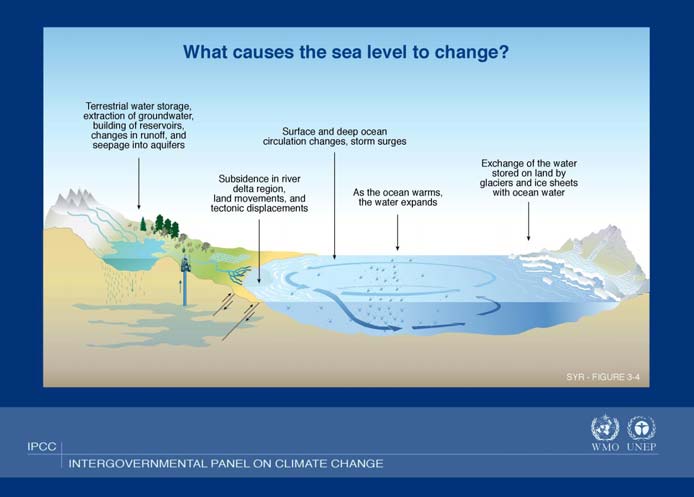
The February 2007 report of the Intergovernmental Panel on Climate cal resources. This has resulted in poorly-informed
Change (IPCC), Climate Change 2007: The Physical Science Basis notes decision-making and inadequate management of
· GEF-funded
the increase in average Arctic temperatures, the resulting decline in both natural resources leading to environmental degra-
Sustainable
mountain glaciers and snow cover and their contribution to sea level rise. dation and resource use conflicts."
IWRM Project in The last time that the polar regions had extended periods of warmer tem-
Pacific Island
Countries (pg.7) peratures was approximately 125,000 years ago. At that time the melted The Buccoo Reef is one of the main tourist attrac-
polar ice resulted in a 4 to 6 metre rise in sea level. If you consider that tions on the island and the major revenue earner
· The LBS Proto- currently, global sea level rise is estimated at 2 mm a year, you begin to for sea tour operators in the Southwestern part of
col - Update (pg. realize that these levels will rise. What implications does this have for Carib-
the island. It was designated a marine park in
8)
bean Small Island Developing States (SIDS)?
1973, but over the years, has increasingly come
under threat from anthropogenic impacts and,
First, some background: Research by the British Antarctic Society (BAS) more recently, from climate change-induced coral
indicates that the melted ice in the Antarctic Peninsula had served as a vital bleaching. It is recognized as a national biodiver-
(Continued on page 5)
sity hotspot and was declared an Environmentally
(Continued on page 2)
www.iwcam.org
2
IWCAM Caribbean WaterWays Newsletter
(Continued from page 1)
On World Environment Day 2007
Sensitive Area in 2005 and subsequently a Ramsar Site in 2006.
"Melting Ice A Hot Topic?"
Despite these designations, the lack of enforcement of park
rules and the inadequate implementation of the Management
Imagine:
Plan (prepared in 1995 by the Institute of Marine Affairs for the
THA ) have resulted in Buccoo Reef being little more than a
· Sea-level rise?
"paper park".
· More frequent and serious flooding
· Losing our coral reefs, mangrove swamps
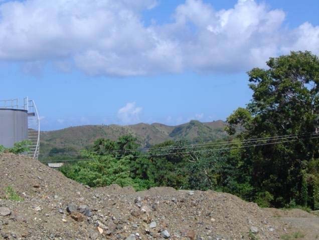
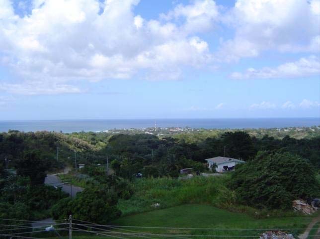
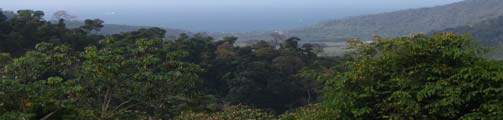
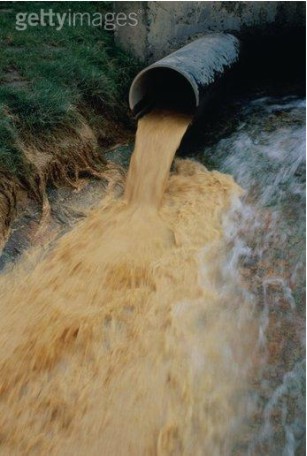
The Courland Watershed is Tobago's largest watershed and
and beaches
most important water catchment area. It supplies water for rural
villages in the watershed and the entire west and south coast.
·
The catchment drains into the coastal areas adjacent to Buccoo
Losing our lives and property
Reef, which is located 7km to the south. It is the site of many
activities, including both planned and unplanned housing devel-
Learn more about Climate Change:
opments, farming and hunting. Changes in land use patterns in
the Courland Watershed, in particular increasing deforestation
www.unep.org/wed/2007
as a result of poor farming practices and bush fires, have greatly
affected the quality of the run-off, and damaged the health of
adjacent fringing coral reefs. The gradual degradation of Buc-
References used for the article "Melting Ice - A Hot Topic
coo Reef has been documented by over 30 scientific studies,
for Caribbean SIDS" and useful if you want to learn more
which all point to land-based sources of pollution as the
about sea level rise include:
main culprit in the loss of live coral cover.
http://news.bbc.co.uk/1/hi/sci/tech/portal/climate_change/
default.stm
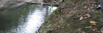
Exposed land in Courland Watershed
http://caribbeanclimate.bz/
http://earthobservatory.nasa.gov/Library/GlobalWarmingUpdate/
http://news.nationalgeographic.com/
news/2004/12/1206_041206_global_warming.html
http://www.acia.uaf.edu/
http://www.ccap.org/Presentations/CDM-FAD/2004_November_%
20Meeting/Trotz~Caribbean%20Climate%20Change%20-%
20Nov04.pdf
http://www.ipcc.ch/
It was against this backdrop that the GEF-IWCAM National
BACKGROUND ON THE IWCAM PROJECT:
Demonstration project for Trinidad and Tobago: Land-Use Plan-
ning and Watershed Restoration in the Courland Watershed
The Integrating Watershed and Coastal Areas Management in Caribbean Small
and Buccoo Reef Area, was developed.
Island Development States (IWCAM) Project, with a value of USD 112 million,
was approved by the Global Environment Facility (GEF) in May 2004. Imple-
menting agencies are the United Nations Environment Programme (UNEP) and
This project seeks to reduce the impact of the Courland Water-
the United Nations Development Programme (UNDP). Executing agencies are
shed and other smaller watersheds from Castara in the North, to
the Secretariat of the Cartagena Convention (UNEP-CAR/RCU) and the Carib-
Crown Point in the Southwestern end of Tobago, upon coastal
bean Environmental Health Institute (CEHI) and the UN Office of Project Ser-
vices (UNOPS). The thirteen participating SIDS are: Antigua and Barbuda, The
areas, from Little Englishman's Bay to Buccoo Reef. The project
Bahamas, Barbados, Cuba, Grenada, Dominica, Dominican Republic, Haiti,
objectives include:
Jamaica, Saint Kitts and Nevis, Saint Lucia, Saint Vincent and the Grenadines,
and Trinidad and Tobago. The length of the Project is 5 years and commenced in
the second quarter of 2005. The Project Coordinating Unit is located at the CEHI,
· Reforestation of the Courland Watershed and a monitoring
as agreed by the Implementing and Executing Agencies and the participating
programme to include surveys to identify point and non-point
countries.
sources of pollution;
(Continued on page 3)
www.iwcam.org


3
IWCAM Caribbean WaterWays Newsletter
(Continued from page 2)
· Incorporation of community involvement into the manage-
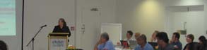
Stakeholders Meetings
ment programme;
· Diversion of surface drains into a constructed artificial wet-
Several one-on-one stakeholder meetings have been held.
land;
Interest in, and anticipated participation in IWCAM sub-
· Upgrading of the land-use plan in the target area and im-
activities is high.
provement of the Enviromental Impact Assessment process;
· Establishment of a sustainable and effective programme of
Public Awareness Campaign
data collection;
· Development of a formal procedure for data flow;
A simple public awareness campaign has begun. This will
· Instigation of an integrated approach to decision-making,
be expanded when more funds are available:
and
· Interview on Tobago's local television morning show,
· Undertaking a long-term public awareness and sensitization
"Rise and Shine".
campaign.
· Distribution of approximately 1,500 public awareness
flyers in villages situated in the watershed, with the assis-
This Demonstration project is being implemented by the Buccoo
tance of The University of the West Indies campus volun-
Reef Trust (BRT), a Non-governmental Organization (NGO), in
teer group.
close collaboration with the Tobago House of Assembly (THA).
· Article in a bi-monthly magazine.
The BRT has established a Project Management Unit (PMU), led
by a Project Manager. The project team also includes a GIS
Data Collection and Monitoring
Specialist, a Scientific Diving Officer and an Environmental Edu-
cational Coordinator. Since its inception in January 2007, the
External Partnership
PMU has been working along with other members of staff at
BRT is fortunate to have entered into partnership with Coral
BRT and members of the National Intersectoral Committee
Cay Conservation (CCC). CCC is a UK-based NGO with
(NIC).
over 20 years experience in mapping and monitoring coral
reefs worldwide, using the effective approach of combining
Achievements to date:
qualified marine biologists
with trained volunteers.
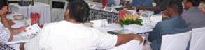
Formation of the NIC
The BRT, with financial
The NIC was formally launched in November 2006 following
assistance from the THA
a Cabinet decision for its establishment. Its inaugural meet-
and the Global Environ-
ing was held in January 2007 and it has convened three
ment Facility's Small
successful meetings to date.
Grants Programme (GEF-
SGP, implemented by the
The role of the
UNDP), invited CCC to
NIC is to inte-
Tobago to undertake a
grate IWCAM
major reef mapping pro-
principles into
gramme called the To-
national policy for
bago Coastal Ecosystem
Trinidad and
Mapping Project
Tobago. Its com-
(TCEMP).
position therefore
Baseline survey
includes repre-
This 2-year project, which
Second meeting of the NIC
sentatives of a
started in April 2007, will develop a detailed database of all
wide cross-
the coastal areas surrounding Tobago down to a depth of
section of agencies and Ministries across the national com-
30 metres. This information will be of critical importance in
munity. These include relevant Divisions of the THA,
formulating recommendations for the management of To-
NGOs, the United Nations Development Programme (one
bago's reefs and fits perfectly into the overall aims of IW-
of the project's implementing agencies), and the Tobago
CAM. The project has a substantial education and capac-
Hotel Association; a total of ten members so far. It is ex-
ity-building programme, including 48 scholarships to local
pected that more agencies will nominate representatives.
volunteers for free training in scuba diving, marine taxon-
The NIC is chaired by Linford Beckles, a THA representa-
omy and survey techniques. For more information on
tive.
TCEMP see www.coralcay.org
www.iwcam.org


4
IWCAM Caribbean WaterWays Newsletter
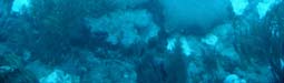
In addition to the above-described mapping and baseline
Work in Progress
data collection of Tobago's coastal areas, the PMU has
established a long-term coral reef monitoring programme.
Watershed Restoration
Initial talks have been held regarding restoration of the
watershed with some key stakeholders. Actual work is on
hold until a Memorandum of Understanding is established
between the THA and BRT. It is anticipated that watershed
reforestation work will be done in partnership with the Water
Resources Agency, the Division of Natural Resources and
the Environment; and the Reforestation Unit of the THA
Community Participation
BRT will also partner with the Poverty Reduction Pro-
gramme and the Division of Community Development and
Culture to support and empower communities in the water-
shed to start self-help projects which will have positive im-
Baseline survey
pacts upon the watershed.
The aim of this component is to establish 12 permanent
Challenges
monitoring stations on reefs around the island in order to
assess any changes over time. These stations have been
· The BRT is working together with the government on the
set-up and the monitoring programme, using underwater
execution of this demonstration project. For example, the THA's
video techniques, is well underway with video surveys car-
Division of Agriculture, Marine Affairs and the Environment, as
ried out in both January/February and March/April. This
the GEF-IWCAM National Focal Point, has an oversight role on
work is being assisted and expanded through a partnership
the demonstration project. Institutional arrangements between
with Dr. Jennie Mallela, a coral reef post-doctoral re-
BRT and government entities should be established to ensure
searcher at the University of the West Indies.
progress, efficiency, and attention to sensitive political or cultural
issues. This requires a consistent and concerted approach to
communication and information-sharing.
Geographic Information Systems (GIS) Unit Establish-
ment)
· Overcoming difficulty in information sharing amongst agen-
cies.
In preparation for the installation of the GIS, discussions
have been held with many of the local authorities with re-
· Maintaining a national profile for the Demonstration Project
sponsibilities in the Demonstration Project area, including
which is located in Tobago, particularly as the lessons learned
the Department of Natural Resources and the Environment
must be applied at the national level.
(DNRE), the Town and Country Planning Unit and the To-
bago National Emergency Management Agency (NEMA).
Discussions were also held with the Institute of Marine Af-
fairs (IMA).
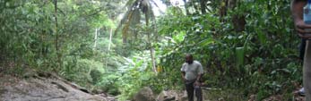
Courland Watershed, Tobago
The GIS Specialist expressed interest in possible avenues
of cooperation with each of these agencies. These discus-
sions underlined the fact that there is a keen interest in GIS
amongst stakeholders, and, that the IWCAM Project can
make a distinct contribution to the development of GIS in
Trinidad and Tobago.
The unit should soon be equipped and once properly in-
stalled at the BRT, initiatives aimed at encouraging commu-
nity participation will begin. These will include a Citizen
Science approach with high school students and On-the-
Job internships for tertiary level students.
PMU monitoring
www.iwcam.org
5
IWCAM Caribbean WaterWays Newsletter
(Continued from page 1)
lighted some of these impacts as:
barrier to the movement of the glacier and as a result of its melt-
ing, they predict that glaciers in Antarctica now flow into the
Beach erosion: As sea level rises, more Caribbean SIDS
ocean up to six times faster than before. In the past decade,
beaches will be reclaimed by the Atlantic Ocean and
several major sections of Antarctic ice have broken off: the Lar-
Caribbean Sea.
sen A ice shelf (1995 1,600 square kilometres), the Wilkins ice
shelf (1998 1,100 square kilometres), and the Larsen B ice
Salinisation of soil, aquifers, and estuaries: Sea level
shelf (2002 13,500 square kilometres). It is estimated that the
rise will bring salt and brackish waters into the soil,
melting Antarctic ice caps contribute to at least 15% of the cur-
aquifers and estuaries, threatening drinking water
rent global sea level rise. In January 2006, the British Antarctic
supplies, agriculture, and important coastal ecosys-
Society, in a study commissioned by the British government,
tems.
warned that the disintegration of the west Antarctic ice sheet
could raise sea levels by at least 5 metres.
Degradation of mangroves, seagrass beds, and coral
reefs: Both salination and beach erosion, as men-
On the other side of the globe, the multinational Arctic Climate
tioned above, would cause degradation of these habi-
Impact Assessment (ACIA) report recently concluded that in
tats. Additionally, sea level rise will result in a reduced
Alaska, western Canada, and eastern Russia, average tempera-
amount of light reaching coral reefs and sea grass
tures have increased at nearly twice the global average (3 to 4
beds. The consequences of their destruction would be
degrees Celsius) in the past 50 years. This impacts the
far reaching, including decreased stocks of the fish
Greenland Ice
which live and feed
Sheet, which is 1.71
in and around the
million square kilo-
reefs; reduction in
meters and gener-
the amount of natu-
ally between two to
ral protection offered
three kilometers in
by coral reefs and
thickness. Scientists
mangrove swamps
who have been
in particular, from
measuring its melt-
storm surges; de-
ing rate since 1979
creased tourism
report that in the
activities, such as
period between
snorkeling, scuba
1979 and 2002 the
diving, and fishing;
melting has in-
and a decrease in
creased by approxi-
valuable biological
mately 16 percent.
diversity.
In 2006, based on
images from a
Enhanced storm
NASA satellite, the
surges: To further
melting rate was
complicate the mat-
estimated at 239
ter of diminished
cubic kilometres
protection from
annually. It is predicted that if the ice sheet were to melt in its
storm surges, the higher sea level, combined with
entirety, which is a long term possibility, global sea levels would
other climatic changes, will bring about more severe
rise 7.2 metres.
storm surges, wreaking havoc on coastal ecosystems
and communities.
From our perspective, the impacts of glacial melt upon
Small Island Developing States (SIDS) will be especially
Coastal inundation: With over 90% of populations and
destructive, both in the short and long-term. These include
economic activities located in the coastal zones of
changes in water temperature, salinity, and sea level rise.
Caribbean SIDS, flooding will have a negative impact
upon economic livelihoods and cause loss of life.
The GEF-funded Mainstreaming Adaptation to Climate Change
(MACC) project, which aims to mainstream climate change ad-
Ronny Jumeau, the Seychelles' Minister for Environment and
aptation strategies into the sustainable development agendas of
Natural Resources, addressed this threat to SIDS in his essay
the small island and low lying states of CARICOM, has high-
(Continued on page 8)
www.iwcam.org
6
IWCAM Caribbean WaterWays Newsletter
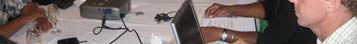
IWCAM Training for Project Managers and
technical officers from the Caribbean Environmental Health Insti-
National Focal Points
tute (CEHI).
Demonstration Project Managers Trained on Indicators,
This initiative, jointly spearheaded by the GEF/IWCAM Project,
Integrated Water Resources Management & Environmental
in collaboration with the Caribbean Environmental Health Insti-
Monitoring of Industrial Waste in Coastal Zones, May 14-18,
tute (CEHI) was co-funded by the Government of Japan, under
2007
the Japan-CARICOM Friendship and Cooperation Fund and the
GEF, under the IWCAM Project.
The Global Environment Facility (GEF)-funded Integrating Wa-
tershed and Coastal Areas Management Project (IWCAM) re-
The Workshop was held at the Bay Gardens Hotel. The feature
cently conducted a regional training activity in St. Lucia. Demon-
address at the formal opening of the workshop was given by Mr.
stration Project Managers from 7 of the 9 demonstration sites as
Donovan Williams, Permanent Secretary, Ministry of Economic
well as representatives from 11 of the 13 GEF/IWCAM Partici-
Affairs, Economic Planning, National Development and Public
pating Countries participated in the week of activities designed
Service for the Government of St. Lucia. It is expected that the
to orient them towards the project objectives and also provide
execution of the workshop will result in a better understanding of
training in key technical areas related to the project. The objec-
GEF procedures, a better appreciation of IWRM, improved envi-
tives of the week of activities were as follows:
ronmental planning and monitoring capabilities of the partici-
pants, and in improved coastal zone monitoring regimes for
For Demonstration Project Managers:
coastal marine industrial pollution in the Region.
· To catalyze networking and communications amongst
Participants in the Workshops visited the Fond D'or Water-
IWCAM Demonstration Projects.
shed on Friday 18 May
· To introduce Demonstration Project Managers to the
IWCAM Project Coordinating Unit.
· To train Demonstration Project Managers in IWCAM-
specific administrative, public awareness and educa-
tion procedures.
For Demonstration Project Managers and National Focal Points:
· To provide an initial introduction to GEF International
Waters outcomes and indicators and their incorpora-
tion into project work planning, execution, and monitor-
ing.
· To provide training on integrated water resources
management (IWRM) and roadmapping for national
IWRM plans.
· To develop "next steps" for IWRM Mainstreaming, in
both demonstration project sites and at the national
level
· To provide training in aspects of environmental plan-
ning and monitoring, including: Coastal Zone Manage-
ment Planning; Impacts of industrial waste; Monitoring
programmes; Coastal
sampling techniques;
IWCAM Orientation
and Relevant labora-
tory analyses.
Resource persons for
the week included staff
of the regional GEF/
IWCAM Project Coordi-
nating Unit as well as
www.iwcam.org
7
IWCAM Caribbean WaterWays Newsletter
The ICRI partners are committed to ensuring that IYOR
2008 is a success, and activities are already underway in
many countries including several from the Caribbean. We
also anticipate many exciting developments as the plan-
ning for IYOR 2008 begins in earnest, and you will be able
to follow the progress by visiting: http://www.iyor.org
(where you can sign-up to the IYoR newsletter). For fur-
International Year of the Reef
ther information on IYOR 2008 including ways to become
involved in the year, please visit www.iyor.org or contact
(IYOR 2008)
info@iyor.org.
The International Coral Reef Initiative (ICRI), a partner-
ship among governments, international organizations,
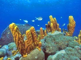
Buccoo Reef, Tobago (courtesy BRT)
and non-government organizations throughout the world,
has designated 2008 as the International Year of the Reef
(IYOR 2008) to celebrate one of Earth's most precious,
fragile, and diverse ecosystems. By raising awareness
and understanding of coral reefs, IYOR 08 aims to pro-
mote urgent conservation and management policies to
best protect our coral reefs on a global scale.
Over the last few decades, the health of coral reefs and
their associated ecosystems (mangroves, seagrass, etc...)
have degraded considerably worldwide. Marine resources
within and surrounding coral reefs have also significantly
declined, primarily due to human influences.
The first IYOR was declared and implemented in 1997 in
response to the increasing threats and loss of coral reefs
The GEF-funded Sustainable Integrated Water Re-
and associated ecosystems. IYOR 97 was a global effort
sources and Wastewater Management Project in the
to raise awareness and understanding of coral reefs and
Pacific Island Countries
the threats they face, and support related conservation,
research and management efforts. Despite IYOR 97's
In an effort to share some of the lessons learned during the GEF-
success in raising global awareness of coral reefs and
IWCAM development phase, GEF-IWCAM Technical Coordinator,
associated ecosystems, ten years later, there remains an
Sasha Gottlieb, traveled to Fiji to participate in the GEF-funded
urgent need to increase awareness, to take action, fur-
Sustainable Integrated Water Resources and Wastewater Manage-
ther conserve and manage coral reefs and associated
ment Project in the Pacific Island Countries Second Steering
ecosystems.
Committee Meeting. The project in the Pacific is in its develop-
ment phase and plans to submit a full project brief to the GEF in
The overall objectives of the International Year of the
late 2007. Given the similar approaches, colleagues from the
Reef 2008 (IYOR 2008) are to:
Pacific were particularly interested in learning about the GEF-
IWCAM approach for demonstration project development and
hotspot diagnostic.
Strengthen awareness about the ecological,
economic, social and cultural value of coral reefs
The two regions, along Sasha Gottlieb of IWCAM pre-
and associated ecosystems
with colleagues from the sents in Fiji
Indian Ocean and Atlantic
Improve understanding of the critical threats to
Ocean SIDS, will continue
coral reefs and generate both practical and inno-
to collaborate in the de-
vative solutions to reduce these threats
velopment of an IWRM
methodology and guide-
Generate urgent action at all levels to develop
lines for SIDS and to serve
and implement effective management strategies
as resources for each
for conservation and sustainable use of these
other throughout project
ecosystems.
implementation.
GEF-IWCAM Consultancies:
IWCAM Consultancies which are underway, or which will shortly begin, include: a Capability Assessment for
Geographic Information Systems; a Review of Policy, Legislation and Institutional Structures; an Indicators
Mechanism Assessment; and a Review of Relevant IWCAM-related Projects. In coming months the Project
will be sharing the outcome of this research.
www.iwcam.org

8
IWCAM Caribbean WaterWays Newsletter
(Continued from page 5)
The LBS Protocol - Update
No Island Is an Island, stating, "We are all linked together: what
happens in the Arctic affects us all on the Equator... (Former)
In October 1999, Parties to the Cartagena Convention
adopted the Protocol Concerning Land-Based Sources
UNEP Executive Director, Klaus Toepfer, said that the... Arctic
and Activities (LBS Protocol), a regional agreement for the
was `the early warning system for the world'. The very same
prevention, reduction, and control of marine pollution from
term has also been used to describe small island states as,
land-based sources and activities in the Wider Caribbean
thanks to our smallness and special frailties, we will be the first
Region.
to succumb to the major environmental problems afflicting the
world today."
The main point sources of pollution to the Caribbean Sea
are: domestic sewage, oil refineries, sugar factories and
Sea level rise from glacial melt is indeed a serious issue and one
distilleries, food processing, beverage manufacturing, pulp
that should not be overlooked until it is too late. While reducing
and paper, and, chemical industries. The main non-point
source category of pollution is run-off from the land.
the carbon dioxide emissions of SIDS will not be sufficient to
curb the global warming trend, islands can mitigate some im-
The Protocol provides the
pacts of sea level rise through sustainable and integrated man-
framework for addressing
agement of watersheds and coastal areas.
pollution based on national
Maintenance of coastal ecosystems will protect developments
and regional needs and
from storm surge and beach erosion. Reducing contamination,
priorities. It adopts an ap-
sedimentation and erosion will help keep mangroves, seagrass
proach which focuses upon
beds, and coral reefs healthy, better enabling them to respond to
addressing the sources of
the degradation caused by sea level rise. Protection and main-
pollution, including the ap-
tenance of watersheds will maintain important freshwater re-
plication of most appropri-
ate technologies and best
sources, especially as sea level rise will increasingly cause salt-
management practices. It
water intrusion into aquifers. Improved water efficiency will re-
also promotes the estab-
duce demand on increasingly stressed water supplies.
lishment of pollution stan-
dards and schedules for
These actions are part and parcel of the integrated watershed
implementation.
and coastal area management that GEF-IWCAM is helping the
13 Participating Countries to adopt. The coastal zones of SIDS
Two countries (Trinidad
are being developed with little regard to loss and degradation of
and Tobago and Panama)
land and flooding during storm surges. Our exposure to these
have so far acceded to the
Protocol. Seven more countries must accede before it can
threats in particular will increase with sea level rise. Responding
come into force. The United States, in March 2007 moved
to the challenge will require assessments of future rates of sea
closer to ratifying the Protocol.
level rise amongst SIDS, information on likely effects and public
awareness of these, as well as, adaptation and mitigation meas-
Several Caribbean countries will, with the assistance of the
ures. The integrated approach to managing our watersheds and
Assessment and Management of Environmental Pollution
coastal areas must take these things into consideration.
(AMEP) Sub-Programme of the Caribbean Environment
Programme (CEP), based at UNEP-CAR/RCU, the Re-
gional Activity Centres at the Institute of Marine Affairs
(IMA), and the Centro de Ingenieria y Manejo Ambiental de
Contributors to this issue of Caribbean WaterWays:
Bahias y Costas (CIMAB), and the IWCAM Project, hold
Sandra Timothy, Owen Day, Vijay Datadin, Sasha Beth Gottlieb, Vincent
workshops to promote the Protocol at the national level.
Sweeney, and Donna Spencer.
For more information see: www.cep.unep.org
Participating Country Focal Points, Demonstration Projects
and others are invited to submit articles. Please contact
Donna Spencer at dspencer@cehi.org.lc
Contact Information:
IWCAM Project Coordination Unit
P.O. Box 1111, The Morne, Castries, Saint Lucia
Tel: (758)-452-2501/1412; Fax: (758)-453-2721
E-mail: dspencer@cehi.org.lc
www.iwcam.org