BOBLME-2009-REG-5.0-IWS-14
Update Fisheries Information,Environment
and Overview
For BOBLME Programme
Mya Than Tun, Dr. Yin Yin Moe, Soe Hla
1. National Coordinator, 2. Assistant Director, Fisheries, 3. Director, Forestry
BOBLME, Programme
MYANMAR
INTRODUCTION
Myanmar has a land of 656770 sq kilometer.
Endowed with an abundance of fishery resources.
Costal line over 2832 kilometer.
0.5 million hectares of swamp along this coast.
8.2 million hectares of seasonal floodplains.
1.3 million hectares of permanent water bodies.
Over 52 million population in 2003.
Fish is nutritionally and economically important
Fisheries sector is third in earning foreign exchange.
Contribute social economic development of country
Post Harvest Losses to take care for sufficient food.

Myanmar marine Fisheries
One of the largest main land country in Southeast Asia.
- A Long coastal line of 2832 km
- A continental shelf of 228,000 sq km
- Territorial sea; 486,000 sq km (EEZ)
Fisheries of Myanmar
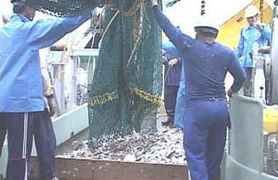
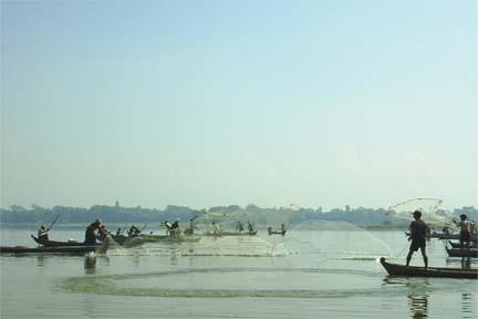
1. Marine Fisheries
Myanmar marine water is demarcated four fishing ground
Rakhine, Ayeyarwady, Mon, Tanintharyi.
(a) Inshore fisheries
- 5 nautical miles from shore ( Rakhine Coastal)
- 10 nautical miles from shore (Ayeyarwady & Taninthayi Coastal)
- Not more than 12 HP engine & 30 feet length of boat
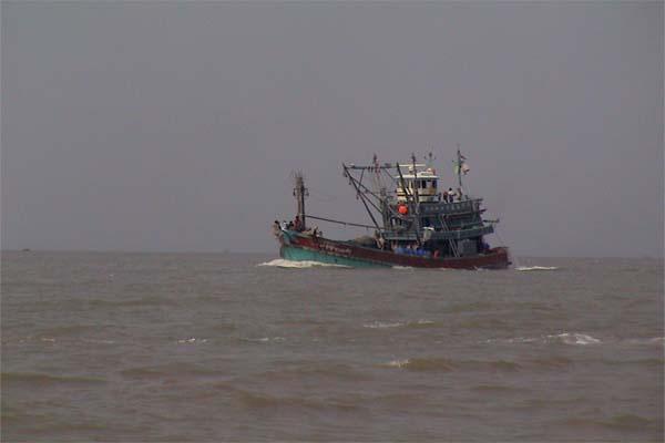
(b) Offshore fisheries
- Outer limit of inshore fishing zone to EEZ
- More than 12 HP engine & 30 feet length of boat
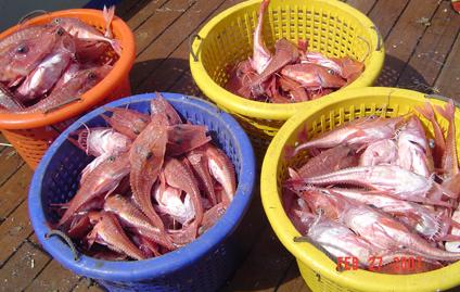
Present Fisheries in Myanmar
Fisheries Total Production:
Marine Ł
1679.01, (53%)
Culture Ł
674.89, (21%)
Open fisheries Ł
625.04, (20%)
Leasable fisheries Ł 189.70, (6%)
Total Production Ł 3168.64, (100%)
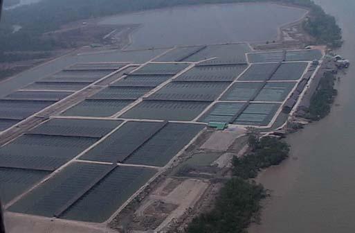
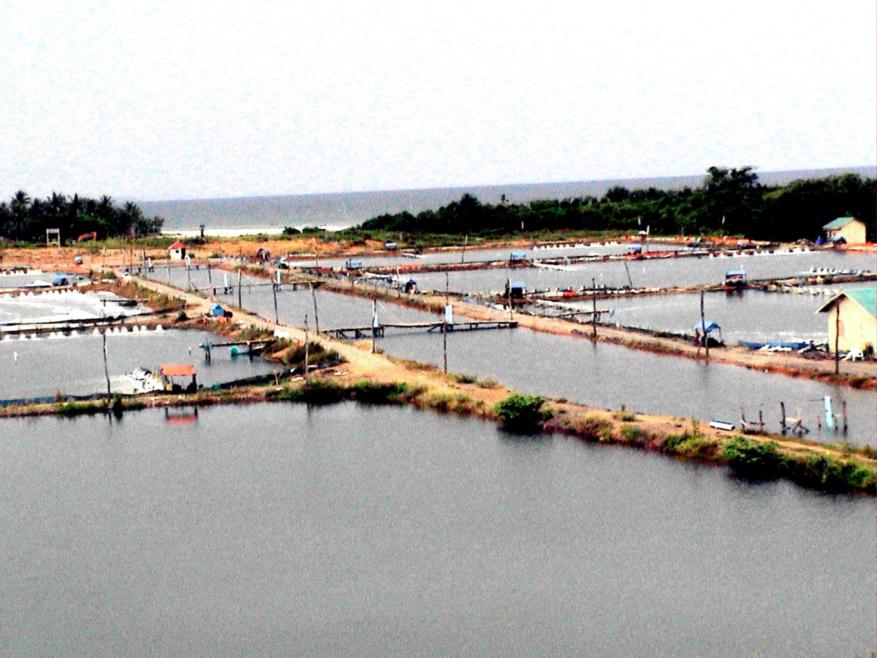
Aquaculture Pond and Production
2007-2008 Ł 440947 acre,
2007-2008 Ł 674.89 thousand MT
2007-2008 Ł 215222, acre (Fish Pond)
2007-2008 Ł 225725,acre (shrimp Pond)
Previous Marine Fisheries
Research Activities
1979/80 Dr. Fridtjof Nansen
(FAO and Norwegian Research Vessel)
1980/83 MFV 525
(FAO and PPFC Project Bur 77/003)
1989 FRTV Chulabhorn
(Myanmar- Thai Joint Survey)
MV SEAFDEC -2
(Myanmar- SEAFDEC- Survey)
Biomass (within 200m depth)
Pelagic fish 1.0 MMT Ł 0.5 MMT(MSY)
Demersal fish 0.8 MMT- 0.55MMT(MSY)
Maximun Sustainable Yield Ł 1.05 MMT
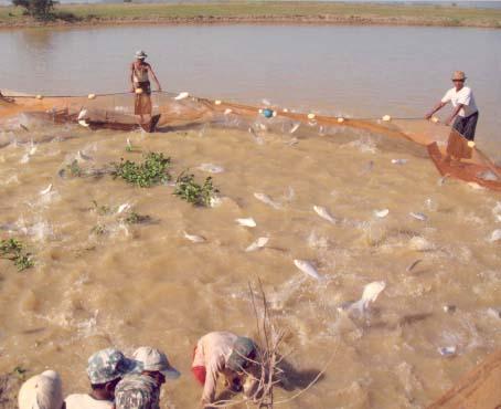
Present Fisheries in Myanmar
The Production of Leasable Fisheries and open Fisheries.
2007-2008 - Total No. 3460
Production Ł 189.70 thousaneasabled MT, (Leasable
fisheries)
Production Ł 625.04 thousand MT,
(Open fisheries)
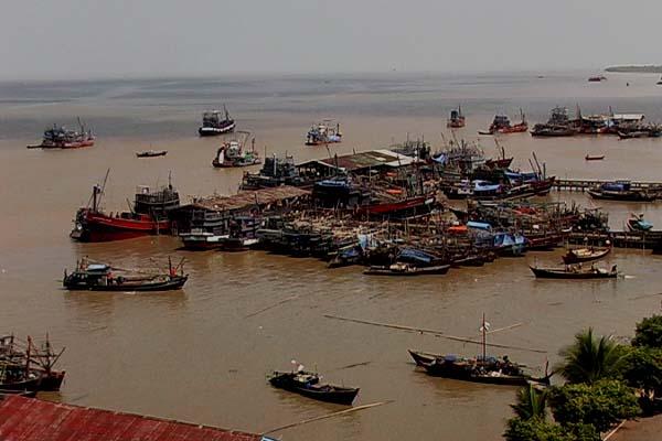
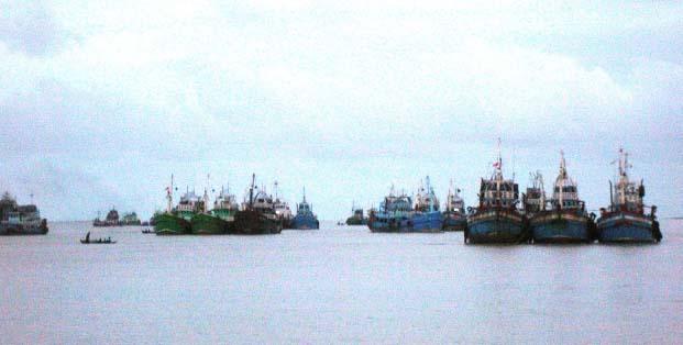
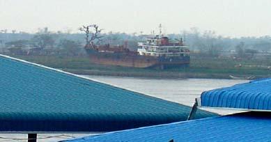
Marine Fishing Vessel
2007-2008 Ł Total Fishing Vessel 31595
Small fishing boat Ł 14289 (power boat)
- 15219 (non power boat)
National fishing boat Ł 1839
Foreign Vessel -
248
National Policy on Fishery Sector
1. To promote all-round development in the
fisheries sector.
2. To increase fish production for domestic
consumption and share the surplus with
neighboring country.
3.To encourage the expansion of marine and
freshwater aquaculture.
4. To upgrade the socio-economic status of fishery
communities.
Fisheries management measure in Myanmar.
Problem of over fishing and declining productivity in coastal
regions, various measures have been adopted according to
Myanmar Fisheries Law.
The Key fisheries legislation for the Union of Myanmar
includes:-
1. The Freshwater Fisheries Law; 1991
2. Law Relating to the Fishing rights to Foreign fishing Vessels; 1989
3. Law Amending the Law relating to the Fishing Rights of Foreign
Fishing Vessels; 1993
4. Myanmar marine Fisheries Law; 1990 and
5. Law Amending the Myanmar Marine Fisheries Law. 1993
6. Aquaculture Law 1989
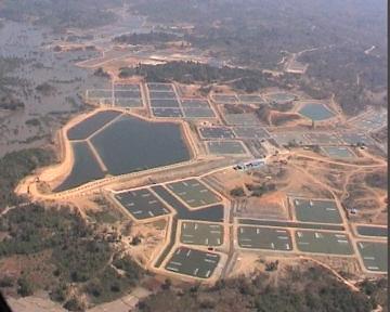
AREA OF SHRIMP PONDS
(1997-98 to 2006-07)
2005-06
2003-04
2001-02
1999-2000
1997-98
0
50000
100000
150000
200000
250000
Shrimp pond (Acre)
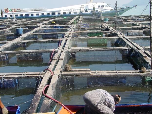
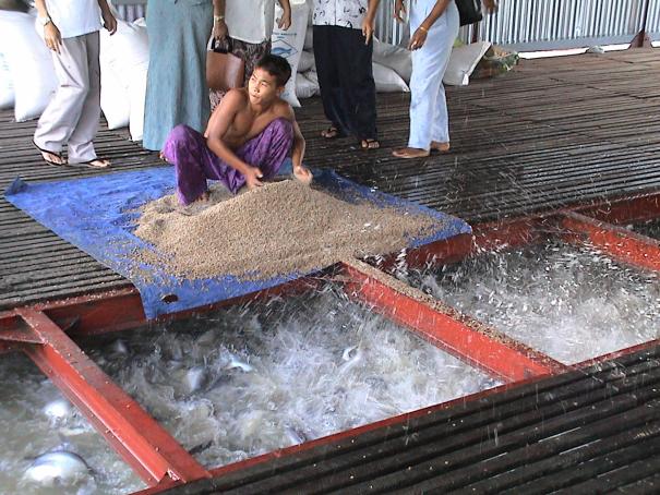
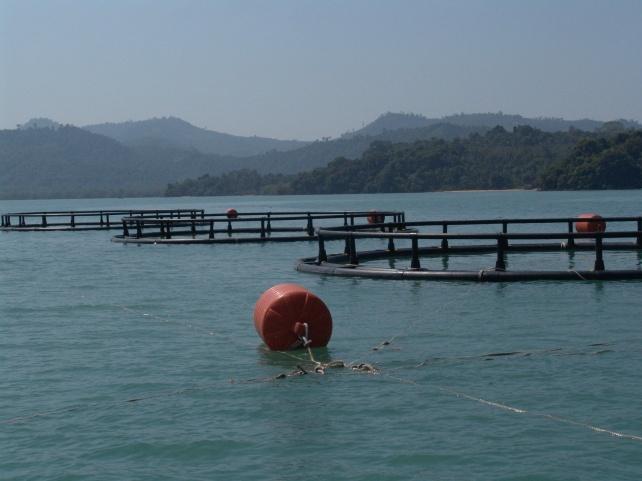
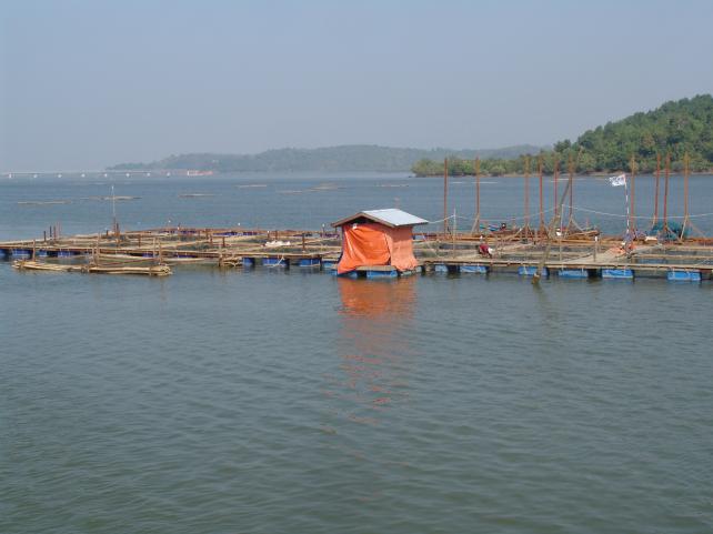
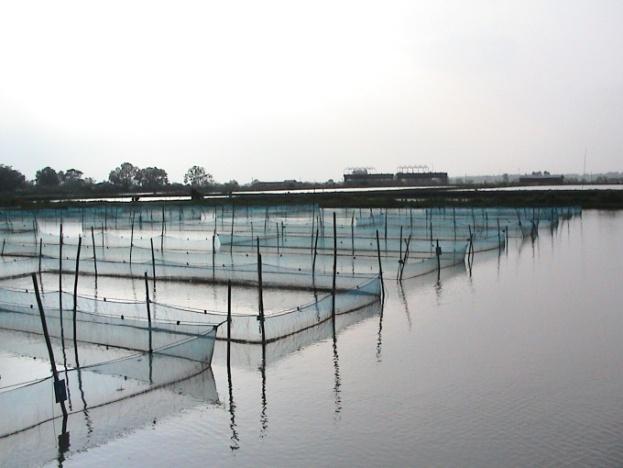
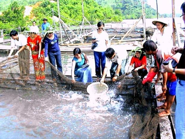
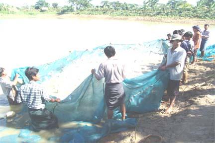
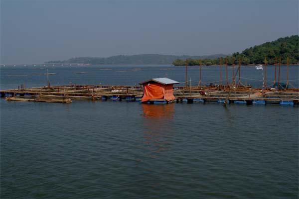
Aquaculture
(cage culture)
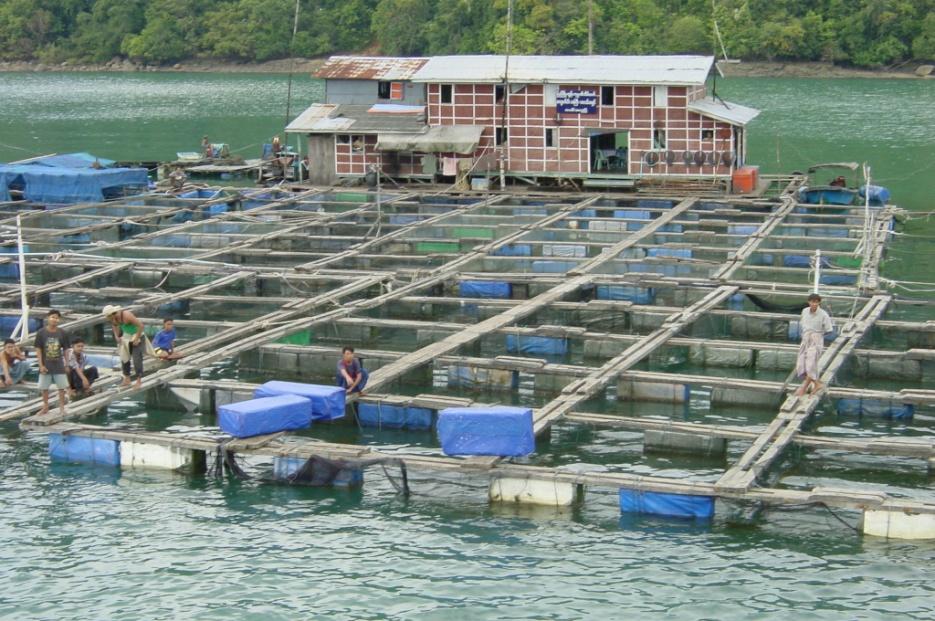
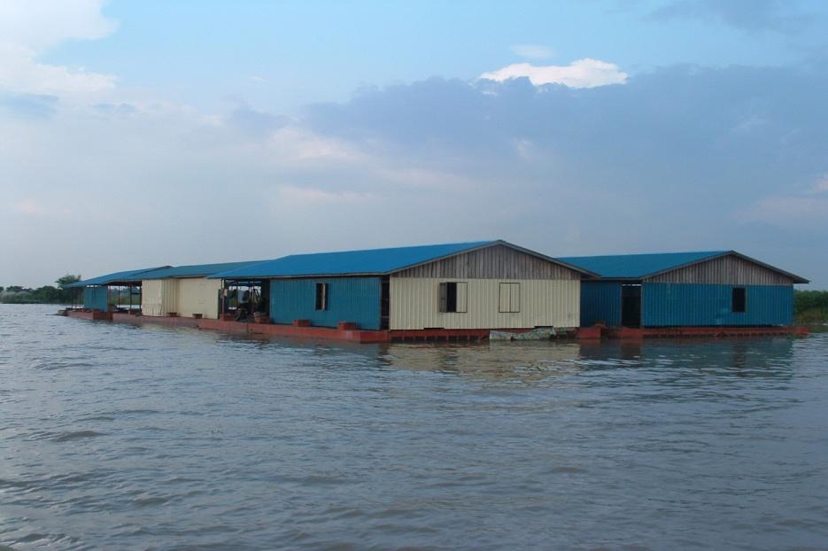
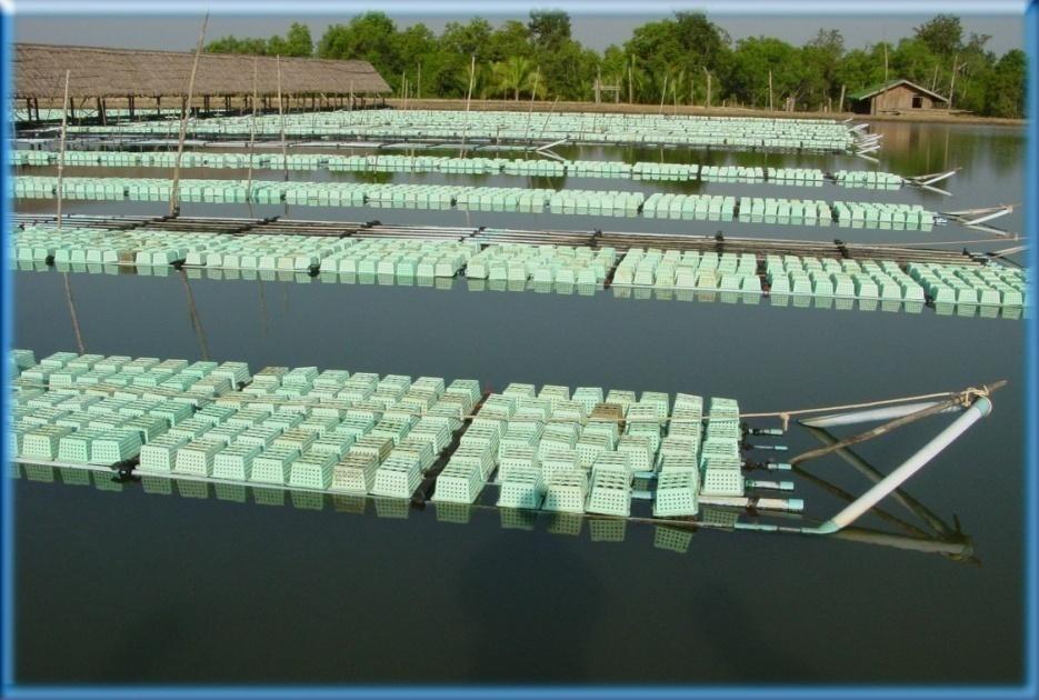
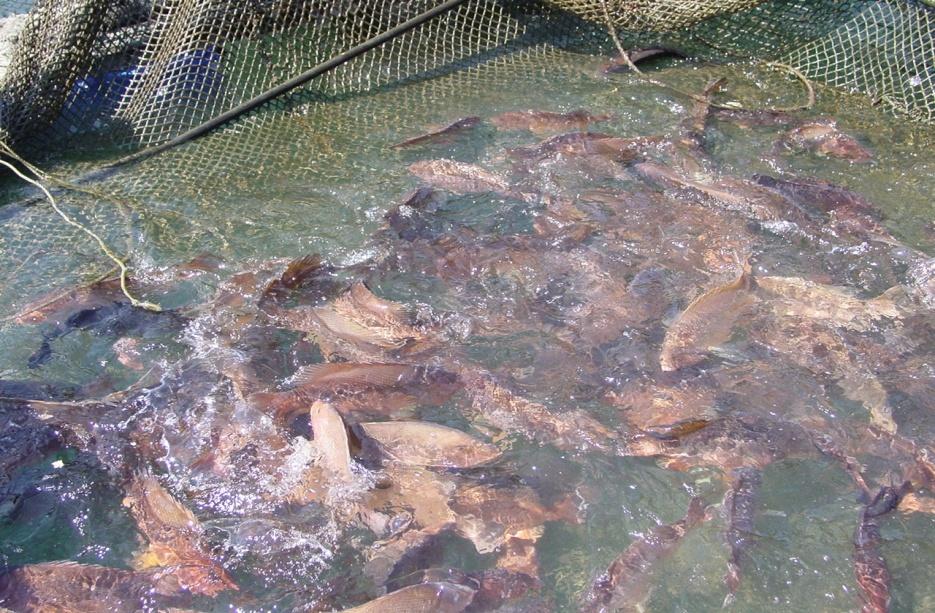
Grouper (Myeik)
Soft shell Crab (Myeik)
Pangus (Ayeyarwady)
Tsunami Disaster.
Tsunami struck Myanmar on 26th December, 2004. The effect
of tsunami was very limited, compared to other neighbouring
countries. Pyinsalu Sub-township of Laputta Township in
Ayeyarwady Division was the worst hit and 2137 persons
were affected, 25 persons dead, and 1138 people displaced,
and 289 houses were destroyed. The Inter-agency Assessment
Mission comprising FAO,UNDP,UNICEF,WFP, and WHO was
conducted in four affected villages between 18-20 January,
2005. The mission found that approximately 1200 fisher
cum other fishing supplies were lost.
Response
In response to the disaster, the Government of Japan
provides an initial contribution of US$ 404 000 to the
United Nation Development Programme (UNDP) to
provide assistance to tsunami-affected people in
Myanmar. UNDP, being a trustee to this financial
resource, signal a Letter of Agreement with FAO 0n 13
April 2005 to implement the project, MYA/05/001
"Emergency Assistant to Tsunami Affected Fishing
Communities, Fishers cum farmers, and Homestead
Gardeners".
Pre Nargis Cyclone Fisheries Condition
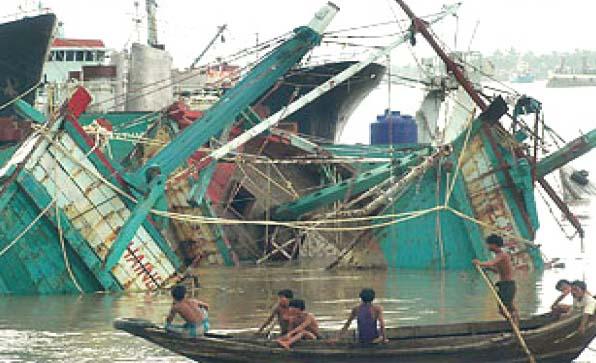
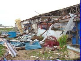
Damages and losses in fisheries sector
Affected in Ayeyarwaddy and Yangon Divisions -
Ę1. Off-shore fishing vessels= 41
Ę2.Local off-shore fishing boats= 288
Ę3.In-shore fishing boats (Mechanized)=553
Ę4.In-shore fishing boats (non-mechanized)=1206
Ę5. Off-shore fishing gears=200 sets
Ę6.In-shore fishing gears (Mechanized)=330 sets
Ę7.In-shore fishing gears (Non-mechanized)=2230 sets
Ę8. Crew death=17876
Ę9.Missing Crew=9612
Ę10.Value of losses = 23140.44 million kyats (details as
follow;)
ĘDamaged Vessels/ Boats and Gears in In-shore/Off-shore Fisheries
In-shore
Sr.
State / Division
Off-shore
Remarks
Mechanized
Non-mechanized
Vessels
Gear
Boat
Gear
Boat
Gear
1
Yangon
41
15
Over GRT 70
Division
Off-shore
fishing
vessels
2
Ayeyarwaddy
288
200
553
330
1206
2230
local off-shore
Division
vessels
Marine Fisheries (Lost of Value)
i. Offshore fisheries
- 8590.00 Million Kyats
ii. Inshore fisheries
- 1719.00 Million Kyats
iii. Total
- 10309.00Million Kyats
Death and Losses of Fisheries Workers in Ayeyarwady Division
Sr Township
Losses
Death
1. Pyapon
-
181
2. Lattputta
4692
7850
3. Ngaputaw
886
-
4. Bogalay
2401
6316
5. Daydaye
160
390
6. Kyaiklat
17
-
7. Mawlamyaing Kyun
1432
3138
8. Kyauk Tan
1
1
9. Yangon
23
-
Total
9612
17876
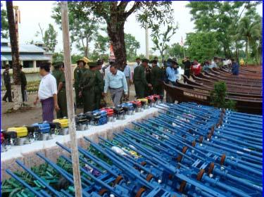
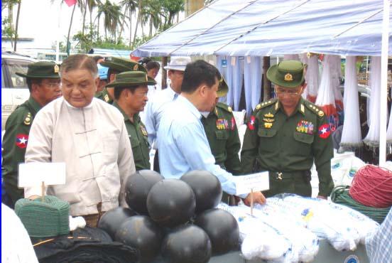
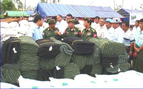
Rehabilitations Activities
Distributed in Ngapudaw, Labutta, Mawlamyinegyun, Pyapon,
Bogale, Kyaiklatt and Dedaye townships in Ayeyarwaddy division.
- Fishing boats
9067
- Tiger mouth nets
7201
- Hilsa nets
3293
- Trammel nets
745
- Push nets
1200
- Cast nets
1688
- Surrounding nets
878
- Shrimp fry nets
112
Distributed in Kungyangon, Kawhmu, Twantay and Kyauktan
townships in Yangon division.
- Fishing boats 433
- Tiger mouth nets 226
- Hilsa nets 143
- Surrounding nets 61
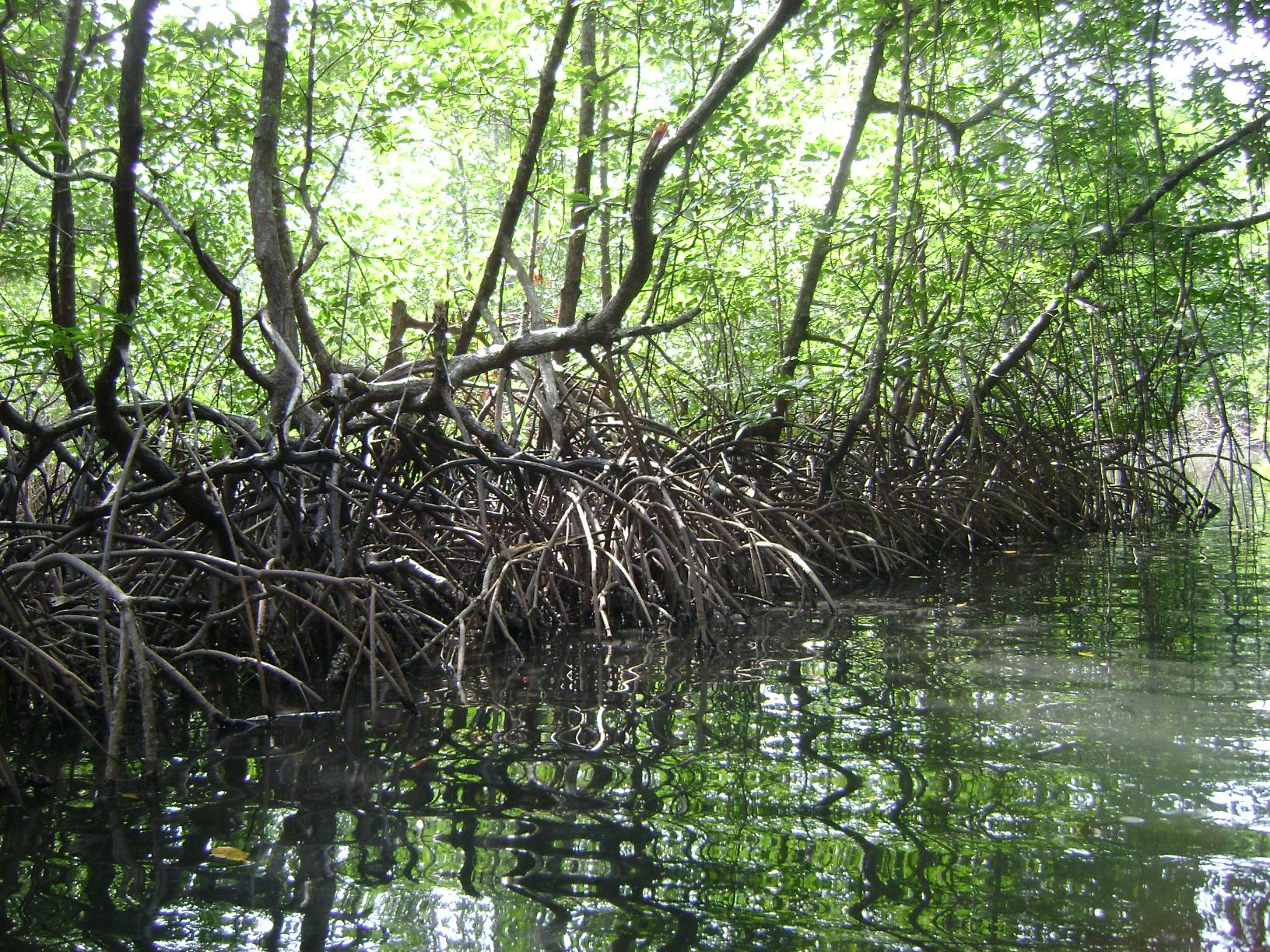
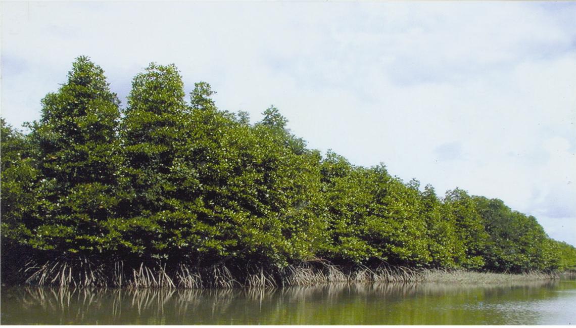
Damage and Losses of Mangrove Forest
Caused by the Cyclone Nargis
Damage to mangrove forests
Sr.
Township
R.F. Area
Remaining
Damage Area
(Acres)
Stands (Acres)
(Acres)
1
Lapputa
251,102
39,908
11,460
2
Bogalay
373,685
97,773
29,827
3
Mawlamyinegyun
54,232
620
155
Total
679,019
138,301
41,442
Damage to plantations
Sr.
Region
Established Area
Damage Area
(Acres)
(Acres)
1
Ayeyarwaddy Division
78,891
49,725
2
Yangon Division
81,990
1,829
Total
160,881
51,554
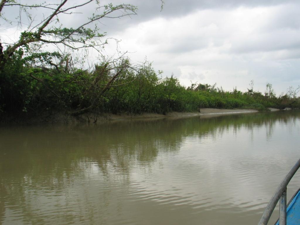
Pre & Post Cyclone Nargis situation of Mangrove forests in
Mainmahla Island, Bogalay township
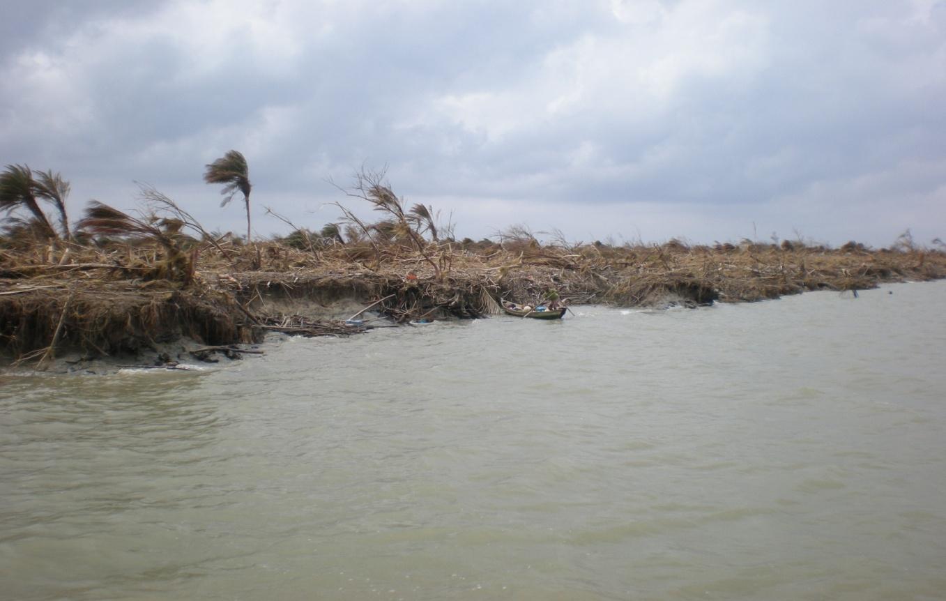
Pre & Post Cyclone Nargis situation of Mangrove forests
in in Byone Mwe Island, Bogalay township
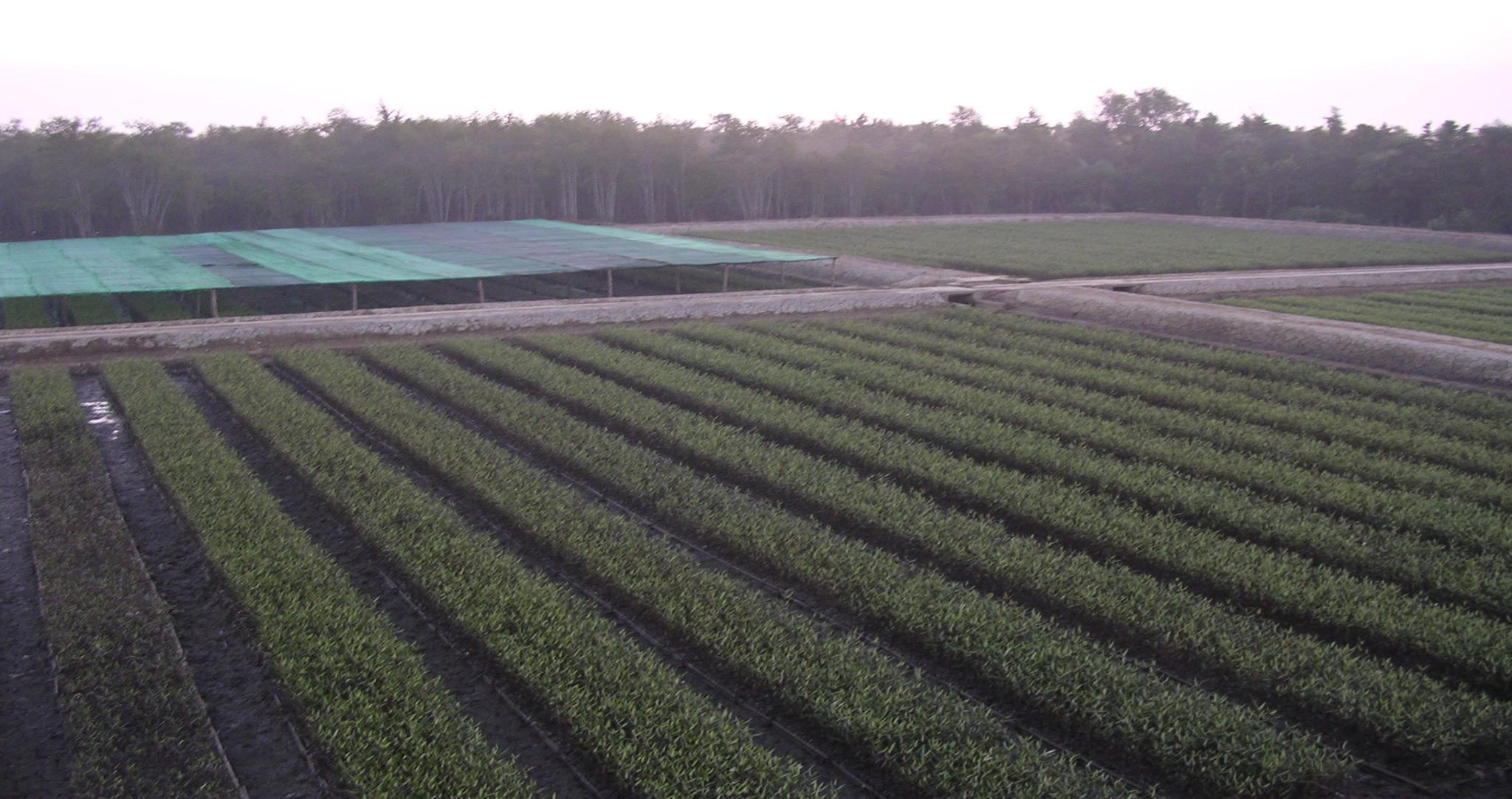
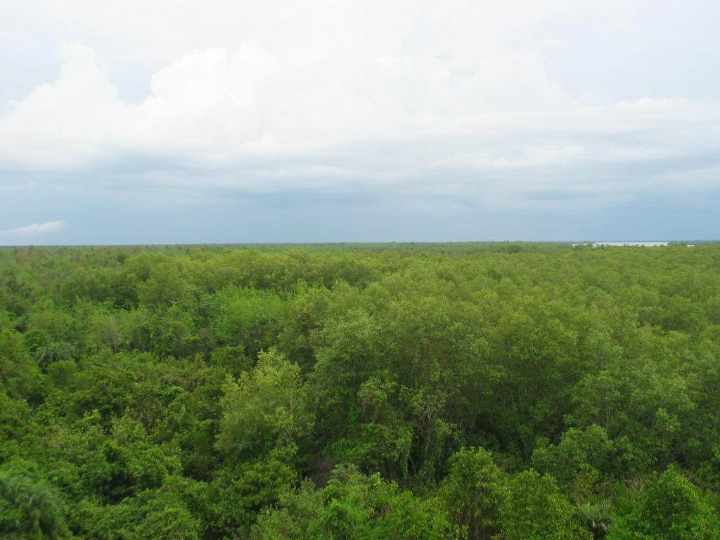
Nursery established by the JICA project
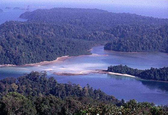
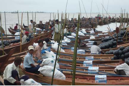
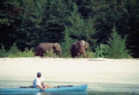
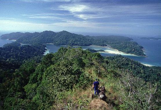
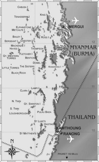
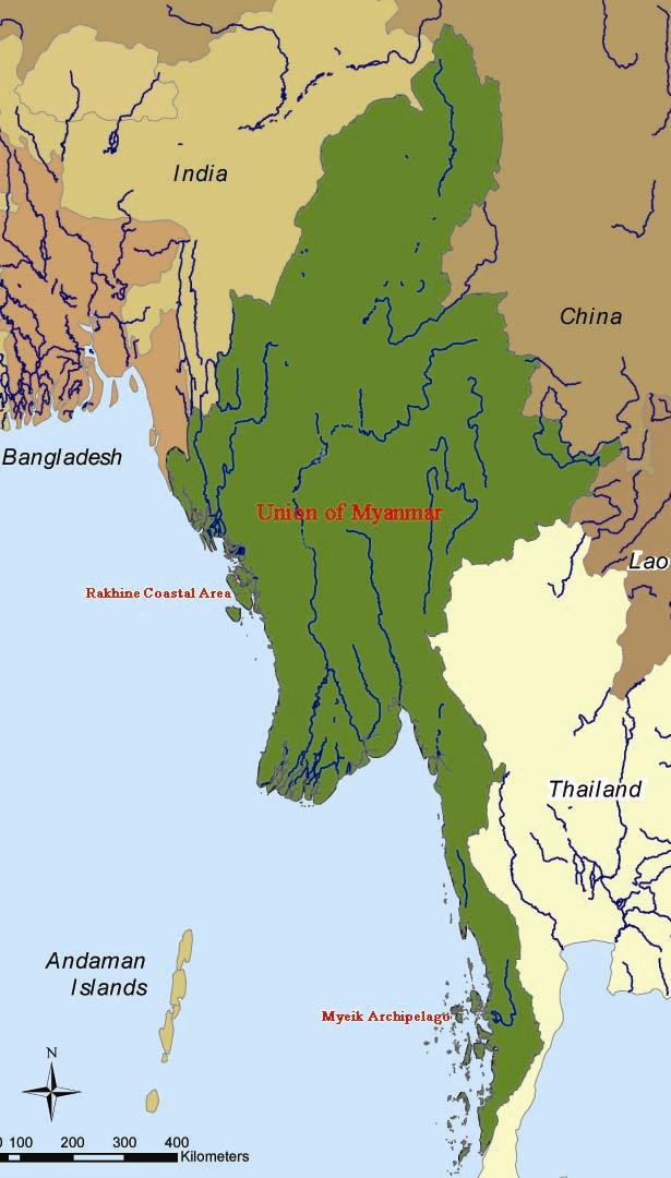
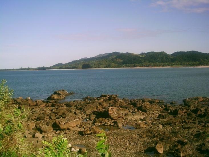
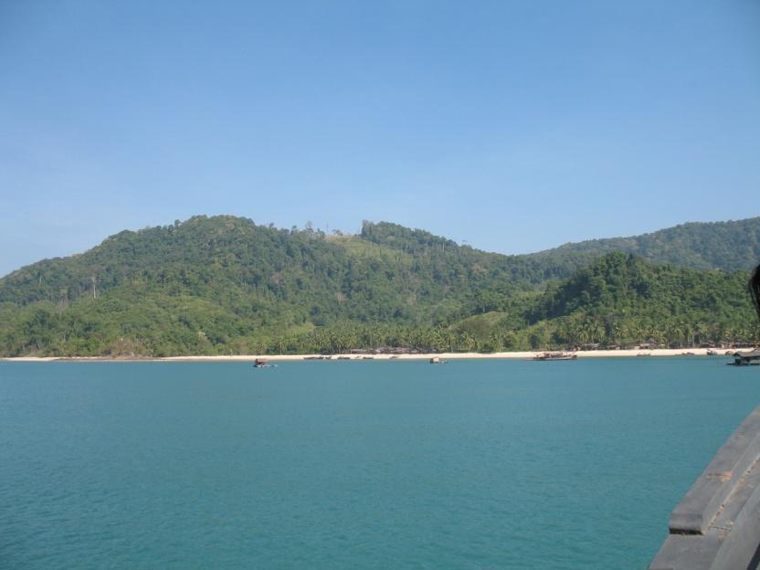
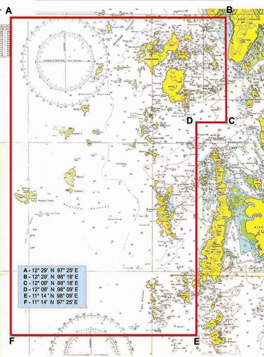
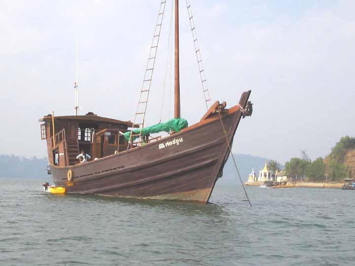
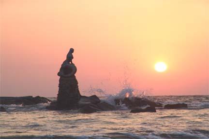
Myeik (Mergui) Archipelago
Large Island Ecosystem Of The Bay Of Bengal
Myeik or Mergui Archipelago covers approximately 36,000
sq km (14,000 sq miles), located in southernmost part of
Myanmar (Burma), comprises over 800 beautiful islands.
The archipelago of Mergui lies north of where the isthmus of
Kra divides Indochina Region from the Sundaic Region.
Flora and fauna of the two regions overlap here, making the
area especially interesting to field biologists.
Due to its virtual isolation, the islands and surrounding seas
are alive with an amazing diversity of flora & fauna and very
beautiful underwater scenes and marine life.
The islands are a part of the Burmese
(Myanmar) of Tenasserim Division
(Tanithary).
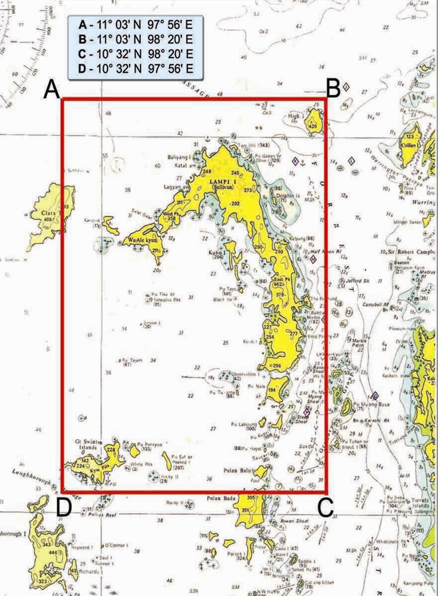
Lampi Island, now an ASEAN Heritage
Site & National Marine Park stretches
for more than 70km.
Historically, the archipelago had been an important
area for trade between Eastern and Western
civilizations particularly in the 18th Century.
After World War Two with the major political
changes that took place in Myanmar and rest of
Southeast Asia, the archipelago fell into obscurity,
resulting in over 50 years of very little human
activity.
With over 800 islands, some of them the size of
Singapore or Phuket, and most of them completely
uninhabited, the area has unlimited potential as a
playground for divers, yachties, naturalists, and
other pleasure seekers.
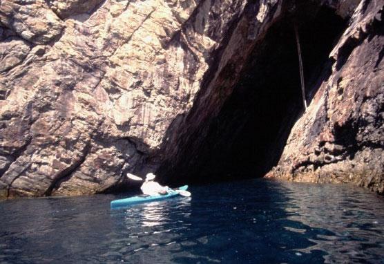
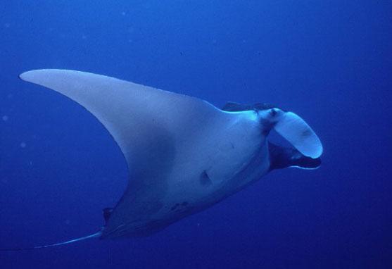
Underwater, this region offers scenic reefs,
fascinating topography and prolific fish and
invertebrate life. One of the main attractions
for divers is the strong possibility of seeing big
animals, especially sharks and rays. More
dependable, however, is the tremendous
variety of smaller fish and reef creatures,
including many unusual species, some of
which are rarely encountered in other water.
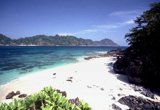
The islands are rugged, unspoiled
terrestrial scenery, high-profile
limestone and granite topography. The
vast majority are uninhabited and
largely untouched by humans. Dense
brush and rainforest cover most areas
above the high-tide line, while vast
stretches of mangroves and
magnificent white-sand beaches are
interspersed with rocky headlands, tidal
creeks and a few freshwater rivers.
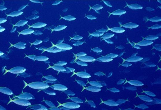
Underwater, this region offers scenic reefs, fascinating
topography and prolific fish and invertebrate life. One
of the main attractions for divers is the strong
possibility of seeing big animals, especially sharks
and rays. More dependable, however, is the
tremendous variety of smaller fish and reef creatures,
including many unusual species, some of which are
rarely encountered in other water.
The only human inhabitants in the area
are sea gypsies, called Salones by
Myanmars. They live on boats during dry
seasons and remain on land during rainy
seasons. They still practice the same
fishing and boat building techniques used
for generations.
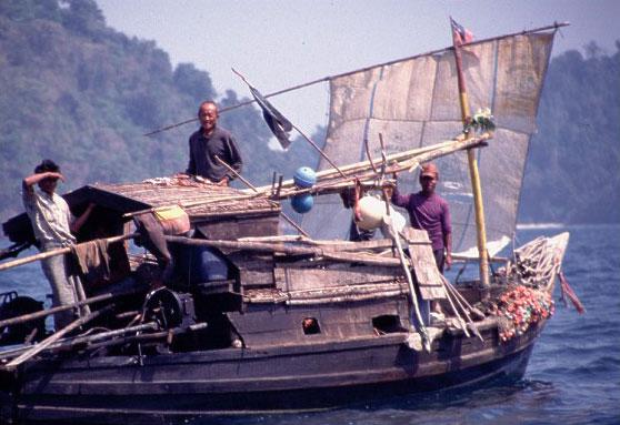
The Moken live in family groups
on boats made from hollowing
out large trees. They roam the
archipelago collecting mollusks
in the tidal flats, diving for shells
and foraging for other food on
the islands
Moken, one of the few remaining groups of sea-gypsies in the world
Burma Banks
A largely unexplored area, the Burma Banks are
a series of large underwater flat-topped sea-
mounts that lie approximately 180 kilometres
(100 nautical miles) northwest of the Similan
Islands. The Banks' surrounding waters are over
350 metres deep and large areas rise to within
the depth limits of recreational scuba diving. The
name derives from the fact that this 1,500
square kilometre area lies within the exclusive
economic zone of Burma.
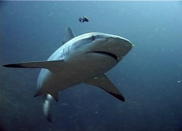
Sharks are perhaps the most misunderstood of
marine animals. Often portrayed as bloodthirsty, evil
killers, in reality sharks should be far more afraid of
humans than vice versa While people routinely kill
sharks for pleasure and profit, shark aggression
toward human! is rare, and unprovoked attacks on
divers are almost unheard of. Fortunately, attitudes
toward sharks are slowly changing.
As of May 24, 2004, the
Myanmar Government has
outlawed all shark fishing
north of Lampi Island in the
Myeik (Mergui) Archipelago.
Steps have already been taken to
preserve the islands, and developing the
area in a positive way.
Unfortunately, many sites show signs of
wear and tear that the dynamite causes.
Meanwhile, the diving is excellent, but
could be better if more controls were
implemented.

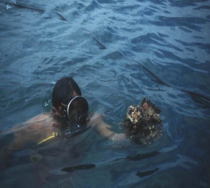
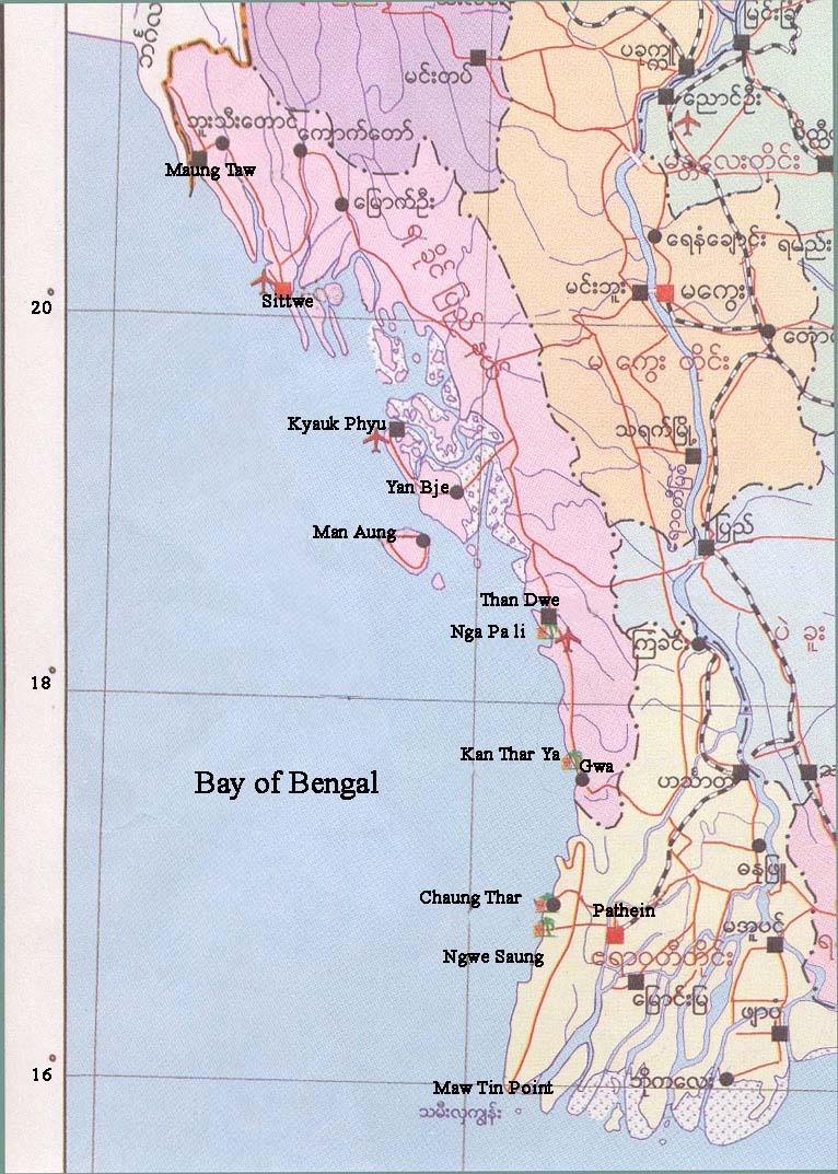
The Preliminary Coralreef Assessment Survey
At Rakhine Coastal & Mergui Archipelago
Preliminary Coralreef
Assessment Survey
Rakhine Coastal 2000
Mergui Archipelago-2001

Preliminary Coral reef Survey at
myanmar
Myanmar
Scientist
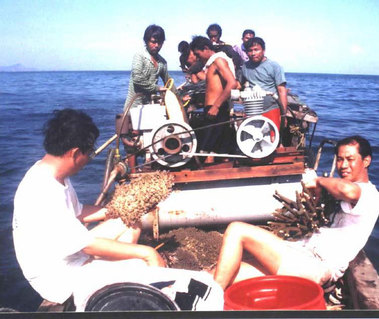
Preliminary Coral reef Survey at
myanmar
Since 2000 March
and April,
Myanmar Team
Collect data and
Species at sea.
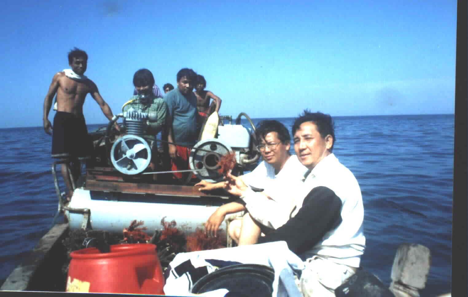
Preliminary Coral reef Survey at
myanmar
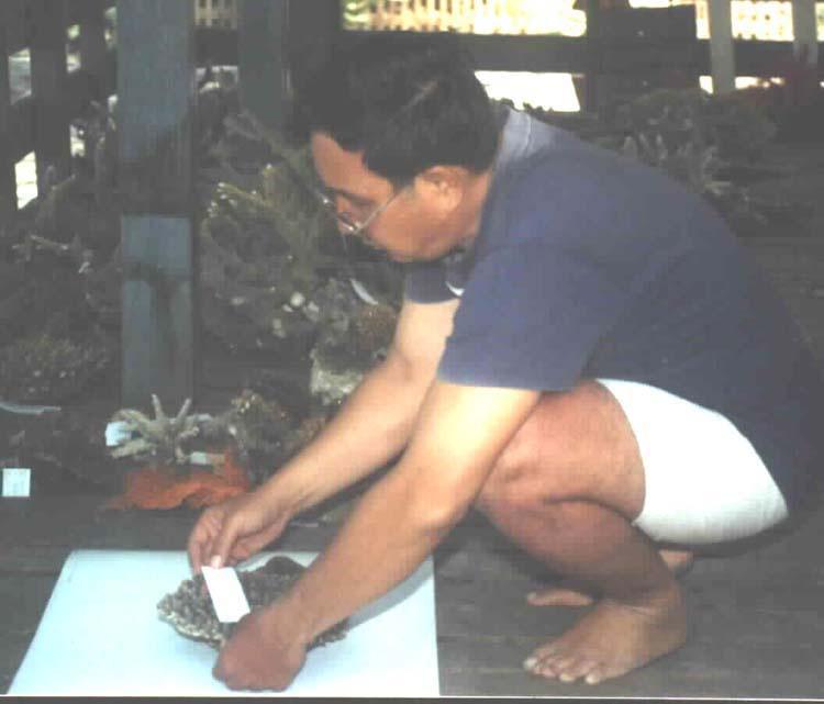
Preliminary Coral reef Survey at myanmar
Myanmar
Scientist
identified The
Coral species
Collecting the Data and Information of
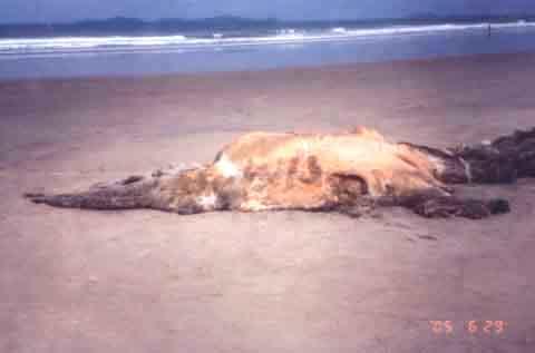
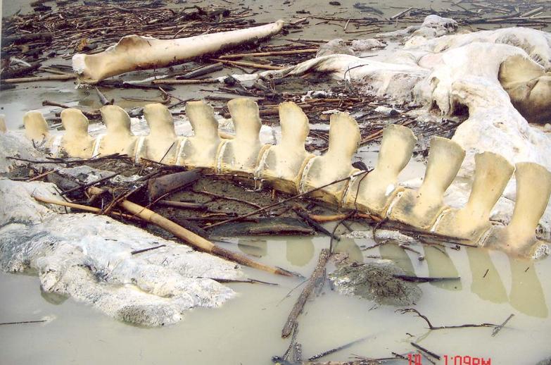
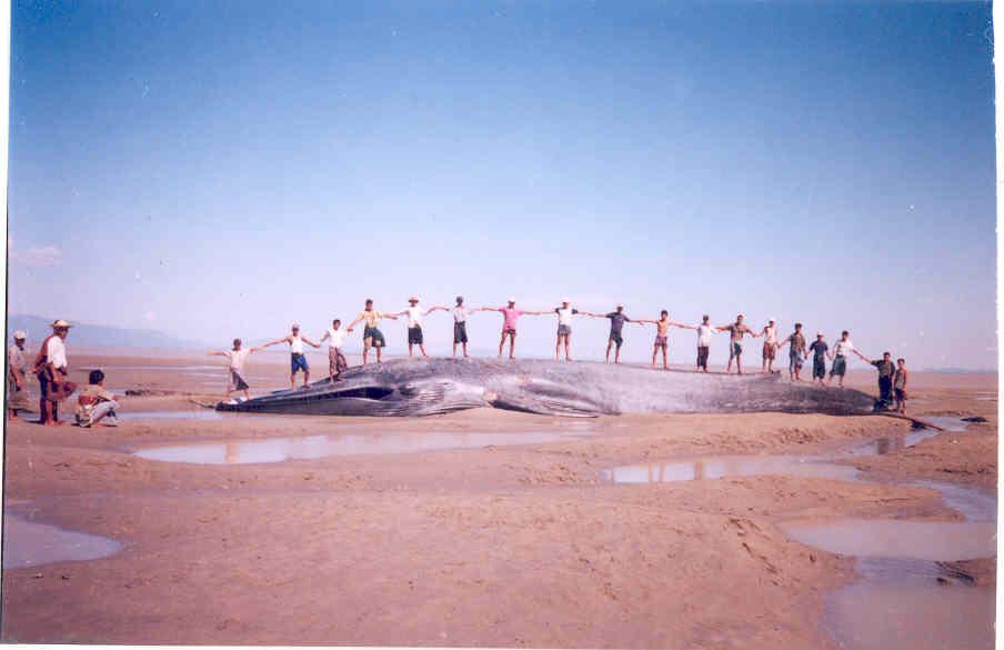
Whale stranding along the Myanmar coastal Area
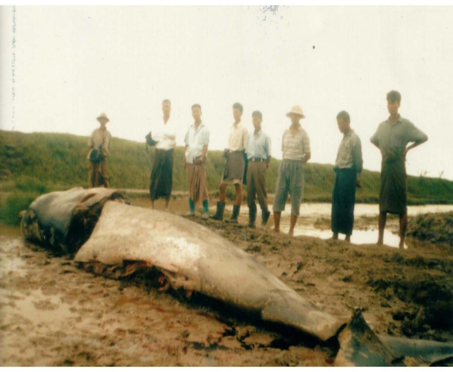
Significant rare Whale Stranding at Yangon River
mouth, July 2005
Longman's-Beaked Whale
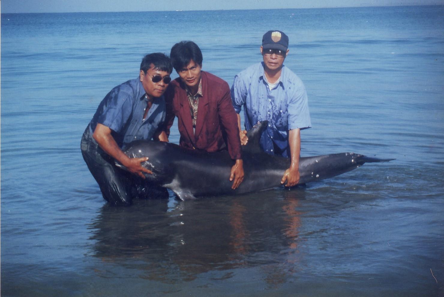
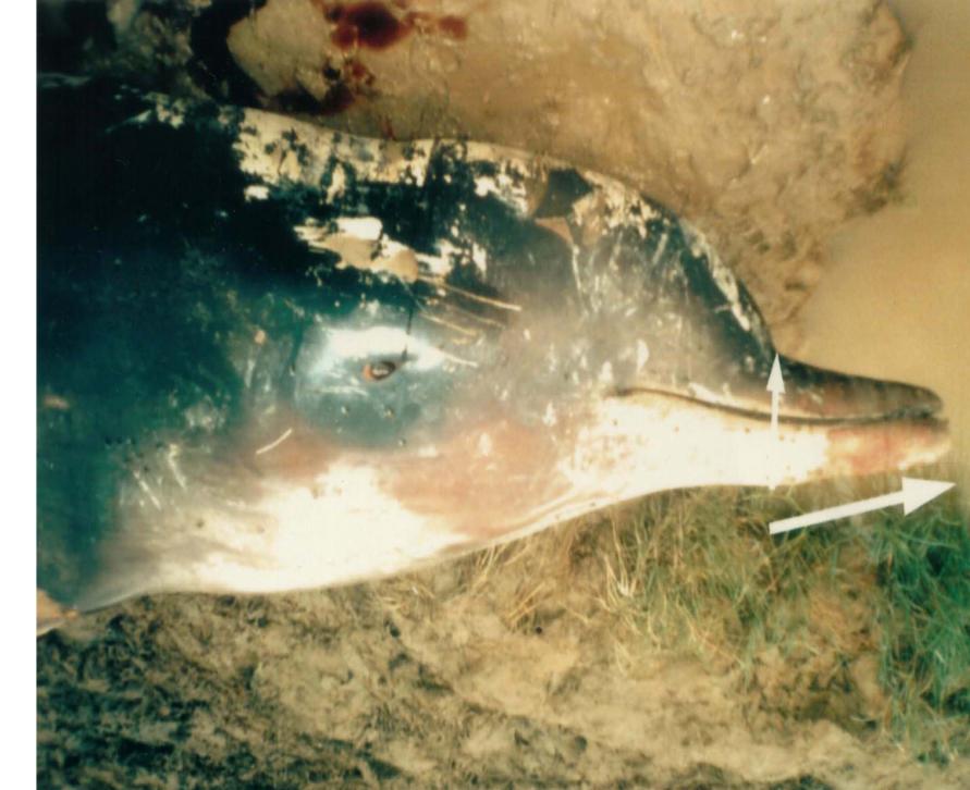
Pygmy-Killer Whale rescue & releasing at
Rakhine Coastal (Kan Thar Ya) -2000
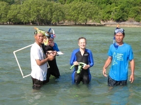
Dugong Survey Area
Rakhine Coastal Area
&
Myeik Archipelago
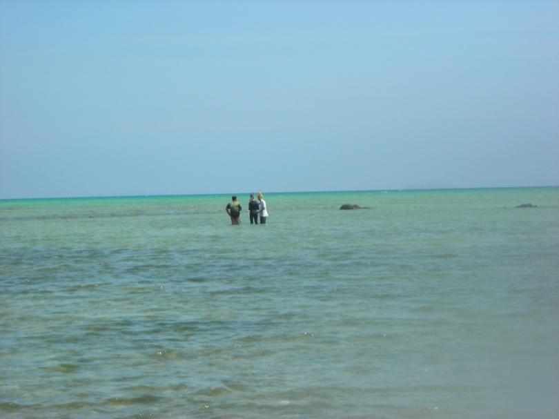
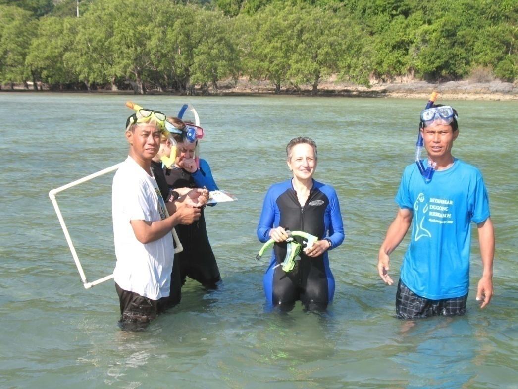
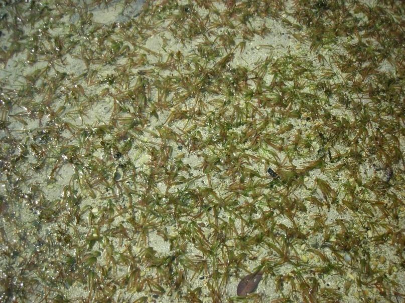
Myeik Archipelago
Dugong & Seagrass
Survey-2006-2007
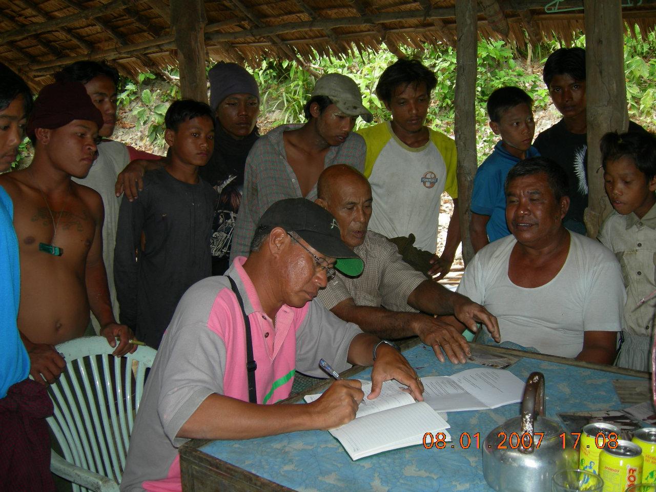
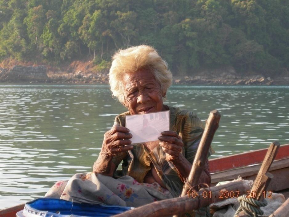
Information Gathering
Inside the Mergui
Archipelago
All island, all communities
all stakeholders
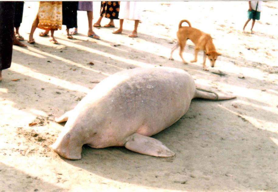
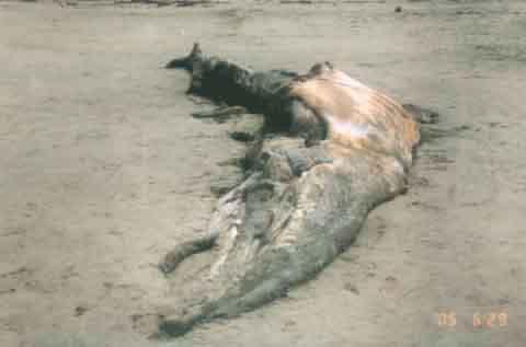
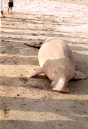
Dugong carcas at Rakhine
Coastal Area, accidental kill
In fishing Gear-2005
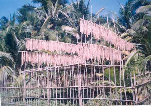
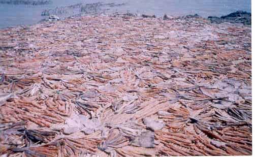
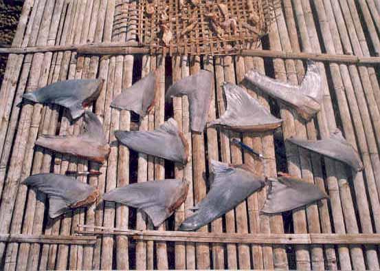
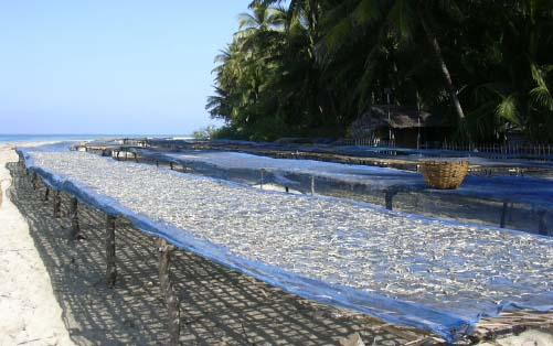
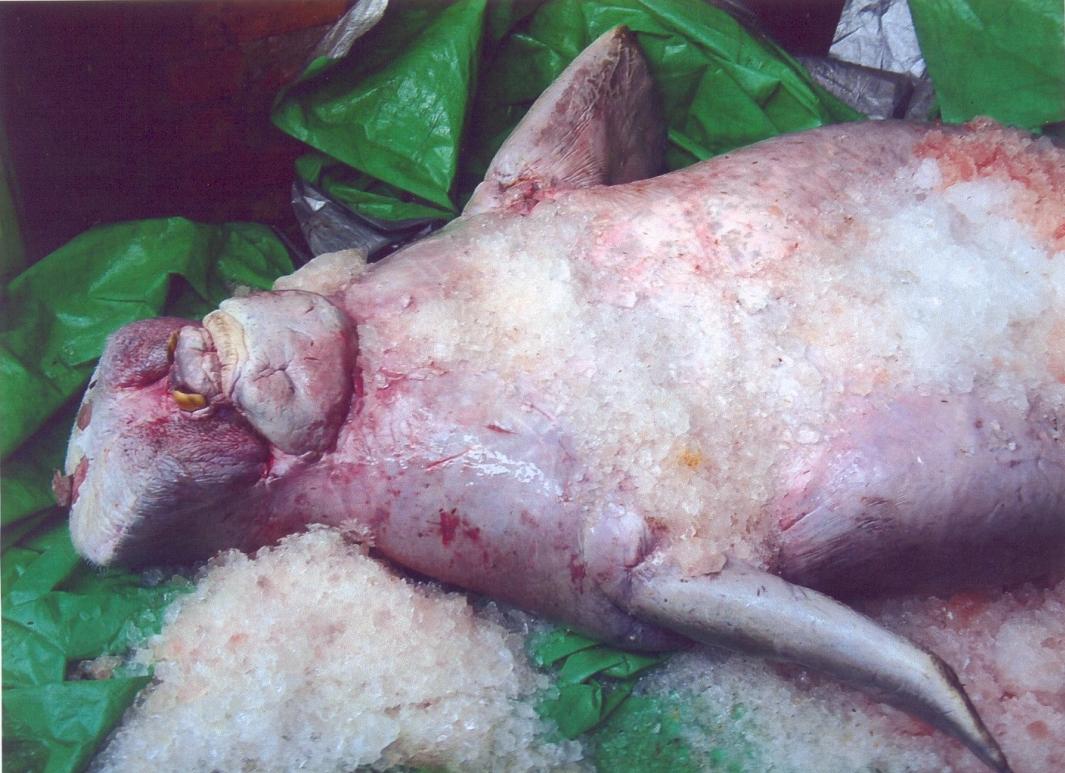
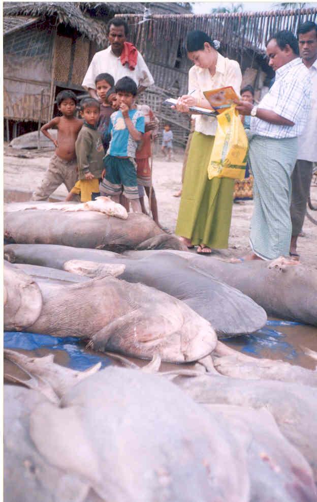
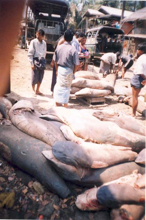
Utilization of Shark
Landing site and Market
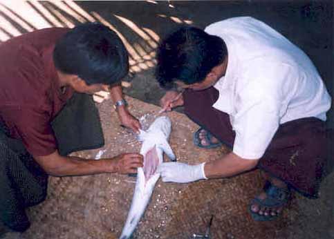
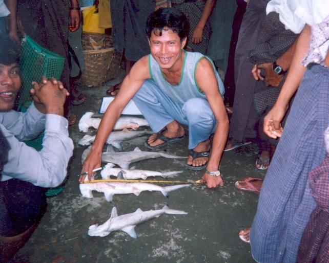
Shark Data Collection
length frequency
Collect information
Shark markets
Maturity stage analyzed
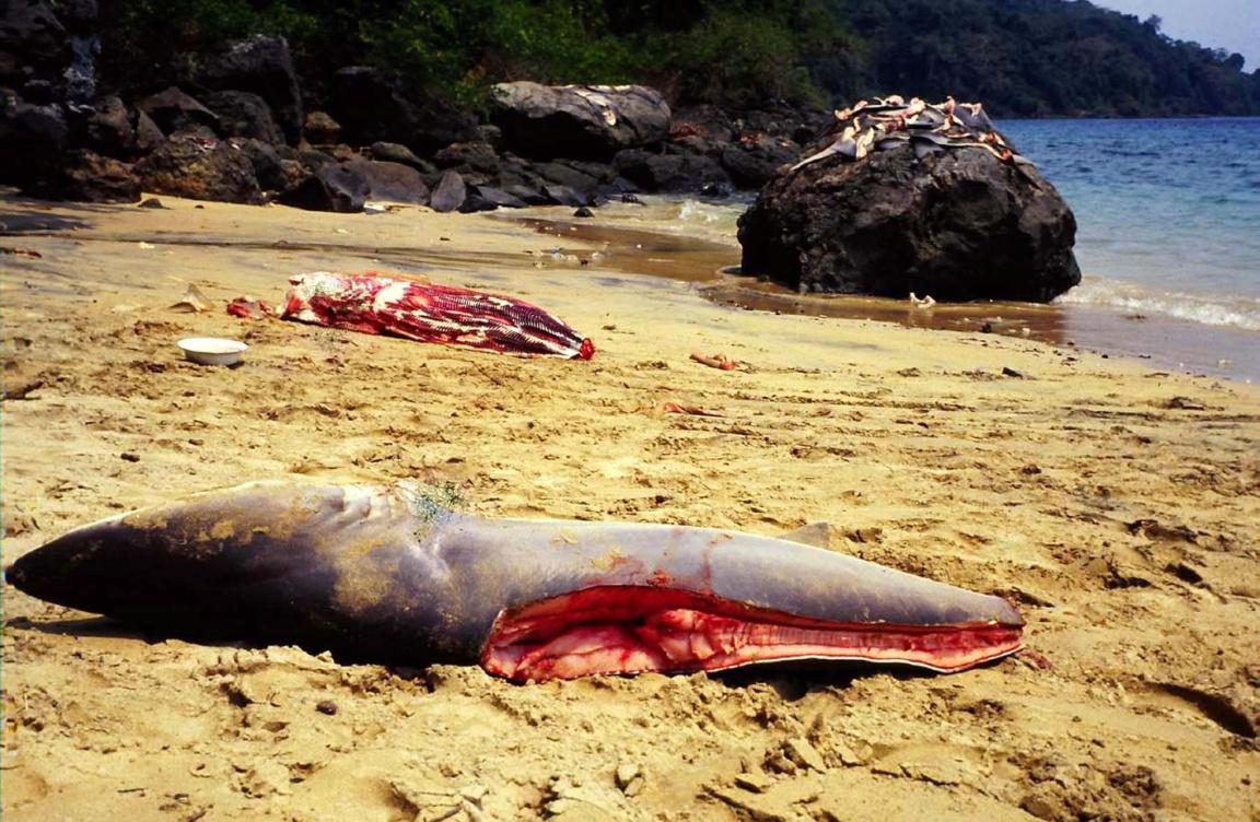
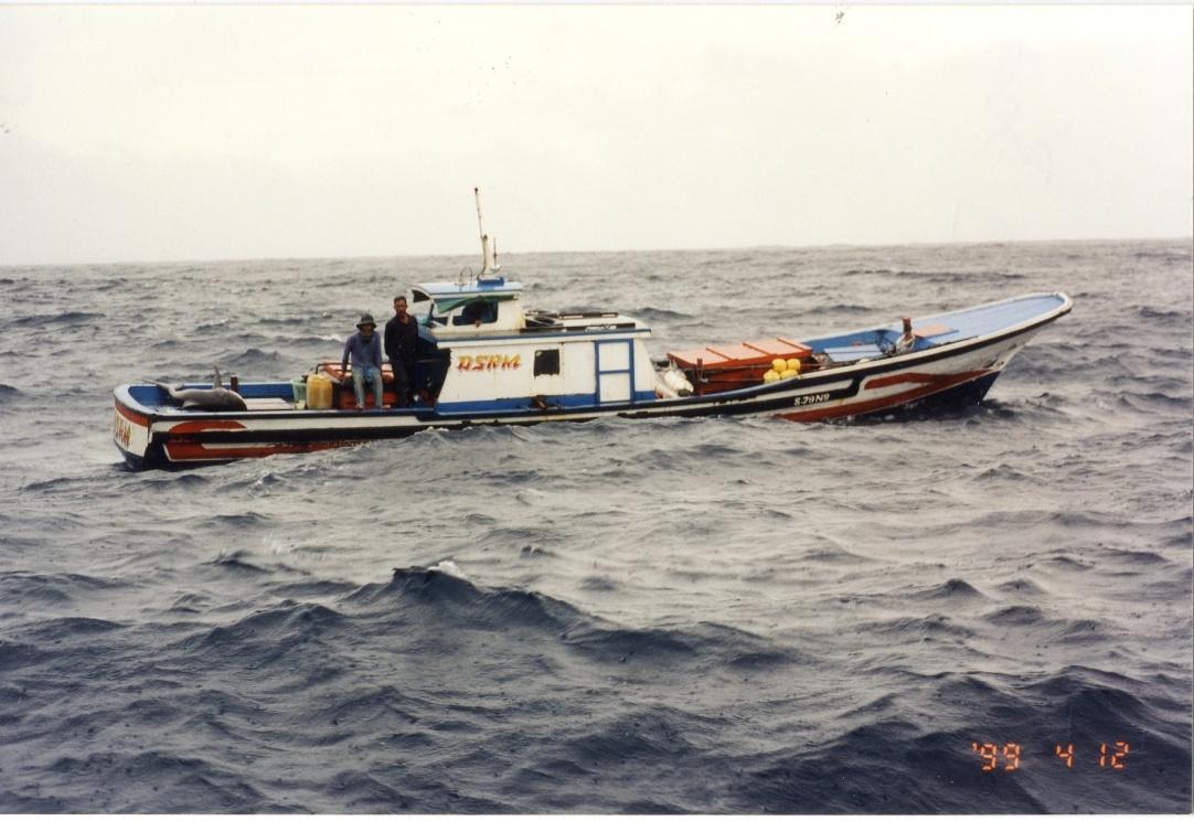
Illegal Shark
fin production and
Fishing boat
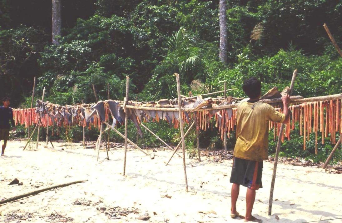
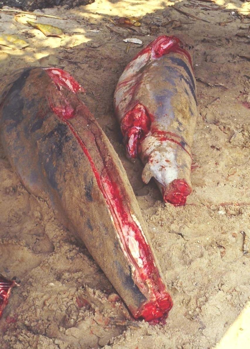
Illegal Shark fin production
at Mergui Archipelago
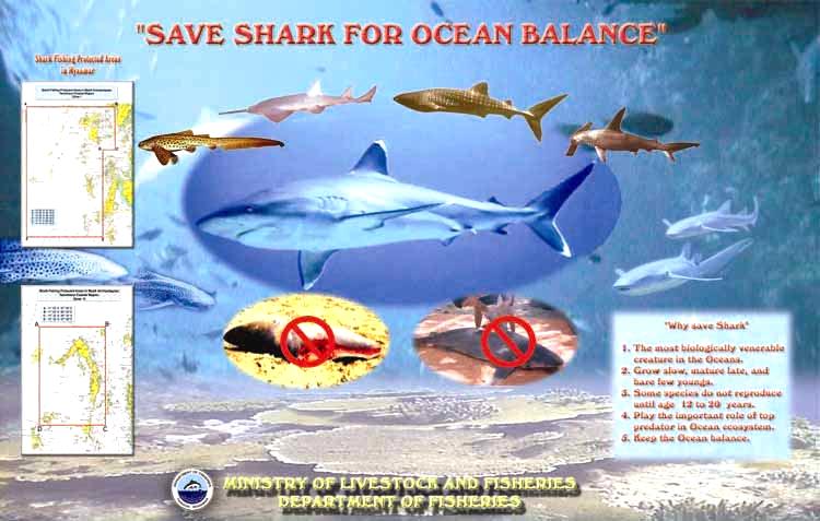
Shark Protected Area
Public Awareness for Shark Conservation Poster
Shark protected Area ( I )
Tanintharyi Coastal
Lampi Island
Established 5-5-2004
By
The Department of Fisheries
Shark protected Area (II )
Tanintharyi Coastal
Ross Island
Established 5-5-2004
Indian mackerel & Hilsa fisheries
Present time the Indian mackerel tagging program was
conducted with SEAFDEC organization at the Myeik
Archipelago, now the program is still going condition.
Department of Fisheries is collaboration with BOBIGO and
collection the data and information program of Hilsa
fisheries at landing site; it's also still implementing stage.
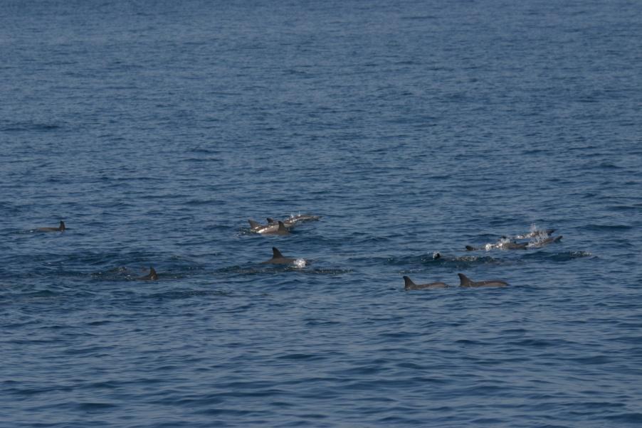
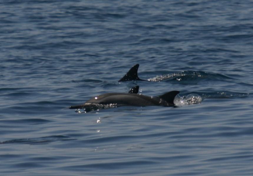
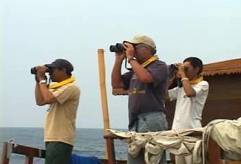
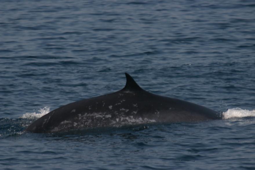
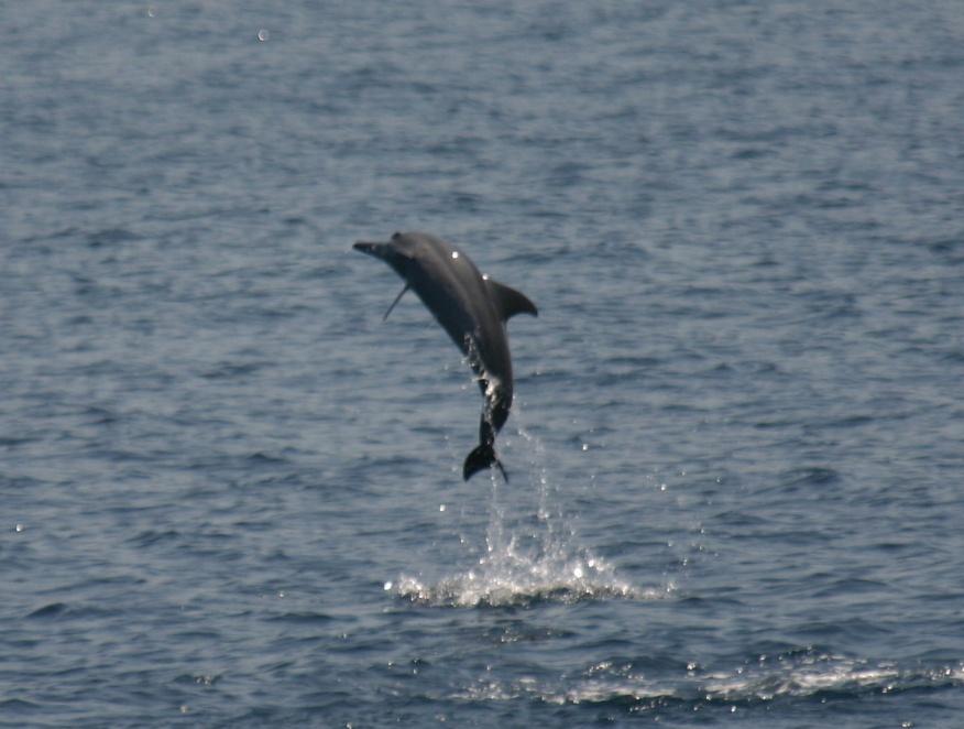
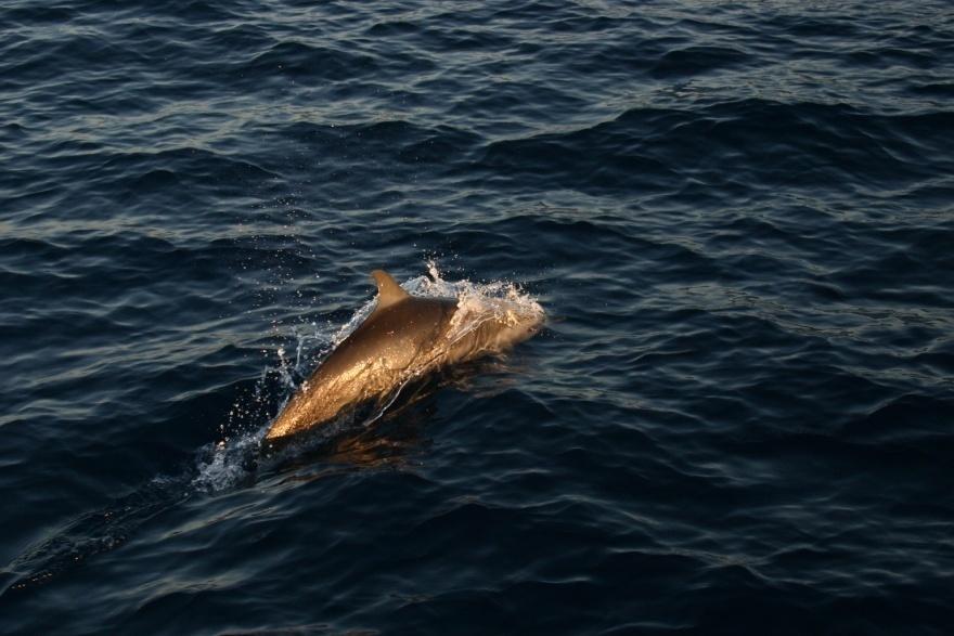
Cetacean Survey in Myanmar
During April 1996, boat based visual surveys for coastal cetaceans
along the Rakhine Coastal area, especially Sittwe, Kyaukpyu and
Thandwe coastal area. Total 566.6 km (57.7 hours) of search effort
conducted in coastal/bay/inlet habitat along the Rakhine Coastal
area. A team recorded 18 sightings of cetaceans: bottlenose
dolphin 38(Tursiops truncates, aduncus-type) ayeyarwady
(Irrawaddy) dolphin 19(Orcaella brevirostris), spinner dolphin
361(Stenella longirostris) and 1 Bryde's Whale,
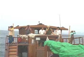

Mergui Archipelago
Cetacean Survey -2005
DoF and WCS
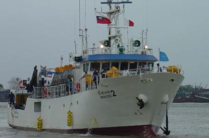
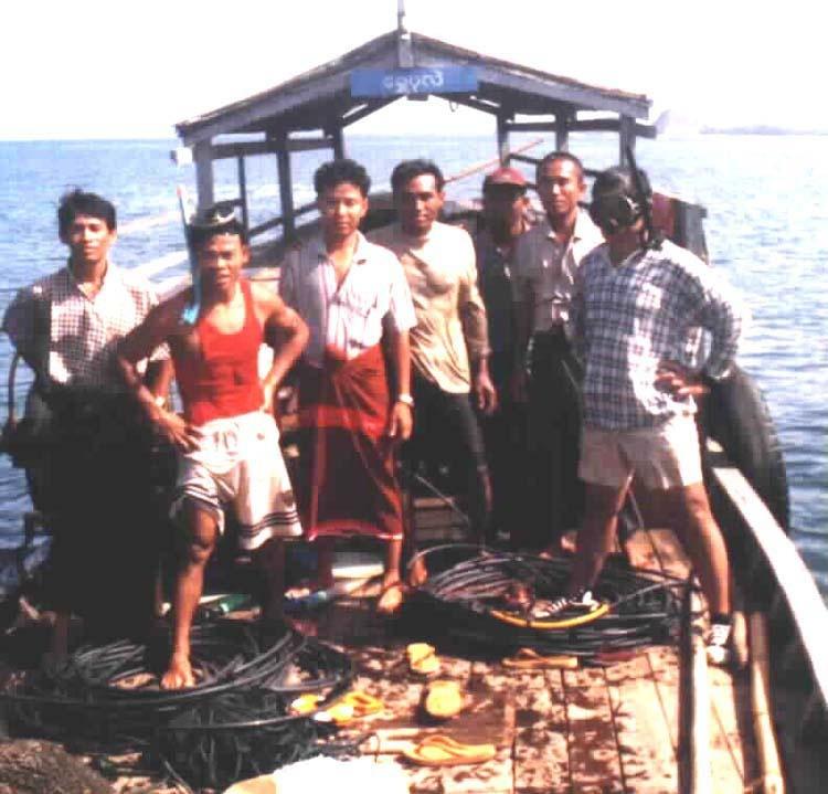
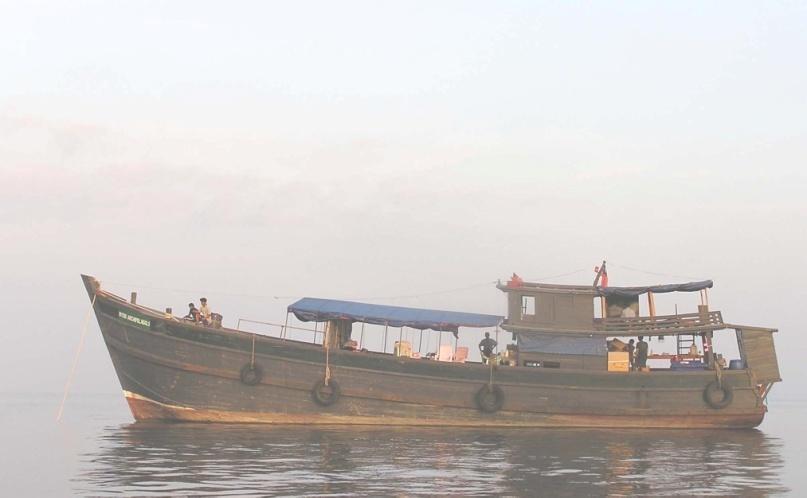
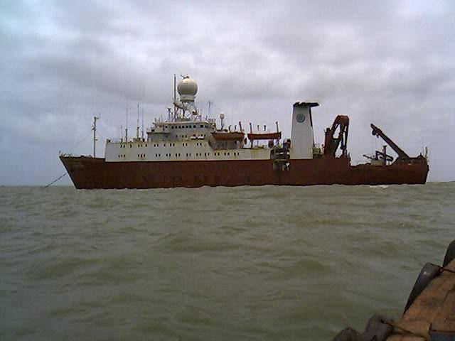
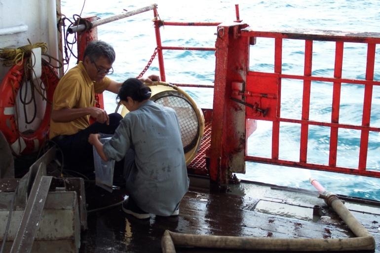
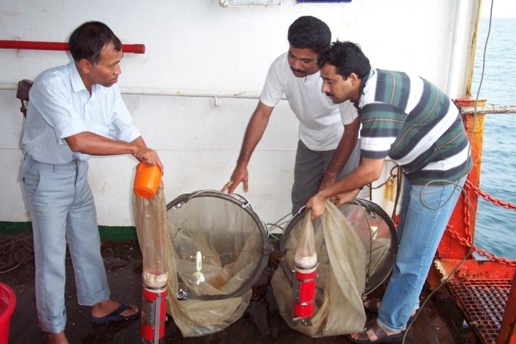
Marine Fisheries Survey
Training and Research
Vessel
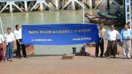
M.V. SEAFDEC 2
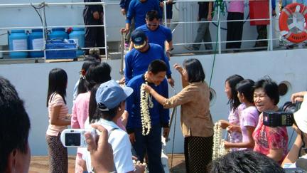
arrived at Myeik Jetty
Warmly Welcome
to
M.V. SEAFDEC 2
from Myanmar
Scientists
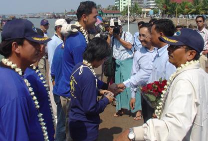
Warmly Welcome M.V.
SEAFDEC
Scientists and Crews
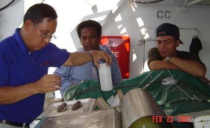
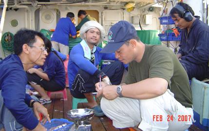
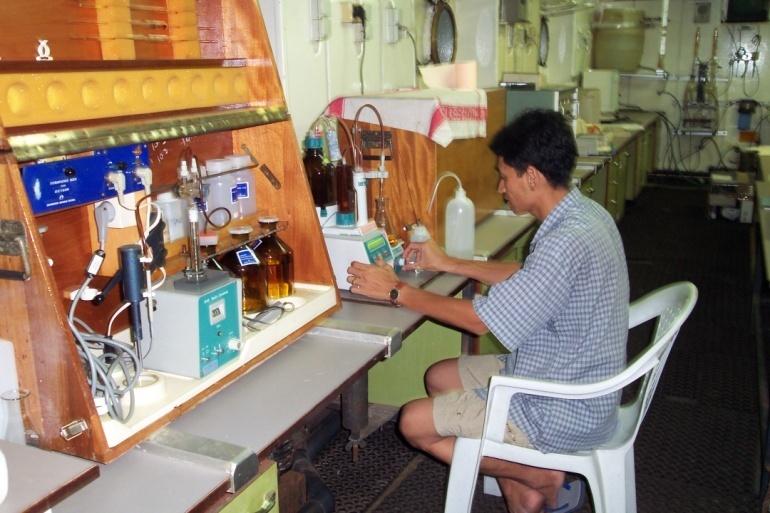
Myanmar Scientists at
Works
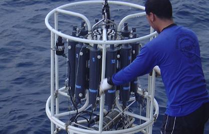
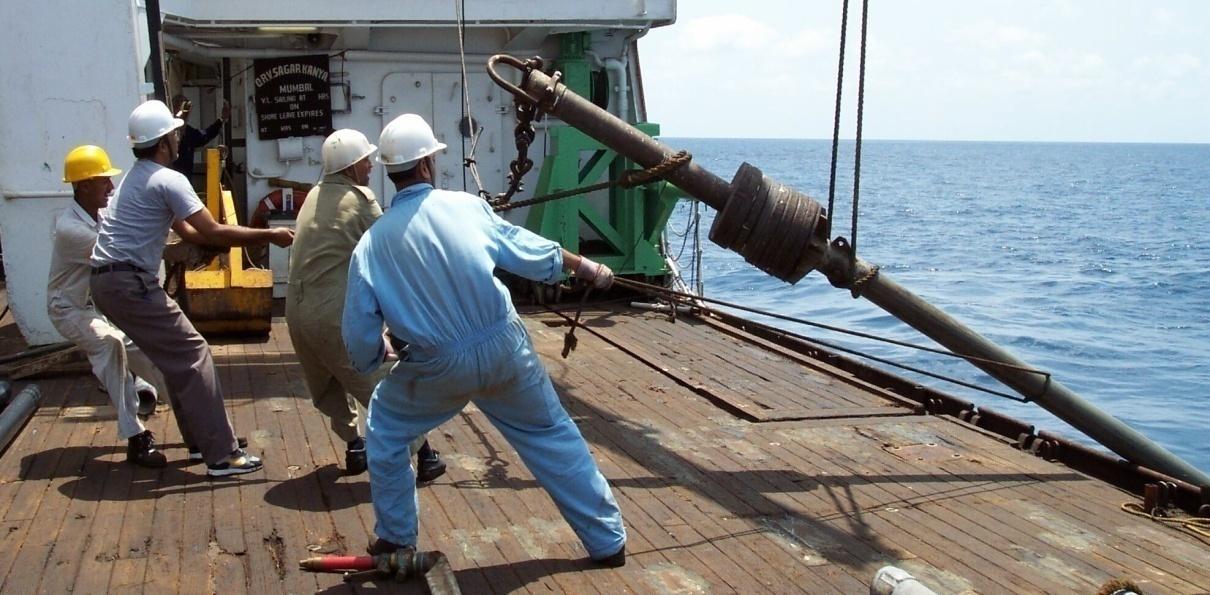
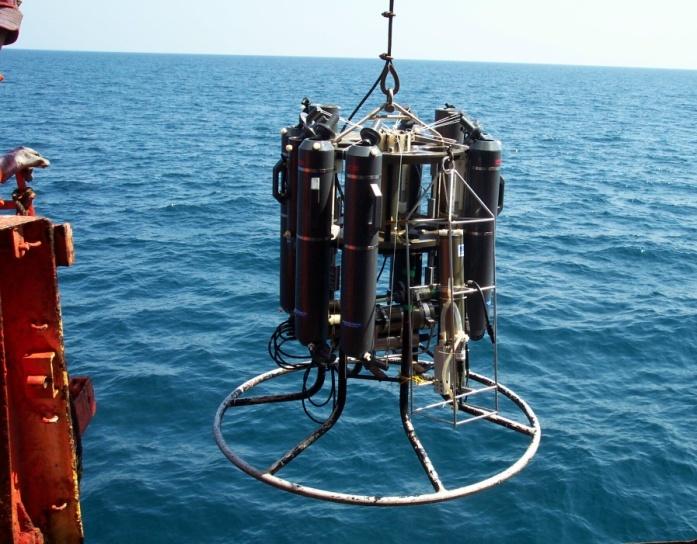
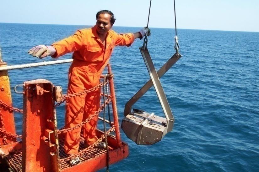
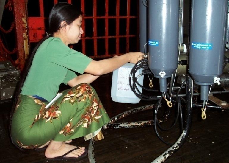
Oceanographic Study at Sea
Conducting CTD
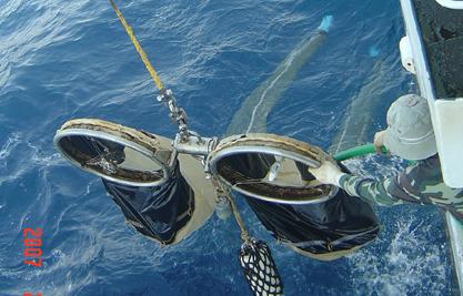
Bongo net for Plankton


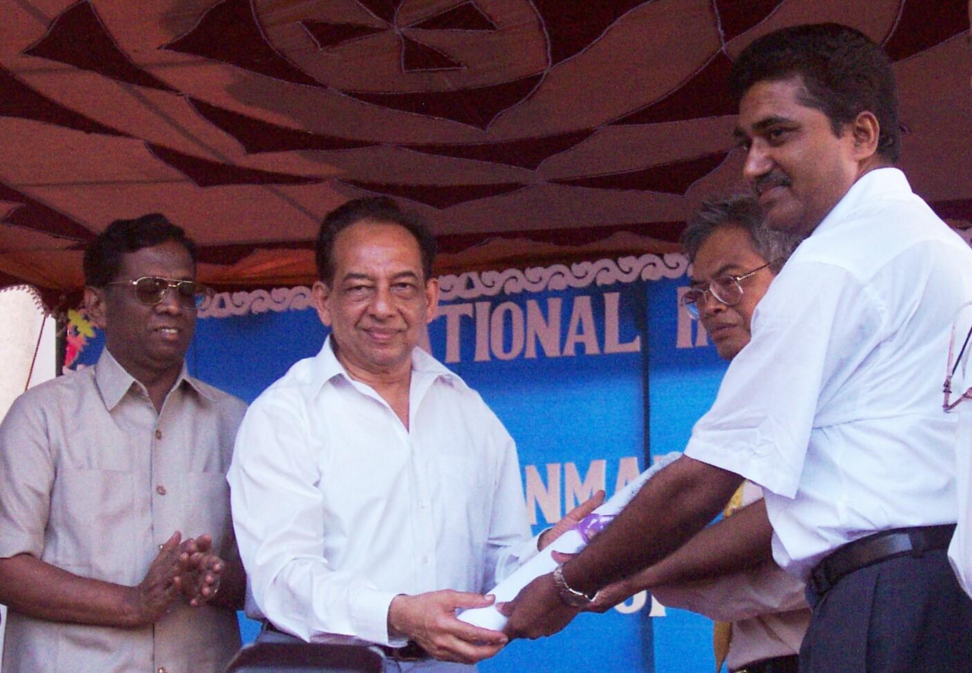
Myanmar- India Oceanography Joint cruise
Flagged off by Dr. Harsh K. Gupta, Sec. DOD, Govt. of
India
15 April 02
Chennai

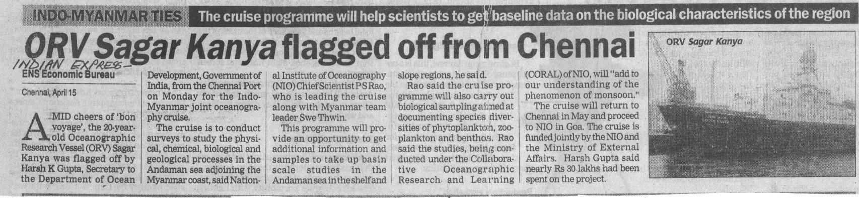

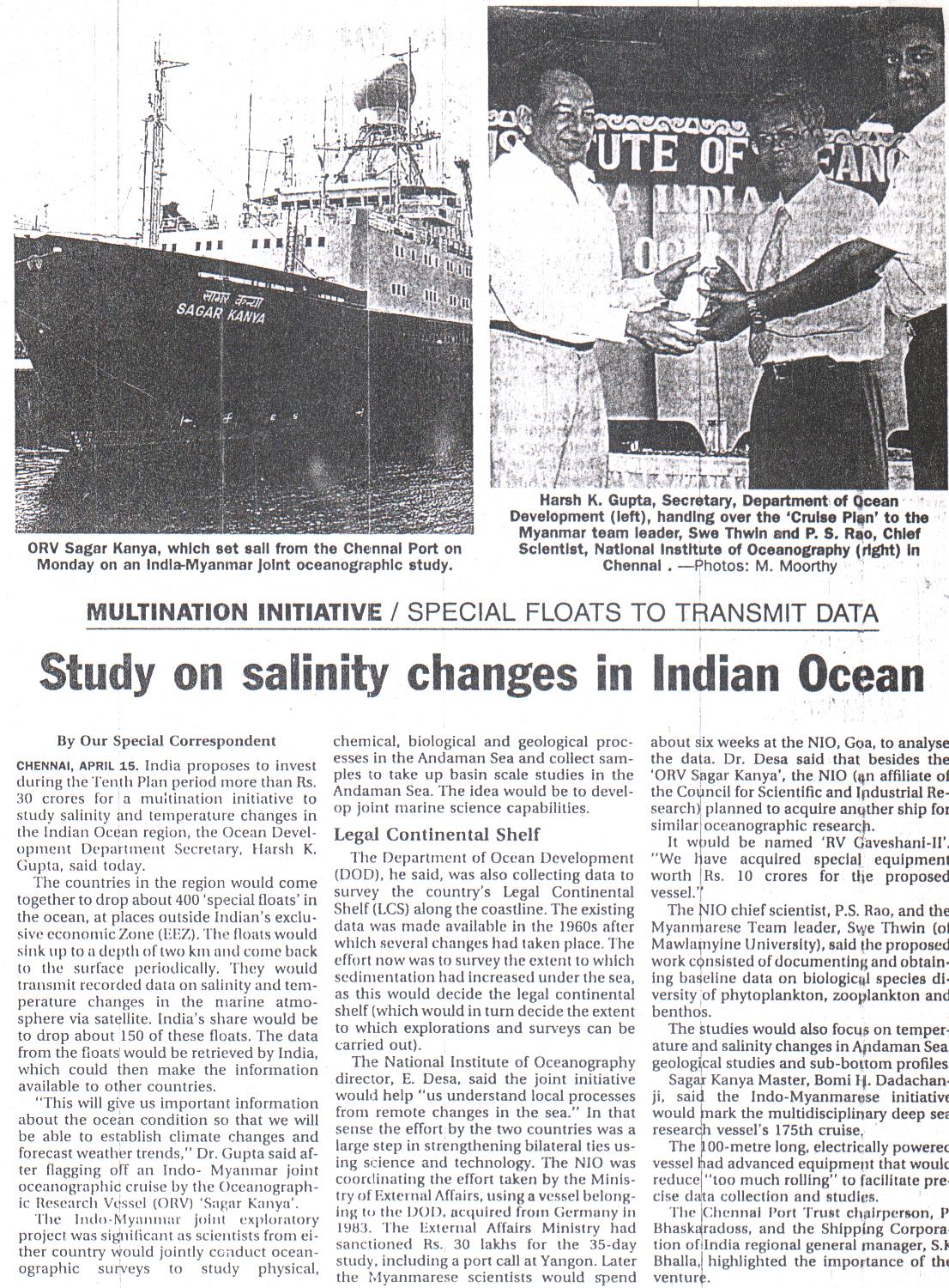
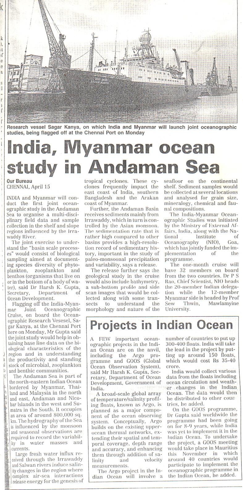

Excellent Cruise

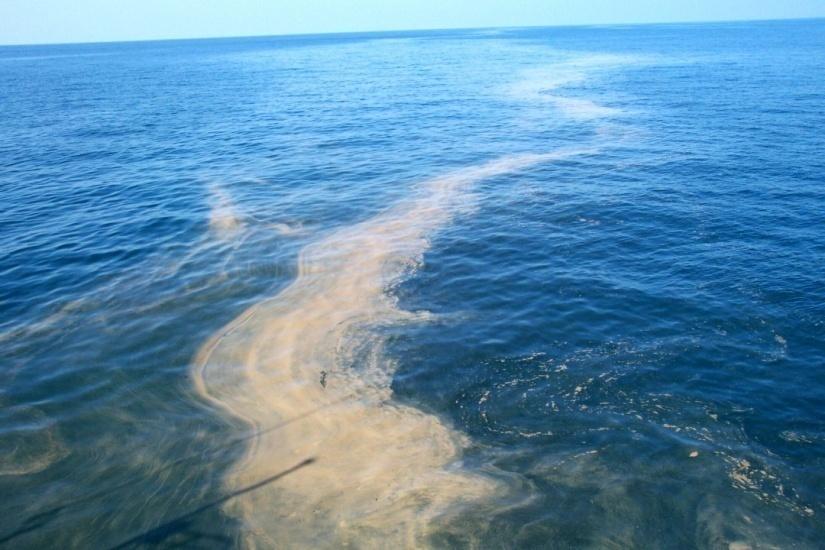
Total 130 locations
CTD Ł 70 stations
Water samples Ł 68
Surface sediments- 125
Sediment cores- 15
TSM (surface)Ł 160
TSM (profile)- 30
Geophysical data Ł 850 lkm

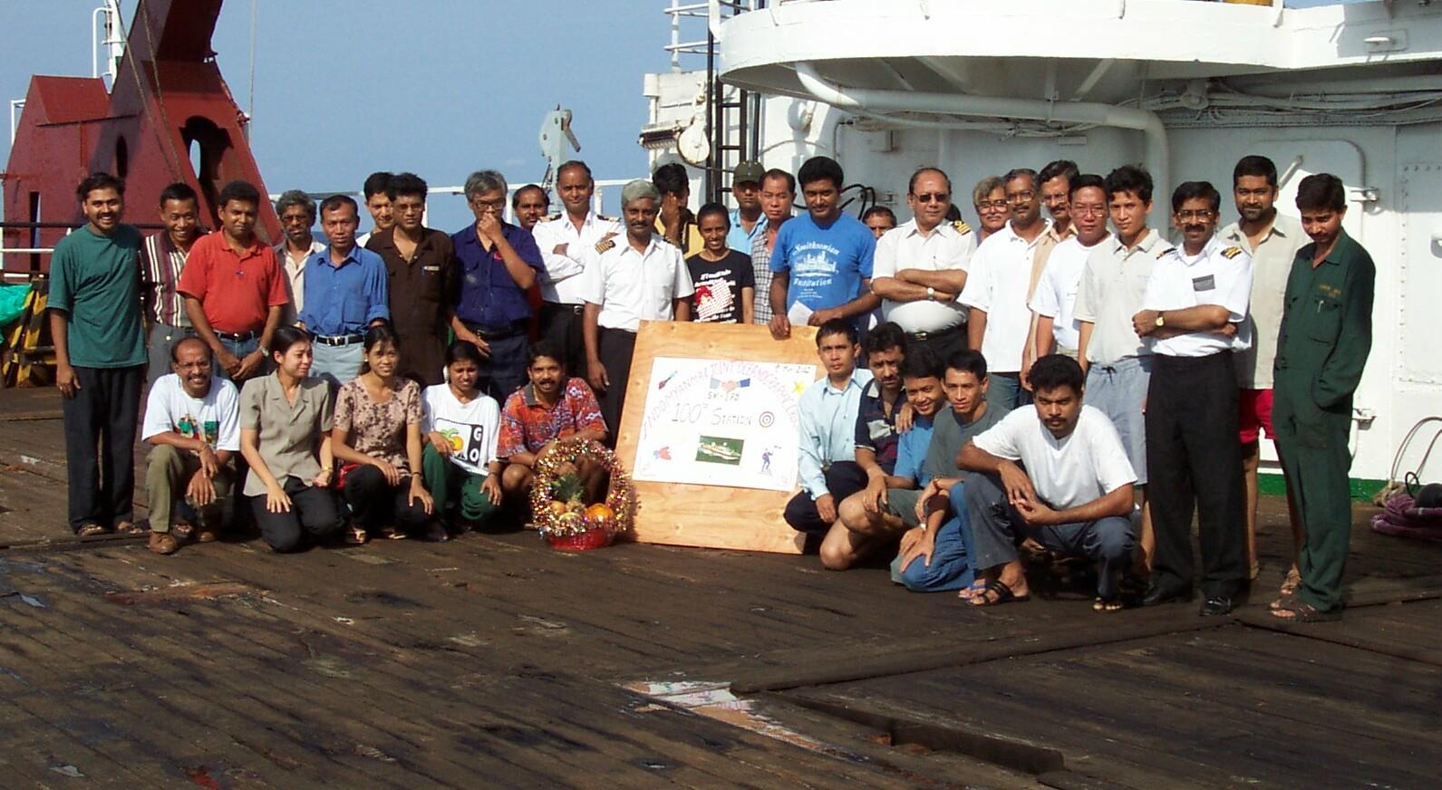
Celebrating 100th station


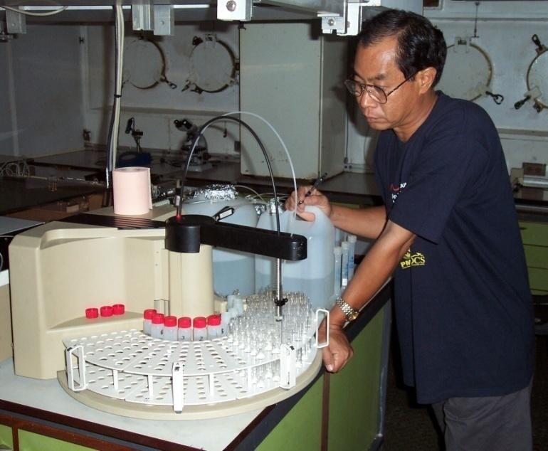
Multi-disciplinary training
Zooplankton & fish larva; primary
productivity; benthic biology
DO, nutrients, DMS
Micropaleontology Ł benthic
foraminifera
Instrumental techniques Ł SEM-
EDAX; NMR; XRD; design &
development of instruments
Bathymetric maps using
computers
SST, salinity data and surface
met observations
Thank You