Task 1.1 Drawing up detailed topographic maps of the Kalimok-Brushlen wetland in scale 1:5000 using GPS and digital maps.
1. Performed activities
For completion of the task the following activities were performed:
1. Preliminary study
2. Elaboration of design for Primary Geodetic Control Network (PGNC) and Secondary Geodetic Network (SGNC)
3. Stabilizing, measuring and computing of PGNC and SGNC
4. Area mapping.
1.1 Preliminary study – march 2003
Main aims of the study are:
- Data collecting for design of PGNC and SGNC .
In the area of Kalimok-Brushlen were found altogether 8 existing points 6 of which of National Geodetic Network (NGN) and two of Regional Geodetic Network (RGN).
In the area of Belene were found four points of RGN.
- Data provision for design of bench traverses.
A research of existing in the region of Kalimok-Brushlen bench marks of National Level Network (NLN) was made with the purpose of high-precisely attachment by level to the Elevation System – Baltic.
Three bench marks of the second-class bench traverse Rousse-Silistra were found in good condition and suitable places, namely: BM1039 located in Nova Cherna; BM1041 (29.692) to the east of Tutrakan and BM48 (27.094) located in Tutrakan, all as a part of second-class bench traverse of NLN.
1.2 Elaboration of design for PGNC and SGNC
Design for PGNC on the territory of Kalimok-Brushlen is conformable to technology of point’s co-ordination – through GPS.
The main goal of the project is to assure by coordinate and by elevation the ”spine” of following geodetic land and hydrographic surveys with the purpose of mapping of the Danube River riverbed.
It consists of 10 points, 2 of which new-established ones and 8 already existing ones – 6 of NLN and 2 of RGN.
Three points shall be surveyed from the both base stations and closed figures shall be computed for fulfillment of strict control of results by coordinates, as well as predominantly by elevation.
For the long-term use of the points it is provided to be stabilized with permanent signs as provided by the ZKIR instruction for this kind of activities.
SGCN
Secondary Geodetic National Network is designed for achievement of the following main aims:
To be used as a base for mapping the right of way of the future dike.
To be used for mapping of the territories of in/out water flows in the wetland.
To ensure base for mapping the objects in scale 1:5000 inside the wetland and on the crowns of existing dikes with the purpose of data collecting for their current condition by elevation.
SGCN points are designed at the safe places with the purpose of their best preservation.
1.3. Stabilizing, measuring and computing of PGCN and SGCN
PGCN (Primary Geodetic Control Network)
Situation and structure
It consists of 10 points. Six of them are of NGN, 2 of RGN and 2 are new-established ones.
Admitting that in the whole working out levels (altitudes) have a substantial role, in the network is carried out reliable connection between the points of PGCN and SGCN with Elevation System – Baltic.
Three bench marks of NLN (National level Network) of second-class traverse “Rousse-Silistra” are count in the network with the purpose of deducing of more precise dependences between the geoid and ellipsoid. Bench marks are placed comparatively uniformly in the beginning, in the middle and in the end of the zone, namely: BM39 situated to the west of Nova Cherna; BM41 to the east of Nova Cherna and BM48 in Tutrakan.
Six of the points are situated out of the zone and four are in it.
Four of the points out of the zone are near to its borders and two points are situated comparatively remote to west of it. These remote points are placed in the west end of the mapping area of the Danube River riverbed.
This situation is prompted by the optimum configuration for achievement of good geometrical indicators as well as from the concept points to be at the maximum safe places and to be used for the future design works and for construction.
Stabilizing – the points of PGCN are stabilized:
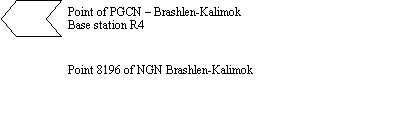
Those of NGN (8007, 2162, 6910, 6913, 6934, 8196) by concreted granite stone with hole.
Those of RGN (33, 27) by concreted granite stone with hole.
The new points are stabilized by solid signs of polyamide concrete with underground center.
Surveying
The new points are defined on the base of 4 existing points as a connection between them is made with the purpose of network homogeneity and control.
The bench marks are included in the measurements as new points by position but they participate in the adjustment as given with their elevations.
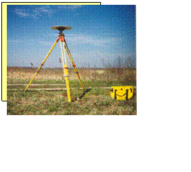
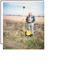
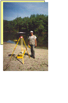
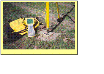
The surveys are made by the geodetic instrument Trimble, model 4700, and double frequency receivers.
The surveys are carried out in fast static regime with following results processing.
Processing
Performed by software product Trimble USA – TGO.
The reports are submitted about chord processing.
Strict adjustment in WGS 84.
Accuracy valuation by close figures by location and elevation.
Points accuracy valuation visualized by error ellipses.
Point mean-square errors.
The transformation parameters are deduced and network transformation is done by WGS 84 – coordinate system 1970.
SGCN (Secondary Geodetic Control Network)
It consists of 23 points. Solid signs of polyamide concrete with underground center of German company INTERMAK stabilize them.
Comparatively safe, surveyed places are selected with purpose of their long term using.
They are situated in pairs at distance 200 – 300 meters at intervals of 1.5 km along the layout of inland dike to the south-west, south and south-east of the zone, as well as three of them (23,24 and 25) around the inlet/outlet at point “C”.
They are surveyed by geodetic instrument Trimble, model 4700, double frequency receivers. Surveys are carried out in fast static regime with following results processing.
Processing
Performed by software product Trimble USA – TGO.
The reports are submitted about chord processing.
Strict adjustment in WGS 84.
Accuracy valuation by close figures by location and elevation.
Points accuracy valuation visualized by error ellipses.
Point mean-square errors.
The transformation parameters are deduced and network transformation is done by WGS 84 – coordinate system 1970.
The points of PGCN and SGCN along the Danube waterside (8007, 8196, 6913, 27) and (1, 2), (23,24,25) 22 ensure hydrographic activities. By reason of that they are situated at the waterside proper or near it. Distance between them is provided to be up to 3.5 km, which is comfortable with the scope of radio-communication, by real-time work of GPS apparatus in the set of vessel hydrographic equipment.
1.4. Area mapping
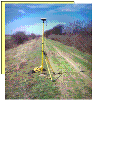
With the purpose of complement of the existing digital mapping design of the territory surveys are made with GPS receivers – Trimble 4700 double frequency high-accuracy geodetic receivers.
Kinematic real-time work regime is used.
The points of PGCN and SGCN are used for base points.
The processing is performed by software product Trimble USA – TGO (Trimble Geomatics Office).
Specific places of the territory are mapped, as well as the dike limiting territory of the zone from the north (Danube River).
So performed surveys, completed with the surveys from task 1.3 refer Brushlen-Kalimok zone, that is the right of way 15 km length and 100 m width and existing model the three components for elaboration zone map in scale M1:5000.
2. Reviewing and specifying the methodology and approach for task implementation
Measuring of base network
The coordination of the base network points is made with support of GPS surveys
Engineers and technical staff:
Eng. Ilko Georgiev
Eng Radoslav Pavlov
Ph.D. eng. Momchil Minchev
Supprot staff – two persons
Technical equipment:
GPS receivers Trimble 4700 – double frequency - 2
Processing software Trimble Geomatics Office - 1 license
Off-road car - 1
Time table of performing of measurements:
Kalimok-Brashlen: 28.03. 2003 - 04.04.2003
The processing is performed from 14.04.2003 to 18.04.2003 from Ph.D. eng. Momchil Minchev
Software for processing of results
The processing of surveys, network adjustment and transformations are made with the licensed software TGO (Trimble Geomatics Office), which is in possession of the company. Plan of surveys was done in advance, with the purpose of optimization of measuring time, with the support of planning module Trimble – Quick plan, which gives the period of the day and right place in the area with the best observation conditions, according to schedule of satellites – configuration, visibility over horizon and signal intensity of the satellites.
Technology and surveying methods
The surveys are performed in Static regime with time for observation sufficient to guarantee necessary accuracy for this type of works.
Brashlen-Kalimok three new points are defined from two stations with the purpose of formation of close figures and control of the results.
Accuracy of results and final results
See attachment “Reports for processing results”.
Area mapping
Method – coordination through performing of GPS high-accuracy surveys
Work regime – real-time, kinematic
Engineers and technical staff:
Eng. Ilko Georgiev
Eng. Jordan Mladenov
Support staff – two persons
Technical equipment:
GPS receivers Trimble 4700 – double frequency - 2
Processing software Trimble Geomatics Office - 1 license
Off-road car - 1
Time table of performing of surveys:
Kalimok-Brashlen: 18.04. 2003 - 22.04.2003
The processing is performed from 07.05.2003 to 09.05.2003 from eng. Ilko Geogiev
Final products
The processing of surveys is made with the software TGO (Trimble Geomatics Office).
Final product – digital design of the terrain and design of the drawings in relevant scales is performed with Autocad LDD.
Reports for surveys and processing results:
Kalimok-Brushlen
Initial data
![]()
|
KALIMOK 2003 TT, "1970", K-7 |
| No X Y H |
|
8196 4775533.825 9517966.102 20.137 |
|
6910 4774485.102 9521840.946 14.620 |
|
8007 4775342.730 9514429.620 20.04 |
|
6913 4776741.517 9524503.277 15.325 |
|
2162 4770586.237 9510251.923 41.101 |
|
27 4777411.880 9532089.548 18.509 |
|
33 4776494.410 9531983.280 124.466 |
|
6934 4775726.290 9530680.370 126.060 |

|
KALIMOK 2003 HP, GPS points, "1970", K-7 |
| No X Y H |
|
1039 4772677.184 9522509.125 30.883 |
|
1048 4778122.962 9534028.108 27.062 |
|
1041 4773619.613 9525733.329 29.776 |
New-established points PGCN and SGCN
1. Coordinate system 1970
|
KALIMOK 2003 OGM, Our GPS Base points, "1970", K-7 |
|
4 4774402.914 9519009.289 16.799 |
|
14 4775392.481 9526815.109 15.854 |
|
KALIMOK 2003 OGM, Our GPS points, "1970", K-7 |
|
1 4775534.988 9518663.220 19.815 |
|
2 4775539.033 9518852.887 19.778 |
|
3 4775210.957 9518828.970 16.721 |
|
4 4774402.914 9519009.289 16.799 |
|
5 4774250.116 9519200.759 16.236 |
|
6 4773982.184 9520391.137 16.398 |
|
7 4774120.347 9520803.954 16.566 |
|
8 4774267.949 9521718.129 13.973 |
|
9 4774558.887 9523494.887 13.913 |
|
10 4774670.364 9523450.823 13.604 |
|
11 4774900.711 9525103.503 15.409 |
|
12 4774971.655 9525373.951 15.364 |
|
13 4775395.812 9526656.885 16.003 |
|
14 4775392.481 9526815.109 15.854 |
|
15 4776049.485 9528215.330 15.659 |
|
16 4776064.626 9528381.054 15.701 |
|
17 4776677.378 9529504.852 15.455 |
|
18 4776756.400 9529660.721 15.510 |
|
19 4777257.015 9531253.369 18.504 |
|
20 4777279.795 9531142.008 18.796 |
|
21 4777220.223 9531436.092 18.793 |
|
22 4777135.936 9527818.977 18.862 |
|
23 4776422.013 9523275.504 19.012 |
|
24 4776497.358 9523486.988 18.834 |
|
25 4776332.720 9523318.832 14.934 |
2. Coordinate system WGS 84 geographic coordinates
|
Name Latitude Longitude Height |
|
REF14 44°01'34.06707"N 26°31'10.57638"E 54.106 |
|
6 44°00'48.79407"N 26°26'22.01801"E 54.774 |
|
7 44°00'53.24955"N 26°26'40.56112"E 54.931 |
|
8 44°00'57.98246"N 26°27'21.61483"E 52.323 |
|
TT6910 44°01'05.01081"N 26°27'27.14719"E 52.960 |
|
3 44°01'28.67742"N 26°25'11.95714"E 55.028 |
|
2 44°01'39.30591"N 26°25'13.05030"E 58.064 |
|
1 44°01'39.18278"N 26°25'04.53309"E 58.102 |
|
TT8196 44°01'39.17273"N 26°24'33.22897"E 58.428 |
|
TT8007 44°01'33.08537"N 26°21'54.41831"E 58.368 |
|
TT2162 43°58'59.02080"N 26°18'46.82079"E 79.746 |
|
HP1039 44°00'06.39639"N 26°27'56.99534"E 69.331 |
|
9 44°01'07.30117"N 26°28'41.41083"E 52.235 |
|
10 44°01'10.91581"N 26°28'39.44246"E 51.920 |
|
11 44°01'18.26553"N 26°29'53.66929"E 53.701 |
|
23 44°02'07.67937"N 26°28'31.72562"E 57.218 |
|
13 44°01'34.18777"N 26°31'03.47193"E 54.256 |
|
12 44°01'20.54423"N 26°30'05.81979"E 53.650 |
|
25 44°02'04.78359"N 26°28'33.66356"E 53.146 |
|
24 44°02'10.10689"N 26°28'41.23028"E 57.035 |
|
TT6913 44°02'17.94912"N 26°29'26.89673"E 53.505 |
|
22 44°02'30.46999"N 26°31'55.86135"E 56.999 |
|
20 44°02'34.81867"N 26°34'25.13700"E 56.906 |
|
19 44°02'34.06925"N 26°34'30.13571"E 56.615 |
|
21 44°02'32.85840"N 26°34'38.33762"E 56.905 |
|
TT27 44°02'38.99924"N 26°35'07.71656"E 56.605 |
|
HP1048 44°03'01.82173"N 26°36'34.90552"E 65.086 |
|
TT33 44°02'09.28720"N 26°35'02.80904"E 162.642 |
|
TT6934 44°01'44.53302"N 26°34'04.18720"E 164.287 |
|
18 44°02'18.00692"N 26°33'18.53420"E 53.661 |
|
17 44°02'15.46140"N 26°33'11.52339"E 53.612 |
|
16 44°01'55.71136"N 26°32'20.97572"E 53.903 |
|
15 44°01'55.23539"N 26°32'13.53149"E 53.861 |
|
HP1041 44°00'36.71190"N 26°30'21.81439"E 68.134 |
|
REF4 44°01'02.48962"N 26°25'20.00579"E 55.156 |
|
5 44°00'57.53070"N 26°25'28.59297"E 54.601 |
Accuracies
1. By closed figures
|
No Triangles dX dY dZ |
|
1 REF4 REF14 9 -0.024 0.011 -0.007 |
|
2 REF4 REF14 11 -0.015 -0.001 -0.003 |
|
3 REF4 REF14 23 -0.001 0.016 -0.005 |
2. Statistical valuations
|
| non-connections [m] | X | Y | Z | |
|
| Minimum | -0.024 | -0.001 | -0.007 | |
|
| Maximum | -0.001 | 0.016 | -0.003 | |
|
| mean-square | 0.020 | 0.014 | 0.006 | |
 | |||
 | |||
| |||||
 | |||||
|