International Waters Programme
Ł Delivering results
T
OLIA
- FO
G
TEINBER
S
ANCK
R
® F
GEF
UNDP-GEF International Waters Team:
Abdoulaye Ndiaye (C/W Africa) abdoulaye.ndiaye@undp.org
Mirey Atallah (Arab States) mirey.atallah@undp.org
Nik Sekhran (S & E Africa marine & coastal) nik.sekhran@undp.org
Akiko Yamamoto (S & E Africa freshwater) akiko.yamamoto@undp.org
Anna Tengberg (Asia-Pacific) anna.tengberg@undp.org
Vladimir Mamaev (E & C Europe and CIS) Vladimir.mamaev@undp.org
Juerg Staudenmann (E & C Europe and CIS) juerg.staudenmann@undp.org
Paula Caballero (Latin America & Caribbean) paula.caballero@undp.org
Andrew Hudson (Global) andrew.hudson@undp.org
UNDP-GEF International Waters Programme Ł Delivering Results
For over 15 years, through its International Waters portfolio, UNDP-GEF has been providing support
to assist over 100 countries in working jointly to identify, prioritize, understand, and address the key
transboundary environmental and water resources issues of some of the world's largest and most
significant shared waterbodies. This publication highlights the many important results delivered to
date by UNDP-GEF's International Waters programme, including:
Ę Preparation and ministerial level adoption of 11 Strategic Action Programmes outlining national
and regional commitments to governance reforms and investments; seven SAPs are now under
implementation;
Ę Preparation and adoption of four regional waterbody legal agreements, some of which have
already come into force Ł Lake Tanganyika, Pacific Fisheries, Caspian Sea (with UNEP support);
Ę The GEF-UNDP-IMO GloBallast programme is widely credited with playing a major role in
helping catalyze adoption of an international Convention on Management of Ship Ballast Water
and Sediments in 2004;
Ę Creation and/or strengthening of 14 multi-country marine/coastal, river and lake basin
Commissions, including establishment of the world's first two Large Marine Ecosystem
Commissions in 2006 (Benguela Current & Guinea Current LMEs);
Ę Successful Strategic Partnership with the World Bank, European Union and other partners on
nutrient reduction in the Danube/Black Sea basin led to measurable reductions in nutrient and
other pollution loads to the highly degraded Black Sea ecosystem; Black Sea is now showing
clear signs of recovery including reduced nutrient levels, elimination of enormous anoxic dead
zone, and increased species abundance.
Strategic Fit
UNDP-GEF's currently active IW portfolio totals about US$ 200 million in GEF grant funding and leverages
an additional US$ 470 million in co-finance. The existing portfolio is strongly aligned with the new GEF4
Strategic Objectives and Strategic Programmes (SP):
Ę US$ 62 million supports SP 1, Depleted Fisheries
Ę US$ 51 million supports SP 2, Nutrient Overenrichment
Ę US$ 65 million supports SP 3, Conflicting Water Uses
Ę US$ 13 million supports SP 4, Reduce releases of Persistent Toxic Substances
Ę Plus US$ 10 million in support of portfolio learning cutting across all four SPs
International Waters portfolio (by water type)
Small Island Developing States
US$
33.46 million
Large Marine Ecosystems
US$ 145.92 million
Lake & River Basins
US$ 130.90 million
Global
US$
30.36 million
TOTAL
US$ 340.64 million
International Waters portfolio (by region)
Africa
US$
98.53 million
Arab States
US$
47.44 million
Asia & Pacific
US$
69.86 million
Europe & CIS
US$
75.73 million
Latin America & Caribbean
US$
18.51 million
Global
US$
30.56 million
TOTAL
US$ 340.64 million
In addition, UNDP's planned 2007 IW submissions ( approximatelyUS$ 58 million) are strongly
aligned with the new GEF-4 IW strategy, as follows:
Ę US$ 19 million supports SP1, Depleted Fisheries
Ę US$ 12.5 million supports SP2, Nutrient Overenrichment
Ę US$ 23.4 million supports SP3, Conflicting Water Uses
Ę US$ 3 million to Portfolio Learning
Partnerships
Forging and sustaining effective partnerships has been a key strategic focus of UNDP-GEF's
International Waters programme since its inception. Currently 48 percent of the operational IW
portfolio involves partnerships between two or more of the GEF IAs; 5 of 15 (or 33 percent) of
planned 2007 submissions involve partnerships with other GEF agencies. UNDP also utilizes
partnerships with other UN agencies (IMO, IAEA, IOC-UNESCO, etc.) and intergovernmental
organizations such as the Forum Fisheries Agency, South Pacific Applied Geosciences Commission,
Caribbean Environmental Health Institute and many others, to take advantage of the expertise,
networks and legitimacy of these organizations in selected thematic areas and regions.
Looking Forward
Through support from GEF and other donors and partners, UNDP has established itself as one of
the leading international organizations supporting the improved governance of transboundary
waterbodies. In 2006, UNDP merged its GEF International Waters Cluster with UNDP's Water
Governance Programme, as part of a process of fully integrating and coordinating all of UNDP's
Water Governance activities under one umbrella. UNDP also prepared and started implementing its
first overall Water Governance Strategy, which, in addition to Cooperation on Transboundary Waters,
includes strategic priorities in the areas of Integrated Water Resources Management, Water Supply and
Sanitation, Adaptation to Climate Change, and Global and Regional Advocacy on Water Governance.
Through these and other initiatives, UNDP is firmly positioned to continue enabling effective water
governance at all levels Ł local, national, regional and global.
ANDREW HUDSON
PRINCIPAL TECHNICAL ADVISOR, INTERNATIONAL WATERS
AND HEAD, WATER GOVERNANCE PROGRAMME
CONTENTS
04. Integrated Management of the Benguela Current Large Marine Ecosystem (BCLME)
06. Environmental Protection of the Rio de la Plata and Its Maritime Front: Pollution Prevention and Control
and Habitat Restoration (FREPLATA)
08. Development and Implementation of the Lake Peipsi/Chudskoe Basin Management Programme
10. Addressing Transboundary Environmental Issues in the Caspian Environment Programme
12. Nile Transboundary Environmental Action Project (NTEAP)
14. Senegal River Basin and Environmental Management Project
16. Partnership interventions for the implementation of the Strategic Action Programme for Lake Tanganyika
18. Combating living resource depletion and coastal area degradation in the Guinea Current LME
through Ecosystem-based Actions
20. Reducing Environmental Stress in the Yellow Sea Large Marine Ecosystem
22. Strengthening the Implementation Capacities for Nutrient Reduction and Transboundary Cooperation in
the Danube River Basin
24. Transfer of Environmentally Sound Technology
(TEST) to Reduce Transboundary Pollution in the Danube River Basin
26. Preparation of a Strategic Action Programme (SAP) for the Dnipro River Basin and Development of SAP
Implementation Mechanisms
28. Implementation of the Strategic Action Programme of the Pacific Small Island Developing States (SIDS)
32. PEMSEA: Building Partnerships in Environmental Protection and Management of the Seas of East Asia
35. Black Sea Ecosystem Recovery Project, Black Sea Environmental Management Programme,
and Black Sea Strategic Action Plan
38. Globallast: Removal of Barriers to the Effective Implementation of Ballast Water Control in
Developing Countries
40. Removal of Barriers to the Introduction of Cleaner Artisanal Gold Mining and Extraction Technologies
(Global Mercury Project)
42. IW:LEARN Ł The International Waters Learning Exchange and Resource Network
4
Integrated Management of the
Benguela Current Large Marine Ecosystem
(BCLME)
Overview
Project description
The BCLME is one of the world's most productive marine
The BCLME Programme was designed to improve the
ecosystems, providing energy, materials, food and
structures and capacities of Namibia, Angola and South
foreign exchange earnings for South Africa, Namibia and Africa to deal with their transboundary environmental
Angola. It also contributes to the region's natural beauty
problems and manage the BCLME in an integrated and
and abundant wildlife, which provides a substantial
sustainable manner.
revenue from tourism. The BCLME's near-shore and
The programme assists governments to manage
offshore sediments contain rich mineral deposits,
their shared marine resources Ł fish, diamond mining
including diamonds, as well as oil and gas reserves.
and petroleum exploration Ł in an integrated and
In the 60s and 70s unsustainable fishing led to the
sustainable way. Key project areas also include
collapse of the South African and Namibian fishing
environmental variability, coastal zone management,
industries. Overfishing by foreign fleets led to the
ecosystem health, socio-economics and governance.
declaration of 200-mile exclusion zones by South Africa
More than 75 different projects and activities are carried
and 1990 Namibia.
out by activity centres in the three countries, which work
Current transboundary issues include regulation of
in close cooperation with the fishing, oil and gas, and
oil exploration and offshore diamond mining; the
offshore diamond mining industries.
migration of fish stocks across national boundaries;
The three activity centres are:
the introduction of invasive alien species, and the
Luanda, Angola Ł Biodiversity, Ecosystem Health and
movement of pollutants or harmful algae from the
Pollution; Swakopmund, Namibia Ł Living Marine
waters of one country into another.
Resources; and Cape Town, South Africa Ł
Environmental Variability.
REGIONAL
COUNTRIES:
Angola, Namibia, South Africa
Partners: UNOPS, BENEFIT, DANCED, SADC
GEF Grant
US$ 15.114 million
OJAS
R
Co-finance
US$ 23.559 million
Project Cost
US$ 38.673 million
V
ASQUEZ
http://www.bclme.org/
UDIO
Newsletter: Benguela Current News
L
A
- C
GANNET
C
APE

5
FACT BOX
S Legal
Fish provide almost 50 percent
LT The establishment of an interim Benguela Control Commission (BCC) in August 2006 as
of animal protein consumed in
U a prelude to a formal commission was a landmark step for the project since protection
Angola and fishing is the country's
S of the BCLME was being undermined by gaps in the legal frameworks of all countries
third largest industry, after oil and
E Ł particularly the lack of laws regulating transboundary projects.
diamonds
R Recent legislation, combined with capacity-building, has already begun to reverse threats
Marine diamonds account for
T Ł including declining fish stocks, deteriorating water quality, alien species invasion, habitat
10 percent of South Africa's
C destruction and alteration Ł and has improved monitoring and management capacity.
production.
Recent productivity rates for fisheries have been significantly higher in the Eastern Cape
Oil provides 70 percent of Angola's
J
E compared with the 1990s.
GDP and 90 percent of exports.
O The project's legal initiatives have included a MARPOL (prevention of pollution) agreement
South Africa has made many new
R and the introduction of exploratory fishing licenses for various stocks that were previously
oil/gas discoveries and deep water
P not regarded as fisheries target species. New legislation on aquaculture, including shellfish
drilling is expected to increase.
production, has been adopted by Angola and Namibia.
D
E General
T An ecosystem approach to fisheries has been adopted by the fisheries institutions of
C the three countries to address transboundary concerns. Key results from `shared stocks'
projects are being presented to decision makers for incorporation into national fisheries
L
E management plans. Consultations are taking place on the shared management of sardine,
E
S hake and horse mackerel stocks.
In Angola the Activity Centre for Biodiversity, Ecosystem Health and Pollution has worked
to harmonize national environmental policies and legislation for marine mining, dredging
and offshore petroleum exploration; has conducted research into land-based pollution,
diamond mining and petroleum exploration, conducted near-shore and offshore species
surveys and developed water and sediment quality guidelines.
In Namibia the Activity Centre for Living Marine Resources has produced a `State of the
BCLME' ecosystem reporting system including oceanographic, biological and pollution
components, reviewed institutional arrangements for artisanal fisheries, developed an
aquaculture policy and worked to harmonize legislation and socio-economic policies
affecting the BCLME.
The Activity Centre for Environmental Variability in South Africa has developed operational
capacity for monitoring algal blooms in countries bordering the BCLME to the north;
developed a shellfish sanitation programme and helped upgrade communications
systems.
Working with regional industries has been an important aspect of the project. The fishing
industry is working with the project to establish a ecosystem approach to sustained
fisheries management; reduce by- catch, and develop an aquaculture policy. The diamond
mining and petroleum industries are helping investigate and reduce the cumulative effects
of their activities on the marine environment.
Training
Bridging the skills gap between the different countries is a project priority commanding
around 20 percent of project funds.. Regional cooperation has been promoted between
the region's scientific institutes and MSc courses are being introduced to universities along
with regional and EU scholarship programs. Training has helped several project-associated
personnel gain promotion to senior management positions in national and regional
organizations.
6
Environmental Protection of the Rio de la Plata
and Its Maritime Front: Pollution Prevention and
Control and Habitat Restoration (FREPLATA)
Overview
processes caused by construction of numerous dams in
The Rio de la Plata and its Maritime Front is a large
the basin.
river-marine system that receives the waters of the Rio
Other problems include: the development of the Paranß-
de la Plata basin, the second largest river basin system
Paraguay Waterway (HidrovĒa) which will generate
in South America. Biological productivity in the project
significant environmental impacts; intense exploitation
area is very high, particularly in fisheries,Ł many river,
of fisheries; an increase in toxic tides; the establishment
coastal and high seas species develop all or part of their
of alien bivalve species; and the fact that the river's
life cycle in the project area. Shared fishing resources are
shallow waters require continuous dredging.
very significant for the economies of both Argentina
and Uruguay.
Project description
The main urban centers of both countries are located
The project is assisting Argentina and Uruguay in
on the coasts of the Rio de la Plata and its Maritime
preparing a Strategic Action Programme as a framework
Front, as well as leading economic activities. Industrial,
for addressing the most imminent transboundary issues
agricultural and port activities, together with fisheries
and threats to the Rio de la Plata and Its Maritime Front.
and tourism, are an important source of livelihood for
Preparation of the SAP was preceded by finalization of a
a significant percentage of the population. The Rio de
Transboundary Diagnostic Analysis and other activities
la Plata and its Maritime Front has become a sink for
including: raising awareness of priority transboundary
substantial urban, agricultural and industrial pollution,
concerns; enabling policy, institutional and financial
and suffers from habitat degradation due to dredging,
reforms; strengthening communications; identifying
sedimentation and the alteration of hydrological
innovative management tools for SAP implementation;
training activities; and an investment programme.
REGIONAL
COUNTRIES:
Argentina, Uruguay
Partners: CARP, CTMFM
GEF Grant
US$ 5.682 million
Co-finance
US$ 4.050 million
OJAS
R
Project Cost
US$ 9.732 million
V
ASQUEZ
http://www.freplata.org/(Spanish):
UDIO
Newsletter: Bulletin (Spanish)
C
L
A
-
ASTLINE
O
C
UTED
POLL

7
FACT BOX
S General
The National Port Administration
LT The project has completed the TDA, which has been formally approved by the bi-national
of Uruguay has adopted protocols
U government commissions from Argentina and Uruguay and by the project coordinating
for ship waste management
S committee. More than 250 scientists and technicians from 34 Argentinian and Uruguayan
and approved a ballast water
E research institutions contributed to the TDA preparation.
treatment plant project in the Port
R A CD compilation prepared to complement the TDA contains more than 200 technical
of Montevideo. This initiative falls
T reports and publications. Most are also available on the project website.
within the Pollution Control and
C Eighteen small and medium size firms in five key industrial sectors are implementing Cleaner
Prevention Strategy adopted by
Production Practices with the support of national and local environmental agencies.
FREPLATA in 2005.
J
E A joint initiative by FREPLATA and a local NGO has resulted in 70 km2 of coastal-marine area
O at Cerro Verde (on the Atlantic coast of Uruguay) being declared a Natural Protected Area.
In Argentina the coastal area
R
contains 45 percent of all industrial
A high-level FREPLATA Inter-ministerial Commission with representation from five ministries
P
activity and 35 percent of its
and the Environment Secretariat of the provincial government has been established by
population, while in Uruguay it
D executive resolution in Buenos Aires.
contains approximately half of
E
T The project has established a working group and pilot project for the study of red tides (algal
its total population and most of
blooms); a bi-national network for monitoring the quality of water used for recreation; and
its economic, industrial and port
C has established bi-national indicators for water and sediment quality.
activities.
L
E Two pilot projects Ł Increasing enterprise performance through cleaner production
E (Argentina) and Cleaner production and the reduction of pollution from industrial waste
S (Uruguay) have been established.
Legal
A compilation of international agreements and legislation on the area's environmental
protection is available on-line and on a CD. A report on legislation for biodiversity protection
is being drafted.
Studies have been made on legislation for the protection of the water environment from
land-based sources of pollution; the legal status of the coastal zones; and the financial and
economic arrangements for their protection.
Communications
TDA findings have been publicized in a series of events, exhibitions, media presentations and
publications, competitions, games and posters. Workshops and seminars on environmental
communications methodology have been held for journalists and NGOs
The FREPLATA website (in Spanish) has increased its audience from 27,167 hits (May 2003)
to 500,620 hits (May 2005). A monthly average of 7,000 visitors spends more than 30
minutes at the site.
Pilot networks for the exchange of information have been developed with the Oceanographic
National Data Centres of Argentina and Uruguay. The project is also supporting the
Uruguayan National Environment Agency in the digitization and geo-referencing of data
on industries and industrial effluents.
A 24-minute video on FREPLATA has been shown several times on TV, distributed to
schools, NGOs and other stakeholders as well as being shown on board ferries and at ferry
terminals.
The project is working with the Government of the Province of Buenos Aires to incorporate
environmental issues into the curricula of elementary schools.
8
Development and Implementation of the Lake
Peipsi/Chudskoe Basin Management Programme
Overview
recommendations for nutrient load reduction and
Lake Peipsi (Estonian) or Chudskoe (Russian) is a large
prevention, as well as the sustainable conservation of
freshwater lake on the border between Estonia and Russia.
habitats and eco-systems.
The lake is used for fishing, transport and recreation, but
The project also sought to replace uncoordinated
suffers from severe environmental degradation.
small-scale projects that would have otherwise been
Eutrophication Ł the major environmental threat to the
implemented separately on the Estonian and Russian
lake Ł is largely produced by agriculture and is expected
sides without sufficient coordination, education, public
to increase with economic recovery. An increase in
information components, or attention to local
agricultural production without improvement in
stakeholder interests.
agricultural practices could affect the lake's ability to
Major project components included: developing a
support important Baltic Sea area habitats for wildlife,
management program and institutional arrangements
especially birds.
for coordinating Estonian and Russian activities, assessing
Solving the lake's problems has been hampered by
the lake's environmental state; preparing a coordinated
financial constraints; communication and language
program for monitoring and measures to reduce nutrient
difficulties; and differences in water monitoring,
load. The project also sought to diversify regional
environmental planning and management capacities
economic activities; develop a public involvement plan;
between the two countries.
establish an institutional `ecosystem' of organizations;
and raise capacity among stakeholder groups. The
Project description
project was implemented by the international NGO
The project sought to develop and begin
Peipsi Centre for Transboundary Cooperation (Peipsi
implementation of a Lake Peipsi/Chudskoe Basin
CTC) a citizens' association working for the sustainable
Management Program that would include practical
development of border areas.
REGIONAL
COUNTRIES:
Estonia, Russian Federation
Partners: Estonian Ministry of the
Environment, Ministry of Natural Resources
of the Russian Federation, and Peipsi Centre
for Transboundary Cooperation
GEF Grant
US$ 1.000 million
Cofinance
US$ 6.280 million
Project Cost
US$ 7.280 million
http://www.peipsi.org/gef
HORES
- S
ANDS
ETL
W

9
FACT BOX
S General
Lake Peipsi/Chudskoe is the
LT A Peipsi Council has been created to better represent the municipalities of Lake Peipsi and
fourth largest lake (but the largest
U improve communication with the Russian side of the lake. It includes representatives of
transboundary lake) in Europe,
S public, business and the NGO sector in the region and also works to facilitate sustainable
covering 3,500 sq km.
E tourism and environment entrepreneurs, and cultural activities.
R A Lake Peipsi/Chudskoe Transboundary Basin Water Management Programme has
The main commercial fish of Lake
T been prepared and adopted by the Commission as a long-term strategy for sustainable
Peipsi/Chudskoe are lake smelt,
C development. It contains an action plan for the reduction of nutrients in the lake over the
perch, ruff, roach, bream, pike,
short (2-5 years) and long (10-20 year) time span.
vendace and pikeperch.
J
E The Lake Peipsi/Chudskoe Transboundary Diagnostic Analysis focused on water quality,
O land use and biodiversity and included a nutrient load reduction programme and water
Lake Peipsi/Chudskoe's annual fish
R management plans. Two research studies Ł one a feasibility study for water and ecological
catch (9,000-12,000 tons), exceeds
P tourism in the lake region, and another on the impact of agriculture and the concept of
that of all large lakes in North
ecological farming Ł were carried out for the lake basin.
Europe.
D
E Cooperation with EU LIFE and TACIS projects in Estonia and Russia helped the project
T prepare its water management programme and nutrient reduction plan.
C An environmental infrastructure demonstration project to improve water quality and
sewage facilities for a municipality of around 6,000 in Estonia demonstrated that the best
L
E available treatment technology could be used at an economical price.
E
S Several calls under the Small Grants Programme in Estonia and Russian contributed
to the development of grassroots organizations and activities aimed at environmental
protection.
A comparative analysis carried out in Estonia and Russia found that the main barrier to water
quality monitoring has been the incompatability of data in the two countries' laboratories.
Joint workshops were organized to help Russian monitoring experts boost their skills in
biological monitoring and quality assurance.
Several Estonian-Russian joint monitoring expeditions have been conducted. One, in
2004, produced an integrated picture of the ecological state of Lake Peipsi, based on the
population structure and abundance of benthic invertebrates.
The project was implemented by the international NGO Peipsi Centre for Transboundary
Cooperation (Peipsi CTC) a citizens' association working for the sustainable development
of border areas.
Communications
The project conducted a wide-ranging publications programme, developed a trilingual
website, formed strong links with Estonian and Russian journalists, organized public
awareness seminars, a children's art competition and mounted exhibitions on the lake's
ecology. An on-line `virtual museum' was developed for better publicity and easy access
to information.
Strong links cultivated with Russian and Estonian journalists ensured that the future of the
lake is frequently debated by the regional press, TV and radio.
The project supported the printing of an environmental educational game Ł developed by
a local school and Peipsi CTC Ł for distribution to other schools.
Training
Training sessions have included environmental studies for secondary and elementary
teachers; eutrophication, biodiversity and lake ecology as well as training on law, taxation
and book-keeping to build NGO capacity, and other training in ecotourism, biological
farming and environmental cooperation.
10
Addressing Transboundary Environmental Issues
in the Caspian Environment Programme
Overview
Project description
The unique ecological system of landlocked Caspian
The Caspian Environment Programme (CEP) is a regional
Sea is home to more than 400 endemic species, many
umbrella programme aiming to halt the deterioration
(especially sturgeon) of economic importance and
of environmental conditions of the Caspian Sea and to
threatened by pollution, overexploitation, invasion of
promote sustainable development in the area.
alien species and alteration of habitat. Increasing oil and
The need for joint protection and management of the
gas production/exploration in the region poses new
Caspian environment and its resources has been an
threat to ecosystem and human health/tourism incomes ongoing issue for the Caspian States particularly since
is threatened by unsafe drinking water, untreated
the 1991 collapse of the Soviet Union.
sewage, unsanitary beaches and bathing waters. CEP is a
The CEP was launched in 1998 to meet a long desire for
regional initiative to address these problems.
regional cooperation, expressed through a number of
Invasive species are a particularly serious problem.
regional agreements.
Mnemiopsis leidyi, a comb jellyfish, was introduced by
In its current phase CEP activities focused on assisting
ship ballast water into the Black Sea around 1980, where
littoral countries implement the Caspian Strategic Action
it multiplied rapidly causing the collapse of the fishing
Programme. GEF support has targeted priority areas
industry. It has now entered the Caspian Sea through
such as biodiversity protection Ł including mitigation
the Volga-Don Canal. Twenty years ago 1,000 tons of
of invasive species impact Ł as well as pollution
sturgeon was caught each year in the Caspian Sea
monitoring and control.
Ł but in January 2006 CITIES warned that sturgeon fish
The programme has also supported regional legal
resources were at their lowest recorded level and that
reform and institutional capacity building aiming at
if the current trend continued, the fish could become
environment protection.
extinct within a few years.
REGIONAL
COUNTRIES:
Azerbaijan, Iran, Kazakhstan,
Russian Federation, Turkmenistan
Partners: UNOPS, UNEP, World Bank, EU
GEF I up to 2003
GEF Grant
US$ 8.341 million
T
OLIA
Co-finance
US$ 9.976 million
- FO
V
Project Cost
US$ 18.317 million
YE
GEF II Ongoing
HENIKE
GEF Grant
US$ 6.026 million
Z
Co-finance
US$ 25.800 million
RMAN
Project Cost
US$ 31.826 million
® A
EA
S
http://www.caspianenvironment.org
C
ASPIAN
11
FACT BOX
S Legal
The northern part of the Caspian
LT The Framework Convention on the Marine Environment of the Caspian Sea (the Tehran
Sea is home to 33 mammal species,
U Convention) has been ratified by all countries and came into force on August 12, 2006
289 plant species and 256 bird
S Ł which has been designated the region's annual Caspian Day. Four Protocols dealing with
species.120 species of migrating
E Land Based Sources of Pollution; Emergency Response to Oil Spills; Biodiversity Protection;
and Transboundary EIA have been developed. Work has begun on a Fisheries Protocol.
birds, sometimes even flamingos,
R
winter on the eastern shores.
T Kazakh Parliament approved a new law in May 2005 to regulate offshore oil operations and
C make production-sharing agreements.
Over 100 different kinds of fish live
A Regional Review of Legislation on Invasive Species has been conducted.
in the Caspian.The Caspian is home
J
E General
to seven different sturgeon species,
O
some of which are found nowhere
R All CAP countries have established national inter-ministry committees/bodies to facilitate
else in the world. All told the sea
inter-sectoral coordination. Public Participation Advisors have been appointed in all five
P
holds 90 per cent of the world's
countries and a public participation strategy has been regionally approved. Industry
sturgeon.
D representatives and NGOs participate in all major events.
E
T On-going dialogue with the oil and gas industries has encouraged data-sharing agreements
The endangered Caspian seal and
and may lead to long-term environmental partnerships. Industry co-funding has already
the magnificent white tailed sea-
C been obtained for two major workshops, an aerial survey of seals, a contaminants cruise,
eagle, are both native to the
L
E biodiversity strategy development, oil spill contingency planning and creation of a
Caspian Sea.
E biodiversity center.
S Twelve Matched Grants and 32 Micro Environment Grants totaling close to US$ 400,000
have been made for projects focusing on fisheries, soil cleansing, reforestation, water
supply for small communities, pollution reduction and environmental awareness.
Four POPs reduction projects worth over US$ 200,000 are under implementation.
Agreement has been reached on initiation of a regional Pollution Monitoring Programme
and a Biodiversity & Environment Monitoring Programme.
The CEP has created and/or strengthened eleven Caspian Regional Thematic Centers and
five Regional Advisory Groups.
During its first four years (July 1998 to October 2002) the CEP established and prepared
a management structure; a Transboundary Diagnostic Analysis (TDA); National Caspian
Action Plans (NCAPs); Strategic Action Programme (SAP); Biodiversity Strategy and Action
Plan (BSAP); Priority Investment Portfolio Project (PIPP); a Regional Cooperation Plan for
Oil Spill Preparedness and drafted the Framework Convention for the Protection of the
Marine Environment of the Caspian Sea.
The IMO is providing technical assistance to the project to assessing the extent of aquatic
species transfer through ship's ballast water into and out of the Caspian Sea and study
appropriate control measures.
The CEP has collaborated with EU regional projects on sustainable fisheries and coastal
communities.
Communications
The CEP has built up its website resources and issues a monthly e-bulletin. The extensive
e-library includes databases, a searchable library of around 900 documents, meeting
reports, maps and GIS data, a photolibrary as well as booklets, brochures and educational
materials.
CEP organized an Environmental Journalism Workshop which was attended by 30
journalists.
12
Nile Transboundary Environmental
Action Project (NTEAP)
Overview
Project description
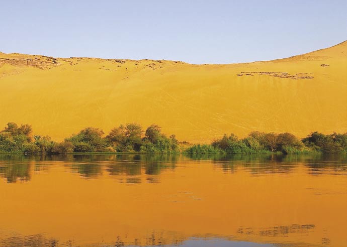
The Nile River, with an estimated length of over 6800
The Nile Transboundary Environmental Action
km, is the longest river flowing from south to north
Project (NTEAP) supports development of a basin-
and crosses over 35 degrees of latitude. The Nile
wide framework for actions to address high priority
Basin boasts a range of rich endowed ecosystems
transboundary environmental issues within the context
that include mountains, tropical forests, woodlands,
of the Nile Basin Initiative's Shared Vision Programme. It
savannas and high and low attitude wetlands. It is
is the largest of seven projects taking place under the
home to about 160 million people, the majority of
programme.
whom live in rural areas and depend directly on land
The main objective of the project is to provide a
and water resources for shelter, income and energy. Six
strategic environmental framework for managing
of the ten Nile basin countries are among the world's
transboundary waters and environment challenges. It
poorest with a GDP per capita of less than US$250.
aims to improve the understanding of the relationship
Over-dependency on, and unsustainable use of the
of water resources to development and environment;
region's natural resources have created a host of
provide a discussion forum for stakeholders; enhance
environmental problems, which in turn stifle local
basin-wide cooperation and environmental awareness;
efforts to reduce poverty and stimulate sustainable
and build the environmental management capacities
economic growth.
of the basin-wide institutions.
Environmental problems in the Nile Basin include
Water quality is a project priority and this component
soil erosion, degradation of agricultural lands,
is addressing the differences between country
desertification, loss of forests and wetlands,
monitoring capacity, weak implementation of laws
overgrazing, declining water quality, over-exploitation
and the lack of tax rebates for clean environmental
of fisheries, and eutrophication of lakes.
practices.
REGIONAL
COUNTRIES:
Burundi, Democratic Republic of Congo, Egypt,
Ethiopia, Kenya, Rwanda, Sudan, UR Tanzania,
Uganda and Eritrea (observer status)
Partners: World Bank, UNOPS, Nile Secretariat
T
OLIA
- FO
GEF Grant
US$ 8.80 million
Y
LDA
Co-finance
US$ 84.10 million
A
Project Cost
US$ 92.90 million
ARRIA
T
XEB
http://www.nileteap.org/
E
V
AN
Newsletter: The Nile Environment (Quarterly)
- ® I
IVER
R
ILE
N

13
FACT BOX
S General
The total area of the Nile basin
LT National Water Quality Monitoring Baseline reports, have been finalized for all the Nile
represents 10.3 percent of the area
U riparian countries. Water quality parameters have been agreed and 44 sampling station
of the African continent and spreads
S locations have been agreed. A training module has been prepared to help boost country
over ten countries.
E capacity.
R The project contributed to the development of the National Plan for Environmental
The Nile is fed by two main river
T Management in Post-Conflict Sudan. Investigating the true state of the environment and
systems: the White Nile, with its
C mainstreaming environmental issues into national planning have been prioritized.
sources on the Equatorial Lake
In collaboration with national and international agencies, the project contributed to the
Plateau (Burundi, Rwanda, Tanzania,
J
E designation of the 30,000 sq km Sudd wetlands in southern Sudan, which support a rich
Kenya, Democratic Republic of
O animal biodiversity as well as thousands of birds, as a Ramsar site in 2005.
Congo and Uganda), and the Blue
R National Steering Committees for the micro-grants component, were formed at either
Nile, with its sources in the Ethiopian
P regional or national levels and provided national ownership to the programmes and
highlands. The Nile's sources are
located in humid regions, with an
D assisted in formulating strategies, action plans and project proposals.
average rainfall of over 1000 mm per
E A River Basin Model is being developed to increase understanding of the Nile's hydrological
T
year. It travels through increasingly
behaviour and the links between environment and development.
arid lands before reaching Egypt,
C Community
where precipitation is less than
L
E The project has supported 118 micro-grant projects with a total commitment level of US$
20 mm per year.
E 2.5 million approved, and US$ 1.2 million disbursed, across all nine riparian countries.
S High-level commitment to the project was shown by the presence of the President of
Burundi at the initiation of a micro-grant project.
The project has used special World Environment Day activities Ł often directed at populations
with limited access to traditional media Ł to increase public participation and community
involvement. In Kenya a Nairobi-Kisuma caravan has conducted awareness-raising events
in remote areas along its route. Other community activities have included environmental
exhibitions, clean-up programmes, tree planting, parades and performances, and the
distribution of awareness raising-materials.
Education and communication
The Environment Education and Awareness component accomplished extensive activities
in all of the NBI countries. EE&A national and regional working groups, university lecturers'
network, journalists' network and practitioners' network were established and conducted a
series of national and regional meetings. EE&A materials production training and schools
environmental activities assessments were also conducted. The component also launched
a university students exchange programme and students award scheme.
A multimedia CD-ROM Nile River Awareness Kit was launched in 2006, with the assistance
of an extra budgetary resource of US$ 400,000 provided by the Canadian Space Agency, to
cover the costs of production of the CD, Earth Observation products and other activities.
The ceremony of the first Nile Transboundary Environmental award scheme for schools was
held in conjunction with the Nile Council of Ministers meeting in May 2006. This scheme
has now become an annual event and focuses on one of the key environmental threats or
values of the Nile basin as identified in the TDA.
A special Nile university course is under development, although a student and graduate
exchange programme already operates in universities, along with an MSc/PhD scholarship
programme run by the Applied Training Project of the NBI.
Legal
The project has worked to address weak implementation and enforcement of water quality
regulations and the lack of tax rebate incentives for clean environmental practices.
14
Senegal River Basin Water and
Environmental Management Project
Overview
Construction of the dams, and their accompanying
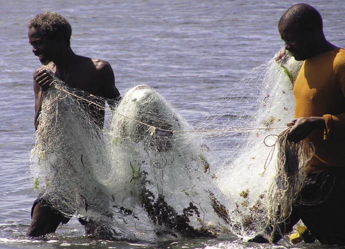
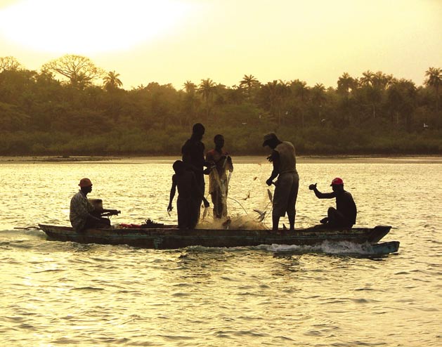
The 1,800 km Senegal River is the second longest river
infrastructure, contributed substantially to making the
in West Africa. Its river basin covers around 300,000
ecosystem more uniform and provided the habitat
km2 and is home approximately 3.5 million people, 85
for aquatic weeds and disease vectors. Current threats
percent of whom live near the river. Population growth
to the river's ecology stem mostly from existing and
rate is high, partly due to in-migration. The upper basin
proposed irrigation and hydropower developments.
has remained largely an area of subsistence agriculture
based on shifting cultivation. In the valley and the
Project description
delta, traditional production systems (flood-recession
The objective of this project is to provide a
cropping, livestock raising, fishing) and the practice of
participatory strategic environmental framework
modern irrigation with water pumped from the river
for the environmentally sustainable development of
exist side by side.
the Senegal River basin and to launch a basin-wide
The river has two large dams along its course. Before
cooperative program for transboundary land and water
they were built the river had markedly different
management. The project is being jointly implemented
hydrological conditions. Fluctuations occurred
by UNDP and the World Bank working with OVMS Ł the
seasonally in water level and quality in addition to the
basin authority.
annual or cyclic episodes of dry and wet conditions.
The UNDP component includes: training and workshops
These fluctuations, characterized by erratic flows and
to strengthen national and local institutional
episodic inundation, prevented any single species
capacity; community-based microgrant-supported
from dominating the ecology and contributed to a real
activities; and increasing the number of stakeholders
diversity of habitats and species.
and communities involved and trained in local and
transboundary water resource management issues.
REGIONAL
COUNTRIES:
Guinea, Mali, Mauritania, Senegal
Partners: Organsiation pour la Mise en Valeur
du Fleuve Sķnķgal
GEF Grant:
US$ 7.250 million
Co-financing:
US$ 39.330 million
Project cost:
US$ 46.580 million
K
N
B
A
http://www.omvs.org/index.php (French)
T
O
O
P
H
E
R
I
N
A
/
M
F
ISHERMEN

15
FACT BOX
S General
The Senegal River basin, located in
LT Community participation has been facilitated by the setting-up of 28 Local Coordination
West Africa, covers 1.6 percent of
U Committees and four National Coordination Committees in the four participating states.
the continent and spreads over four
S Working in close collaboration with the OMVS Observatory of the Environment, the project
countries.
E has upgraded data on the river valley hydro-system. A number of important studies have
R also been carried out on the status of natural resources in the Guinean part of the basin, its
Fishing, in terms of the income of
T cartography, existing water resources monitoring system and bush fires.
the work force that it employs, is
C A participatory process was used to draw up a Transboundary Diagnostic Analysis (TDA) for
undoubtedly the largest economic
each of the four member countries. Based on these national TDAs, a region-wide analysis
activity in the Senegal River basin
J
E was carried out and validated by the technical departments of the member countries before
after agriculture, especially for
O submission to the World Bank for approval.
populations living near the river in
R Micro-finance has been made available to communities in the basin to support
the valley and the delta.
P environmental degradation control.
D Training
E
T Capacity building is one of the project's prime objectives and a number of workshops,
designed for OMVS experts and national and local technical departments, have been
C organized. Workshop topics included water resources management, water and environment
L
E legislation in the four member states, water management tools and software, project
E management, and techniques for social advocacy.
S Community
Information and awareness-raising activities have been carried out across the four countries
directed at communities in the basin, civil society and the scientific community. IUCN has
supported the project's public participation component.
Networks have been established and information and awareness-raising drives have been
organized since the project's second year of operations.
Legal
Guinea's admission to the OMVS became effective with the signing of the Accession Treaty
in March 2006.
T
OLIA
- FO
ARD
ONT
C
SABELLE
® I
ENEGAL
- S
F
ISHERMEN
16
Partnership interventions
for the implementation of the Strategic Action
Programme for Lake Tanganyika
Overview
Biodiversity Project (1995-2000) and the Lake
Lake Tanganyika is Africa's second-largest (after Lake
Tanganyika Framework Fisheries Management Plan
Victoria) inland fishery and provides food and income,
developed by FAO/FINNIDA/AGFUND. The TDA
as well as water, transport and other resources for
identified the main transboundary problems
around 10 million people. However, Lake Tanganyika's
facing the riparian states as: unsustainable fisheries,
unique ecology faces many cross-boundary threats
increasing pollution; excessive sedimentation
including: soil erosion, pollution; over-fishing; and oil
and habitat destruction.
and mineral exploration. The most immediate threats
In order to help the states develop an effective,
are excessive loads of sediments and nutrients caused
sustainable system for managing and conserving
by erosion in the watershed; industrial and urban
Lake Tanganyika's biodiversity the LTBP also prepared
pollution, including boat discharges; and intensive
a draft Convention on the Sustainable Management
fishing with inappropriate methods. As the lake is a
of Lake Tanganyika, setting out the legal rights and
closed basin, it takes 7,000 years for water to be
duties of the four states. The Convention was finalized
flushed through evaporation, making any pollution
and signed during the second GEF planning phase
permanent in relation to human lifetimes. Invasive
project: "Lake Tanganyika Management Planning
alien species and uncontrolled development add
Project" (LTMPP, 2002-2004) and entered into force
to the lake's problems.
in September 2005. LTMPP also supported the
preparation and establishment of the Lake Tanganyika
Project Description
Management Authority (LTA), a formal permanent body
This project is guided by the conclusions drawn in
to coordinate and monitor the management of the
the TDA and SAP produced by the Lake Tanganyika
lake and its basin.
REGIONAL
COUNTRIES:
Burundi, DR Congo, Tanzania UR and Zambia
Partners: UNOPS, NEX, AfDB-NDF and FAO GEF
Grant
US$ 13.500 million
Co-finance
US$ 43.500 million
Project Cost
US$ 57.000 million
T
AMUS
IPPOPO
H

17
FACT BOX
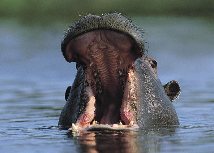
S General
Lake Tanganyika is the largest
LT GEF-funded components of the Lake Tanganyika Integrated Management Programme
body of water in Africa, holding
U include the establishment of the Lake Tanganyika Authority; creating demonstration
S sites for sustainable catchment management in DRC, Tanzania and Zambia; supporting
almost one-sixth of the world's
E wastewater treatment plants in Burundi and Tanzania; and establishing, in partnership
freshwater resources and
with IUCN, a lake monitoring system.
the second deepest lake in
R
T Co-financing from AfDB, FAO and NDF will support a pilot fisheries projects, construction
the world. It has the greatest
biodiversity of any lake, with
C of a new wastewater treatment plant in Tanzania, the establishment of local development
funds, assisting the development of community infrastructure as well as capacity-building
more than 2,000 species of fish,
J
E among local and national stakeholders.
invertebrates and plants, half
O The project willĘaddress priority issues described in the TDA including: excessive fishing
of them unique to the
R in the littoral and pelagic zones; introduce measures to manage the ornamental fish
Tanganyika ecosystem.
There are three National Parks,
P trade; future mining operations and to prevent and control major marine accidents. It
will promote sustainable agricultural practices to reduce non-point source pollution
several protected areas and
D
two Ramsar sites border Lake
E especially sedimentation. The project will also undertake specific measures to counteract
T deforestation; and Ębuild national capacity to support parks management.
Tanganyika.
C The project is also investigating the effects of climate change on the Lake Tanganyika
environment, a subject not covered by LTBP's TDA or SAP. Recent studies in Science
L
E and Nature suggest that fish catches in the lake may be falling due to changes in water
E processes, plankton levels and fish stocks caused by increased surface water temperatures.
S The project will update the SAP to include action on climate change adaptation, as it affects
catchment management, deforestation issues, lake monitoring, as well as fisheries.
Fishing communities are also being encouraged to change to more sustainable fishing
methods and practices, to develop alternative sources of income; and to increase attention
on monitoring and stock and catch data.
Lake Tanganyika Biodiversity Project (LTBP)
As well as the TDA, SAP, Convention and progress towards the establishment of a lake
management authority the LTBP conducted special studies in biodiversity, pollution and
sedimentation; encouraged alternative livelihoods or changes in current practices which
may be detrimental to long-term biodiversity conservation; and helped improve physical
assets such as transport accommodation, sanitation and education services.
The project helped establish a GIS system as a key resource for integrating geographical
activity and providing an interface between scientists and the decision-makers. It allowed
decision-makers were able to see how pollution, fishing practices and sedimentation affect
the distribution and quality of biodiversity in the lake, and get an overview of the lake's
resources and interactions.
The LTBP recruited Training, Education and Communication Coordinators (TECC) in each
riparian country. Activities included on-the-job training across all technical components
and disciplines. LTBP also sponsored 12 students from African universities to join 12
American students each year in the Nyanza Project, an intensive six-week academic
training experience on geology, limnology and biology of the African Great Lakes.
LTBP created a project website at www.ltbp.org/OVIEW.HTM and published Lakeside,
a quarterly newsletter.
18
Combating living resource depletion and coastal
area degradation in the Guinea Current LME
through Ecosystem-based Actions
Overview
Most countries in the region are oil producers and
The Guinea Current Large Marine Ecosystem (GCLME) is
some (Angola, Cameroon, Gabon and Nigeria) are
an important global resource. Ranked among the most
exporters. Offshore platforms, import/export terminals
productive coastal and offshore waters in the world,
and refineries create oil pollution. Untreated sewage,
the GCLME includes vast fishery resources, oil and gas
agricultural and industrial waste products also
reserves and precious minerals, has a high potential for
damage the environment.
eco-tourism and is an important reservoir of globally
significant marine biodiversity.
Project description
Around 40 per cent of the region's 280 million
The project was designed as an ecosystemŁbased
inhabitants live in coastal areas and are dependent on
effort to assist countries adjacent to the GCLME to
the GCLME for food security and exports. Almost all
prevent pollution, conserve biodiversity and achieve
major cities, harbours, airports and other infrastructure
environmental and resource sustainability. Activities
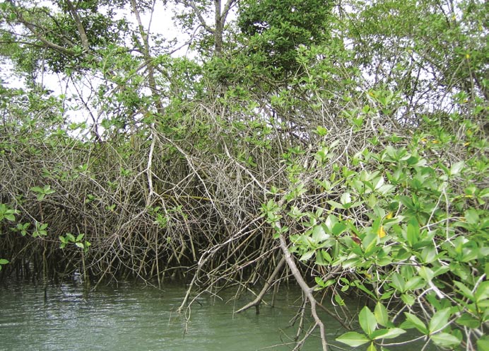
are situated on or near the coast. Communities
included institutional strengthening, water quality
use rivers for transport and mangroves as a source
and ecological monitoring, pollution control, setting
of firewood, fish smoking, building material, salt
up demonstration sites and developing institutional
production, oyster harvesting and medicinal plants.
mechanisms.
However the GCLME's habitats and living resources
The project's long-term objective was to facilitate
are threatened by human activities including
changes in human activities in different sectors of
overexploitation of fish resources, pollution from land-
national life to ensure that the GCLME and its multi-
based sources and degradation of coastal areas
country drainage basins can support sustainable
through erosion.
regional socio-economic development.
REGIONAL
COUNTRIES:
Angola, Benin, Cameroon, Congo, Democratic
Republic of the Congo, C¶te d'Ivoire, Gabon,
Ghana, Equatorial Guinea, Guinea, Guinea-
Bissau, Liberia, Nigeria, Sao Tome and Principe,
Sierra Leone and Togo
Partners: UNEP, UNIDO, NOAA, Norway, NOAA,
private sector
GEF Grant
US$ 20.810 million
Co-financing
US$ 37.870 million
Project Cost
US$ 58.680 million
OVES
http://www.gclme.org
ANGR
M

19
FACT BOX
S General
Most of the major cities in the
LT An Interim Guinea Current Commission, 16 national inter-ministry committees and five
countries bordering the Gulf of
U Regional Activity Centres have been established and are fully functional. Countries have
Guinea are located along the coast.
S formed National Steering Committees to guide Integrated Coastal Area Management
Numerous industries also operate
E Plans.
in this area. The Gulf of Guinea
R Country coast profiles have been published and Integrated Coastal Area Management Plans
is rich in living marine resources
T adopted by all participating countries. Countries have formed National Steering Committees
and it is estimated that around
C to guide these plans.
one million metric tons of fish are
Port reception facilities, which will enhance ballast water management capacity are being
caught annually, of which about
J
E established in maritime ports in Nigeria, Ghana and Cote D' Ivoire.
a third is exported. Many of the
O Public/private partnerships have been formed to reduce effluent discharges and aid
important commercial and artisanal
R restoration of the Lagos lagoon, Nigeria. Public-private partnerships have also been formed
fish species in the Gulf of Guinea
P to conduct two projects - one that aims to use municipal solid waste for fertilizer production
use the coastal waters, lagoons and
mangroves for spawning and as
D in Nigeria; and the other a waste oil reception facility in Team Port, Ghana.
nursery grounds.
E A new mangrove reserve has been established in Calabar, Nigeria and additional mangrove
T areas are being delineated in Cameroon and Angola for adoption as reserves. Coastal
C communities have begun mangrove restoration as a result of awareness-raising campaigns
conducted by NGOs.
L
E
E A Marine Protected Area has been established in Cotonou, Benin Republic.
S Plans have been developed for introducing novel low-cost technology options Ł including
the use of settling pits in Ghana for sewage treatment and community sorting of domestic
waste for recycling.
A group of national GIS experts has been established to help develop a regional GIS database
for data archiving and sharing.
Legal
Regional effluent regulations and standards have been established for industries in coastal
areas. A management programme for reduction, recovery and recycling of municipal and
industrial solid waste, which proved cost-effective in Ghana, is being extended to other
GCLME countries.
A regulatory policy Ł with closed and open seasons Ł has been adopted to conserve
fisheries. Under the Accra Declaration on Environmentally Sustainable Development of the
GCLME (adopted in 1998 during this project's pilot phase) the licensing of distant water
industrial fishing fleets has been halted, other than for tuna vessels, and some jointly-
owned Angola/Spanish vessels. In the past large commercial offshore fishing fleets
from the EU, Eastern Europe, Korea and Japan have placed extreme pressure on fisheries
resources.
Common industrial effluent standards for industries in the coastal area are being adopted
and enforced in some countries.
Training
Around 900 participants have taken part in 40 technical assistance and capacity building
workshops and a regional network of 300 technical experts has been formed. More than
100 environmental experts have been trained in drafting and implementing common
standards, policies and legislation.
20
Reducing Environmental Stress
in the Yellow Sea Large Marine Ecosystem
Overview
economic development in the coastal zone, and by the
Of the 64 large marine ecosystems in the world's
unsustainable exploitation of natural resources.
oceans, the Yellow Sea is one of the most significantly
affected by human development. It is bordered by
Project description
land on three sides and many people depend on
The objective of the project is to promote ecosystem-
the ecosystem for food security and revenue from
based, environmentally sustainable management
economic development.
and use of the Yellow Sea and its watershed; reduce
Bordering countries share common problems with
development stress; and promote sustainable use of
pollution from municipal and industrial sites as well as
the ecosystem.
agriculture. Degradation of the environment is shown
In order to achieve its objectives the project is
by reduced fish catches; shifts in species biomass
preparing a Transboundary Diagnostic Analysis (TDA),
(partly caused by over-fishing); red tide outbreaks,
National Yellow Sea Action Plans and a regional
degradation of coastal habitats (caused by extensive
Strategic Action Programme (SAP). The project will
coastal development) and climate variability.
initiate and facilitate implementation of the SAP, which
The Yellow Sea LME is also an important global
will consist of a series of legal, policy and institutional
resource supporting substantial populations of fish,
changes and investments to address the priority
invertebrates, marine mammals, and seabirds, many
transboundary issues identified in the TDA.
of which are threatened by both land and sea-
The project will also address the lack of a formal
based sources of pollution as well as loss of biomass,
infrastructure to bring about international
biodiversity, and habitat resulting from extensive
collaboration and cooperation in monitoring and
research activities on shared marine resource issues.
REGIONAL
COUNTRIES:
Republic of Korea, and China
Partners: UNOPS
T
OLIA
GEF Grant
US$ 14.295 million
- FO
V
Co-finance
US$ 20.992 million
Project Cost
US$ 35.287 million
ONOMARE
P
GIO
http://www.yslme.org/
ER
Newsletter: YSLME PMO Newsletter
® S
HINA
- C
Z
ONE
AL
AST
C
O

21
FACT BOX
S General
Approximately 600 million people
LT The project has conducted consultations, consensus building, public participation exercises,
(10 percent of the population of the
U issue and problem definition and analysis to prepare a full Transboundary Diagnostic
entire globe) live in the area that
S Analysis which will guide the Strategic Action Programme, and National Strategic Action
drains into the Yellow Sea.
E Plans.
R Memoranda of Understanding have been signed with the Yellow Sea Eco-region Planning
Of the 64 large marine ecosystems
T Programme, the Korea Ocean Research and Development Institute (KORDI), Wetlands
in the world's oceans, the Yellow
C International China Office, and the Marine Stewardship Council.
Sea is one of the most significantly
A joint workshop between the YSLME Project and the Yellow Sea Eco-Region Planning
affected by human development..
J
E Programme in 2005 produced a checklist of critical indicator species and a provisional GIS
O map of the ecologically important areas for the Yellow, Bohai and East China Seas.
R Regional Working Groups have been set up to guide the project's key components -
P ecosystem, investment, pollution, biodiversity and fisheries - and the Regional Scientific
D and Technical Panel have been established.
E Regional guidelines for pollution monitoring have been drafted. These include suggestions
T for areas to be monitored, parameters to be monitored; collaboration with current national
C monitoring programmes; and recommendations for future regional monitoring activities.
L
E The project has worked with Globallast programme on the introduction of alien species,
E including those introduced for mariculture.
S Several Small Grants Projects have began implementation with focus on `education for
coastal communities'. Six institutions have been awarded funds based on their successful
proposals.
Communication
The Yellow Sea Public Awareness and Communications Strategy identifies nine target
stakeholder groups for whom key messages and expected outcomes have been defined.
However, the strategy also seeks to target the communities living around the Yellow Sea
coastal areas, especially those using its watersheds and resources, as well as the greater
global community who are indirect stakeholders of the ecosystem.
Training events, workshops and programmes have been for decision-makers, community
trainers and local government officials in areas such as small grants, project documentation
and fund-raising.
Competitions, exhibitions, workshops and a `call to action' for the region's youths have been
held to increase public awareness. Multi-language information has been made available
through print and electronic media. Brochures, posters and promotional items have been
distributed.
Legal
The Yellow Sea Project is working to encourage national and regional commitments to
international conventions and agreements, such as the United Nations Convention on
the Law of the Sea (UNCLOS), the FAO Code of Conduct for Responsible Fisheries, and the
Global Programme of Action for the Protection of the Marine Environment from LandŁ
based Activities.
Training
Training programmes have been held on pollutant sampling and analysis, and on public
awareness.
An internship programme has been initiated, designed for interns to learn about
international project management and to transfer knowledge back to their institutes,
thereby strengthening national institutions and capacity.
22
Strengthening the Implementation Capacities
for Nutrient Reduction and Transboundary
Cooperation in the Danube River Basin
Overview
Project description
The Danube River is the second largest river in
The overall goal of the project (also known as the
Europe (2,780 km) draining an area of 817,000 km2
Danube Regional Project, or DRP) is to improve the
before discharging into the Black Sea. Its delta is the
river basin environment and manage its natural
second largest natural wetland in Europe. However,
resources. Particular attention is paid to achieving
unsustainable use of water resources and the release of
sustainable ecological effects within the DRB and
wastewater into the river without adequate treatment
Black Sea area, including reducing nutrient and toxic
have created problems of water quality and quantity,
loads to levels which will allow ecosystems to
including significant environmental damage, with
recover to 1960s conditions.
resulting threats to public health and quality of life.
The ongoing DRP is one of three components of
Pollution is another serious problem, with a high
the US$ 95 million GEF Strategic Partnership for
volume of nutrients Ł mainly from agricultural fertilizers,
Nutrient Reduction in the Danube/Black Sea Basin.
household projects and urban sewage. Pollution in
This is composed of three complementary parts:
the Danube also increases Black Sea problems such as
The Black Sea Ecosystem Recovery Project Ł
eutrophication, algal blooms, and contamination.
implemented by UNDP in cooperation with the
A large number of dams, dikes, locks and other hydraulic
Black Sea Commission and with UNEP assistance;
structures have been built on the Danube with the
The Danube Regional Project Ł implemented by UNDP
result that some 80 percent of its wetlands and
in cooperation with the International Commission for
floodplains have been lost since 1900, threatening the
the Protection of the Danube River (ICPDR); and
region's bird and fish habitats and compounding the
The GEF/World Bank Partnership Investment Fund for
risk of flood damage.
Nutrient Reduction Ł focused on single country nutrient
reduction investments.
REGIONAL
COUNTRIES:
Czech Republic, Slovak Republic, Hungary,
Slovenia, Croatia, Bosnia-Herzegovina,
Bulgaria, Romania, Moldova, Ukraine, Serbia
and Montenegro
T
OLIA
- FO
Partners: UNOPS, ICPDR
H╔RIE
C
GEF Grant
US$ 12.240 million
Co-finance
US$ 12.878 million
T╔PHANE
Project Cost
US$ 25.118 million
® S
AN
ELIC
http://www.undp-drp.org/drp/intro.html
P
HITE
On-line newsletter DRP: Updates on the
W
T
project web-site
REA
G

23
FACT BOX
S General
The Danube River Basin covers
LT DRP assistance has resulted in legislative reforms in seven Danube EU countries which now
the whole or part of Austria,
U comply with the relevant nutrients/toxics legislation of EU Water Framework Directive (EU
Germany, Hungary, Czech Republic,
S WFD). The project has also helped four non-EU countries achieve voluntary compliance.
Slovakia, Slovenia, Croatia, Bosnia &
E The project reports a reduction in nitrogen emissions to the Danube of 4,915 t/y, of phosphate
Herzegovina, Serbia, Montenegro,
R emissions 977 t/y (projects completed in 2003); and reductions of nitrogen emissions of
Bulgaria, Romania, Moldova and
T 10,562 t/y, and phosphate emissions 2,224 t/y (projects completed by 2005).
Ukraine.
C Eight family farms in Serbia served as demonstration projects to test 15 Biodiversity Action
Plans (BAPs). It was estimated that their application reduced the release of approximately
The Danube is of high social,
J
E 14 tonnes of nitrogen, 2 tonnes of phosphorus and 160 kg of pesticides per year. The
economical and environmental
O dissemination of the pilot project results reached thousands of farmers in all seven lower
value, providing drinking water and
R Danube Basin countries.
supporting agriculture, industry,
P Wetlands restoration and protection projects involving 4,400 hectares have been
fishing, tourism, power generation,
navigation, tourism and other
D implemented at pilot sites in Slovakia, Romania and Croatia.
economic activities.
E The EU highlighted the Danube/Black Sea partnership as a model for transboundary water
T governance in its 2005 report to the UN Commission on Sustainable Development.
C
The project has supported the enhancement of a system for accident/emergency warning
L
E and prevention of accidental pollution.
E The project has helped the ICPDR and Black Sea Commission develop monitoring
S systems for process, stress reduction and environmental indicators. It also supported the
development of a prototype Danube GIS and improvement of the warning systems for
accidents, emergencies and pollution spills.
The DRP carried out a pilot project for the Sava River Basin, which joins the Danube at
Belgrade, as a model for management planning at a sub-basin level.
The number of NGOs engaged with the project through the Danube Environmental Forum
has grown from 50 at the start of the project to 174 today.
The project's Small Grants Programme supported 114 national and 12 regional projects. It
also provided financial support to community-based demonstration projects.
Legal
The project facilitated the EU Accession Process for candidate countries including helping
them meet legal obligations to implement EU Directives.
The project has assisted countries in designing new agricultural point and non-point source
pollution control policies and legislation as well as policies and legislation for new land use,
wetlands rehabilitation/protection, and industrial pollution control.
Communications
A consistent strategic approach was used throughout the project. Basic products
were developed and disseminated. Target audiences of the DRP received significant
communications support, including the ICPDR and DEF. Activities also included the writing
and submission of stories about the Danube and DRP for international environmental
journals.
In five Danube countries the project developed a number of communication and public
participation materials including manuals for government employees, information
databases, training, study tours, information dissemination and public participation tools,
and information brochures for citizens and NGOs.
24
Transfer of Environmentally Sound Technology
(TEST) to Reduce Transboundary Pollution in the
Danube River Basin
Overview
Project description
Industry, mining and agriculture are responsible for
The project set out to build capacity in cleaner
most of the direct and indirect pollution of the Danube
production in five Danube countries by applying the
Basin. Industrial effluents include heavy metals from
UNIDO programme on Transfer of Environmentally
smelting, electroplating, chlorine production, tanneries
Sound Technology (TEST) at 17 selected pilot enterprises
or metal processing; organic micro-pollutants from
that were contributing to transboundary pollution in the
pulp and paper, chemical, and pharmaceuticals; or oil
Danube River Basin and the Black Sea.
products and solvents from machine production and oil
One of the project's objectives was to bring these
refineries. The food, paper, chemicals, and iron industrial
enterprises into compliance with the environmental
sub-sectors account for about 75 per cent of major
norms of the Danube River Protection Convention and
industrial pollutants. Mining drainage water, run-off
the EU Integrated Pollution Prevention and Control
and process water contain metals and organic solvents.
Directive while keeping them competitive, and at the
Old-fashioned fertilizer factories are major dischargers
same time dealing with the social consequences of major
of nitrogen while sewage from human settlements
technology upgrading.
provides a source of ammonia.
The project also sought to build institutional capacity
As a result the Danube suffers serious oxygen
for TEST procedures in each country by training staff
deficiencies in its slow-flowing and stagnant waters,
from Cleaner Production Centres (CPCs) and Pollution
including its tributaries, where oxygen concentrations
Control Centres (PCCs) whose expertise could then could
can drop below the level that can support aquatic life,
then be made available to help clean up other polluting
including fish, and make the water unsuitable
enterprises in the participating countries, and
for drinking or recreation.
across the Danube region.
REGIONAL
COUNTRIES:
Bulgaria, Croatia, Hungary, Romania and
Slovak Republic
Partners: UNOPS, ICPDR
GEF Grant
US$ 0.990 million
Co-finance
US$ 1.923 million
Project Cost
US$ 25.118 million
http://europeandcis.undp.org/WaterWiki/index.
php/Danube-TEST
IVER
R
ANUBE
D

25
FACT BOX
S General
The 2,857 km Danube River drains
LT The 17 enterprises were selected on the basis of the priority hotspots identified in the
817,000 sq. km including all of
U Danube Ł Pollution Production Programme and reconfirmed at the national level. They
Hungary; most parts of Romania,
S included alcohol production, fish processing, textiles, meat rendering and processing,
Austria, Slovenia, Croatia, and
E pesticide, sugar production, chemical and petrochemical production, mechanical and
railway rolling stock repair and reconditioning.
Slovakia; and significant parts
R
of Bulgaria, Germany, the Czech
T More than 230 cleaner production measures were implemented at the selected enterprises at
Republic, Moldova and Ukraine.
C a cost of US$ 2.00 milion, producing savings equivalent to US$ 1.30 milion per year.
The river basin also includes parts of
Implementing the TEST process brought overall improvements to company profiles and
Yugoslavia, Bosnia and Herzegovina
J
E credibility as well as specific benefits such as: i) a reduction in unnecessary investments
and, through its network of
O and costs; ii) a change from loss to profit by recycling wastes or using them for alternative
tributaries, smaller parts of Italy,
R products) iii) overall improvements in product quality; iv) increased marketing potential as
Switzerland, Albania and Poland.
P a result of environmental acceptability; v) avoidance of fines, penalties and ill-will.
The Danube River discharges into
the Black Sea through a delta,
D Significant environmental benefits were achieved in terms of reduced consumption of
which is the second largest natural
E natural resources (including fresh water and energy), reduced wastewater discharges and
T
wetland area in Europe.
pollution, as well as a reduction in waste generation and atmospheric emissions.
C By the end of 2003, wastewater discharges into the Danube River basin had been reduced
by 4.59 million cubic meters per year with an additional 7.86 million cubic meters reduction
L
E expected on full implementation of the TEST investments.
E
S The project also succeeded in decreasing raw material consumption, water and air pollution
and solid waste. An annual reduction of more than three tonnes of pollutants was reported
along with energy savings of 200,000kWh/year.
Environmentally Sound Technology assessments were completed at the selected plants
in accordance with the EC's Integrated Pollution Prevention and Control (IPPC) Directive,
which must be fully implemented in all EU member states by October 2007. Pre-investment
studies totalling US$ 47 million are currently under implementation.
Environmental Management Systems were introduced in 11 demonstration enterprises
while Environmental Management Accounting systems were implemented in six
companies. Several companies received ISO accreditation over the course of the project.
Training
Over a three-year period, a total of 90 persons in the five countries were trained in TEST
procedures through the delivery of 622 training days.
The high standard of training in TEST procedures and associated products which the national
counterpart institutes (CPCs and PCCs) received has enabled them to become cost-effective
businesses in their own right, selling cleaner production packages and test modules to
industry.
Within the 17 selected enterprises, a total of 380 employees received TEST capacity building
through 1691 person-days of training. The project was responsible for eight TEST-related
jobs being created within the participating countries.
Communications
Every country hosted a National Dissemination Seminar to which at least 10 companies
were invited to see how the TEST approach worked. A regional seminar was organized with
ICPDR (International Commission for the Protection of the Danube River).
Two TEST publications were distributed and made available through the project website.
The project exchanged information with on-going EU-funded programmes for the
implementation of the Integrated Pol ution Prevention and Control (IPPC) Directive in Romania
and Hungary and with the USAID-funded ECOLINK programmes in Bulgaria and Croatia.
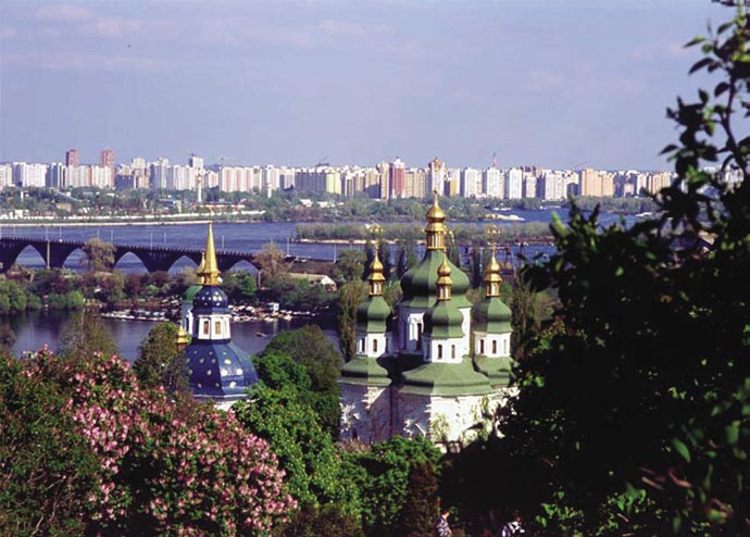
26
Preparation of a Strategic Action Programme (SAP)
for the Dnipro River Basin and Development of
SAP Implementation Mechanisms
Overview
animal species inhabit the Dnipro Basin, including
The Dnipro, Europe's third largest river, and its tributaries
five fish species
drain industrial and residential centres of high
economic, social and environmental value. However,
Project description
the river can no longer be considered a self-regulating
This project was designed to develop a programme
river-ecosystem. Hydro-electric facilities, reservoirs and
of measures and implementation mechanisms to
dams, numerous nuclear power stations and other
sustainably protect the Dnipro and to contribute to the
heavy industrial complexes have caused region-wide
protection of regional and global international waters.
environmental and socio-economic damage.
Management capacity, both at the level of individual
Extensive forest and wetland reclamation for
countries Ł Republic of Belarus, Russian Federation,
agricultural development and sewage from large
and Ukraine Ł and at the regional level, would be
urban populations have also added to the severe
strengthened, so that all basin countries will benefit
environmental and health problems found in the
as well as those bordering the Black Sea.
Dnipro river basin and the entire Black Sea region.
This project was designed to develop a programme
The situation has been complicated by the extreme
of measures and implementation mechanisms to
social and economic difficulties the region faces in the
sustainably protect the Dnipro and to contribute to the
transition to market economies.
protection of regional and global international waters.
The Dnipro river itself has suffered severe deterioration
Management capacity, both at the level of individual
and there is no reliable safe drinking water. Water
countries Ł Republic of Belarus, Russian Federation, and
quality is classified as "poor" to "unacceptable". The
Ukraine Ł and at the regional level, was strengthened,
deterioration of the Dnipro also threatens the natural
so that all basin countries benefit as well as those
environment Ł 69 of the Ukraine's 164 endangered
bordering the Black Sea.
REGIONAL
COUNTRIES:
Republic of Belarus, Russian Federation,
Ukraine
Partners: UNIDO, UNEP, IAEA, IDRC, UNOPS
GEF Grant
US$ 6.482 million
Co-finance
US$ 7.628 million
Project Cost
US$ 14.110 million
http://www.dnipro-gef.net
IVER
R
O
NIPR
D

27
FACT BOX
S General
The Dnipro River is the third
LT Support for a Dnipro Basin Convention and an implementing Commission was confirmed
largest river in Europe and the
U by all three countries in the Kyiv Declaration on Cooperation in the Dnipro Basin signed in
S
second largest river emptying
May 2003.
E
into the Black Sea. It drains an
The riparian countries developed a draft Agreement on Cooperation in the Field of
area of 509,000 square km and
R Management and Protection of the Dnipro Basin which created the institutional framework
T
has a total length of 2,200km.
for a Dnipro Commission and its operational mechanisms.
About 33 million people live
C The project set up the Dnipro Basin Council (DBC) in 2003 to provide a public forum for local
in the Dnipro basin, 22 million
representatives, relevant state ministries, NGOs, research institutes and the private sector.
J
E
of them in Ukraine where the
All three countries have increased their national budgets to improve the Dnipro river water
O
largest part (57 percent) of the
quality. Ukraine's budget has increased threefold.
R
river basin is located.
Pioneering research on assessment of pollution hotspots, regional fisheries and biodiversity
P assessments has been undertaken. Fisheries research produced the first inventory of series
D inhabiting the Dnipro Basin. Of 90 listed species there were nine introduced species, nine
E interventionist species and five invasive species.
T The project created six Regional Thematic Centres Ł two per country Ł to coordinate
C project activities. Their responsibilities were: Cleaner production, Pollution prevention and
L
E control (Belarus); Biodiversity, Legal, regulatory and Economic Issues (Russia); Pollution
E monitoring, Information management (Ukraine).
S The SAP included a Priority Investment Portfolio (PIP) which identified ten sites in Ukraine,
and five each in Belarus and Russia, needing immediate intervention.
Water monitoring capacity was increased. Approximately 10 percent of the project budget
was allocated to equipment purchases, mostly for water quality monitoring laboratories.
A 2003 report on waste management from intensive livestock production included a
legislative review, case studies and mitigation measures.
An IAEA report revealed that although radioactive contamination in flowing rivers had
fallen to acceptable levels since the Chornobyl nuclear accident of 1986 there were still
problems with radioactive waste dumps and in enclosed lakes.
A regional Dnipro River Basin environmental database was created with on-line user
capacities.
Legal
Two legal studies Ł Harmonization of Environmental Legislation of Dnipro River Countries
with Legislation of the European Union (September 2003) and Environmental Legislation
of Belarus, Russia and Ukraine compared with the Principles of EU environmental law, with
focus on water legislation" (June 2002) Ł were conducted.
A 2002 report entitled "Review of Dnipro Basin Biodiversity legislation ensuring Public
Participation Support" included a review of the legal protection accorded to flora and fauna,
protected areas, endangered species and public participation in the three countries.
Community
Working through the Dnipro Basin Council and NGO forums the project helped the continuing
expansion, involvement and competence of the region's environmental NGO community.
The Small Grants Programme helped NGO activities, especially public awareness-building.
The NGOs and other community-based organizations in the region developed a deeper
involvement in transboundary Dnipro environmental issues, as shown by the formation of
an International Dnipro River Network of NGOs
28
Implementation of the Strategic Action Programme
of the Pacific Small Island Developing States (SIDS)
Overview
percent of the two million ton catch goes for
The ecosystems of the Pacific islands support an
local consumption.
enormous and largely undocumented array of diversity
The tuna fisheries of the Western and Central Pacific
including more rare, endangered and threatened
Ocean are one of only two remaining major fisheries
species than anywhere else on earth. Its productive
in the world still considered to be in healthy condition
fisheries support the economies of nations, islands
and amenable to increased exploitation. The OFM
and communities.
component targets the Western Pacific Warm Pool
However this environment is critically threatened with
ecosystem, whose boundaries correspond almost
up to 50 percent of the region's total biodiversity at risk.
precisely to the Western Pacific tuna fishing grounds.
Threats come from over-exploitation of resources; the
It has been designed to improve knowledge of the
fragmentation of ecosystems and habitat destruction
ecosystem, including the effects of fishing, and to
from human activities; the impact of invasive species;
improve national and regional management regimes
climate change and destructive natural events. These
to optimize sustainable economic returns from
are compounded by a complex combination of
the fisheries.
socio-economic factors including smallness,
geographic isolation and narrow resource bases,
Integrated Coastal and Watershed Management
population growth, lack of technical capacity and
(ICWM) component . The ICWM component of
ineffective coordination among resource and
the project works with pilot communities in the
conservation agencies.
participating countries to find practical ways to
strengthen environmental management in three key
Project description
areas: coastal fisheries, waste reduction, and freshwater
The long-term objective of this project is to conserve
protection. Its actions focus on freshwater supplies
and sustainably manage coastal and ocean resources.
including groundwater, Marine Protected Area (MPA)
Project activities are designed to encourage
enhancement and development, sustainable coastal
comprehensive, cross-sectorial, ecosystem-based
fisheries, integrated coastal management including
approaches to mitigate and prevent existing imminent
tourism development, and activities to demonstrate
threats to International Waters.
waste reduction strategies will be stressed.
Although a single SAP provides a regional framework
Three out of four Pacific Islanders live in rural areas and
within which actions are identified, developed and
many people still depend on coastal resources for both
implemented, project activities are carried out in two
food and economic opportunities. The project works
complementary components Ł International Waters
with pilot communities on the root causes of their
Programme (IWP) and Oceanic Fisheries Management
resource management problems and seeks to find low-
(OFM) Ł which can be seen as two distinct projects.
cost solutions that will improve resource management
planning at the national level.
Oceanic Fisheries Management (OFM) component.
The project also promotes community-based,
South Pacific fisheries provide 48 percent of the world's
environmentally-friendly, behaviour change through
tuna catch from an area that covers only a 12th of the
a range of social and economic tools including
world's surface. Tuna fisheries earn the region more
legislation, economic incentives, infrastructure, public
than US$1.7 billion annually although only about one
services and social marketing.

29
OCEANIC FISHERIES MANAGEMENT COMPONENT Ł RESULTS
FACT BOX
S Legal
The Pacific marine environment
LT GEF support facilitated the full participation of Pacific SIDS as primary stakeholders in
is an enormous and largely
U the negotiation and development process for the Convention and Commission for the
unexplored resource. It has the most
S Conservation and Management of Highly Migratory Fish Stocks in the Western and Central
extensive and diverse reefs in the
E Pacific.
world, the deepest oceanic trenches
R The project helped establish the new Western and Central Pacific Fisheries Commission in
and relatively intact populations of
T 2004. The WCPFC works to secure a sustainable future for the industry, securing present
many globally threatened species
C and future economic and other benefits for the islands, while at the same time minimizing
including whales, sea turtles,
the impacts of fisheries, including by-catches of turtles and sharks and pollution caused
dugongs and saltwater crocodiles.
J
E by fishing. A compliance programme for the Convention, including appointing observers,
O boarding and inspection, and the application of sanctions, has begun.
The executing agency for the
R Many Pacific SIDS are conducting reviews of the legal, policy and institutional arrangements,
first project component (IWP)
P their national fisheries status, and management plans relating to the Convention with
was the South Pacific Regional
Environmental Programme
support from the project. At the regional levels scientific, legal and policy workshops and
D
(SPREP), a regional organization
E consultations are taking place.
T
established by the governments
At the Western and Central Pacific Fisheries Commission meeting in December 2005
and administrations of the Pacific
C conservation and management measures were adopted which maintain bigeye and
region. SPREP has grown from a
yellowfin catches at current levels, cap purse seine at 2004 levels, limit bigeye longline
L
E
small programme into the Pacific
catches and allow no increase in vessels fishing for albacore in both north and south Pacific
E
region's major intergovernmental
waters.
S
organization charged with
General
protecting and managing the
environment and natural resources.
Regional consultation and coordination has been improved by strengthening the links
between the Forum Fisheries Agency (FFA) and the Secretariat of the Pacific Commission
(SPC). These organizations were the original proponents of the OFM project.
Tuna management plans were developed and reviewed in the Cooks Islands, Fiji, Kiribati,
Marshall Islands, Niue, Tuvalu and Vanuatu. Other countries were supported in their efforts
to develop national tuna management plans for the 14 participating countries. Support was
also given to the preparation of Tuna Management Plans by the Secretariat of the Pacific
Commission.
A Tuna Fishery Data Management System has been installed and is operating operation in
seven of the 17 Pacific SIDS. National observer programmes have been established in 10
SIDS. A baseline study on the oceanic fisheries resources of the Central and Western Pacific
was conducted in 2002.
The Pacific Island Forum Heads of State has established a ministerial committee to oversee
regional fisheries affairs.
The project achieved a high level of co-ordination between its activities and existing on-
going tuna fisheries management projects and has integrated them into its overall strategic
plan.
The project supported regional and national observer training courses, port sampling
training and evaluation, and has created manuals and other materials to help observers.
Support was provided to national observer coordinators in four countries (Fiji, Kiribati,
Marshall Island and PNG). Port sampling contractors in Samoa and Tonga also received
project support.
Models have been created to describe the dynamics of transboundary fish stocks including an
examination of the ecosystem issues relating to the Western Central Pacific tuna resource.
The project has also supported Pacific islands' attendance to the annual meetings of the
Standing Committee on Tuna and Billfish and to the meetings of other regional fisheries
management organizations such as. IATTC, IOTC and ICCAT.
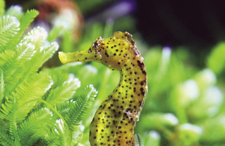
30
INTEGRATED COASTAL AND WATERSHED MANAGEMENT (ICWM) Ł RESULTS
General
S Sites were selected to host community-based, social marketing elements of the project in each of
LT the participating countries. In each country a National Coordinator and National Task Force have been
U appointed and meet regularly to ensure effective coordination.
S IWP and SPREP introduced a Waste Reduction Champion Award in 2005 to mark SPREP's Year of Action
E Against Waste.
R The project funds a scholarship scheme for students which is designed to build up technical capacity and
T keep skilled people in-country and involved in environmental protection activities. Fourteen students
C have benefited from the scheme Ł four from PNG, two each from the Solomon Islands and Tonga, and
one each from the Cook Islands, Fiji, Kiribati, Palau, Tuvalu and Vanatu.
J
E
At project demonstration sites
O
R Coastal fisheries:
P On the island of Yap, Federated States of Micronesia the project team has been collecting and sharing
information on the effectiveness of Local Marine Managed Areas with host communities. The project is
D
E also promoting tourism and other economic opportunities to the islanders.
T At Marovo Lagoon, in the Solomon Islands sustainable coastal fisheries are being promoted by establishing
C a system of Marine Protected Areas and promoting increased community involvement and responsibility
for local resource management and conservation. It has helped transfer techniques and regulations Ł such
L
E
as bag limits, gear restriction, seasonal closures, species rotation, and area restrictions Ł to communities.
E Mangroves have also been replanted.
S At Malekula Island, Vanuatu a series of participatory processes have been used to encourage the whole
community to fully participate in all resource management decisions and to better understand their
natural resources. Progress has also been made in the sustainable management of threatened species
such as turtles and land crabs.
At Alofi North and Makefu in Niue public meetings and awareness programmes have been held to
develop rapport with the village communities and build commitment to the sustainable management of
coastal resources. The project is also working with communities to develop new village-based fisheries
management plans, improve marine habitats and establish Marine Protected Areas.
Waste reduction
In Fiji the project has been working with villagers to develop a waste management system that includes
composting (kitchen/green waste), recycling and reducing water pollution through composting human
and animal waste. Village Environment Committees have been formed, open dumps have been cleared
T
OLIA
- FO
EE
L
T
ERENCE
®
HORSE
S
EA

31
FACT BOX
and Smost households are now composting organic material. Recycling centers have been established,
skip bins provided and the use of composting toilets as an environmentally safe alternative to pit/septic
IWP activities took place in 14
t
LT
oilets has been encouraged. National waste management plans are under consideration.
SIDS Ł the Cook Islands, Federated
In Tongatapu, Tonga the project has been encouraging waste separation and composting at the household
U
States of Micronesia, Fiji, Kiribati,
level. TS
the Marshall Islands, Nauru, Niue,
Eonga has also recently adopted a Water Resource Bill and national waste management plans are
Palau, Papua New Guinea, Samoa,
being drawn up.
In the village of Barakau, on Papua New Guinea the project is working to raise community awareness
R
the Solomon Islands, Tonga, Tuvalu
of
T
and Vanuatu. These countries are
C
solid and human waste disposal and to establish an effective waste management system. It has also
spread out across more than
helped draw up an effective marine resources management system and has lobbied for national policy
38 million square kilometers
J
E
and legislative changes to support community-based environmental management plans.
of ocean.
In Majuro Atoll, part of the Marshall Islands, a task force has been formed to improve the solid waste
O
pr
R
oblem on the islands and investigate the viability of establishing a centralized recycling and composting
The Pacific Ocean contains an
facility P.
estimated 20,000 to 30,000
individual islands.
At Bikenibeu West, Kiribati, the project is assisting the Kiribati community implement low-cost alternatives
to
D
E
manage their solid and liquid waste. A container deposit system encouraging people to recycle cans
and Tplastic bottles has been established and a series of community `competitions' organized as a way
of pr Comoting waste reduction behaviour. There has been an improvement in wastewater and sewerage
treatment and coastal areas have reported reduced levels of waste.
In Funafuti, Tuvalu the project is working with communities to promote practical, cost-effective and safe
L
E
toilet ESsystems, create awareness of the environmental impacts caused by unmanaged wastewater on
groundwater, human health, and the surrounding environment, and provide the financial or technical
support need to assist households and government to install environmentally sound treatment systems.
Wastewater and sewerage treatment facilities have been improved, there has been a reduction in coastal
pollution and national waste management plans are under consideration.
Freshwater protection
In Lepa and Apolima Island, Samoa the project is working with the Samoa Water Authority to monitor
water quality and with landowners to develop freshwater management plans for two communities.
Lessons learnt from these activities could be expanded to all Samoa's water catchment areas. Project
activities have also led to a decrease in land-based pollution and a reduction in waste.
In the Takuvaine Valley in the Cook Islands the project has been working with the local community to
develop a management plan for the watershed, the area's main source of water, which was threatened by
pollution. Experience from this project assisted development of a national water management plan. The
Cook Islands have also reported a reduction in land-based pollution, particularly from waste.
Regional (Cook Islands, Micronesia, Fiji,
International Waters Project (IWP): ICWM &
Kiribati, Marshall Islands, Nauru, Niue, Papua
OFM Components
New Guinea, Samoa, Solomon Islands, Tonga,
Tuvalu, Vanuatu)
GEF Grant
US$ 12.200 million
Co-finance
US$ 8.999 million
Partners: South Pacific Regional
Project Cost
US$ 20.999 million
Environmental Programme, Forum Fisheries
Agency
http://www.sprep.org/iwp/index.htm
http://www.ffa.int/gef/
Oceanic Fisheries Management (OFM)
component
GEF Grant
US$ 11.644 million
Co-finance
US$ 79.091 million
Project Cost
US$ 90.735 million
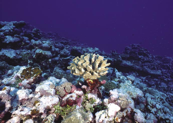
32
PEMSEA: Building Partnerships in
Environmental Protection and
Management of the Seas of East Asia
Overview
addressing environmental problems.
The East Asian Seas (EAS) region comprises six Large
PEMSEA has established a network of over 30 national
Marine Ecosystems (LMEs) Ł East China Sea, Yellow Sea,
ICM demonstration projects, parallel sites and sub-
South China Sea, Sulu-Celebes Sea, Indonesian Sea and
regional sea area/pollution hotspot management sites.
the Gulf of Thailand. In the last 30 years, 11 percent of
The programme seeks to consolidate and build on the
the region's coral reefs collapsed while 48 percent are
experiences gained from these sites by transferring
currently in a critical condition and over 80 percent are at the lessons learned and building the required skills
risk. Mangroves have lost 70 percent of their cover in the
and capacities across the region, supported by a
last 70 years while seagrass beds' loss ranges from 20-60
comprehensive, systematic, region-wide strategy,
percent. Unless properly managed, the current rate of
action program and implementing mechanism.
loss will result in the removal of all mangroves by 2030,
A recently launched medium-sized project Ł East Asian
while reefs face collapse within 20 years.
Seas Region: Development and Implementation
of Public Private Partnerships in Environmental
Project description
Investments Ł complements existing PEMSEA activities.
The PEMSEA programme was designed to enable the
The US$ 1.81 million (GEF grant US$1 million) project is
sustainable use and management of coastal and marine
designed to build confidence and capabilities in public-
resources through intergovernmental, interagency
private sector partnerships as a means of financing
and intersectoral partnerships. Emphasis is placed on
environmental facilities and services in the region. It will
the demonstration of actual management actions
operate pilot programmes at five of the existing PEMSEA
on the ground, the success of which will strengthen
sites and will build capacity to effectively develop,
government confidence and increase the commitment
finance, implement and sustain new investments in
and investment of the public and private sectors in
environmental facilities and services.
REGIONAL
COUNTRIES:
K
N
B
A
Brunei Darussalam, Cambodia, China,
T
O
O
Democratic People's Republic of Korea, Japan,
P
H
E
Indonesia, Malaysia, Philippines, Republic of
R
I
N
A
Korea, Singapore, Thailand, Vietnam
2
0
0
5
/
M
Partners: International Maritime Organization
R
Y
E
N
H
T
T
GEF Grant
US$ 16.224 million
O
L
C
Co-financing
US$ 33.531 million
O
)
W
Project Cost
US$ 49.755 million
-
(
C
R
E
E
F
http://www.pemsea.org/
N
O
Newsletter PEMSEA E-Updates Tropical Coasts
D
E
A
H
L
R
A
C
O

33
FACT BOX
S General
The region in which PEMSEA
LT A Sustainable Development Strategy for the Seas of East Asia (SDS-SEA) was developed
works encompasses a series of
U and adopted by the Ministers of the 12 participating countries as the Putrajaya Declaration
large marine ecosystems, sub-
S in 2003.
regional seas, coastal areas, and
E The PEMSEA Programme Steering Committee was transformed into an EAS Partnership
their associated river basins that are
R Council in 2006.
linked by large-scale atmospheric,
T Several participating countries, including China, Japan and the Democratic People's Republic
oceanic and biological processes/
C of Korea, have agreed to share the costs of creating a PEMSEA Resource Facility.
phenomena, such as typhoons,
the Kuroshio Current and highly
J
E Regional networks, a Regional Task Force and a Multidisciplinary Expert Group of coastal
and marine experts have been formed.
migratory species.
O
R PEMSEA has facilitated a partnerships agreement for oil spill preparedness and response in
Although the LMEs are semi-
the Gulf of Thailand.
P
enclosed and interconnected
Legal
they are also strategic, globally
D
significant, and geologically unique
E ICM legislation has been prepared to aid the establishment of an institutional arrangement
T at each site.
international water systems.
C Results from selected PEMSEA sites
L
E Bali, Indonesia:
E A Bali Coastal Strategy was adopted in 2002; a Coastal Strategy Implementation Plan
S in 2005; and a Coastal Use Zoning Plan in April 2005. Bali's zoning plan has established
protected areas for rivers, beaches and cliffs, mangroves, coral reefs and water resources.
Chonburi, Thailand:
An Implementation Plan for Coastal Strategy, action plans and institutional arrangements
for ICM implementation have been made. An ICM Consultative Committee and Secretariat
have been established and US$10 million of provincial and municipal government funds
has been identified to implement Chonburi's Coastal Management Plan
Danang, Vietnam:
Coastal Strategy and implementation plans have been adopted along with a communications
plan, coastal use zoning plan and institutional arrangements for ICM implementation,
including draft local legislation. PEMSEA has also helped organize water segregation and
beach clean-ups in two pilot communes.
Port Klang, Malaysia:
PEMSEA's ICM program has chosen the Port Klang area as it hosts the mouths of two rivers
that travel through Malaysia's mostly populated and urbanized areas. A coastal use zoning
program which defines primary usage, compatible usage, and proposes a licensing or
permitting system, has been launched.
Nampho, DPR Korea:
A Coastal Strategy and Integrated Coastal Use Zoning Plan has been officially adopted and
are under implementation. One of the strategy's major outputs has been the development
of drinking water and sanitation supply project which benefits about 330,000 people.
Sihanoukville, Cambodia:
Sihanoukville has adopted a Coastal Strategy and developed Implementation Plans in the
areas of: tourism development, solid waste management and habitat protection.
Batangas, Philippines:
Strengthening of local legislation and institutional arrangements in Batangas has allowed
the sustainable operation of the ICM programme using its own resources.
34
Xiamen, China:
An Oceans and Fisheries Bureau has been established. User fees col ected from use of the sea areas have
been earmarked for marine management and environmental protection. Xiamen's experiences in the
implementation of sea-use zoning contributed to the enactment of national legislation on sea area
management in China. ICM implementation in Xiamen, particularly the zoning scheme, has aided
the projection of marine habitats and endangered species such as the Chinese white dolphin, egret and
lancelet.
Other PEMSEA results
Bohai Sea Environmental Management Programme
A Bohai Sea Sustainable Development Strategy has been developed as well as a Legal Framework for
Bohai Sea Management.
Manila Bay Environmental Management Project (MBEMP)
A Manila Bay Coastal Strategy has been adopted and a Project Coordinating Committee established. A
Coastal Use Zoning Plan has established areas for all major activities as well as sanctuary zones for fish,
bird and marine turtles, and restoration and protection zones for coral reef, seagrass, mangroves and
mudflats.
Gulf of Thailand Environmental Management Project
A Gulf of Thailand Secretariat has been established by bordering nations. PEMSEA has also facilitated a
Partnerships Agreement in Oil Spill Preparedness and Response in the Gulf of Thailand, signed in January
2006.
Communications
An Integrated Information Management System (IIMS) now aids management and planning. Information
sharing is enhanced by the Coast to Coast (C2C) network of country websites which gives facts and
figures, coastal and marine topics and organizational contacts for each country. PEMSEA also encourages
cross-project information exchange and sharing experiences through training, website linkage, technical
workshops, and meetings with PERSGA, Yellow Sea LME Project, NOWPAP and others.
PEMSEA has produced videos and publications including case studies, scientific papers, books, magazines
and brochures for distribution around the region.
Specialized training workshops have been organized for environmental journalists. Media partnerships
are encouraged through regular media conference forums.
Community awareness
Regular public awareness initiatives have involved women, youth and community associations. A
Summer Youth Camp in the Philippines organized by PEMSEA in 2002 led to similar initiatives across the
region such as the Manila Bay Youth Forum in 2002 and 2003, the Girl Scouts Coastal Clean-Up in Bataan,
Philippines, and the Boy Scouts Coastal Clean-Up in Chonburi, Thailand.
Environment-related themes have been introduced into school activities. The PEMSEA website has a
Young Environmentalist Hub with on-line quiz and particular emphasis is placed on promoting World
Ocean Day activities. Environmental material produced for children includes information sheets, education
materials, a special website, interactive puzzles, and art competitions.
Training
During the period 1999-2006, 72 training sessions Ł attended by more than 1,400 trainees Ł were
organized, offered or supported by PEMSEA. Capacity-building has been enhanced by the establishment
of an ICM regional training center in Xiamen, China and national training centers in Batangas, Philippines,
and in DPR Korea. A professional apprenticeship programme, internship and fellowship programmes
provide on-the-job training.
35
Black Sea Ecosystem Recovery Project,
Black Sea Environmental Management Programme,
and Black Sea Strategic Action Plan
Overview
Rivers form by far the most important pathway for
The most significant process degrading the Black Sea
land-derived nutrients contributing over 95% of the
in recent years has been massive over-fertilization by
land-derived inorganic nitrogen load and over 85%
nutrients Ł compounds of nitrogen and phosphorus Ł
of the land-derived phosphate load (i.e. excluding
largely coming from agriculture, but also from domestic
loads from the rivers Don and Kuban which flow
and industrial sources. This has resulted in a process
into the Sea of Azov). Direct municipal/industrial
known as eutrophication, and has led to the wide-scale
discharges contribute only a minor proportion of the
death of marine life which, allied with overfishing and
land-derived nutrient load. In recent years the Danube
the introduction of invasive species, such as the comb
has carried over 80% of the total river-borne DIN load
jellyfish (Mnemiopsis leydi), left some parts of the
and over 50% of the total river-borne phosphate load
ecosystem in a state of collapse and other parts
to the Black Sea.
severely damaged.
During the 1970s and 1980s intense agricultural
Project description
management practices were adopted in the Black Sea
Although the management of the Black Sea is the
basin. Greater use of inorganic fertilizers and growing
shared responsibility of the six coastal states until
livestock numbers increased the amount of nutrients
the early 1990s there was no common framework
and organic waste. Other sources of pollution were
for cooperation.
poorly regulated industrial activity, ship discharges and
After agreement on the 1992 Convention for the
tanker spillages, the dumping of solid waste into the
Protection of the Black Sea against Pollution, which
sea or onto wetlands, untreated sewage and radioactive
established the Black Sea Commission, and with the
waste. These helped create pollution hot spots in the
support of the GEF-funded Black Sea Environmental
sea, severely affecting its ecology and economy and the
Programme (1993-1996) the countries were finally
quality of life and health of Black Sea residents.
able to launch joint, collaborative action.
Eutrophication has had profound consequences on
The subsequent Black Sea Strategic Action Plan
fisheries and tourism. Although fish catches declined
(1997-2000) supported them in drawing up SAPs,
from 850,000 tons (mid 1980s) to a low of 250,000 tons
creating institutional networks and identifying
(1991) there is evidence of recovery of some species,
priority national investments needed to improve
e.g. anchovy and sprat, but a worsening of the situation
the Black Sea environmental situation.
for others, such as spiny dogfish and whiting. In recent
The long-term objective of the current Black Sea
years the catch of bonito has increased massively.
Ecosystem Recovery Project is to assist Black Sea
During the 1990s Turkey typically landed about 10,000
countries to develop national policies and legislation
ton/yr, but in 2005 this jumped to 60,000 ton/yr, since
and define priority actions that, while allowing
when catches have remained high.
economic development, can reduce levels of
Black Sea tourism has suffered from poor water quality,
nutrients and other hazardous substances so
(it is estimated that poor bathing water alone has
that Black Sea ecosystems can recover to similar
cost the region US$ 500 million a year in lost tourist
conditions to those observed in the 1960s.
revenue) as well as a lack of industry training and poorly
BSERP seeks to reform agricultural policies; improve
planned development of hotels and facilities. Tourist
industrial and municipal wastewater treatment,
developments are now subject to environmental
rehabilitate key basin ecosystems, and strengthen the
impact assessments.
region's legislative framework and its enforcement.
36
S BLACK SEA ENVIRONMENTAL PROGRAMME
LT The project worked to assist implementation of the 1992 Convention for the Protection of the Black Sea
U against Pollution (the Bucharest Convention) and the policy objectives of the 1993 Odessa Declaration . It
S also helped introduce Integrated Coastal Zones Management practices to Black Sea countries.
E A Transboundary Diagnostic Analysis and Strategic Action Plan were developed. The SAP was adopted by
R Black Sea environment ministers in Istanbul in 1996.
T The programme helped set up a regional network of institutional structures, including Thematic Advisory
C Groups and Regional Activity Centres. It conducted biodiversity studies and developed the basis of the
J
E Black Sea GIS system.
O The project worked with WHO on a regional survey of beach and bathing water quality and with the
R International Atomic Energy Agency (IAEA) on radionuclides pollution and use of nuclear and isotopic
techniques to analyse and monitor pollution.
P The project assisted governments with water quality monitoring and worked in close cooperation
D with the private sector on issues such as ship oil and waste, including drawing up a contingency plan
E
T for oil spills.
C The foundations of a communications and public awareness strategy were laid and NGO activities initiated
through the first Black Sea NGO Forum and the establishment of the Black Sea NGO Network.
L
E BLACK SEA STRATEGIC ACTION PLAN
E
S This project continued to support countries in preparing national SAPs and in identifying priority national
investments. It helped reinforce national programmes, collect data and set up a series of Regional Activity
Centres. Each country hosted an activity centre, located in a leading scientific or technical institution, with
its own designated focal point.
In 1997, the Black Sea and Danube Commissions established a joint technical working group to synthesize
national reports into a regional report and provide the basis for a MOU between the two commissions.
The Strategic Partnership for the Black Sea and Danube Basin, launched in 2001, is a US$ 97 million
support framework providing investment and capacity building to the 17 riparian countries.
Agreement was reached with Globallast (another UNDP-GEF programme), which had operated a pilot
site at Odessa, on a cooperative programme to tackle alien species invasion.
The Black Sea SAP helped identify and map marine habitats and make an assessment of transboundary
fish populations and current fishing practices. It established conservation areas in the Black Sea and
neighboring wetlands. Protection of marine mammals was secured through these sanctuaries and the
use of appropriate fishing gear.
BLACK SEA ECOSYSTEM RECOVERY PROJECT - BSERP
BSERP has worked to reform agricultural policies; improve industrial and municipal wastewater treatment
(including private sector incentives to invest in wastewater facilities); rehabilitate key basin ecosystems
such as wetlands to act as nutrient sinks (including the creation of artificial wetlands); and to strengthen
both the region's legislative framework and its enforcement.
The Black Sea TDA(1996) has been updated using the latest data available for the Black Sea on the key
transboundary issues, the Black Sea SAP (1996, updated 2000) is being also revisited to incorporate the
results of a National Gap Analysis Study and the TDA (2007).
The Black Sea Ł Danube Joint Technical Working Group (BS-D JTWG) was re-established between the
Black Sea and Danube Commissions to develop a joint strategy on eutrophication and allow all 17 Black
Sea countries to pursue common targets. Under EC initiative a task force has been formed for financing
investments in both Danube and Black Sea regions
The project is closely linked with the Danube and Dnipro river projects and a joint working group reviews
scientific findings and coordinates the activities of the Black Sea and Danube Commissions.
37
FACT BOX
An assessment has been made of options and opportunities for small and medium sized investment in
three sectors Ł agriculture, industry and municipalities Ł in projects that could reduce nutrient loads and
Aided by nearly 14 years of GEF-
facilitate habitat recovery.
funded interventions the Black Sea
ecosystem is showing clear signs of
The agricultural and industrial sectors have benefited from the promotion of ICZM and testing of best
recovery. These include:
practices. Pilot projects have been implemented in ICZM, marine protected areas, fishery-free zones,
Ę Since 2000, nutrient loads in the
nutrient export modeling and a Black Sea Vessel Traffic Oil Pollution Information System.
upper and middle stretches of
A targeted research programme has been carried out on Black Sea eutrophication. Four international
the Danube have shown a clearly
scientific cruises have been organized in the North-west shelf of the Black Sea by the project's International
reducing trend.
Study Group. Studies have also been made on inputs of nutrients to the Black Sea by atmospheric
Ę Between 1988 and 2003 livestock
deposition, through River inputs, and the effects of livestock management.
numbers in coastal country sub-
Legal
basins fell by about two-thirds.
Livestock numbers are now about
EU accession countries (Bulgaria and Romania) have harmonized their national legislation and policies
half of what they were in 1960, with
on nutrient reduction with EU directives (particularly the Urban Waste Water Treatment and Nitrates
huge reductions in the volume
Directive). This includes the development, adoption and implementation of Codes of Good Agriculture
of manure applied to fields or
Practice and site-specific programmes on nitrogen export reduction in vulnerable zones.
discharged to river from intensive
A study is being undertaken on cost-effective legal, administrative and investment practices relating
rearing facilities.
to eutrophication control. Legal protocols governing pollution and resource use in the Black Sea have
Ę Levels of phytoplankton, which
been revised.
depend on nutrients for growth,
Continued support has been provided to the Black Sea Commission including promotion of revised
have been reduced in the North-
west shelf of the Black Sea (a
protocols and the development of new ones, such as the drafting of a new legally-binding fisheries
decrease in biomass of about 50%
document and a new protocol on land-based sources of pollution.
compared with 1980s). In 1990
Training
about 80% of the 50,000 km2
BSERP sponsored 17 training and workshop events, which were attended by 306 participants and also
area of seabed in the North west
sponsored 23 additional events, attended by 630 participants, for the NGO community.
shelf was considered effectively
dead. Low oxygen conditions
Public awareness and communications
still occur in NW shelf waters, but
Schools have incorporated Black Sea studies into their curriculum and some have adopted their own
they now cover a much smaller
beaches for clean-up and conservation activities.
area, are much less severe, and
Black Sea Day (Oct 31) is supported by the project with events across the region including beach clean up
much less frequent. The number
campaigns, children's art competitions, concerts, festivals and promotion of environmental issues through
of macrozoobenthos species Ł an
the media.More than 25,000 people have directly participated in over 100 BS Day events and activities;
indicator of environmental quality
media coverage reached an estimated audience of over eight million people throughout the region.
Ł has increased. Large areas of the
NW shelf are now characterized
as being of moderate or good
REGIONAL
ecological status.
COUNTRY:
Bulgaria, Georgia, Romania, Russia, Turkey and Ukraine. Links to river basin projects also affect
Bosnia and Herzegovina, Croatia, Czech Republic, Hungary, Moldova, Slovak Republic, Slovenia,
and Yugoslavia.
Partners: UNOPS, World Bank, UNEP, Black Sea Commission
Black Sea Ecosystem Recovery Project - BSERP
GEF Grant
US$ 10.349 million
Co-finance
US$ 9.277 million
Project Cost
US$ 19.626 million
http://www.bserp.org/
Newsletter: Saving the Black Sea
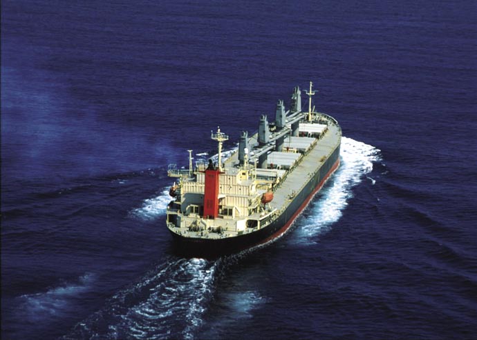
38
GloBallast: Removal of Barriers to
the Effective Implementation of Ballast Water
Control in Developing Countries
Overview
of harmful aquatic organisms and pathogens through
Shipping carries more than 90 percent of the world's
the control and management of ships' ballast water
commodities and is essential to the global economy.
and sediments. The project, conducted in partnership
However the transfer of aquatic invasive species
with the International Maritime Organization (IMO),
through ships ballast water has become one of the
established demonstration sites, national lead agencies
greatest threats to the world's oceans. Between 5 and
and task forces, assisted with laws and regulations,
10 billion tones of ballast water Ł carrying more than
increased awareness and expertise, established best
7,000 different species at any given time Ł are shipped
practices and stimulated innovative ballast water
around the world every year.
management solutions. The project also contributed to
It is almost impossible to eradicate or even control an
the early adoption of the International Convention for
invasive aquatic species once it has established itself.
the Control and Management of Ships' Ballast Water and
The cost of controlling invasive species in the USA
Sediments (BWM Convention). GloBallast has sought to
alone is around $138 billion a year. Invasive species can
harmonize different approaches in different countries
threaten marine-based economies, especially fisheries
to ballast water control through standardized templates
and shellfish culture and can pose risks to human health.
and models, facilitating maximum communications
Ecosystems in Africa, Asia-Pacific, Eastern Europe and
within and between countries, and has included
South America are particularly at risk as globalization
capacity building and institutional strengthening in all
opens up new markets, ports and shipping routes.
its activities. Other activities included sampling ballast
water and making risk assessments, conducting port
Project description
baseline surveys, education and awareness programmes,
GloBallast was designed to help developing countries
training, developing regional strategic action plans and
prevent, minimize and ultimately eliminate the transfer
establishing information clearing houses.
GLOBAL
COUNTRIES:
Brazil, China, India, I.R.Iran, South Africa,
Ukraine
Partners: International Maritime Organization
(IMO)
K
N
B
A
GEF Grant
US$ 7.392 million
T
O
O
Co-financing
US$ 6.475 million
P
H
E
Project Cost
US$ 13.867 million
R
I
N
A
/
M
http://globallast.imo.org
USE
Newsletter : Ballast Water News (Quarterly)
I
NDUSTRIAL
ARINE
M

39
FACT BOX
S Legal
Some of the most disastrous
LT The International Convention for the Control and Management of Ships' Ballast Water &
introductions of alien species across
U Sediments was adopted at the IMO in London in February 2004. Among its measures are a
the globe have been:
S requirement for ships to have a Ballast Water Management Plan, maintain a Ballast Water
- Mnemiopsis leidyi, a jellyfish from
E Record Book and, conduct ballast water exchange in deep water or treat ballast water to
meet the standards stipulated by the Convention. The Convention requires ratification by at
east coast USA, which invaded
R least 30 states, the combined merchant fleet of which constitutes not less than 35 percent
the Black Sea and Caspian Sea
T of the gross-tonnage of the world's merchant shipping, in order to enter into force.
ecosystem and contributing to the
C
collapse of the local fishing industry
General
in both regions..
J
E Six demonstration sites were chosen as representative of the six main developing regions
- The European Zebra mussel
O of the world Ł South America, East Asia, South Asia, Arab Countries/Persian Gulf, Africa
Ł introduced into the Great Lakes
R and Eastern Europe Ł have been developed into `centers of excellence' in ballast water
and spread to more than 40 percent
P management, and have helped catalyze regional agreements and strategic action plans.
of US waterways;
- The Golden Mussel which was
D GloBallast secured the support of the shipping industry and national governments. In some
introduced to South America,
E pilot sites, as many as 60-70 percent of ships submitted ballast water reporting forms, far in
T
threatening the Pantanal wetlands
excess of the project's 25 percent target. In most pilot countries the national governments
and the entire Amazon basin.
C extended the use of reporting forms to other ports.
- A North Pacific sea star introduced
In 2003 GloBallast was awarded the Queen's Golden Jubilee Medal in recognition of its
L
E
to Australia, which threatened the
contribution to the protection or enhancement of the Marine Environment.
E
local oyster and shellfish industries;
S Port Baseline Surveys were made of native biota and introduced marine species in each
- Toxic algae, which can cause
pilot country and assessments undertaken to assess the risk of alien species introduction.
red tides and paralysis or death
Training packages were developed to train administrators, port and shipping personnel in
in humans who eat shellfish
IMO guidelines for ballast water management and ballast water legislation in each country
contaminated with algal toxins.
was evaluated and improvements suggested.
Awareness and expertise were increased though training and awareness campaigns. Best
practices and standard models were established for technical activities and innovative and
technical innovations Ł such as ballast water electronic monitoring system and ballast
water disinfection technologies Ł were supported.
Communications
The GloBallast Programme has established a collection of reports, monographs, papers and
other publications as part of a global information resource centre. This collection is held by
the IMO library in London and is made available through the GloBallast website
A communications network including global and pilot country-specific websites, databases/
directories, a regular newsletter and an information clearing house was established
GloBallast awareness programme posters and brochures have been produced and are now
avaliable in Arabic, Chinese, English, Farsi, Spanish, Portuguese, Ukrainian and Hindi.
Invaders from the sea Ł a TV documentary on ballast water issues Ł was produced by
GloBallast, in cooperation with the BBC and the shipping industry, and launched in March
2006. In April 2007 the film won the gold award in the category of Best United Nations
Feature at the third annual United Nations Documentary Film Festival.
Training
Modular ballast water management training courses have been conducted at pilot sites. A
training package was also developed in 2003 in partnership with the UN Train-Sea-Coast
for national and regional deliveries.
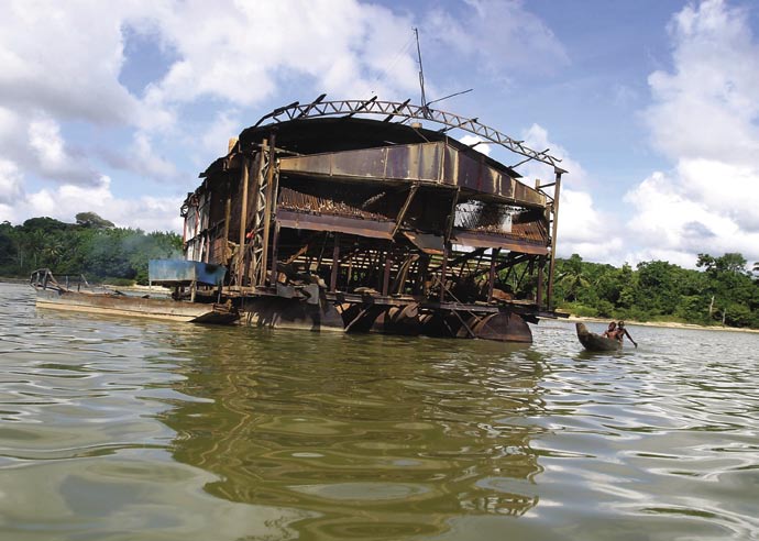
40
Removal of Barriers to the Introduction of Cleaner
Artisanal Gold Mining and Extraction Technologies
(Global Mercury Project)
Overview
diversion of rivers, water siltation, land degradation,
The number of people working in artisanal gold mining
deforestation and habitat destruction.
is between 10 and 15 million in more than 55 countries,
usually in Africa, Asia and Latin America. As many as
Project background
4.5 million women and 300,000 children may also be
The Global Mercury Project aims to raise awareness
employed in such mining, and many more affected by
of health, economic and environmental risks among
contamination of their environment.
miners and their communities, promote cleaner
The miners use mercury, or a combination of mercury
extraction technologies, make health assessments
and cyanide, to extract and refine gold. Unfortunately,
and provide health solutions for victims of mercury
they are seldom aware of or, driven by poverty, are
poisoning, especially children who are particularly
forced to ignore the health risks of the mercury which
vulnerable to neurological damage.
they ingest through work, and from their environment.
The cleaner technologies are safer, more efficient and
Mercury contamination is persistent, rapidly absorbed
cheap to introduce. GMP recognizes that poverty is
by aquatic organisms and biomagnified as it passes up
the root cause of the miners' unsafe practices and a
the food chain Ł miners and their families are advised
long-term solution must be a social and economic one.
not to eat local fish, particularly carnivorous fish.
GMP also works to develop regulatory mechanisms and
Due to inefficient processing techniques as much as 2
government capacities, and build monitoring capacities
grams of mercury can be released into the environment
in local laboratories. Poor health and sanitation, lack of
for every gram of gold recovered. This is of grave
schools and other facilities in remote camps is another
ecological significance since most artisanal mining
problem and GMP also tackles health and social issues
takes place within transboundary river basins. As well
Ł such as HIV /AIDS and malaria Ł in its multi-faceted
as mercury contamination, ecological impacts include
approach.
GLOBAL
COUNTRIES:
Brazil, Lao PDR, Indonesia, Sudan, Tanzania
and Zimbabwe
T
OLIA
Partners: UNIDO
- FO
GEF Grant
US$ 6.807 million
Co-finance
US$ 14.452 million
ISSONDES
P
Project Cost
US$ 21.259 million
ANIEL
® D
http://www.globalmercuryproject.org
TION
Newsletter GMP News
AMINA
ONT
C
Y
CUR
ER
M

41
FACT BOX
S Legal
The Global Mercury project is
LT GMP's policy group is working with country governments to develop policies and legislation
unique among the IW portfolio in
U that address mercury hazards. New legislation has been proposed for incorporation into
reporting significant contributions
S the Mining Codes of the six GMP project countries. Dangerous practices such as whole
to several MDG indicators including
E ore amalgamation, joint use of mercury/cyanide and mercury recycling will be banned or
strictly controlled.
1.1,2.3,3.4.11,4.5,5.6, 7.10 and 8.18.
R
T Training
It is estimated that the Amazon
C The project has used mobile demonstration units (TDUs) to demonstrate methods to
basin receives 40 tons of mercury a
improve gold recovery and reduce mercury use to at least 10,000 people in all project
year from gold mining while mining
J
E countries. The TDU training modules were drawn up at a series of international workshops
in Indonesia adds 150 tons to the
O in 2005. They consist of: i) how to produce more gold; ii) how mercury makes us sick; iii)
Java Sea. In total around 1,000
R how to use and re-use mercury safely; iv) how to make more money; v) how to protect
tonnes of mercury are released
P water supplies and improve sanitation; vi) how to prevent malaria HIV/AIDS and other
annually into the environment from
diseases.
informal or small scale gold mining,
D
accounting for between 30-40
E About 200 trainers have been trained in the GMP countries. They train other trainers
T
percent of man-made mercury
and disseminate the concepts of cleaner technologies and mercury pollution awareness
pollution.
C throughout the mining communities.
Community
L
E
E TDU visits are also used to conduct health surveys, including mercury poisoning and other
S health problems related to artisanal mining communities such as malaria, sanitation, HIV/
AIDS and TB. GMP is also teaching the use of simple sand filters to produce clean drinking
water and has taught miners how to build water wells and ventilated latrines.
In the mining village of CrepurizŃo, Brazil, more than 700 children are being educated by
local teachers in a school funded by miners. A primary school for boys and girls in Gugub,
Sudan, another GMP project site, is also funded largely by the profits from gold mining.
The results of surveys are given to communities at training sessions, when health and
environmental advice is provided, alongside the demonstration of extraction technologies.
Health and environment surveys of mining sites showed widespread evidence of mercury
poisoning Ł 70 percent of miners and 69 percent of child miners at a site in Zimbabwe
showed symptoms. High concentrations of mercury were found in the breast milk of
mothers from mining communities.
Trading initiatives which eliminate middlemen, encourage better practices and secure
premium prices for miners and communities, are also supported by the project. By creating
more income for miners and making their communities more stable and less migratory
GMP has helped reduce child labor and allowed better primary education, often funded by
the profits from more efficient mining.
General
Major mining companies are now working with GMP in the project sites and other areas.
GMP also promotes alternative income-generating activities to communities. Activities
include making tropical seed jewelry, aquaculture and reforestation work.
GMP's approach has been replicated in countries such as Mozambique, Venezuela, Guinea,
Ecuador, Cambodia and Senegal, which neighbor GMP countries.
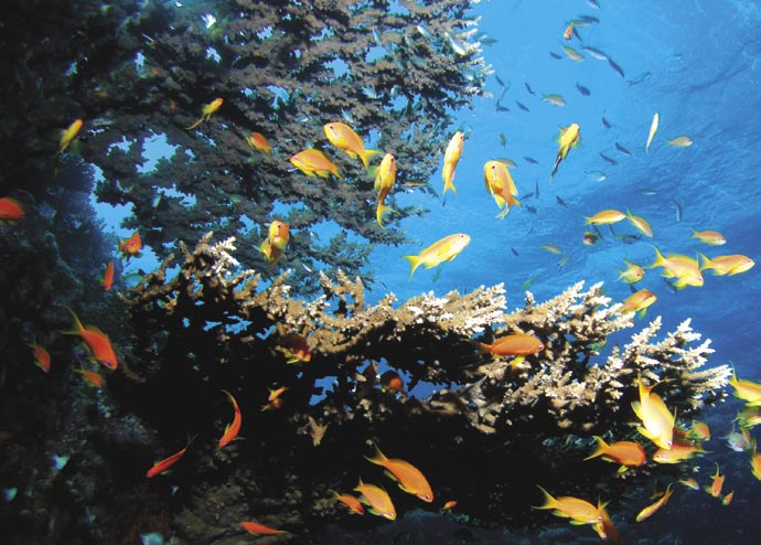
42
IW:LEARN Ł The International Waters
Learning Exchange and Resource Network
Overview
management, marine management and other IW
IW:LEARN Ł the International Waters Learning Exchange
domains. Without leaving their offices, they can access
and Resource Network Ł is a GEF partnership to
IW:LEARN distance learning Ł via CD-ROM, web-based
strengthen transboundary waters management
training, email forums and blogs Ł covering issues as
through information sharing and learning among
varied as integrated coastal management, measuring
stakeholders. UNDP collaborates with over 25
impacts and results, and a multi-day course on the
international and national agencies and NGOs
GEF's TDA/SAP approach to adaptive management.
to facilitate peer-to-peer learning across the GEF
Along with face-to-face and distance learning, IW:
International Waters portfolio. UNDP leads in delivering
LEARN produces and disseminates various knowledge
IW:LEARN's learning activities, synthesis of practical
products to advance IW capacity, success and
knowledge products, and broad dissemination of
sustainability. These include training-related handbooks
transferable GEF IW experiences.
and a quarterly GEF IW Bridges newsletter. Through a
More than 60 projects and 70 nations have participated
new series of four-page International Waters Experience
in IW:LEARN's demand-driven, peer-to-peer workshops
Notes, IW:LEARN also helps GEF projects to document,
and conferences to improve IW management. Sample
share and adapt practices such as implementing
topics include fostering public involvement, marine
a small grants programme, selecting optimal
governance and socioeconomics, economic valuation
demonstration sites, creating constructed wetlands,
of freshwater ecosystems, knowledge management,
fisheries treaties, and involving parliamentarians in IW
and communicating for results.
management. IW:LEARN also produces a global e-mail
Stakeholders have also joined IW:LEARN study tours
list (jobs@iwlearn.org) for disseminating vacancy and
to transfer cutting-edge practices in groundwater
consultancy announcements across the IW community.
GLOBAL
GEF Grant
US$ 11.597 million
Co-finance Amount US$ 10.690 million
Project Cost
US$ 22.287 million
Partners: UNEP, World Bank
T
OLIA
http://www.iwlearn.net/
- FO
TR
IO
Newsletters:
P
IWBridges (quarterly; for innovation transfer);
IWTech (periodic newsletter for software and
ANECZEK
technology updates);
-® J
W
IWCalendar (meetings, events etc)
VIE
A
TER
W
NDER
U

43
FACT BOX
S Conferences and workshops
The IW:LEARN web-site Ł
LT IW:LEARN's flagship event is a series of biennial GEF International Waters Conferences
www.iwlearn.net Ł has received
U Ł (Hungary (2000), China (2002), and Brazil (2005) and South Africa (2007). At the 2007
1.3 million hits Ł including 27,000
S conference, over 250 people gathered to actively learn from one another in small and highly
unique visitors Ł from more than
E interactive groups. Working groups and "inter-project clinics" collaboratively addressed
what participants targeted as their highest priority challenges to realizing successful IW
120 countries since it became
R management. The conference also showcased transferable best practices through an
operational. One in ten visitors
T "Innovations Marketplace" and conducted practical sessions for adapting recently tested
bookmarks the IW-IMS website.
C
IW:LEARN's IW Experience Notes
technical tools across projects.
and GEF IW Bridges newsletter
J
E IW:LEARN has trained over 450 people at needs-driven IW-related workshops.
depend on submissions from
O Publications and visual media
the IW community. IW:LEARN
R More than 540 copies of IW Bridges newsletters and over 320 sets of IW Experience Notes
welcomes article proposals, project
P were picked up by participants at global IW events in 2006.
announcements, and stories
of lessons learned, challenges
D 1,000 LME governance and socio-economics handbooks have been produced and
overcome, and milestones in
E distributed to all GEF LME projects.
T
IW project implementation.
IW:LEARN's video documentary, Turning the Tide: Sustaining Earth's Large Marine
Suggestions should go to
C Ecosystems, conveys how GEF-supported LME projects from the Benguela Current to the
info@iwlearn.org.
L
E Baltic Sea are lead global efforts to steward Earth's vital near shore ecosystems. The video
E premiered before 108 nations' ministry representatives in 2006. Partners have voluntarily
S translated the video into Chinese, and expect to use the video as a basis for an international
educational packet on LME management.
General
IW:LEARN helps facilitate exchanges between diverse projects, stakeholders and
beneficiaries, e.g., between the BCLME and the Pacific SIDS on fisheries treaties.
IW:LEARN's Gender and Water Exhibit spans a Latin American Countries Expo, two spin-off
expos in Pacific SIDS, over 23 nations and four continents.
IW:LEARN's IW Jobs e-mail list (jobs@iwlearn.org) assists projects and partners looking to
hire qualified staff and consultants.
IW:LEARN has catalyzed alliances, such as a public-private partnership for stakeholders'
involvement in African source water protection.
IW:LEARN has recently created a downloadable Web toolkit Ł a free user-friendly and
powerful content management system for IW projects.
The IW:LEARN website also features a section of blogs and forums Ł some open to the
public, others restricted or requiring subscriptions. GEF corporate and project dialogue
topics include: GEF Strategy Development for 2007-2010; Policies and Procedures; Good IW
Governance and Institutions; IW Scientific and Technical Tools; Financing IW Partnerships;
Learning Among IW Projects; and Measuring IW Impacts and Results. Thematic discussions
include: the IW Groundwater Learning Blog; Africa Freshwater; the Aquifer Learning
Community; Governance; International Waters Job Announcements; Lake Basin Learning
Community; Marine Learning Community; and the River Basin Learning Community.
All of these IW:LEARN products and services are featured on IW:LEARN's knowledge
clearinghouse at www.iwlearn.net.
GEF
Production coordination and text: Mahenau Agha, Jay Dowle
Photography:
Cover photo & inside cover photo: Claudio Vasquez Rojas
Design: Sandra Rojas
® Copyright United Nations Development Programme, June 2007
All rights reserved.
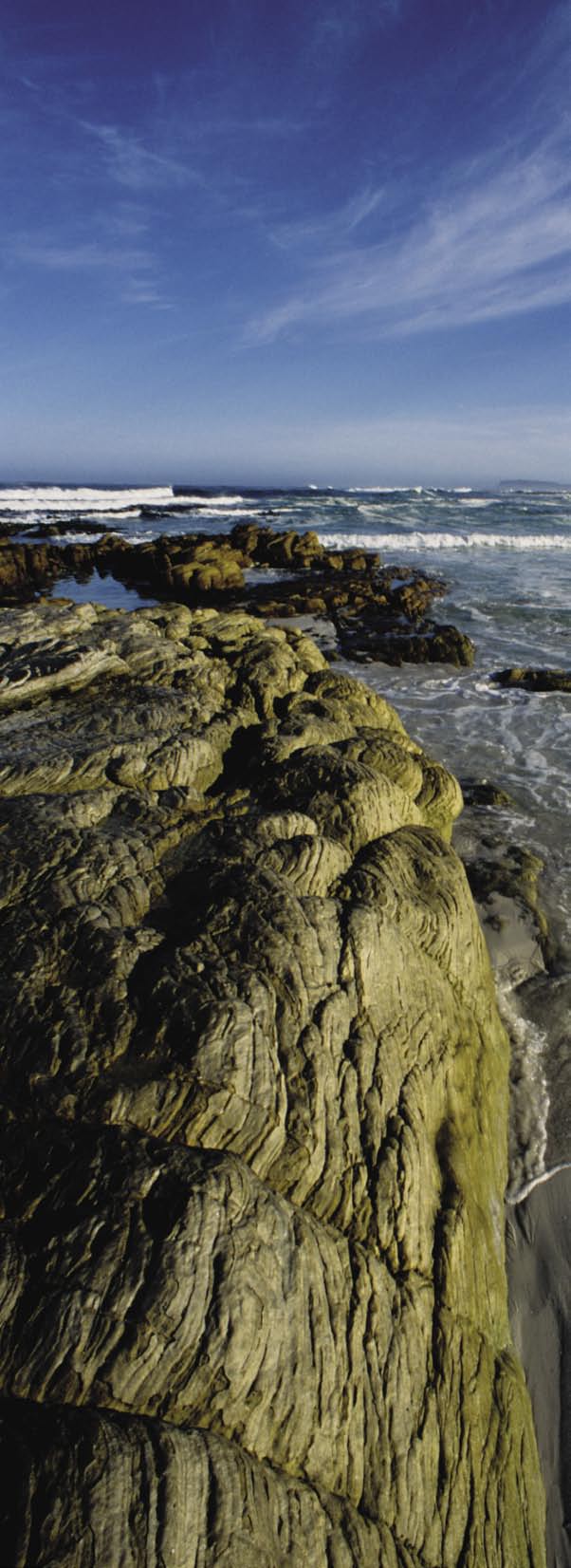
a partnership to protect the
UNDP GEF Global Environment
www.undp.org/gef
United Nations Development Programme -
Global Environment Facility Unit
(UNDP-GEF)
304 East 45th Street
New York, NY 10017
http://www.undp.org/gef