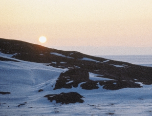
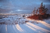
Ilulissat
The Arctic
Seqinersuup alakkaqqilerpai
qaqqavut kusanartorsuit
qamani neriuutit ikippai
maqaasiuartakkavut*
(The sun has begun to appear again
Our beautiful mountains
have ignited hopes within us
that we have missed all this time)
In mid-January every year, people in Greenland
gather to greet the returning light. In Ilulissat,
they sing this greeting, waiting for the sun to
peek above the horizon. Its first rays manage
only a brief glimmer, but the promise they
bring is strong, the hope of summer:
Seqinersuup qimaatilereerpaa
ukiorsuup kaperlassua
(The sun has put to flight
winter's long gloom)
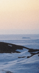
Dark winters followed by long summer days
are one of the most profound features of the
Arctic, and are responsible for the ubiquitous
snow and ice. The spring and summer sun
brings enough energy to sustain life, but not
enough to melt all the frozen water or the
frozen ground. Ice and snow have therefore
shaped and are still shaping the northern
landscape.
The Arctic is not a uniform environment.
Different geological histories, warm and cold
ocean currents, and varying weather patterns
bring diversity to the scene. A circumpolar
voyager will meet everything from the perma-
MJAALAND
nent ice cover of the High Arctic to the boreal
forest of the subarctic, with the wide expanse
of tundra in between.
This chapter describes the land, the seas, and
the climate of the AMAP region, setting the
GREENLAND TOURISM/LARS
stage for the rest of the report.
*Greenlandic text: Samuel Knudsen, Kangersuatssaat
low climate more than solar radiation. Clima-
tically, the Arctic is often defined as the area
north of the 10°C July isotherm, i.e. north of
the line or region which has a mean July tem-
perature of 10°C.
The climate is highly influenced by regional
weather patterns and ocean currents. In the
Atlantic Ocean west of Norway, the warming
effect of the North Atlantic Current (an exten-
sion of the Gulf Stream) pushes this 10°C iso-
therm north of the Arctic Circle, so that only
NILSSON
the northernmost parts of Scandinavia are
ANNIKA
included in this definition. In North America
The Arctic Circle
and northeast Asia, the isotherm is pushed
marked in the terrain
next to the railroad in
What is the Arctic?
south by cold water and cold air moving down
from the Arctic Basin. Here the Arctic would
Sweden.
Arctos is Greek for bear, and the Arctic region
include northeastern Labrador, northern Que-
derives its name from the stellar constellation
bec, Hudson Bay, central Kamchatka, and the
of Ursa major, the Great Bear. A common geo-
Bering Sea. Greenland and most of Iceland
graphical definition of the Arctic is the area
also fall north of this isotherm.
north of the Arctic Circle (66°32'N), which
encircles the area of the midnight sun.
A treeline boundary
would move Arctic limits further south
July temperatures
A third definition of the Arctic region uses the
create a climatic definition
treeline as the boundary. Simply put, the tree-
From an environmental point of view, defining
line is the border between southern forests and
the Arctic solely on the basis of the Arctic
northern tundra. It is a transition zone where
Circle makes little sense. Vegetation types fol-
continuous forest gives way to tundra with
Boundaries of the Arctic
Arctic Circle
10°C July isotherm
Treeline
Marine
AMAP
Southern boundaries of
the High Arctic and
the subarctic delineated
on a basis of vegetation
High Arctic
80°N
subarctic
70°N
60°N
sporadic stands of trees and finally to treeless
· In the Bering Sea area, the southern bound-
7
tundra. In North America, the tundra-forest
ary is the Aleutian chain.
The Arctic
boundary is a narrow band, but in Eurasia it is
· Hudson Bay and the White Sea are consid-
up to 300 kilometers wide. The treeline corre-
ered part of the Arctic for the purposes of
sponds with a climate zone where the cold
the assessment.
Arctic air meets warmer airmasses from far-
· In the terrestrial environment, the southern
ther south.
boundary in each country is determined by
In some places, the treeline roughly coin-
that country, but lies between the Arctic
cides with the 10°C July isotherm, but across
Circle and 60°N.
much of mainland Eurasia and North America
The map on the opposite page shows the
the treeline is 100 to 200 kilometers south of
area covered in this report.
the isotherm. By the treeline definition, the
Eight countries have land within the area
Arctic also includes western Alaska and the
of AMAP's responsibility: Canada, Denmark
western Aleutians.
(Greenland and the Faroe Islands), Finland,
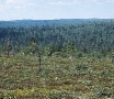
The subarctic lies between the treeline to the
Iceland, Norway, Russia, Sweden, and the
north and the region to the south where the
United States (Alaska).
forest becomes dense enough to have a closed
canopy. The subarctic is also called the taiga or
forest tundra. Permafrost (permanently frozen
ground) is only present in patches, and in sum-
The land
mer the unfrozen layer is generally thick. The
presence of discontinuous permafrost is some-
About 13.4 million square kilometers, 40 per-
times used to define the subarctic, in contrast
cent, of the AMAP area is covered by land.
to the Arctic where permafrost is continuous.
The map below shows the major physical-geo-
graphical regions. Old crystalline shields under-
Meeting of cold and warm water forms
lie most of eastern Canada, Greenland, and
the marine boundary
Fennoscandia. Younger sedimentary rock,
eroded into plains, covers large parts of Russia
The marine boundary of the Arctic is formed
and the Mackenzie River valley in Canada. In
when the water of the Arctic Ocean, cool and
the Ural Mountains, in the northeastern corner
dilute from melting ice, meets warmer, saltier
of Russia, in Alaska, and in the Yukon Territo-
water from the southern oceans. In the Cana-
ries of Canada the sedimentary rock has folded
dian Arctic Archipelago, this belt is at approxi-
into mountain ranges. Similar folded sedimen-
Major physical-geo-
graphical regions of the
mately 63°N and swings north between Baffin
tary rock forms the mountain ranges of the
Arctic. Colors indicate
Island and the coast of west Greenland. Off
northern Canadian Arctic islands. Iceland and
similar landscape fea-
the east coast of Greenland, the marine bound-
the Aleutian islands are of volcanic origin.
tures.
ary lies at approximately 65°N. In the Euro-
pean Arctic, the marine boundary is much far-
ther north, pushed to about 80°N to the west
of Svalbard by the warming effect of the North
Atlantic Current. At the other entrance into
the Arctic, warm Pacific water flows through
the Bering Strait to meet Arctic Ocean water at
East Siberian
North American
about 72°N, forming a boundary that stretches
Highlands
Cordillera
from Wrangel Island in the west to Amundsen
Interior
Gulf in the east.
Plain
Central
AMAP's boundaries
Siberian
Arctic
Plateau
Islands
Because of the difficulty of defining the Arctic
in a way that is relevant for all areas of sci-
Hudson
ence, AMAP does not define the Arctic but
Lowlands
West
Canadian Shield
Siberian
gives a guideline about the core area to be cov-
Ural
Lowland
Mountains
ered by the AMAP assessment. The boundary
East European
should lie between 60°N and the Arctic Circle,
Plain
with the following modifications:
Baltic
Shield
· In the North Atlantic, the southern bound-
North
Atlantic
ary follows 62°N, and includes the Faroe
Islands
Islands, as described in `The Joint Assess-
ment and Monitoring Programme' of the
Convention for the Protection of the Marine
Environment of the North-East Atlantic (the
OSPAR Convention). To the west, the La-
brador and Greenland Seas are included in
the AMAP area.

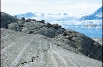
BRY
KNUT
Glacier Bay, Alaska.
Ice has shaped the landscape
hard crystalline granite bedrock, the glaciers
left the land dotted with depressions that filled
On a shorter time scale, ice has put its signa-
with water and became lakes. Glaciers that
ture on most of the terrestrial landscape. Some
eroded the bedrock below sea level at the coast
of the land is covered by glaciers, which are
created deep, winding fjords. In other areas,
large masses of snow and ice that flow under
the glaciers piled extensive moraines and sedi-
their own weight. Glaciers form where the
mentary deposits on top of the bedrock.
mean winter snowfall exceeds mean summer
Some of the land is still rebounding after
melting. Melting, refreezing, and pressure
being pressed down by the weight of the ice
gradually transform the snow to ice.
sheets during the latest glaciation. Along the
Many areas have been shaped by repeated
coasts, the land is still emerging from the sea.
glaciations. In the North American and west-
Around Hudson Bay, for example, the land
ern Eurasian Arctic, ice sheets have scoured
rises at a rate of one meter per century.
the landscape like giant bulldozers, tearing
away topsoil and broken rock. In areas with
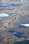
Permafrost creates patterned ground and
Discontinuous permafrost
governs water movement
Continuous permafrost
Ice cap /glacier
Much of the ground is frozen by permafrost,
and only a thin top layer, called the active layer,
thaws each summer. Permafrost is defined as
ground that remains frozen for at least two
summers in a row. The frozen layer can reach
depths of 1500 meters in the coldest areas of
the Arctic. The active layer ranges between a
few centimeters in the northernmost wet mead-
ows to a few meters in warmer, drier areas
with coarse-grained soils. Perennially frozen
ground occurs throughout the Arctic and ex-
tends into the forested regions to the south.
Along the northern coasts, frozen grounds
meet the sea, and the permafrost extends
under some shelf seas.
The constant freezing and thawing in per-
mafrost areas makes the ground move. In the
process, debris is sorted and rocks are forced
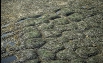
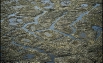
to the surface. In some areas this sorting has
created extensive polygonal patterns; see fig-
ures on the opposite page. Another physical
feature is the pingo, a mound of earth thrust
up by a core of ice. Pingos can be as high as 40
meters. Occasionally, changes in local climate
or physical disturbance of the ground can
Sphagnum peat
Sedge-moss peat
Permafrost table
Mineral soil
Ice
MCLEOD
Low-center polygons
5 m
KATHERINE
Amorphous peat
Organic-mineral mixture
Sphagnum peat
Sedge-moss peat
Mineral soil
Permafrost table
Ice
MCLEOD
High-center polygons
KATHERINE
cause the permafrost to melt. In some cases,
Cross-sections of low-
and high-centered poly-
this causes the ground to sink, and the depres-
gons found in Arctic
sion fills up with water, creating so-called ther-
wetlands. The low-cen-
mokarst lakes, which are unique to the Arctic.
tered polygons gradu-
Permafrost governs the fate of water in the
ally evolve into high-
Arctic landscape. For example, groundwater
centered polygons with
the accumulation of
formation is much slower in frozen ground
biomass.
than in unfrozen ground. The groundwater
can be on top of, in cracks within, or under-
neath the permafrost layer.
WIDSTRAND
In spring, permafrost contributes to flood-
Tundra, Kolyma,
ing. Eighty to ninety percent of the freshwater
Russia.
STAFFAN
input to the land occurs during the two to three
weeks of snowmelt in spring. Instead of seeping
into the ground, the meltwater flows over the
frozen surface and into streams, rivers, lakes,
and various wetlands, which cover vast areas
on the flat plains.
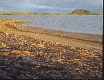
The lack of oxygen in the waterlogged soil
of wetlands delays the decomposition of plant
matter and results in a build-up of organic ma-
terials, such as peat and humic substances. In
drier areas where the water can escape, such as
steep slopes and high narrow ridges, increased
WIDSTRAND
Driftwood and pingo,
bacterial activity in the soil leads to a lower
Tuktuyaktuk, Yukon,
content of organic matter. These areas often
STAFFAN
Alaska
Well drained site
Impervious ground at surface
forces water to percolate through
the unfrozen part (talik) in permafrost
Substrate
Clay and silt
Poorly drained site
Gravel
Small lake
Permafrost
Active layer
Depth of
summer thawing
(bottom of active layer)
Groundwater
River
percolating throughout
the year
percolating only during
the warm season
Groundwater in perma-
frost.
The seas
The marine areas within AMAP's boundaries
cover approximately 20 million square kilome-
ters. These include the Arctic Ocean, the adja-
cent shelf seas (Beaufort, Chukchi, East Siberi-
an, Laptev, Kara, and Barents Seas), the White
Sea, the Nordic Seas (Greenland, Norwegian,
and Iceland Seas), the Labrador Sea, Baffin Bay,
Hudson Bay, the Canadian Arctic Archipelago,
and the Bering Sea. The narrow Bering Strait
connects the Arctic Ocean and the Bering Sea
(and the Pacific Ocean), while the main con-
nection between the Arctic Ocean and the
northeast Atlantic Ocean (Nordic Seas) is via
the deep Fram Strait and the Barents Sea. There
are two major basins in the Arctic Ocean, the
Canadian Basin and the Eurasian Basin, sepa-
rated by the transpolar Lomonosov Ridge.
The Arctic Ocean has a vast continental
shelf, extending from northern Scandinavia
eastward to Alaska. All the Eurasian marginal
seas are located over this shelf, which has a
width of up to 900 kilometers off the coast of
Siberia. Off North America, the shelf extends
only 50 to 100 kilometers from the coast.
WIDSTRAND
Most of the water in the Arctic Ocean comes
from the Atlantic Ocean via Fram Strait and
STAFFAN
the Barents Sea, with some additional inflow
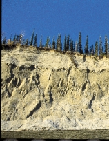
Erosion, Kobuk River,
have a characteristic soil profile caused by the
from the Bering Strait. Rivers account for about
Alaska.
redistribution of soil particles and chemicals.
two percent of the input, a high proportion
Arctic rivers also owe much of their charac-
compared with other oceans. The main outflow
ter to the permafrost. Because the ground has
from the Arctic Ocean is via the East Green-
such a limited ability to store water, the spring
land Current, with a minor portion flowing
flood can be violent, undercutting the river
out via straits in the Canadian Archipelago.
bank and causing extensive erosion along its
The water flow is further described in the figure
path. Ice jams add to the uneven flow and ero-
on page 31. A prominent feature in the surface
sion. The rivers thus carry huge amounts of
water is the oceanic polar front, which sepa-
sediments that are deposited along their course
rates the cold, less saline surface water of the
and in wide deltas.
Arctic Ocean from saltier, warmer water origi-
nating in the oceans farther south. The posi-
tion of the front is relatively stable in most
Natural resources are abundant
areas, moving little from year to year.
The circumpolar region has numerous large
Surface water temperatures vary both sea-
deposits of fossil fuels and minerals. Examples
sonally and geographically. In the Arctic Ocean,
include nickel in the vicinity of Norilsk in Rus-
the surface water temperature is close to freez-
sia, the recently discovered diamond deposits
ing point year-round because of the ice. In the
in the Northwest Territories in Canada, coal in
shelf areas, the sun can warm the water from
Svalbard, and oil and gas fields at Prudhoe Bay
freezing point in winter to 4-5°C during sum-
in Alaska and in many other areas that are de-
mer. In areas influenced by Atlantic and Pacific
scribed in the chapter Petroleum Hydrocarbons.
water, there may be greater seasonal variabil-
The AMAP region also contains many re-
ity, and the temperature remains higher than
newable resources. Forests supply fuel for
0°C throughout the year.
energy and material for pulp and paper pro-
Salinity varies with depth and with the
duction. Both marine and freshwater ecosys-
water's source. Arctic surface water is less salty
tems are important for commercial fishing.
than the deep ocean water and than the surface
Powerful rivers provide hydroelectric power,
waters of other oceans because of meltwater
while geothermal energy is used for heating in
from ice as well as large inputs of freshwater
some areas.
from north-flowing rivers. The highest salinity
11
The Arctic
KASSENS
HEIDI
The central Arctic Ocean.
is in water of Atlantic or Pacific origin. The
salinities. This is further discussed on page 31.
fresher water floats on top of more saline water,
The halocline that separates the fresher from
and the water mass is best described as having
the saltier water creates a lid that keeps deeper,
distinct layers with different temperatures and
warm water from reaching the surface.
Pacific
Ocean
Bering
Sea
Yukon River
210 km3 per year
Bering
Strait
Chukchi
Kolyma
Sea
132 km3 per year
Mackenzie River
333 km3 per year
East Siberian
Sea
Beaufort
Sea
Arctic Ocean
Laptev
Lena, 525 km3 per year
Depth, m
Sea
0
Canadian Basin
100
Nelson River
Canadian
500
75 km3 per year
Arctic
Archipelago
1000
Eurasian
Lomonosov Ridge
Basin
Yenisey, 630 km3 per year
2000
Hudson
Kara
3000
Bay
Sea
Ob, 404 km3 per year
5000
Baffin
Bay
Fram
Freshwater discharge
Strait
Barents
Pechora
Catchment area
Sea
140 km3 per year
North Greenland
Labrador
Sea
Sea
Northern Dvina
106 km3 per year
Iceland
Greenland
Sea
Sea
Norwegian
Sea
Atlantic
Ocean
Bathymetry of the Arctic
Ocean and adjacent seas
and freshwater input
from major rivers.
Hudson Bay in Arctic Canada is considered
part of the AMAP area even though it extends
as far south as 51°N. The bay is ice-covered in
the winter, and gets much of its water from
rivers draining central and northeast North
America. A similar semi-enclosed body of wa-
ter in the Eurasian Arctic, also heavily influ-
enced by freshwater runoff, is the White Sea.
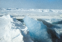
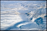
Sea ice dominates the Arctic Ocean
Ice is the most striking feature in the Arctic
Ocean. The perennial pack ice covers about 8
million square kilometers. The total area cov-
Shallow, warm
ered by sea ice changes with season, reaching
its peak in March to May, at about 15 million
square kilometers; see figure below left.
The ice is in constant motion, following the
Deep, cold
major currents and growing in thickness as it
moves along. The trip from one end of the
The polar front influences global ocean currents
Arctic Basin to the other can take up to six
The Arctic plays a fundamental role in the circulation of water in the oceans of the
years, allowing the ice to grow as thick as
world. When warm, salty North Atlantic water reaches the cold Arctic around Green-
three meters or more; see the map on page 32.
land and Iceland and in the Labrador Sea, it becomes denser as it cools, and therefore
Forces from winds, upwelling water, and
sinks to deeper layers of the ocean. This process of forming deep water is slow, but takes
water currents create strains and stresses on
place over a huge area. Every winter, several million cubic kilometers of water sink to
deeper layers, which move water slowly south along the bottom of the Atlantic Ocean.
the moving ice, which lead to patches of open
water even in the depths of winter. In some
areas, these leads and polynyas are formed
every year and serve as important gathering
Many coasts feature semi-enclosed
grounds for marine wildlife and as hunting
bodies of water
grounds for Inuit. They also represent areas of
Semi-enclosed water bodies in the Arctic
high energy exchange between the ocean and
Basin include fjords, bays, straits, and chan-
the atmosphere. During summer, about 10 per-
nels between islands. Many of these estuarine
cent of the pack ice area is actually open water.
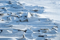
environments are important links between the
In other areas, the ice is pushed into huge
terrestrial environment and the ocean because
hummocks and pressure ridges. The height of
they act as sediment traps.
hummocks is typically 4 to 5 meters, but they
Each of the semi-enclosed bodies of water
sometimes reach heights of 12 to 15 meters.
is unique, and its environment is governed by
An underwater ice ridge can extend 30 to 40
ice cover and tides. In Frobisher Bay, Baffin
meters below the surface.
Island, for example, the tides are extreme.
Shelf seas mainly have first-year ice, which
In Lancaster Sound, Baffin Bay, an area of
builds from the coast and the ice edge during
open water within sea ice, called the North
winter. Offshore winds often separate the pack
Water Polynya, forms every year. Fjords in
ice from the landfast ice.
some regions, such as Norway, are ice-free
year-round, due to the warming effect of the
North Atlantic Current.
Maximum and minimum
sea-ice extent.
September
ice edge
March ice edge
WIDSTRAND
STAFFAN
Pancake ice.
13
The Arctic
KASSENS
HEIDI
Nilas ice, Laptev Sea.
The icescape from near and far
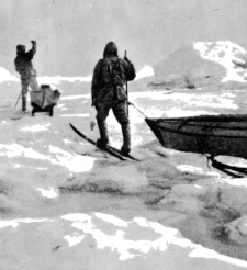
About a century ago, the Norwegian Arctic explorer Fridtjof Nansen traveled over
the drifting ice pack in his quest for the North Pole. Some days the ice was smooth
enough to allow the sleds an easy passage, but oftentimes open water came in the
way or huge hummocks turned his travel into arduous work. His description from
early August 1895 gives a sense of the Arctic icescape:
`It was as if a giant had thrown the worst iceblocks helter-skelter, strewn deep,
wet snow between them and water underneath, so that we sank all the way up to
our thighs . . . It was like struggling over mountains and valleys, up and down over
block after block, and ridge after ridge with deep crevices between, not an even sur-
face large enough to put a tent on.'
Fridtjof Nansen: Fram over Polarhavet, 1897.
Today's Arctic travelers can get a bird eye's view of this icescape:
`Flying over the ice is an easy way to appreciate its tectonic activity on a larger
scale, to better understand it as the never-quite-settled surface of the Arctic Ocean.
From above, the finger-rafting of huge, transparent sheets of nilas seems like a deli-
cate and regular joinery of panes of glass . . . Dark ice cakes below prove to be ones
covered with epontic algae and flipped over by animals, or places where walrus
have hauled out, rested and defecated. Long streaks on gray-white ice cutting across
a broad, snow-covered expanse show where leads have recently frozen over. A low
pressure ridge may lead to a dark hole and a patch of reddish snow, a polar bear
kill. Streamers of grease ice in patches of open water line up with the wind. In win-
ter the leads steam with frost smoke where the (relatively) warm water meets the
frigid air.'
F R I D T J O F N A N S E N A N D H J A L M A R J O H A N S E N , S U M M E R 1 8 9 6
Barry Lopez: Arctic Dreams, 1986
KASSENS
Black nilas ice,
HEIDI
Laptev Sea
14
Climate
example, the mid-latitude jet streams and the
low- and high-pressure systems embedded in
The Arctic
Weather in the Arctic can be more extreme
them are results of the on-going heat exchange.
than in most other areas of the world, with
The stronger the temperature differences, the
low temperatures and strong winds. The
stronger the jet streams. Therefore, the strongest
region includes some of the coldest places on
storms occur in winter. The heat exchange be-
Earth, but temperatures and weather patterns
tween the Arctic and areas farther south is also
vary greatly among different regions of the
important for understanding contaminant trans-
AMAP area.
port and global climate change as described in
later chapters.
A cold reservoir in a global heat machine
The High Arctic is cold and dry
One basic feature of the Arctic climate is
that the sun never reaches high in the sky, even
The temperature over the Arctic Ocean is mod-
in summer, which limits the total amount of
erated by heat released through the ice from
incoming solar energy. Moreover, in snow-
the underlying water, but winter air tempera-
covered areas as much as 90 percent of the
tures over the permanent ice pack still fall to
incoming solar energy is reflected back to
30°C . The cold air cannot hold much mois-
space by the snow and ice. Furthermore, the
ture. Together with the lack of open water, this
area loses heat back to space as infrared radia-
creates very dry conditions in the High Arctic,
tion. This is compensated by heat exchange in
making a cold desert environment. It might
the atmosphere and ocean currents that carry
snow often, but little falls each time, so the
relatively warm air and water masses north-
total accumulation of snow is relatively low in
ward and cold air and water southward. The
winter. Precipitation on northern Greenland,
Arctic region also imports moisture from sur-
for example, is hardly more than 100 millime-
rounding areas.
ters per year. Powerful high-pressure systems
Seeing the polar area as a refrigerator in the
in the Arctic often create clear, cold days in
equator-to-pole transport of energy is impor-
late winter and spring.
tant in understanding weather patterns. For
Summers in these far-north areas are
usually gray and foggy as mild, humid air
1000
moves in over the cold water. Cloud cover in
Aleutian low
summer ranges from 70 to 90 percent. The
1004
1008
amount of precipitation is still low, however,
1012
and temperatures remain between 10 and
1016
+10°C, with temperatures most commonly
Atmospheric
pressure,
High
around freezing.
January means,
1024
1020
millibar
1024
1020
High
Elevation
1028
1032
1016
Coastal and continental
2000 m
climates can be very different
1000 m
1012
Farther south, average temperatures and pre-
1008
cipitation are governed by the major move-
1004
1000
1020
ment of air masses and the proximity to open
Icelandic low
1004
water. For example, winter circulation patterns
1008
1012
bring cold air from the Arctic Ocean south-
1016
ward over North America. Over the continen-
1016
tal parts of the Arctic, stable, cold high-pres-
sure systems prevail during typical winters.
These are particularly well developed over Sibe-
1024
ria and northwestern Canada.
1020
1016
The winter high-pressure systems are accom-
1012
panied by weak winds and thermal inversions,
allowing cold air to gather in the lower one-to-
two kilometers of the atmosphere. The lowest
Low
temperatures are usually recorded in typical
1004
continental climates, such as the inland areas
Atmospheric
1008
pressure,
Canadian low
of Alaska, Siberia, eastern Arctic Canada, and
July means,
1008
Greenland. Minimum winter temperatures
millibar
across inland areas in the Arctic range from
1012
20 to 60°C.
There are large temperature differences be-
1012
1016
tween winter and summer over the continents.
1020
In some parts of Siberia and in the interior of
Patterns of high- and
1024
low-pressure systems in
Alaska, temperatures can range from less than
High
winter and summer.
50°C in winter to above +30°C in summer.
15
The Arctic
Surface air temperature, °C
9.5
7
2
3
8
13
18
23
28
33
38
43
January
July
48
Coastal areas often have a maritime climate.
warm seasons, the Icelandic and Aleutian lows
Surface air tempera-
Around the Norwegian and Barents Seas, for
weaken considerably.
tures in winter and
example, winter temperatures are on average
Inland areas of the Low Arctic are generally
summer.
only just below freezing because of the warm
dry, with decreasing precipitation from south
North Atlantic Current. Even as far north as
to north. East Siberia, Northern Canada, and
Svalbard, mean winter temperatures are only
Greenland receive less than 140 millimeters
about 12°C, about 20°C higher than those at
per year.
the same latitude in the Canadian Arctic Archi-
Winds have a great impact on the polar
pelago. As in most maritime climates, the tem-
environment because they aggravate the chill-
perature difference between summer and win-
ing effect of low temperatures. The open Arc-
ter around the Norwegian and Barents Seas is
tic landscape does not slow the winds, which
not as great as in inland areas. Other areas
are also important in mobilizing snow, causing
with typical maritime climates are Iceland and
scouring in exposed areas and deposition in
the south coast of Alaska.
sheltered locations. In the marine environ-
ment, wind affects sea surface stability and
increases mixing in the water column. It also
Semi-permanent low-pressure systems
produces ocean currents and influences ice
govern winds and precipitation
drift and the formation of polynyas.
Wind patterns and precipitation in the Low
In winter, unstable conditions in the cold air
Arctic are governed by the low-pressure sys-
over the open, relatively warm oceans north of
tems that form over the North Atlantic and the
the polar front often trigger the formation of
Bering Sea, bringing warm, moist air north-
polar lows. They are much smaller than the
ward. These weather systems, the Icelandic
more permanent lows, but they bring stormy
and Aleutian lows, gather moisture over open
weather and high winds farther south.
water and dump it as precipitation when the
Temperature inversions over ice sheets on
air is forced to rise. The windward sides of
land can create local, extremely strong winds
mountainous areas often have daily rain or
in the winter, as cold air surges downhill, usu-
snow. Southern Iceland and parts of the Nor-
ally from the ice toward the sea. Such kata-
Svalbard.
wegian coast can thus get extreme yearly pre-
batic winds are frequent and persistent around
cipitation, exceeding 3000 millimeters. In the
Greenland.
Norilsk, Russia.
BRY
BRY
KNUT
KNUT
16
The Arctic
WIDSTRAND
Baffin Island, Canada.
STAFFAN
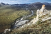
A circumpolar voyage
Greenland, which is geologically a part of
North America, is a mountainous island. Most
As a result of the combined effects of geology,
of it is covered by a permanent ice cap, which
ice, and climate, the lands covered in the
reaches elevations of 3000 meters. Many of
AMAP assessment are very diverse. Circling
the glaciers extend all the way to the sea, and
twice around the Arctic, first among the
western Greenland produces icebergs at a rate
islands and then through the continents, gives
of 300 cubic kilometers per year. The Jakobs-
the traveler a sample of features that are typi-
havn Isbrae alone creates 25 cubic kilometers
cal of the different regions..
of icebergs per year as the ice tongue glides
Icy island outposts
The archipelagos of northern Canada, Green-
land, and the islands north of Scandinavia and
Russia form the terrestrial outposts farthest to
the north.
Canada's northernmost area is the world's
largest archipelago, with 20 large and many
smaller islands, some of which are covered by
ROSING
Kangerlusuaq,
extensive glaciers. The Canadian Arctic Archi-
East Greenland.
pelago starts with flat to rolling plains in the
MINEK
west (Banks, Melville, Victoria, Bathurst, and
Narsaq, southern
Prince of Wales Islands), building up to rug-
West Greenland.
ged, ice-capped mountains in the northeast
(Baffin, Devon, Axel Heiberg, and Ellesmere
Islands) toward Greenland. The northernmost
land is Ellesmere Island, where the Agassiz ice
cap covers much of the central part of the is-
Ellesmere Island,
land. The fjords and straits between the islands
Canada.
are often blocked by pack ice.
ROSING
MINEK
forward at an average rate of 20 meters a day.
In areas where the ice does not reach the sea,
meltwater flows into abundant lakes and river
systems.
Along the coasts, conditions are governed
by water temperature. The south-flowing East
Greenland Current brings cold water and ice
down from the Arctic Ocean. As much as six
million tonnes of ice travels down the coast
per year, almost blocking it from open water.
Farther south, the warm Irminger Current has
created a more favorable climate. The current
mixes with colder water, but still manages to
WIDSTRAND
bring relative warmth to the coastal areas
around Baffin Bay and southwest Greenland.
STAFFAN
The coastal waters from Qaqortoq to Sisimiut
17
The Arctic
OSING
R
MINEK
Isua, West Greenland.
on the west side of Greenland can be open
year-round, and winter sea ice does not become
the norm until Disko Bay and farther north.
Most of Greenland that is not covered by
glaciers is barren rock with only small patches
of low shrubs or grass. The main tracts of ice-
free land in Greenland are in the southwest,
the north (Peary Land), and the northeast.
The southwestern coast features some grazing
land for sheep, and vegetation that includes
WIDSTRAND
small trees.
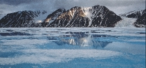
The Svalbard and Franz Josef archipelagos,
Svalbard.
STAFFAN
the northern island of Novaya Zemlya, and
Severnaya Zemlya are extensively ice-clad,
mountainous islands, with glaciers calving ice-
bergs into the sea. Most of the ice-free land is
bare and rocky, since cold and lack of water
have not allowed much soil to form. The
southern Novaya Zemlya island is mostly an
ice-free coastal plain with continuous per-
mafrost. All of the Eurasian island outposts
are mountains rising from the wide continental
shelf. Novaya Zemlya is an extension of the
Ural Mountains. The highly productive sea
around the islands supports huge populations
of sea birds.
North Atlantic islands:
weather ruled by the sea
Iceland was created by volcanic activity along
the mid-Atlantic ridge some 20 million years
ago. New volcanic rock is constantly forming,
and volcanoes erupt regularly. About one tenth
HUNTINGTON
of Iceland is covered by lava deposited since
HENRY
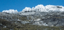
Heimaey, Iceland
the last ice age. More than half of the surface
does not have any vegetation. About one tenth
of the land is covered by glaciers. The climate
on Iceland is warmed by the Irminger Current.
The extent of sea ice along the coast varies but
does not normally block shipping.
Another island on the mid-Atlantic ridge is
Jan Mayen, with its 2300-meter-high volcanic
mountain Beerenberg. It erupted as recently as
1970.
The North Atlantic part of the AMAP area
also includes the Faroe Islands, situated 300
kilometers north of Scotland and approximately
KUBUS
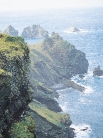
The Faroe Islands.

half-way between Iceland and Norway. This
18
archipelago has a landscape of low, bare
The Arctic
mountains, with plenty of grazing land for
sheep. The climate is oceanic: humid, change-
able, and windy. The ocean temperatures are
well above freezing.
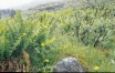
Fennoscandia and Kola:
subarctic climate, lakes and forests
NILSSON
Fennoscandia, which includes Finland, Nor-
Sarek National Park,
Sweden.
ANNIKA
way, and Sweden, rests on old bedrock that
has been worn down to low hills and coastal
flats. The Norwegian coast features deep
fjords. Along the border between Sweden and
Norway, younger mountains form peaks as
high as 2000 meters, while the landscape gen-
erally flattens toward the north and east. The
area features an abundance of lakes.
The climate in this region is greatly influ-
enced by the warm North Atlantic Current.
The coasts have a long ice-free period and,
except on high mountains, the snow melts in
summer. Glaciers build in areas with high pre-
cipitation, where summers are too short to
OKSANEN
melt the snow in spite of fairly warm tempera-
Saariselkä, Finnish
Lapland.
ERKKI
tures. Farther inland, on the Norwegian Finn-
marksvidda and in Swedish and Finnish Lap-
land, the climate is continental, with warmer
summers than along the coast, but consider-
ably colder winters.
The vegetation represents a transition be-
tween the Arctic and the boreal forest with
many subarctic species. The boreal forest
reaches its northernmost point at Finnmarks-
vidda in northern Norway, a little south of
70°N. There are only patches of permanently
frozen ground.
The Russian Arctic: vast expanses
of tundra, wetlands and mountains
The Arctic area of the Russian plains (west of
the Ural Mountains) has been shaped by re-
peated build-up and retreat of glaciers that
have left a flatland rich in sediments. The per-
mafrost has created a tundra landscape along
the coast and some forest-tundra closer to the
Arctic Circle. Summers are cool, wet, and
short, while the winters are long, fairly mild,
and snowy.
WIDSTRAND
Going east toward the Ural mountains, the
Kolyma River delta,
climate becomes more severe with abundant
Russia.
STAFFAN
snow in the winter. Summers are cool. Most of
the northern Ural landscape is tundra, with
small glaciers in the mountains. Immediately
east of the Urals, the landscape is again flat,
but moving farther eastwards in Siberia, moun-
tains reappear.
Much of Arctic Siberia was never glaciated,
so pre-glacial soils were never disturbed and
thus provide a cover over the bedrock that sus-
tains forests. Siberia has one of the most severe
HUNTINGTON
climates in the Arctic, with extremely cold win-
Koyuk River, Russia.
HENRY
ters. Most years, even large rivers freeze to the
bottom for several months. Permafrost pre-
19
vails, with vast wetland areas and numerous
The Arctic
shallow lakes. The landscape is transected by
several large north-flowing rivers. Many of
these create deltas where they meet the ocean.
The coast is ice-bound for most of the year.
The northeastern corner of Russia has a
mountainous landscape. In a zone of active
low-pressure systems, its climate is more tem-
perate than farther west. In the Chukotka
mountains, the peaks reach elevations up to
1500 meters.
Alaska: rugged mountains, coastal plains
and volcanic islands
HUNTINGTON
Alaska's landscape covers a wide range of ter-
rains and climates. Rugged mountain ranges
HENRY
Chukotka, Russia.
stretch across the state in the north and south,
reaching 6194 meters at Mt. McKinley. There
are several active volcanoes in the Alaska
Range, and extensive glaciers in the south-cen-
tral and southeastern mountains. Wide coastal
tundra plains extend along the northern coast
and the southwest. The interior, drained by the
Yukon river, is forested and has a continental
climate, with extreme temperature variation
between summer and winter.
WIDSTRAND
From the west coast, the Aleutian chain
STAFFAN
Kobuk Valley, Alaska.
stretches westward across the Pacific. The cli-
mate on the Aleutian Islands is milder than in
the interior of Alaska, but strong winds are
common and can create severe weather
throughout the year.
Permafrost is extensive across the northern
third of Alaska, and is discontinuous for much
of the rest of the state. Along the northern
coast (the Chukchi and Beaufort Seas), sea ice
is common even in summer.
HUNTINGTON
Canada: from forests
HENRY
Brooks Range, Alaska.
to a frozen archipelago
At the westernmost boundary of Canada's
mainland Arctic is the Yukon Plateau, consist-
ing of rolling uplands with valleys and isolated
mountains. The climate in this region is sub-
arctic and supports forests.
Southwest of this plateau are the Coast
Mountains with extensive glaciers. To the
northeast of the Yukon Plateau are the Mac-
WIDSTRAND
kenzie Mountains. These mountain ranges give
way to the interior lowlands covered by exten-
STAFFAN
Ivavik, Yukon, Canada.
sive wetlands and transected by the Mackenzie
River. The Arctic climate becomes more pro-
nounced because of the cold air moving down
from the Arctic Ocean. Most of the ground is
permanently frozen.
The large Great Bear and Great Slave Lakes
extend from the interior lowland eastward into
the Canadian Shield. The shield continues to
the east coast and contains numerous lakes
and the vast expanse of Hudson Bay.
WIDSTRAND
Toward the north is the Canadian Arctic
Archipelago.
STAFFAN
Hudson Bay, Canada.