|
PROJECT Development Facility
Request for PDF B proposal Approval |
|
Agency’s Project ID: 2272
GEFSEC Project ID:
Country: Georgia,Armenia, Azerbaijan, Islamic Republic of Iran
Project Title: Reducing Trans-boundary Degradation of the Kura-Aras River Basin
GEF Agency: UNDP
Other Executing Agency: n/a
Duration: 18 months
GEF Focal Area: International Waters
GEF Operational Program: OP 8 - Waterbody
GEF Strategic Priority: IW –2 Capacity Building for IW
Estimated Starting Date: March 2005
Estimated WP Entry Date: August 2006
Pipeline Entry Date: 5 March 2002 |
|
Record of endorsement on behalf of the Government: |
|
Details regarding endorsement letters signed by the rest of countries are provided in Annex 4 of the project proposal. |
|
|
|
|
This proposal has been prepared in accordance with GEF policies and procedures and meets the standards of the GEF Project Review Criteria for approval. |
|
Mr. Yannick Glemarec
IA/ExA Coordinator |
Mr. Juerg Staudenmann, Water Governance Advisor; Project Contact Person |
|
Date: (Month, Day, Year) |
Tel. and email: +421 2 59 337 250, Juerg.staudenmann@undp.org |
|
* Indicate approval date of PDFA: 30 Sept 2003
** If supplemental, indicate amount and date of originally approved PDF |
|
Financing Plan (US$) |
|
GEF Allocation |
|
Project (estimated) |
5,000,000 |
|
Project Co-financing (estimated) |
5,000,000 |
PDF A*
|
25,000 |
PDF B**
|
698,328 |
PDF C
|
|
|
Sub-Total GEF PDF |
723,328 |
|
PDF Co-financing (details provided in Part II, Section E – Budget) |
GEF Agency
|
125,000 |
|
National Contribution |
145,000 |
Others
|
594,427 |
|
Sub-Total PDF Co-financing: |
864,427 |
|
Total PDF Project Financing: |
1,562,755 |

TABLE OF CONTENTS:
PART I - PROJECT CONCEPT. 3
A – SUMMARY.. 3
B - COUNTRY OWNERSHIP. 6
1. COUNTRY ELIGIBILITY.. 6
2. COUNTRY DRIVENNESS. 6
C – PROGRAM AND POLICY CONFORMITY.. 7
1. PROGRAM DESIGNATION AND CONFORMITY.. 7
2. PROJECT DESIGN.. 8
3. SUSTAINABILITY (INCLUDING FINANCIAL SUSTAINABILITY) 10
4. REPLICABILITY.. 10
5. STAKEHOLDER INVOLVEMENT/INTENDED BENEFICIARIES. 11
D - FINANCING.. 11
1. FINANCING PLAN.. 11
2. CO-FINANCING.. 11
E - INSTITUTIONAL COORDINATION AND SUPPORT.. 11
1. CORE COMMITMENTS AND LINKAGES. 12
2. CONSULTATION, COORDINATION AND COLLABORATION BETWEEN AND AMONG IMPLEMENTING AGENCIES, EXECUTING AGENCIES, AND THE GEF SECRETARIAT, IF APPROPRIATE. 13
3. IMPLEMENTATION/EXECUTION ARRANGEMENTS. 13
PART II - PROJECT DEVELOPMENT PREPARATION.. 14
A - DESCRIPTION OF PROPOSED PDF ACTIVITIES. 14
B - PDF BLOCK B (OR C) OUTPUTS. 20
C - JUSTIFICATION.. 22
D – TIMETABLE.. 22
E – BUDGET.. 22
PART III – RESPONSE TO REVIEWS. 24
A - CONVENTION SECRETARIAT.. 24
B - OTHER IAS AND RELEVANT EXAS. 25
ANNEXES. 27
PART I - PROJECT CONCEPT
A – SUMMARY
Brief Description
The Kura-Aras river system is a principal source of water for industry, agriculture, residential uses and energy in Armenia, Azerbaijan and Georgia, Islamic Republic of Iran and Turkey. The rivers are important to regional cooperation as they cross and form many of the borders. Both rivers are seriously degraded in places. Water quality is impaired by the dumping of untreated municipal, industrial, medical and agricultural wastes, and by high sedimentation loads resulting from upstream deforestation. Water quantity is constrained by use of water for agricultural and hydropower purposes, which impacts upon the river ecosystem in places.
Integrated, inter-country efforts are urgently required to evaluate the degree of ongoing degradation of these river ecosystems and to take action to halt and reverse damaging trends where necessary. The proposed project aims to ensure that the quality and quantity of the water throughout the Kura-Aras river system meets the short and long-term needs of the ecosystem and the communities relying upon the ecosystem. The project will achieve its objectives by: fostering regional cooperation; increasing capacity to address water quality and quantity problems; demonstrating water quality/quantity improvements; initiating required policy and legal reforms; identifying and preparing priority investments and; developing sustainable management and financial arrangements.
The Regional Environmental Governance Programme of the UNDP Regional Support Centre for Europe and CIS, based in Bratislava, will: establish an NGO forum and support an inaugural meeting; support development of a public involvement plan, including pilot projects, for inclusion in the full GEF project and ensure public involvement in the design of the demonstration projects; and create and support a regional stakeholder group to provide input into the TDA-SAP process.
Project rationale:
The Kura-Aras river system is an internationally significant river system, which is seriously degraded and threatened in different places. Water scarcity is an issue at many points in the region. Water quality and quantity constraints may increasingly lead to disputes amongst water users over the coming years. Integrated, multi-country, trans-boundary responses are necessary to address the threats to the river system, and their underlying causes.
Geographical Description
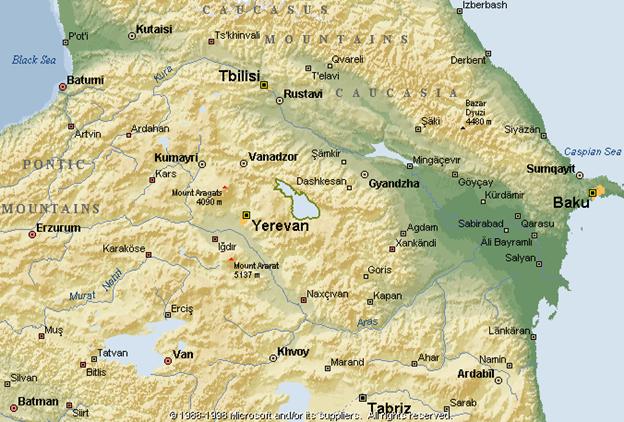
The Kura River originates in the Kizil-Giadik mountain range in Ardahan province in Northeast Turkey. It winds its way through regions in Turkey, Georgia and Azerbaijan into the Caspian Sea. Tributaries flow northwards from Armenia and join the Kura in Georgia and Azerbaijan. The Aras river originates in Erzurum province in eastern Turkey. It flows along the Turkey-Armenia border, along the Iran-Armenia border, along the Iran-Azerbaijan border, before flowing into Azerbaijan where it joins the Kura near the Caspian. Many tributaries from Armenia and Iran flow into the Aras. The map in Annex 5 provides an illustration of the region. This region is largely mountainous – with the exception of the flat delta areas in Azerbaijan - and is home to approximately 7 million people.
The region is of global ecological interest. For example, Conservation International (CI) has identified the South Caucasus - an area corresponding closely to the Kura-Aras river basin - as being one of the world’s top 25 biodiversity hotspots. Notably, the Aras is home to one of the last natural sturgeon breeding grounds; there are important and unique dry-land riparian forests along the Kura; and the Kura delta where the river flow into Caspian contains many important wetland sites.
General Status of the Waters
Human activities in the second half of the twentieth century had a profound effect on the quality and quantity of the water in the rivers. A range of factors, including pollution from industry, municipal wastewater discharges, domestic solid waste, agricultural pesticides, large-scale irrigation/flood control/hydropower schemes and watershed degradation have all contributed to a reduction in water quality and quantity. All countries have contributed to this situation. However, many countries in the region experienced a significant economic decline in the 1990s, and the threats to water quality have decreased in some parts of the river. In the future, however, as the economies in the region recover, and as some industrial activities are restored, the most likely scenario is that these threats will grow again. Water quantity problems have generally become more problematic in the past decades, with increasing droughts and floods, possibly linked to climate change, which water management strategies have thus far failed to address. A good example of how inadequate management knowledge can cause irreversible damage to the ecosystem is the disappearance of the Tugai forest in Azerbaijan.
The further downstream one goes, the greater the water quantity challenges become with increasing demands for water for irrigation and industry and a corresponding decline in water quality. This downstream progression is due to the increasing levels and accumulation of critical pollutants such as pesticides, the increasing demands for water, and the natural aridity of the downstream areas. The Kura-Aras Rivers also have a significant impact on the Caspian Sea environment being the second contributory basin, providing approximately 10% of the total inflow.
Objectives and expected outcomes:
The overall long-term objective of this proposed project is to ensure that the quality and quantity of the water throughout the Kura-Aras river system meets the short and long-term requirements for optimum ecosystem function as well as the needs of the communities using the river. A subsidiary objective is to reduce the contaminant load into the Caspian Sea and improve its water quality.
In targeting this objective, the project will adhere to the following guiding principles agreed at the Johannesburg summit:
· Human beings are at the centre of concerns for sustainable development.
They are entitled to a healthy and productive life in harmony with nature;
· Environmental protection constitutes an integral part of the development
process and cannot be considered in isolation from it;
· The right to development must be fulfilled so as to equitably meet
developmental and environmental needs of present and future generations.
To achieve the overall objective, the immediate objectives are: to foster regional cooperation for river basin management, including information exchange; to increase national and regional capacities with reghard to IWRM in addressing water quality and quantity problems; to make key improvements to water quality/quantity at specific points on the river; to assist development of sustainable financial and institutional coordination arrangements for the management and protection of the river basin; and to promote appropriate reforms to economic sectors causing pollution, water shortages and habitat degradation. The focus will be on trans-boundary issues.
During the PDF B phase, the proposed project will prepare a Transboundary Diagnostic Analysis (TDA) and a draft Strategic Action Programme (SAP). The SAP will provide a solid framework for a long-term, regional, fully integrated and comprehensive approach to management of the Kura-Aras Rivers. Following on from this, the full project will support SAP implementation through a series of policy, institutional and legislative reforms at regional and national level, taking account of existing agreements, as well as lending incremental support to key, on-the-ground, pilot projects within the SAP. Regional management mechanisms will be operationalized, and management tools developed. Priority soft and hard investments will be designed and implemented with some incremental investments supported by the full GEF project. Sustainable financial and institutional arrangements for coordination of long-term management of the rivers will be established and the mobilisation of public and private sector funding will be sought to implement the SAP. Reforms will be initiated in key polluting or withdrawing sectors. It is noted that a number of countries, including Georgia, are committed to approximation or harmonisation of their environmental legislation with that of the EU and that this should provide considerable impetus for implementation of the SAP.
The proposed GEF project will build on the findings, information, capacity development and institutional setting of other internationally-supported projects in the region, specifically the USAID-funded project on Sustainable Management of Water Resources in the Caucasus, the EU project on monitoring the Kura river basin (the TACIS Joint River Management Project) and the German supported Eco-Regional Planning project. The project will benefit from the experience and lessons learnt during execution of these projects in the region, particularly the USAID and Tacis projects. During the PDF-B stage, the project will try to systematically record favoring factors and barriers, respectively, with regard to cooperation among stakeholders within and across country borders. Initial information on these and other related projects is provided in Annex 6 (please note that this list is not exhaustive).
Planned activities to achieve outcomes:
The following provides a list of indicative activities. All of these are subject to verification during the PDF-B phase. Some of the activities listed below (indicated ‘PDF’) will start, and may even be completed, during the PDF-B phase. Co-financed activities are indicated with ‘*’.
Indicative regional level activities:
· Undertake a trans-boundary diagnostic analysis (TDA) and prepare the draft SAP*. Financing mechanisms for implementation of the SAP will be identified (PDF);
· Appraise and approve the SAP at senior government level (PDF)
· Carry out a Stakeholder Analysis, develop a stakeholder involvement plan, and establish a Stakeholder Group to support the TDA-SAP process (PDF)
· Prepare annual SAP implementation plans, including financing plan;
· Secure approval of the annual plans, and secure full budget for their implementation;
· Prepare feasibility studies to address one priority, cross-border, demonstration activity in each country (PDF)*;
· Review options (PDF) and establish an inter-governmental mechanism for coordination and monitoring of SAP implementation*;
· Establish and inaugural meeting of a regional NGO forum (PDF);
· Carry out training activities to strengthen the capacity with regard to IWRM (integrated water resource management) in the region (PDF)*; TDA/SAP course is first priority; in-depth capacity building should probably wait until FP.
· Implement regional workshops to bring all the stakeholders together and to facilitate concerted action (PDF)
· Establish communication and information technology systems, including mechanisms to disseminate and replicate project outcomes;*
· Implement soft elements of the SAP, including monitoring, training, building data-bases, establishing resource centre(s), awareness raising, strengthening NGO and NGO networks, strengthening legislation and policies, market based incentive development and revenue generation activities
At a national level:
· Prepare and appraise annual, national SAP implementation plans (PDF)*;
· Establish inter-ministerial committees;
· Mobilise and coordinate financing, including through regular donor meetings (PDF)*;
· In each country, implement at least one on-the-ground investment to address an urgent cross-border water scarcity or pollution conflict. These will serve as demonstration projects – notably demonstrating cooperation and the effectiveness and viability of financing mechanisms*;
· Carry out awareness raising, training, seminars and conferences (see also UNDP-SIDA component focusing on IWRM);
· Undertake data collection, data base preparation, information management systems*;
· Prepare proposals for legislation and economic incentives to promote sustainable water use behaviour (PDF)*; these would presumably be part of the SAP.
In addition, there may be some country specific or bilateral activities. These are to be identified and developed jointly during the PDF B stage and may include:
· Study of Mingachevir lake quality (Azerbaijan);
· Implement business development activities to overcome barriers to private sector funding;
· Develop a water sharing agreement between Georgia and Azerbaijan; again, sub-set of SAP;
· Establish sub-basin management councils in the Aras basin on the rivers Megri or Agarak, on the border between Armenia and Iran sub-set of SAP
The emphasis will be on promoting broad consultation at both national and regional levels, and on ensuring high quality information collection and analytical work.
B - COUNTRY OWNERSHIP
1. COUNTRY ELIGIBILITY
All countries are eligible for GEF assistance under article 9b of the GEF instrument.
Status of national operational focal point review (dates):
Letters of Endorsement are provided in Annex 4.
2. COUNTRY DRIVENNESS
Project Linkages to National Priorities, Action Plans, and Programs:
Please refer to the attached Concept Paper (Annex 8) for detailed and country specific information related to sections 7 – 12.
Importance of the Rivers to Sustainable Development in the Region
The Kura-Aras river basin covers almost all of Armenia and Azerbaijan, and covers a sizeable part of the populated and urbanized parts of Georgia. These countries rely heavily on the Kura-Aras river system as a principal source of water for all sectors and users: industry, agriculture, energy and residential uses. Although less crucial, at the national level, to Turkey, the basin is important to the livelihoods of sizeable populations in this upstream country. Notably, many of the region’s poorest communities live within the Kura-Aras river basin and depend upon its waters. Finally, the rivers run into and impact the Caspian Sea, affecting the ecosystem and biodiversity of the region, particularly that of Iran and Azerbaijan.
All countries in the region are committed to sustainably managing water resources and this commitment is reflected in national development and environment policies and plans. Moreover, these policies and plans give due emphasis to the management and protection of the Kura and Aras rivers. Each participating country has also established legal and institutional frameworks for managing water resources, the mandates of which cover the Kura-Aras river basin. Finally, each of the countries has a growing non-governmental community to complement the work of governmental organisations in this sector. In general, a willingness to cooperate among stakeholders, as well as their readiness to contribute to, and benefit from the project was found during the PDF-A phase.
Sub-Regional Level Policies and Cooperation
Regional cooperation is a key long-term aim of all participating countries. The Kura and Aras rivers are important to regional cooperation as they cross many borders and constitute lengthy parts of the borders.
Following the break-up of the former Soviet Union, the existing mechanisms for cooperation, joint water management, and information sharing in the region has deteriorated, although there are still a number of bilateral agreements that continue to function, particularly between the Islamic Republic of Iran and its neighbours. In 1997, the Georgian Ministry of Environment, with the support of the EU TACIS Programme, took the initiative to promote cooperation on a range of environmental issues in the region. Bilateral co-operation agreements were developed between Armenia and Georgia and between Azerbaijan and Georgia and were signed in 1998. Since then, there have been a growing number of inter-country initiatives in the environmental field at project, technical and bilateral levels. Despite these agreements and the ongoing projects, political tensions in the region have limited cooperation. The concerned countries are working to address these political issues.
C – PROGRAM AND POLICY CONFORMITY
1. PROGRAM DESIGNATION AND CONFORMITY
The proposed project addresses a transboundary river system and conforms fully to waterbody-based Operational Programme Number 8. The project will play a catalytic role in bringing together four of the five basin countries for the first time in a single intervention. Previous water resource projects funded by USAID, OSCE and Tacis included only the three Caucasus countries, Armenia, Azerbaijan and Georgia, with the Islamic Republic of Iran and Turkey excluded. The Islamic Republic of Iran is participating fully in the GEF project and Turkey has been invited to join the project at anytime during the PDF stage. The importance of the GEF project is recognized by the international community and has already, even at the PDF-B stage, attracted co-funding of nearly $700k from the Swedish International Development Agency (Sida). Other donors (USAID, OSCE and Tacis) have recognized the GEF project as being an important basin-wide environmental initiative and are adjusting their new projects to link up and complement it.
During the PDF-B stage the countries will develop a Strategic Action Programme (SAP) to address priority transboundary problems in the Kura basin, supported by four National Action Plans (NAP) which will serve as the implementation instruments for the SAP at the national level. The SAP will be developed using the standard GEF TDA-SAP methodology for international waters projects and will be carried out in accordance with the best practice guidelines developed under the GEF TrainSeaCoast programme. To maximize co-funding, potential key donors such as WB, EBRD, USAID, Tacis, KfW and OSCE will be invited to participate in the TDA-SAP process and, through a Friends of the Project group, help shape and later support SAP implementation.
The full sized project will assist the countries with the implementation of the agreed SAP. In accordance with the Strategic Priority it will support capacity building in transboundary water resource management, including the encouraging the involvement of civil society, and implement a series of transboundary pilot projects addressing specific water quality and quantity issues in the basin.
2. PROJECT DESIGN
Threats to the Water Environment
Urban and residential threats: A large proportion of the population living in the river basin discharge water and other waste materials directly into the rivers, with almost no treatment. This problem is widespread across the basin, and is most damaging downstream of large urban areas such as Tbilisi and Yerevan.
Industrial threats: The region is relatively industrialized and where industry is still functioning generally relies on old, polluting technology. Contaminated industrial lands, a lasting legacy of Soviet modernization in the region, are highly polluting sources which will remain potent over large time-scales. Industrial pollution crosses all the borders, for example, the Rustavili industrialized region near Tbilisi is a major source of pollution for the Kura River flowing through Georgia to Azerbaijan and is sequestered in the Mingachevir and the upstream Shamkir reservoirs, flow through the latter being controlled to minimize impacts. Mining is a major industry in the upper catchment and heavy metal pollution from tailings is a serious concern in some of the upper tributaries where buffering capacity is minimal. Industry can also be a major user of water an in certain areas cause environmental stress.
Energy-related threats: The basin countries use dams to generate hydropower. These already affect the hydrological regime of the river impacting on water quality and fish migrations, as well as reducing waters in the summer period for downstream users. There are currently plans to increase hydropower generation significantly in the region in the coming years and an increase in mini-hydropower-schemes in Georgia is being investigated as means of addressing that country’s acute power shortages.
Agricultural threats: Poorly maintained and designed irrigation systems in Armenia, Georgia and Azerbaijan have lead to inefficient water usage. Although the scale of irrigation has decreased in the region with the abandonment of pumped systems, agriculture is still a major water consumer in the basin. As these irrigation areas are rehabilitated with the assistance of International Finance Institutions, pressures on the hydraulic environment are expected to increase. There is a need to agree on a balance between the obvious and much needed socio-economic benefits of an improved agricultural sector and the potential damage to the river ecosystem. In the past, agriculture was a major source of pollution, but in recent years the extensive use of fertilizers and pesticides has declined, although there is evidence that certain pesticides are still a major problem in parts of the basin. With the rehabilitation of the irrigation networks and drive for greater efficiency there is reason to believe that unless the appropriate management and controls are put in place pollution from agro-chemicals may again be of concern. Salinization of poorly irrigated land is also a chronic problem in the most arid parts of the basin and many hectares of land have been destroyed in this way.
Land degradation: Deforestation and improper management of upstream watersheds bring about rapid run off during the spring thaw and downstream flooding. High sediment loads cause increased rates of reservoir siltation and smothering of fish spawning sites.
Detailed reports of the transboundary issues from the four participating countries are contained in annex 9.
Underlying Causes
The above threats to water environment have many underlying causes, including:
At the regional level:
· Government and non-governmental agencies involved in water resource management do not coordinate closely with counterpart agencies in other countries;
· There is little incentive to maintain agreed or adequate water quality standards and quantity levels leaving the country;
· Private sector activities are not coordinated across borders and do not necessarily respect the plans, standards and legislation across borders;
· Standards, legislation and enforcement vary from country to country making integrated basin management difficult;
· Data and information on water quality/quantity is limited, notably at cross-border points;
· Lack of implementation of EIA procedures in a transboundary context (Espoo Convention).
At national levels:
· Government agencies do not have the resources or, in some cases, the capacity to undertake basin wide water management, and inter-ministerial/inter-sectoral cooperation is often inadequate;
· Tools to improve water management within each economic sector, such as industry and agriculture are lacking;
· Internal migration within the basin has in places led to unsustainable utilization of river and riverside resources;
· The incentives for polluters to clean up are either too low or not applied;
· Legislation and enforcement mechanisms are poorly developed;
· Reliable data on water quality and quantity is often unavailable;
· There are no mechanisms for generating the revenue required to tackle municipal wastewaters or pollution from state owned industrial enterprises and sites;
· Old technologies still in use may be harmful, while opportunities to use state-of-the-art environmentally friendly technology are unexploited.
Baseline Scenario
In the Baseline, the countries increasingly recognize the problems and make efforts to improve water quality. However, these efforts tend to be fragmented and un-coordinated, and tend to focus on the threats rather than the underlying causes. As the underlying causes are not sufficiently addressed, it is likely that quality and quantity challenges will get worse before getting better.
In the Baseline, the international community continues to support efforts to improve water quality, particularly in the Caucasus countries. The absence of Turkey and Iran from many initiatives means that a comprehensive, integrated approach cannot be taken, although it should be noted that Iran has strong bilateral cooperation with its neighbours. In the downstream countries, there are no strong tools to foster coordination and cooperation. Even if tools were developed, the capacity in the countries to manage water and to cooperate across the sub-region is insufficient. Notably, information scarcity makes it impossible to set priorities. Existing initiatives are limited in technical scope and, although they follow an integrated approach, tend to focus on immediate threats over the root causes. They do not aim to initiate the required comprehensive reforms and investments.
3. SUSTAINABILITY (INCLUDING FINANCIAL SUSTAINABILITY)
The sustainability of the full sized project will depend upon the political endorsement and financial support of the SAP and NAPs by the participating countries. The SAP and the NAPs need to be main-streamed into the national planning process, and allocations from national budgets will be required for their implementation. In the region there are many pressing social and economic demands and environment services and quality have been a relatively low priority. A major task during the PDF stage will be to demonstrate to the countries how good environmental governance, through the application of the concept of sustainability can address many of the existing and future social and economic problems of the basin; and, in so doing, gain government support for SAP implementation. At the PDF stage every effort will be made to establish in each country an active inter-ministerial committee, responsible for overseeing all aspects of national implementation, in which key government ministries such as finance and planning are fully engaged. Prior to approval of the full-sized project a commitment from the countries should be sought for the establishment of a regional management and institutional framework for implementation of the SAP.
Good coordination with other donors active in the basin is vital. Ideally, all donors should agree to support common objectives, hopefully within the framework of the SAP and the NAPs. A ‘Friends of the Project’ group will be established coordinated by the Chief Technical Advisor (CTA) which will meet regularly to discuss coordination and cooperation. It is expected that substantial co-funding for the full sized project will be mobilized through this grouping.
Once the pre-conditions for the full-sized project are met - government support, establishment of a regional management and institutional framework and co-funding – the projects longer term sustainability will depend upon the effectiveness of the intervention in demonstrating the practicality and value of the concept of sustainable development in the basin. Ever increasing utilization of the basin’s land and water resources to meet social and economic demands will need to be tempered by good environmental governance if the basin’s biodiversity and fisheries are to be conserved. The full sized project will implement a series of pilot projects, developed during the PDF-B stage, which will address specific transboundary water quality and quantity issues, with the aim of improving resource management while at the same time providing increased environmental protection.
REPLICABILITY
It is hoped that the pilot projects to be implemented in the full-sized project will be showcases for improved water management and enhanced environmental protection in the basin. Success of the pilot projects will depend upon involvement of national and local administrations and, most importantly, local communities, without whose support no improvements can be sustained. During the full-sized project, new sites will be identified and funding sourced for replication of the best of the community-based management techniques developed as part of the pilot projects.
4. STAKEHOLDER INVOLVEMENT/INTENDED BENEFICIARIES
A stakeholder analysis undertaken during the PDF-B will determine more precisely the roles and potential or degree of involvement of concerned public and private sector agencies in each country, and a stakeholder involvement plan will be developed accordingly. Without pre-empting the findings of that analysis, it is likely that the following institutions and organisations will be involved:
· relevant Ministries and State Committees and Departments and their local offices, Parliamentary Committees for environmental protection, Hydro-meteorological Departments, etc;
· local government agencies;
· water users’ associations, including urban and domestic users;
· representatives of farmers and representatives of industries;
· fishing industry;
· regional and national NGOs and NGO coalitions;
· representatives of the scientific community; and
· donor community and International Financial Institutions.
The UNDP Environmental Governance programme will support the establishment of a NGO forum and its inaugural meeting, and the creation of a regional stakeholder group and regional meetings to compile inputs into the TDA and SAP and other key PDF-B project documents.
D – FINANCING
1. FINANCING PLAN
It is estimated that $5 million will be required from GEF for cofinancing of the full-sized project. Of this total, approximately $3.5 million will be spent on the pilot projects and $1.5 million on further capacity building and institutional support, as described in the SAP. The design and technical evaluation of pilot projects will be undertaken during the PDF-B stage allowing a large percentage of the funds to be spent on capital investments and improved resource management, as well as local capacity building.
2. CO-FINANCING
A total of $5 million in co-funding for the full-sized project will be sought during the PDF-B stage from the UN agencies and various other multilateral and bilateral funding agencies active in the Kura basin in the water and environment sectors. Linkages have already been made with EU-Tacis, OSCE, Sida, USAID and KfW with a view to establishing, under the SAP, consistent donor support objectives and coordinated interventions.
The countries will provide substantial co-funding to the full sized project through their financial commitments to implement the National Action Plans. It is expected that these commitments will exceed the GEF project total by many fold.
E - INSTITUTIONAL COORDINATION AND SUPPORT
1. CORE COMMITMENTS AND LINKAGES
Recent Activities/Programmes in Particular Those Relevant to the GEF:
There are many related activities and projects starting up or ongoing in the region. Some of the most significant are:
- the establishment of the Regional Environmental Centre, REC (Armenia, Azerbaijan, and Georgia) and its many on-going grants programmes;
- the initiation of the UNDP Environmental Governance Programme as part of the RBEC Regional Programme;
- USAID funded project Water Management in the South Caucasus (Armenia, Azerbaijan, and Georgia - Turkey has also officially observed some of the activities in this project);
- German/Government KfW support to “Elaboration of a Vision of an Ecoregional Conservation Plan and Proposal of a Nature and Biodiversity Conservation Programme in the Caucasus Region” (Armenia, Azerbaijan, and Georgia);
- the South Caucasus Environmental Protection Programme under the auspices of the UN Economic Commission for Europe (Armenia, Azerbaijan, and Georgia);
- UNDP/GEF phases I and II support projects to the Caspian Environment Programme, (Iran, Azerbaijan and all other Caspian littoral states);
- The EU TACIS/UNECE Transboundary Water Management Project, phases I and II.
- NATO-OSCE South Caucasus River Monitoring project.
- OSCE/UNEP/UNDP Environment and Security Initiative (Armenia, Azerbaijan, Georgia)
- the formation of a strong Kura-Aras NGO coalition and its numerous projects, including celebration of Kura-Aras Day, June 2nd.
Links with Implementing Agency Program:
In recent years, a broad body of experience and knowledge regarding TDA/SAP preparation and enhancement of regional cooperation on international waters has developed, much of it through GEF support and its International Waters portfolio. The project will build on this experience and these findings. In particular, the TDA and SAP will be prepared in accordance with the best practice guidelines recently published as a training manual under the GEF IWLearn programme and communication with the team developing the guidelines will be maintained throughout the PDF-B. It is the intention to complete the TDA/SAP process within the 18-month PDF B programme in order to ensure SAP implementation can commence under the full size Project, with country and donor co-funding. This will be a challenging objective, and good support from the UNDP country offices will be crucial. Also there will need to be very close coordination between the two components (UNDP-GEF and UNDP-SIDA) and flexibility in their implementation. This will be one of the CTA’s main tasks. With the creation of the Friends of the Project and the convening of regular group meeting we hope to secure buy-in from bi-lateral, multi-lateral, IFIs and the private sector into the project, so at the end of the 18 month programme at the Donors Conference, which shall be hosted in cooperation with the WB, real financial commitment for implementation of the SAP can be demonstrated. Potential friends of the project will be defined at the beginning of the project and confirmed at the SHA. A specific dialogue will be emphazised with the WB, in view of their involvement in water law reform processes in the different countries.
The project is closely related to the ongoing Caspian Environment Programme (CEP). The CEP involves all countries along the Caspian and is supported by all three GEF IAs and EU. It provides a strong informational, data and technical base, which can be drawn on at both the PDF and full project stages. During the PDF stage, optimal coordination arrangements with the CEP and its Programme Coordination Unit in Tehran - negotiations are on-going to establish the project’s Iranian office in the Caspian PCU building. There is a link with UNDP-GEF phase II support project to the CEP, which will begin in March 2004 and will undertake a rapid, land-based source assessment for the near Caspian basin, including the Kura–Aras River within the territory of Azerbaijan. Assessment of the contaminant loads in the Mingachevir reservoir system is also envisaged.
The project will build linkages with the Caucasus Environment and Security Initiative: Transforming Risks into Cooperation (ENVSEC) which has just been launched jointly by the Organization for Security and Cooperation in Europe (OSCE), United Nations Environment Programme (UNEP), and United Nations Development Programme (UNDP). Among the array of environment-security interactions, ENVSEC seeks to identify and map those situations where environmental problems threaten to generate tensions – among communities, countries or regions, where for example:
- water or air pollution in one community is a source of insecurity in another;
- allocation or use of land resources create instability between neighboring regions;
- environment can be (perceived as) a means of control and influence of one country over another (upstream – downstream relations)
There is clearly common ground and potential synergy between the projects and the ENVSEC team will be asked to participate in the regional TDA and SAP projects to explore further collaboration.
Where appropriate, the proposed project will also be linked to national donor supported projects, such as the UNDP Georgia project “Capacity Building for the Ministry of Environment” and UNDP projects on Capacity Building for Implementation of the Protocol of Strategic Environmental Assessment in Armenia and Georgia.
2. CONSULTATION, COORDINATION AND COLLABORATION BETWEEN AND AMONG IMPLEMENTING AGENCIES, EXECUTING AGENCIES, AND THE GEF SECRETARIAT, IF APPROPRIATE.
Implementation of the SAP will rely on the good coordination and cooperation amongst the main GEF Implementing Agencies (UNEP and WB) and other key donors (e.g. EU-Tacis, SIDA and KfW). It is suggested that the implementing agencies be asked to sit on the project Steering Committee and that they be invited along with representatives from the other regional projects to attend and participate in all TDA and SAP regional workshops during the PDF-B activities. Specifically, a diaologue will be set-up with the WB, to ensure sufficient exchange and potential coordination with regard to the water reform processes supported by the WB.
3. IMPLEMENTATION/EXECUTION ARRANGEMENTS
The project proponents are the riparian governments of the Kura-Aras Basin. The governments of Azerbaijan, Armenia, Georgia and the Islamic Republic of Iran have confirmed their full commitment to participating in this project and implementing the SAP - see letters in Annex 4.
The government of Turkey is not ready to enter into a formal project mechanism. Turkey will be encouraged to participate in all activities as an observer, with a view to its future full participation
The Lead Agencies are:
Armenia: Ministry of Nature Protection;
Azerbaijan: Ministry of Ecology and Natural Resources;
Georgia: Ministry of Environment;
Islamic Republic of Iran: Ministry of Energy
In each country the Lead Agency stated above is responsible for either regulation or planning of water resources. However, for an international project of this nature, it will be necessary to involve other national agencies, including those responsible for foreign affairs, finance, energy, transport or forests. The Lead Agency will take responsibility for fully involving those agencies, and, through the PDF process, establishing a national coordination mechanism, including non-governmental members as appropriate.
PART II - PROJECT DEVELOPMENT PREPARATION
A - DESCRIPTION OF PROPOSED PDF ACTIVITIES
Information on PDF B activities
The development of the TDA and SAP, major outputs of the PDF-B project, will be undertaken in line with the proposed best practice approach recently prepared by GEF-UNDP-UNDOALOS Train-Sea-Coast Programme. The applicability of the lessons from this project will be transferred as appropriate to the present project with sensitivity to the variation in circumstances. Communications will be maintained throughout the project with the Trans-Sea Coast Programme team led by Professor Laurence Mee of Plymouth University, UK.
Based on the TDA-SAP best practices guidelines the following incremental phases shall be undertaken in order to prepare a regional TDA and SAP for addressing the transboundary and contributing national issues resulting in the degradation of the Kura Aras river system. The first phase will involve undertaking the Stakeholder Analysis (SHA), appointment of the Technical Task Team (TTT), designation of the Steering Committee and Friends of Project Group, inter-ministerial committees, and establishment project coordination offices.
The second phase will focus on joint fact finding, specifically developing the TDA with empirical studies, information gathering, Causal Chain Analysis, and analysis and review of institutions, laws, policies and projected investments. This will culminate in a TDA to be reviewed by stakeholders, and adopted by the Steering Committee.
The third phase is the preparation of the SAP, involving identification of a vision statement for the basin with long term EcoQOs, and development of coordination between the SAP and NAPs, with sensitivity to socially and economic feasibility of projected activities. This will include a regional and national level institutional framework to monitor and evaluate indicators of operational objectives and targets. The final outcome will be a SAP, supported by partnerships, endorsed nationally and adopted by all countries.
Activities to be financed by PDF -B Grant
1. Establish PDF-B Coordination and Implementation Arrangements
An organigram of the implementation arrangements is given in figure 1.
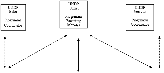
The National Focal Points (NFP) will be confirmed and the national coordination officers identified at an early-convened project inception meeting. The NFP will be the main contact point for the project in the basin state. As part of the SIDA component (see annex 8) will establish project offices in Baku, Tbilisi and Yerevan. A fourth project office will be established in Tehran supported by the UNDP - GEF component. It is the CTA’s responsibility to ensure that roles and responsibilities are adequately clarified between the various elements of the management arrangements, such as the various stakeholder, steering and advisory groups of the project, as well as national stakeholders and focal points, and in particular between the two (SIDA- and GEF-) components.
The composition of the project Steering Committee will be determined at the inception meeting. Initially Steering Committee members will include the NFPs from the four participating countries, representatives from UNDP-GEF, UNDP-SIDA and UNDP Environmental Governance Programme components and representatives from UN Office for Project Services (UNOPS), executing agency for the UNDP-GEF component, and SIDA. The UNDP-GEF Chief Technical Advisor (CTA) will act as the executive secretary to the Steering Committee supported by the country offices. Meetings will be held every six months.
It is suggested that the Steering Committee membership be widened to include the two other GEF implementing agencies, the World Bank and UNEP, as well as the EU. Invitations either to join as full members or observers will be extended to major regional donors and to regional NGO representatives and representatives of stakeholder groups. Turkey, who has project observer status, will be invited to all project meetings and will be encouraged to join the as full project members as soon as possible.
The National Focal points will organize national Inter-Ministerial Committees to ensure that there is adequate feed-back from all relevant sectors and that National Action Plans (NAP) receive the necessary political support. It is anticipated that this national level committee will meet at least every three months to discuss and assess project progress at national and regional levels. The national coordination officer will prepare minutes of the meeting and submit them to the CTA. Furthermore, a dialogue mechanism will be set-up with the WB during the preparation phase to ensure sufficient communication and potential coordination with regard to the water reform processes supported by the WB.
A “Friends of the Project Group” will be formed by the CTA at the beginning of the project comprising representatives of the major regional donors and donor projects, IFIs and the private sector. This group will meet every six months just prior to the Steering Committee meeting to discuss coordination of basin-wide activities and potential for integration and linkage of activities. This group will issue a report to the Steering Committee and will be granted observer status to the Steering Committee.
The PDF-B project will be implemented in two components. The lead UNDP-GEF component will be executed by UNOPS and the head-office will be based in Georgia. The Principal Resident Representative for the component will be the Director of the UNDP Regional Support Centre in Bratislava. He will be responsible for supervising preparation of the main regional project documents, the TDA, SAP and the project brief and overall project coordination. The second component, implemented by UNDP-SIDA and executed by the Georgian UNDP country office will be responsible for assisting with development of the TDA, and SAP, and preparing the NAPs in Armenia, Azerbaijan and Georgia. Preparation of the Iranian NAP will be assisted by the UNDP-GEF component.
The UNDP-SIDA component will also take the lead in delivering in-country capacity building in Integrated Water Resources Management (IWRM). The UNDP-GEF will support Iran in the development of its NAP and participation in all the UNDP-SIDA component activities, including the IWRM capacity development.
The CTA of the UNDP-GEF component will have responsibility for the day-to-day management of the GEF project and coordination with the UNDP-SIDA component, reporting to the UNDP Bratislava office and the Georgian UNDP country office. Coordination of the project at the country level will be the responsibility of the UNDP-SIDA component and the appointed national coordination officers who will assist the NFPs.
2. Undertake Stakeholder Analysis
The objective of the Stakeholder Analysis (SHA) is to identify the major stakeholder groups affected by and impacting the degradation of the Kura-Aras river basin.
An initial stakeholder consultation was undertaken during the PDF-A stage, which helped develop an analysis of the specific issues n the region. It involved individual, qualitatively oriented interviews with NFPs, formal and unofficial stakeholder group representatives, to determine the broadest ranging transboundary interests and influences impacting degradation of waters in the region. A clear willingness of cooperation amongst all stakeholders has been found during the PDF-A stage, as well as their general readiness to contribute to, and profit from this project.
The SHA will involve identification of major stakeholder groups throughout the region, and their concerns regarding water degradation issues. Once all relevant groups are identified with the aid of the initial stakeholder consultation process, a stakeholder involvement plan will be drafted, and a survey developed and administered in order to create a baseline level of stakeholder perceptions. This survey, in combination with a ground-truthing mission by the SH Analyst will inform the Transboundary Diagnostic Analysis and create an empirically valid measure of the major perceived challenges perceived by the multiple stakeholder groups in the region.
The stakeholder analysis will provide an overview of where tensions and potential conflicts between specific stakeholder groups exist, both nationally and regionally. Additionally, it will allow areas of potential cooperation between and amongst groups to be identified, including collaboration with NGOs operating in the region. The stakeholder groups in this analysis will include: Ministry representatives for agencies overseeing natural resources, hydrometeorology, public health, energy, agriculture, fishing and wildlife, economy, foreign affairs, industry and mining sectors, culture, and other sectors; local, municipal and district government officials; public and private industry officials; farmers; agro-chemical producers and distributors; fishermen; public health care providers; NGOs; researchers and scientists; national park officials and forestry managers; littoral residents; water user associations, where applicable; and others.
The findings of the SHA will serve as basis for the steakholder involvememt plan. Furthernore, it will enable the project to prepare a broader public participation plan for full implementation at the project stage and is a prerequisite of formal project approval. Initial implementation of stakeholder and public participation projects during the PDF-B stage will include an outreach programme requiring the establishment of a web-site for dissemination of all project documents, creation of project brochures and informational posters and coordination with local and national press regarding project activities. The plans will also ensure that the relevant stakeholder groups are fully consulted in the TDA/SAP process. This consultation with stakeholder will include review of TDA prior to adoption by Steering Committee.
The SHA will be carried out by locally appointed consultants assisted by a stakeholder analyst/public involvement expert who will undertake analysis of the questionnaires for inclusion in the TDA and prepare public involvement plan.
This activity will be lead by the UNDP-GEF component project.
A regional Stakeholder Group SHG will be established based on the results of the SHA. The group will meet regularly supported by co-funding from the UNDP Environmental Governance Programme to review the TDA, preliminary SAP, the final SAP and the GEF project document. The first meeting of the SHG will be organized in the third quarter of 2004 and will familiarize the members with the TDA-SAP process. This work will be managed by the Stakeholder analysis and public involvement expert.
3. Undertake Transboundary Diagnostic Analysis
The Transboundary Diagnostic Analysis will be undertaken in line with the proposed best practice. The first step of which will be the formation of a Technical Task Team (TTT), to either undertake or recommend experts to undertake the fact finding work of the TDA. The National Focal Points will be consulted regarding the composition of the TTT, using the Stakeholder Analysis as guidance. It is recommended that each country nominate three qualified participants to the TTT with experience and expertise from different sectors within each country to avoid undue influence of a particular sector in the TTT.
Identification and location of transboundary issues will be undertaken by the TTT at the first TDA workshop, which will be lead by the project CTA and the TDA/SAP expert. A short summary report will be prepared on transboundary issues based on the country reports prepared at the PDF-A stage as a precursor to the meeting. It is proposed that a member of Professor Mee’s team currently working on the best practice guidelines be asked to help with facilitating this workshop. The workshop will be in the form of a brain-storming exercise not only to identify and locate but also to assign priorities (high, medium, low) to the transboundary issues. The results of the workshop will be written up in brief scoping report
The next step will be to gather and interpret information for each identified priority transboundary issue pertaining to the environmental, economic and social consequences of each issue, both positive and negative. This could take the form of a series of studies which might, for example, include:
- Sustainable yields assessment/assessment of current/planned abstraction levels and patterns.
- Land-based pollution source assessment/identification of hot-spots.
- Land–use threats to basin biodiversity
- Flood risk assessments
The studies should look at the environmental, economic and social consequences within the basin and within the Caspian Sea. Close collaboration with the Caspian Environment Programme will be sought and it is hoped that resources may be pooled in order to carry out specific studies, such as the land-based source assessment. Linkages will also be made with the other regional projects, (see annex 6) in data gathering. The KfW project has developed and is to implement an Ecoregional Conservation Plan for the Caucasus, which is a potentially important project partner. An on-going regional project supported by German Federal Government and aiming at the development of trans-boundary cooperation for hazard prevention in the Kura-River Basin, with major focus on industrial hazard prevention, can also be thought as a potential project partner. The ways of linking of all these projects functionally will be investigated at an early stage. These studies will be summarized in short reports to be presented to the stakeholders at a TDA review workshop for stakeholders.
In addition to the summary reports the TTT will undertake a Causal Chain Analysis (CCA) to relate the issues to their immediate physical causes and their social and economic underlying causes. This analysis will be invaluable in identifying the highest impact, cost effective options for addressing priority transboundary issues and identifying monitoring indicators. This CCA will focus on the issues, causes and consequences of degradation of the river basin.
The UNDP-SIDA component will undertake an analysis of institutions, laws, policies, and projected investments in each of the Caucasus countries as part of the TDA and will prepare a regional report (with input from the Islamic Republic of Iran supported by UNDP-GEF). This work will build upon the excellent work already done under the USAID project on water management in the South Caucasus. The analysis will examine the problems of implementation and compliance as well as the legal and institutional mechanisms themselves, and will make clear recommendations for coordinated reforms. Furthermore, lessons will be systematically collected – and recorded for use during the supbsequent implementation phase of the SAP – deriving form previous projects and experiences with regard to favoring factors and barriers, respectively, that influenced cooperation among stakeholders within and across country borders. A review of all existing and projected investments will be undertaken in order to understand the investment priorities of each country and of the major regional donors. This study will assist in defining the basin vision (see below) and understanding how the Strategic Action Programme and National Action Plans can be placed in the wider planning frameworks
The UNDP-GEF CTA will have the responsibility of integrating the TDA and presenting the draft to the stakeholder groups and Steering Committee for review. The Steering Committee will give final approval of the TDA. The TDA should be accepted as a living document and procedures agreed for it to be reviewed at regular intervals. The TDA will be published in a summary form using non-technical terminology, and distributed as widely as possible to multiple stakeholder groups for comment, as well as being made available on the World Wide Web.
4. Preparing the SAP and NAPs
A regional SAP formulation team will be formed, which should incorporate official decision makers as well as technical experts drawn from the TTT. The SAP formulation team will be larger and its composition more varied than the TTT, based on consultations by the project CTA with the NFPs, however it is recommended that it also include the Friends of Project from the donor community. Oversight of the TDA and the SAP will be provided by the Stakeholder Group (see section 2), which will include representatives of the private sector and regional NGOs, and representatives of latent, but impacted stakeholder groups.
The first task of the SAP formulation team will be to agree to a basin ‘vision’ in terms of what is acceptable to the stakeholders in terms of long-term environmental status. The vision will be described in a series of Ecosystemic Quality Objectives (EcoQO) which should be tangible, measurable and easily communicated. A set of EcoQOs will be prepared by the project team. This will be reviewed and refined by the SAP formulation team at a specially designed workshop.
The first regional SAP workshop will be quickly followed by a regional brain-storming meeting to identify the intervention options to meet EcoQOs and the elements of a potential SAP. The options will then be reviewed and where necessary subject to desk studies to assess their technical and economic feasibility. These options must also be considered within the social settings in which they will be implemented and adjusted accordingly. The SAP formulation team will also set operational objectives for the short to medium term for each EcoQO and will appoint consultants to prepare a preliminary SAP.
The resulting EcoQOs will then be reviewed at the national level by NAP formulation teams before agreeing to the formalized regional basin vision. The NAP formulation teams will be created by the NFPs in consultation with the inter-ministerial committee and under the guidance of the project, which will be responsible for drafting the NAPs and reviewing the SAP at the national level. The objective will be to closely coordinate national level policies and legislation with the SAP in order to strengthen country commitment.
At the national level NAP formulation teams will undertake parallel activities in identifying options to meet the EcoQOs and interpret the operational targets in terms of national activities to be carried out. The preliminary SAP will provide the NAP formulation teams with a guide in preparing their plans. As the teams develop their draft NAPs they should incorporate the national and regional activities required to meet the operational targets.
It is envisaged that the duration of activities for both the SAP and NAP will be ten years, with financial commitment being sought for the first five years. The NAPs need to be realistic and reflect the countries budgetary constraints, and these limitations should in turn be reflected in the SAP. There therefore will need to be a series of iterative revisions and cross consultations between the SAP and the NAPs in order to provide a balanced and supportive planning structure. There should be step-wise consensus building created through a series of national and regional workshops to be organized collaboratively by the two component projects.
An extensive training programme, with the objective of incorporating IWRM concepts into the national management systems, will be implemented. Inter-sectoral policy building will be a key aspect of this training. The UNDP-SIDA component will be working with the basin states (Iran will be supported with UNDP-GEF funding) to identify national institutional frameworks for implementation of both the SAP and NAP. This will include a review of existing institutional arrangements and making recommendations based on best IWRM practice.
The inter-ministerial committees will be tasked with preparing inter-sectoral policy proposals for inclusion in the NAPs during the iterative SAP/NAP process. Ideally, the NAP would be a stand alone document, but may have to be incorporated into wider existing water sector planning documents, since it will be a requirement that it is be endorsed by the Government. If the NAP is to be incorporated in a wider document it should retain its focus on the basin and specific investment interventions aimed at countering threats to the water quality and quantity. The incorporation of the NAP into the national strategies of the IFIs should be an objective. Involvement of the WB and ADB in development of the NAP is to be encouraged.
As part of the NAP process the formulation teams will be asked to make recommendations for pilot projects to address priority, transboundary issues, which may be implemented in the final project. Desk studies will be made of the most promising recommendations and following final selection by the Steering Committee included in the draft project brief.
Towards the end of SAP development a regional workshop will be organized under the UNDP-GEF component to review the options for development of institutional and legal arrangements for monitoring and coordinating implementation of the SAP, including perhaps the establishment of a UN umbrella agreement. An options paper will be prepared ahead of the meeting and be circulated to the NFPs for comment. In addition, as part of the UNDP-SIDA component a study tour will be organized for key policy makers and stakeholders to visit an international river basin commission to see how such an organization is structured and works.
The NAPs will go through their country endorsement procedures, including consultation with the key government and non-government stakeholders. The draft version of the SAP will be reviewed by stakeholders at a regional workshop before approval by the NFPs and the Steering Committee. The final version of the SAP will include a set of monitoring and evaluation indicators based on GEF guidelines and agreed to by the countries.
If possible, the SAP will be signed at a specially organized ministerial meeting, which will take place at the same time as specially convened Partnership Conference, which shall be hosted by WB. Throughout the PDF-B project the Friends of the Project (bi-lateral and multi-lateral donors, IFIs, international NGOs and the private sector) will be encouraged to attend the TDA/SAP process workshops and will be invited, either as members or observers to the Steering Committee meetings. In this way we hope that they will develop a sense of ownership of the SAP and commitment to implementation of selected components. Early involvement of Friends of the Project is crucial because of the length of the donor project cycle and the relatively short PDF-B project programme.
5. Preparing the Project document
The project brief for the full size project will be prepared once the content of the SAP is known and the commitments of the countries - incorporated in the NAPs – and support of Friends of the Project have been outlined. The project will provide support to the agreed SAP institutional framework for monitoring and coordination of SAP implementation and will support those SAP activities, which maximize co-funding and establish links between component projects. Design of transboundary demonstration projects is seen as an important part of project brief development, helping to attract donor co-funding. As a parallel activity a Monitoring and Evaluation Framework for the SAP and NAPs will be prepared by the project brief consultants in consultation with the participating countries to be included as an annex to both the SAP and the Project document. It is hoped that the full project will lever a level of country co-funding many times greater than that of the GEF grant. The project brief will be prepared by the CTA and will incorporate the public involvement plan prepared during the PDF-B project. If possible, the project brief will be completed and submitted to the countries for endorsement before the first WB-hosted partnership conference during PDF-B.
B - PDF BLOCK B OUTPUTS
- Stakeholder Analysis (SHA): A detailed analysis to identify and articulate the views of key basin stakeholders, describing both areas of conflict, and more importantly, areas of agreement. The SHA will help in the formation of a basin vision and will be central to the design of the public involvement plan. The key private-sector stakeholders will be invited to join the Friends of the Project and assist in the later review of the TDA and subsequent implementation of the SAP.
- Public Involvement Plan: A realistic and meaningful plan will be created to widen the commitment to the TDA/SAP and increase public support for the implementation of the SAP through direct action and through the democratic process of all stakeholder groups. The public involvement plan is a prerequisite for submission.
- Transboundary Diagnostic Analysis (TDA): The TDA is an objective, scientifically oriented, empirical assessment that identifies and describes priority transboundary issues and evaluates the environmental and socio-economic causes and consequences of transboundary issues. It endeavors to prioritize the issues based on a holistic and multi-sectoral consideration of the problems associated with the state of and threats to transboundary waters. Although the TDA itself contains no recommendations it leads to the development of a basin ‘vision’ and a Strategic Action Programme (SAP) guided by EcoQOs arising from the TDA. The Causal Chain Analysis, an integral part of the TDA, provides an understanding of the distal, intermediate and immediate causes of the transboundary issues, thereby assisting the design of a targeted and cost effective SAP. The TDA is to be treated as a living document to be reviewed, up-dated and supplemented at regular intervals and made available to the wider public (see output 2).
- A shared ‘vision’ of the long-term environmental status of the basin by all stakeholders. The vision is expressed in terms of long-term EcoQOs, broken down further into operational targets over the planning period (5 to 10 years). The vision is not necessarily an improvement on or reaffirmation of the status quo and could envisage further resource utilization if proven sustainable. Careful consideration of the EcoQOs will need to be given if they do not too unduly restrict economic and social development. Development of WQO/WQS and water use standards should be considered as part of the vision.
- National Action Plans (NAPs): Incorporating both the national and regional activities aimed at meeting the EcoQOs and operational targets, complimenting and supporting the Strategic Action Programme. The NAPs will be endorsed at the highest government level and will signify national political and financial commitment to the TDA/SAP process. The planning period will be ten-years, split into two sequential five year plans, with a full financial plan for the first five years only. The NAP ideally will be a stand alone planning document but may have to be incorporated into a wider water sector planning document.
- Strategic Action Programme (SAP): An agreement among the participating countries on actions needed to address priority transboundary threats, including investments, legal and institutional reform, capacity building and baseline studies. The SAP will be implemented through a partnership between the basin countries and multi-lateral and bi-lateral donor agencies, IFIs and the private sector. The SAP and the component NAPs will embrace and balance the development and conservation priorities of the basin countries and, as much as possible, the programme objectives of the major donors, including those of the GEF. The SAP will present a manageable programme of activities to meet the EcoQO and operational targets of the basin vision over a planning period of ten years and will incorporate quantifiable performance indicators by which implementation can be monitored. Financial commitment to the SAP will be sought for the first five to ten years only, in line with common country and donor planning horizons. The SAP will be endorsed by the basin countries.
- Partnership Conferences: In cooperation with, and hosted by the WB, two meetings will be convened at which political and financial commitment to SAP implementation will be sought from the basin countries and the Friends of the Project. The first conference will take place during the finalization of the PDF-B phase and shall be combined with an inter-ministerial meeting to sign the SAP; a second conference shall be planned during the project implementation, after the SAP will be completed.
- Institutional framework: A framework plan to coordinate and monitor implementation of the SAP, with a permanent management structure to be supported in its first years by the new GEF project. The framework will be established by an inter-governmental agreement or declaration.
- A GEF project brief, including proposals for pilot projects: A project brief to be submitted to the GEF Council for support to implementation of the SAP and selected transboundary pilot projects. The proposed pilot projects will address priority, transboundary, environmental issues, involving two or more countries which will result in a measurable improvement in the environment. Each pilot project will be supported by a pre-feasibility desk study.
- Monitoring and Evaluation Framework: This is a critical component of the SAP which will be produced in parallel with the project brief and will be used monitor implementation and effectiveness of the SAP and component NAPs during the initial five years.
C - JUSTIFICATION
The PDF-B activities will be the first time that the four main Kura countries have come together to analyze the water management issues and problems of the basin since the break up of the former Soviet Union. The existing mechanisms for cooperation, joint water management, and information sharing in the region have deteriorated, although there are still a number of bilateral agreements that continue to function, particularly between the Islamic Republic of Iran and its neighbours. Although efforts have been made to establish new coordination mechanisms, notably by Georgia, cooperation remains limited. The concerned countries are working to address these political issues and the PDF-B activities and subsequent full-sized project have been designed to help this process.
D – TIMETABLE
The timeline for the PDF-B project is eighteen months, from March 2005 until August 2006. A detailed work plan is presented in annex 1. The key milestones will be:
· Month 1: Inception meeting.
· Month 2: Confirmation of project steering committee and rules of procedure. Establishment of inter-ministerial committees, project coordination offices and technical task team.
· Month 3: First TDA workshop to define and scope the priority transboundary issues. Stakeholder analysis and production of the initial public involvement plan
· Month 6: Production of analyses of institutional, legal and policies and projected investments in the basin countries.
· Month 7: Completion of the detailed TDA studies and production of summary reports. National meeting and second TDA workshop to review summary reports and initiate the causal chain analysis.
· Month 8: First SAP meeting to define the vision statement in terms of long-term EcoQOs, followed by national confirmation meetings. Identification of regional and national SAP formulation teams.
· Month 9: Second SAP meeting to identify options to meet EcoQOs and draft, preliminary SAP.
· Month 10: Third SAP workshop to review preliminary SAP and launch NAPs. Production of draft TDA.
· Month 11: Completion of SAP option feasibility studies. Third TDA workshop to review draft TDA.
· Month 14: Design of pilot projects.
· Month 16: Fourth SAP workshop to present draft NAPs and review draft SAP. Prepare draft project brief and Monitoring and Evaluation Framework.
· Month17: First WB-hosted partnership conference
· Month 18: Signing of SAP and country endorsements of the project brief
E – BUDGET
This PDF B financed preparatory phase will specifically finance the following: (1) establishment of regional and national institutional management and support mechanisms; (2) undertaking a stakeholder analysis in the basin; (3) carrying out a transboundary diagnostic analysis, including a causal change analysis; (4) preparing a regional Strategic Action Programme and component National Action Plans; (5) preparation for two WB-hosted donors conferences; (6) the preparation of a project brief for submission to GEF.
After approval of the PDF A proposal, UNDP secured co-funding for the project from the Government of Sweden of approximately $690,000, with $100,000 spent during the PDF A phase, and $594,427 is to be spent on PDF B activities. The Swedish funds will be executed separately from the GEF funds by the UNDP office in Tbilisi. The two project components (UNDP-SIDA and UNDP-GEF) although they have separate work plans (annex 1) will be fully coordinated and together will execute the activities described in this document.
Further co-funding of $100,000 is provided by the UNDP Regional Environmental Governance Programme of the UNDP Regional support Centre for Europe and CIS based in Bratislava. The UNDP TRIB programme contributed $50,000 to the project, with $25,000 spent on PDF-A activities and the remaining $25,000 allocated to PDF-B.
Expected total budget for the PDF B Project
|
Source |
US$ |
|
GEF |
698,328 |
|
UNDP EGP and TRIB |
125,000 |
|
Government Co-financing: |
145,000 |
|
SIDA |
594.427 |
|
|
|
TOTAL: |
1,562,755 |
Details of budget for Full Project
PDF B funds will be used to identify and secure funding for implementation of the SAP and co-financing for the Full project. This includes investment financing to finance any necessary infrastructure developments. It also includes technical assistance financing, to finance both the incremental and non-incremental aspects of the GEF Full Project. Possible sources of co-financing other than the countries themselves through central budget or loans include: the UNECE Trust Fund for the South Caucasian Environmental Protection Programme, USAID, the EU TACIS Programme, SIDA, KfW, WWF, Eurasia Foundation and the OSCE.
|
Total Budget for PDF B and Information on How Costs Will be Met: |
|
Activity |
GEF |
SIDA |
UNDP/TRIB /EGP |
Govt[1] |
TOTAL (US$) |
|
1. Coordination arrangements and management |
|
|
|
|
|
|
Consultancy (international and regional) |
61,500 |
76,000 |
|
40,000 |
177,500 |
|
Travel |
26,500 |
37,000 |
|
10,000 |
73,500 |
|
Meetings (SCM) |
50,000 |
|
|
15,000 |
65,000 |
|
Office expenses |
44,000 |
111,427 |
|
20,000 |
175,000 |
|
UNOPS execution costs |
51,728 |
|
|
|
51,728 |
|
Total |
233,728 |
224,427 |
|
85,000 |
543,155 |
|
|
|
|
|
|
|
2. Stakeholder analysis/public involvement |
|
|
|
|
|
|
Consultancy (international and regional) |
24,000 |
|
40,000 |
|
64,000 |
|
Travel |
5,000 |
|
10,000 |
|
15,000 |
|
Meetings and NGO forum |
15,000 |
|
40,000 |
5,000 |
60,000 |
|
Total |
44,000 |
|
90,000 |
5,000 |
139,000 |
|
|
|
|
|
|
|
3. TDA |
|
|
|
|
|
|
Consultancy (international and regional) |
52,500 |
147,000 |
|
|
199,500 |
|
Travel |
11,000 |
18,000 |
|
|
29,000 |
|
Meetings |
45,000 |
|
15,000 |
|
60,000 |
|
Total |
108,500 |
165,000 |
15,000 |
|
288,500 |
|
|
|
|
|
|
|
4. SAP/NAP |
|
|
|
|
|
|
Consultancy (international and regional) |
40,600 |
147,000 |
|
35,000 |
222,600 |
|
Travel |
10,500 |
18,000 |
|
|
28,500 |
|
Meetings and study tour |
86,000 |
40,000 |
20,000 |
18,000 |
164,000 |
|
Total |
137,100 |
205,000 |
20,000 |
53,000 |
415,100 |
|
|
|
|
|
|
|
5. Donors Conference (in cooperation with WB) |
|
|
|
|
|
|
Total |
30,000 |
|
|
2,000 |
32,000 |
|
|
|
|
|
|
|
6. Project preparation (including pilot projects and M&E Framework) |
|
|
|
|
|
|
Consultancy (international and regional) |
130,000 |
|
|
|
130,000 |
|
Meetings |
15,000 |
|
|
|
15,000 |
|
Total |
145,000 |
|
|
|
145,000 |
|
|
|
|
|
|
|
GRAND TOTAL |
698,328 |
594,427 |
125,000 |
145,000 |
1,562,755 |
|
Co-financing Sources for PDF B |
|
Name of Co-financier (source) |
Classification |
Type |
Amount (US$) |
Status |
UNDP EGP
|
Impl. Agency
|
cash
|
100,000 |
Confirmed |
UNDP TRIB
|
|
cash
|
25,000 |
confirmed |
Government
|
government
|
In kind
|
145,000 |
Confirmed |
SIDA
|
bilateral
|
cash
|
594,427 |
Confirmed |
|
|
|
|
|
|
Sub-Total Co-financing |
864,427 |
Confirmed |
PART III – RESPONSE TO REVIEWS
A - CONVENTION SECRETARIAT
B - OTHER IAS AND RELEVANT EXAS
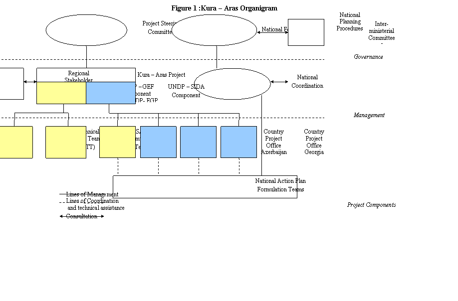

ANNEXES
Annex 1: Work plan and logframe
Annex 2: Legal Context
Annex 3: Terms of Reference for UNDP-GEF international experts
· Chief Technical Advisor
· TDA/SAP advisor
· SHA/Public involvement expert
· Legal and institutional expert
· National Focal Point
Annex 4: Letters of Endorsement
Annex 5: Map showing geographical features of the basin of Kura and Aras Rivers
Annex 6: Information on Related Projects in the Region
Annex 7: Project Concept Paper
Annex 8: SIDA funded project implementation plan
Annex 9: National Country Reports
ANNEX 1: Work Plan
|
Month |
1 |
2 |
3 |
4 |
5 |
6 |
7 |
8 |
9 |
10 |
11 |
12 |
13 |
14 |
15 |
16 |
17 |
18 |
|
Activity |
|
|
|
|
|
|
|
|
|
|
|
|
|
|
|
|
|
|
|
Establish of Implementation arrangements and offices |
|
|
|
|
|
|
|
|
|
|
|
|
|
|
|
|
|
|
|
Inception meeting |
* |
|
|
|
|
|
|
|
|
|
|
|
|
|
|
|
|
|
|
Stakeholder analysis and public involvement plan |
|
|
|
|
|
|
|
|
|
|
|
|
|
|
|
|
|
|
|
SHA and PI review meeting |
|
|
* |
|
|
|
|
|
|
|
|
|
|
|
|
|
|
|
|
Summary of country reports |
|
* |
|
|
|
|
|
|
|
|
|
|
|
|
|
|
|
|
|
1st TDA workshop – identify and scope issues |
|
|
* |
|
|
|
|
|
|
|
|
|
|
|
|
|
|
|
|
TDA studies and summary reports |
|
|
|
|
|
|
|
|
|
|
|
|
|
|
|
|
|
|
|
2nd TDA meeting Causal Chain analysis |
|
|
|
|
|
|
|
|
|
|
|
|
|
|
|
|
|
|
|
Legal and institutional analyses |
|
|
|
|
|
|
|
|
|
|
|
|
|
|
|
|
|
|
|
Review of environmental investments |
|
|
|
|
* |
|
|
|
|
|
|
|
|
|
|
|
|
|
|
Synthesis of TDA and 3rd TDA review meeting |
|
|
|
|
|
|
|
|
|
|
* |
|
|
|
|
|
|
|
|
1st SAP meeting top define basin vision and EcoQOs |
|
|
|
|
|
|
|
* |
|
|
|
|
|
|
|
|
|
|
|
2nd SAP meeting to identify options |
|
|
|
|
|
|
|
|
|
|
|
|
|
|
|
|
|
|
|
Draft preliminary SAP |
|
|
|
|
|
|
|
|
|
* |
|
|
|
|
|
|
|
|
|
3rd SAP meeting to review prelim SAP and launch NAPS |
|
|
|
|
|
|
|
|
|
|
|
|
|
|
|
|
|
|
|
Draft SAP – presentation at 4th SAP meeting |
|
|
|
|
|
|
|
|
|
|
|
|
|
|
|
|
|
|
|
Final SAP |
|
|
|
|
|
|
|
|
|
|
|
|
|
|
|
* |
|
|
|
IWRM training including study tour |
|
|
|
|
|
|
* |
|
|
|
|
|
|
|
|
|
|
|
|
Draft NAPs –presentation at 4th SAP meeting |
|
|
|
|
|
|
|
|
|
|
|
|
|
|
|
|
|
|
|
Final NAPs |
|
|
|
|
|
|
|
|
|
|
|
|
|
|
|
* |
|
|
|
Donors Conference (in cooperation with WB) |
|
|
|
|
|
|
|
|
|
|
|
|
|
|
|
|
* |
|
|
Pilot project preparation |
|
|
|
|
|
|
|
|
|
|
|
|
|
|
|
|
|
|
|
Full project preparation |
|
|
|
|
|
|
|
|
|
|
|
|
|
|
|
|
|
|
|
Monitoring and Evaluation Framework |
|
|
|
|
|
|
|
|
|
|
|
|
|
|
|
|
|
|
|
Ministerial Conference and SAP signing |
|
|
|
|
|
|
|
|
|
|
|
|
|
|
|
|
|
* |
* - co-financed activities
Logframe (to be read in conjunction with SIDA implementation plan Annex 8)
|
Objectives and project outputs |
Verifiable Indicators |
Sources of Verification |
Assumptions and Risks |
|
OUTPUT 1 : Establish PDF-B Coordination and Implementation Arrangements |
- Hold inception meeting to determine composition of Steering Committee
GEF/SIDA
|
· Selection of Steering Committee members
· Approval of Steering Committee composition by national bodies |
· Report on composition of Steering Committee
· Letters of support from countries regarding composition of Steering Committees |
· Availability of qualified individuals to serve on Steering Committee
· Political balance of Steering Committee
· Country support for Steering Committee composition |
- Confirm NFPs
Countries
|
· Selection and confirmation of NFPs for each country |
· Selection of NFPs supported by representative ministry |
· Availability of qualified individual to serve as NFP
· Ministry support for personnel to serve on project |
- Establish Project Offices in country capitals
GEF/SIDA
|
§ Project offices functioning and active in Baku, Tbilisi, Tehran, and Yerevan with full equipment, staff and training
§ Offices capable of offering assistance to support efforts of states |
§ Full time staffed Project office in Baku, Yerevan, Tbilisi, and Tehran |
§ Availability of staff and training resources
§ Country agreement on staffing components |
- Create national level inter-ministerial committees
Countries
|
§ Inter-ministerial Committee led by NFP working with project issues across traditional sectoral boundaries
§ Meetings held at least every three months |
§ Quarterly reports of NFP of minutes of the meetings submitted to CTA |
§ Support for inter ministerial cooperation by governments
§ Ability of ministerial respresentatives to address transboundary and Intersectoral issues |
- Create Friends of Project Group
GEF
|
§ Identify and recruit “Friends of Project” from members of major regional donors, IFIs, and the private sector, as well as other stakeholder group representatives
§ Establishment of e-mail list-serve for FoP representatives
§ Invite FoP representatives to attend/observe Steering Committee Meetings and provide input on project direction |
§ Regular meetings held with coordination mechanisms in place for “FoP” group.
§ Functioning of e-mail list-serve for FoP representatives
§ FoP members attending Steering Committee Members |
§ Availability of IFI, donor and private sector representatives to support the projects
§ Risk of one nation or sector dominating group
§ Competition between International organizations for input and influence in region
§ Non-project oriented factors influencing group membership and direction |
- Create SH Advisory groups
UNDP-EGP/SIDA |
§ Identify stakeholder representatives to serve on advisory groups at national level, and allow them to select representatives for regional SH Advisory group
§ Charge advisory group with providing input into project focusing on various stakeholder concerns and issues
§ Ask advisory group members to develop mechanisms to provide broader SH group review at critical project junctures
§ Create region-wide newsletter, and contact information for all members of the SH advisory group |
§ Roster of SH advisory group in each country
§ Advisory group meetings held at national level
§ Advisory group representatives selected by each advisory group
§ Mechanisms for dispersal of project information to multiple stakeholder groups.
§ Quarterly publication of region wide newsletter with contact information database |
§ Availability of adequately diverse stakeholder group representatives to serve on advisory group
§ Ability of group to reach agreement and/or consensus on issues
§ Capacity of groups to function without undue influence of external actors, such as political or social forces interested in advancing own agendas
§ Ability to successfully target multiple stakeholder groups
§ Information dispersal mechanisms reliable and cross cutting as needed. |
|
OUTPUT 2 : Undertake Stakeholder Analysis |
- Initial SHG Consultation
UNDP - EGP
|
· Consult with individuals from multiple stakeholder groups to best understand the range of stakeholder groups to be included in the full stakeholder analysis |
· Report on qualitative interviews with stakeholders, including listing of additional groups to include in stakeholder analysis
· Overview of the perceptions of power relationships involved in water management issues to inform stakeholder analysis |
· Access and availability of stakeholder group representatives
· Stakeholder willingness to speak openly about issues and concerns
· Appropriately targeting stakeholder group representatives
· Accurate portrayal of information from interview subjects |
- Conduct SHA
GEF
|
· With assistance of NFPs and local consultants, design and administer stakeholder survey
· Create database of stakeholder concerns based on survey
· Analyse data for trends in stakeholder group perception and concerns regarding trans-boundary water issues |
· Completed stakeholder survey
· Database of resulting from compilation of stakeholder survey
· Report from SH consultant on major trends in SHG perceptions and concerns, to include recommendations for Public Involvement Plan |
· Availability of local area consultants to administer survey
· Access to all stakeholder groups and accuracy of representatives opinions
· Ability to reliably test broad stakeholder opinions based on surveys of limited populations |
- Create Public Involvement Plan
UNDP-EGP
|
· Based on SHA findings, develop a feasible, implementable and targeted public involvement plan for the project, including role of SH Advisory Group, and means for inclusion stakeholders in the TDA and SAP advisement process through review and information dissemination |
· A full scale public involvement plan for the full project
· Clearly defined and functioning mechanisms for information dissemination
· Functioning mechanisms for processing feedback from stakeholder groups
· Preliminary public involvement plan to be incorporated into SAP |
· Public involvement feasibly based on socio-economic and political factors in the region
· Public involvement interests from key stakeholder groups
· Avoidance of overlap with other organizations seeking to increase public involvement in related sectors |
- Create NGO Forum and hold inaugural meeting
UNDP-EGP
|
· NGO forum members identified and officials appointed
· Inaugural meeting of the NGO forum held
· Inputs into the TDA and SAP |
· Meeting report
· Summary of comments and suggests from forum on TDA and SAP. |
· Willingness of regional NGO to cooperate with the project and to work together |
|
OUTPUT 3 : Undertake TDA |
- Formation of Technical Task Team (TTT)
Countries/GEF
|
· Designate and appoint 3 members per country to TTT based on diversity of expertise |
· TTT functioning with full representation from all participating countries. 12- 15 members |
· Availability of qualified individuals for TTT work in each country
· TTT members from sufficiently diverse sectors to avoid capture by any single sector |
- Identify trans-boundary issues and locations, and prioritize trans-boundary issues
GEF
|
· Hold workshop for TTT, CTA and TDA/SAP expert with support from Plymouth University
· Brainstorm to identify, locate and prioritize trans-boundary issues to address in the TDA |
· Deliver of brief scoping report summarizing findings of workshop |
· Sufficient knowledge and diversity of TTT members
· Appropriate prioritization of issues |
- Gather and interpret information on issues
GEF/SIDA
|
· Gather and interpret information on priority trans-boundary issues pertaining to environmental, economic and social consequences of each issue including both positive and negative aspects.
· Include information pertaining to the Caspian Sea
· Identify and create linkages with other regional projects, such as KfW and CEP, as appropriate |
· Summary reports of studies
· Linkages with other regional projects established, as appropriate
· Comments from SH Advisory Group |
· Availability of sufficient scientific, socio-economic information on causality of priority issues
· Reliability of information gathered
· Other regional projects receptive to collaboration
· Information accessible to stakeholder groups, in terms of technical issues |
- Analyze institutions, laws, policies of and projected investments at national level pertaining to trans-boundary issues
SIDA/GEF
|
· UNDP-SIDA to analyze institutions, laws, policies of and projected investments at national level in Armenia, Azerbaijan and Georgia in relation to the transboundary priority issues for use in clearly defining basin-wide vision in the SAP stage, with similar activities in Iran supported by GEF
· Challenges of conflicting legislation to be identifies (identified) |
· Report to CTA and TTT reviewing institutions, laws, policies of and projected investments at national level as they pertain to trans-boundary issues |
· Availability of and access to information pertaining to institutions, laws, policies of and projected investments at national level
· Existence of national level policies addressing transboundary issues
· Accessibility of materials to those conducting the review |
- Conduct Causal Chain Analysis for transboundary issues
GEF
|
· Conduct a Causal Chain Analysis to relating priority issues to immediate physical causes and underlying social and economic causes with involvement of TTT, NFPs and UNDP-SIDA
· Identify most appropriate, effective and highest impact level for project intervention
· Identify monitoring indicators for actions and interventions |
· Report on Causal Chain Analysis
· Summary of appropriate interventions for transboundary issues
· Listing of monitoring indicators for actions and interventions |
· Ability of group to identify root causes and causal chain
· Clear instructions for groups in CCA methodology
· Appropriate levels chosen for targeting interventions
· Monitoring indicators realizable and effective |
- Draft Initial TDA
GEF
|
· Building on studies and analysis conducted above, draft TDA with all tables, annexed and summaries |
· Initial TDA draft incorporating studies and analysis above |
· Accuracy of information in earlier studies |
- Consult with Stakeholder Advisory Group regarding TDA Draft, and make TDA open for public review
GEF
|
· Present draft to SH Advisory Group via meeting(s) and make available for public review via mechanisms identified above |
· Comments from SH Advisory Group and from public comments |
· Accessibility of information for SH Advisory Group
· Functioning of public review mechanisms |
- Present TDA to Steering Committee for final approval
GEF
|
· Deliver TDA to Steering Committee for review in a timely fashion prior to meeting
· At Steering Committee meeting present TDA for approval |
· Steering Committee approval of TDA |
· TDA acceptable to Steering committee. If not, additional revisions may be required |
|
OUTPUT 4 : Preparation of Strategic Action Programme and National Action Programme |
- Designate SAP formulation team
Countries/GEF
|
· Select members of TTT, Friends of Project, Stakeholder Advisory Group, and regional NGOs, as well as CTA and NFPs to work together to draft SAP |
· Appointment of SAP formulation team |
· Appropriate size group to be both representative of relevant groups and yet not so large as to be unwieldy |
- Designate NAP formulation teams at national level
Countries/SIDA |
· NFPs to select individuals from Inter-ministerial Committee, sectoral representatives and specific stakeholder representatives to serve on NAP formulation team |
· Membership of NAP formulation team submitted to CTA |
· Balanced representation on all national teams to avoid capture by any particular sector
· Ability of NAP teams to understand their role in the NAP/SAP process |
- SAP formulation team create consensus on basin “vision” with a series of EcoQOs
GEF/SIDA
|
· In workshop format, identify a clearly defined vision of long-term environmental status, based on SHA and transboundary issues
· Establish a series of Ecosystemic Quality Objectives (EcoQOs) |
· Delivery of clearly articulated basin-wide vision of long-term environmental status to SAP formulation team
· Series of EcoQOs delivered to SAP formulation team |
· Basin wide vision realizable
· EcoQOs realistic within socio-economic and time constraints of the project |
- Refine EcoQOs by SAP workshop and review of EcoQOs by NAP formulation teams
GEF
|
· SAP team to review and refine EcoQOs in workshop
· Review by NAP teams for acceptability and applicability in NAP |
· Reports from SAP Team and NAP Teams regarding acceptance, and/or suggested revisions |
· Cohesion of views of SAP team and NAP teams
· EcoQOs generally supported by both sets of teams with minor revisions |
- Identification of national level institutional framework for implementation of SAP and NAPs, including coordination with IFIs
Countries/SIDA |
· UNDP-SIDA to assist with identification of institutional framework
· Coordination of SAP EcoQOs with IFI national and regional objectives |
· Report on appropriate interventions for EcoQOs within the institutional frameworks of each country |
· Potential institutional framework within each government to support activities associated with EcoQOs |
- Identification of options to meet EcoQOs, and elements of SAP at national and regional levels, with guidelines for NAP preparation
GEF
|
· Comments from NAP and SAP teams incorporated into EcoQOs.
· SAP components specified
· Development of standardized guidelines for NAP |
· Revised set of EcoQOs
· SAP components outlined
· Guidelines for NAPs delivered to NFPs |
· Guidelines suitable to use in NAPs
· Revision of EcoQOs acceptable to NAP and SAP teams |
- Draft preliminary SAP
GEF
|
· SAP Formulation Team and TDA/SAP expert to draft SAP |
· Initial draft of SAP submitted to Project Team |
· SAP draft in accordance with GEF standards and coordinated with NAPs |
- Draft NAPs in coordination with SAP
Countries/SIDA/GEF |
· NAP Team drafts initial NAP based on agreed upon standards and guidelines |
· Submission of NAP to SAP Team for review and standardization |
· National and Intersectoral support for NAP
· NAPs in relatively standardized format and able to be integrated with SAP |
- Develop pilot project proposals to address transboundary issues in full project. Conduct desk studies for pilot projects and make selections to be included in project brief
GEF/SIDA/UNDP-EGP |
· SH Advisory group and others to submit pilot project proposals for transboundary issues
· Complete assessment of feasibility of pilot projects |
· A listing of feasible pilot project for potential inclusion in project brief that compliment the SAP, and address EcoQOs |
· Sufficient number of proposals submitted that meet criteria of transboundary pilot projects.
· Capacity of staff to assess feasibility of proposals |
- Hold regional workshop to review options for monitoring and coordination of implementation of SAP
GEF
|
· Workshop to be held with UNDP-GEF |
· Brief on areas of future collaboration between UNDP-GEF and UNDP-SIDA regarding implementation of SAP |
· Collaborative efforts mutually beneficial |
- Undertake study tour of an international river basin institution for key policy makers and SH Advisory Group members
SIDA/GEF
|
· Arrange for selected policy makers and stakeholders tour to river basin commission in Europe |
· Brief on findings of study tour with lessons learned and appropriate applicability defined |
· Ability to secure travel documents for all parties
· Identification of suitable comparable river basin |
- Review of SAP by NFPs and key policy makers and stakeholders
Countries/SIDA/GEF |
· Presentations of SAP and NAP to for review and comment |
· Summary of comments from each country |
· Policy Makers able to make constructive comments regarding SAP and NAP drafts
· Similarities throughout region regarding comments |
- NAPs to go through country endorsement procedures
Countries
|
· Submission of NAP to individual country endorsement bodies |
· Endorsement proceedings initiated in all participating countries |
· All countries willing to initiate endorsement procedures in a timely fashion |
- SAP and NAPs approved by Steering Committee
Countries
|
· NAP and SAP presented to Steering Committee in a timely fashion
· Steering Committee to discuss and approve NAPs and SAP |
· Approval of SAP and NAPs by Steering Committee |
· SAP and NAPs prepared in time for Steering Committee meeting |
- SAP approved and signed at ministerial meeting
Countries
|
· Hold a ministerial meeting to signify commitment of governments of all participating countries to SAP |
· SAP approved and signed by ministers |
· Willingness of governments to commit to SAP and to funding of SAP through government budgets |
|
OUTPUT 5 : Preparation of Project Document |
- Incorporate SAP and NAP commitments and transboundary pilot projects into full project plan
GEF
|
· Design full project plan based on commitments in SAP and NAPs
· Include transboundary pilot projects into plan
· Full project plan to be prepared in accordance with GEF requirements |
· Plan outlined focusing on SAP and NAPs and pilot projects |
· SAP and NAPs sufficiently grounded to provide basis for full project plan
· Pilot projects sufficiently transboundary in scope |
- Identify co-funding linkages and opportunities
GEF
|
· Coordinate with other IFIs, donor organizations and government priorities to build linkages for full project participation and co-funding |
· Establish formal linkages for full project implementation |
· Availability of other projects to link with
· Project cycle coordination possible
· Appropriateness of other projects with SAP and NAP priorities and Basin vision |
- Prepare Monitoring and Evaluation Framework for inclusion in SAP and Project document
|
· M & E Framework prepared and agreed by the participating countries |
· Inclusion of M&E framework in SAP and Project document |
· Ability of governments to monitor cross-sectoral activities and to comply with corrective measures |
- Submit Project document to the countries for endorsement
GEF
|
· Project document based on NAPs and SAP to be submitted to individual countries for formal endorsement |
· Endorsement of project document by all participating countries |
· Willingness of governments to formally endorse project document |
- Hold WB-hosted first partnership conference for full scale project and implementation of SAP
GEF
|
· In coordination with all partners, initiate full scale project and implementation of SAP, based on conference agreements |
· Summary report from conference |
· Full scale project supported by countries and partners with sufficient funding sources and commitments |
ANNEX 2 – Legal Context
This Project Document shall be the instrument referred to as such in Article 1 of the Standard Basic Assistance Agreement between the Government of those participating countries, which have signed such Agreement, and the United Nations Development Program.
The following types of revisions may be made to this project document with the signature of the Principal Project Resident Representative only, provided he or she is assured that the other signatories of the project document have no objections to the proposed changes:
1. Revision in, or addition of, any of the annexes of the project document.
2. Revisions, which do not involve significant changes in the immediate objectives, outputs or activities of the project, but are caused by the rearrangement of the inputs already agreed to or by cost increases due to inflation.
3. Mandatory annual revision, which re-phase the delivery of agreed, project inputs or increased expert or other costs due to inflation or take into account agency expenditure flexibility.
Annex 3: Terms of reference
3.1 Chief Technical Advisor
3.2 TDA/SAP advisor
3.3 SHA/Public involvement expert
3.4 Legal and institutional expert
3.5 National Focal Point
3.1 Chief Technical Advisor
Background
The Kura-Aras river system is the principal source of water for industry, agriculture, residential uses and energy in Armenia, Azerbaijan and Georgia, Iran and Turkey. The rivers are important to regional cooperation in the region as they cross and form many of the borders. Both rivers are very seriously degraded. Water quality is seriously impaired by the dumping of untreated municipal, industrial, medical and agricultural wastes and by huge sedimentation loads resulting from upstream deforestation. Water quantity is seriously affected by uncoordinated damming, over use of water for agricultural and hydropower purposes, and watershed degradation.
Integrated, inter-country efforts are urgently required to reverse the ongoing degradation of these river ecosystems. The proposed project aims to ensure that the quality and quantity of the water throughout the Kura-Aras river system meets the short and long-term needs of the ecosystem and of the communities using the ecosystem. The project will achieve its objectives by: fostering regional cooperation; increasing capacity to address water quality and quantity problems; demonstrating water quality/quantity improvements; initiating required policy and legal reforms; identifying and preparing priority investments and; developing sustainable management and financial arrangements.
The project is currently in its preparatory phase (PDF B). The PDF B will specifically finance the following:
- establishment of coordination and management framework
- undertaking of a Stakeholder analysis and development of a public involvement plan
- development of a transboundary diagnostic analysis
- creation of a basin vision
- development of a regional Strategic Action Programme (SAP) and National Action Plans
- organisation of donors’ conference in cooperation with WB and in support of the SAP
- production of a GEF SAP implementation project
Skills and Experience Required
Qualifications
Post graduate qualification in water, pollution or river basin management or a related discipline;
Demonstrated understanding of the socio-economic processes which lead to degradation of international waters;
At least 10 years experience in international project management and/or project design;
At least five years demonstrated and successful experience in preparing and implementing projects which have successfully conserved water ecosystems, with some of this experience in countries with economies in transition;
Demonstrated ability to discuss, negotiate and facilitate inter-governmental consultations in the region;
Full knowledge of GEF procedures and structures;
Knowledge of the South Caucasus Region would be an asset, as would knowledge of the Russian language.
Duty station: Home office, Caucasus region, project offices, and other offices as needed
Duration: 6 months
Tasks
1. Referring to the approved PDF B document, finalise and update as appropriate the project workplan;
2. Assist in the establishment of the country offices and appoint national experts and officers
3. Maintain contacts and exchange information with key project partners, including UNDP/GEF, UNDP/REGP, UNDP/TRIB, USAID, TACIS, World Bank, EBRD, UNECE, CEP and establish Friends of the Project group and a specific dialogue mechanism with the WB;
4. Collect and record lessons and experience from similar projects (USAID, TACIS), with special focus on factors favoring/hindering in-country and transboundary stakeholder cooperation;
5. Hold in-depth relations with SIDA, in each country, and possibly in Stockholm, in order to facilitate the most appropriate implementation arrangements for the PDF B;
6. Maintain contacts with offices in all four (five) countries to meet the national teams, and support in-country implementation and management arrangements;
7. Organise and facilitate TDA and SAP meetings with assistance of SAP expert;
8. Review and be responsible for production of all project documents
9. Prepare detailed agenda and list of participants for inception meeting and subsequent Steering Committee meetings;
10. Provide detailed guidance on the format, structure and approach to the Regional Consultation;
11. Determine appropriate options for co-financing, managing the project, building partnerships and mobilizing resources to the Full Project;
12. Identify possible management mechanisms for the Full Project
13. Prepare a Project Document based on SHA, TDA. SAP, and NAPs, including preparation of pilot project briefs.
Outputs
· Workplans, TORs, comments on national experts work;
· Basin vision based on a set of EcoQOs
· SAP and component NAPS, Basin Vision,
· Regular Progress Reports
· A paper describing the options for partnerships, covering financial arrangements for the Full Project with linkages with other projects, SAP execution arrangements and execution/implementation arrangements for the Full Project (including PIP);
· A complete, high quality Project Document
3.2 TDA/SAP advisor
Background
The Kura-Aras river system is the principal source of water for industry, agriculture, residential uses and energy in Armenia, Azerbaijan and Georgia, Iran and Turkey. The rivers are important to regional cooperation in the region as they cross and form many of the borders. Both rivers are very seriously degraded. Water quality is seriously impaired by the dumping of untreated municipal, industrial, medical and agricultural wastes and by huge sedimentation loads resulting from upstream deforestation. Water quantity is seriously affected by uncoordinated damming, over use of water for agricultural and hydropower purposes, and watershed degradation.
Integrated, inter-country efforts are urgently required to reverse the ongoing degradation of these river ecosystems. The proposed project aims to ensure that the quality and quantity of the water throughout the Kura-Aras river system meets the short and long-term needs of the ecosystem and of the communities using the ecosystem. The project will achieve its objectives by: fostering regional cooperation; increasing capacity to address water quality and quantity problems; demonstrating water quality/quantity improvements; initiating required policy and legal reforms; identifying and preparing priority investments and; developing sustainable management and financial arrangements.
The project is currently in its preparatory phase (PDF B). The PDF B will specifically finance the following:
- establishment of coordination and management framework
- undertaking of a Stakeholder analysis and development of a public involvement plan
- development of a transboundary diagnostic analysis
- creation of a basin vision
- development of a regional Strategic Action Programme (SAP) and National Action Plans
- organisation of donors’ conference in cooperation with WB and in support of the SAP
- production of a GEF SAP implementation project
Qualifications
Post graduate qualification in environmental management, environmental economics, international development, or related discipline;
Demonstrated understanding of the socio-economic processes that lead to degradation of international waters;
Demonstrated experience in international water project management and/or project design;
Demonstrated experience in the TDA/SAP Processes, including familiarity with methodologies to be employed in multiple analyses and Best Practices of IWLearn;
At least five years demonstrated and successful experience in preparing and implementing projects which have successfully conserved water ecosystems, with some of this experience in countries with economies in transition;
Demonstrated ability to discuss, negotiate and facilitate inter-governmental consultations in the region;
Full knowledge of GEF procedures and structures; and familiarity with UNDP operational procedures;
Duty Station: Home office, Caucasus region, project offices, and other offices as needed
Duration: 2 months
Tasks:
1. Provide assistance and support to CTA throughout the TDA and SAP process
2. Review of PDF-B, including WorkPlan, Logframe, and country reports
3. Attend Inception meeting to provide input/advice on selection of Steering Committee members to best facilitate SAP processes
4. Provide training, input for NFPs and staff on GEF procedures and expectations
5. In consultation with the CTA and national teams, through obtaining timely information, finalise the TDA and SAP and submit to UNDP/GEF and all governments;
6. Provide support to incorporate the comments of the governments, SIDA, UNDP/REGP, UNDP/GEF, GEF Secretariat and Council, Steering Committee and other relevant committees into the TDA and SAP
Outputs
· Workplans, TORs, comments on national experts work;
· TDA and SAP workshop preparatory materials and final reports
· Review of TDA and SAP and component NAPs
· Final summary report on lessons learned regarding TDA/SAP methodology and approach to be submitted to GEF
3.3 SHA/Public involvement advisor
Background
The Kura-Aras river system is the principal source of water for industry, agriculture, residential uses and energy in Armenia, Azerbaijan and Georgia, Iran and Turkey. The rivers are important to regional cooperation in the region as they cross and form many of the borders. Both rivers are very seriously degraded. Water quality is seriously impaired by the dumping of untreated municipal, industrial, medical and agricultural wastes and by huge sedimentation loads resulting from upstream deforestation. Water quantity is seriously affected by uncoordinated damming, over use of water for agricultural and hydropower purposes, and watershed degradation.
Integrated, inter-country efforts are urgently required to reverse the ongoing degradation of these river ecosystems. The proposed project aims to ensure that the quality and quantity of the water throughout the Kura-Aras river system meets the short and long-term needs of the ecosystem and of the communities using the ecosystem. The project will achieve its objectives by: fostering regional cooperation; increasing capacity to address water quality and quantity problems; demonstrating water quality/quantity improvements; initiating required policy and legal reforms; identifying and preparing priority investments and; developing sustainable management and financial arrangements.
The project is currently in its preparatory phase (PDF B). The PDF B will specifically finance the following:
- establishment of coordination and management framework
- undertaking of a Stakeholder analysis and development of a public involvement plan
- development of a transboundary diagnostic analysis
- creation of a basin vision
- development of a regional Strategic Action Programme (SAP) and National Action Plans
- organisation of donors’ conference in cooperation with WB and in support of the SAP
- production of a GEF SAP implementation project
Qualifications:
Post graduate qualification in environmental management, social sciences, international development, or related discipline;
Demonstrated understanding of the socio-economic processes which lead to degradation of international waters;
Demonstrated experience in international water project management public participation;
Demonstrated ability to discuss, negotiate and facilitate stakeholder group consultations in the region;
Knowledge of the ecosystems of South Caucasus Region would be an asset, as would a working knowledge of English, and Russian Languages.
Duty Station: Home office, Caucasus region, project offices, and other offices as needed
Duration: 3 months
Tasks:
1. Conduct preliminary qualitative stakeholder consultations in all participating countries to gauge relationship dynamics, perceptions and concerns of stakeholders and to gather information regarding additional stakeholder groups for inclusion in analysis
2. Advise NFPs on creation of national SH Advisory Groups
3. Develop and design stakeholder survey and oversee administration of stakeholder survey
4. Interpret and analyze findings of SH survey
5. Create accessible, non-technical summary of SHA for use in TDA
6. Support SH Advisory Group in review process for TDA and SAP
7. Provide input for TDA issue prioritization based on SHA findings, including support in Causal Chain Analysis, and the SAP.
8. Prepare a public involvement plan for implementation during PDF-B and full project
Outputs
· SHA survey and database
· graphic presentation of SHA findings for presentation to project staff, Friends of Project, SH Advisory Group, IFIs and public as warranted
· public involvement plan
· recommendation on public information mechanisms
· Final summary report on lessons learned regarding methodology and approach to be submitted to GEF
3.4 Legal and institutional expert
Background
The Kura-Aras river system is the principal source of water for industry, agriculture, residential uses and energy in Armenia, Azerbaijan and Georgia, Iran and Turkey. The rivers are important to regional cooperation in the region as they cross and form many of the borders. Both rivers are very seriously degraded. Water quality is seriously impaired by the dumping of untreated municipal, industrial, medical and agricultural wastes and by huge sedimentation loads resulting from upstream deforestation. Water quantity is seriously affected by uncoordinated damming, over use of water for agricultural and hydropower purposes, and watershed degradation.
Integrated, inter-country efforts are urgently required to reverse the ongoing degradation of these river ecosystems. The proposed project aims to ensure that the quality and quantity of the water throughout the Kura-Aras river system meets the short and long-term needs of the ecosystem and of the communities using the ecosystem. The project will achieve its objectives by: fostering regional cooperation; increasing capacity to address water quality and quantity problems; demonstrating water quality/quantity improvements; initiating required policy and legal reforms; identifying and preparing priority investments and; developing sustainable management and financial arrangements.
The project is currently in its preparatory phase (PDF B). The PDF B will specifically finance the following:
- establishment of coordination and management framework
- undertaking of a Stakeholder analysis and development of a public involvement plan
- development of a transboundary diagnostic analysis
- creation of a basin vision
- development of a regional Strategic Action Programme (SAP) and National Action Plans
- organisation of donors’ conference in cooperation with WB and in support of the SAP
- production of a GEF SAP implementation project
Qualifications:
Postgraduate degree in law, with focus on international environment law specializing on water issues and transboundary river system law
Demonstrated ability to develop institutional mechanisms for sustainable transboundary programmes
At least five years demonstrated and successful experience in assisting the preparation and implementation of projects which have successfully conserved water ecosystems, with some of this experience in countries with economies in transition;
Demonstrated ability to discuss, negotiate and facilitate inter-governmental consultations in the region;
Duty Station: Home office, Caucasus region, project offices, and other offices as needed
Duration: 1 month
Tasks:
1. Provide support in the creation of the SAP Basin Vision regarding legal precedence for common river system management
2. Provide collaborative support in UNDP-SIDA analysis of institutions, laws, policies and regulations pertaining to river basin management
3. Provide support in selection of Pilot Projects pertaining to transboundary legal issues
4. Assist in the development of institutional mechanisms for implementation of SAP
5. Assist in the development of suggested legal status of institutions for implementation of full project
Outputs
· Summary of legal and institutional framework for inclusion in the TDA
· Report on legal constraints and precedents of SAP EcoQOs as warranted
· Brief on institutional mechanisms for implementation of SAP
· Brief on legal status of institutions for implementation of full project
3.5 National Focal Point
Background
National Focal Point is the main contact point for the project in the participating state. The NFP is a member of the Steering Committee, and represents his/her country’s interests in the governance of the project. The National Focal Point is tasked with coordinating and being responsible for his/her country’s participation in the project. The NFP must hold an appropriate and senior position in the national government.
Tasks:
Member of the Steering Committee representing his/her country.
Performs Intersectoral Coordination with his/her country, including ministries, private sector, NGOs, and other stakeholders
Direct and manages the national coordination functions
Oversees the development of the National Action Plan (NAP)
Annex 4 Letters or Endorsement
Endorsement letter from Georgia
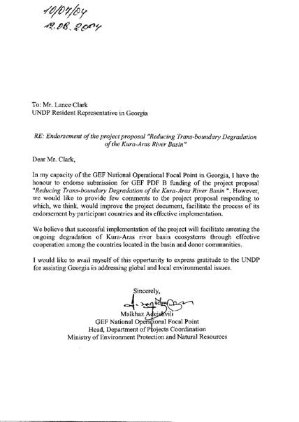
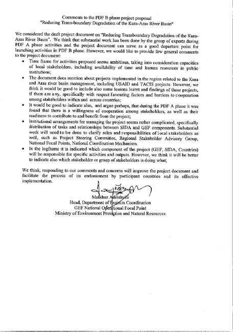
Endorsement letter from Armenia
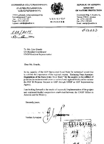
Endorsement letter from Azerbaijan
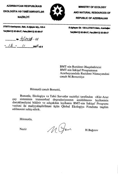
Unofficial translation of the endorsement letter from Azerbaijan
Dear Mr. Borsotti,
This is to express the support of Ministry of Ecology and Natural Resources to the “Kura-Araz river system transboundary degradation reduction” project and it is requested to present the above mentioned project to the Global Environment Facility for its financing through the UN Development Program.
With Respect,
Minister Huseyn Baghirov
18 November 2004
Endorsement letter from Iran
ANNEX 5: Map showing geographical features of the basin of Kura and Aras rivers
ANNEX 6: Initial information on related projects in the region
(list not exhaustive).
USAID Water Management in the South Caucasus
Although a regional programme, it is run a three separate country office projects (Armenia, Azerbaijan and Georgia) with funding varying in each country. Georgia provides the most funding and Azerbaijan the least: total budget over $4 million. Attention is focused on rehabilitation of monitoring networks (particularly hydrology), data management, river basin management at sub-basin level, institutional building at national and regional levels and water supply/wastewater treatment project preparation.
The first phase of the project has been extended until September 2004 and a second smaller phase is currently being developed, which is likely to be focused on the sub-basin and community level. The project has considerable support in Georgia and Armenia and there are clear opportunities to link the new phase into the SAP implementation.
Regionally, water supply is an important focus area for USAID. The Armenia office in particular was interested in widening their water sector interests to include wastewater treatment.
TACIS Transboundary River Basin Management
This was a 4 million euro project set up in conjunction with the UNECE secretariat to test the monitoring guidelines under the Convention on the Protection and Use of Transboundary Watercourses and International Lakes. The Kura-Aras basin was one of four pilot sites. The project involved the establishment of transboundary water quality monitoring sites (upstream and downstream) between the three Caucasus countries. The first phase is now completed with mixed results. A second phase, due to start in the autumn and worth 5 million euro, will focused on two sites, one of which may be the Kura-Aras/Araks. The project will provide more assistance in establishing monitoring stations and strategies, identify investments for pollution remediation and carry pilot investment projects. The two latter components are especially interesting.
There is a good potential for linkages, even co-funding, with the TACIS project and an early visit to meet with the new TACIS regional task manager is recommended. Early development in the PDF-B of the pilot projects is recommended.
NATO - OSCE South Caucasus River Monitoring Project
The NATO-OSCE project is working to improve water quality monitoring capacity in the Academies of Sciences in the three Caucasus countries. The project aims to strengthen the capacity of the Academies to provide monitoring services to the impoverished Hydromet organizations. It seems to be a successful project and may get further funding. There is little scope for co-funding or parallel funding but there should be some opportunities for mutual project support.
KfW Ecoregional Conservation Plan
The project aims were to develop an eco-regional conservation plan for the Caucasus which took into account forecast scenarios for socio-economic development in the region. The first phase included:
- Collating and synthesizing information on the current ecological, economic, social and institutional status;
- Reviewing development goals at national levels and assessing their implications for spatial development;
- Identifying long-term priority areas for biodiversity conservation;
- Elaborating alternative scenarios for future supra-national development;
- Deciding on a preferred scenario;
- Elaborating the preferred scenario into an Eco-regional Conservation Plan.
Key interventions are now being considered and priorities set. The next phase of the study will be implementation of the plan. One priority intervention selected has been the transboundary Javakheti conservation area which straddles the Turkish, Georgian and Armenian borders. The budget for the complete project is in total 4.6 million euro: Georgia 1.4 m, Armenia 2.0m and Azerbaijan 1.2. However, the project is currently stalled because of a lack of institutional framework through which the plan and KfW are still searching for a suitable composition and arrangement for the Steering Committee.
There is a natural synergy between the KfW land-use/conservation plan and the more water orientated GEF SAP and the possibility of linking or better still incorporating the eco-regional plan within the SAP should be discussed at the highest levels between UNDP and KfW. If the two could be amalgamated it would give the SAP a wider scope and be more attractive to potential co-funders and provide an opportunity to embed national GEF biodiversity projects within the international waters programme regional framework – probably a first in the CIS. The involvement of Iran and Turkey would need to be discussed.
There is extremely good collaboration between the regional projects within the Kura-Aras basin and the minimum of technical overlap. The USAID project manager has been at the centre of the coordination efforts and has with the assistance of OSCE held a several regional workshops to discuss the institutional and legal framework options for a basin-wide management body. These workshops have been attended by the three Caucasus countries and on one occasion representatives from Turkey. The USAID project will finish in September 2004.
It is important that this close collaboration between regional projects is maintained and broadened. If during the PDF-B phase an inter-governmental legal and institutional framework cannot be agreed, an option may be to form a Kura-Aras Environmental Programme under the UN umbrella to implement the SAP. Members of the body would include the basin countries, the UN GEF implementing agencies (UNDP, UNEP and the WB) and other donor partners such as the EU, and perhaps, SIDA, USAID and KfW. At the present time, membership of such a body would be difficult for some donors because of the presence of Iran; however, mechanisms should be sought to achieve as wide membership as possible. It has been proposed that during the PDF-B project regular six monthly donor meetings be held, possibly outside the region, to which all the major players be invited to discuss project and programme integration, including co-funding. This idea was welcomed by all the donor agencies contacted during the initial mission. It will be the task of the PDF-B project team to organize and set the agenda for these meetings.
OSCE/UNDP/UNEP Environment and Security Initiative (ENVSEC): Transforming Risks into Cooperation.
The Organization for Security and Cooperation in Europe (OSCE), United Nations Environment Programme (UNEP), and United Nations Development Programme (UNDP) joined together to form the Environment and Security Initiative (ENVSEC). Cooperation between the three founding organisations – UNEP Regional Office for Europe, UNDP Regional Centre, and OSCE– is governed by a Memorandum of Understanding, signed in Vienna on 17 November 2003. The Memorandum establishes a Programme Management Unit located at UNEP in Geneva which coordinates all operations, fund-raising and reporting of the initiative. The ENVSEC Management Board, consisting of senior members of the respective organisations, approves strategic direction and fund allocation.
National Governments are strongly represented in the ENVSEC process through partnerships with all three founding organisations. Ministries of Foreign Affairs and Ministries of the Environment have given their firm endorsement to the ENVSEC approach at the 5th Environment for Europe Conference in Kyiv, at the OSCE’s Economic Forum in Prague, at the OSCE Maastricht Ministerial Council, and at other international and regional fora.
The pilot phase of the initiative assessed environmental threats in Central Asia and South-Eastern Europe. The work began at with a regional snapshot, identifying through consultation with national and regional stakeholders the priority environment and security issues and situations. The subsequent stage moves to the local level in the regions and countries, when specific hot spots will be evaluated and inter-agency interventions designed. It also moves into additional regions, such as the southern Caucasus, where environment and security links are priority concerns.
Among the array of environment-security interactions, ENVSEC seeks to identify and map those situations where environmental problems threaten to generate tensions – among communities, countries or regions, where for example:
- water or air pollution in one community is a source of insecurity in another;
- allocation or use of land resources create instability between neighbouring regions;
- environment can be (perceived as) a means of control and persuasion of one country over another (upstream – downstream relations)
At the same time, ENVSEC looks at situations where environmental cooperation may help build common understanding on other more general issues. For example, joint collection of data or management of a cross-border nature reserve will not immediately reduce insecurity per se, but will certainly help build trust and strengthen relations. Ultimately, it is believed that transboundary environmental cooperation can contribute to peace building[i].
The academic community and civil society organisations will be involved in national and regional scoping consultations, make part of country working groups and participate in specific project activities. On the international level, ENVSEC will maintain links with research and policy organisations with relevant expertise, including the International Institute for Sustainable Development and Adelphi Research.
The project will link with ENVSEC through the TDA/SAP process and will coordinate will coordinate through the UNDP Bratislava office and at a technical level through UNEP-GRID in Geneva.
ANNEX 7: Project Concept Paper
Full Project Concept Paper, as approved by GEF in March 2002
Global Environment Facility
CONCEPT PAPER for a FULL SIZED GEF PROJECT
1 Project title: Reducing Transboundary Degradation of the Kura-Aras River Basin
2 GEF Implementing Agency: United Nations Development Programme
3 Country or countries in which the project is being implemented: Armenia, Azerbaijan, Georgia, Islamic Republic of Iran and Turkey
4 GEF Focal Area(s): International Waters
5 Operational Program/Short-term measure: Waterbody-based Operational Programme (OP8)
6 Country Drivenness (Project linkage to national priorities, action plans and programs):
The Kura-Aras[2] river system is critical to sustainable development of the South Caucasus countries - Armenia, Azerbaijan and Georgia. It is the principal source of water for industry, agriculture, residential uses and energy. Accordingly, the management and protection of the river system is reflected in the national development and environment policies and plans of the three countries. The rivers are also important to sustainable development for sizeable populations in the two upstream countries - Iran and Turkey. The rivers run into and impact the Caspian Sea, therefore affecting all communities using the Sea, in particular those of Iran and Azerbaijan.
Regional cooperation is a key long-term aim of all five countries, and cooperation on shared water resources is an intrinsic component of such cooperation. The Kura and Aras rivers are important to regional cooperation as they cross many borders and constitute lengthy parts of the borders.
National Policies
Armenia: The 1998 Armenian National Environment Action Plan (ArNEAP) gives high priority to the water sector. This is demonstrated by the fact that the Integrated Water Resource Management Plan is the only component of the ArNEAP on which significant progress has been made. Armenia has also prepared the Lake Sevan Environmental Action Plan (Lake Sevan is a major water resource within Armenia) targeting the sustainable and integrated management of the lake’s resources. Armenia lies fully within the Kura and Aras river basins and all national policies targeting water resources target principally the Kura, the Aras and their tributaries.
Azerbaijan: Azerbaijan relies on surface waters for 90% of its water supply, and most of the surface water comes from the Kura/Aras. According to the Azerbaijan National Environment Action Plan “pollution of the main rivers and the Caspian Sea is a very serious problem”. Much of Azerbaijan’s industry, agriculture and urban areas therefore depend on the water in the Kura and Aras rivers. Azerbaijan is also very committed to international cooperation on water issues. It has ratified the Helsinki convention on Trans-boundary watercourses and has approved the Hague Declaration on Water security in 21st century.
Georgia: The Georgian National Environmental Action Plan (GeNEAP) gives priority to water resource management and lists the Kura river as one of the most polluted watercourses in Georgia. The GeNEAP indicates that protecting the Kura requires immediate and concerted action both at national and regional levels. Georgia is committed to regional co-operation in the management of Trans-boundary surface waters. In 1999, the Government of Georgia signed the protocol to the Helsinki convention on Trans-boundary watercourses at the Ministerial Conference on Health and Environment. At the meeting of the parties to the Convention in March 2000 at the Hague, Georgia signed the Ministerial Declaration on the principles of integrated water resource management, including the Trans-boundary context.
Turkey: Water resources management and water quality protection is identified as a priority in Turkey’s National Environmental Action Plan (NEAP, 1998). The main water resource and quality issues identified in the NEAP are: (1) deforestation and poor farming practices leading to erosion, (2) uncontrolled agricultural runoff and discharge of fertilizers and chemical pesticides, (3) large water management projects which if improperly managed can cause population displacement, climatic changes, loss of biodiversity and salinization, (4) diffused responsibility and authority for managing water bodies involving many organizations operating under a variety of laws which reduce effectiveness of water resources management. The Aras river is identified as one of the 26 major water basins in Turkey with a precipitation area of 27,548 km2.
Iran: The Iranian National Strategy for Sustainable Development identifies the following relevant actions among its list of priority actions and investments:
- Implementing projects to protect biodiversity…and international water pollution mitigation.
- Implementing a priority investment programme for “win-win” projects…investments that have both environmental and economic benefits…(such as) projects for watershed and forestry management.
- Addressing water pollution problems from urban households and industrial sectors through modification of water pricing, institutional framework, and efficient investments…Along with investment preparatory work, water sector studies should be launched and the comprehensive water plan updated.
The National Biodiversity Report of the I. R. Iran recognizes that managing the rivers that flow into the Caspian is vital to protecting the Caspian Sea ecosystem.
The Islamic Republic of Iran has ratified several global and regional conventions including: Convention on Biological Diversity (CBD), Convention on Transboundary Movement of Hazardous Waste (Basel), and is cooperating in regional international waters initiatives in the Caspian Sea and Persian Gulf at present.
Sub-regional Policies and Cooperation
Following the break-up of the Soviet Union, mechanisms for cooperation, joint water management, and information sharing ceased to function. In 1997, the Ministry of Environment in Georgia took the initiative to promote regional cooperation, notably with the support of the EU TACIS programme. Bilateral co-operation agreements were developed between Armenia and Georgia and between Azerbaijan and Georgia and were signed in 1998[3]. Articles 6, 7, and 8 of these agreements state an urgent need for the protection of transboundary ecosystems and migratory species. In a related initiative, in 1997, the Hydrometeorological Departments of Armenia, Azerbaijan and Georgia signed a co-operation agreement governing the exchange of information
At project, technical and bilateral levels, there are a growing number of inter-country initiatives in the environmental field, including:
- the establishment of the Regional Environmental Centre (REC[4]);
- the GEF MSP Arid and Semi-Arid Ecosystem Conservation in the Caucasus (see later in this document for further details) by Armenia, Azerbaijan and Georgia;
- informal cooperation on the USAID funded project South Caucasus sustainable water management project. Turkey has also officially observed some of the activities in this project.
See Annex 2 for more information on related inter-country projects [5].
Despite the above-mentioned agreements and the many projects listed in Annex 2, recent political tensions (between Armenia and Azerbaijan, and between Armenia and Turkey) have limited cooperation in the sub-region. The concerned countries are working to address these political issues, and progress has been made recently.
7 Context
Regional Importance of the Waters
The Kura-Aras river system is an internationally significant river system, which is seriously degraded and continues to be threatened. Integrated, multi-country, trans-boundary responses are necessary to address the threats to the river system, and to address their underlying causes.
The Kura River originates in the Kizil-Giadik mountain range in Ardahan province in Northeast Turkey, winding its way through mountainous regions in Turkey, Georgia and Azerbaijan into the Caspian Sea. Tributaries flow northwards from Armenia and join the Kura in Georgia and Azerbaijan. The Aras River originates in Erzurum province in eastern Turkey. It flows along the Turkey-Armenia border, along the Iran-Armenia border, along the Iran-Azerbaijan border, before flowing into Azerbaijan where it joins the Kura near the Caspian. Tributaries from Armenia flow south into the Aras. The Aras divides just before meeting the Kura, and one branch flows directly into the Caspian. The total length of the Kura river is 1515km and the total area of the Kura-Aras basin 188 000km2, occupying the greater part of the South Caucasus. This area is distributed amongst the five countries as follows: Iran – 40 000 km2; Turkey – 28.900 km2; Azerbaijan 52.900 km2; Armenia – 29.800 km2; and Georgia – 36.400 km2. The population in this largely mountainous area is approximately 7 million (see Maps in Annex 1).
The rivers and their tributaries cover almost all of Armenia and Azerbaijan, and a sizeable part of the populated and urbanized parts of Georgia. The waters in the rivers are therefore essential to sustainable development of these three countries. Whereas they are less crucial, at a national level, to Iran and Turkey, they are nevertheless important to the economy and communities living in the catchment areas. The South Caucasus have been identified by Conservation International (CI) as one of the world’s 25 biodiversity hotspot, and the area identified by CI corresponds closely to the Kura-Aras river system. This demonstrates the ecological importance and fragility of this area. Notably, the Aras is home to one of the last natural sturgeon breeding grounds, there are important and unique dry-land riparine forests along the Kura, and the delta where the Aras and Kura rivers flow into Caspian contains many important wetland sites. The Caucasus region is also well known for its diversity of natural landscapes, climate, unique and ancient cultural heritage, archaeology and ethnography.
General Status of the Waters
Man’s activities in the second half of the twentieth century had a drastic effect on the quality and quantity of the water in the rivers. A range of factors, including industrial pollution, domestic waste, agricultural pesticides, large-scale irrigation/flood control/hydropower schemes and watershed degradation have affected the waters. All countries have contributed to this situation. However, as many countries in the region experienced a significant economic decline in the last decade, the stress on water quality in some parts of the river has decreased temporarily. In the future, as the economies in the region grow, and as some industrial activities are restored, the most likely scenario is that the threats to the water quality will also again grow. Water quantity problems have generally not decreased in the past decades, with increasing droughts and floods. A good example of how mismanagement can cause irreversible damage to the ecosystem is the disappearance of the Tugai forest in Azerbaijan. Inefficient upstream irrigation systems used the water needed by the forests, and the forests were unable to survive.
The further downstream, the greater the deterioration in water quality and the increases in water quantity challenges. This downstream progression is due to the increasing levels and aggregation of pollution emissions, the increasing demands for water, and the fact that the downstream areas are naturally drier. The Kura-Aras rivers also have a major impact on the Caspian Sea. At present, the river is the second largest flowing into the Caspian, providing approximately 10% of the total inflow. It is possible that it provides an even greater share of the Caspian’s pollutants[6]. In order to sustainably manage the Caspian Sea, it will be necessary to manage the quality and quantity of the inflow from the Kura Aras.[7]
Generally speaking, capacity to manage natural resources in the region is limited. Each country has limited institutions and tools to manage water, and lacks funds due to poor economic performance in recent years. Monitoring and information systems are weak in each country. Each of the countries has a growing but incomplete legislative system to manage water resources, including laws, decrees, guidance, fees and charges. Enforcement levels are mixed. Each country also has a small but growing NGO community, particularly Georgia and Armenia. Previously, the three downstream countries were part of the Soviet Union and since the break-up of the Soviet Union there are almost no mechanisms for regional cooperation.
National Contexts
Armenia lies upstream on the Kura and Aras Rivers. Armenia has considerable water reserves, both underground, surface and in over 50 man-made reservoirs. Irrigation accounts for an estimated two-thirds of water usage, and water resources are also used for industry, hydropower, recreation, domestic use, and waste disposal. Hydropower accounts for 35% of total energy production. Existing data suggests that Armenia is a source of trans-border pollution on the rivers, notably to Azerbaijan. Armenia experiences regular spring floods due to snow-melts and flash floods which can cause much damage. These floods can flush out sediments in the reservoirs, including deposits of pollutants. Finally, lake Sevan, which plays an important role in the national economy, and feeds into the Aras river, has been shrinking in recent years.
Management of water and environment is distributed over several agencies, including the Ministry of Nature Protection, the National Environmental Authority, the Hydrometeorological department and others. Coordination amongst agencies is weak and there is institutional confusion, however there is a strong vertical management structure in place.
At present, Armenia has weak relations with two of its neighbours - Turkey and Azerbaijan - and this is a barrier to cooperation. However, cooperation on natural resource management does exist, and it is hoped that cooperation on such technical issues as water resources will become increasingly possible. Armenia continues to have good relations with Iran.
Azerbaijan is an arid country, totally reliant on water from the Kura-Aras for agriculture, industry and residential use. The rivers also feed many ecosystems in Azerbaijan, including the sturgeon breeding grounds. The present status of the rivers is a real threat to national sustainable development and to these ecosystems.
As described by the AzNEAP, “The Kura River (from Georgia) and its tributary (Aras River from Armenia) are already heavily polluted before they cross the border to Azerbaijan. Most flora and fauna cannot survive under these conditions. Municipal and industrial contamination sources and agricultural pesticides from inside Azerbaijan add to the problem. Water from Kura River does not meet Azerbaijan’s drinking water standards, even after conventional treatment.” Despite this latter statement the river is still a main source of water for the nation’s capital, Baku.
On leaving Georgia, the river Kura enters Azerbaijan and is immediately stored in the Minchechou reservoir. Vast areas of Azerbaijan are irrigated by this reservoir. Irrigation use may increase following ongoing projects to upgrade the irrigation system (including a WB project). Pollutants from Georgia also collect in this reservoir, and these pollutants are subject to being flushed out by floods.
Due to recent conflicts with Armenia, Azerbaijan is home to a large number of internally displaced persons (IDP). The IDPs create a large pressure on the country’s natural resource base, particularly on riparian forests along the Kura in the north of the country.
At the national level, responsibilities for environment and water resources are shared by the newly formed Ministry of Environment and Natural Resources (formed from the previous State Committees for Environment, Geology, Hydrometeorology and the Forestry Agency) and the State Water Committee.
Georgia is rich in water resources. It has two primary drainage basins, separated by the Likhi range of mountains. The eastern basin drains into the Caspian Sea, the western into the Black Sea. The Kura is the largest river in the eastern basin. Georgia is also rich in biological diversity due to its highly varied climatic, geologic, topographic, and hydrologic conditions. These conditions allow Georgia to support a biota that includes up to 4,500 species of vascular plants and 10,000 cryptograms together with other organisms. Much of this diversity is found in the Kura watershed, and in the Kura and its tributaries
Georgia both contributes to and suffers from degradation of the Kura river. Industrial and domestic untreated waste, coming largely from the Tibilsi region[8], severely degrades the water. This is further exacerbated by inefficient agricultural practices (large irrigation schemes and pesticide use). By the time the water leaves Georgia for Azerbaijan it is seriously degraded. At the same time, a healthy Kura River is essential for an healthy Georgian economy. Georgia depends on the Kura river for industry, agriculture, fishing, energy production and recreation. For example, large areas of eastern Georgia depend on agriculture irrigated by the Kura. Also, some of Georgia’s hydropower (which supplies approximately 70% of Georgia’s electricity) comes from schemes on the Kura.
Of the three lower riparian countries, Georgia probably has the strongest institutional and legislative framework. It also has a stronger technical capacity and a developing network of NGOs.
Iran A large area of Northern Iran feeds into the Aras river. The Aras accounts for over 350 km of Iran’s northern border, and therefore the area is important for Iran’s relations with its neighbours. The border areas of Iran and Azerbaijan share a common culture, which has facilitated relations between the two countries. Iran has good relations with Armenia.
The Government of Iran has a policy to develop hydropower. Details of the plans are still being prepared, but it is considered likely that a large number (up to forty) of small and medium hydropower plants may be built on the Aras river and its tributaries. At present, little is known of the use of this water in Iran, and the status of the water as it runs into the Azerbaijan.
Iran is a riparian country of the Caspian Sea and large parts of its population are dependant on the Caspian for industry, agriculture and recreational uses. However, as noted in The National Biodiversity Report of I. R. Iran “polluted rivers threaten the coastal ecosystems… Man-made barriers and obstacles close the migration routes of fishes, and no fish-ways are anticipated along their migration routes, therefore many spawning grounds are destroyed.” Iran is therefore a strong supporter of efforts to improve the quality of the Caspian through the improved quality management of inflowing rivers (notably the Kura-Aras).
Turkey The Turkish provinces of Erzurum, Ardahan, Kars and Igdir lie upstream in the Kura-Aras basin. The rivers also make up a small part of Turkey’s border with Armenia. While the environmental situation in these eastern provinces is comparatively good; watershed degradation, erosion and agricultural pollution are issues of concern. Existing data suggests Turkey contributes to pollution levels. Long-term efforts to manage the Kura-Aras would require the involvement of Turkey, and Turkey is keen to cooperate in the region in the long-term.
8 Project Rationale and Objectives:
Objectives
The overall objective is to ensure that the quality and quantity of the water throughout the Kura-Aras river system meets the short and long-term needs of the ecosystem and of the communities using the ecosystem. Related to this, a second objective is to improve water quality in the Caspian Sea.
The inter-related immediate objectives of the project are: to foster regional cooperation; to increase national and regional capacity to address water quality and quantity problems; to make noticeable improvements to water quality/quantity at points on the river; to develop sustainable financial and institutional arrangements for long-term management and protection of the rivers; and to promote changes in the economic sectors causing pollution, water shortages and habitat degradation. The focus will be on transboundary issues.
Threats
The water quality in the Kura and Aras rivers is low, conditions decline progressively downstream, and is likely to get worse in the future. In terms of quantity, despite many efforts to manage the water flow, areas in the region continue to experience both floods and shortages. These constraints are also likely to grow along with the demand for water in the coming decades. Finally, the Kura contributes greatly to the degradation of the Caspian Sea. All of the major quality and quantity challenges on the rivers have trans-border aspects.
Urban and residential threats
The 7 million or so people in the river system discharge water and other waste material directly into the river system, with almost no treatment. This problem is widespread across the basin, and tends to accumulate downstream. It is notably important downstream of large urban areas such as Tibilsi, spreading into Azerbaijan.
Industrial threats
Industry is common throughout the region and is generally old, highly polluting technology. All kinds of industry are found, providing all forms of pollution. All countries also have abandoned contaminated industrial lands, which are likely to release pollution over large time-scales. Although industrial pollution crosses all the borders, the Rustavili industrialised region just downstream from Tibilsi is a major source of pollution for Azerbaijan. Industry is also a major user of water, therefore affecting water quantity.
Energy-related threats
Upstream countries use dams to generate hydropower. These already affect the temporal flow of water. There are plans to increase hydropower significantly in coming years, notably in Iran (and probably Turkey and Armenia). These plans will clearly affect water in all downstream countries.
Agricultural threats
Armenia, Georgia and Azerbaijan have large, inefficient and polluting agricultural systems, based on dams and irrigation. Irrigation schemes lead to water loss and lead to salinization, and agricultural systems add pesticides and fertilisers to the water. These problems accumulate downstream, leading to severe water quality and quantity problems as the rivers enter the Caspian.
Water-shed management
Deforestation and land degradation in upstream areas, notably in Turkey, Iran and Armenia, are affecting the quality and quantity of water entering the river. Deforestation is a major contributor to changes in the temporal flow of water, and to the sedimentation flow in the river. Deforestation along the river in Armenia and Azerbaijan is also a major challenge. In Azerbaijan refugees are contributing to the deforestation of unique, biodiversity rich riverside forests.
Underlying Causes
The above threats to water quality and quantity have many underlying causes, including:
At a regional level:
· Agencies responsible for water management have little incentive to work closely with counterpart agencies in other countries;
· There is little incentive to ensure sustainability of water quality and quantity that leaves the country;
· Government actions and action plans in each country are not coordinated with related actions in other countries;
· Similarly, efforts by the non-governmental community (the scientific community and NGOs) are not coordinated with efforts in other countries;
· Private sector activities in one country are not in line with plans and legislation across the border;
· Standards, legislation and enforcement vary from country to country;
· Data and information on the water quality/quantity and on absorption capacity is limited, especially at cross-border points.
At the National levels:
· Government agencies do not have capacity to manage water;
· Inter-sectoral cooperation mechanisms are inadequate;
· Lack of tools to improve water management within each sector, eg to manage pesticide use in the agricultural sector;
· In Azerbaijan, internal migration leads to unsustainable utilization of river and riverside resources;
· Polluters face few incentives to clean up;
· Underdeveloped legislation and enforcement;
· Fragmented and very incomplete system of water monitoring and unavailability of reliable data on pollution;
· Finance and financial mechanisms to clean water or reduce pollution emissions are inadequate;
· Government and non-governmental actors (NGOs and private sector) do not pool resources.
Baseline Scenario
The concerned countries recognize the problems and are making efforts to improve water quality. The efforts tend to be fragmented and un-coordinated, and tend to focus on the threats rather than on addressing the root causes. This fragmentation is both within the countries, and across the countries. Given the above underlying causes, it is unlikely that ongoing national efforts would lead to water improvements in the near future; it is more likely that things would get significantly worse before getting better.
The international community is supporting efforts to improve the water quality, particularly in the three downstream countries. The international community is also fostering regional cooperation amongst these three countries. Two important planned/ongoing projects include the EU/TACIS Interstate Environment Programme (ISEP) and the USAID Regional Sustainable Water Management project. ISEP is supporting capacity building for monitoring and assessment. This includes the necessary institutional strengthening to improve monitoring[9]. The USAID project is working with the three countries on information collection and management (including GIS), on regional political cooperation and on initiating pilot projects. This project initially takes a series of bilateral approaches to strengthening water management capacity.
Both of these projects start off with a rapid needs assessment.
The absence of Turkey and Iran from other initiatives means that a comprehensive, integrated approach cannot be taken. Even in the three downstream countries, there are no strong tools to foster coordination and cooperation. Even if tools were developed, the capacity in the countries to manage water and to cooperate across the sub-region are insufficient. Notably, information shortages make it impossible to set priorities. Existing initiatives are limited in technical scope, focusing on some aspects but not all aspects of the degradation, and existing initiatives do not take an integrated approach – they focus too much on the threats, not on the underlying causes. They do not aim to initiate the comprehensive set of reforms and investments needed to upgrade water quality.
Alternative Scenario
The present and planned efforts may slow down the deterioration of the Kura-Aras system. They are not likely to lead to an improvement in the water quality. Without additional support, no effective national or regional management system will be established. Lack of coordination, lack of incentives, will mean that degradation and pollution continue.
During the PDF stage, the proposed project will prepare a draft Strategic Action Programme (SAP) which will set solid foundations for a long-term, regional, fully integrated and comprehensive approach to management of the Kura-Aras rivers. Following on from this, the full GEF project will support SAP implementation through a series of policy, institutional and legislative reforms at regional and national level, as well as lending incremental support to key, on-the-ground, pilot projects within the SAP. Regional management mechanisms will be operationalised, and management tools developed. Priority soft and hard investments will be designed and implemented – some incremental investments will be supported by the full GEF project. Sustainable financial and institutional arrangements for long-term management of the rivers will be established, including possibly the mobilisation of public and private sector funding to implement the SAP. Reforms will be initiated in key polluting or withdrawing sectors. The proposed GEF project will build on the findings, information, capacity development and institutional setting of other internationally supported projects in the region, notably the above-mentioned EU/TACIS and USAID projects, and the Caspian Environment Programme[10].
The results should be fewer water conflicts, improved water quality on significant stretches of the river, an improved ecosystem and habitat, and biodiversity conserved.
Why should GEF get involved at all?
The Kura Aras river system is an internationally important waterbody seriously threatened by transboundary threats. Protecting this waterbody is therefore beyond the scope of one country, and will have global benefits. The catchment area is also important in terms of biodiversity, ethnic diversity and political cooperation. Finally, improving the quality and flow of the Kura Aras is essential to protecting the Caspian Sea.
Governments in the region are committed to cooperate. However, existing mechanisms to operationalise this commitment are limited, and hindered by the tense political situation. GEF support can ensure this commitment leads to action. Specifically, with GEF support, cooperation can lead to joint action and management.
9 Expected outcomes and activities of Full Project:
As mentioned previously, the immediate objectives of the project are: (i) to foster regional cooperation; (ii) to increase national and regional capacity to address water quality and quantity problems; (iii) to make noticeable improvements to water quality/quantity at some points along the river; (iv) to develop sustainable financial and institutional arrangements for long-term management and protection of the rivers; (v) and to promote changes in the economic sectors which cause pollution, water shortages and habitat degradation. The focus will be on transboundary issues. The project will be co-financed through baseline and cost-shared incremental funding.
The following table identifies likely outcomes and indicative activities for the proposed full project (to be verified during a PDF stage). In the table, activities marked * are not fully incremental and will be co-financed. Co-financing will also be sought for fully incremental activities.
Generally, GEF funds will focus on the policy, institutional and legislative measures. Some GEF increment may go to scientific (databases, measurements, monitoring, etc) activities, although much of this should be undertaken by other projects and governments. GEF may support limited data collection, although where possible existing data sources will be used. GEF increment will be provided to pilot on-the-ground demonstration investments. By project end, it is anticipated that GEF will have assisted in establishing a sustainable financial mechanism.
Collaboration arrangements will be established with ongoing USAID and EU/TACIS project, in order to leverage support from these projects to both baseline and incremental activities. Additional sources of co-financing, including future USAID and TACIS projects, will be explored during the PDF stage and during full project implementation.
|
Likely Outcomes |
Indicative Activities (some of these activities will commence during PDF stage): |
|
At a regional level: |
|
|
1. A fully approved regional Strategic Action Programme (SAP). This SAP will clarify the overall goals, objectives and responsibilities for basin management. It will clarify coordination and management arrangements. The SAP will determine sources of funding and include a long-term financing plan (the SAP is to be based on the scientific information provided in the transboundary diagnostic analysis (TDA) and the draft SAP which are to be prepared in the PDF stage); |
(PDF) Undertake TDA and prepare draft SAP*
Appraise and approve SAP |
|
2. Annual, action-oriented, SAP implementation plans. To be approved at the highest government level, these annual plans will set out objectives, outputs, activities, responsibilities, timelines for the year, as well as identifying budget and funding sources; |
Preparation of annual SAP implementation plans, including financing plan (first years’ to be prepared under PDF);
Undertake analysis and consultation
Draft and approve plan, with secured budget
Preparation of detailed feasibility studies to address at least one priority, cross-border, demonstration activity in each country * |
|
3. Inter-governmental capacity for transboundary joint water management. An appropriate regional approach to management will be developed, this may be an inter-governmental committee, or river-basin authority, etc. The possibility of an inter-country water management agreement will be explored; |
(PDF) Designing of optimal river basin coordination and management mechanism
Establishment of river basin management mechanism and logistical support
Training/workshops/strengthening of mechanisms*
Conducting regional workshops to bring all the stakeholders together and to facilitate concerted action;*
Establish communication and information technology systems;* |
|
4. In line with the SAP and the first years’ SAP implementation plans:
· Improved information on the water quality and quantities at key points on the rivers, and on the flow of pollutants along the river;
· Increased harmonization of legislation, standards and monitoring;
· Enhanced non-governmental regional capacity: this will cover the technical and scientific community, the private sector, the industrial and agricultural community, and NGOs. The project may facilitate the setting up of networks, information centers, and clearing houses. |
Implementation of soft elements in the SAP, including monitoring, strengthening monitoring and assessment, training, building data-bases, establishing resource centers, awareness raising, strengthening NGO and NGO networks, strengthening legislation and policies, market based incentive development and revenue generation activities; |
|
At a national level: |
|
|
5. National SAP implementation plans for each country in the basin. Based on the regional SAP, these national plans will cover technical, legislative, financial, economic and scientific activities, and a clear allocation of responsibilities. They will set out priorities, timeframes, milestones and budgets for activities in each country. They will be updated annually; |
Undertake analysis and consultation
Prepare and appraise implementation plans
Preparation of detailed feasibility studies to address at least one priority, cross-border, demonstration activity in each country;
Mobilise funding |
|
6. Improvements in water quality or quantity leading to decreased transborder water-related conflicts (in line with the SAP). |
In each country, at least one on-the-ground investment to address an urgent cross-border pollution conflict, for example by reducing industrial or agricultural pollution, or increasing irrigation efficiency. These will serve as demonstration projects – notably demonstrating cooperation and financing mechanisms. ** |
|
7. National capacity for integrated water resource management of the basin. This will include high-level political commitment. Each country should develop appropriate mechanism for in-country management, which feed into and from the regional mechanism. This will include appropriate inter-departmental mechanisms, and mechanisms for NGO and private sector participation in water resources management; |
Awareness raising, training, seminars and conference
Data collection, data base preparation, information management systems* |
|
8. Reformed policy, legislative and economic framework, in line with regional and national SAPs, providing incentives for sustainable utilisation of Kura Aras waters; |
Analyses and reviews Consultation
Prepare proposals for legislation and economic incentives to promote sustainable behaviour in water users and water polluters |
|
9. Public, private and international concessional funding to finance water quality and quantity improvement projects in the SAP; |
Regular donor meetings (formal and informal) to channel and coordinate donor resources;
Business development activities to overcome barriers to private sector funding; |
|
10. Raised awareness, at all levels, including high-level political levels, and strengthened NGO networks; |
Awareness raising, training, seminars and conference*
Information and network building* |
|
11. Country specific outcomes |
Examples…
Study of Minchechou lake quality (Azerbaijan only).
Development of a water sharing agreement between Georgia and Azerbaijan; |
10 Sustainability (financial, social, environmental) and replicability of the full project
Financial From PDF stage and through the full project, the project will address, head-on, financial constraints to addressing water management issues. Financing strategies will be a component of the SAP and all regional and national implementation plans. No programme or plan is to be approved if the sources of finance are not defined. As part of these strategies, legislative and market-based approaches to generate revenue, or to provide incentives to stimulate investments into water quality will be explored in each country. Also, the barriers to private sector funding will be assessed and measures implemented for the removal. Donor conferences and meetings will be held in line with resource mobilisation strategies to channel grant and concessional funding towards implementing the SAP.
Institutional Sustained government commitment is also essential. Regional government cooperation mechanisms will be established and agreements drawn up to ensure long-term government commitment to the SAP. Project support to non-governmental networks (across the region and in each country) will mean these networks can support implementation of the SAP and maintain pressure on governments.
Partnerships and participation are key to successfully implementing the SAP. Key partners include all government agencies, NGOS, scientific community, financial community (private and donor), other donors, GEF and all GEF IAs. Following a stakeholder analysis in the PDF stage, appropriate roles and responsibilities of all partners will be clarified.
A regional institutional/management mechanism to ensure long-term continuation of basin-wide management and activities after GEF support is necessary. The PDF will explore alternatives, including the establishment of a river basin authority with a permanent secretariat or an inter-governmental committee. The possibility of managing Kura-Aras activities within the framework of the Caspian Environment Programme will also be explored. The full project will help establish the management mechanism and support its initial operations.
11 Country Eligibility:
All riparian countries are eligible for GEF support for International Waters. UNDP has a programme in each country.
12 Stakeholders involved in project:
Success in a project of this nature depends on the full involvement of a broad group of actors. During the PDF stage, a stakeholder analysis will be undertaken in each country to determine the public and private sector agencies involved in water pollution and water management. Without pre-empting the findings of that analysis, it is likely that the following institutions and organisations will be involved:
· relevant ministries and State committees and Departments and their local offices, Parliamentary committees for environmental protection, Hydro-meteorological Departments, etc;
· local government agencies;
· water users’ associations, including urban and domestic users;
· representatives of farmers;
· public health care providers;
· representative of members of littoral communities;
· representatives of industries;
· NGOs, NGO resource centres and Regional Environmental Centre (REC);
· representatives of the scientific community;
· donor community and international financial institutions.
Through the stakeholder analysis, for each stakeholder group, the present and possible future roles, responsibilities and relationships with water will be clarified. The plan will suggest mechanisms for the optimal involvement of each actor in the full project and follow-up.
The stakeholders will be involved in the PDF stage in the preparation of the TDA and SAP. This should generate the buy-in to the process. Through the full project, the stakeholders will benefit from other activities such as studies, workshops, reviews, law and institutional analyses, again helping their buy-in to the SAP and its implementation.
During the PDF stage, a broad advisory group will be established with representatives from most of the stakeholders mentioned above. The role of the group will be to advise on project outputs and support project objectives.
13 Information on project proposer:
The project proponents are the riparian governments of the Kura Aras Basin and all but Turkey have indicated their abiding interest in working on the project. Signatures will be provided at PDF B submission stage, as is normal in International Waters Projects.
The project will be implemented by UNDP and executed by UNOPS. UNOPS will assure neutrality and financial/administrative oversight. UNDP and UNOPS will together ensure appropriate linkages with related GEF and other internationally supported projects, notably relations with the Caspian Environment Programme.
To facilitate donor coordination, and to strengthen financial leveraging capacity, an international financial institution (eg EBRD or WB) will be invited to manage components of the full project related to financing implementation of the SAP. This institution may have responsibilities for preparing and hosting donor conferences, for undertaking feasibility and pre-feasibility studies and for developing financial strategies. This institution may already be involved during the PDF stage.
A project steering committee will be established, which will consist of one member from each of the concerned governments, UNDP/GEF and other donors. The Steering Committee will approve project workplans and major project outputs. Other donors to the project will be represented on the Steering Committee. WB, EBRD, UNEP, EU/TACID and USAID will be invited to observe the meetings of the Steering Committee.
14 Financing Plan of Full project
GEF will finance most of the incremental costs of the project. This will include the costs to prepare the SAP, the costs to prepare the first 3 years regional and national implementation plans, and the costs related to implementing soft (policy, legal, institutional) investments. During the PDF, co-financing will be sought to these incremental activities. Co-financing will be sought from governments, from existing EU and USAID projects (see below), and other projects. GEF will also cover the incremental costs of a small number of strategic demonstration projects. Co-financing will be sought for these on-the-ground activities, and it is hoped that cost-sharing may cover up to 50% of these.
Following on from the full project, full implementation of the SAP will require a large number of investments, many large-scale. GEF may contribute to determining financial arrangements and mobilising finance to these projects, otherwise GEF cannot be expected to contribute to implementing the SAP. The details are to be determined during PDF and Full Project, and it is expected that many other private and public sector will participate in SAP implementation.
During the PDF and SAP preparation, close collaboration will be established with the following USAID and EU/TACIS projects, with a view to co-financing activities and mobilising follow-up investments in SAP.
- USAID/Strengthening Regional Sustainable Water Management in the South Caucasus. This $4mn project aims to increase the quantity and quality of dialogue between countries in the region, notably Armenia, Azerbaijan and Georgia. The activities and outputs are closely related to the outputs and objectives of the proposed GEF project. Links between the two projects have already been established, and a draft MOU prepared. During PDF B stage, these links will be deepened and areas of cooperation developed.
- EU/TACIS Joint River Management Programme on Monitoring and Assessment of Water Quality on Transboundary Rivers. This €4mn project covers four rivers, including Kura. The overall objective of this Project is to support the prevention, control and reduction of adverse transboundary pollution impact caused by the quality of the four rivers selected for the Project. Although the focus is strongly on monitoring, the project will address related legislative, institutional, economic and financial issues. Information generated and capacity built under this project will be very closely related to the GEF project.
15 IA coordination and Linkages to GEF and IA programs and activities
In recent years, a broad body of experience and knowledge with preparing SAPs and enhancing regional cooperation on international waters has developed, much of it through GEF support. The project will build on the experience and findings of the GEF International Waters and other projects, particularly those involved in the preparation of SAPs.
Implementation of the Kura Aras SAP will require a variety of support measures and financial mechanisms. Accordingly, as with other international waters projects, implementation of the SAP will rely on good coordination and cooperation amongst the GEF IA and other donors. To ensure this, the IAs and key donors will be involved from the outset and through the process to prepare the SAP. They will be invited to participate in Steering Committee meetings as observers.
The project is closely related to the ongoing Caspian Environment Programme – CEP. (CEP involves all countries along the Caspian and is supported by several donors. It provides a strong information, data and technical base, which can be drawn on at both the PDF and full project stages.) During PDF stage, optimal coordination arrangements with the CEP and its coordination centre in Azerbaijan will be determined.
In addition, where possible, the project will build on the institutional and informational basis of other regional GEF projects, for example the MSP Arid and Semi-Arid Ecosystem Conservation in the Caucasus. This project involves Armenia, Azerbaijan and Georgia, and aims to develop management plans for arid zones and develop demonstration pilot projects, in the Kura catchment area. This project will generate information and data relevant for the national diagnostic analysis, as well as provide model institutional arrangements at technical and decision-making levels. Another closely related project, implemented by the WB, aims to upgrade the irrigation system in northern Azerbaijan. Possible collaboration with this project will be explored during the PDF.
Where appropriate, the proposed project will also be linked to national donor supported project, such as the UNDP Georgia project “Capacity Building for the Ministry of Environment”.
16 Proposed project development strategy
A PDF B will be requested for the further development of the project. The PDF B will be implemented over an 18-month period, starting early 2002. It is anticipated that the full project brief will be submitted to GEF Council for review in mid-late 2003.
The PDF B will establish the project management and decision-making mechanisms. It will also establish necessary advisory and expert support to the decision-making mechanism, for example regional expert groups and national expert teams. The PDF will support a transboundary diagnostic analysis (TDA) to identify and quantify pollution sources, hotspots, impacts, habitat loss and water quantity issues. Where possible, the TDA will be based on already available data and information. The TDA will constitute an updated and comprehensive background scientific document to be used as a basis for planning, priority setting and decision-making. The TDA will help identify the causal chain to water degradation in the basin and to quantify the root causes.
Based on the TDA, PDF B will prepare the Strategic Action Programme for the Kura Aras Basin (SAP may not be formally approved by highest level government in the lifetime of the PDF). The PDF B will also prepare the first of the annual regional SAP implementation plans, and the national implementation plans in each country. The SAP will also identify one suitable demonstration project for each country, undertake pre-feasibility studies for these[11], and set out the steps to implementing these demonstration projects. The PDF will organise at least one formal donor conference. The PDF process to prepare the SAP and identify financing arrangements will operationalise the commitment of the countries to protecting the rivers.
The PDF will identify possible institutional and management mechanisms needed to ensure sustainable management of the Kura-Aras basis and implementation of the SAP. These may include a regional steering committee, a river basin authority, or linking into an existing inter-governmental authority. The PDF will set out the detailed steps to choosing and establishing the SAP management mechanism.
The PDF will also generate the detailed information needed prepare the full project GEF Brief. The PDF will prepare a stakeholder participation plan, it will cost out all activities, undertake an incremental cost analysis and prepare a financial package.
17 Response to Reviews
This concept incorporates comments received from GEF and other IA’s when first submitted in July 2001.
ANNEX 9: SIDA funded project implementation plan

Phase II
Reducing Trans-boundary Degradation of the Kura-Aras River Basin
Legislative, Institutional and Planning Studies and Development of a Basin Vision on National Level
CONTENTS
Introduction
Background
Underlying Causes
Related Donor Assistance
Implementation Strategy
Activities Implemented under Phase I
Activities Implemented under Phase II
Next Steps: Implementation Phase (UNDP-GEF led activity)
Objectives of Phase II
Approach
Component Activities
Legislative and institutional Studies
Define Objectives
Institutional Analysis
Legislative Needs
Policy Needs
Regulatory Needs
Identify and Evaluate Institutional Models
Study Tour
National Workshops
Technical Studies
Define Objectives for IRBP&M
Determine Needs and Priorities
Identify Existing Data Bases, Data Collection Techniques, Monitoring, Standards
Prepare outline for IRBP&M
Gender Issues
Study Tour
National Workshops
Regional Workshop
Task Reports
Organizational Structure of the Programme
Milestones
Reporting Deliverables
Appendices
Map
Budget
Schedule
Staffing Plan
Financial Plan
Terms of Reference for National Team Leader
Terms of Reference for Programme Technical Assistant
Terms of Reference for Technical Advisor/Coordinator
Introduction
The Kura River originates in the Kizil-Giadik mountain range in Ardahan province in Northeast Turkey. It winds its way through mountainous regions in Turkey and Georgia and flows across Azerbaijan discharging into the Caspian Sea. Tributaries from Armenia flow northwards and join the Kura in Georgia and Azerbaijan. The Aras River originates in Erzurum province in eastern Turkey. It flows along the Turkish-Armenian border, along the Iranian-Armenian border, along the Iranian-Azerbaijani border, before flowing into Azerbaijan where it joins the Kura River near the Caspian Sea. Tributaries from Armenia flow south into the Aras. The Aras divides just before meeting the Kura, and one branch flows directly into the Caspian. The Kura-Aras river system is the second largest freshwater inflow into the Caspian Sea, accounting for approximately 10% of the total inflow.
The total length of the Kura River is 1,515 km and the total area of the Kura-Aras drainage basin is 188,000 km2, occupying the greater part of the South Caucasus Region. This area is distributed among the five riparian countries as follows:
- Iran – 40,000 km2;
- Turkey – 28,900 km2;
- Azerbaijan 52,900 km2;
- Armenia – 29,800 km2; and
- Georgia – 36,400 km2.
The Kura River has a mean annual inflow into the Caspian Sea of 16,600 Mm3.[12]
The basin population in this largely mountainous area is approximately 7 million.
The rivers and their tributaries cover almost all of Armenia and Azerbaijan, and a sizeable area of the populated and urbanized parts of Georgia. The waters in the rivers are therefore essential to sustainable development in these three countries. Whereas the river waters are less crucial, at a national level, to Iran and Turkey, they are nevertheless important to the economy and to communities living in the catchment areas.
Conservation International (CI) has identified the South Caucasus Region as one of the world’s 25 biodiversity hotspots. The area identified by CI corresponds closely to the Kura-Aras river system. This demonstrates the ecological importance and fragility of this area. The Caucasus region is also well known for its diversity of natural landscapes, its climate, its unique and ancient cultural heritage, and its archaeology and ethnography.
Background
Human activities in the second half of the twentieth century had a drastic effect on the quality and quantity of the water in the rivers. A range of factors, including pollution from industry, municipal wastewater discharges, domestic solid waste, agricultural pesticides, large-scale irrigation/flood control/hydropower schemes and watershed degradation have all contributed to a reduction in water quality and quantity. All countries have contributed to this situation. However, many countries in the region experienced a significant economic decline in the 1990s, and industrial pollution diminished as a consequence. However, municipal wastewater throughout the region is now untreated due to lack of funds, except for mechanical processes in some instances, and returned to the river systems with biological and chemical wastes that continue to pollute the waters. Water quantity problems have generally become more serious in the past decades, with increasing droughts and floods. A good example of how mismanagement can cause irreversible damage to the ecosystem is the disappearance of the flood plain forests in Azerbaijan. Recent flooding in Azerbaijan and in the tributaries to the Kura River in Georgia can be seen as attributable to land-use practices detrimental to sound resources management.
The further downstream one goes, the greater the water quantity challenges become and the greater the deterioration in water quality. This downstream progression is due to the increasing levels and aggregation of polluted effluents, the increasing demands for water, and the natural aridity in downstream areas. The rivers also deposit considerable pollution loads into the Caspian Sea.
In the near future, economic development, renewed industrial activities, and rising demand for water could lead to increased water scarcity and degradation in the region. Alternatively, joint, integrated and sustainable mechanisms and approaches to managing water resources could be successfully developed in the region. Such sound practices could end the trends of degradation to the resources systems in the region, and contribute to the reversal in such trends; the development of these mechanisms and approaches would strengthen general partnerships and relations among the countries, not just in the water sector.
Underlying Causes
Overall threats to water quality and volume have many underlying causes, mostly related to national and inter-country governance capacity. These include:
At the regional level:
· Government agencies involved in water management and water users in the region do not coordinate closely with counterparts in other countries;
· There is little incentive to ensure sustainability of water quality and quantity that leaves the country;
· Private sector activities are not coordinated across borders and do not necessarily respect the plans, standards and legislation across borders;
· Existing policies, standards and current enforcement procedures in different countries make integrated basin management difficult;
· Data and information on water quality/quantity are notably limited at cross-border points.
At national levels:
· Government agencies do not have capacity to manage water properly, inter-sectoral cooperation is inadequate and legislation and enforcement mechanisms are poorly developed;
· Government policies towards water resources management need to be strengthened, to facilitate local, regional, national, and trans-boundary measures of integrated resources management;
· Tools to improve water management within each economic sector, such as industry and agriculture are lacking;
· In Azerbaijan, internal migration has led to unsuitable utilization of river and riverine resources;
· Polluters face few incentives to clean up;
· Reliable data on water quantity and quality are often unavailable, although recent projects sponsored by USAID and TACIS have added some reliable data, and provided for mechanisms in data sharing among the countries of the region (the extent to which data sharing extends beyond the specific data collected under the respective projects remains unclear);
· Mechanisms are lacking to generate the finances required to clean up water or to reduce pollution effluents.
Related Donor Assistance
UNDP has been actively supporting the development of a regional initiative for Reducing Trans-boundary Degradation of the Kura-Aras River Basin. The development of the initiative is being undertaken in two components:
· A UNDP-GEF component, supported by planning phase PDF Block B funding which will support all five basin countries to prepare a Trans-boundary Diagnostic Analysis (TDA), a Strategic Action Programme (SAP) and a final project document for submission to the GEF council. The component is currently under development and will be finalized in April/May 2004. The value of GEF support is anticipated to be $700, 000 over an eighteen month period;
· A UNDP-Sida component, described in this document, which will support the three South Caucasus countries (Armenia, Azerbaijan and Georgia) to review the legislative, institutional and planning frameworks at the national and, if relevant, regional levels in the context of integrated water resource management planning, and to create a development vision for the Kura-Aras basin at national level. The above UNDP – GEF component will support the other two basin countries Islamic Republic of Iran and Turkey in these activities. The output from the Sida funded component will feed directly into the TDA and be the foundation of the SAP and is an integral part of the PDF-B preparatory work. The value of the Sida co-funding in the PDF-B phase is $600,000K
Other on-going basin-wide studies include:
· DAI/USAID Water Resources Management Project in the South Caucasus, operational since 2000 focuses on water quantity and quality data management and ex-change issues, and as well, on building capacities for integrated river basin planning at the local level. The project is anticipated to end in September 2004;
· The EU TACIS Trans-boundary Water Management Project, focusing on water quality monitoring issues is concluding its activities by the end of 2003;
· OSCE and NATO support South Caucasus River Monitoring project dealing with improved water quality sampling and analysis techniques.
· The German Federal Ministry for the Environment, Nature Conservation and Nuclear Safety is supporting the project: "Development of the trans-boundary cooperation for hazard prevention in the Kura-river basin", with a focus on development of model early warning and prevention system for hazard, predominately industrial accidents in the Kura-river Basin. It is anticipated that the project will run through 2006.
· The Global Water Partnership (GWP), which is a global network of organizations involved in water resources management, has its programme in the South Caucasus and Central Asia. It finances regional consultations and other activities that support the introduction and implementation of principles and approaches for Integrated River Basin Management (IRBM).
There is an excellent communication between these projects and the planned ones. All main donors active in the basin are and will be encouraged to participate through national and regional workshops in development of the TDA, SAP and the vision for the Kura-Aras basin.
Implementation Strategy
The component project teams of the UNDP-GEF and UNDP-Sida will work very closely together and were possible the two components will share administration and technical resources.
Building on lessons learned from GEF international waters experience, both components intend to adopt a process-oriented and dialogue-based approach to resolving water challenges in the Kura-Aras Basin. By facilitating a sustained multi-level dialogue, and through the development of individual and institutional partnerships at national levels and across the countries, the UNDP GEF and UNDP-Sida intervention will develop trust and create an enabling environment that may lead to an improved management of the Basin.
As mentioned above, the Sida component will support the overall objectives of the regional GEF Programme for the Kura-Aras River Basin in Armenia, Azerbaijan, and Georgia in the PDF-B phase. This phase will develop the TDA and Strategic Action Programme (SAP) and lead to the development of a project to assist the countries to implement the SAP and leverage large investments for the Kura-Aras River Basin.
In Georgia, the UNDP-Sida component will work with the Ministry of Environment, as the “focal-point” agency, and in particular the Ministry’s Policy, International Liaison and Water Management Departments. The component will also work with Hydromet, the Ministry of Foreign Affairs, and the Ministry of Economy. In addition to these government agencies, the component will work with NGOs, parliamentary committees, academics, and private sector organizations, to achieve a well-rounded set of opinions in response to the work.
In Armenia, the focal-point agency will be Ministry of Nature Protection and within the Ministry, the Water Resources Management Agency. In addition, the component will work closely with the other government agencies (Hydromet, Ministry of Foreign Affairs, Ministry of Economy), as well as academia, NGOs, parliamentary committees, and the private sector.
In Azerbaijan, the focal-point agency will be the Ministry of Ecology and Natural Resources, including the Hydromet services. The component will also work with the Committee on Water Amelioration attached to the Cabinet of Ministers, academia, NGOs, parliamentary committees, and the private sector.
The UNDP-Sida component is divided into two phases, corresponding to the PDF-A and PDF-B phases of the UNDP-GEF component.
Activities Implemented under Phase I
The following steps have been undertaken under the present phase I:
1. definition of objectives of this component;
2. identification of existing regional (bi-lateral) and national institutional settings for water resources management;
3. filling key information gaps;
4. initial discussions related to co-financing of project later phases;
5. an inter-country regional consultation on the project and on water management in the region;
6. the preparation of documentation to guide follow-up phases of the project; and
7. identification of national and regional gender issues related to water management in the Kura-Aras watershed;
8. Drafting of the Work Plan for Phase II activities
Activities to be undertaken under Phase II
Phase II will focus on the legal, institutional and methodological aspects of integrated river basin management. These studies will contribute to the Trans-boundary Diagnostic Analysis and the Strategic Action Programme (SAP) to be develop in full by the UNDP-GEF component. The output of Phase II will be a detailed planning document providing necessary information about required activities needed for an Integrated Water Resources Planning and Management.
Next Steps: Implementation Phase (UNDP-GEF led activity)
The Implementation Phase (which is outside the scope of the UNDP-Sida funded component) will focus on assisting the basin countries on implementation of priority measures foreseen in the SAP, with the technical and financial support of many partners, including international donors.
Objectives of Phase II
The general objective of the Programme is to stop the existing trends that have lead to the deterioration of conditions in the Kura-Aras River Basin, and to reverse these long-standing trends that have lead to the degradation in quality and quantity of the water resources, and the environmental setting, in general. The goal is, therefore, to establish practices of sound water and related resources management in the river basin.
To accomplish this objective, two key issues are defined. Addressing these key issues will guide the preparation of the design of the Phase II. These key issues are:
· the institutional needs for proper water resources management of the river basin;
The existing institutional setting for managing the water resources of the Kura-Aras River Basin is a mixture of agencies and organizations in the individual riparian nations. There is no clear responsibility, nor authority, for overall management. Diverse policies, regulations, legislation and programs currently being implemented or being considered in the individual nations further complicate this mixture. There is no significant cooperation and coordination among the riparian nations of the Kura-Aras River Basin.
· the technical needs for integrated water resources planning and management of the river basin.
The current mixture of agencies, organizations, policies, and regulations make the uniform technical management of the river basin not possible. The technical setting, as it exists, will not permit trans-boundary, integrated management of the river basin.
Approach
The approach to be taken during the Phase II, in order to accomplish the above noted objective, and to address these key issues, will be to conduct parallel activities in Armenia, Azerbaijan, and Georgia, concurrently. The Team Leaders in the three countries will closely coordinate these parallel activities. At appropriate times in the course of the work, national workshops will be conducted to discuss results with a broader audience, and to receive feedback to concepts being generated by the Programme. Also, at a suitable time, a Regional Workshop will be held, to discuss these concepts, and to try and achieve harmonization of results.
In each of the three countries, work will proceed in parallel, filling gaps in information, policies, procedures, etc. in each country individually, with country-specific applications of this Work Plan.
A project office will be established in Baku, Azerbaijan; Tbilisi, Georgia; and Yerevan, Armenia. Each office will have a Team Leader, and appropriate support staff (see later section on Organizational Structure of the Project). Team Leaders in the three countries will coordinate their activities very closely using up-to-date communications means, and also with occasional travel to one another’s offices. The UNDP Programme Executing Manager, located in the UNDP office in Tbilisi will lead the Programme in close coordination with the UNDP CO in Armenia and Azerbaijan . Team Leader in each country will maintain close contact with each respective UNDP office. Also, the UNDP focal-point water resources management agencies in each country will be active participants in the Programme, and the study teams in each country will closely coordinate activities with these agencies.
The project team in each country will carry out the series of activities described below, and document the work performed, as indicated. This work will be conducted concurrently in each country, and supervised by the Team Leader in each country and an International Advisor/Coordinator, under the general guidance of the UNDP Programme Executing Manager and UNDP COs in Armenia and Azerbaijan. Ample opportunities will be provided to exchange information and findings among the three study teams, and to share experiences, as well as to “cross-pollinate” ideas. The work will consist of the clearly defined activities described below, and a series of Technical Assistance measures conducted within the focal-point agencies and other appropriately identified organizations in each country. Country-specific plans will be prepared by the Team Leaders to define the particular Technical Assistance measures. These measures will comprise a combination of assignments within government ministries and agencies, including internal subject-specific workshops, training sessions, as well as some short-term internships by government officials in the water resources sector to work within the Programme offices on specific tasks.
A National Advisory Committee will be established in each country, to serve for the duration of the Phase II. This Committee will be comprised of 5-6 members, specifically selected because of their expertise in water resources management, and their stature in the field. Representatives from government ministries, and state departments, parliamentary committees, academia, NGOs, and the private sector will be evaluated and selected for suitability to serve on the National Advisory Committee. The focal-point agency in each country will have final say on the membership in the National Advisory Committee, based on recommendations made by the country Team Leaders.
An expatriate expert in river basin management will serve as Technical Advisor/Coordinator, and make periodic visits to the Project venues to assess progress, offer suggestions as the work proceeds, and participate in national and regional workshops.
At the conclusion of the Work Plan described below, the national teams will be able to create documents that will lay a foundation for the GEF PDF B institutional and methodological aspects of integrated river basin management and a Strategic Action Programme (SAP). This SAP will be the basis of the Implementation Phase led by GEF. .
During the course of the work, the three team leaders will be seeking suitable arrangements within their individual countries, and regionally, among the donor community for “partnering” in on-going and future tasks related to the institutional and technical work of managing the Kura-Aras River Basin. When such opportunities arise, the Team Leaders and the UNDP will establish the most appropriate arrangement for donor participation.
The UNDP Programme Executing Manager, and the Team Leaders will be responsible for the close coordination with the UNDP/GEF PDF A and then PDF B component of the UNDP regional initiative. . Among other strong advantage of this coordination will be that the GEF-funded program includes participation of the two other riparian nations of the Kura-Aras Basin: Iran and Turkey. Thus, those countries can be kept apprised of the work of this Sida-funded project, through the coordination with the GEF-funded project, and their participation can be encouraged.
This Programme will also make full use of the available results of other regional and national programmes related to the Kura-Aras River Basin. All such information will be inventoried, so as to make it readily available to the work of this project. Such programs as the regional USAID-funded work on the Kura-Aras, and the USAID-funded work on water resources management in Armenia, will be very helpful. Other UN, OSCE, EU-TACIS, NATO, World Bank, and similar projects, will also be included in the information inventory.
Component Activities
The activities to be undertaken by this component are described below, and shown on the graphic Work Plan in the Appendix. Two series of studies will be undertaken in each of the three countries (Armenia, Azerbaijan, and Georgia) concurrently: institutional studies, and technical studies. A National Advisory Committee will be established in each country, comprised of members from a liaison ministry, parliamentary committee, academia, NGOs, and the private sector. Each National Advisory Committee will work in close consort with the on-going studies, to provide independent review, and advise on issues as they arise during the course of the work.
Technical Assistance measures within existing government departments and agencies will be undertaken by the Programme, as described below.
The individual activities will be:
· Legislative and Institutional Studies
o Define objectives
o Institutional Analysis
o Legislative needs
o Policy Needs
o Regulatory Needs
o Identify and evaluate institutional models
o A study tour
o Technical Assistance
o National Workshops
o Regional Workshop
· Technical Studies
o Define objectives for Integrated River Basin Planning and Management
o Determine needs and priorities
o Identify existing data bases, data collection techniques, monitoring, standards
o Prepare an outline for IRBP&M
· Define principles, goals and objectives
· Define standards
· Define criteria
· Identify public role
· Identify gender issues
· Identify problems, needs, and opportunities
· Identify physical resources
· Identify plan elements
· Non-structural
· Structural
· Propose alternative plans
· Technical Assistance
· National Workshops
· Regional Workshop
Based on the results of the above noted studies, necessary documentation for the preparation of a Strategic Action Programme will be prepared, and the process fully documented, to be carried out in the subsequent, Implementation Phase led by GEF.
The Institutional Studies will be carried out in each of the three countries, in parallel, with the active participation of the National Advisory Committee. The Team Leader in each country, with the aid of the Technical Assistant and additional staff will perform the work. The National Advisory Committee will meet at regular intervals to review the work underway, and offer appropriate comments and suggestions.
Technical Assistance will be provided by the Study Team in each country, based on a needs assessment that will be undertaken in each country. The purpose of the Technical Assistance component of the Work Plan will be to offer capacity-building to government staff engaged in aspects of water resources management; both at the policy level and the technical level. This will be a “value-added” feature of the Sida funded component. Country-specific plans will be developed by the Team Leader, an International Advisor/Coordinator and Staff in each country to determine the most appropriate measures to be undertaken. It is envisioned that members of the Study Team will work within identified government agencies and departments within ministries, on specific assignments, working closely with government officials, providing on-the-job training in particular tasks. Mini-workshops will be conducted in government offices on specific subjects of work. Also, government officials can be “seconded” on short-term assignments for on-the-job training in the Project office, to participate in work underway. Those government employees benefiting from this Technical Assistance will be asked to prepare brief written reports to the supervisors, describing the nature of the assignment they worked on, and what they learned from it.
National Workshops in each country will be conducted to present the work to a broader audience in each country, to discuss the results, to receive feedback, to achieve consensus, and to obtain support for the findings. A Regional Workshop will be carried out to unify the results of the parallel activities taking place in each country.
A study tour will be undertaken to an appropriately selected location to examine existing type(s) of institutions, and to determine their suitability for institutional models being considered for the Kura-Aras River Basin. This study tour will include the participants in the Technical Studies, so that the policy and technical work can share the exposure to institutions and their technical activities.
The Technical Studies will be conducted in a similar fashion as described above, with the staff in each country performing the defined tasks; guidance provided by the National Advisory Committee; national workshops conducted; and the regional workshop held. Technical Assistance will be provided in the Technical Studies component of the plan, in a similar fashion as that described above for the Institutional Studies. A study tour is envisioned, at which participants will have an opportunity to observe, first-hand, the procedures and benefits of integrated water resources planning and management, as well as to benefit from observing the policy-making aspects of management.
Legislative and Institutional Studies
The purpose of the institutional studies described below is to provide the background and experience necessary to address the key issues involved in the proper management of the water resources of the Kura-Aras River Basin. This experience will be invaluable in the performance of subsequent phases of work.
Define Objectives
The study team will assess an array of national objectives related to institutions responsible for trans-boundary water resources management. Based on these assessments those objectives applicable to the existing Kura-Aras situation will be identified. The objectives will then be fully defined and described, and the rationale for their selection will be documented. Institutional objectives may include, among others bi-lateral or any other relevant arrangements.
Upon conclusion of this activity, a detailed Planning Memorandum will be drafted describing the work performed at arriving at the selected objectives, and supporting the conclusions and findings. The National Advisory Committee will review the Planning Memorandum, and it will be finalized following the National Advisory Committee review.
Institutional Analysis
The existing national level institutional situation regarding water resources management of the Kura-Aras River Basin will be analyzed. The analysis will make use of existing documentation, and interviews and meetings with local water resources management authorities. If appropriate, a mini-workshop within the responsible government agency can be conducted to discuss the existing status of how management of the Kura-Aras is carried out, and what sorts of modifications to these procedures would be worth pursuing, and why. The situation, and any workshop results, will be fully described in a Planning Memorandum that will be reviewed by the National Advisory Committee, before being finalized.
Legislative Needs
The existing national level legislative situation regarding the water resources management of the Kura-Aras River Basin will be analyzed. The analysis will be based on existing documentation, and interviews and meetings with local water resources management authorities. Based on the findings of the existing situation and the institutional objectives defined in the above activity, needs for legislation will be addressed.
A mini-workshop can also be conducted on this subject with an array of government participants from different areas of government for discussion of legislative needs for proper water resources management.
These legislative needs will be fully described, and the rationale for their need will be documented.
A Planning Memorandum will be prepared describing the results of these studies, including the existing and desired set of legislative conditions, as well as the reasons behind their need. The draft Planning Memorandum will be reviewed by the National Advisory Committee, and finalized following its review.
Policy Needs
Existing national level policies regarding the water resources management of the Kura-Aras River Basin will be reviewed. This review will be based on existing documentation, and interviews and meetings with local water resources management authorities. Based on this review, the needs for new and additional policies, or the elimination of some existing policies, in order to achieve the desired objectives, will be addressed.
A mini-workshop within the appropriate government department or agency can be held on this subject.
The results of this analysis will be documented in a Planning Memorandum, which will describe in detail the results of the review of existing policies, and the need for any changes. The National Advisory Committee will review this Planning Memorandum before it is finalized.
Regulatory Needs
Existing national level regulations concerning the management of the Kura-Aras River Basin will be analyzed. This analysis will be based on existing documentation and interviews and meetings with local water resources management authorities. Based on the findings of this analysis, the needs for modifying existing regulations and for developing new regulations, in order to satisfy the above noted objectives, will be addressed.
This will also be the subject of a mini-workshop to be held; discussions could concentrate on the differences between existing regulatory approaches, and other types of regulations that could be employed. This type of targeted-workshop could develop common ground between policy makers and regulators.
The results of these studies will be documented in a Planning Memorandum, which will fully describe the existing regulatory setting, and the need for any modifications. The Planning Memorandum will be finalized, following review by the National Advisory Committee.
Identify and Evaluate Institutional Models
The study team will identify and review an array of existing institutions (local, national, and regional level) for river basin management from around the world. Literature searches will assist in identifying these institutions , and in evaluating the various characteristics of different entities . Based on this research, alternative models of water resources management entities, in terms of their missions, mandates, structures, financing, etc., will be described. These descriptions will analyze the advantages and disadvantages of different models, and their applicability to the situation of the Kura-Aras River Basin. Here, also, a targeted-type of mini workshop can be held for discussion of the alternatives associated with various institutional models.
The results of this analysis will be documented in a Planning Memorandum. This Planning Memorandum will describe in detail the various models of water management institutions existing throughout the world, their differing characteristics, and the benefits of different characteristics as related to the needs of the Kura-Aras Basin. The Planning Memorandum will include results from the targeted-workshop, and identify alternative models to be considered for the case of the Kura-Aras, and provide the rationale for their selection. The National Advisory Committee will review the Planning Memorandum before it will be finalized.
Study Tour
The Study Team and other participants will take a study tour to a selected river basin entity, to meet with an agency engaged in the active management of a river basin. The purpose of the study tour will be to provide first-hand experience to the team members on the institutional aspects of river basin management, and for the team to see how such an institution functions. The team will then be able to use that experience in shaping the institutional needs for the Kura-Aras, by adapting what they have learned on the study tour to conditions existing in the Kura-Aras River Basin.
The selection of a site for the study tour will be a product of the research conducted during the activity on identifying and evaluating institutional models. In order to obtain a broader perspective of different institutions, it may be advisable to visit more than one location on the study tour.
The team will prepare a report upon completing the study tour describing what they have learned, and how it can be applied to the institutional needs of the Kura-Aras River Basin. The National Advisory Committee will review and assist in finalizing the report.
National Workshops
In addition to the targeted, mini-workshops, national-level workshops will be conducted in each of the three countries, individually, at appropriate times during the course of the institutional studies. These workshops will be attended by a broad audience of people involved with water resources management and governance in each country. The objectives of the workshops will be to discuss the concepts being investigated, to receive ideas from a broader group of participants, provide for public participation in the deliberations, to try and reach consensus on key issues, and to obtain general support for the paradigms being developed by the study team.
The results of these workshops will be documented in reports that describe the feedback obtained, the response to the ideas and concepts offered, and the levels of consensus achieved.
Regional Workshop
A Regional Workshop will be conducted with participants from all three countries at an appropriate time during the institutional studies. At this Workshop, the experiences and results of the national workshops will be shared. One of the objectives of the Regional workshop will be to attempt to compare the results obtained at the individual national workshops. Reactions of participants will be documented and presented in a report on the Regional Workshop.
Technical Studies
The work to be done under technical studies is intended to be preparatory to the actual preparation of a SAP (task will be fully implemented by the GEF funded component). The purpose of this series of activities is to provide the experience in the techniques of integrated water resources planning and management, but not the actual preparation of the detailed plan. By undertaking these activities, key issues in the proper management of the Kura-Aras River Basin will be addressed. The experience and knowledge gained from completing these activities will be of great value in subsequent phases of work.
Activities
The Study Team will be carrying out th activities described below in a manner similar to the activities described above for the Institutional Studies. That is, work will be performed in close coordination with the national focal-point agency in each country; documentation will be prepared and carefully reviewed for each activity; technical assistance will be provided through the same system of in-house, and on-the-job training; targeted, mini-workshops within government departments and agencies will be conducted; national and a regional workshop will be conducted; and participants will benefit from a study tour. All of these activities will lead up to the preparation of a SAP (task will be fully implemented by the GEF funded component) that will define activities to be undertaken during the Implementation Phase to follow.
Define objectives for Integrated River Basin Planning and Management
At the national level the study team will identify options for the objectives of an integrated plan for the Kura-Aras River Basin. These objectives may include both water quantity and water quality considerations, as well as both surface water and ground water considerations, and support of unique and valuable eco-systems. The objectives are a reflection of the desires of society for the maintenance and conservation of vital natural resources such as water and biodiversity. Not all objectives are achievable simultaneously, and thus eventually trade-offs will need to be evaluated.
The identification of objectives is a valuable effort in and of itself. Examples of such objectives may include, among others:
· Establishment of a set of water-quality standards that are manageable and applicable to the existing situation in the Kura-Aras River Basin;
· Achievement of water quality standards established for individual reaches of the river system;
· Provide quantity and quality of potable water to all inhabitants of river basin in accordance with established standards;
· Provide flood protection against the flood with recurrence interval of 1% (or of some other frequency) throughout river basin;
· Maintain environmentally determined quantities of low flows in designated river reaches;
· Maximize hydroelectric power generation in the river basin;
· Maximize area under irrigation in the river basin;
· Maintain river flows for other identified needs in selected reaches of the river system;
· Protect and maintain ground water resources;
· Conservation of land resources;
· Protection of biodiversity;
· Conservation and protection of landscapes and natural habitats;
· etc.
The subject of objectives could serve as the basis for a targeted-workshop, within the appropriate agency.
The identification and evaluation of objectives for the Kura-Aras River Basin will be documented in a Planning Memorandum. This Planning Memorandum will present the rationale behind selection of certain objectives and not others, and will explain the purpose of each objective and how it relates to the conditions of the Kura-Aras River Basin.
The Planning Memorandum will be reviewed by the National Advisory Committee, and finalized on the basis of comments and suggestions offered.
Determine Needs and Priorities
The national study team will assess the overall situation in the Kura-Aras River Basin on the basis of existing information and documents, and interviews and meetings with people currently responsible for the water resources management of the respective countries. With this background, the team will evaluate the needs and priorities within the river basin. A weighted matrix-type analysis for evaluation of priorities may be employed, or some other technique for comparative assessment.
One session at a National Workshop will be dedicated to the subject of needs and priorities.
The results of this analysis will be documented in a Planning Memorandum. The Planning Memorandum will explain the technique(s) employed in the assessment, and the implications of the selected needs and priorities on the overall management of the Kura-Aras River Basin.
The National Advisory Committee will review the Planning Memorandum, and its comments and suggestions will be used to finalize the document.
Identify Existing Data-Bases, Data Collection Techniques, Monitoring, and Standards
The national study team will identify existing data bases, data collection techniques, monitoring programs, and standards, on the basis of existing documentation, and interviews and meetings with those responsible for data management of the Kura-Aras River Basin. This inventory will be summarized in a Planning Memorandum. The Planning Memorandum will be reviewed by the National Advisory Committee, and finalized on the basis of its comments and suggestions.
Prepare outline for IRBP&M
Integrated River Basin Planning involves a systematic process of investigation that includes the following steps:
· Define principles, and goals
· Define standards
· Define criteria
· Identify public participation role
· Identify gender issues
· Identify problems, needs, and opportunities
· Identify physical resources
· Identify plan elements
Non-structural
Structural
· Propose alternative plans
· Evaluate alternative plans
· Select plan
· Implement plan
· Maintain plan up-to-date
The national study team will address each of these steps, and prepare an “outline” for each step with respect to the Kura-Aras River Basin. The studies for IRBP&M are at a very preliminary level. A cursory examination of each step in the process will be made. The “how” and the “what” that would be undertaken for each step will be identified and described, without the actual performance of the step. The nature of the results for each step that would be anticipated will be described.
Common ground with European Union (EU) Directives will be sought in the preparation of this “outline .
This outline will be valuable to future efforts at integrated river basin planning for the Kura-Aras River Basin It will provide a guideline for the future GEF intervention for river basin planning and management.
The outline will serve as a topic for a mini-workshop, and a session at the National Workshop, and Regional Workshop.
The results of this exercise will be documented in a Planning Memorandum, which the National Advisory Committee will review before it will be finalized.
Gender Issues[13]
Gender[14] issues have been gaining more attention throughout the world, including the South Caucasus region. The international donor community, regional or locally-based funds or NGOs in the region have taken some steps for community mobilization and participation, including women involvement, aiding marginalized groups of society, addressing some explicit gender issues, i.e., domestic violence and trafficking. However, gender indicators are rarely used to measure project success.
Regardless of social and economic difficulties experienced by Caucasus countries in the way of achieving their development goals, the situation existing in these countries is different from that of other developing countries of the world in terms of gender equality. In the South Caucasus, gender issues are more linked to deepening poverty, general deterioration of quality of life, and drastic marginalization of society, rather than to formal legal systems and institutional arrangements, creating gender-based constraints and fostering practices that put women in inferior position. National constitutions and laws guarantee equal rights for women and men. Both have equal access to major social benefits, such as health care services and education. However, this does not mean that gender disparity is not an issue for the region. Traditional socio-cultural attitudes and obligations are important, if not crucial in defining gender roles of men and women in the region. Women still have restricted access and control over resources. Their participation in management and decision-making is also low. As a tradition, women are rarely advanced to leadership and managerial positions and are frequently under-represented in technical fields. In the private sector, male and female employment roles are differentiated. Women’s roles are seen more in conducting clerical, administrative and operational tasks, while male employees are seen as experts, in managerial and leadership positions. Gender inequity becomes more obvious in rural areas, where women are traditionally less socialized and involved in community activities, have poor access to and control over community resources as well as limited mobility. Their roles are mostly limited to raising children and keeping households.
Some peripheral attention to gender issues has been paid in the recent past, but never before in the South Caucasus have gender issues been considered in environmental and natural resources management, including water resources management. Gender is not yet mainstreamed[15] in existing environmental policies and programs developed at different levels. Along with this, sector related gender-disaggregated data are scarce or absent so as to judge on roles, perceptions and preferences of men and women in water resources management. Nevertheless, as the world experience suggests, gender plays a central role in the water sector, specifically:
· Under gender-based division of labor women and men have different roles and responsibilities in the water sector. Women are primary collectors, users and managers of water in households, especially in rural areas. Men have more power in public decision-making related to water resources. Given different roles and responsibilities carried by male and female members of a society, existing services may affect men and women differently as well as preferences for types and levels of services may be different for males and females.
· Women are major keepers of sanitation in their households and educating their children in hygiene. Hence, they may be more concerned with tap water quality, sanitation and health care issues. Men may consider other water-related issues, e.g. irrigation water quantity, as top priorities. Hence, men and women can have different needs and priorities in water resources management;
· Gender-balanced participation in management and decision-making and addressing of concerns and preferences of both men and women can increase effectiveness, efficiency and sustainability of existing policies/programs/projects.
Suggested Activities
The National Study Team will conduct gender and social analyses to identify gender issues relevant to water resources management, as well to the given project. For analyses, the following indicators may be used:
· Men’s and women’s roles in water resources management;
· Gender-balance of participation in decision-making;
· Constraints to women’s participation within the sector;
· Women’s and men’s relative access to existing resources;
After major gender issues are identified, the study team will suggest an action plan that will be documented in a Planning Memorandum. The document will be reviewed by the National Advisory Committee members and may also become the subject of discussion at national and regional workshops.
Given limited resources and time, only limited quantitative analyses, and qualitative analyses methods will be employed:
· A sociologist, specializing in gender issues, will design a questionnaire, for conducting surveys in three rural locations in Armenia, Azerbaijan, and Georgia; the specialist will study the data collected from these surveys, and provide insightful analysis of the results;
· Collection, synthesis and analyses of existing gender-disaggregated data and information;
· In-depth interviews with different experts, project stakeholders, including local NGOs and international development agencies having specific gender sensitive programs/projects in the region;
· Focus group discussions;
· Discussions at national workshops.
Apart from conducting gender related studies the Study Team in each country will make efforts to mainstream gender into the Programme activities by employing a gender balanced participatory approach. Gender mainstreaming will also serve as one of the criteria for project evaluation. Finally, gender criteria will be included for evaluating and selecting trans-boundary demonstration projects.
Study Tour
The national study team members and others will participate in a study tour. The purpose of the study tour will be for the team members to gain first-hand experience in observing situations where integrated planning for river basins has taken place, or is currently taking place.
Research will be done to identify suitable venues that will benefit the team members. Arrangements will be made so that the hosting agencies will provide the best experience possible.
The results of the study tour will be documented in a report that the National Advisory Committee will assist in finalizing.
The study tour will be organized so that participants in the above-described institutional studies, and participants in these technical studies will both have the opportunity to share the experience, and thus observe how both policy-makers and technical staff coordinate their work.
National Workshops
National Workshops will be conducted in each of the three countries, individually, at appropriate times during the course of the technical studies. These Workshops will be attended by a broad audience of people involved with water resources management in each country. The objectives of the workshops will be to share the results of investigations, to receive feedback from people knowledgeable in the field, to try and achieve consensus on issues, and to try and receive general support for the results of the technical studies.
The results of these workshops will be documented in reports that describe the feedback obtained, and the response to the ideas and concepts offered.
Regional Workshop
A Regional Workshop will be conducted with participants from all three countries (if relevant, participation of Iran and Turkey could be funded by the GEF led component) at an appropriate time during the course of the technical studies. At this Workshop, the experiences and results of the national seminars will be shared. One of the objectives of the Regional Workshop will be to attempt to compare the results obtained at the individual national workshops. Reactions of participants will be documented and presented in reports on the Workshop.
Task Reports
The Planning Memoranda and other Task Reports described in the above activities are intended to be summary documents. It is anticipated that each such document will be on the order of ten to twenty pages. These documents will serve as appendices to the final Programme Report, and will be the basis upon which the SAP (GEF task) will be prepared.
Organizational Structure of the Programme
The Programme will be organized with three parallel teams: one in each of the three countries; Armenia, Azerbaijan, and Georgia. Programme offices will be established in each of the three countries. The Team Leader in each office will be responsible for the work to be performed in accordance with this Work Plan, and will prepare a detailed, country-specific work plan, on the basis of this overall Work Plan. The Team leaders in each country will coordinate closely with the UNDP offices in each country and the GEF led component.
Under the overall guidance and supervision of the Programme Executing Manager of the UNDP Office in Georgia, and in close consultation with the relevant individuals in the UNDP Country Offices in Armenia and Azerbaijan, the Programme Technical Advisor/Coordinator (expatriate) will work closely with the National Team Leaders in Armenia, Azerbaijan, and Georgia. He/she also will work closely with the focal-point ministries in each country, and the proposed National Advisory Committee in each country. The Technical Advisor/Coordinator will be coordinating and reviewing the work being performed by the Study Teams in each country, in accordance with the overall work plan, and the country-specific work plans, during Phase II of the Programme. The Technical Advisor/Coordinator, on periodic short-term assignments in the region, will assist each Study Team in the performance of its work; will participate in National Workshops and the proposed Regional Workshop. As needed, the Technical Advisor/Coordinator will be asked, from time-to-time, to review work sent to him/her at his/her base location. The overall role of Technical Advisor/Coordinator is to provide a quality control function to the work being performed by the Programme.
Overall direction of the Programme will come from the UNDP Programme Executing Manager, based in the UNDP office in Tbilisi.
Programme Technical Advisor/Coordinator

Each Programme Office will have a full-time Technical Assistant that will assist the the Team Leader with overall project coordination as well as provide administrative support to the Team Leader, Short-term Technical Support Staff, and Technical Advisor/Coordinator (expatriate) and will be directly accountable to the Team Leader, and support staff to assist with other Programme activities and needs such as cleaning, security, and transportation. Also, Short-term Technical Support will be employed in each office, to aid Programme with institutional and technical studies and needs described above. This Short-term Technical Support will be in the form of part-time, local expert help, with specific tasks. Each national Team Leader will be responsible for organizing the work efforts, in accordance with this Work Plan, and in preparing country-specific adjustments to this Work Plan.
The Study Team in each country will work closely with the National Advisory Committee that will be established in each country for the duration of the Programme. The production of all of the documentation, as described above, in the form of Planning Memoranda and Reports, will be the responsibility of the Team Leader and his/her staff. This documentation will receive the necessary review process, as described above, with the participation of the National Advisory Committee. The Team Leader will assure compliance with this process. The finalized documentation will be submitted to the focal-point agency in each country, and a sign-off sheet with each document will represent receipt and acknowledgement for each document.
Each Programme office will be responsible for scheduling national workshops at appropriate times during the course of the work. The Regional workshop will be scheduled and organized through a coordinated effort among all three offices. Team Leaders of each Programme Office will communicate with his/her counterparts in other Programme Offices on a regular basis, and will be able to travel to other Programme Offices for coordination purposes, as required.
The Programme Accountant will service all three offices, and be based in the Tbilisi office, reporting to the Programme Executing Manager. The Programme Accountant will maintain all financial records, personnel records, and other related administrative documentation, in full compliance with UNDP requirements. The Programme Accountant will provide all budgetary data in a timely fashion for use by the Programme Executing Manager, and assist each Team Leader with the preparation of periodic progress reports. The Programme Accountant will be responsible for establishing the procurement procedures for all offices, in accordance with UNDP requirements, and will oversee the activities of the Programme Administrators in each office. The Programme Accountant will keep the UNDP Programme Executing Manager, and the UNDP Administrative staff fully informed.
Each Team Leader together with the Programme Technical Advisor/Coordinator will prepare Quarterly Progress Reports of Programme activities, finances, achievements, resolutions to difficulties, etc., with the assistance of his/her staff, and the Programme Accountant. These reports will also include a comparison of the actual activities accomplished with the Country-specific Work Plan for that Quarter, and descriptions of any variations between the two. The Quarterly Progress Reports will also show an up-dated Country-Specific Work Plan for the forthcoming Quarter, with description of the work to be accomplished in that forthcoming Quarter. These Quarterly Progress Reports will be submitted to the UNDP Programme Executive Manager in the UNDP Tbilisi Office, as well as to the local UNDP Offices in Baku and Yerevan. Annually, the Team Leaders will also prepare up-dated Country-specific Work Plans. The Team Leaders, Programme Technical Advisor/Coordinator, administrative staff, Programme Accountant and others, as appropriate, will assist in the preparation of these reports, in a timely fashion. Each Programme office will coordinate with the other Programme offices so that the progress reporting is consistent and timely.
Milestones
Programme milestones will be identified in the country-specific work plans. It is envisioned that these milestones will be such things as:
- Receipt and acceptance of Programme documents by the direct liaison officer of each focal-point agency (“acceptance” will need definition with each agency individually);
- Receipt and acknowledgement of Workshop Reports by focal-point agencies; and
- Acceptance of the final deliverable by the UNDP Programme Executing Manager.
Reporting Deliverables
- Task Reports:
- Planning Memoranda;
- Workshop Reports;
- Report on Study Tour;
- Annual Country-specific Work and Financial Plans;
- Quarterly Progress and Financial Reports;
- Final (completion) Programme Report;
ANNEX 10. National Country Reports
National Report for Armenia
National Report for Georgia
Natrional Report for Azerbaijan
National Report for Iran
National Report for Armenia
GENERAL DESCRIPTION
The Republic of Armenia covers 29,8 thousand sq.km area. Neighboring countries are Georgia in the North, Azerbaijan in the East, Iran in the South and Turkey in the West.
Population - 3.2 million
Population density – 127,6 person/ sq. km
Capital - Yerevan (1,2 mln. population)
State language - Armenian
Religion – Christianity
Monetary unit – dram (since November 22, 1993)
The Republic of Armenia is situated in the South of Transcaucasus, at the northern edge of subtropical climatic zone and covers a small part of Armenian extended highland. Being situated far from oceans, it has a comparatively dry, continental climate.
Armenia is a typically mountainous country with a complex combination of uplands, plateaus, river valleys, depressions. The natural structure of the country is characterized with a complex relief, limited land, water and forest resources, with unfavorable engineering-geological conditions of the most part of the area (high seismicity, abundance of geodynamic processes). Average altitude above sea level is 1850 m, and 42,3 % of the area is unusable for habitation.
Being situated in the central continental sector of subtropical climate zone, Armenia should have a semi-desert - desert climate, however, due to the mountainous nature of the country, high-altitude zoning has been formed on the background of horizontal zonality with a specific climate. Climate is sub-tropical, warm and cool summer, moderate or cold winter. Average multi-year temperature variations -13 +26 C0.
In general, Armenia is not considered a country of scarce water; the available annual water resources per capita amount approximately to 3.000mm. However, an uneven distribution of water resources is present in the country in terms of space and time.
Armenian rivers belong to Kura-Araks basin. Average multi-year river run-off is about 7.15 mlrd. m³, flow coefficient is 0.4. Catchment area of Kura basin rivers is 7890 km², and that of Araks river 21900 km². Average river network density is 0.4 m³/km². Rivers mainly have snow melt, rain and ground feeding. Glacial feeding is insignificant. River waters are fresh, useful for water supply.
The Republic of Armenia is a sovereign, democratic, social and legal state.
State governance is implemented in accordance with the constitution and laws, based on the principle of division of legislative, executive and judicial authorities.
The Republic of Armenia has a presidential governance system. Executive authority is implemented by the RA government.
The superior legislative body in Armenia is uni-apparatus National Assembly.
The territory of the Republic of Armenia is rich with fossils. There are considerable reserves of pumice-stone, marble, tuff, lime, pearlite, basalt, salt, as well as precious and semi-precious stones.
The beginning of the 21st century was notable for Armenia with changes and stable economic growth tendencies. Different economic branches have gradually been rehabilitated and such a development, surely, has its positive sides. However, the chaotic development of economy has its adverse impact on the environment and natural resources use and exploitation.
During the recent years the economic performance of Armenia was high enough. Since the second half of 2000 an additional improvement has taken place in the economy, which has been promoted by the further export expansion. Economic growth during 2003 amounts to 14%.
Coal, iron, bauxite, molybdenum, gold, silver, lead, zinc are extracted in Armenia.
Our nation has struggled and fought for centuries thanks to its culture.
In the field of art, culture the Armenian nation has always occupied its specific place and has represented itself to the world as a creating, constructing nation.
1. WATER STATUS AND USE
Water resources
Armenian rivers have all features characteristic for mountainous rivers – high gradients and inclinations, waterfalls and rapids, flood-mudflow temporary rivers and beds, rain, snow melt and underground flow feeding, spring freshets. Run-off mainly originates in high altitude zones.
The total run-off of Armenian rivers is estimated around 7.15mlrd. cub.m, of which around 6.25 mlrd. cub. m is formed within the country.
Annual total underground water resources of Armenia are estimated 4017mlrd.cub.m, of which around 1.6 mlrd. cub.m is spring flow, 1.4 mlrd. cub.m – drainage flow and about 1.0 mlrd. cub.m – deep flow. Underground transit water flow to Armenia is about 1.2 mlrd. cub.m (from upstream basin of Araks) and outflow from the country is around 0.7 mlrd. cub.m (to Georgia, Azerbaijan, Iran).
Underground water resources play an important role for total balance. About 96% of the water used for drinking purposes and about 40% of the waters used in the country are taken from underground water resources.
More than 80% of the total river run-off is formed within the Republic (not counting the run-off of Lake Sevan basin rivers). The other part of surface run-off is formed by transit flows of Araks and Akhouryan border rivers.
In the Republic 9480 rivers and small rivers are counted, their total length is about 23 thousand km. Of them 379 rivers have 10 km and more length, their total length is 7565 km.
Except Akhouryan and Araks rivers, the sources of the other rivers are situated and their run-offs are formed within Armenia. All the rivers (except those feeding Lake Sevan) flow out of the Republic.
The rivers within the Republic mainly originate from near-to-top regions of high mountains, because of it having a high gradient. The rivers belonging to Kura basin mainly originate at 2300- 2800 m altitudes, and those belonging to Araks basin – at 3300- 3500 m altitudes. Average river inclinations vary in a range of 0.0006 (Metsamor) to 0.095 (Goris). Inclinations of small mountainous rivers are great, their average being 0.025- 0.035.
The catchment areas of the rivers vary in a range of several sq.km to 22100 sq.km (Araks-Surmalou). Their average balanced altitudes vary in a range of 1300-1400m to 3100m, therewith, average altitudes of the Kura basin rivers’ catchments are 130-2100 m, and those of Araks basin rivers’ catchment areas - 2200-2700m.
From hydrological point of view, the rivers and lakes of the Republic are mainly investigated.
The rivers of the Republic are tributaries to Araks and Kura rivers – the major rivers of South Caucasus. The watershed line of midstream catchments of those rivers divides the Republic area into two unequal parts: between Araks basin - 22556 km2 (76% of the area) and Kura basin - 7185 km2 (24%) .
Araks basin covers western, central and south-eastern parts of the Republic, Kura basin covers its northern and north-eastern regions.
Among significant tributaries to Araks are river Akhouryan with Kars and Karkachun tributaries and feeding from Arpi lake; river Metsamor with Cassakh and Mastara Hegheghat tributaries; river Hrazdan with Marmarik tributary and feeding from Lake Sevan; river Azat; Vedi; river Arpa with Elegis tributary; river Vorotan with Sissian and Goris tributaries; river Voghji ; river Meghri and small tributaries to Araks and those flowing into Lake Sevan.
Among significant tributaries to Kura river are: river Debed with Pambak and Dzoraget tributaries, river Aghstev with Getik and Voskepar tributaries, as well as Hakhoum, Tavoush, Khndzorout and other small tributaries.
Brief description of these rivers is presented below (see also Table 1).
Araks – originates within Turkey. Flowing to the East, Araks twice cuts Armenian boundaries in its midstream at 364th km and 746th km downstream the river, becoming a border river between Armenia and Turkey (about 150 km) and between Armenia and Iran (42 km). In downstream parts Araks flows through Azerbaijan-Iran border and conjoins with Kura river at 1072km within Azerbaijan. Before reaching the border of Armenia, Araks, having 11630 km2 catchment area, is already a high water river and has specific hydrological characteristics. The river has a regime of high spring freshets. Within the borders of Ararat valley Araks often inundates the near-bank lands, destroys embankments. Use of river waters by bordering states is carried out with equity principle.
Akhouryan – is the first left major tributary to Araks within Armenia. It originates from Arpi lake, at 2017m altitude above sea level and flows into Araks. The river basin is divided from Kura basin in north-east by Javakhk ridge.
Akhouryan river is the only water source of the Republic’s western region. Its rivers are broadly used in the economy of the country, mainly for irrigation purposes. Numerous canals originate from it. Arpa lake (in the source) and Akhouryan (in midstream) major reservoirs are constructed on the river.
Metsamor (Sevjour) – the river source is considered to be in the wetlands located west from Metsamor (Ayghr) lake. The river flows through Ararat valley. Near Metsamor river source Mastara Hegheghat flows into it, and river Cassakh flows into it 26km higher the river mouth. If the influence of tributaries is not taken into account, river Metsamor has exclusively underground feeding with high natural river flow regulation. The role of river Metsamor in Ararat valley dictates broad use of its waters for irrigation purposes.
Cassakh - originates from northern slopes of Aragats mountain, flows into river Metsamor, at a distance of 26km from its mouth. Cassakh is a typically mountainous river. It has a high gradient and a large average inclination. During spring freshets the river is high-water, during summer scarce water stage it becomes shallow because of irrigation intakes.
Hrazdan - before artificial decline of Lake Sevan level it originated from the Lake, nearby Sevan town. The river mainly flows through a narrow gorge. Downstream Yerevan it comes out to Ararat valley and flows into Araks.
Marmarik is the largest tributary to Hrazdan.
River Hrazdan flows through central regions of Armenia and the capital Yerevan. It is considered the main water vein of Armenia. The river is completely used in Sevan-Hrazdan water complex for irrigation and energy purposes, through the derivation HPP cascade of the same name, irrigation canals system, as well as for water supply, recreation and other purposes.
Rivers of Lake Sevan basin – 29 rivers and small rivers are counted in the basin, including two major springs that flow into the lake in the form of rivers. Comparatively large rivers, catchment basin area of which exceeds 100 km2 are Masrik, Karchaghbyur, Vardenis, Argichi and Gavaraget.
Azat- flows into Araks 21km downstream the Hrazdan river mouth. Springs have important role in the river feeding. The river waters are used both for water supply and irrigation purposes. The river flow is regulated through Azat reservoir.
Vedi - flows into Araks. In mid- and down-streams the river waters are mainly used for irrigation purposes.
Arpa – river flowing 92 km through Armenia, cuts the border between Armenia and Azerbaijan and passing through Nakhijevan territory, flows into river Araks. The largest tributaries are rivers Elegis, Darb and Herher. Arpa river’s regime is characterized with spring freshets lasting 3-4 months, carrying about 60% of annual run-off. The river waters are used for irrigation and energy purposes, and a part of the flow is transferred to Lake Sevan through “Arpa-Sevan” tunnel.
Meghri – river originates from Zangezour ridge and passing through Meghri town flows into river Araks. Water regime is characterized with spring melt-rain freshets. The river waters are used for water supply and irrigation purposes.
Voghji – river is the second largest river in Zangezour after Vorotan. Waters of river Voghji and its main tributaries Geghi and Norashenik are mainly used for industrial water supply and irrigation purposes.
Vorotan - river is the largest tributary to Araks within Zangezour area. At 111th km it flows out of the Republican borders and receiving its largest Hagara tributary from its left bank, flows into river Araks. Aimed at regulation of the river flow Spandaryan and Toloris (on Sissian river) large reservoirs have been constructed on it. Vorotan-Arpa tunnel originates from Spandaryan reservoir. After commissioning of the tunnel a part of the river flow will be transferred to Lake Sevan through Arpa-Sevan tunnel.
Vorotan waters are used for irrigation and energy purposes. Vorotan HPP cascade has been constructed on it. From the point of view of complex use of the river flow, Vorotan is the second river in Armenia after Hrazdan.
Debed – After river Araks, it is the second river in the Republic with the largest flow. It flows into Khram (Ktsia-Khrami) river, a tributary to Kura, at 15km distance from its mouth.
The river receives its Debed name after confluent of its two major tributaries Pambak and Dzoraget.
Pambak river is the main tributary to Debed and its upper stream.
Dzoraget - the other major tributary to Debed, Tashir being its major tributary.
After confluence of Dzoraget and Pambak rivers, river Debed flows out of Armenia at 70km, of which the last 10km it flows along Armenia-Georgia border.
Debed with its tributaries has large irrigation and energy potential.
Aghstev – river originates from northern slopes of Pambak ridge. In upper stream it flows through Margahovit depression, after extends near Dilijan and Ijevan towns. It flows into Kura river. The largest tributaries are Getik and Voskepar.
Small tributaries to Kura river – A number of small tributaries to Kura originate from northern slopes of Miapor ridge within the Republic. Comparatively large ones of them are Hakhoum and Tavoush rivers.
The flow of Hakhoum, Tavoush and Khndzorout rivers is regulated by reservoirs and used for irrigation purposes.
Brief characteristics of Armenian rivers
Table 1
Name of river
|
Catchment area
sq.km
|
Length, km
|
Flow
mln.cub.m
|
Total
|
including within Armenia |
Total
|
including within Armenia |
Araks
|
102000 |
22600 |
- |
192 |
- |
Akhouryan
|
9700 |
2784 |
- |
186 |
391 |
Metsamor
|
480 |
480 |
38 |
38 |
711 |
Cassakh
|
1480 |
1480 |
89 |
89 |
329 |
Hrazdan
|
2560* |
2560* |
141 |
141 |
733 |
Marmarik
|
- |
427 |
- |
37 |
- |
Azat
|
- |
572 |
- |
40 |
232 |
Vedi
|
- |
- |
- |
- |
110 |
Arpa
|
2630 |
2080 |
- |
128 |
764 |
Elegis
|
- |
516 |
- |
47 |
- |
Vorotan
|
5650 |
2030 |
- |
178 |
725 |
Voghji
|
1175 |
788 |
- |
82 |
502 |
Meghri
|
- |
336 |
- |
36 |
166 |
Debed
|
4080 |
3790 |
- |
176 |
1203 |
Pambak
|
- |
1370 |
- |
84 |
- |
Dzoraget
|
- |
1460 |
- |
67 |
- |
Tashir
|
- |
470 |
- |
54 |
- |
Aghstev
|
2500 |
1730 |
- |
121 |
445 |
Hakhoum
|
352 |
248 |
71 |
41.5 |
199 |
Tavoush
|
1180 |
229 |
63 |
29.5 |
* Without Lake Sevan’s basin
Lakes of Armenia Sevan and Arpi lakes are of great importance in terms of their sizes and economic use. Besides, there are about 100 mountainous lakes of local importance. Those lakes are mainly located at altitudes exceeding 1500m above sea level and differ from each other by their origin and sizes.
Lake Sevan is the largest lake in the Caucasus. At the same time it is one of the largest mountainous fresh lakes in the world. Before artificial decline of the lake (1950), its mirror surface was 1416sq.km, which, together with the catchment area of the lake is about 16% of the area of Armenia. From catchment basin 29 rivers and small rivers flow into the lake. Their average annual run-off is 26.8 cub.m/sec. The major part of the flow is the flow of spring freshets. During 1947 to 1995 the water of the lake has been unsoundly used for energy and irrigation purposes. As a result, the water level has declined 19m, almost reaching the limit level of river Hrazdan floodgate and the water volume in the lake has reduced with around 44%.
With the purpose of maintaining the lake level, reaching it to optimal height in the future, termination of energy releases and regulating the irrigation releases, Arpa-Sevan water main has been constructed, which transfers on average annually 250 mln. cub.m. water from Arpa river to Lake Sevan. Construction of Vorotan-Arpa tunnel is in the stage of completion. Through that tunnel 165 mln.cub.m more water will be transferred from river Vorotan to Lake Sevan. Construction of Yeghvard reservoir, which would save annually around 94mln. cub.m water released from the lake for irrigation purpose, has been left unfinished. After implementing Vorotan river flow transfer and finishing Yeghvard reservoir construction, it will be possible to increase the lake level with 6m during the coming 20 years, which in its turn will allow to rehabilitate the disturbed ecological condition and water quality of the lake, create strategic water reserve in the lake, use the lake water for water supply.
Lake Arpi – is located in the western part of Ashotsk depression at an altitude of 2020m above sea level. Thanks to the dam constructed with the purpose of solving irrigation problems the lake became a reservoir.
Reservoirs. The reservoirs of Armenia have been mainly constructed in Soviet period. The main purpose of reservoir construction is seasonal or annual regulation and redistribution of river run-off.
The reservoirs functioning in Armenia mainly serve for irrigation purposes. Some reservoirs are of energy, water supply, recreation, fish production, environmental importance. A number of the mentioned reservoirs of complex importance confront also mudflows.
The largest one is Akhouryan reservoir with a capacity of 525 mln. m3 .
Spandaryan reservoir with 257 mln.m3, is the second largest reservoir, however it is specific from the point of view of flow regulation. It can carry out many year flow regulation, as its active storage capacity is close to the river midstream flow value in the reservoir section.
Many of the small lakes constructed on Aragats mountain’s south-western slopes and fed from flood waters (Talish, Talin, Kaqavadzor, Bazmaberd, Katnaghbyur) have only from 10 thousand to 50 thousand cub.m capacity.
Summing up the information characterizing water resources, the following could be noted:
1. Water resources are distributed unevenly throughout Armenia.
2. Armenian rivers are of typical mountainous nature with features characterizing them: sharp seasonal variations, spring freshets and low water summer flow.
3. The need and efficiency of regulating water flows in Armenian rivers is obvious. It will allow cumulate flows during spring floods and use them during summer season in parallel with irrigation water demand increase. By the way, this process is favorable both for Armenia and neighboring downstream Georgia and Azerbaijan.
Water use
Water use sectors in Armenia are: irrigation, water supply to population, energy (thermal and hydro-power plants), industry, fish production, recreation, etc.
The indexes of water use by the main sectors during the recent 15 years are provided in Figure 1.

Figure 1. Indexes of main water use sectors
Irrigation sector is the main water user. According to the data of the RA Ministry of Agriculture the irrigated land area is 640.000 ha or 67% of total agricultural lands. The total area of usable lands, which was 340.000 ha in 1987, reduced to 274.000ha in 1998. The area of irrigated lands in 1987 was 314.000 ha and reduced to 188.000ha in 1998.
The irrigation water volume reduced to 1.3 mlrd.cub.m in 2000, as compared to 2.7mlrd. cub. m in 1988.
Such a decline in irrigated land use is mainly conditioned with low efficiency of operation of pump stations requiring large power volume. During recent years works have been carried out for replacing the pump irrigation systems with gravity systems, reconstruction and improvement of engineering structures, increasing the systems’ efficiency and developing new land areas.
Perspective indexes of irrigation water demand by river basin, according to the data of ArmDesignInstitute (Integrated Water Resources Management project) are provided in Table 2.
Irrigation demand prediction by river basin (mln.m3)
Table 2
|
No. |
River basin |
2005 |
2020 |
|
1 |
Debed |
175.0 |
178.0 |
|
2 |
Aghstev and Joghaz |
106.0 |
100.0 |
|
4 |
Small tributaries to Kura |
45.0 |
59.0 |
|
5 |
Akhouryan |
469.0 |
694.0 |
|
6 |
Cassakh |
133.0 |
124.0 |
|
7 |
Araks |
377.0 |
385.0 |
|
8 |
Metsamor (Sev jour) |
475.0 |
480.0 |
|
9 |
Hrazdan
|
956.0 |
924.0 |
|
10 |
Lake Sevan |
111.0 |
107.0 |
|
11 |
Azat |
66.0 |
60.0 |
|
12 |
Vedi
|
14.0 |
45.0 |
|
13 |
Arpa
|
110.0 |
156.0 |
|
14 |
Vorotan
|
121.0 |
130.0 |
|
15 |
Voghji
|
19.0 |
31.0 |
|
16 |
Meghri
|
17.0 |
18.0 |
|
17 |
Hrazdan-Araks
|
128.0 |
171.0 |
|
Total |
3322.0 |
3662.0 |
Irrigated land area in 2005- 290,000ha
Irrigated land area in 2020 - 386,000 ha
Municipal water supply
The municipal water supply area is the second main water user. For providing drinking water demand of population mainly underground water resources are used. Only about 50% of the total water demand is taken from surface water resources, which is subject to treatment.
Municipal water supply systems provide water supply to the population and various objects, including industrial enterprises functioning in residential areas.
In this sector to, sharp changes in water use volumes have been noticed during recent 15 years. In stead of 750mln. cub, m water use volume in 1988, it was 500mln. cub.m in 1995. This decline tendency is mainly explained by sharp reduction of industrial water demand, as well as operation of pump systems in limited regime.
Municipal systems have appeared in generally poor technical and financial conditions. Because of many year operation without repair and serious investments the degree of exhaustion of the systems’ engineering structures and pipelines, number of breakdowns, consequently the leakage level have increased. The indexes of perspective water demand of municipal water supply are provided in Table 3.
Drinking water perspective demand
(according to the data of JINJ company – Integrated Water Resources Management Project)
Table 3
|
№ |
River basin |
Water demand
mln m3/year |
|
2010 |
2020 |
|
1 |
Debed
|
53.7 |
56.2 |
|
2 |
Aghstev
|
17.2 |
18.0 |
|
3 |
Hakhoum-Tavoush-Hakhinja |
4.4 |
4.6 |
|
4 |
Akhouryan
|
50.8 |
53.2 |
|
5 |
Cassakh
|
17.1 |
17.9 |
|
6 |
Metsamor
|
40.5 |
42.4 |
|
7 |
Hrazdan |
294.2 |
308.1 |
|
8 |
Lake Sevan basin |
30.3 |
31.8 |
|
9 |
Azat |
5.5 |
5.8 |
|
10 |
Vedi |
21.9 |
23.0 |
|
11 |
Arpa |
8.4 |
8.8 |
|
12 |
Vorotan |
11.6 |
12.2 |
|
13 |
Voghji |
9.7 |
10.2 |
|
14 |
Meghri |
2.0 |
2.1 |
|
Total |
567.3 |
594.3 |
The wastewater systems of residential areas are also in a poor condition. None of the 20 municipal wastewater plants functioning in the past is operated at present. Only Yerevan wastewater treatment plant is operated to some extent, just its mechanical treatment grids.
The wastewater systems of all the towns and around 250 villages of Armenia are also in an extremely poor situation because of lacking repair and renewal works. The number of breakdowns has sharply increased.
The water born diseases has become very often because of drinking water pollution. The carried out studies evidence about a great number of quality infringements of the drinking water supplied through water supply systems. Around 17% of the total samples taken for bacteriological analysis do not correspond to the required criteria.
Industry
A part of industrial enterprises in Armenia provides it water demand from own (or group) water supply systems, the other part uses municipal water supply systems. As a result of the USSR collapse many industrial enterprises stopped their operation, which had its impact in the process of sharp water use decline. In 1998 water use reduced 55mln. cub. m in stead of 220mln. cub.m in 1995. The industrial sector of course is not considered a major water user, however, an important problem for this sector is implementation of industrial wastewater removal and treatment process.
Hydropower
There are 35 high- and mid- capacity hydro-power plants in Armenia, 9 of which are the plants of Vorotan and Hrazdan hydro-power cascades. The total capacity of HPPs is estimated 1020MV, of which 800MV is used. The HPPs at present generate 25% of total energy production of the country. As a result of insufficient regulating volumes the hydro-power production is also subject to seasonal variations. At present works for HPPs improvement, construction of new high- and mid- capacity plants, involvement of private sector are being carried out.
2. LEGAL AND POLITICAL CONDITIONS
Water relations in the Republic of Armenia are regulated by the RA Water Code, laws and corresponding regulations. It is worth mentioning that since the very beginning of independence the Government of Armenia has kept the issues of efficient water resources management and regulation of water relations at the center of its attention. After a series of serious activities, the concept paper on “RoA Water Resources and Water Systems Management Reformation” was developed based on the outcomes of the World Bank funded project on “Integrated Water Resources Management” (IWRMP) implemented in Armenia during 1999-2001 (executors – IWACO – Holland, Norconsult -Norway and JINJ -Armenia). The concept paper was approved by the RA Government (N 92 Decision as of 9 February 2001 of the Government of the RA). This concept paper further became the basis of legal and institutional reformations to be carried out in Armenian water sector.
In the process of water sector reformations implementation adoption of the RA Water Code in 2002 was of essential importance. The Code approved the objectives of water resources protection, management and sustainable use, as well as approaches to solution of the problems important for the field. Aimed at water resources protection, management and reasonable use, as well as solution of important sector problems, the Code approved the development of National Water policy and National Water program. Dividing of water resources protection, management and use functions and application of integrated water resources management principles, during implementation of which the geographical river basin area shall be accepted as a unit area, are approved both in the concept paper and in the Water Code.
The Water Code established a number of principles for management, use and protection of water resources and water systems, the basic ones of them being:
- satisfaction of the basic vital needs of the present and future generations, related to water resources;
- maintenance and increase of volumes of the national water reserve;
- water use shall be regulated through water use permits;
- encouragement of efficient use and fair principles of useable water resources accessibility;
- acceptance of conjunctive and integrated management of ground and surface water resources;
- recognition of importance of public participation and awareness in the processes of management and protection of water resources;
- the use of water resources is permitted only in conditions of their protection and restoration;
- the water resources are a constituent part of the ecosystem and the natural landscape, and their protection shall be stipulated by the maintenance of balance within the given ecosystem.
The Water Code of Armenia regulates also the conditions of use and protection of transboundary water resources. The transboundary water relations shall be established by inter-state agreements and (or) treaties between the Republic of Armenia and neighboring countries. Based on it, the “Commission of the Republic of Armenia of Transboundary Water Resources” has already been established, the authorities and obligations of which are as follows: (the Commission)
- Draws up and submits to the Government drafts of inter-state agreements;
- Draws up and submits to the Government proposals on establishing joint permanent inter-state commissions for operation of transboundary water systems;
- Informs the authorized bodies of the Republic of Armenia in the established order on the transboundary impacts;
- Presents the decisions of the Permanent Inter-State Committee to the Water Systems Management Body;
- In the established order, presents to the authorized bodies of the Republic of Armenia the disputes occurred in the Permanent Inter-State Committee.
Separate chapters of the RA Water Code reflect the requirements to the water use permits and water system use permits. It is worth mentioning that, being the state monopoly property, water resources can be used only by water use permit. Unlike the water use permits existing in the past, it is the water users’ property and can be transferred to other persons as inheritable or succeeded property, for which the agreement of Water Resources management authority is required. For reflecting, as well as applying the Code’s requirements in the economic development programs of the Republic, the Code approved development of National Water Program (NWP), which further shall be approved by the National Assembly upon presentation of the Government of the RA by adoption of corresponding law.
The NWP shall include:
- Quantities of national water reserve and water resources as well as the measures directed to preserving and enhancing national water reserves,
- Main problems of maintenance and development of the sector,
- Identification criteria for water systems of state significance and the list of these systems,
- Description, scopes and schedule of implementation of the planned measures;
- Established maximum and minimum water use permit fee (water use fee);
- Estimated financial requirements necessary for the implementation of the National Water Program and proposed sources for funding:
The National Water Program includes also by water basin management areas:
- Boundaries, quantity, quality of water available, and classification of water resources,
- Classification of water systems,
- Volumes of the National Water Reserve and measures to enhance its preservation;
- Current water use by various sectors and associated complex impacts to water resources allocation;
- Water demand based on priorities;
- Criteria for effectiveness of current water conservation and management activities, volumes of defined environmental flows and maximum allowable volumes of irreversible water withdrawal to ensure maintaining of safe environmental state of water resources and ability for self-restorability;
- Strategy for storage, allocation and use of water resources;
- Measures to improve water resources monitoring and pollution prevention, including the application of modern technologies;
- Water standards;
- Description of actions to be taken by various State government bodies for implementation of the program and their coordination;
- Expenditures and income related to the implementation of the program;
- Mechanisms to ensure public awareness;
- List of specially protected basin areas or parts thereof, for surface and/or ground waters of which or for fauna and/or flora directly depending on them application of special protection system is needed;
- Emergency and ecological disaster zones in water resources;
- Description of the threats to the health of critical watersheds and wetlands and counter measures to prevent any negative impacts to water ecosystems.
The Water Code approved also the requirements for the National Water Policy, which shall establish perspective objectives and problems for strategic development of water resources use and protection, based on which water use priority principles are established, etc. According to the Code enforcement measures, numerous legal acts and normative documents, as well as National Water Policy and National Water Program should have been developed so far. However, because of lacking corresponding financial means, those activities have not been completed yet. So far more than thirty regulations and normative documents have been developed. A number of legal acts of the long list of the documents have already been adopted and enacted. Some preparatory works have been carried out towards development of National Water Policy provisions and National Water Program drafts.
It is to be mentioned that taking into account the fact that the Water Code has not yet a sufficient period of practical experience (it has been applied since October 2002) and considers all the possible issues of water relations regulation, it is early to speak about the efficiency of the legally ratified approaches, since many legal acts and procedures are in the course of development yet. At present trials are being done to revise the Water Code. However, such an approach is very dangerous, as it can result in an everlasting process of the Code development. It is more advisable to allow the Code to be completely applied during 3-5 years and make necessary addenda and changes only based on the weaknesses identified during that period.
Among the legal documents related to water resources, the Law on Lake Sevan is to be mentioned that was adopted in 2001. The law establishes the legal and economic bases of the state policy for natural development, rehabilitation, natural reserves’ reproduction, protection and use of Lake Sevan, as an ecosystem of environmental, economic, social, scientific, historic-cultural, aesthetic, healthcare, climate, recreation and ethical value of strategic importance. However, the law provisions are of declarative nature and the law needs revision at present, in order to make it more practical. At present works are being carried out for that purpose. Another law, directly related to this field is the RA Law on “Provision of the Population Sanitary and Epidemic Safety”. This law ratifies the general requirements for provision of the population’s sanitary and epidemic safety in water supply and wastewater field. Independent on the water use type (drinking, household, economic, industrial, technical purposes) the water quality shall comply with the sanitary rules and standards, and the authorized state bodies shall carry out measures for water supply system protection, development and for providing the population with high quality water. In case of water quality not complying with the sanitary rules, the water source use by enterprises, institutions, organizations and citizens shall be terminated, according to the decision of the RA Hygiene and Anti-epidemic State Service. This law envisages mandatory sanitary-hygienic expertise, which shall be carried out also for the objects with chemical and biological discharges and effluents to the environment.
After obtaining independence, the South Caucasus countries have signed and ratified a number of international conventions regulating water resources management:
· Convention on Environmental Impact Assessment in a Trans-boundary Context (Espoo,1991)
· Convention on Water and Sustainable Development, (Dublin, 1992)
· Convention on Protection and Use of Trans-boundary Watercourses and International Lakes (Helsinki, 1992)
· Water and Health Protocol under Convention on Protection and Use of Trans-boundary Watercourses and International Lakes (London, 1998)
· Convention on Access to Public Information, Public participation in Decision-making and Access to Justice in Environmental Matters (Aarhus,1998)
· Convention on Trans-boundary Impacts of Industrial Accidents (Helsinki, 1992)
From those documents Armenia has ratified:
· Convention on Environmental Impact Assessment in a Trans-boundary Context (Espoo,1991) and protocol of the Convention
· Convention on Access to Public Information, Public participation in Decision-making and Access to Justice in Environmental Matters (Aarhus,1998)
· Convention on Trans-boundary Impacts of Industrial Accidents (Helsinki, 1992).
Armenia has only signed: Water and Health Protocol under Convention on Protection and Use of Trans-boundary Watercourses and International Lakes (London, 1999)
Aimed at regulating water resources management issues in the region a number of projects are being implemented with financial and expert assistance of international organizations, which are mainly focused on improvement of legislation and monitoring system and their primary objective is assisting in river basin management process.
The following projects have been implemented so far in the Republic of Armenia in water resources management field:
· USAID/DAI project on “Water Management in the South Caucasus”, which has been implemented since 2001 in Khrami/Debed (Armenia-Georgia) and Alazani (Georgia-Azerbaijan) river basins. One of the main objectives of the project was demonstration of integrated river basin planning process in the mentioned areas and capacity building at local level for implementing the process. Within the framework of the project Armenian “JINJ” company proposed an integrated river basin planning methodology using water resource mathematical modeling. For Stepanavan town feasibility study of water supply, wastewater and solid waste systems has been carried out.
In Armenia the project cooperates with “ArmHydromet” state service and was aimed at reconstruction of observation posts in Debed river basin and afterwards, obtaining accurate qualitative data on water resources. This, in its turn, allowed having a perfect data base for water quality in “ArmHydromet” service. Within the framework of this project training courses were planned for Lori marz’s state employees, thanks to which the specialists had the possibility to familiarize themselves with the new equipment in the fully reconstructed posts. Within the framework of this project the Northern river basin management authority has been established (one of five river basin management authorities planned under the project), web pages have been prepared for “ArmHydromet” services (Yerevan and Vanadzor cities), inserting and updating the received data. The project has been carrying out extensive activities in Lori marz towards public awareness raising and providing public participation in water resources management issues; a number of pilot projects have been implemented. The project is in course of implementation.
· USAID/ARD project has assisted the working group organized by the National Assembly and the Government in the “RA Water Code” development and at present continues cooperation with the RA Ministry of Nature Protection for re-equipping water quality monitoring laboratory, “ArmHydromet” service and “Water Resources Management Agency”.
· During implementation of TACIS “Joint river management” regional project considerable steps have been made in transboundary quantity monitoring improvement process. The project covers 5 regions. In the RA it is aimed at receiving qualitative data on waters belonging to Kura river basin, importing laboratory equipment with this purpose in 3 South Caucasus states, as well as training of specialists. The project has been completed.
· Within the framework of NATO project “Science for Peace” scientific grant project aimed at establishment of water resources quality monitoring data base in South Caucasus region. In the RA project is implemented by the RA NAS econoospheric center. Within the framework of the project it is planned to bring from the USA and install new equipment diagnosing water quality (content of heavy metals, acids and other compounds), as well as equipment for field measurements. The project cooperates with “ArmHydromet” service and provides data also to the RA NA Permanent Commission for Social, Healthcare and Environmental issues, which further, during official meetings allows the deputies having actual data on the water quality of rivers flowing out of the RA. The project is in course of implementation.
3. INSTITUTIONAL AND REGULATING CONDITIONS
Absence of integrated water resources management and planning approaches has had its impact so far on formation of social, economic, legal and ministerial conflicts during water resources protection, management and use processes. Each sector, working out its own development concept, policy and strategy has individually approached to water resources use problems. As a result we have had conceptual programs for development of important fields of economic activity, which, along with economic justification, included the approaches satisfying the water use demands of the given sector.
The Water Code adopted in 2002 clarified the Armenia water resources management institutional structure. According to the WC the Armenia water resources protection, management and use functions were divided among three authorities.
According to the WC, National Water Council (NWC) has been established under the chairmanship of the RA Prime-Minister, which is the superior consulting authority in water resources management field. The NWC through intersectoral participation discusses and makes recommendations on the National Water Policy, National Water Program and other related to the area legal acts. The NWC’s composition and charter shall be approved by the RA Prime-Minister’s decision. Within the structure of the National Water Council the Dispute Resolution Commission (DRC) has been established and functioning. The DRC is an authority, which resolves disputes related to water relations. During its activity it shall be governed with the Armenian Constitution, Water Code, laws, other legal acts and its Charter. Development of policy in water relations, issuing water systems use permits to non-competitive water suppliers is carried out by the Regulation Commission (RC).
Water Resources Management and Protection Body
shall coordinate preparation of the draft National Water Policy and National Water Program of the RA, implement water resources management and protection within the framework of the adopted policy and National Water Program, develop the principles and norms for ecological-economic substantiation of assessment of the impact on water resources as a result of economic activity, classify water resources by use function and status, approve allowed quantities of surface and ground water extraction, provide for development of water basin management plans and implementation thereof, in accordance with its own adopted regulations, receive water use permit applications through the authorized bodies, issue water use permits, facilitate water resources monitoring and incorporate water resources monitoring results in the planning and management process, coordinate development and implementation of projects related to water resources management and protection. Aimed at implementation of the above mentioned authorities, according to the RA Government Decision as of 30.01.2002 N82 the RA Water Resources Management Agency was established under the RA Ministry of Nature Protection.
For promoting decentralized water resources management in the Republic, regulating river basin management, essentially improving water resources use programs and control activities, the RA Government decided to establish 5 Water basin management authorities under the Water Resources Management Agency and has approved the schedule for transferring to water basin management. For implementation of water resources monitoring in the Republic, operative data collection, processing and summing up, registration of reports, as well as regulation of the legal relations related to implementation of the mentioned functions by the authorized state bodies, the RA Government approved Procedures for the monitoring of water resources and registration of reports by its decision N639-N as of 22.05.2003, which makes clear the monitoring composition and order of implementation. The monitoring shall be carried out by the RA Ministry of Nature Protection at the expense of the RA state budget.
As a positive step it could be mentioned that during the past 2003 USAID repaired and re-equipped “Environment monitoring laboratory” with modern equipment. It is responsible for receiving qualitative data on water resources and establishing a data base in this field. Training courses have been carried out for the laboratory staff. T The observation posts on Hrazdan river, as well as the Republican “Hydrometeorology and Environment Monitoring Agency” and its branch in Lori have also been re-equipped.
These activities will allow having a water quality and quantity data base.
Water resources protection functions have been left after the corresponding department of the RA Ministry of Nature Protection. Because of the changes taken place in 2003 in the structure of the RA Ministry of Nature Protection, the separate natural resources protection departments joined within one “Environment protection department”. One of the divisions of the department provides biodiversity and water resources protection. Will the given change positively, or negatively influence the process of protection function implementation, will the resource protection mechanisms, including those for water resources, be weakened? It will come apparent later.
The regulation of water resources management functions is implemented by the “State Committee for Water Economy” under the RA Government, which is charged with the functions of regulation and management of water (drinking water supply, wastewater, irrigation) systems operation, management and use process; assistance in engaging private investors.
The structure of the State Committee includes:
- the following units operating drinking water supply and wastewater systems and implementing investment projects: “Armenian Water and Sewerage” CJSC, “Yerevan Water and Sewerage” CJSC, “Nor Akounq” PIU SE (established in 2004 ), “Municipal development management unit” SE,
- the following units operating irrigation systems and implementing investment projects: “Vorotan-Arpa-Sevan” tunnels operating organization, “Vorogum-jrar”CJSC with its 4 branches, “Water economy development and reformations” PIU SE
Below the organizational structural scheme of Armenian water resources protection, management and use is provided.
Water resources management in Armenia is planned to be carried out through integrated planning, which is a mutually agreed package directed to water resources protection, management and use. The package shall take into account providing to the extent possible the demands of water users of various locations and importance, based on water supply (offer) in corresponding areas if river network. Integrated water resources management plan (IWRMP) regulates the sector water relations and plans provision of cooperation both inside our country (at sub-basin level) and between countries at inter-state level (transboundary water resources).
As a water system management weakness it could be mentioned the circumstance that water resources management and protection functions are given to a single management authority – the RA Ministry of Nature Protection, which is in conflict with the concept paper adopted in 2001 and can hinder efficiency and purposefulness of water resources protection, management and use processes.
Authorities regulating water relations; their functions
|
State and authorized bodies |
Regulating functions |
|
RA Government |
· responsibility for policy
· responsibility for taking decisions on water releases from Lake Sevan |
|
Regulating Commission |
· establishing tariff policy in water relations
· issuing water systems use permits |
|
RA Ministry of Nature Protection |
· development of policy for nature protection, including water resources protection
· proposing economic means (water use and pollution charges)
· development of environmental legislation
· carrying out environmental studies
· running water cadaster and issuing water use permits (WRMA)
· pollution control, participation in developing quality criteria, developing environmental certificates, environment condition monitoring
· establishing public relations and promoting public awareness activities
· implementing qualitative and quantitative monitoring of surface water resources, control over wastewater disposal and pollution, control over river and reservoir surface water quality |
|
Water Resources Management Agency under the RA Ministry of Nature Protection |
· systemization of preparatory activities for drafting the RA national water policy and national water program
· implementing water resources management under national water policy and national water program
· developing principles and norms for ecological-economic justification of assessment of economic activity impact on water resources
· classification of water resources by their use function and status
· participating in development of water standards and control over their enforcement
· establishment of allowable limit concentration in water resources and environmental flows and approval of qualitative and quantitative criteria for allowable limit wastewater discharge
· establishing limit values for surface and underground water intake
· providing water basin management plans and their implementation
· issuing water use permits
· providing a joint scientific-technical state policy implementation in water resources management and use field, organizing implementation of basic and applicable scientific researches in the field and introduction of their outcomes
· systemization of development and implementation of projects related to water resources management issues
· developing measures for preventing adverse impacts on water eco-systems
· providing publicity and public notification of the developed documents
· providing compilation of maps on water ecosystem protection zones
· control over meeting the sizes and limits of the norms established in water resources management and use |
|
State and authorized bodies |
Regulating functions |
|
State Committee for Water Economy under the RA Government |
· responsibility for management and safe operation of water systems of state ownership
· participating in preparatory works for drafting national water program
· providing implementation of national water program
· participating in annual and perspective works for calculation of usable water resources demand
· providing implementation of works for re-allocation of usable water resources
· developing investment policy of water systems and providing its implementation, organizing expertise of investment programs
· providing preliminary expertise of design documents of construction and reconstruction works for facilities having impact on water systems, representing proposals
· control and regulation of safe operation of hydro-technical structures
· supervision of work organization in non-competitive water supply systems, according to the conditions of water system use permit
· participating in development of loss normatives in water supply and wastewater, as well as other water systems
· submission of proposals on regulating tariffs to Regulating Commission
· submission of water systems use permits and conditions included there to the Regulating Submission |
|
RA Ministry of Energy |
· implementing water releases from Lake Sevan according to the norms established by the Ministry of Health |
|
RA Ministry of Health |
· pollution control, developing qualitative criteria for drinking water, systemization of all issues related to human health |
|
Communities/local self-governing bodies |
· management of the community assets and solution of issues of local importance
· operation and maintenance of water supply systems in villages |
|
RA Ministry of Finance and Economy |
· responsibility for state financing issues of state services and state enterprises |
|
Water user associations and Federations of Water user associations |
· operation and maintenance of irrigation systems, collection of charges established for irrigation services |
4. THREATS TO KURA-ARAS RIVER BASIN’S ENVIRONMENT AND BIODIVERSITY
Since the 1990s of the previous century the social-economic, hard political situation, economy collapsed because of the earthquake, persisting blockades, scarcity of energy carriers have had their adverse impact on the environment, mostly on the unrecoverable natural resources. Illegal cutting of thousands of ha of forests, irrational use of resources, general impoverishment and polarization of the population has resulted in irrevocable infringement of natural balance, over-pollution of the environment.
If by 1994 the economic reformations in the country were being implemented on the background of sharp economic decay (average annual decline rate of GDP was 18%), since the second half of the 1990s certain economic revival, formation of legal-normative field have made the situation more stable to a certain extent. However there is no success yet in termination of the environment degradation reached to disastrous sizes. In the conditions of destroyed economy when the economic growth greatly depends on external investments, it is natural that efficient nature use policy is ignored.
The collapsed economy, instability of situation has resulted in water resources use reduction. It has been greatly promoted both by general privatization of lands, and imperfect operation of irrigation systems functioning with pumps due to energy deficit (during initial years) and high fees. Since the 1990s around 20 urban wastewater treatment plants have terminated their operation. At present more than and 80% of the removed wastewater is discharged into surface water bodies without any treatment. The other part of the wastewater is treated only by mechanical method. As a result thousands of tons of dangerous substances are discharged into surface water receivers. Impact of different economic sectors on the environment, and consequently on the water resources of Kura-Aras river’s catchment basin, conditioned with the nature of development of the given sector, has the following picture:
Urban development: As a necessary precondition providing sustainable development of inhabited areas, works for developing the RA emigration and regional planning designs are implemented in the Republic. The mentioned works are of primary importance in the urban development program document system established by the RA legislation. The main goals of the development of the mentioned program documents are identification of the required and favorable preconditions for natural activity and development of residential areas and their systems, including approval of the main directions of municipal improvement and development of the areas, rational distribution of population, confirmation of measures aimed at maintenance of ecological balance, specification of residential areas’ plan role and forecast of perspective directions of their development, based on multi-factor (natural and plan factors) and demographic capacities of the areas.
However, in the face of numerous social-economic measures of vital importance, the urban development is a serious threat to the environment. It is expressed by occupation of new, high-quality lands for installation of structures and communications, population centralization, bulk consumption of natural resources and energy carriers, etc. As a result, objectively justified bulk polluters (wastes, effluents, and discharges) are generated, which permanently increase the pressure on the nature, violate the balance of ecosystems. From that point of view pre-mountainous, mountainous and boundary regions are the most vulnerable ones.
From the point of view of geographical-political situation of the Republic, the strategy of sustainable development of the boundary residential areas is primary and present-day. It presumes, within the framework of preparation of boundary areas’ urban planning designs and based upon them, working out of measures aimed at development and strengthening of residential areas, transport and engineering infrastructures located in weakly settled emigration zones, as well as at regulation of joint use of water resources for energy and agricultural purposes, and ratification of implementation mechanisms for those measures. Development of concept paper on “Balanced policy for the development of rural residential areas” was also very important. The main directions of apartment sector reformations making the organic part of the conception on “Sustainable development of residential areas”, have been clearly formed, including improvement of settlements network aimed at strengthening of settlements in weakly settled emigration zones, development of transport and engineering infrastructures, purposeful dislocation of the network of the roads of local importance, regulation of water resources joint use with energy and agricultural purposes, etc.
From the point of view of environment pollution the management of household wastes is of importance. It is to be noted that in the Republic landfills corresponding to the acting sanitary norms (or close to them) are lacking. If taken into account that, according to the experts’ estimations, annually minimum 180kg solid household waste/per capita is produced on average, and as a rule, natural depressions, gullies, canyons serve as landfills, then the picture of environment pollution risk (mostly water and land resources) will be complete. It is worth mentioning that in the same anti-sanitary landfills also industrial, construction and other wastes are cumulated.
Industry: the low-class technologies requiring much energy and materials inherited from the past and still occupying a considerable place in the industrial potential, do not allow providing of high-quality and competing, also ecologically lower risky production. It is natural that in these conditions the mining industries (particularly construction materials, metallurgy, etc.) as well as precious stone facilities have most attracted the interest of foreign investors, being the main promoters of production development, and have been considerably developing. Adaptation to situation dictates a liberal attitude, moving the country peculiarities and local features of direct investment approaches of international standards to the background.
The measures aimed at commercialization of the energy sector resulted in decomposition of energy system having a vertical integrated structure in the past and in re-formation of energy enterprises as legally and economically independent joint stock companies – Hrazdan thermal power plant, Yerevan thermal power plant, Vanadzor thermal power plant, Metsamor NPP, Sevan-Hrazdan HPP cascade, Vorotan HPP system and a number of small hydropower plants.
The hydro-power potential of two major Armenian rivers (Hrazdan and Vorotan) is mainly appropriated. Pambak-Dzoraget-Debed system’s potential is comparatively less appropriated. There are 17 HPPs at present in Armenia, which operate on small rivers. The design power generation of two HPP cascades and small HPPs is about 50% of the total economic potential. Lake Sevan's hydro-power potential has been intensively used during the crisis years. The water releases from the lake have been reduced during recent years, limiting only to provision of irrigation demand.
Recognizing the principles of providing power safety and independence of the country, a new strategy of Armenian power engineering development has been developed. This strategy is summed up in the “Strategic document” report, which has been submitted to the Council of Europe (EC)-Armenia joint working group. Both parties have agreed that the selected strategy is a sufficient basis for future work planning and negotiating with other countries’ cabinets and international organizations.
Provision of power safety and the maximum level of independence of the Republic of Armenia are considered the main priorities of the state energy strategy. According to the classical determination: the power safety is considered a warranty for reliable energy supply required for satisfying individual, public and country demands in the conditions of natural development, as well as in emergencies. The objectives promoting the RA power engineering sustainable development, the main warranty for provision of which is implementation of three-level diversification strategy, are particularly expansion of small HPP network, reduction of the risk degree of thermal and nuclear power plants, alternative energy use.
Forest cuts. The forests are unevenly distributed in the Republic. In the northern regions forest cover composes 29 %, in the southern regions - 13 %, and in central Armenia - 2 %. The uneven distribution of forests is conditioned with natural-climatic conditions and man-made adverse-impacts. During centuries the mentioned factors have caused destruction of forest families and reduction of forest areas. In many forests irrevocable changes have taken place because of wrong and intense exploitation: plant species of high value have changed into the ones of lower efficiency. At present 70% of the Republic forests are decomposed and old. In mature and over-mature forests 36% of wood reserves are centralized, in volumetric expression - 13,5 mln. cub.m. They are situated in places comparatively difficult of access. Here it is necessary to join forest exploitation with increasing of economic efficiency of forests and implementation of nature protection measures.
In the conditions of blockade and power crisis in the Republic in recent years the forests have suffered illegal forest cut. Particularly extensive forest cut took place in forest areas adjacent to towns and other residential areas. The forest cuts have a negative impact, causing uncovering of lands, erosion phenomena, as a result of which reduction of underground water resources has been observed because of rapid snow melting.
Agriculture: Agriculture in the Republic is characterized with scarce land resources of agricultural importance (0.449ha per capita, 0.135ha arable land, and 0.058ha irrigated land). Taking into account that a considerable part of those lands are situated on steep slopes, without protective forests, on plateaus – in high ground water zones, not meeting the agro-technical standards, there is a high risk of land degradation.
Land erosion: Strong erosion is mainly present on steep and dry slopes of south disposition. A considerable part of arable lands, being stretched on slopes with 3-6 and even more gradient, are subject to erosion of various degrees because of heavy spring and autumn precipitation and incorrect agro-technical activity. Because of recent economic crisis the Republican lands have been absolutely ignored; no measure has been carried out for improvement of pastures, hay harvesting, arable and other lands. Valley pastures, because of heavy pasturing, have been eroded and lost their best features, have become unusable lands.
Secondary salination. Ararat valley is notable for its economic, social and environmental specific features of Armenian land cover where the desertification processes are the most intensive. They are conditioned mainly with natural and secondary salination phenomena. The intensely used lands of Ararat valley, including the arable farm lands, compose 81,0 thousand ha, of which 50,0 thousand ha are practically without salt. The other 31,0 thousand ha are salinated to different degrees. The secondary salination was caused by the lands where the ground waters are close to land surface, their depth varying in a range of 1,5-2,5m. Large filtration losses from reservoirs and canals, non-perfect irrigation techniques have resulted in often high variations of ground water level. The secondary salination was caused also because of drainage pipes and collectors being not clean, inefficient operation of facilities removing ground water. During recent 50 years a drainage network with more than 1700 km length has been constructed. However, the irrigation works left the draining measures far behind that has resulted in increase of ground water level. It is to be added also that during 1991-1997 cleaning and repair works for Ararat valley drainage system practically have not been carried out.
Land disturbance: The most promoting factor is extraction of fossils in open way. The disturbed lands are situated in 281 communities of the Republic. According to 1978-98 inventory data 640 sites of disturbed lands with a total area of 7530.0 ha have been revealed in the Republic, of which 3780.0 ha have been agricultural lands before disturbance. Rehabilitation of the mentioned lands is an important problem, since 1 ha of such an area pollutes on average more than 10 ha area.
Land pollution: Almost all sectors of economic activity promote land pollution. Wastes are the main source of land pollution. The extracting organizations pollute lands with heavy metals (Cu, Hg, Pb, Mo, Ni, Cd, etc.), cyanide compounds. Only Alaverdi copper-molybdenum plant in 3km radius has become infected with heavy metals, the content of which 20-40 times exceeds the permissible limit concentration. The copper (32.3 times) and lead (16.0 times) concentrations are the highest.
Degradation of forage lands: Qualitative indexes of Armenia natural forage lands are important criteria characterizing desertification processes. The natural forage lands of the Republic cover 1062,7 thousand ha area and are located by vertical zonality. Clean forage lands cover 225,3 thousand ha or 21 % of total area, rocky ones - 759,8 thousand ha or 71 %, thorny - 161,2 thousand ha or 15 %, bush lands - 173,5 thousand ha or 16 %, with dominating dangerous plants - 861,6 thousand ha or 81 %, trampled down -369,5 thousand ha or 35 %, eroded - 388,4 thousand ha or 36 %, swamped - 6,3 thousand ha or 0,6 %. One of the reasons of degradation of natural forage lands (pastures) is not only wrong pasturing, but also absence of irrigation of those lands.
Natural disasters and emergencies: the area of the RA, being entirely seismically hazardous, is characterized also with broad occurrence of exogenous geological processes (landslides, collapses, mudflows, inundations, etc.). They cause great damage to the Republican economy, ecological condition of areas, threaten safety of the population. Annual average damage caused only by landslide phenomena to the Republic’s social-economic structures is around USD 30 million. The present condition of the Republic of Armenia does not allow implementing necessary measures aimed both at forecasting and preventing, as well as engineering-protective measure implementation. However, investigation works have been carried out in the Republic, drafts of engineering-protective measures and a number of projects have been developed.
The impact of man made factors on landscapes is increasing year out, because of which the process of land disturbance, particularly water erosion becomes intense. Around half of the Republic’s area is subject to mudflow phenomena, which, increasing the surface run-off, accelerates the desertification process. Some parts of the territory of Armenia are subject to impact of flooding and inundation phenomena, causing significant damages to the economy of the country.
Landslides: the Republic’s area is characterized with very intense and broad development of landslide processes. It is conditioned with high gradient of slopes, complex geomorphologic, geological features that are worsened because of intensive and often careless man-made activity. Landslide phenomena in the Republic cover around 0.5 thousand km2 area (around 2 % of the Republic area). They are mainly developed in middle altitude mountainous zone. Landslides and collapses are spread in around 125 residential areas of the Republic, in the sites of a number of historical-cultural monuments.
There are more than 2000 major landslides in Armenia, many of them being located within the borders of residential areas. High landslide hazard threatens transport and energy mains, pastures and arable lands. It is notable also that more than 1500km of the Republic’s transport roads with around 5 thousand km total length is within the landslide impact zone. Taking into account the role of surface and ground water flows in activation of landslides, it is clear that construction of open canals in landslide-hazardous areas is forbidden. However, such mistakes have been made in Yerevan water supply, irrigation of adjacent villages’ lands and in wastewater practice.
Mudflows are the most obvious expressions of water erosion and one of the powerful stimuli of desertification in Armenia. Water erosion of land begins during heavy rains and ends with mudflow formation, which pollutes water with alluvium, clogs their beds, and covers near-bank lands of river valleys. The damage caused by erosion-mudflow phenomena to social-economic system annually amounts to USD 3-3,2 mln. Irrational land use, over-pasturing of cattle, and cutting of forests have accelerated the course of erosion-mudflow phenomena particularly during the recent 20 years. Because of insufficient number of engineering-protective structures and other measures, exhaustion and low reliability of the existing structures, a great damage is caused to agriculture – as a result of land washing out, gully formation, land covering with mudflow alluvium.
5. STAKEHOLDERS
The RA Government
· The RA Ministry of Nature Protection together with Water Resources Management Agency is responsible for water resources protection and management.
· The “State Committee for Water Economy” under the RA Government is responsible for management and regulation of water resources use by hydro-technical systems.
· The Ministry of Agriculture is responsible for development of policy for irrigation and drainage system.
· The Ministry of Health is responsible for control over water quality and quantity with healthcare purposes.
· The Ministry of Urban Development is responsible for water supply to population and for development of a policy for sewerage system services.
· The Ministry of Energy is responsible for energy, including hydropower policy and projects.
· The Ministry of Finance is responsible for water tariffs and financial issues.
The structures functioning under the RA SCWE were as follows:
1. Yerevan Water and Sewerage (YWSE) CJSC, which implements drinking water supply to the capital and a number of adjacent villages and removal and treatment of produced wastewater,
2. Armenia Water and Sewerage (AWSE) CJSC, which implements drinking water supply to all towns (except Yerevan) and the most part of the villages of Armenia and removal and treatment of produced wastewater,
3. “Vorogum-jrar” (Irrigation – water intake) CJSC, which implements operation of water systems carrying out water intake from natural water sources
4. “Vorogum” CJSCs, which implement transfer and distribution of the received (bought) water among WUAs.
5. WUAs, which transfer and distribute the received/bought waters among land owners- water users.
The organizations of the “Vorogum-jrar” CJSC – “Vorogum” CJSC – WUA chain are stakeholders providing water measurement, identification of actual losses in water system and in time and complete collection of water fees and transparency of and control over generation of financial flows, their purposeful use, possessing.
Beside the Government, stakeholders in water resources protection, management and use process improvement are also specialized organizations of various nature functioning in Armenia – RIs, private consulting organizations, NGOs and HEIs, public representatives, individual water users, each of them within its activity framework implementing various functions and projects related to water resources.
Research, design and consulting companies
- RA NAS Institute of Hydro-ecology and Ichthyology– study of Lake Sevan ecosystem
- RA NAS Institute of Geology – study of underground water sources
- RA NAS Econoosphere investigation center – Hrazdan river water quality monitoring
- Research institute of water problems – study of Armenia water resources, water balance, water allocation, etc.
- ArmWaterDesign institute – design of water structures of ameliorative importance
- JINJ Co. Ltd. – consulting in the fields of water supply, wastewater and water resources.
Educational organizations
- Corresponding Departments of Yerevan State Engineering University
- Departments of Geology, Geography, Biology and Chemistry of the Yerevan State University
- RA Academy of Agriculture
- Yerevan State Economic Institute and other institutes.
The curricula of higher education institutions are very limited and insufficient and can not provide that the students become perfect specialists after graduating the institute. All the institutions seriously need assistance and the HEI curricula – renewal and adapting to the present-day conditions.
The organizations directly engaged in water resources protection, management and use problems are few in the Republic of Armenia. There are tens of organizations that are engaged in water sector problems in one way or another during their activity. With the purpose of improving water resources protection, management and use process, it is necessary to provide close cooperation between HEIs, sector relevant RIs, private organizations and NGOs. Meetings and seminars on the sector problems shall be organized, inviting also foreign specialists, which will allow to get familiar with international experience and approaches.
For solution of water sector problems a number of international and regional structures have been established:
· Global Water Partnership for Central Asia and Caucasus
· EU Water Initiative, Eastern Europe, Caucasus and Central Asia component
· Regional Ecological Center
· Kura-Araks coalition (regional)
· Water Alliance (Armenia).
There is a serious need to extend participation of specialized organizations and public in the works of water sector and coordinate their works. All the more that the Republic of Armenia has ratified the Aarhus Convention and based on the Convention provisions, public participation has been ratified in the RA Water Code (Article 20). Public participation has been approved also in the Convention on Environmental Impact assessment in Transboundary Context, which has been ratified by Armenia and in the RA Law on “Environmental Impact Expertise”.
A special attention has been paid to public participation provision in and public awareness raising related to the issues of water resources protection, management and use during implementation of the project on “Water Management in South Caucasus”. Within the framework of the project the specialized organizations of the region have proposed to establish river basin councils (RBC) in each country, as non-governmental public authorities. The RBCs can include various water users, representatives of local self-governance bodies, scientific, consulting organizations, NGOs, mass media, stakeholders. They will make the first steps to understand the needs and demands of each other and to mitigate the differences of the existing possibilities for river basin management in the countries.
RBCs will assist in the activity of management authorities, serving as a link between the public and the management authority. Thanks to this cooperation, upstream and downstream water uses of the river basin will be regulated, providing through trade-offs the interests of all water users. In the future the RBCs will take part in the management process both within country and in transboundary relationship. Thanks to it, an atmosphere of trust will be created that to the extent possible will mitigate social, economic and in the future also political tension related to the management of transboundary catchments and will serve a platform for the further inter-state negotiations.
National Report for Georgia
C o n t e n t s
|
1. Introduction,,,,,,,,,,,,,,,,,,,,,,,,,,,,,,,,,,,,,,,,,,,,,,,,,,,,,,,,,,,,,,,,,,,,,,,,,,,,,,,,,,,,,,,,,,,,,,,,,,,,,,,,,,,,,,,,,,,,,,,,,, |
|
|
1.1. Geography,,,,,,,,,,,,,,,,,,,,,,,,,,,,,,,,,,,,,,,,,,,,,,,,,,,,,,,,,,,,,,,,,,,,,,,,,,,,,,,,,,,,,,,,,,,,,,,,,,,,,,,,,,,,,,,,,,,,,,,,, |
|
|
1.2. Political and social aspects,,,,,,,,,,,,,,,,,,,,,,,,,,,,,,,,,,,,,,,,,,,,,,,,,,,,,,,,,,,,,,,,,,,,,,,,,,,,,,,,,,,,,,,,,,,,,,, |
|
|
1.3. Economic aspects,,,,,,,,,,,,,,,,,,,,,,,,,,,,,,,,,,,,,,,,,,,,,,,,,,,,,,,,,,,,,,,,,,,,,,,,,,,,,,,,,,,,,,,,,,,,,,,,,,,,,,,,,,,,, |
|
|
2. Water Status and Use,,,,,,,,,,,,,,,,,,,,,,,,,,,,,,,,,,,,,,,,,,,,,,,,,,,,,,,,,,,,,,,,,,,,,,,,,,,,,,,,,,,,,,,,,,,,,,,,,,,,,,,,, |
|
|
2.1. Main hydrological characteristics and water quantities,,,,,,,,,,,,,,,,,,,,,,,,,,,,,,,,,,,,,,,,,,,,,,,,,,, |
|
|
2.2. Water quality,,,,,,,,,,,,,,,,,,,,,,,,,,,,,,,,,,,,,,,,,,,,,,,,,,,,,,,,,,,,,,,,,,,,,,,,,,,,,,,,,,,,,,,,,,,,,,,,,,,,,,,,,,,,,,,,,,,, |
|
|
2.3. Water use,,,,,,,,,,,,,,,,,,,,,,,,,,,,,,,,,,,,,,,,,,,,,,,,,,,,,,,,,,,,,,,,,,,,,,,,,,,,,,,,,,,,,,,,,,,,,,,,,,,,,,,,,,,,,,,,,,,,,,,,, |
|
|
3.Legislative and Policy Setting,,,,,,,,,,,,,,,,,,,,,,,,,,,,,,,,,,,,,,,,,,,,,,,,,,,,,,,,,,,,,,,,,,,,,,,,,,,,,,,,,,,,,,,,,,,,,,,,,,,,,,,,,,,,,,,,,,,,,,,,,,,,,,,,,,,,,, |
|
|
3.1. The legal framework,,,,,,,,,,,,,,,,,,,,,,,,,,,,,,,,,,,,,,,,,,,,,,,,,,,,,,,,,,,,,,,,,,,,,,,,,,,,,,,,,,,,,,,,,,,,,,,,,,,,,,,,, |
|
|
3.2. The policy framework,,,,,,,,,,,,,,,,,,,,,,,,,,,,,,,,,,,,,,,,,,,,,,,,,,,,,,,,,,,,,,,,,,,,,,,,,,,,,,,,,,,,,,,,,,,,,,,,,,,,,,,,,,,,,,,,,,,,,,,,,,,,,, |
|
|
3.3. Approximation of Georgian legislation th the EU legislation,,,,,,,,,,,,,,,,,,,,,,,,,,,,,,,,,,,,,,,,,, |
|
|
3.4. National plans and programmes related to water management in the basin,,,,,,,,,,,,,,,,,,,, |
|
|
3.5. International supported programmes and projects,,,,,,,,,,,,,,,,,,,,,,,,,,,,,,,,,,,,,,,,,,,,,,,,,,,,,,,,,,,, |
|
|
3.6. Internationally suuported programmes and projects,,,,,,,,,,,,,,,,,,,,,,,,,,,,,,,,,,,,,,,,,,,,,,,,,,,,,,,, |
|
|
4. Institutional and regulatory setting,,,,,,,,,,,,,,,,,,,,,,,,,,,,,,,,,,,,,,,,,,,,,,,,,,,,,,,,,,,,,,,,,,,,,,,,,,,,,,,,,,,,,, |
|
|
4.1. Governmental bodies involved in the water resources management and control,,,,,,,,,,,,, |
|
|
4.2. Main water users,,,,,,,,,,,,,,,,,,,,,,,,,,,,,,,,,,,,,,,,,,,,,,,,,,,,,,,,,,,,,,,,,,,,,,,,,,,,,,,,,,,,,,,,,,,,,,,,,,,,,,,,,,,,,,, |
|
|
5. Threats to the Kura/Mtkvari river basin,,,,,,,,,,,,,,,,,,,,,,,,,,,,,,,,,,,,,,,,,,,,,,,,,,,,,,,,,,,,,,,,,,,,,,,,,,,,,,,,,,,,,,,,,,,,,,,,,,,,,,,,,,,,,,,,,,,,,,,,,,,,,,,,,,,,,,,,,, |
|
|
5.1. Urban and residential development,,,,,,,,,,,,,,,,,,,,,,,,,,,,,,,,,,,,,,,,,,,,,,,,,,,,,,,,,,,,,,,,,,,,,,,,,,,,,,,,,,, |
|
|
5.2. Industry,,,,,,,,,,,,,,,,,,,,,,,,,,,,,,,,,,,,,,,,,,,,,,,,,,,,,,,,,,,,,,,,,,,,,,,,,,,,,,,,,,,,,,,,,,,,,,,,,,,,,,,,,,,,,,,,,,,,,,,,,,,,, |
|
|
5.3. Agriculture,,,,,,,,,,,,,,,,,,,,,,,,,,,,,,,,,,,,,,,,,,,,,,,,,,,,,,,,,,,,,,,,,,,,,,,,,,,,,,,,,,,,,,,,,,,,,,,,,,,,,,,,,,,,,,,,,,,,,,,, |
|
|
5.4. Hydropower,,,,,,,,,,,,,,,,,,,,,,,,,,,,,,,,,,,,,,,,,,,,,,,,,,,,,,,,,,,,,,,,,,,,,,,,,,,,,,,,,,,,,,,,,,,,,,,,,,,,,,,,,,,,,,,,,,,,,, |
|
|
5.5. Land degradation,,,,,,,,,,,,,,,,,,,,,,,,,,,,,,,,,,,,,,,,,,,,,,,,,,,,,,,,,,,,,,,,,,,,,,,,,,,,,,,,,,,,,,,,,,,,,,,,,,,,,,,,,,,,,, |
|
|
5.6. Human health aspects,,,,,,,,,,,,,,,,,,,,,,,,,,,,,,,,,,,,,,,,,,,,,,,,,,,,,,,,,,,,,,,,,,,,,,,,,,,,,,,,,,,,,,,,,,,,,,,,,,,,,,,, |
|
|
6. Stakeholders,,,,,,,,,,,,,,,,,,,,,,,,,,,,,,,,,,,,,,,,,,,,,,,,,,,,,,,,,,,,,,,,,,,,,,,,,,,,,,,,,,,,,,,,,,,,,,,,,,,,,,,,,,,,,,,,,,,,,,,,, |
|
|
6.1. National government,,,,,,,,,,,,,,,,,,,,,,,,,,,,,,,,,,,,,,,,,,,,,,,,,,,,,,,,,,,,,,,,,,,,,,,,,,,,,,,,,,,,,,,,,,,,,,,,,,,,,,,,, |
|
|
6.2. Local authorities,,,,,,,,,,,,,,,,,,,,,,,,,,,,,,,,,,,,,,,,,,,,,,,,,,,,,,,,,,,,,,,,,,,,,,,,,,,,,,,,,,,,,,,,,,,,,,,,,,,,,,,,,,,,,,, |
|
|
6.3. Local institutions responsible for control and supervision,,,,,,,,,,,,,,,,,,,,,,,,,,,,,,,,,,,,,,,,,,,,,,, |
|
|
6.4. Key water use sectors,,,,,,,,,,,,,,,,,,,,,,,,,,,,,,,,,,,,,,,,,,,,,,,,,,,,,,,,,,,,,,,,,,,,,,,,,,,,,,,,,,,,,,,,,,,,,,,,,,,,,,,, |
|
|
6.5. Social groups may be impacted,,,,,,,,,,,,,,,,,,,,,,,,,,,,,,,,,,,,,,,,,,,,,,,,,,,,,,,,,,,,,,,,,,,,,,,,,,,,,,,,,,,,,,,,, |
|
|
6.6. Protected areas,,,,,,,,,,,,,,,,,,,,,,,,,,,,,,,,,,,,,,,,,,,,,,,,,,,,,,,,,,,,,,,,,,,,,,,,,,,,,,,,,,,,,,,,,,,,,,,,,,,,,,,,,,,,,,,,,, |
|
|
6.7. Non-governmental organisations (NGOs),,,,,,,,,,,,,,,,,,,,,,,,,,,,,,,,,,,,,,,,,,,,,,,,,,,,,,,,,,,,,,,,,,,,,,,, |
|
|
7. Used reports,,,,,,,,,,,,,,,,,,,,,,,,,,,,,,,,,,,,,,,,,,,,,,,,,,,,,,,,,,,,,,,,,,,,,,,,,,,,,,,,,,,,,,,,,,,,,,,,,,,,,,,,,,,,,,,,,,,,,,,,,, |
|
Annex I
|
|
|
Annex II (Maps) |
|
1. I n t r o d u c t i o n
1.1.Geography.
Georgia is located between the 4100/ and 43035/ latitudes, and between the 40005/ and 46044/ longitudes. The total area is 69 700 sq. km, the Kura/Mtkvari river basin area – 34 700 sq. km.
The country has 310 km of the Black Sea coastline and it is bounded by four countries: the Russian Federation to the north (border length 723 km), Turkey to the south-west (252 km), Armenia to the south (164 km) and Azerbaijan to the south-east (322 km).
The territory of Georgia features a highly contrasting topography. The north of the country is occupied by the Greater Caucasus chain (the highest point – Mount Shkhara, 5068 m), which includes the Great Caucasian Range and Gagra, Bzipi, Kodori, Egrisi, Ratcha, Kartli and other ranges. The intermountain depression south of the Greater Caucasus encompasses the Kolkheti lowland, Inner Kartli, Lower Kartli and the Alazani plain. Still further to the south the Lesser Caucasus ranges rise to a medium height (Meskheti, Shavsheri, Trialeti and other ranges), reaching 2850 m. The southernmost area of the country is covered by the volcanic South Georgian Upland (Mount Didi-Abuli, 3301 m, its highest peak), dissected by specific canyon-like river gorges.
The Greater Caucasus and the South Georgian Upland join with the Likhi Range, which at the same time divides Georgia into two contrasting climatic zones: Western and Eastern Georgia. A humid subtropical climate dominates in Western Georgia (the Black Sea basin), while Eastern Georgia (the Kura river basin) features a transition from subtropical to moderate. Humidity in the Eastern Georgia is lower than in the west and rainfall averages 500 to 800 mm per year; winter temperatures average between 20C to 40C, while average summer temperatures range from 200C to 240C. Alpine highland regions and the semiarid region on the Iori Plateau to the southeast have their own district microclimates.
1.2. Political and social aspects.
After the disintegration of the USSR and following Georgia’s Declaration of Independence, national policy focused upon the creation of a democratic legal state based upon the principles of market economy.
Now Georgia is a multiparty democratic republic with a strong executive presidency. The country has 11 administrative units (Tbilisi, Mtskheta-Mtianeti, Samtskhe-Javaxeti, Kvemo-Kartli, Shida Kartli and Kakheti – in the Kura/Mtkvari river basin), including two autonomous republics: Ajara and Abkhazia, divided into 67 districts (Annexes II-1, II-2).
The total population of Georgia (2002) is 4,371,500 including population of the Kura river basin - 2,633,400 (60%). The average population density of 71 people per km2 is quite low, but local population density from place to place significantly varies.
The Kura river valley, where the capital Tbilisi is located, is heavily and densely populated.
Table 1-1
The population of the Kura/Mtkvari river basin (2002)
|
Administrative unit |
Total population |
Urban, %
|
Rural, % |
|
Tbilisi |
1,081,700 |
100 |
- |
Kakheti
|
407,200 |
20,8 |
79,2 |
|
Mtskheta-Mtianeti |
125,400 |
35,6 |
74,4 |
|
Samtskhe-Javakheti |
207,600 |
31,6 |
68,4 |
Kvemo Kartli
|
497,500 |
37,5 |
62,5 |
Shida Kartli
|
314,000 |
36,2 |
40,6 |
|
Total in the Kura river basin |
2,633,400 |
59,4 |
40,6 |
Source: Report on the general census of population, the State Department for Statistics of Georgia, 2003.
1.3. Economic aspects.
Georgia is predominantly agricultural country. The main products are grapes, wine, citrus and other fruits, tea, vegetables and grain. Animal husbandry is important in the mountain regions.
From 1990-1993, when a series of civil and ethnic conflicts occurred, traditional economic links between the former soviet states which had supplied Georgia with raw materials and provided markets for Georgian products were disrupted, and economic activity reduced. In 1990-1995 GDP decreased by a factor of four. The volume of industrial production declined sharply; by 1998 the share of industry in GDP was only 9,2 %, while it was 22,8 in 1990. The same trend was observed in agriculture, although its share in the national economy has increased. Energy shortages hinder the economic development of Georgia as well.
Nevertheless, under a very difficult economic-political climate, some remarkable achievements had a positive impact on the economic situation. Economic reforms and privatization and a strict monetary policy are creating a positive background for the restoration of industrial production. A moderate influx of foreign investments clearly indicates the increasing confidence in the steady economic development of the country.
Micro-economic indexes have improved, the rate of inflation lowered. GDP in 2001 was GEL 6,510 million (USD 3,140 million, that is USD 681,7 per capita). The growth of GDP in 2001 in real terms was 4,5 %, which is the highest rate since 1998 (2,9 per cent in 1998, 3,0 per cent in 1999 and 2,0 per cent in 2000), but substantially less than in 1996-1997 (11,2 per cent in 1996 and 10,6 per cent in 1997).
Volume and changes is gross domestic product
(at current prices, mln. GEL)
|
1996
|
1997
|
1998
|
1999
|
2000
|
|
Gross Domestic Product |
3846
|
4639
|
5041
|
5666
|
5971
|
Source: “Georgian Economic Trends”, Annual Reports Georgian-Europian Policy and Legal Advice Centre, 1997-2001
One of the weakest aspects of the economy is the scale of shadow economy. According to Ministry of Economy it makes up 60% of Georgia’s economy and incurs a GEL 150-200 mil. loss to the budget.
The State budgets shows a decline in the expenditures on environmental protection. It could be concluded that environmental protection is not considered a priority. In 2002, of the 12 environmental projects proposed by the Ministry of Environment, only 5 received any financing from the State budget. The total amount of the State budget allocated to the Ministry in 2002 was 0,81 mln.GEL
The revenue from the environmental pollution taxes and the taxes for the use of natural resources amounted to 19,2 mln.GEL in 2001. Most was generated by the environmental pollution taxes on fuels. The emission taxes on air and water generated much less. The revenue from environmental taxes has increased considerably in recent years.
The collection of taxes, whether general taxes or environmental taxes, remains one of the most acute economic problems in Georgia.
2. Water Status and Use
2.1. Main hydro-geological characteristics and water quantities
Georgia is rich in water resources. Surface water and groundwater resources include numerous thermal and mineral springs. Many snow- and glacier-fed rivers drain the mountains and substantial limestone aquifers are present in the Greater Caucasus.
Surface water
The total river flow is 65, 8 km3. 56, 5 km3 of water per year is formed on the territory of Georgia, the transit flow being 9, 3 km3. On average, 810 thousand m3 of water is generated on 1 km2 per year.
However, the water resources of Georgia are distributed unevenly: in West Georgia 1.340 thousand m3 of water is generated on 1 km2, in East Georgia only 370 thousand m3 per km2.
A natural division between these two regions coincides with the drainage basins of the Black Sea (Rioni, Inguri, Churokhi rivers) and the Caspian Sea (Kura /Mtkvari, Alazani rivers) respectively.
There are more then 26 thousand rivers in Georgia, most of them quite small, less than 25 km.Total length is about 59 thousand km.
Table 2-1
Number and length of Georgian rivers
|
Length of the river |
Quantity of the rivers |
Total length
|
% of total
quantity/length |
< 25 km
|
25905
|
50480
|
99,4/85,6
|
26 - 100 km
|
141
|
5743
|
0,54/9,72
|
101 - 500 km
|
13
|
2344
|
0,05/3,99
|
> 500 km
|
1
|
390*
|
0,0001/0,69
|
Total
|
26060
|
58957
|
100/100
|
Note * - the Kura /Mtkvari river on the territory of Georgia
Source: “Natural Resources of Georgia and Problems of Their Use”, publisher: “Metsniereba”, 1991
The Kura/Mtkvari River is the largest watercourse of the Caucasus. The headwaters of the river are in Turkey at the Kizil-Giadik Mountain at 2720 m altitude and falls into the Caspian Sea on the territory of Azerbaijan. The catchment area is 188 000 sq. km and accommodates on territory of 5 countries: Islam Republic of Iran (40 000 sq. km), Turkey (28 900 sq. km), Georgia (36 400 sq. km), Armenia (29 800 sq. km) and Azerbaijan (52 900 sq. km).
The total length of the river is about 1 515 km, of which 390 km is on the territory of Georgia.
Table 2-2
Characteristics of the Kura river on the territory of Georgia
Site, Region
|
Catchment area, km2 |
Multi-annual average discharge, m3/sec. |
|
Khertvisi, Aspindza region |
4960 |
32,2 |
|
Likani, Borjomi region |
10540 |
67,0 |
|
Dzegvi, Mtskheta region |
16000 |
176,0 |
|
the city of Tbilisi |
21120 |
203 |
Source: “Natural Resources of Georgia and Problems of Their Use”, publisher: “Metsniereba”, 1991
The river is fed by snow (36%), groundwater (30%), rain (20%) and glaciers (14%).
More detail information on the river is given in Annex I-1.
Table 2 -3
Characteristics of the main first order tributaries
River
|
Length, km
(on the territory of Georgia) |
Catchment area, km2
(on the territory of Georgia) |
Multi-annual average discharge, m3/sec. |
Notes |
Paravani
|
66,6 |
2350 |
18,9 |
|
Didi Liakhvi
|
96,0 |
2440 |
47,3 |
|
Lekhura
|
47,0 |
285 |
2,99 |
|
Aragvi
|
110,0 |
2740 |
54,8 |
|
Ktsia Khrami
|
186,8 |
8260 |
400,0 |
|
Iori
|
184,0 |
4190 |
17,4 |
transboundary (Azerbaijan) |
Alazani
|
91,6 |
12000 |
112,0 |
transboundary (Azerbaijan) |
Source: “Natural Resources of Georgia and Problems of Their Use”, publisher: “Metsniereba”, 1991
The rivers are fed mostly by snow, rain, groundwater and glaciers.
There are more than 860 lakes and reservoirs in Georgia with a total water surface area of about 170 km2. The biggest lakes in the Kura/Mtkvari river basin are Paravani, Sagamo, Tabatskuri , Jandari.
Table 2-4
Main lakes of Georgia (the Kura/Mtkvari river basin)
|
Lake |
Water surface
area, km2 |
Basin area,
km2 |
Maximum
depth, m
|
Mean depth,
m
|
Storage,
mln.m3 |
Paravani
|
37,5 |
234,0 |
3,3 |
2,42 |
90,8 |
Sagamo
|
4,81 |
528,0 |
2,3 |
1,6 |
7,7 |
Tabatskuri
|
14,2 |
83,1 |
40,2 |
15,5 |
221,0 |
Jandari*
|
12,5 (6 km2- in Georgia) |
330 |
7 |
4,8 |
50.0 |
Note:*- international lake (Azerbaijan)
Source: “Ecology and Water Relationships in Georgia”, “Metsniereba, 1992, “Background paper for the guidance on monitoring and assessment of Transboundary and International Lakes”, Finnish Environment Institute, 2001
There are 43 reservoirs in Georgia (35 in East Georgia, 8 in West Georgia), mostly used for irrigation and power engineering. The regulated flow area constitutes 2184,85 mil. km3
Groundwater.
Groundwater resources are abundant, especially in the lower slopes (karst limestone) of the Greater Caucasus and in the lava plateau of Akhalkalaki and Marneuli.
Resources of groundwater subdivide into the following groups:
1. Ground waters of porous rocks. These are particularly found at the plains and depressions. The stock is 89 km3 per sec.
2. Ground waters of cleft karst rocks. These are at the southern part of the Main Caucasian ridge and are characterized by high water - abundance. The stock is 147 km3 per sec.
3. Ground waters of cleft lava rocks. These are the Akhalkalaki lava Plato and Marneuli plain. Their stock is 101,1 km3 per sec.
A forecast of safe yield of fresh groundwater resources in Georgia constitutes 337,5 m3 per sec. or 10,6 km3 (East Georgia - 4,2 km3 - 39,5%, West Georgia - 6,4 km3 - 60,5%).
2.2 Water quality
Data on quality of the surface waters is extremely limited. Before 1992, surface water quality was measured by State Department of Hydrometeorology at 91 stations (133 sampling locations). Hydro-chemical samples were taken from 43 rivers, 2 lakes, 2 reservoirs in the Black Sea basin and from 29 rivers, 4 lakes, 3 reservoirs and 2 canals in the Mtkvari river basin. At best in recent years, the State Department of Hydrometeorology has collected data for up to 10 indicators of pollution at up to 42 monitoring sites (in the Kura/Mtkvari river basin – 9 sites).
Now the State Department of Hydrometeorology does not have sufficient data and information to assess changes in the quality of surface water of the Kura/Mtkvari river basin during last years.
Available data held by the Department and some other governmental and non-governmental bodies demonstrates that:
- concentrations of NNH# are high in all rivers of the basin,
- the level of pollution by organic substances (BOD) recorded during last years is about the same in different rivers (less than 2,5 mg O2/l in the tributouries of the Kura/Mtkvari river in the Kura/Mtkvari river itself upstream the toan of Gori) and 2,5-2,9 mg O2/l downstream, Only downstram the towns of Rustavi and Tbilisi the level of BOD increases to 3,0-3,5 mg O2/l.
- concentrations of nitrates, nitrites and phosphates are low in the all water bodies of the basin,
- high concentrations of Cu and Zn have been registrated during last ten years in the Mashavera river (as a result of operation of JSC ”Madneuli”),
- no recent data exist on pollution of surface waters by hydrocarbons,
- as regards to heavy metals, only concentrations of iron are measured at some sites, and these concentrations are low.
Some data on the water qulity in the Kura/Mtkvari river, based on the investigations of the NGO ”Fund Aqua Media ” and The Centre "Javara" in 2000, which seems comparatively complete and reliable, is given in Annex I-2.
It should be noted that according this data microbiological pollution of the river is high across the whole length of the river.
2.3. Water use.
The river water resources are of significant importance for the population living in the Kura/Mtkvari river catchment. In 2002 8676 mil. m3 was abstracted from the water sources (27% of total surface water abstraction in Georgia). The water use for different purposes constituted 8217 min.m3 (459 mln. m3- losses during transportation).
The main water users are:
- hydropower – 7,516 million m3/year (about 91, 5 %)
- households – 326 million m3/year (about 4 %)
- agriculture – 120 million m3/year (about 1, 5 %)
- industry and others – 255 million m3/year (about 3 %)
Due to the economic crisis water abstraction and its use for industrial, agricultural and domestic purposes in the Kura/Mtkvari river basin (as well as in the other parts of Georgia) have decreased; at the same time water losses increased as a result of bad technical condition of water intakes and pipelines:
Table 2-5
Water abstraction and water use
mln.m3/year
|
1990 |
1995 |
2000 |
2002* |
|
water abstr. |
water use |
water abstr. |
water use |
water abstr. |
water use |
water abstr. |
water use |
|
Georgia – total |
3853 |
3623 |
2000 |
1628 |
2010 |
778 |
1953 |
764 |
|
The Kura river basin |
3299 |
2938 |
1997 |
1531 |
1281 |
700 |
1149 |
691 |
Note: * - hydropower is not included
Source: Annual reports on Water Use in Georgia, Ministry of Environment of Georgia, 1990, 1995, 2000, 2002
Table 2-6
Water use in the Kura river basin by different sectors:
mln.m3/year
|
1990 |
1995 |
2000 |
2002 |
Total
|
2936 |
1530 |
701 |
8217 |
Agriculture
|
1315 |
1083 |
188 |
120 |
Industry
|
915 |
133 |
144 |
245 |
Households
|
680 |
288 |
296 |
326 |
Hydropower
|
no inf. |
no inf. |
no inf. |
7516 |
Other purposes
|
26 |
26 |
73 |
10 |
Source: Annual reports on Water Use in Georgia, Ministry of Environment of Georgia, 1990, 1995, 2000, 2002
Irrigation.
In 2002 the operating irrigating systems collected 607 million m3 of surface water, 90% of which in the Kura/Mtkvari river basin. Only 22% of water was used directly for irrigation, whereas the remaining part was lost.
The effectively irrigated area in the basin has decreased in the last 10 years by 60% from 460,300 to 187,198 ha.
Efficiency of irrigation systems is low: < 70%, and of some systems, e.g. the Marneuli irrigation system, < 50-60%. This is caused by large operational losses of water during transportation via main and local canals. In the last years, the state budget funds for maintenance have been limited. This has caused even lower efficiency of the systems, and thus, more irrational use of water. At the same time, as a result of irrigation, the average flow of Iori, Alazani, Khrami and Kura/Mtkvari rivers has been lessened down to 90, 37, 27 and 16% respectively as compared to the natural flow.
Irrigation has caused rather high salinity. Currently, 59 220 ha are severely and 54 340 ha moderately saline.
Industry.
After the collapse of the Soviet Union, Georgia’s industry is in a precarious state, and has to deal with severe energy shortages, obsolete techniques, inefficient equipment, and lack of investment. Most large industrial enterprises in Georgia stopped functioning or disintegrated into small ones. Industrial output is currently divided as follows: manufacturing (54,71%), energy (38,71%), mining (6,58%).
About half of the industrial facilities of Georgia are concentrated in the Kura/Mtkvari river basin – in the city of Tbilisi and Kvemo-Kartli Region. These enterprises are the main water users of surface water in the basin.
There are chemical plants (e.g. rubber goods, polymeric vessel, pharmaceutical production) within the city of Tbilisi, as well as aircraft, machine manufacturing, production of construction materials, food and light industry.
In the Kvemo-Kartli Region there are:
- the Madneuli complex (JSC “Madneuli”), where barite, copper-barite, zinc and variety of sub products are mined – in the Bolnisi district;
- the oil refinery GAOR in Sartichala – Gardabani district;
- the Rustavi metallurgical Plant, which nowadays with the support of foreign investors has restarted operation – in the city of Rustavi;
- the JSC “Azot”, the largest chemical plant in Georgia, accounted for 99% of all production of sub-sector in 2000 – in the city of Rustavi;
- the main thermal power plants in Georgia: JSC “Tbillsres” and “AES Mtkvari” – in the Gardabani district.;
- the cement plant – in the city of Rustavi.
In other regions of the basin decorative stones for use as building materials, a gang of industrial minerals, including bentonite, diatomite, talc and zeolite are mined. Georgia has taken steps to increase domestic oil production, mostly in the Kura/Mtkvari river basin, east of Tbilisi.
Table 2-7
Main industrial water users in the Kura/Mtkvari river basin
(data for 2002)
thous.m3/year
|
Enterprise |
Water abstraction |
Water use |
|
Rustavi metallurgical plant |
279 |
263 |
JSC “Azot”
|
4974 |
4563 |
|
Rustavi cement plant |
300 |
268 |
JSC “Tbilsres”
|
104000 |
103905 |
AES Mtkvari
|
207360 |
101287 |
JSC “Madneuli”
|
845 |
840 |
|
Tbilisi aircraft |
154 |
154 |
Source: Collected Statistics Data, Ministry of Environment of Georgia, 2002
Hydropower
Georgia has a great potential of hydropower and is using approximately 25% of it.
There are 6 main hydropower stations on the Kura/Mtkvari River and its tributaries, which provide a total of 429 MW, using 7,516 million m3 of water per year:
Table 2-8
Main hydropower stations in the Kura river basin
Name
|
Location
|
River |
In operation from |
Max.MW
|
Ortachala
|
Tbilisi
|
Kura/Mtkvari
|
1952
|
18
|
Zagesi
|
Mtskxeta –Mtianeti region |
Kura/Mtkvari
|
1937
|
37
|
Zinvali
|
Mtskheta- Mtianeti region |
Aragvi
|
1985
|
130
|
Chitakhevi
|
Samtskhe-Javakheti region |
Kura/Mtkvari
|
1949
|
21
|
Khrami - I |
Kvemo Kartli region |
Ktsia Khrami
|
1947
|
113
|
Khrami - II |
Kvemo Kartli region |
Ktsia Khrami
Shavtskala
Chociani
|
1962
|
110
|
Source: “Kura basin Interim Report. Joint River Management Programme, TACIS, 2003
Households.
Groundwater contributes around 70% of the total amount of water feeding the centralized water-supply networks. About 65% of the total production of drinking water is provided in a centralized way, supplying 95% of the urban and 35% of the rural population.
In the Kura/Mtkvari river basin only the cities of Tbilisi (some districts) and Borjomi use surface water for drinking purposes.
Most of the population in rural areas obtains its drinking water from individual wells, natural springs, or, in the high mountains, from streams,
Table 2-9
Population served by centralized supply
Town |
Share of population with central water supply, % |
Water abstraction, thous.m3/year
(data of 2002) |
|
|
groundwater |
Surface water |
Tbilisi |
100 |
429167 |
116355 |
Rustavi |
100 |
11028 |
0 |
Gori |
100 |
3273 |
0 |
Khashuri |
80 |
1104 |
0 |
Telavi |
80 |
2207 |
0 |
Marneuli |
80 |
1150 |
0 |
Akhalkalaki |
86 |
4000 |
0 |
Borjomi |
95 |
1200 |
630 |
Akhalkalaki |
90 |
4000 |
0 |
Source: “Recommendations for Drinking Water Quality and Supply Strategy”, DANCEE, 2003
Fishery
The Kura/Mtkvari river is an important river in terms of commercial fishing in Eastern Georgia. The following fish species, including non-commercial fish, can be found in the river:
§ Common Khramuli – Varicorhinus capoeta
§ Mtkvari barbel – Barbus lacerta
§ Caucasian Chub – Leuciscus cephalus
§ Barbel murtsa – Barbus mursa
§ Black Brow – Acanthalburnus microlepis
§ Mosquito fish – Gambuzia affinis
etc ( about 20 species).
The river Alazani is used for commercial fishing as well.
The total annual catch in the rivers of the basin collapsed after 1990. At the same time illegal fishing has significantly increased.
There are some Fish Breeding farms in the Kura/Mtkvari river basin:
- Jandari Lake Fish breeding Farm (common khramuli, European mirror carp, Mtkvari barbel, silver carp, grass carp).
- Kumisi Lake Fish breeding Farm (silver carp, spotted silver carp, grass carp, European mirror carp),
- Tsalka Reservoir Fish breeding Farm (Gil trout, Mtkvari barbel, Cauvasian chub etc.)
- Tabatskuri Fish breeding Farm (trout, Cisco, whitefish)
Most of the farms, in addition, have a small incubation plants.
3. Legislative and Policy settings.
3.1.The legal framework.
Today, Georgia recognizes the need of and is willing to treat environmental (incl. water resources use and protection) issues as an integral part of the overall strategy for economic and social development during the transition to a market economy. Georgian constitution, adopted by the Parliament in 1995, states that:
§ Everyone has the right to live in a healthy environment and to use its national and cultural resources. Everyone has the duty to protect the natural and cultural environment.
§ The State undertakes to protect the natural environment and to guarantee its rational use, in order to maintain a healthy environment that meets the ecological and economic needs of society, and preserves the interests of current and future generations.
There are about 30 major laws in Georgia that have significant influence over water resources management and protection. (selected list is given in Annex I-3).
Law on Environmental Protection adopted by the Parliament of Georgia in 1996, which establishes the general legal framework for comprehensive environmental protection and for the use of natural resources, and Law on Water, adopted by the Parliament in 1997, sets the overall objective of the water resources management activities in Georgia and provides guiding principles and instruments that will be applied to achieve that goal in the long term. In the process of planning and implementation of the activities governmental and private organizations, as well as individuals are obliged to follow the principles of water resources protection. The principles are:
Principle of risk reduction: in the process of planning and implementation of activities, organizations and individuals have to apply measures to prevent or reduce a risk of negative effect on the human health and environment.
Principle of sustainability: the use of the water resources in the manner that does not hinder the society’s development and ensures the protection of the water resources from irreversible quantitative and qualitative changes.
Priority principle: action that can cause a negative effect on the human health and environment can be changed with less risky, even more costly actions. Priority is given to the latter, if its costs are less than the cost of environmental damage caused by the less costly action.
User pays principle: for the use of water for business activities the user is to pay.
Polluter pays principle: polluter has to pay for the damage to the human health and water resources caused by its activities.
Recycling principle: priority should be given to materials that can be reused, recycled, biologically degraded or destroyed safely to the environment.
Restitution principle: environment degraded by an operation should be restored to a state as close as possible to the original.
Information availability principle: information on the environment (incl. water resources) is open and available to the public.
The Law on Water establishes state property on water and sets up the legal basis for licensing the water abstraction from surface waters and discharge into surface waters. The Law sets the highest priority of all uses of drinking water by the population..
The Law defines principles for setting water protection zones, surface water quality standards (norms), waste water emission limits, and enforcement tools available in Georgia.
Two equally important laws were adopted in 1996 - The Law on Environmental Permits and The Law on State Ecological Examination. These two laws establish the legal basis for the following key elements of the environmental permitting process:
categories of activities subject to environmental permit
procedures for issue of environmental permits
procedures for state ecological examination
procedures for environmental impact assessment
public notification and participation in the decision-making process of the issues of environmental protection permits.
According to the potential impacts on the environment all business activities are divided into four categories. For the first category projects permits are granted only after a full Environmental Impact Assessment (EIA) has been carried out by the proponent and the report evaluated by the Ministry of Environment.
The Law on Health Protection was adopted by Parliament in1997.
The Law outlines measures to be taken to guarantee safe environment for health of population, the influence of dangerous factors on health and preventive measures to be taken.
The Sanitary Code adopted by Parliament in 2003 defines sanitary-hygiene norms to be complied with; it also describes the responsibilities of different authorities in case of problems, and it defines the measures to be implemented in order to solve the problems.
3.2. The policy framework
There is no separate policy document that directly spells out Georgian policy for protecting and managing water availability and quality. The Law on Water and a number of relevant laws does outline key principles that comprise a policy framework:
- Create an enabling environment for sustainable solutions at both national and local levels
- Develop integrated and demand-driven management systems combining the collection and treatment of wastewater with drinking water supply and the provision of sanitation services
- Prevent pollution at the source, use water efficiently and apply appropriate low cost technologies for wastewater treatment
- Use time-bound targets and indicators for environmental integrity
- Implement measures step-by-step to reach long-term management goals
- Introduce innovative financial mechanisms
Regulatory instruments applied for water resources management are described in the part 4 of this document.
3.3 Approximation of Georgian legislation to the EU
It might be concluded that Georgian legislation in the field of water resources management and protection is only slightly compatible with the EU law and the harmonization of legislation is seen to be among the first-stage priorities in the environment sector.
In accordance with the Partnership and Co-operation Agreement between Georgia and EU (1996), Georgia has taken important obligations in the sector of environment to approximate Georgian legislation towards Community standards.
The National Programme on Harmonisation of Georgian Legislation with the EU legislatopn has been drafted to implement these obligations.
The following EU legislative acts are considered as short-term priorities
Horizontal legislation:
- 96/61/EC IPPC- Integrated Prevention and pollution Control Directive
- Council Recommandation 75/436/Euratom, ECSC, EEC - Polluter Pays Principle 85/337/EEC amended by 97/11/EC on Environmental Impact assessment
§ Council Directive 96/82/EC on the control of major-accidents hazards involving dangerous substances (SEVESO II)
Water protection and management:
· New Drinking Water Directive (98/83/EC).
· Directive on Surface Water intended for the Abstraction of Drinking Water (75/440/EEC as amended by Directives 79/869/EEC and 91/692/EEC).
· Directive on the Measurement of Surface (Drinking) Water (79/869/EEC as amended by Directive 81/855/EEC).
· 76/160/EEC concerning the quality of bathing water
· Urban Wastewater Treatment Directive (91/271/EEC, as amended by Directive 98/15/EC) and related decision 93/481/EEC.
· Nitrates Directive (91/676/EEC).
· Ground Water Directive (80/68/EEC as amended by Directive 91/692/EEC).
It is recommended by the EU expert not to consider the new Directive 2000/60/EC of the European Parliament and of the Council establishing a framework for Community action in the field of water policy (WFD) as a short term priority - it is preferable for Georgia to concentrate on the most important older legislation not taking the WFD as short term priority, but as background document for the monitoring of its progress.
3.4 National plans and programmes related to water management in the basin.
- The National Environmental Action Plan (NEAP).
Development of the NEAP began in 1996, the work being coordinated by the Ministry of Environment of Georgia with financial support of the World Bank. Numerous ministries, departments, scientific institutions, non-governmental organizations and local and experienced environmental experts contributed to the process.
Priorities were identified through consultations conducted under the auspices of the Ministry of Environment and included all interested parties (all parliamentary committees and political groups, the Ministries, numerous governmental institutions and NGOs.)
NEAP was adopted in 2000 by Presidential Decree.
The following priority issues were identified in the field of water resources:
1. Municipal wastewater treatment
2. Industrial wastewater treatment
3. Medical wastewater treatment
4. Diffuse water pollution sources
5. Municipal drinking water supply
6. Rural drinking water supply
7. Irrigation water supply
8. Water Resources Management
9. Monitoring
In the field of water resources protection and management in the Kura/Mtkvari river basin the major short-term priority actions set up in NEAP are as follows:
- Improve water supply and wastewater treatment plants in major cities. Specific investment actions include: i) rebuilding the Jinvali-Tbilisi sewage collector in order to improve the water supply to Tbilisi, ii) rehabilitating the water treatment plant at Gardabani,
- installing wastewater treatment facilities for hospitals and clinics dealing with infectious diseases,
- Introducing industrial and domestic water meters.
- Reduce the environmental impact of agriculture through i) a program of development and demonstration of Best Agricultural Practice, including e.g. crop rotation, biological methods for pest control, terracing, better irrigation techniques, etc; and ii) a watershed management demonstration program to promote public awareness and protection of soil resources.
- Implement a program of demonstration projects on cleaner industrial production and products, aimed at the established industries that are now regenerating themselves, and emergent industries.
- Implement a program of demonstration projects in energy efficiency in both the industrial and domestic sectors.
Note: the NEAP identified a range of environmental problems, but did not take into account the cost and fundability of the actions necessary, such as new WTW and other environmental investments. As a result, most of identified actions are not implemented.
- The National Environmental Health Action Plan (NEHAP).
The NEHAP was developed in 1998 by the Ministry of Labour, Health and Social Affairs with the assistance of the World Health Organization (WHO) and approved by the Presidential Decree in 2003.
The NEHAP includes a detailed programme of actions to reduce the health effects of environmental pollution. It calls for an assessment of environmental risk factors, the setting of priorities for decision-making and the implementation of measures to reduce the health impact of harmful environmental factors.
The NEHAP also provides detailed programmes to reduce exposure to environmental pollution for each environmental medium (including water).
3.5 International agreements regulating water management in the basin.
Georgia is not a Contracting Party of the Convention on the Protection and Use of Trans-boundary Watercourses and International Lakes (1992) and related Conventions of UNECE, but has signed the Protocol on Water and Health to this Convention (London Protocol 1999) and the Protocol on Civil Liability and Compensation for Damage caused by the Trans-boundary Effects of Industrial Accidents on Transboundary Waters (2003), although the Protocols are not ratified yet.
Nowadays Georgia is tending to ratify both Protocols, as well as the Convention on the Protection and Use of Trans-boundary Watercourses and International Lakes and the Convention on the Trans-boundary Effects of Industrial Accidents.
There are no advanced plans to accede to the Convention on Environmental Impact Assessment in a Trans-boundary Context (1997).
Georgia has signed and ratified the Aarhus Convention on Access to Environmental Information, Public Participation in decision-Making and Access to Justice on Environmental Matters (2001).
In addition, Georgia signed (but not ratified) the UN Convention on the Law of Non-Navigational Uses of International Watercourses (1997).
Georgia has concluded a number of bilateral agreements with its neighbouring countries on environmental co-operation, which are of a great importance in regard to the management and use of trans-boundary water resources of the Kura/Mtkvari river basin. The most important of them are as follows:
- The Protocol on Results of Negotiation between the Governmental Delegations of Georgia and Republic of Azerbaijan on Water Resources Use (1997);
- Memorandum of Understanding among the Ministry of Environment of Georgia and the State Committee for Ecology and Natural Resources of Azerbaijan Republic on Collaboration in the Development and Implementation of the Pilot Project on Monitoring and Assessment in the Kura River Basin (1997)
- Agreement between the Governments of Georgia and Azerbaijan Republic on Collaboration in the Field of Environmental Protection (1997);
- Agreement between the Governments of Georgia and Armenian Republic on Collaboration in the Field of Environmental Protection (1997);
- Agreement between the Governments of Georgia and Armenian Republic on the Principles of the Water System Use (1997).
- Agreement between the Governments of Georgia and Azerbaijan Republic on Principles and Policy of Water Use of Water Bodies of Georgia and Azerbaijan Republic (1997).
3.6. Internationally supported programmes and projects.
Two main international projects have been implemented (and may be continued) in the field of trans-boundary water resources management:
- The European Union’s TACIS programme on Joint Management for the Kura river basin includes several activities being carried out by national technical work groups in Georgia, Armenia and Azerbaijan. Capacity-building components included reviews of water management practices, legislation, rising of public awareness, pollution “hot spots” identification. Transboundary functions and issues of the river basin, information needs were identified. Progress has been made to upgrade technologies and monitoring of water quality and data sharing. A final document on the Strategy for monitoring and assessment in the basin has been drafted. New equipment for the laboratories of the State Hydrometeorological Department responsible for the surface water quality monitoring has been received through this programme.
- The South Caucasus Water Resources Management Strengthening Project (United States Agency for International Development – USAID). This work was focused on sub-regional watershed-based planning for two pilot sub-basins to the Kura/Mtkvari River: the Alazani river basin (north-eastern Georgia and north-western Azerbaijan) and the Khrami-Debed river basin (south-central Georgia and north-central Armenia). Project tasks included data sharing, improvement of technologies and capabilities of water quantity monitoring, assessments of problems, etc.
In 2003 the international project "Development of Transboundary Cooperation on Awareness on industrial accidents in the Kura river basin" (Armenia, Azerbaijan, Georgia) supported by the Ministry of Environment of Germany was started. The project tasks include analyses of the legislation related emergency warning systems, implementation of pilot-projects at some selected enterprises, development of recommendations on transboundary awareness on industrial accidents.
Investment projects:
Donors and international financial institutions have supported some investment projects in the Kura/Mtkvari river basin, which are now under way. Among them:
- The Irrigation and Drainage Community Development Project (started in 2002) is funded with a loan from the World Bank. The project aims to improve irrigation and drainage. During the first stage, 18,000 ha of irrigated land in the Kura/Mtkvari river basin (the Tashiskari irrigation system, the Kvemo Alazani irrigation system and the Giorgitsminda irrigation system) will be rehabilitated. In addition, the project introduces new policies on responsibility and the longer-term ownership of the irrigation and drainage infrastructure and the concept of “amelioration associations”.
- Tbilisi Water Supply and Sanitation Project, facilitated by the World Bank (expected to be started in ,,,,,) includes two key components: a repair and rehabilitation fund to improve drinking water and associated sanitation conditions, and a technical assistance component to improve legislative conditions and utility management. Investments will cover water loss reduction, water demand management, repairing and replacing broken or energy inefficient pumps, reduction in cross-connections with wastewater collection pipes, and rehabilitating treatment technologies.
- Improvement of Rustavi Water Supply System, Municipal Development Fund of Georgia. The project is partly financed by the World Bank’s Municipal Development Fund 80 % (40% grant + 40% loan) and partly by the city (20%).
The project covered headwork rehabilitation, minor repairs of the main supply pipelines, commencement of work on the city distribution network and bulk and large customer metering. As a result of Phase I (completed in December 2001) despite of continuing problems with electricity supply, production of water has increased increasing the number of Rustavi residents who receive a piped supply of potable water. Second phase of the project is supposed to maximize the benefits of the works undertaken in Phase I by focusing on water losses that currently represent about 50% of water produced.
Starting up of the second phase is subject to granting of local share of the project cost.
4. Institutional and Regulatory Settings.
4.1 Governmental bodies involved in the water resources management and control
The main national institution in charge of environmental policy implementation is the Ministry of Environment and Natural Resources Protection of Georgia. The Ministry has responsibilities in all areas of environmental protection including water resources management and protection. The Ministry of Environment elaborates the strategy of environmental policy, in this field it has the functions of regulation, legislation, supervision, control, organisation and co-ordination.
There are several specialized departments within the Ministry of Environment of Georgia, which are the designated authorities in the field of water resources management and protection (Department of Water Resources Protection, Department of Environmental Strategy, Department of Environmental Permits and State Ecological Examination, Department of Mineral Resources Protection, Centre of Environmental Monitoring). Under the Ministry are also the Ministries of Environment of Ajara and Abkhazia, 12 Regional Departments of Environmental Protection, the Regional Environmental Laboratory of Ajara, and Complex Environmental Laboratory of West Georgia.
The Ministry was created in 1995 by the Presidential decree N.230, March 1996.
The structure of the Ministry is given in Annex I-4.
The Ministry’s competences and powers are outlined in the Law on Environmental Protection. They comprise inter-sectoral coordination, administering the monitoring system, and natural resources management.
The Ministry is responsible for regular development of sustainable development strategies and action plans, natural resources (including water) licensing, controlling pollution, carrying out the State ecological expertise, preparing the annual State-of-the-Environment reports.
Ministry of Labour, Health and Social Affairs develops and approves sanitary-hygienic rules and norms (hygienic “normatives”) to guarantee safe environment for population, in particular, Ministry develops and approves such norms for water resources used for drinking, domestic and recreational purposes. The State Sanitary Supervision Service (which constitutes the environmental health branch of the Ministry) is responsible for state sanitary supervision on drinking water quality performed at the 53 laboratories, and for surveillance, control and enforcement of any regulation related to drinking water intake, treatment, quality and distribution.
Note: As a result of unclear differentiation (definition) of the responsibilities between the Ministry of Environment and the Ministry of Labour, Health and Social Affairs in the field of water use licensing there are registered collisions between the Law on Water and Sanitary Code.
Ministry of Economy, Trade and Industry identifies, on the advice of interested parties, capital investment projects, prepares indicative plans for their accomplishment and co-ordinates related tariff structures. Municipal authorities advise on tariffs and co-ordinate with Ministry of Economy, Trade and Industry which has the authority of final approval.
Ministry of Finance allocates funds for development of capital investment projects. The Tax Inspection, subordinated to the Ministry, is responsible for collection of the taxes for water abstraction and wastewater discharge into the surface water. Cooperation and information flow between the Ministries is limited. Because of this, the Ministry of Environment usually has no relevant information on environmental taxes collection rate.
The State Department of Hydrometeorology is responsible for the collection, storage and analysis of environmental data on surface water quality. The water quality monitoring system covers all important rivers, streams and reservoirs. In the past, surface water quality was measured at 91 stations (133 sampling locations). Hydro-chemical samples were taken from 43 rivers, 2 lakes, 2 reservoirs in the Black Sea basin and from 29 rivers, 4 lakes, 3 reservoirs and 2 canals in the Mtkvari river basin. Standardized analysis of this environmental information has been established in 1976. In addition, two hydrological parameters (flow velocity and water discharge) are measured. The analysis does not include bacteria or biological indicators.
Actually, at present, due lack of operational equipment for sampling and analysis, frequent interruptions of the power supply, etc., the monitoring system is (almost) not operational. There are no funds to collect and transport samples over long distances, because of which only 15 sampling locations are in operation. Thus, most monitoring sites are not operating in the similar way.
The State Department of Geology conducts geological surveys, calculates mineral resources (including fresh, mineral and thermal groundwater), and maintains a database on mineral resources. The Institute of Geology monitors groundwater.
In accordance with water legislation, several regulatory instruments applied for water resources management are in use. Among them:
1. Regulatory instruments:
Ambient standards:
Administratively Water quality standards are issued by the Ministry of Labour, Health and Social Affairs (for drinking water and surface water used for human consumption and recreation) and by the Ministry of Environment (surface water quality standards).
In particular, quality standards for surface water in Georgia are set up by the following normative acts:
· Regulation on the protection of Georgian surface waters from pollution, adopted by the Ministry of Environment of Georgia, order N147, 17.09.96 (Annex 1);
· Sanitary Rules and Norms on Protection of Surface Waters Against Pollution, adopted by the Ministry of Health of Georgia, order N297/n, 16.08.01
Drinking Water Quality Standards are set up by the following normative acts:
· Hygienic Requirements to Drinking Water Quality of the Centralized Water Supply Systems, adopted by the Ministry of Health of Georgia, order N297/n, 16.08.01
· Hygienic Requirements to Drinking Water Quality of the Non-centralized Water Supply Systems, adopted by the Ministry of Health of Georgia, order N297/n, 16.08.01
Wastewater quality standards are set up only for wastewater used for land irrigation - by the normative act “Hygienic Requirements to Wastewater and Sewage Sludge Use for Land Irrigation and Fertilization”, adopted by the Ministry of Health of Georgia, order N297/n, 16.08.01
Most of the standards are adopted from those in place during the Soviet era, albeit with some regard to international norms (such as those of the World Health Organization).
Effluent (emission) standards:
These standards establish legal ceiling on the total quantity or concentration of a pollutants discharged from a pollution source.
Setting and control of the wastewater emission standards are based on the “Methodology of the calculation of the wastewater maximum allowable discharge (MAD) limits” and is the responsibility of the Ministry of Environment of Georgia.
In accordance with the Methodology, complex mixing zone models (the dilution models) are used to calculate a plant’s maximum allowable discharge limit, so that the Maximum Allowable Concentration (MAC) values for the surface water are not violated. The mixing zone equation uses a variety of information to calculate the available dilution in the receiving stream: discharge design flow, stream 95% low flow???, actual concentrations of pollutant substances, mixing factors and velocity, depth, width and mender length of stream. For substances such as the oxygen budget related parameters, there is an adopted equation that takes into account a number of water quality processes (self-purification) that relate to the amount of oxygen that is required for the decay of organic matter.
The wastewater maximum allowable discharges (MADs) have to be calculated for all facilities, which have direct discharge of industrial, domestic, agricultural or other wastewater into rivers, lakes, reservoirs and other surface waters.
2. Licences and Permits:
Licence for water abstraction:
All water users (industry, agriculture, including irrigation systems, drinking water supply facilities) are required to have licence for surface and ground waters abstraction. Licences are issued by the Ministry of Environment or its regional bodies based on a decision of the Interdepartmental Council Body of Experts or Regional Experts Councils.
Licence for wastewater discharge:
All municipal, industrial or other facilities that have direct discharge of wastewater into the surface water body require the licence on wastewater discharge. Licensing is based on the calculation of Maximum Admissible Discharges (MAD) and issued by the Ministry of Environment or its regional bodies based on a decision of the Interdepartmental Council Body of Experts or Regional Experts Councils.
Licences for surface water bodies use without water abstraction
Surface water bodies (or their parts) used for recreation, sports, fishery is a subject for licensing as well. Licences are issued by the Ministry of Environment or its regional bodies based on a decision of the Interdepartmental Council Body of Experts or Regional Experts Councils.
Environmental Permits:
Business enterprise or activity of any kind dealing with relocation, construction or sectoral development programmes and projects require an Environmental Permit. The permit is issued by the Ministry of Environment or its regional or local bodies based on the results of an ecological expertise.
Note: The Law on Environmental Protection states that “environmental permits” allow operators to emit and discharge pollutants; however, according to the Law on Water, pollutants may be discharged into surface water only if a separate licence has been obtained for it. Formally, this means that for the same impact an operator has to obtain a wastewater discharge licence and environmental permit. Thus, these procedures are very complicated and not integrated.
3. Registration of water use
All water users are obliged to perform registration on water abstraction and use, as well as on wastewater discharge, in accordance with Instruction "Provisions for compilation of primary statistic forms on the water use", approved by the Ministry of Environment.
Once a year water users submit to the Ministry of Environment statistic forms on quantity of water abstracted and used, quantity and quality of wastewater. Based on these statistics, Ministry prepares Annual Reports on water us in Georgia.
4. Economic instruments:
Wastewater effluent tax
The wastewater effluent tax has been in effect since 1993, and has its legal basis in the Government Resolution on environmental pollution taxes. Since 1998, these taxes have been unified in the Tax Code of Georgia.
The tax is imposed on about 140 substances and is dependent on relative toxicity of each. Furthermore, the tax depends on location of the activity, for example, for the Kura/Mtkvari river basin this factor is 1.3 (from the Turkey border up to the city of Gori) and 1.5 from the city of Gori up to the Azerbaijan border.
Table 3-1
Tax rates for selected water pollutants
GEL/tone
|
Water pollutant |
Tax rate per ton |
|
Total Suspended Solids |
7,8 |
BOD
|
13,0 |
Oil products
|
780,0 |
N total
|
390,0 |
Source: The Tax Code of Georgia, 1997
Notes: The system of taxes and charges is too complex to administer (the number of taxable substances is very big). The lack of monitoring of polluter performance makes evaluation of the effectiveness of the instruments difficult.
Tax for surface water abstraction:
Taxes are levied in order to stimulate rational use of water.
There are three different rates for the abstraction of surface water:
- The highest is 0, 01 GEL/m3 (basic), which applies to the Kura/Mtkvari river with its tributaries and connected water bodies.
- the tax on water abstraction for irrigation, drinking purposes of population and thermal energy enterprises is 1% of the basic amount,
- The tax on water for hydropower enterprises is 0, 0001% of the basic amount.
Penalties and fines for non-compliance
Non-compliance fees can be imposed if evidence of a violation of environmental legislation is found. The penalties are in accordance with the Administrative and Criminal Codes.
The punishments vary from one to 360 times the daily salary.
Significant pollution of water bodies that may endanger human life is punishable by up to three years imprisonment.
4.2. Main water users
Drinking water supply.
The Ministry of Urbanisation and Construction is responsible for methodic supervision, coordination, control and implementation of a common technical policy in all municipal services of water supply and sewerage systems. The ministry makes policies for and administers the planning and construction of public facilities including water supply and sewerage systems.
The Ministries has developed some regulations in the field of water use. Among them:
1. Regulation on Use of Municipal Water Supply and Sewerage Systems (1999) |
2. Regulation on Receiving Industrial Wastewater into the Sewerage Network (1999) |
3. Regulation on Maintenance of Municipal Water Supply and Sewerage Systems (2000). |
Water supply and wastewater utilities are operated and maintained directly by utility companies, which are organized either as Joint Stock Companies (JSC) or as Limited Liability Companies (LLC), but in administrative respect, subordinated to the municipalities.
The Municipalities are responsible to consumers for ensuring and securing an uninterrupted water supply and a high quality of drinking water. The Municipalities, through decisions on tariffs to be recommended for approval by Ministry of Economy, Trade and Industry (see above), are to facilitate investments in the drinking water and sewage operations, so that rehabilitation and upgrading needs are met.
Municipalities are legally obliged to compensate for any shortfall in the revenue of the utilities due to insufficient tariffs. On the other hand, in the unlikely event of tariffs being too high for normal operation and maintenance, municipalities can restrict tariffs to be in accordance with actual costs.
The drinking water supply arrangement outlined above is valid for centralized water supply networks in urban areas. In respect of rural areas, almost all organizational structures, previously responsible for centralized water supply, have collapsed during the past decade. The responsibilities have been decentralised to the local authorities, but these have not had the capacity and resources to shoulder the tasks.
At present, there is no overall co-ordination of this sector in Georgia and important water management and services functions are not undertaken as nobody is responsible or, because, those that are responsible, lack the capacities and/or resources to do it. From an integrated water resources management perspective there is a need for a general review and reform of the water sector, including reform of the institutional set-up for better governance.
Industry
The Ministry of Economy, Industry and Trade is the main institution responsible for the development and implementation of industrial policies in the country. Currently, there is no single institution responsible for the promotion of cleaner technologies and environmental management in industry. The Department of Industry and the Division of Environment (under the Department of Social Affairs have responsibilities in this field. The State Inspection for Technical Supervision is responsible for safety regulations and inspections in mining and industry.
Ministry has not developed any specific regulations or rules in the field of water use and protection by industrial enterprises.
During last years progress has been achieved in the privatisation of industrial enterprises. Around 80% small and medium enterprises have been privatised. Unfortunately, the Law on the Privatisation of State Property (1997) does not contain any provisions on environmental protection, does not refer to environmental assessments during the privatisation process or to relations on environmental impact assessment. As a result, environmental protection is of low priority.
Hydropower.
The Ministry of Fuel and Energy is responsible for determining and development policy in the energy sector (including hydropower). These responsibilities within the Ministry have been allocated to the Environmental Department. The Ministry promotes the environmental protection of all energy activities, and incorporates environmental protection goals in the formulation and implementation of energy programmes.
The Ministry has not developed any specific regulations or rules in the field of water use and protection by hydropower stations.
During last years (since 1998) several state-owned companies have been restructured to joint-stock companies, among them the Khrami-1 and Khrami-2 hydropower stations.
Agriculture.
The Ministry of Food and agriculture has the primary responsibility for agricultural policies. Its important department related to water resources use is the Department of Melioration and Water Resources; and, all local departments of irrigation system are State-owned and subordinated to it. The World Bank Irrigation and Drainage Community Project (see above) aims at the creation of “associations of water users” and uniting farmers using joint infrastructure for irrigation.
Ministry has developed "Regulation on operation and maintenance of the water reservoirs used for irrigation" (1999).
There is cooperation between the Ministry of Environment and the Ministry of Food and agriculture in the field of the issues on erosion and the registration of pesticides, but there are no formal links with regard to agricultural and environmental policy-making.
Flood protection.
Flood warning and forecasting system in Georgia is in a very poor condition. No uniform standards relating to flood defences and no schemes for reducing potential damage and improving protection have been developed.
In accordance with the Law on Water, special standing commissions comprising of officials from the state administration and local government bodies are set up for the organisation of work against a flood and liquidation of its effect.
In this regard the following commissions have been established:
a) Including the President of Georgia - the State Extraordinary Flood Control Commission,
b) At the Councils of Ministers of autonomous republics - the Hood Control Commissions of Autonomous Republics:
c) At local government bodies - the district and city flood control commissions:
d) At state administration establishments -the departmental Hood control commissions.
The district and city flood control commissions directly supervise the flood control work and operations for liquidating its effects during dangerous events. These commissions provide the State Extraordinary Flood Control Commission with information concerning the progress of work in the course of implementation thereof.
The operational supervision of activities of the flood control commissions during a natural disaster is exercised directly by the State extraordinary Flood Control Commission.
The work concerning the forecasting of floods, the liquidation of their effects and the restoration is financed from the state budget, the budgets of autonomous republics and other territorial units in the cases and under procedure established by Georgian legislation, as well as by donations of natural and legal persons.
Cooperation and coordination between different authorities is not always smooth. Information flow between Ministries is limited. In some cases, regulations issued by different authorities are not fully in conformity.
5. Threats to the Kura/Mtkvari river basin
For the recent decades, economic activities of the population have greatly influenced internal annual distribution of the river water flow, heavily violating natural regime of the water resources. Strong impact of anthropogenic factor is especially obvious during the warm periods of the year in the regions with insufficient humidity.
Intensive water abstraction from the Kura/Mtkvari River and its main tributaries for irrigation in Georgia and Azerbaijan and absence of intergovernmental agreement between countries on regulation of surface waters use may lead to potential conflicts.
Despite the significant effect of human economic activity on natural distribution of surface water resources, the most altering factor of anthropogenic nature is their pollution. Water quality is threatened by industry, mining, municipal wastewater, urban and agricultural runoff.
5.1. Urban and residential development
Neither the legal nor the institutional framework is at present conductive to sustainable urban development. In major cities environmental pollution, caused by poor municipal services is a problem.
5. 1. 1 Municipal sewage is the dominant polluter of surface water by organic compounds (BOD), nitrogen and phosphate compounds. The following rivers are polluted most by municipal sewage in the Kura/Mtkvari river basin:
- the Mtkvari river downstream of Gori, Borjomi, Tbilisi, Rustavi cities;
- the Vere river within Tbilisi city limits;
- the Alazani river downstream of Telavi town;
- the Algeti river downstream of Marneuli town;
- the Suramula River downstream of Khashuri town.
Wastewater treatment facilities exist in 14 towns and settlements with total capacity of 1,094,100 m3/day. Traditional biological treatment plants are present in 11 towns with a total designed capacity of 1,086,300 m3/day, whereas treatment plants with mechanical treatment are present only in 2 residential areas with a total capacity of 7,800 m3/day. The treatment plants started to operate between 1972 and1986. At this moment, no treatment plant can guarantee any biological purification of municipal sewage. The phases of mechanical purification (minimal treatment) to a certain degree are in place on the treatment plants of Tbilisi-Rustavi, Khashuri and Gori towns, but most of the treatment plants are out of order. The construction of many treatment plants was stopped for this or that reason.
Table 5-1
Municipal wastewater treatment plants in the Kura/Mtkvari river basin
|
Town |
Treatment |
Designed Capacity,
1000 m3 |
Condition |
Site of discharge |
|
1. Tbilisi-Rustavi Regional Treatment Plant (Tbilisi, Rustavi, Gardabani, Dusheti, Mckheta) |
mechan.+biol. |
1000.0
|
works mechanical step partly |
river Mtkvari
|
2. Akhalkalaki
|
mechan.+biol. |
10.0
|
plant not finished |
river Paravani
|
|
3. Abastumani (Adigeni region) |
mechan.+biol. |
1.4
|
out of order |
river Otskhe
|
4. Kareli
|
mechanical |
5.3
|
low efficiency |
river Mtkvari
|
5. Kaspi
|
mechanical |
2.5
|
low efficiency |
river Mtkvari
|
6. Sagarejo
|
mechan.+biol. |
10.2
|
out of order |
river Iori
|
7. Telavi
|
mechan.+biol. |
4.5
|
out of order |
river Alazani
|
|
8. Tetri-Tskaro |
mechan.+biol. |
1.0
|
out of order |
river Khrami
|
9. Khashuri
|
mechan.+biol. |
10.0
|
out of order |
river Mtkvari
|
10. Gori
|
mechan.+biol. |
18.0
|
low efficiency |
river Mtkvari
|
|
11. Kazreti (Bolnisi region) |
mechan.+biol. |
0.6
|
low efficiency |
river Kazreti
|
12. Tskhinvali
|
mechan.+biol. |
25.0
|
no information |
river Liakhvi
|
13. Java
|
mechan.+biol. |
3.5
|
no information |
the guch
|
|
14. Bakuriani (Borjomi region) |
mechan.+biol. |
2.1
|
out of order |
river Borjomula |
Source: “Water Resources Management”, Working Group 3 Report for NEAP, 1997
In 2002 about 300 mln.m3 of municipal wastewater was discharged into the rivers of the basin.
Tbilisi- Rustavi region.
Tbilisi-Rustavi Regional Treatment Plant with capacity 1000 thousand m3/24 hours was built in 1984. The plant is located in Gardabani region near the Azerbaijan frontier and supposedly ensures the total biological purification of industrial and domestic sewage of the city of Tbilisi, towns of Rustavi, Gardabani, Dusheti, Mtskheta, Marneuli and Bolnisi.
At present, the previously mentioned complex is used for mechanical purification of Tbilisi, Rustavi and Gardabani sewage in volume of 700 thous m3/day. Unfortunately, biological purification is not possible for the lack of electric power. The facilities and premises are in a need of reconstruction and substitution for depreciated equipment.
Only 70% of municipal sewage of Tbilisi city is treated. The rest part is discharged into the river Mtkvari and its tributaries within the city limits without any treatment.
The volume of the municipal wastewater discharged by the city of Tbilisi (treated and untreated) is about 270,000.000 m3/year (BOD load – about 10 800 tons/year).
Borjomi.
Construction of the treatment plant started in 60s with the capacity of 25 thous.m3/24 hours, but not after very long, the works ceased.
Abastumani.
The health resort Abastumani is famous with its climate, which is useful for tubercular patients. A treatment plant for the sewage discharges of the health-resort with the capacity of 1400 m3/24 hours was constructed in 1984 here. The plant was in operation only for several years, today being out of order.
At the same time, the tubercular clinics have not separate treatment facilities. Untreated sewage is discharged into the river Otskhe and then into the river Kvabliani.
5.1.2 Along with urbanisation municipal waste generation increases. Unfortunately, the effects of landfills on surface waters and groundwater are not known, as there is not monitoring at the disposal sites. Virtually none of these sites meets surface and ground water protection requirements. Many of them are located on riverbanks in Tbilisi, Borjomi, Khashuri, and Gori. In many cases, hazardous waste is not separated from domestic waste.
5.2 Industry.
5.2.1 Industrial pollution
Although industrial pollution of surface waters has decreased due to decline in industrial output in recent years, industrial wastewater discharges with inefficient or no treatment are significant sources of surface water pollution.
Major industries responsible for polluting surface waters of the Kura/Mtkvari river basin are mining (the Mashavera river and the Chrami river, the Kvemo Kartli Region), chemical industry (the Kura/Mtkvari river, the cities of Tbilisi and Rustavi), oil exploration and exploitation (the Kura/Mtkvari river, Mtskheta-Mtianeti region; small rivers of the Kakheti region and the Kvemo Kartli region) and thermo power stations (the Kura/Mtkvari river, the Kvemo Kartli region).
Joint-Stock Company “Madneuli".
The most important “hot spot” is Joint-Stock Company “Madneuli”, located in the Bolnisi district, Kvemo Kartli region. At the open-pit copper mine, acid mine drainage pollutes the nearest river system (Mashaver-Chrami) with copper and zinc. In addition, seepage from tailing deposits can contaminate groundwater and surface waters with heavy metals and other harmful substances (e.g. cyanide used for gold extraction).
Joint-Stock Company "Rustavi Chemical Plant".
Wastewater is discharged into Tbilisi-Rustavi Regional Treatment Plant, where it is mechanically treated together with municipal wastewater of Tbilisi and Rustavi. Chemical composition of sewage of the enterprise is rather complicated; in particular, the concentration of nitric ammonium and oil products is rather high; therefore, local purification installations for the separate shops shall be constructed there.
The thermal power station located in the Gardabani district (Kvemo Kartli region)- JSC “Tbillsres” is the main source of thermal pollution of the Kura/Mtkvari river due to outdated technological scheme of water use and lack of facilities for re-use of cooling water.
Oil exploration and exploitation have considerably increased in the past years. However, environmental monitoring of these activities is not conducted, making it difficult to assess the extent of related environmental problems.
Contamination of groundwater from oil extraction techniques that inject oil and gas waste into the wells is also of environmental concern since some sedimentary formations contain fresh water.
5.2.2 Other impacts
:
Gravel and sand extraction from the river coastlines have considerably increased last years. Many small enterprises (in some cases illegal) are in operation in the Kura/Mtkvari river basin (the Aragvi and the Ksani rivers, Mtskheta-Mtianeti region, the Debeda and Algeti rivers, Kvemo Kartli region etc.). These activities, which are not adequately monitored, may cause negative impact on the ecosystems of the rivers, entailing erosion of the coastline, changes of the morphological characteristics of the water bodies.
5.3. Agriculture
Impacts of agriculture, especially pollution from diffused sources are not adequately monitored. Only limited data is available, therefore, it is not possible to use this data to assess pressures and consequent quality and quantity impacts of agricultural activities in concrete regions of the basin.
According expert assessment, the main threats to the surface waters of the basin are as follows:
§ Excess abstraction of water for irrigation purposes leads to surface water scarcity and depletion.
§ Although the use of fertilizers is small (mainly only nitrogen pesticides are used), it causes the pollution of surface waters with nitrate. The runoff from diffuse fertilizers can may cause eutrophication.
§ Toxic pollution of surface waters results from the runoff of pesticides. The use of pesticides is small as well, however DDT is still found in run-off of fields. As there is not systematic monitoring, it is not clear how widespread this problem is.
§ Salinity due to the transport of salt via irrigation water in naturally or semi-arid regions results either in land becoming too saline to support crops, or in the need of consumption of greater quantities of fresh water to “flesh” salts from the land.
§ Pollution from animal production. A few remaining large animal production units mainly for poultry and eggs production (Kakheti and Kvemo Kartli regions) cause severe pollution locally.
A significant proportion of the produced manure is discharged without any treatment resulting in the surface water pollution by nutrients, organic substances, bacteria and viruses present in manure.
Manure handling in smaller-scale production also contributes to the pollution of surface waters.
5.4 Hydropower.
There is not specific information on the negative impacts of large hydropower dams in the basin, but supposedly, the following effects can be observed:
§ the loss of forests and wildlife habitat, the loss of species populations and the degradation of upstream catchment areas owing to flooding of the reservoir areas,
§ the loss of aquatic biodiversity, of upstream and downstream fisheries, and of the services of downstream floodplains and riverine ecosystems.
5.5 Land degradation.
Soil erosion is one of the greatest problems for Georgia. It is a widespread natural phenomenon conditioned by the relief and climate of the country, at the same time, it is accelerated by poor land management practices, as a result of the cultivation of land on steep slopes without appropriate terracing, the excessive grazing and the uncontrolled cutting of forests, shrubs and bushes, including wind shelters, top soil washing away due to irrigation.
In the Kura/Mtkvari river basin, the climate is relatively dry, and mainly wind erosion takes place. In particular, strong winds during cold periods cause severe wind erosion. A major reason, for what seems to be increasing problems of wind erosion, is that the wind shelters, which previously protected the fields, have been cut down. Estimation shows that some 100,000 ha of land are damaged by wind erosion.
Desertification, closely related to erosion, in eastern Georgia has intensified in the past few years. Overgrazing, unsustainable logging and use of unsuitable land, combined with unusually low levels of precipitation, represent the main reason of desertification. About 3,000 ha, including the areas in Shiraki, Eldari, Iori, Taribana valleys, as well as the ridges, plateaus and the major part of the south slope of the Kakheti ridge, are eroded.
Although there are not specific investigations conducted on the impacts of erosion on water resources, it can be expected that soil erosion give rise to increased sediment loads in the rivers; greater turbidity can damage fish stocks, while shallow aquatic ecosystems suffer from accelerated infilling and vegetation developments.
5.6 Human health aspects.
Public health in the Kura/Mtkvari river basin suffers from the effects of declining economic activity in the last years. While most water-supply systems use uncontaminated water sources (mainly groundwater) microbiological contamination of water supplies is a serious risk factor for a number of systems.
For example, some of the Tbilisi water intakes use surface water from the Aragvi River and from the Tbilisi Sea (Tbilisi water reservoir), which are at a high risk of contamination from the discharged untreated wastewaters.
A crucial problem in Tbilisi is that the Zhinvali-Tbilisi main sewer collector is located within first and second sanitary protection zones (surface water reservoir) of Tbilisi water-intakes, in the Aragvi gorge. At present the sewer collector is damaged in many places, and broken down pumping stations are plundered. This situation causes pollution of the drinking water reservoir supplying the population of Tbilisi, Dusheti, and Mtskheta and involves a big risk of outbreaks of epidemics.
One of the main “hot spots” is also the Borjomi district (Samtskhe-Mtianeti region), where source of drinking water supply is surface water.
According to the investigation performed by the Disease Control Centre of the Ministry of Labour, Health and Social Affairs of Georgia, the percentage of population with access to safe drinking water in the different regions of the Kura /Mtkvari river basin is as follows:
Table 5.6-1
Region
|
percentage of population with access to safe Drinking Water |
Tbilisi
|
99,8
|
Kakheti
|
73,7
|
|
Mtskheta-Mtianeti, Shida Kartli
|
71,0
|
Kvemo-Kartli,
Samtskhe Javakheti |
88,1
|
Urban area
Rural area
|
89,4
81,2
|
Source: “Recommendations for Drinking Water Quality and Supply Strategy”, DANCEE, 2003
Contaminated drinking water can cause infectious and parasitic diseases; it also adversely affects health in general and well-being of the population.
Last years waterborne disease outbreaks has been registered in the towns of Borjomi, Rustavi, Telavi (data of the Disease Control Centre of the Ministry of Labour, Health and Social Affairs of Georgia).
Major industry responsible for polluting surface water is mining (“hot spot” – Bolnisi district, where the JSC “Madneuli” is located).
6. Stakeholders
6.1. National Government
According to ”Law on Water” the following shall constitute the competence of the Supreme State Bodies of Georgia in the sphere of governing water-associated relations:
a) State policy determination in the sphere of water protection and use,
b) Adoption of legislative acts concerning water use and protection and control of the implementation thereof,
c) Establishment of specially authorised state bodies of water protection and use governing and control,
d) Creation of protected territories on the Water State Fund lands,
e) Establishment of the procedure for fixing water-use, penalties for the actions causing pollution, depletion and other adverse impact and the amount of the damage caused,
f) Uniform state control over water protection and use on the territory of Georgia, in the territorial waters, continental shelf and in the special economic zone,
g) Organisation of water protection and the state governing of its use,
h) Suppression of unauthorised water use and unwarranted economic activity on water bodies,
I) coordination of activities of state bodies in the sphere of water protection and use,
j) Restriction or prohibition of water use of separate water bodies, including the ones in the zone of historic and cultural monuments protection,
k) State registration of water, conducting the record of its use and maintenance Water State Inventory
1) System of water state supervision and analysis (monitoring),
m) working out of regulations for water protection and use, commercial production of water and trade in water, quotas- limits, uniform state standards and quality assessment methods and criteria,
n) creation of an information collection related to water resources and use thereof (within the limits of the common information collected on natural resources as stipulated by the Law of Georgia "On the Entrails") and its disposal. In addition, the establishment and maintenance of the procedure for carrying out of state statistics related to water resources and use thereof,
o) Working out and approval of' multipurpose state water reserve, water use and protection plans, water economy balance;
p) Conduct of the state ecological examination and issuance of an environmental permit on any activity, which may adversely affect the state of water and its bodies in the course of its use within the limits defined by the laws of Georgia "On an Environmental Permit" and "On the State Ecological Examination",
q) Disposal of the water fund of the particular state and the state significance and of a mining allotment for operating the underground waters within the limits of the approved plans, limits and programs of multipurpose water management and protection on the territory of Georgia,
r) Granting of a license on commercial production of water,
s) Carrying out of the uniform scientific and technical policy, coordination, organization and financing of research, experimental and design and other works in the sphere of water use and protection,
t) Conclusion of international treaties and agreements in the sphere of water use and protection,
u) Allocating funds for the restoration work of the water bodies of particular state and state significance damaged because of a natural catastrophe.
Key ministries, which have influence on the water sector, are:
§ the Ministry of Environment and Natural Resources Protection (the strategy of environmental policy, regulation, legislation, supervision, control, organisation and co-ordination),
§ Ministry of Labour, Health and Social Affairs (state sanitary supervision on water resources used for drinking, domestic and recreational purposes),
§ Ministry of Economy, Trade and Industry (capital investment projects, indicative plans for their accomplishment),
§ Ministry of Finance (funds for development of capital investment projects),
§ Ministry of Urbanisation and Construction (policy in municipal services of water supply and sewerage systems),
§ The State Department of Hydrometeorology (collection, storage and analysis of environmental data on surface water quality and quantity),
§ Ministry of agriculture and Food (irrigation, usage of fertilisers, animal farms),
§ Ministry of Fuel and Energy (hydropower and thermal power stations),
§ State Department of Geology (fresh, mineral and thermal groundwater),
§ State Department of Protected Areas (protected areas management),
6.2 Local authorities.
According to the “Law son Water”, the competence of local self-government and administration bodies in the sphere of governing water-associated relations include:
a) Supervision of measures for the rational use and protection of water on the territory of local-government and administration bodies,
b) Suppression of the unauthorised water use and economic activity on the water bodies on the territory of local self-government and administration bodies,
c) Control over water protection and use on the territory of local self-government and administration bodies,
d) Participation in the working out of multipurpose water-management and protection plans and water-economy balances,
e) State registration of water and its use on the territory of local self-government and administration bodies,
f) Participation in the definition and implementation of the uniform scientific and technical policy of water use and protection of Georgia,
g) Disposal of the State Water Fund of local significance and land allotment for operating underground waters within the limits of approved plans, limits and programmes of water use and protection,
h) Restriction or prohibition of water use on individual water bodies of the local significance available on the territory of self-government and administration bodies, including in the zone of historic and cultural monument protection,
I) Financing of restoration work of the water bodies of local significance damaged as a result of a natural catastrophe on the territory of self-government and administration bodies,
j) Settlement of a dispute within their competence in connection with water protection and use on the territory of sell-government and administration bodies within their competence,
k) Settlement of other matters related to water protection and use within the limits of competence established under legislation of Georgia.
6.3 Local institutions responsible for control and supervision on water resources use and protection
Local institutions responsible for control and supervision on water resources use and protection are as follows:
§ local environmental departments/committes of the Ministry of Environment:
- Tbilisi Commette of the Protection of Environment and Regulation of the Natural Resources Usage (subordinated to the Ministry and Tbilisi Municipality)
(central office - the city of Tbilisi),
- Kvemo Kartli Regional Department of Environmental Protection
(central office - the town of Rustavi),
- Shida Kartli Regional Department of Environmental Protection
(central office - the tpwn of Gori),
- Kakheti Regional Department of Environmental Protection
(central office - the town of Telavi),
- Samtskhe Javakheti Regional Department of Environmental Protection
(central office - the town pf Akhaltsikhe),
- Mtskheta-Mtianeti Regional Department of Environmental Protection
(central office - the town of Mtskheta),
- Khahuri Town Department of Environmental Protection
(central iffice - the town of Khashuri).
§ state sanitary supertvision inspections under the Ministry of Labour, Health and Social Affairs (are established in all administrative districts).
6.4 Key water use sectors
6.4.1 Agriculture:
- Regional Departments of irrigation systems under the Ministry of Food and Agriculture (21 regional departments, list is given in the Annex I-6)
- Poultry enterprises.
6.4.2 Industry
Description of main industrial water-users is given in part 2 of this document.
Most of small enterprises (mainly food industry, building materials industry) are privitized. Large entrprises /joint-stock companies are mainly owned by state.
6.4.3 Water supply service and wastewater utilities under the Local Municipalities and Local Self-Government Bodies, responsible for drinking water supply, collection and treatment of municipal wastewaters are established in all administrative districts. Privatization of the water utilities of the country has not started yet.
6.5 Social groups that may be impacted are:
- sports fishery assossiations
- farmers
- local residents/water customers
6.6 Protected areas:
There are 13 Reserves and national Parks in the Kura/Mtkvari river basin. The major are:
- Borjomi-Kharagauli National Park, which covers some areas of the Kura/Mtkvari river basin
- Lagodekhi Reserve (the Lagodekhi district, Kakheti region)
- Shida Kartli Protected Areas Monitoring Body (the town of Gori)
- State Reserve Algeti (Manglisi, Gardabani administrative district)
- State Reserve Akhmeta (village Zemo Alvani, Akhmeta district)
6.7 Non-Governmental Organisations (NGO)
There are approximately 200 environmental NGOs in Georgia. Some of them operate throughout Caucasus. The largest and more active are financed by international organisations or donor countries.
NGOs are involved in public awareness raising, public information, legal aspects of environment matters, agricultural practice, fighting against illegal logging and poaching, and biodiversity preservation.
The Regional Environmental Centre (REC) for the Caucasus established in 2000 with the support of EU TACIS Programme and located in Tbilisi plays a significient role in furthering regional cooperation among the Caucasius countries. The Centre has developed a number of programmes for suistainable development, information and public participation, NGO support, and institutional development. Among its activities are several that address transboundary water issues in the Kura-Araks river basin, including thgrough for development of collaborative partnerships, discussion and determination of policy options and project preparation.
The Caucasus Environmental NGO Network (CENN) was established to bring environmental information to the public in the three Caucasus countries (Azerbaijan, Armenia and Georgia), but also to people all over the world interested in environmental issues in the region (located in Tbilisi). Its aims are NGO capacity building and joint environmental activities in the region, improvment of task solutions in a transboundary context, coordination of development of environmental strategies and policies in the Caucasus, and networking and information exchange.
The following establishments actively participate in the Kura-Araks basin water resources managent projects:
- NGO ”Little Town” which was involved in two pilot-projects of the South Caucasus Water Resources Management Strengthening Project - the Alazani river basin management planning and the Khrami-Debed river basin management planning (component – public awareness, United States Agency for International Development – USAID),
At present, this NGO is involved in the activities of the project “Improvement of the legislation of water use and protection in the South Caucasus, supported by the Fund “Evrazia”.
- NGO “Origo Consulting “, which was involved in the same project, performed in the Alazani river basin (component – public awareness),
- NGO ”Fund Aqua Media” which was involved in the European Union’s TACIS programme on Joint Management for the Kura river basin.
This NGO has performed also investigations on the quality of the water of Tbilisi reservoir and the Kura/Mtkvari river.
Local NGOs ("Nadikvari", the town of Telavi), "Arishi", the town of Rustavi, "Bolneli", the town of Bolnisi and others activily participate in the local micro-projects in the frames of the South Caucasus Water Resources Management Strengthening Project.
7. References
1. Georgian Economic Trends. Annual Reports. Georgian-European Policy and Legal Advice Centre, 1997-2002
2. Annual Reports on Water Use in Georgia, Ministry of Environment of Georgia, 1990, 1995, 2000, 2002
3. National Environmental Action Plan of Georgia, 2000
4. Collected Data on Surface Water Quality. Annual Reports, State Department of Hydrometeorology, 1989, 1992, 2000, 2001, 2002
5. Municipal Water and Wastewater Sector in Georgia. Background Analyses for the Financing Strategy, DEPA/DANCEE, 2001
6. ”Clean river – the Way to the Nature”, Fund ”AquaMedia”, Centre ”Javari”, 2001
7. Support to the Implementation of Environmental Policies and NEAPs in the NIS. Country Inception Report. Georgia. Tacis, 2002
8. Kura Basin Inception Report. Joint River Management Programme, TACIS, 2002
9. Collected Statistics Data, Ministry of Environment of Georgioa, 2002
10. . The Alazani River Basin. Integrated River Basin Management Plan, DAI, 2003
11. The Khrami-Debeda River Basin..Integrated River Basin Management Plan, DAI, 2003
12. Kura Basin Interim Report. Joint River Management Programme, TACIS, 2003
13. Environmental Performance Reviews. Georgia., Economic Commision for Europe, 2003
14. Recommendations for ”Drinking Water Quality and Supply Strategy”, DANCEE, 2003
15. National Environmental Health Action Plan, 2003
16. Dr. D.Fouquet. Assustance on Elaboration of National Programme for the Approximation of Georgian legislation to thay of the EU in thje field of environmental law, 2003
17. K. Kordzaya. Economic Overview of Georgia, Environmental Financing and Constrains in Drinking Water Management, 2003
Annex 10 -1
Distribution of Water Flows of the Kura River
1. The Turkey frontier – the mouth of the Paravani river (the village of Khertvisi)
Main charasteristics of the stretch
Length of the stretch – 27 km
Tortuosity of the river channel – temperate, no brunches
Breadth of river – varies from 6 m (the village of Gmogva) to 80 m (the village of Khertvisi), predominant – 20 m.
Depth of the river – 0,3 – 0,5 m (shoals), 2,5 m (the village of Gmogva), predominant – 0,8-1,0 m.
Flow velocity – 0,3-0,5 m/sec. (pools), 1,3 m/sec. (shoals).
Parameters of the Annual Water Flow (site – the village of Khertvisi):
|
Period of investigation |
Provision*
|
m3/sec. |
Average annual
|
1936-1955
|
25%(1) |
38,4
|
|
|
75%(2) |
27,7
|
Maximum annual
|
1936-1968
|
1%(3) |
757
|
|
|
2%(4) |
654
|
|
|
10%(5) |
453
|
|
Minimum (Summer-Autumn) |
17 years
|
75%(6) |
1,64
|
|
|
95%(7) |
1,16
|
|
|
97%(8) |
1,08
|
|
Minimum (Winter) |
24 years
|
75%(6) |
1,86
|
|
|
95%(7) |
1,49
|
|
|
97%(8) |
1,41
|
Comment:* periodicity (re-iteration):
(1) – once during 4 years
(2) – once during 1,3years
(3) – once during 100 years
(4) – once during 50 years
(5) – once during 10 years
(6) – once during 4 years
(7) – once during 20 years
(8) – once during 33 years
Seasonal Distribution of the River Flow (site – the village of Khertvisi):
% of annual flow
Months
|
Season
|
III
|
IY
|
Y
|
VI
|
VII
|
VIII
|
IX
|
X
|
XI
|
XII
|
I
|
II
|
winter
(XII-III)
|
spring (IV-V)
|
summer-autumn (VI-XI) |
4,3
|
21,2
|
32,6
|
12,7
|
5,6
|
4,0
|
3,4
|
3,5
|
3,5
|
3,1
|
3,0
|
3,1
|
70,8
|
20,0
|
9,2
|
2. The mouth of the Paravani river – the village of Minadze
Main charasteristics of the stretch
Length of the stretch – 42 km
Tortuosity of the river channel – temperate, some brunches
Breadth of river – varies from 6 m (0,6 km downstream the village of Muskhi) to 65 m (4 km upstream the village of Minadze), predominant – 45 m.
Depth of the river – 0,7 – 0,9 m (shoals), maximum – 4,5 m (6 km upstream the village of Minadze), predominant –1,2 m.
Flow velocity – 0,4 m/sec. (pools), 1,8-2,0 m/sec. (shoals), predominant – 0,8-1,0 m/sec.
Parameters of the Annual Water Flow (site – the village of Minadze):
|
Period of investigation |
Provision*
|
m3/sec. |
Average annual
|
1933-1965
|
25%
|
65,4
|
|
|
75%
|
48,5
|
Maximum annual
|
1933-1968
|
1%
|
1010
|
|
|
2%
|
900
|
|
|
10%
|
625
|
|
Minimum (Summer-Autumn) |
22 years
|
75%
|
2,62
|
|
|
95%
|
1,98
|
|
|
97%
|
1,85
|
|
Minimum (Winter) |
27 years
|
75%
|
2,70
|
|
|
95%
|
2.35
|
|
|
97%
|
2.27
|
Seasonal Distribution of the River Flow (site – the village of Minadze):
% of annual flow
Months
|
Season
|
III
|
IY
|
Y
|
VI
|
VII
|
VIII
|
IX
|
X
|
XI
|
XII
|
I
|
II
|
winter
(XII-III)
|
spring (IV-V)
|
summer-autumn (VI-XI) |
4,8
|
19,2
|
28,0
|
12,3
|
6,4
|
4,8
|
4,2
|
4,3
|
4,4
|
3,9
|
3,8
|
3,9
|
64,3
|
24,1
|
11,6
|
3. The village of Minadze – the village of Atskura (Chitakhevi hydropower station)
Main charasteristics of the stretch
Length of the stretch – 20 km
Tortuosity of the river channel – temperate, many brunches
Breadth of river – varies from 15 m (the village of Tsnisi) to 88 m (the village of Atskura), predominant – 30-40 m.
Depth of the river – 0,3 – 0,4 m (shoals), 0,8-1,2 m (pools).
Flow velocity – 0,4 m/sec. (pools), 1,3 –1,8 m/sec. (shoals).
Parameters of the Annual Water Flow (site – the village of Atskura):
|
Period of investigation |
Provision*
|
m3/sec. |
Average annual
|
1928-1930, 1932-1937, 1944-1948, 1955-1965 |
25%
|
84,6
|
|
|
75%
|
64,6
|
Maximum annual
|
-
|
1%
|
no inf.
|
|
|
2%
|
no inf.
|
|
|
10%
|
no inf.
|
|
Minimum (Summer-Autumn) |
-
|
75%
|
no inf.
|
|
|
95%
|
no inf.
|
|
|
97%
|
no inf.
|
|
Minimum (Winter) |
-
|
75%
|
no inf.
|
|
|
95%
|
no inf.
|
|
|
97%
|
no inf.
|
Seasonal Distribution of the River Flow (site – the village of Atskura):
% of annual flow
Months
|
Season
|
III
|
IY
|
Y
|
VI
|
VII
|
VIII
|
IX
|
X
|
XI
|
XII
|
I
|
II
|
winter
(XII-III)
|
spring (IV-V)
|
summer-autumn (VI-XI) |
5,5
|
20,9
|
26,5
|
12,5
|
6,0
|
4,4
|
4,0
|
4,3
|
4,4
|
4,0
|
3,6
|
3,9
|
65.4
|
23,1
|
11,5
|
4. The village of Atskura – the village of Kvishkheti
Main charasteristics of the stretch
Length of the stretch – 47 km
Tortuosity of the river channel – temperate, some brunches
Breadth of river: maximum – 80 m (1,4 km downstream the village of Kortaneti), minimum – 6 m (the village of Dviri), predominant – 40 m.
Depth of the river: maximum – 7 m (the village of Zuareti), minimum - 0,4 m (shoals), predominant – 2 m.
Flow velocity – 0,4 m/sec. (pools), 2 m/sec. (shoals).
Parameters of the Annual Water Flow (site – the village of Likani):
|
Period of investigation |
Provision*
|
m3/sec. |
Average annual
|
1932-1965
|
25%
|
96,2
|
|
|
75%
|
73,3
|
Maximum annual
|
1933-1968
|
1%
|
1180
|
|
|
2%
|
1070
|
|
|
10%
|
780
|
|
Minimum (Summer-Autumn) |
27 years
|
75%
|
2,79
|
|
|
95%
|
2,19
|
|
|
97%
|
2,06
|
|
Minimum (Winter) |
27 years
|
75%
|
2,90
|
|
|
95%
|
2,51
|
|
|
97%
|
2,43
|
Seasonal Distribution of the River Flow (site – the village of Likani):
% of annual flow
Months
|
Season
|
III
|
IY
|
Y
|
VI
|
VII
|
VIII
|
IX
|
X
|
XI
|
XII
|
I
|
II
|
winter
(XII-III)
|
spring (IV-V)
|
summer-autumn (VI-XI) |
5,3
|
19,4
|
27,8
|
12,6
|
6,1
|
4,4
|
4,0
|
4,5
|
4,8
|
3,8
|
4,1
|
4,7
|
65,1
|
23,8
|
11,1
|
5. The village of Kvishkheti – the town of Gori
Main charasteristics of the stretch
Length of the stretch – 61 km
Tortuosity of the river channel – temperate, many brunches
Breadth of river: maximum – 84 m (1 the village of Tskhramukha), minimum – 39 m (the town of Khashuri
Depth of the river: 0,2-0,4 m (shoals), 1,2-2,2 m (pools)
Flow velocity – 0,7-0,8 m/sec. (pools), 1,3-1,6 m/sec. (shoals).
Parameters of the Annual Water Flow (site – the town of Gori):
|
Period of investigation |
Provision*
|
m3/sec. |
Average annual
|
-
|
25%
|
no inf.
|
|
|
75%
|
no inf.
|
Maximum annual
|
-
|
1%
|
no inf.
|
|
|
2%
|
no inf.
|
|
|
10%
|
no inf.
|
|
Minimum (Summer-Autumn) |
-
|
75%
|
no inf.
|
|
|
95%
|
no inf.
|
|
|
97%
|
no inf.
|
|
Minimum (Winter) |
24 years
|
75%
|
no inf.
|
|
|
95%
|
no inf.
|
|
|
97%
|
no inf.
|
Seasonal Distribution of the River Flow (site – the town of Gori):
% of annual flow
Months
|
Season
|
III
|
IY
|
Y
|
VI
|
VII
|
VIII
|
IX
|
X
|
XI
|
XII
|
I
|
II
|
winter
(XII-III)
|
spring (IV-V)
|
summer-autumn (VI-XI) |
6,3
|
18,3
|
24,0
|
12,0
|
6,9
|
4,7
|
4,0
|
5,9
|
6,1
|
4,4
|
3,3
|
4,1
|
60,6
|
27,6
|
11,8
|
6. The town of Gori – the village of Dzegvi
Main charasteristics of the stretch
Length of the stretch – 61 km
Tortuosity of the river channel – temperate, some brunches
Breadth of river: 80-90 m
Depth of the river: 0,5 - 1,5 m
Flow velocity – 1,0-1,5 m/sec. (pools), 1,5-2,0 m/sec. (shoals).
Parameters of the Annual Water Flow (site – the village of Dzegvi):
|
Period of investigation |
Provision*
|
m3/sec. |
Average annual
|
1928-1930, 1933-1943, 1947-1953, 1955-1957, 1960-1965 |
25%
|
185
|
|
|
75%
|
135
|
Maximum annual
|
1928-1968
|
1%
|
2190
|
|
|
2%
|
2000
|
|
|
10%
|
1580
|
|
Minimum (Summer-Autumn) |
26 years
|
75%
|
1,80
|
|
|
95%
|
1,37
|
|
|
97%
|
1,30
|
|
Minimum (Winter) |
15 years
|
75%
|
2,41
|
|
|
95%
|
1,86
|
|
|
97%
|
1,76
|
Seasonal Distribution of the River Flow (site – the village of Dzegvi):
% of annual flow
Months
|
Season
|
III
|
IY
|
Y
|
VI
|
VII
|
VIII
|
IX
|
X
|
XI
|
XII
|
I
|
II
|
winter
(XII-III)
|
spring (IV-V)
|
summer-autumn (VI-XI) |
6,5
|
19,3
|
25,3
|
12,5
|
6,3
|
4,2
|
3,8
|
4,8
|
5,3
|
4,4
|
3,7
|
3,9
|
63,6
|
24,4
|
12,0
|
7. The village of Dzegvi – the city of Tbilisi (incl. territory of the city)
Main charasteristics of the stretch
Length of the stretch – 39 km
Tortuosity of the river channel – the village of Dzegvi – hydropower station ”ZAGES” – straight, downstream the ”ZAGES” – temperate tortuosity, many brunches
Breadth of river: main channel - 40-60 m, brunches – 20-50 m.
Depth of the river: 1,0 - 2,0 m (shoals), 3-4 m (pools)
Flow velocity – 0,8-1,0 m/sec. (pools), 1,5-2,0 m/sec. (shoals).
Parameters of the Annual Water Flow (site – the city of Tbilisi):
|
Period of investigation |
Provision*
|
m3/sec. |
Average annual
|
1862-1866, 1914-1916, 1923-1965 |
25%
|
253
|
|
|
75%
|
193
|
Maximum annual
|
1862-1866, 1904-1968 |
1%
|
2410
|
|
|
2%
|
2100
|
|
|
10%
|
1630
|
|
Minimum (Summer-Autumn) |
36 years
|
75%
|
2,93
|
|
|
95%
|
2,33
|
|
|
97%
|
2,10
|
|
Minimum (Winter) |
45 years
|
75%
|
2,72
|
|
|
95%
|
2,04
|
|
|
97%
|
1,89
|
Seasonal Distribution of the River Flow (site – the city of Tbilisi):
% of annual flow
Months
|
Season
|
III
|
IY
|
Y
|
VI
|
VII
|
VIII
|
IX
|
X
|
XI
|
XII
|
I
|
II
|
winter
(XII-III)
|
spring (IV-V)
|
summer-autumn (VI-XI) |
6,6
|
18,4
|
24,3
|
13,7
|
7,8
|
4,7
|
4,2
|
4,7
|
4,6
|
3,9
|
3,4
|
3,7
|
63,0
|
26,0
|
11,0
|
Source: Surface Waters of USSR. Main Hydrological Characteristics, part 9 – Southern Caucasus, publisher: ”Hydrometeoizdat”, 1977
Annex 10 - 2
Results of chemical study of the Kura/Mtkvari river Water Quility (2000, august, december)
|
# |
Site
|
pH |
t0C |
NNNH4
mg/l |
NO2
mg/l |
phenols, mg/l |
detergents mg/l |
Cl-
mg/l |
Dissolved O2, mg0/l |
BOBOD, mg0/l |
phosphates, mg/l |
|
month
|
YIII |
XII |
YIII |
XII |
YIII |
XII |
YIII |
XII |
YIII |
XII |
YIII |
XII |
YIII |
XII |
YIII |
XII |
YIII |
XII |
YIII |
XII |
|
1. |
Akhaltsikhe
|
6,5 |
6,5 |
15 |
7 |
0 |
0 |
38 |
13 |
0 |
0 |
0 |
0 |
37,5 |
140 |
9,5 |
7,9 |
1,5 |
1,3 |
3 |
0 |
|
2. |
Borjomi
|
6,5 |
6,5 |
17 |
7 |
0 |
0 |
45 |
17 |
0 |
0 |
0 |
0 |
40 |
30 |
9,2 |
7,9 |
1,6 |
1,3 |
5 |
0 |
|
3 |
Kasuri
|
6,6 |
6,0 |
19 |
7 |
0,01 |
0 |
5 |
25 |
0 |
0 |
0,05 |
0 |
35 |
35 |
9,8 |
7,7 |
0,85 |
1,4 |
0 |
0 |
|
4 |
Gori
|
6,7 |
6,7 |
20 |
9 |
0,02 |
0 |
10 |
30 |
0 |
0 |
0,1 |
0 |
38 |
29 |
9,6 |
7,7 |
1,2 |
1,4 |
0 |
0 |
|
5 |
Tbilisi
|
6,8 |
6,7 |
21 |
9 |
1,5 |
0,15 |
7 |
35 |
0 |
0 |
0 |
0 |
36,5 |
30 |
6,7 |
8,8 |
- |
1,1 |
70 |
0 |
|
6 |
Rustavi
|
7,2 |
7,0 |
21 |
9 |
3,8 |
0,34 |
11 |
40 |
0 |
0 |
0,2 |
0 |
40,5 |
30 |
7,1 |
8,4 |
- |
1,2 |
85 |
0 |
|
7 |
Tsiteli Khidi (border) |
6,8 |
6,8 |
22 |
8 |
0,2 |
4,0 |
15 |
45 |
0 |
0 |
0 |
0 |
37 |
30 |
7,2 |
8,6 |
4,1 |
3,4 |
52 |
90 |
Source: “Clean river – the way to the Nature”, Fund “AquaMedia”; Centre “Javari”, 2001
Annex 10-3
Selected Water Legislation of Georgia
related the Kura/Mtkvari river basin
|
In force from
|
|
1. Law on Environmental Protection |
1996
|
|
2. Law on Environmental Permits |
1996
|
|
3. Law on State Ecological Examination |
1996
|
|
4. Law on Mineral Resources |
1996
|
|
5. Law on Prorected Areas System |
1996
|
|
6. Law on Water |
1997
|
|
7. Law on Health Protection |
1997
|
|
8. Law on Hazardouz Chemical Substances |
1998
|
|
9. Sanitary Code |
2003
|
10. Tax Code
|
1997
|
|
11. Code on Administrative Violations |
1984
|
|
12. Criminal Code |
1999
|
Reduction of Trans-boundary Degradation of the
Kura-Araz River Basin
The National Report
Azerbaijan
Introduction
The Kura River is the largest watercourse of the Caucasus. The headwaters of the river are in Turkey at the Kizil-Giadik Mountain, at the 2720 m altitude and falls into the Caspian Sea on the territory of Azerbaijan.
The whole territory of Azerbaijan, except for its northest and Lenkoran zones, refers to the Kura River basin.
The Kura basin consists of 2 major rivers, the Kura and the Araz contributing about 60% and 40% respectively to the total runoff. Both have their sources in Turkey.
The Kura River is regulated. The depth and width are diversified along the riverbed. The river is fed by snow (36%), groundwater (30%), rains (20%) and glaciers (14%).
The total length of the river is about 1,515 km, 915 km of which are on the territory of Azerbaijan.
The main tributaries of the river Kura are:
Araz (its total length is 1,072 km; 715 km is on the Azerbaijan territory), Alazan (413 km), Iori (398 km), Khrami (220 km), Akstafachay (133 km) and others;
The Kura River enters into Azerbaijan territory near Khrami river zone. Annual flowing-out (AF) of the Kura River amounts 9.078 million cubic meters (hereinafter as - mcm) in Khrami River.
The increase of the flowing-out of the river course is due to the tributaries at the territories of Armenia and Azerbaijan. AF is equal to 10.281 mcm in the Kura - Shamkir confluence. Then the Kura River discharges into the Shamkir water reservoir and furtherer into the Mingechevir water reservoir, where AF is equal to 16.617 million cubic meters.
Long-term average mean flow of the Kura on the border between Azerbaijan and Georgia is about 260 m3/ s, and the average discharge is increased to 387 m3/s in the lower part of the river on the territory of Azerbaijan. Totally 84 % of the whole natural flowing-out of the Araz River and 72% of the flowing-out of the Kura River are formed beyond the territory of Azerbaijan.
Water resources of the Kura River are 19,6 cubic km, which of them local resources are only 6,08 cubic km. Kura and Araz water resources together are 28,6 cubic km, local water resources are only 7,49 cubic km or 238 cubic meters per second. Therefore, totally 84% of the whole natural flowing-out of Araz River and 72% of the flowing- out of Kura River are formed beyond the territory of Azerbaijan.
Drainage density makes up 0.36 km/km2 across Azerbaijan Republic that is two times less than in comparison with neighboring countries of Caucasus, where the upper parts of basins of Transboundary Rivers are located. The river grid in arid areas of Kura-Araz lowlands is less developed. Many rivers of the Shirvan zone dry up in summer before reaching the sea or the main river due to the lack of precipitation and the high level evaporation.
The water of the Kura is characterized by high turbidity as the result of removing of materials (clay, soil and etc) along the bank. Deforestation in the whole region and flood irrigation strongly increase this.
There is a wide range of climatic conditions and landscapes in the Kura basin: from Alpine mountains to steppe and wetlands. Azerbaijan has a partly mountainous climate, and a very dry steppe climate with permanent lack of precipitation. The rainfall peaks in winter and spring. A large part of the precipitation falls in the form of snow on the mountains, contributing to the high runoff of the rivers in the spring.
The water supply for potable water preparation is especially important in Azerbaijan part of the basin. Furthermore, the river is important for irrigation, industrial water supply, hydropower and recreation. The municipal sewer systems and waste water treatment are not efficient. The industrial and municipal waste water have considerable influence on the quality of water resources. Serious loads of suspended solids, organic compounds, nitrogen, oil products and heavy metals are discharged to the Kura River and its tributaries. Almost there are high contents of pesticides in all rivers of the basin, if noticed. Catastrophic pollution is connected with anthropogenic activities in Georgia, Armenia and Azerbaijan.
Long-term average mean precipitation is 500 mm, maximum is about 650 mm, and minimum is 300 mm in Azerbaijan.
There are 5 large and many small water reservoirs on the territory of Azerbaijan, the total capacity of which is about 21000 million cubic meters.
Water Balance is characterized by the following figures: precipitation 427 mm or 36,96 cubic km, river flowing out to 118 mm or 10, 31 cubic km , including 5,96 cubic km or 58% is due surface waters and 4,35 cubic km (42%) is due to groundwater. The tributaries give 21,967 cubic km or 697 cubic meters per second in Azerbaijan, while the local flowing out is equal to 10,309 cubic km or 327 cubic meters per second. The average multiannual flowing-out module of the territory is 3,781 (cubic meters per a second). The flowing-out coefficient of the territory of Azerbaijan is equal to 0,28. The total evaporation is 26,66 cubic km. As evident, the whole territory of Azerbaijan is in zone of non-sufficient humidity, where evaporation is 2,6 times flowing out. According to all parameters, the balance of the Republic is non-favorable.
Generally, the water deficiency and negative humidity (wetting) of the country, the main water resources are formed due to atmospheric precipitation and ground, flowing-out of Alpine rivers with low catchments 75-80% which turn due to surface waters. The main part of lowland occupies the Kura-Araz inter-river, being the major area of irrigated agriculture. The difficulties of water supply of Azerbaijan are largely caused by the fact that about 70% of water balance refer to tributaries. At the same time the resources of Kura basin are widely used in national economy of Armenia and Georgia without any regarding to the needs of Azerbaijan.
Azerbaijan is left with a water deficit, salty underground water and is dependent for its potable water for more than 79 % on the Kura and Araz Rivers.
The main water use is irrigation, industry and potable water in the Kura basin. Azerbaijan uses the most water mainly due to irrigation and industry.
The population of the Kura river basin on the territory of Azerbaijan amounts to 5,6 million people and spread over the basin.
The Kura River and its tributaries have substantial importance for the preservation and protection of such unique fish supply of the Caspian Sea as sturgeon, endemics like Caspian salmon. Unfortunately, construction of the water reservoirs and intensive fishing in the mouth of the Kura River blocked the way to spawning-grounds for major numbers of fishes, though adequate measures put in place could reinstate and support the value of Kura and tributaries for the preservation of fish stocks.
There are 23 main reservoirs in Azerbaijan, only 3 of which have a volume over 1 km3. The Mingechevir reservoir on the Kura River is the largest one, with a capacity of 15.7 km3. The water is used for power generation and for irrigation.
There are 3 National Parks with a total area of 84.500 ha: Ordubad, Aghgol and Shirvan; 12 State Natural Reservations (114.098 ha) and 19 Preservations (258860 ha) in the Kura River basin, established to protect and preserve a wide variety of endemic fauna аand flora in ecologically sensitive areas.
State and Use of Water
The population of the Kura river basin on the territory of Azerbaijan amounts to 5,6 million people. The river water resources are of great importance for the population living in the catchments territory. The main water users are industry, agriculture, hydropower, and households.
The water supply for potable water preparation is especially important in Azerbaijan part of the basin. Furthermore, the river is important for irrigation, industrial water supply, hydropower and recreation.
The State Committee for Amelioration and Water Economy receives annual water use reports from all water users (1,860 users in 2002). Total water use in 2002 was 10 billion m3, with 6% used for domestic water supply, 20% for industrial water supply and 42% for irrigation. Irrigation had gone down by 49% and industrial usage by 43%. Domestic usage, however, had increased from 2.5 to 5%, and water losses from 26% in 1993, and to 33% in 2002. Surface water constitutes 95% of the water resources used. Abstraction was 2,149 m3 per capita in 1993. In 2002 this had decreased to 1,256 m3 per capita, or a reduction of 42%. Water use data are shown in the table
Water abstraction and use
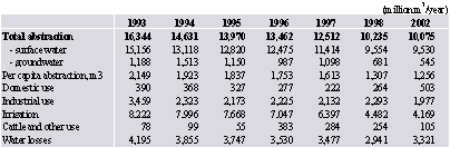
Source: Amelioration and Water Economy Committee January 2003
Water-supply coverage in Azerbaijan is estimated at 50%, which is accordingly high in comparison with other countries with similar income levels.
The quality of potable water in the networks does not meet international standards. The limited data available indicate that bacteriological requirements are exceeded and minimum residual chlorine content is not met. There are several reasons for this. First, the surface water is highly polluted, and treatment is complicated and expensive; the second, the water treatment is insufficient (outdated facilities and lack of chemicals, e.g. chlorine); and the third, the water distribution network is leaking and operated intermittently, which allows the contaminated groundwater to enter the water network during periods of low pressure.
The municipal sewer systems and waste water treatment are not efficient. The industrial and municipal waste water have considerable influence on the quality of water resources. Serious loads of suspended solids, organic compounds, nitrogen, oil products and heavy metals are discharged to the Kura River and its tributaries. Almost high contents of pesticides are noticed in all rivers of the basin. Majority flora and fauna cannot survive under those conditions.
The condition of waste-water facilities is generally very poor in Azerbaijan. Lack of maintenance for more than a decade, the excessive flows due to leakage and infiltration, and the low standard of construction and materials are the main reasons for this. Discharges of insufficiently pre-treated harmful industrial waste water into municipal sewer systems impair the efficiency of the waste-water treatment plants not designed to deal with these loads.
The people uses swallow water dells in the most rural settlements, which are highly contaminated by chemicals being widely used both in state and private sectors of agriculture.
In addition to inefficient use of water, pollution of the main rivers of Kura basin is a very serious problem. The Kura River and its tributaries are already heavily polluted before they cross the borders into Azerbaijan.
Only communal sewage, thrown into Kura and Araz out of the territory of AR, consists more than 40,000 tons of nitrous-phosphorous compounds, which create 8 million tons of organic matter of phytoplankton photosynthesis and 3.5 million of the bacterial biomass in the reservoirs of AR. The intensive processes of "flowering" of water and oxygen absorption enhancement take place in three largest water-reservoirs of AR (Mingechevir, Shamkir, and Varvara).
The water of the river is not able to restore its natural stability due to enormous pollution with sewage and waste, in the lower part of course (since Mingechevir).
The most tense situation in waters of Kura commences after the confluence of Araz River carrying chemical weed/pest killers industrial waste of tens industrial works of Armenia.
Municipal and industrial contamination sources and agricultural pesticides from inside Azerbaijan added to the problem water from the Kura does not meet Azerbaijan potable water standards, even after conventional water treatment. This is a critical problem, because the Kura River is the main source of potable water in Azerbaijan.
The water of Kura is polluted by a number of small and medium-sized industrial (1,5 million m3/year) and communal enterprises of Mingechevir on the territory of Azerbaijan. The lower and mouth flows of the Kura water quality is negatively influenced by household sewage waters of the towns of Ali-Bairamli, Salyan, Neftechala.
As a result, the concentration of copper and phenols exceeded MPS by 5-10 times, oil products 1-3 times.
There is a weak system of main pipelines for water-supplying rural residents in Azerbaijan. More than 70% of people use water from open water sources subjected to multiway anthropogenic impact.
There are not dedicated open sources for water-supplying people of Azerbaijan. So, there is no any river, used for communal water-supply, with clearly defined zone of sanitary control. At the present, more than 2 million people in rural tracts feel the large deficiency in potable water and are necessitated to use highly contaminated water and hazardous to human health and life.
The irrigation canals serve as communal water supply sources in the most rural regions. The highly difficult situation is created in villages of Kura-Araz plain, where people use a water of Kura, Araz and their tributaries due to lack of suitable water sources, which are highly contaminated.
The available treatment facilities in Azerbaijan do not meet modern requirements. It is necessary to note, that only in 35 of 75 cities and region centers of the Republic have the treatment plants, the basic fund constitute mechanical one, besides they physically and morally worn out.
Only in 8 cities of the Republic there are biological installations for treatment of the sewage, but any of them does not function according to the said requirements.
2001 Water use for different demands (on the water entities)
In mln m3
|
The River basin, area of the basin and the river-bed |
Water use |
Water discharge rate in water supply system |
Complete water usage |
Total
|
Including for needs |
|
Household and public |
Manufacture
|
Irrigation
|
Water supply for the Agriculture |
Water supply for winter quarters |
Others
|
Repeated-systematic |
Periodic
|
|
1 |
2 |
3 |
4 |
5 |
6 |
7 |
8 |
9 |
10 |
11 |
|
Total On the Republic |
6413,76 |
408,46 |
2273,25 |
3689,31 |
20,14 |
2,95 |
19,65 |
328,69 |
1533,85 |
8276,29 |
|
1. The Kura River basin on the territory of the Republic (including the Araz River) |
Total:
|
5595,84 |
89,06 |
2110,59 |
3361,24 |
16,22 |
|
18,72 |
49,12 |
1522,93 |
7167,89 |
|
2. The Kura River boundary – Mingechevir (including the Araz River) |
Total:
|
1933,78 |
14,31 |
1534,35 |
377,65 |
2,00 |
|
5,47 |
49,08 |
1522,93 |
3505,79 |
|
3. The Kura River boundary – Mingechevir (the Araz River is not included) |
Total:
Kura River-bed
Haramichay
Aghstafachay
Akhum (Hassansu) Tovuzchay
Asrikchay
Zayamchay
Shamkirchay
Qoshqzrchay
Gyanjachay
Iori (Qabarrichay) |
1764,40
1610,52
2,91
66,69
0,02
5,13
2,05
69,43
7,64
61,47 |
11,11
8,10
0,88
0,01
0,32
0,76
1,04
3,96 |
1530,11
1530,01
0,01
0,01
0,00
0,02
0,07
0,93 |
219,92
71,16
2,91
63,81
4,81
2,05
68,65
6,53
56,58 |
2,00
2,00 |
|
1,25
1,25 |
44,08
44,08 |
1522,93
1522,90 |
3331,40
3177,50
2,91
66,69
0,02
5,13
2,05
69,43
7,67
61,78 |
|
4. Alazan (Qanikh chay) basin on the territory of the Republic |
Total:
Alazan River-bed Mazimchay
Balakanchay
Katekhchay
Talachay
Qarachay
Kurmukhchay
Mukhakhchay
Shinchay
Kishchay
|
169,39
1,77
11,17
3,44
3,85
8,82
21,46
22,49
11,13
18,75 |
3,20
0,27
0,41
0,01
0,31
0,04
2,11 |
4,24
0,23
0,01
4,00 |
157,73
1,77
10,90
3,44
3,21
8,82
21,45
22,18
11,09
12,64 |
|
4,22 |
5,01 |
0,01
5,00
|
|
174,39
1,77
11,17
3,44
3,85
8,82
21,48
22,50
11,13
23,75 |
|
1 |
2 |
3 |
4 |
5 |
6 |
7 |
8 |
9 |
10 |
|
Ayrichay
|
66,52 |
0,06 |
|
62,24 |
|
|
4,22 |
|
|
66,52 |
|
5. Kura River Mingechevir – mouth (including the Araz River) |
Total:
|
3662,05 |
74,75 |
576,24 |
2983,59 |
14,22 |
|
13,26 |
0,04 |
0,00 |
3662,10 |
|
6. Kura River Mingechevir – mouth (the Araz River is not included) |
|
Total:
Kura River-bed
Kurekchay
Koranchay
Injachay
Oghuzchay
Alchiqanchay
Tartar
Vandamchay
Demiraparchay
Hamzalichay
Bumchay
Tikanlichay
Turyanchay
Gyoychay
Girdmanchay
Talishchay
Akhokhchay
Aghsuchay |
2640,27
2389,43
14,85
11,85
11,87
17,92
20,86
56,13
1,76
5,14
0,75
1,68
1,06
47,50
23,92
21,96
1,94
2,66
8,99 |
70,53
5059
0,,24
0,16
8,27
2,08
0,34
8,67
0,17 |
574,35
574,33
0,02
0,00 |
1969,36
1753,39
14,59
11,68
11,87
9,65
20,86
39,83
1,76
4,10
0,75
1,68
1,06
38,83
23,92
21,79
1,94
2,66
8,99 |
14,22
1422 |
|
11,81
11,11
0,70 |
0,04
0,02
0,02 |
0,00
0,00 |
2640,31
2389,45
14,85
11,85
11,87
17,92
20,86
56,13
1,76
5,14
0,75
1,68
1,06
47,50
23,92
21,98
1,94
2,66
8,99 |
|
7. Araz River basin on the territory of the Republic |
Total:
|
1021,79 |
4,22 |
1,89 |
1014,23 |
|
|
1,44 |
|
|
1021,79 |
|
8. Araz River on the territory of Nakhchyvan Autonomous Republic |
Total:
Araz river-bed
Arpachay
Nakhchivanchay
|
186,91
80,71
105,75
0,44 |
1,68
1,68
0,00 |
0,01
0,01 |
185,21
79,02
105,75
044 |
|
|
|
|
|
186,91
80,71
105,75
0,44 |
|
9. Araz River boundary – mouth |
Total:
Araz river-bed
Kondelenchay
|
834,88
834,88 |
2,54
2,54 |
1,88
1,88 |
829,02
829,02 |
|
|
1,44
1,44 |
|
|
834,88
834,88 |
|
|
|
|
|
|
|
|
|
|
|
|
|
|
|
|
|
|
|
|
|
As a result of unsatisfactory operation of the sewage disposal plants in the majority of the populated areas, located along the Kura River and its tributaries, the polluted flows enter in the river. All these contaminations destroy the whole ecosystem of the Kura and Araz Rivers, thus cause huge damage to unique water system of the Caspian Sea, where the Kura River finally runs.
The water resources of Azerbaijan are limited. Water resources are distributed and used rather inefficiently.
About half of water is lost in the system of distribution because of shortage of the water supply network, and also its deterioration.
The potable tap water provides needs less than 50 % of the population, and some objects feel shortage of stocks of the potable water.
.More than 80 % of the population live in conditions of an out-of-date water service facilities and the sewerage in the Republic.
Rivers flowing into the limits of Azerbaijan bring water in the compound of which the pollution content exceeds fixed norm at 5-10 times.
Utilization of polluted water of these rivers for irrigating and household needs has resulted in sharp contamination of soils by copper and molybdenum, decrease of productivity of agricultural plants and animals, has retarded development of undergrowth and has resulted in development of various pathological changes and diseases. More than 40 thousand hectares of a flat part of the zone nowadays has turned out salinized, and a principal cause of salinization is a utilization of highly - mineralized and polluted water.
The population of the Republic receives a water from 165 communal and 577 departmental water pipelines for economic drinking purposes, including the population of 279 rural and 16 administrative areas receive water of group of water pipelines (Salyan, Lenkoran, Sabirabad, Saatly, Nakhchyvan, etc.). The groundwater and surface waters of the river of the Kura are accepted as a source of water supply in group of water pipelines.
At present the Sabirabad water pipeline group, Ujar, Khachmas, Mil, Nakhchivan, the first line of Salyan-Astara water pipeline group is partially operated. The water pipelines group provides about 500 populated areas, 2 million rural populated areas.
Neither of water pipelines group functions by the present moment to the full in connection with absence of reagents and chlorine-contained substances. There is no necessary equipment, reagents in laboratories.
The water pipelines group of Sabirabad, Salyan, and Shirvan lowland transmits without processing of Kura water to its consumer as economic and potable water.
The researches of potable water conducted in 1997 taken from Lankaran, Salyan, Ali-Bairamly, Geychai, Kazakh, and Akctafa did not meet "The Potable Water" STATE STANDARD No. 2874-82 on chemical parameters, particularly on a high level of mudiness.
Significant construction arrears in the piping lay-out networks, pressure-regulating structures in the zone of influence of water-pipelines group are observed that has an adverse effect on technical and economic parameters of group systems. It is necessary to provide simultaneously commissioning of the water mains and intrasettlement piping lay-out networks with structures on them for effective utilization of the water pipelines groups.
Unsatisfactory treatment of potable water conditions its danger in terms of epidemiology.
The water not always meets hygienic specifications after treatment at Kura water treatment plant, and in some cases, even after chlorination, basically on organoleptic (on mudiness) and bacteriological parameters..
There are periodically registered outbreaks of infectious diseases, particularly the intestinal ones in the Republic, connected to pollution of water resources.
The "Water and Health" Report (which Azerbaijan has ratified in 22.10.02) was signed in June of 1999, the basic goal of which was assistance at all the relevant levels to health protection and well-being of the person, restriction and reduction of spreading extent of water-related diseases..
It is necessary to take measures, that the population of transboundary basin of Kura River has been provided with pure water of high quality.
The water of the Kura, Araz and its tributaries is used for industrial purposes in mainly three ways as:
· cooling;
· cleaning;
· processing.
Major water using industries are power plants, chemical and oil industry, fertilizer, metallurgical mining etc.
Majority industries closed down due to the breakdown in economy. A number of them are slowly opened again. This does not go hand in hand with modernization of the production equipment resulting in even higher levels of pollution.
Hydropower
Hydropower is the most important branch for Azerbaijan.
The following large power stations are located on the water reservoirs in the basin of Kura River:
1. 380 МWt Shamkir HPS
2. 150 МWt Yenikend HPS
3. 369 MWt Mingechevir HPS
4. 16,5 MWt Varvara HPS.
Moreover, there are a number of power stations of smaller capacity in the basin of Kura River. The generated hydraulic power is used in various branches of the national economy.
Many water reservoirs are used for combined usage by water-power engineering and irrigation, which frequently results in the conflict of water use.
The largest water reservoir is Mingechevir Reservoir, located directly on the Kura River, on downstream from border with Georgia. Mingechevir water reservoir is a universal dam with volume of 16 km3, and length of 70 km and width of 14-20 km.
In the past, the Kura River and especially the Araz River were characterized by periodic flooding. Usually, the volume of spring flooding of the Araz River makes 500-1000 m3 per a second, but catastrophic flooding in volume of 10000 m3 per a second is registered in 1968.
The high level of flooding has been eliminated by construction of many dams and water reservoirs. It has reduced direct economic losses, but has resulted in reduction of the fishery. The basic stream of the Kura and Araz Rivers adjust 4 water reservoirs on the Kura River with general capacity of 18,4 km3 (Yenikend, Shamkir, Mingechevir and Varvara). Moreover, the part of regulation of the river is provided by 135 reservoirs located on inflows. All these reservoirs influence on hydroperiodicity of the river, downturn of peak flooding, reduction of the flooded and boggy territories.
The flood retarding protective structures along the banks of the Kura River make about 650 km/sec.
In general, the irrigation reservoirs are not primarily designed for flood storage reservoirs. However, most of the existing reservoirs are able to mitigate (part of) the effects of otherwise devastating floods. These reservoirs act as flood storage reservoirs whenever they have ample (dynamic) storage volume in comparison with the volume of the spring runoff of that particular river. No reservoirs exist in other rivers (or river sections), e.g. in the Araz River, where along both riverbanks high flood embankments have been constructed to prevent inundation of home and arable lands. It is quite enough, the fact that many of the spillway structures of reservoir dams have too low capacity which means that the dynamic flood storage capacity is larger than it should be under satisfactory spillway design conditions.
Transport environment
The rivers are a major transport environment for waste water and cooling water. Also, they are used to reduce salinization in irrigation regions. This coincides often with salinization in lower regions.
There are located waste polygons near the river banks in a lot of places. High water levels often result in the washing away of the waste downstream.
Navigation
The Kura can only be used for navigation in Azerbaijan downstream of the Mingechevir water reservoir. The Araz is not suitable for navigation. However, the Kura is rather shallow, which limits the carrying capacity. The water depth is further decreasing in the Kura delta. Dredging one river branch in the delta for navigation purposes is resulted in silting up of other river arms with flooding as a result of high water level.
Fishery
Significant resource was the fishery, particularly in bottom pools of the Kura River, but within last decades it has promptly come to decline.
Agriculture
Azerbaijan is a country with irrigated agriculture. Besides the largely water consuming oil-chemistry and coal iron and steel industry are well developed in Azerbaijan. The major part of fresh water is used in irrigated agriculture with mainly technical crops. Moreover, the great part of water is spent for pasture watering, ameliorative works, other agro technical arrangements (desalinization).
The usage of water for irrigation comprises 80% of all water-usage.
Azerbaijan is dependent on irrigation for most of its agricultural production. In 2002 4.2 billion m3 were used for irrigation. This constitutes 41% of total water abstraction, making irrigation the largest water user. The total area with installed irrigation is 1.45 million hectares (nearly 85% of the cultivated area). Since Azerbaijan become independent, the water use for irrigation has significantly dropped. In 1993, irrigation used 8.2 million m3, which is for 95 % more than in 2002.
The irrigation infrastructure suffers from a number of problems, including:
· Deterioration of infrastructure and pumping equipment due to insufficient maintenance;
· High reliance on pumped irrigation (over 500,000 ha), which in many instances would make the agriculture uneconomical, if the energy were valued at its real cost;
· Negligible contribution from users to operation and maintenance expenses;
· Inefficient water distribution and application.
It is estimated that 40-45% of the irrigation infrastructure is in need of rehabilitation. The inefficient use of water and the high water losses in irrigation are major problems in relation to water resources and soil.
Recent efforts to improve the situation have led to the establishment of institutional mechanisms for the collection and use of water charges and delegation of responsibility to water users.
A cumbersome water management system was created in Azerbaijan, including the irrigation network, drainage canals, water-pumping stations for redistribution of flowing-out, and the system of water reservoirs used for management of seasonal, annual and multiannual water usage. The length of water-collecting and drainage networks comprise 30,900 km, 10 km of which are closed lines. The length of irrigative canals is 64,300 km of which only 5,400 are covered by concrete. There are 90,000 hydro works at irrigation canals.
The complexity of irrigate infrastructure and irrational exploitation of irrigation systems, that in turn is caused by the out-of-date irrigation technology lead to enormous excessive consumption of fresh water. Only in agriculture the losses of water comprise 14,000 mcm, which is by 4,000 mcm larger than all the water flowing-out forming at the territory of the Republic. Moreover, the major part of irrigative and drainage canals have soil beds. The coefficient of efficiency of such canals is less than 0.5-0.6. The lack of good cover of irrigation networks and absence of ameliorative refining of canal beds lead to losses up to 50% of water. In communal and every-day sector water usage comprises only 1% of all excessive water consumption.
Use of pesticides and fertilizes in agriculture has also been a major source of water pollution problem in the past. Up to 180 kg/ha of pesticides was applied in some regions. As a result, pesticide and nitrate levels have exceeded in ground and surface waters which exceed the MPC. The use of chemicals has declined, however, since the late 1980-s.
Legislative and Political base
The legal framework for the water sector consists of the following laws:
· The Water Code (1997);
· The Law on Water Supply and Waste Water (1999);
· The Law on Amelioration and Irrigation (1996); and
· The Law on Environmental Protection (1999).
The Water Code sets the basis for water management in Azerbaijan and gives the following main principles for use and protection:
· Economic development and environmental protection;
· Provision of the population with quality water;
· Water management should be based on river basins; and
· Water protection functions should be separate from water use and water industry functions.
Meeting these objectives poses a big challenge. The present coverage with quality potable water is 50%. Water management is based on administrative units rather than river basins and there is very little coordination among the countries in the main river basin, the Kura. Although establishment of the Ministry of Ecology and Natural Resources has provided a clearer management structure in the water sector, overlapping functions and responsibilities remain.
The Law on Water Supply and Waste Water sets the legal framework for this sector. Its important features are as follows:
· Responsibility for providing water and sewerage services is given to enterprises;
· The management and operation of water-supply enterprises are to be regulated by a contract with the municipalities they serve;
· Enterprises now have the right to cut services to consumers in case of non-payment or illegal connections; and
· Metering of water supply is recognized as the main method for charging for water services.
The Law on Amelioration and Irrigation regulates the planning, design, construction and operation of amelioration and irrigation systems. It states that design and construction activities require special permits (licences). Systems have to be certified with technical passports.
The Law on Environmental Protection identifies the legal, economic and social bases of environmental protection. It governs the use of natural resources (e.g. water) and protection against pollution (e.g. domestic and industrial). The Law also sets the basis for economic mechanisms, e.g. payment for the use of natural resources, payment for the disposal of domestic and industrial waste, and economic incentives for environmental protection. The environmental requirements and approval procedures in connection with the construction or reconstruction of municipal and industrial facilities are defined in the Law. It includes a very detailed description of the ecological expertise to be conducted.
These laws are supplemented by a large number of decrees issued by the President and decisions issued by the Cabinet of Ministers.
Azerbaijan pursues the State water policy in the field of rational use and protection of water resources, including transboundary water-flows, based on the International water jurisdiction.
The purpose of the State water policy is maintenance of a safe and high-grade human inhabitancy in satisfaction of his demands. Thus, rights for high-grade environment neither other states, nor the future generations should not be broken.
The state water policy is intended to provide:
- Access of all layers of the population to safe potable water within the limits of hygienic requirements;
- Realization of the rights of the present and the future generations on using in environmentally high-grade water-resource potential;
- Equation of needs of the economy and opportunities of reproduction of environmentally high-grade water resources;
Achievement of the marked complex of the purposes is defined by the term of sustained water use and is a strategic purpose of a water policy.
The analysis of positive international experience, modern situation identifies the main principles of the State water policy:
· basin planning and territorial administration of the water economic activities;
· Constant and systematic reduction of harmful exposure on water entities and the water-efficiency;
· Stage-by-stage transition to self-financing of water sector of the economy;
· Transparency, wide involving of the public in process of preparation and decision-making.
Precisely formulated State water policy creates a platform for achievement of arrangements under the reasonable and fair decision of sharing, restoration and protection of transboundary water entities. The State water policy is intended to provide the followings:
- Access of all layers of the population to safe potable water within the limits of hygienic requirements;
- Realization of the rights of the present and the future generations on using in environmentally high-grade water-resource potential;
- Equation of needs of the economy and opportunities of reproduction of environmentally high-grade water resources;
· transparency, wide involving of the public in process of preparation and decision-making.
It is well-known, that the population and agriculture of Azerbaijan lack for qualitative water. There is felt sharp deficiency in water resources in a number of areas, particularly on Absheron Peninsula.
A number of the important actions are carried out for addressing of problems in the field of rational use of water resources. First of all it is necessary to adjust the strict account of consumed water, taking into account sharp deficiency of water per capita in Azerbaijan.
Implementation of the program on reduction of losses of water in the system of a water pipelines in urban zone is a question of priority importance.
Among the important problems there are rigid sanitary protection, for control of quality of water entities and potable water, harmonization of all standards with the international norms and creation of national state system of standards in Azerbaijan regarding rational use of water resources.
On the average and the long-term order, the water resources should be protected through investment into the construction of municipal sewer structures along the Kura River and in industrial systems on sewage treatment.
It is impossible to address all environmental problems of the country at once. The nature protection policy in Azerbaijan is determined by the National Environmental Action Plan (NEAP), directed on the addressing of the priority problems.
The basic environmental problems highlighted in the NEAP are the followings:
- The great damage from contamination of the environment caused by the manufacturing enterprises, oil producing, oil refining and energetic;
- Threat of irreciprocal reduction of stocks of the sturgeon caused by loss of reproductive capacity, and water pollution;
- Deterioration of water, especially potable one, both in rural, and in urban areas that can result in growth of the water-transferable diseases;
- Damage to coastal zone of the Caspian Sea, caused by water-flooding in connection with increase of the sea level and its contamination.
As priorities in due course vary, the NEAP will be periodically updated. Eventually, the choice of the priority environmental actions should start with the purposes of social and economic development of the country. Now, the nature protection purposes of Azerbaijan are focused on maintenance of effective utilization of natural resources, improvement of population health, prevention of sustainable losses of biological resources.
The economic mechanism of water management in Azerbaijan is based on realization of payable principle for water consumption. Payments for natural management, payments for discharge of pollutants into the natural environment and use of the means from collection of the specified payments have been enacted by the Decision of the Cabinet of Ministers of Azerbaijan Republic No. 122, dated on March, 3, 1992.
The basic instruments regulating the legal issues in the Republic on water resources, are the Water Code adopted in December 26, 1997 and “the Law on the Environment”, adopted in June 8, 1999.
At the present time, Azerbaijan Republic ratified 16 main international conventions, including the Convention “On Protection and use of Transboundary Watercourses and the International lakes“ (The Water Convention), and also “the Water and Health” Protocol thereto. However, unfortunately Georgia and Armenia under inexplicable reasons still were not parties to the Water Convention, being so important.
Potentially, Azerbaijan has not enough resources to satisfy the requirements for potable water of the population and agriculture. Shortage of water also occurs because of irrational use and leakage of water in the main pipelines. So, for example, disharmony to technical requirements of network systems results in water losses in the greater quantity.
The fair addressing of distribution of regional water resources is necessary for Azerbaijan, which has the limited water reserves. Approximately 70 % of water resources of the country are formed in the territories of neighboring countries and annual water deficiency constitutes 4 billion cubic meters. Because of location of ¾ territories of the country in the downstream of the Kura River basin, up to 700 million cubic meter of polluted water is discharged annually from the territories of the next republics that lead to input of already polluted transit water to Azerbaijan and to ecological intensity.
As it has been marked above, the basic problem of Azerbaijan is the small potential of water reserves to provide the population with drinking water and for agricultural needs. Other problem is contamination of the largest waterway of the country of the Kura River by the neighboring republics as Georgia and Armenia by household and industrial wastes. The urgency of this problem is expressed that 80 % of the population of the country uses the waters of the Kura River in drinking purposes.
However it is necessary to note, that there are implemented projects similar per se and duplicating each other in the Caucasian region with participation of the international organizations. Just, 5 Projects on monitoring and assessment of Transboundary Rivers are carried out in the South Caucasus. Furthermore, some more projects on development of legal baseline are stipulated therein. However, concrete measures are not carried out to address of the given problem, i.e. to prevent the contamination. It is necessary to coordinate the realized and planned projects for this purpose at the international level.
Azerbaijan Republic ratified the Helsinki Convention “About Protection and use of Water Resources and the International lakes” for the solution of problems of transboundary water basins at the regional level pursuant to the international norms and we call also other states, particularly neighboring countries to be parties of the given Convention..
Reception of the information on pollution of the Kura River basin outside of our country has become extremely inconveniently because of occupation of 20 % territory of Azerbaijan Republic by Armenia.
As a result of absence of the ecological control, natural monuments are destroyed, the natural resources are used barbarously and process of contamination of the water reserves is observed.
Unfortunately, the process of pollution of water resources is continued in the territory of the Republic as well. Part of the territory of the country is not provided with treatment plants. There is a great need for their reconstruction because of unfitness of the treatment plants.
The discharge in water basins, including to the Caspian Sea untreated waters with industrial and household wastes, in its turn, creates other ecological problems. It is necessary to note the basic ecological problems of the Caspian Sea, for example contamination of the sea water area, reduction of number of biodiversity, bioresources, particularly sturgeon, damage of the coastal infrastructure because of fluctuation of the sea level, desertification of the coastal zones, negative influence of Mnemiopsis dog's-tail grass. The Ministry has developed the National Action Plan on the Caspian Sea to address the given problems. All environmental issues of the Caspian Sea are investigated, the priority measures under the solution of these problems are aimed and on main directions of the project proposals are created in the given Plan.
Alongside with their solution at local level the Ministry will carry out the regional cooperation on the given directions as well, taking into account the transboundary nature of these issues.
As instance, the Caspian Environment Program can serve to solution of these issues carried out by five littoral countries.
Improvement of social and economic condition of the country and provision of sustainable development directly depends on provision of environmental balance. At the present time, several alternative versions on social and economic development of the country have been created. Issues of industry, agrarian sector, social sphere, environment, science and education are reflected in the programs. Addressing of these strategic problems will allow to increase well-being of the population in the future without prejudice to the environment.
Numerous action plans (“the National Program on Restoration and Development of the Forests”, “the National Program on Sustainable Environmental Development”, “the National Climatic Program”, “the Program on Erosion Control of Lands” and so forth) have been drawn up to address the relevant issues and strengthening of correct management of the environment in Azerbaijan Republic.
It is necessary to note also, that Azerbaijan Republic has achieved definite results in the sphere of social and economic development for the last years which was reflected in the national and international instruments. Sustainability in achievement of results in the social and economic spheres is the basic priority for the country. It is considered, that more optimal results will be achieved after implementation of the National Program on Sustainable Development.
The given program prepared by the Ministry for Ecology and Natural Resources has been adopted by the Decree President of Azerbaijan Republic No. 1152, dated on, February 18, 2003. The National Program serves to implementation of principles of the “Sustainable Development” Concept accepted by the world community.
The National Program consists of the following sections: the population and manpower, protection of the environment and rational use of the natural resources, the global environmental issues, industrial complexes, agriculture, tourism, science, education and culture.
According to this program, the state program on rational use of the water reserves is planned, stimulation of the rational use of the water reserves, improvement of quality of potable water according to the relevant standards, updating of the laws regulating action of ecosystems, protection of transboundary rivers from pollution, and involvement of the states to rational use of the waters which are located in their basins and so forth is encouraged. With this purpose active dialogues at the regional and international levels will be carried out.
Unfortunately, it is impossible to carry out many of the above-said measures, because of financial difficulties of the country, being in the transition period. That is why, it is needed the assistance of donor countries and the international financial institutions.
Priorities for Azerbaijan Republic are environmental control and achievement of rational use of natural resources pursuant to the national program on social and economic development from the ecological point of view. The given Program, being an integral part of the Strategy of Development of the country is aimed to coordination of national, regional efforts on environmental control, realization of principles of development on scientific trends, providing of sustainability for the present and the future generations in use of economic and human resources. Also one of the important trends is the coordination of the efforts of the public and not-governmental organizations in environmental control sphere.
Generally, the given national program should serve to make changes in use of natural resources and economic activities, realization of the newest technologies according to ecological requirements, optimizing the industrial manufacture and agriculture to achieve concrete results of quality of air, water, targeted and rational use of lands and other natural resources.
Great attention is paid to introduction of types of alternative power and fuel for providing of the sustainable development. To this effect, the undiverted attention is given to these issues in programs and projects prepared in the Republic.
Alongside with providing of sustainable development, realization of above mentioned measures promotes to simultaneous realization of principles of Johannesburg Summit.
Several national programs have been adopted in the Republic, including “On Sustainable Social and Economic Development from the Ecological Point of View”, “On Restoration and Enhancement of the Forests, “the State Program on Reduction of Poverty” and so forth.
The targeted measures on searching for potable drinking water sources and creation of the conforming resources, creation of sewer systems adequate to state-of-the-art demands, construction of treatment plants and establishment of the ecological balance in the Caspian Sea are carried out in this direction. The basic purpose is provision the population of the country by pure potable water up to the years 2015.
Shortage of financial resources does not allow to make changes in these spheres. Therefore, implementing in the practice small projects, measures on provision of various regions of the country with the treatment plants working in off-line operation will be taken. The majority of these projects are developed according to high technologies of the developed countries in the given sphere.
Transboundary activities
There is regional communication restarting between the Hydrometeorology of Georgia and Azerbaijan, and Georgia and Armenia on water quantity.
Bilateral agreements:
The following agreements exist for bilateral communication and/or cooperation relating to the Kura River, mainly between Azerbaijan and Georgia:
· The Protocol on Results of Negotiation between the Governmental Delegations of Georgia and Azerbaijan Republic on Water Resources Usage (27. 12. 1997)
· Memorandum of Understanding among the Ministry of Environment of Georgia and the State Committee for Ecology and Natural Resources of Azerbaijan Republic on Collaboration in the Development and Implementation of the Pilot Project On Monitoring and Assessment in the Kura River Basin (16.09.1997)
· Agreement between the Governments of Georgia and Azerbaijan Republic on Collaboration in the Environmental Protection (18.02.1997)
Alongside with this, there are some agreements between related agencies of mentioned countries on use of Gandar Lake (Georgia and Azerbaijan).
Hydrometeorological services also agreed to share information about hydro meteorological conditions of the Kura River basin. However, the exchange of information is very weak because of economical problems and, mainly because of the absence of required water parameter measurements on the territory of Georgia.
The deteriorating water quality of the Kura River is a major problem for Azerbaijan. It cannot be solved without involving Armenia and Georgia. Although multilateral negotiations cannot take place at the political level at present, initiatives by international organizations have made technical cooperation possible. This will be very important for the preparation of political discussions once this will again be possible.
There is a great number of water related projects in the Kura basin, recently finished, going on or in the pipeline. The projects can be divided into: water management (quality and quantity), potable water supply and waste water management, irrigation and drainage, environmental policy, awareness raising, local initiative. Major funding organizations in the water management related fields are:
World Bank EU, Tacis, USAID, UNDP/GIEF, EBRD, IDB, SADC, GTZ/KfW.
Averagely, there is good cooperation between the projects and lot of efforts are being put into harmonization between them.
One of the problems is that the governments do not have an overview of the projects going on in the countries or regions.
UNDP and Tacis JRM are trying to reduce this by regularly organizing coordination meetings in the field of (water) environment.
For example:
It is agreed between Tacis JRM and Tacis NEAP 2 that the first will not focus on standards and economic instruments;
It is agreed with USAID – DAI that Tacis JRM will focus on water quality and USAID on water quantity, database management and together on IRBM, public awareness and legislation, where USAID takes the introduction and Tacis JRM is taking over.
The USAID will focus on regional level, water quantity and improvement of Legislation of Azerbaijan Republic, TACIS JRM:
on Water quality monitoring and harmonization of legislation, standards; provide UNDP with the data for the assessment and support the selection of hot spots of pollution.
DANCEE will concentrate on potable water aspects.
TACIS will make a basic plan for emergency warning systems with the German Ministry of Environment and they will work further in the field of prevention and implementation; with the WB irrigation and drainage project the common selection of monitoring points; with the WB the sharing of water utilization information; with the WB ICZM project sharing of outputs and experience.
Institutional and Regulatory Basis
The following ministries and institutions are involved in water management:
· The Ministry of Ecology and Natural Resources;
· The Ministry of Health;
· The State Committee of Amelioration and Water Economy;
· The State Committee of Architecture and Construction;
· The Absheron Regional Water Company;
The Ministry of Ecology and Natural Resources has overall responsibility for the conservation of water resources and the prevention of pollution. In the process of establishing the Ministry, a number of State committees and other organizations were transferred and became departments in the new Ministry, and several of these are involved in the water sector: the National Geological Exploration Service is responsible for the regulation and control of groundwater abstraction, the National Hydrometeorological Service is responsible for surface water monitoring, operating of 99 Hydrometeorological stations and publishing the results in an annual report. Water quality monitoring in surface water and groundwater is the responsibility of the National Monitoring Service.
The Ministry of Ecology and Natural Resources issues waste-water discharge permits, which are valid for 3 to 5 years. Its regional offices control and enforce discharge permit conditions.
The Ministry of Health through its Centre for Epidemiology and Hygiene is responsible for setting drinking-water standards and monitoring its quality.
The State Committee of Amelioration and Water Economy is responsible for monitoring water use and issues annual reports based on information from water users (1860 users in 2002). The Committee’s activities focus on irrigation, for which, it sets water-use norms and handles user relations, for example. It is also responsible for establishing the charges for water use. In addition, it is in charge of land improvement on irrigated land, and the operation and maintenance of the irrigation infrastructure.
The State Committee of Architecture and Construction is responsible, among other things, for water-supply and waste-water services outside the supply area of the Absheron Regional Water Company. The Committee works through the municipal water and waste-water enterprises (vodokanals) in urban areas. The Committee is meant to have an advisory and monitoring role; however, due to the relative weakness of the municipalities, the Committee has taken on a managing role too. Rural water supply also falls under its responsibility.
Absheron Regional Water Company is a joint-stock company responsible for the treatment and distribution of water to Greater Baku, including bulk water supply to the vodokanals of Absheron and Sumgayit. The Company’s share capital is fully owned by the State.
The Laws regulating water use and protection:
- Constitution of Azerbaijan Republic, 12.11.2003
- Law on Environmental Protection, 10.08.99
- Water Code, 26.12.97
- Law on Water Supply and Waste Waters, 31.01.00
- Law on Ecological Safety, 14.08.99
- Law on Amelioration and Irrigation, 26.09.96
- Law on Sanitary-Epidemiological Well-being, 10.11.92
- Law on Municipal Water Supply, 29.06.01
Regulations on water-related issues of the Cabinet of Ministers:
- Breakdown of specially protected water entities into the categories, 01.05.00, N 77
- State control on use and protection of water entities, 25.09.98, N195
- Identification of sites for facilities, complexes and objects affecting the condition of water; co-ordination of their construction project; state expertise and exploitation rules, 28.09.98, N 197
- Regulations on use and protection of water entities, 15.10.98, N206
- Elaboration of water use limits and detailed protection plan, their coordination, state expertise, state approval regulations, 15.10.98, N206
- Approval of water use plan in farming and water use system, 15.10.98, N206
- Approval order of intrafield water use plans and system planning on water use, 15.10.98, N206
- Statue on water use for recreational and sport purposes, 22.10.98, N216
- Delimitation of water protection zones, their protection strip’s extent, borders and use, 24.03.00, N56
- Water entities’ management towards hydroenergy needs, 6.12.00, N216
- Decision on release of statute-banned factory wastes and types of institutions, 13.07.00, N122
- State water resources assessment, 17.01.00, N7
- Regulation on utilization of water entities for fish-breeding and hunting farms, 08.05.2000, N 82
Former Committee for Ecology and Control of Nature Use and Ministry of Health approved “Protection of Surface Waters from Wastewater Pollution”, 04.01.93.
Standards, used in water supply:
- Government standard (GOST) 2884-82 “Potable water. Quality control”.
- Construction norms and principles (CNP) “Water consumption”.
The Ministry of Ecology and Natural Resources and Amelioration and Water Economy Committee are implementing State control over management and protection of water entity in the Azerbaijan Republic. State control is implemented based on appropriate statues and other normative legal documents of relevant institutions.
Main objective and functions of this control are that all of legal entities and physical persons should follow rules of proper management of water entities and their protection irrespective of the ownership forms.
The Ministry of Ecology and Natural Resources, Amelioration and Economy Committee, the Construction and Architecture Committee and Absheron Regional Joint-Stock Community are implementing the State control over management of water entities in Azerbaijan Republic.
Brief description of Laws on Water Resources Management and Protection
The Constitution of the Azerbaijan Republic:
Guarantees the right of healthy environment, access to environmental information, compensation for damages to the person’s health and property.
The Law on Environmental Protection:
Defines the legal, economical and social base for the environmental protection. Purpose of the law is to ensure ecological safety, prevent from industry and other related harmful impacts to natural ecosystems, conservation of biodiversity and efficient use of nature for protection of ecological balance of the environment.
This law regulates the improvement of environmental quality, efficient management of natural resources and their rehabilitation, relation between the society and environment for strengthening of environmental rules and legislation.
The Water Code:
Regulates the legal aspects related to the management of water entities and protection. Inland waters of Azerbaijan Republic, appropriate part of the Caspian Sea are national wealth of the Republic and are used and protected by local population for their daily life and activities and ensures the existence of flora and fauna.
The Water Code defines the basic principles of balance of the water economy, which is prepared for the whole country, separate water basins and administrative territories. The Water Code also regulates the issues of the preparation, coordination of the state expertise of approval, realization of the complex scheme of use and protection of water resources, state water inventory, state water account, state monitoring of water entities. The Water Code reflects all the main issues of the regulation of legal relationships of water resources and entities.
On the basis of the principles of the Water Code, the Cabinet of Ministers of Azerbaijan, the Ministry of Ecology and Natural Resources, the State Committee of Amelioration and Water Economy have approved many law accountable normative legal acts on water resources.
Presently, there is functioning the comprehensive and complicated complex of water economy, wide network of irrigation and drainage canals, water-engineering schemes, pumping stations and the system of regulating water reservoirs in Azerbaijan Republic.
The Law on water supply and waste waters:
regulates supply of population, institutions and organizations with water standardized by state water quality requirements in the necessary amount; regulates relations within wastewater release issues.
The Law on ecological safety:
Regulates ecological safety relations of activities of individuals and corporate persons, state organizations and municipality, and their functionaries. At the same time, the law identify legal basis for the protection of water entities from danger caused by natural and artificial impacts.
Registration of water entities and resources
Water resources and water entities are registered through the existing single system in the state water inventory (Water Code, p.26). The State Committee of Amelioration and Water Economy and the Ministry of Ecology and Natural Resources draw up the state water inventory (Decree of the President of Azerbaijan Republic, paragraph 2). The state account and registration of the ground water resources is carried out by the relevant service of the Ministry of Ecology and Natural Resources.
Measures on the protection of water resources:
Water legislation and environmental legislation envisages the complex of measures and legal standards on the protection of water resources and water entities (The Water Code of Azerbaijan Republic, chapter 14, p-p. 81-95), specifically the protocol of surface and ground waters, water entities from pollution, drying up, and other pernicious impacts. Also the Government of the Republic has approved a number of decisions determining the rules of the state monitoring of the operation and protection of water entities. The Law "About Water Supply and Wastewaters defines the concrete measures and standards of sanitary supervision.
Protection of the aquatic animal world
Protection of the aquatic animal world of all the water reservoirs of the country is carried out in compliance with the requirements of the Water Code, laws of the country "About Animal World" (1999), "About Fishery (Fishing)" (1998), "About Protection of Environment" (1999), "About Especially Protected Natural Territories and Entities" (2000), relevant law accountable acts approved by the Government of the Republic. Pages 66-73 of the Water Code give a detailed description of the aquatic animal world protection envisaging the restrictive requirements of putting into operation the water entities impacting on the conditions of commercial fishery water without providing the respective conditions for the protection of fishing and other resources of aquatic animal and vegetation world. The same legislative acts also ban putting into operation the hydro technical and water abstracting facilities equipped with the respective devices for fish protection or fish passes (p-p.69-70 of the Water Code).
Water protecting zones
Pursuant to the legislation of the protection of the environment and water resources, special water protection zones (lines) are established within every water entity. The width of the zones along both banks from the river edge is defined in the following way:
For up to 10 km length rivers - 50 m.
For rivers from 10 to 50 km - 100 m.
For rivers from 50 to 100 km - 200 m.
For rivers from 100 to 200 km - 300 m.
For rivers from 200 to 500 km - 400 m.
For more than 500 km length rivers - 500 m.
The protection zone for lakes and water reservoirs is defined in the following way:
For up to 2 km 2 area water reservoir - 300 m.
For more than 2 km 2 area water reservoir - 500 m.
The protection zone of main canals and collectors is defined in the following way:
With the carrying capacity:
Up to 3 m3/ 1sec - 5 m.
From 3 to 10 m3/1sec - 10 m.
From 10 to 30 m3/sec - 25 m.
From 30 to 50 m3/ sec - 60 m.
More than 50 m3/sec - 100 m.
Pursuant to the Water Code (p85) and other normative acts the zones of sanitary protection are established for the protection of the entities of drinking and household purposes, medicinal and health resort needs.
Monitoring of water resources pollution
The Water Code of Azerbaijan Republic stipulates the measures and legal regulations of the monitoring of the pollution of water entities (p-p.84-93). According to the water legislation and the legislation of the protection of environment the baseline monitoring of the conditions of water resources is being carried out by the Hydro Meteorological Service of the Ministry of Ecology. The Cabinet of Ministers of Azerbaijan Republic defines the order of monitoring procedure.
The National legislation of the Republic defines the payment rates for the discharge of injurious substances.
Payment for the use of water resources
The water resources use is payable on the territory of the Republic. It is stipulated by the water legislation of the Republic. Rates are defined by the Government of country for the surface and ground water resources: for the industrial, hydro electro power, irrigation needs, municipal economy, potable water supply, and sewerage service.
Licensing of water use
Pursuant to the water legislation of Azerbaijan Republic special water use (drinking, household, irrigation, industrial, hydro power water supply) should be licensed. The order of licensing is defined by the Cabinet of Ministers of Azerbaijan Republic.
The license for the use of water entities is issued respectively by the Ministry of Protection of Ecology and Natural Resources, the State Committee of Amelioration and Water Economy, JSC "Absheron ", the State Committee of Architecture and Construction.
The water use of transboundary water entities of the country is carried out in compliance with the requirements of the international conventions and interstate (intergovernmental) agreements.
Responsibility for the violation of water legislation
The water legislation of the country envisages the administrative and criminal amenability in cases of the violation of ownership of water resources and water entities, right of water use, protection regimen of water entities, water protection zones and sanitary protection zones, in cases of pollution of water and other requirements of the water and environmental protection legislation.
Norms and standards
The design of water-supply and waste-water infrastructure is based on the building codes developed during Soviet times known as SNIP standards. These standards set high consumption rates, usually 400 liters per capita per day (lcd). Furthermore, they require a high level of supply safety (e.g. duplication of main pipelines and high storage capacity). The result is oversized and therefore costly systems. The standards lead not only to over production but also to wasteful consumption practices.
The quality of potable water must comply with World Health Organization (WHO) standards. Most water-supply systems have difficulties in meeting these standards. While they are certainly a commendable goal, it might be better to achieve a minimum acceptable level of safe potable water. Additionally, the large number of parameters and the high sampling frequency would require very sophisticated equipment and many staff. The result is little follow-up on water quality and compliance.
Azerbaijan’s effluent standards for waste-water treatment plants are among the most demanding in the world. For example, the standard for BOD is set at 3 mg/l for fishing water and 6 mg/l for other waters. Standards for other pollutants are similarly strict. In comparison, the EU standard for BOD is 25 mg/l. In Azerbaijan waste water is chlorinated. This is unnecessary and actually gives rise to harmful organochlorine compounds in the effluent. The strict requirements for waste-water treatment naturally increase the construction and operation cost of waste-water systems.
Charges are levied on surface and groundwater abstraction as well as on use. The charges were introduced in 1992 to stimulate the rational and integrated use of water and to raise funds for water protection. However, the rates have not been adjusted to take account of the high inflation in the 1990s.
Charges on waste-water discharge were also introduced in 1992. The rates are again very low and so is the collection rate, which weakens the effectiveness of the charge system. Furthermore, the near collapse of the charge system has eliminated the primary source of financing for monitoring and enforcement.
Consumers are charged for water-supply and waste-water services. The tariff systems are based on heavy cross-subsidies from industry to domestic users. The rates for domestic users are very low. The Absheron Regional Water Company charges 185 manats/m3 or US$ 0.04 /m3). The rates for budget organizations and industries are 800 manats/m3 and 2,200 manats/m3 respectively. At the same time the Company’s collection rate is low: 80%. Although the rates are based on consumption, there are few water meters (only 1.1% of the Company’s domestic customers have water meters), so in fact a flat rate of 12 m3 per person per month is used. The rate of metering is higher for industries; 52% of the Company’s industrial customers have meters. The revenue collected by the Company does not cover its operating cost and as a result the Company is itself in arrears, especially with its energy bills.
In the provincial town of Imishli, where a German company has signed a 10-year management contract (2000 to 2010) for the water-supply system, the rates per m3 have been set at 1,000 manats for domestic use, 3,000 manats for budget organizations and 5,000 manats for commercial use. Water use is metered, and the revenue covers the investment and operating costs. The project is meant as a pilot for provincial towns and the company is considering similar projects in two other towns.
The water sector of Azerbaijan faces enormous problems. Adverse climatic conditions with low precipitation and high evaporation cause widespread water shortages. Poor-quality water-supply and irrigation networks cause very high losses. Payment systems are not based on actual water use and therefore give no incentive to save water. Water resources are polluted owing to the lack of waste-water treatment plants in Azerbaijan and neighboring countries. The quality of potable water does not meet even minimum standards. Owing to inflation, economic instruments such as abstraction charges and user fees have become meaningless.
The Government of Azerbaijan has taken a number of steps to reverse this negative situation. The most recent of these is the National Programme on Environmentally Sustainable Socio-economic Development launched in February 2003. It includes a number of specific actions aimed at improving the situation before 2010. The following recommendations in most cases coincide with the Government’s plans and should therefore be considered as support to its efforts.
Many of the problems mentioned above are related to the lack of efficient cooperation among the stakeholders in the water sector. The creation of the Ministry of Ecology and Natural Resources was a clear improvement in this respect. The State Committee of Amelioration and Water Management focuses on water regulation and irrigation. The water-supply interests are defended by the Absheron Regional Water Company and the State Committee of Architecture and Construction. Waste-water management involves a number of entities: Baku and Sumgayit executive authorities, the State Committee of Architecture and Construction and industries. Others with an interest in water include: hydropower-generation plants, farmers’ associations and domestic water users. All these stakeholders should be involved in establishing a common vision for the water sector. The basis should be a river basin approach rather than an administrative, territorial approach.
Conventions Ratified by Azerbaijan Republic
|
Name |
Date of ratification |
|
1. Convention "On the protection of the world cultural and natural heritage”, Paris |
06.12.1993 |
|
2. UN Framework Convention “On Climate change”, Rio De Janeiro |
10.01.1995 |
|
3. Convention “ On the protection of the ozone layer”, Vienna |
31.05.1996 |
|
4. Convention “ On the prevention of pollution from ships”,
MARPOL, London |
22.04.1998 |
|
5. UN Convention “To combat desertification in those countries experiencing drought and/or desertification, particularly in Africa”, Paris |
24.04.1998 |
|
6. Convention “On International trade in endangered species of wild fauna and flora (CITES) ”, Washington D.C. |
23.05.1998 |
|
7. Convention “ On Environment impact assessment in transboundary context”, ESPO ( Finland) |
01.02.1999 |
|
8. Convention “ On the conservation of European wildlife and natural habitats”, Bern ( Germany) |
28.10.1999 |
|
9. Convention “ On access to public information, public participation in decision-making and access to justice in environmental matters”, Aarhus, Denmark |
09.11.1999 |
|
10. Convention “ On biological diversity”, Rio De Janeiro |
14.03.2000 |
|
11.Convention “ On Protection and use of transboundary water sources and international lakes”, Helsinki Protocol “Water and Health” |
14.03.2000
22.10.2002 |
|
12.Convention “ On Plant protection”, Rome |
14.03.2000 |
|
13.Convention “ On wetlands of international importance especially as waterfowl habitat”, Ramsar |
18.07.2000 |
|
14.Convention “ On the control of transboundary movements of hazardous wastes and their disposal ”, Basel |
16.02.2001 |
|
15.Convention “ On long-range transboundary air pollution,”
Geneva |
09.04.2002 |
|
16.Convention “ On persistent organic pollutants ( POPs),
Stockholm |
09.12.2003 |
Threaten for the Kura River
Main issues:
Scarcity
Organic pollution
Hazardous pollution
Erosion / sediment load
Scarcity
Azerbaijan has the highest negative water balance. It depends widely on the Kura and the Araz. Besides that, only limited good quality underground water resources are available. This makes Azerbaijan the most vulnerable for scarcity.
Organic pollution
Organic pollution is induced by none or hardly working municipal waste water treatment systems (MWWT). They are only functioning mechanically up to around 50%. Effectively the treatment capacity of the working MWWs does not go over 20%.
Hazardous pollution
Hazardous pollution comes mainly from a limited number of mining, metallurgic and chemical industries. Major pollutants are heavy metals (Cu, Zn, Cd) from mining the leather industry, ammoniac and nitrates from the fertilizer industry and a number of chemical ingredients from chemical industries producing glue, acetyl-vinyl. The hazardous pollution limits the use of water for potable water and irrigation.
Diffuse sources of organo-chlorine pesticides, like DDT, are the main polluters. Source of these is not sure; it may be old stock or illegally produced or imported.
Erosion /Sedimentation
It is caused by deforestation and over-grazing (Soviet period) and by flood irrigation. As result of this, irrigation lakes are faced with filling up with sediment, irrigation canals need more intensive cleaning up. For Azerbaijan there are the additional problems of preparing potable water out of the highly sedimented surface water.
Other issues
Eutrophication is not a problem due to the low level of phosphated soap use and phosphate fertilizers. Due to this fact and the high flow of the rivers the eutrophication gets little chance either.
Anthropogeneous problems
Deforestation
Large scale deforestation all over the South Caucasus is the driving force behind the erosion, sediment load and sedimentation problems all over the countries. As result water reservoirs are increasingly filled up with sediment, resulting in low water quality and flooding upstream and downstream.
Flood irrigation
At the same level as deforestation flood irrigation is inducing a high sediment load, causing sedimentation downstream and therefore flooding in the river delta. Also the irrigation canals themselves have problems with sediment blocking the flow and requiring more intensive management. The sediment load is a serious problem for potable water supply.
Non-working sewage systems
None of the Municipal wastewater treatment plants in the basin is operating. The most which can be expected, is a mechanical treatment of 30-40 %. This is the case for major cities. For smaller towns the MWWT is not working at all.
Diffuse sources
Main sources of diffuse pollution are:
• Agriculture
• Households not connected to sewage
• Transport
• Air pollution
Agriculture is a main source of diffuse pollution regarding pesticides and manure. Major concern is the small-scale use of DIDT, which can be bought on several markets. It is used for gardening and green herb production and lately against insects in the house like cockroaches. In the bottom sediment of the Kura delta on the Caspian Sea substantial levels of DIDT are found (CEP-river delta monitoring data). Other pesticides, except for Cu against fruit diseases are only used on a very limited level.
Privatization of farming left a lot of farmers with small facilities regarding environmental situation. A fair amount of the slurry depots are drained into the tributaries raising the nutrient levels.
Few houses are connected to the sewerage system in the countryside and drain directly into underground or river tributaries, raising the nutrient and bacteriological level. This accounts also for major sanatoria for example for tuberculosis.
Transport is polluting the basin with oil products and residues and lead. Most car fuel used is leaded. Bad functioning of the mainly old cars is raising the pollution level through partly burned fuel and oil. As the roads are often close to the riverbanks there is a fair transport impact.
The main impact from air pollution comes from traffic, household heating and waste burning. The industrial pollution level has dropped strongly after the perestroika due to closure of major industries.
In general it can be said that diffuse pollution is difficult to estimate. Calculating methods like the Slovak method seems not to be satisfactory here.
Very little is known about the level of accidental pollution in the Kura basin. Main suspected sources of accidental pollution are known:
• Oil transport
• Pipeline
Little is known about leakage in pipeline systems in the South Caucasus. Many crossings of pipelines over rivers are increasing the risk. Generally, the oil companies supervise the major pipelines at least once a day. There is little control on the small and old ones.
Many of these issues have a transboundary character; this means that the driving force is upstream of the country impacted. This shows that most of the problems faced by the countries at the same time have a national and transboundary source. The countries cause a transboundary impact and at the same time they face the impact themselves, too.
Flood risk
Flooding is a yearly occurring phenomenon especially in the Kura. It may be induced by rainfall of extreme snowfall.
The main problem is the flooding of agricultural lands and villages in the countryside. Due to deforestation less water is stored in the hills and mountains. As a result, the water is quicker coming down and flooding downstream areas.
Also, as result of deforestation and from flood irrigation the sediment load in the river has strongly increased over the last 30 years. Part of the sediment is left behind in the water reservoirs but major sedimentation occurs in the lower areas of the Kura in Azerbaijan.
This has to be seen in combination with dredging of main river branches. This resulted in blocking of smaller branches with sediment, reducing the effective use of flood plains of these branches.
Flooding is difficult to solve at the place of impact, especially in a meandering river flood plains and swamps are needed. When they cannot buffer the floodwater, solutions should be sought upstream to reduce flood irrigation and compensate deforestation.
Another problem is due to the fact that major waste disposals are located near the rivers. Flooding results in transportation of waste into the river.
Special areas of risk are:
-Flood plains around cities in use for housing, industrial use or waste storage
-Downstream, low lying areas with dammed flood plains for agriculture
-Lowlands upstream of the delta affected by sedimentation and high sea water.
During the spring period, river floods cause damage to infrastructure and personal properties and sometimes cause casualties. The cause of the floods is generally rainfall in the Kura River basin, and in the Araz River basin it is snow melt. In particular, when sudden high temperatures and relatively warm rain trigger high runoff, floods can be devastating and ruin bridges, riverbank protections, cultivated fields and whatever is in the way of a flood.
High rainfall and related runoff often cause landslides in parts of the country with steep slopes and loose weathered surface material, which tend to be more damaging than runoff with low concentrations of solids.
Given its character in general, a flood-wave with few solids extends further downstream in a river valley than a mudflow and its effect is more predictable, mitigated and even prevented by structural and non-structural means. These include measures such as maintaining flood storage volumes in reservoirs during critical periods and construction of embankments along low, flood prone areas.
Reservoir and dam construction also serves flood regulation, and the Mingechevir has improved the situation in this respect in the Kura lowlands. Downstream of the confluence of the Araz River, however, floods frequently occur due to a combination of increased water level in the Caspian Sea and sedimentation in the river bed. Emergency work on the Kura dykes in May and June 2003 mitigated the impact of flooding in the Salyan and Neftchala areas. Deforestation in the upper part of the river catchment areas has led to poor soil protection with damaging mud slides as a result. Flash floods are frequent.
The Kura River is a source of potable water for more than 70 % of the population of the country.
Average-annual water consumption of the Kura within limits of Azerbaijan riches to almost 80 % from the common consumption of fresh water in the Republic for the economic - household needs.
Taking into account that waters of the Kura River provide by potable water supply of Azerbaijan up to 80 %, including over 75 % of drinking water supply of cities Baku, Sumgayit and all economic region of Absheron Peninsula, any deterioration of water of the Kura River constitutes a menace for a population health of the Republic.
About 80 % of all human diseases are connected to use of potable water, and many of them is connected to the microbial factor.
The role of water in spreading of acute coliform diseases of a contagious nature is especially brightly expressed. Such mass diseases of non-contagious nature by waterway are spread which are connected to a mineral compound of the water (endemic goiter, endemic fluorosis, etc.).
Military occupation of more than 20 % of the territory of the Republic has resulted in demographic changes and appearance of tent-camps (small towns) where are temporarily placed about half-million persons. Naturally, accumulation of such quantity of people in unequipped conditions increases risk of originating and spreading of the contagions diseases.
However, in conditions of limited reserves of water resources and formation of over 75 % of aqueous runoff of the Kura River basin and its transit in our Republic from the adjacent states (Turkey, Iran, Georgia, Armenia), and also incessant transboundary pollution of its waters, is sharply aggravated situation with uninterrupted providing with fresh water of needs of the population and various branches of the national economy of the country.
Intense development of the mining, metallurgical, chemical, power-engineering and processing industries, irrigation farming, the increase of water disposal and discharge of the sewage waters in river basin in 1970-90s, have resulted in sharp deterioration of water of the Kura River and its tributaries.
As a result of inflow of this sewage in the Kura River and its tributaries, concentration of pollutants (phenols, mineral oil, metals, etc.) in their waters from year to year exceed fixed sanitary norm.
The most intense ecological situation have been noticed on the Araz River (the largest tributary of the Kura) and its tributaries (the Razdan, Aqarak, Okhchuchay Rivers) the waters of which uncontrolled are contaminated by economic - household sewage of cities of Armenia and the ore-dressing integrated works located in Aqarak, Qafan and Kadzharan areas.
The Kura River basin is located in the territory of five states, but neither, except for Azerbaijan, the Kura River is the main source of life for Azerbaijan and its troubles can be nation-wide.
Intensive contamination of water sources by harmful ingredients of chemical and biological nature causes significant damage to population health, consuming of poor-quality potable water.
In the period of the Soviet power abused the quantity of surface waters by means of uncontrollable development of irrigated agriculture, particularly in droughty parts of the region, for example, in steppes of Azerbaijan.
Following the 1991, the national economy has fallen into decay, therefore contamination of water entities by the industry and agriculture has decreased. However, significant amount of pollutants still arrives from the abandoned production territories, and use of water becomes more and more inefficient, since the infrastructure concerning to it (pipes, channels, water pipelines) falls into decay. Moreover, economic depression has increased its influence on other resources, for example, forests. The cutting area of the forests has strengthened the erosion.
The municipal sewerage and water disposal systems are inefficient too, a great quantity of suspended floats, organic compounds, nitrogen, petrochemicals and heavy metals are discharged in the Kura and its tributaries. Largest consumer of water in Azerbaijan is the agricultural sector. In the past, the level of use of the pesticides and fertilizers was high, about 180 kg per a hectare in some areas. At the present time, usage of chemicals was much more reduced.
The removal of garbage is insufficiently supervised from the point of view of organization or hygiene, and many dumping sites are located close or directly on the banks of the rivers. The high level of contamination of the Kura is risky not only for the population health residing at the Kura River basin and using its water as a source of drinking water supply, but also for the population of Baku consuming unsound water of the Kura.
High levels of groundwater, hoisting of the internal water to the surface and salinity of soils increases the problem of salination and eutrophication of soil in Azerbaijan that has become the main problem of agricultural sector for the last decade. Naturally, high levels of water can be mentioned by changes of water level in the Caspian Sea which has increased minimum to 2,5 meters for the last twenty years and has affected on the coastal regions and the rivers falling into the sea..
Azerbaijan, being located on low territories of the Kura and Araz rivers receives the great quantity of mud from both systems. As a result of the mud accumulation in the Kura, the maximal depth of the Mingechevir water reservoir has decreased from 83 meters up to 63 meters (after its putting in operation in 1953). Deforestation has a large scale, that together with low level of rain precipitations and the big speed of a wind, results in significant eolation of soil.
The water intake alone is not hazard, but can become hazardous to material resources, if the intake level from the rivers is inadequate. There are attributes of the water intake from the Kura, Araks and their main tributaries have already exceeded the hazardous threshold at the present time.
The 30-40 % of all irrigated lands (1,4 million hectares - (according to the USAID)) are subject to salination and eutrophication. For the last times, programs on regeneration of these lands have launched to work.
The channel - spoiler is under construction to the south of the Kura, in the central Azerbaijan which is to be served for addressing of the problem of eutrophication/salination. According to the program, the waters of the Kura will be used for washing-off of the infested lands of the Organizations, engaged in preservation, it is concerned, however that the spoiler can result in degradation (unprotected) of waterlogged territories along the Kura.
The basin of the Kura was to date a significant resource for the fishery, especially in the downstream. However, the existing conditions are precipitantly worsened, basically, because of construction of numerous dams, water reservoirs and other barriers, blocking the migration of fishes. Moreover, because of sedimentation of an mud deposits and fluctuation of flood flows for treatment of the Kura River mouth, the depth of the water at the mouth has decreased from 4 meters up to 0,5-1 meter, thus creating a barrier to big fish species, for example, as the sturgeon.
Contamination of the Kura and the Caspian Sea, enhanced by regular waste discharges, threaten the fish resources and biodiversity.
Hazard of remediless loss of the sturgeon family, as a result of loss of ability of reproduction is considered in Azerbaijan, as one of the basic ecological problems of the country.
The ecological situation in the Kura River basin has assumed catastrophic nature because of incompetent, unreasonable, of ecologically illiterate management, of the departmental approach to use of water resources of the Kura.
The hydrotechnical constructions and dams, hydroelectric power stations, thermal power stations constitute a menace to the Kura.
Wear and tear of the water economy, absence of due supervision of safe exploitation make substantial the crevasse of water reservoirs and holding lagoons of runoffs that can result in catastrophic consequences.
Baku -Tbilisi-Jeihan (BTJ) oil pipeline constitutes a certain menace to the Kura.
The route of BTJ pipeline crosses the Kura River twice: for the first time, at Yevlakh city, upstream of the important sites of breeding of the sturgeon and for the second time, at Poylu, upstream of important Shamkir and Mingechevir water reservoirs. These water reservoirs are the vital ones, both for water supply, and as a range of population of living organisms.
Taking into account, that BTJ pipeline crosses the Kura, there is a risk that in stacking of the pipeline can be occurred unknown sites with contaminations, including:
· in the places, where the pipelines route crosses the existing oil-pipelines on which there can be leakage to underground;
· in the places, where the BTJ pipelines route crosses the channels on which the concentrations of pollutants in sedimentations of the mouths (particularly heavy metals) are possible. Therefore, there is a risk of contamination in places of intersections by the pipelines of channels downstream from industrial zones.
There is menace of introduction of chemicals into surface watercourse at all stages of the project. The menace occurs in the form of leakage of lubricants, fuel or waste water in pumping station, gate-valve stations and ground structures during construction of the pipelines, tests, maintenance and exploitation. The contaminants which have got in watercourses as a result of work of installations and the equipment during construction can migrate adrift in such important receptors, as Mingechevir and Shamkir water reservoirs. The migration of contaminants in these key receptors can take place very quickly, in some events for several hours.
Though, the probability of significant leakage of crude oil from BTJ pipelines into the watercourse is considered as rather low, possible consequences for such leakage can be serious and vary between wide ranges. It is possible, that oil leakage into the aqueous system on the surface can have negative consequences for sensitive environment, for the sources of delivery by fresh water, service-water and populated areas.
The Interested Parties
The owner of water can be the State, Municipalities or Private sector in Azerbaijan Republic. A large scope of organizations is charged with the management of water resources use and water quality control:
The State organizations:
1. Committee of Amelioration and Water Economy;
2. Ministry of Ecology and Natural Resources;
3. Ministry of Health;
4. "AzerEnergy" JSC;
5. Ministry of Agriculture;
6. Ministry of Justice.
7. Bodies of local executive authorities;
1. Committee of Amelioration and Water Economy is responsible for the purely complex use of water resources, providing the needs of the water field of economy and population; studies demand on water resources; elaborates water use plans; operates amelioration and water economy systems; in line with the other departments works on the issues of interstate flow distribution of transboundary and boundary rivers; jointly with the associations of water use coordinates the water use and water distribution plans of economies on the payable basis and etc.
2. Ministry of Ecology and Natural Resources together with Committee of Amelioration and Water Economy carries out state account of surface waters and controls their quality through the stationary hydrometrical, hydro chemical and radiological surveys; gives forecast on the spring flood volume and flood inflow volume; carries out complex management and regulation of the protection of environment including streamlined use and reproduction of water resources; on the basis of national regulations and MAC standards provides carrying out of expertise on water use projects.
3. Ministry of Health is charged with the state sanitary supervision of legislation execution in terms of sanitary-epidemiological welfare of population in the field of water supply; organizes studies on the impact of the aquatic factor of natural environment on human health; carries out monitoring of the pollution of water sources in coordination with the respective bodies of the state executive authorities.
4. "AzerEnergy" Joint-Stock Company monitors use of water resources at the hydro power stations; at the power plants controls the natural water use for cooling and quality of used water discharged into the water entities.
5. Ministry of Agriculture facilitates realization of water resources provision program, development of agro industrial complexes in accordance with the government task; elaborates the procedure of working out, agreement and implementation of the documents prepared by the Association of Water Use for the non-state enterprises (farmers) including territorial plans of water use.
6. Ministry of Justice elaborates, coordinates and implements normative legal instruments stipulating the creation of legal field for water resources and water use.
7. Bodies of local executive authorities implement the single technical and ecology - economical policy in terms of water supply and water extraction on the territory of the Republic; take responsibility for water supply of the population with the good quality potable water; foster implementation of the efficient and safe technological methods of water purification, development of the alternative ways of water supply; coordinate setting of the economically substantiated rates for water use.
The Committee of Amelioration and Water Economy, which have elaborated new rules, levy payment due to the area of irrigating land, thus raising objections on the farmers' side. In certain regions of the republic farmers buy water form water users associations in resemblance with the international patterns. Due to the new order, the payment is collected in the amount of 18 thousand manats per hectare by growing season. The payment for water is levied on the basis of the used volume of water (in m3).
Conflicts and contradictions take place in terms of the use of Transboundary Rivers water resources
There are a number of legislative acts on water resources, for instance "Water Code of Azerbaijan Republic" of May 1998, envisaging coordination of the use of water resources, "Rules of Water Use at Hydro Power Entities" 06.12.2000, "Rules of State Account of Waters" 17.01.2000, "Rules of Payable Water Use" 06. 2002. etc
Azerbaijan Republic joined the "Convention on Protection and Use of Transboundary Water Courses and International Lakes" (17. 03. 1992), though neither the Republic of Georgia nor the Republic of Armenia joined the Convention. In the outcome, it substantially complicates the issues of water use and protection of waters of the transboundary rivers Kura and Araz.
Lack of coordination in river basin management leaves it very difficult to steer and overcome the issues Azerbaijan is facing in relation with the functions of the rivers.
The fact that water is owned not only by the state is complicating the situation.
Irrespective of the ownership form of the institution, enterprise, organization, other legal entities, citizens of the country, foreigners, stateless persons can be users of water entities in the order stipulated by the legislation of the country. The users of the water entities can transfer the water in use of the legal entities and physical persons pursuant to the existing enactments. Conditions and the water use rules, reciprocal rights and obligations of the parties are regulated pursuant to the bilateral agreements.
The water entities are transferred in use under special permission (licenses), but water use is transferred pursuant to the agreements. Surface water entities are placed in use under conditions, situating of water sites, places of abstraction and sewage discharge in the order stipulated by the relevant enactments.
Granting in use the sector of the Caspian Sea belonging to Azerbaijan Republic, transboundary water entities is carried out pursuant to the legislation of the country and the international agreements, to which Azerbaijan Republic was joined.
The following water entities are the state-owned:
- the sector of the Caspian Sea (lake) belonging to Azerbaijan Republic, transboundary water entities, surface and underground water entities of the public and local importance, the water entities of preferential protection.
The state-owned water entities can be granted in use, on lease and municipal ownership in the order established by the legislation.
The state management in the area of the water usage and protection of the water areas being in the state ownership are carried out by the relevant bodies of the executive authorities within framework of their competences.
The water entities of local importance, located on the lands being in the municipal ownership are granted in the municipal ownership in the order, established by the legislation of Azerbaijan Republic.
The water entities being in the municipal ownership, located can be granted in general usage, on lease to the legal entities and physical persons, as well as to ownership of the citizens and legal entities of Azerbaijan Republic in the order, established by the legislation of Azerbaijan Republic.
The state management in the sphere of usage and protection of the water entities, being in the municipal ownership is carried out by the municipalities within their competences being entrusted pursuant to the legislation.
The small water entities, located on the sites, being in private ownership and having no hydraulic connection and overflow with other water entities can be assigned in the private ownership in the order, established by the legislation of Azerbaijan Republic.
It is banned to assign in the private ownership of the water entities to the persons, being not nationals of Azerbaijan Republic, as well as to legal entities of the foreign states.
The following responsibilities of the states in the sphere of water usage and protection of water entities are:
- identification of the State policy in the sphere of usage and protection of the water entities;
- carry out the investment policy in the sphere of usage and protection of the water entities;
- approval and implementation of the State programs on usage, protection of the water entities and programs on prevention of harmful exposure of the water, organization of the control on their realization;
- carry out the scientific and technical policy in the sphere of usage and protection of the water entities;
- carry out the state monitoring of all water entities, the State inventory of water resources, as well as establishment of orders for records of surface and underground waters;
- establishment of procedures for usage of the water entities and securing of their implementation;
- establishment of procedures for issue of special permissions for usage of the water entities with a specific purposes;
- establishment of procedures for identification of water protection zones of the water entities, littoral protective belts, usage conditions of their territories;
- determination of economic principles of regulation of the usage, rehabilitation and protection of the water entities, establishment of payment for usage of the water entities and the water, the payments rules thereof;
- identification of procedures for organization and the state supervision for the usage and protection of the water entities;
- approval of the standards, norms and procedures in the sphere of usage and protection of water entities;
- provision the State environmental examination of projects under construction, reconstruction of the economic and other entities/ influencing on the state of the water entities;
- prohibition of commissioning, as well as restriction, suspension and banning of operation of works, equipment, enterprises and other entities, exerting harmful impact on the state of the water;
- determination of regimes of specially protected water entities, including sources of potable water supply, their zones and areas of sanitary protection;
- preparation and implementation of flood protection measures, as well as prevention and liquidation of consequences of the harmful impact of the waters;
- identification of measures on prevention of calamity and accidents, environmental crisis and liquidation of their consequences, organization of their execution;
- carry out other responsibilities, established by the water legislation of Azerbaijan Republic in the sphere of the usage and protection of the water entities.
The following responsibilities are in the competence of the municipalities in the sphere of the usage and protection of the water entities:
- possession of water basins, being in the municipal ownership, usage and issue of the orders thereof;
- control for performance of measures under the protection of the environment on the relevant territories in taking the measures on usage and protection of the water entities;
- water intake from the water entities, located on the relevant territories, for potable and household water supply, establishment of places, banned for swimming, for stock watering and other conditions of general usage of the water, including usage of the water entities for water-based recreation and sport;
- fulfillment of other responsibilities, established by the water legislation of Azerbaijan Republic in the sphere of usage and protection of water entities.
Role of intersectoral and international cooperation in water management
The Organization for Security and Co-operation in Europe (OSCE) facilitates regular donor meetings on water sector issues. In May 2003 OSCE and the United States Agency for International Development (USAID) organized a regional workshop in Georgia on the priorities in the water sector. Prior to this national workshops had been conducted in Armenia, Azerbaijan and Georgia. Although only bilateral cooperation is possible owing to the present political situation, fruitful discussions were held at the administrative level.
The TACIS-financed Joint River Management Programme includes the Kura River. Armenia, Azerbaijan and Georgia participate therein. The Programme, which started in 2002 and will run for two years, will help to prevent, control and reduce transboundary pollution caused by the water quality of the Kura River. The project focuses on issues such as water quality and quantity monitoring, transboundary pollution reduction, pollution warning systems, legal and regulatory improvements, raising public awareness, and transboundary agreements.
The World Bank, in cooperation with Azerbaijan’s Committee for Housing and Communal Property and the Absheron Regional Water Company, prepared the National Water Supply and Sanitation Sector Review and Strategy in 2000. Its proposed strategy encompasses four key reforms:
(i) institutional and governance;
(ii) financial;
(iii) technical; and
(iv) service.
The institutional strategy proposes that the water-supply and waste-water systems of Baku, Sumgayit and Absheron be merged into one enterprise operated by an international utility operator. For medium and small urban areas (population >5,000) the proposal is to restructure water-supply and waste-water utilities and decentralize responsibility supported by regional service units. In rural areas (communities <5,000) with relatively simple water-supply systems, the vision is that communities own, manage and help finance their facilities. The financial strategy encompasses rigorous bill collection, tariff levels for full cost recovery, revision of cross-subsidies and improved financial management. The technical reform includes installation of water meters, reduced network leakage, increased energy efficiency, pre-treatment of industrial waste water, and appropriate and low-cost solutions for rural areas. The service reforms include the following elements: improved service to the poor, appropriate and affordable standards and level of service, and development of human resources.
As part of the implementation of the Water Supply and Sanitation Sector Strategy a number of World Bank financed projects are underway. One project will propose a regulatory framework for the utility sectors, based on either a common framework or individual regulations for water, gas and electricity. Another project will develop a framework and policy for the water sector and a third project will develop a privatization strategy for the combined water-supply and waste-water Company of Greater Baku.
The World Bank and the European Bank for Reconstruction and Development (EBRD) are financing the Greater Baku Water Supply Rehabilitation Project. The Project, which started in 1996, made emergency short-term improvements in the water-supply system in order to restore the provision of water supply to Baku, i.e. rehabilitation of the water-treatment plants on the Kura River and the Jerianbatan reservoir, and of intake and distribution systems. In November 2000 a strong earthquake hit Azerbaijan and badly damaged the water-treatment plants and the distribution network in Baku. A supplemental credit has been given to repair the damages.
Kreditanstalt für Wiederaufbau (KfW), Germany’s development bank, is financing a project in Imishli, a provincial town with approximately 40,000 inhabitants. The project started in 2001 with the rehabilitation of the water-supply system and the installation of water meters. A ten-year management contract for the Imishli water utility has been signed with a German utility company.
USAID finances the South Caucasus Water Management Project covering the Kura basin. The Project’s goals are to improve water quality and quantity monitoring, to improve capacity to analyse and to implement watershed management pilot projects.
The Asian Development Bank finances the Secondary Towns Water Project. The Project, which started in 2002, includes the rehabilitation of existing water-supply systems. So far three towns have been selected: Geychai, Aghast and Nakhchivan.
National Report for Iran
1- Introduction
1-1Background
The Kura-Aras river system is a significant river system, which is seriously degraded and continues to be threatened. Water scarcity is an issue at many points in the river system. The "Reducing Trans-boundary Degradation of Kura-Aras River Basin Project" aims to ensure that the quality and quantity of the water throughout the Kura-Aras river system meets the short and long-term requirements for optimum ecosystem function as well as the needs of the communities using river. The project also affect the water quality improvement of the Caspian Sea. The project will achieve its objectives by: fostering regional cooperation; increasing capacity to address water quality and quantity problems, demonstrating water quality / quantity improvements, initiating required policy and legal reforms; identifying and preparing priority investments and; developing sustainable management and financial arrangements.
The project is financed by the Global Environmental Facility (GEF), UNDP as the Regional Implementing Agency, Ministry of Foreign Affairs as the GEF Focal Point and Ministry of Energy as the National Executing Agency. Countries in which the project is being implemented: Armenia, Azerbaijan, Georgia and Islamic Republic of Iran where Turkey has not yet expressed commitment to participate in the project.
The present report is part of preparatory phase of the project (PDF-A) and deals with an in-country review of the Aras basin in the Islamic Republic of Iran. The report deals with: a general description of the basin within the country and summarize its national and regional importance; a review on water status and present use; a review on legislative, policy, Institutional and Regulatory settings; identify the stakeholders; a survey on water quality and pollutions and finally the threats, priorities and recommendations have been presented.
1-2 General description of the country
Iran is located in the south-west of Asia between 44º 02´ and 63º 20´ eastern longitude and 25º 03´ to 39º 46´ northern latitude. The country covers an area of about 1.648 million km2. Iran is bordered on the north by Armenia, Azerbaijan, Caspian Sea and Turkmenistan; on the east by Afghanistan and Pakistan; on the south by Oman Sea, Strait of Hormuz and Persian Gulf; and on the west by Iraq and Turkey.
Climatologically, Iran is situated in the arid and semi-arid regions of the world. Of the total area, 13% has a cold and mountainous weather, 14% has a moderate climate and the remaining 73% is covered by dry weather. The population of the country is estimated to be 65,800,000 (for the year 2000).
Water status in Iran
57% of Iran is covered by mountains. The main Zagros mountain range (1300 km long and average width of 200) consists of a range of parallel highlands. Numerous plains and valleys spread in the spaces between the highlands through which several permanent and seasonal rivers flow. The Alborz mountain range with a length of 1500 km extends from Azerbaijan to Khorassan Province. It reaches 120 km in its widest part in north of Tehran. Alborz and Zagros mountain ranges are the dominant features of the country with respect to water resources.
There are some closed basins among main mountain ranges such as Lake Urmia (The largest natural, permanent lake in Iran), Arak Desert, Tashk and Bakhtegan Lakes and Maharlu Lake.
The total (actual) renewable water resources estimate at 130 km3/year. Surface runoff represents a total of 97.3 km3/year.
Iran consists of six main hydrological catchments as follows:
- Caspian Sea Catchment which covers northern part of Azerbaijan Province, northern slopes of Alborz and some eastern and northern parts of Zagros slopes. All rivers in this region flow into Caspian Sea.
- Persian Gulf and Oman Sea Catchment covers Zagros in some main parts of its west and southwest heights and slopes.
- Lake Urmia Catchment which covers the northern slopes of Zagros and eastern slopes of Border Mountains between Iran and Turkey as well as southern and western slopes of Mt. Sahand. All rivers in this area flow into Lake Urmia.
- Central Catchment which covers all regions with waters flowing into central lakes, swamps, saline steppes and deserts.
- North-eastern Catchment named Gharaghoum Catchment and eastern Catchment named Meshkil & Hamoun Catchment which consist of those regions whose water flows into border swamps and salina and into Iran-Afghanistan and Iran-Pakistan borderlands.
Main Hydrological Catchments of Iran
Temporal and spatial distribution of precipitation in Iran is volatile, as 90% of total precipitation occurs in cold and humid seasons and in northern and western parts of the country and only 10% occurs in warm and dry seasons and in central, southern and eastern parts. About 52% of precipitation occurs in 25% of the area of the country; hence some parts of the country will meet lack of water resources and water crisis in early future. The average annual precipitation varies from 50 mm in central, southern and eastern parts to 1500 mm in western and northern parts of Iran. The average annual precipitation in 6% of the area of the country (eastern and central parts) is less than 50 mm, in 45% of the area (southern, eastern and central parts) is less than 200 mm, in 40% of the area is 200 to 500 mm, in 8% of the area (northern and western parts) is 500 to 1000 mm and in 1% of the area (north western coasts of Caspian Sea) is more than 1000 mm.
2- General description of Aras River Basin
2-1- General location of Aras River Basin
Aras River Basin covers part of Turkey, Islamic Republic of Iran, Armenia and Republic of Azerbaijan territories. Total area of Aras River Basin is about 102,000 km2, in which 41800 km2 (41%) located in Iran, 25800 km2 (25.3%) in Turkey, 17900 km2 (17.5%) in Armenia and 16500 km2 (16.2%) in Azerbaijan. About 72% of the Aras River Basin in Iran is Mountainous region and the rest (28%) is comprises of hilly and plain areas.
According to the General classification Hydrological map of Iran, the Aras River Basin is part of Caspian Sea Basin. The former is bordered from the north to the Aras River Basin from west to Turkey, from south to Lake Uromiyeh Basin, from south eastern to Sephid Roud Basin and from the east to Talesh Basin (from Astara to Hashtpar). The common length of the Aras River Basin in Iran with the above mentioned basins are as follows:
· With Aras River 450 km
· with Turkey 240 km
· with The Lake Uromiyeh Basin 410 km
· with The Sefid Roud Basin 75 km
· with The Talesh Basin 76 km
The Area of Aras River Basin in the Riparian countries
|
Country |
Area (km2) |
Area (%) |
|
I.R. Iran |
41800 |
41 |
|
Turkey |
25800 |
25.3 |
|
Armenia |
17900 |
17.5 |
|
Azerbaijan |
16500 |
16.2 |
|
Total |
10200 |
100 |
Source: Comprehensive Water Study for Iran, JAMAB, 1998.
2-2 Climatological characteristics of Aras River Basin (Iran)
Aras River Basin in Iran located at the latitutes of 38-40 northern degree and in respect with Macro-climatology has the characteristics of moderate regions. Besides, the elevation variation of the basin which varies between 1000 m (at the Aras shores) up to 4500 m (the Sabalan heights) play an important role in the climatological variations of the Aras River Basin.
The yearly average rainfall in the Aras River basin(Iran) is about 340 mm which varies between 250 mm at the West North of the basin to 600 mm at the heights of Iran and Turkey border. The distribution pattern of rainfall in the Aras River Basin is Mediterranean with the Max. rainfall in the spring season and summer as the minimum rainfall season.
The percentage of rainfall in the different seasons are as follows:
|
Fall |
Winter |
Spring |
Summer |
Year |
|
24.9 |
23.8 |
41.8 |
9.5 |
100 |
Part of rainfall in the Aras Basin is from the snowy heights, but the major part of rainfall in the Aras Basin originates from the humid air stream flows from Turkey (28.6%), Syria (41%), Africa (22.4%), Black Sea (2.5%), and upper-lows (5.5%) to the region.
The temperature regim in the Aras Basin consist of sever cold (up to exceptional - 38 degree). The normal yearly average temperature varies 14°c at the Aras shores up to 2.5°c at the Sabalan heights. The yearly average freezing days varies between 2 upto 4.5 months. The yearly evapolation in the Aras Basin varies between 1200 mm (at the lowlands of eastern part of the basin), 1000 mm (at the Sabalan and border heights) and 1600 mm (at the central part of Aras River shore lands). The climate of Aras Basin (Iran) according to De Martonne classification is from desert region to very humid elevated region.
2-3 Aras River System
Aras River:
Aras River origin from the MigoleDagh highlands from Turkey and after passing through the Turkey, Armenia and Azerbaijan, at the 3 km north east of Deymgheshlagh of Maku Shahrestan enters the border of Iran, flows west to east and while receiving the various branches forms the border with Iran, Armenia and Azerbaijan. The Aras River near the Tazehkand village separates the border and enters the Azerbaijan tritority. The Aras River joins Kura River in Azerbaijan and at the Salian divides into two branches: the northern branch enter the GezelAghaj Gulf and enter the Caspian Sea and the southern branch reaches to Salian Gulf. The total length of Aras River is about 1072 km, of which 450 km border with the I.R. of Iran.
Aras River sub-basins:
The Aras River basin (in Iran tritority) in the Comprehensive Water Study of Iran, coded as (2-1) and consist of five sub basins: Zangeneh-Poldasht sub-basin (2-1-1), Ghotour Chai sub-basin (2-1-2), Jolfa-Kalibar sub-basin (2-1-3), DarehRoud sub-basin (2-1-4) and SariGhamish – Moghan sub-basin (2-1-5).
Characteristics of Aras river sub-basin in Iran
|
Sub-basin |
Main rivers |
Area (km2) |
Max. Elevation (m) |
Min. Elevation (m) |
|
Zangeneh-Poldasht |
Zangmar
Sariso |
5574 |
5154 |
770 |
|
Ghotour |
Ghotour Chai |
8820 |
3600 |
730 |
|
Jolfa-kalibar |
Hajilar Chai,
Kalibar Chai,
Ilghena Chai |
6480 |
3255 |
350 |
|
Dareh-Roud |
Ahar Chai,
Dareh-Roud |
13733 |
4811 |
140 |
|
Sari Ghamish-
Moghan |
Sari Ghamish Chai |
3954 |
896 |
30 |
|
Total |
38551 |
5156 |
30 |
Source: Comprehensive Water Study for Iran, JAMAB, 1998.
The Zangmar, Sariso, Ghotour Chai, Hajilar Chai, Kalibar Chai, Ilghena Chai, Dareh Roud and Balha Roud are the major rivers of the Aras River Basin (Iran) which enter the Aras River from the right bank, the Ghareso river (at the common border of Turkey and Iran), and rivers of Akhuriyan, Metsamor, Hrazdan, Azat, Vedi, Arpa, Vorotan, Voghchi, Megri, Khachin Chai, Okhchi Chai, Kuri Chai and Kandlan Chai are the major rivers of the Aras River basin in (Armenia and Azerbaijan) which enter the Aras River from the left bank.
2.4 Water quantity status
In the Aras River basin in Iran 47 hydrometry stations on the main and tributaries rivers have been established, where the water discharge, sedimentation and water quality (water chemical analysis) are measured regularly. The longest records in the Aras River basin (Iran) belongs to Moshiran Hydrometry station which has been established in 1950.
The location of Hydrometry station in Aras River basin (Iran) has been shown on map and the average, minimum and maximum water discharge along with specific discharge at the 28 Hydrometry stations has been shown in the attached table. The long-term (1926-1987) yearly average of Aras River at the Aras storage dam (with basin area of 47800 km2), Khoda-Afarin storage dam (with basin area of 72000 km2) and Mill & Moghan diversion dam (with basin area of 76800 km2) is 5920, 8720 and 8910 MCM repcetively (Bakh Hydro project[16], 1991)
2.5 Aras River basin and its contribution to regional & national economy
The Aras River is the most important river of the Caspian Sea basin that supply domestic and agricultural needs of the west northern part of the country, where its role in water supply to the nearby cities: Poldasht, Maku, Julfa, Siah Roud, Khomarlo, ParsAbad and Germi and water supply to the Moghan modern irrigation scheme (90,000 ha.) and under construction Khoda-Afarin irrigation scheme (75,000 ha.) and the along Aras side cultivated areas (through large pumping stations) represents the important role of the Aras River in the regional development.
The Aras River basin due to its vast potential of Agriculture, Industry and Tourism could contribute greatly to the regional and national development and economy. Besides, due to border with Iraq, Turkey, Azerbaijan and Armenia the Aras basin is considered as important trading pole in the region. According to comprehensive Water Study of Iran, JAMAB, 1998:
· The population of Aras River Basin (Iran) has been about 2.6 Million (in the year 1994). The cities of Maku, Bazargan, Khoy, Jolfa, Marand, Ahar, Meshkinshahr, Ardebil, Germi, Aslandouz, Bilehsavar and ParsAbad are located in the basin.
· The soil resources, from point of quantity and quality has no limitation where, the total arable land which has been surveyed is 636000 ha.
· The water withdrawal in the basin at the present is about 3147 MCM.
· The cultivated area in the Aras River Basin (Iran) at the present is about 270,000 ha., where 500,000 ha. is under dry farming.
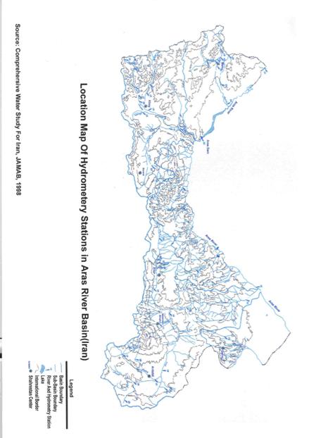
· The per capita water use in the Aras River basin (Iran) is about 1450 m3 per year which is lower than the national figure due to high population in the basin.
Water Discharge (Ave., Min and Max) and specific discharge of rivers in the Aras Basin (Iran)
|
C.V. |
SP.DIS.
L/S/A |
DISCHARGE Cm/s |
Area
Km2 |
Code |
Station |
River |
|
Ave |
Min |
Max |
|
0.44 |
0.73 |
1.75 |
0.80 |
4.78 |
2406 |
2-1-1-10 |
Bazargan |
Sari – so |
|
0.64 |
0.71 |
3.96 |
1.36 |
12.81 |
5602 |
2-1-1-12 |
Pole-Dasht |
Zangmar |
|
0.31 |
4.72 |
2.21 |
1.00 |
3.92 |
468 |
2-1-1-13 |
Gareh-Korpi |
Gareh – so |
|
0.31 |
3.66 |
4.13 |
2.12 |
7.58 |
1127 |
2-1-1-14 |
Galeh-Joogh |
Baroun chai |
|
0.32 |
3.99 |
6.47 |
3.07 |
12.33 |
1620 |
2-1-1-15 |
Maku |
Zangmar |
|
0.32 |
3.69 |
3.87 |
2.09 |
7.34 |
1050 |
2-1-1-16 |
Baroun |
Baroun chai |
|
0.26 |
4.76 |
1.31 |
0.64 |
2.13 |
275 |
2-1-1-18 |
Badaveli |
Agh – so |
|
0.28 |
5.03 |
6.69 |
4.10 |
12.00 |
1331 |
2-1-2-10 |
Ghorl sofla |
Agh chai |
|
0.45 |
2.79 |
4.63 |
1.87 |
11.17 |
1659 |
2-1-2-11 |
Mara kand |
Agh chai |
|
0.37 |
5.26 |
3.91 |
1.56 |
7.43 |
743 |
2-1-2-12 |
Pasak |
Aland chai |
|
0.45 |
2.20 |
1.46 |
0.62 |
3.52 |
665 |
2-1-2-13 |
Mile-Marzi |
Ghotour chai |
|
0.56 |
7.07 |
0.82 |
0.37 |
2.77 |
116 |
2-1-2-15 |
Tars Abad |
Ghotour chai |
|
0.32 |
2.86 |
2.79 |
1.43 |
4.84 |
974 |
2-1-2-16 |
Ghotour |
Ghotour chai |
|
0.27 |
3.86 |
5.96 |
3.68 |
9.80 |
1545 |
2-1-2-17 |
Pole Yazdekan |
Ghotour chai |
|
0.32 |
1.83 |
1.14 |
0.53 |
2.04 |
623 |
2-1-2-18 |
Mosa Gholi |
Ghazan chai |
|
0.47 |
0.49 |
1.31 |
0.48 |
3.24 |
2650 |
2-1-2-21 |
Mozafar Abad |
Ziber chai |
|
0.43 |
1.29 |
11.71 |
3.89 |
26.84 |
9100 |
2-1-2-22 |
Mara kand |
Ghotour chai |
|
0.39 |
1.53 |
0.46 |
0.08 |
0.81 |
300 |
2-1-2-23 |
Chercher |
Zonouz chai |
|
0.29 |
2.61 |
5.24 |
3.42 |
10.02 |
2010 |
2-1-4-10 |
Tazeh kand |
Ahar chai |
|
0.41 |
8.21 |
0.87 |
0.18 |
1.64 |
106 |
2-1-4-11 |
Pole sultan |
Khiav chai |
|
0.10 |
5.08 |
1.31 |
1.05 |
1.55 |
258 |
2-1-4-13 |
Nir |
Nir chai |
|
0.20 |
3.93 |
4.21 |
3.30 |
6.33 |
1070 |
2-1-4-14 |
Pole Almas |
Balkho chai |
|
0.28 |
2.06 |
3.38 |
2.29 |
5.97 |
1638 |
2-1-4-15 |
Gilandeh |
Balkho chai |
|
0.48 |
1.81 |
1.47 |
0.69 |
3.24 |
812 |
2-1-4-16 |
Kozehtopragh |
Ghouri chai |
|
0.36 |
1.92 |
7.75 |
4.09 |
15.47 |
4040 |
2-1-4-18 |
Taleb Gheshlagh |
Ghare – so |
|
0.37 |
1.43 |
10.47 |
5.90 |
19.79 |
7310 |
2-1-4-19 |
Doust Biglo |
Balkho chai |
|
0.38 |
1.72 |
19.44 |
10.10 |
39.15 |
11290 |
2-1-4-20 |
Moshiran |
Dareh Roud |
|
0.35 |
1.62 |
22.08 |
11.40 |
42.73 |
13650 |
2-1-4-21 |
Bouran |
Dareh Roud |
Source: Comprehensive Water Study for Iran, JAMAB, 1998
2.5 water ecosystems and protected areas
Exclusive ecosystems: protected areas, wet lands, wild life preserved, no hunting zones have been formed along side of the Aras River and in the basin. The important wet lands and preserved areas in the Aras River Basin, where their locations are shown on the map are as follows:
· Aarasbaran protected area
· Marakan protected area
· Kiamaki wild life preserved
· Yakamat no hunting zone
· Aghgol wetland and no hunting zone
· Yarim Ghiyeh wetland
· Gareh Boulagh wetland
· Sariso wetland
· EshghAbad wetland
· Siahbaz wetland
3- Water Status and Use
The present water withdrawal for different purposes in the Aras River basin (Iran) is about 3270 MCM as has been shown in the following table in detail (Comprehensive Water Study in Iran, JAMAB, 1998.)
Present water withdrawal in the River Aras Basin in Iran (MCM)
|
Agriculture |
Fisheries |
Industry and
Mining |
Urban |
Rural |
Total |
|
Surface water |
Ground water |
total |
Surface water |
Surface water |
Ground water |
total |
Surface water |
Ground water |
total |
Surface water |
Ground water |
total |
Surface water |
Ground water |
total |
|
2266 |
881 |
3147 |
4.7 |
1.1 |
3.0 |
4.1 |
4.3 |
64.5 |
68.8 |
0.2 |
44.5 |
45 |
2277 |
993 |
3270 |
Source: Comprehensive Water Study for Iran, JAMAB, 1998.
The comprehensive Water Study in Iran which approved by the government in 2003, also has determined the water needs for different sectors and the water resources development projects at different time horizon, which for the year 1400 (corresponding to 2021) is as follows:
· The total water withdrawal in the Aras River basin reaches 5286 MCM where the share of agriculture will be 4026 MCM (the irrigated land increased to 442000 ha), domestic 237 MCM, Industry 68 MCM, fisheries 64 MCM and water requirement for Environment will be 902 MCM.
3-1 Shared water resources (operated and under construction) projects in the Aras River
1- Aras storage dam
Aras storage dam was constructed in 1970 at 40 km western north of Julfa near a place called Quzel-Queshlaq in the Aras River. The capacity of the dam is 1350 MCM and the useful storage is 1150 MCM and the regulation capacity is 1756 MCM. To provide irrigation water at the commanded areas and hydropower is the main goal of the Aras River. The hydropower and the regulated water is shared on a 50-50 basis between the Islamic Republic of Iran and the Republic of Azarbaijan through the yearly bilateral agreement (protocle).
2- Mill & Moghan diversion dam
The water requirement for the Moghan plain (Iran) with the gross area of 90,000 ha. and the Mill plain (Azarbaijan) supply by the Mill & Moghan diversion dam which is constructed - km downstream of the Aras storage dam. In addition, the drinking water requirement of the inhabitants along side of the Aras river also supply by this diversion dam.
3- Khoda Afarin storage dam
The Khoda Afarin storage dam with capacity of 1612 MCM and useful storage of 1495 MCM and regulation capacity of 2130 MCM is under construction upstream of Mill & Moghan diversion dam and near the village Khomarlo in the Aras river. The water supply for the commanded irrigation areas of Iran and Azarbaijan and the hydropower supply with the capacity of 200 megawatt is the main goal of the storage dam. The agreement for the construction of the dam reached on Oct. 1977 between the former USSR and Iranian government.
The prepared designed was approved on 1982, revised on 1991 and the construction restarted on 1999 (due to the Kharabakh conflict) and progressed now. The commanded modern Khoda Afarin irrigation scheme (Iran) at the extent of 75000 ha is also under construction. The use of regulated water and energy of the Khoda Afarin storage dam is accordance with the bilateral protocle which was agreed between former USSR and Iranian government on Dec. 1988 in Moscow.
4- Giz-Gale Si diversion dam
Giz-Gale Si diversion dam with a capacity of 62 MCM and hydropower capacity of 80 Megawatt is planned at the downstream of the Khoda-Afarin dam to supply the regulated water on a 50-50 basis between the Islamic Republic of Iran and the Republic of Azerbaijan.
5- Other shared projects in the Aras River which are at the study phase are: the Megri Hydropower project (with Armenia), Urdobad and Mazraee project (with Armenia).
6- Pumping stations
The water right of I.R. of Iran for direct water withdrawal from the Aras River at the reaches of upstream and downstream of Aras storage dam is 29.5 m3/s (equal the sum of withdrawal by Azerbaijan and Armenia), which currently withdrawal by pumping stations (Shiblo, Ghanbar Kandi, Zangeneh, Gardian, Golfaraj, Golibiglou and Isargaran) along side of the Aras River.
3-2 On-going internationally supported project
In addition to the above mentioned on going bilateral projects, not any internationally supported project with the attendance of I.R. of Iran has been carried out in the Aras River basin. The "Reducing Transboundry Degradation of the Kura-Aras River Basin" is the first one which is started with the support of GEF-UNDP.
4- Legislation and National Policy
4-1 Relevant national laws
In I.R. of Iran a comprehensive national laws and document related to water has been passed. New legislation reflect the importance of environment where, adjusts intercoupling a society and natures in purpose of the fortification to legality and legal rules in the field of improvements of environment quality, rational use and reconstruction natural resources, guard surrounding ambiences. The water laws of Iran comprises different sectors and is comprehensively documented by the Legal Bureau of Ministry of Energy. Herein, the relevant national laws concerning the Aras border River are as follows:
1- Water Law and its Nationalization, ratified in 1968 with 9 section, 66 Clauses
2- Law on Fair Distribution of Water, ratified in 1987 with 52 Clauses and 30 Articles
· The Law on Fair Distribution of Water and its articles and working procedures considers to a certain the social economic, resources and environmental issues pertaining in the country and is the main legal framework operating in Iran.
3- Law on Conserving Groundwater Resources ratifies in 1966 with 15 Clauses
4- Law on Protection of Sea and Border Rivers from the oil Pollution, ratified in 1975 with 19 Clauses
5- Law on Reservoir Boundaries behind the Constructed Dams, ratified in 1965 and its working procedures ratified on 1967
6- Law on Mostahdas and Shoreline Boundaries, ratified on 1975
7- Law on Protect and Stabilize the Bank and Beds of Border Rivers, ratified on 1983
8- Code on Water Pollution Protection, ratified on 1985 with 21 Clauses
9- Long-term policies in Water Sector, ratified by Assembly to Discern the Interests of the State in 2003 with 5 Articles.
10- Long-term Strategies of Water Resources Development in Iran, ratified by the I.R. Government of Iran in 2003 with 18 Articles.
11- Five Year Plan (FYP) of Islamic Republic of Iran (First, Second, Third and Forth FYP).
5- Institutional and Regulatory Settings
5-1 Institution of water resources management in the Aras River Basin
4-2 International Agreements Regulating Water Management in the Aras River
1- Agreement of 14 May 1957, between Iran and former USSR with 6 Sections, 44 Clauses and one Protocol
2- Agreement of 11 August 1957, between Iran and former USSR with 5 Clauses
3- Agreement of 27 June 1963, between Iran and former USSR regarding the technical and financial cooperation that in this regard the construction of Aras storage dam has been forseen
4- Protocol law of Apr. 1974, between Iran and former USSR regarding the implementing the protocol about conditions and regulations of Maintenance and Utilization of Power and Water Resources of Structures on the Aras River
5- Agreement law of Mar. 1989, between Government of Iran and former USSR regarding construction and operation and utilization of water and power resources (on 50-50 basis) of Khoda-Afarin and Giz Galeh Si dams on the Aras River
6- The yearly protocols between I.R. of Iran and R. of Azerbaijan regarding the operation and utilization of water and power resources on Aras River and Aras Storage Dam
7- Agreement between Iran and Turkey regarding Sariso River about release of 1.8 m3/s as the minimum flow in the Sariso River.
The duties of the Ministry of Energy (MoE) have been categorized in Water, Power and Energy Sectors. By law, the MoE is responsible for water, its supply and the developments of this resources. The main duties of MoE in Water Sector are:
- To supply and transfer water for agriculture, industry and urban purposes
- Underground and surface water resources management
- To implement water resources development projects
- Coast and river engineering
- Urban potable water treatment and distribution
- Urban sewage disposal system
The deputy of Water Affair of the ministry and its organization (including 16 Regional Water Authorities) are responsible for the planning, development, management and conservation of water resources throughout the country. The distribution and allocation of urban drinking water and water for industrial needs is by the Water and Water Waste Companies.
· The construction and development of primary and secondary irrigation networks is the responsibility of MoE, while the implementation of tertiary and quaternary irrigation and drainage systems and On-farm infrastructures (subsurface drainage, land leveling, land consolidation, …), raising of irrigation efficiency and establishment of Water User's Association is the responsibility of Ministry of Agricultural Jihad (MoAJ). MoAJ effects this responsibility through the Water and Solid Deputy and the Provincial Agricultural Organization (PAO) where the latter undertake the task in coordinate with the relevant department and technical offices of the ministry.
· The quantity and quality monitoring of water resources throughout the country carried out by MoE. Water quality management and monitoring in the river basins implemented by the MoE and Department of Environment (DoE) where:
o Department of Environment by law is responsible for prevention of pollution of water resources, effluent monitoring and monitoring of the water resources for supervision purpose.
o MoE conduct the quality monitoring of water resources at the river basins. In the 3rd Five Year Plan of the Islamic Republic of Iran Articles 106 and 134 more role has been given to the MoE in respect of Water Quality Management where MoE should improve the quality and quantity of measuring networks and strengthen the context of Water Quality Management throughout the country.
5.2 Identification of stakeholders in the Aras basin
The main governmental, private sectors and non-governmental organizations NGO's which are identified in the Aras River basin can listed as follows:
Governmental
· Ministry of Energy
· Ministry of Agricultural-Jihad
· Ministry of Internal Affairs
· Ministry of Foreign Affairs
· Ministry of Defense and Logistic of Armed Forces
· Planning and Management Organization
Private sectors
· Scientific and university communities
· Islamic Councils
· Operation and Maintenance Companies (OM'C)
· Water User's Association
Non-Governmental Organizations NGO'S
· Iranian Committee on the Large Dam (IRCOLD)
· Iranian Committee on Irrigation & Drainage (IRNCID)
· Green Front of Iran (Green Peace)
· Iranian Environmental experts Association
· Iranian Water Resources Association (IR-WRA)
· Iranian Hydraulic Association
6- Water quality status
6-1 Water quality in the Aras River Basin in Iran
The surface and groundwater quality in the Aras River Basin due to the geological formations and the climatological condition is favourable. The surface water quality problem (salinity) is only refer to one river (Zilber Chai) in the Aras River where its salinity varies between 1800-14600 Micromhos/cm.
In respect with the water chemical analysis, the groundwater in the Aras River basin has the Bicarbonate type (61%), Chloride type (21%) and Sulphate type (18%).
According to the comprehensive water study of Iran, JAMAB, 1998:
· 71,000 tons of chemical fertilizer and 572,000 kg (or liter) pesticides used in the Aras River basin that partly through 1100 MCM return flows reaches the water bodies.
6-2 Water quality of Aras River (along border with Iran)
The water quality and pollution of the Aras River as it supply domestic, agricultural, industrial and environmental needs of a vast communities is very important. The results, of sparse water quality monitoring shows that the Aras River facing to all kind of point and non-point (diffusive) source of pollution. In general it can be said that main pollution is heavy metal reaches to the Aras through mining waste water.
6-2-1 Pollution indexes of Aras River water:
· Physico-chemical index
· Microbiological index (total & focal caliform)
· DO, BOD5 and COD index
· Heavy metal index
· Pesticides (Agro-chemical) index
· Radioactive materials
6-2-2 Water Quality Monitoring of the Aras River
The Water Quality of the Aras River has been monitored at different periods and most of the pollution index has been measured. Among them in a monitoring program which was carried out by the Department of Environment in March 1997 the Physico-chemical, Microbiological, DO, COD, BOD5 have been monitored at six measuring stations.
The most comprehensive water quality monitoring of the Aras Basin has been carried out by East Azerbaijan and Ardebil water Authority since 1999 where the heavy metals and the water quality index (except Agro-chemical and Radioactive materials) has been monitored. The monitoring was repeated on 2001 and based on these results a permanent monitoring program for Aras River has been established. According to the monitoring of the year 1997 which was carried out monthly at six measuring stations (as shown on the map), the chemical composition of Aras River (Anions, Cations, Nitrate, Nitrite, EC, PH) were at the desirable level and no limitation for different purposes.
The Dissolved Saturation Oxygen was varied between 80-90% which classified as suitable river.
The result of heavy metal monitoring of the year 1999 and 2001 which was carried out monthly at 11 measuring stations (as shown on the map) shows that, the concentration of most heavy metals Ni, Co, Cd, Mo, Pb, Hg, Mn and Fe exceed the recommended River Water Quality Standard for drinking and in some cases for irrigation.
6-2-3 Aras River water quality and Radioactive materials
There is no information about the Radioactive monitoring in the Aras River water. However, some reports indicate, due to possible Nuclear activity in the Karabakh occupied region the Nuclear waste spilt into the Aras and Kura Rivers. The monitoring of Radioactive in Aras River should be included in the Monitoring program.
Nuclear waste are spilt into Araz and Kur Rivers – January 08, 2003 – 6:59
"He estimates in Araz river water capacity was 36% in 1999 – 2000 years. At the result 8 kinds of fish exterminated. Instead extict birds with sharp beak and claw have appeared in the banks of the rivers."
http://www.alexsrv7.com/Nkarabakh
6-3 Sources of pollution
The Aras River is facing to all kind of point and non – point (diffusive) sources of pollution. Main sources of pollution in the Aras River is mining waste water, which contribute a large amount of various heavy metal especially copper (Cu), Molibdium (Mo), Mangenisium (Mn) and Iron (Fe) into the Aras River. The main hot spot of pollution is in Armenia at the vicinity of Megrichai and Yerevan.
Discharge of the urban waste water that receives either limited mechanical treatment or no treatment at all is also another source of pollution.
Special concerns relating to agricultural pollution return flow consisting of Agro-chemical waste, pesticides, nutrients and salts).
Industry is contributing now in much lower amount. However, chemical and metallurgical industries (Armenia & Azarbaijan)are a source of concern.
The solid waste as well as floating liquids results from border stations and fuel trading are also consider a source of pollution in the Aras river.
In general it can be said that main pollution is heavy metal like Cu, Mo, Ni, Cr, Fe and the main hot spot of pollution is in the vicinity of Armenia border.
7- Threats and Priorities
7-1 Water quantity of Aras River
Due to the highly dependence of various sectors in Iran to the Aras River water resources, the variation and reduction of river inflow has caused a major Threats. At the present, the Aras River inflow to the Aras storage dam has a reduction of about 30 percent in compare with the long-term (62 years) yearly average of the Aras natural inflow at the mentioned site. This problem is more serious, where there is a high demand of the Aras River water resources for developing of considerable land resources and other needs of large local communities. Therefore, access to the water resources of the Aras River for present and future demands, which can improve the standard of life and settlement of a large number of nomade communities is a high priority for the local communities in Iran.
In this respect, progress in completion of under construction of Khoda-Afarin storage dam and its commanded irrigation networks is an urgent demand of the local communities.
7-2 Water pollution of Aras River
The water quality monitoring of the Aras River indicates that, the Aras River is highly polluted with the heavy metals, where the concentration of most heavy metals exceed the Water Quality Standard for drinking and in some cases for irrigation. The source of this pollution belongs to mining waste which effluents to the Aras River mainly by the Megri Chai at the Vicinity of Armenian border.
The instantaneous release of this pollutants, causes a major threats to the river ecosystems at the down stream which may reach upto the Caspian Sea. Besides of pollution due to mining waste, some reports indicate the spilt of Radioactive material in the Aras and Kura rivers. Although, there is no record of measurements of this pollutant. The prevention and mitigation measures of water pollution is a high priority for the Aras River.
7-3 Lack of Integrated Water Resources Management for Aras Basin
An integrated water resources management in the Aras Basin is only possible throughout the attendance and cooperation of all the riparian countries, where, the information on water status (quantity, quality, use, pollution, …) can be exchanged. The international communities also foster regional cooperation among the countries. In this respect, the join of Turkey to the present project is a necessity. The absence of Turkey means that a comprehensive, integrated approach can not be taken.
7-4 Lack of collaboration in monitoring of the Aras River
Although I.R. of Iran posses an appropriate institutional, strategy and organization both at the national and regional level for water quantity and quality monitoring but, the lack of collaboration between the riparian countries mainly in exchange of information and collaborative laboratories is a serious problem in water quality monitoring of the Aras River. Strengthening and improvement of the water quality monitoring networks and access to the collected information is an expectation from the present project.
The International Conventions which developed under the UNDP that together " provide an international framework governing the environmentally sound management of hazardous pollutants throughout their life cycles" should be used in monitoring program in the Aras River.
7-5 Operation and Maintenance of infrastructures
There is a need for proper Operation and Maintenance of structures on the Aras River and the infrastructures on the commanded schemes in all the riparian countries. Untreated urban wastes, and the lack of proper Operation and Maintenance of the existing irrigation and drainage schemes leads to waterlogging and salinization of lands which causes more pollutants to the water bodies and consequently to the Aras River.
7-6 Aras River ecosystems
Along side of 450 km of Aras River border with the I.R. of Iran, exclusive water ecosystems and preserved areas have been formed. To protect these ecosystem and their inhabitants from the increasing pollution of Aras River is a priority.
7-7 Aras River Training
The natural river variation of the Aras River in its alluvial beds causes sever bank erosion at the right bank (Iran), which have caused considerable agricultural land loss and damages to the urban areas and the infrastructures along side of the Aras River. The solution to this problem, needs cooperation amongst the riparian countries where, more effective and less costly river training projects can be designed and implemented.
7-8 Cooperation strengthening between riparian countries
Cooperation strengthening between riparian countries throughout the national and regional workshops and shared projects and with the participation of all stakeholders will result better understanding of problems, needs of the Aras River and is a priority at this stage.
[1] Government contribution is in-kind in the form of the time of officials and staff members, the provision of office space and communication costs.
[2] Kura is the name of the river in Russian, the language commonly used and understood by all countries of the South Caucasus. The river is called Kur in Armenian and Azeri, Mtkvari in Georgian. The Aras river is known as the Araks river in Armenia.
[3] The “Agreement on Environmental Protection between Georgia and Azerbaijan” and the “Agreement on Environmental Protection between Georgia and Republic of Armenia”.
[4] The REC was established under the Environmental Action Programme for Central and Eastern Europe (EAP) in 1999. Its mission is to assist in solving environmental problems in the Caucasus region by encouraging co-operation among non-governmental organisations, governments, businesses, and other environmental stakeholders, by supporting the free exchange of information and by promoting public participation in environmental decision-making. The founders are the authorised representatives of the European Commission (DGXI) and Armenia, Azerbaijan and Georgia (their ministries of environment).
[5] The information in Annex 2 was provided by Development Alternatives Incorporated who are responsible for implementing the previously mentioned USAID project.
[6] Until recently, the Volga was by far the largest pollution source. However, economic decline along the Volga has led to major drops in the pollution load.
[7] The Caspian Sea covers 422,000 km2 and provides a livelihood for 12 million people in five countries. GEF is providing support to the protection of the Caspian through the Caspian Environment Programme (CEP) with the involvement of the five riparian countries and UNDP, World Bank, UNEP and EU-TACIS.
[8] The Rustavili industrial district, just downstream from Tibilsi, is a major source of industrial pollution
[9] This €4 million programme covers four rivers, and starts up in 2001.
[10] The Caspian Environment Programme (CEP), supported by several international agencies including GEF, has its headquarters in Azerbaijan. CEP is a cooperative effort amongst all states on the Caspian to revert environmental degradation in the Caspian. The CEP houses much information on environmental management in the region, and through its network will contribute to the successful implementation of this Kura-Aras project.
[11] The projects should address priority issues, and be suitable for demonstrating financial and institutional mechanisms. The pre-feasibility studies will describe overall benefits and indicate incremental costs and sources of co-finance.
[12] Caspian Environmental Programme, 1999.
[14] ‘Gender refers to the roles and responsibilities of men and women and the relationship between them. Gender does not simply refer to women or men, but to the way their qualities, behaviors and identities are determined through the process of socialization. These roles and responsibilities are culturally specific and can change over time. Gender is seen as the social construction of men’s and women’s roles in a given culture or location’, UNDP Mainstreaming Gender in Water Management, Resource Guide;
[15] The European Commission in its communication on ‘Incorporating equal opportunities for women and men into all Community policies and activities’ defines gender mainstreaming as “ not restricting efforts to promote equality to the implementation of specific measures to help women, but mobilizing all general policies and measures specifically for the purpose of achieving equality by actively and openly taking into account at the planning stage their possible effects on the respective situation of men and women (gender perspective). This means systematically examining measures and policies and taking into account such possible effects when defining and implementing them", Progress report from the Commission on the follow-up of the Communication: “Incorporating equal opportunities for women and men into all Community policies and activities”, Commission of the European Communities, COM (1998) 122 Final, Source: http://europa.eu.int/comm/employment_social/equ_opp/com98122/com98122_en.pdf
[16] Khoda-Afarin project on the Aras River, revised detailed contract design, vol. II, Book1, Natural Conditions, Bakh Hydroproject, Baku, 1991.