EAST ASIA AND PACIFIC
4E-Marine Electronic Highway
GEF Project Brief
East Asia and Pacific Region
EASTR
Date:
Team Leader: Hatim M. Hajj
Sector Manager/Director: Jitendra N. Bajpai
Sector(s): Ports, waterways and shipping (100%)
Country Manager/Director: N
Theme(s): Regional integration (P), Pollution
Project ID: P068133
management and environmental health (P)
Focal Area: I - International Waters
Project Financing Data
[ ] Loan [ ] Credit [X] Grant [ ] Guarantee [ ] Other:
For Loans/Credits/Others:
Amount (US$m):
Financing Plan (US$m): Source
Local
Foreign
Total
BORROWER/RECIPIENT
1.58
0.35
1.93
GLOBAL ENVIRONMENT FACILITY
2.16
5.84
8.00
FOREIGN PRIVATE COMMERCIAL SOURCES
0.00
5.52
5.52
(UNIDENTIFIED)
Total:
3.74
11.71
15.45
Borrower/Recipient: GOVERNMENTS OF INDONESIA & MALAYSIA
Responsible agency: INTERNATIONAL MARITIME ORGANIZATION
Address: 4 Albert Embankment, London SE1 7SR
Contact Person: Mr. Jean-Claude Sainlos
Tel: 44 20 7735 7611
Fax: 20 7587 3210
Email:
Estimated Disbursements ( Bank FY/US$m):
FY
2004
2005
2006
2007
2008
Annual
1.20
2.80
2.00
1.60
0.40
Cumulative
1.20
4.00
6.00
7.60
8.00
Project implementation period: 4/1/2004 to 3/31/2008
Expected effectiveness date: 09/01/2004
Expected closing date: 12/31/2008
OPCS PAD Form: Rev. March, 2000
GEF Project Brief (PAD)
A. Project Development Objective
1. Project development objective: (see Annex 1)
5.
The project is the first (demonstration) phase of a potential two-phase program to eatablish a
Marine Electronic Highway (MEH) in the Straits of Malacca and Singapore. The Demonstration Project's
objective is to determine if a full-scale MEH for the Straits is economically justified and financially
feasible. The potential full-scale MEH program's development objectives are to increase the efficiency of
marine transport through the Straits, reduce its negative environmental impacts, and strengthen the
conservation and mangement of neighboring marine and coastal environments. The MEH would achieve
these objectives by: (a) reducing the frequency of ship collisions in the Strait's congested sea lanes and
ports; (b) making marine navigation in the Straits safer and therefore more often feasible in poor weather;
(c) tracking and monitoring vessel operations, such as illegal bilge water releases, in the Straits, with
benefits for the management and protection of marine and coastal resources; and (d) testing the feasibility
of a MEH fund to co-finance the system and to support coastal and marine resource conservation and
management in the Straits area. The program would thus generate coastal development and
environmental benefits for the littoral states; global environment benefits by reducing the pollution of
shared marine water bodies; and economic benefits for the international shipping industry and their
billions of customers.
2. Key performance indicators: (see Annex 1)
The key indicators for the demonstration project will be:
(a) full-time operation of a reliable, state-of-the-art MEH system covering the target 100 km section of the
Straits of Malacca and Singapore; (b) use of the system by a significant proportion of the large crude oil
tankers and container ships that pass through the Straits; (c) enhanced capacity of the maritime
management staff of the three participating countries to jointly promote maritime safety and marine
environment protection; (d) an initial assessment of the marine pollution prevention and ship operational
benefits of the MEH demonstration system; (e) design of a proposed financing mechanism for the MEH
system and for a regional Marine Environment Conservation Fund; and (f) a professional evaluation of
the financial, economic and legal feasibility and potential environmental benefits of a full-scale MEH
system covering the entire Straits of Malacca and Singapore.
The key indicators of the two-phase program (assuming the second phase is implemented) will be:
the number of shipping accidents or incidents occuring yearly along the maritime lanes covered by
the MEH;
the percentage of ships plying the covered zone equipped with adequate onboard equipment to
benefit from the MEH system;
the reduction of marine insurance premiums for regional shipping lines sailing regularly through the
MEH-covered area;
once the MEH is established in its permanent setting, the revenues accruing into the Maritime
Environment Management Fund.
B. Strategic Context
1. Sector-related Country Assistance Strategy (CAS) goal supported by the project: (see Annex 1)
Document number: Report No.21580-IND
Date of latest CAS discussion: February 8, 2001
There is no CAS for Malaysia at this time, and the Bank does not operate in Singapore.
For Indonesia, the MEH project would contribute to the CAS objectives in two ways: (i) in helping
secure a safe and cost-effective maritime transport environment to and from Indonesia's main seaports
and external trade gateways, which will support economic growth objectives and private sector
- 2 -
development; and (ii) in helping improve natural resource management and environmental protection, in
particular in marine ecosystems.
1a. Global Operational strategy/Program objective addressed by the project:
6.
The proposed program will help overcome the barriers to the adoption of best-practice
technology in marine navigation and pollution control, and thereby reduce the contamination of the
international waters, which is one of the major objectives of the GEF's Operational Program 10 - the
International Waters Contaminent-Based Operational Program. The proposed MEH program is a
partnership between governments, the GEF and the private sector, and is therefore also consistent with
one of the GEF's key strategic objectives, which is to promote public-private partnerships that benefit the
global environment.
7.
More effective action to reduce marine pollution is a GEF priority because 90% of world trade, in
tonnage terms, is currently and will in the forseeable future be transported by ships, which are a
significant threat to the marine environment. Economic development in many parts of the world, and
especially in the dynamic Asia-Pacific region, will increase the demand for maritime transport. This,
coupled with burgeoning coastal populations that depend heavily on marine ecosystems, makes it
essential to reduce marine pollution from ship-based sources by, inter alia, reducing ship collisions, oil
spills and illegal bilge water discharges. One of the most promising means of achieving these objectives is
through rapid and widespread use of state-of-the-art navigation systems and effective marine pollution
monitoring and control technology. This proposed program is designed to accelerate the use of such
technology in the Straits of Malacca and Singapore and elsewhere in the developing World.
8.
GEF support for the program is further justified because the Straits of Malacca and Singapore is a
zone of high marine biodiversity significance, rich in marine fauna and flora that is characteristic of
tropical estuarine environments. The abundance of seagrass beds, mangrove swamps, coral reefs and
wetlands enriches the associated coastal marine environments, which are also stopover points for
migratory birds on seasonal transition. Natural resource-related activities such as fishing and coastal
tourism have also boosted the regional economy. By catalysing the MEH program and better protecting
these natural resources, the GEF can therefore help to generate local and regional sustainable
development benefits also.
9.
In summary, the proposed MEH program is consistent with the GEF's Operational Strategy and
Operational Programs in the following respects:
1.
It will develop and demonstrate an innovative system of maritime traffic management
and pollution prevention that will reduce the accidental spills of oil and chemical
substances that damage international waters.
2.
It will develop and demonstrate innovative regional networking of information
technology that will enhance monitoring and enforcement of MARPOL regulations.
3.
It will strengthen the technical capabilities and the institutional and co-ordinating
arrangements among the region's littoral States to collectively prevent, manage and
respond to transboundary marine pollution.
4.
It will establish a mechanism that facilitates co-operation between the public and private
sectors.
5.
It will conserve significant marine and coastal biodiversity and promote sustainable
development.
2. Main sector issues and Government strategy:
10.
Although the Straits of Malacca and Singapore are shallow, hazardous to navigation, and
characterized by narrow channels, irregular tides and shifting bottom topography, they are the preferred
- 3 -
international route for the majority of ships en route between the Persian Gulf and the Far East, mainly
because the two alternative routes (Lombok-Makassar and Sunda Straits) add several days the voyage.
Recent enhancements in maritime safety infrastructures and regulatory mechanisms in the Straits have
improved navigational safety, vessel traffic flow and the overall management of the Straits as a major
international sea lane. However, the volume of international traffic passing through the Straits or calling
at its ports is already heavy for such a confined and environmentally-sensitive waterway and is
increasing steadily. In 1997, approximately 104,000 vessels transited the Straits of Malacca and Singapore,
and in 2001, 146,265 vessels (>75 GT) arrived at the port of Singapore. Vessel arrival statistics from 1995 to
2001 showed an annual average increase in arrivals of 5.96% for the Port of Singapore and 10.58% for Port
Klang. There is also substantial volume of cross-Straits traffic between the three littoral States for trade
and fishing. Notwithstanding the current navigation system, the threat of collision and grounding and of
consequent environmental damage is significant and is rising, and the cost of serious accidents is very
high, which justifies further action to reduce them.
11.
Although the three littoral States of Indonesia, Malaysia and Singapore have oil spill response
capabilities, such as oil spill contingency plans and response facilities, including a cooperative response
agreement, a series of recent serious shipping accidents have highlighted the need for a better traffic
management system to reduce their incidence. Another lesson learned from recent incidents is the need
for quicker deployment of spill response equipment and manpower and more efficient institutional
arrangements. In addition to the more rapid response, immediate access to information on the resources
at risk, on spill location and on the locations of stockpiled response equipment can also contribute to the
effectiveness and efficiency of an oil spill response operation. Better and more efficient communication is
the key to achieving a successful response in the event of an oil spill, but an effective ship monitoring
system is also important to prevent such incidents, as well as to serve as early warning.
12.
Recent incremental improvements to existing navigational aids and facilities in the Straits of
Malacca and Singapore have not reduced the incidence of ship collisions and grounding or of chemical
and oil spills. Although risk assessment of tankers in the Straits based on tanker accidents in the period
from 1982 to 1993 showed a relative constant risk at 0.029% (� 0.03=95%CL) [Malacca Straits: refined risk
assessment, GEF/UNDP/IMO Regional Programme, 1999], a steady number of serious vessel accidents still
occurred in recent years. For example, several vessel groundings and collisions occured in the past two
years, some resulting in spillage of oil, such as the `Natuna Sea' (October 2000) and `Singapora Timur'
(May 2001). Total compensation claims for the `Natuna Sea' from the 3 littoral States were
US$127,003,226, but only 8.48% was paid due to unsubstantiated and disallowed claims, especially on
environmental and fishery-related damages (Annex 2). Reliable information on the Strait's natural
resources, particularly its economic value, is certainly important and urgently needed in order to better
quantify the economic losses incurred in the event of a chemical or oil spill in the Straits.
13.
The increasing volume of maritime traffic and port development in the Straits, as well as the
increasing mix of other uses (e.g., marine recreation, fisheries), are seriously taxing the capacity of the
Straits to handle such growth and diverse uses safely and efficiently. From the maritime safety
standpoint, continued growth will lead to more congestion and will require intensive monitoring,
especially along critical areas of the TSS. The effects of this congestion are exacerbated by
weather-related conditions, including the tidal regime. This combination causes ship delays or diversions,
more conservative loading and higher risk of collision, allision and grounding. The environmental
consequences of the aforementioned situations are increased risk in the number and magnitude of oil
spills, discharges of bilge waters and chemical spills from ships. These facts have motivated the littoral
States to adopt an innovative and more effective approach to improving the management of maritime
traffic and marine environment protection in the Straits, which is to establish a Marine Electronic
Highway (MEH) system.
- 4 -
3. Sector issues to be addressed by the project and strategic choices:
Issue 1: Marine pollution.
14.
Land-based activities, such as agriculture, manufacturing industry and human settlements,
contribute about 70% of the total marine pollution load in the Straits. However, because of its dispersed
sources, land-based pollution is very difficult and costly to control. While ship-based sources of pollution
contribute only about 20% of the pollution load, they often has an acute environmental impact and can be
traced to specific sources, which makes action on them feasible and relatively cost-effective. Reduction
ship collisions and groundings also benefits the shipping industry, which makes action to achieve that
result a commercial and environmental win-win option.
15.
The major pollutants from ships are oil, chemicals and noxious liquid substances, liquefied gases,
sewage, garbage, bilge water, ballast water and antifouling paints. The biggest concern is a catastrophic
oil spill, following a collision or grounding of a VLCC or any vessel carrying large quantities of bunker
oil. The damage caused by an oil spill can be considerable and cover a vast area. The clean-up cost is
always high and a spill's environmental impact on the living resources, particularly sea birds and near
shore sessile organisms, is highly detrimental. A MEH system can significantly reduce the risk of these
marine pollution occurences.
Issue 2: Ship operating costs.
16.
A Marine Electronic Highway system offers ship owners and operators the opportunity to: (a)
operate more safely in confined waters during periods of reduced visability and thus reduce transit time
lost due to bad weather; (b) reduce the risk of collision, and hence repair and damage control costs and
perhaps even insurance premia; (c) eliminate the current practice of manually updating paper charts. In
combination, these benefits can significantly reduce ship operating costs.
Issue 3: Sustainable financing the MEH and local marine environment management.
17.
A further atttribute of the MEH system is that its significant commercial benefits make it
potentially feasible for the littoral States to develop a voluntary sustainable financing mechanism both for
the recurrent costs of the MEH and, potentially, for local marine environment management. The MEH
program will test if it is feasiblethrough a public/private partnership, to establish a MEH Fund for the
Straits of Malacca and Singapore. If it is feasible, part of the Fund's revenue will be used for the
operation, administration and management of the MEH system including its maintenance and upgrading,
and part of the revenue will be used to strengthen local marine environmental protection and
management. This would supplement the scarce public resources currently available for coastal and
marine management and conservation. A description of the proposed MEH Fund is in Annex 4.
18.
The structure and capitalization strategy for the MEH fund will be based on socio-economic,
market and financial surveys to be conducted under the MEH Demonstration Project and will be further
refined in the course of its implementation. A multisectoral Working Group will formulate the MEH
Fund, its structure, financial controls, management and administration, strategy for leveraging private
sector contributions and financial modalities for cost recovery. A pilot MEH Fund is envisaged to be
operational during the later period of the MEH Demonstration Project but the revenue that will be
generated will form part of the funding for the implementation of the MEH Full-scale Development
Project.
- 5 -
C. Project Description Summary
1. Project components (see Annex 2 for a detailed description and Annex 3 for a detailed cost
breakdown):
The MEH Demonstration Project has 7 strategic components aimed at addressing the aforementioned
issues:
Component 1
Establish the Marine Electronic Highway and demonstrate its technical functionalities on
navigation safety and marine environment protection for the Straits of Malacca and
Singapore;
Component 2
Facilitate the integration of marine environment systems and data flow and information
exchange through the MEH system;
Component 3
Develop the operational and administrative mechanisms for the sustainable management
of the MEH system;
Component 4
Evaluate the financial, social and economic benefits and legal issues of the MEH system;
Component 5 Promote awareness and participation of relevant stakeholders to support the MEH
system;
Component 6
Strengthen national and regional capacity in maritime safety and marine environment
protection for the sustainable management of the MEH system; and
Component 7
Implement transitional activities to develop the first phase MEH Full-scale Development
Project and assess the feasibility of establishing the second phase MEH system extending
to other sea areas in the East and West of the Straits.
The logical framework matrix in Annex 1 provides a summary of analysis on the outputs, methodology,
verifiable indicators to measure impacts and the assumptions made to implement the MEH
Demonstration Project.
Indicative
Bank
% of
GEF
% of
Component
Costs
% of
financing
Bank
financing
GEF
(US$M)
Total
(US$M)
financing
(US$M)
financing
Component 1 - Establishment of MEH System
11.22
72.7
0.00
0.0
4.15
51.9
Component 2 - Integration of Marine Environment
0.60
3.9
0.00
0.0
0.58
7.3
Protection System
Component 3 - Development of Operational and
0.72
4.7
0.00
0.0
0.62
7.8
Administrative Mechanisms
Component 4 - Evaluation of Financial, Social and
0.17
1.1
0.00
0.0
0.13
1.6
Economic Benefits and Legal Issues
Component 5 - Promoting Participation of Relevant
0.17
1.1
0.00
0.0
0.13
1.6
Stakeholders
Component 6 - Capacity Building, Evaluation and
2.46
15.9
0.00
0.0
2.33
29.1
Project Management
Component 7 - Implement Transition to Full-scale
0.10
0.6
0.00
0.0
0.06
0.8
MEH Development and Feasibility of Second
Phase
Total Project Costs
15.44
100.0
0.00
0.0
8.00
100.0
Total Financing Required
15.44
100.0
0.00
0.0
8.00
100.0
- 6 -
2. Key policy and institutional reforms supported by the project:
The establishment of a financially sustainable MEH system in the Straits after the implementation of the
two stages of the MEH Project is envisaged to strengthen existing regional and international cooperation
among the littoral States and user States on navigational safety (e.g., STRAITREP) and maritime security
(e.g., piracy, terrorism, armed robbery at sea) of the Malacca Straits including oil and chemical pollution
prevention and response (e.g., ASEAN OSPAR), but more specifically, the flow and exchange of
information and timely intervention on maritime incidents.
3. Benefits and target population:
Potential beneficiaries of the MEH system apart from the three littoral States and the shipping sector are
those engaged in marine environment protection. Appropriate activities of the project have been
formulated (e.g., integration of EMPS into the MEH system, assessment of the MEH technical
functionalities, environmental models development and applications) including the development of
public private partnership scheme, to ensure their participation as well as share in the responsibility of
contributing to the development of the full-scale MEH system in the Straits.
4. Institutional and implementation arrangements:
The Project Steering Committee (PSC) established during the PDF Block B Grant period will continue to
act as the overall regional body to oversee the implementation of project activities in both the
demonstration and the full-scale stages of the MEH Project. The PSC will provide the institutional
arrangement for the development of the managing tool, which will operate, administer and manage the
MEH system on a sustainable basis under a cooperative agreement among relevant stakeholders of the
Malacca Straits.
Four Technical Committees and two Working Groups will be established in the course of implementing
the MEH Demonstration Project to evaluate various technical issues and outputs of the project for the
purpose of refining the activities for the MEH Full-scale Development Project, which will cover the entire
Straits. The Technical Committees and Working Groups will be composed of relevant stakeholders of the
MEH Project including potential users under the direction of the PSC. The PSC will be developed into the
governing body or managing tool (i.e., corporate body) of the MEH system. This corporate body will
operate, administer, maintain and manage the MEH system within the public private partnership
framework. It is envisaged that the corporate body will be fully commissioned at the latter part of the
second stage of the MEH Project.
Monitoring and evaluation of project activities will include milestones for each major activity with a
corresponding specific timeframe to complete. In addition, there will be annual reviews by the Project
Steering Committee as well as bi-annual internal reviews of project implementation as well as the results
and outputs. The findings of these reviews will be used to assess project progress and the need to modify
approaches and resources. The key performance indicators as shown in Annex 5 will be used to gauge
the outputs and impacts of the MEH Demonstration Project.
In addition, review and evaluation of the project activities will be undertaken by four Technical
Committees (TC) to address relevant issues on the implementation of the project and will come under the
guidance and direction of the Project Steering Committee (PSC). Two Working Groups (WG) will be
established at some stage of the project life to evaluate the impacts of the demonstration project as well as
the formulation of the proposal for the MEH Full-scale Development Project. The technical committees
and working groups will be composed of representatives from relevant stakeholders as well as
consultants hired under the project. The project will participate in the annual GEF Project
Implementation Review (PIR).
A Project Management Office will be established in the region to administer and manage the project
- 7 -
onsite and will have a Project Manager and four experts. The staff will be working closely with the
national agencies staff assigned to the MEH Data Centres and oversee/coordinate the works of the
consultants as well as providing support to the PSC, TC and WG.
D. Project Rationale
1. Project alternatives considered and reasons for rejection:
The alternative of making incremental improvements to existing navigational facilities and ship control
systems in the Straits was considered but rejected because it has significantly less potential for reducing
ship-related environmental damages and for improving navigational efficiency than the more advanced
MEH system.
2. Major related projects financed by the Bank and/or other development agencies (completed,
ongoing and planned).
Latest Supervision
Sector Issue
Project
(PSR) Ratings
(Bank-financed projects only)
Implementation
Development
Progress (IP)
Objective (DO)
Bank-financed
Other development agencies
IP/DO Ratings: HS (Highly Satisfactory), S (Satisfactory), U (Unsatisfactory), HU (Highly Unsatisfactory)
3. Lessons learned and reflected in proposed project design:
The concept of a marine electronic highway (MEH) was initiated in Canada in the early 1990s with the
application of digital technology to navigation, particularly in the development of electronic navigational
charts and the Electronic Chart Display and Information System (ECDIS). The core of the Canadian
version of the MEH was the integration and interconnection of the ECDIS and the Automatic
Identification System (AIS) with powerful shore-based databases to provide a basis for optimised
shipping traffic management decisions. Since 1995, the ECDIS has been widely deployed in the Great
Lakes and the St. Lawrence River corridor with considerable success, especially in navigating through
treacherous waters even in heavy fog conditions. However, standards for electronic navigational charts
and the unavailability of type approved ECDIS during this early period led to the use of nonconformal
ECDIS by the Canadian shipping sector. Thus, many Canadian ships plying the Great Lakes and the St.
Lawrence Seaway had difficulty in switching to standardized technology subsequent to the commercial
launching of the first type approved EDCIS in 1999 and the wider adoption of the IHO S-57 (electronic
chart standard) due to technical and financial constraints. Furthermore, central government support
waned. Consequently, the MEH concept remains to be realized. Nevertheless, the pioneering efforts in
Canada on digital navigation had led to the widespread adoption of electronic navigational charts and the
ECDIS and subsequently, by the world shipping industry accelerating the commercial development of
electronic maritime technology and the necessary international standards. Since 1999, there are several
type-approved ECDIS in the market and many national hydrographic agencies have S-57 ENC
production capability.
The utility of ECDIS and ENCs is now well accepted in the maritime industry, being able to increase the
safety net of vessels and improve commercial performance (e.g., in areas with restricted under keel
clearance and water depth). Placing these technologies in the framework of the MEH system will provide
greater benefits not only for the shipping industry but also for the marine environment sector. From the
marine environment protection standpoint, for instance, the reduction of vessel accidents and online
availability of marine information could lead to improve monitoring and response to marine
environmental incidents, lower response and clean-up costs and better quantification of damages as well
- 8 -
as enhance management of the coastal and marine resources in the Straits.
4. Indications of borrower and recipient commitment and ownership:
Two national workshops, one regional workshop and three regional meetings were conducted during the
PDF Block B Grant period with the participation of a number of stakeholders with a variety of interests.
Aside from participants from the littoral States, observers from user States, the maritime sector, maritime
technology and telecommunications groups attended these gatherings. Their participation and inputs
have significantly contributed to the refinement of the MEH concept and the development of the project
proposal in general.
Apart from the PDF Block B Grant meetings and workshops, consultations were also undertaken with the
participating countries and the shipping sector regarding the implementation of the pilot demonstration
project. Overall, there has been a positive response from shipping sector in terms of active participation
in the project. The partnership with the International Association of Independent Tanker Owners
(INTERTANKO) and the International Hydrographic Organization in this demonstration project attests to
such a positive response.
Over the years, the littoral States have largely financed the establishment of safety facilities and
mechanisms in the Straits in aid of international navigation as well as in oil spill response and clean-up
during a number of spill incidents due to tanker collision and grounding in the Straits. In addition, the
three countries have, and continue to show, a strong commitment to safety of navigational and
environmental management of the Straits by ratifying various international conventions dealing with
maritime safety and pollution prevention and control. Moreover, national and regional projects and
programmes that address some of the maritime safety and marine environment issues are being
implemented by the littoral States, especially Indonesia and Malaysia with support from donors and
international agencies.
5. Value added of Bank and Global support in this project:
Bank and GEF support for the MEH Demonstration project will make it possible to establish the
conditions under which the MEH system can be viable both technically and financially, then paving the
way for further development along international sea lanes. From then on, Bank and GEF support, in
cooperation with IMO, will facilitate the dissemination of knowledge and experience so as to spur the
replication of the MEH system, in particular in regions where developing countries will need institutional
support and capacity building to be able to play their part in establishing the system and to reap the
expected benefits, both in terms of more economically efficient international transport and of more
sustainable marine environment protection policy.
E. Summary Project Analysis (Detailed assessments are in the project file, see Annex 8)
1. Economic (see Annex 4):
Cost benefit
NPV=US$ million; ERR = % (see Annex 4)
Cost effectiveness
Incremental Cost
Other (specify)
The GEF will be asked to fund the incremental costs of removing the barriers to the development
and adoption of a MEH for the Straits of Malacca and Singapore. These incremental costs will be a
significant portion of the total cost of the phase 1 MEH demonstration scheme, because, in this phase, the
MEH must be designed, new capacity and new partnerships formed to install and operate it, the system
refined and evaluated and all the key stakeholders convened to make a decision on phase 2. The
- 9 -
incremental costs of this first phase are therefore likely to be at least 50% of its total cost.
A necessary condition for moving to phase 2 will be to demonstrate that the full-scale MEH is
justified on cost-benefit grounds and can become financially self-sustaining. A much lower proportion of
phase 2 costs will therefore be incremental and qualify for GEF funding.
Cost benefit
Benefits
Reduced risk of environmental catastrophe
The principal benefit of the Marine Electronic Highway is expected to be reduced risk of environmental
damage from a catastrophic shipping accident in the Straits of Malacca and Singapore. While even
without the implementation of the MEH the risk of such an accident is low, the environmental and social
cost of such an accident would be very high. This benefit of the MEH would therefore be measured as a
small reduction in the probability of an unlikely but costly event.
The costs of the event could be measured in several ways. The simplest might be from the compensation
claims from those damaged by the event, plus the financial cost to those causing the event. The most
complex might be assess the many separate environmental impacts and the cost of remedying them.
Other environmental benefits
The MEH would have many additional benefits, some environmental, some marine safety but most
would be reduced maritime operating costs. The environmental benefits could come from the avoidance
of dumping of ship waste and bilge in an environmentally sensitive environment, while the safety
impacts could include a reduction in accidents that did not involve oil spill and were therefore not
accounted for in the principal benefit measure.
There are potential less direct economic benefits derived from these environmental benefits, but these
would be even harder to estimate and measure. If the reduction in pollution in the Straights were
significant, there could be a potential for increased fishing, marine farming and tourist development.
However, it would be difficult to estimate and evaluate such benefits with the same level of confidence as
could be attached to the direct environmental benefits.
Ship operating costs � ship loading
The reduction in ship operating cost come in at least two ways. First, bulk takers and possibly container
ships, could be loaded closer to the depth of the channel. The electronic navigation charts could provide
more detailed and updated information than is presently available. If combined with current weather and
tide information, this could give a significant advantage to ships that make use of the MEH systems,
Indeed, it is this benefit that would be the incentive for most of them to participate.
Ship operating costs � avoidance of longer voyages
Another ship operating benefit could come from an increase in the capacity of the Straights and therefore
an avoidance of ships having to use longer and more time consuming alternative routes.
Financial and economic benefits
Most of the assessments of ship operating costs (and therefore benefits of the project through a reduction
in those costs) are measured in financial , so some effort would need to be made to convert these financial
benefits so that they measure economic benefits.
- 10 -
Costs
Investment costs
The costs of the MEH would be much more easily measured than the benefits. There would be investment
costs to be mad by the littoral states in setting up the facilities (electronic navigation charts, buoys and
land stations for transmitting data) for the MEH to operate, and there would be some additional costs to
ship operators in providing equipment for their vessels to make use of the systems.
Most of these investment costs will be measured as part of the cost of setting up the MEH Demonstration
Project.
Operating costs
The littoral states would also incur operating costs in keeping the electronic charts updated and operating
the buoys and other equipment for recording weather and tide information. There would be operating
costs incurred by the IMO in collecting and making the data available to the ships participating in the
system. The ship owners would incur additional operating costs in training ships crew to receive,
interpret and act on the information provided by the MEH.
Most of these operating costs will be estimated as part of the implementation of the MEH
As with the benefits measures, cost estimates made in financial terms will need to be converted to
economic units.
2. Financial (see Annex 4 and Annex 5):
NPV=US$ million; FRR = % (see Annex 4)
Maritime safety and environmental management in the Straits of Malacca and Singapore,
particularly on the prevention and response to oil pollution arising from discharge and spillage by ships
have been largely carried out by the three littoral States of Indonesia, Malaysia and Singapore including
the financing of safety facilities and mechanisms. International assistance in combating oil spills in the
Straits has been provided by Japan and to a limited extent, by other countries. Evidently, the costs of
installing, maintaining and managing the aforementioned facilities and measures are financially taxing to
the littoral States. Compensation for the costs that the littoral States have incurred for the Straits cannot
be easily realized as international law prohibits them to charge for a toll or other fees merely for passage
through the Straits (Article 26 of 1982 UNCLOS). However, the UNCLOS allows a coastal State to charge
for specific services rendered to a ship.
The Marine Electronic Highway (MEH) system in the Straits of Malacca and Singapore is
envisaged to be a financially sustainable enterprise based on voluntary use or subscription of the system's
products and services for enhanced navigation and environmental management. The MEH system has
three features, namely, a network of maritime safety and marine environment protection systems and
facilities, a governing or corporate body and three MEH Data Centres (MDCs). The overall management
of the MEH system will be distinct from the management of the Straits of Malacca and Singapore.
Therefore, the operation and actual maintenance of navigational facilities will remain with the relevant
authorities of the three littoral States. It is further envisaged that the MEH system will limit the financial
burden of the littoral States to provide for and maintain navigational aids and facilities in the Malacca
Straits but enhancing monitoring and emergency response, especially in the event of chemical and oil
spills.
Given that a coastal State can levy charges from users of the a strait under Article 26 of UNCLOS,
- 11 -
the feasibility of generating revenues from the establishment of the MEH system in the Straits of Malacca
and Singapore is certainly achievable. Having such revenues could obviate the need for the 3 littoral
States and other donors to continue to carry out the financing of maritime safety and pollution prevention
facilities in the Straits. The revenues will be generated from the application of a sustainable financing
mechanism through public-private sector partnerships to establish, operate and manage the MEH system.
A financing system for the MEH system to administer and manage the revenues and other funding will
be established and hereto called the MEH Fund.
Financing Plan
US$Million
Source
Local
Foreign
Total
Indonesia
0.2
0.0
0.2
Malaysia
0.8
0.1
0.9
Singapore
0.6
0.2
0.8
Intertanko
0.0
5.6
5.6
GEF
2.2
5.8
8.0
Total
3.7
11.7
15.5
Notes: Indonesia is seeking assistance from JICA in funding its share
Malaysia will fund its share from government sources
Intertanko has committed its members to equip a minimum of 60 ships to take part in the
Demonstration Project
Fiscal Impact:
3. Technical:
From the technical standpoint, the critical aspects in the development of the MEH system would be the
integration of maritime safety technologies and marine environment protection systems and the
establishment of the managing tool. The risk associated with project implementation could be minimized
by identifying and addressing the technical, socio-economic, financial and legal issues and by quantifying
and promoting the benefits of the MEH system. The process will be a participatory approach and this
will provide the opportunity for the relevant stakeholders to internalise the development of the MEH
system and propel it to its completion. The co-operation initiated during the PDF Block B phase will be
strengthen by the participatory approach and serve as an impetus to stronger public private sector
partnership and broader clientele (littoral States, user States, the private sector and technology provides
and users).
4. Institutional:
The littoral States of Indonesia, Malaysia and Singapore are the major players in this project.
Aside from their membership in the Project Steering Committee, Technical Committees and Working
Groups, the littoral States will co-finance the implementation of the Demonstration Project by providing
in-kind contributions such as the use or access of maritime safety facilities, office space, equipment,
utilities and local experts. The littoral States with their designated National Focal Points and
lead/implementing agencies will be working with the project team in partnership with relevant
stakeholders to implement the activities of the 7 components of the Demonstration Project including the
development of the MEH Fund and the governing body of the MEH system. The littoral States will also
work towards overcoming policy, institutional and legal barriers to the establishment of the MEH system
in the Straits of the Malacca and Singapore.
- 12 -
Currently, the Demonstration Project has, as its partners, the International Association of
Independent Tanker Owners (INTERTANKO) and the International Hydrographic Organization (IHO).
The partnership with INTERTANKO will ensure that adequate tankers will be made available for the
technical evaluation of the MEH system. INTERTANKO will be the focal point for the shipping industry
and will identify ships that will be participating in the project (e.g., ships that regularly ply the Straits)
including assessment of onboard availability of ECDIS and AIS as well as the use of digital technology,
especially for Internet access. INTERTANKO will also assist in monitoring participating ships to ensure
that they adhere to the requirements of the project and also, to identify any constraints or problems that
may arise onboard the ships during its participation. As a partner, INTERTANKO will be a member of
the Project Steering Committee and also will take part in the review and evaluation of the project and the
implementation of its activities as a member of the various technical committees and working groups of
the project.
As a partner, IHO will also be a member of the Project Steering Committee and also will take part
in the review and evaluation of the project and the implementation of its activities as a member of the
various technical committees and working groups of the project. Its major inputs to the project will be to
provide technical assistance in the development and production of ENCs, the development of ENC-based
ecological or sensitivity maps and mapping services as well as leveraging technical cooperation (e.g.,
training, expert advice, use of facilities/equipment, funding) from among its member states for the
development of the Straits ENCs and related products.
Private sector partners such as technology providers, especially those engaged in digital
technology and telecommunications as well as those in the environment sector will be involved in the
development of various products and services of the MEH system covering online and real time
communications and data exchange, establishment of VPN, packaging and marketing, development of
the MEH Fund as well as actively participate in the PSC and its Technical Committees and Working
Groups.
4.1 Executing agencies:
International Maritime Organization, Governments of Indonesia, Malaysia and Singapore.
4.2 Project management:
The Project Steering Committee (PSC) established during the PDF Block B Grant period will
continue to act as the overall regional body to oversee the implementation of project activities in both the
demonstration and the full-scale stages of the MEH Project. The PSC is comprised of designated National
Focal Points from Indonesia, Malaysia and Singapore, representative from GEF/World Bank, IMO,
PEMSEA, INTERTANKO, IHO, private sector and other partners. IMO will serve as the Secretariat of the
PSC.
The PSC will be developed into the governing body or managing tool (i.e., corporate body) of the
MEH system. This corporate body will operate, administer, maintain and manage the MEH system
within the public private partnership framework. It is envisaged that the corporate body will be fully
commissioned at the latter part of the second stage of the MEH Project.
In the MEH Demonstration Project, various activities under Component 3, 4 and 5 on developing
the operational, administrative and financing mechanisms for the sustainable management of the MEH
system will be implemented that will assess the evolution of the PSC into a corporate entity with its
organizational structure, corporate rules and financing mechanism. Further refinement of the results of
the assessment will be carried out in the MEH Full-scale Development Project. It is envisaged that the
corporate body will be established through a ministerial conference at the latter part of the Full-scale
Development Project.
- 13 -
The PSC will have four standing Technical Committees (TC) and two-ad hoc Working Groups
(WG). The TC and WG will assist the PSC in monitoring and evaluating the implementation of project
activities as well as providing technical guidance to the Project Management Team (PMT) tasked with the
implementation and management of the project including the development of charging mechanism, the
MEH Fund and institutional arrangements to establish a governing body for the MEH system. A project
office will be established as a work base for the PMT. The location of the project office will be decided by
the PSC. The WG will review and evaluate project outputs, particularly those relating to the transition
from the pilot demonstration to the full-scale MEH Project (Component 7) and assist the PMT in the
development of project proposal for the MEH Full-scale Development Project and in the development of
the managing tool or governing body.
4.3 Procurement issues:
Each country with use its own procurement procedures for equipment and civil works funded from its
own sources. Intertanko will rely on its ship-owning members to equip their own ships using their
company procurement procedures. The IMO will use its procurement procedures, which are compatible
with those of the World Bank, for the procurement of consultants (for undertaking studies, building of
mathematical models, and for support of the Project Steering Committee, Technical Committee's and
Working Groups), for gathering the hydrographic data and production of the Electronic Navigation
Charts (under ICB procedures) and for equipment for the Project Management Office. Premises for the
Project Management Office will be provided (at cost) by the participating country selected for the location
of the office. Although the IMO will contract for the production of the ENCs (the hydrgrpahic data and
charts) hydrographic data and charts themselves will remain the property of the respective countries.
However, it will be a condition of their participation in the Demonstration Project that the charts be made
available at no charge to the MEH Project Management Office.
4.4 Financial management issues:
The GEF funds will be managed by the IMO and by the governments of Malaysia and Indonesia. Each of
these has managed World Bank and/or GEF projects in the past.
5. Environmental:
Environmental Category: C (Not Required)
5.1 Summarize the steps undertaken for environmental assessment and EMP preparation (including
consultation and disclosure) and the significant issues and their treatment emerging from this analysis.
The marine environment protection system (EMPS) component of the MEH system is an amalgamation of
several models and systems. The demonstration project will evaluate several EMP models and systems
for integration into the MEH system including meteorological and oceanographic systems. The EMPS
that will be evaluated are the following: 3-Dimensional hydrodynamic model; oil spill trajectory and fate
model; coastal and ocean monitoring systems (e.g., tides and current); environmental impact assessment;
oil spill damage assessment model and sensitivity mapping. The ENCs that will be produced from the
hydrographic survey using multi-beam technology will be used as base maps for these models including
the sensitivity mapping.
Existing models and systems in use by relevant authorities of the littoral States for marine pollution
prevention and response, environmental monitoring and coastal resource management will be evaluated
and harmonized for incorporation into the MEH system as appropriate. New models and systems will
also be included such for sandwaves monitoring and chemical spill response. Aside from the technical
evaluation of the EMPS, related activities in other components will be implemented to promote the
participation of relevant stakeholders in the environmental sector in the project and also to ensure long
term utility of the MEH system for marine environment protection.
5.2 What are the main features of the EMP and are they adequate?
EMP not required
- 14 -
5.3 For Category A and B projects, timeline and status of EA:
Date of receipt of final draft:
5.4 How have stakeholders been consulted at the stage of (a) environmental screening and (b) draft EA
report on the environmental impacts and proposed environment management plan? Describe
mechanisms of consultation that were used and which groups were consulted?
N.A.
5.5 What mechanisms have been established to monitor and evaluate the impact of the project on the
environment? Do the indicators reflect the objectives and results of the EMP?
N.A.
6. Social:
6.1 Summarize key social issues relevant to the project objectives, and specify the project's social
development outcomes.
6.2 Participatory Approach: How are key stakeholders participating in the project?
Relevant stakeholders of the MEH Project are the national and local governments in the three
participating countries of Indonesia, Malaysia and Singapore, partners in the shipping and the maritime
communities and user States, the private sector (technology providers and users), the scientific
community, nongovernment organizations and other users of the Straits. Part of the assessment of the
technical functionalities of the MEH system will involve ship-based and offshore linkups, for example, the
ECDIS-AIS-telemetry/buoy systems. Also, the evaluation of the ENC-ECDIS for navigation in critical
areas of the Straits and the influx and exchange of information will require land- and ship-based
interactions (e.g., ship to ship, ship to shore and offshore facilities to shore or ship). Thus, the
participation of the shipping sector and the maritime community in general will be crucial in
demonstrating the effectiveness, viability and value-added contribution of the MEH system to maritime
safety and marine environment protection. In this demonstration stage of the MEH Project, additional
land-based and offshore facilities and equipment need to be installed or upgraded. For ship-based
facilities and equipment, the project will take into account the mandatory requirements under the revised
SOLAS Chapter V, such as the installation of AIS and the need for ships, particularly new or refurbished
ships to be fitted with improved Integrated Bridge System. Thus, the participation of the shipping sector
in the demonstration project will take into consideration their plans and activities to install AIS and
ECDIS onboard their fleets, which will be their co-financing contribution to the project should they agree
to become partners.
6.3 How does the project involve consultations or collaboration with NGOs or other civil society
organizations?
6.4 What institutional arrangements have been provided to ensure the project achieves its social
development outcomes?
6.5 How will the project monitor performance in terms of social development outcomes?
TBD
7. Safeguard Policies:
7.1 Are any of the following safeguard policies triggered by the project?
- 15 -
Policy
Triggered
Environmental Assessment (OP 4.01, BP 4.01, GP 4.01)
Yes
No
Natural Habitats (OP 4.04, BP 4.04, GP 4.04)
Yes
No
Forestry (OP 4.36, GP 4.36)
Yes
No
Pest Management (OP 4.09)
Yes
No
Cultural Property (OPN 11.03)
Yes
No
Indigenous Peoples (OD 4.20)
Yes
No
Involuntary Resettlement (OP/BP 4.12)
Yes
No
Safety of Dams (OP 4.37, BP 4.37)
Yes
No
Projects in International Waters (OP 7.50, BP 7.50, GP 7.50)
Yes
No
Projects in Disputed Areas (OP 7.60, BP 7.60, GP 7.60)*
Yes
No
7.2 Describe provisions made by the project to ensure compliance with applicable safeguard policies.
Management of the Project will be undertaken by the International Maritime Organization, the agency
responsible for environmental issues in international waters. The Governments of Indonesia, Malaysia
and Singapore are also parties to the proejct through their respective environmental agencies, responsible
for territorial water
F. Sustainability and Risks
1. Sustainability:
Since the establishment of the Traffic Separation Scheme in the Straits of Malacca and Singapore,
various regional and international workshops and conferences on the Straits had debated on how to
distribute the financial burden of the littoral States to users (i.e., direct user States and non-state users) but
without any concrete and practical solutions.
The establishment of the MEH system in the Straits provides for a practical and tangible solution
that littoral States, users and other stakeholders can collectively understand and support. The creation of
the MEH Fund can further appeal to the stakeholders, especially the littoral States due to regional benefits
that it could generate through the Environmental Trust Fund (see purposes of the MEH Fund). At the
national level, the Fund could subsidize activities that will enhance environmental monitoring, especially
in coastal areas and ecologically sensitive sea areas or habitats, capacity building and integrated
information sharing for environmental impact assessment, risk assessment and management including
damage assessment (e.g., for oil spill damage compensation).
1a. Replicability:
2. Critical Risks (reflecting the failure of critical assumptions found in the fourth column of Annex 1):
The Demonstration Project risks to the development and establishment of the MEH Fund are that
the private sector will not be willing to commit, finance and implement the activities designed to develop
and establish the MEH system as well as the lack of commitment from governments to engage in such
partnership arrangements. However, the implementation of the two stages of the MEH Project means
that ample time and efforts will be provided for the development and establishment of the MEH Fund.
Such duration will allow the implementation of activities that will remove policy, legal, financial and
management barriers as well as the strengthening of public-private sector partnerships, especially in
product/service development.
- 16 -
Potential risks
Sources of risk
Political
Given that this is a multi-national project, requiring the cooperation of countries that have not
always had cordial relations with each other, there are a number of intrinsic risks that a normal
project would not have. In addition, the Marine Electronic Highway itself will be in international
waters, where the authoritative institution is the International Maritime Organization. The
activities of shipping in international waters are subject to a large number of conventions and
agreements that are administered by the IMO, however it has few powers of enforcement of
these, other than persuasion.
Managerial
The demonstration MEH will involve a large number of agencies, the procurement of a large
volume of highly sophisticated equipment and the integration of several different technologies.
The coordination of these activities will require a strong management effort based on a long
period of experience in dealing with similar multi-national, high technology projects.
Technical
A second set of risks derives from the pilot nature of the demonstration project. The MEH
demonstration project will be the first to implement a coordinated set of marine operational and
environmental tools, and as such is subject to the risks of any demonstration project.
Financial
The third set of risks derives from the projects dependence on support from the shipping
industry, in particular the ship operators who make most use of the Malacca and Singapore
Straits.
Mitigation of risks
The design of the MEH demonstration project has a number of significant features that are
designed to minimize these risks.
Political
During the project preparation phase, the three countries involved in the project have
demonstrated a high level of cooperation and coordination of their respective activities. The
IMO has prepared draft Memoranda of Understanding to be signed by all participating countries
and agencies, that indicate their commitment to help achieve the objectives of the demonstration
project. These letters will be signed before presentation of the project to the GEF Board. A
- 17 -
second round of Memoranda of Commitment will be signed before negotiation of the project.
These memoranda will spell out the specific commitments of each of the countries and agencies
whose participation is essential to the success of the project.
Managerial
The required managerial capacity and experience will be provided by the IMO as project
manager. The strength of the IMO in this role was demonstrated during the project preparation
phase, as well as in numerous similar projects that depend on international cooperation in the
mutual interest of a group of maritime littoral states. The day-to-day management of the project
will be provided by a specially recruited project management team that will be responsible to a
Project Steering Committee (PSG), which will be chaired by the IMO. The PSG will be assisted
by two working groups and four technical committees drawn from the appropriate marine and
environment institutions in the three littoral states.
Technical
While the inclusion of a wide range of electronic navigation and environmental control
procedures is innovative, the technology of each of them has already been demonstrated and
proven. The technical specifications of all the electronic equipment to be used in the project are
based on existing definitions and agreements made by the IMO and International Hydrographical
Institute. None of the equipment to be use din the project is subject to patent or similar
restrictions and there are multiple suppliers of each item to be procured. So the principal
remaining technological risk is in the provision of the software and models that will be needed
for their successful coordination. Since this software and associated models does not involve any
new or innovative technology, this risk is considered minimal and not exceptional for a project
based on electronic procedures, despite the designation of the project as a demonstration project.
Financial
Principal funding for the project will come from the GEF and shipping operators, with their
combined contribution amounting to some 70% of the total. The remainder will be provided by
the participating states, much of it as in-king contributions. Intertanko, an international shipping
association that has some 240 members that represents more than half the world's fleet of tankers
over 10,000 dwt, has committed to ensure that it members will provide a minimum of 60 ships
that are fully equipped to implement the systems of the demonstration MEH. Since these ships
are among those that make the most use of the Straits and are at greatest risk of being involved in
a marine incident that could involve a significant spill of oil, this commitment is considered
sufficient to provide a demonstration of the MEH principles. Nevertheless, on-going
consultations with representatives of other shipping interests will be maintained in the
expectation that further commitments to equipping ships to participate in the demonstration
project will be made.
Each of the states and Intertanko has already committed to its financial contribution and these
commitments will be conformed in the Memoranda of Understanding.
- 18 -
Risk
Risk Rating
Risk Mitigation Measure
From Outputs to Objective
Future charges for using MEH facilities
M
Ship operators are part of Project Managment
will discourage users
team and will be able to influence design of
MEH to meet their needs
Authority of IMO to charge for use of
S
Aothority of IMO is widely accepted. Ship
facilities in international waters will be
owners will continue to have choice to avoid
challenged by ship owners and operators
charges by free passage in Straits without using
MEH facilities
Participating countries will be unable to
M
Project design and benefits will give countries
agree on administration mechanism of
high incentive to cooperate with each other.
MEH
From Components to Outputs
Not enough vessels will be equipped to
M
One ship-owner agency has already committed
use MEH facilities
that its members will supply at lest 60
adequately equipped ships
Integration of MEH tools will be too
M
No new technology will be needed. At worst,
difficult
systems can function independently of each
other
Participating countries will be unable to
IMO already has experience of dealing with
agree on location of Operations Center
unwilling cooperating countries in similar
proejcts (Indian Ocean Islands)
Overall Risk Rating
M
Risk Rating - H (High Risk), S (Substantial Risk), M (Modest Risk), N(Negligible or Low Risk)
3. Possible Controversial Aspects:
G. Main Conditions
1. Effectiveness Condition
2. Other [classify according to covenant types used in the Legal Agreements.]
H. Readiness for Implementation
1. a) The engineering design documents for the first year's activities are complete and ready for the
start of project implementation.
1. b) Not applicable.
2. The procurement documents for the first year's activities are complete and ready for the start of
project implementation.
3. The Project Implementation Plan has been appraised and found to be realistic and of satisfactory
quality.
4. The following items are lacking and are discussed under loan conditions (Section G):
- 19 -
I. Compliance with Bank Policies
1. This project complies with all applicable Bank policies.
2. The following exceptions to Bank policies are recommended for approval. The project complies
with all other applicable Bank policies.
Hatim M. Hajj
Jitendra N. Bajpai
N
Team Leader
Sector Manager/Director
Country Manager/Director
- 20 -
Annex 1: Project Design Summary
EAST ASIA AND PACIFIC: 4E-Marine Electronic Highway
\
Key Performance
Data Collection Strategy
Hierarchy of Objectives
Indicators
Critical Assumptions
Sector-related CAS Goal:
Sector Indicators:
Sector/ country reports:
(from Goal to Bank Mission)
Conserve natural resource
Condition of coastal and
Environmental assessments
base of the Straits of Malacca marine resources.
and Singapore to reduce
poverty of coastal people.
GEF Operational Program:
Outcome / Impact
Indicators:
Reduce ship-based
Frequency and severity of
Littoral states marine incident The majority of larger ships
contamination of a
ship-based environmental
and pollution monitoring
use the MEH system.
biologically rich shared water damage to marine resources.
systems.
body.
The system is capable of
reducing accidents and spills
The system is financially
sustainable
Global Objective:
Outcome / Impact
Project reports:
(from Objective to Goal)
Indicators:
Establish the Marine Electronic Highway
Operationalization of pilot MEH
Technical assessment reports on the
Al the lit oral States must be level players
and demonstrate its technical
system
establishment of the MEH system
to benefit from the establishment of the
functionalities on navigation safety and
Validated implementation and
Technical Commit ee and Working
MEH system
marine environment protection for the
operational plan for a ful -scale MEH
Group meetings
Straits of Malacca and Singapore
system
Annual PSC meeting
Operation of the navigational aids and
Ful y operational MEH
Quarterly and annual reports
shore-based maritime safety facilities wil
infrastructure (pilot) in strategic areas of
Test run and intercalibration
remain with the designated authorities of
the Straits
the lit oral States but it is crucial that
Availability of high resolution
information be shared for the MEH system
ENCs for the TSS
Replication and adoption of the
Cooperation among agencies is vital
MEH system in congested or confined
waters along the Straits and beyond
Enhanced navigational safety and
improved marine pol ution prevention and
response
Improved delivery of
Environmental agencies in the lit oral
environmental data and services
States must play an active role in the
Improved regional marine
integration of EMPS to the MEH system
pol ution networking
Reduction of marine pol ution
Information sharing is crucial in the
along the Straits
development of products and services for
Establishment of a corporate
the environmental sector clientele
body to operate and manage the MEH
system in the context of Article 43 of
UNCLOS and public-private partnership
Improved user and lit oral States
cooperation in maritime safety and
reduction of transboundary marine
pol ution
Validation of the financial plan
Policy and other legal barriers must be
for a ful -scale MEH system
addressed such on sharing of information
- 21 -
Establishment of a voluntary
and resources, copyright and limitations
sustainable financing mechanism
imposed by international and national
regulations that could undermine ef ective
and ef iciency flow and exchange of
information and resources for the MEH
system
Implementation of the MEH
Ful -scale Development Project
Establishment of the
international trust fund
Pilot charging mechanism
operating
MEH Fund blue print drafted
Feasibility study for second phase
initiated
Output from each
Output Indicators:
Project reports:
(from Outputs to Objective)
Component:
1. Establish the Marine Electronic
�
Quantified changes and
PSC through the Technical
Relevant stakeholders wil provide the
Highway
benefits arising from the introduction of
Commit ees (TC) and Working Group
required data that are critical to the
the MEH system
(WG) to review the activities, monitor and quantification of the benefits of the MEH
�
Improvement in gov-ernment
evaluate the implementation
system
programmes and activities on
Progress reports
navi-gational safety and marine pol ution
Milestone reports
Timely delivery of commitments by the
pre-vention and response
Technical reports on the results of
participating States and other
�
One DGPS Broadcast Station
activity implementation.
stakeholders.
established and operational
Factory testing, delivery instal ation,
�
Upgraded tide stations with
commissioning and acceptance trials
TC reports to PSC for work progress and
telemetric capability
monitor and evaluate by Project
development.
�
2 AIS base stations established Management Team (PMT).
and opera-tional
Technical reviews updates and includes
Equipment procurement adheres to WB
�
1 of shore station for
emerging technology in the technical
procedures and practices.
oceanographic data col ection established specifications and action plans.
and operational
Keeping track of emerging technology
�
Survey data, and ENCs
development maintains up to date mode
�
DTM of submarine
of overal MEH Project.
geomorphology of selected areas of
Straits
Fast development in ICT requires flexible
�
Guidelines and protocols
and timely interventions.
prepared
�
Seminars organized
New potential tech-nologies evaluation
and integrated into the MEH system
2.
Facilitate integration of marine
Guidelines and protocols
Technical reviews and evaluation
Systematic integration of environmental
environment systems and data flow and
prepared
reports.
information on ENC requires industry
information exchange through the MEH
Seminars organized
support.
system
Expanded and improved MEH
Progress and milestones reports.
system
Telemetry communications requires
Validated sandwaves model for
MDC staf interacts and liaise with
support from telecommunications network
a specific area of the Straits
PMT in close consultation.
in the region. Ship shore communication
3 MDCs established and
via satel ite is wel -established world wide.
operational
Project meetings and workshops
Chemical and oil pol ution
Sharing of information requires the
models field tested and ef ectively used
Technical Commit ee and Working Group consensus and openness of lit oral States
Measurable indicators and
meetings
in achieving a common seamless
assessment criteria for environmental
database to create decision support
management and pol ution prevention
systems for maritime safety and
tested and adopted for the MEH system
environmental management.
environmental models
Information sharing requires openness
and wil ingness to provide access to
in-country databases
- 22 -
3. Development of Operational and
3 MDCs established and
Annual PSC meeting
Organization mechanism under the PDF
Administrative Mechanisms
operational
Technical reviews and milestone reports.
Grant worked wel and is adopted.
Intergovernmental and project Cooperative agreements
meetings
Quarterly and annual reports
Sensitivity to local cultures and
Blueprint of the managing tool
background aids negotiation and decision
developed
process leading to smooth consensus.
Technical Commit ees and Working
Groups established
Recognition of shared responsibility for
transboundary marine pol ution problems
in the Straits wil serve as impetus for
closer co-operation and mutual sharing of
information and resources.
4. Evaluation of financial, social and
Potential MEH users identified
Workshop reports, technical reviews and Policy and other legal barriers must be
economic benefits and legal issues
Criteria and measurable
recommendations.
addressed such on sharing of information
indicators for financial and socioeconomic Assessment reports (socioeconomic,
and resources, copyright and limitations
assessment for the MEH system and its
financial and market).
imposed by international and national
impacts developed
Workshops and consultative meetings
regulations that could undermine ef ective
Valuation of MTN and
MOUs and, or agreements
and ef iciency flow and exchange of
extra-MTN products and services
Quarterly and annual reviews
information and resources for the MEH
Pilot charging mechanism
Annual PSC meeting
system
established
Technical Commit ee and Working
MEH Fund blueprint developed Groups meeting
The products and services of the MEH
PPP Programme developed
system must be functional y at ractive,
Investment projects for PPP
ef icient and ef ective to ensure wide client
developed
base and partners (private sector and user
Benefits of the MEH system
States).
quantified
Revenue from the pilot MEH
Quantifying the incremental cost of the
generated
MEH system products and services wil be
Expanded client base and
crucial in the development of the MEH
partners
Fund
Funding for the MEH Ful -scale
Development Project established
5
Promote awareness and
3 national and 2 regional
Reports and reviews
The involvement of potential users,
participation relevant stakeholders
workshops organized and held
Newslet ers, brochures, audiovisual
especial y from the environment sector as
5 special seminars organized
materials (digital)
wel as the national maritime sector wil
and held
Annual PSC meeting
have significant impact on the client base
2 users feedback meetings
Workshops and seminars
and the products and services being
organized and held
Internet dissemination of project
of ered by the MEH system
A directory of users and
information
expanded client base
Compliance to standards and quality
Enhanced national and
control must be met at al times as
regional capacity
clientele expands
Publication of technical reports
and project newslet er
Publication of promotional materials on
the MEH system
6. Capacity building, evaluation and
1 regional training organized
Training course assessment
National staf trained should be assigned
project management
3 short term training organized Progress and annual reports
to the work that they are trained for and
Training materials prepared
Annual PSC meeting
not transferred to other posts to ensure
and used
ef ective and ef icient operation of the
Joint exercises
MEH system.
Trained national staf assigned to the
MDCs and Hos
7. Implement transitional activities and
Database on impacts of MEH system
Technical reports, annual and quarterly
Al the components are interlinked and
assess feasibility of second phase
established
progress reports
outputs of some activities are inputs to
Project document for MEH Ful -scale
Project Document on the MEH Ful -scale other components so that proper
Development approved for implementation Development
implementation of activities must be
Feasibility study for second phase initiated Annual PSC meeting
ensured.
International forum on second phase
International forum on second phase
organized and held
Preliminary assessment of MEH Impacts on
shipping and environmental sector carried
out
- 23 -
Project Components /
Inputs: (budget for each
Project reports:
(from Components to
Sub-components:
component)
Outputs)
- 24 -
Annex 2: Detailed Project Description
EAST ASIA AND PACIFIC: 4E-Marine Electronic Highway
By Component:
Project Component 1 - US$11.30 million
Component 1: Establish the Marine Electronic Highway and demonstrate its technical
functionalities with respect to maritime safety and marine environment protection for the
Straits of Malacca and Singapore.
The existing maritime navigation, safety and marine environment equipment and systems in the
100km section of the Straits that has been selected for the MEH demonstration project will be
upgraded and integrated to establish a fully-functioning MEH system in this section. The system
will produce large-scale resolution environmental forecasts, extremely precise ship traffic
management information (covering both through and cross-channel traffic), real time
ship-to-shore communications, and large-scale resolution electronic charting information for
navigational use by ships passing through the Straits. The following sub-component activities
will be undertaken to produce these outputs:
1.
Finalization of the MEH boundaries and upgrading of existing marine technology
infrastructure in the boundary area of the MEH demonstration system.
The MEH demonstration system's precise geographical boundaries will be confirmed by the
participating governments. In collaboration with representatives of key system users, including
Intertanko, the system's technical infrastructure requirements will be finalized. Exisiting
Differential Global Positioning System (DGPS) facilities, Automatic (ship) Identification
Systems (AIS), Vessel Traffic Service/Management (VTS) and Environmental Management and
Protection Systems (EMPS) will then be upgraded to achieve full MEH system functionality.
The major new on-shore facility to be established is a DGPS Broadcast Station in Sumatra. Two
new AIS Stations and 1 Offshore Station for oceanographic data collection will also be
established. Six existing operating tide stations will be upgraded with telemetry capability.
2.
Upgrading of Electronic Navigation Charts.
Currently available digital Electronic Navigation Charts (ENCs) for the MEH demonstration
section of the Straits of Malacca and Singapore are (with the exception of the Singapore Strait,
Sectors 7 to 9), incomplete, based on inaccurate and outdated paper charts, of various different
degrees of resolution, and are of insufficiently high resolution for precision navigation.
In collaboration with the three national hydrographic institutions, a hydrographic survey using
multi-beam technology with DGPS will be undertaken for the STRAITREP sectors 1 to 6, which
includes the entire Traffic Separation Scheme from One Fathom Bank to Tanjung Piai and the
port approaches to Port Klang, Malacca, Dumai and Sekupang in Batam. Sectors 7 to 9, which
cover the Singapore Strait, will not be resurveyed as adequate large-scale (1:10,000) ENCs are
already available for them. From this survey, a comprehensive set of high resolution electronic
- 25 -
charts will be produced that are fully consistent with IHO S-57 ENC standards. The three
national agencies responsible for chart production will all use the same tools for digital chart
compilation and a common suite of software and hardware, which will enable the ENC data
produced by each country to be seamlessly meshed together into one comprehensive ENC service
for the MEH demonstration system area.
3.
Installation of ship-based MEH equipment
At least 60 large oil tankers owned by members of the International Association of Independent
Tanker Owners (Intertanko), more than Y other large tankers, and at least X large container ships
that regularly pass through the Straits of Malacca and Singapore will be equipped with the
standardized ship-based electronic equipment that is required to fully use and test the benefits of
MEH demonstration system. The major piece of equipment that these ships will install and
operate is an Electronic Chart Display and Information System (ECDIS). ECDIS is a real-time
navigation system that combines and graphically displays state-of-the-art navigational
information (including the ENC for the area through which the ship is passing). When combined
with Differential Global Positioning System data, this ECDIS information allows the mariners
controlling these ships to continuously determine their vessel's position in relation to land and
charted objects (reefs, sandbars, wrecks, etc) and to exercise precise control of their ship. In
addition to electronic charts, radar images, including AIS information, can also be displayed,
which enhances the mariner's tactical understanding of his surroundings. Provision of this
comprehensive, real-time navigational information will significantly reduce the risk to user ships
of ship collisions and/or groundings. The ECDIS will be complemented by Automatic
Indentification Systems (AIS), which allow shore-based controllers to identify and monitor the
ship's position, course and speed and to alert the mariner to any nearby shipping or obstructions.
It will also help them to identify the source of any illegal bilge water discharges and thus deter
this practice.
4.
Development and assessment of the integrated technical functionalities of the MEH
system for maritime safety and marine environment protection.
This sub-component will harmonize and package the various technologies that will comprise the
MEH, so that it functions as a coherent, accurate, reliable and efficient system under different
maritime, environmental and meteorological conditions and fully meets the demands of its
multi-sectoral users, operators and data providers. Such functionalities will cover both marine
safety and environmental protection. In addition to its basic navigational information display, call
up, transmission and download features, the advanced functionalities envisaged for the MEH
system include the ability to provide real time 3-D information (e.g., water column and seabed, in
addition to surface features); traffic conditions, especially along critical parts of the TSS; and
environmental data along its route (inter-operability) including model results. These
functionalities will be developed, evaluatedand fine-tuned to meet the various user requirements,
which include: real-time user communication, user accessibility, inter-agency and inter-country
multiple data flow and transfer, Internet connectivity, vessel identification and detection (e.g.
discharges of ballast water and oil pollutants), and emergency response capabilities (search and
rescue, oil spill), among others.
- 26 -
5.
Augmentation of the MEH system with new and emergent technologies on maritime safety
and marine environment protection.
The pace of development of maritime navigation and environmental technologies is very fast,
propelled by the rapid advancement in information and communications technology. It is
anticipated that improved or new technologies will become commercially available during the
development of the demonstration project. This activity will assess the options to integrate
emerging improved or new technologies and processes to enhance the MEH system and keep it
up-to-date, including the application of new standards and performance criteria, as well as
acceptance and compliance with the needs of stakeholders and other entities (e.g. international
bodies).
Project Component 2 - US$0.61 million
Component 2: Facilitate the integration of national marine environment data systems,
information exchange and institutional collaboration on marine environment management.
This component will design, develop and demonstrate collaborative use by the national marine
and environment agencies of a Marine Environment Protection System (EMPS) for the Straits of
Malacca and Singapore. A core of the EMPS will be a centralised marine environment database
or repository system shared commonly by these agencies in the three littoral States and accessed
through the MEH Data Centres (MDCs). Key marine environment data, particularly
hydrographic and oceanographic data, will be collected by installing sampling devices attached to
buoys. Data will be transmitted continuously by telemetry. All data arriving at the MDCs will
be automatically stored in the centralized database where it will be processed and packaged
according to an agreed format, based on the national users' specifications. It will then be
accessible by the littoral states' maritime and environment institutions either offline or in real
time mode via a Virtual Private Network (VPN). Other relevant existing marine environmental
data, such as ecological and meteorological data, will be transferred to the database system by the
cooperating national institutions or agencies.
Selected data sets will be processed for use in various environmental management and navigation
models such as:
�
3-D hyro-dynamic model;
�
Sensitivity maps;
�
Oil spill trajectory and fate model; and
�
Weather forecast.
The ENCs that will be produced from the hydrographic survey using multi-beam technology will
serve as base maps for these models and for the sensitivity mapping. Eventually, sandwave and
shoal models and 4-D models of critical areas will be developed in support of navigational safety
and pollution prevention. At the national level, the data will facilitate environmental impact
assessment and damage assessment (from oil and chemical pollution). Locally, it will improve
the mapping of coastal and marine biodiversity and facilitate the development of sensitivity
maps, which can be incorporated into coastal and marine environment management plans and
- 27 -
activities. Existing models and systems in use by relevant authorities of the littoral States for
marine pollution prevention and response, environmental monitoring and coastal resource
management will be evaluated and harmonized with the MEH system outputs.
A multi-agency demonstration of how the EMPS can be used to strengthen marine pollution
prevention and/or environmental management plans and activities will be organized in each of
the participating countries. These demonstrations will involve both the national and local level
marine and environmental management institutions.
The component includes the following specific activities:
1.
Integration of marine and coastal management information systems into the MEH system.
Currently, data from monitoring programmes on coastal management, the coastal environment
and marine pollution such as SMEIS, fisheries, SEAWATCH (including remotely sensed and
spatial data) are generally not available online. This activity will assess the technical challenge
of integrating existing marine environmental and associated data and databases into the MEH
system. It will be undertaken in conjunction with market survey to identify potential users and
their needs will include a cost-benefit analysis to assess the financial implications on the part of
the data providers and users.
2.
Integration of meteorological and oceanographic data into the MEH system.
Tide, current, wind and weather are the environmental data most commonly used in the maritime
sector to aid navigation, especially in precautionary areas such as the Straits. This activity will
integrate the currently available meteorological and oceanographic data, including forecasts, into
the MEH system, in conjunction with the new technical functionalities of the system (e.g.,
ECDIS-AIS-telemetry/buoy systems). This activity will also link with the profiling and
modelling of sandwaves and in emergency response (pollution and search and rescue).
3.
Profiling and modelling the sandwaves phenomena in selected areas of the Malacca
Straits.
One of the maritime hazards in the Straits of Malacca and Singapore, particularly along the TSS
from One Fathom Bank southwards, is the presence of sandwaves. Sandwaves are moving sandy
sediments that attain maximum vertical extent following periods of relatively calm weather or
neap tides and therefore at the most critical navigational conditions. While sandwaves are
monitored through the use of echo sounders, minimal studies have been undertaken on the
location and movement of sandwaves in the Straits. This activity will integrate various
oceanographic and meteorological data and multi-beam technology to assess the physical profile
of the sandwaves in the Straits as well as the possibility of forecasting their conditions. This
activity will provide better information on under keel clearance of ships.
4.
Evaluation of the the MEH system's potential to improve marine pollution prevention and
- 28 -
response.
One of the lessons learned from the experience with `EVOIKOS' and `NATUNA SEA' oil spill
incidents was the need for quicker response. While relatively quick response is possible with the
present oil spill response framework, the existing response outfits are not well integrated into a
unified system. This activity will evaluate the applicability of the MEH system for improving the
regional marine pollution prevention and response during emergency situations and for routine
monitoring. Chemical spills or incidents involving hazardous and noxious substances will also be
included in the assessment.
5.
Development and evaluation of mechanisms for the long-term management of data and
information exchange for the MEH system.
This activity will design the environmental data processing, storage and retrieval systems and
their links to the navigational information databases and information. It will address data and
services maintenance, up-dating, data management and quality control, including data
warehousing, performance and compatibility issues of the MEH system as a whole. The
institutional, financial, administrative arrangements will be evaluated to ensure that the
information and services provided by the MEH system are sustained over the long term.
Project Component 3 - US$ 0.73 million
Component 3: Develop the operational and administrative mechanisms for the sustainable
management of the MEH system.
The component will identify and develop the most appropriate institutional mechanisms for the
operation, administration and management of the MEH system, with the help of inputs from
relevant stakeholders at the national, regional and international levels. Account will be taken of
the provisions of relevant international conventions, agreements and protocols that relate to
navigation in the Straits of Malacca and Singapore, including Article 43 of the 1982 UNCLOS.
The operation, administration and management of the MEH system will be distinct from and will
not usurp any of the functions and responsibilities of the exisiting national and regional
institutions that manage the Straits of Malacca and Singapore. The management of maritime
traffic will remain the responsibility of the littoral States and designated authorities that have
been mandated to discharge such responsibility, i.e., Directorate General of Sea Communications
(Indonesia), Marine Department (Malaysia) and the Maritime and Port Authority (Singapore).
Various co-operation systems among the three littoral States on safety of navigation and marine
pollution prevention and management already exist. For instance, the Tripartite Technical Expert
Group (TTEG) was established in 1971 by the three countries for the safety of navigation in the
Straits. In a similar vein, the MEH system will require an institutional anchor, which could be an
extension of existing mechanism, such as the Project Steering Committee, the TTEG or an
entirely a new set up.
The institutional arrangements for the MEH system will thus have a supportive rather than a
direct role in the operation of navigational aids and safety facilities and mechanisms (e.g., VTS,
DGPS and AIS stations, etc.). The maintenance and operation of these facilities and associated
- 29 -
equipment will remain a responsibility of the existing agencies. In this way, the safety of
navigation in the Straits will not be compromised.
The MEH Data Centre (MDC) will be the core MEH institution. It will be established under a
cooperative agreement among the three littoral States, and will manage and operate the technical
components of the MEH system, i.e., the data and information on environmental monitoring and
emergency response and those related to navigation safety, such as hydrographic data and ENCs.
The main function of the MDC will be to transform the exisiting marine information databases
into a common working format and process the data into specific products, then package and
disseminate them to the MEH users.
Subdidiary MDCs will be established in each littoral State, which will function as the national
data clearinghouses. The three national servers will be linked through high-speed digital
connection, such as the Integrated Services Digital Network (ISDN) line, via a virtual private
network (VPN). The ISDN is a digital telecommunications network that is able to carry voice,
data, image and video, while VPN uses a public network, such as the Internet, to link up with
remote systems in a secure and private channel. The network management of the MEH system
covering policy, staffing, platform, administration, maintenance and security (e.g., virus, worms)
will be developed as part of the establishment of the MDCs.
Effective linkages between the MEH system and the related national authorities will be
established. This is vital for its effective operation, because the national authorities will be the
primary producers of the marine information that the MEH will package and supply. Thus,
co-operative agreements, including operational modalities, guidelines and protocols, will be
established between the MEH corporate body and these authorities in order to ensure the smooth
operation of the MEH.
The activities under this component that will develop these institutional and operational
arrangements comprise:
1.
Development of the operational and administrative mechanisms in the littoral States to
establish the MEH system.
This activity will assess various alternative operational and administrative mechanisms for the
establishment and operation of the MEH system and establish the most appropriate
administrative mechanism. It will take into account existing co-operative arrangements and the
national, regional and international bodies that deal with various issues and aspects of marine
management in the Malacca Straits, including the Steering Committee of the MEH Project. It
will also design the various components of the managing unit, including its terms of reference,
corporate policies and regulations.
2.
Organization and management of MEH system digital data exchange and warehousing.
Mechanisms will be established to ensure the reliability of the MEH system, the smooth flow of
information, including access and quality control, define the roles and responsibilities of data and
- 30 -
service providers, and the overall management and maintenance of the system. This activity will
also determine the MEH network management, administration, maintenance, policy and
computer security, including telecommunications networking, and will establish the MEH Data
Centres, taking into consideration existing national and regional capacity.
Project Component 4 - US$0.18 million
Component 4: Evaluate the financial, social and economic benefits of the MEH system and
promote its sustainable financing through a public-private partnership.
The costs of installing, maintaining, managing and enhancing their maritime safety facilities and
measures are financially taxing to the littoral States. Compensation for the costs that the littoral
States have incurred for the Straits cannot be realized as international law prohibits them to
charge for a toll or other fee merely for passage through the Straits (Article 26 of 1982
UNCLOS). However, if the MEH is to be financially viable, a means must be found to cover its
operating and future investment costs. The UNCLOS does allow a coastal State to charge for
specific services rendered to a ship on a voluntary basis. The type of charges and the manner of
charges, however, are not specified. The demonstration project will explore various cost-recovery
options for the system and propose a mechanism through which it could be made financially
viable and sustainable.
It is envisaged that the revenues from voluntary subscriptions to the MEH system, its products
and services will flow into a "MEH Fund" that will be developed and managed within a
public/private partnership framework under the project. Part of the revenue from the MEH
system will then be used to cover the future operation, administration and management costs of
the MEH system, including its maintenance and upgrading. A percentage of the revenue will
also be used for coastal environmental protection and management purposes, particularly on
chemical and oil pollution prevention and remediation. This latter mechanism will constitute an
Environmental Trust Fund subset of the MEH Fund.
This component will identify the most appropriate financing mechanism for the MEH, based on
inputs from the relevant stakeholders, and will estimate the financial, social and economic
benefits that would result from the establishment and operation of a full-scale MEH system for
the entire Straits of Malacca and Singapore. Article 43 of 1982 UNCLOS and relevant
international conventions, protocols and agreements will be considered in the formulation and
validation of the financial plan. The activities to be completed under this component are:
1.
Socio-economic assessment of the MEH system.
The MEH system is expected to generate significant societal and economic benefits, particularly
for the three littoral States and the ship owners whose vessels use it. This activity will assess the
cost as well as the benefits that accrued from the establishment and use of the MEH system in
terms of enhanced maritime safety and marine environment protection. This activity will also
evaluate the effects and impacts of the MEH functionalities against pre-MEH period on the
coastal communities, the maritime sector, and the public sector as well as those engaged in
cross-channel trade.
- 31 -
2.
Financial assessment of the MEH system.
This activity will assess the potential financial viability of the MEH system (infrastructure,
operation and management) as well as conduct a market analysis for potential users (e.g.,
willingness to pay). The activity will also look into the value-added and various modalities of
revenue generation. On the environmental aspects, the financial assessment will tackle the
financial benefits associated with the integration of environmental systems covered by
Component 2 in conjunction with Component 4, activity 5 and 6 below.
3.
Evaluation of the financing mechanisms for the MEH system.
This activity will evaluate various sustainable financial mechanisms and outline the mechanisms
needed to establish the full-scale MEH system, such as Trust Funds, public-private partnerships,
among others including cost-benefit of the demonstration system, the modalities of revenue
generation and management, co-financing of the full-scale system, and agreements among
stakeholders on the funding and financing the system. This activity will also evaluate various
practical mechanisms to implement Article 43 of the 1982 UNCLOS.
4.
Promote financing of the MEH system through public-private partnerships.
This activity ties in with the previous two activities and focuses on identification of partners for
the full-scale MEH system, modalities to secure their participation and commitments. This
activity also covers the strengthening of partnerships among existing stakeholders committed to
the implementation of the demonstration system. International conferences will be organized
with the participation of relevant stakeholders (user States, private sector, littoral States, others)
to address the financial sustainability of the MEH system within the context of Article 43 of the
1982 UNCLOS.
5.
Packaging the MEH system technology and essential marine information as an
investment project.
This activity focuses on marketing strategies to package and market the MEH system and the
essential marine information it carries and the services it could provide, to draw in potential users
and partners, especially those who are dealing with coastal management, marine environment
management, certain NGOs, and user States including relevant entities outside the 3 littoral
States.
6.
Cost-benefit evaluation on system integration of maritime safety and marine environment
protection technologies and information.
The MEH demonstration system will be subjected to cost-benefit analysis to determine the
value-added in terms of facilities, services, information and operations. This activity will be
undertaken in conjunction with activity 2 and 5 of Component 4. The expected outcomes will
lead to the development of mechanisms to generate revenue for the MEH system and also the
development of strategies and actions to promote the wider usage of the system other than the
- 32 -
existing stakeholders.
Project Component 5 - US$0.18 million
Component 5: Promote awareness and participation of relevant stakeholders to support the
MEH system.
This component will promote the benefits and applicability of the MEH system to broaden
awareness and acceptance of it. Effective promotion of the MEH system at the demonstration
phase is envisaged to attract donors to finance the implementation of the full-scale MEH Project
and is expected to have a multiplier effect among relevant stakeholders, especially those from the
user States. The activities under this component are:
1.
Organization of national and regional workshops and special seminars on the benefits
and applicability of the MEH system and users feedback.
This activity will deal with the preparation and organization of regional workshops and special
seminars on the dissemination of information about the MEH system and the demonstration
Project in general. This activity will focus on enhancing awareness on the benefits and utility of
the MEH system and as means to broaden client base including dialogue with users to ensure
improvement of the system and effectiveness on the delivery of products and services.
2.
Production and dissemination of information on the MEH system through print media
and via the Internet.
This activity will involve the preparation, production and dissemination of project outputs such
as technical reports, progress reports and a newsletter as well as on the MEH products and
services using printed media, video and the Internet.
Project Component 6 - US$2.49 million
Component 6: Strengthen national and regional capacities in maritime safety and marine
environment protection for the sustainable management of the MEH system.
This component will strengthen the national and regional capacities for the operation and
management the MEH system in addition to their existing duties and responsibilities. This
component will provide the means to move towards digital technology through training to effect
the necessary institutional and management changes to sustain the operation of the MEH system.
The initiation of technical training of in-country and regional personnel during the demonstration
project is envisaged to develop a pool of dedicated technical staff to operate and maintain the
system over the long term and at the same time, able to move forward with new or emerging
needs and technologies. The activities under this component are:
1.
Organization of regional training on the operation and management of the MEH system.
To ensure that the MEH system is effective and efficient, competent staff must handle its
operation and maintenance. This activity will focus on capacity building for the MEH system
covering technical backstopping at the regional level. National staff assigned to the project's
- 33 -
MDCs will undergo training with a regional focus so that they will be able to appreciate and
understand the operation and maintenance of the system in a regional context as well as the
interdependency of the system. This aims to create accountability among MDC staff as well as
improve operational efficiency.
2.
Organization of specialized short-term trainings on various components of the MEH
system covering data processing, maintenance, field validation, troubleshooting and
communications.
This activity is similar to the regional training although more focused on specific components of
the MEH system such as data collection and validation, processing and production of ENCs,
troubleshooting and network management. Such specialized trainings will be have one day to 1
week duration.
Project Component 7 - US$0.10 million
Component 7: Plan the transition to the full-scale MEH project and assess the feasibility of
establishing the second phase MEH system covering the Straits to the Sea of Japan/East
Sea.
The second phase MEH system is envisaged to cover priority waters between the Straits to the
Sea of Japan/East Sea. Compare to the Straits, this sea area is large and covers several East
Asian countries, some of which are major users of the Straits. Focus of the feasibility study will
be on areas that are critical to international shipping such as precautionary areas and where
incidents of oil spills are deemed high. Replicability and link up with such program as the
Singapore, Hong Kong Admiralty Raster and ENC Demonstration (SHARED) to cover parts of
South China Sea will be explored.
In addition to assessing the feasibility of establishing a second phase MEH system, this
component will also cover the transitional activities for the development of the full-scale MEH
Project.
1.
Transitional activities for the development of the full-scale MEH Project.
This activity will evaluate the initiatives undertaken during the demonstration phase that will
have direct bearing on the implementation of the full-scale MEH Project such as financial and
institutional arrangements including the development of the managing tool, mobilization of
resources and the preparation of project proposal. Extensive consultation with the littoral States
and other relevant stakeholders will be made through meetings and workshops in conjunction
with the implementation of the various activities of the demonstration phase.
2.
Feasibility of establishing a second phase MEH system.
This activity will involve a preliminary economic, market and financial feasibility of establishing
a second phase covering priority waters for international voyages from the Straits to the Sea of
Japan/East Sea. Also, a regional forum will be organized to determine the acceptability of a
second phase among relevant potential stakeholders of the East Asian Seas region.
- 34 -
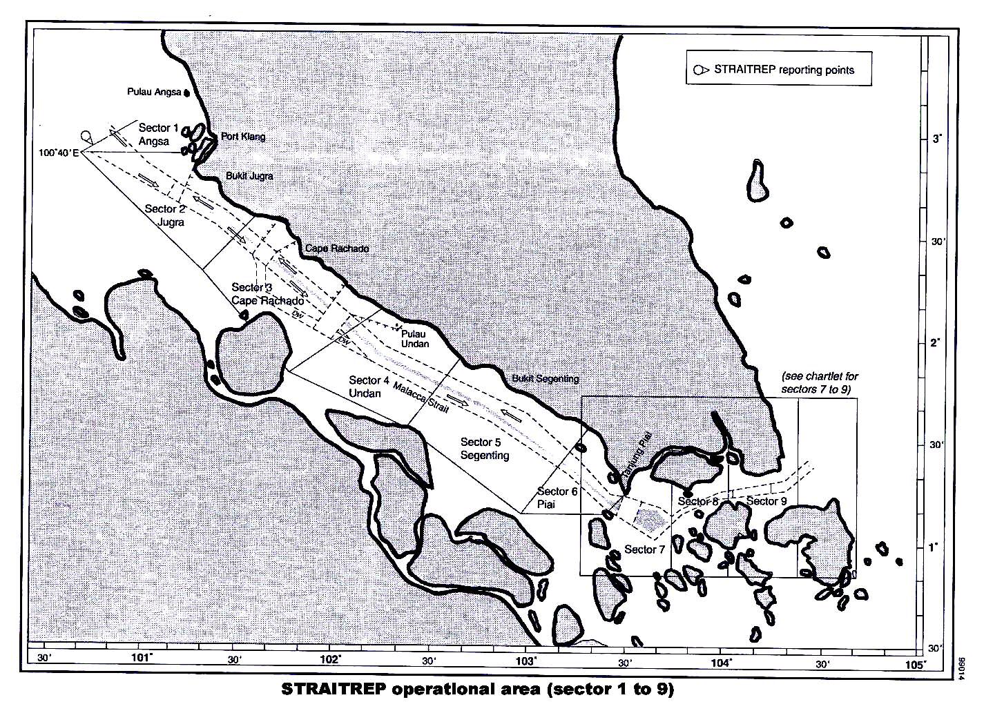
- 35 -
Additional GEF Annex 3: Incremental Cost Analysis
EAST ASIA AND PACIFIC: 4E-Marine Electronic Highway
The Project's Strategic Context
1.
The Straits of Malacca and Singapore are relatively shallow, hazardous to navigation, and
characterized by narrow channels, irregular tides and shifting bottom topography. The Straits are also of
global marine biodiversity significance, rich in the marine fauna and flora that characterize tropical
estuarine environments. Abundant seagrass beds, mangroves, coral reefs and wetlands enrich the
associated coastal marine environments, which are also stopover points for migratory birds on seasonal
transition. Marine natural resource-related activities such as fishing and coastal tourism, are very important
sources of income for the millions of people living in the coastal zone.
2.
The Straits are also the preferred international route for the majority of ships en route between
the Persian Gulf and the Far East, mainly because the two alternative routes (the Lombok-Makassar and
Sunda Straits) add several days the voyage. Recent enhancements in maritime safety infrastructures and
regulatory mechanisms in the Straits have improved navigational safety, vessel traffic flow and the overall
management of the Straits as a major international sea lane. However, the volume of international traffic
passing through the Straits or calling at its ports is very heavy for such a confined and
environmentally-sensitive waterway and is increasing steadily. In 2001, 146,265 vessels (>75 GT) called at
the port of Singapore. Vessel arrivals from 1995 to 2001 increased by an average 6.% per year for the Port of
Singapore and 11% for Port Klang in Malaysia. There is also substantial volume of cross-Straits traffic
between the three littoral States for trade and fishing. Notwithstanding the current navigation system, the
risk of ship collisions and groundings and of consequent environmental and economic damage is high.
3.
Ship-based sources contribute 20% of the marine pollution in the Straits and have acute impacts
on it. The major pollutants from ships are oil, chemicals, liquefied gases, sewage, garbage, bilge water,
ballast water and antifouling paints. The biggest concern is a catastrophic oil spill due to collision and/or
grounding of a very large tanker, thousands of which pass through the Straits each year. An oil spill can
cover a vast area of the sea's surface, as well as neighbouring beaches, and its damage can be considerable.
The cost of cleaning-up an oil spill is very high and its environmental impact on living resources,
particularly sea birds and near-shore sessile organisms, is significantly detrimental.
4.
Unfortunately, recent incremental improvements to existing navigational aids and facilities in the
Straits of Malacca and Singapore have not reduced the incidence of ship collisions and grounding or of
chemical and oil spills. Although risk assessment of tankers in the Straits based on tanker accidents in the
period from 1982 to 1993 showed a relative constant risk at 0.029% (� 0.03=95%CL) [Malacca Straits: refined
risk assessment, GEF/UNDP/IMO Regional Programme, 1999], a steady number of serious vessel accidents
have occurred in recent years, such as the `Natuna Sea' (October 2000) and `Singapora Timur' (May 2001).
Total compensation claims for the `Natuna Sea' from the 3 littoral States were over US$127 million, but only
8.48% was paid due to unsubstantiated and disallowed claims, especially on environmental and
fishery-related damage.
5.
Although the three littoral States of Indonesia, Malaysia and Singapore have relatively good oil
spill response capabilities, including oil spill contingency plans and response facilities and a cooperative
response agreement, several recent serious shipping accidents have highlighted the need for quicker and
better targeted deployment of spill response equipment and manpower and more efficient institutional
arrangements. Immediate access to information on the resources at risk, on spill location, and on the
locations of stockpiled response equipment would also raise the effectiveness and efficiency of an oil spill
response.
- 36 -
The Baseline Scenario
6.
The littoral States of Indonesia, Malaysia and Singapore have demonstrated and continue to
demonstrate a strong commitment to navigational safety and environmental management of the Straits.
Each country has ratified the 1982 UNCLOS and MARPOL 73/78, in addition to other IMO Conventions
dealing with navigational safety and pollution prevention and control. The three countries are also
signatories to the Tokyo Memorandum of Understanding on Port State Control, involving inspection of
vessels for validation of International Oil Pollution Prevention Certificates.
7.
Singapore initiated a Vessel Traffic Information Service in 1990. This comprehensive radar and
computer-based vessel traffic system, which covers the Singapore Strait, can show the positions of up to
1,000 vessels at a time. In 1998, Malaysia commissioned a radar and vessel traffic monitoring system at Port
Klang, covering the Malacca Straits. In that year also, a Differential Global Positioning System (DGPS)
station was installed by Singapore and Singapore released Electronic Navigation Charts for the Singapore
Strait, which are fully compliant with international standards. A DGPS station was recently installed by
Malaysia in Lumut Island north of One Fathom Bank is currently being tested.
8.
A Mandatory Ship Reporting System, STRAITREP, came into force on 1 December 1998, which
requires designated vessels to report to the marine authorities of the littoral States when transiting the
Malacca and Singapore Straits via VHF voice radio communication. Designated vessels entering the
operational area report their name, call sign, IMO identification number (if available), position, any
hazardous cargo and any deficiencies that could affect navigation. STRAITREP is divided into nine sectors,
each with assigned VHF channel. The operators provide information to each participating vessel about
specific and critical situations and traffic movements that could potentially cause problems, as well as other
information relevant to navigational safety.
9.
Under the Baseline (Business-as-Usual) Scenario, the littoral states will continue to maintain and
upgrade existing navigation systems and will establish a few new AIS and DPGS reference stations to
increase area coverage of maritime communications in the Straits. They will also maintain their existing oil
spill response capacity and facilities. They will continue to monitor the environmental condition of the
Straits on an ad hoc basis, but will lack comprehensive information on the environmental condition of the
Straits and detailed information on whether individual ships are leaking oil or dumping bilge water and so
will not be able to effectively deter such behaviour. And will have no mechanism for sharing shipping or
environmental information or agreeing joint action on it.
10.
Ships passing through the Straits will continue to navigate from paper charts that are invariably
out-of-date. They will utilize the available AIS and DPGS facilities to monitor their positions, but, due to
the relatively high risk of collisions and groundings, some will be reluctant to pass through the Straits at
times of poor visibility, in bad weather or at low tide and will be forced to load conservatively and to
anchor and wait for more favourable navigational conditions during bad weather.
11.
In sum, with the increasing volume of maritime traffic and port development in the Straits, as
well as the increasing mix of other uses (e.g., marine recreation, fisheries), the capacity of the Straits to
handle such shipping growth and diverse uses safely and efficiently will be severely taxed. From the
maritime safety standpoint, continued growth in shipping movements will lead to more congestion and will
require more intensive monitoring, especially along critical areas of the TSS. The effects of this congestion
will be exacerbated by the Straits tricky weather conditions and its strong tidal regime. This combination of
factors will cause significant ship delays or diversions, more conservative ship loading and a higher risk of
collision, allision and grounding. The environmental consequences of the aforementioned outcomes will be
an increasing number and magnitude of oil spills and more bilge water discharges and chemical spills from
ships.
- 37 -
The GEF Alternative Scenario
12.
Under the GEF Alternative Scenario, Indonesia, Malaysia and Singapore will: (a) establish a
Marine Electronic Highway (MEH) demonstration system, covering a 100km section of the Straits of
Malacca and Singapore from One Fathom Bank to the Horsburgh Lighthouse, which roughly corresponds
to the Traffic Separation Scheme, and in which shipping is heavily concentrated and some of the MEH
technology is already in operation; (b) assess its domestic and global/regional benefits and its financial
viability, and, if the benefits of a full scale MEH for the entire Straits of Malacca and Singapore justify its
cost and if it is financially viable, (c) prepare a Phase 2 project to extend the demonstration system to entire
Straits and facilitate its replication on the entire Persian Gulf to the Far East shipping route; and (d) initiate
marine environment information sharing and management collaboration between their shipping and
environment management institutions.
13.
The MEH demonstration system will be an integrated and comprehensive regional network of
marine information technologies, comprising: (a) continuously updated and highly accurate electronic
marine navigation charts (ENCs) for the target section of the Straits; and (b) ship-based Electronic Chart
Display and Information Systems (ECDIS) and ship Automatic Identification Systems (AIS) installed on and
operated by a significant number of the larger oil tankers and container ships that regularly use the Straits.
The system will be designed from the end-users' perspective and requirements and will make full use of
new technologies, their applications and management. Other components will include the review of
alternative sustainable financing mechanisms for the MEH, consistent with obligations associated with
accession or ratification of relevant international conventions, protocols, agreements and treaties; legal,
institutional and administrative arrangements; and political and public relations initiatives to enhance the
utility and acceptability of the MEH system and its long-term sustainability.
14.
The GEF Alternative project will involve the following four key tasks/challenges:
1. Integration of existing marine information technologies and capacities within the three littoral
States with the new and innovative MEH electronic navigation and environmental information
technologies to enhance marine transport through and environmental management of the Straits of
Malacca and Singapore.
2. Development of appropriate nstitutional arrangements for the installation and operation of the
MEH demonstration system, including agreement among participating parties on the
administrative, legal, financial and operational aspects of a MEH managing organization, which
will be responsible for implementing this first phase MEH system in the Straits.
3. Quantification of the economic and environmental benefits to the governments, industry/private
sector and the coastal communities of the MEH demonstration system and of a potential full-scale
system covering the entire Straits and assessment of the full-scale system's financial feasibility.
4. If the conclusions of the economic and environment and the financial feasibility analyses are
positive and the three littoral states decide to expand the MEH system to the entire Straits,
establishment of the inter-agency and inter-governmental partnerships required to design, finance,
construct and operate the full-scale MEH as a potentially self-sustaining, revenue-generating
enterprise.
The GEF Alternative Project's Objective
15.
The project is the first, demonstration phase of a potential two-phase program to install a Marine
Electronic Highway (MEH) system in the Straits of Malacca and Singapore. The project's primary objective
is to demonstrate, by establishing a MEH demonstration system in the narrowest and most congested
- 38 -
100km section of the Straits, that an MEH for the entire Straits is economically and environmentally justified
and is financially viable and, by so doing, to catalyze the establishment of a MEH for the entire Straits and
its widespread use by ships passing through the Straits, particularly large crude oil carriers and container
ships which pose the greatest risk of causing major environmental and economic damage to the Strait's
biological resources. A secondary project objective is to strengthen coastal and marine resource
management by providing better information on ship-related environmental threats and promoting
collaboration between the littoral states' national marine and environment institutions in coastal and marine
environmental management.
The MEH Program's Global Environment and Development Goals
16.
The MEH program's local and global environmental goals (of which this project is the first phase)
are to reduce marine pollution and strengthen coastal and marine environmental management in the Straits
of Malacca and Singapore. Its economic/development objective is to reduce the cost of ship transport
through the Straits by improving marine navigational safety and efficiency. If the MEH program shows that
these goals can be achieved in a cost-effective and sustainable manner, the program will serve as a global
demonstration of the MEH system and thereby: (a) facilitate its extension to the entire shipping route from
the Persian Gulf through the Chinese Seas to the Yellow Sea and the Sea of Japan; and (b) trigger its
replication world-wide.
Incremental Costs of the MEH Demonstration Project
17.
The Incremental Costs of the GEF Alternative Project total about $16.2 million. Of this, ship
owners and operators will fund about $5 million for the ship-based equipment required to utilize the MEH;
Indonesia, Singapore and Malaysia will fund about $3.2 million of investment in upgraded shore facilities
to supply the additional real-time information the MEH requires; and the GEF is requested to fund the
balance of $8 million, which will finance the system's detailed design and the initial start-up and operation
of the MEH management organization.
- 39 -
Incremental Cost Matrix
Component
Baseline
Alternative
Domestic Benefits
Global/Regional Benefits
Integration of existing, Lit oral States have
Major improvement in
Significantly imroved safety
Less environment-related damage in the
standard marine
established various
maritime traf ic and
margin for vessel operations.
Straits of Malacca and Singapore due to
navigation and
navigational aids and
environmental management
improved navigational safety.
environment systems
measures, including
through instal ation of an
Increase in operational
in the Straits of
mandatory STRAITREP,
integrated, electronic MEH
ef iciencies of vessels.
Lower fuel ship consumption and
Malacca and
which are maintained and
system, which would enable
greenhouse gas emissions.
Singapore into a
slowly upgraded to
interactive tracking, guiding
Reduced incidence and risk of
Marine Electronic
marginal y improve safety of and monitoring of larger ships
col isions, possibly leading to
Accessibility and exchange of marine
Highway System
navigation, reduce ship
transiting, crossing or cal ing
lower insurance premiums.
environmental information at any time at low
environmental damage and
at ports along the congested
cost facilitates bet er conservation.
improve monitoring of
and confined waters of the
Lower oil spil response and
maritime traf ic.
Straits.
clean-up costs.
Enhanced monitoring and forecasting of
oceanographic, meteorological and
Improved quality and availability environmental conditions of the Straits,
of marine environment
including biodiversity mitigates impact of
information.
shipping accidents.
Improve management of vessel
Bet er oil spil detection, prediction and
port arrivals/departures.
more ef ective response results in less
environmental damage from spil s that do
Ef ective interactive tracking
occur.
and monitoring of vessel
movement by the VTS.
Improved compliance with marine
environment conventions and standards.
Greater use of local port
facilities and services.
Reduce congestion and more
ef icient vessel traf ic
management, including
cross-Straits traf ic.
Production of
Smal scale ENCs from the
Production of high resolution
Same as above
Same as above
electronic charts for
Four Nations Joint Survey
ENCs for the Straits wil
the MEH system's
covering the international
have a pivotal role in the
100km section of the
sea lanes of the Straits
adoption of new and
Straits.
have been completed but
emerging maritime
not yet released or used.
technologies to enhance
Lit le use wil be made of
voyage planning and
them due to their modest
navigational safety as wel
quality and limited
as reducing the risk of
coverage.
groundings and col isions
Marine information
Advances and widespread
Integration of national
Same as above
Same as above
technology
utility of Information and
maritime safety and marine
integration
communication technology
environment data under
has resulted in various
the multimodal MEH
applications in the maritime
system enables rapid
sector including Internet
delivery of integrated
connectivity and
information in real time
e-commerce.
mode, particularly useful
for marine emergency
response and maritime
security.
- 40 -
Component
Baseline
Alternative
Domestic Benefits
Global/Regional Benefits
Development of MEH Lit oral States have
Regional cooperation on the
Same as above
Same as above
operations and
consistently carried out
establishment and operation of
administrative
regional cooperation to
the MEH system develops
mechanisms
address common concerns on mechanisms on regional
maritime safety and marine
col aboration and sustainable
environment protection.
financing and institutional
arrangements that include the
private sector.
Integration and
Pol ution preventive
Integrated and multimodal
Reduced risk of shipping
Enhanced regional and international
enhancement of
measures in the Straits are
approach to pol ution
accidents (groundings and
cooperation to mitigate transboundary
regional marine
in place at the national and
prevention, response and
col isions) in ports and
marine pol ution issues leading to less
environment
regional levels, which
management in the Straits
congested sea lanes and
environmental damage.
protection systems
include navigational aids, oil
through the Marine Electronic
bet er port manoeuvres.
within the MEH
spil contingency plans and
Highway system wil ensure
Promotion of sustainable resource use.
framework
response programmes as
ef ective, ef icient and timely
Increased cargo load due to
wel as environmental
intervention of spil incidents
bet er definition of under keel
Improved emergency response (search
monitoring.
clearance with updated and
and rescue, pol ution response) reduces
Through information and
precise bot om soundings.
negative regional environmental impacts
Environmental monitoring in
communication technology
of ship accidents or pol ution releases.
the Straits is general y
(ICT), continuous and real time
Reduced damage claims
undertaken on an ad hoc
environmental monitoring is
associated with oil spil s.
Model of marine environmental information
basis, including col ection of
achieved, ensuring reliable and
management and col aborative response
hydrographic and
accurate assessments and
Reduce queuing time for
for other sea areas in the world, especial y
oceanographic data.
forecasts.
vessels at entering the TSS or
along congested and busy waterways.
ports.
Applications of
Availability of sea-based
environmental data in the
monitoring devices for
Bet er usage of port facilities.
Straits are limited,
hydrographic and
particularly on
oceanographic parameters with
Reduce red tape in data
transboundary issues,
telemetry capability significantly
acquisition, delivery and
including pol ution response,
enhance monitoring programs
access.
due technical and resources
and the use of environmental
limitations.
data for policy and
management decisions.
Evaluation of the
No action
The user States, private sector
The evaluation takes ful
International partners - the GEF, Japan and
economic, social and
partners and donors contribute
account of the cost/benefit
the World Bank, contribute to and learn
evironmental benefits
to a participatory evaluation of
assessments of the three
from the evaluation. This enhances their
of the demonstration
the MEH Demonstration system participating governments
ownership of it and, if is positive, promotes
MEH
as a precursor to its possible
and the MEH's private sector
support for the second phase MEH and
expansion to the entire Straits.
partners.
achievement of its global environment
benefits.
Feasibility assessment Few resources available for
Establishment of a Revolving
Bet er management of the
More ef ective conservation of the global y
and design of an
the environmental
Fund and perhaps multi- and
coastal and marine resources of significant marine and coastal biological
Environment Fund for
management of the Straits of bilateral agreements and
the Straits on which many
resources of the Straits of Malacca and
the Straits of Malacca
Malacca and Singapore and
arrangements to address
thousands of local people
Singapore.
and Singapore
no financial contribution from maritime safety and improve
depend.
users of the Straits
environmental management of
the Straits.
Design of the Second
No action
If economical y and financial y
Enhanced vessel operating
The MEH Demonstration Project's global
Phase of the MEH
feasibile and environmental y
ef iciency, higher navigational
environment benefits are extended to the
System covering the
justified, development, financing safety standards linked with
entire Straits of Malacca and Singapore,
entire Straits and
and operation of a MEH system integrated marine environment
potential y into the East Asian Seas, Bay of
promotion of its
for the entire Straits and
protection and sustainable
Bengal and Indian Ocean, and possibly in
replication on the
promotion of its replication
development of the coastal and other parts of the World.
Gulf-Far East ship
elsewhere.
marine resources of the entire
route and World-wide.
Straits.
- 41 -
Additional GEF Annex 4: STAP Roster Technical Review
EAST ASIA AND PACIFIC: 4E-Marine Electronic Highway
Scientific and Technical Review
By Professor Richard Goss, Master Mariner
Technical Soundness
The demonstration project will not introduce any new technology but will make maximum use of
that currently available. In doing this, there are a few operational aspects that should be given
more attention
a.
ECDIS and other ship-borne equipment
The ship-borne equipment which results from this study will have to be used by ship-borne
people and I therefore wonder at the absence of specialist navigation and nautical bodies from the
list of those advising. You will appreciate that current ship-borne people are not always
adequately represented either by associations of their employers or by former seafarers whose
practical experience ended some time ago -such as myself -even if they still use the title of
Captain.
May I suggest contacting Mr. Julian Parker, Secretary, The Nautical Institute, 202 Lambeth
Road, LONDON SE I 7LQ and Group Capt D W Broughton, MBE, Director, The Royal Institute
of Navigation, 1, Kensington Gore, LONDON SW7 2AT. Both are highly respectable
professional institutions with worldwide -not just British -memberships and IMO accreditation.
Prince Philip is an Hon. Fellow of the first and Patron of the second. The Royal Institute of
Navigation benefits from a strong air navigation component and the Nautical Institute from
extensive contacts with people serving at sea.
Singapore, however, has its own Nautical Institute and you might care to contact them directly. I
also wonder at the absence of academic contacts, for there are many universities around the
world with developed maritime interests, economic and environmental. Some of their staff have
practical sea-going experience. If you want a list, with named contacts, I could supply it.
b.
How to deal with small ships
S E Asia has many ports, often with small throughputs, and much trade is carried over short
distances, so optimal ship size is small. Moreover, many of these vessels are traditional, built of
wood and correspondingly make poor radar targets. Practical problems must therefore be
expected and this may not be wholly related to the familiarity of mariners with the reporting
requirement. Greater problems may be expected with fishing vessels and those of the less
reputable registers. See, for example the Port State Control reports on ships without compasses,
inoperable life-saving and fire-fighting equipment and (paper) charts. Some aspects of this are
referred to on p 81. The Malacca Straits are also a notorious center for piracy and I am surprised
- 42 -
that this is not covered -though the RIBs commonly employed for piratical purposes are, of
course, poor radar targets.
c.
Under-keel clearances
Precise use of under-keel clearance may indeed depend on new and repeated bottom surveys: also
new and more precise information on tides and surges, e.g. those caused by winds and changes in
barometric pressures These are far from trivial matters (i.e. for any given under-keel clearance,
maximum drafts will vary from time to time) and deserve consideration if expectations are not to
be followed by disillusionment.
If ECDIS is to be trusted with respect to such matters (as optimum under keel clearance and
precise position-finding) then the hydrographic authorities must be prepared to drop the
restrictive wording they commonly employ (e.g. "no guarantee can be given") and accept legal
responsibility for the information they provide. I have seen no sign that this has been appreciated,
let alone accepted. Yet, if this is not done, the MEH will not be sustainable or replicable.
d.
Ship operations
Seaways, the Nautical Institute publication, carries many examples of ships not being operated
'credibly', e.g. without lookouts, failing to answer signals and without regard for the collision
regulations. However, the demonstration project as described in the PAD, assumes that what is
supposed to happen, will actually occur. Too many practical seafarers know otherwise. They
often regard such schemes with skepticism, especially about the possibilities of achieving
universal compliance.
e.
Climate data
Climatic data will be needed from the off-shore buoys. Sea levels vary, sometimes significantly
with barometric pressures and wind effects as well as tides.
Innovativeness
a.
Charging system
Capital and operating cost estimates are described and it is assumed that the latter will be
recovered by a charge on ships transiting the Malacca Straits This is an innovative proposal (and,
as far as I know, a precedent for international waters) and both the principle involved (elements
of 'public goods') and the practical means of collection (through AIS? but this has previously
been considered as a safety measure, not an opportunity for collecting revenue) deserve a good
deal of discussion. What about cross-Straits, e.g. ferry, traffic? Would there be any reduction for
frequent users? Upon what basis would ships be charged? How would non-payers be stopped or
punished? There arc economic and practical matters to be considered here, not just the legal ones
as described in the PAD.
Moreover, the PAD specifies that the charges should be 'voluntary' and leaves open the question
- 43 -
of those who decline to pay (the 'free-riders').
Benefits
Method of evaluation
There is little discussion of the more difficult parts of the proposed cost benefit analysis (CBA)
of the outcome of the demonstration project, e.g. the environmental effects. I am not aware of
any accepted techniques or evaluations for assessing the benefits of avoiding marine pollution;
though this is certainly no reason for not attempting to pursue the subject as far as possible. In
particular we may note that avoiding the cost of clearing up the mess is likely to be a serious
under-statement of the benefits of avoiding an oil-spill; the same goes for other forms of
pollution. However, we should also note that CBA is, at best, an aid to decision-making: we
should not expect it to take decisions for us.
We should, therefore, go as far as we can in the qualitative. quantitative and evaluation stages
without necessarily expecting to do everything. Given the progress that has been made in the last
50 years (most of which I have spent arguing for this kind of rational decision-making), we may
expect substantial progress to be made in the next 50.
Nowhere have I seen any outline of how this is to be done, not even a list of items to be included,
let alone anything on how they are to be assessed. In considering the benefits they could be
categorized as:
1
Those which reduce the social cost (including externalities like pollution) of sea
transport;
2
Those which reduce the transit time of sea transport; and
3
Those which reduce the risks of sea transport (to people, ships, cargoes and the shore).
You will know that the sum of these is known as generalized transport cost and, whilst it is a
useful concept (e.g. in providing an intellectual framework for MER), very little serious work has
been done on it. Has the World Bank considered bringing in any academic economists (or PhD
students) with a view to developing the idea in a maritime context? Do bear in mind that such
economic research is extremely cheap, and especially if you use people who are already being
paid by someone else.
Now is the time that some thought be given to the evaluation methodology, otherwise I do not
see how the CBA is to be carried out effectively and on time. For example, how will the expected
reduction in congestion in the Straits be assessed? With the use of congestion theory and the
standard concept of a backward-bending supply curve? This needs to be explored so that people
are ready to switch on to the relevant. techniques. Again, many of the domestic and global
benefits specified here could be divided into the three elements of generalized transport cost
listed above.
Obviously, the most difficult parts would be those concerning environmental effects but I
imagine that WB and GEF have done relevant work in that field. Others would include
- 44 -
reductions in:
1.
Lives lost
2.
People injured, seriously and minor
3.
Ships lost
4.
Ships damaged, seriously and minor (including loss of time whilst being repaired)
5.
Cargoes lost
6.
Cargoes delayed, seriously and minor
7.
Cargoes delayed
8.
SAR costs
9.
Port and other fixed shore installations
10.
Floating navigation marks.
Use of insurance as a measure of value and interest rate as a time value
You should not suppose that social risks are in any way equivalent to insurance and for three
reasons: Insurance policies always exclude some risks; they arc subject to 'deductibles',
equivalent to a de minimus rule; and there are no insurance policies which cover delays to ships
or cargo.
Taking the rate of interest on the value of the goods is a very inadequate measure of the values of
time-saving. Some Belgian work suggests that it should be about seven times as much.
The PAD says very little about how competition in the provision of MEH type services might be
encouraged. Yet it is competition which keeps the private sector efficient -and some parts of the
public sector This needs to be thought. through.
Benefits derived from increases in operating efficiency would include:
1.
Maintaining speed more efficiently in adverse conditions
2.
Steering a more accurate course (e.g. great circle instead of rhumb line) 3. Carrying
more cargo by optimizing under-keel clearance
4.
Manoeuvring more efficiently when near tugs and port installations
5.
More efficient implementation of collision regulations.
In my experience many of these present significant difficulties in respect of qualitative and
quantitative assessment as well as in evaluation. If you want me to expand these ideas, let me
know.
Given the successful development of Formal Safety Assessment at IMO and their welcome
involvement in this work, I would imagine that you would want to use, rather than to duplicate,
their ideas and practices. If you were visiting them in London then it would usually be practicable
for me to attend any meetings you had with them.
- 45 -
Valuation of reduced risk of loss of life
The PAD makes no mention of evaluating the reduced risk of loss of human lives. It may be
difficult, but IMO is making substantial progress in this field, through Formal Safety Assessment
(FSA), most recently on bulk carriers. Progress is also being made in the assessment of
environmental effects; but I assume GEF have relevant expertise there.
Institutional Structure
It is important that the experts in the various levels of management of the demonstration project
(The Project Steering Committee (PSC), the members of the Technical Committees (TCs) and
the Working Groups (WGs) as well as staff of the Project Management Office (PMO)) should
work together and should be aware of each other's needs. In particular they should be aware of
the need for their work to feed into the CBA through the three stages of qualitative and
quantitative analyses leading to evaluation. It should be made clear to all participants from the
outset, and in particular the staff of the PMO that CBA will play a major role in assessing the
outcome of the demonstration project. If this is not done then much effort may be spent in work
leading to unhelpful results. Statistics of gross tonnages are an example. The addition of like and
unlike figures, as in some of the data already presented to the PSC, is an example.
Stakeholder Involvement and sustainability
Sustainability of the project and conversion of the demonstration to the full-scale phase depend
critically on stakeholder involvement. There has been extensive and productive consultation with
the national stakeholders and the major shipping users of the Straits. The proposals for
consultation, and particular that with ship operators and their representatives, should be
expanded. If the ship operators are not fully supportive of the actions taken during the
demonstration project and the proposals for expanding them into the full-scale project, neither
project will be sustainable
Replication Potential
The PAD very reasonably says that this MEH work can provide a global approach in the marine
environmental sector. Indeed it may, and also in respect of ECDIS, SAR arrangements, marine
surveying and many other factors. This work is, in other words, creating a precedent in many
fields of which environmental assessment is only one. As such it would be worthy of support
even if it did not appear (on Canadian Coast Guard CBA and CSL evidence) to be thoroughly
worth-while in itself. The changes likely to be wrought in many parts of the world (Dover Straits
and the inland Sea of Japan) both leap to mind, as well as the sea route from Singapore to Japan,
may be as profound as those which appeared after the publication of paper charts derived from
professional surveys in the late 18th and early 19th centuries or the comprehensive analyses of
wind systems derived from US Navy work in the middle of the 19th century. I think the terms in
which the expansion of the demonstration to the full scale project are too modest and the rate of
progress too slow. (These points are taken up on p 5 of the Draft Project Brief for the GEF, see
below.)
- 46 -
Charging mechanisms for this MEH have implications for other places. Many of the lights and
buoys of the UK and Ireland are currently financed through a hypothecated tax charged on ships
entering the ports. The many ships which steam past pay nothing; nor do they contribute anything
to the costs of the elaborate UK-French regulation of navigation in the Dover Straits (radio
micro-wave links, VHF navigation advice, ship identification by aircraft). This situation is
currently controversial and precedents are therefore correspondingly important.
World Bank Response to the Scientific and Technical Review
The very constructive comments of the Reviewer have proved helpful in considering how the
project design and implementation can be adapted to increase the probability of success. The
project team looks forward to a continued active involvement of the Reviewer in assessing
progress and modifying the demonstration project as necessary during its implementation.
Technical Soundness
a.
ECDIS and other ship-borne equipment
The recommendation of the Reviewer is accepted and his sources will be contacted for a
maritime advisor. To date, the extensive stakeholder consultations with representatives of
shipping lines using the Straits have provided an indirect perspective of ship Captains, but a more
direct advisory role will be incorporated into the demonstration project.
b.
How to deal with small ships
Small ship operators will not be able to afford the ECDIS equipment proposed for the project.
Design of the ECDIS systems and their incorporation with standard navigation systems will be
deigned to maximize the possibility of detecting small ships.
c.
Under-keel clearances
Minimizing under keel clearances is one of the benefits that would make the full-scale MEH
attractive to ship operators. The IHO is an active participant in the project management (a letter
of commitment has been received from them). However, we accept the reviewers' comment on
the need to pay particular attention to the legal repercussions of providing more detailed
information of changes in channel depths than is usually available.
d.
Ship operations
The advice on "not credible" ship operations is noted and methods of dealing with issue will be
sought from the ship operating advisors chosen under (a) above.
Innovativeness
- 47 -
a.
Charging system
The details of the charging system will determine the acceptability of the full-scale scheme to the
ship operators and be designed to provide adequate revenue to the operator of the MEH to cover
investment, system and data maintenance and operating costs. At the same time since the MEH
will operate in international waters if will of necessity be voluntary. The charges should be set so
that sufficient ship operators see a financial benefit to participating in the scheme. The Reviewers
observation that satisfying these needs will be difficult is recognized and much of the technical
effort in the last two years of the demonstration project will be devoted to devising a sustainable
financing system.
Benefits
Method of evaluation
It is recognized that little progress has been made to date on establishing the methodology of the
evaluation of the demonstration project. The recommendations of the Reviewer are accepted and
welcomed and will be acted on in the design of the evaluation method. The Reviewers advice
will be sought on suitable advisors to the Project Team on how the evaluation should be done,
and particular on the data that will need to be collected early in the demonstration phase to
provide the "base case" for comparison with that after implementation.
Institutional Structure
Most, if not all, the participants in the various levels of administration of the demonstration
project are experienced in management of projects involving shipping in international waters.
They are aware of the need for a high level of coordination and collaboration. In selecting the
members of the PMO, the IMO and GEF Task Manager will take full account of the advice of the
Reviewer in this respect.
Stakeholder Involvement and sustainability
The IMO and Project team have been cognizant of the need for an exceptionally high level of
stakeholder involvement. Frequent coordination meetings have been held in the participating
countries at which all major stakeholder interests, including shipping operators and potential
providers of services and equipment to the demonstration project have participated. An
indication of the success of this coordination and the strength of ship-owner participation is their
commitment to equip sufficient ships ( a minimum of 60) with the equipment necessary for the
demonstration project to function. It is expected that the interest of other ship-owners shown so
far will result in their also equipping some of their ships to take part in the demonstration project.
Replication Potential
The IMO is participating in other projects that are intended to replicate at least in part some of
the components of the demonstration project. The EU and maritime agencies of several European
- 48 -
governments and of Japan have expressed an interest in being kept informed of progress on
implementation of the demonstration project. The project work plan envisages a lengthy process
of discussion with these and other maritime agencies (including those of the US and Canada) to
ensure that lessons of previous attempts at establishing MEH-type systems are fully taken into
account in the design of the full-system and to ensure so far as is possible that it will be
compatible with other systems being considered.
- 49 -
- 50 -