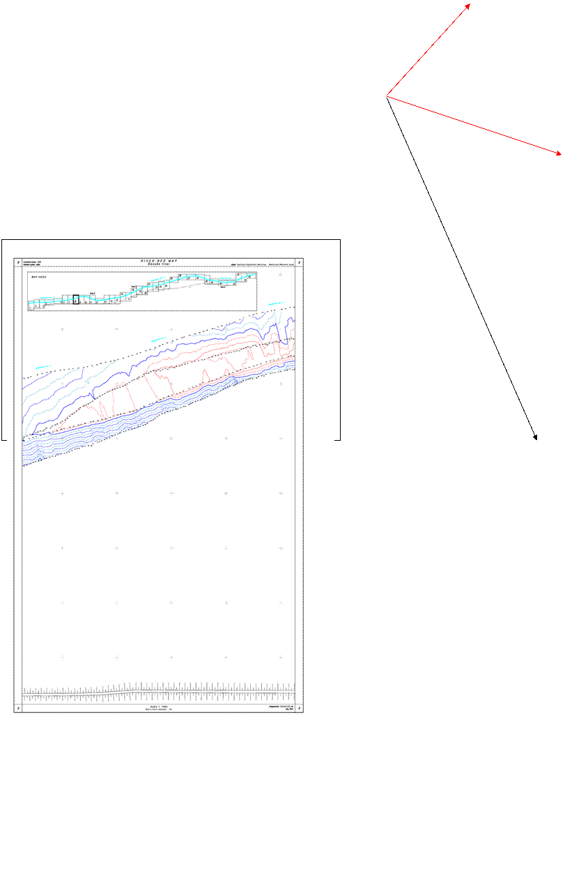
Task 1.4. Preparation riverbed map of the Danube River from rkm 455,0 to rkm 433,0 bordering to the north Brushlen-Kalimok wetland
Preliminary preparation
- Data for high accuracy determination of the parameters of the geoid and connection of the up-elliptical heights to the altitude system are assured. Marks from the national geodetic NETWORK (bench traverse II class) are assured from “Geokardfond” and opened at place of Nova Cherna village and town of Tutrakan for assuring the planned height accuracy.
These marks are included in the project for Secondary geodetic CONTROL NETWORK and they will be outlet points in height relation for all zone surveys.
The marks are three – two operating and one controlling.
- Project for a basis of geodetic points is created in order to assuring the surveys/soundings on water. These points are included in Secondary geodetic CONTROL NETWORK and are surveyed together with the points from Primary geodetic CONTROL NETWORK and Secondary geodetic CONTROL NETWORK.
They are “basis” for the water soundings and will assure the latest as well as a signal for radio-receiving of differential corrections of the basis GPS receiver from the portable one.
These points are situated nearby to the waterside in distance between them approximately 7 km in accordance to the above-mentioned considerations. The distance is approximately 7 km because of the radio transmitter of the basis receiver has 0,5 W power and covers approximately 3,5 km in the existing conditions (riverside afforesting).
· Controlling soundings have been conducted with a fathomer for determination “at site” the accuracy of it work in conditions bed deposits with soft or semi-liquid consistence.
Surveys, finalizing, final product
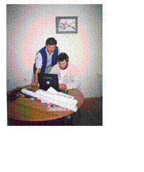
The surveys are conducted in period 6-11 May 2003
Team: Eng. Ilko Georgiev
Eng. Yordan Mladenov
Supporting staff – 3 persons
The following technical facilities have been used:
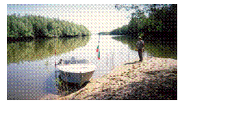
Vessel reg. No ЛМ 437 “GEOHIDE”, sailing license No1279 from 15.01.2002, DMA, Lom
GPS receivers Trimble 4700 – 2
GPS receivers Trimble 5700 – 1
Fathomer SonarLite – 1
Field computer – 1
Software HidroPro – 1
High road-ability car – 1
The preliminary digital model of the Bulgarian riverside of the Danube River in the 20 km section was created for the survey preparation. The basic gales for conductions of the surveys were planned on the preliminary digital model using the HidroPro Software.
- The surveys start by stages from west to east in accordance to preliminary developed scheme during the working stage
Hydrographical surveys based on the using of a GPS receiver at real time are accomplished on the basis of points from Primary geodetic CONTROL NETWORK and Secondary geodetic CONTROL NETWORK situated on the waterside.
The evaluation done after the ending of the field surveys confirms that the data are correct and correspond to accuracy and density requirements.
Control surveys are conducted as well on level connected to the yards with zeros in the “Baltic system” as follows:
Tutrakan 8.70 m
Oryahovo 10.31 m
Svishtov 14.89 m (this one has not been used)
- Digital model of the riverbed was created on the basis of the received data from the accomplished hydrographical surveys
The digital model is created with AutoCad LDD.
The points from the field surveys and processed points are entered. Mathematical definable surface of the riverbed is prepared with the method of the uncovering triangles using the specializing software HidroPro – Trimble USA.
- Drawings in “cadastral plan” 1:1000 are prepared on the basis of the received digital model. The cadastral plan 1:1000 is the same as this one for the map of inlet-outlet places.
Isobars of points with equal altitude are drawn according to the method of interpolation. The arbitrary signs and symbols are standard for the scale.
35 map sheets are prepared.
The scale and cadastral plan are selected in way that full compatibility and ability for imposition of the drawings of the riverbed and these ones of the inlet-outlet places to be assured.
2. Review and specifying the methodology and approach for task implementation
The measurement of the points under water is conducted according to technology based on the using of working in real time high accuracy GPS receiver synchronized through 1 pps outlet with digital fathomer. The GPS receiver indicates the co-ordinates and height of the surveying points (GPS antenna) and the fathomer – the distance between the GPS antenna and the bed (the distance between the fathomer transducer and the bed + the distance between the transducer and the GPS antenna).
The data from the surveys of GPS receiver and the fathomer are registered in the field computer.
A key moment in the technology plays the software for hydrographs Trimble – Hydro Prо.
The surveying points are visualized in real time in order to avoiding survey omissions and respecting the planned numbers and configuration of the gales.
Note: HydroPrо Software allows an opportunity for calculation in real time of eccentric elements that allows the vertical axis of the GPS antenna to do not coincide physically with this one of the fathomer transducer.
The GPS receiver and fathomer included in the field computer are synchronized and managed from Hydro Prо Software.
The current positions of the antenna of the GPS receiver and the vessel (if data for it form and measurements as well as the place where the GPS antenna is set up are entered) are visualized on the digital map with the designed gales.
The skipper of the vessel controls from the display the current position of the vessel according to the respective gale in every moment.
Two hard and expensive processes are avoided trough this way:
- Positioning and controlling of the vessel during its movement in the respective gale from the waterside by means of theodolite.
- Materialization of the ended points of the gales on the waterside.
HydroPrо software allows:
- Automatic or manual elimination of the points that do not response to the set parameters, basically:
- Pick values of the depths as value and time with accuracy +/- 0.001 m and 1 sec according time;
- Variations of water level (a rough see) above definite set value with accuracy +/- 0.001 m;
- Slope of the vessel above definite value with accuracy +/- 0.001 m and 1 sec time
- Value above/bellow a definite level with accuracy +/- 0.001 m
- And more:
- Alarm for reaching of desired depth;
- Alarm for reaching of water level above/bellow definite values (high and low tide or sharply rising or subsiding) for definite time;
- Automatically adding the distance from transducer to the antenna of the GPS receiver;
- Automatically adding the distance from transducer/ antenna of the GPS receiver to the water level;
- Synchronization according time between GPS and fathomer with accuracy 0.01 ms.
All these opportunities are realized in real time (during the surveying process). There are opportunities for drawing reports for the condition of parameters for every second after finishing of the surveys.
All this can be done because of using of the technology for surveying in real time with high accuracy GPS set with precise phase processor and complete cycle of the phase study.
The processing of surveyed points from the changes is done with the same software.
The creation of the mathematical definable surface of the riverbed and digital model is done with TGO (Trimble Geomatics Office) software.
The map is prepared with AutoCad LDD.
Accuracies
The instrumental accuracy guaranteed from the fathomer is 0.025 m; from GPS receiver is 0.02 m. From instrumental faults is accumulated 0.045 m.
The final accuracy of the sounded depths depends from one more component reverberated ability of the riverbed ground.
During the surveys no sediments with different from the normal reverberated ability and penetrate degree were found. It was not necessary correction factors for the sounded depths to be deduced.
Having in mind this and taking into account all other sources of faults the accuracy of the sounded depths is between values of 5 to 7 cm.
Note:
The consultants for the present project suggested during the work for this task to be made comparison between the present map of the riverbed and a hard copy map from 1960.
The following basic prerequisites are required for the implementation of this comparison:
· Presences of identical points from both map materials.
· These points have to be in the same coordinate system and height.
· Relation between points from the previous row and the graphical contents of the map.
For the first bullet: identical points were not founded.
For the second bullet: the current data can be in coordinate systems 1970 and WGS84. The map from 1960 is in unknown coordinate system – perhaps 1950 or 1942, cross sections from the coordinate network are obliterated.
For the third bullet: it is possible to be created through vectors such relation but without identical points and coordinate network this is useless.
The comparison is possible but its conduction is connected to:
· Implementation of additional surveys;
· Mathematical deducing of parameters for the above-mentioned coordinate systems (they are vague in this moment);
· Digital data extracted from a hard copy map (the accuracy will be contestable)
· Data transformation from one system to another.
These activities are not covered from the contracted activities for the present preliminary survey and the compatibility is not possible at this stage.
Attachment:
Map sheets 35 numbers
Digital map (CD/diskette)
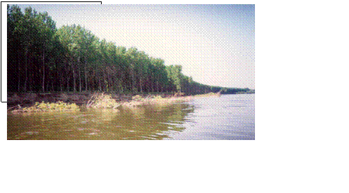
The waterside line of Brushlen-Kalimok wetland was investigated in details during the implementation of the hydrographic activities for preparation riverbed map of the Danube River. Some areas have been located along the line with strong waterside erosion. This is of interest for the future surveys.
These areas are located in the map material and photos have been taken in order to visualization of the existing situation.
These areas are:
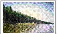
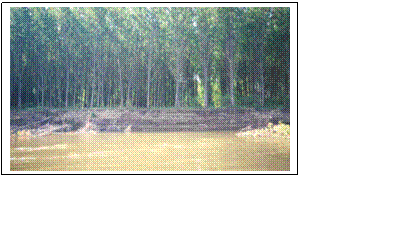
Zone of the erosive waterside, sheet 8
 The Bulgarian waterside
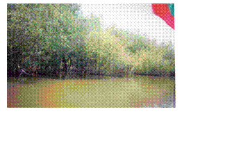
 Typical waterside in channel in south direction from an island of Danube river, “point С”