
CERMES Technical Report No 4
An assessment of the vulnerability of the Cocal area,
Manzanilla, Trinidad, to coastal erosion and projected sea
level rise and some implications for land use
DENYSE MAHABIR AND LEONARD NURSE
Centre for Resource Management and Environmental Studies (CERMES)
University of the West Indies, Faculty of Pure and Applied Sciences,
Cave Hill Campus, Barbados
2007
ABSTRACT
An assessment of the vulnerability of the Cocal area, Manzanilla, Trinidad, to coastal
erosion and projected sea level rise and some implications for land use
DENYSE MAHABIR AND LEONARD NURSE
There has been an overwhelming concern over the possibilities of the consequences of the rise in
the production of greenhouse gases, particularly by the developed countries. What poses the
greatest concern is the effect that these gases will have on the climate. The greatest threat
however is going to be faced by Small Island Developing States (SIDS). For all intent and
purposes most small islands can be considered to fall into the category of what some may call the
coast.
This paper looks at and area on the East coast of Trinidad- the Cocal area, its erosion status,
vulnerable resources within that area and the possible impacts that four scenarios of sea level rise
will have on a portion of the East coast in Trinidad. It makes use of Geographic Information
Systems, more specifically the programme Arc View; so as to determine how far inland the sea
will go and what land uses will be affected. In doing so, a holistic approach was taken so as to
formulate ways in which the effects of the rising sea and coastal erosion can be dealt with.
Key words: vulnerability, sea level rise, land use, Trinidad
i
ACKNOLEDGEMENTS
Throughout life we are very fortunate to have met persons who are very helpful, kind,
considerate, understanding and supportive. The time spent on this paper has really brought to life
so many of these persons because the completion of this research paper would not have been
possible without the help of so many people. Firstly I would like to thank the Almighty God
because without him nothing is possible and everything is possible. To my supervisor, Dr.
Leonard Nurse, my heartfelt thanks and gratitude for all the assistance and guidance that you
have given me throughout the duration of the project. I would also like to say special thanks to
the following persons:
Dr. Jacob Opadeyi
Ms Shahiba Ali
Mr. Lloyd Gerald
Dr. St. Clair Barker
Ms. Helen Harris
Mr. Kishan Kumarsingh
Mr. Rodney Thomas
Staff of the Forestry Division of the Ministry
Special thanks to my family and friends (you know who you are) for all of their support and
encouragement, I have truly been blessed.
ii
CONTENTS
ABSTRACT...........................................................................................................................I
ACKNOLEDGEMENTS.........................................................................................................II
1
INTRODUCTION ..............................................................................................................................................................1
2
LITERATURE REVIEW .................................................................................................................................................2
2.1
CLIMATE CHANGE ....................................................................................................................................................... 2
2.2
THE NATURAL GREENHOUSE EFFECT ........................................................................................................................ 2
2.3
GREENHOUSE EFFECT - A PRECURSOR TO SEA LEVEL RISE ................................................................................... 3
2.4
SEA-LEVEL RISE: PROJECTIONS AND IMPLICATIONS.............................................................................................. 4
2.4.1
The global perspective.........................................................................................................................................4
2.4.2
Possible impacts of sea level rise.......................................................................................................................4
2.5
THE REGIONAL PERSPECT IVE..................................................................................................................................... 6
2.6
THE LOCAL PERSPECTIVE ........................................................................................................................................... 7
2.6.1
Existing environment............................................................................................................................................8
2.6.2
Geology of Trinidad..............................................................................................................................................8
2.6.3
The climate of Trinidad........................................................................................................................................9
2.6.4
El Ni±o Southern Oscillation ............................................................................................................................10
2.6.5
Flooding................................................................................................................................................................10
3
METHODOLOGY AND DATA SOURCES .............................................................................................................11
3.1
USE OF GIS ................................................................................................................................................................ 12
3.2
STEPS INVOLVED IN USING GIS............................................................................................................................... 12
4
THE S TUDY AREA .........................................................................................................................................................17
4.1
COCOS BAY Ł MANZANILLA-MAYARO................................................................................................................. 19
4.1.1
Geographical circumstances.............................................................................................................................19
4.1.2
Coastal land use..................................................................................................................................................20
4.1.3
Seismic conditions off Trinidad's east coast..................................................................................................20
4.1.4
Coastal form and features .................................................................................................................................20
4.1.5
Bathymetry............................................................................................................................................................20
4.2
OCEANOGRAPHIC FEATURES................................................................................................................................... 21
4.2.1
Currents and circulation....................................................................................................................................21
4.2.2
Waves and tides...................................................................................................................................................21
4.3
VULNERABILITY ASSESSMENT ................................................................................................................................ 21
4.4
RESOURCES THAT MAY BE AT RISK IN THE STUDY AREA..................................................................................... 22
4.4.1
The Nariva swamp ..............................................................................................................................................22
4.4.2
Mangrove communities......................................................................................................................................23
4.4.3
Manzanilla beach................................................................................................................................................24
4.4.4
The Manzanilla Mayaro Road ..........................................................................................................................29
4.4.5
The community.....................................................................................................................................................30
5
RESULTS AND DISCUSSION.....................................................................................................................................32
5.1
RESULTS..................................................................................................................................................................... 32
5.2
DISCUSSION................................................................................................................................................................ 33
6
MEASURES THAT CAN BE ADOPTED TO COUNTERACT COASTAL EROSION AND THE
PROJECTED IMPACTS OF RISING LEVEL..................................................................................................................35
6.1
PERFORMANCE OF PAST COASTAL STRUCTURES................................................................................................... 36
6.2
RECOMMENDATIONS................................................................................................................................................. 37
6.2.1
Protective mechanisms that may be utilized...................................................................................................37
6.2.2
Plans for the development of the study area...................................................................................................38
7
CONCLUSION ..................................................................................................................................................................40
8
REFERENCES ..................................................................................................................................................................42
iii
Citation: Mahabir, D. and L. Nurse. 2007. An assessment of the vulnerability of the Cocal area,
Manzanilla, Trinidad, to coastal erosion and projected sea level rise and some implications for
land use. CERMES Technical Report No.4. 44 pp.
iv
1 INTRODUCTION
"Is Trinidad Sinking" was the caption used for a programme aired on one of the local television
stations in Trinidad and Tobago approximately four years ago. An alarming caption I thought at
the time, but then I pondered a little and realized that indeed I must agree not based on the
information given in the programme however, but on my own knowledge.
According to the host of the programme - Dr. Bhawan Singh, a climatologist and the principal
investigator of an Earthwatch Institute field project in Trinidad, he states and I quote, "Based on
the limited data set that we have for Trinidad, it's showing that sea level is rising at about 8-
10mm per year, which is way above the global average, which is only 2mm per year." I
stopped and pondered a bit more, thinking that such a statement needed to be backed up by more
evidence, which clearly the man stated was lacking. It must be said though that to the 'naked
eye' I have always wondered, since I have travelled along the East coast often, 'how long will it
take for the sea to reach the road and when is someone going to do something about it?'
It has been widely documented that the developed countries are responsible for the increases in
the level of carbon dioxide (CO2) and other green house gases in the atmosphere that have led to
a change in the overall climatic conditions. While these larger countries are the main
contributors to this change, it is the smaller islands that will suffer the greatest consequences,
since they will be impacted upon the most. Small islands are widely considered to be vulnerable
to sea level rise. Among the factors which exacerbate their vulnerability are their low resource
bases, over reliance on a few sectors within the economy such as tourism or agriculture, a high
population density and a tendency for that population to be concentrated in low-lying coastal
locations, which will be impacted upon by the rise in sea level. Increasing human pressures, lack
of resources, and the limited size of the islands also limit adaptation options. The Caribbean, of
which Trinidad is a part, is one such region in terms of population that could be affected by
storm surges which will be amplified given a one-meter rise in sea level.
Up until quite recently this phenomenon of sea level rise has gone almost unnoticed by many
planners and institutions holding the portfolios that cover environmental awareness and
management. At this present time there is a lot of literature available on the forecasted rise in
sea level and also on the impacts and implications of such a rise. Information on the Caribbean
Islands is limited, but the impacts on these islands would not really vary from what those other
small islands in other parts of the world would have to face. The impacts that such islands would
face include coastal flooding, erosion, saltwater intrusion, damage to coastal infrastructure, all of
which would eventually lead to the displacement of many coastal communities.
In the Caribbean, the project - Caribbean Planning and Adaptation to Global Climate Change
(CPACC) has now been initiated, and all participating countries have set up units to facilitate
project implementation at the national level. In Trinidad and Tobago work is being done in
collaboration with the Environmental Management Authority.
In order to truly consider the impacts that sea level rise will have on Trinidad, it is important to
look at it from a holistic point of view. Aspects such as climate, geology, the location of the
island, all of these need to be considered just to name a few.
For the purposes of this research paper, an area of Trinidad was selected since it was noted that
this coastal segment is already under threat from erosion, in addition to which the area possesses
many features which are of great importance including a Ramsar site Ł the Nariva Swamp, and a
main transportation link on the East coast.
1
This area is exposed to the high wave energy of the Atlantic Ocean and many coastal protection
mechanisms have been put into place, none of which has been successful thus far. One of the
objectives of this paper is to determine whether the erosion activity is due primarily to wave and
current action, sediment deficiencies, sea level rise, or a combination of these.
Chapter two of this paper deals with the issue of sea level rise and climate change at the local,
regional and global levels, as well as the possible impacts that such a change may have on the
island. It also gives a general overview of the island of Trinidad, its climate, its geographic
location and other features of the island. The following chapter takes a look at the study area in
more detail and focuses on an area on the Eastern part of Trinidad. The objective of this part of
the paper is to look at various features of the study area, as well as the potentially vulnerable
resources of the area. Chapter four is the one that allows for quantitative analysis to be carried
out, its objectives being to identify the coastal resources that would be affected by different
scenarios of sea level rise and to quantify the area and the value of the resource that will be
affected. All this will be done using the Geographic Information System programme - Arc
View.
Based on the findings of chapter four and the previous chapters, recommendations will be made
with regards to protective and mitigative mechanisms that could be used to conserve the area, as
we know it.
2 LITERATURE REVIEW
2.1 Climate change
Previous studies at the international and regional level have proven that natural and human-
induced climate variations ranging from short term i.e., seasonal to interannual variability due to
El Nino Southern Oscillation (ENSO) to long-term changes (i.e., temperature shifts and sea-
level-rise associated with greenhouse warming) may have significant impacts. These include
impacts on water resources, on grasslands and livestock, on agriculture and forests, on the
physical, biological and chemical aspects of the coastal zone, and even on human health. The
associated occurrence of extreme events like floods, droughts, and severe weather conditions, as
well as steady change of average climatic conditions and morphological variations of the
coastline are present ly a matter of serious concern,
(http://www.gcrio.org/CSP/IR/Iruruguay/html).
Human activities e.g. (fossil fuel burning and land use changes) are increasing the atmospheric
concentrations of greenhouse gases (GHG's), which in turn are altering the radioactive balances
and warming the atmosphere. Aerosols on the other hand tend to scatter out incoming radiation
resulting in a cooling effect on the atmosphere. Unfortunately, the net effect remains as a
warming due to the much shorter life spans of aerosols as against the much more long-lived
GHG's, (http://www.ema.co.tt/Fnc/V_a.htm).
2.2 The natural greenhouse effect
Energy emitted from the sun (solar radiation) is concentrated in a region of short wavelengths
including visible light. Much of the short wave solar radiation travels down through the earth's
atmosphere to the surface virtually unimpeded. Some of the solar radiation is reflected straight
back into space by clouds and by the earth's surface. Much of the solar radiation is absorbed at
the earth's surface, causing the surface and the lower parts of the atmosphere to warm (Figure
2.1).
The warmed earth emits radiation upwards, just as a hot stove or bar heater radiates energy. In
the absence of any atmosphere, the upward radiation from the earth would balance the incoming
2
energy absorbed from the Sun at a mean surface temperature of around -18░C, 33░ colder than
the observed mean surface temperature of the earth,
(www.katipo.niwa.cri.n2/ClimateFuture/Greenhouse.htm). The presence of greenhouse gases in
the atmosphere accounts for the temperature difference. Heat radiation (infra-red) emitted by the
earth is concentrated at long wavelengths and is strongly absorbed by greenhouse gases in the
atmosphere, such as water vapour, carbon dioxide and methane. Absorption of heat causes the
atmosphere to warm and emit its own infra-red radiation. The earth's surface and lower
atmosphere warm until they reach a temperature where the infra-red radiation emitted back into
space, plus that directly reflected solar radiation, balance the absorbed energy coming in from the
sun. As a result, the surface temperature of the globe is around 15░C on average, 33 ░C warmer
than it would be if there were no atmosphere. This is called the natural greenhouse effect,
(www.katipo.niwa.cri.n2/ClimateFuture/Greenhouse.htm).
2.3 Greenhouse Effect - a
precursor to sea level rise
At the turn of the century, scientific
opinion regarding the practical
implications of the greenhouse
effect was sharply divided. Since
the 1860's, people have known that
by absorbing outgoing infrared
radiation, atmospheric CO2 keeps
the earth warmer than it would
otherwise be. Throughout the first
half of the 20th century, scientists
generally recognised the
significance of the greenhouse
effect, but most thought that
humanity was unlikely to
substantially alter its impact on
climate. The oceans contain 50
times as much CO2 as the
atmosphere, and the physical laws
governing the relationship between
Figure 2.1 A simplified diagram illustrating the greenhouse
the concentrations of CO2 in the
effect (based on a figure in the 1990 IPCC Science Assessment)
oceans and in the atmosphere
seemed to suggest that this ratio
would remain fixed, implying that only 2 percent of the CO2 released by human activities would
remain in the atmosphere, (http://users.erols.com/jtitus/Holding/NRJ.html).
In the last decade, climatologists have reached a consensus that a doubling of CO2 would warm
the earth by 1.5- 4.5oC, which would leave our planet warmer than it has ever been during the
last two million years. Moreover, humanity is increasing the concentrations of the other gases
whose combined green house effect could be as great as that due to CO2 alone, including
methane, chlorofluorocarbons, nitrous oxides and sulphur dioxide. Even with the recent
agreement to curtail the use of CFCs, global temperatures could rise as much as 5oC in the next
century. Global warming would alter precipitation patterns, change the frequency of droughts
and severe storms, and raise the level of the oceans,
http://users.erols.com/jtitus/Holding/NRJ.html).
3
2.4 Sea-level rise: Projections and implications
As a result of global warming, the penetration of heat into the ocean leads to the thermal
expansion of the water and this effect, coupled with the melting of glaciers and ice sheets, results
in a rise in sea level. Sea-level rise will not be uniform globally but will vary with factors such as
currents, winds, and tides--as well as with different rates of warming, the efficiency of ocean
circulation, and regional and local atmospheric effects. The current best estimates for sea-level
rise is approximately 5 mm/yr, with a range of uncertainty of 2-9 mm /yr. This rate is between
two to four times higher than the rate experienced in the past 100 years (i.e., 1.0Ł2.5 mm/yr).
Model runs also show that sea level would continue to rise beyond the year 2100 (because of
lags in the climate response), even with assumed stabilization of global GHG emissions (Wigley,
1995, quoted in IPCC 1996, WG II, Section 9.3.1.1).
2.4.1 The global perspective
The level of the oceans has always fluctuated with changes in global temperatures. During the
last major ice age when global temperatures were 5║C lower than today, much of the ocean's
water was tied up in glaciers and sea level was often over one hundred meters lower than today.
Global sea level trends have generally been estimated by combining, averaging and evaluating
the trends at tidal stations around the world. These records suggest that during the last century,
worldwide sea level has risen 10 to 25cm, much of which has been attributed to the global
warming of the last century, (http://users.erols.com/jtitus/Holding/NRJ.html).
When considering shorter periods of time, worldwide sea level rise must be distinguished from
relative sea-level-rise. Although global warming would alter worldwide sea level, the rate of sea
level rise relative to a particular coast has more practical importance. Relative sea level rise
varies for more than one meter per century in some areas with high rates of groundwater or
mineral extraction, to a drop in extreme northern latitudes,
(http://www.epa.gov/globalwarming/publications/impacts/sealevel/landuse.html).
The projected global warming could raise worldwide sea level by expanding ocean water,
melting mountain glaciers, and causing the ice sheets of Greenland and Antarctica to melt or
slide into the oceans. Climate change could also influence local sea level causing a change in the
intensity and direction of winds, atmospheric pressure and ocean currents.
All assessments of future sea level rise have emphasised that much of the data required for
accurate estimates is unavailable. As a result, studies of the possible impacts generally have
used a range of scenarios, as is the case in this paper.
2.4.2 Possible impacts of sea level rise
Coastal flooding
This is the most obvious impact of sea level rise. It refers both to the conversion of dry land to
wetland and the conversion of wetlands to open water. Unlike most dry land, all coastal
wetlands can keep pace with a slow rate of sea level rise. Coastal wetlands are sensitive to sea
level rise as their location is intimately linked to sea level. However they are not passive
elements of the landscape and, as sea level rises, so the surface of any coastal wetland rises due
to sediment and organic matter output. If this keeps pace with sea level, the coastal wetland will
grow upwards, but if it does not, the wetland steadily sinks relative to sea level. Intertidal areas
will be steadily submerged. Vegetated wetland systems will be submerged during a tidal cycle
for progressively longer periods and may die due to waterlogging, causing a change to bare
intertidal areas, or even open water. Therefore coastal wetlands show a dynamic and non-linear
4
response to sea-level-rise. Coastal wetlands with a small tidal range are more vulnerable than
those with a large tidal range.
Direct losses of coastal wetland due to sea-level-rise can be offset by inland wetland migration
(upland conversion to wetland as sea level rises). In areas without low-lying coastal land, or in
areas that are protected by `hard' engineering structures to stop coastal flooding, wetland
migration cannot occur, (http://www.ima-cpacc.gov.tt/climate_change_facts.htm).
Erosion
In many areas the total shoreline retreat from a one-meter rise would be much greater than
suggested by the amount of the land below the one-meter contour on the map, because shores
will also erode. While acknowledging that erosion is caused by many other factors, Brunn
(1962) showed that as sea level rises, the upper part of the beach is eroded and deposited
offshore in a fashion that restores the shape of the beach profile with respect to the sea level.
The "Brunn Rule" implies that a one-meter rise would generally cause shores to erode 50 to 200
meters along sandy beaches, even if the visible portion of the beach is fairly steep.
Saltwater intrusion
Sea level rise would generally result in saltwater intrusion into aquifers and estuaries. In
estuaries, the gradual flow of freshwater towards the oceans is the only factor preventing the
estuary from having the same salinity as the ocean.
The impact of sea level rise on ground water salinity could make some areas uninhabitable even
before they are actually inundated, particularly those that rely on unconfined aquifers just above
sea level. Generally these aquifers have a freshwater "lens" floating on top of the heavier salt
water, a phenomenon known as the Ghyben-Herzberg relationship (Figure 2.2).
On low, small islands that are largely composed of coral or other porous materials, salt water
intrusion into the underlying interior is quite common. The drilling or digging of wells on these
islands and especially on along the shoreline must be done with care. Going too deeply will
penetrate the transition zone and result in salt-water infiltration and the contamination of the
fresh water in the well.
Figure 2.2 Saltwater interface in an aquifer according to Ghyben-Herzberg relationship
(Source: http://www.ecy.wa.gov/pubs/0111013)
5
2.5 The regional perspective
The 1995 Intergovernmental Panel on Climate Change (IPCC) Second Assessment Report
estimated changes in the number of people who would be affected by flooding from storm surges
due to a one-meter sea level rise and the associated losses in coastal wetlands. The rise in sea
level assumed was just above the top end of the range for 2100 suggested by IPCC, and the
calculations did not consider the rapid socio-economic changes, which are occurring in the
coastal zone, (http://www.ima-cpacc.gov.tt/climate_change_facts.htm).
In the Caribbean region, more than 60% of the population live in coastal areas (Nurse, pers.com).
This is as a result of many factors, one main one being that most of these islands are heavily
dependent on tourism as the main contributor to their economy, and many developments have
taken place along the coastal areas so as to boost the tourism industry. Traditionally many of the
coastal communities were heavily dependent on the fishing industry as a main income earner
with fish being a major protein source in their diets. Concentration along the coast therefore
made access to the resource easier and transportation cost less, which is still the case today.
Establishment of communities close to the coast was easier in that land in these areas was
generally flat and as you go further inland the terrain becomes more hilly in most cases. In the
case of Trinidad, settlement along the East coast was driven as a result of the increasing
discoveries of oil fields off that coast, an industry on which many families financially depend.
Awareness of climate change and its potential implications for the region's socio-economic
development is fairly recent. Research on anthropogenically induced climate change and its
impacts are only at the fledging stage in the Caribbean. Consequently, the scenarios and
projections on which impacts for the Caribbean are made are based largely on global and
hemispheric findings because these are more readily available. In addition, the level of public
education and awareness about the potential impacts of climate change is low. As such there is
really no data available on the effect that climate change has had on the sea level, although some
changes have been observed in coastal areas.
The IPCC has indicated that the need to implement strategies to cope with sea-level-rise is more
urgent than previously thought. Present stress on coastal resources could be further impacted by
projected increases in sea level as a direct consequence of global warming. The Caribbean's
vulnerability to sea level rise is likely to be reflected in adverse effects on its freshwater supply,
coastal erosion rates, the frequency and intensity of tropical storms.
At the forefront of dealing with the issues of climate change and sea level rise in the region is the
Caribbean Planning for Adaptation to Global Climate Cha nge (CPACC) Project. CPACC has its
origin in the Global Conference On the Sustainable Development Of Small Island Developing
States, which took place in Barbados in May 1994. During this conference, the Small Island
Developing States (SIDS) of the Caribbean requested the Organisation of American States
(OAS) assistance in developing a project on adaptation to climate change for submission to the
Global Environmental Facility (GEF). The project was submitted for consideration of the GEF
and endorsed by the Caribbean Community Market (CARICOM) Ministers of Foreign Affairs.
The project was approved by the GEF Council and CPACC became effective in April 1997 with
twelve countries participating. These were Antigua and Barbuda, Bahamas, Barbados, Belize,
Dominica, Grenada, Guyana, Jamaica, St. Kitts and Nevis, St. Lucia, St. Vincent and the
Grenadines and Trinidad and Tobago (CPACC, 1999).
The Regional Project Implementation Unit (RPIU) was established at the Cave Hill campus in
Barbados, while the administrative body, the Center for Environment and Development of the
University of the West Indies (UWICED) is based at the Mona campus in Jamaica, to ensure
6
effective coordination and management of project activities at the regional level. All
participating countries have established National Implementation Coordinating Units (NICU)
composed of a network of existing institutions, to facilitate and coordinate project
implementation at the national level (CPACC, 1999).
The overall objective of CPACC is to support Caribbean countries in preparing to cope with the
adverse effects of global climate change, particularly sea level rise, in coastal and marine areas
through vulnerability assessment, adaptation planning, and capacity building linked to adaptation
planning. Specifically, the project will:
Ę Strengthen the regional capability for monitoring and analysing climate and sea level
dynamics and trends, seeking to determine the immediate and potential impacts of Global
Climate Change (GCC).
Ę Identify areas particularly vulnerable to the adverse effects of climate change and sea
level rise.
Ę Develop an integrated management and integrated framework for cost effective response
and adaptation to the impacts of GCC on coastal and marine areas.
Ę Enhance regional and national capabilities for preparing for the advent of GCC through
institutional strengthening and human resource development.
Ę Identify and assess policy options and instruments that may help initiate the
implementation of a long-term program of adaptation to GCC in vulnerable areas.
(Source: CPACC, 1999).
2.6 The local perspective
As mentioned earlier Trinidad and Tobago is one of the countries participating in the CPACC
project, the first phase of which has now come to an end. A Working Group has been set up to
determine the implications of global warming, climate change and sea level rise for National
development. This group has been Cabinet appointed in Trinidad and Tobago in 1990 and has
multi-sectoral representation (equivalent to National Climate Committees in most countries).
The working group is currently chaired by the Environmental Management Authority.This
Working Group has the mandate to advise Government on climate change related impacts.
The Working Group assumed the role of the National Implementation Coordinating Unit (NICU)
to oversee the implementation of CPACC in Trinidad and Tobago and also overseeing the
preparation of Trinidad and Tobago's Initial National Communication under the United Nations
Framework Convention on Climate Change (UNFCCC).
As part of the Working Group's work four ad hoc committees, inter alia, have been set up. The
first is a Sub-committee on Public Awareness whose function is to develop Public
Awareness/Education Strategies for the period 2000-2002. This sub-committee has put forward
recommendations that have already been implemented e.g. printing of posters and exercise books
containing information on climate change. The second is a Sub-committee on Climate Data
whose function is to collect, collate and analyse historical climate-related data e.g. rainfall,
temperature, coastal erosion, saline intrusion etc, with a view to detecting climate variability and
the possible impacts of climate change. The third is a Sub-committee on Health Vulnerability so
as to analyse the incidences of vector borne diseases, agricultural pests incidences and the
incidence of respiratory diseases such as asthma, the data being collected and analysed by the
Climate data sub-committee. The fourth Sub-committee is on the Clean Development
7
Mechanisms (CDM) under the Kyoto Protocol (which calls for countries to reduce the level of
greenhouse gases emitted in the atmosphere by a certain time) in order to determine Trinidad and
Tobago's opportunities under the CDM.
The Climate Data group has liased with the National Wetlands Committee in conducting an
economic valuation of the Nariva Swamp (a Ramsar site), using the experience gained from the
CPACC pilot project "Economic Valuation of Coastal and Marine Resources' which was done in
Trinidad and Tobago.
To date there is no hard data to analyse sea levels, the main reason for the unavailability of sea
level rise data thus far is because the Global Circulation Model that is being used to predict sea
level rise has not been resolved to the scale of small islands, in addition to which there is a lack
of a long time series of measured tide gauge data. However, data collected from three
monitoring stations established under the CPACC Component 1 can be used in the long term to
establish sea level fluctuations.
Only one estimate of sea level rise for Trinidad has been documented and that was done by Dr.
Bhawan Singh. According to Dr. Singh, Trinidad's sea is rising at about 8-10 mm/yr, which he
states is clearly above global average. There is some question as to the scientific basis of the
information presented by Dr. Singh, since it seems that no direct measurements were done on sea
level rise. What Dr. Singh presented was data on rainfall, temperature, coastal erosion and tidal
data, but no data on sea level rise. The programme aired on television therefore presented
information based on the results of field studies conducted over a ten year period on the variables
mentioned above.
2.6.1 Existing environment
The islands of Trinidad and Tobago lie roughly between 10 deg.N and 11.5 deg.N latitude and
between 60 deg.W and 62 deg.W longitude or 14 kilometers (at its closest point) off the eastern
coast of Venezuela. These are the two most southerly islands in the eastern Caribbean
archipelago. As a result of their southerly location, Trinidad and Tobago experiences two
relatively distinct seasonal climatic types which will be discussed in greater detail in section
2.4.3.
2.6.2 Geology of Trinidad
A geological outline of Trinidad indicates that the island is generally an uplifted mudflat that was
formed in the estuary of South American Rivers, millions of years ago. The soils of south
Trinidad are generally weak clays, with some weak Guaracara limestone. As the northern range
was uplifted from the greater depth by tectonic activity, the soils of the northern part are more
consolidated. The dominant soils of the northern range are schist clays that are quite hard but
can disintegrate when wet, (Ministry of Works, 2000).
The compressibility of the deeper soils that support the coastal terrain is of particular interest. If
the shoreline is underlain by compressible soils (such as peat), then the gradual compression and
consolidation of these deeper layers may be a factor that contributes to the geological settlement
of the coastal land, and alternatively the rise of the sea level relative to the shore. The level of
coastal land may also be affected by the production of oil and/or gas, particularly in the vicinity
of the large gas and oil exploration fields offshore.
8
2.6.3 The climate of Trinidad
The island experiences a typical tropical climate with the main seasonal variation of rainfall
occurring between the wet (June to December) and dry (January to May); with minimal
precipitation during the dry. The main climatic determinants affecting Trinidad and Tobago are:
Ę The latitudinal position and strength of the subtropical ridge of High pressure (the Azores
Bermuda High) - a semi permanent hemispheric feature.
Ę The Intertropical Convergence Zone (ITCZ) Ł the major rainfall/cloud producing system
that is heavily responsible for our rainy season.
Ę The Mid- Atlantic Trough of low pressure Ł an upper tropospheric feature that assumes
increased prominence mainly during the fall and early winter months.
Ę Daytime convection, Orography and Land size.
Controls of a lesser degree are: -
Ę The occasional intrusion of polar fronts into our latitudes, mainly during the dry season
as shear lines, bringing with them some rainfall.
Ę Tropical waves and cloud clusters in the easterly wind current. This feature is noticeable
only during the hurricane season from June to November.
Ę Tropical cyclones i.e. Depressions, Tropical storms and Hurricanes. (Even though these
systems cause severe damage and bring phenomenal rainfall, they cannot be given major
status owing to their low frequency of occurrence).
Ę The Sea-Breeze effect. It is noteworthy that the sea breeze has a rather telling effect on
west coast rainfall during the summer (wet season) months in that it is responsible for
occasional heavy showers and sometimes thundershowers in and around the city of Port
of Spain. During these events, the prevailing easterlies are weak and onshore westerlies
on the west coast may dominate, especially after a hot day to drive a front of conversion
inland, (http://www.ima-cpacc.gov.tt/climate_change_facts.htm).
Rainfall
The movement of the Azores-Bermuda High pressure zone is responsible in large measure for
the two seasons. The northward movement of the High and its seasonal weakening during the
summer months significantly lessen its rainfall suppressive effects on Trinidad and Tobago. The
ITCZ migrates northward and affects the area. Trade winds weaken and give way to a moister
equatorial flow from the east or east- southeast and the climatic regime changes to a more
equatorial type.
The first and major peak in rainfall is around June or July and is associated with the northward
movement of the ITCZ. The other peak occurs in November and can be attributed to an unstable
transitional air mass before the true northeasterly trade winds reassert themselves as the ITCZ
migrates again southward. November is also a month marked with upper tropospheric trough
activity, (http://www.ema.co.tt/Fnc/Climate_of_Trinidad.htm).
Although small, total annual rainfall for Trinidad, varies from over 3048mm in the North East
(NE) to approximately 1524mm in the North West (NW) and South West (SW) peninsulas of the
island, with the difference between seasons very marked. In the wet season it is 2032mm and in
the dry it is 1016mm (Berridge, 1981).
9
Temperature
Overall for Trinidad and Tobago there are only small seasonal variations in temperature and no
significant spatial variation. The average annual temperature in Trinidad is 25.7oC.
Temperatures for the most part average between 24.5oC in January and 26.7oC in
May,(http://www.ema.co.tt/Fnc/Climate_of_Trinidad.htm).
Winds
The prevailing wind system is the Northeast Trades. Winds are easterly with either a weak
northerly component during the dry season or an even weaker southerly component during the
wet season. The directional persistence is high (>95%) with speeds averaging 11 to 30 km h-1
during the day. Gusts of over 65km h-1 are rare and usually associated with heavy showers and
thunderstorms. At nights wind speeds generally fall below 7km h-1 inland and, at areas close to
sea level, it is generally calm.
The sea breeze has a greater influence on the eastern side of Trinidad than on the western due to
the direction of the prevailing winds. Its influence is in the form of increased cloudiness and
showers and can be felt some 35km inland on most days. The western half of the island is not so
favored as the sea breeze is weaker, only serving to reduce the strength of the easterlies in that
area. Sea breeze induced showers are not noticeable on Trinidad's western half.
2.6.4 El Ni±o Southern Oscillation
El Nino describes the warm phase of a naturally occurring sea surface temperature oscillation in
the tropical Pacific Ocean. Southern Oscillation refers to a shift in surface air pressure at
Darwin, Australia and the South Pacific island of Tahiti. When the pressure is high at Darwin, it
is low at Tahiti and vice versa. El Nino and its sister event Ł La Nina- are the extreme phases of
the southern oscillation, (www.ogp.noaa.gov.enso/). La Nina is characterized by unusually cold
ocean temperatures in the Equatorial Pacific, the opposite of El Nino. Typically, El Nino occurs
more frequently than La Nina, that is, La Nina events occur after some (but not all) El Ninos,
(www.pmel.noaa.gov/tao/elnino/la-nina-story.html).
The Caribbean including Trinidad and Tobago has experienced significant El Nino
teleconnections. It is now well established that during El Nino years, Tropical cyclone activity
in the Caribbean is markedly suppressed. In its place however, is an augmentation of rainfall
especially in wet season months. This effect is not always evident and is dependent on the
severity of the El Nino episode.
Interestingly, during intense El Ninos, a teleconnected area of drought that is manifested in
Northeastern Brazil, shows expansion and tends to migrate into the Guyanas and Eastern
Venezuela. It is in such situations that the area of deficit rainfall may affect the southern
Caribbean and thus Trinidad and Tobago. This was particularly evident during the El Nino of
1997/1998 during which Trinidad and Tobago experienced drought-like conditions from late
August 1997 to May 1998, interrupted only by a wet November 1997,
(http://www.ema.co.tt/Fnc/climate_of_Trinidad.htm).
2.6.5 Flooding
This is a perennial problem in Trinidad where heavy rains can cause flooding in major river
basins. The Caroni river basin is the most notable, with river basin flooding occurring at least
once per year, during the period October to December,
(http://www.ema.co.tt/Fnc/Climate_of_Trinidad.htm).
10
In some cases flooding has led to the death of some people and one event that stands out
occurred in May of 1993, when freak thundershowers triggered heavy flooding and mudslides,
which eventually led to the death of five persons and a total of ten persons being injured. In
1996 floods affected a total of two hundred persons in that year. Over the period 1990-2001, one
thousand, four hundred and ten persons were affected in the sense that houses were totally
flooded, furniture and appliances were damaged, as well as some houses were washed away.
Flooding has also led to a very heavy sediment load being carried to the coast, this ultimately
means that the visibility through the water would decrease and less sunlight would be able to
penetrate. Sunlight is an important element in marine food chains, since the primary food
source, that is, plankton rely on energy from the sun to carry out photosynthesis. This means that
there will be a shift in the food chain, as species further up the chain will respond to the decrease
in production of plankton. There are coral reefs located off the East coast in closer vicinity to
Tobago and these will also be affected by heavy sediment loads in the water and will be
smothered by it.
3 METHODOLOGY AND DATA SOURCES
The data used and reproduced in this paper was obtained from various sources. It must be noted
that only limited data was available on Trinidad with respect to sea level rise. The bulk of data
presented in the paper was obtained from the IMA, that is either directly or indirectly as is the
case with the information obtained from the Drainage Division, which was bought from the
IMA. Information from the IMA included data on beach profiles set up along the East coast,
which provided data on whether there was erosion or accretion at various sites along the coast.
An aerial photograph, again obtained from the IMA was used to verify the phenomenon of
erosion and accretion at said sites. Other information obtained from the IMA that was
particularly useful was a Land Use Map. The map was used to verify land use types in the study
area when field visits were conducted in the presence of forestry officers that are responsible for
patrolling and the everyday protection of the area. Changes that were observed during the field
visits were corrected in the legend of the map when the data on the map was being processed for
use in the GIS programme Ł Arc View.
The EMA also provided information on the present strategies that are being put in place to deal
with sea level rise and climate change. Information was obtained from the Land and Survey
Board of Trinidad and Tobago, that is, what is presented in Appendix 1. Appendix 1 has
calculations that show the elevations of land in the study area. Nails have been imbedded at
different points along the Manzanilla- Mayaro Road, the locations are given in the appendix. A
level was used, the starting point for measurements being a set of benchmarks set up by the
government. For each station the closest benchmark was used. The elevation of the land at the
different stations was calculated in relation to mean sea level. The calculations were done by
simply subtracting the sum of the foresight measurements from the sum of the backsight
measurements (S Backsight Ł S Foresight). A negative value meant that the elevation was
below mean sea level, while a positive value meant that the elevation was above mean sea level.
The Internet also proved to be a very important source particularly in conducting the literature
review and obtaining information about the Nariva Swamp. NEDECO Consultants provided
useful information on what was required to combat climate change and sea level rise, namely in
a report that they had prepared for the Drainage Division on Coastal Protection Works in
Trinidad and Tobago.
11
3.1 Use of GIS
GIS accommodates the compilation into a common database of a wide range of data needs that is
typical of multi-disciplinary initiatives e.g. coastal management. GIS facilitates data sharing,
standardization and co-ordination, thereby avoiding duplication in data collection efforts. With
GIS you can carry out evaluation of alternative planning scenarios and spatial identification of
conflicting or competing interests. Overall GIS allows for a `dynamic decision-making process'.
GIS has many weaknesses, but these lie mainly in the limitations of its use. It must be noted that
the resources required in terms of cost and time are great and is a limiting factor in the
implementation of GIS for decision-making. Lack of data in terms of accessibility and quality
also limits its use. In the case of this study the accuracy and resolution of the maps used will
also be an issue.
It must be noted that environmental data collected from historical sources and satellite imagery is
not as accurate as the data obtained from ground truthing. However, it can provide an excellent
first overview that would allow planners to make decisions that would maximize the protection
of the environment for marine, amphibious, air, and land operations. This method can easily be
transferred to any part of the world. Using this approach, one can quickly create an accurate GIS
system that can serve as a useful planning tool.
3.2 Steps involved in using GIS
Using a land use map, digitizing was done and the following layers were generated:
Ę Contours
Ę Land Use
Using the GIS software Arc View, the layer with contours was prepared so as to obtain the
Contour theme ensuring that heights were in metres, there was closure to the zero contour, and
also to include roads in the creation of the TIN model. The Land Use Theme was generated
containing only natural resources e.g. beaches, swamps. The Land Use Theme was generated
containing only coastal resources that result from human intervention or direct investment e.g.
agriculture.
A TIN model was created of Contour 25. The TIN model was used to generate new contours
with a contour interval of 0.5m. The following pairs of contour lines were selected:
-heights equal to 0.0m and 0.5m
-heights equal to 0.5m and1.0m
-heights equal to 1.0m and 1.5m
-heights equal to 1.5m and 2.0m
Polygons were created from the following pairs of polylines:
-polyline 0.0m and 0.5m
-polyline 0.5m and 1.0m
-polyline 1.0m and 1.5m
-polyline 1.5m and 2.0m
An INTERSECT overlay was done with the coastal resource theme:
Land use
12
On each of the following polygons
- polygon 0.0m and 0.5m
- polygon 0.5m and 1.0m
- polygon 1.0m and 1.5m
- polygon 1.5m and 2.0m
Figure 3 summarises the process.
13
Build
Create contours
Select and convert to shapefile
Input
Contours 0
TIN
0.5m
Contours >0
and 25ft
contour
and 2m
intervals
Study area
Contours in
(poly)
study area
Overlay
Build polygons
Clean: Intersect and Pseudonodes
Closed
Polygons 0 to
Snapped
contours in
Merge
2.0
polylines
study area
Intersect
Study area
(line)
Land use
Vulnerable land use
Figure 3.1 Cartographic model
14
Figure 3.2 below is a representation of the land use theme. It shows the different types of land
uses in the study area. Eight different types of land uses were picked up in the study area.
These were as follows:
Ę Swamp
Ę Forest
Ę Bush Bush Wildlife Sanctuary
Ę Grassland
Ę Biche Bois Neuf Area
Ę Agriculture
Ę Extended Squatting
Ę Coconut Plantation
Land Use Types
Agriculture
Biche Bois Neuf Area
Bush Bush Wildlife
Sanctuary
Coconut Plantation
Extended Squatting
Forest
Grassland
Figure 3.2 Different types of land uses
The different colours indicate the different polygons. Each polygon represents an interval of sea
level rise, for example, a sea level rise between 0.0 - 0.5 m.
15
Contours
0.0-0.5
0.5-1.0
1.0-1.5
1.5-2.0
>2.0
Figure 3.3 The different contour lines created to represent the different scenarios of sea level rise
16
The contour theme and the land use theme were intersected, so that areas common to both
themes would have been selected (Figure 3.4).
Agriculture
Biche Bois Neuf Area
Bush BushWildlife
Sanctuary
Coconut Plantation
Extended Squatting
Forest
Grassland
Figure 3.4 The intersection of the two layers
4 THE STUDY AREA
The boundaries demarcating the study area are as follows:
- the coastline on the east,
- the boundary of the Nariva swamp to the west,
- Manzanilla Point to the north,
- Radix Point to the south.
17
Figure 4.1 Location of the study area
The East Coast of Trinidad, formerly known as Bande de L'est is noted for its special charm and
historical background (TIDCO, 1999). The area encompasses a host of coconut plantations, with
one Copra factory still in operation. The village of Kernaham is located in the study area, with
agriculture being the mainstay of the residents. Agricultural production includes aquaculture, the
growing of rice, watermelon and vegetables. In other areas there is also livestock production
taking place along the coast.
Running parallel to the coast is the Manzanilla Mayaro Road, which connects the town of
Mayaro to the town of Sangre Grande. On the opposite side of the road lies the biggest wetland
area in Trinidad-the Nariva Swamp. The swamp stretches over 6000 hectares and includes
mainly palm swamp forest, an endemic species of Moriche palm (Mauritia flexuosa var
trinitensis) and 1550 hectares of highland forests. Presently kayaking tours are being conducted
in the swamp by the Caribbean Discovery Tours Limited, (www.users.carib-
link.net/~wildfowl/article.htm).
18
4.1 Cocos Bay Ł Manzanilla-Mayaro
4.1.1 Geographical circumstances
The country's location is in the close vicinity of a large continent, with two narrow straits of
approximately 10 Ł15 km. At these points, tidal currents build up higher velocities, with local
effects on coastal erosion and coastal stability.
Open exposure to the Atlantic Ocean makes important stretches of the coast the target to strong
waves. Significant erosion often results, causing much damage to property, expensive and
strategic infrastructure (coastal roads, bridges, resorts), dislocation of economic activities, loss of
economic interest (tourism and business), valuable historical assets and ecological values. In
addition to which, this zone may be directly exposed to hurricane tails as well, (Ministry of
Works, 2000).
Coastal hydrology
Along the East Coast, coastal water movement occurs predominantly under the influence of the
energy impact of ocean waves that approach the coast from the northeast, east and southeast, in
accordance with the predominant wind directions.
The major rivers that have outlets under tidal influence in the area of Cocos Bay, that contribute
significant amounts of material to the coastal budget, and therefore influence the coastline
evolution and morphology are:
Ę Nariva River
The Nariva River enters the sea at some 12km south of Manzanilla Point (Figure 4.2). It
represents the channel connection of the Nariva Swamp with the sea. According to field
evidence and resident information, the tidal prism through this tidal channel does not reach the
swamp area. In fact the tidal currents around the inlet are known to be quite weak (Ministry of
Works, 2000). Also, due to the
buffer-like role of the swamp, only
small sand volumes are spilled into
the sea, thus the morphological
effects are most likely limited to the
immediate surroundings of the
channel's inlet. The sand spit built
up on the left side of the inlet seems
to present perennial stable features.
The present river inlet- as
consolidated by man-made works,
made within the last 2-3yrs seems to
be a quite stable one (Ministry of
Works, 2000).
Figure 4.2 The mouth of Nariva river meets the sea
Ę Ortoire River
It outflows into the ocean at the southern limit of the Cocos Bay, just north of Radix Point.
Based on work done by the Ministry of Works, Drainage Division, it is most likely that the
sediment volumes brought by the river into the sea are quite significant. The presence of the
Radix Point peninsula in close southern proximity to the inlet creates a solid boundary, which
funnels in/out the tidal volumes with increased velocities. It should also be considered that the
same Radix Point creates a natural protecting `breakwater' of the river mouth. The sediment
19
load of the river contributes to the build-up of the sand spit, which is a perennial feature of the
river inlet's left bank.
Ę L'Ebranche River
This represents the northern limit of the Manzanilla beach and is located just south of Manzanilla
Point. Although tidal currents are weak here, flood tidal current would most likely register
increased velocities, due to the guiding effect of the Manzanilla promontory. Due to the river's
low gradient over its coastal stretch and its apparent quite vegetated watershed, sediment load to
be brought into the sea is likely to be very small, but just enough to maintain a modest sand spit
at its mouth. Occasionally with high water levels (during storms and heavy rainfall) in its basin,
it can break the sand bar that separates the riverbed from the seacoast.
4.1.2 Coastal land use
The Manzanilla Beach at Cocos Bay extends between Manzanilla Point in the north and Point
Radix in the south. The beach forms a natural barrier between the Nariva swamp and the
Atlantic Ocean. This barrier also forms the base of the Manzanilla Mayaro Road, a
transportation link of great national importance.
A number of resort buildings have been built on this barrier strip. The land is under the
cultivation of coconuts and is also used for the grazing of Buffalypso. Over the last 10 years
erosion of the coast has been a continuous source of concern to the owners of resort homes and
agricultural estates, community dwellers and persons who use the road on a regular basis (taxi-
drivers, market vendors, etc.).
4.1.3 Seismic conditions off Trinidad's east coast
Seismic conditions are monitored by the Seismic Research Unit of the University of the West
Indies. The nearest fault system to the study area is associated with the Manzanilla Bank, which
extends east of Radix Point. According to Speed, 1985, the present deformation front of the
active (South American) foreland thrust and fold belt in Trinidad appears to be just south of the
island and hence, the study area. According to Ambeh and Russo (1993), after a moderate
earthquake on the east coast in March 1988, which resulted in only minor damage, activity in this
area subsequently continued, but on a reduced scale.
Increased seismic activity suggests that waves and tides will be amplified. This coupled with the
rates of erosion in certain areas (Sectio n 4.4.3), means that saltwater will be propelled even
further inland. Ultimately the effects are twofold, increased volume of seawater inland and
increased erosion as more water moves inland.
4.1.4 Coastal form and features
East Trinidad shows significant coastal zone variation, characterised mainly by three stretches of
low coast, separated by prominent headlands at Manzanilla and Radix Points (Ministry of
Works, 2000). In the study area, there is a popular resort and in the central stretch, the Cocal
barrier beach. The latter is the pivotal physical feature responsible for the freshwater
impoundment, which maintains the Nariva Swamp.
The beach has remained stable in many areas, whereas there has been erosion and accretion in
other areas. This will be discus sed in greater detail in Section 4.4.3.
4.1.5 Bathymetry
The seabed of the Exclusive Economic Zone (EEZ) off Trinidad's east coast shows significant
variation in type and topography. On the east, it dips gently from the coast towards the edge of
20
the continental shelf approximately 100km away. The main prominent sea-floor feature in the
southern portion of the east coast is the Manzanilla Bank. This extensive shallow feature
comprises a hard- bottom bank, which runs in an east-northeast direction from Radix Point to
Darien Bank, which emerges as a small reef formation approximately 30km due east of
Manzanilla Point (Ministry of Works, 2000).
4.2 Oceanographic features
4.2.1 Currents and circulation
Off Trinidad's east coast, the dominant direction of current flow is towards the north. Sea water
supply to Trinidad's marine environment comes mainly from the Guiana Current (Kenny and
Bacon, 1981). On approaching Trinidad, the Guiana current divides into two streams. The outer
stream passes northward along the Atlantic east ocean and has been reported as having average
speeds of up to 2 knots (EMA, 1997).
The northward current circulation patterns are affected by seabed topography and coastal
geometry. These include the eddying effects close to the shoreline of semi-enclosed bays,
between prominent headlands. The circulation pattern is also influenced by seasonal variations
in atmospheric conditions and water quantity inputs. These may result in spatial and temporal
fluctuations in the dominant current flow patterns.
4.2.2 Waves and tides
Trinidad's marine environment is characterised by wind driven waves originating predominantly
from the east. Open water swell is generally approximately 2 metres, but higher waves are at
times generated by tropical or extreme winter storms (Ministry of Works, 2000).
Generally the tidal regime is semi-
diurnal, characterised by two periods
of high and low tides each day. Tidal
range varies with moon phase, sun
position and the time of the year. On
Trinidad's east coast it is on average
1.3m (Figure 4.3).
Figure 4.3 Rough waves - typical of the East coast
4.3 Vulnerability assessment
Vulnerability to Climate Change is defined as the extent to which a natural or social system is
susceptible to sustaining damage from climate changes. Vulnerability in this context therefore is
related to the sensitivity of the system to a change in climate, i.e. the degree to which a system
will respond to a given change in climate including both beneficial and ha rmful effects and its
ability to adapt to the changes in climate. Adaptation of necessity must focus on the degree to
which adjustments in practices, processes or structures can moderate or offset the potential for
damage, or take advantage of the opportunities created due to a given change in climate,
(http://www.ema.co.tt/Fnc/V_a.htm).
21
The ecology of small islands generally is characterized by a limited range of terrestrial and
coastal ecosystems, surrounded by a vast expanse of ocean. The vegetation usually consists of
groups of easily dispersed species, which have a tendency to be restricted in their distribution.
Forests (including stands of mangroves), coral reefs, and sea grass communities provide a range
of food, other resources and ecological services. Biodiversity is highly variable and depends on a
combination of physical and other factors (e.g., location, area, geology).
The ecological systems of small islands--and the functions they perform--are sensitive to the
rate and the magnitude of changes in climate. These systems provide food, medicine, and energy;
process and store carbon and other nutrients; assimilate wastes; purify water and regulate runoff;
and provide opportunities for recreation and tourism (IPCC 1996, WG II, Section 9.2).
The economies of small island states are sensitive to external market forces over which they have
little control. The economies generally are dominated by agriculture, fisheries, tourism and
international transport activities (air and sea). In the case of Trinidad and Tobago a significant
petrochemical and petroleum industry has developed and has become the country's leading
revenue earner.
Some low-lying small island states--such as the atoll nations of the Pacific and Indian Oceans--
are among the most vulnerable to climate change, seasonal-to-interannual climate variability, and
sea-level rise. Much of their critical infrastructure and many socioeconomic activities tend to be
located along the coastline, in many cases at or close to present sea level (Nurse, 1992; Pernetta,
1992; Hay and Kaluwin, 1993). Island systems would be extremely vulnerable to any changes in
the frequency or intensity of extreme events (e.g., droughts, floods, hurricanes, and storm
surges). Indeed, vulnerability to these and other natural hazards--including some that may not be
influenced by climate change (e.g., tsunamis, volcanoes)--contributes to the cumulative
vulnerability of many small island states (Maul, 1996).
The IPCC Second Assessment Report has quoted vulnerability indices for different categories of
countries as derived by Briguglio (1993). The index is calculated as the average of three
variables: export dependence, insularity and remoteness and proneness to natural disasters. The
highest vulnerability is indicated by the values closest to zero. The vulnerability index for Small
Island Developing States (SIDS) carries the highest value at 0.590. This suggests that small
island states are the most vulnerable to climate change impacts.
4.4 Resources that may be at risk in the study area
4.4.1 The Nariva swamp
In 1992, Trinidad and Tobago designated Nariva Swamp for the list of Wetlands of International
Importance maintained under the Ramsar Convention. Nariva has the most varied vegetation of
all wetlands in Trinidad and Tobago. The swamp stretches over 6,000 hectares and includes
mainly palm forest, an endemic species of Moriche palm and over 1,550 hectares of highland
forest. The ecology of this swamp is unique, serving as the spawning ground of many freshwater
fish including the Cascadura (Hoplosternum littorale), an important source of food for many
people, (www.users.carib-link.net/~wildfowl/article.htm). It is especially important for large
numbers of waterfowl and the main site still sustaining populations of anaconda (Eunectes
murinus) and manatee (Tricheus manatus) and it supports considerable populations of molluscs
and crustaceans. It comprises state lands, including the Bush Bush Wildlife Sanctuary, part of
the Ortoire Nariva Windbelt Reserve and the proposed Nariva National Park. The Nariva
Swamp qualifies under several of the Convention's criteria for identifying internationally
important sites.
22
Nariva swamp was considered a prime site for a national park and tourism centre in 1980, since
it easily meets all the requirements of a national park in Trinidad and Tobago. The conservation
policy at the time was to protect in perpetuity, areas in the country that are significant examples
of the natural heritage, unique ecosystems and habitat types and to promote understanding,
appreciation and enjoyment of this heritage in ways which will not degrade the resource,
(www.geocities.....ainforest/Canopy/8466/Nariva4.html).
The Nariva Swamp is presently being used for tourism activities, particularly Eco-tourism; the
area being one that is rich in a wide range of flora and fauna. Management of this area therefore
has important implications for the tourism industry in Trinidad since tourism has been identified
as a sector for economic growth in the Trinidad and Tobago Tourism Master Plan (1995).
Wetland reserves have considerable potential for generating income from tourism and recreation.
However, care must be taken to ensure that any infrastructural development does not reduce the
value of the area for tourism or compromise its ability to perform its ecological functions.
4.4.2 Mangrove communities
The capacity of mangrove forests to cope with sea-level rise is greater where the rate of
sedimentation approximates or exceeds the rate of local sea-level rise. Indeed, Hendry and
Digerfeldt (1989) have shown that mangrove communities in western Jamaica were able to keep
pace with mid-Holocene sea-level rise (ca. 3.8 mm/yr). However, the adaptive capacity of
mangroves and other coastal wetlands to sea-level-rise (usually by landward migration) is now
severely limited in many localities by increasing human activities such as land reclamation for
physical development and the construction of coastal protection works. It has been suggested, for
instance, that a 1-m rise in sea level in Cuba will drastically affect the viability of 333,000 ha of
these wetland communities (approximately 93% of Cuba's mangroves) (Perez et al., 1996).
Additionally, adaptive capacity will vary among species; some species of mangroves appear to
be more robust and resilient than others to the effects of climate change and sea-level rise
(Ellison and Stoddart, 1991; Aksornkaoe and Paphavasit, 1993 as cited in IPCC (1996)).
Some ecologists believe that mangrove communities are more likely to survive the effects of sea-
level rise in macrotidal, sediment-rich environments--such as northern Australia, where strong
tidal currents redistribute sediment (Semeniuk, 1994; Woodroffe, 1995 as cited in IPCC
(1996))--than in microtidal, sediment-starved environments like those in many small islands
(e.g., in the Caribbean) (Parkinson et al., 1994 as cited in IPCC (1996)). Most small islands fall
within the latter classification; therefore, they are expected to suffer reductions in the
geographical distribution of mangroves. Furthermore, where the rate of shoreline recession
increases, mangrove stands are expected to become compressed and suffer reductions in species
diversity in the face of rising sea levels.
On the other hand, Snedaker ((1993) as cited in IPCC (1996)) argues that mangroves in the
Caribbean are more likely to be affected by changes in precipitation than by higher temperatures
and rising sea levels because they require large amounts of fresh water to reach full growth
potential. He hypothesizes that a decrease in rainfall in the Caribbean would reduce mangroves'
productive potential and increase their exposure to full-strength seawater. Thus, peat substrates
would subside as a result of anaerobic decomposition by sulphate-reducing micro organisms,
leading to the elimination of mangroves in affected areas, Snedaker ((1993) as cited in IPCC
(1996)).
23
4.4.3 Manzanilla beach
In many areas there has been erosion of the beach, while in others the beach has remained stable.
Erosion has led to the destruction of many coconut palm trees (Figure 4.4). The beach has
become a popular destination for the after Carnival Ash Wednesday "lime", when thousands of
tired revellers congregate to enjoy the last of the festivities. The Manzanilla beach therefore, is
of significant social and cultural importance. A 1 m rise in sea level would increase the threat of
erosion and possibly lead to further coastal land loss.
Figure 4.4 Erosion has caused the toppling of many coconut trees
Data regarding erosion in this area were obtained from a NEDECO report that was prepared for
the Ministry of Works, Drainage Division, the raw data being obtained from the IMA. The IMA
has five monitoring stations set up along the beach. The approximate locations of such stations
are as follows:
Figure 4.5 Location of IMA stations
IMA station
Location vs. Nariva inlet
Location vs. Ortoire inlet
Data were presented for
1
13.2 km N
-
the years 1990-1999.
2
1.5 km N
-
Figure 4.5 represents
3
2.3 km S
4.9 km N
sand volumes at the
4
3.9 km S
3.2 km S
northern part of the
5
6.7 km S
0.6 km S
beach, that is, the part
north of the Nariva inlet. The figure shows that this part of the beach has remained fairly stable
with some accreting tendencies. The NEDECO report indicates that by using aerial photo
comparisons this tendency was confirmed. It was found that the average accretion rate at 1.7km
north of the Nariva inlet was 0.17 m/yr (Figure 4.5). This area coincides with the approximate
location of IMA station 2. Various sand volume parameters such as total sand volume, upper
beach sand volume and total net differential volume followed over the profile confirmed this
average net dominant accreting feature.
The southern part of the beach is monitored by stations 3, 4 and 5. The visual evidence that the
area has experienced significant coastal erosion (e.g. undermined road and exposed tree roots) is
supported by actual measured field data which is presented graphically in Figures 4.6 and 4.7.
The graphs indicate that while there were a few periods of accretion, the principle trend has been
that of erosion. Overall, the average erosion rate for the period was approximately 0.55m/yr.
24
Evidence of upper beach erosion was also presented (Figures 4.9, 4.10 and 4.11). Figure 4.9
would suggest that erosion was virtually zero for the period 1992-1994, however, the rate
increased as time went by. Figure 4.11 is a representation of the same period 1992-1999 and
indicates the total sand volume for each of the two-year periods. In most cases the volumes
indicated that there was more erosion (indicated by the ne gative values) than accretion (indicated
by the positive values).
Aerial photographs provided by the IMA, suggests that the most intense erosion occurs 3 km
north of the Ortoire river mouth. Figure 4.14 indicates that in some areas of this stretch of the
beach, the road is behind the shore at distances as short as 5m. Station 5 is located along this
stretch of beach. Data collected by the IMA and processed by NEDECO indicates that there was
rapid erosion (approximately 1.7m/yr) during the period 1996-1999 (Figure 4.12).
50
40
30
20
10
0
-10
January
July
October
-20
-30
Sand Volume (m3/m) -40
-50
Control Months
Profile 1
Profile 2
Profile 3
Profile 4
Profile 5
Figure 4.6 Total net sand volume per IMA profiles (1990-1999)
8
7
6
5
4
3
Benchmark (m) 2
1
Distance of Eroded Upperbeach to
0
1990
1992
1994
1996
1998
1999
Years
Upper beach erosion
Figure 4.7 Manzanilla beach Ł upper beach erosion
25
1.60
1.40
1.20
1.00
Erosion Rates 0.80
(m/yr)
0.60
0.40
0.20
0.00
90-92
92-94
94-96
96-98
98-99
Period (yrs)
Erosion Rates
Figure 4.8 Manzanilla beach-IMA station no.3 - Upper beach erosion rates
10
5
90-92
92-94
94-96
96-98
98-99
0
0
1
2
3
4
5
6
-5
-10
-15
Total Sand Balance (m3/m)
-20
Period (yrs)
Jan
July
Oct
Figure 4.9 Manzanilla beach-IMA profile no.3
26
12
11
10
9
8
7
Benchmark (m)
6
5
4
Distance of Eroded Upperbeach to
1992
1994
1996
1998
1999
Years
Upper beach erosion
Figure 4.10 Manzanilla beach -IMA profile no.4 - Upper beach erosions
1.2
1
0.8
0.6
0.4
0.2
Erosion Rates (m/yr)
0
92-94
94-96
96-98
98-99
Period (yrs)
Erosion Rates
Figure 4.11 Manzanilla beach-IMA station no.4 - Upper beach erosion rates
27
30.00
25.00
/m) 20.00
3
15.00
10.00
92-94
92-94
96-98
98-99
5.00
0.00
-5.00
-10.00
Total Sand Balance (m
-15.00
-20.00
Period (yrs)
Jan
July
Oct
(-) Eroded Volumes
(+) Accreted Volumes
Figure 4.12 Manzanilla beach-IMA profile no.4 - Total sand volume balance per periods
2.5
2
1.5
1
Rates (m/yr)
0.5
0
92-94
94-96
96-98
98-99
Period (years)
Erosion Rates
Figure 4.13 Manzanilla beach - IMA station no. 5 - Erosion rates (Period 1992-1999)
28
Figure 4.14 The popular resort where the Ash Wednesday "lime" takes place
4.4.4 The Manzanilla Mayaro Road
The Manzanilla Mayaro Road runs parallel to the Manzanilla Beach, and is situated a minimum
of 5m and a maximum of 50m from the coast. In some areas between the shoreline and the road
there has been heavy erosion over the past ten years. This has led to the destruction of many
coconut palms, which were used for the fresh nuts as well as for the production of coconut oil
and copra. The rapid rate of erosion also has serious implications for the very existence of the
road (Figure 4.14), which is the main transportation link between the towns of Sangre Grande
and Mayaro. At the
current rate of erosion,
the road may cease to
exist in 2-3 years, if no
intervention is made.
At high tide and in the
rainy season water
reaches the road. With
a 1 m rise in sea level
therefore, compounded
with high tides and
stormy weather, waves
are going to cover the
road, since the upper
beach will be totally
inundated.
Figure 4.15 The sea is now very close to the road
29
4.4.5 The community
The village of Kernaham (Figure 4.15) is located in an area that is below sea level (Ministry of
Works, 2000), and as such experiences periodic flooding throughout the year. On several
occasions entire crops have been lost, leaving many farmers to wonder about their livelihood and
how they will support their families.
Figure 4.16 A view of the village of Kernaham in the distance
30
Figure 4.17 Location of some features in the study area
31

5 RESULTS AND DISCUSSION
5.1 Results
The GIS programme Arc View which was used as a part of the methodology, has on its pull-
down menu an option known as Seagate Crystal Report and Report Writer which were used to
generate the results. The amount and type of land that will be affected by the different scenarios
for sea level rise is represented in the pie chart in Figure 5.1 below.
Vulnerable Land Use Type by Area
Agriculture
Agriculture
0.6%
Coconut
Plantation 34.9%
Swamp
64.4%
Coconut Plantation
Total:
100.0%
Swamp
Figure 5.1 Different types of land uses that will be affected by the scenarios of sea level rise
Table 5.1 Different areas of each land use type and the value of the area that will be affected
Sea level rise/land value
Land use type
Agriculture Coconut
Swamp
Total
plantation
0.0 - 0.5
0.00
185.10
108.21
293.31
Land Value ($US)
0.00
447039.00 229788.00
676213.00
0.5 - 1.0
0.12
104.67
126.04
230.83
Land Value ($US)
292.00
252788.00 266946.00
520026.00
1.0 - 1.5
1.86
39.12
192.45
233.43
Land Value ($US)
4494.00
94470.00
407608.00
506572.00
1.5 - 2.0
4.39
19.72
216.25
240.36
Land Value ($US)
10598.00 47625.00
458003.00
516226.00
Total Area Affected
6.37
348.61
642.94
997.93
(ha)
Total Land Value ($US)
15384.00 841922.00 1361731.00 2219037.00
32
5.2 Discussion
The pie chart above shows the total percentage of areas that will be affected by all the different
scenarios for sea level rise. The results show that, of the entire area to be affected coconut
plantations will account for 34.9 %, agriculture for 0.6% and the swamp 64.4 %. This indicates
that the swamp area will be the one at greatest risk to adverse impacts of any possible rise in sea
level. For the chosen scenarios, it should be noted that the results obtained from applying the
GIS model do not provide any evidence that the other land use types listed previously are likely
to be impacted significantly by sea-level-rise.
Table 5.1 provides information on the amount of land for each land use type to be affected by the
different scenarios for sea level rise. It also provides the value of these parcels of land that will
be affected by the scenarios for sea level rise. For each scenario of sea level rise swampland
was the one to be affected the most, followed by coconut plantation and then agricultural lands.
The total value of land to be lost to sea-level-rise is $US 2,219037. These values for the land in
that area was obtained from an economic valuation of the Nariva Swamp area as requested by the
Ministry of Agriculture in Trinidad and Tobago.
The figures suggest that the problem is severe and needs to be tackled urgently. For instance, the
Manzanilla-Mayaro Road which is located in the study area will be severely affected, and in
some sections where it is particularly close to the coast it could be completely undermined. If
this were to occur, communities within the area (e.g. village of Kernaham) would be cut off from
neighbouring settlements, and access to goods and services. Some parts of the swamp will also
be affected thus altering the ecology of what can be considered a natural asset of national and
international significance. Changes in the composition of the flora and fauna of the area would
be inevitable, as the different species are forced to adjust to the new conditions.
The data provided supports the contention that Trinidad properly belongs to that group of small
island states that is categorised as `very vulnerable'. Within the study area a lot of activities
would be impacted upon by this change in climatic conditions. Of these there will be changes in
agriculture, tourism, transportation and also an impact on human health. Until recently tourism
has not been a major contributor to the economy of Trinidad and Tobago, but in recent times this
has taken a turn for the better, with tourism contributing five percent (5%) to the G.D.P (C.S.O,
1999). The area on the East coast, i.e., the study area is used as a bathing area; it is home to the
largest wetland area in Trinidad-the Nariva Swamp, in which resides a number of different
species of flora and fauna.
Along the coast lie two small communities whose livelihood depends mainly on agriculture.
These communities are involved in the production of rice, primarily in the wet season and they
cultivate watermelon along with other vegetables (bodi, peppers) in the dry season (Figure 5.2).
There are also a few coconut estates running parallel to the coast, and livestock are reared in
conjunction with these estates. The animals are allowed to roam between these trees using them
as a source of shade, and they also graze among the trees. Within the swamp as well as the in
communities, fishing is also practiced.
33
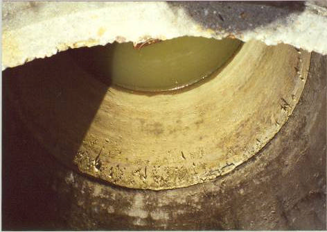
Figure 5.2 Watermelon being grown between coconut trees
Over the years the incidence of flooding appears to have increased in the Cocal region. This
makes the area one that is very vulnerable to projected sea level rise, since for the most part its
elevation is below present mean sea level (refer to the Ministry of Works, Drainage Division,
2000 and Appendix 1). As a consequence, the threat of saltwater intrusion into the coastal
aquifer may also lead
to a decline in the
availability of
freshwater in the
area. Residents in
the district may
therefore have to
source another supply
of irrigation water,
since they presently
make use of water
from roadside canals
or from wells (see
Figure 5.3).
Figure 5.3 Well with water for irrigation
34
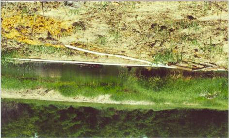
Figure 5.4 Swamp water being used to irrigate crops
The body of water seen in Figure 5.4 has a direct link to the swamp. A bank was built on the
side of the swamp to collect water that is used to irrigate watermelons. As the extent of flooding
increases, so will the likelihood of negative changes in water quality. A significant impact might
be that created by inundation of drainage ditches since these are also used as irrigation ditches by
farmers in Kernaham. Another impact on water quality is the increase of fresh water salinisation.
The increase in inundation will trigger significant impacts upon the terrestrial and freshwater
ecology in the study area. The increase of the fresh water salinity would result in changes in
species composition, as the environment is converted from that of fresh water to that of a more
brackish nature. Ultimately those species that have that ability to adapt to their changing habitat
will be the ones to survive. A more permanent occurrence of flooding will lead to a complete
change of the local ecology and the destruction of many species.
Erosion and recession of the beach area will also cause some changes in the marine ecology as
well. The East coast is a popular nesting area for 4 of the 5 species of turtle in Trinidad, the
exception being the Loggerheads. Decrease in beach means that those four species that now visit
the beach will have less and less beach to lay their eggs. As is the case with any good mother, if
the turtles find the traditional sites unsuitable, then eventually they will no longer come to these
beaches to lay their eggs.
6 MEASURES THAT CAN BE ADOPTED TO COUNTERACT COASTAL EROSION
AND THE PROJECTED IMPACTS OF RISING LEVEL
There has been erosion along various strips of the Manzanilla beach, which is evident by the
many trees which have succumbed to it and the decreasing distance between the road and the
coastline. This makes it a matter of national concern, something that the Drainage Division of the
Ministry of Works has begun to investigate. A consultant, NEDECO, was hired by the Ministry
of Works to carry out studies at various coastal areas in Trinidad, namely Los Iros Bay,
Manzanilla Beach and Mayaro Beach. The main objectives of the consultancy was:
Ę To conduct consolidated appraisal at each project site, one of the main focus being the erosion
status at each site- the basic data being supplied to the consultants by the Ministry.
Ę The consultants use the data to carry out, among other things, GIS analysis of coastal flooding
events, which is still in the processing stage.
35
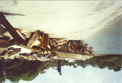
Ę The consultants were to determine what the present coastal status was, and predict likely future
changes, as sea level rises due to climate change.
Ę Identify solutions as to what structures could be used as well as the specific designs that these
structures should follow in order to combat the effects of sea level rise and climate change.
Ę Make recommendations with regards to the legal and legislative framework that needs to be
incorporated so that the issues involved can be dealt with expediently and in a timely manner.
6.1 Performance of past coastal structures
The coastal structures established within the study site include sheet pile revetment, reinforced
steel, concrete piles, concrete columns and blocks, gabion basket retaining structures, boulder
splash aprons and boulder rip rap. Most of these coastal structures have however failed in
preventing the sea from encroaching on the land (Figure 6.1).
Steel sheet piling can be found along the roadway in the central part of the study area in the outer
concave segment of the channel. The sheet piles are approximately 12m long, 0.6m wide and
1cm thick. Many sections of this revetment are severely eroded and some have collapsed
completely.
Reinforced steel concrete piles can be found at the southern end of the study area. They are
precast and were driven into place on site. These are isometric in cross section, with
approximately 25cm
sides. Rebars are
embedded more than
6cm within the
structural units from
the sides, but less
than 6cm from the
pile head in some
units. On the
seaward aspect and
around the base of the
each pile, scouring is
aggressive. This
causes considerable
removal of beach
sediment and
offshore transport in
the rainy season.
Figure 6.1 Protective structures at the mouth of the Nariva river
Concrete blocks and walls can be found north of the study area. The concrete blocks are
isometric and can be found adjacent to the channel area and are held in place by their high
density. The structures have shown extensive cracking and foundation settlement.
Gabion baskets can be found in both the northern and sout hern sections of the study area. These
have been for the most part completely destroyed due to abrasion and corrosion of the steel wire
mesh used to construct the baskets and as a result the boulders with the basket are easily
removed. To the extreme south of the site, gabion basket groynes and retaining structures are
36
present. These have also suffered abrasion and corrosion, but they have been completely buried
due to sedimentation.
Rip-rap can be found mainly in the central section of the sheet pile revetment. The boulders are
low grade, Neogene metamorphic marbles, and are generally oblate and have a maximum length
of 1.0m, with a short axis of 0.3m. These were placed to prevent the further erosion of the
roadway fill and foundation where the sheet pilings have collapsed. Rip-rap were placed here on
several occasions, but they are often removed during high spring tides. As a result these have
been unsuccessful in preventing the ingress of the sea or roadway erosion.
A 2-3m wide, boulder splash apron can be found near the southern end of the site, landward of
the concrete pile cluster. This consists of tertiary, reefal, yellow limestone boulders with an
average maximum diameter of 25cm. The boulders are placed on soft sand overlying sandy clay
soils. These have been partly removed due to scouring by high tides, or sometimes covered by
sand during the dry season. Scouring also removes the underlying in-situ soils and sand is
sometimes deposited on land by waves or onshore winds.
For the most part the failure of these structures would be attributable to the choice and design of
the protection works, as well as the dynamic nature of the shoreline processes. Several failure
modes are associated with the diverse set of coastal defence works in the study area. One
primary mode is scouring and basal erosion. This occurs along the seaward aspect of the sheet
pile revetment, the concrete pile cluster, the gabion baskets and the concrete blocks and walls.
Scouring is associated with peak stream discharge and tidal outflow from the swamp and river.
This is concentrated where the channel begins to curve and along the entire western section of
the channel south of this point of inflection. Since the study area is part of a near sea level
swamp and the sediments are largely sandy and organic with shells, they can become
waterlogged.
6.2 Recommendations
6.2.1 Protective mechanisms that may be utilized
When considering the use of coastal structures, limitations must be taken into consideration,
particularly those with practical and financial consequences. A good design is one that- through
acceptable and economically reasonable efforts- would consider both external and internal
conditions, which in the long run would allow for existing structural weaknesses to be
determined in advance thereby preventing failure of the structure before such an eventuality
occurs, (Ministry of Works, 2000).
As stated previously, existing coastal protections have failed miserably in preventing the
encroachment of the sea onto the land. With this in mind the following are a list of coastal
structures that could be utilized to deal with the issues of sea level rise. These are as follows:
Sloping revetment
These allow wave energy to be dissipated better that a wall, and it also prevents scouring at the
base of the structure. The coarser the surface of the structure the better wave energy is absorbed,
and the shallower the slope of the revetment the lesser the wave energy deflected.
A rubble revetment of sound design can also be used. This has the advantage of being able to
respond more flexibly to both settlement and wave movement without really compromising the
integrity of the revetment. This type of revetment would also allow for the maintenance of the
area in what would appear to be the natural state, since vegetation will eventually grow on the
37
material used in the revetment. This in itself in an added bonus since the vegetation would help
in fixing the sand brought onshore.
Offshore breakwaters
These will serve to provide a calmer environment affecting the beach behind the breakwater,
since the force of the waves reaching the shore will be reduced considerably. The environment
created allows for the reduced transport of sand along the beach; the chances therefore, of the
settlement of sand on the throughout the beach is greater.
Beach nourishment in conjunction with the establishment of groynes can also be utilised. The
shape and orientation of the groyne will depend on the intensity of sand transport and the
dominant wave action along the beach. Groynes tend to reduce sand transport along the beach. If
the retentive capacity of the groyne created on construction is not filled at that time, the groyne
will partially or completely stop sand transport downdrift of the groyne, thereby increasing
erosion in those areas.
It will therefore be wise to carry out beach nourishment in the areas downdrift of the groynes.
Care must be taken to ensure that the material used for nourishment is very similar to the original
sand for it to be accepted by the prevailing wave conditions. It should be noted that there may be
leakage of the material from the embayment and from time to time these must be replaced. As
such some monitoring and maintenance program must be put in place.
The major benefits of coastal protection works at the study area are as follows:
The safeguard of the nationally important road connection from the centre of the population and
economic activity to the southwest of Trinidad;
To safeguard the internationally important Nariva Swamp ecology;
To safeguard the mature coconut trees on the land at threat;
To preserve the real estate value of the lands that is protected.
To ensure that these benefits are realized some system of coastal zone management must be put
in place.
6.2.2 Plans for the development of the study area
The paramount goal of the nation as stated in the National Physical Development Plan (NPDP),
is to seek the continued improvement in the quality of the life of all the citizens.
The NPDP describes the area as one that is developing and is essentially rural. The area is
typified as one with low development density, a heavy dependence on primary economic
activities and extensive agriculture, forests and outdoor recreation resources. Industrial
development in negligible and there is a lack of a significant mineral resource base.
The plan proposes the implementation of strict land use controls particularly with reference to
agriculture and conservation areas. The area has been earmarked for rural development. To date
there has been some development within the communities with respect to the provision of
utilities as there has been the installation of a supply of electricity. Along the Manzanilla
Mayaro road there has been the upgrading of several bridges and the repaving of most of the
road. Consequently, the area has become more vulnerable, as more resources have been placed
at risk. A system of integrated coastal zone management has to be put in place if the study area
as well as the entire country is to successfully deal with the issues related to climate change.
Within the study area lies the structures of abandoned buildings that were once inhabited and are
now dilapidated, suggesting that the coast was once quite developed. In recent times this has
again become the trend with several persons constructing houses along the strip of the coast.
38
The Town and Country Planning Division of Trinidad and Tobago does not have a
comprehensive policy document, but rather a policy atlas developed by the Research Department
of that division. While this is not a legal document, it provides some guidelines for the planning
of coastal developments. When plans for developments are brought to the Town and Country
Planning Division, the relevant authorities such as the Water and Sewerage Authority (WASA)
and the Institute of Marine Affairs (IMA) are contacted and these provide information as to the
regulations and guidelines that need to be conformed.
At present there are no building line setbacks. This however is taken to be 50m from the high
water mark, but this can be reduced based on the topography of the area and if retaining walls are
already in existence. Where these walls are present the setback may be reduced to 30m, but
permission must be sought from the engineers from the Ministry of Works.
With respect to environmentally sensitive areas, no development will be permitted within, or in
the vicinity of environmentally sensitive areas, if such development is incompatible with that
area, either by virtue of the nature, scale or resulting impacts of the development activity.
Where development is permitted, developers will be expected to preserve and protect any
features of a site, which are deemed to be of environmental or ecological significance.
The fact that there is no policy document at this present time means that many persons can
attempt to develop lands to their own specifications. This means that in some years to come
many properties and homes may be lost to the encroaching sea.
Integrated Coastal Zone Management
For the most part small islands in their entirety can be considered to be the coastal zone.
Management must therefore be based on a revision of the concept of the "coast" as it applies to
small islands because it really symbolizes survival for the 60% of the population that lives in the
coastal zone. It is a concept that should truly embrace and reach out to those that inhabit small
islands, since it is a concept that is all encompassing. Really when we look at what we have,
there is not much we can afford to give away without putting up a fight, so we have to use our
resources wisely and try to put mechanisms in place to conserve them for future generations to
have the opportunity to enjoy them to their fullest. What is required therefore, is a good system
of coastal zone management, although this is a concept that is relatively new to small islands- a
rather ironic situation, since rising sea level would have the greatest impact on small islands.
Integrated coastal management is a process designed to achieve sustainable multiple uses of
coastal and marine resources - yielding maximum economic and social benefits - without
degrading the resource base (Nurse, 1998, Clark, 1995 and Cicin-Sain, B. and Knecht, R.W,
1998). The key principles of a sustainable management programme for the coastal zones must
include elements of the following:
Take a wide ranging perspective.
Be based on an understanding of specific conditions in the area of interest.
Work with natural processes.
Use participatory planning to develop consensus.
Ensure the support of all relevant bodies.
Use a combination of instruments.
Ensure that decisions taken today do not foreclose options for the future.
The most cost effective way to minimise costs of damage due to coastal processes is to avoid the
exposure of coastal assets to the risks of flooding and erosion hazards. Appropriate coastal
39
zoning, integration of coastal zone issues with coastal watersheds, elaboration of adequate
construction standards in coastal areas and disaster preparedness planning represent the proper
steps that should be adopted in order to deal with the issue of sea level rise in Trinidad. These
are all elements of a properly thought out coastal zone management programme, which if ideally
executed will protect the beach area, the swamp area, the communities, the road and agricultural
lands.
The sectoral approach, which categorises almost all management, is reflected in governmental
planning and institutional make-up, and has proven inadequate in addressing the issue of sea
level rise and will continue to do so, thus preventing the realisation of sustainable development.
This type of management is therefore not sustainable and it must be noted that the development
of societies hinges also on many aspects of the environment and it must be factored into the
equation if true progress is to come into being.
In Trinidad alone, the largest revenue earner, the petroleum and petrochemical industry is
heavily dependent on the environment, since it raw materials that continue to perpetuate the
industry are natural products of the environment. Coastal monitoring has not been carried out
with any adequacy in Trinidad, and quite surprisingly maintenance of coastal structures has not
been part of the current coastal practice in Trinidad. This however does not mean that a reactive
approach should be adopted, it merely should be used as a support mechanism for plans that are
made in the proactive capacity. This seems to be the route that makes most sense since the Cocal
area has undergone many adverse biogeophysical changes in the recent past. What is required is
the design of efficient defences and the enforcement of appropriate land use practices that are
informed and guided by the principles of integrated coastal zone management. In the absence of
such action, the ecological, economic and socio-cultural character of the area could be altered
irreversibly.
7 CONCLUSION
The paper has as its objectives:
Ę To determine whether the study area had undergone erosion.
Ę To look at the features and the resources in the study area that may be at risk to sea level
rise and erosion.
Ę To identify the coastal resources that would be affected under three different scenarios of
sea level rise.
Ę To quantify the area and the value of the resource to be affected.
Ę To make recommendations with regards to protective and mitigative mechanisms that
may be utilised.
Careful evaluation of the available evidence suggests that the Cocal area of Trinidad has
experienced significant coastal erosion during the last decade or so, and it is likely that global sea
level rise has contributed to this trend. It must be noted that scientific data for local sea level rise
is not presently available. Over the past years it has seemed that this phenomenon has gone
unnoticed by the planners and the policy makers, although this was not the case with the
community members, who seemed to have noticed the changes a long time ago. In recent times
local authorities have begun to pay some attention to the problem, as a response to the growing
awareness and concern about the projected impacts of climate change and sea level rise, at the
global, regional and local levels. It must be noted that the measures used to mitigate erosion also
have the potential to be effective for vulnerability reduction to sea level rise.
Before this paper was prepared there was the suspicion that the study area would have been
affected, but the extent of that disturbance was not known. One of the objectives of the paper
40
was to find out whether there was erosion of the beach in the study area. The latter part of
Chapter four graphically shows that some stretches of the coast in the study area had been eroded
whereas some stretches exhibited accretion. This part of the chapter also indicates the resources
in the study area that may be at risk from erosion and sea level rise. The work done in this paper
has indicated to a great degree the possible impacts that three different scenarios of sea level rise
(0.5m, 1.0m and 1.5m) would have on the study area.
The results in Chapter five have shown and quantified that 64.4% of swamp, 34.9% of coconut
plantation and 0.6 of % of agricultural lands will be lost and a threat will be posed to the road
that runs parallel to the coast. If the phenomenon of sea level rise goes unnoticed, the area may
possibly become deserted as salt water seeps inland causing contamination of groundwater and
soil salinisation. The value of the land affected was also calculated, overall $US 2,219,037.00
will be lost, which is roughly 13.5 million $TT. This may seem like a small amount of money,
but if we were to begin to quantify the amount of money that is earned as a result of the use of
these resources (e.g. agriculture, tourism, transportation) then this figure would increase by quite
a substantial amount. It must also be noted that the elevations of land areas within the study
area is just below mean sea level (Appendix 1). This in itself puts the area at even greater risk
because water from the sea would have less resistance in travelling inland.
It is clear that from the findings of this research that the current practices employed to combat
erosion and sea level rise have proven to be ineffective. In light if this recommendations have
been put forward in terms of structures that can be used, policies that can be guided by
sustainable development and the incorporation of some system of Integrated Coastal
Management, all of which, if properly designed and implemented will counteract the impacts of
sea level rise and coastal erosion. It has been recommended that structures such as offshore
breakwaters and sloping revetments be used, in addition to which beach nourishment could also
be utilized where necessary. However, these must be done keeping in mind that the area
consists of many systems that are very dynamic. It therefore follows that a programme of
ongoing monitoring and supervision must be put into effect so as to ensure that the
recommendations, if put into effect can be evaluated in terms of performance over time.
Most countries, particularly those from North America and Asia, have established practical
measures to ameliorate environmental problems through policies and programmes. Around one
hundred countries have now prepared National Environmental Action Plans (NEAPs) to help
guide their thinking on environmental management. The most suitable NEAPs often use
economic analysis to help identify priorities for environmental interventions based on the
benefits and costs of different alternatives - recent examples include countries like Costa Rica
and Lebanon, all using economic analysis as one means to help identify priorities for action.
One of the positive aspects of the current situation with Trinidad is that EMA has begun putting
strategies in place to deal with sea level rise as mentioned in Chapter two. It thus means that we
are to now continue building on what we have at present to ensure that the benefits of coastal
zone management are achieved.
41
8 REFERENCES
Ambeh,W.B. and Russo, R.M, 1993. "In March 1988 East of Trinidad Earthquake Sequence" In
Proc. Caribbean Conference on Natural Hazards: Volcanoes, Earthquake, Windstorm,
Floods: October 11 - 15, 1993. Seismic Research Unit and Department of Civil
Engineering, University of the West Indies, St. Augustine.
Bacon, P.R. and Kenny, J,S, 1981. "Aquatic Resources". In Cooper, St. G. and Bacon, P.R.
(Eds). The Natural Resources of Trinidad and Tobago. Edward Arnold, United Kingdom,
pp 112- 144.
Berridge, C.E, 1981. The Natural Resources of Trinidad and Tobago. Edward Arnold, United
Kingdom.
Central Statistical Office, 1999. Ministry of Integrated Planning and Development, Eric
Williams Financial Complex, Port of Spain, Trinidad.
Cicin-Sain, B. and R.W Knecht (1998). Integrated Coastal and Ocean Management: Concepts
and Practices. Island Press, Washington, D.C., 517 pp.
Clark, J.R. (1995). Coastal Zone Management Handbook. CRC Press Inc. and Lewis
Publishers, Boca Raton, Florida, USA, 694 pp.
CPACC, 1999. Component 6. Coastal Vulnerability and Risk Assessment (Barbados, Grenada,
Guyuna). Screening Assessment. Outcome of the Sub-regional Workshop, St. George's,
Grenada, March 29-31, 1999.
Ellison, J.C and Stoddart, D.R, 1991. Mangrove ecosystem collapse during predicted sea-level
rise: Holocene analogues and implications. Journal of Coastal Research, 7, 151-165.
E.M.A, 1997. Trinidad and Tobago: State of the Environment 1996 Report. Environmental
Management Authority, Government of the Republic of Trinidad and Tobago.
Hendry, M.D. and Digerfeldt, G, 1989. Palaeogeography and palaeoenvironments of a tropical
coastal wetland and adjacent shelf during Holocene submergence, Jamaica.
Palaeogeography, Palaeoclimatology, Palaeoecology, 73, 1 - 10.
Institute of Marine Affairs, 1998. Final Report for EIA of the Nariva Swamp (Biche Bois Neuf
Area). Document Prepared for Ministry of Agriculture, Land and Marine Resources.
Institute of Marine Affairs, 1998. Land Use Map for Nariva Swamp Area.
IPCC, 1996. Climate Change 1995: The Science of Climate Change. Contribution of Working
Group 1 to the Second Assessment Report of the Intergovernmental Panel on Climate
Change, Section 7.5.2.4.
IPCC, 1996. Climate Change 1995:Impacts, Adaptations and Mitigation of Climate Change:
Scientific Technical Report. Contribution of Working Group 11 to the Second Assessment
Report of the Intergovernmental Panel on Climate Change, Section 9.2.
Maul, G.A, 1996: Small Islands: Marine Science and Sustainable Development. American
Geophysical Union, Washington, D.D, U.S.A.
Ministry of Works, Drainage Division, 2000. Feasibility Study and Detailed Design for Coastal
Protection Works in Trinidad and Tobago, Inception Report.
42
Ministry of Works, Drainage Division, 2000. Feasibility Study and Detailed Design for Coastal
Protection Works in Trinidad and Tobago, Problem Identification and Assessment Report.
Nicholls. R, 1998. A CPACC Publication. Technical Report TR 98002. "Coastal Vulnerability
Assessment for Sea-Level Rise: Evaluation and Selection of Methodologies for
Implementation".
Nurse, L.A. (1992). Predicted sea-level rise in the wider Caribbean: likely consequences and
response options. In Semi-enclosed Seas. Elsevier Applied Science, Essex. United
Kingdom, pp. 52-78.
Nurse, L.A. (1998). "Integrated Coastal Zone Management in the Caribbean: Lessons borrowed
from empirical experience" in Natural Resources Management in the Caribbean: Discussion
Papers. NRMU/OAS/CARIDAD, Castries, St. Lucia, pp. 1-5.
Parkinson et al, 1994. Holocene sea-level rise and the fate of mangrove forests within the Wider
Caribbean region. Journal of Coastal Research, 10, 1077-1086.
Perez et at, 1996. Evaluation of Risks of Coastal Flooding, Cuba. Institute of Physical Planning,
Institute of Meteorology, Havana, Cuba.
Ramsar Convention, 1996. Monitoring Procedure Final Report - Nariva Swamp, Trinidad and
Tobago, Gland, Switzerland.
Simenuik, V, 1994. Predicting the effect of sea-level rise on mangroves in North Western
Australia. Journal of Coastal Research, 10, 1050-1076.
Snedaker, S.C, 1993. Impact on Mangroves; Climate Change in the Intra-American Sea.
Edward Arnold, London, United Kingdom, pp 282-305.
Speed, R.C, 1985. "Cenezoic Tectonics of the Southeastern Caribbean and Trinidad". In Proc.
1st Geological Conference of the Geological Society of Trinidad and Tobago, pp 270-280.
TIDCO, 1995. Tourism Master Plan, Tourism and Industrial Development Company of Trinidad
and Tobago, Port of Spain, Trinidad.
TIDCO, 1999. Tourism Brochure on the East Coast of Trinidad.
TIDCO, 2001, Tourism and Industrial Development Company of Trinidad and Tobago, Port of
Spain, Trinidad.
Wigley, 1995 as quoted in IPCC, 1996. Climate Change 1995:Impacts, Adaptations and
Mitigation of Climate Change: Scientific Technical Report. Contribution of Working
Group 11 to the Second Assessment Report of the Intergovernmental Panel on Climate
Change, Section 9.3.1.1.
http://www.pulseplanet.com/Feb98/1563.html. 05/24/00. Trinidad's Rising Sea.
http://www.geocities.....ainforest/Canopy/8466/Nariva4.html. 05/24/00. Nariva Swamp.
Trinidad, West Indies - Human and Community Use.
http://www.users.carib-link.net/~wildfowl/article1.htm. 05/24/00. Wetland: Our Precious Gift.
http://www.users.erols.com/jtitus/Holding/NRJ.html. 02/06/00. Greenhouse effect and sea level
rise Ł The Cost of Holding Back the Sea.
http://www.epa.gov/globalwarming/publications/impacts/sealevel/landuse.html. 03/08/01.
Greenhouse Effect, Sea Level Rise and Land Use.
43
http://www.gcrio.org/CSP/IR/IRuruguay.htm. 06/02/00. Uruguay: Climate Change
Vulnerability and Adaptation Assessment Methods for Coastal Resources and Agriculture.
http://www.ema.co.tt/Fnc/Climate_of_TT.htm. 03/08/01. The Climate of Trinidad and Tobago.
http://www.ema.co.tt/Fnc/V_a.htm. 03/08/01. Climate Change Vulnerability.
http://www.ima-cpacc.gov.tt/climate_change_facts.htm. 03/08/01.Climate Change Facts.
http://www.katipo.niwa.cri.n2/ClimateFuture/Greenhouse.htm. 07/08/02. The Natural
Greenhouse Effect.
http://www.pmel.noaa.gov/tao/elnino/la-nina-story.html. 13/08/02. What is La Nina?
http://www.ogp.noaa.gov/enso/. 13/08/02. Reports to the Nation: Our Changing Planet.
http://www.ecy.wa.gov/pubs/0111013. 13/08/02. Investigation of Water Resources, Water
Quality and Sera Water Intrusion, Anderson Island, Pierce County, Washington.
44